California High-Speed Train Project 1.1.5.1 CHSTP Plan... · 01/03/2012 · 2.2.1 TEXT ROTATION AND...
65
Prepared by for the California High-Speed Rail Authority California High-Speed Train Project TECHNICAL MEMORANDUM CHSTP Plan Preparation Manual TM 1.1.5.1 Prepared by: Signed document on file 01 March 12 Rebecca Mincio Date Checked by: Signed document on file 14 April 12 John Chirco, PE Date Approved by: Signed document on file 21 June 12 Ken Jong, PE, Engineering Manager Date Released by: Signed document on file 18 July 12 Hans Van Winkle, Program Director Date Revision Date Description 0 01 Mar 12 Initial Release, R0 Note: Signatures apply for the latest technical memorandum revision as noted above.
-
Upload
phungduong -
Category
Documents
-
view
213 -
download
0
Transcript of California High-Speed Train Project 1.1.5.1 CHSTP Plan... · 01/03/2012 · 2.2.1 TEXT ROTATION AND...

Prepared by
for the California High-Speed Rail Authority
California High-Speed Train Project
TECHNICAL MEMORANDUMCHSTP Plan Preparation Manual
TM 1.1.5.1
Prepared by: Signed document on file 01 March 12Rebecca Mincio Date
Checked by: Signed document on file 14 April 12John Chirco, PE Date
Approved by: Signed document on file 21 June 12Ken Jong, PE, Engineering Manager Date
Released by: Signed document on file 18 July 12Hans Van Winkle, Program Director Date
Revision Date Description0 01 Mar 12 Initial Release, R0
Note: Signatures apply for the latest technical memorandum revision as noted above.

California High-Speed Train Project CHSTP Plan Preparation Manual, R0
This document has been prepared by Parsons Brinckerhoff for theCalifornia High-Speed Rail Authority and for application to the CaliforniaHigh-Speed Train Project. Any use of this document for purposes otherthan this Project, or the specific portion of the Project stated in thedocument, shall be at the sole risk of the user, and without liability to PBfor any losses or injuries arising from such use.

California High-Speed Train Project CHSTP Plan Preparation Manual, R0
Page i
System Level Technical and Integration ReviewsThe purpose of the review is to ensure:
Technical consistency and appropriateness Check for integration issues and conflicts
System level reviews are required for all technical memoranda. Technical Leads for eachsubsystem are responsible for completing the reviews in a timely manner and identifyingappropriate senior staff to perform the review. Exemption to the system level technical andintegration review by any subsystem must be approved by the Engineering Manager.
System Level Technical Reviews by Subsystem:
Systems: Signed document on file 13 Aug 12Rick Schmedes Date
Infrastructure: Signed document on file 14 April 12John Chirco, PE Date
Operations: Signed document on file 20 March 12Joe Metzler Date
Maintenance: Signed document on file 20 March 12Joe Metzler Date
Rolling Stock: Signed document on file 2 March 12Frank Banko Date
Project ManagementOversight: Signed document on file 24 June 12
Michael D. Lewis, PE Date
Note: Signatures apply for the technical memorandum revision corresponding to revision number in header and as noted oncover.

California High-Speed Train Project CHSTP Plan Preparation Manual, R0
Page ii
TABLE OF CONTENTS
1.0 GENERAL .................................................................................................................................. 1
1.1.1 PURPOSE OF MANUAL ................................................................................................ 1
1.2 APPLICATION OF THE PLAN PREPARATION MANUAL ............................................. 11.3 DEFINITIONS................................................................................................................. 11.4 USE OF COMPUTER AIDED DESIGN AND DRAFTING (CADD) SOFTWARE ............. 21.5 DEVELOPMENT OF ELECTRONIC FILES .................................................................... 21.6 ELECTRONIC DELIVERY PROCESS ............................................................................ 3
2.0 CONTRACT DRAWINGS ........................................................................................................... 42.1 GENERAL PROCEDURES ............................................................................................ 42.2 DRAFTING STANDARDS .............................................................................................. 4
2.2.1 TEXT ROTATION AND PLACEMENT ............................................................................ 5
2.3 U.S. CUSTOMARY UNITS ............................................................................................. 6
2.3.1 DIMENSIONS................................................................................................................. 6
2.3.2 LOCATION OF CONSTRUCTION FEATURES (STATION / OFFSET) ............................ 7
2.3.3 ACCURACY / PRECISION ............................................................................................. 7
2.3.4 STATIONING ................................................................................................................. 8
2.4 PLAN SHEET BORDERS ..................................................................................................... 9
2.4.1 TITLEBLOCK ............................................................................................................... 10
2.4.2 REVISION BLOCK ....................................................................................................... 11
2.4.3 STAMP AND LOGO AREA ........................................................................................... 12
2.4.4 SEAL AND SIGNATURE INFORMATION ..................................................................... 12
2.5 CONTRACT DRAWINGS SUBMITTALS ................................................................................. 13
2.5.1 PRELIMINARY DESIGN DRAWINGS (PRELIMINARY ENGINEERING FORPROCUREMENT) ........................................................................................................ 13
2.5.2 CONSTRUCTION DRAWINGS (DESIGN BASELINE REPORT) ................................... 15
2.5.3 CONSTRUCTION DRAWINGS (CHSTP DESIGN SUBMITTALS, READY FORCONSTRUCTION (RFC) SUBMITTALS AND AS-BUILT SUBMITTALS) ....................... 17
2.5.4 PROJECT PLAN FILE FORMAT .................................................................................. 21
2.6 USE OF STANDARD AND DIRECTIVE DRAWINGS ................................................... 21
3.0 FACILITY NAMING CONVENTIONS ........................................................................................ 233.1.1 SUBDIVISIONS ............................................................................................................ 23
3.1.2 MILEPOSTS ................................................................................................................. 23
3.1.3 TRACK ......................................................................................................................... 25
3.1.4 INTERLOCKING........................................................................................................... 26
3.1.5 STATIONING ............................................................................................................... 26

California High-Speed Train Project CHSTP Plan Preparation Manual, R0
Page iii
3.1.6 ELEMENTS DESIGNATOR .......................................................................................... 27
4.0 CONSTRUCTION DRAWINGS ................................................................................................. 354.1 CONSTRUCTION DRAWING SUBMITTALS ............................................................... 35
4.1.1 CONSTRUCTION DRAWING SUBMITTAL REQUIREMENTS ..................................... 35
4.1.2 SIGN AND SEAL REQUIREMENTS ............................................................................. 35
4.2 AS-BUILT DRAWINGS ................................................................................................ 364.2.1 AS-BUILT DRAWING PROCEDURES .......................................................................... 36
4.2.2 AS-BUILT STAMPS ...................................................................................................... 38
4.3 THIRD PARTY DRAWINGS ......................................................................................... 38
APPENDIX A – FACILITY NAMING CONVENTION SUMMARY TABLE ........................................... 39
APPENDIX B –PRELIMINARY ENGINEERING FOR PROCUREMENT DRAWING SAMPLE PLANCHECKLISTS ..................................................................................................................................... 42
APPENDIX C –PRELIMINARY ENGINEERING FOR PROCUREMENT DRAWING SAMPLEPLANS ................................................................................................................................................ 60

California High-Speed Train Project CHSTP Plan Preparation Manual, R0
Page 1
1.0 GENERAL
1.1.1 PURPOSE OF MANUAL
The purpose of this Manual is to provide guidelines for all drawings prepared for the California High-Speed Train Project (CHSTP). This Manual will provide the guidelines that shall be used by allparties involved in the preparation of all civil, structural, roadway, utility and other plans and drawingsprepared for the California High-Speed Rail Authority (Authority). Adherence to these guidelines willresult in the required level of uniformity and consistency of the drawings all plans.
1.2 APPLICATION OF THE PLAN PREPARATION MANUAL
The guidelines provided in this Manual shall be used for all project phases from 15% design throughfinal design and construction. Additionally, all parties who shall use these guidelines include, but arenot limited to all regional consultants, the PMT, and the final Designer/Contractor.
1.3 DEFINITIONS
As-Built Additional Drawings Drawings generated during the as-built process indicatingnew or additional work constructed
As-Built Drawings Construction Drawings modified to reflect design changesand actual conditions of construction, conformed from fieldand design changes directly from the Ready forConstruction (RFC) drawings
As-Built Revised Drawings Drawings generated during the as-built process for thepurpose of providing clear and concise as-built correctioninformation, but contain with no new or additional workadded
Contract Change Order A written order to the contractor, issued after the executionof the contract, authorizing a change in the work
Contract drawings Drawings that are specific to the project and contract.Contract drawings include preliminary design drawings andconstruction drawings.
Construction Drawings Drawings furnished by the contractor representing the postpreliminary design project delivery, from final designthrough completion of construction. Construction drawingsinclude Final Design drawings, Ready for Construction(RFC) drawings as As-Built drawings.
Contract Number The number assigned to an individual construction project
Directive Drawings Directive Drawings provide mandatory design criteria in agraphical format that the Contractor shall follow and applyto ensure consistency during design for system-wideelements and features
Drawing Number Number found in the titleblock assigned to an preliminary,construction, standard or directive drawings
Preliminary Drawings Drawings prepared during the preliminary design phase
Preliminary Engineering forProcurement
Preliminary engineering that demonstrate technicalfeasibility and constructability for procurement

California High-Speed Train Project CHSTP Plan Preparation Manual, R0
Page 2
Ready for ConstructionDrawings (RFC)
Construction drawings designed to 100% that are readyand used during construction. They are the basis for the as-built drawings
Regional Consultant The consultant selected by the Authority to be responsiblefor the overall preliminary design of the project
Standard Drawings Standard project elements for general use in theconstruction of the California High-Speed Train system, asdetermined applicable by the Contractor
Title Block The title block in these guidelines is defined as the lowerportion of the drawing containing information such asdrawing title, signature blocks, project logos, etc.
1.4 USE OF COMPUTER AIDED DESIGN AND DRAFTING (CADD) SOFTWARE
CADD is an integral part of the project delivery process, from preliminary design through thecompletion of construction and as-built drawings. For drafting and sheet preparation, the CHSTPstandard CADD production platform shall be Bentley’s MicroStation V8i (Select Series 1 or higher).The CHSTP standard vertical design platform shall be Bentley’s Inroads Suite V8i. For additionalinformation regarding CADD software and subsequent computer systems requirements, see Section1.2 of the CHSTP CADD Manual.
1.5 DEVELOPMENT OF ELECTRONIC FILES
Electronic files for all CHST Project design drawings must conform to the following information anddeveloped with the following CADD best practices:
General
• Use only the “Default” model space. One model per DGN
• Use only CHSTP seed files to create master and sheet files
Master files
Master files typically contain proposed design information for the design elements of the project. Thisfile can include, but is not limited to features, such as track/road alignments, alignment labels, right-of-way line, and construction features (retaining wall, guard rails, intrusion barriers, et al.). All masterfiles must follow the guidelines below:
• For master files that need to be geo-referenced, use correct seed file from the correspondingState Plane Coordinates system.

California High-Speed Train Project CHSTP Plan Preparation Manual, R0
Page 3
Contract drawings:
Contract drawings are sheet files that are specific to the project and contract. They contain itemssuch as callouts, notes, linework and symbology that define the items of work shown. Specific sheetcontent, sample plans and checklists are contained in Section 2.5 and Appendix B and C of thisManual.
1.6 ELECTRONIC DELIVERY PROCESS
Information regarding electronic submittals can be found in Section 1.3.7 of the CHSTP CADDManual.

California High-Speed Train Project CHSTP Plan Preparation Manual, R0
Page 4
2.0 CONTRACT DRAWINGS2.1 GENERAL PROCEDURES
Contract drawings must be clear and concise in indentifying all items of work that a contractor caninterpret and build. All items of work shall use dimensioning and labeling on plan, profile and detailsheets to clearly indentify quantity items. This will ensure that the bidders and contractors are notexpected or need to scale quantity items from a hard copy print.
Contract drawings are supplemented by the CHSTP Standard and Directive Drawings. Do not includethe drawing of a standard detail as it is already shown on CHSTP Standard Drawings. For moredetailed information regarding the use of standard and directive drawings for CHSTP contractdrawings, see Section 2.6 of this Manual.
All contract drawings shall utilize the standardized Facility Naming Conventions as detailed in Section3.0 of this Manual.
2.2 DRAFTING STANDARDS
General Drafting Standards to be followed for the creation of contract drawings:
Lineweight and linestyles shall conform to Section 4.5 and Appendix G of the CHSTP CADDManual.
Abbreviations and symbology shall conform to the CHSTP Acronyms and Abbreviations, andSymbols Directive Drawings
Text height shall conform to Section 4.3 of the CHSTP CADD Manual. Project requires theuse of uppercase characters for all text and dimensioning found within the contract drawings.
The placement and rotation of text shall conform to Section 2.2.1 of this Manual. All projectplan notes shall be placed in the upper right hand corner of the sheet whenever possible toallow consistency of all contract drawings. Topographical information shall be maskedunderneath the notes to provide additional clarity for the information shown on the projectplan.
Placement of text shall not interfere with other text, cross linework or dimensions. The use oftext mask is allowable and recommended whenever possible to provide additional clarity forthe information shown on the project plan.
Sheet match lines shall be perpendicular to the alignment line. Alignment annotation shall beclipped out if it interferes with the Matchline cell.
Leaders and callouts shall be shown with arrowheads and straight leader lines to allow forconsistency of all contract drawings. The use of curved leaders is not allowable.

California High-Speed Train Project CHSTP Plan Preparation Manual, R0
Page 5
2.2.1 TEXT ROTATION AND PLACEMENT
Text placement and rotation shall be consistent throughout all CHSTP contract drawings. To ensureconsistency is met, text placement and rotation shall be as shown in the example below:
Text orientation shown with 5° of the vertical baseline is up to the discretion of the project planpreparer. Be consistent on all contract drawings.

California High-Speed Train Project CHSTP Plan Preparation Manual, R0
Page 6
2.3 U.S. CUSTOMARY UNITS
2.3.1 DIMENSIONS
The use of decimal feet versus feet and inches shall be based upon of the item of work. The followingparameters shall be followed for the various prepared CHTSP design drawings:
General Dimension Guidelines
Civil plans, including track, grading, drainage and utility plans: Decimal feet
Sections and details within civil plans: Feet and inches
Structural, architectural, mechanical, traction power, overhead catenary, train control, trackwork and electrical drawings, sections, and details: Feet and inches
Dimension text shall always be parallel and above the dimension line
Specific Items of Work Values:
Pavement structures and depths: Feet and Inches. When pavement depth is less than onefoot, the depth can be expressed in inches only (i.e., 6” AB).
Formed concrete construction features (bridges, walls, drainage features, curbs, sidewalks,etc.): Feet, inches and fractions of inches.
Manufactured or fabricated items (generally): Feet, inches and fractions of inches.
Surface cross slopes and superelevations: Percents, with the exception of sub-ballast crossslopes which shall be presented as a ratio of 24:1
Pipe / Ditch slopes: Shown as decimal value. (i.e., 0.005).
Side slopes: Non-dimensional ratio with the horizontal component shown first and then thevertical (X:Y). When the side slope becomes steeper than 1:1, the horizontal component isshown as a fraction (i.e., ¾:1).
Flares and tapers: Non-dimensional ratio with the longitudinal component shown first andthen the lateral offset component (i.e., 20:1, 15:1).
All dimensions in feet, tenth of a foot or hundreds of a foot shall be shown with a universalfoot symbol (apostrophe) as a suffix. For dimensions less than one foot, a zero shall beplaced in front of the decimal (i.e., 0.25’).
All dimensions in inches shall be shown with the universal inch symbol (quotation mark).When the dimension is one foot or greater, a hyphen is placed to separate the foot andinches values with no space before or after the hyphen (i.e., 1’-6”. When the dimension isless than one foot, a zero or hyphen designation is not required to lead the inch value. (i.e.,6”, not 0’-6”). Fractions of an inch shall be down as a stacked fraction (i.e., 10 ½”).
Additionally, the CHTSP standard details shall be used as a guide to determine whendimensioning standards shall be decimal feet or feet and inches.
For design drawings specifically prepared for state highway facilities, the standards set forth inSection 2-1.3 U.S. Customary Units Standard in the Caltrans Plan Preparation Manual shall befollowed. See the link below:
http://www.dot.ca.gov/hq/oppd/cadd/usta/ppman/2-1.pdf

California High-Speed Train Project CHSTP Plan Preparation Manual, R0
Page 7
2.3.2 LOCATION OF CONSTRUCTION FEATURES (STATION / OFFSET)All construction features shall be located using stationing and, as applicable to the item of work, offsetdistances to an established station line. Offset distances from a station line shall include a footsymbol suffix (apostrophe). Exceptions to the above standard are instances in which constructionitems are located by post mile or from fixed objects.
2.3.3 ACCURACY / PRECISION
Accuracy to the nearest foot, tenth of a foot, or hundreds of a foot, is dependent on the locatedconstruction feature.
Elevations, distances and dimensions in decimal feet are provided to two decimal places.Accompanying foot symbols are not required for spot elevation or datum elevations (i.e.,Elevation: 654.54)
Contour lines shall be rounded to the nearest whole number. No foot symbol is required.
Horizontal coordinates (northings and eastings) are provided to three decimal places (i.e.,2044643.712, 6016950.302).
Bearings for all alignment geometry shall be expressed in degree, minutes and seconds withthe N (northing) prefix and E (easting) suffix (i.e., N 70°35'32.5” E).
Angles shall also be shown in degrees, minutes and second (i.e., 48° 38’18”)
Dimensions expressed in feet and inches shall be given to the nearest 1/8” or as appropriate.(1-1¼”).
For station/offset callouts, the accuracy shall match the examples shown below:
o Stationing: 180+45.15 / Offset: 74.15’ LT or RT
All other quantities such as volume, weight, slope, et al., shall be expressed with anappropriate level of precision.
8

California High-Speed Train Project CHSTP Plan Preparation Manual, R0
Page 8
2.3.4 STATIONING
Stationing shall be based upon scale. For 50 scale or greater, stationing shall be based upon 100 footstationing with full annotation at 500’ stations. Annotation at 100 foot intervals shall be a half tick markonly. 500’ interval shall show a full tick mark and station label. For scale less than 50 scale, stationingshall be based upon 100 foot stationing with full annotation at 100’ stations. Annotation at 100 footintervals shall be shown as a full tick mark and station label. Half size tick mark shall be 0.1’ at 1:1scale, 0.2’ for full size tick marks at 1:1 scale
Each station label shall have the subdivision code prefix. See Section 3.1.1 of this Manual for acomplete list of CHSTP subdivision code.
See example below
Stationing (50’ scale or greater)
Stationing (Less than 50’ scale)

California High-Speed Train Project CHSTP Plan Preparation Manual, R0
Page 9
2.4 Plan Sheet Borders
CHSTP borders shall be used for all contract drawings preparation.
General Border Guidelines
Outside border line for full size plot
The CHSTP border has a work limit line on Level 64 No Plot. Never extend the drawing,details and notes beyond work limit line.
With the exception of adding a company logo, the border shall not be edited/revised.
Access to the CHSTP borders can be found at the link shown below:

California High-Speed Train Project CHSTP Plan Preparation Manual, R0
Page 10
2.4.1 TITLEBLOCK
General Titleblock Guidelines
Titleblock tags shall be placed in the drawing using the “titleblock” cell in the CHSTP celllibrary.
Segment designation shall be placed in the titleblock during 15% design. SubdivisionPackage designation shall be placed during Preliminary Engineering for Procurement design.The subdivision package designation shall remain through the completion of the as-builtdrawings for the same contract.
The Sheet number tag shall not be populated during 15% and Preliminary Engineering forProcurement submittal. Sheet number information shall be required for construction drawingsand as-built drawings.

California High-Speed Train Project CHSTP Plan Preparation Manual, R0
Page 11
2.4.2 REVISION BLOCK
General Revision Block Guidelines
Revision Block tags shall be placed in the drawing using the “titleblock” cell in the CHSTP celllibrary.
Revision block shall remain blank during 15% and Preliminary Engineering for Procurementdesign. The construction drawings and as-built drawings shall have the revision blockpopulated as needed.
Names shall be shown as first initial (period) (space) last name.
Date shall be month, day and year format (MM/DD/YYYY).

California High-Speed Train Project CHSTP Plan Preparation Manual, R0
Page 12
2.4.3 STAMP AND LOGO AREA
Stamp Area
During preliminary design, stamps shall be placed in the drawings by using the levels defined in theCHSTP dgnlib. The levels are defined for each submittal, from 15% through Preliminary Engineeringfor Procurement. Level display will be dictated by submittals defined in Levels 75-80. See Appendix Bof the CHSTP CADD Manual for additional information regarding the seal/signature area of theborder.
Logo Area
The logo area is user defined. Company logos can be placed in the area for plan preparation. Logoscannot be placed anywhere else in the border.
2.4.4 SEAL AND SIGNATURE INFORMATION
Engineering seals and signature shall not be placed in the stamp area during the preliminary designphase. With the exception of survey data control sheets, no seal or signatures shall be required for15%, Preliminary Engineering for Procurement drawings.
A seal and electronic signature by a licensed land surveyor is required for the survey data controlsheets during Preliminary Engineering for Procurement. See Section 4.1.2 of this Manual forsignature and seal requirements for construction drawings. A seal and electronic signature by alicensed professional is required for the Ready for Construction (RFC) and As-Built drawings.

California High-Speed Train Project CHSTP Plan Preparation Manual, R0
Page 13
2.5 Contract Drawings Submittals
2.5.1 PRELIMINARY DESIGN DRAWINGS (PRELIMINARY ENGINEERING FOR PROCUREMENT)Preliminary Design Drawings prepared for Preliminary Engineering for Procurement submittalsincluded, but are not limited to, the drawings shown in the below chart. They shall be grouped intovolumes based upon discipline. Checklist and Sample plans can be found in Appendix B and C of thisdocument.
Plan Scale (Full Size)
VOLUME 1 - GENERAL and TRACK GUIDEWAYVOLUME 1A - GENERAL
TITLE SHEET - VICINITY MAP - GENERAL NOTES NO SCALEGENERAL / TRACK GUIDEWAY – INDEX OF DRAWINGS NO SCALEGENERAL - SURVEY CONTROL DATA 1"=100' / ENLARGED
DETAILS ASNEEDED
VOLUME 1B - TRACK GUIDEWAYTRACK GUIDEWAY- GENERAL NOTES NO SCALETRACK GUIDEWAY - TYPICAL SECTIONS 1" = 10'TRACK GUIDEWAY - KEY MAP VARIESTRACK GUIDEWAY - HORIZONTAL ALIGNMENT DATA TABLE NO SCALETRACK GUIDEWAY - PLAN AND PROFILE 1"=100'
VOLUME 2 - TRACK STRUCTURESTRACK STRUCTURES - INDEX OF DRAWINGS NO SCALETRACK STRUCTURES - GENERAL NOTES NO SCALETRACK STRUCTURES - KEY MAP VARIESTRACK STRUCTURES - TYPICAL SECTIONS (AERIAL /TUNNELS) 1" = 10'TRACK STRUCTURES - TRACK STRUCTURAL PLAN(AERIAL STRUCTURES)
TOP OF RAIL NO SCALEELEVATION 1" = 40'
PLAN 1" = 40'TRACK STRUCTURES - TRACK STRUCTURAL PLAN(TUNNEL STRUCTURES)
TOP OF RAIL NO SCALEELEVATION 1" = 40'
PLAN 1" = 40'

California High-Speed Train Project CHSTP Plan Preparation Manual, R0
Page 14
TRACK STRUCTURES - DRAFT GENERAL PLAN (SMALL STRS)TOP OF RAIL NO SCALE
ELEVATION MATCH PLAN
PLAN
1" = 20' , 1" = 30or 1" = 40'
(DETERMINED BYSIZE OF
STRUCTURE)TYPICAL SECTION 1" = 10'
RETAINING WALL (ID, LENGTH, AVERAGE HEIGHT) NO SCALE
VOLUME 3 - ROADWAYROADWAY - INDEX OF DRAWINGS NO SCALEROADWAY - GENERAL NOTES NO SCALEROADWAY - INDEX MAP VARIESROADWAY - GRADE SEPARATION - "STREET NAME"
PLAN 1" = 100'
PROFILEH: 1" = 100' ; V:
1"=10'TYPICAL SECTION 1" = 10'
ALIGNMENT CURVE DATA NO SCALERETAINING WALL (ID, LENGTH, AVERAGE HEIGHT) NO SCALE
ROADWAY – “STREET NAME” - DRAFT GENERAL PLANPROFILE GRADE NO SCALE
ELEVATION 1" = 20'PLAN 1" = 20'
TYPICAL SECTION 1" = 10'RETAINING WALL (ID, LENGTH, AVERAGE HEIGHT) NO SCALE
VOLUME 4 - UTILITIESUTILITIES - INDEX OF DRAWINGS NO SCALEUTILITIES - GENERAL NOTES NO SCALEUTILITIES – COMPOSITE UTILITY PLANS - KEY MAP VARIESUTILITIES - UTILITY COMPOSITE PLAN - ALONG TRACKALIGNMENT 1" = 100'UTILITIES - UTILITY PROTECTION & RELOCATION - PLAN ANDPROFILE 1"=50'
FOR HIGH RISK UTILITIES -AS NEEDED, AT CRITICAL AREAS, PINCH POINTS -
UTILITIES - GRADING AND DRAINAGE - KEY MAP VARIESUTILITIES - GRADING AND DRAINAGE PLANS - ALONG TRACK ALIGNMENT 1" = 100'UTILITIES - GRADING AND DRAINAGE DETAILS 1"=50'
AS NEEDED, AT CRITICAL AREAS, PINCH POINTS -

California High-Speed Train Project CHSTP Plan Preparation Manual, R0
Page 15
2.5.2 CONSTRUCTION DRAWINGS (DESIGN BASELINE REPORT)Construction Drawings prepared by the contractor during final design for the Design Baseline Reportsubmittal includes, but are not limited to, the drawings shown in the below chart.
Plan Scale (Full Size)
TITLE SHEET NO SCALEINDEX OF DRAWINGS NO SCALETRACK CIVIL - TYPICAL SECTIONS NO SCALETRACK GUIDEWAY - PLAN AND PROFILE -
PLAN 1" = 100'PROFILE H: 1" = 100' ; V: 1"=10'
TRACK STRUCTURES - TYPICAL SECTIONS (AERIAL /TUNNELSTRUCTURES) 1" = 10'TRACK STRUCTURAL PLAN (AERIAL/TUNNEL STRUCTURES) -
TOP OF RAIL NO SCALEELEVATION 1" = 40'
PLAN 1" = 40'TRACK STRUCTURAL - GENERAL PLAN (SMALL STRUCTURES) -
TOP OF RAIL NO SCALEELEVATION MATCH PLAN
PLAN
1" = 20' , 1" = 30 or 1"= 40'
(DETERMINED BYSIZE OF
STRUCTURE)TYPICAL SECTION 1" = 10'
RETAINING WALL (ID, LENGTH, AVERAGE HEIGHT) NO SCALETRACK STRUCTURES - RETAINING WALL - PLAN AND PROFILE -
PLAN 1" = 50'PROFILE H: 1" = 50' ; V: 1"=10'
ROADWAY CIVIL* (SEE NOTE 1) - GRADE SEPARATION - "STREETNAME" -
PLAN 1" = 50'PROFILE H: 1" = 50' ; V: 1"=10'
TYPICAL SECTION 1" = 10'ALIGNMENT CURVE DATA NO SCALE
RETAINING WALL (ID, LENGTH, AVERAGE HEIGHT) NO SCALEROADWAY STRUCTURES* (SEE NOTE 1) - GENERAL PLAN -
PROFILE GRADE NO SCALEELEVATION MATCH PLAN
PLAN
1" = 20' , 1" = 30 or 1"= 40'
(DETERMINED BYSIZE OF
STRUCTURE)TYPICAL SECTION 1" = 10'
RETAINING WALL (ID, LENGTH, AVERAGE HEIGHT) NO SCALECOMPOSITE UTILITY PLAN 1" = 100'
FOR EXISTING, PROPOSED AND RELOCATED UTILITIES -

California High-Speed Train Project CHSTP Plan Preparation Manual, R0
Page 16
GEOMETRIC APPROVAL DRAWINGS *SEE NOTE 1
* NOTE 1:GEOMETRIC APPROVED DRAWINGS, ROADWAY CIVIL AND ROADWAY STRUCTURAL DRAWINGSUNDER STATE OR THIRD PARTY JURISDICTION SHALL FOLLOW CALTRANS OR THIRD PARTYSTANDARDS.

California High-Speed Train Project CHSTP Plan Preparation Manual, R0
Page 17
2.5.3 CONSTRUCTION DRAWINGS (CHSTP DESIGN SUBMITTALS, READY FOR CONSTRUCTION (RFC)SUBMITTALS AND AS-BUILT SUBMITTALS)
Construction Drawings prepared by the contractor during final design submittals include, but are notlimited to, the drawings shown in the below chart. Final design submittals include CHSTP DesignSubmittals, Ready for Construction (RFC) submittals and As-Built submittals.
Plan* (See Note 1) Scale (Full size)
GENERALTITLE SHEET NO SCALEINDEX OF DRAWINGS NO SCALEFACILITY LOCATION MAP NO SCALE
SURVEYSURVEY - GENERAL NOTES NO SCALESURVEY - SURVEY DATA CONTROL PLANS 1" = 50'
TRACK CIVILTRACK CIVIL - GENERAL NOTES NO SCALETRACK CIVIL - EXISTING TOPOGRAPHY AND DEMOLITION PLANS 1"=50'TRACK CIVIL - TRACK ALIGNMENT - TYPICAL SECTIONS 1" = 10'TRACK CIVIL - TRACK ALIGNMENT - KEY MAP VARIESTRACK CIVIL - TRACK ALIGNMENT - HORIZONTAL ALIGNMENT
DATA TABLE NO SCALETRACK CIVIL - TRACK ALIGNMENT - PLAN AND PROFILE -
PLAN 1" = 50'PROFILE H: 1" = 50' ; V: 1"=10'
TRACK CIVIL - TRACK ALIGNMENT DETAILS VARIESTRACK CIVIL - GRADING AND DRAINAGE PLAN 1" = 50'TRACK CIVIL - DRAINAGE SECTION AND DETAILS VARIESTRACK CIVIL - TEMPORARY WATER POLLUTION PREVENTION
PLANS 1"=50'TRACK CIVIL - TEMPORARY WATER POLLUTION PREVENTION
DETAILS VARIESTRACK CIVIL - EROSION CONTROL PLANS 1"=50'TRACK CIVIL - EROSION CONTROL DETAILS VARIESTRACK CIVIL - WATER POLLUTION PREVENTION PLANS 1"=50'TRACK CIVIL - WATER POLLUTION PREVENTION DETAILS VARIESTRACK CIVIL - STAGE CONSTRUCTION PLAN 1"=100' 0R 1"=200'TRACK CIVIL - STAGE CONSTRUCTION DETAILS VARIESTRACK CIVIL - TRAFFIC HANDLING PLAN 1"=100' 0R 1"=200'TRACK CIVIL - TRAFFIC HANDLING DETAILS VARIES
TRACKWORKTRACKWORK - GENERAL NOTES NO SCALETRACKWORK - TRACK CHART NO SCALETRACKWORK - MAINTENANCE-OF-WAY ACCESS PLAN 1" = 20'TRACKWORK - MAINTENANCE-OF-WAY ACCESS DETAILS VARIES

California High-Speed Train Project CHSTP Plan Preparation Manual, R0
Page 18
TRACK STRUCTURESTRACK STRUCTURES - GENERAL NOTES NO SCALETRACK STRUCTURES - KEY MAP VARIESTRACK STRUCTURES - INDEX MAP VARIESTRACK STRUCTURES - RETAINING WALL - PLAN AND PROFILE -
PLAN 1" = 50'PROFILE H: 1" = 50' ; V: 1"=10'
TRACK STRUCTURES - RETAINING WALL - DETAILS VARIESTRACK STRUCTURES - TYPICAL SECTIONS (AERIAL/TUNNEL STRUCTURES) 1" = 10'TRACK STRUCTURAL PLAN (AERIAL/TUNNEL STRUCTURES) -
TOP OF RAIL NO SCALEELEVATION 1" =20'
PLAN 1" = 20'TRACK STRUCTURAL - GENERAL PLAN (SMALL STRUCTURES) -
TOP OF RAIL NO SCALEELEVATION MATCH PLAN
PLAN
1" = 20' , 1" = 30 or 1"= 40'
(DETERMINED BYSIZE OF
STRUCTURE)TYPICAL SECTION 1" = 10'
TRACK STRUCTURES - FOUNDATION PLAN
DETERMINED BYSIZE OF
STRUCTURETRACK STRUCTURES - FOUNDATION DETAILS VARIESTRACK STRUCTURES - ABUTMENT PLAN AND ELEVATION -
ELEVATION MATCH PLAN
PLAN
DETERMINED BYSIZE OF
STRUCTURETRACK STRUCTURES - ABUTMENT DETAILS VARIESTRACK STRUCTURES - PIER PLAN AND ELEVATION -
ELEVATION MATCH PLAN
PLAN
DETERMINED BYSIZE OF
STRUCTURETRACK STRUCTURES - PIER DETAILS VARIES
TRACK STRUCTURES - GIRDER DETAILS
DETERMINED BYSIZE OF
STRUCTURETRACK STRUCTURES - GIRDER FRAMING PLAN VARIESTRACK STRUCTURES - BEARING DETAILS VARIESTRACK STRUCTURES - EXPANSION JOINT DETAILS VARIESTRACK STRUCTURES - DECK DRAINAGE DETAILS VARIESTRACK STRUCTURES - LOG OF TEST BORINGS VARIES

California High-Speed Train Project CHSTP Plan Preparation Manual, R0
Page 19
ROADWAY CIVIL (**See Note 2)ROADWAY CIVIL - GENERAL NOTES NO SCALEROADWAY CIVIL - INDEX MAP VARIESROADWAY CIVIL - EXISTING TOPOGRAPHY AND DEMOLITION
PLANS 1"=50'ROADWAY CIVIL - TYPICAL SECTIONS 1" = 10'ROADWAY CIVIL - GRADE SEPARATION - "STREET NAME" -
PLAN 1" = 50'PROFILE H: 1" = 50' ; V: 1"=10'
TYPICAL SECTION 1" = 10'ALIGNMENT CURVE DATA NO SCALE
RETAINING WALL (ID, LENGTH, AVERAGE HEIGHT) NO SCALEROADWAY CIVIL - GRADING AND DRAINAGE PLAN 1" = 50'ROADWAY CIVIL - DRAINAGE SECTION AND DETAILS VARIESROADWAY CIVIL - TEMPORARY WATER POLLUTION
PREVENTION PLANS 1"=50'ROADWAY CIVIL - TEMPORARY WATER POLLUTION
PREVENTION DETAILS VARIESROADWAY CIVIL - EROSION CONTROL PLANS 1"=50'ROADWAY CIVIL - EROSION CONTROL DETAILS VARIESROADWAY CIVIL - WATER POLLUTION PREVENTION PLANS 1"=50'ROADWAY CIVIL - WATER POLLUTION PREVENTION DETAILS VARIESROADWAY CIVIL - STAGE CONSTRUCTION PLAN 1"=100' 0R 1"=200'ROADWAY CIVIL - STAGE CONSTRUCTION DETAILS VARIESROADWAY CIVIL - TRAFFIC HANDLING PLAN 1"=100' 0R 1"=200'ROADWAY CIVIL - TRAFFIC HANDLING DETAILS VARIESROADWAY CIVIL - SIGN PLANS 1"=50'ROADWAY CIVIL - SIGN DETAILS VARIES
ROADWAY STRUCTURES (**See Note 2)ROADWAY STRUCTURES - GENERAL NOTES NO SCALEROADWAY STRUCTURES - GENERAL PLAN -
PROFILE GRADE NO SCALEELEVATION MATCH PLAN
PLAN
1" = 20' , 1" = 30 or 1"= 40'
(DETERMINED BYSIZE OF
STRUCTURE)TYPICAL SECTION 1" = 10'
RETAINING WALL (ID, LENGTH, AVERAGE HEIGHT) NO SCALE
ROADWAY STRUCTURES - FOUNDATION PLAN
DETERMINED BYSIZE OF
STRUCTUREROADWAY STRUCTURES - FOUNDATION DETAILS VARIESROADWAY STRUCTURES - ABUTMENT PLAN AND ELEVATION -
ELEVATION MATCH PLAN
PLAN
DETERMINED BYSIZE OF
STRUCTURE

California High-Speed Train Project CHSTP Plan Preparation Manual, R0
Page 20
ROADWAY STRUCTURES - ABUTMENT DETAILS VARIESROADWAY STRUCTURES - PIER PLAN AND ELEVATION -
ELEVATION MATCH PLAN
PLAN
DETERMINED BYSIZE OF
STRUCTUREROADWAY STRUCTURES - PIER DETAILS VARIES
ROADWAY STRUCTURES - GIRDER FRAMING PLAN
DETERMINED BYSIZE OF
STRUCTUREVARIES
ROADWAY STRUCTURES - BEARING DETAILS VARIESROADWAY STRUCTURES - EXPANSION JOINT DETAILS VARIES
ROADWAY STRUCTURES - DECK CONTOURS
DETERMINED BYSIZE OF
STRUCTUREROADWAY STRUCTURES - DECK DRAINAGE DETAILS VARIESROADWAY STRUCTURES - LOG OF TEST BORINGS VARIES
UTILITIESUTILITIES - GENERAL NOTES NO SCALEUTILITIES - KEY MAP VARIESUTILITIES - UTILITY COMPOSITE PLAN - ALONG TRACK
ALIGNMENT 1" =50'FOR EXISTING, PROPOSED AND RELOCATED UTILITIES
UTILITIES - UTILITY COMPOSITE PLAN - AT ROADWAYS 1" = 50'FOR EXISTING, PROPOSED AND RELOCATED UTILITIES -
UTILITIES - UTILITY PROTECTION & RELOCATION PLAN ANDPROFILE -
FOR HIGH RISK UTILITIES AND AT CRITICAL AREAS, PINCH POINTS ASNEEDED -
PLAN 1" = 50'PROFILE H: 1" = 50' ; V: 1"=10'
UTILITY DETAILS VARIES
TRACTION POWERTRACTION POWER - GENERAL NOTES NO SCALETRACTION POWER - KEY MAP VARIESTRACTION POWER - UNDERTRACK DUCT BANK PLAN -
FOR UNDERTRACK DUCT BANKS AND MANHOLES LOCATIONS -PLAN 1" = 20'
PROFILE H: 1" = 20' ; V: 1"=10'TRACTION POWER - GROUNDING AND BONDING TYPICAL
SECTIONS 1" = 10'
* NOTE 1: PLANS VARY BY CONTRACT SUBMITTALS. CONTRACTOR SHALL SUBMIT DRAWING PACKAGE LISTTO THE AUTHORITY FOR APPROVAL

California High-Speed Train Project CHSTP Plan Preparation Manual, R0
Page 21
** NOTE 2: ROADWAY CIVIL AND STRUCTURAL PLANS UNDER STATE OR THIRD PARTY JURISDICTION SHALLFOLLOW CALTRANS OR THIRD PARTY STANDARDS
2.5.4 PROJECT PLAN FILE FORMAT
The drawing file format for the project shall be DGN only. Any file that is created in DWG or DXFformat must be converted into DGN using the correct seed files, levels and symbology. See Section1.3.7 of the CHSTP CADD Manual for electronic copies deliverable information. See Section 2.10 ofthe CHSTP CADD Manual for project seed file information. See Section 4.0 of the CHSTP CADDManual for level and symbology requirements.
2.6 USE OF STANDARD AND DIRECTIVE DRAWINGS
Standard and Directive Drawings supplement the contract drawings and assist in the design of thecontract work. Standard and Directive drawings are approved details and design guidance by theAuthority that are applicable to the construction of track, system, and civil facilities.
Standard and Directive Drawings are divided into categories by an alpha prefix and level 1 disciplinecode. The file naming convention, which matches the drawing number, is shown below:
Example:
Directive Drawings, Civil, Sequence number 001
Drawing Type Designator
There are two drawing types – DD and SD. DD stands for Directive Drawing and SD stands forStandard Drawing. See Section 1.3 of this Manual for more detailed definitions of the standard anddirective drawings.
C V - 0 0 1D -D
SEQUENCE NUMBER
LEVEL 1 DISCIPLINE CODE
DRAWING TYPE DESIGNATOR
C V - 0 0 1D -D
DRAWING TYPE DESIGNATOR

California High-Speed Train Project CHSTP Plan Preparation Manual, R0
Page 22
Level 1 Discipline Code
The 3rd and 4th characters are the discipline codes. Most are inclusive of the discipline codes definedin Appendix C of the CHSTP CADD Manual. The discipline codes for the standard and directivedrawings are as follows:
AR - Architecture
CD – Drainage
CO – Communications
CV – Civil
GE- General
IP – Intrusion Protection
OC – Overhead Contact System
ST – Structures
SY – Systems
TC – Train Control
TN – Tunnels
TP – Traction Power
TT – Track
UT – Utility
VS – Survey
Do not include the drawing of a standard detail in a drawing submittal as it is already shown on aCHSTP Standard Drawing. The contract drawings need only to callout the name and drawing numberof the particular standard detail. Unsigned DGNs for the standard drawings shall be made available ifthe standard detail needs to be modified and included in the plan set. Only the individual modifieddetail, not the entire standard drawing itself, shall be included in the project plan. The contractdrawings containing individual modified details (s) from any CHSTP Standard Drawing shall besigned by the licensed engineer designated on the project plan. If only minimal modifications aremade to the standard detail, show the modification only with a reference back to the applicablestandard drawings. Any modified details shown on contract drawings shall be labeled “MODIFIED” asshown below
C V - 0 0 1D -DLEVEL 1 DISCIPLINE CODE

California High-Speed Train Project CHSTP Plan Preparation Manual, R0
Page 23
3.0 FACILITY NAMING CONVENTIONSThe following facilities naming convention shall be used for Preliminary Engineering for ProcurementDesign deliverables, and all final design and construction drawings. The naming convention providesconsistency for CHSTP facilities throughout the entire project. See Appendix A of this Manual forFacility Naming Convention Summary Table
3.1.1 SUBDIVISIONS
It is standard U.S. railroads practice that large track systems are traditionally divided into manageablesections called branches or subdivisions. This is vital in enabling the location of trains, physical plantand assets, and to define right-of-way maintenance sections.
It is proposed that the CHSTP be apportioned into seven “subdivisions”. A single alpha charactershall used to identify each subdivision:
B Bay Subdivision – Extends from San Francisco to CP Divide
S Sierra Subdivision – Extends from CP Divide to Bakersfield
D Desert Subdivision – Extends from Bakersfield to Los Angeles
T Tongva Subdivision – Extends from Los Angeles to Anaheim
C Capitol Subdivision – Extends from CP Divide to Sacramento
J San Jacinto Subdivision – Extends from CP Inland Junction to San Diego
P Pacheco Subdivision – Extends from CP San Joaquin to CP Merced
3.1.2 MILEPOSTS
In accordance with the majority of U.S. railroads, the “initial” mile post (MP) on the system isdesignated 0.0 beginning at the initial subdivision.
It is proposed that the CHSTP’s, Bay Subdivision begin at milepost 0.0 in San Francisco prefixed withthe initial letter designation of the subdivision where the milepost is located. It is further proposed thatall subsequent high-speed corridor extensions (links to Sacramento and San Diego) begin at themilepost located at the junction where the extensions connect to the primary corridor “spine” of SanFrancisco-Los Angeles-Anaheim, and increasing mileposts from North to South. Refer to Figure 1.

California High-Speed Train Project CHSTP Plan Preparation Manual, R0
Page 24
Milepost (1) Stationing (1)
Approx. Equality Approx. EqualitySan Francisco B0 B100+00San Jose B50 B2800+00CP Merced B150 P148 B8100+00 P8300+00CP Divide B160 C160
S160B9000+00 C9000+00
S9000+00Fresno S192 S11000+00Bakersfield S303 D303 S17000+00 D17000+00Los Angeles D447 T447 D23710+00 T23710+00CP Inland Junction T448 J448 T23760+00 J23760+00Anaheim T477 T26000+00Sacramento C6 C500+00Merced C123 C7000+00CP San Joaquin C144 P144 C8000+00 P8000+00San Diego J571 J31000+00
(1) Milepost and Stationing is approximate and has been provided as reference, it should be confirmedby Regional Consultant Teams.
Figure 1 – Milepost and Stationing

California High-Speed Train Project CHSTP Plan Preparation Manual, R0
Page 25
3.1.3 TRACK
A two–character reference designator shall be used for HST Tracks: an alpha character followedby a numeric.
All tracks will use as prefix the single alpha character subdivision identifier.
In addition, HST tracks shall be designated as “1” for northbound and “2” for southbound.
Where there are more than two HST tracks the additional tracks are numbered on a site specificbasis, using odd numbers for northbound and even numbers for southbound.
Example:
Sierra SB tracks S2, S4; Bay NB tracks B1, B3
Terminal tracks shall be designated with a “T” followed by a two-digit number, and an assignedthree-character [NAM] prefix for terminal designator: X-[NAM]-T-##.
Example:
San Francisco Terminal tracks B-SAF-T-01, B- SAF-T-02
Yard tracks shall be designated with “Y” followed by a two-digit number, and an assigned three-character [NAM] prefix for Yard designator: X-[NAM]-Y-##.
Example:
C-MER-Y-01, C-MER-Y-02
Figure 2 – Station Tracks

California High-Speed Train Project CHSTP Plan Preparation Manual, R0
Page 26
Yard lead (Transition Tracks) tracks shall be designated with “YL” followed by a one-digit number,and an assigned three-character [NAM] prefix for Yard designator: followed by 1” for enteringyard and “2” for exiting: X-[NAM]-YLn.
Example:
C-MER-YL1, C-MER-YL2
3.1.4 INTERLOCKING Identify intermediate interlocking using the convention X-INT-[NAM], where,
X: Subdivision nameINT: Three-character element designator[NAM]: Three-character designator for nearest Street
Example:
Sierra Subdivision interlocking S-INT-FLO
For Station interlocking, add a suffix to the above convention using the convention X-INT-[NAM]-(S/N) where,
(S/N): Denotes S South of Station or N North of Station
Example:
Sierra Subdivision station interlocking south of station S-INT-FLO-S
3.1.5 STATIONING
The southbound HST track centerline shall be the control line for stationing; begin at station 100+00,at milepost 0.0 in San Francisco increasing towards the south to Anaheim. Further, the Capitol, SanJacinto and Pacheco Subdivisions will increase north to south. In order to differentiate the stationing,the two-character track reference designator shall be added as a prefix for all subdivisions, X###+##.
Example:
Bay SB Track at CP Merced B8000+00
Pacheco SB Track CP Merced P310+00

California High-Speed Train Project CHSTP Plan Preparation Manual, R0
Page 27
3.1.6 ELEMENTS DESIGNATOR
The following facilities, equipment and devices shall be identified using the convention X as the prefix,followed by the element’s designator:
X: Subdivision name:
B BayC CapitolD DesertJ San JacintoP PachecoS SierraT Tongva
Survey Control Monuments
Identify Survey Control Monuments using the convention X####P where,
X: Subdivision name:####: 3-digit number (001-999)P: Denotes Primary Survey Control Monument Designation
Example:
Primary Survey Control Monument in Bay Subdivision B204P
Access Roadway
Identify Access Roadways using the convention X-[NAM]-(#) where,
X: Subdivision name[NAM] Three-character Access Road designator, street name of Access Road
connecting to(#): 1-digit number if multiple roadways with same street designator (1-9)
Example:
Sierra access road from Flore Street, S-FLOSierra fifth access road from Camino Real, S-CAM-5
Temporary Roadways will use the same Access Roadways identifier but will have a “T” suffix. X-[NAM]-(#)-(T).
Example:
Sierra Subdivision temporary access road from Second Street, S-SEC-TSierra Subdivision second Temporary access road from Third Avenue, S-THI-2-T

California High-Speed Train Project CHSTP Plan Preparation Manual, R0
Page 28
Maintenance / Access Gates
Identify Maintenance / Access Gates using the convention X-MW[1/2]-[NAM]-(#) where,
X: Subdivision nameMW: Two-character element designator[1/2]: Denotes to which track gate is located along, 1 for NB and 2 for SB.[NAM] Three-character for Access Road designator(#): 1-digit number if multiple gates with same street designator (1-9)
Example:
S-MW2-FLO S-MW1-CAM-2
Stations
Identify HST Stations using the convention X-S-[NAM] where,
X: Subdivision nameS: One-character element designator[NAM] Three-character station designator assigned by PMT
SAF San Francisco
SFO Millbrae-SFO
MPE Mid-Peninsula
SJD San Jose Diridon
GIL Gilroy
SAC Sacramento
STO Stockton
MOD Downtown Modesto
MER Downtown Merced
FRE Fresno
KTR Kings/Tulare Regional
BAK Bakersfield
PAL Palmdale
SBB San Fernando/Branford/Burbank
LOS Los Angeles
NSF Norwalk/ Santa Fe Springs or Fullerton
ANA Anaheim
SGV San Gabriel Valley
ONT Ontario Airport
RIV Riverside
COR Corona
AFB March AFB
TEM Temecula/Murrieta
ESC Escondido
SAD San Diego
Example:
Sierra Fresno Station, S-S-FRENon HST Stations (through Stations) keep original name.
Example:
Caltrain Station, Burlingame Station

California High-Speed Train Project CHSTP Plan Preparation Manual, R0
Page 29
Platforms
Identify HST Stations Side Platforms using the convention X-[NAM]-[1]/[2] where,
X: Subdivision name[NAM] Three-character station designator assigned by PMT[1]/[2] Denotes to which track platform is located along, 1 for NB and 2 for SB
Example:
Sierra Subdivision Fresno Station southbound side platform, S-FRE-1
Identify HST Stations Center and Terminal Platforms using the convention X-[NAM]-## where,
X: Subdivision name[NAM] Three-character station designator assigned by PMT## Denotes numbers of platforms (01-99)
Example:
Station along Sierra Subdivision with Center platform at S-FRETerminal Platforms at Transbay B-TRA-04
Grade Separated Structures
Identify grade separated structures using the convention X-{EL}-mp where,
X: Subdivision name{EL}: Two-character element designator
UP UnderpassOP OverpassAS Aerial StructureBR BridgeSP Separation
mp: Denotes milepost ##.#, identify northern milepost
For multi or split structures, add a suffix to the above convention X-{EL}-mp-[1]/[2] where,
[1]/[2]: Denotes 1 for NB and 2 for SB, HST Structure
For identifying HST Structure piers and bents, add a two-digit suffix to the above convention X-{EL}-mp-## or X-{EL}-mp-[1]/[2]-## where,
## Denotes numbers of bents and piers, from north to south (01-99)
Note: A Grade Separated Structure may also have a BIN name given by the owner of the structure.

California High-Speed Train Project CHSTP Plan Preparation Manual, R0
Page 30
Figure 4 – Grade Separated Structure Types
Example:
Grade separated structures on Sierra Subdivision.
Underpass: S-UP-170.2HST Overpass: S-OP-175.5HST Aerial Structure: S-AS-180.5
HST Aerial Structure(multi):
S-AS-188.4-1
HST Bridge: S-BR-172.5HST Separation: S-SP-176.8Piers/bents: S-AS-187.5-05Piers/bents (multi): S-AS-187.5-1-0

California High-Speed Train Project CHSTP Plan Preparation Manual, R0
Page 31
Tunnels / Underground Structures
Identify tunnel using the convention X-TS[1]/[2]-mp-(n) where,
X: Subdivision nameTS: Two-character element designator[1]/[2]: Denotes 1 for NB and 2 for SB, only use if single track tunnel track.mp: Denotes milepost ##.#, identify northern milepost(n): Denotes multi sequential tunnels (1-9)
Example:
Bay subdivision northbound single track tunnel, B-TS1-66.5Bay subdivision two track sequential tunnel number 3, B-TS-77.5-3
For tunnel infrastructure elements, add a suffix to the above convention using the conventionX-TS[1]/[2]-mp)-(n)-{EL} where,
{EL} One-character denotes:P(S/N) Portal
(S/N): Denotes S South Portal or N North PortalV# Ventilation Structures
# Denotes quantity, increases in direction of stationing (1-9)C# Cross passages
# Denotes quantity, increases in direction of stationing (1-9)
Example:
Bay subdivision northbound single track tunnel - B-TS1-66.5North Portal - B-TS1-66.5-PN1st Ventilation Structures - B-TS1-66.9-V12nd Cross Passages - B-TS1-67.2-C2
Buildings
Operation Control Centers
Identify Operation Control Centers using the convention X-OCC-# where,
X: Subdivision nameOCC: Three-character element designator# Denotes quantity, increases in direction of stationing (1-9)
Example:
Capital subdivision 2nd Operational Control Center C-OCC-1

California High-Speed Train Project CHSTP Plan Preparation Manual, R0
Page 32
Walls
Identify walls using the convention X-{EL}[1]/[2]-mp where,
X: Subdivision name{EL}: Two-character element designator
RW Retaining WallSW Sound WallWW Wind WallIP Intrusion Protection Wall
[1]/[2]: Denotes 1 for NB and 2 for SBmp: Denotes milepost ##.#, identify northern milepost
Example:
Walls located along Sierra Subdivision NB HST Track:
Retaining Wall S-RW1-188.4Sound Wall S-SW1-172.5Wind Wall S-WW1-280.4Intrusion Protection Wall S-IP1-300.7
Traction Power
Identify Traction Power facilities according to the convention X-{TYPE}-[NAM] where,
X: Subdivision name{TYPE}: Element designator
SS SubstationsPS Paralleling StationsSWS Switching StationsPB Phase Break
[NAM]: Three-character designator for nearest Street
Example:
S-SS-FLO

California High-Speed Train Project CHSTP Plan Preparation Manual, R0
Page 33
Power Utility Company / HV Electrical Power Connections
Identify Utility Switching Stations according to the convention X-{TYPE}-[NAM]-USW where,
X: Subdivision name{TYPE}: Element designator for Type of Traction Power Facility,
SS SubstationsPS Paralleling StationsSWS Switching Stations
[NAM]: Three-character designator for nearest Street USW: Three-character element designator
For HV Connection - tie, add a suffix to the above convention using the convention X-{TYPE}-[NAM]-USW-HV[kV###] where,
HV[kV###]: Character element designator### Voltage designation (115, 220, 230 kV)
Example:
S-SS-FLO-USW and S-SS-FLO-USW-HV115
Train Control
Interlocking Houses
Identify Interlocking facilities according to the convention X-INT-[NAM]-# and X-INT-[NAM]-(S/N)-# where,
X: Subdivision nameINT: Three-character element designator[NAM]: Three-character designator for nearest Street(S/N): Denotes S South of Station or N North of StationH#: Denotes quantity of interlocking houses, increases in direction of
stationing (1-9)
Example:
Intermediate Interlocking S-INT-FLO-H1Interlocking North of Station S-INT-FLO-N-H1

California High-Speed Train Project CHSTP Plan Preparation Manual, R0
Page 34
Communications
Communications Equipment or shelters co-located with Traction Power Facilities and TrainControl Interlocking Houses
Identify Communication Equipment at Traction Power Facilities according to the conventionX-{TYPE}-[NAM]-RT where,
X: Subdivision name
{TYPE}: Element designatorSS SubstationsPS Paralleling StationsSWS Switching StationsINT Interlocking Houses
[NAM]: Three-character designator for nearest StreetRT: Two-character element designator
Example:
S-SS-FLO-RT
Standalone Radio Sites
Identify Standalone Radio Sites Equipment according to the convention X-ST-[NAM]-RTwhere,
X: Subdivision nameST: Standalone Tower[NAM]: Three-character designator for nearest StreetRT: Two-character element designator
Example:
S-ST-FLO-RTMaintenance Facility
Identify Maintenance Facility using the convention X-{Type}-[NAM] where,
X: Subdivision name{Type}: Three-character designator for type of facilityMOE Maintenance of EquipmentMOI Maintenance of Infrastructure [NAM]: Three-character Maintenance Facility designator assigned by PMT
Example:
Bay segment Maintenance of Equipment Facility B-MOE-GEN

California High-Speed Train Project CHSTP Plan Preparation Manual, R0
Page 35
4.0 CONSTRUCTION DRAWINGS
4.1 CONSTRUCTION DRAWING SUBMITTALS
Construction drawings furnished by the contractor represent the post-preliminary design projectdelivery, from proposed design through completion of construction. Construction drawingssubmittals can be categorized into three (3) types – Design Submittal drawings, Ready forConstruction (RFC) and As-Built drawings. The below graphic indicates the construction drawingworkflow:
4.1.1 CONSTRUCTION DRAWING SUBMITTAL REQUIREMENTS
The CHSTP management team has established SharePoint and ProjectWise as its primaryelectronic document managements system for construction drawings submittals. All drawingssubmitted to the Authority shall be in the following formats:
Design Submittals (Nominal 60%, Nominal 90% and Others): PDFReady for Construction (RFC) Drawings: PDF and DGNAs-Built: PDF and DGN
For hard copy and electronic “soft” copy deliverables requirements, see Section 1.3.6 and 1.3.7 ofthe CHTSP CADD Manual.
4.1.2 SIGN AND SEAL REQUIREMENTS
Ready for Construction (RFC) drawings shall be signed and sealed by a licensed Californiaprofessional engineer. Sign and seal information shall be placed in the stamp area of thetitleblock, as indicated by Section 2.4.3 of this Manual.
Construction Drawing Workflow
Design Submittals(Nominal 60%,Nominal 90% &
Others (as needed)
Ready forConstruction
Submittals (RFC 100%)
As-Built

California High-Speed Train Project CHSTP Plan Preparation Manual, R0
Page 36
4.2 AS-BUILT DRAWINGS
As-Built drawings are the original RFC drawings that have been updated showing changes thatoccurred during the course of construction. As-built drawings are mandatory for accuratelyrecording the final field conditions at the completion of the contract.
4.2.1 AS-BUILT DRAWING PROCEDURES
Any changes made during design in the form of contract change orders and/or field changesaccording to his/her redlined field corrections shall be conformed into one record as-built drawing.Revisions shall be made directly on the Ready for Construction (RFC) drawings in DGN format.When completing the As-Built drawings, the following procedures shall be followed to incorporatecorrections:
As-Built corrections shall be on Level 62 AsBuilt Chng
Each As-built drawing must be clearly identified with an As-built stamp, as definedin Section 4.2.2 of this Manual.
Superseded information must remain legible and shall not be deleted. Instead,denote changes by striking through the original information.Strikethrough linework: LW=1, LV=62
To differentiate the correction information from the contents shown on the RFCdrawings, text shall be larger than the original information and show in italics.Correction text: TX=.175x, FT=3, LW=1, LV=62, Italics
If any item(s) of work that was part of the RFC drawings is not constructed, theitem(s) must be crossed out and stated that it was not constructedCorrection text : TX=.175x, FT=3, LW=1, LV=62, Italics
Any design change initiated by the contract change order must be indicated on theAs-Built drawings.

California High-Speed Train Project CHSTP Plan Preparation Manual, R0
Page 37
Best practice is to show all as-built changes on the original RFC drawings. If theas-built changes cannot be clearly indicated on the RFC drawing, then a reviseddrawing may be necessary in order to indicate the changes. A revised drawing isan additional drawing with no new or additional work added. They may include theentire RFC drawing or a portion of the sheet in greater detail for clarity purposes.The signature and seal information of the original RFC drawings shall remain sinceno new work is was added. Use revised drawings only when absolutely necessary.Drawings must be labeled “REVISED” and a lower case “r” added to the drawingsnumber, as shown below.
If new or additional work is designed and constructed, additional drawings need to beincluded in the as-built drawings. An additional drawing only indicates new oradditional work, not revisions. . All additional drawings generated during constructionshall update the signature and seal information to the resident engineer in chargewho initiated the new and additional drawings. Additional drawings must be labeled“”ADDITION” and a lower case “a” are added to the drawings number, as shownbelow.
TX=.20x, FT=43,LW=0, LV=62
TX=.15x, FT=3,LW=1, LV=62
TX=.20x, FT=43,LW=0, LV=62
TX=.15x, FT=3,LW=1, LV=62

California High-Speed Train Project CHSTP Plan Preparation Manual, R0
Page 38
4.2.2 AS-BUILT STAMPS
Two different cells from the CHSTP cell library shall be used for developing as-built drawings.Each as-built drawing must have one of the two stamps, including revised drawings andadditional drawings.
Cell = Asblt1
Use: As-built drawings with no corrections
Cell = Asblt2
Use: As-built drawings with corrections
4.3 THIRD PARTY DRAWINGS
All Caltrans and third party submittals shall be submitted in accordance of the localagency/company CADD requirements and submittal process. In addition to the localagency/company submittal requirements, PDFs shall be submitted to the Authority for all thirdparty submittals.

California High-Speed Train Project CHSTP Plan Preparation Manual, R0
Page 39
APPENDIX A – FACILITY NAMING CONVENTION SUMMARYTABLE
PROJECTNOMENCLATURE /FACILITY NAMING CODE EXAMPLE
INFRASTRUCTURE ELEMENTS
1. Survey and MappingSurvey Markers X####(P) B204P
2. Right-of-WayMaintenance / Access Gates X-MW[1/2]-[NAM](-#) S-MW2-FLO-2
3. Track AlignmentTracks
- Mainline Tracks Xn S1
- Station Tracks Xn (not 1 or 2) S5- Terminal Tracks X-[NAM]-T-## B-SAF-T-01- Yard Track X-[NAM]-Y-## S-FRE-Y-01- Yard Track Lead X-[NAM]-YLn S-FRE-YL1- Interlocking
Interlocking at Stations X-INT-[NAM]-(S/N) S-INT-FLO-SInterlocking Intermediate X-INT-[NAM] S-INT-FLO
4. Roadway WorksAccess Roadways X-[NAM](-#) S-FLO5. Temporary ConstructionFacilities
Temporary Access Roads X-[NAM](-#)-T S-FLO-T6. Stations
HST Stations X-S-[NAM] S-S-FRENon HST Stations (throughStations) Use current station name Burlingame StationPlatform- Platforms Side X-[NAM]-[1]/[2] S-FRE-1- Platforms Center X-[NAM] S-FRE- Terminal Platform X-[NAM]-## B-TRA-04
7. Grade Separation StructuresUnderpass X-UP-mp S-UP-170.2HST Overpass X-OP-mp S-OP-175.5HST Aerial Structure X-AS-mp S-AS-180.5HST Aerial Structure (TwoStructures) X-AS-mp-[1]/[2] S-AS-188.4-1HST Bridge X-BR-mp S-BR-172.5HST Separation X-SP-mp S-SP-176.8- Piers / Bents X-{EL}-## S-AS-187.5-05

California High-Speed Train Project CHSTP Plan Preparation Manual, R0
Page 40
- Piers / Bents (Two-Structures) X-{EL}-mp-[1]/[2]-## S-AS-187.5-1-058. Tunnels / UndergroundStructures
Tunnels X-TS[1]/[2]-mp-(n) B-TS2-77.5-3- Portals X-TS[1]/[2]-mp-(n)-P(N/S) B-TS1-66.5-3-PN- Ventilation Structures X-TS[1]/[2]-mp-(n)-V# B-TS1-66.9-3-V1- Cross Passages X-TS-mp-(n)-C# B-TS-67.2-3-C1
9. BuildingsOperation Control Centers X-OCC-# C-OCC-1
10. Earthwork, Retaining Structuresand Borrows Sites
Retaining Walls X-RW[1]/[2]-mp S-RW1-188.4Sound Wall X-SW[1]/[2]-mp S-SW1-172.5Wind Wall X-WW[1]/[2]-mp S-WW1-280.6Intrusion Protection Wall X-IP[1]/[2]-mp S-IP1-300.7
11. Hydrology/Hydraulics,Drainage/Grading TBD TBD
12. Utilities TBD TBD13. Geotechnical TBD TBD14. Seismic TBD TBD15. Contaminated Soil/Groundwater TBD TBD16. Other TBD TBD
SYSTEMS ELEMENTS
1. Traction PowerSubstations X-SS-[NAM] S-SS-FLOParalleling Stations X-PS-[NAM] S-PS-FLOSwitching Stations X-SWS-[NAM] S-SWS-FLOPhase Break X-PB-SS-[NAM] or
X-PB-SWS-[NAM]
S-PB-SWS-FLO
2. Power Utility Company / HVElectric Power ConnectionsUtility Switching Stations X-SS-[NAM]-USW S-SS-FLO-USWHV Connection X-SS-[NAM]-USW-HV[kV###] S-SS-FLO-USW-HV1153. Overhead Contact System(OCS)4. Train ControlInterlocking Houses (Intermediate) X-INT-[NAM]-H# S-INT-FLO-H1Interlocking Houses (Stations) X-INT-[NAM]-(S/N)-H# S-INT-FLO-N-H15. Communications
Traction Power Facility and TrainControl Interlocking Houses
X-{TYPE}-[NAM]-RTX-SS-[NAM]-RTX-PS-[NAM]-RT
X-SWS-[NAM]-RTX-INT-[NAM]-RT
S-SS-FLO-RT

California High-Speed Train Project CHSTP Plan Preparation Manual, R0
Page 41
Standalone Radio Tower Site X-ST-[NAM]-RT S-ST-FLO-RTMAINTENANCE ELEMENTS
1. Maintenance of EquipmentFacility X-MOE-[NAM] B-MOE-GEN2. Maintenance of InfrastructureFacility X-MOI-[NAM] S-MOI-GEN

California High-Speed Train Project CHSTP Plan Preparation Manual, R0
Page 42
APPENDIX B –PRELIMINARY ENGINEERING FOR PROCUREMENTDRAWING SAMPLE PLAN CHECKLISTS
The sample plan checklists are intended for use in the preparation of the contract drawings .

California High-Speed Train Project CHSTP Plan Preparation Manual, R0
Page 43
TITLE SHEET
General
Titlesheet shall always include“Proposed Preliminary Design” &“California High Speed Train Project”title text. Subdivision and segmentand/or contract titles shall be revisedas needed
Project / Subdivision title TX=0.45x,FT=43, LW=0, LW=1060
Contract title TX=0.35x, FT=43, LW=0,LV=1060
Seal information required fromEngineering Manager. (1) seal persegment
Design Firm/JV logos shall be shown inthe lower left corner
California High Speed Train Project Map
California High-Speed Train ProjectMap shall be located at the top rightcorner of the sheet.
Alignment shown for the entire CHSTPproject. Hatch Project Location area toindicate limit of work
Limit of Work Hatch LV=1060,Angle=45d, Scale of 0.05x
CHSTP Project Map Alignment (withinlimit of work) LW=7, LV=1019
CHSTP Project Map Alignment (withinlimit of work) LW=3, LV=1019
Project Location Map
Project location map requiredindicating the limits of work for theCHSTP alignment.
Project location shall include, but notlimited to, the following information
o Alignment (no station labels)
o Begin and End work stations &labels
o County Boundary linework andlabels
o City Names
o Major Roads/Road Names
o Label with arrow for nearestHST station
o Important adjacent railroad /infrastructure features
o Major water features
HST Alignment within work limitLW=10, LV=1018
HST Alignment outside work limitLW=3, LV=1019
City Name TX=0.175x, FT=3, LW=3,LV=1060
Road Names/Callouts TX=0.14x, FT=3,LW=1, LV=1060
County Names TX=0.24x, FT=43,LW=0, LV=1060, Italics
BEGIN/END work labels TX=0.175,FT=3, Lw=2, LV=1060

California High-Speed Train Project CHSTP Plan Preparation Manual, R0
Page 44
INDEX OF DRAWINGS
Index Volume title shall be TX=0.24x,FT=43, LW=0, LV=1060
Index table information shall beTX=0.14x, FT=3, LW=1, LV=1060
Exterior Border lines shall be LV=1060,LW=2
Interior vertical column lines andcolumn heading line shall be LV=1060,LW=1
Interior horizontal row lines shall beLV=1060, LW=0
Column titles shall be Drawing No.,Rev No. and Drawing Description
All drawing titles shall be listed in theDrawing Description column. A dashbetween text represents a new line inthe titleblock.
Gaps in pagination shall be indicatedas “(NOT USED)” as shown below

California High-Speed Train Project CHSTP Plan Preparation Manual, R0
Page 45
SURVEY CONTROL DATA PLAN
Notes shall be located at the top rightcorner of the sheet.
Road names and Callouts shall beTX=0.14x, FT=3, LW=1, LV=1060
Survey Data points shall beTX=0.175x, FT=3, LW=1, LV=1015
Leaders and Dimensions shall beTX=0.14x, FT=3, LV=1012
Existing topographic image
North arrow
Show Survey data control points withsymbol (AC=PRHV)
Horizontal and Vertical Controlinformation organized into a table.Columns shall include Point #,Description, Northing, Easting andElevation
List Horizontal Control Datum, verticalcontrol datum and projectioninformation
AC=MATCH LINE for Match line textand symbology
Station HST alignment every 1000’ (S2only unless tracks are non-concentric)TX=0.14x, LV=1019, LW=1
HST alignment: LV=1020, LW=3

California High-Speed Train Project CHSTP Plan Preparation Manual, R0
Page 46
TRACK GUIDEWAY AND ROADWAYTYPICAL SECTIONS
General
Notes shall be located at the top rightcorner of the sheet.
Section, Plan, Profile and Detail titleshall be TX=0.24x, FT=43, LW=0,LV=1015 for Track Plans, LV=10 forRoadway Plans
Notes title shall be TX=0.175x, FT=3,LW=1, LV=1015 for Track Plans,LV=60 for Roadway Plans
Leaders and Dimensions shall beTX=0.14x, FT=3, LV=1012 for TrackPlans, LV=60 for Roadway Plans
Notes and callouts shall be TX=0.14x,FT=3, LW=1, LV=1014 for Track Plans,LV=60 for Roadway Plans
AC=MATCH LINE for Match line textand symbology
AC=GR-SCALE for scale bar (full sizescale)
Label Track Right of Way andTemporary Construction easement as“PROP ROW” and “PROP TCE”respectively at each matchline.
Increasing stationing of the typicalsections from top to bottom of sheet.
Track Typical Sections
Typical cross sections identifying
o station to station geometrics
o track type and depth
o cut/fill and cross slopes
Show appropriate vertical clearancesfrom Top of Rail or Top of Low Rail andhorizontal clearances from trackcenterline to structures.
OCS components shown in gray scale(Color 140)
Label Alignment Control Point (CP)and Top of Rail (TOR)
Intrusion Protection
Cable Trough
Drainage features
Roadway Typical Sections
Typical cross sections identifying
o station to station roadwaygeometrics
o surfacing type and depth
o cut/fill and cross slopes
o guardrail, curb type, barrier type
o vertical cut locations
No rolling stock shown
Structural and Tunnel Typical Sections
Bridge superstructure cross-sections(including structure depth andconstruction type)
Tunnel cross sections includingconsiderations for train operations, fireand life safety requirements, OCS, andfixed equipment
No rolling stock shown

California High-Speed Train Project CHSTP Plan Preparation Manual, R0
Page 47
KEY MAPS (TRACK GUIDEWAY,TRACK STRUCTURES & UTILITIES)
Notes shall be located at the top rightcorner of the sheet.
Notes title shall be TX=0.175x, FT=3,LW=2, LV=1015
Leaders and Dimensions shall beTX=0.14x, FT=3, LV=60 for RoadwayPlans, LV=1012 for Track Plans
Station and street labels shall beTX=0.14x, FT=3, LW=1, LV=60 forRoadway Plans, LV=1014 for TrackPlans. Station @ each end of sheetmatch line.
City/Town names & Drawing No. shallbe TX=0.175x, FT=3, LW=2, LV=60 forRoadway Plans, LV=1015 for TrackPlans
Scale varies
Topographic background (no aerial) for30% design drawings, Aerialbackground for 15% design drawings

California High-Speed Train Project CHSTP Plan Preparation Manual, R0
Page 48
TRACK GUIDEWAY HORIZONTALALIGNMENT DATA TABLE
Table Headings shall be TX=0.175x,FT=3, LW=2, LV=1060
Text with tables shall be TX=0.14x,FT=3, LV=1060
Exterior Border lines – LV=1060, LW=2
Interior vertical column lines andcolumn heading line: LV=1060, LW=1
Interior horizontal row lines: LV=1060,LW=0
Geometric data to two decimal places
Design speed to one decimal place
Actual and unbalanced superelevationdata to the nearest ¼ inch

California High-Speed Train Project CHSTP Plan Preparation Manual, R0
Page 49
TRACK GUIDEWAY PLAN ANDPROFILE
Notes shall be located at the top rightcorner of the sheet.
Plan & Profile titles shall be TX=0.24x,FT=43, LW=0, LV=1015
Notes title shall be TX=0.175x, FT=3,LW=1, LV=1015
Leaders and Dimensions shall beTX=0.14x, FT=3, LV=1012
Notes and callouts shall be TX=0.14x,FT=3, LW=1, LV=1014
Dimensions shall be in decimal feet(##.##)
Existing topographic backgroundshowing existing conditions
North arrow
Vertical Alignment showing key existingfeatures (ground, water bodies, high-risk utility crossing, and over and undercrossings)
AC=MATCH LINE for Match line textand symbology
AC=GR-SCALE for scale bar (full sizescale)
Critical Clearances shall be confirmedand noted on plan and profile views
Delineate environmentally sensitiveareas (ESA) and other areas that haverestricted access
Label HST tracks (S1, S2, et al) andother parallel and /or transversehighways and railroads
Right-of-Way limits including temporaryeasements. Label Track Right of Wayas “PROP ROW”. Label TemporaryConstruction easement as “PROPTCE” at each Matchline.
ROW note as note #1.
No toe and top of slope line work orcallouts shall be shown
Fencing, Noise mitigation and/orRetaining features shall be shown
Show outline in profile view for gradeseparation structures
Show station equations for intersectingalignments
Show curve, spiral as a table on aseparate sheet. Show curve numberwith radius on plan view only.
Label tangent bearings and distanceon alignment

California High-Speed Train Project CHSTP Plan Preparation Manual, R0
Page 50
TRACK STRUCTURES TYPICALSECTION
Total width of structure
Spacing between track centerline andOCS pole centerline
Spacing between track centerlines
OCS configuration Color =140
Indicate and show top of rail
Callout walkway and cable trough
Cross slope of the deck
Location of control point (CP)
Structure depth/type
Substructure:
o Pier /column diameter
o Foundation - pile cap (Length,Width, Thickness)
o Drill shaft (Number, Diameter,Length)
o Minimum horizontal clearance fromface of HST column to criticalelements.
Approximate original ground (OG)
Required Vertical and Horizontalclearances, if any, to adjacent orcrossing facilities (RR, HWY, et al)

California High-Speed Train Project CHSTP Plan Preparation Manual, R0
Page 51
TRACK STRUCTURAL PLAN
(Sheet 1 of 2)
GENERAL:
Notes shall be located at the top rightcorner of the sheet.
Plan, Profile and Top Of Rail titles shallbe TX=0.24x, FT=43, LW=0, LV=1015
Notes title is TX=0.175x, FT=3, LW=1,LV=1015
Leaders and Dimensions shall beTX=0.14x, FT=3, LV=1012
Notes and callouts shall be TX=0.14x,FT=3, LV=1014
Dimensions shall be in feet and inches(##’-##”)
Label HST tracks (S1, S2, et al) andother parallel and /or transversehighways and railroads
AC=MATCH LINE for Match line textand symbology
AC=GR-SCALE for scale bar (full sizescale)
Right-of-Way limits including temporaryeasements. Label Track Right of Wayas “PROP ROW”. Label TemporaryConstruction easement as “PROPTCE”.
Transition structure locations and Type(i.e., at-grade to bridge, bridge totunnel, et al)
Table of retaining wall limits (extentand height) of walls and foundations.Shown on structural layout plans
Indicate requirements for existingfacility modifications (pedestrian,roadway, highway, and railroad)
PLAN:
Existing topographic backgroundshowing existing conditions
Right-of Way limits including temporaryeasements. Label Track Right of Wayas “PROP ROW”. Label TemporaryConstruction easement as “PROPTCE”.
North Arrow and Name and direction ofnearest towns and/or cities
Name and direction of stream flow orroadway under the structure
Total width of structure
Control line intersection stations, asapplicable
Station intervals for scale <50 scale
Location of minimum vertical clearance
Label HST tracks (S1, S2, et al) andother parallel and /or transversehighways and railroads
Slope paving at abutment, asapplicable
Horizontal clearance from piercenterline to existing and proposedelements
Show HST alignment points (TS, SC,CS, et al), as applicable
Show major existing utilities (overheadand underground) and utilityrelocations as applicable
Existing facility modifications plan(pedestrian, roadway, highway,railroad), major utility relocations
Tangent and curve callouts
Skew angel (between the normal orradial to centerline of structures andCL of pier or abutment), as applicable
California High-Speed Train Project CHSTP Plan Preparation Manual, R0
Page 52
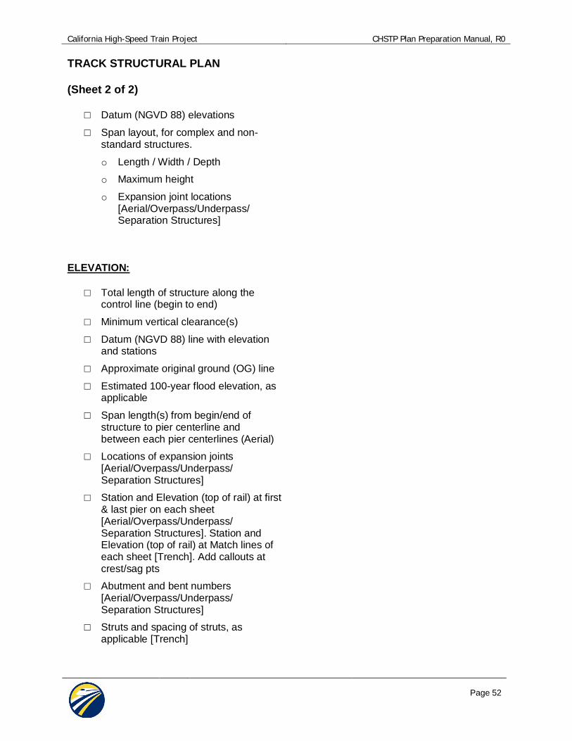
TRACK STRUCTURAL PLAN
(Sheet 2 of 2)
Datum (NGVD 88) elevations
Span layout, for complex and non-standard structures.
o Length / Width / Depth
o Maximum height
o Expansion joint locations[Aerial/Overpass/Underpass/Separation Structures]
ELEVATION:
Total length of structure along thecontrol line (begin to end)
Minimum vertical clearance(s)
Datum (NGVD 88) line with elevationand stations
Approximate original ground (OG) line
Estimated 100-year flood elevation, asapplicable
Span length(s) from begin/end ofstructure to pier centerline andbetween each pier centerlines (Aerial)
Locations of expansion joints[Aerial/Overpass/Underpass/Separation Structures]
Station and Elevation (top of rail) at first& last pier on each sheet[Aerial/Overpass/Underpass/Separation Structures]. Station andElevation (top of rail) at Match lines ofeach sheet [Trench]. Add callouts atcrest/sag pts
Abutment and bent numbers[Aerial/Overpass/Underpass/Separation Structures]
Struts and spacing of struts, asapplicable [Trench]

California High-Speed Train Project CHSTP Plan Preparation Manual, R0
Page 53
TRACK STRUCTURES / ROADWAYDRAFT GENERAL PLAN
(Sheet 1 of 2)
GENERAL:
Notes shall be located at the top rightcorner of the sheet.
Plan, Profile and Top Of Rail titles shallbe TX=0.24x, FT=43, LW=0, LV=315
Notes title is TX=0.175x, FT=3, LW=2,LV=315
Leaders and Dimensions shall beTX=0.14x, FT=3, LV=312
Notes and callouts shall be TX=0.14x,LW=1, FT=3, LV=314
Dimensions shall be in feet and inches(XX’-XX”)
Label HST track (S2) and other paralleland /or transverse highways andrailroads
AC=MATCH LINE for Match line textand symbology
AC=GR-SCALE for scale bar (full sizescale)
Right-of Way limits. Label Track Rightof Way as “PROP ROW”.
Easements associated with structure
Transition structure locations and Type(i.e., at-grade to bridge)
Table of retaining wall limits (extentand height) of walls and foundations
Indicate requirements for existingfacility modifications (pedestrian,roadway, highway, and railroad)
TYPICAL SECTION:
Total width of structure
Show widths of traveled way,sidewalks, shoulder and medians[Roadway]
Cross slope of the deck
Location of profile grade (PG)
Show width of barrier rail and type only[Roadway]
Structure depth/type
Show utilities and openings for futureutilities
Approximate original ground (OG)
Substructure dimensions[Aerial/Overpass/Underpass/Separation Structures]
o pier/footing locations
o spread footings and/or drilledpier
o column type
o approximate size
o identify areas where supports
o or foundations are prohibited

California High-Speed Train Project CHSTP Plan Preparation Manual, R0
Page 54
TRACK GUIDEWAY / ROADWAYSTRUCTURAL DRAFT GENERAL PLAN
(Sheet 2 of 2)
PLAN:
Existing topographic backgroundshowing existing conditions
North arrow
HST control line and alignment name
Total width of structure
Control line intersection stations
100’ Station intervals for scale <50scale
Location of minimum vertical clearance
Show begin and end station ofstructure
Label HST track (S2) and other paralleland /or transverse highways andrailroads
Right-of Way limits. Label Track Rightof Way as “PROP ROW”.
Slope of cut or fill (2:1, 4:1, et al), asapplicable
Top and toe of approach fill or cut, asapplicable
Bank protection or slope paving, asapplicable
Horizontal clearance from face of pierto HST track centerline and othercritical elements
Show major existing utilities (overheadand underground)
Show proposed Systems sites
Approach slab, as applicable
Stream flow and/or traffic arrows, asapplicable
Guard rail, temporary railings, andapproach rail curb
ELEVATION:
Abutment and bent numbers
Total length of structure along thecontrol line (begin to end)
Span length(s) from begin/end ofstructure to pier centerline andbetween each pier centerlines
Minimum vertical clearance(s)
Datum (NGVD 88) line with elevationand stations
Approximate original ground (OG) line
Locations of expansion joints, asapplicable
Pier/footing locations
Struts and spacing of struts, asapplicable

California High-Speed Train Project CHSTP Plan Preparation Manual, R0
Page 55
ROADWAY INDEX MAP
Notes shall be located at the top rightcorner of the sheet.
Notes title shall be TX=0.175x, FT=3,LW=2, LV=1015
Leaders and Dimensions shall beTX=0.14x, FT=3, LV=60
Notes and callouts shall be TX=0.14x,FT=3, LW=1 LV=60
Map Titles, Column Headings and Citynames shall be TX=0.24x, FT=43,LW=0, LV=60
Scale varies
Provide table for Grade SeparationLocation, Sheet Title, RoadwayDrawing number(s) and StructuralDrawing number(s), as applicable
Use symbol to denote location
Differentiate between gradeseparation, local road modification andState Facility modifications
Grade Separation: AC=KMGS
Caltrans Facilities Modification : AC=KMCT
Local Road Modification: AC= KMLR
Show HS Alignment line. No stationLabels. LV=1019, LW=6
Show Roadway Alignments as needed.No station Labels. LV=13, LW=4
Background map showing roadway linework and names only (CO=140)
Street names shall be TX=0.14x, FT=3,LV=60

California High-Speed Train Project CHSTP Plan Preparation Manual, R0
Page 56
ROADWAY GRADE SEPARATIONPLAN AND PROFILE
Notes shall be located at the top rightcorner of the sheet.
Plan & Profile titles shall be TX=0.24x,FT=43, LW=0, LV=10
Notes title shall be TX=0.175x, FT=3,LW=2, LV=23
Leaders and Dimensions shall beTX=0.14x, FT=3, LV=23
Notes and callouts shall be TX=0.14x,FT=3, LV=23
Superelevation diagram designed onlyfor State Highways (not localroadways).
Vertical Alignment showing key existingfeatures (ground, water bodies, overand under crossings)
Label HST track (S2) and other paralleland /or transverse highways andrailroads
AC=MATCH LINE for Match line textand symbology
AC=GR-SCALE for scale bar (full sizescale)
Critical Clearances shall be confirmedand noted on plan and profile views
Curve, tangent and/or retaining wallnumbers/tables show in plan view
Right-of-Way limits including temporaryeasements. Label Track Right of Wayas “PROP ROW”. Label TemporaryConstruction easement as “PROPTCE” at each Matchline.
Indicate required driveway relocations
Show proposed Systems sites
Radius callouts for access roads
Label conforms points (STA and ELEV)
Line/curve data tables for roadalignment geometry and retaining walltable as needed. Below standardsapply to the tables:
o Table Headings shall beTX=0.175x, FT=3, LW=2, LV=23
o Text with tables shall be TX=0.14x,FT=3, LW=1, LV=23
o Exterior Border lines shall beLV=23, LW=2
o Interior vertical column lines andcolumn heading line shall beLV=23, LW=1
o Interior horizontal row lines: LV=23,LW=0
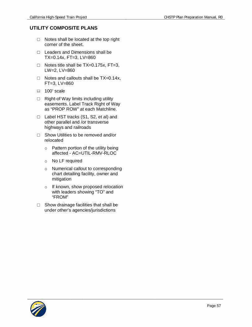
California High-Speed Train Project CHSTP Plan Preparation Manual, R0
Page 57
UTILITY COMPOSITE PLANS
Notes shall be located at the top rightcorner of the sheet.
Leaders and Dimensions shall beTX=0.14x, FT=3, LV=860
Notes title shall be TX=0.175x, FT=3,LW=2, LV=860
Notes and callouts shall be TX=0.14x,FT=3, LV=860
100’ scale
Right-of Way limits including utilityeasements. Label Track Right of Wayas “PROP ROW” at each Matchline.
Label HST tracks (S1, S2, et al) andother parallel and /or transversehighways and railroads
Show Utilities to be removed and/orrelocated
o Pattern portion of the utility beingaffected - AC=UTIL-RMV-RLOC
o No LF required
o Numerical callout to correspondingchart detailing facility, owner andmitigation
o If known, show proposed relocationwith leaders showing “TO” and“FROM”
Show drainage facilities that shall beunder other’s agencies/jurisdictions

California High-Speed Train Project CHSTP Plan Preparation Manual, R0
Page 58
UTILITY PROTECTION ANDRELOCATION PLAN AND PROFILE
For High Risk Utilities
1”=50’ Horizontal ; 1”=10’ Vertical
Leaders and Dimensions shall beTX=0.14x, FT=3, LV=860
Label HST tracks (S1, S2, et al) andother parallel and /or transversehighways and railroads
Notes title shall be TX=0.175x, FT=3,LW=2, LV=860
Notes and callouts shall be TX=0.14x,FT=3, LV=860
Right-of Way limits including utilityeasements. Label Track Right of Wayas “PROP ROW” at each Matchline.
Show High Risk Utilities to be removedand/or relocated
o Pattern portion of the utility beingaffected - AC=UTIL-RMV-RLOC
o No LF required
o Label “BEGIN” and “END” ofremoval

California High-Speed Train Project CHSTP Plan Preparation Manual, R0
Page 59
GRADING AND DRAINAGE PLANALONG TRACK ALIGNMENT
Notes shall be located at the top rightcorner of the sheet.
Leaders and Dimensions shall beTX=0.14x, FT=3, LV=860
Notes title shall be TX=0.175x, FT=3,LW=2, LV=860
Notes and callouts shall be TX=0.14x,FT=3, LV=860
Show line style for ditch/swale centerLS=rd-flowln, LW=1
All proposed drainage line work,including pipes, ditches and anno: LV=824 ut-stormD-p
No pipe sizes or slopes on drainageannotation
Label HST tracks (S1, S2, et al) andother parallel and /or transversehighways and railroads
Right-of Way limits including utilityeasements. Label Track Right of Wayas “PROP ROW”. Right-of Way limits.Label Track Right of Way as “PROPROW”.
No proposed drainage line work shownwhen alignment is within trench, tunneland cut-and-cover structures
Show/Label connections to existingdrainage
Show limit of grading for track
Show limit of detention basin only.
Show floodplain information. LS=ph-FL for 100yr boundary
Show Grade Separation alignmentonly. No proposed master line work.Place note to refer to thecorresponding grading and drainageroadway sheet.
Flow arrows are permissible to indicatedirection of flow to provide additionalclarity

California High-Speed Train Project CHSTP Plan Preparation Manual, R0
Page 60
APPENDIX C –PRELIMINARY ENGINEERING FOR PROCUREMENTDRAWING SAMPLE PLANS