
CADASTRAL STUDIES (MGHU1514) SR DR TAN LIAT CHOON
89
CADASTRAL STUDIES (MGHU1514) WEEK 1-INTRODUCTION SR DR. TAN LIAT CHOON 07-5543157 016-4975551 1 FINAL SR DR TAN LIAT CHOON
Transcript of CADASTRAL STUDIES (MGHU1514) SR DR TAN LIAT CHOON
CADASTRAL STUDIES(MGHU1514)
WEEK 1-INTRODUCTION
SR DR. TAN LIAT CHOON07-5543157
016-4975551
1
FINAL
SR DR TAN LIAT CHOON
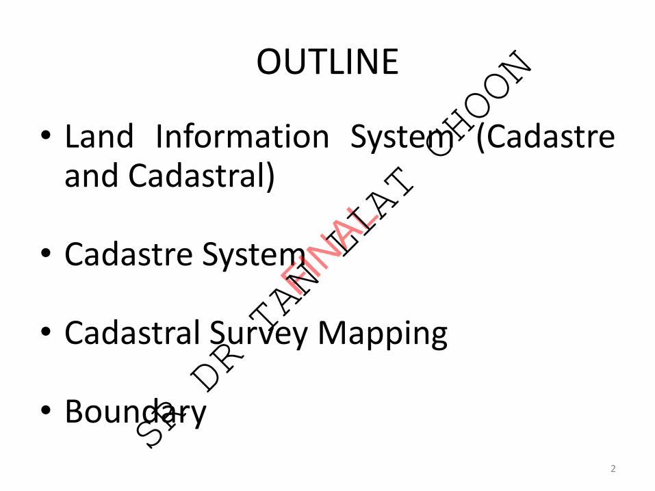
OUTLINE
• Land Information System (Cadastreand Cadastral)
• Cadastre System
• Cadastral Survey Mapping
• Boundary
2
FINAL
SR DR TAN LIAT CHOON
CADASTRE AND CADASTRAL
3
FINAL
SR DR TAN LIAT CHOON
Objective
To understand the role of the cadastre in the administrationof Federal or State or jurisdiction, its operation andcomponents.
4
FINAL
SR DR TAN LIAT CHOON
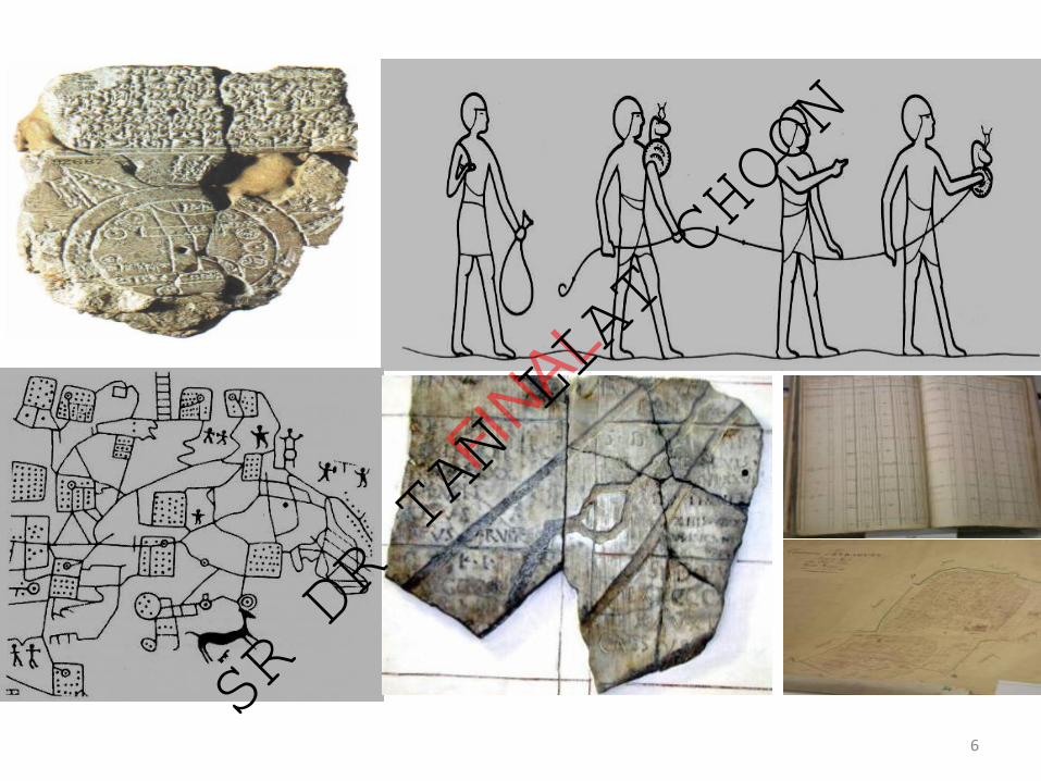
History of Cadastres
• Babylonian 4000 BC• Egyptians 3000 BC• Italy 1600 BC• Roman Empire 300 AD• Doomsday Book 1076 AD• Maria Theresia Cadastre 1792 AD• Napoleonic Cadastre 1807 AD• Computerized Cadastre 1980 AD• Cadastre 2014
5
FINAL
SR DR TAN LIAT CHOON
6
FINAL
SR DR TAN LIAT CHOON
The Definition of Cadastre
❑ The Cadastre is a land information system, usually managedby one or more government agencies. Traditionally the Cadastrewas designed to assist in land taxation, real estate conveyancing,and land redistribution.
❑ A cadastre is normally a parcel-based, and an up-to-date landinformation system containing a record of interests in land (e.g.rights, restrictions, and responsibilities).
❑ It usually includes a geometric description of land parcelslinked to other records describing the nature of interests theownership or control of those interests, and often the values ofthe parcel and its improvements.
7
FINAL
SR DR TAN LIAT CHOON
The Definition of Cadastre
The International Federation of Surveyors Statement on theCadastre highlights the importance of the cadastre as a landinformation system for social and economic developmentfrom an international perspective and recognises thecentral role that surveyors play in the establishment andmaintenance of cadastre.
8
FINAL
SR DR TAN LIAT CHOON
The Definition of Cadastre
❑ Effective land management requires land information,for example information about land resource capacity, landtenure and land use. The cadastre is the primary means ofproviding information about land. The cadastre provides:
• Information identifying those people who have interestin parcels of land;
• Information about those interest, for example nature andduration of right, restriction of interest andresponsibility;
• Information about the parcels, for example location, size,improvements and value.
9
FINAL
SR DR TAN LIAT CHOON
Essential Elements of a Modern Cadastre
❑ Large scale maps❑Registers❑Cadastre must be complete❑ Each parcel must have a unique identifier❑Cadastre must be dynamic❑ Information must be correct❑ Information must be public❑Cadastre must be supported by a coordinated survey
system❑ The cadastre must include an unambiguous definition of
parcel boundaries both in map form and on the ground.
10
FINAL
SR DR TAN LIAT CHOON
Cadastre
A successful CADASTRE should provide security of tenure, be simple and clear, be accessible, and provide current and
reliable information at minimum cost
11
FINAL
SR DR TAN LIAT CHOON
Categories of Cadastre
Juridical/Legal Cadastre
Fiscal Cadastre
Multipurpose Cadastre
12
FINAL
SR DR TAN LIAT CHOON
Juridical/Legal Cadastre❑ Supports land rights.
❑ Is concerned with documenting rights and relating them tothe land with which they are associated. It is concerned with allforms of property rights.
❑ As the information system which underpins land registration.
❑ A written record or register containing information about eachparcel, such as the spatial information and the rights whichappertain to the land.
❑ Contains a detailed description of the parcel, in the form ofeither survey maps or measurements.
13
FINAL
SR DR TAN LIAT CHOON
Fiscal Cadastre
❑ An instrument for administering land tax and valuepolicy.
❑ The information required to develop and maintain afiscal cadastre may be collected directly or indirectlythrough surveys or from other sources, for instance detailsof land ownership and their property boundaries.
14
FINAL
SR DR TAN LIAT CHOON
Multipurpose Cadastre
❑ Should be maps showing the location and different typesof physical features.
❑ Concerned with physical attributes such as man-madeobjects and natural features associated with each landparcel, abstractions, surveying and mapping data can alsobe referenced to the parcel.
15
FINAL
SR DR TAN LIAT CHOON
Multipurpose Cadastre❑ Advantages directly beneficial from multipurposecadastre are:
(i) an improved conveyancing system;(ii) an improved cadastral survey system;(iii) improved land use planning, land management and
environment management;(iv) improved management of publicly owned lands,(v) reduction of duplication; and(vi) better control of land transactions.
16
FINAL
SR DR TAN LIAT CHOON
Multipurpose Cadastre
An extension of the basic cadastre, is an essential tool that can include other information from various databases or
registers, and can be adapted for local needs. It is a basis for planning for utilities, land information and development
management.
17
FINAL
SR DR TAN LIAT CHOON
Benefits of Multipurpose Cadastre
❑ A modern multipurpose cadastre can lead to improve:
• Conveyancing system.• Cadastral survey system.• Land use planning and land management.• Sustainable development.• Management of publicly owned lands.• Reduction of duplication.• Control of land transactions.
18
FINAL
SR DR TAN LIAT CHOON
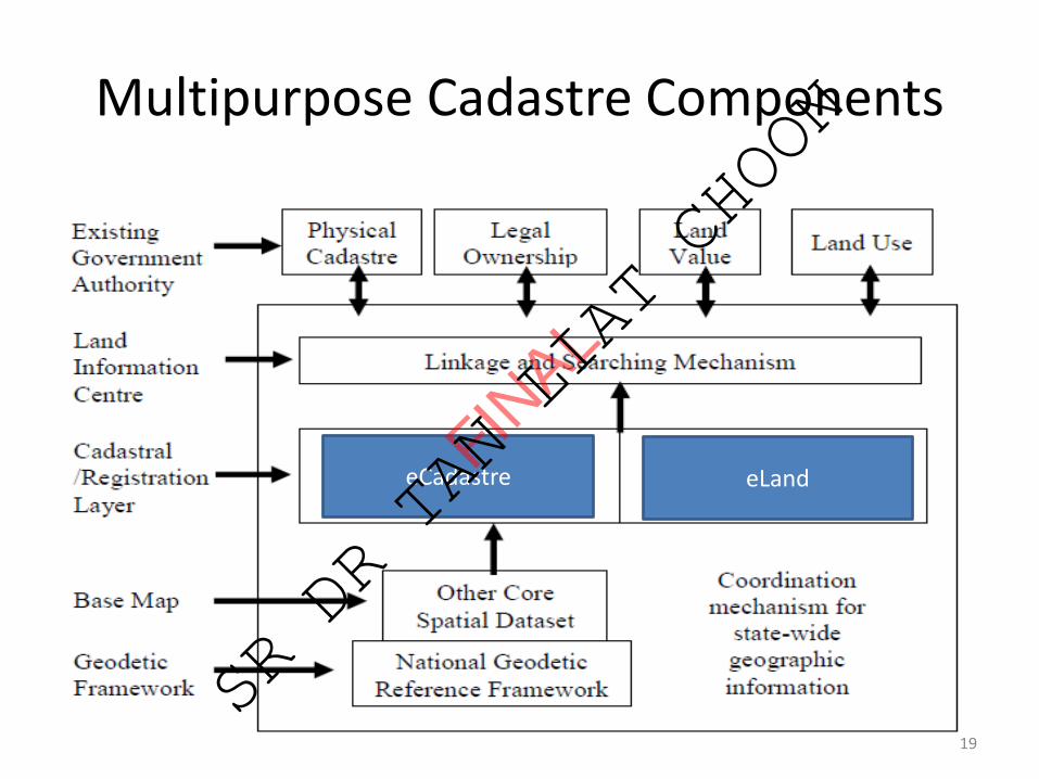
Multipurpose Cadastre Components
eCadastre eLand
19
FINAL
SR DR TAN LIAT CHOON
Cadastral
The basic building block in any land administration system is the cadastral parcel. The cadastre consists of two parts:
• Registers• Maps
20
FINAL
SR DR TAN LIAT CHOON
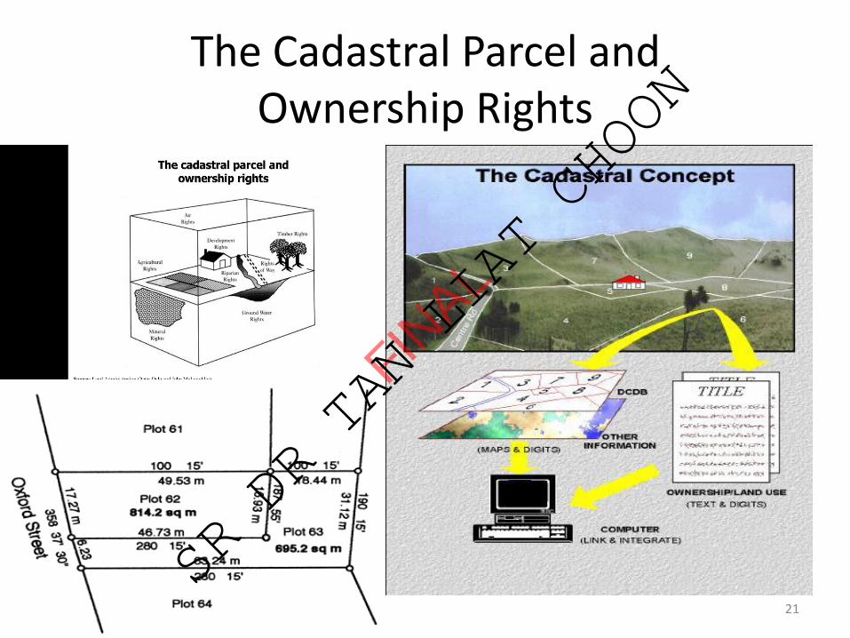
The Cadastral Parcel and Ownership Rights
21
FINAL
SR DR TAN LIAT CHOON
Cadastral Issues
❑ Documentation of informal or customary rights.
❑ Land registration (deeds, title or combinations).
❑ Land titling.
❑ Parcels and properties.
❑ Boundaries (fixed, graphical, general).
❑ Impact of technology.
22
FINAL
SR DR TAN LIAT CHOON
CADASTRE SYSTEM
23
FINAL
SR DR TAN LIAT CHOON
Cadastre System
The basic building block in any land administration systems is theland parcel as identified in the cadastre. However, since theconcept of a cadastre is difficult to define, it would be better todiscuss cadastre systems rather than a cadastre becausecadastre systems include the interaction between theidentification of land parcels, the registration of land rights, thevaluation and taxation of land and property, and the present andpossible future land use (Enemark, 2005). Therefore, it is notedthat even though cadastre systems around the world are clearlydifferent in terms of structure, processes and actors, their designis increasingly influenced by globalisation and technology,moving towards multipurpose cadastres (Molen, 2003).
24
FINAL
SR DR TAN LIAT CHOON
Cadastre System
The cadastre system comprises the map, real estate and landregister. The map shows the boundaries of real estates andlocation of the parcels. Real estates and changes are entered intothe cadastre. The land register based on the cadastre contains alist of titles for real estate. Today’s cadastre registration not onlyfocuses on property registration but also serves other tasks usedby private and public sectors in land development, urbanplanning, land management and environment monitoring(Federation Internationale de Geometres, 1995; Williamson andTing, 2001).
25
FINAL
SR DR TAN LIAT CHOON
Cadastre System
The central components of the cadastre systems areadjudication, demarcation, survey and preparation of boundarydescriptions (Dale, 1976). The overall cadastre systems areadministered or controlled by the State or federal government,either on its own or in conjunction with the private sector. Theoutputs of the cadastre system are the boundary descriptionsthat can be used for the production of cadastral maps, recordingtitles or boundaries, valuation and taxation or planning anddevelopment.
26
FINAL
SR DR TAN LIAT CHOON

Cadastre System
Nevertheless, it is more important to examine the key processeswith the cadastre systems which are associated withadjudicating, transferring and subdividing land rights, rather thanlook at a free standing concept of a cadastre (Williamson, 1983).It is important to recognise the flexibility of a cadastre. It canrecord a continuum of land tenure arrangements from privateand individual land rights to communal land rights as well ashave the ability to accommodate traditional or customary landrights. Additionally, Williamson (1983) suggests that the successof a cadastre system can be measured on how well it achievesthese broad social and economic objectives, not the complexityof its legal framework or the technical sophistication of thecadastral surveys or cadastral maps.
27
FINAL
SR DR TAN LIAT CHOON
CADASTRAL SURVEY MAPPING
28
FINAL
SR DR TAN LIAT CHOON

Cadastral Survey and Mapping
A section of the United Nations Economic Commission forEurope reads: Cadastral surveys are concerned with settingout and recording the turning point or corners alongproperty boundaries. A variety of techniques may be used,each having its own inherent accuracy and cost. Thenecessary and sufficient accuracy that is needed for anysurvey depends on the purposes for which that survey isconducted. (United Nations Economic Commission forEurope, 2005: 90)
29
FINAL
SR DR TAN LIAT CHOON

Cadastral Survey and Mapping
Federation Internationale de Geometres states thatcadastral surveying: is the definition, identification,demarcation, measuring and mapping of new or changedlegal parcel boundaries. It usually includes the process ofre-establishing lost boundaries and sometimes resolvingdisputes over boundaries or other interests in real property.(Federation Internationale de Geometres, 1995: 5)
30
FINAL
SR DR TAN LIAT CHOON
Cadastral Survey and Mapping
The United Nations Economic Commission for Europe (2005: 8) statesthat “the basic features that are recorded in a cadastre are the landparcels and their boundaries. Good practice will result in laws relatingto parcels and their boundaries that: (i) provide a legal definition of aland parcel; (ii) recognize that boundaries may be vertical (for mostsurface areas) or horizontal (for strata titles); (iii) differentiate betweenthe legal position of a boundary and the physical position of objectssuch as fences or hedges; (iv) define the priority of evidence, such assurvey measurements versus monuments, when re-establishing aboundary line, and indicate whether marks on the ground takeprecedence over measurements recorded in the registers in the re-establishment of boundaries or whether data on the plans must befollowed; and (v) avoid getting into detail over the precision withwhich boundaries should be surveyed for the purposes of land titling”.
31
FINAL
SR DR TAN LIAT CHOON
Cadastral Survey and Mapping
In order to guarantee the accuracy of boundary surveys and toapply quality controls to the work of the cadastral survey, it iscommon for survey regulations to be introduced. These oftenprescribe the manner in which surveys are to be carried out aswell as the standards that must be achieved. Survey regulationsmay also prescribe the necessary qualification for the granting oflicence to undertake cadastral surveys.
32
FINAL
SR DR TAN LIAT CHOON
Cadastral Survey and Mapping
Cadastral surveying is a general term applied to several differenttypes of survey. It is mentioned here only to make the readeraware of the expression and broad aspects of its use. A rigiddefinition of a cadastral survey involves only the informationrequired to define the legal boundaries of a parcel of a land,whether it is rural or urban. Therefore, the documentation,bearings, distances and areas would be shown. This definitionhas now been expanded through common usage to includecultural features, such as building location, drainage features andtopographic information, such as spot elevation or contours.
33
FINAL
SR DR TAN LIAT CHOON
Cadastral Survey and Mapping
Cadastres and cadastral surveys are aspects of landadministration. The primary object of a cadastral is to determinefor each land parcel, its location, the extent of its boundaries andsurface area, and to indicate its separate identity, bothgraphically on a map or in a record as well as physically on theground. Its secondary objective is to provide information for amultipurpose cadastre to fulfil the overall informationrequirements of land administration (Dale, 1976). Cadastralplans can fulfil many of the functions of large-scale topographicmaps, not only serving such purposes as boundary control,registration of title and valuation but also forming a basis ofplanning and development (Dale, 1976).
34
FINAL
SR DR TAN LIAT CHOON

Cadastral Survey and Mapping
The function of the multipurpose cadastre is to bring together allrelevant land information in a compatible data form. Theobjectives of cadastral surveys are to acquire information,process it, coordinate and finally to present the vital information.Cadastral surveying is an expensive process not only in itsexecution but also in the loss of capital from delays indevelopment and investment which may arise owing toinefficiency. The challenge is how to meet the short and longterm requirements of the fiscal, juridical and multipurposecadastres at minimum expense with maximum efficiency.
35
FINAL
SR DR TAN LIAT CHOON
Cadastral Survey and Mapping
The existence of up-to-date maps and records of all existingrights in land provided to every branch of the government thatdeals with the administration of land is helpful. For instance, thesimplification of courts/judicial processes; improved landacquisition for public purposes; and improved administration offorests and other public land are the results of good cadastralmaps and a good system of registration of rights to theappreciation of a national agrarian situation and to theelaboration of measures for its improvement and reform.
36
FINAL
SR DR TAN LIAT CHOON
Cadastral Survey and Mapping
It is mentioned by Rabley and Falk (2004) that cadastral surveysand cadastral maps are fundamental to an efficient and speedyland registration process. They are needed to ensure that rightsand restrictions about properties can be quickly identified byreferring to the same unique place on the earth. In addition,they all work to define the boundary of real property. In order tospeed up and streamline the process of property registration, itis important for cadastral surveys and mapping to emphasizereliable cadastral surveying information, which adds to thesecurity of titles.
37
FINAL
SR DR TAN LIAT CHOON
Cadastral Survey and Mapping
As Dale and McLaughlin (1999) point out, cadastral surveying isthe term generally used to describe the gathering and recordingof data about land parcels even though the records do not formpart of an official cadastre. When properties are initiallyregistered, government officials have traditionally undertakenthe processes of cadastral surveying and land title adjudication.
38
FINAL
SR DR TAN LIAT CHOON
Cadastral Survey and Mapping
In many countries, the techniques that are used in cadastralsurveying are prescribed in the law and in the regulations thatspecify the standards that are to be achieved and the methodsthat must be used to deliver them. Surveyors may also need tobe licensed in order to carry out their work. Regulations andlegislation for licensed surveyors have been introduced in manycountries to ensure that quality reliable data is collected. Thesestandards, in many cases, are still monitored by the centralgovernment cadastral mapping agency, which are responsible forthe accuracy of the work (Dale and McLaughlin, 1999).
39
FINAL
SR DR TAN LIAT CHOON
Cadastral Survey and Mapping
In conclusion, the methods and precision of cadastral surveys are oftenprescribed in survey-related laws and regulations although the finalstandard of the product is not normally defined in laws relating to theregistration of titles (United Nations Economic Commission for Europe,2005). From the legal perspective, it is necessary to prescribe thequalification of those who may conduct cadastral surveys. It is alsoessential to establish the legal liability of the surveyors for workundertaken and for the consequences in the short and long term ofany errors in measurement. The definition of legal liability isimportant, since quality control is most cost effective when it isundertaken by sampling. Since this implies the risk of failing to identifyincorrect data, the level of risk and consequences of mistakes must beclear in order to prevent expensive, unnecessary and time consumingchecking of surveys (United Nations Economic Commission for Europe,2005). 40
FINAL
SR DR TAN LIAT CHOON
Section 83 National Land Code 1965-Survey for purposes of alienation
under final title.
Where any land is surveyed in accordance with theprovisions of section 396 National Land Code 1965 for thepurpose of its alienation under final title, the boundariesdetermined on the survey shall accord as nearly as may bewith those indicated by the plan and description byreference to which the approval of the State Authority wasgiven.
41
FINAL
SR DR TAN LIAT CHOON
BOUNDARY
42
FINAL
SR DR TAN LIAT CHOON
43
➢ Tanda sempadan yang dijumpai berkeadaan tegak tetapiterlalu tinggi dari permukaan bumi boleh dianggapberkedudukan betul, kecuali dapat dibuktikan dengan caralain boleh digunakan sebagai datum dan pengukur perlumenurunkan tanda tersebut tanpa dianjakkan daripangkalnya.
➢ Tanda sempadan yang dijumpai condong dari tapaknyaboleh dianggap kedudukannya betul kecuali dapatdibuktikan dengan cara lain, boleh digunakan sebagaidatum dan pengukur hendaklah terlebih dahulumenegakkan tanda sempadan tersebut sebelum ianyadigunakan.
Kenalpasti Keadaan Tanda Sempadan
FINAL
SR DR TAN LIAT CHOON

Types of Boundary
❑ The need to indicate boundaries on the ground camelong before the practice of title registration, survey,mapping, or conveyancing.
❑ A boundary is a surface which defines where onelandowner’s property ends and the next begins.
❑ The legal boundary is an infinitesimally thin surfaceextending from the centre of the earth to the infinite in thesky and is essentially an abstract concept.
❑ Exceptions lie in three-dimensional property rights orstrata titles where the boundary may be horizontal as well. 44
FINAL
SR DR TAN LIAT CHOON

Types of Boundary
❑ There are three categories of fixed/specific boundaries:
(i) Defined on the ground prior to development andidentified.
(ii) Identified after development.(iii) Defined by surveys to specified standards.
❑ A fixed boundary is one that has been accuratelysurveyed so that any lost corner monument can be replacedprecisely from the measurements.
45
FINAL
SR DR TAN LIAT CHOON

Types of Boundary
❑ There are also three categories of general boundaries:
(i) The situation where the ownership of the boundaryfeature is not established, so that the boundary may beone side of a hedge or the other or down the middle.
(ii) The indeterminate edge of a natural features.(iii) The situation where the boundary is regarded as
approximate so that the register may be kept free fromboundary disputes.
46
FINAL
SR DR TAN LIAT CHOON
Types of Boundary
The third type of general boundary is suitable in thedetermination of actual forest or watershed boundaries, oreven lot parcels in some countries using aerial photographsor space satellite techniques to define an accurateboundary line that it can be mapped in the register ordocument of title.
47
FINAL
SR DR TAN LIAT CHOON
Types of Boundary
❑ The actual physical location of a boundary line is normallydemarcated by:
(i) Point features such as pegs the straight line between whichmarks the divide between two properties.
(ii) Linear features such as walls, hedges and fences.
❑ Such an approach works equally well with three-dimensionalproperties such as apartments since their construction definestheir effective limits. In the case of strata titles, the ownership ofparts of buildings can be defined and guaranteed withdetermination of where, within the walls and floors, one set ofproperty rights changes into another.
48
FINAL
SR DR TAN LIAT CHOON

Types of Boundary
❑ Advantage of fixed boundaries:
• Landowners can have confidence in where their propertylimits lie since these are formally recognized within thesystem.
❑ Disadvantages of general boundaries:
• The precise line of the legal boundary between adjoiningparcels is left undetermined.
• The ownership of the land can be guaranteed up to thebounding feature, the ownership of which is left uncertain.
49
FINAL
SR DR TAN LIAT CHOON

Types of Boundary
Information about the location of parcels and theirboundaries is an important part of a land informationsystem, the only differences being the precision with whichthe location of boundaries is recorded and the extent towhich this information can be used as legal evidence.
50
FINAL
SR DR TAN LIAT CHOON
Boundary Marks
❑ Section 5 National Land Code 1965:
• Boundary mark includes any survey stone, iron pipe orspike, wooden peg or post, concrete post or pillar orother mark used for the purpose of marking boundaries.
51
FINAL
SR DR TAN LIAT CHOON
Boundary Marks❑ Section 114 National Land Code 1965 (Implied conditionsaffecting all alienated land):
• The proprietor will, take all reasonable steps to prevent theirdamage, destruction or unlawful removal.
• The proprietor will if any of them are damaged, destroyed orunlawfully removed, give immediate notice of the fact to theLand Administrator, or to the penghulu having jurisdiction in thearea in which the land is situated.
• The proprietor will, if so required by the Land Administrator, paythe cost of repairing or, as the case may be, replacing any ofthem which may have been damaged, destroyed or unlawfullyremoved.
• The proprietor will, if so required by the Land Administrator, athis own expense clear any boundary line between any of them.
52
FINAL
SR DR TAN LIAT CHOON
53
FINAL
SR DR TAN LIAT CHOON
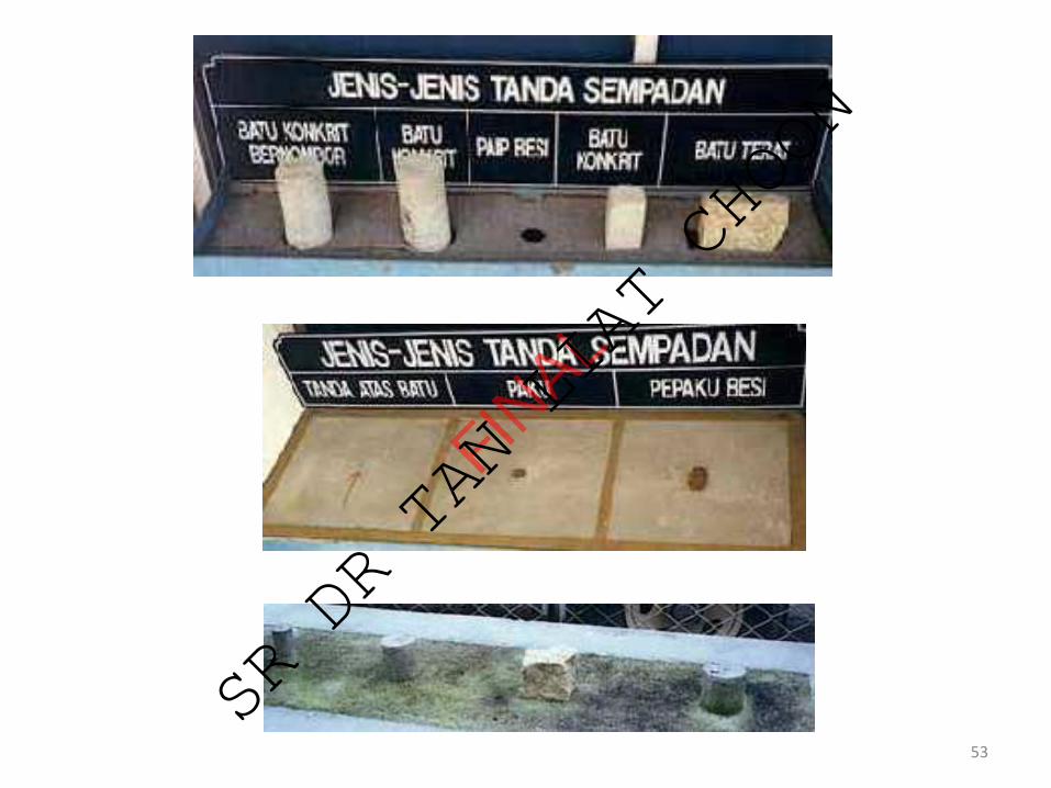
Jenis Tanda Sempadan Untuk Penandaan
Tanda-tanda sempadan yang dibenarkan adalah:
(a) batu konkrit, tiang konkrit, batu granit dan paip besimengikut saiz yang ditetapkan oleh Jabatan;
(b) paku dan pepaku besi dalam konkrit;
(c) tanda atas batu iaitu tanda lubang dengan satu anakpanah dipahat menunjuk ke arah lubang tersebut; dan
(d) sebarang tanda lain yang dibenarkan oleh Jabatan,melalui ketetapan yang dikeluarkan dari semasa ke semasa.
54
FINAL
SR DR TAN LIAT CHOON
Jenis Tanda Sempadan Untuk Penandaan
Batu Konkrit
• Batu konkrit bertetulang yang panjangnya tidak kurang600 milimeter (mm) dengan garispusat tidak kurang 75mm yang mempunyai tanda tebuk bagi titik stesen. Bagibatu konkrit yang ditanam oleh JUPEM, satu pengenalanbertulis “JUP” dicetak di bahagian atas permukaannya.Manakala bagi batu bernombor, nombor siri berkenaandicetak menggantikan tulisan “JUP” tersebut. Saizcetakan nombor siri mestilah mengikut saiz yangditetapkan.
55
FINAL
SR DR TAN LIAT CHOON
Jenis Tanda Sempadan Untuk Penandaan
Batu Konkrit
• Bagi batu konkrit yang ditanam oleh JTB, permukaanatasnya tiada mempunyai apa-apa pengenalan, manakalabatu konkrit bernombor hendaklah dibeli daripadaJUPEM Negeri yang berkenaan. Sekiranya JTB bercadanguntuk mencetak sendiri batu bernombor tersebut makanombor sirinya hendaklah terlebih dahulu dipohondaripada JUPEM Negeri yang berkenaan. Harga bagisetiap batu bernombor yang dibeli oleh JTB dari JUPEMNegeri adalah RM 5.00.
56
FINAL
SR DR TAN LIAT CHOON

57
Batu Konkrit
FINAL
SR DR TAN LIAT CHOON
Jenis Tanda Sempadan Untuk Penandaan
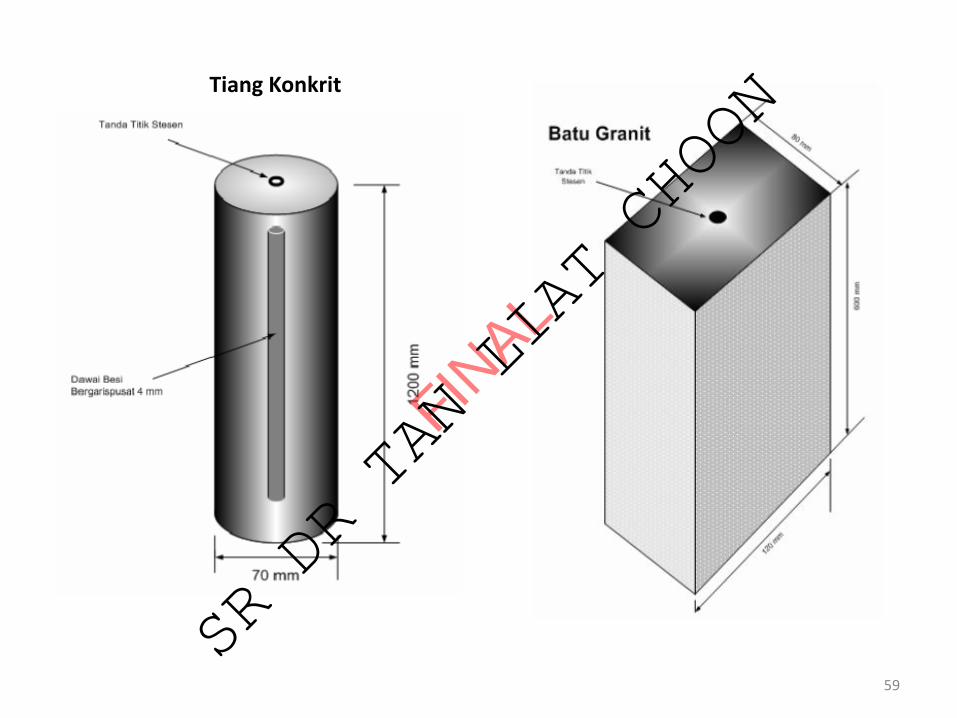
Tiang Konkrit
• Tiang konkrit bertetulang yang panjangnya 1200 mmhingga 1800 mm berbentuk silinder dengan garispusattidak kurang 70 mm dan mempunyai tanda tebuk bagititik stesen.
Batu Granit
• Batu granit berbentuk empat segi dengan ukuran 80 mmlebar, 120 mm panjang dan 600 mm tinggi yangmempunyai tanda tebuk bagi titik stesen.
58
FINAL
SR DR TAN LIAT CHOON
59
Tiang Konkrit
FINAL
SR DR TAN LIAT CHOON

Jenis Tanda Sempadan Untuk Penandaan
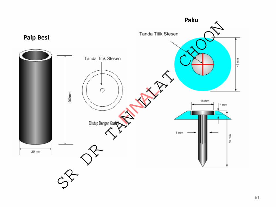
Paip Besi• Paip besi yang panjangnya tidak kurang 900 mm dengan
bergarispusat di antara 25 mm hingga 50 mm dan sebaik-baiknya disalut tar atau disadur dengan logam supaya tahankarat dan lubang paip di bahagian atas mestilah ditutupsebaik-baiknya dengan konkrit yang mempunyai tanda bagititik stesen.
Paku• Paku (nail) yang panjangnya tidak kurang 55 mm dengan
bergaris pusat 8 mm. Kepala paku hendaklah bergaris pusat15 mm dan mempunyai penutup bergarispusat 46 mm sertamempunyai tanda bagi titik stesen.
60
FINAL
SR DR TAN LIAT CHOON
61
Paip Besi
Paku
FINAL
SR DR TAN LIAT CHOON
Jenis Tanda Sempadan Untuk Penandaan
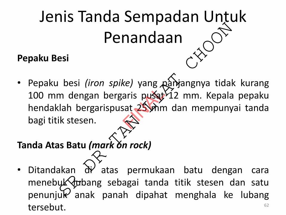
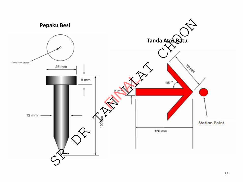
Pepaku Besi
• Pepaku besi (iron spike) yang panjangnya tidak kurang100 mm dengan bergaris pusat 12 mm. Kepala pepakuhendaklah bergarispusat 25 mm dan mempunyai tandabagi titik stesen.
Tanda Atas Batu (mark on rock)
• Ditandakan di atas permukaan batu dengan caramenebuk lubang sebagai tanda titik stesen dan satupenunjuk anak panah dipahat menghala ke lubangtersebut. 62
FINAL
SR DR TAN LIAT CHOON
63
Pepaku Besi
Tanda Atas Batu
FINAL
SR DR TAN LIAT CHOON
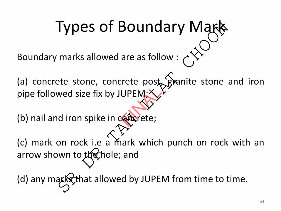
Types of Boundary Mark
Boundary marks allowed are as follow :
(a) concrete stone, concrete post, granite stone and ironpipe followed size fix by JUPEM;
(b) nail and iron spike in concrete;
(c) mark on rock i.e a mark which punch on rock with anarrow shown to the hole; and
(d) any marks that allowed by JUPEM from time to time.
64
FINAL
SR DR TAN LIAT CHOON
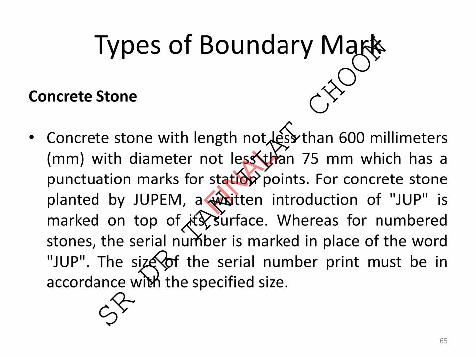
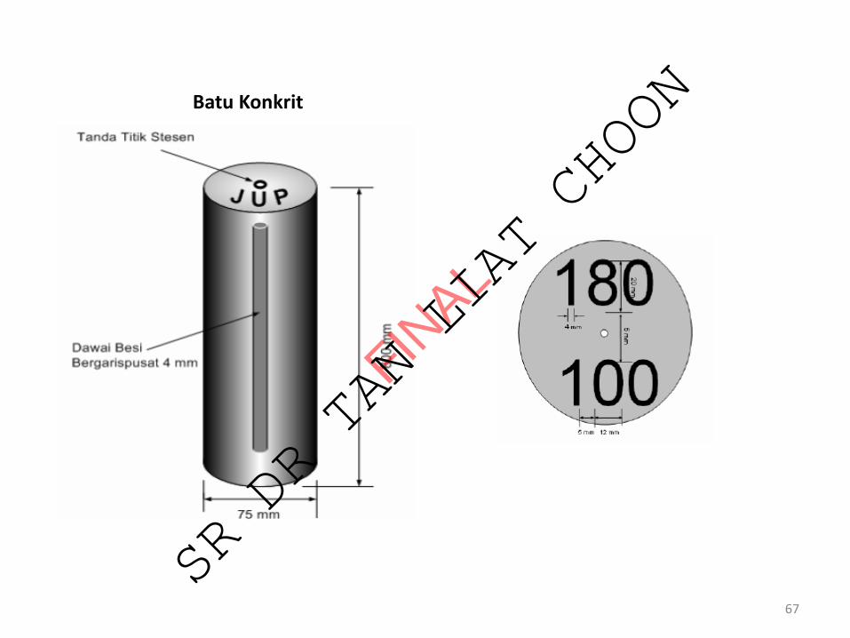
Types of Boundary Mark
Concrete Stone
• Concrete stone with length not less than 600 millimeters(mm) with diameter not less than 75 mm which has apunctuation marks for station points. For concrete stoneplanted by JUPEM, a written introduction of "JUP" ismarked on top of its surface. Whereas for numberedstones, the serial number is marked in place of the word"JUP". The size of the serial number print must be inaccordance with the specified size.
65
FINAL
SR DR TAN LIAT CHOON

Types of Boundary Mark
Concrete Stone
• For concrete stone planted by JTB, its upper surface doesnot have any identification, while numbered concretestones should be purchased from the respective StateJUPEM. If the JTB intends to mark the numbered stonethemselves then the serial number shall be applied fromrespective State JUPEM. The price for each numberedstone purchased by JTB from State JUPEM is RM 5.00.
66
FINAL
SR DR TAN LIAT CHOON
67
Batu Konkrit
FINAL
SR DR TAN LIAT CHOON
Types of Boundary Mark
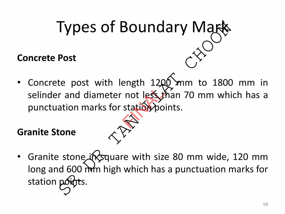
Concrete Post
• Concrete post with length 1200 mm to 1800 mm inselinder and diameter not less than 70 mm which has apunctuation marks for station points.
Granite Stone
• Granite stone in square with size 80 mm wide, 120 mmlong and 600 mm high which has a punctuation marks forstation points.
68
FINAL
SR DR TAN LIAT CHOON

69
Tiang Konkrit
FINAL
SR DR TAN LIAT CHOON
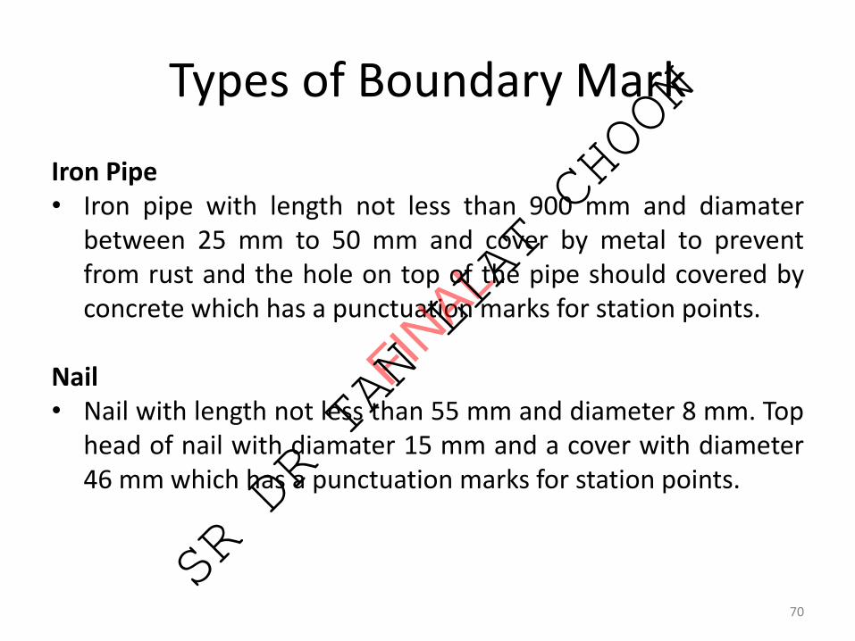
Types of Boundary Mark
Iron Pipe• Iron pipe with length not less than 900 mm and diamater
between 25 mm to 50 mm and cover by metal to preventfrom rust and the hole on top of the pipe should covered byconcrete which has a punctuation marks for station points.
Nail• Nail with length not less than 55 mm and diameter 8 mm. Top
head of nail with diamater 15 mm and a cover with diameter46 mm which has a punctuation marks for station points.
70
FINAL
SR DR TAN LIAT CHOON

71
Paip Besi
Paku
FINAL
SR DR TAN LIAT CHOON
Types of Boundary Mark
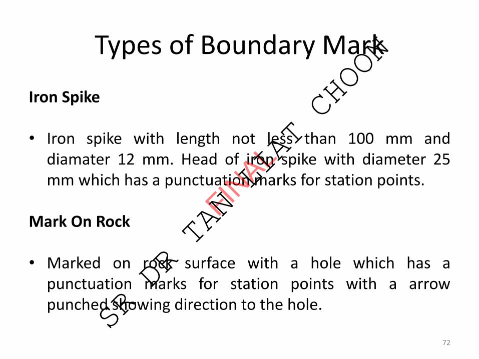
Iron Spike
• Iron spike with length not less than 100 mm anddiamater 12 mm. Head of iron spike with diameter 25mm which has a punctuation marks for station points.
Mark On Rock
• Marked on rock surface with a hole which has apunctuation marks for station points with a arrowpunched showing direction to the hole.
72
FINAL
SR DR TAN LIAT CHOON

73
Pepaku Besi
Tanda Atas Batu
FINAL
SR DR TAN LIAT CHOON
Type Of Boundary Mark
Abbreviations and symbols used for boundary marks shallbe as prescribed by the Department.
i. Should use the permitted type of boundary marks allowedby Department.
ii. Cadastral Reference Mark can be from iron pipe inconcrete or iron spike in concrete. The existing boundarymarks can be used as Cadastral Reference Mark. Serialnumber of Cadastral Reference Mark is generated bysystems and based on the survey file number.
74
FINAL
SR DR TAN LIAT CHOON
Distance Between Boundary Mark
❑ The marks on the boundary line should be planted atintervals of not more than 300 meters away if marks visibleeach other or at intervals of not more than 200 meters ifthey are not visible.
❑ Boundaries lines shall be marked follow the curve at theend of the chord so normal distance from the curve to thechord line does not exceed 0.2 meters.
❑Minimum distance between two boundary marks is 0.1meter.
75
FINAL
SR DR TAN LIAT CHOON
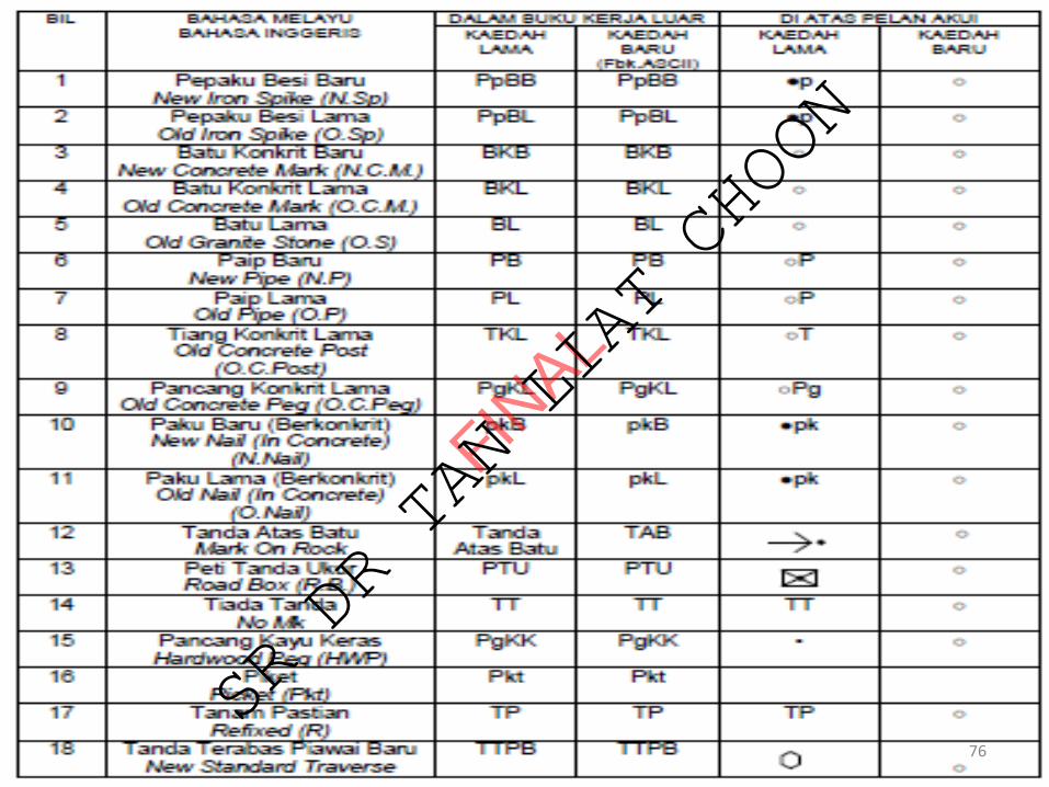
76
FINAL
SR DR TAN LIAT CHOON
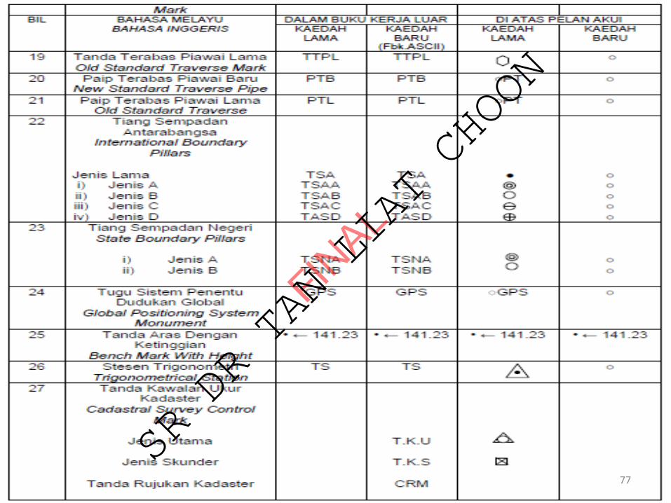
77
FINAL
SR DR TAN LIAT CHOON

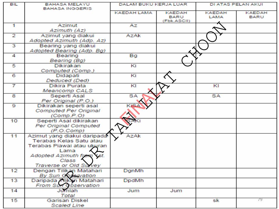
78
FINAL
SR DR TAN LIAT CHOON
79
FINAL
SR DR TAN LIAT CHOON
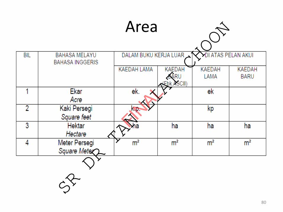
Area
80
FINAL
SR DR TAN LIAT CHOON
81
FINAL
SR DR TAN LIAT CHOON
82
FINAL
SR DR TAN LIAT CHOON
83
FINAL
SR DR TAN LIAT CHOON
84
FINAL
SR DR TAN LIAT CHOON
PARTY WALL
85
FINAL
SR DR TAN LIAT CHOON
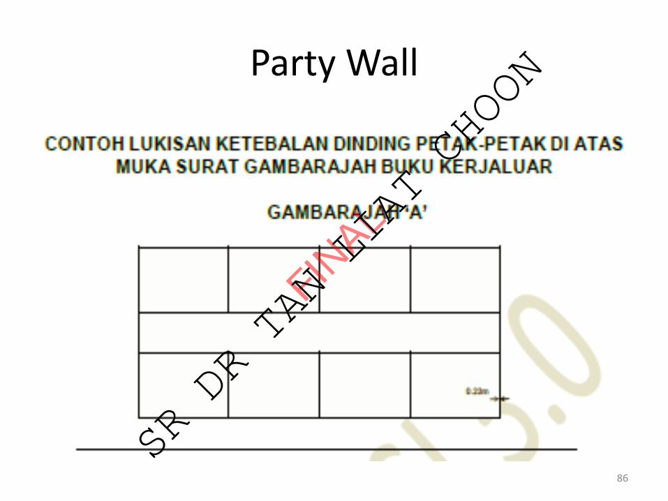
Party Wall
86
FINAL
SR DR TAN LIAT CHOON

Party Wall
87
FINAL
SR DR TAN LIAT CHOON
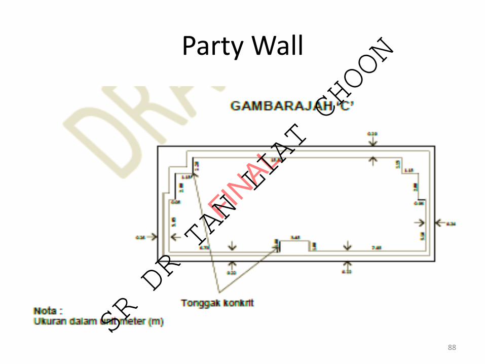
Party Wall
88
FINAL
SR DR TAN LIAT CHOON

T H A N K YO U
89
FINAL
SR DR TAN LIAT CHOON