Butano State Park - CA State Parks prelim gp...Location of Butano State Park Recent additions to the...
32
BUTANO STATE PARK Preliminary General Plan Draft Environmental Impact Report March 2008
Transcript of Butano State Park - CA State Parks prelim gp...Location of Butano State Park Recent additions to the...

B U T A N O S T A T E P A R K
Preliminary General Plan
Draft Environmental Impact Report
March 2008

© 2008 California State Parks All photographs copyright California State Parks unless otherwise noted. This document is also available as an electronic file at: www.parks.ca.gov/planning Cover photo: Wooden flume, Little Butano Creek area

B U T A N O S T A T E P A R K
Preliminary General Plan
Draft Environmental Impact Report
State Clearinghouse # 2003102090
March 2008
Arnold Schwarzenegger Governor
Mike Chrisman
Secretary for Resources
Ruth Coleman Director of Parks and Recreation
State of California
The Resources Agency Department of Parks and Recreation
P.O. Box 942896 Sacramento, CA 94296‐0001


EX
EC
UT
IVE
SU
MM
AR
Y

Photo on reverse: Butano State Park entrance

Executive Summary
Butano State Park Preliminary General Plan and Draft EIR March 2008
ES‐1
E X E C U T I V E S U M M A R Y
PARK DESCRIPTION Butano State Park (approximately 4,630 acres) is located in western San Mateo County, approximately 25 miles south of Half Moon Bay and 30 miles north of Santa Cruz. The park is in the Santa Cruz Mountains region, within 60 miles of the major metropolitan centers of San Jose and Oakland, and within 40 miles of the city of San Francisco and heavily populated eastern San Mateo County. Cloverdale Road, via State Highway 1, provides the primary public access.
The park’s main visitor use area is developed in a small secluded redwood forest valley, with a network of trails that connects with the backcountry at the park’s higher elevations. The backcountry terrain and vegetation varies from riparian canyons to dry rocky hillsides partially covered in coastal scrub and conifers.
The area was logged extensively in the late nineteenth and early twentieth centuries. This logging, plus private development plans, spurred acquisition of the park in 1957 to preserve some of the finest remaining stands of old growth redwoods in the southern end of their range.
PURPOSE FOR THE GENERAL PLAN
Butano State Park has been a state park for over fifty years, yet a general plan for the park has never been completed. The need for formal planning was highlighted by recent acquisitions, new potential for regional natural lands and open space connections, a growing demand from the expanding California population for new recreation options and coastal access, and the opportunity to coordinate planning with several other state parks in the region. A comprehensive planning effort was initiated to create a long-term and visionary general plan that would be commensurate with the park’s significance within the region as well as in the California State Park System.
REGIONAL PLANNING CONTEXT This plan was developed by California State Parks as part of a regional planning effort, along with general plans for Año Nuevo State Natural Reserve, Año Nuevo State Park, and Big Basin Redwoods State Park. These four parks not only are in
Location of Butano State Park
Recent additions to the
park, new potential for
regional open space
connections, and growing
demand for recreation
were factors in the
decision to develop this
general plan.

Executive Summary
Preliminary General Plan and Draft EIR Butano State Park March 2008
ES‐2
proximity to each other, they share natural, cultural, and visitor demographic characteristics, and face similar issues. Regional characteristics and common issues were researched at the beginning of the planning process and used as a foundation for the resulting park plans. The general plan process also recognized each park’s unique assets and needs separately. The plans recognize the close relationship between California State Park units and other nearby public and private lands, and emphasize the potential for regional collaboration in resource management, recreational use, education and interpretation, and park management.
For each plan, park issues and opportunities were identified and goals and guidelines developed as part of the regional planning approach. Planning zones were created for each park to assist in shaping appropriate management strategies and projected levels of visitor use. Three Butano State Park planning zones were developed and are described in Table ES-1, Management Zones.
KEY ISSUES AND OPPORTUNITIES The following are the primary planning issues addressed by the General Plan:
Recreation Demand and Visitor Opportunities: California’s rapidly growing population and shifting demographics have created new and increased demands for recreation facilities, amenities, programs, and concession services. Butano State Park, along with other surrounding regional open space and natural areas, can play an important role in providing more diversified and accessible recreational activities and help serve a high regional demand for recreation in the nearby high density urban centers of the greater Bay Area.
Public Access and Circulation: Butano State Park is attracting many more visitors than when it first opened in 1957. This has impacted visitor access and circulation within the park. The park’s entrance area, in particular, can become overcrowded on busy weekends and during the peak summer season. The plan provides proposals to expand visitor capacity in the area and improve circulation. The plan also encourages development of alternative transportation in and around these regional parks to reduce traffic congestion and air polluting vehicle emissions.

Executive Summary
Butano State Park Preliminary General Plan and Draft EIR March 2008
ES‐3
Regional Planning Approach: Butano State Park is surrounded by several California State Park System units as well as other open space, natural, and recreational lands, including the Cloverdale Coastal Ranches, Año Nuevo State Park and State Natural Reserve, Big Basin Redwoods SP, and Pigeon Point Light Station State Historic Park. Inter- and intra-agency regional management and planning will be actively sought to enhance recreation, resource protection, education, and interpretation in the area, plus increase the efficiency of park maintenance and operations.
Wildlife and Habitat Protection: Plant and animal species composition has shifted and populations and habitats in and around the park have declined due to past land use and current human activities. Strategies for ecosystem management and regional collaboration for natural resource management are emphasized in the plan. Additional focus is provided for the special status species found in the park, which include the San Francisco garter snake, coho salmon, steelhead, California red-legged frog, and marbled murrelet. Conservation of the state and federally listed marbled murrelet, a sea-going bird which nests in old growth redwoods and Douglas-fir, is of high importance and nesting habitat of this bird will be protected.
KEY PLANNING CONCEPTS AND PLAN PROPOSALS
Key Planning Concepts Coordinate with area partners and adjacent natural
lands and open space properties on regional land management, sensitive resource protection and habitat linkages, recreation, trail networks, interpretation, and education. Explore acquisitions for these same purposes as properties become available.
Provide a trail system that offers a range of trail experiences, including hiking, biking, and equestrian use. Connect to regional trail systems and destinations, including the California Coastal Trail.
Manage park resources as an ecosystem, maintaining the natural processes, abundance, and diversity of plants and animals.
Minimize sensitive resource impacts while expanding recreation opportunities and services.
The plan emphasizes
strategies for ecosystem
management and regional
collaboration for natural
resource management.
Executive Summary
Preliminary General Plan and Draft EIR Butano State Park March 2008
ES‐4
Work with federal, state, and local agencies to provide effective and efficient regional natural resource management.
Incorporate sustainable design principles into the design, development, operations, and maintenance of park facilities and programs.
Key Plan Proposals Provide additional day use and overnight
accommodations, where possible, to serve the visitor needs reflected by California’s changing demographic trends. Consider group picnic and camping facilities, alternative overnight accommodations, and ADA-compliant recreational facilities where appropriate and compatible with the intimate park setting.
Improve park circulation and access for vehicles, pedestrians, equestrians, and bicycles. Redesign existing day use parking to minimize traffic conflicts and congestion during peak use.
Continue to protect sensitive habitats and survey for special status plant and wildlife species. Implement appropriate management techniques to protect sensitive habitat and special status species.
Establish a trailhead and trail connection from the park through Año Nuevo SP to the coastline. Coordinate with the Peninsula Open Space Trust to develop a trail connection from the park through the adjacent Cloverdale Coastal Ranches to the coast.
Remove the former nature lodge building from the Little Butano Creek riparian zone.
Provide additional cultural resource interpretation in the visitor center and at historic sites. Interpret the story of the Jackson Flats homestead and research, survey, and interpret the history and significance of the cultural resources related to the site of the historic sawmill.
Maintain or renovate the existing facilities in the Gazos Mt. Camp area to support park programs, educational, and recreation activities that do not adversely affect sensitive resources.
Provide additional trail camps in backcountry locations.

Executive Summary
Butano State Park Preliminary General Plan and Draft EIR March 2008
ES‐5
MANAGEMENT PLANS Some of the goals and guidelines comprising Chapter 4, Park Plan, recommend the preparation of specific management plans and more detailed site investigations subsequent to the adoption of the General Plan, including the following:
Interpretation Management Plan Roads and Trails Management Plan Watershed Management Plans Wildfire Management Plan Scope of Collections Statement
ENVIRONMENTAL ANALYSIS The environmental analysis and the consideration of alternatives contained in the General Plan were prepared in conformance with the California Environmental Quality Act (CEQA) requirement to analyze and disclose the potential environmental effects of a proposed action. The environmental analysis is programmatic in scope and serves as a first tier EIR. Tiering is a process where a lead agency prepares a series of environmental documents, progressing from general concerns to more site-specific evaluations with the preparation of each new document. The environmental analysis in this document analyzes broad environmental matters and does not contain project-specific analysis for the facilities that are considered in the General Plan. It is a reference for future environmental documents that will provide more detailed information and analysis for site specific developments and projects.
The General Plan includes guidelines that direct future project-level environmental review of site-specific projects to avoid or minimize potential adverse effects to resources during construction or operations of the facilities and improvements. Specific projects would also undergo subsequent CEQA review as appropriate. Because the General Plan contains goals and guidelines that are designed to avoid or minimize potential adverse environmental effects, no significant program-level impacts were identified.

Preliminary General Plan and Draft EIR Butano State Park March 2008
Table ES‐1 Management Zones
ENTRANCE AND FACILITIES ZONE GAZOS MOUNTAIN CAMP ZONE BACKCOUNTRY ZONE
AREA DESCRIPTION
This zone is located in the lower portion of the Little Butano Creek watershed at the park entrance. It contains most of the park’s visitor services and recreation opportunities, including initial visitor contact, orientation, picnic and campgrounds, and visitor center.
This zone is located southeast of the primary park entrance and is adjacent to Gazos Creek and Gazos Creek Road. It includes the former Gazos Mountain Camp classrooms, offices, cabins, maintenance facilities, and outdoor activity areas within a forest setting.
The Backcountry Zone is generally characterized by the steeper, more rugged terrain in the park’s higher elevations, forested mountains, and riparian corridors within the Little Butano Creek, Gazos Creek, and Butano Creek watersheds. Most of the park is in the Backcountry zone.
RESOURCE CHARACTER & MANAGEMENT (Carrying Capacity Objective)
This zone will be managed to preserve and enhance the combination of recreation opportunities and resource values, plus provide for administrative functions. The redwood and Douglas-fir forest ecosystems and the riparian corridors will be protected as important features and essential elements that define this park’s distinct identity and its visitor experiences.
This zone will be managed for its natural, scenic, educational, and recreational values. Management of the Gazos Creek riparian area and the surrounding redwood/Douglas-fir forest will encourage natural processes, protect sensitive species, and preserve scenic views.
The Backcountry will be managed primarily to preserve its cultural, natural, and scenic resources and sense of solitude, while expanding trail and primitive camping recreation opportunities.
VISITOR EXPERIENCES (Carrying Capacity Objective)
Recreation and administration facilities will remain small-scale to maintain the park’s intimate character. Public use areas will be separated from park administration, staff housing, and operations and maintenance facilities as much as possible to reduce congestion and
The Gazos Mountain Camp area will retain appropriate existing facilities for adaptive uses that are compatible with protection and enhancement of the natural resources.
A low level of visitor use contributes to the remote character of the Backcountry.
Executive Summary ES‐6

Executive Summary ES‐7
Butano State Park Preliminary General Plan and Draft EIR March 2008
Table ES‐1 Management Zones
ENTRANCE AND FACILITIES ZONE GAZOS MOUNTAIN CAMP ZONE BACKCOUNTRY ZONE
user conflicts in this primary visitor use area. • High to medium level of use • Frequent contact with others
• Medium level of use • Moderate contact with others
• Low level of use • Infrequent contact with
others VISITOR USES Visitor facilities provide
interpretation of the natural and cultural resources, as well as day use and overnight camping. There are also limited park administration, staff housing, and operations facilities in this area.
Appropriate uses may include park programs, educational, and recreation activities. Provides day use and overnight opportunities for individuals and groups.
Hikers, bicyclists, and equestrians can explore the park on an extensive trail system and connect with the region’s network of multi-use trails to venture into the surrounding Santa Cruz Mountains and coastal areas. Trail camps provide backcountry camping.
RANGE OF APPROPRIATE FACILITIES
• Visitor center • Trails • Trailheads • Parking • Office/Storage • Interpretive elements • Staff housing • Restrooms • Individual & Group Picnic sites • Individual & Group Campsites • Maintenance/Ops. Bldg.
• Classrooms • Offices • Restrooms • Cabins • Vehicle parking • Concessions • Interpretive elements • Outdoor activity areas • Trails • Maintenance facilities
• Trails • Trailheads • Trail camps • Restrooms • Regional trail connections


Table of Contents i
Butano State Park Preliminary General Plan and Draft EIR March 2008
T A B L E O F C O N T E N T S EXECUTIVE SUMMARY ES-1 1 INTRODUCTION 1-1
1.1 Location and Regional Context 1-1 1.2 Site Characteristics 1-1 1.3 Purpose Acquired 1-2 1.4 Sense of Place 1-2 1.5 Purpose of the General Plan 1-3
Combined General Plan/EIR 1-4 Tiered CEQA Analysis 1-4
1.6 Organization of the General Plan 1-6 1.7 Subsequent Planning 1-6 1.8 The Planning Process 1-7
The Planning Hierarchy 1-8 Interagency and Stakeholder Involvement 1-9
2 EXISTING CONDITIONS 2-1
2.1 Regional Land Use 2-1 2.2 Regional Recreation Facilities 2-2
Public Recreation Facilities 2-2 Private Recreation Facilities 2-5
2.3 Existing Park Land Use and Facilities 2-6 Parkwide Land Use 2-6 Park Attendance Levels 2-7 Day Use Facilities 2-7 Overnight Facilities 2-8 Circulation 2-9 Administration and Maintenance
Facilities 2-12 Utilities 2-13 Employee Housing 2-13 Concessions 2-13 Accessibility of Park Facilities 2-13
2.4 Significant Resource Values 2-14 Physical Resources 2-14 Natural Resources 2-27 Cultural Resources 2-35 Aesthetic Resources 2-53 Interpretation and Education Resources 2-56 Recreation Resources 2-58
2.5 Park Support 2-60

Table of Contents ii
Preliminary General Plan and Draft EIR Butano State Park March 2008
2.6 Planning Influences 2-62
Systemwide Planning 2-62 Regional Planning 2-65 Regulatory Influences 2-71 Regional Agencies and Non-Governmental Organizations 2-74 Demographics, Trends, and Projections 2-77 Opportunities for Public Input 2-83
3 ISSUES 3-1
3.1 Planning Assumptions 3-1 3.2 Parkwide Issues 3-2
Wildlife and Habitat Protection 3-2 Recreation Demand and Visitor
Opportunities 3-3 Park Planning and Management
in a Regional Context 3-3 Public Access and Circulation 3-4
3.3 Specific Area Issues 3-4 Entrance and Facilities 3-4 Backcountry 3-5 Gazos Mountain Camp 3-5
4 PARK PLAN 4-1
4.1 Classification 4-1 4.2 Declaration of Purpose 4-2
Proposed Declaration of Purpose 4-3 4.3 Vision 4-4 4.4 Planning Zones and Area-Specific Guidelines 4-5
Entrance and Facilities Zone 4-5 Gazos Mountain Camp Zone 4-7 Backcountry Zone 4-9
4.5 Parkwide Goals and Guidelines 4-10 Physical Resource Management 4-10 Natural Resource Management 4-13 Cultural Resource Management 4-20 Visitor Use and Opportunities 4-23 Interpretation and Education 4-33 Park Operations 4-41
4.6 Managing Visitor Capacity 4-47 Visitor Capacity Management
Methodology 4-48

Table of Contents iii
Butano State Park Preliminary General Plan and Draft EIR March 2008
5 ENVIRONMENTAL ANALYSIS 5-1
5.1 Introduction 5-1
Purpose of the EIR 5-1 Focus of the EIR 5-1 Subsequent Environmental Review
Process 5-1 Contents of the EIR 5-2
5.2 EIR Summary 5-3 Summary of Impacts and Mitigation 5-3 Summary of Alternatives Considered 5-3
5.3 Project Description 5-4 5.4 Environmental Setting 5-5 5.5 Environmental Effects Eliminated from
Further Analysis 5-5 Agriculture Resources 5-5 Land Use and Planning 5-6 Mineral Resources 5-6 Population and Housing 5-6 Public Services 5-7
5.6 Environmental Impacts 5-7 Aesthetics 5-8 Air Quality 5-9 Biological Resources 5-10 Cultural Resources 5-13 Geology and Soils 5-13 Hazards and Hazardous Materials 5-14 Hydrology and Water Quality 5-16 Noise 5-18 Recreation 5-18 Transportation and Traffic 5-19 Utilities and Service Systems 5-20
5.7 Other CEQA Considerations 5-21 Unavoidable Significant Environmental
Effects 5-21 Significant Irreversible Environmental
Changes 5-21 Growth-Inducing Impacts 5-22 Cumulative Impacts 5-23
5.8 Alternatives to the Proposed Plan 5-24 Alternative 1: Facility Improvement and
Resource Protection 5-25 Alternative 2: Increased Backcountry
Development 5-27 Alternative 3: No Project 5-28

Table of Contents iv
Preliminary General Plan and Draft EIR Butano State Park March 2008
6 REFERENCES 6-1 TABLES
ES-1 Management Zones ES-6 2-1 Fiscal Year Attendance 2-6 2-2 Day Use and Overnight Facilities 2-7 2-3 Roads and Trails 2-12 2-4 Air Pollution Summary 2-19 2-5 Selected County Populations 2-79 4-1 Desired Outcomes and Indicators 4-52 5-1 Plan Alternatives 5-31
APPENDICES
A Location of EIR-Required Content in the General
Plan/EIR B Publicly-Owned Recreational Facilities in the Vicinity
of Butano State Park C Privately-Owned Recreational Facilities in the
Vicinity of Butano State Park D Existing Trails E Existing Roads F Soil Types G Beneficial Uses of Water H Sensitive Plant Species for Which Suitable Habitat
Exists within Butano State Park I Sensitive Wildlife Species That Occur or for Which
Potential Habitat Exists within Butano State Park J California Population 1960-2020 K Acronyms and Abbreviations L Glossary
FIGURES
Figure 1 Regional Map Figure 2 Location Map Figure 3 Existing Facilities Figure 4 Existing Roads and Trails Figure 5 Alquist-Priolo Fault Zones Figure 6 Watersheds and Streams Figure 7 Coastal Zone Figure 8 Vegetation Communities

Table of Contents
Butano State Park Preliminary General Plan and Draft EIR March 2008
v
Figure 9 Wildlife Habitat Figure 10 Natural Resource Sensitivity Figure 11 Cultural Resources Figure 12 Planning Zones Figure 13 Proposals
REPORT CONTRIBUTORS Inside Back Cover

1 IN
TR
OD
UC
TIO
N

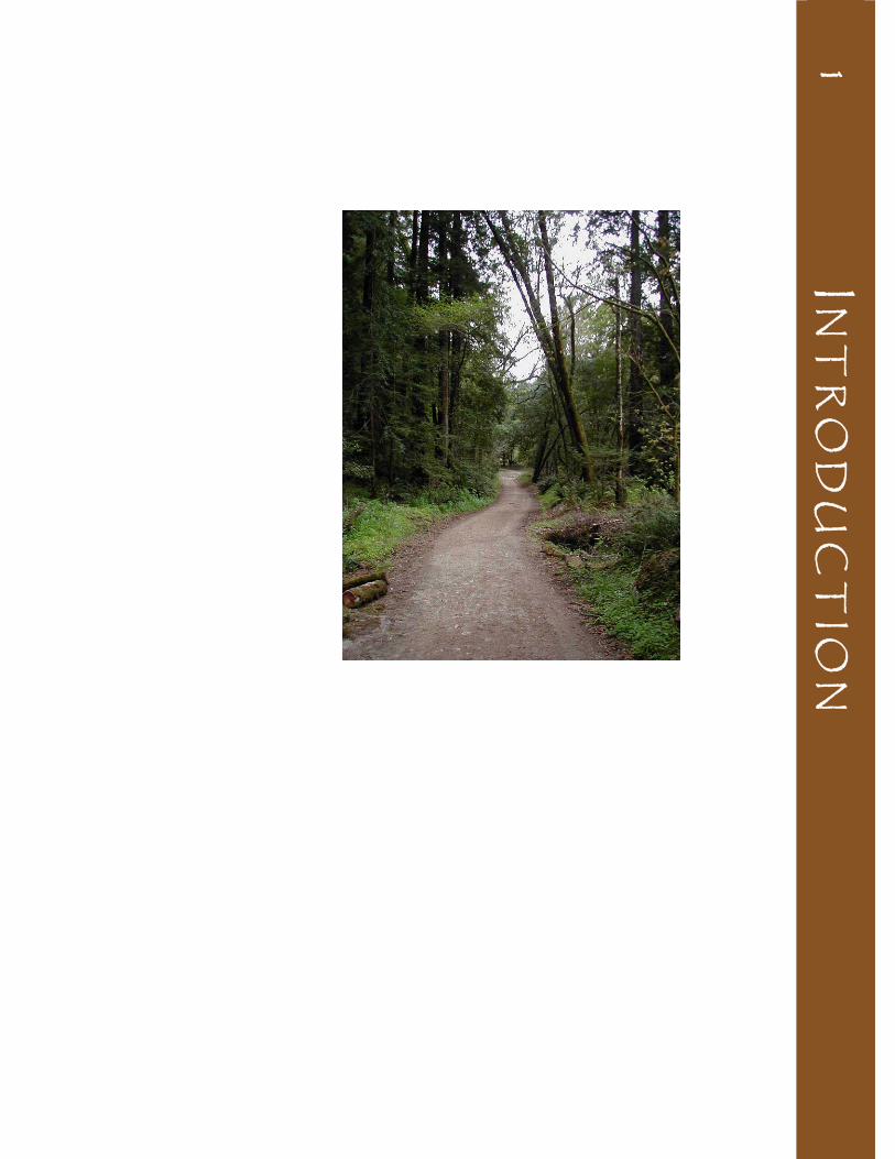
Photo on reverse: Hiking trail

Chapter 1 : Introduction
Butano State Park Preliminary General Plan and Draft EIR March 2008
1‐1
C H A P T E R 1 : I N T R O D U C T I O N
Butano State Park (SP) is located in San Mateo County, approximately 30 miles northeast of Santa Cruz and 25 miles south of Half Moon Bay (see Figure 1, Regional Map). The park is situated in the Santa Cruz Mountains, a section of the California Coast Ranges paralleling the Pacific coast and running in a northwest direction from Watsonville to South San Francisco, and is within 60 miles of the major metropolitan centers of San Jose, San Francisco, and Oakland. The Santa Cruz Mountains region includes many recreation and open space providers such as California State Parks, Santa Cruz and San Mateo County Parks, the Midpeninsula Regional Open Space District, the California Department of Fish and Game, the Santa Cruz Water Department, the University of California, the Sempervirens Fund, and the Peninsula Open Space Trust. In addition to public natural lands and open space providers, the region contains small towns, rural housing, small business, timber companies and private recreation providers.
The park consists of approximately 4,628 acres of canyons and uplands characterized by coast redwood and mixed evergreen forests, oaks, chaparral, rugged terrain, and mountain streams. The western boundary of the park is approximately two miles east of the ocean.
At the west entry to the park, visitors are greeted by park staff in a kiosk adjacent to the park’s visitor center. The visitor center offers natural history interpretation and contains park administrative offices. A short distance up the park road is a day use/picnic facility with parking, and farther east the Ben Ries Campground offers 38 campsites and a campfire center under the redwoods. Trails from the campground follow Little Butano Creek or travel up the forested slopes of the backcountry, offering quiet solitude among the large evergreen trees and canyon slopes. The eastern uplands of the park contain several areas of relatively gentle terrain. The
1.1 LOCATION AND REGIONAL CONTEXT
1.2 SITE CHARACTERISTICS
Second growth forest, a typical scene in much of the park.

Chapter 1 : Introduction
Preliminary General Plan and Draft EIR Butano State Park March 2008
1‐2
majority of streams and creeks in these uplands drain to Little Butano Creek, which flows west out of the uplands and eventually enters the ocean north of the boundary of the state park.
On the southeast side of the park is a parcel of land that includes the former Gazos Mountain Camp. This facility consists of a complex of buildings in a redwood forest. Access to the camp is on Gazos Creek Road, a county road, adjacent to Gazos Creek. The creek continues southwest forming the boundary between Año Nuevo and Butano State Parks and flows into the ocean at the north end of Año Nuevo State Natural Reserve (SNR).
In the 1920s developers planned to build homes on land that is now part of Butano SP, but were thwarted by the collapse of the stock market in the late 1920s. The Save-the-Redwoods League commissioned a study for the potential for a park in the Butano area, recognized as containing some of the best remaining stands of old growth coast redwoods in the state. Butano SP came into existence in 1957 to further protect California's native coast redwood habitat and to provide recreational opportunities for the state’s growing population.
Each of California’s state parks inspire a unique sense of place. Most visitors begin to sense the essence of a park when they first enter the park environment – the feeling of being in a special place set aside in perpetuity to preserve and protect a set of extraordinary values. This awareness of a certain place often leads to a sense of belonging and reconnection. State parks offer visitors opportunities to reconnect to the natural world and our cultural heritage, providing lasting impressions and memorable experiences.
Butano SP preserves an environmentally diverse segment of the California coastal landscape. Different areas in this complex system of diverse landforms and climatic influences impart different feelings to individuals exploring the park. The ocean to the west sends cooling fogs and salt-laden winds and rains into the canyons of the park; when clouds and fog are absent the sun bakes the hills, especially south-facing
1.4 SENSE OF PLACE
1.3 PURPOSE ACQUIRED
At Butano and other state
parks, visitors can begin or
rekindle a connection to
the natural world and
California’s cultural
heritage.

Chapter 1 : Introduction
Butano State Park Preliminary General Plan and Draft EIR March 2008
1‐3
slopes covered with knobcone pine and chaparral. The majestic coast redwoods shelter a unique plant and wildlife habitat, and sunlight often beams through high branches imparting a cathedral-like quality to the space below. The mountainous Little Butano Creek watershed also sets a dramatic context for the park.
Visitors to Butano SP experience distinct settings in various areas, each with its own sense of place. These experiences are found in gentle hills covered with grass, wildflowers and live oaks on the west side of the park; the towering coast redwood/Douglas-fir forest and shaded understory in the canyons and campground area; and along various trails that traverse the drier uplands and ridges.
The developed areas of the park provide campgrounds and visitor facilities that are comfortable areas for relaxation. The park’s main campground and campfire center are located within a redwood forest where visitors experience the quiet strength of the ancient trees and the plant and animal species beneath them. Hikers explore the park on trails that lead up a canyon following Little Butano Creek, passing reminders of past occupants of the land that is now part of the state park. Other trails lead up to the ridges of the mountains above, where the slopes are drier and support chaparral and pines. From the eastern highlands, hikers experience expansive vistas of the rolling terrain below and the ocean in the distance. The redwood trees and beauty of this coastal environment inspired the creation of the park, and continue to inspire those who visit this special place.
The general plan is the primary management document for a park within the California State Park System, establishing purpose and management direction for the future. By providing a defined purpose and vision with long-term goals and guidelines, it provides the framework for a unit’s resource stewardship, interpretation, visitor use, operation, and development. Subsequently, this established framework helps guide daily decision-making and serves as the basis for developing more detailed management and site-specific project plans.
This General Plan was developed to serve as a long range management tool that provides guidelines for fulfilling Butano SP’s purpose. This document does not attempt to provide detailed management or development proposals, but rather
1.5 PURPOSE OF THE GENERAL PLAN

Chapter 1 : Introduction
Preliminary General Plan and Draft EIR Butano State Park March 2008
1‐4
provides conceptual direction and parameters for future management and development actions. Specific objectives and strategies for implementation of the General Plan are intended to be developed in subsequent planning efforts as they are needed, including the preparation of management plans and specific project plans.
This General Plan document was prepared by California State Parks to satisfy the requirements of the California Public Resources Code (PRC) Section 5002.2. The PRC specifies that a general plan will be prepared prior to development of any new facilities and shall consist of elements of discussion that will evaluate and define the proposed management of resources, land uses, facilities, concessions, operation of the unit, and any environmental impacts. The Butano SP General Plan is submitted to the State Park and Recreation Commission for consideration and final approval.
COMBINED GENERAL PLAN/EIR The California Environmental Quality Act (CEQA) of 1970 establishes a requirement for state agencies to analyze and disclose the potential environmental effects of a proposed action. The environmental impact report (EIR) is usually a freestanding document intended to meet the requirements of CEQA. However, CEQA also encourages options to avoid needless redundancy and duplication, such as combining general plans and EIRs (CEQA Guidelines Section 15166) and the use of tiering, a process where a lead agency prepares a series of environmental documents, progressing from general concerns to more site-specific evaluations with the preparation of each new document (CEQA Guidelines Section 15152). This General Plan also serves as a first-tier EIR as defined in Section 15166 of the CEQA guidelines. The analysis of broad environmental matters found within the Environmental Analysis section will be a reference for future environmental documents that will provide more detailed information and analysis for site-specific developments and projects.
When the lead agency combines a general plan and an EIR all CEQA requirements must be covered and the document must identify where the requirements are met. Please see Appendix A for a table indicating the location of required elements of the EIR within this document.
TIERED CEQA ANALYSIS This Preliminary General Plan/Draft EIR serves as a first-tier EIR, as defined in Section 15166 of the CEQA Guidelines. Individual

Chapter 1 : Introduction
Butano State Park Preliminary General Plan and Draft EIR March 2008
1‐5
and/or site-specific projects and appropriate CEQA compliance will follow the Preliminary General Plan/EIR. The analysis of broad potential environmental impacts discussed in the Environmental Analysis section of this document will provide the basis for future second-level environmental review, which will provide more detailed information and analysis for site-specific developments and projects. These projects include facility development projects and future studies. Planning and feasibility studies for park management, recreation, and resource protection are ongoing.
This document provides discussion of the probable impacts of future development and establishes goals, guidelines, and objectives to implementing such development in a manner which will avoid or minimize such environmental impacts. This approach is consistent with a tiered approach to EIRs.
Where a proposed project covers a wide spectrum of action, from the adoption of a general plan, which is by definition tentative and subject to further refinement, to activities with a site-specific impact, CEQA requires that “environmental impact reports shall be tiered whenever feasible[.]” (Public Resources Code sec. 21093(b).) Tiering is defined as “the coverage of general matters and environmental effects in an environmental impact report prepared for a policy, plan, program, or ordinance followed by narrower or site-specific environmental impact reports…” (PRC sec. 21068.5; CEQA Guidelines sec. 15385). While a tiered EIR may not defer all consideration of impacts to a point in the future, it can legitimately indicate that more detailed studies and project-specific impacts may be considered in future environmental documents. Generally, the courts have recognized that environmental studies at the general plan level will be general. It has been found acceptable that a more detailed analysis be considered later in the process.
The level of detail addressed in the Environmental Analysis section is comparable to the level of detail provided in the land use proposals of the plan. What is critical, and what is set forth in the plan, is the formulation and eventual adoption of a set of goals and guidelines designed to minimize and mitigate impacts that might occur from the implementation of projects under the General Plan.
For example, the General Plan designates park property into management zones. Goals and guidelines are proposed for each of these zones which provide conceptual parameters for future management actions.

Chapter 1 : Introduction
Preliminary General Plan and Draft EIR Butano State Park March 2008
1‐6
Chapter 1 - Introduction gives an overview of the park’s characteristics.
Chapter 2 - Existing Conditions identifies the natural, cultural, interpretive, recreation, and aesthetic resources of the park, including a discussion of the demographic and recreation trends in California that are relevant to the planning process. This information provides a foundation to understand the specific park issues.
Chapter 3 - Issues describes current challenges and planning issues facing the park.
Chapter 4 - Park Plan presents a purpose and vision statement that describes the park’s future characteristics. Parkwide and area-specific goals and guidelines address the existing issues and provide park management and development proposals. This section also includes a description of the adaptive management process that will be used to maintain resources and positive visitor experiences at the park. The Park Plan is considered the preferred alternative.
Chapter 5 - Environmental Analysis discloses the preferred alternative’s effect on the environment, including any significant and potential significant effects that may result from implementing the General Plan. Potential mitigation measures and alternatives to the proposed project are also discussed in this section. This is considered a Program EIR which will inform decision-makers and the public about the environmental consequences of the adoption of the General Plan, consistent with the requirements of the California Environmental Quality Act and CEQA guidelines.
Major programs and projects implemented during the lifespan of the General Plan will require additional planning, such as management plans or specific project plans. Management plans define the specific objectives, methodologies and/or designs for accomplishing the management goals discussed in the General Plan. Occurring on an as-needed basis, management plans typically focus on specific management
1.7 SUBSEQUENT PLANNING
1.6 ORGANIZATION OF THE GENERAL PLAN

Chapter 1 : Introduction
Butano State Park Preliminary General Plan and Draft EIR March 2008
1‐7
topics, goals, or issues. Typical examples include resource management plans, trails plans, operations plans, interpretive plans, concession plans, and facility development plans.
Specific project plans are the detailed implementation plans necessary to accomplish specific projects. Future planning efforts may include the preparation of specific plans to protect sensitive resources or site-specific plans for new visitor facilities.
Subsequent planning efforts also include preparing project-specific environmental compliance documents to implement the management plans and proposed park development projects. These compliance documents will tier off and be consistent with the General Plan’s Program EIR. The General Plan may also be amended if significant new acquisitions are added to the existing park or if other circumstances render parts of the General Plan inapplicable.
Butano SP has been a state park for many years, yet a general plan for the park has never been completed. A comprehensive planning effort was initiated to create a long-term and visionary general plan that would be commensurate with the park’s significance within the region as well as in the California State Park System. This General Plan was prepared by a multi-disciplinary team from the Department’s Santa Cruz District, Santa Cruz Mountains Sector, Northern Service Center, and Planning Division in Sacramento. The team conducted field investigations, research, interviews, and surveys to compile a planning information base. This work included specific information related to the land, water, vegetation, wildlife, habitats, aesthetics, the area’s prehistory and history, surrounding land uses, recreation patterns and demographic trends, and visitor use patterns, needs and desires. This planning effort examined not only the area within park ownership, but also considered planning information regarding the surrounding region.
An initial public meeting was held at the Russell Administrative Center in Pescadero on August 26, 2003 to inform the public about the park’s resources and to identify various public concerns and issues regarding planning for the park. Soon after this public meeting the park planning was put on hold due to Department reorganization and staffing and budget challenges. Planning resumed in 2005 with further data gathering and analysis, identification of issues and
1.8 THE PLANNING PROCESS
The planning team shared plan concepts and draft proposals, answered questions, and collected public feedback at the December 2007 Public Open House.

Chapter 1 : Introduction
Preliminary General Plan and Draft EIR Butano State Park March 2008
1‐8
opportunities, and assessments of visitor and recreation needs. A subsequent open house was held in Pescadero on December 8, 2007 to share progress on the draft proposals and maps and to receive public input on the draft Butano State Park and Año Nuevo State Park general plans.
Newsletters provided information about the planning process and where to obtain additional information on upcoming public meetings, provided summaries of public comments, and explained major issues and planning team proposals. Planning information was also made available to the public on the Department’s website.
This active participation by the public, organizations, local governments, and other agencies in the development of the park’s concepts, goals, and proposals influenced the direction and content of the General Plan.
THE PLANNING HIERARCHY The following planning hierarchy provides direction for the future of Butano SP:
California State Parks Mission: The mission sets the fundamental parameters within which California State Parks acquires, plans, and manages its 278 park units.
Classification: In addition to the Department’s mission, park management and development is further directed by park unit classification as specified by the California Public Resources Code. Butano is classified as a State Park.
Declaration of Purpose: A broad statement of direction that is unique to Butano SP. The Declaration of Purpose required by Public Resources Code, Section 5019.50 is determined by the park’s prime resources and recreation opportunities in terms of the larger context of the State Park System.
Regional Planning Considerations for California State Parks Located in the Santa Cruz Mountains: Developed in response to a regional analysis, these considerations address existing issues and recreation trends and provide ongoing guidance to achieve the long-term vision for California State Parks located in the Santa Cruz Mountains. The regional vision provides a philosophical direction and serves as a guide for the desired condition of these parks.
Park Vision: The vision statement for each park is a view of the desired future conditions. It expresses what
The Mission of the
California Department of
Parks and Recreation is to
provide for the health,
inspiration, and education
of the people of
California by helping to
preserve the state’s
extraordinary biological
diversity, protecting its
most valued natural and
cultural resources, and
creating opportunities for
high‐quality outdoor
recreation.

Chapter 1 : Introduction
Butano State Park Preliminary General Plan and Draft EIR March 2008
1‐9
the park should ultimately be and look like as well as what kinds of visitor experiences should be available in the future.
Parkwide Management Goals and Guidelines: Topical guidance of a scope relevant for the entire park. These goals and guidelines were developed in response to an evaluation of existing conditions and are intended to address existing issues, foreseeable trends/patterns, and provide ongoing guidance for the incremental actions that will be taken over time to realize the long-term vision for the park.
Planning Zones: Land use concepts for the park that characterize types of resource conditions and visitor experience within certain specific geographic areas.
Specific Area Goals and Guidelines: Management goals and guidelines that clarify goals for a specific area.
INTERAGENCY AND STAKEHOLDER INVOLVEMENT Participation by pertinent agencies and organizations was sought throughout the planning process to ensure a broad consideration of concerns and interests as well as compliance or consistency with relevant policies, regulations, and plans. Early consultation with agencies on prominent issues such as habitats, endangered species, and recreation needs was conducted to ensure that their input would have timely consideration during the planning process. These agencies and other organizations included the U.S. Fish and Wildlife Service, California Department of Forestry and Fire Protection, California Department of Transportation, California Department of Fish and Game, the Sempervirens Fund, Save-the-Redwoods League, and the Peninsula Open Space Trust.