Bucks Relicensing Project FERC Project No. 619
21
Bucks Relicensing Project FERC Project No. 619 Erosion and Sedimentation (GS-S1) Study Results Meeting February 3, 2016
Transcript of Bucks Relicensing Project FERC Project No. 619
Bucks Relicensing ProjectFERC Project No. 619
Erosion and Sedimentation (GS-S1)Study Results Meeting
February 3, 2016
2
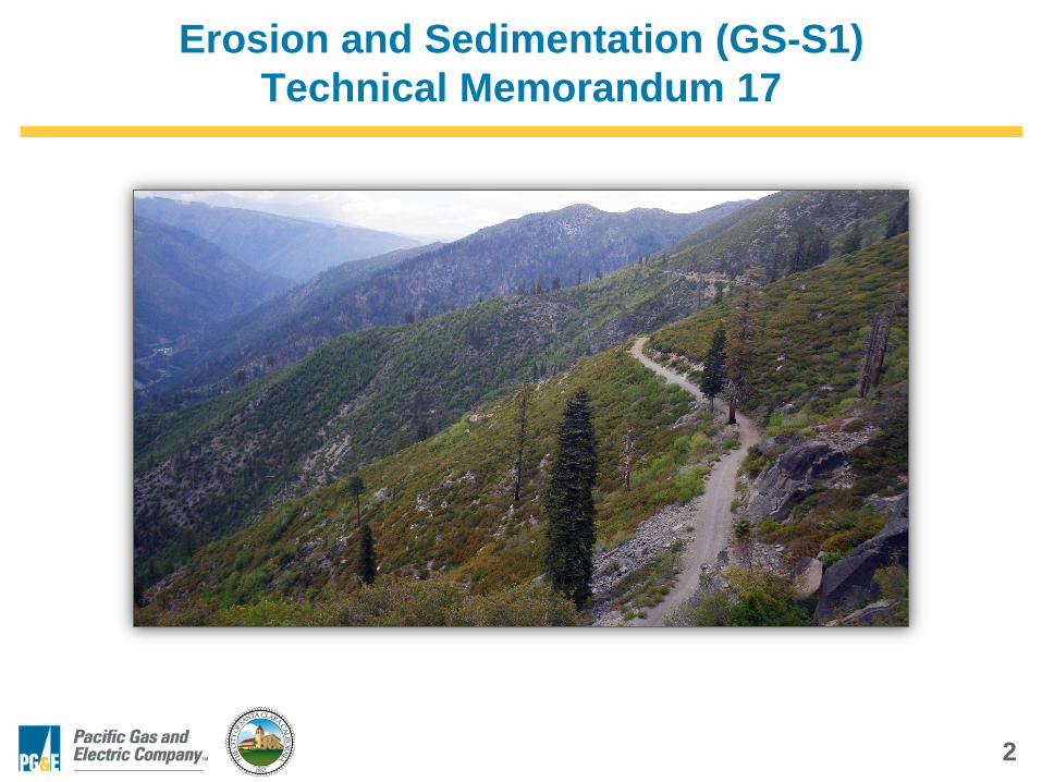
Erosion and Sedimentation (GS-S1)Technical Memorandum 17
3
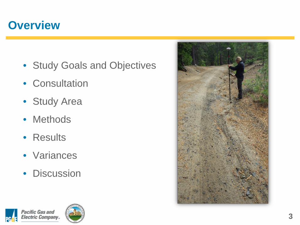
Overview
• Study Goals and Objectives
• Consultation
• Study Area
• Methods
• Results
• Variances
• Discussion
4
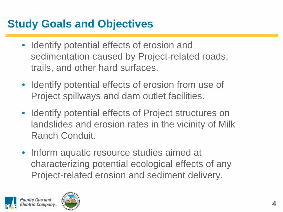
Study Goals and Objectives
• Identify potential effects of erosion and sedimentation caused by Project-related roads, trails, and other hard surfaces.
• Identify potential effects of erosion from use of Project spillways and dam outlet facilities.
• Identify potential effects of Project structures on landslides and erosion rates in the vicinity of Milk Ranch Conduit.
• Inform aquatic resource studies aimed at characterizing potential ecological effects of any Project-related erosion and sediment delivery.
5
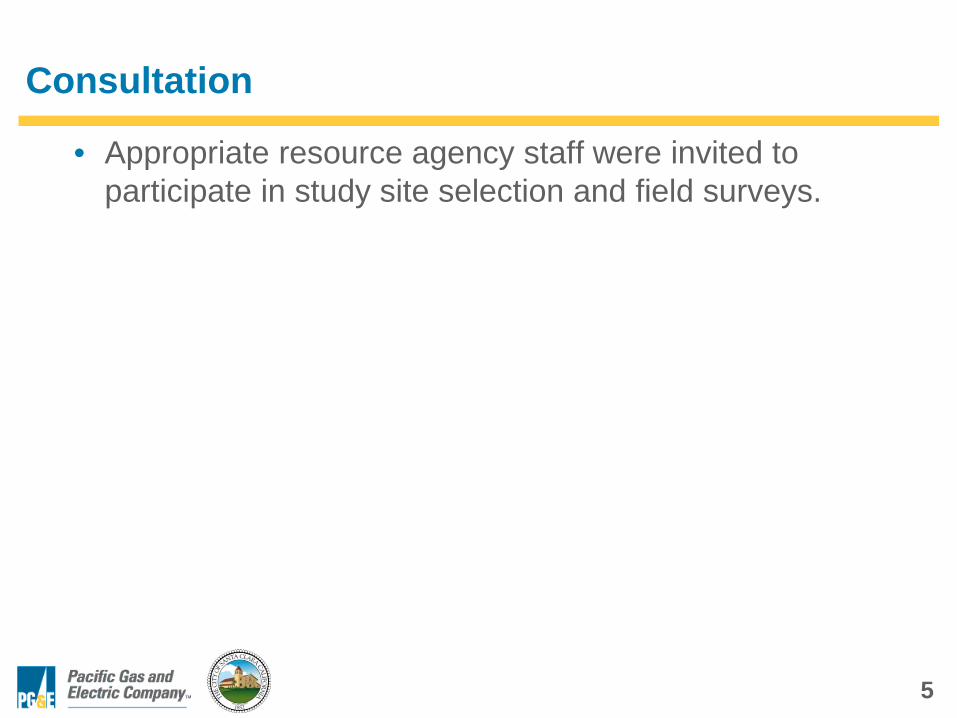
Consultation
• Appropriate resource agency staff were invited to participate in study site selection and field surveys.
6
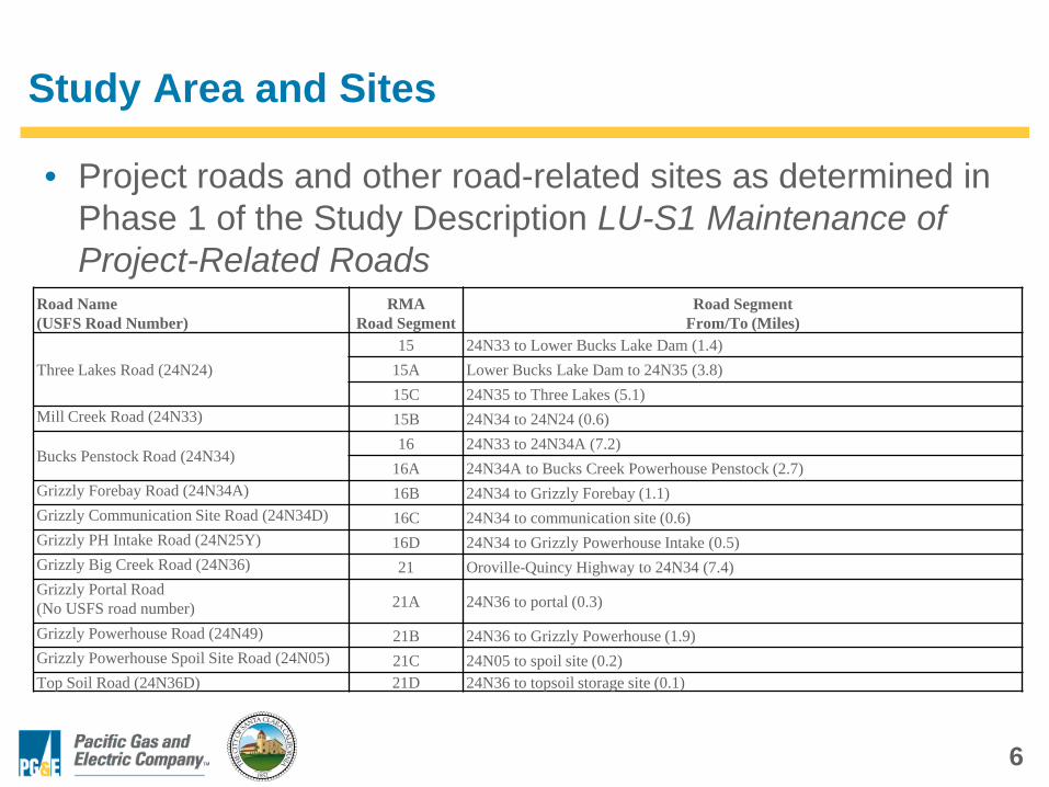
Study Area and Sites
• Project roads and other road-related sites as determined in Phase 1 of the Study Description LU-S1 Maintenance of Project-Related Roads
Road Name(USFS Road Number)
RMARoad Segment
Road SegmentFrom/To (Miles)
Three Lakes Road (24N24)15 24N33 to Lower Bucks Lake Dam (1.4)
15A Lower Bucks Lake Dam to 24N35 (3.8)15C 24N35 to Three Lakes (5.1)
Mill Creek Road (24N33) 15B 24N34 to 24N24 (0.6)
Bucks Penstock Road (24N34)16 24N33 to 24N34A (7.2)
16A 24N34A to Bucks Creek Powerhouse Penstock (2.7)Grizzly Forebay Road (24N34A) 16B 24N34 to Grizzly Forebay (1.1)Grizzly Communication Site Road (24N34D) 16C 24N34 to communication site (0.6)Grizzly PH Intake Road (24N25Y) 16D 24N34 to Grizzly Powerhouse Intake (0.5)Grizzly Big Creek Road (24N36) 21 Oroville-Quincy Highway to 24N34 (7.4)Grizzly Portal Road(No USFS road number) 21A 24N36 to portal (0.3)
Grizzly Powerhouse Road (24N49) 21B 24N36 to Grizzly Powerhouse (1.9)Grizzly Powerhouse Spoil Site Road (24N05) 21C 24N05 to spoil site (0.2)Top Soil Road (24N36D) 21D 24N36 to topsoil storage site (0.1)
7
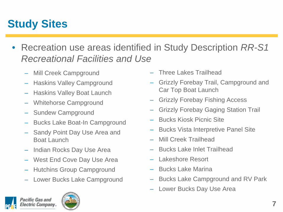
Study Sites
• Recreation use areas identified in Study Description RR-S1 Recreational Facilities and Use
– Mill Creek Campground– Haskins Valley Campground– Haskins Valley Boat Launch– Whitehorse Campground– Sundew Campground– Bucks Lake Boat-In Campground– Sandy Point Day Use Area and
Boat Launch– Indian Rocks Day Use Area– West End Cove Day Use Area– Hutchins Group Campground– Lower Bucks Lake Campground
– Three Lakes Trailhead– Grizzly Forebay Trail, Campground and
Car Top Boat Launch– Grizzly Forebay Fishing Access– Grizzly Forebay Gaging Station Trail– Bucks Kiosk Picnic Site– Bucks Vista Interpretive Panel Site– Mill Creek Trailhead – Bucks Lake Inlet Trailhead – Lakeshore Resort– Bucks Lake Marina– Bucks Lake Campground and RV Park– Lower Bucks Day Use Area
8
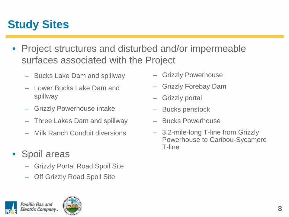
Study Sites
• Project structures and disturbed and/or impermeable surfaces associated with the Project– Bucks Lake Dam and spillway
– Lower Bucks Lake Dam and spillway
– Grizzly Powerhouse intake
– Three Lakes Dam and spillway
– Milk Ranch Conduit diversions
– Grizzly Powerhouse
– Grizzly Forebay Dam
– Grizzly portal
– Bucks penstock
– Bucks Powerhouse
– 3.2-mile-long T-line from Grizzly Powerhouse to Caribou-Sycamore T-line
• Spoil areas– Grizzly Portal Road Spoil Site– Off Grizzly Road Spoil Site
9
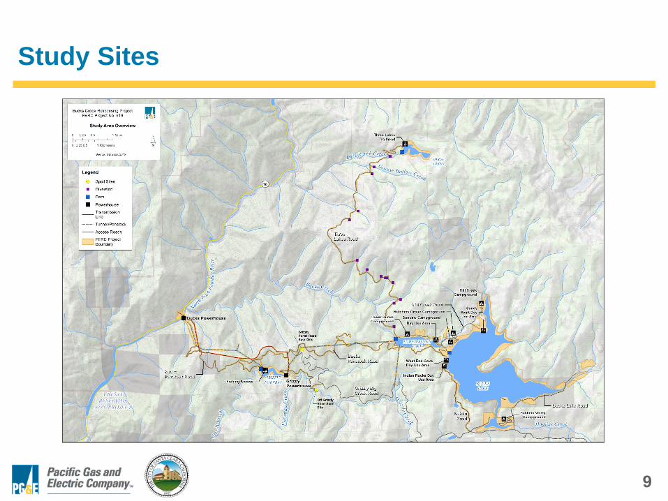
Study Sites
10
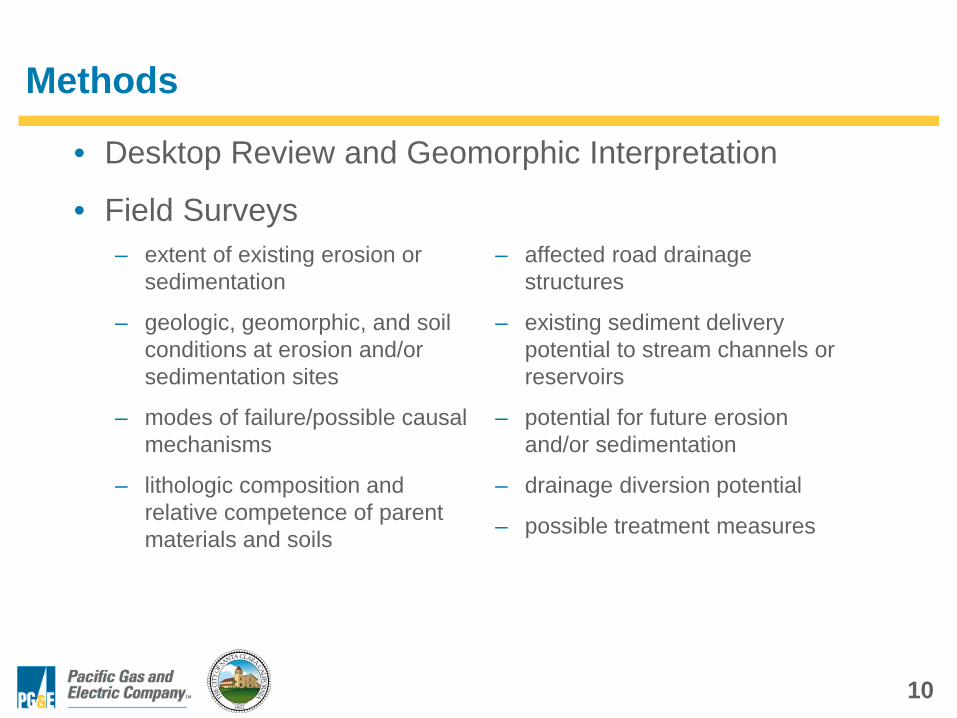
Methods
• Desktop Review and Geomorphic Interpretation
• Field Surveys– extent of existing erosion or
sedimentation
– geologic, geomorphic, and soil conditions at erosion and/or sedimentation sites
– modes of failure/possible causal mechanisms
– lithologic composition and relative competence of parent materials and soils
– affected road drainage structures
– existing sediment delivery potential to stream channels or reservoirs
– potential for future erosion and/or sedimentation
– drainage diversion potential
– possible treatment measures
11
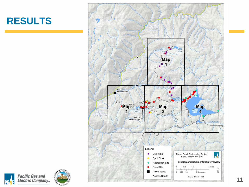
RESULTS
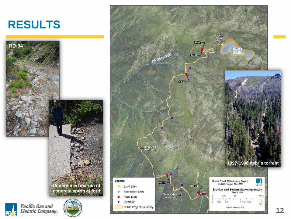
12
RESULTS RD-34
1997-1998 debris torrent
Undermined margin of concrete apron at ford
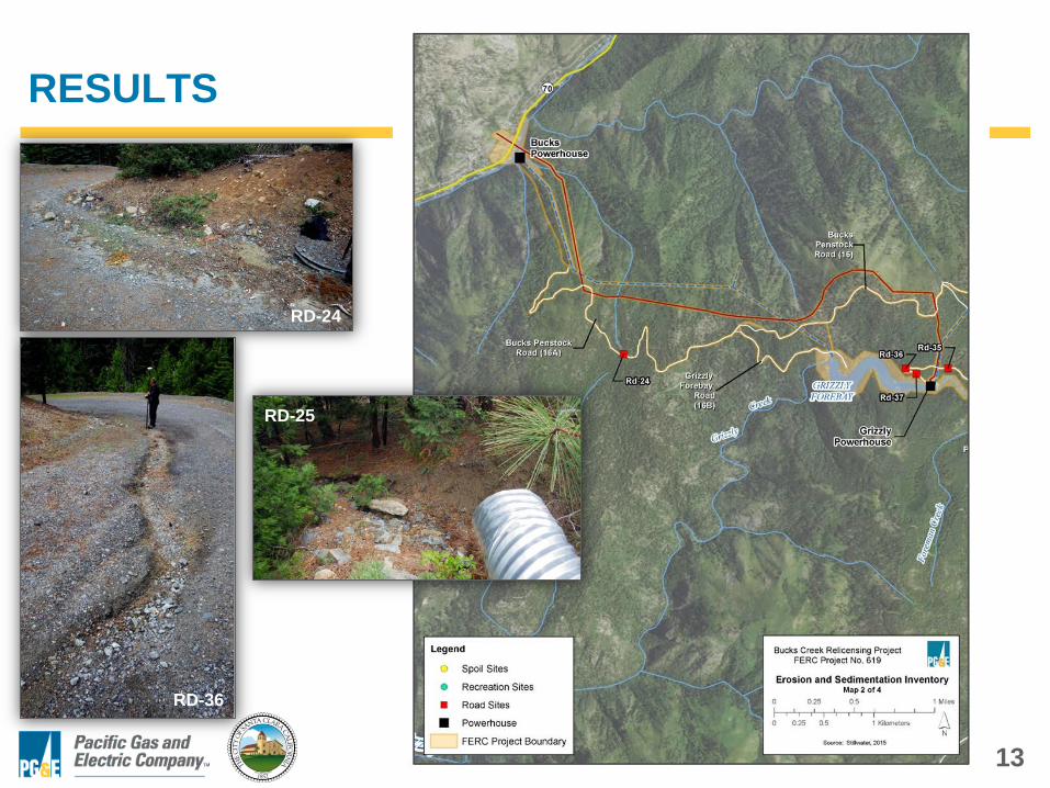
13
RESULTS
RD-24
RD-25
RD-36
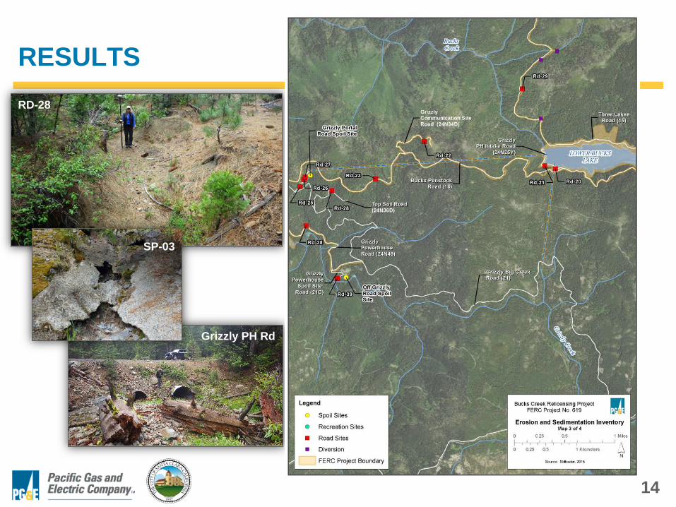
14
RESULTS RD-28
Grizzly PH Rd
SP-03
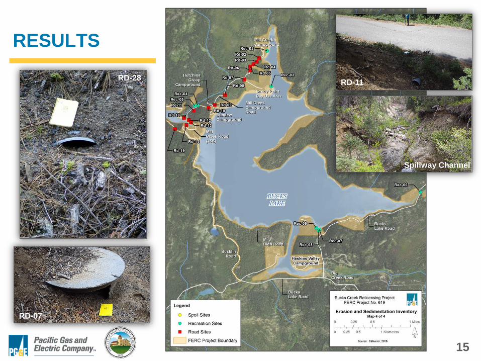
15
RESULTS
RD-28
RD-07
RD-11
Spillway Channel
16
RESULTS – Summary
• Most roads and recreational use areas are designed and constructed to effectively accommodate runoff and minimize erosion and sediment delivery.
• Inboard ditch relief typically adequate to avoid significant erosion and exceedance of culvert capacities.
• Relief culverts generally sized and aligned appropriately.
• Many relief culvert inlets folded or crushed, impeding flow conveyance and promoting sedimentation.
• Discharge of road drainage typically occurs without significant hillslope erosion.
17
RESULTS – Summary
• Most sites related to chronic but relatively minor road drainage issues: – sedimentation and/or erosion of drainage ditches
– accumulation of sediment and organic debris at culvert inlets and outlets
– overtopping of ditch berms and/or culvert headwalls
– surface erosion and rilling of road surfaces due to unintended routing of concentrated road surface runoff
18
RESULTS – Summary
• Most of these issues can be remedied and avoided in the future through annual inspection and maintenance prior to the rainy season and during storm periods.
• Some sites may require modifications to the existing road prism and/or road drainage design to correct chronic surface erosion and sedimentation problems.
• Recommended approaches to addressing erosion and sedimentation problems and potential threats at specific sites will be addressed during development of PM&E measures for the Draft License Application.
19
Remaining Study Elements
• Implementation of the study is complete.
• There are no outstanding study elements or remaining work.
20
Study Description Variances
• There are no variances from the Study Description.
21
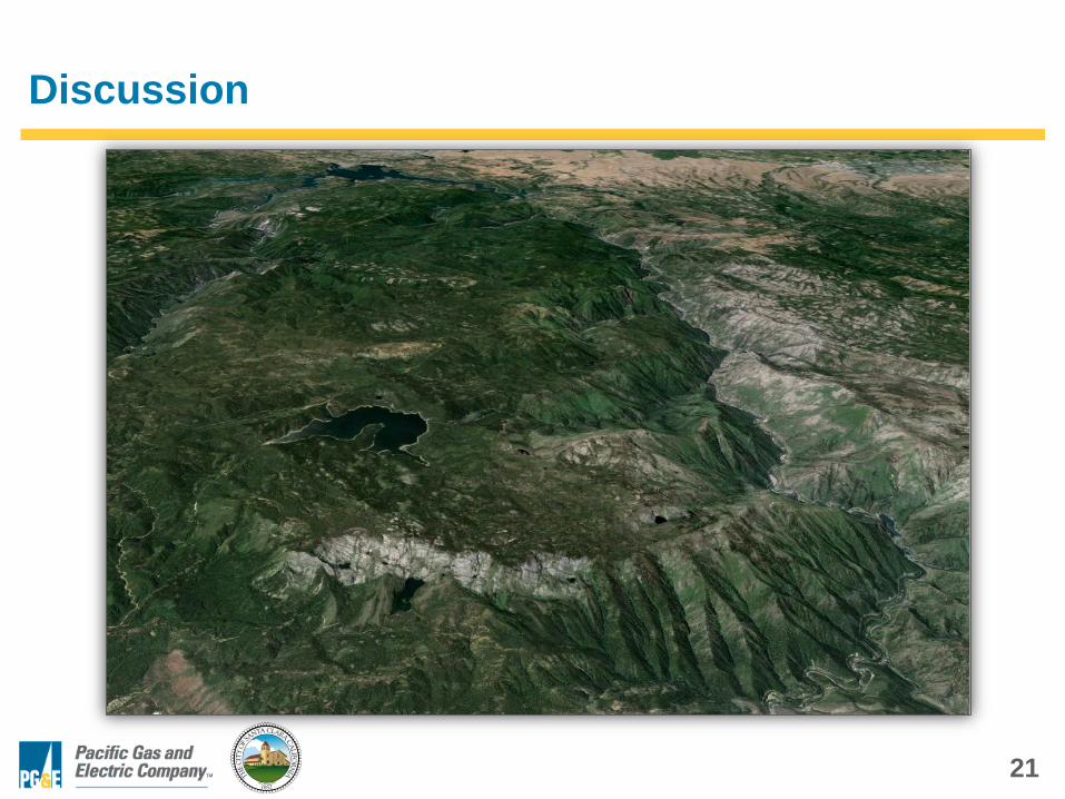
Discussion