British Menorca
109
-
Upload
manel-cusido -
Category
Documents
-
view
243 -
download
2
description
The 18th century was a turbulent time for the island of Menorca. The ongoing struggle for control of the Mediterranean saw the British, French and Spanish each seize the island. The 74 years spent under British rule during the century had a significant influence, leaving an imprint which can still be seen there, above all in the port of Maó and surrounding area.With the aim of sharing this rich legacy, this e-Book sets out a cultural tour comprising the most distinctive elements of the heritage handed down from the era, including towers, fortifications and buildings designed in accordance with the dictates of colonial architecture. The route also includes those museums featuring the exhibits most clearly illustrating the British legacy.The book is the work of Fundació Destí Menorca, the body responsible for promotion and tourism on Menorca.
Transcript of British Menorca
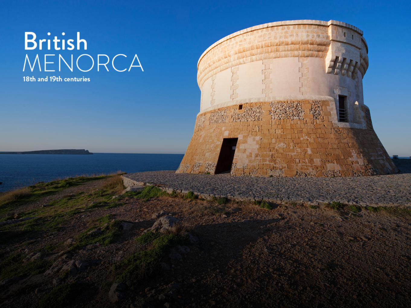
INTRODUCTION The inclusion of Menorca under British sovereignty made a deep and lasting impression on the island, leaving a wealth of indelible cultural signs such as the numerous English words that blended into the Menorcan language, architectural styles still in evidence today, culinary dishes, children's games, dances and so on. The “boinders” or bow windows and the typical sash windows can still be seen on many houses in Menorca. The British also brought their own period style furniture, including Queen Anne, Chippendale and some Sheraton pieces, all of which were later copied by local cabinet-makers. Menorca gin, made by artisans in Maó by distilling juniper berries and wine vinegar, was first introduced by the British, who also imported their distinctive culinary preferences.Traditional puddings became known as “greixera dolça” and “brou de xenc” can trace its origins back to English beef stock. Gravy was known locally as “grevi” and “manteca inglesa” or English butter features in many Menorca recipes, and the delicious “piquéis” are pickled gherkins and capers. Children still play “mérvels” – marbles – and tell “joques” – jokes – and chase each other shouting “fáitim” – “fight him”.
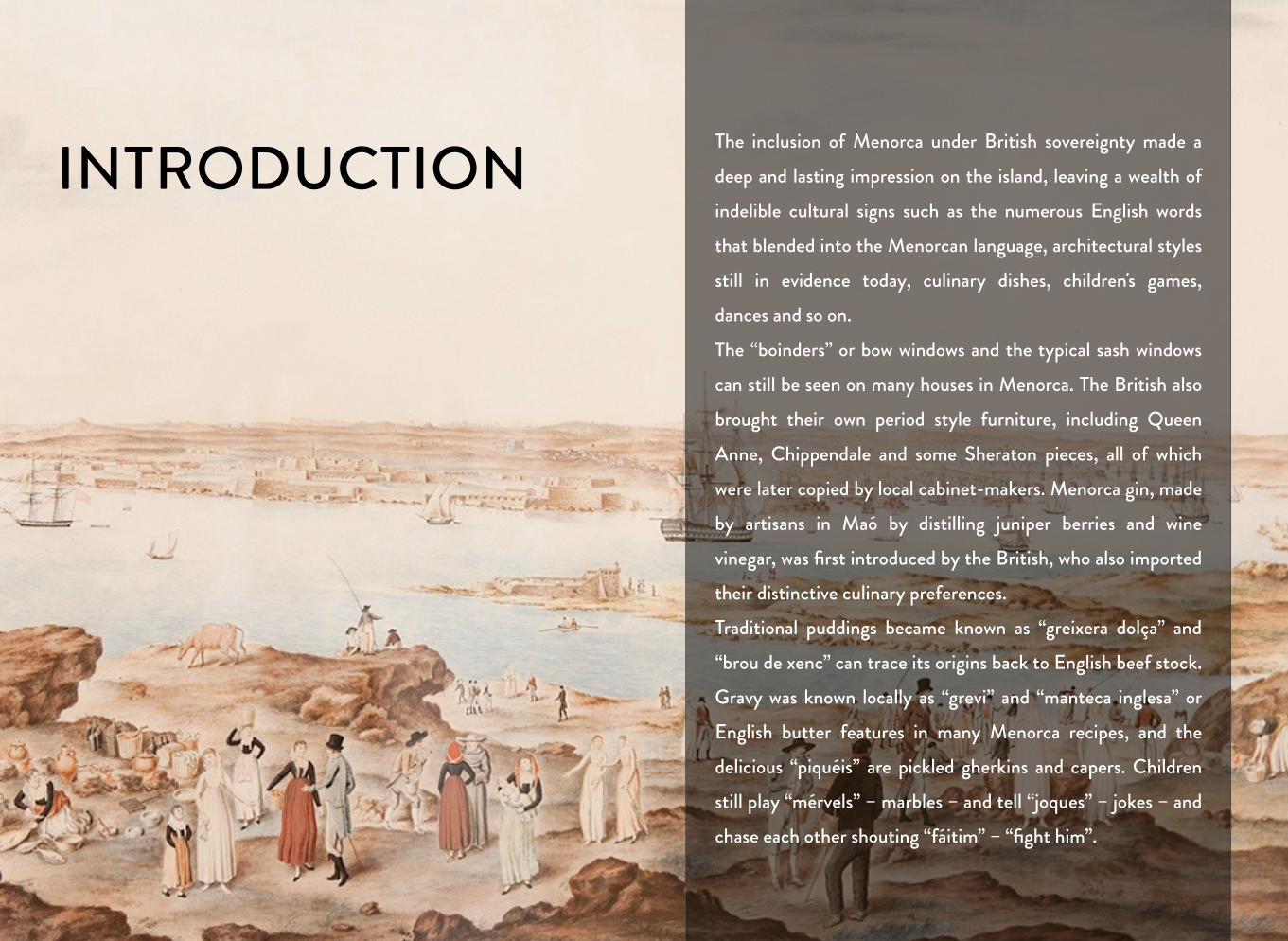
CHAPTER 2TOWERS AND DEFENCES
3
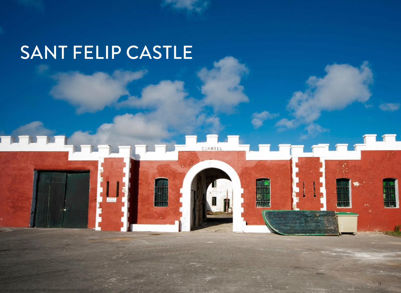
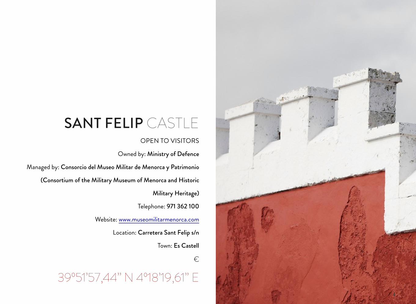
SANT FELIP CASTLE
4
OPEN TO VISITORS
Owned by: Ministry of Defence
Managed by: Consorcio del Museo Militar de Menorca y Patrimonio
(Consortium of the Military Museum of Menorca and Historic
Military Heritage)
Telephone: 971 362 100
Website: www.museomilitarmenorca.com
Location: Carretera Sant Felip s/n
Town: Es Castell
€
39º51’57,44’’ N 4º18’19,61’’ E
SANT FELIP CASTLE
5
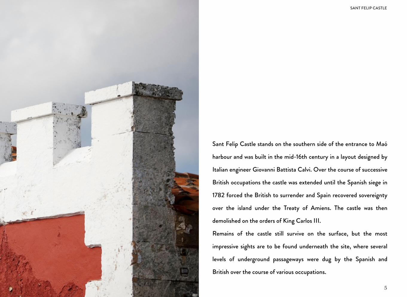
Sant Felip Castle stands on the southern side of the entrance to Maó
harbour and was built in the mid-16th century in a layout designed by
Italian engineer Giovanni Battista Calvi. Over the course of successive
British occupations the castle was extended until the Spanish siege in
1782 forced the British to surrender and Spain recovered sovereignty
over the island under the Treaty of Amiens. The castle was then
demolished on the orders of King Carlos III.
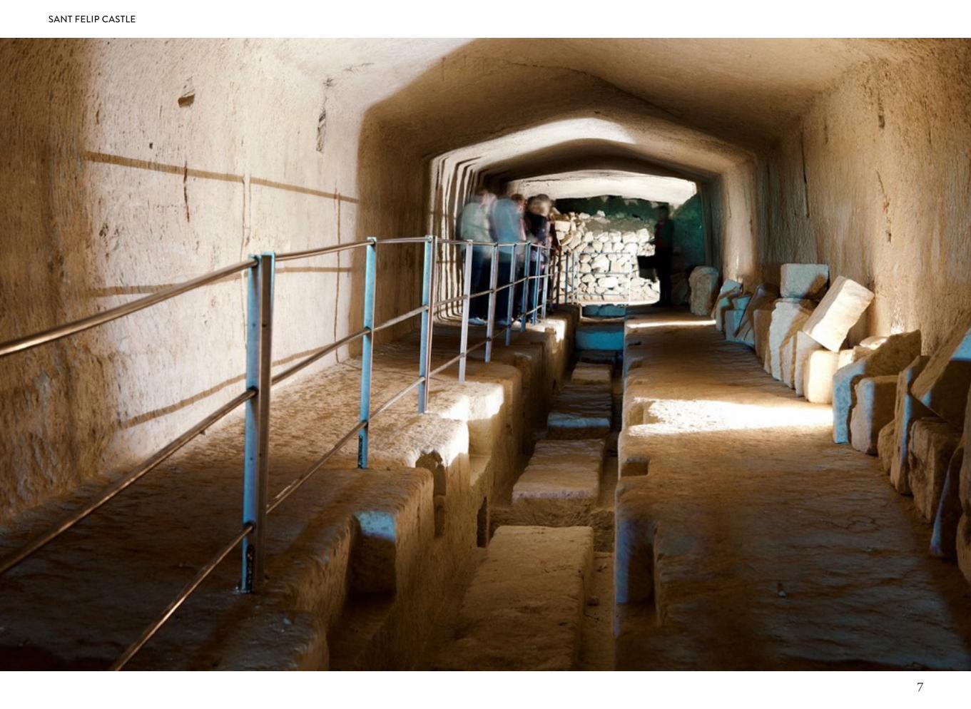
Remains of the castle still survive on the surface, but the most
impressive sights are to be found underneath the site, where several
levels of underground passageways were dug by the Spanish and
British over the course of various occupations.
SANT FELIP CASTLE
6
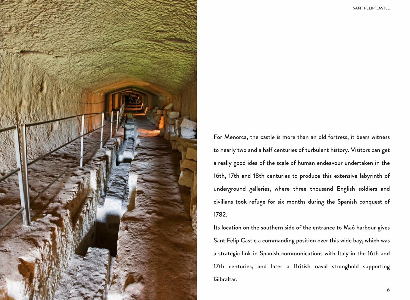
For Menorca, the castle is more than an old fortress, it bears witness
to nearly two and a half centuries of turbulent history. Visitors can get
a really good idea of the scale of human endeavour undertaken in the
16th, 17th and 18th centuries to produce this extensive labyrinth of
underground galleries, where three thousand English soldiers and
civilians took refuge for six months during the Spanish conquest of
1782.
Its location on the southern side of the entrance to Maó harbour gives
Sant Felip Castle a commanding position over this wide bay, which was
a strategic link in Spanish communications with Italy in the 16th and
17th centuries, and later a British naval stronghold supporting
Gibraltar.
SANT FELIP CASTLE
7
SANT FELIP CASTLE
8
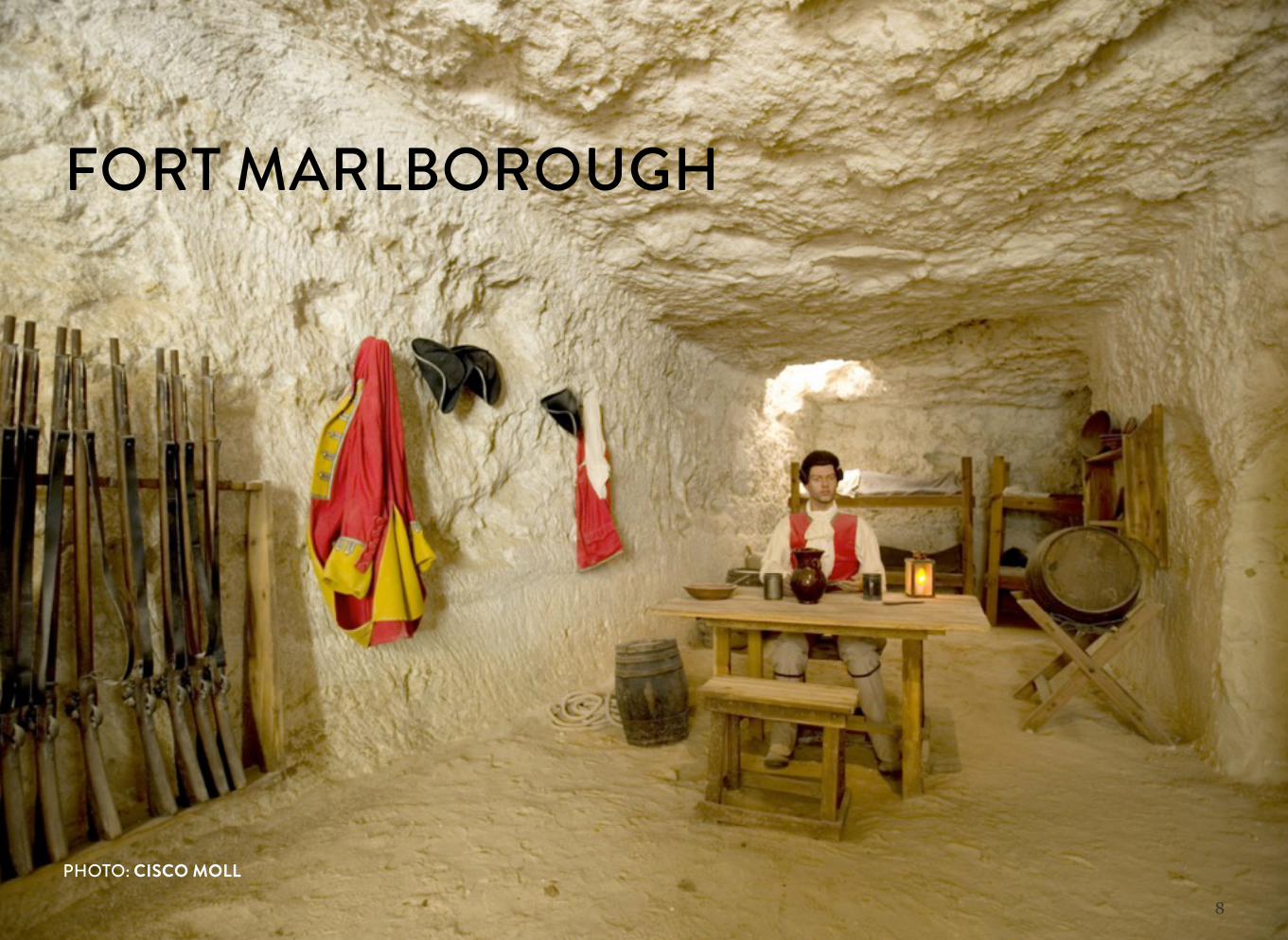
FORT MARLBOROUGH
PHOTO: CISCO MOLL
9
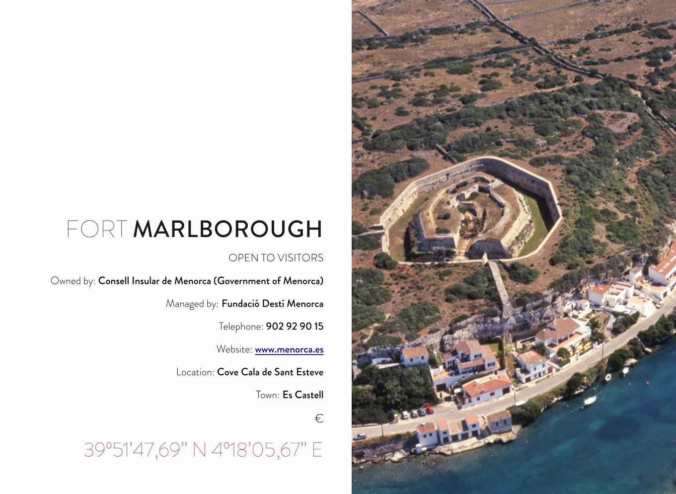
OPEN TO VISITORS
Owned by: Consell Insular de Menorca (Government of Menorca)
Managed by: Fundació Destí Menorca
Telephone: 902 92 90 15
Website: www.menorca.es
Location: Cove Cala de Sant Esteve
Town: Es Castell
€
39º51’47,69’’ N 4º18’05,67’’ E
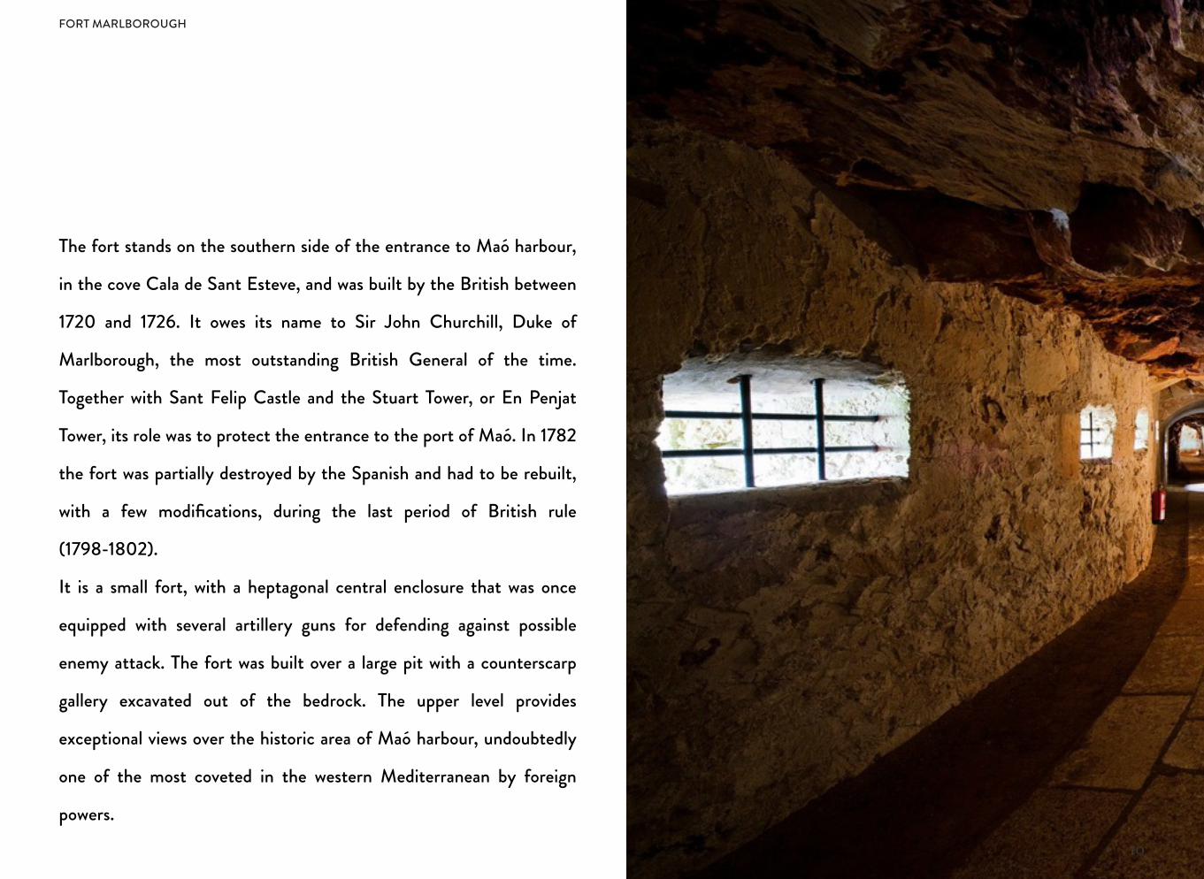
FORT MARLBOROUGH
10
The fort stands on the southern side of the entrance to Maó harbour,
in the cove Cala de Sant Esteve, and was built by the British between
1720 and 1726. It owes its name to Sir John Churchill, Duke of
Marlborough, the most outstanding British General of the time.
Together with Sant Felip Castle and the Stuart Tower, or En Penjat
Tower, its role was to protect the entrance to the port of Maó. In 1782
the fort was partially destroyed by the Spanish and had to be rebuilt,
with a few modifications, during the last period of British rule
(1798-1802).
It is a small fort, with a heptagonal central enclosure that was once
equipped with several artillery guns for defending against possible
enemy attack. The fort was built over a large pit with a counterscarp
gallery excavated out of the bedrock. The upper level provides
exceptional views over the historic area of Maó harbour, undoubtedly
one of the most coveted in the western Mediterranean by foreign
powers.
FORT MARLBOROUGH
11
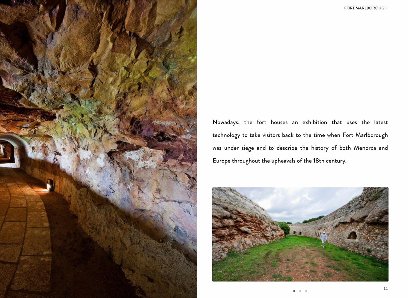
Nowadays, the fort houses an exhibition that uses the latest
technology to take visitors back to the time when Fort Marlborough
was under siege and to describe the history of both Menorca and
Europe throughout the upheavals of the 18th century.
FORT MARLBOROUGH
12
FORT MARLBOROUGH
13
FORNELLS TOWER
14
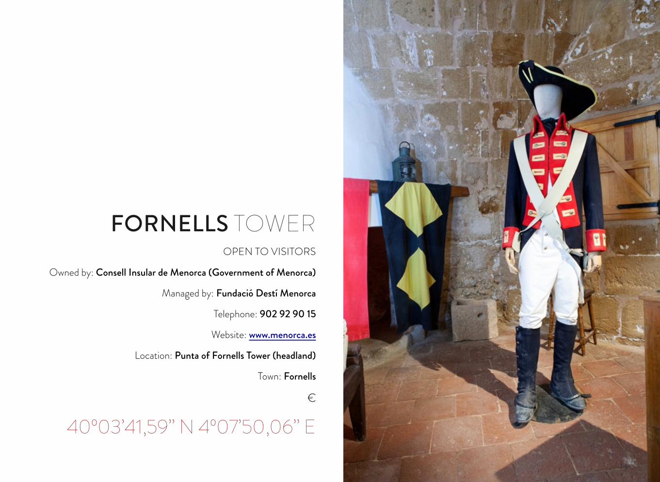
OPEN TO VISITORS
Owned by: Consell Insular de Menorca (Government of Menorca)
Managed by: Fundació Destí Menorca
Telephone: 902 92 90 15
Website: www.menorca.es
Location: Punta of Fornells Tower (headland)
Town: Fornells
€
40º03’41,59’’ N 4º07’50,06’’ E
FORNELLS TOWER
15
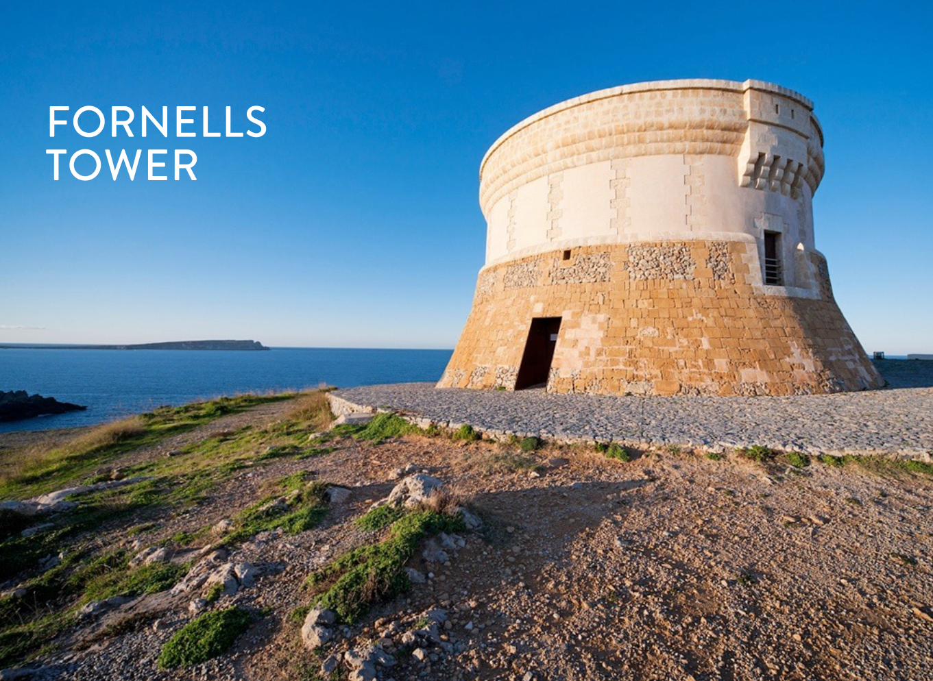
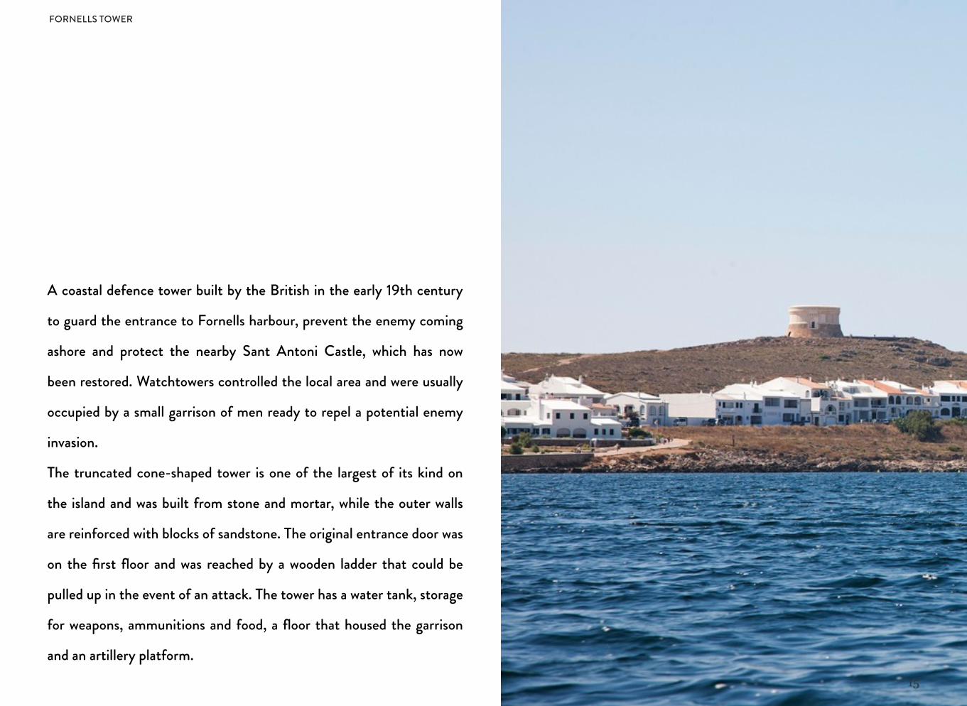
A coastal defence tower built by the British in the early 19th century
to guard the entrance to Fornells harbour, prevent the enemy coming
ashore and protect the nearby Sant Antoni Castle, which has now
been restored. Watchtowers controlled the local area and were usually
occupied by a small garrison of men ready to repel a potential enemy
invasion.
The truncated cone-shaped tower is one of the largest of its kind on
the island and was built from stone and mortar, while the outer walls
are reinforced with blocks of sandstone. The original entrance door was
on the first floor and was reached by a wooden ladder that could be
pulled up in the event of an attack. The tower has a water tank, storage
for weapons, ammunitions and food, a floor that housed the garrison
and an artillery platform.
FORNELLS TOWER
16
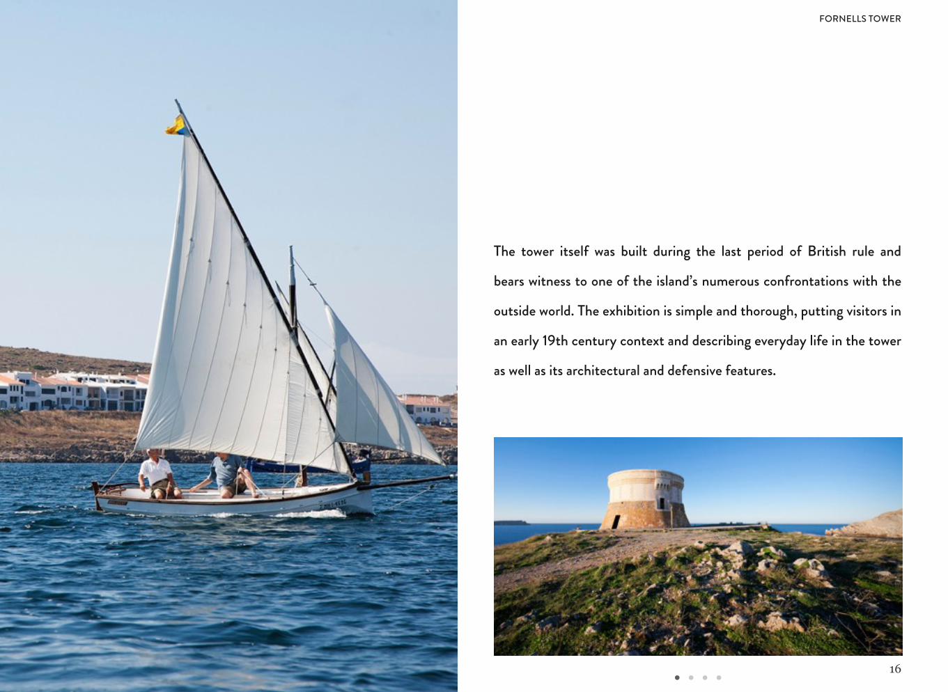
The tower itself was built during the last period of British rule and
bears witness to one of the island’s numerous confrontations with the
outside world. The exhibition is simple and thorough, putting visitors in
an early 19th century context and describing everyday life in the tower
as well as its architectural and defensive features.
FORNELLS TOWER
17
FORNELLS
18
ILLA DEL REI (THE KING'S ISLAND)
19
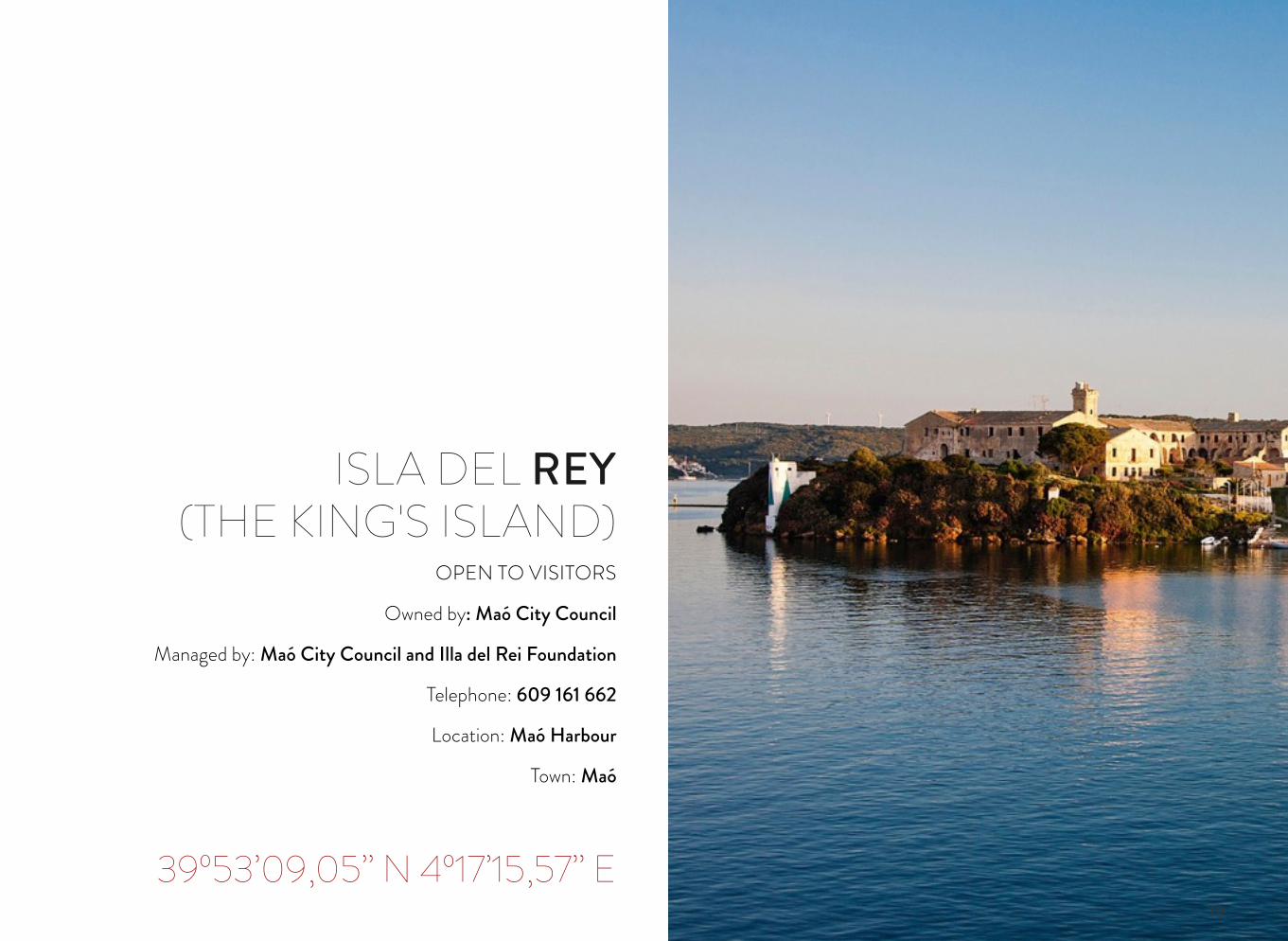
OPEN TO VISITORS
Owned by: Maó City Council
Managed by: Maó City Council and Illa del Rei Foundation
Telephone: 609 161 662
Location: Maó Harbour
Town: Maó
39º53’09,05’’ N 4º17’15,57’’ E
ISLA DEL REY(THE KING'S ISLAND)
20
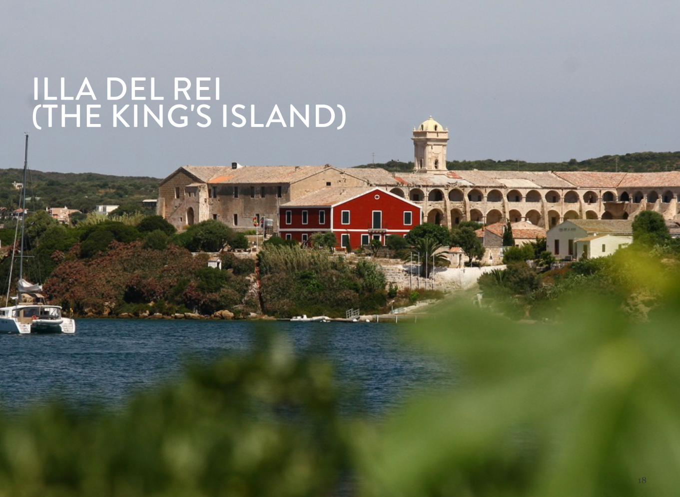
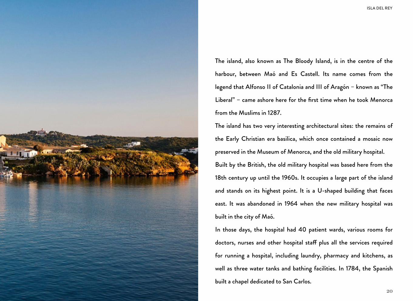
The island, also known as The Bloody Island, is in the centre of the
harbour, between Maó and Es Castell. Its name comes from the
legend that Alfonso II of Catalonia and III of Aragón – known as “The
Liberal” – came ashore here for the first time when he took Menorca
from the Muslims in 1287.
The island has two very interesting architectural sites: the remains of
the Early Christian era basilica, which once contained a mosaic now
preserved in the Museum of Menorca, and the old military hospital.
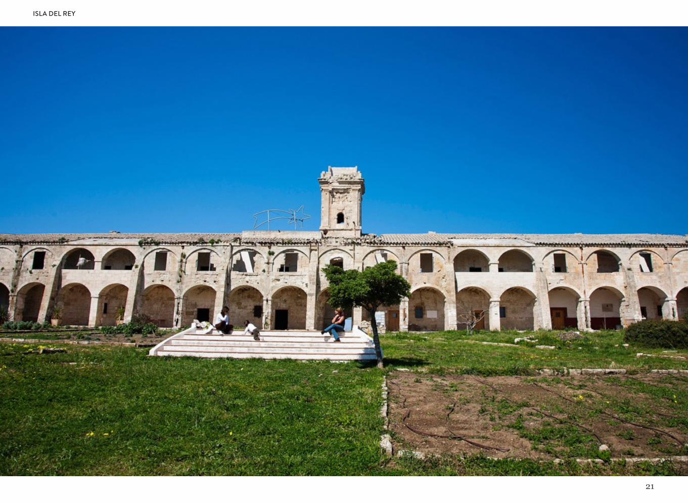
Built by the British, the old military hospital was based here from the
18th century up until the 1960s. It occupies a large part of the island
and stands on its highest point. It is a U-shaped building that faces
east. It was abandoned in 1964 when the new military hospital was
built in the city of Maó.
In those days, the hospital had 40 patient wards, various rooms for
doctors, nurses and other hospital sta! plus all the services required
for running a hospital, including laundry, pharmacy and kitchens, as
well as three water tanks and bathing facilities. In 1784, the Spanish
built a chapel dedicated to San Carlos.
ISLA DEL REY
21
ISLA DEL REY
22
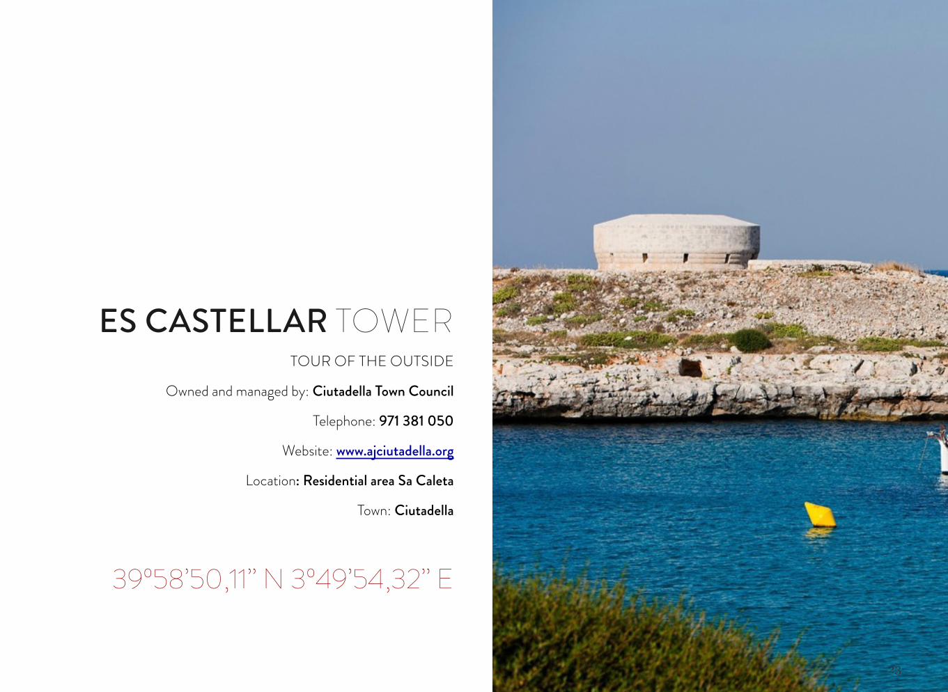
ES CASTELLAR TOWER
23
TOUR OF THE OUTSIDE
Owned and managed by: Ciutadella Town Council
Telephone: 971 381 050
Website: www.ajciutadella.org
Location: Residential area Sa Caleta
Town: Ciutadella
39º58’50,11’’ N 3º49’54,32’’ E
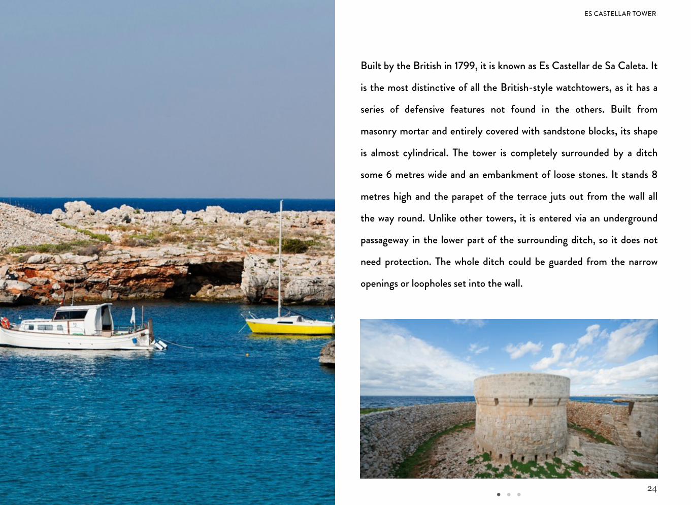
ES CASTELLAR TOWER
24
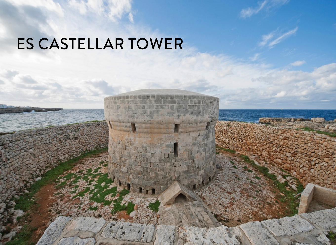
Built by the British in 1799, it is known as Es Castellar de Sa Caleta. It
is the most distinctive of all the British-style watchtowers, as it has a
series of defensive features not found in the others. Built from
masonry mortar and entirely covered with sandstone blocks, its shape
is almost cylindrical. The tower is completely surrounded by a ditch
some 6 metres wide and an embankment of loose stones. It stands 8
metres high and the parapet of the terrace juts out from the wall all
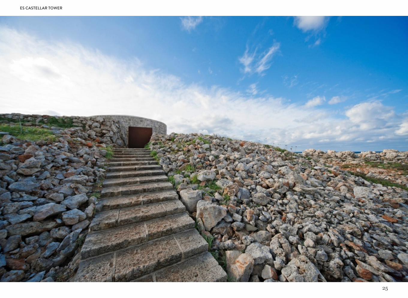
the way round. Unlike other towers, it is entered via an underground
passageway in the lower part of the surrounding ditch, so it does not
need protection. The whole ditch could be guarded from the narrow
openings or loopholes set into the wall.
ES CASTELLAR TOWER
25
ES CASTELLAR TOWER
26
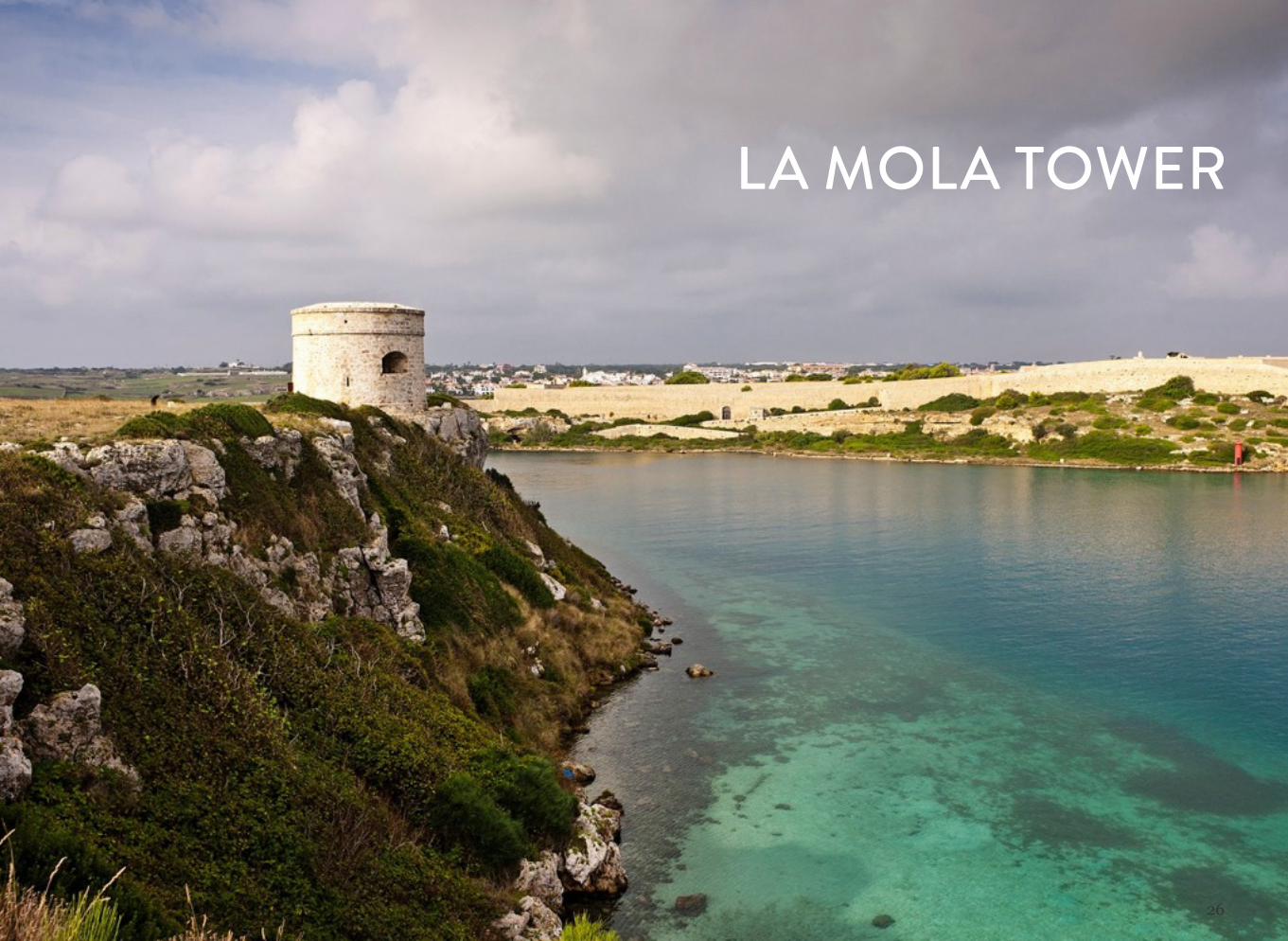
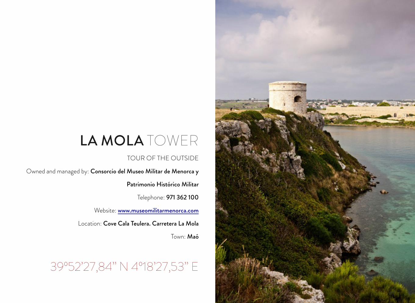
LA MOLA TOWER
27
TOUR OF THE OUTSIDE
Owned and managed by: Consorcio del Museo Militar de Menorca y
Patrimonio Histórico Militar
Telephone: 971 362 100
Website: www.museomilitarmenorca.com
Location: Cove Cala Teulera. Carretera La Mola
Town: Maó
39º52’27,84’’ N 4º18’27,53’’ E
LA MOLA TOWER
28
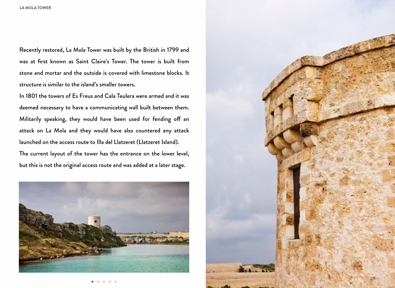
Recently restored, La Mola Tower was built by the British in 1799 and
was at first known as Saint Claire’s Tower. The tower is built from
stone and mortar and the outside is covered with limestone blocks. It
structure is similar to the island’s smaller towers.
In 1801 the towers of Es Freus and Cala Teulera were armed and it was
deemed necessary to have a communicating wall built between them.
Militarily speaking, they would have been used for fending o! an
attack on La Mola and they would have also countered any attack
launched on the access route to Illa del Llatzeret (Llatzeret Island).
The current layout of the tower has the entrance on the lower level,
but this is not the original access route and was added at a later stage.
LA MOLA TOWER
29
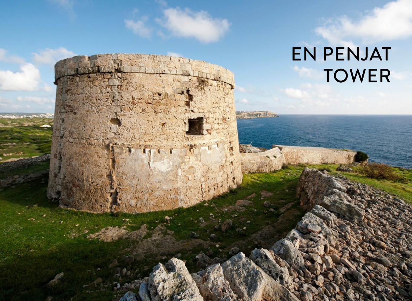
EN PENJATTOWER
30
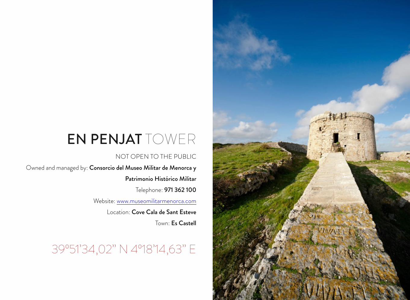
EN PENJAT TOWERNOT OPEN TO THE PUBLIC
Owned and managed by: Consorcio del Museo Militar de Menorca y Patrimonio Histórico Militar
Telephone: 971 362 100Website: www.museomilitarmenorca.com
Location: Cove Cala de Sant EsteveTown: Es Castell
39º51’34,02’’ N 4º18’14,63’’ E
31
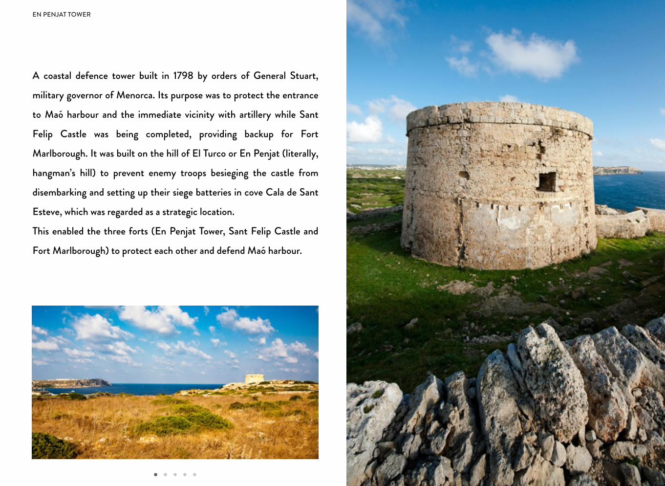
A coastal defence tower built in 1798 by orders of General Stuart,
military governor of Menorca. Its purpose was to protect the entrance
to Maó harbour and the immediate vicinity with artillery while Sant
Felip Castle was being completed, providing backup for Fort
Marlborough. It was built on the hill of El Turco or En Penjat (literally,
hangman’s hill) to prevent enemy troops besieging the castle from
disembarking and setting up their siege batteries in cove Cala de Sant
Esteve, which was regarded as a strategic location.
This enabled the three forts (En Penjat Tower, Sant Felip Castle and
Fort Marlborough) to protect each other and defend Maó harbour.
EN PENJAT TOWER
32
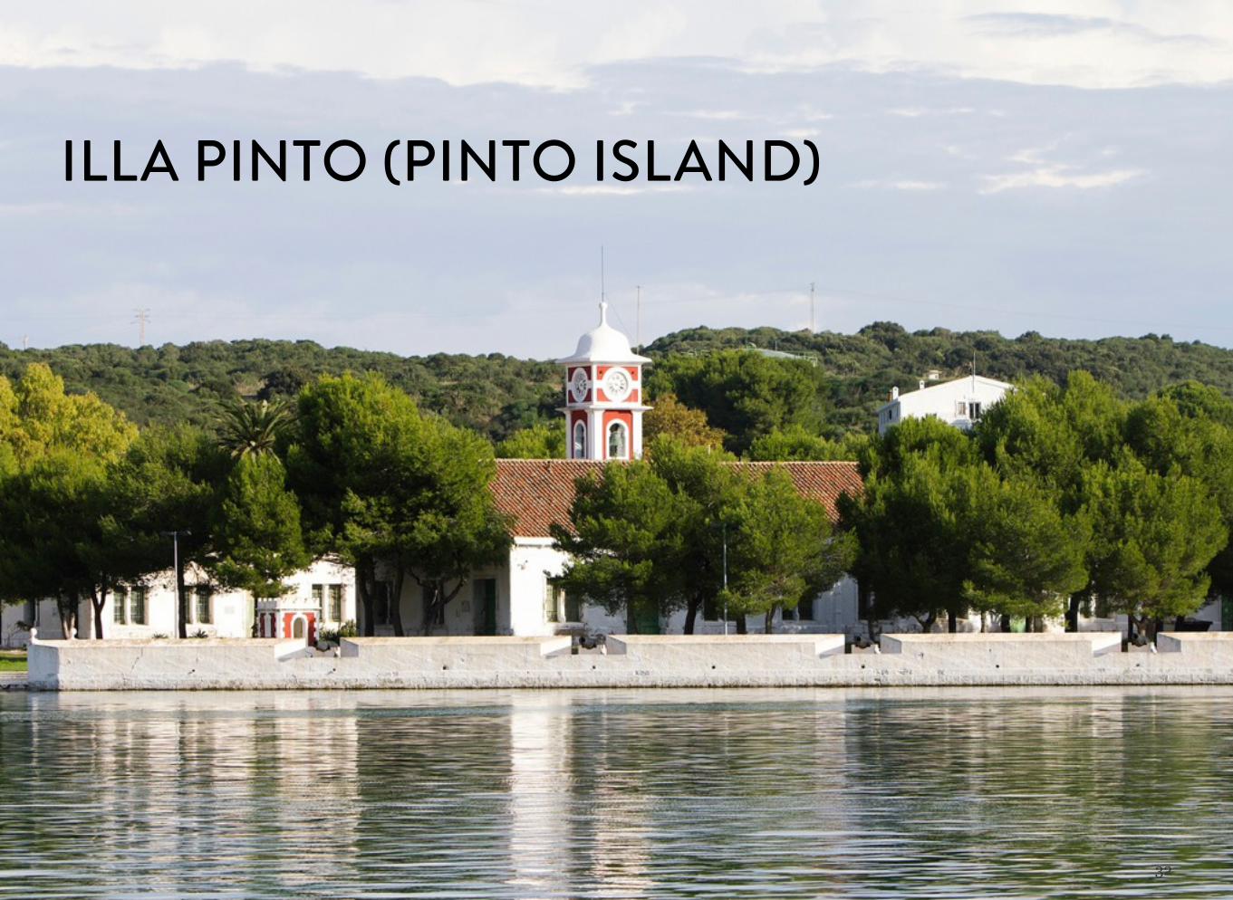
ILLA PINTO (PINTO ISLAND)
33
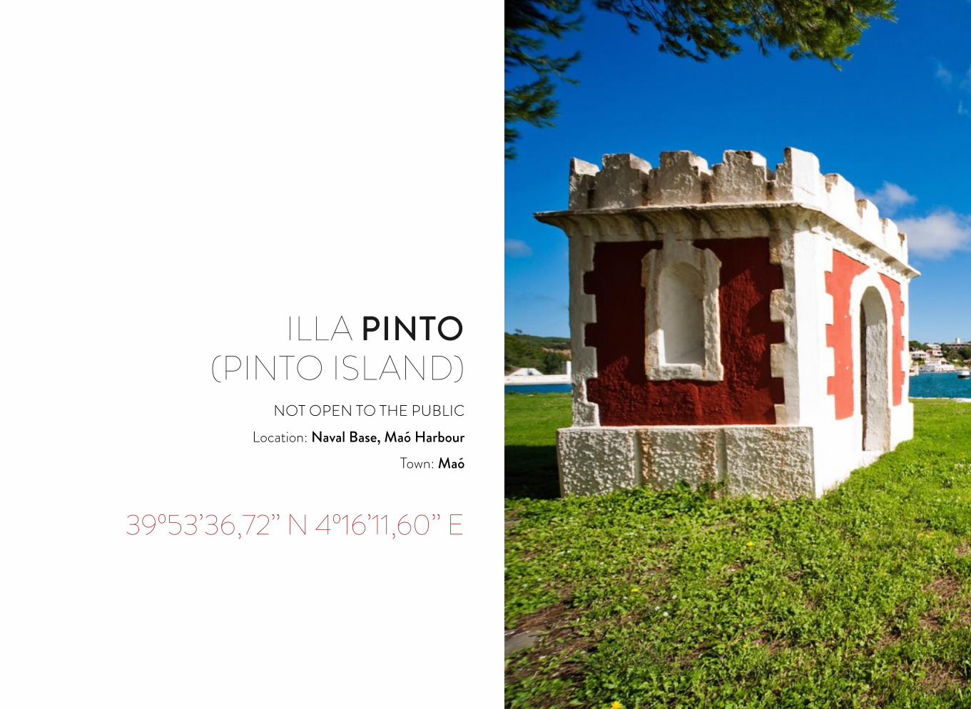
ILLA PINTO(PINTO ISLAND)
NOT OPEN TO THE PUBLICLocation: Naval Base, Maó Harbour
Town: Maó
39º53’36,72’’ N 4º16’11,60’’ E
34
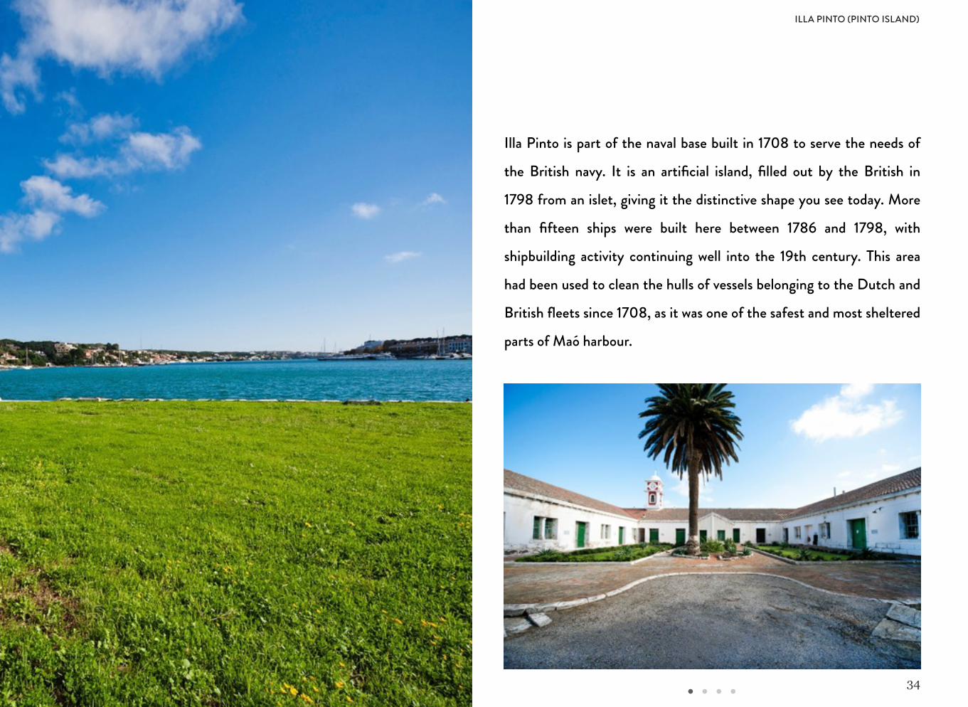
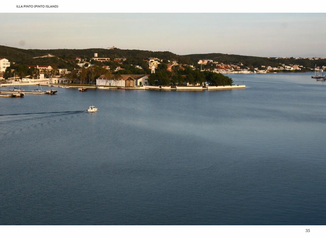
Illa Pinto is part of the naval base built in 1708 to serve the needs of
the British navy. It is an artificial island, filled out by the British in
1798 from an islet, giving it the distinctive shape you see today. More
than fifteen ships were built here between 1786 and 1798, with
shipbuilding activity continuing well into the 19th century. This area
had been used to clean the hulls of vessels belonging to the Dutch and
British fleets since 1708, as it was one of the safest and most sheltered
parts of Maó harbour.
ILLA PINTO (PINTO ISLAND)
35
ILLA PINTO (PINTO ISLAND)
36
RAMBLA TOWER

37
RAMBLA TOWERNOT OPEN TO THE PUBLIC
Location: Albufera des Grau Nature ParkTown: Maó
39º57’46,26’’ N 4º15’54,52’’ E
38
RAMBLA TOWER
39
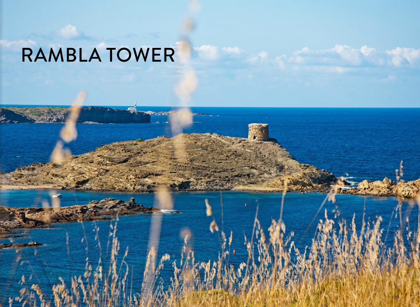
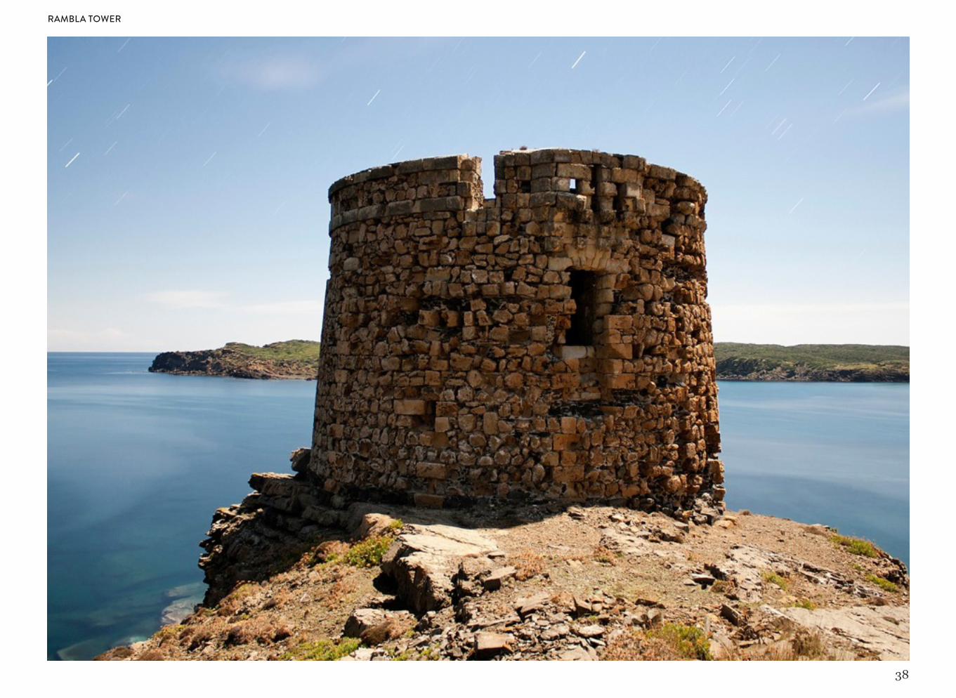
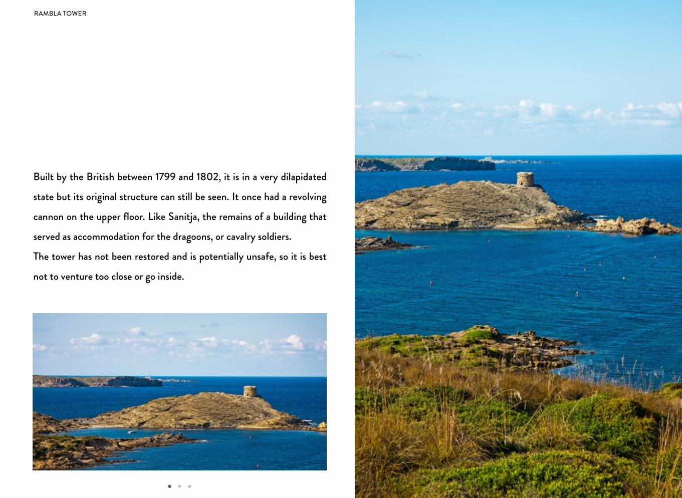
Built by the British between 1799 and 1802, it is in a very dilapidated
state but its original structure can still be seen. It once had a revolving
cannon on the upper floor. Like Sanitja, the remains of a building that
served as accommodation for the dragoons, or cavalry soldiers.
The tower has not been restored and is potentially unsafe, so it is best
not to venture too close or go inside.
RAMBLA TOWER
40
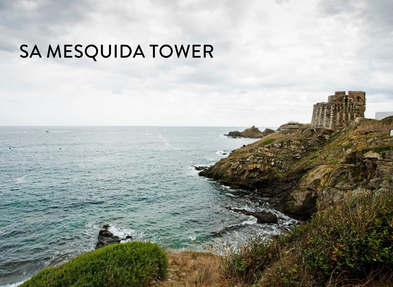
SA MESQUIDA TOWER
41
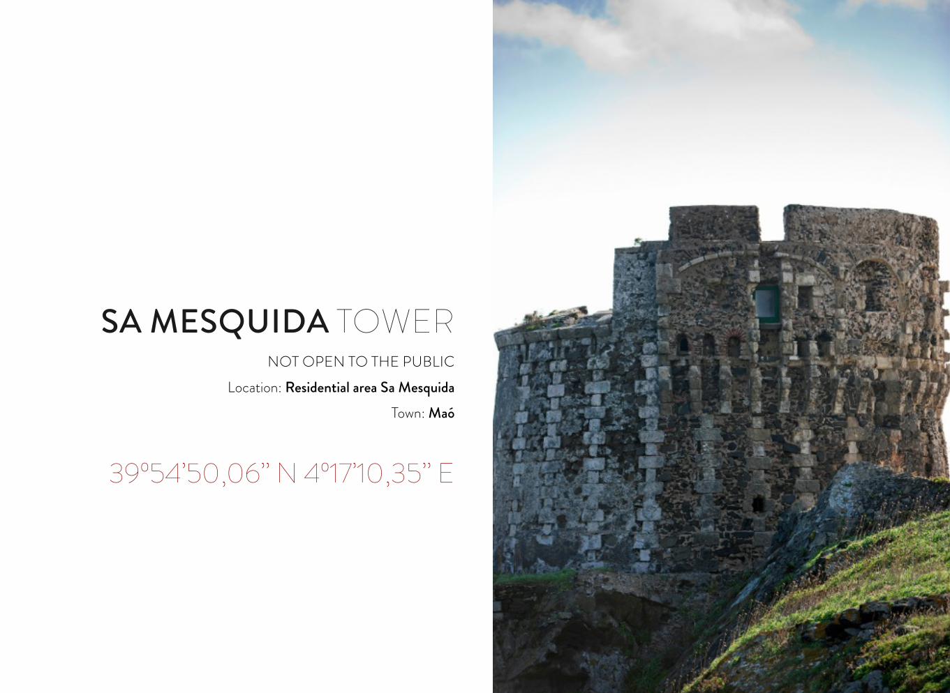
SA MESQUIDA TOWERNOT OPEN TO THE PUBLIC
Location: Residential area Sa MesquidaTown: Maó
39º54’50,06’’ N 4º17’10,35’’ E
42
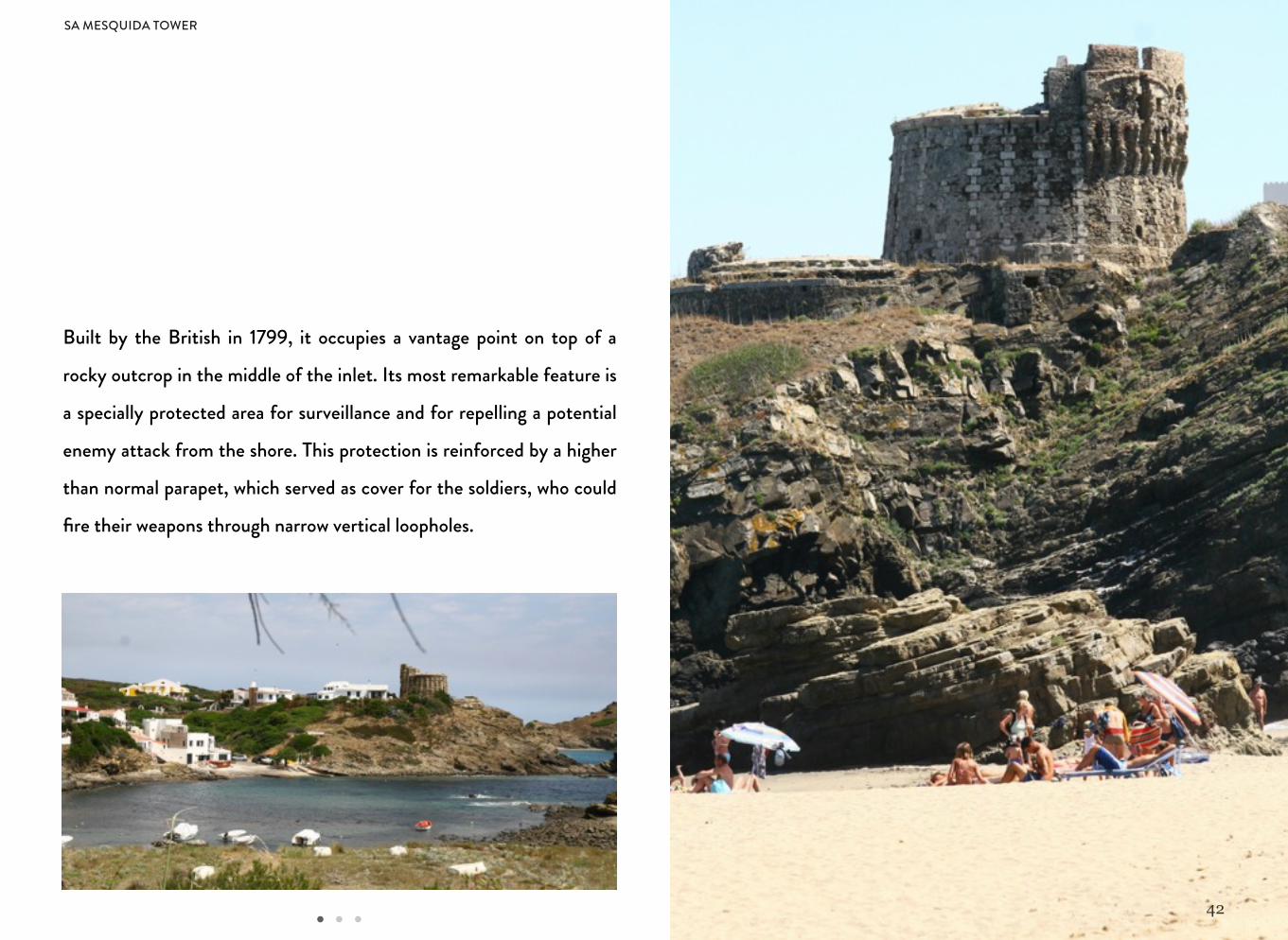
Built by the British in 1799, it occupies a vantage point on top of a
rocky outcrop in the middle of the inlet. Its most remarkable feature is
a specially protected area for surveillance and for repelling a potential
enemy attack from the shore. This protection is reinforced by a higher
than normal parapet, which served as cover for the soldiers, who could
fire their weapons through narrow vertical loopholes.
SA MESQUIDA TOWER
43
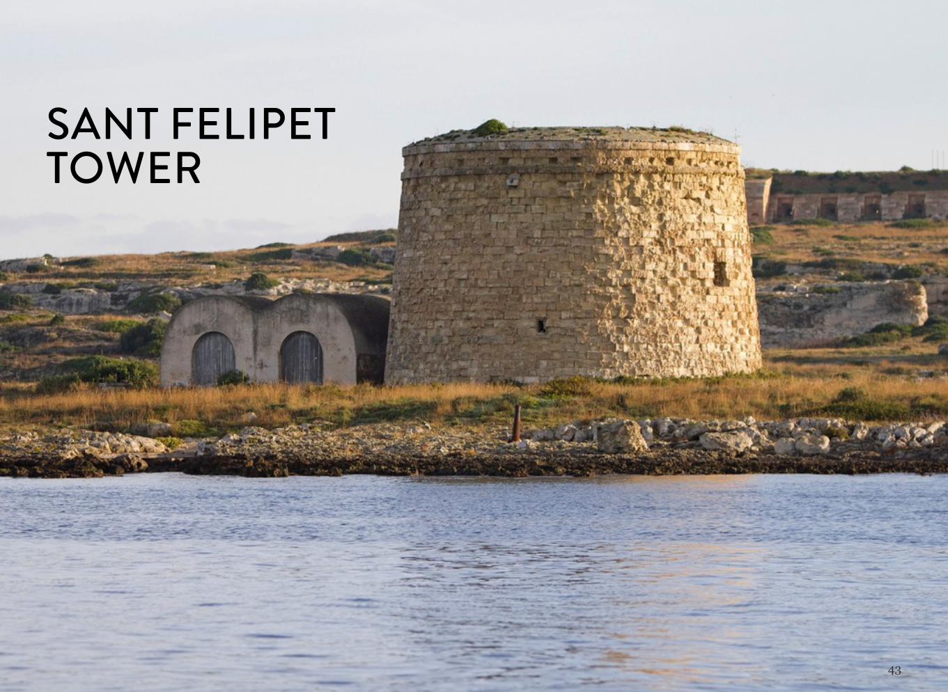
SANT FELIPET TOWER
44
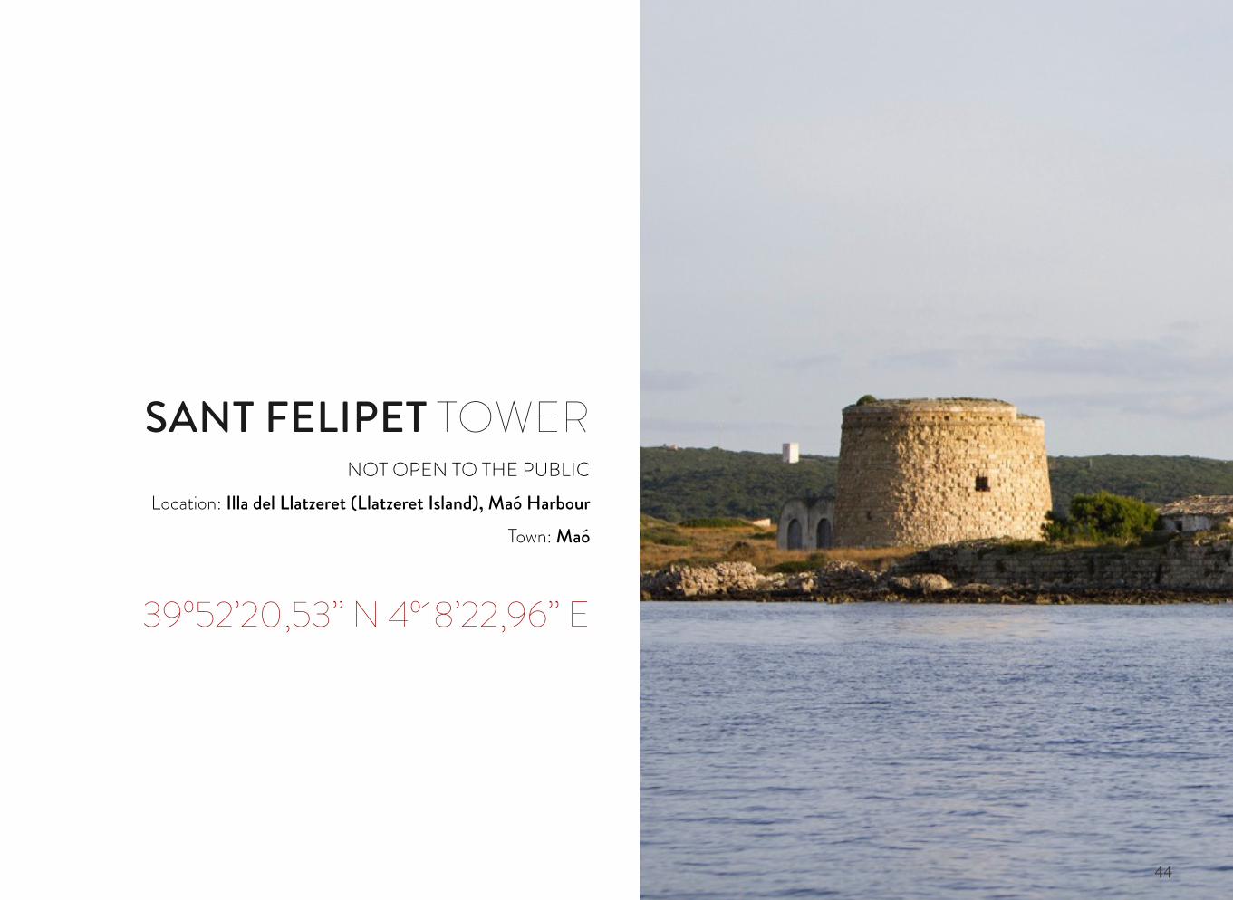
SANT FELIPET TOWERNOT OPEN TO THE PUBLIC
Location: Illa del Llatzeret (Llatzeret Island), Maó HarbourTown: Maó
39º52’20,53’’ N 4º18’22,96’’ E
45
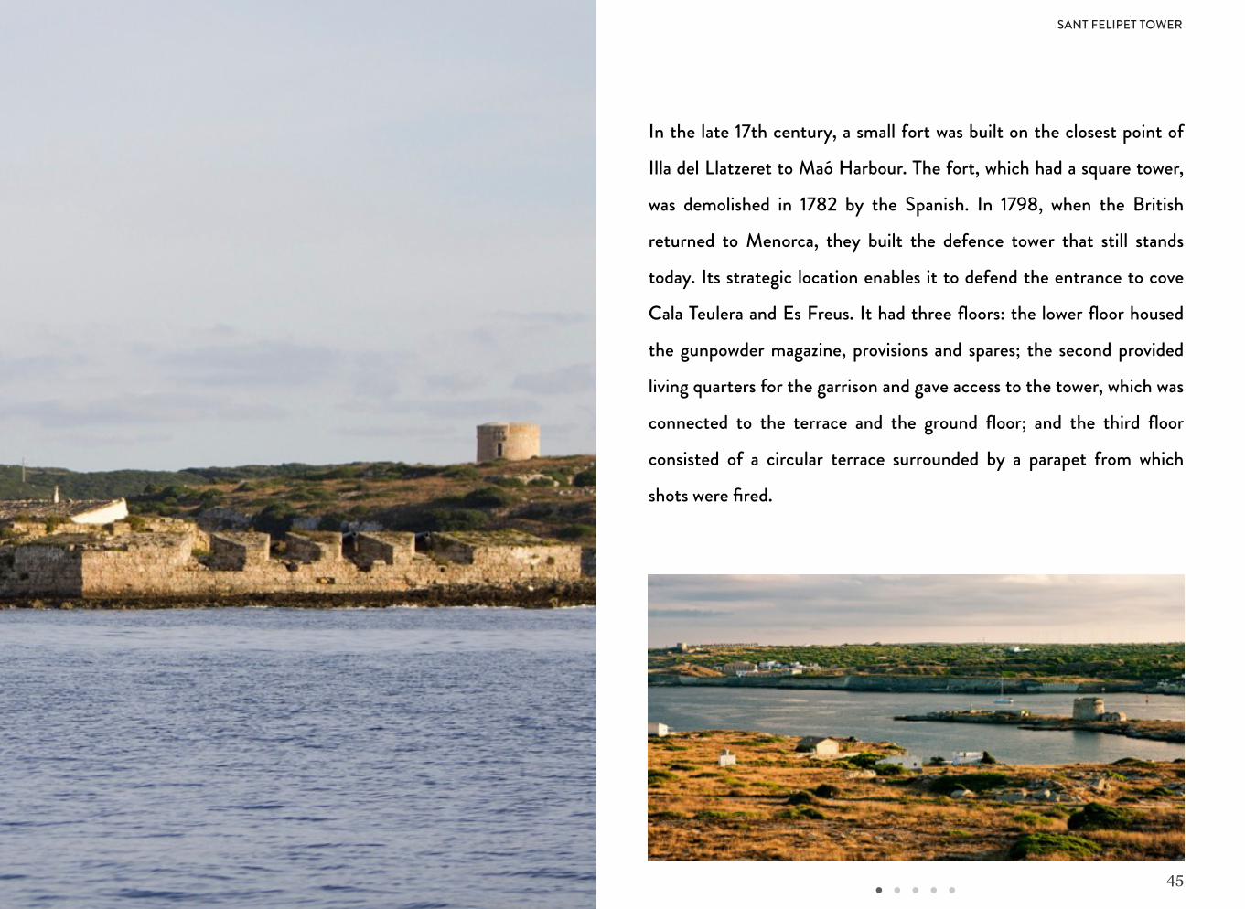
In the late 17th century, a small fort was built on the closest point of
Illa del Llatzeret to Maó Harbour. The fort, which had a square tower,
was demolished in 1782 by the Spanish. In 1798, when the British
returned to Menorca, they built the defence tower that still stands
today. Its strategic location enables it to defend the entrance to cove
Cala Teulera and Es Freus. It had three floors: the lower floor housed
the gunpowder magazine, provisions and spares; the second provided
living quarters for the garrison and gave access to the tower, which was
connected to the terrace and the ground floor; and the third floor
consisted of a circular terrace surrounded by a parapet from which
shots were fired.
SANT FELIPET TOWER
46
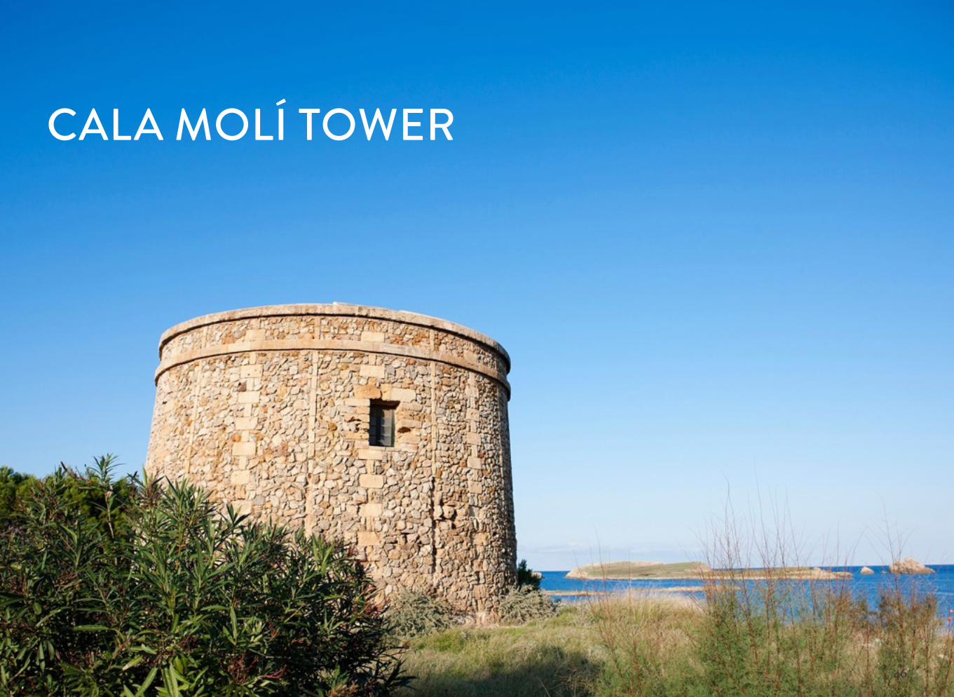
CALA MOLÍ TOWER
47
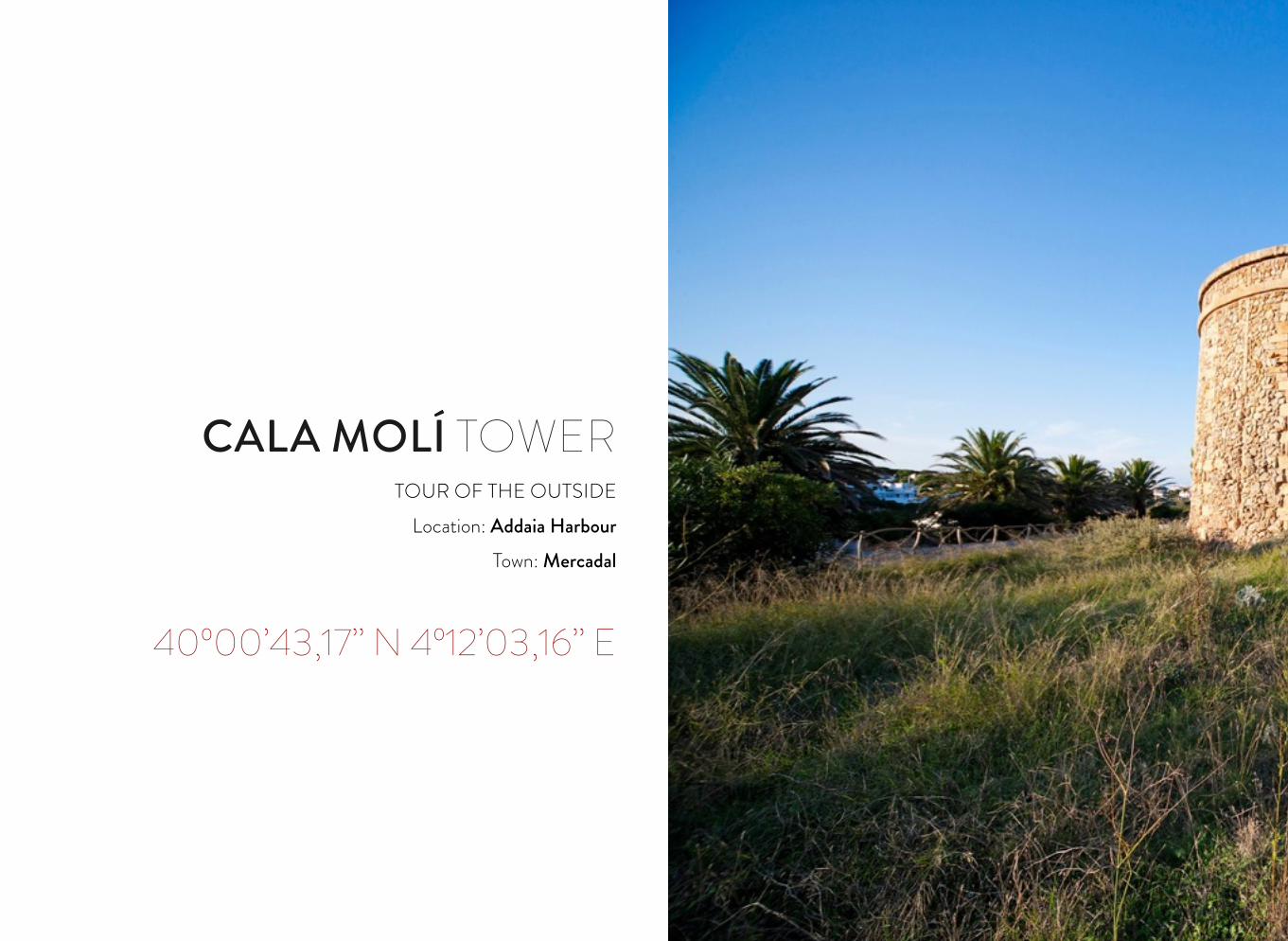
CALA MOLÍ TOWERTOUR OF THE OUTSIDE
Location: Addaia HarbourTown: Mercadal
40º00’43,17’’ N 4º12’03,16’’ E
48
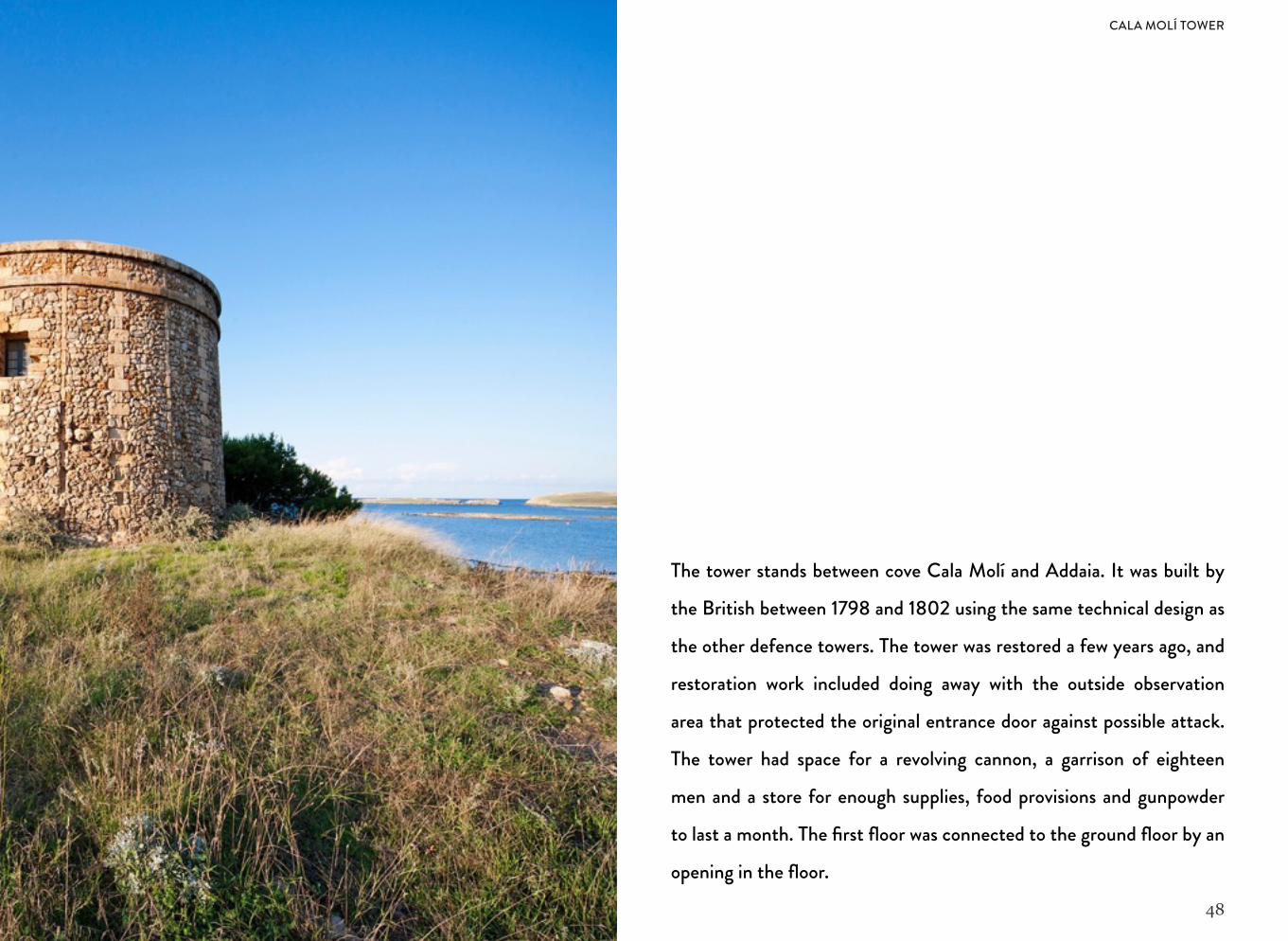
The tower stands between cove Cala Molí and Addaia. It was built by
the British between 1798 and 1802 using the same technical design as
the other defence towers. The tower was restored a few years ago, and
restoration work included doing away with the outside observation
area that protected the original entrance door against possible attack.
The tower had space for a revolving cannon, a garrison of eighteen
men and a store for enough supplies, food provisions and gunpowder
to last a month. The first floor was connected to the ground floor by an
opening in the floor.
CALA MOLÍ TOWER
49
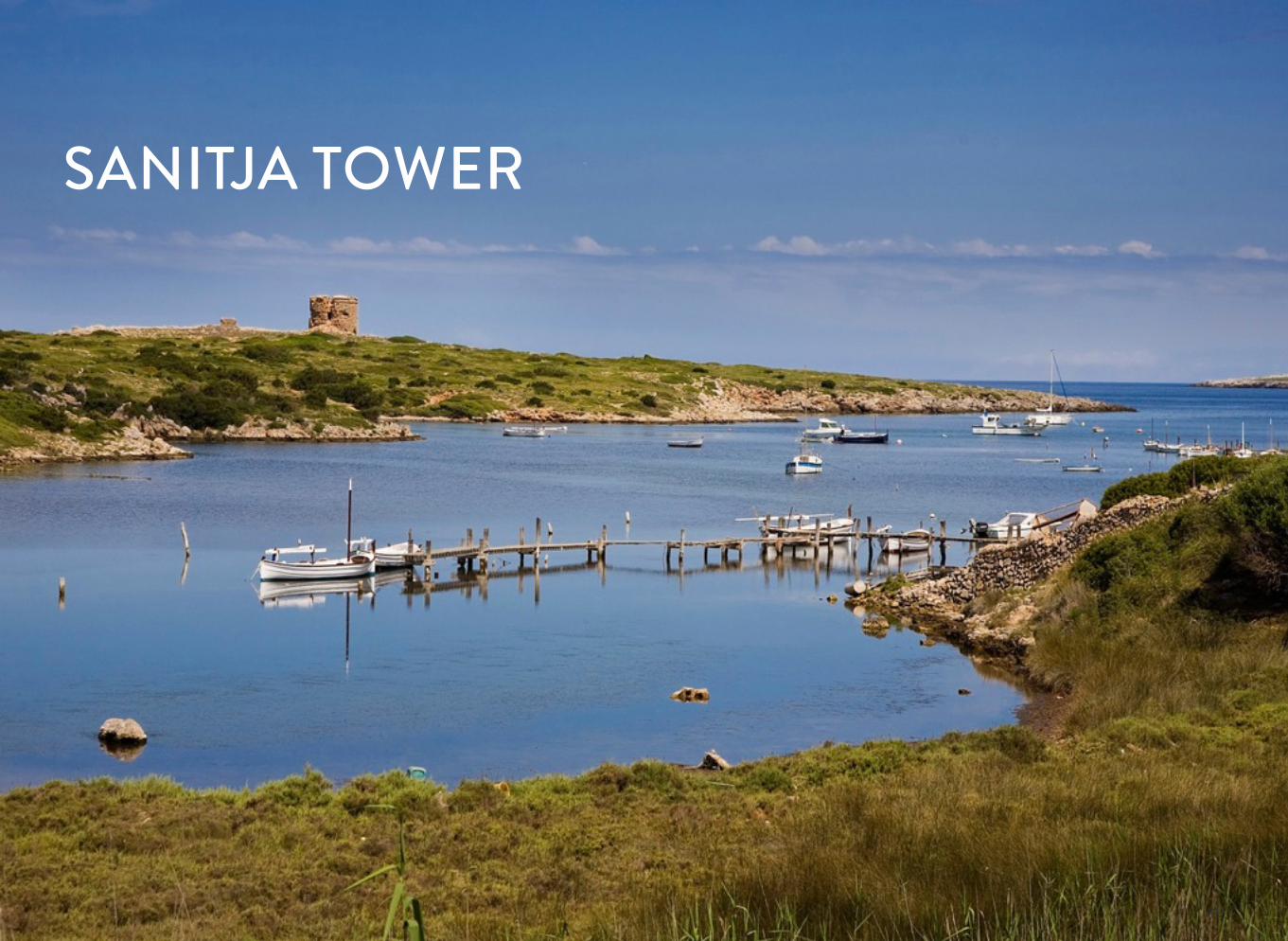
SANITJA TOWER
50
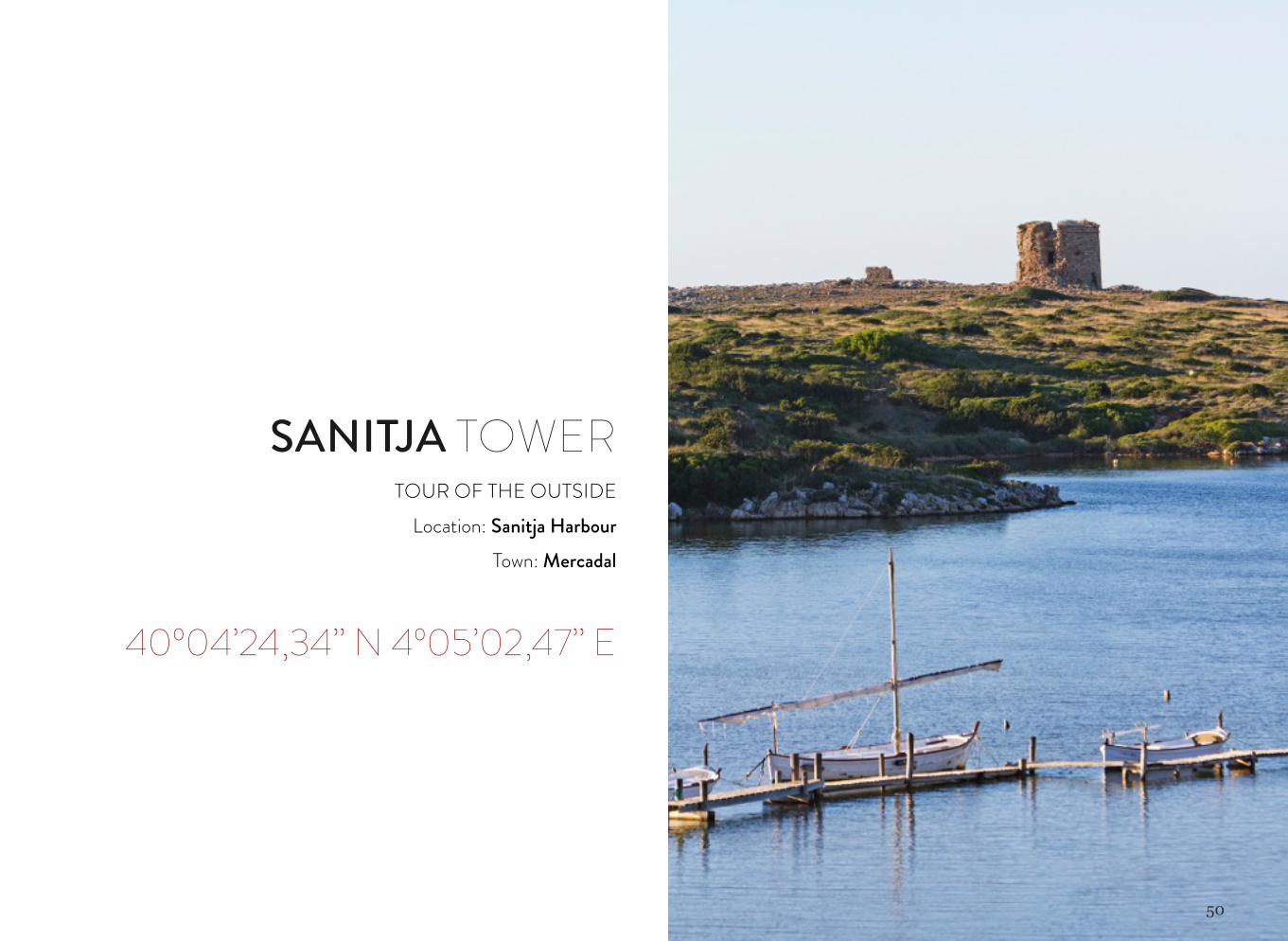
SANITJA TOWERTOUR OF THE OUTSIDE
Location: Sanitja HarbourTown: Mercadal
40º04’24,34’’ N 4º05’02,47’’ E
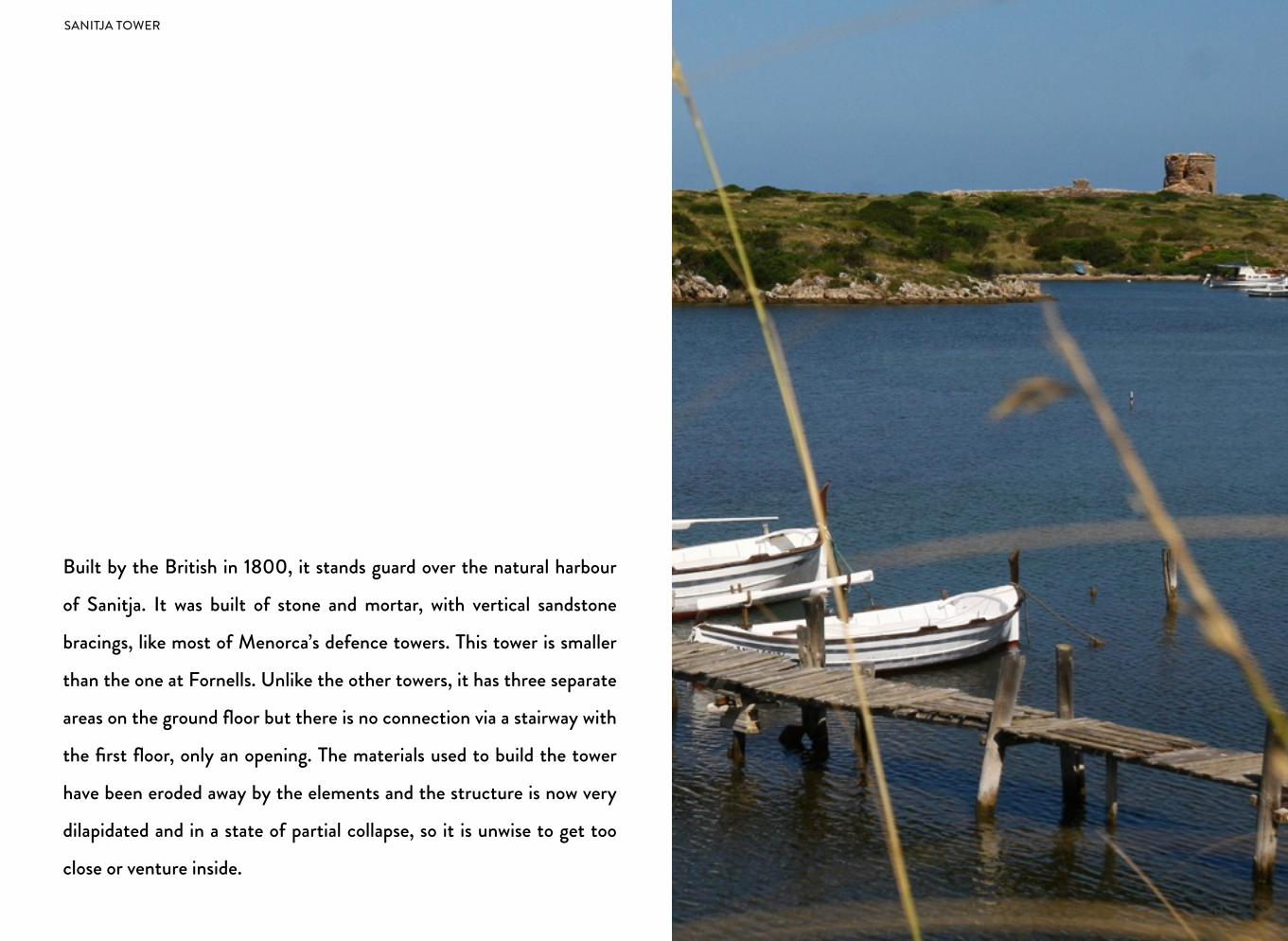
Built by the British in 1800, it stands guard over the natural harbour
of Sanitja. It was built of stone and mortar, with vertical sandstone
bracings, like most of Menorca’s defence towers. This tower is smaller
than the one at Fornells. Unlike the other towers, it has three separate
areas on the ground floor but there is no connection via a stairway with
the first floor, only an opening. The materials used to build the tower
have been eroded away by the elements and the structure is now very
dilapidated and in a state of partial collapse, so it is unwise to get too
close or venture inside.
51
SANITJA TOWER
52
SES SARGANTANES ISLAND TOWER
53
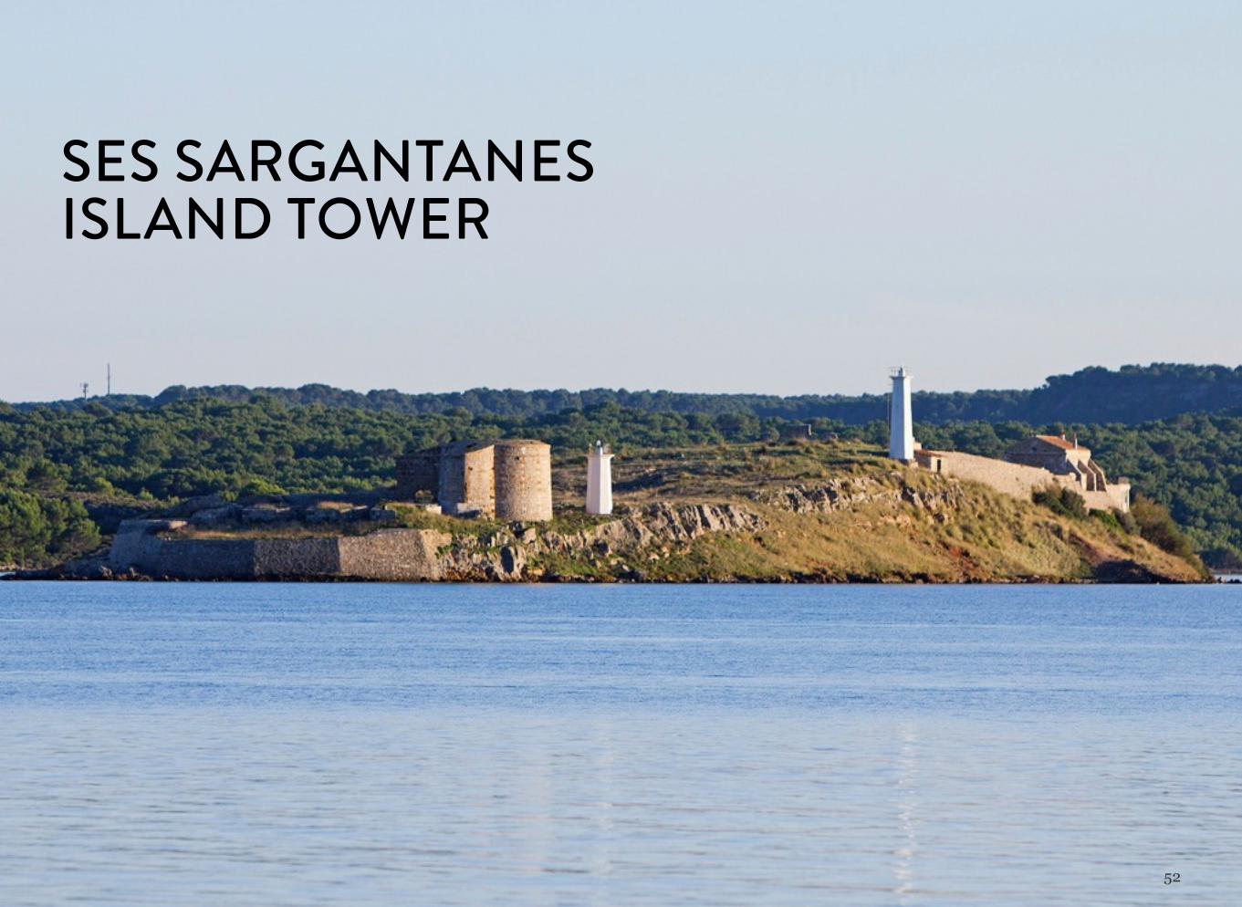
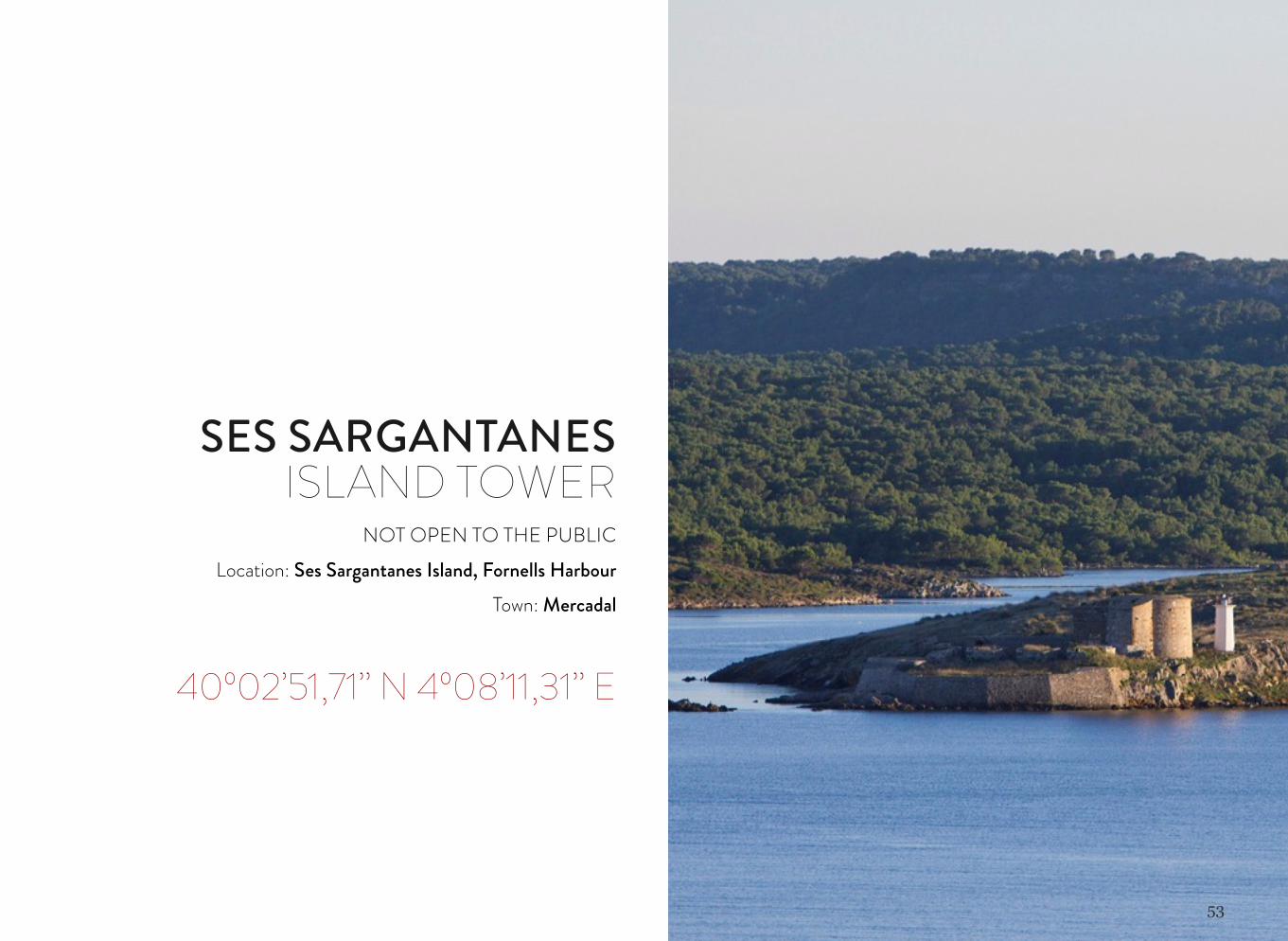
SES SARGANTANES ISLAND TOWER
NOT OPEN TO THE PUBLICLocation: Ses Sargantanes Island, Fornells Harbour
Town: Mercadal
40º02’51,71’’ N 4º08’11,31’’ E
54
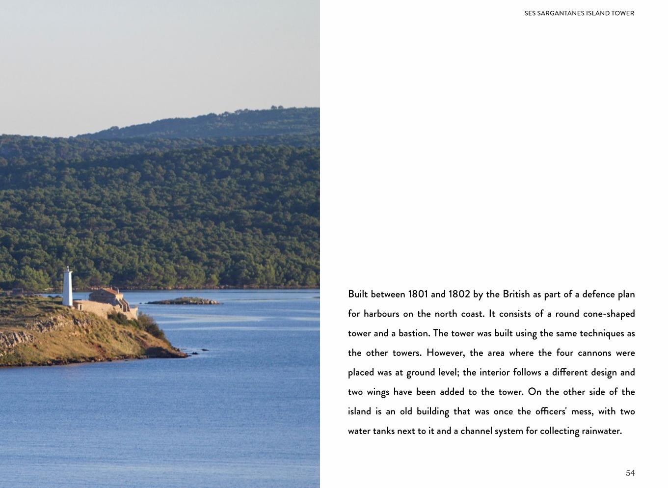
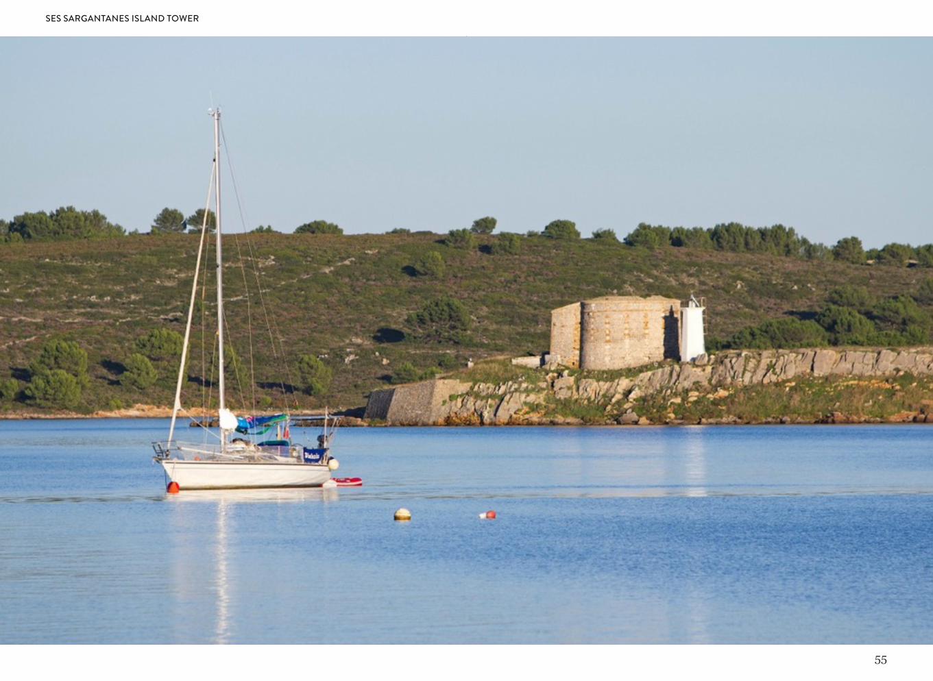
Built between 1801 and 1802 by the British as part of a defence plan
for harbours on the north coast. It consists of a round cone-shaped
tower and a bastion. The tower was built using the same techniques as
the other towers. However, the area where the four cannons were
placed was at ground level; the interior follows a di!erent design and
two wings have been added to the tower. On the other side of the
island is an old building that was once the o"cers' mess, with two
water tanks next to it and a channel system for collecting rainwater.
SES SARGANTANES ISLAND TOWER
55
SES SARGANTANES ISLAND TOWER
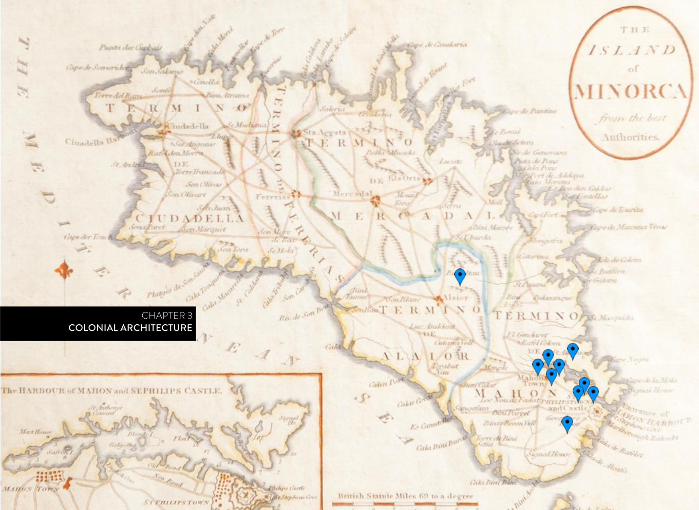
CHAPTER 3COLONIAL ARCHITECTURE
57
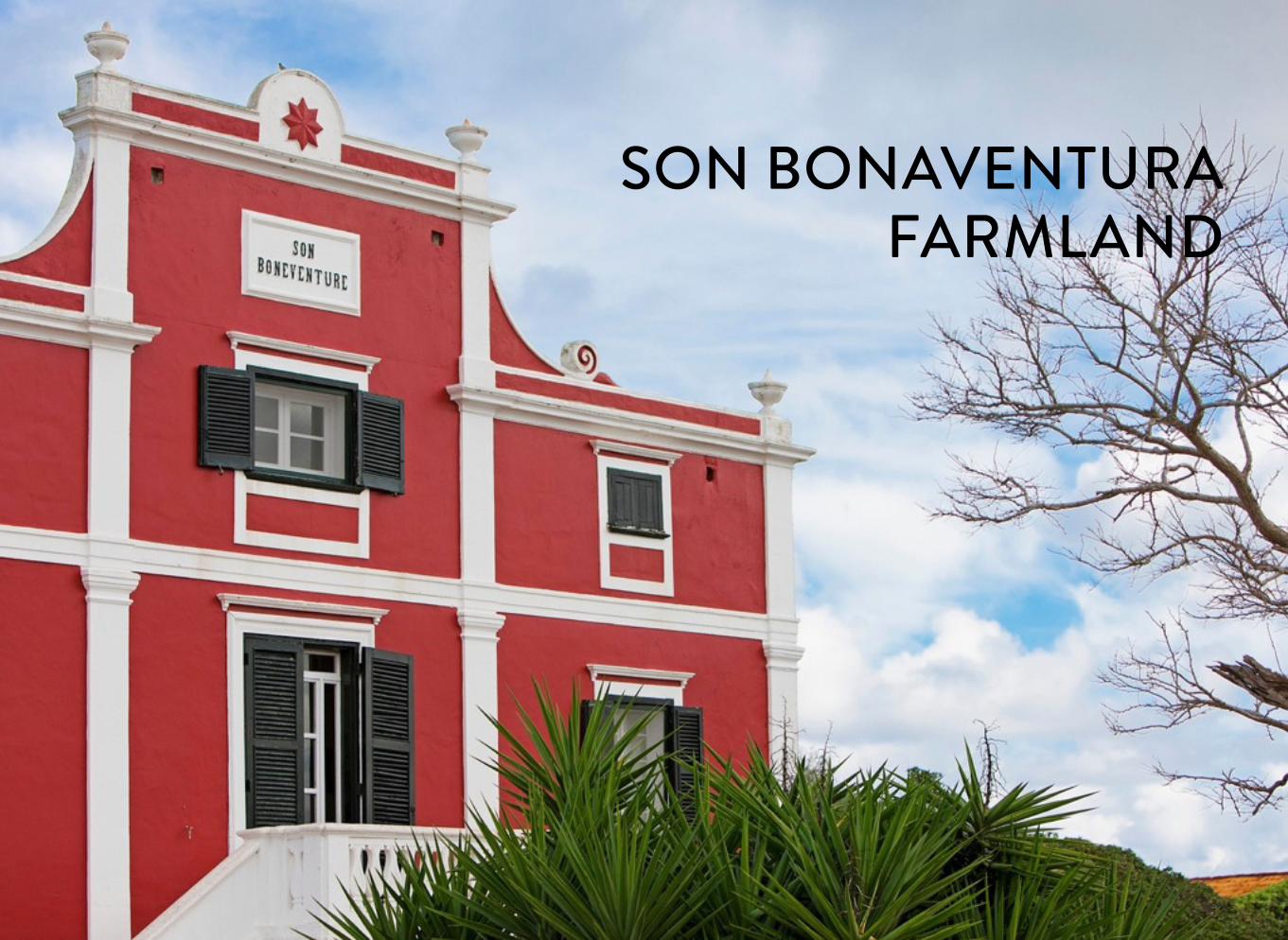
SON BONAVENTURA FARMLAND
58
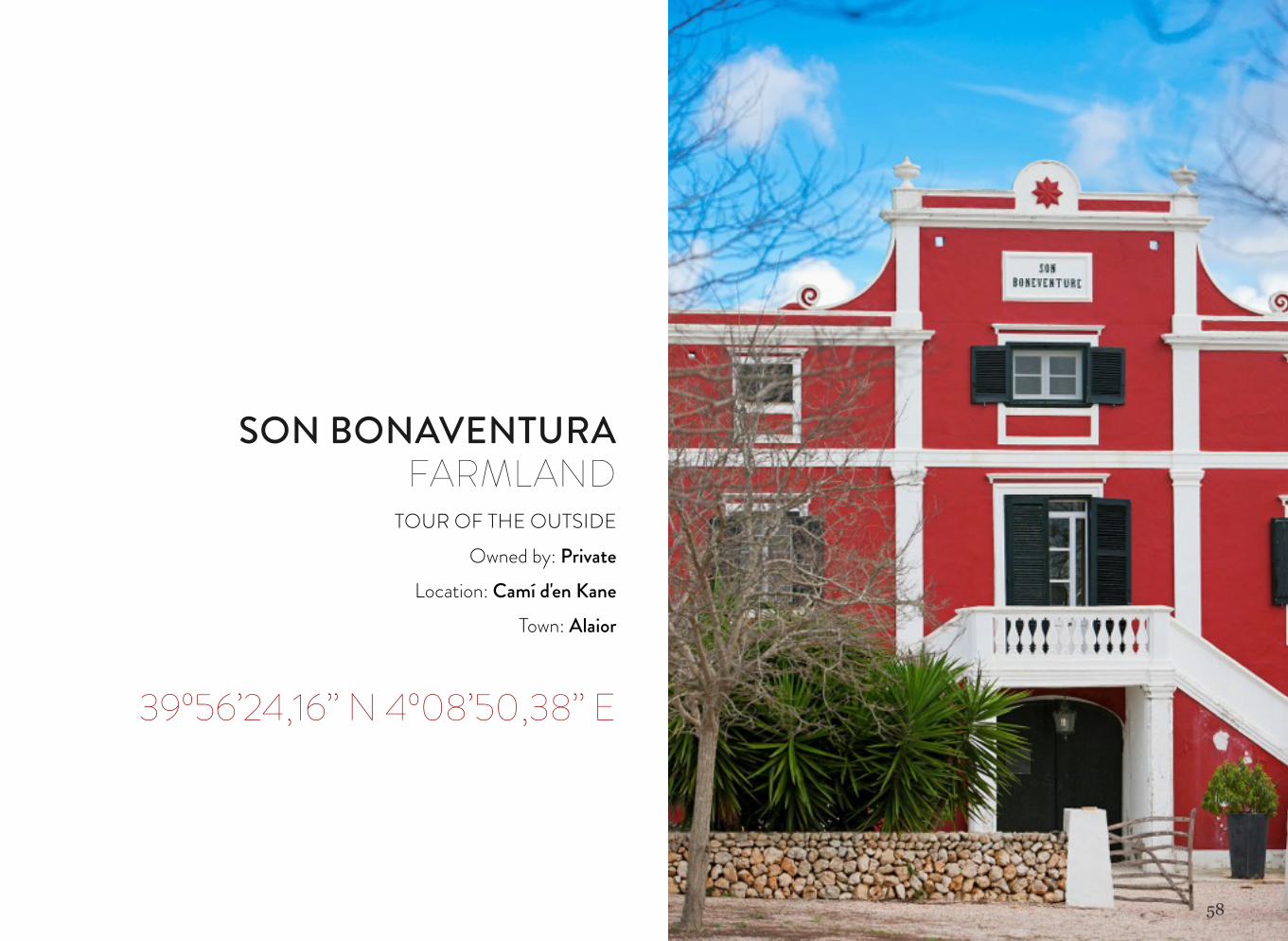
SON BONAVENTURA FARMLAND
TOUR OF THE OUTSIDEOwned by: Private
Location: Camí d'en KaneTown: Alaior
39º56’24,16’’ N 4º08’50,38’’ E
59
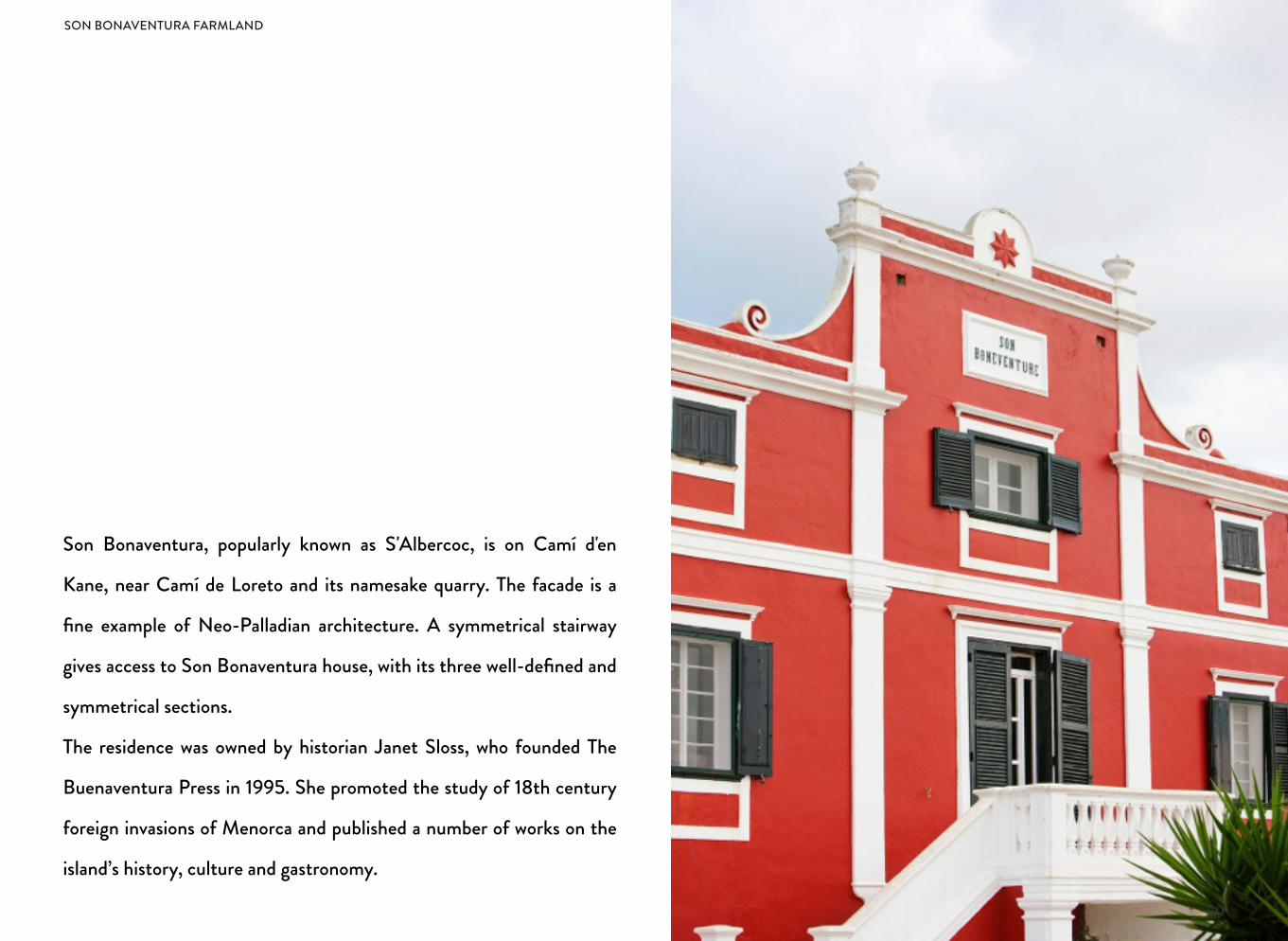
Son Bonaventura, popularly known as S'Albercoc, is on Camí d'en
Kane, near Camí de Loreto and its namesake quarry. The facade is a
fine example of Neo-Palladian architecture. A symmetrical stairway
gives access to Son Bonaventura house, with its three well-defined and
symmetrical sections.
The residence was owned by historian Janet Sloss, who founded The
Buenaventura Press in 1995. She promoted the study of 18th century
foreign invasions of Menorca and published a number of works on the
island’s history, culture and gastronomy.
SON BONAVENTURA FARMLAND
60
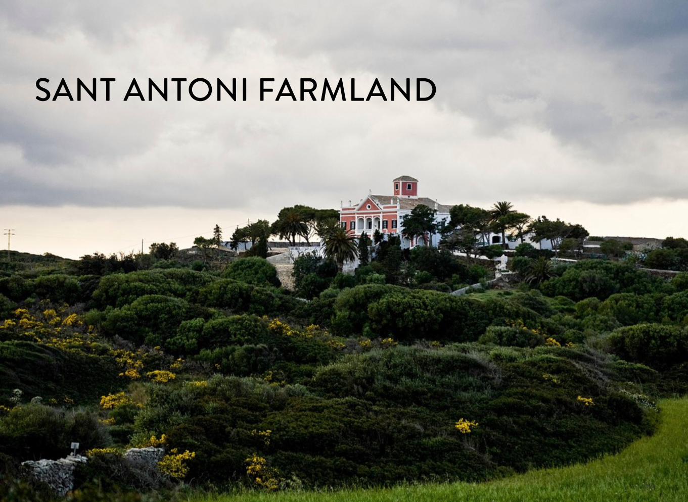
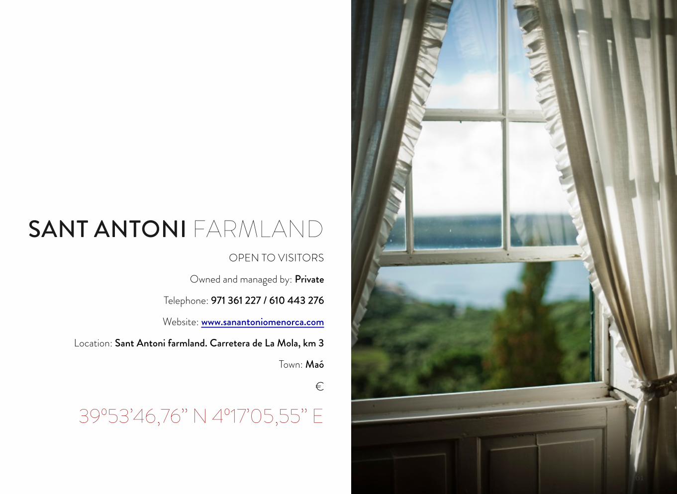
SANT ANTONI FARMLAND
61
OPEN TO VISITORS
Owned and managed by: Private
Telephone: 971 361 227 / 610 443 276
Website: www.sanantoniomenorca.com
Location: Sant Antoni farmland. Carretera de La Mola, km 3
Town: Maó
€
39º53’46,76’’ N 4º17’05,55’’ E
SANT ANTONI FARMLAND
62
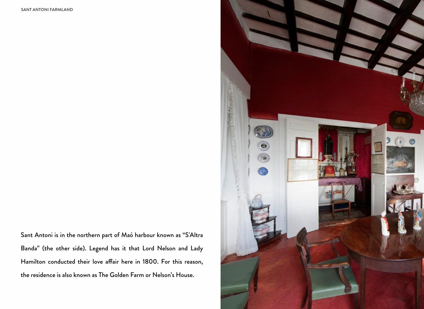
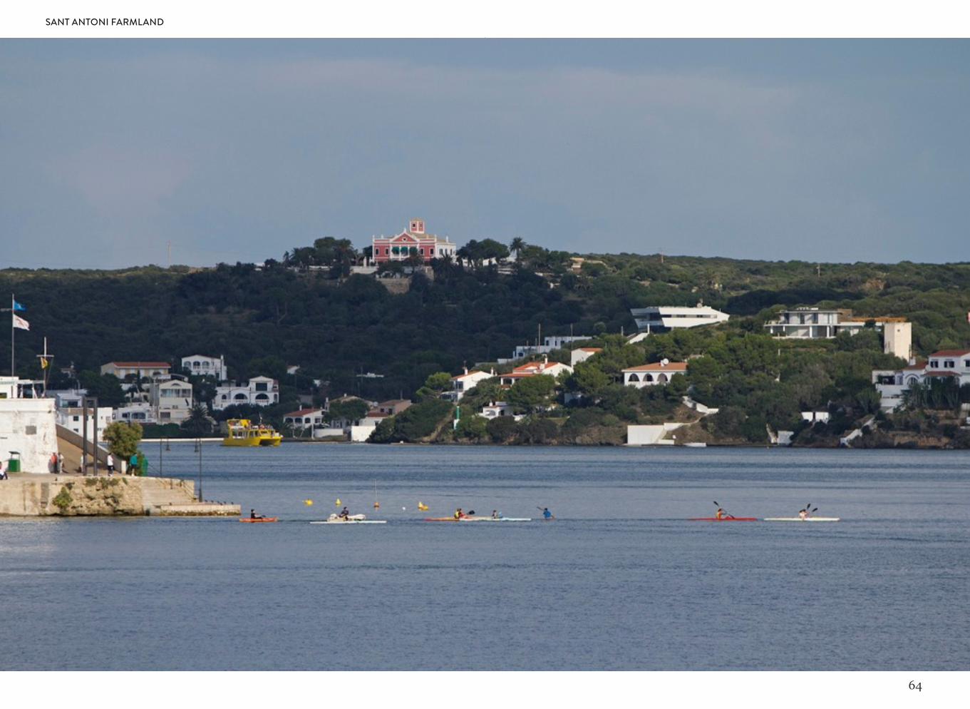
Sant Antoni is in the northern part of Maó harbour known as “S'Altra
Banda” (the other side). Legend has it that Lord Nelson and Lady
Hamilton conducted their love a!air here in 1800. For this reason,
the residence is also known as The Golden Farm or Nelson’s House.
SANT ANTONI FARMLAND
63
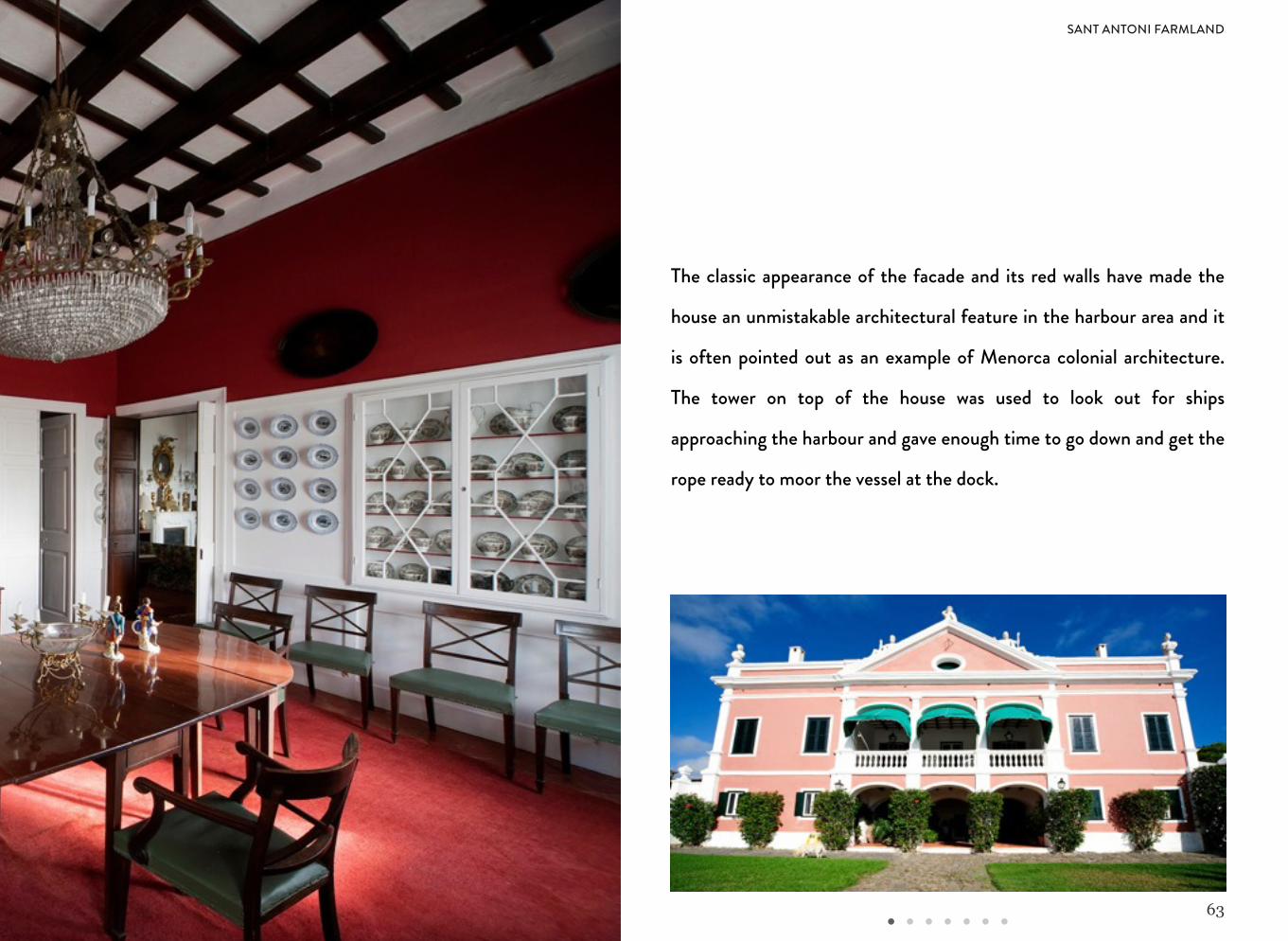
The classic appearance of the facade and its red walls have made the
house an unmistakable architectural feature in the harbour area and it
is often pointed out as an example of Menorca colonial architecture.
The tower on top of the house was used to look out for ships
approaching the harbour and gave enough time to go down and get the
rope ready to moor the vessel at the dock.
SANT ANTONI FARMLAND
64
SANT ANTONI FARMLAND
65
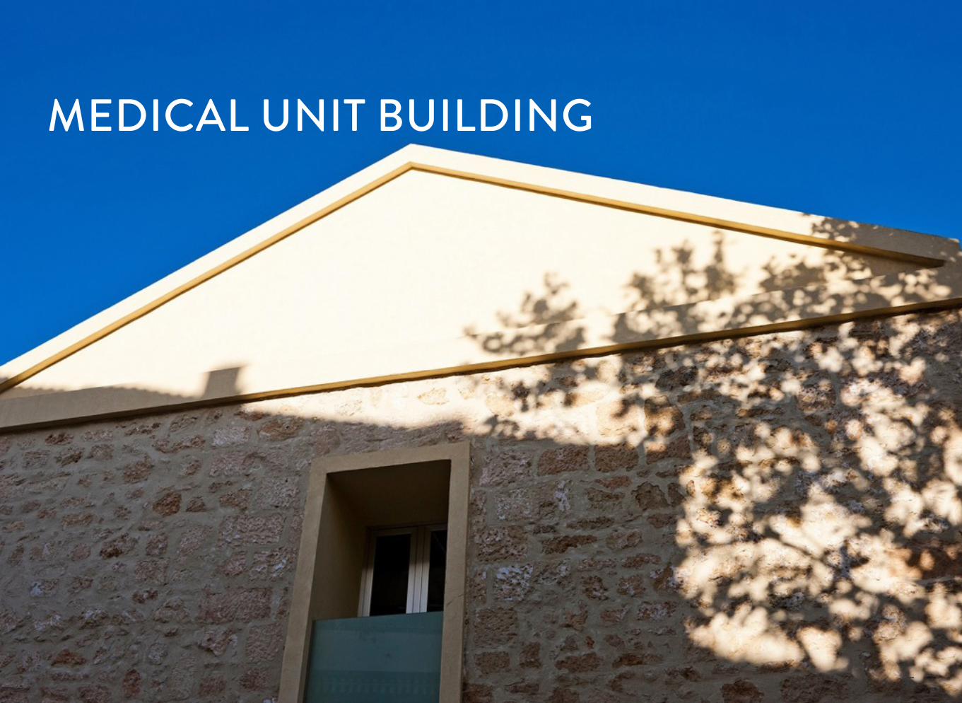
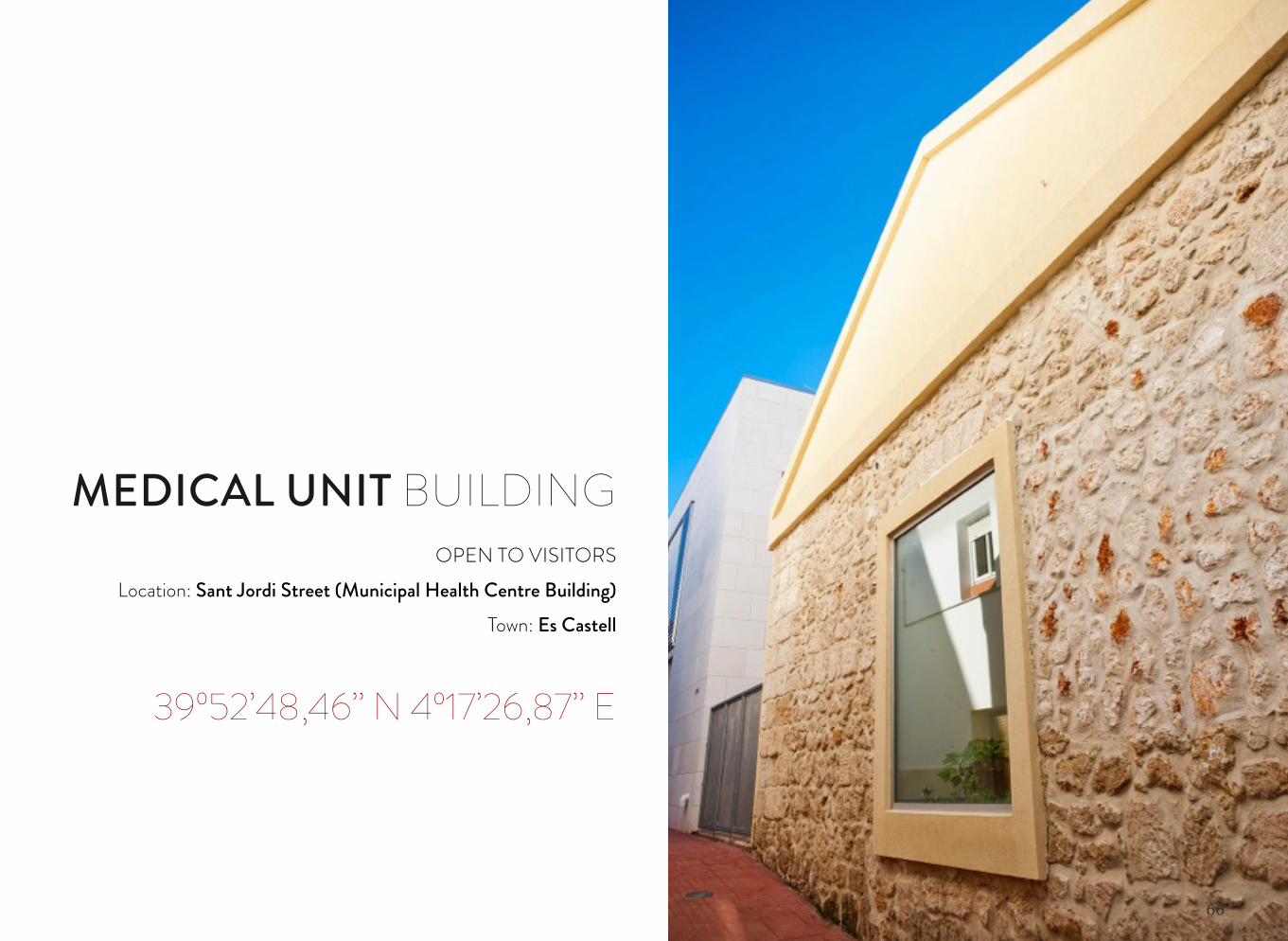
MEDICAL UNIT BUILDING
66
OPEN TO VISITORSLocation: Sant Jordi Street (Municipal Health Centre Building)
Town: Es Castell
39º52’48,46’’ N 4º17’26,87’’ E
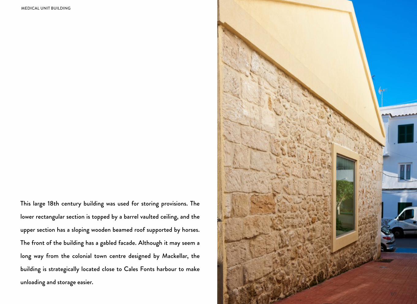
MEDICAL UNIT BUILDING
67
This large 18th century building was used for storing provisions. The
lower rectangular section is topped by a barrel vaulted ceiling, and the
upper section has a sloping wooden beamed roof supported by horses.
The front of the building has a gabled facade. Although it may seem a
long way from the colonial town centre designed by Mackellar, the
building is strategically located close to Cales Fonts harbour to make
unloading and storage easier.
MEDICAL UNIT BUILDING
68
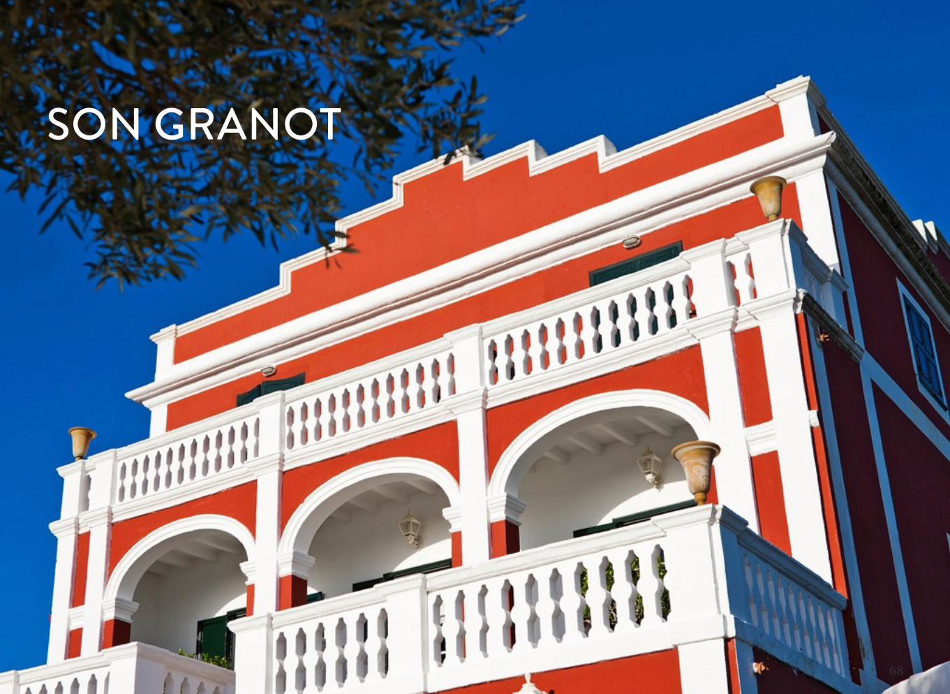
SON GRANOT
69
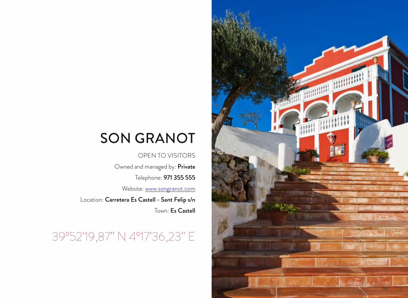
SON GRANOTOPEN TO VISITORS
Owned and managed by: PrivateTelephone: 971 355 555
Website: www.songranot.comLocation: Carretera Es Castell - Sant Felip s/n
Town: Es Castell
39º52’19,87’’ N 4º17’36,23’’ E
70
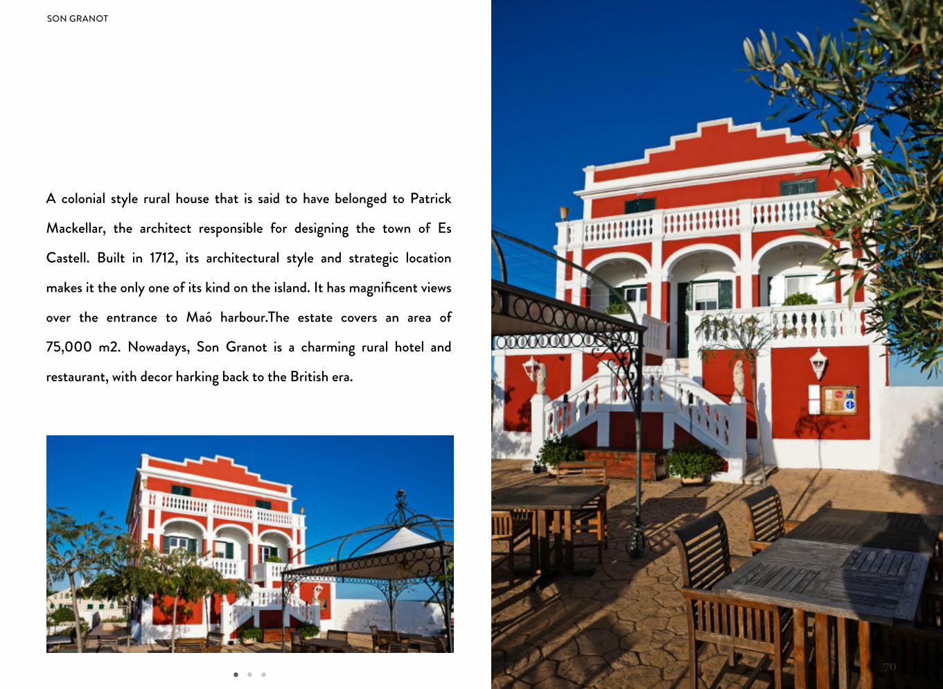
A colonial style rural house that is said to have belonged to Patrick
Mackellar, the architect responsible for designing the town of Es
Castell. Built in 1712, its architectural style and strategic location
makes it the only one of its kind on the island. It has magnificent views
over the entrance to Maó harbour.The estate covers an area of
75,000 m2. Nowadays, Son Granot is a charming rural hotel and
restaurant, with decor harking back to the British era.
SON GRANOT
71
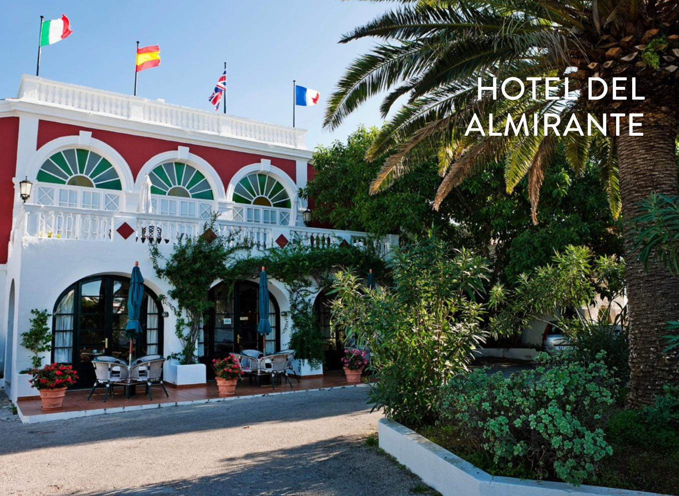
HOTEL DELALMIRANTE
72
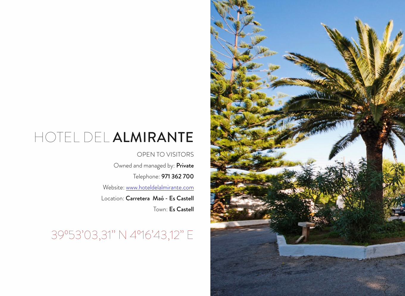
HOTEL DEL ALMIRANTEOPEN TO VISITORS
Owned and managed by: PrivateTelephone: 971 362 700
Website: www.hoteldelalmirante.comLocation: Carretera Maó - Es Castell
Town: Es Castell
39º53’03,31’’ N 4º16’43,12’’ E
73
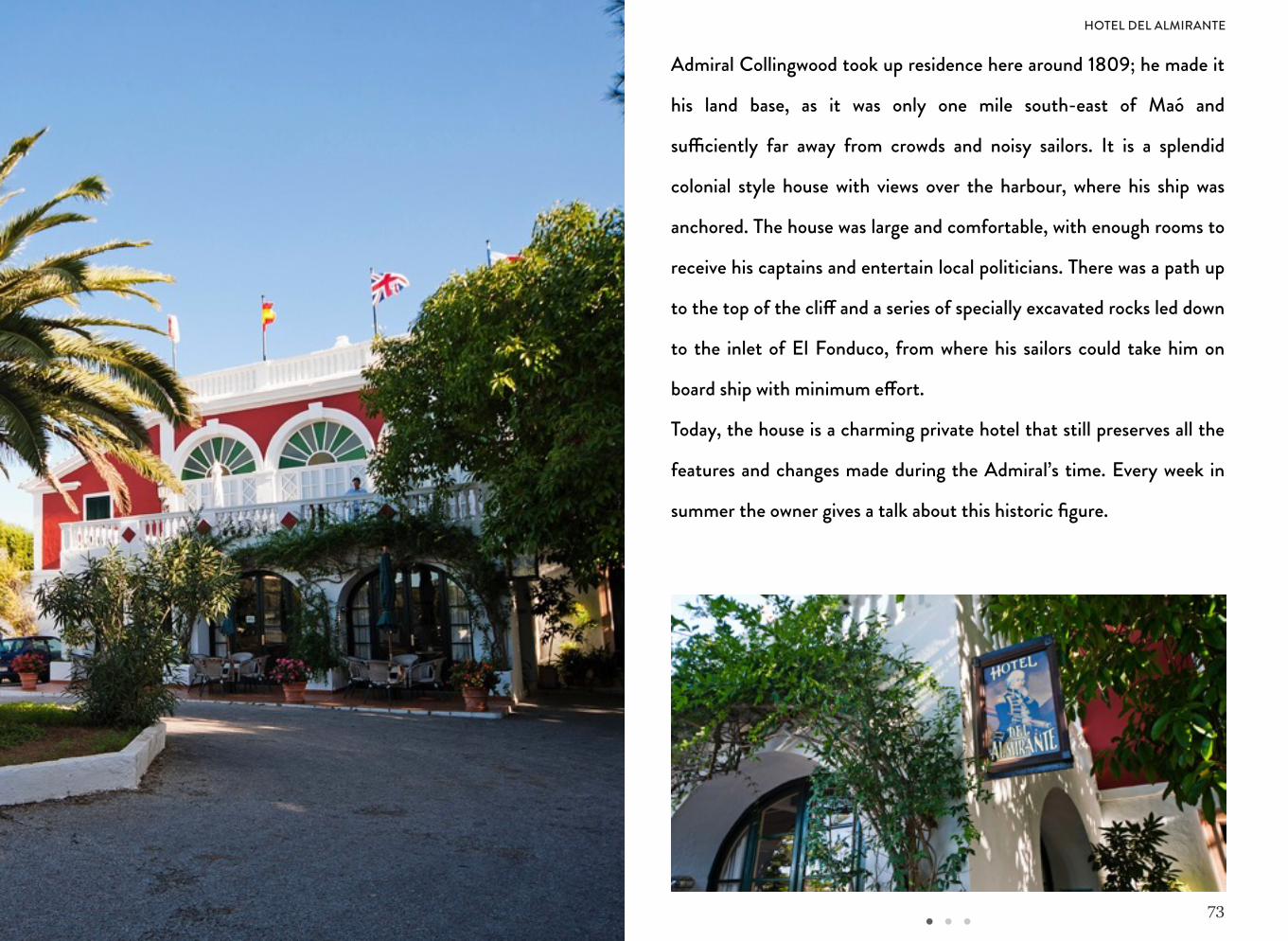
Admiral Collingwood took up residence here around 1809; he made it
his land base, as it was only one mile south-east of Maó and
su"ciently far away from crowds and noisy sailors. It is a splendid
colonial style house with views over the harbour, where his ship was
anchored. The house was large and comfortable, with enough rooms to
receive his captains and entertain local politicians. There was a path up
to the top of the cli! and a series of specially excavated rocks led down
to the inlet of El Fonduco, from where his sailors could take him on
board ship with minimum e!ort.
Today, the house is a charming private hotel that still preserves all the
features and changes made during the Admiral’s time. Every week in
summer the owner gives a talk about this historic figure.
HOTEL DEL ALMIRANTE
74
MAÓ CITY COUNCIL CLOCK
75
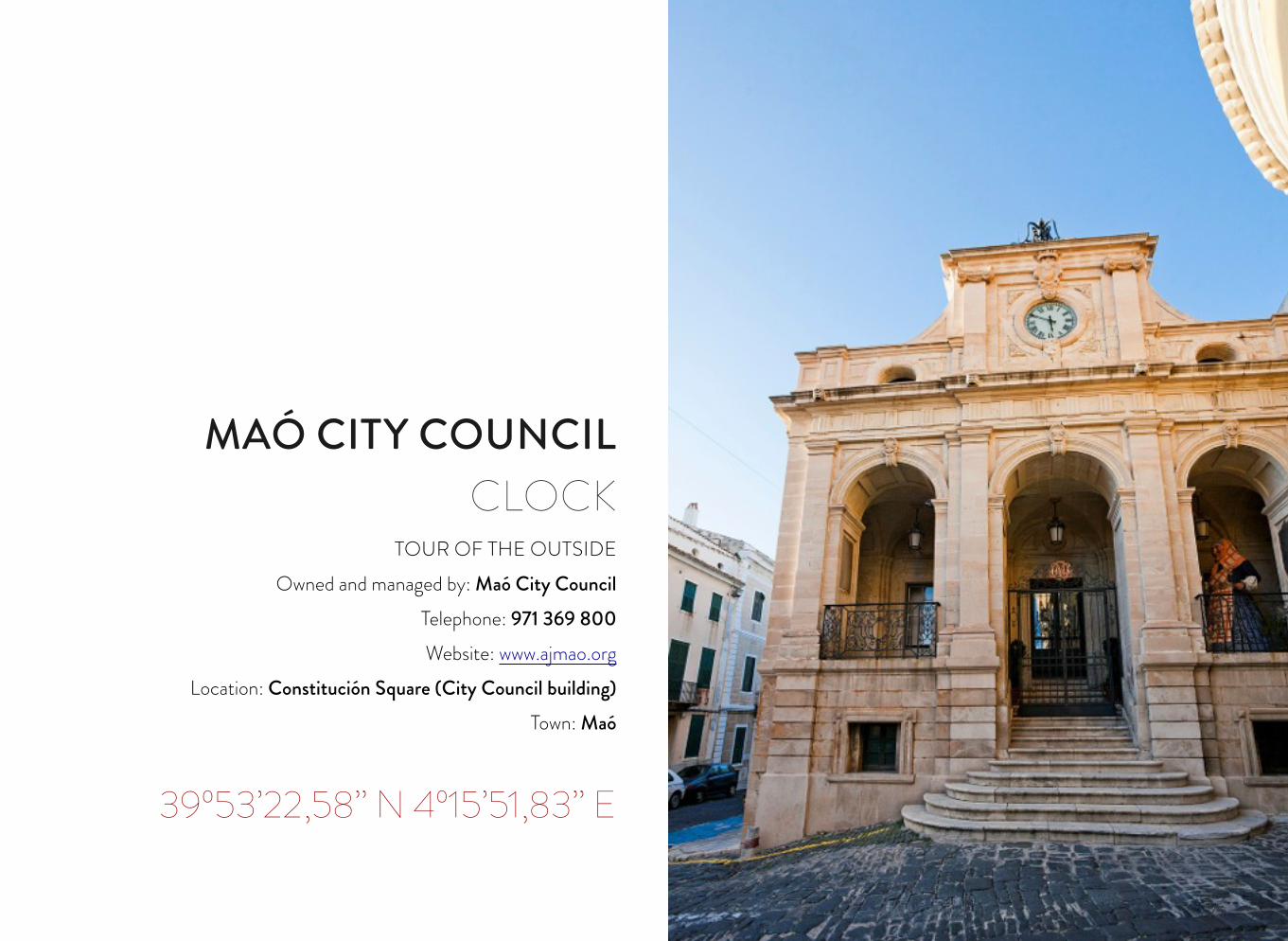
MAÓ CITY COUNCIL CLOCK
TOUR OF THE OUTSIDEOwned and managed by: Maó City Council
Telephone: 971 369 800 Website: www.ajmao.org
Location: Constitución Square (City Council building)Town: Maó
39º53’22,58’’ N 4º15’51,83’’ E
76
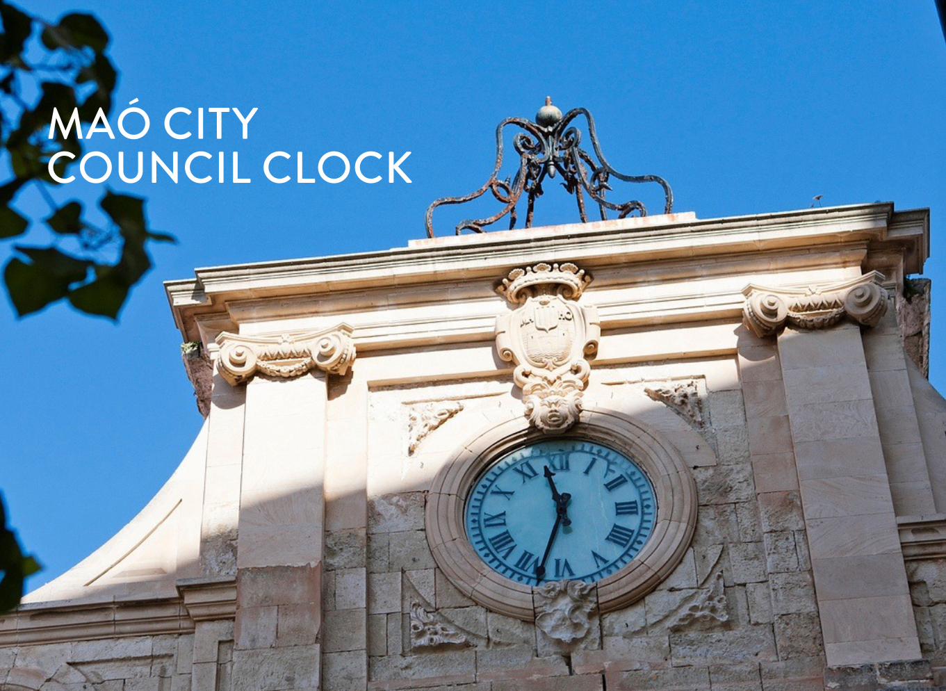
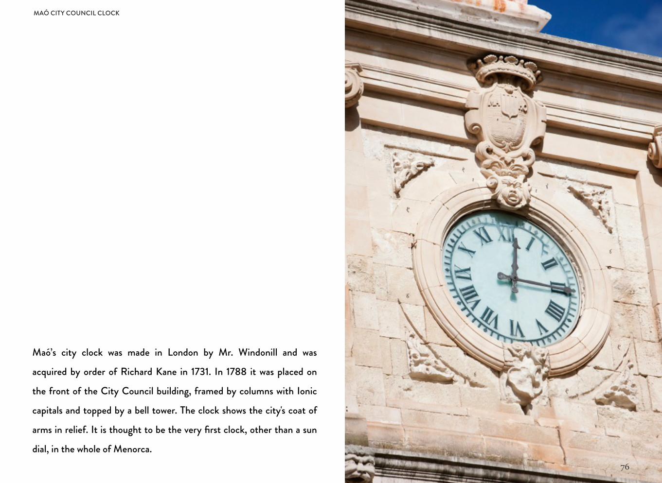
Maó’s city clock was made in London by Mr. Windonill and was
acquired by order of Richard Kane in 1731. In 1788 it was placed on
the front of the City Council building, framed by columns with Ionic
capitals and topped by a bell tower. The clock shows the city's coat of
arms in relief. It is thought to be the very first clock, other than a sun
dial, in the whole of Menorca.
MAÓ CITY COUNCIL CLOCK
77
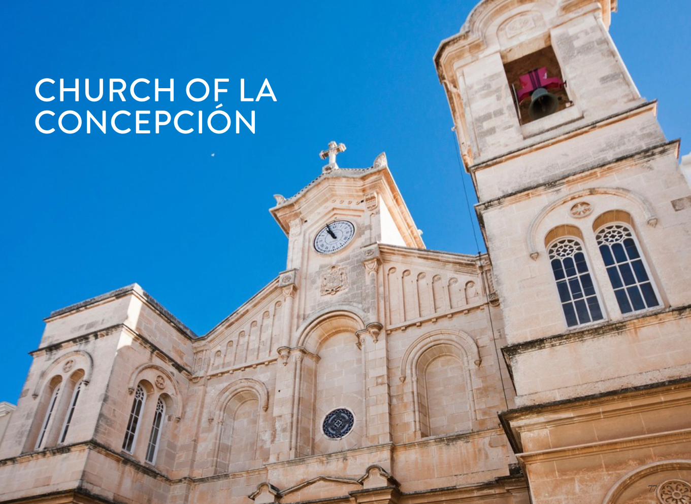
CHURCH OF LA CONCEPCIÓN
78
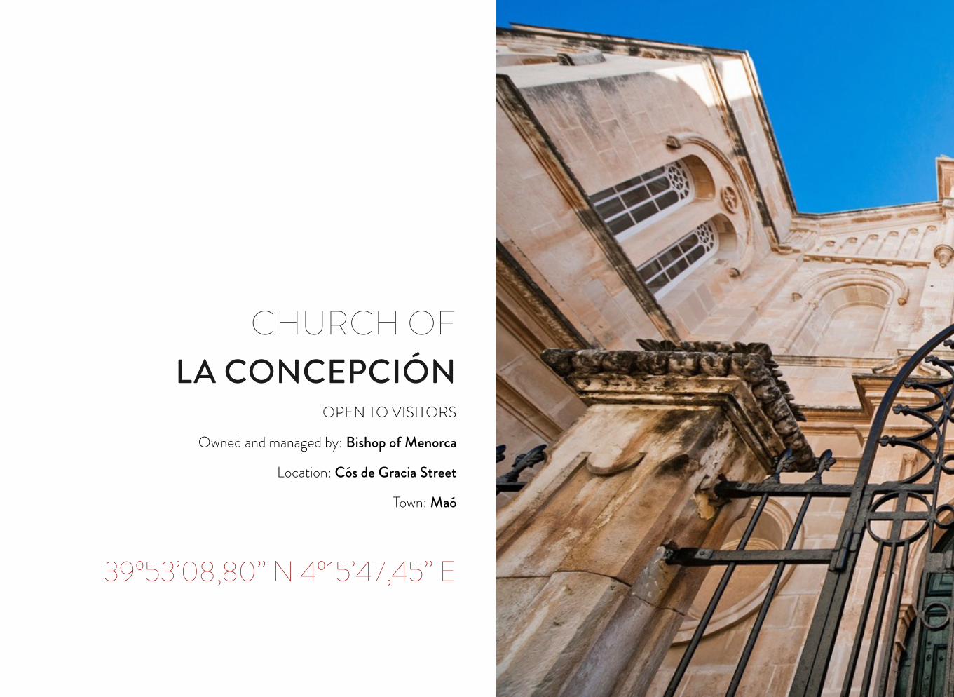
CHURCH OF LA CONCEPCIÓN
OPEN TO VISITORS
Owned and managed by: Bishop of Menorca
Location: Cós de Gracia Street
Town: Maó
39º53’08,80’’ N 4º15’47,45’’ E
79
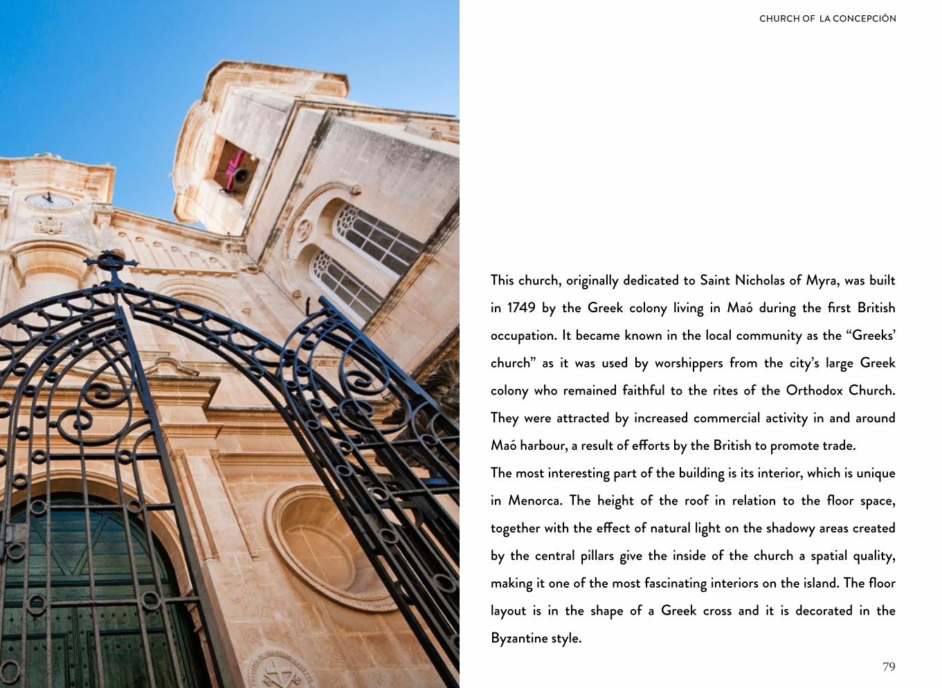
This church, originally dedicated to Saint Nicholas of Myra, was built
in 1749 by the Greek colony living in Maó during the first British
occupation. It became known in the local community as the “Greeks’
church” as it was used by worshippers from the city’s large Greek
colony who remained faithful to the rites of the Orthodox Church.
They were attracted by increased commercial activity in and around
Maó harbour, a result of e!orts by the British to promote trade.
The most interesting part of the building is its interior, which is unique
in Menorca. The height of the roof in relation to the floor space,
together with the e!ect of natural light on the shadowy areas created
by the central pillars give the inside of the church a spatial quality,
making it one of the most fascinating interiors on the island. The floor
layout is in the shape of a Greek cross and it is decorated in the
Byzantine style.
CHURCH OF LA CONCEPCIÓN
80
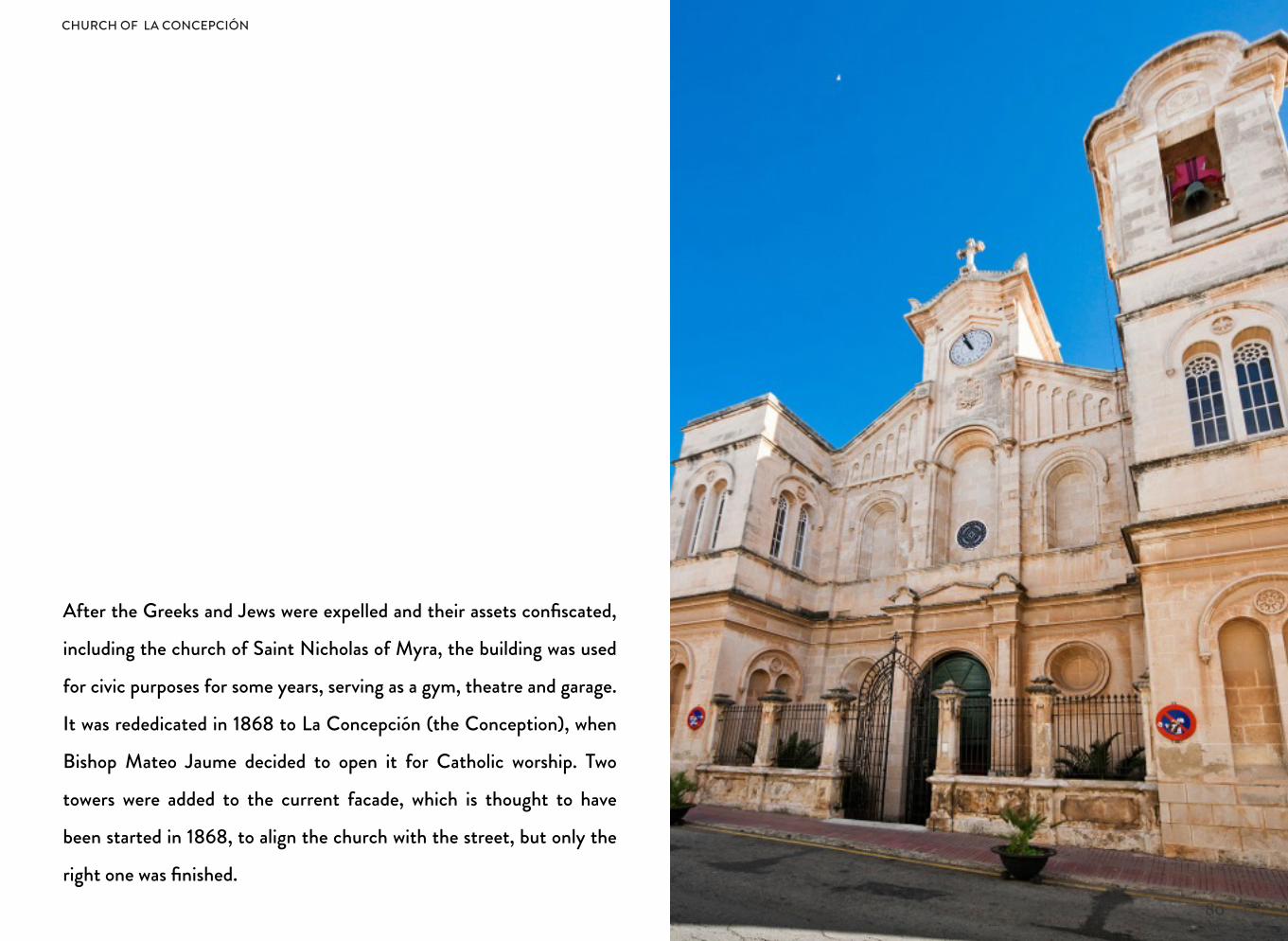
After the Greeks and Jews were expelled and their assets confiscated,
including the church of Saint Nicholas of Myra, the building was used
for civic purposes for some years, serving as a gym, theatre and garage.
It was rededicated in 1868 to La Concepción (the Conception), when
Bishop Mateo Jaume decided to open it for Catholic worship. Two
towers were added to the current facade, which is thought to have
been started in 1868, to align the church with the street, but only the
right one was finished.
CHURCH OF LA CONCEPCIÓN
81
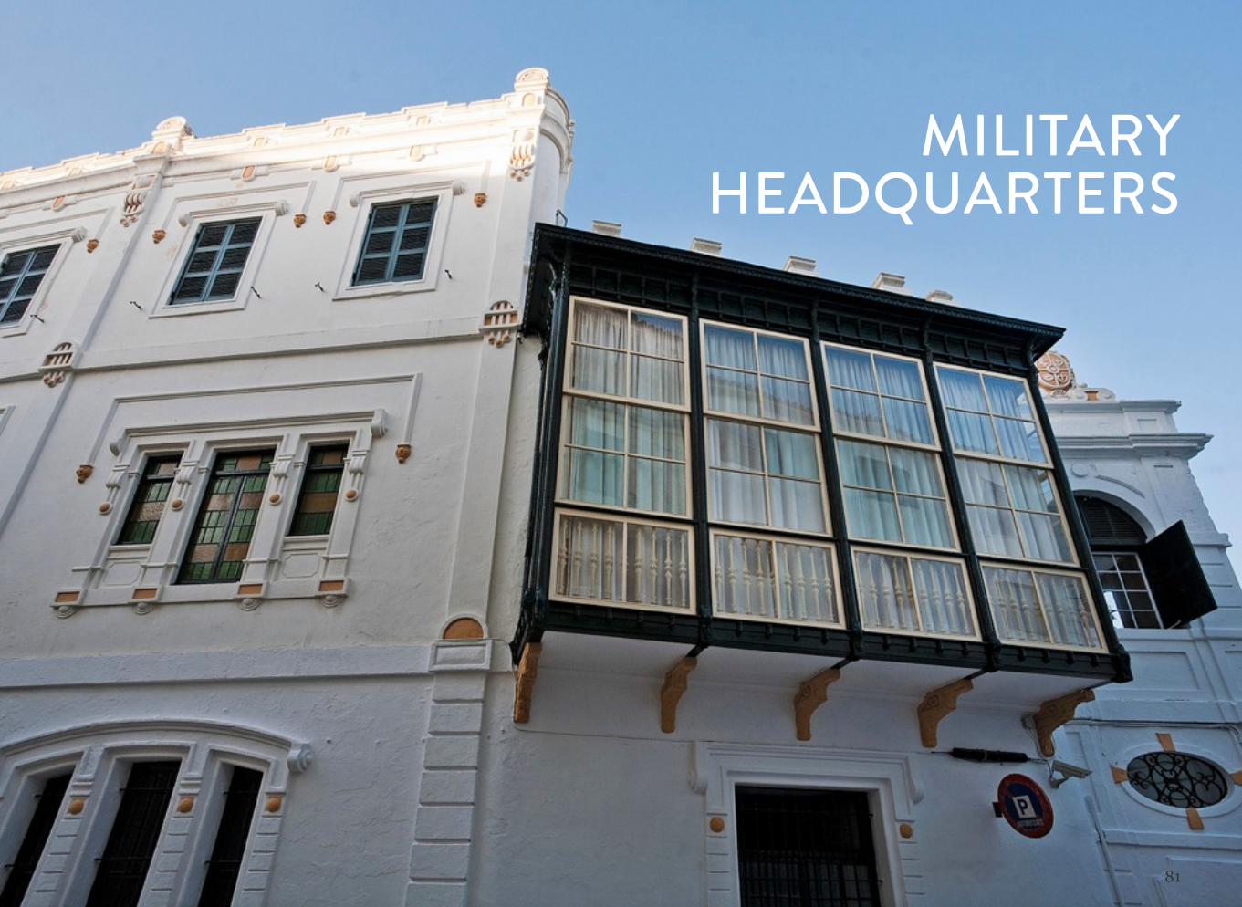
MILITARY HEADQUARTERS
82
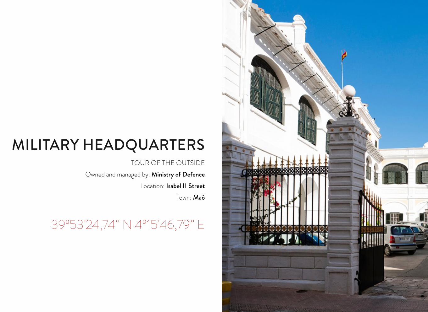
MILITARY HEADQUARTERSTOUR OF THE OUTSIDE
Owned and managed by: Ministry of DefenceLocation: Isabel II Street
Town: Maó
39º53’24,74’’ N 4º15’46,79’’ E
83
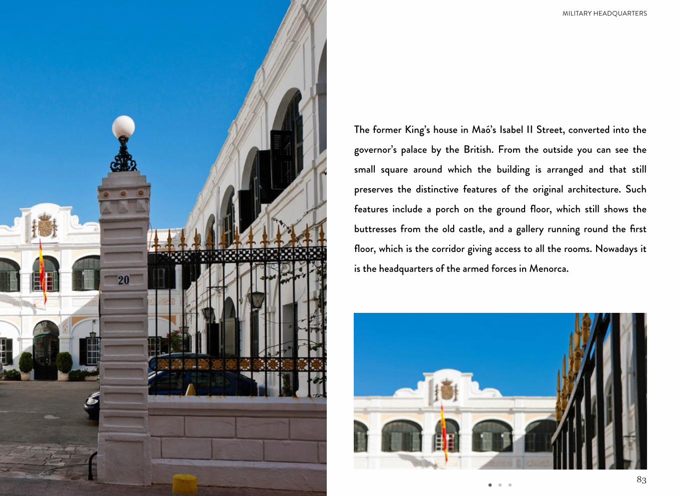
The former King’s house in Maó’s Isabel II Street, converted into the
governor’s palace by the British. From the outside you can see the
small square around which the building is arranged and that still
preserves the distinctive features of the original architecture. Such
features include a porch on the ground floor, which still shows the
buttresses from the old castle, and a gallery running round the first
floor, which is the corridor giving access to all the rooms. Nowadays it
is the headquarters of the armed forces in Menorca.
MILITARY HEADQUARTERS
84
ES CASTELL TOWN COUNCIL
85
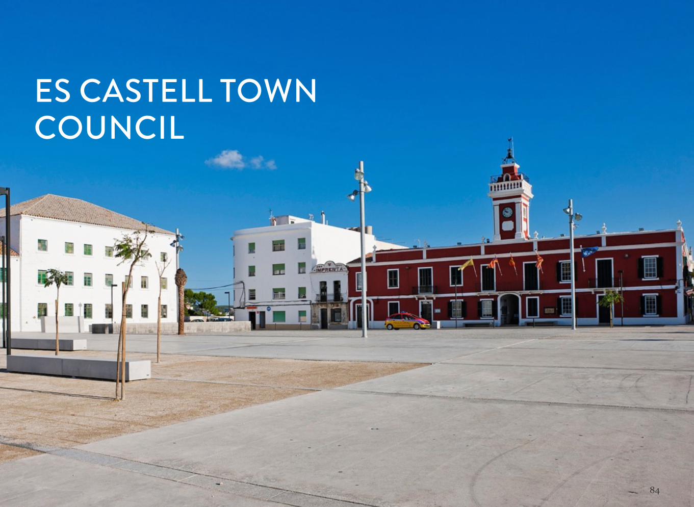
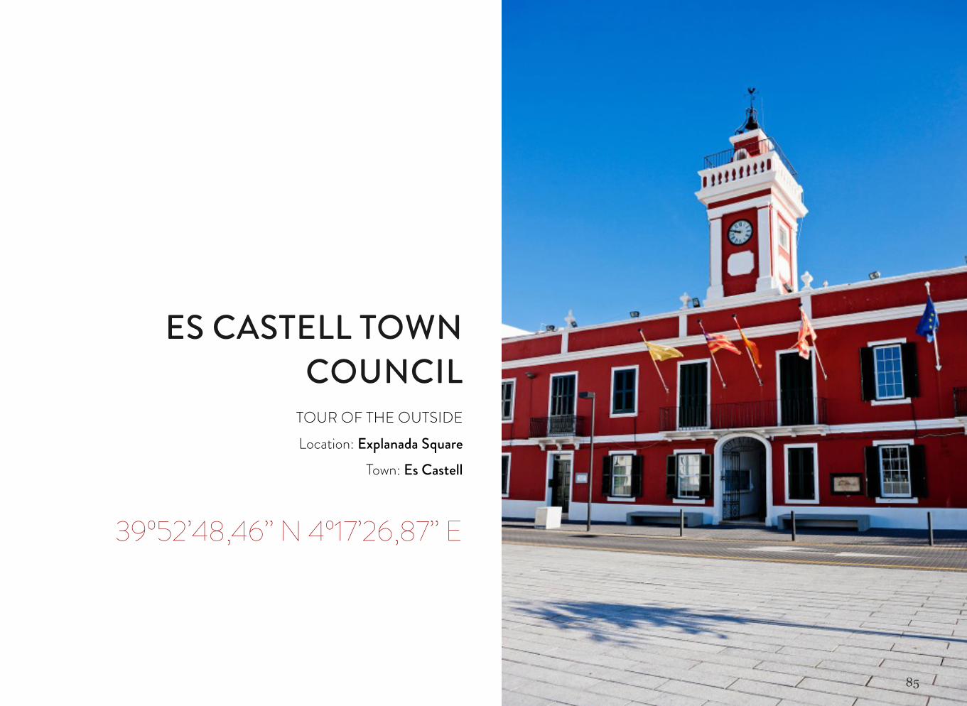
ES CASTELL TOWN COUNCIL
TOUR OF THE OUTSIDELocation: Explanada Square
Town: Es Castell
39º52’48,46’’ N 4º17’26,87’’ E
86
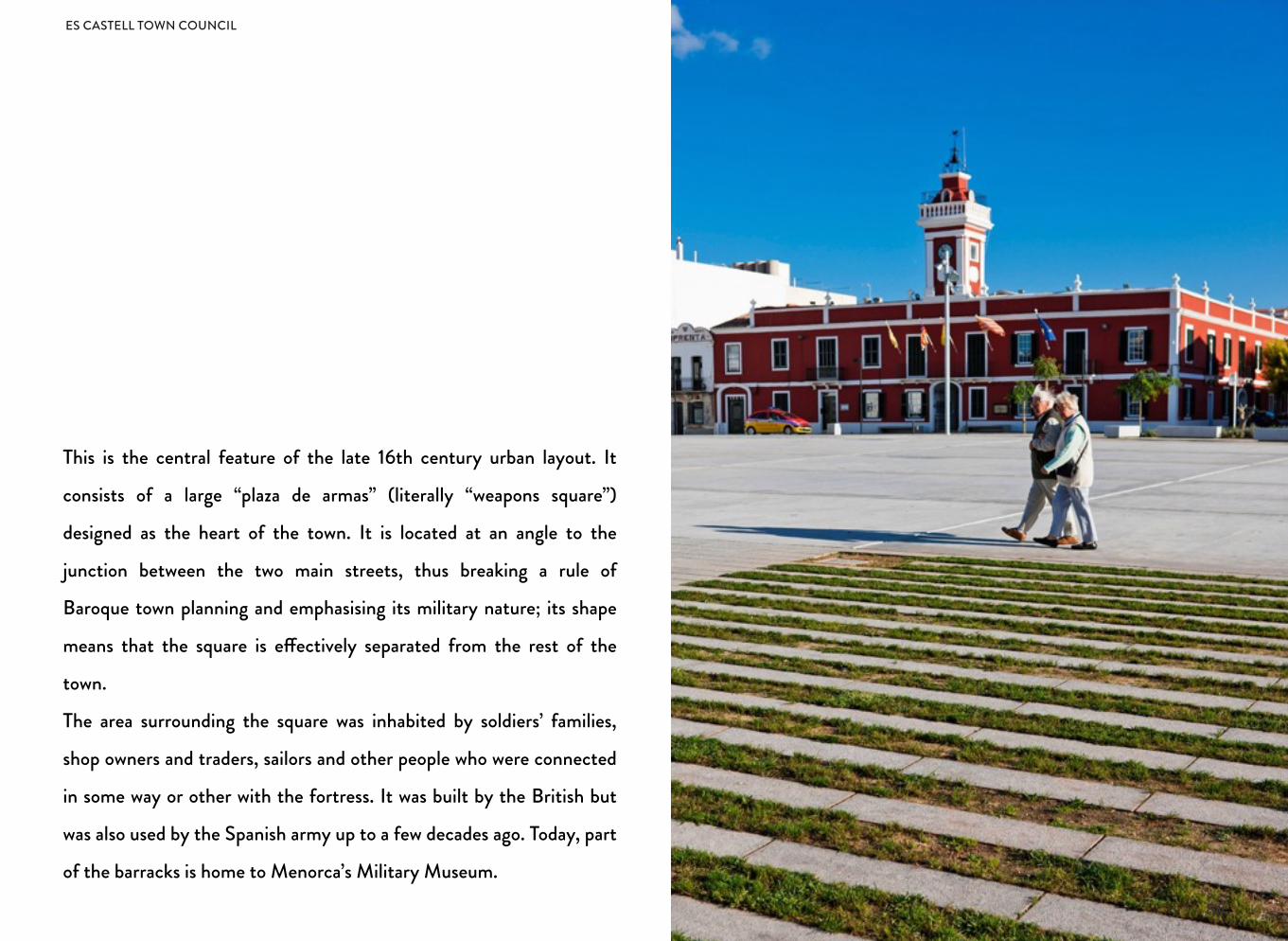
This is the central feature of the late 16th century urban layout. It
consists of a large “plaza de armas” (literally “weapons square”)
designed as the heart of the town. It is located at an angle to the
junction between the two main streets, thus breaking a rule of
Baroque town planning and emphasising its military nature; its shape
means that the square is e!ectively separated from the rest of the
town.
The area surrounding the square was inhabited by soldiers’ families,
shop owners and traders, sailors and other people who were connected
in some way or other with the fortress. It was built by the British but
was also used by the Spanish army up to a few decades ago. Today, part
of the barracks is home to Menorca’s Military Museum.
ES CASTELL TOWN COUNCIL
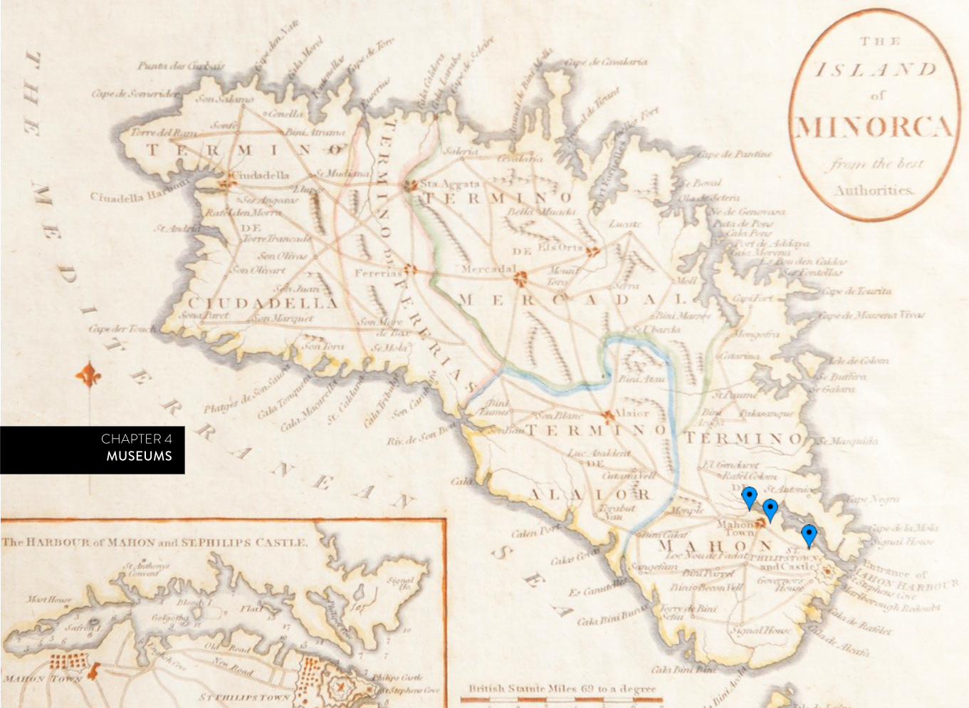
CHAPTER 4MUSEUMS
88
HERNÁNDEZ SANZ-HERNÁNDEZ MORA Museum Collection

89
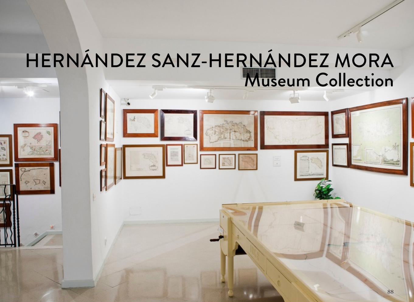
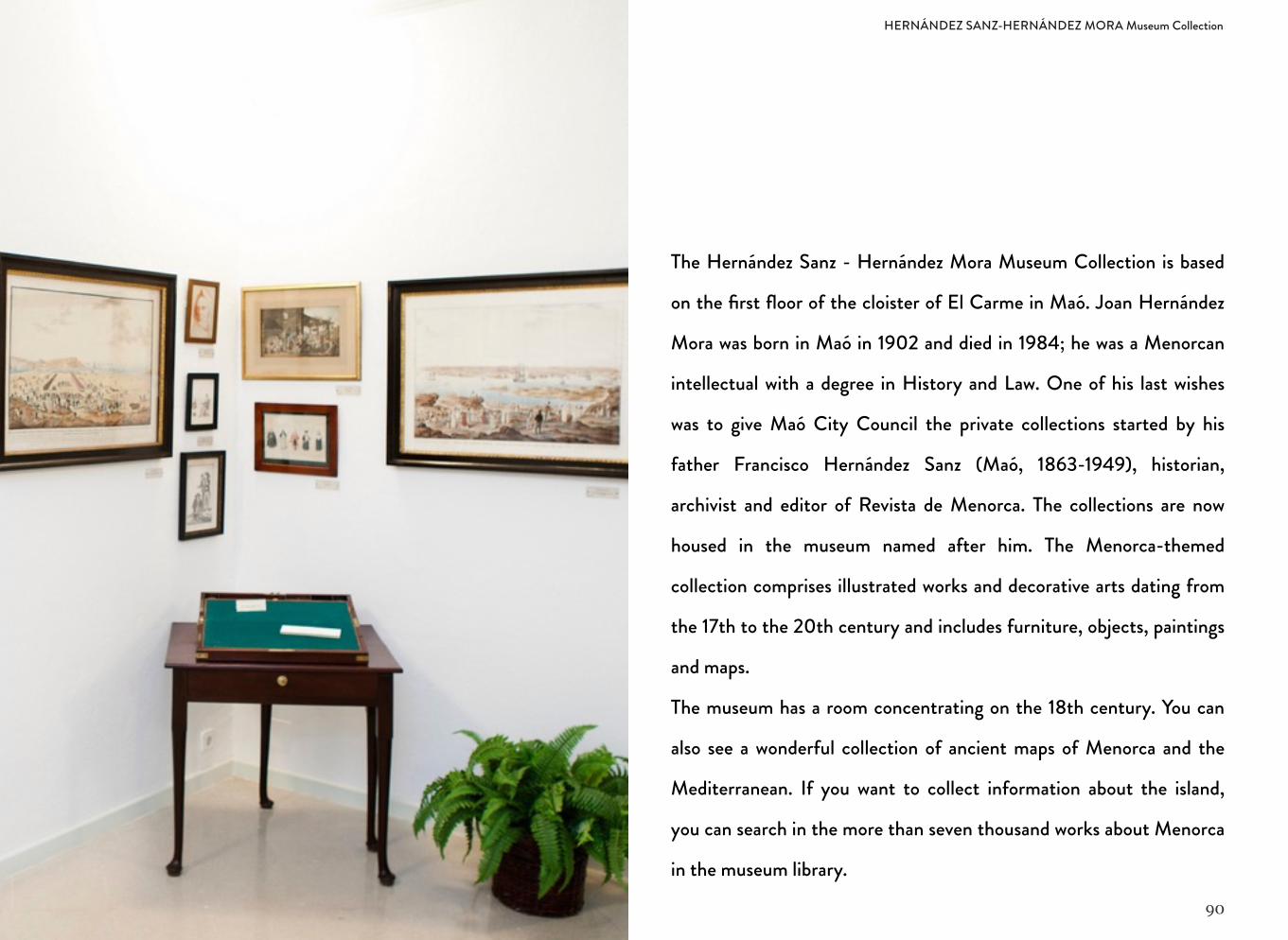
HERNÁNDEZ SANZ-HERNÁNDEZ MORA
Museum CollectionOPEN TO VISITORS
Owned and managed by: Maó City Council
Telephone: 971 350 597
Location: First floor of the cloister of El Carme. Miranda Square, 5
Town: Maó
39º53’19,31’’ N 4º15’57,96’’ E
90
The Hernández Sanz - Hernández Mora Museum Collection is based
on the first floor of the cloister of El Carme in Maó. Joan Hernández
Mora was born in Maó in 1902 and died in 1984; he was a Menorcan
intellectual with a degree in History and Law. One of his last wishes
was to give Maó City Council the private collections started by his
father Francisco Hernández Sanz (Maó, 1863-1949), historian,
archivist and editor of Revista de Menorca. The collections are now
housed in the museum named after him. The Menorca-themed
collection comprises illustrated works and decorative arts dating from
the 17th to the 20th century and includes furniture, objects, paintings
and maps.
The museum has a room concentrating on the 18th century. You can
also see a wonderful collection of ancient maps of Menorca and the
Mediterranean. If you want to collect information about the island,
you can search in the more than seven thousand works about Menorca
in the museum library.
HERNÁNDEZ SANZ-HERNÁNDEZ MORA Museum Collection
91
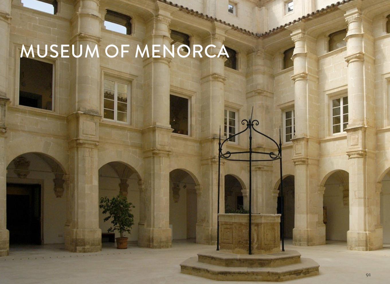
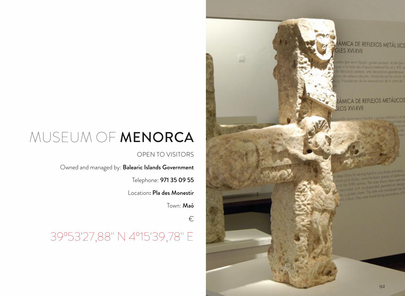
MUSEUM OF MENORCA
92
MUSEUM OF MENORCAOPEN TO VISITORS
Owned and managed by: Balearic Islands Government
Telephone: 971 35 09 55
Location: Pla des Monestir
Town: Maó
€
39º53'27,88'' N 4º15'39,78'' E
93
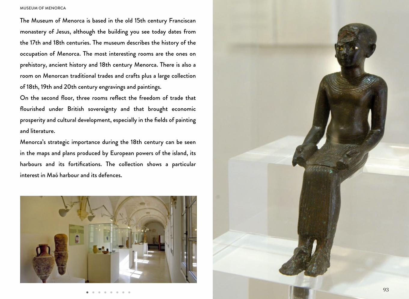
The Museum of Menorca is based in the old 15th century Franciscan monastery of Jesus, although the building you see today dates from the 17th and 18th centuries. The museum describes the history of the occupation of Menorca. The most interesting rooms are the ones on prehistory, ancient history and 18th century Menorca. There is also a room on Menorcan traditional trades and crafts plus a large collection of 18th, 19th and 20th century engravings and paintings.On the second floor, three rooms reflect the freedom of trade that flourished under British sovereignty and that brought economic prosperity and cultural development, especially in the fields of painting and literature. Menorca’s strategic importance during the 18th century can be seen in the maps and plans produced by European powers of the island, its harbours and its fortifications. The collection shows a particular interest in Maó harbour and its defences.
MUSEUM OF MENORCA
94
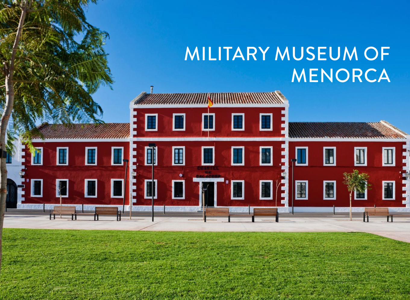
MILITARY MUSEUM OF MENORCA
95
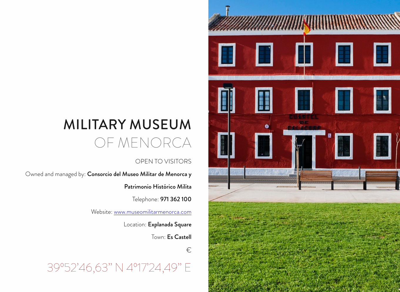
OPEN TO VISITORS
Owned and managed by: Consorcio del Museo Militar de Menorca y
Patrimonio Histórico Milita
Telephone: 971 362 100
Website: www.museomilitarmenorca.com
Location: Explanada Square
Town: Es Castell
€
39º52’46,63’’ N 4º17’24,49’’ E
MILITARY MUSEUM OF MENORCA
96
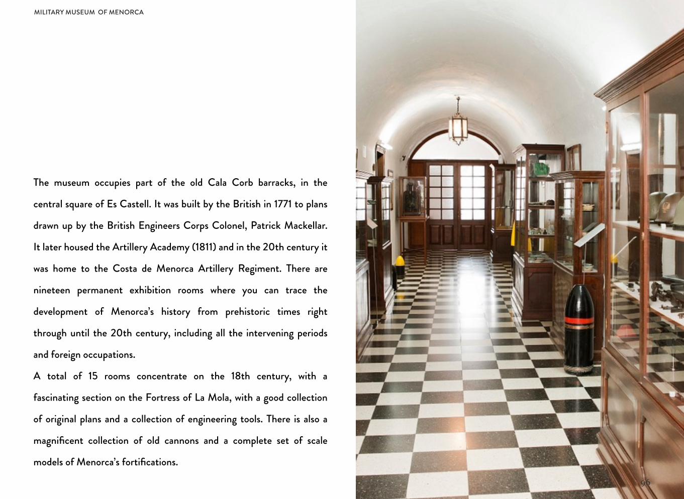
The museum occupies part of the old Cala Corb barracks, in the
central square of Es Castell. It was built by the British in 1771 to plans
drawn up by the British Engineers Corps Colonel, Patrick Mackellar.
It later housed the Artillery Academy (1811) and in the 20th century it
was home to the Costa de Menorca Artillery Regiment. There are
nineteen permanent exhibition rooms where you can trace the
development of Menorca’s history from prehistoric times right
through until the 20th century, including all the intervening periods
and foreign occupations.
A total of 15 rooms concentrate on the 18th century, with a
fascinating section on the Fortress of La Mola, with a good collection
of original plans and a collection of engineering tools. There is also a
magnificent collection of old cannons and a complete set of scale
models of Menorca’s fortifications.
MILITARY MUSEUM OF MENORCA
CHAPTER 5OTHERS
98
CAMÍ D’EN KANE
99
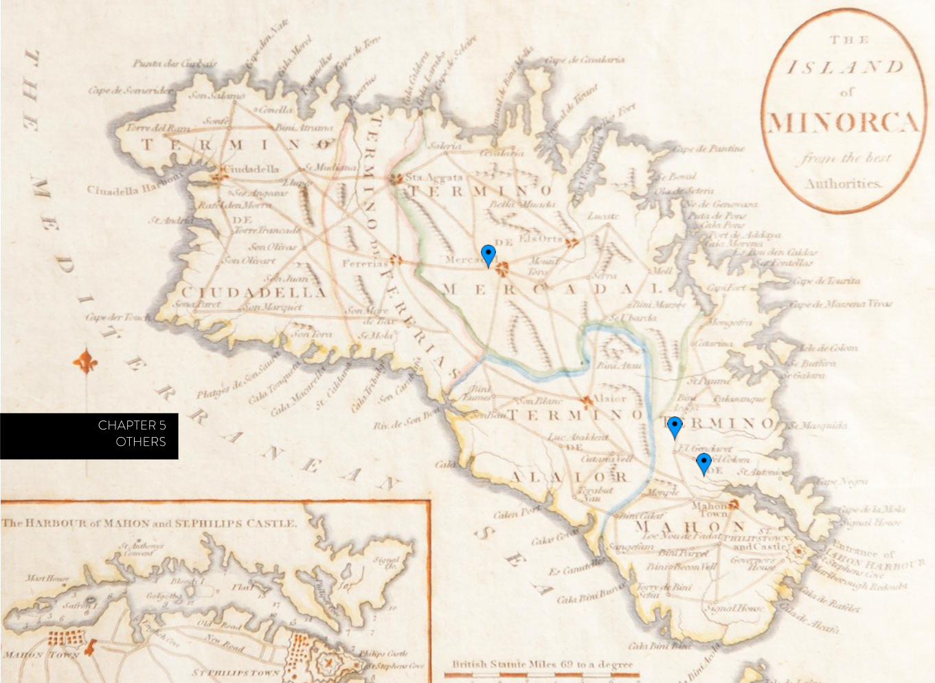
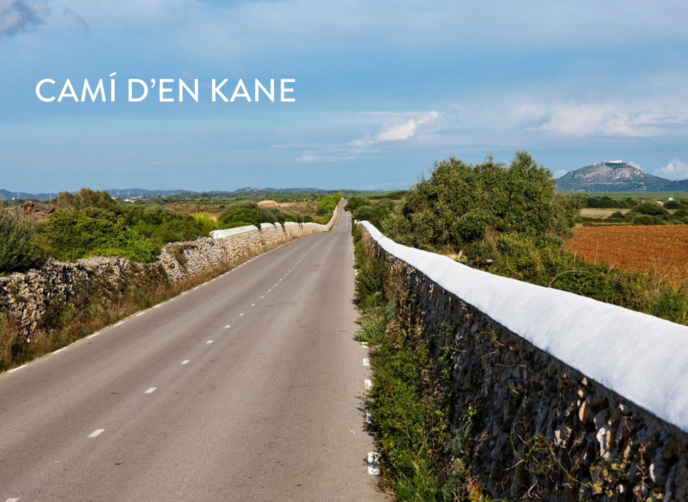
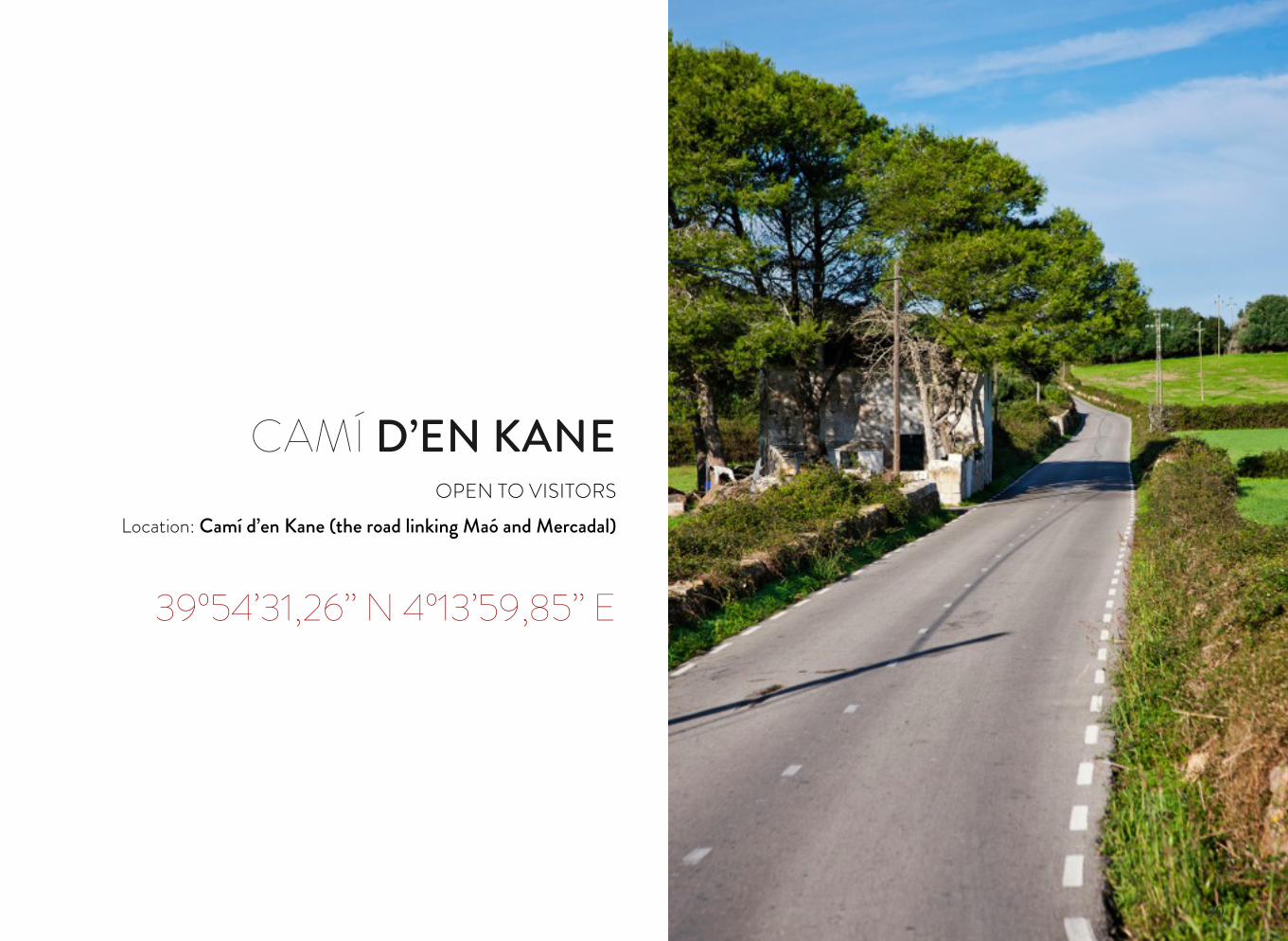
CAMÍ D’EN KANEOPEN TO VISITORS
Location: Camí d’en Kane (the road linking Maó and Mercadal)
39º54’31,26’’ N 4º13’59,85’’ E
100
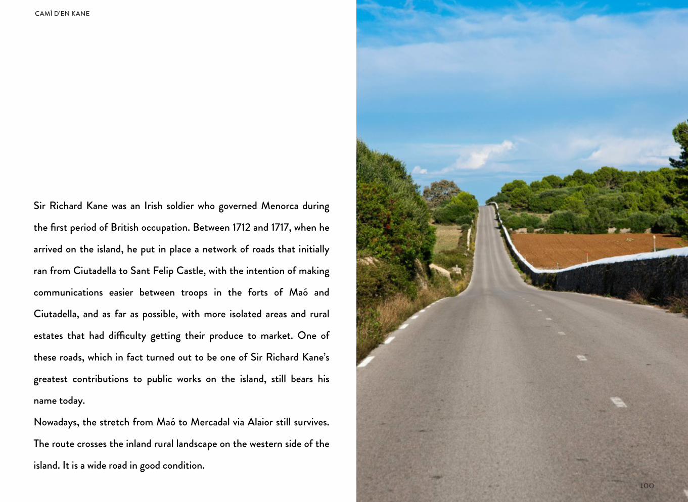
Sir Richard Kane was an Irish soldier who governed Menorca during
the first period of British occupation. Between 1712 and 1717, when he
arrived on the island, he put in place a network of roads that initially
ran from Ciutadella to Sant Felip Castle, with the intention of making
communications easier between troops in the forts of Maó and
Ciutadella, and as far as possible, with more isolated areas and rural
estates that had di"culty getting their produce to market. One of
these roads, which in fact turned out to be one of Sir Richard Kane’s
greatest contributions to public works on the island, still bears his
name today.
Nowadays, the stretch from Maó to Mercadal via Alaior still survives.
The route crosses the inland rural landscape on the western side of the
island. It is a wide road in good condition.
CAMÍ D’EN KANE
101
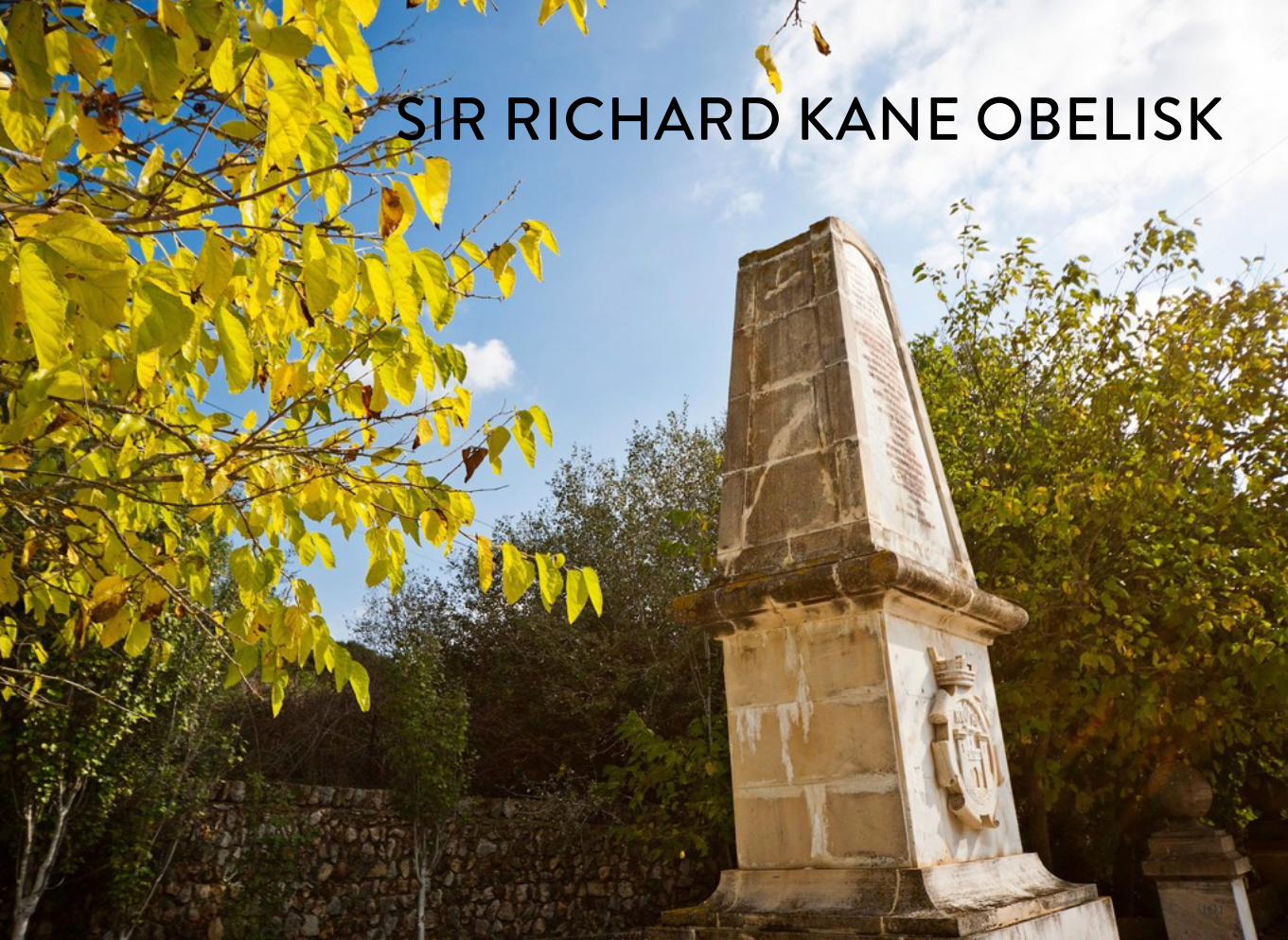
SIR RICHARD KANE OBELISK
102
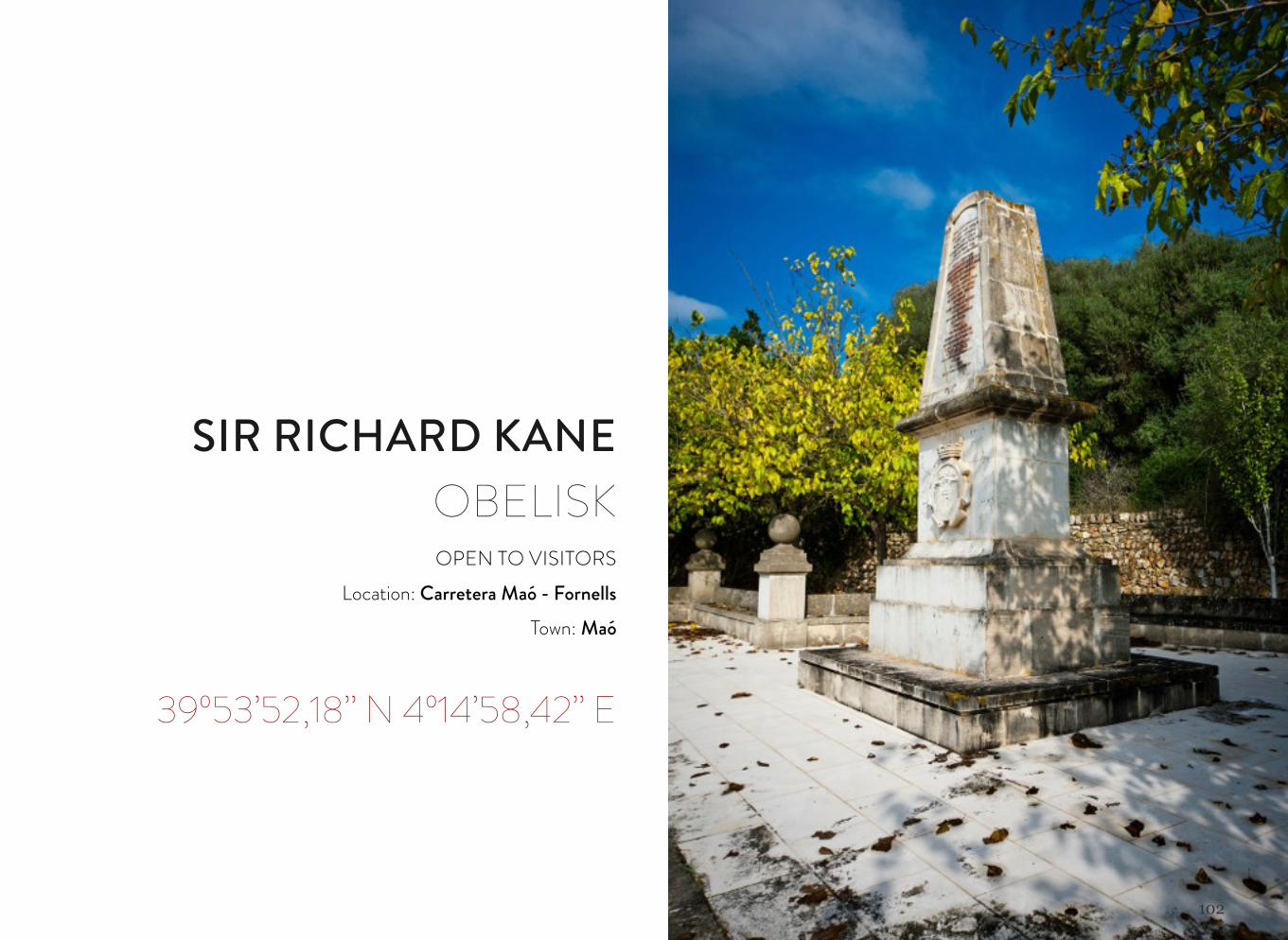
SIR RICHARD KANE OBELISKOPEN TO VISITORS
Location: Carretera Maó - FornellsTown: Maó
39º53’52,18’’ N 4º14’58,42’’ E
103
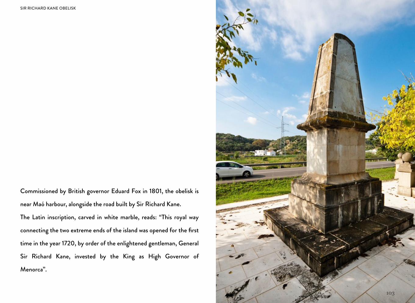
Commissioned by British governor Eduard Fox in 1801, the obelisk is
near Maó harbour, alongside the road built by Sir Richard Kane.
The Latin inscription, carved in white marble, reads: “This royal way
connecting the two extreme ends of the island was opened for the first
time in the year 1720, by order of the enlightened gentleman, General
Sir Richard Kane, invested by the King as High Governor of
Menorca”.
SIR RICHARD KANE OBELISK
104
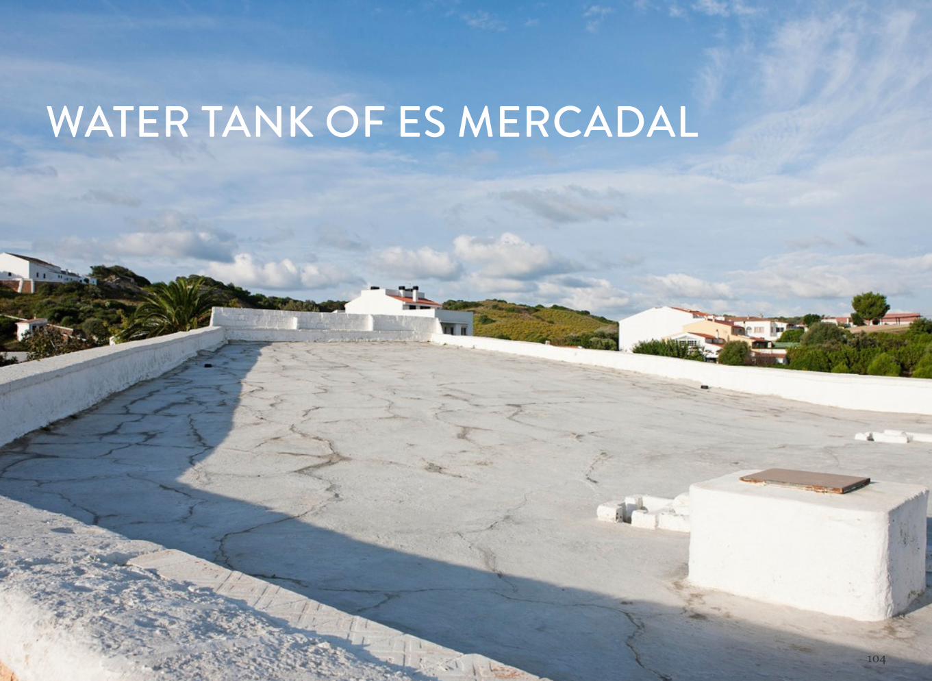
WATER TANK OF ES MERCADAL
105
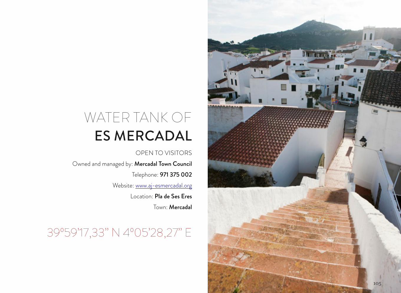
WATER TANK OF ES MERCADAL
OPEN TO VISITORSOwned and managed by: Mercadal Town Council
Telephone: 971 375 002 Website: www.aj-esmercadal.org
Location: Pla de Ses EresTown: Mercadal
39º59’17,33’’ N 4º05’28,27’’ E
106
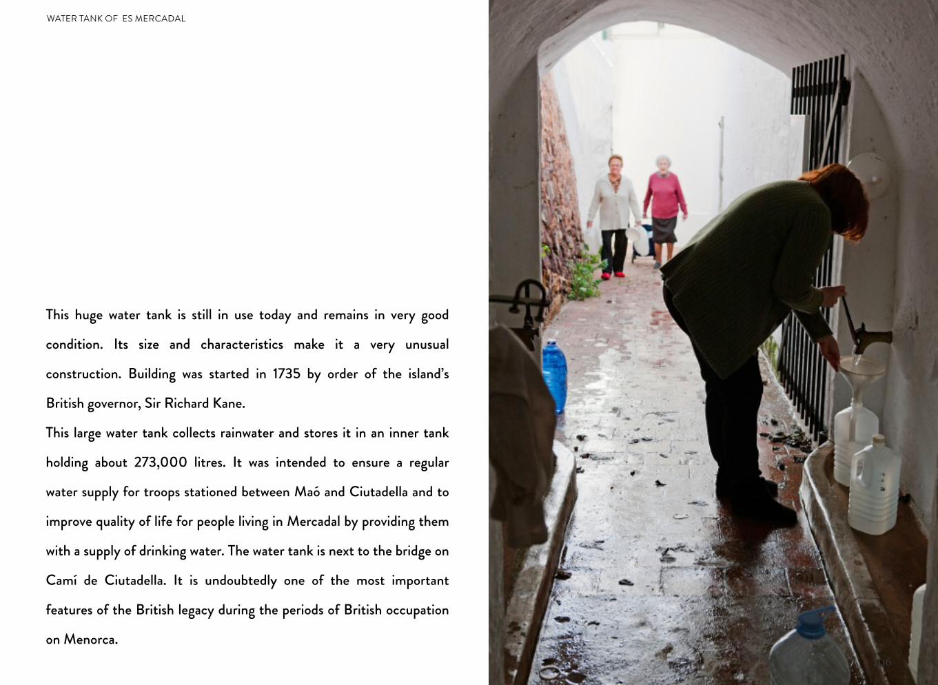
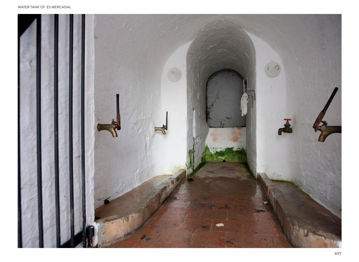
This huge water tank is still in use today and remains in very good
condition. Its size and characteristics make it a very unusual
construction. Building was started in 1735 by order of the island’s
British governor, Sir Richard Kane.
This large water tank collects rainwater and stores it in an inner tank
holding about 273,000 litres. It was intended to ensure a regular
water supply for troops stationed between Maó and Ciutadella and to
improve quality of life for people living in Mercadal by providing them
with a supply of drinking water. The water tank is next to the bridge on
Camí de Ciutadella. It is undoubtedly one of the most important
features of the British legacy during the periods of British occupation
on Menorca.
WATER TANK OF ES MERCADAL
107
WATER TANK OF ES MERCADAL

108
This book may not be copied either totally or partially by any method whatsoever, including reprographics and computing procedures, without permission from the copyright holders. All rights reserved in all countries.
British Menorca ohDigital © 2013www.ohdigital.cat