Brett Elliot Yukon Geological Survey Esri Whitehorse User ... Elliot... · How to make better web...
55
How to make better web maps Brett Elliot Yukon Geological Survey Esri Whitehorse User Conference 2018
Transcript of Brett Elliot Yukon Geological Survey Esri Whitehorse User ... Elliot... · How to make better web...

How to make better web maps
Brett ElliotYukon Geological Survey
Esri Whitehorse User Conference 2018
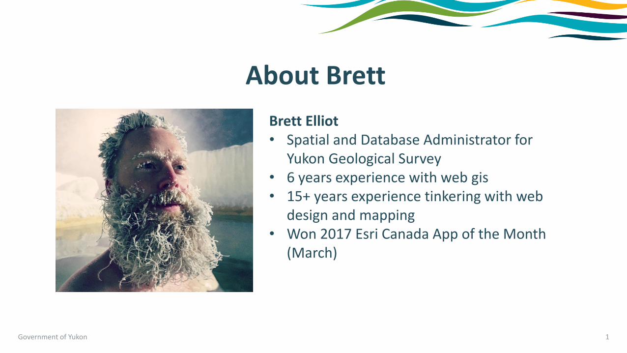
About Brett
Government of Yukon 1
Brett Elliot• Spatial and Database Administrator for
Yukon Geological Survey• 6 years experience with web gis• 15+ years experience tinkering with web
design and mapping• Won 2017 Esri Canada App of the Month
(March)

Overview
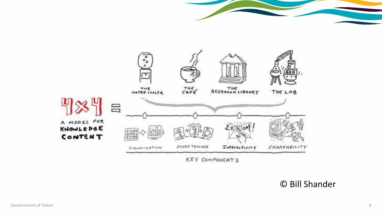
• The 4x4 model for knowledge content
• Cartography and design Considerations
• How to improve performance
• Case study / demo
Government of Yukon 2

Key components to a better web map
Government of Yukon 3
•Meaningful content
•Good performance
• Intuitive design
Government of Yukon 4
© Bill Shander

Government of Yukon 5
AudienceGet the right
people to the right information
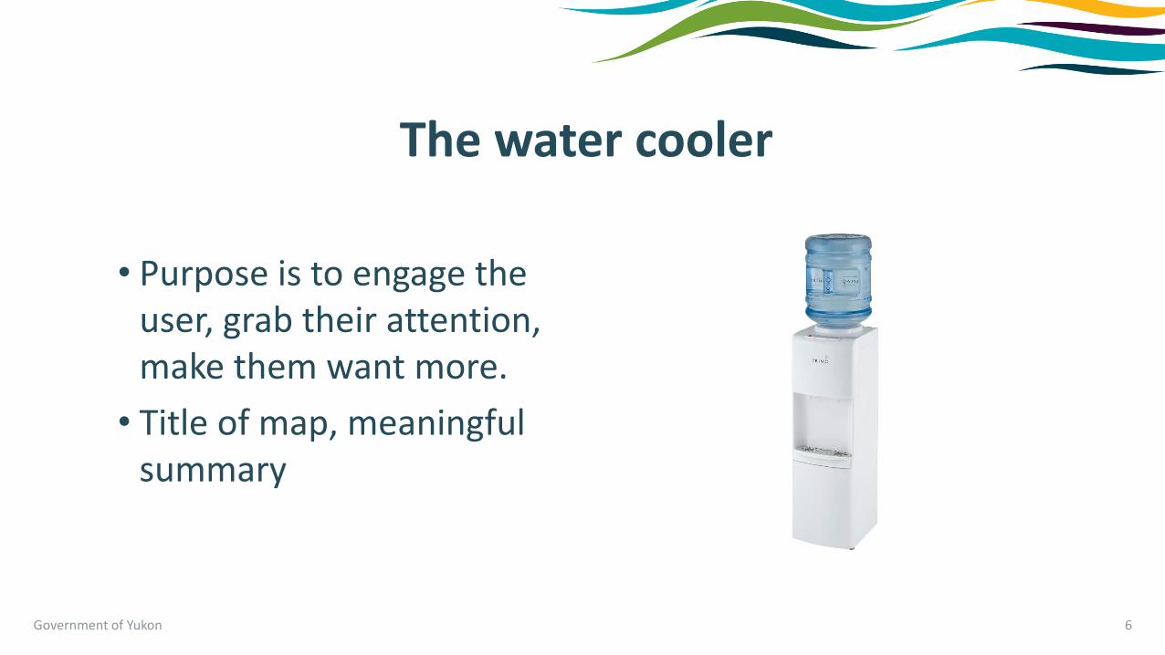
The water cooler
• Purpose is to engage the user, grab their attention, make them want more.
• Title of map, meaningful summary
Government of Yukon 6

The café
• Delve into a subject at some length, but isn’t deep study.
• Blog post / article, 3 minute video
• Longer form, produced content
• A basic web map
Government of Yukon 7

The research library
• You go here to really learn about a topic. Users have self-selected as interested on the topic.
• More scholarly, long form content
• A focused web app
Government of Yukon 8

The lab
• Give users access to the data to analyze and research.
• Twist and turn knobs to make it about them and their interests
• Web / Desktop GIS Application
Government of Yukon 9

Government of Yukon 10
ComponentsIncrease understanding,engagement,retention,sharing

Visualization
• Consider a bar chart compared to a table of data
• Geographic context
Government of Yukon 11
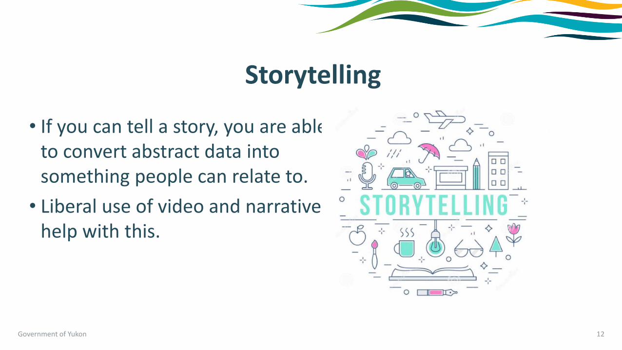
Storytelling
• If you can tell a story, you are able to convert abstract data into something people can relate to.
• Liberal use of video and narrative help with this.
Government of Yukon 12
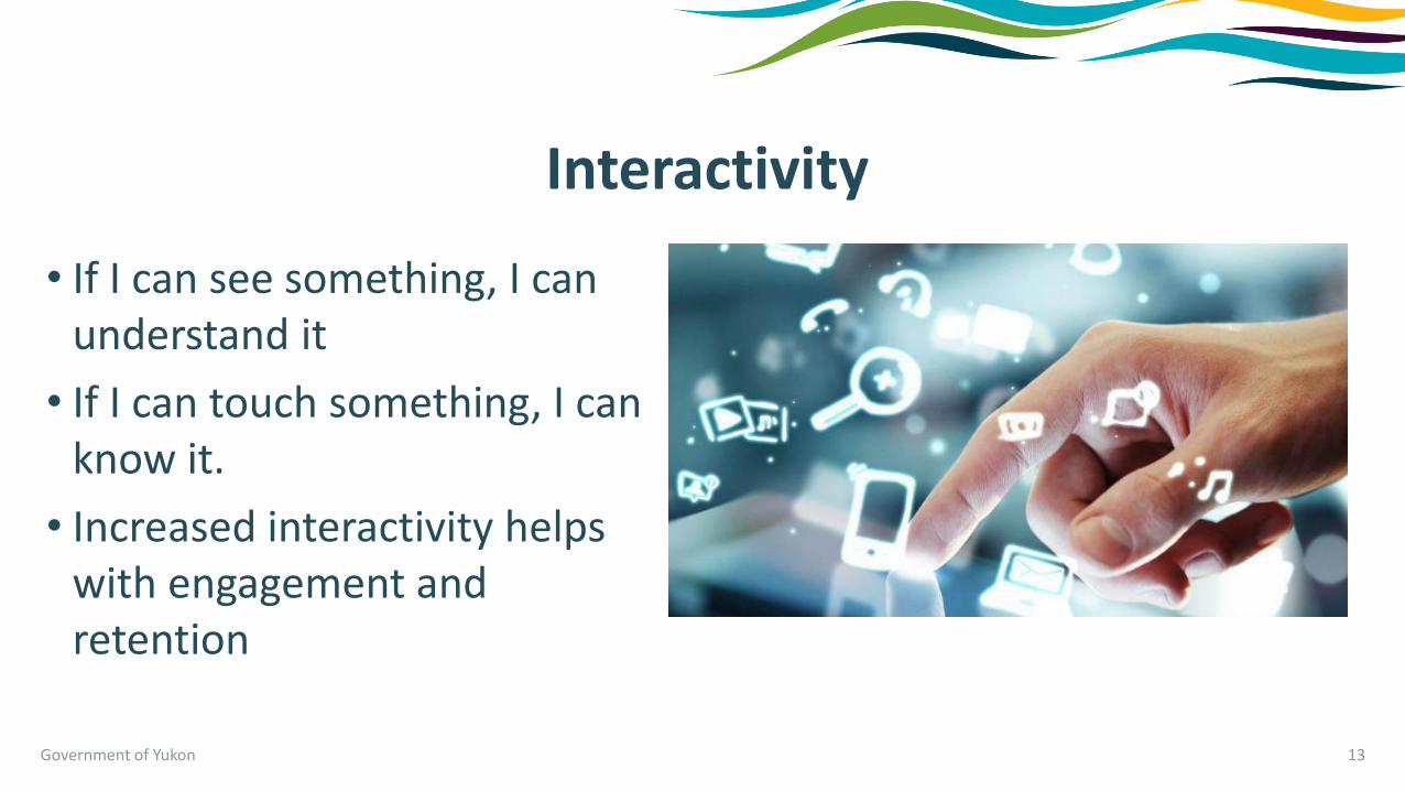
Interactivity
• If I can see something, I can understand it
• If I can touch something, I can know it.
• Increased interactivity helps with engagement and retention
Government of Yukon 13

Shareability
• How easy is it to find
• Have basic sharing tools
• Tweet, like, share to facebooketc.
• Increase your audience
Government of Yukon 14

What does this mean for web maps?
•Consider your audience
•Use the right tool for the job
•Provide levels of information based on interest
•Have the data available for download and remix
Government of Yukon 15

Cartography and design considerations
Government of Yukon 16

Government of Yukon 17
Map from Peel Watershed Planning Commission

Government of Yukon 18
Map from National Geographic article

Less is more
(attractive)
(impactful)
(effective)
Government of Yukon 19

Design for web and mobile
• First impressions matter
• Cartography = User Experience
• Use strong size and colors
• Meaningful data representation
• Use simple, uncluttered designs.
Government of Yukon 20
Pictured: Brett’s Mom

Web maps vs PDF
Government of Yukon 21
•digital vs print
•Most of us come from designing in a “print” background
•Web and mobile is a new medium
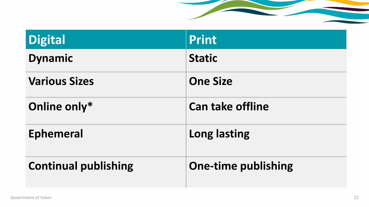
Government of Yukon 22
Digital Print
Dynamic Static
Various Sizes One Size
Online only* Can take offline
Ephemeral Long lasting
Continual publishing One-time publishing

Dynamic vs static
• Web maps are interactive. Can allow for much more information to be displayed, but users need to interact with it.
• Studies show most people don’t explore interactive maps.
• Use scale based visibility to turn layers and labels on and off to not clutter the map
Government of Yukon 23

Design web maps to work on small screens
• People expect to tap to interact
• Limit the default layers that are turned on
Government of Yukon 24

Think about accessibility
Government of Yukon 25

Digital resource lifespan
Government of Yukon 26

Government of Yukon 27
How many people have seen this?

Basemaps
• Provide geographic context
• Should be exhaustive, comprehensive, and complete
• Multiple styles – transportation, topographic, terrain, imagery
Government of Yukon 28

Basemaps
• Take a lot of time and skill to produce
• Should be extremely performant – under 200ms response time, small tile size (20-50kb).
• Exponential data storage
Government of Yukon 29

But web mercator sucks!
• The earth isn’t flat!
• Geometry engine built in takes into account curved surface of earth
• It’s the de-facto world standard
Government of Yukon 30
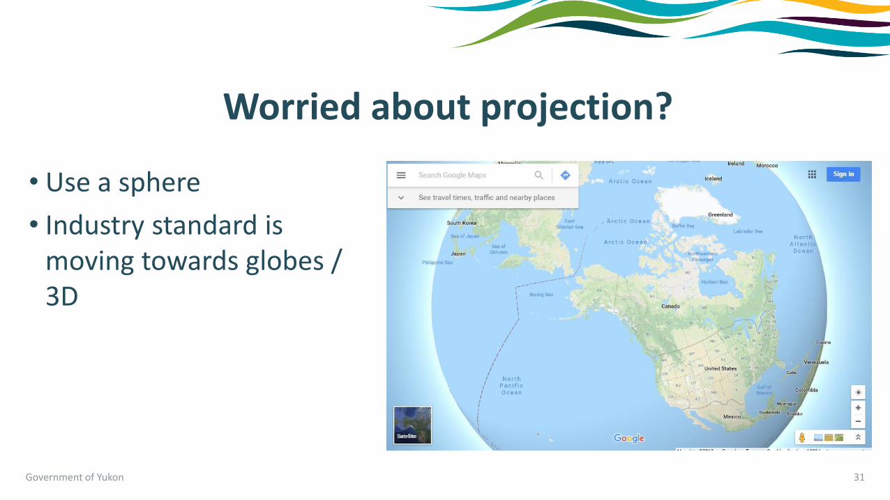
Worried about projection?
Government of Yukon 31
• Use a sphere
• Industry standard is moving towards globes / 3D

How to improve performance
Government of Yukon 32

Government of Yukon 33
Yukon has the slowest internet in Canada
Canadian Internet Registration Authority (CIRA) 2016

Web performance metrics
Government of Yukon 34
• What are recommended page load times?
• What’s the typical size of a webpage you should aim to be under?
• How do I measure and improve these?

Web Performance Metrics
Government of Yukon 35
•Fast as possible
•Smallest file size as possible
•Using your web browsers developer tools

Chrome Developer Tools
Government of Yukon 36
• “Lightweight” ArcGIS Online App
•154 requests
•10.51s
•6.0MB

Chrome Developer Tools
Government of Yukon 37
•Heavier Web GIS App
•473 requests
•1.0 min
•15.5 MB

Tools to increase performance
• Keep it simple
• Use caching
• Leverage cloud services
• Monitor and make changes to improve performance
• Performance impacts the user at every pan, click, and query
Government of Yukon 38

Let’s test what we’ve learned.
• Campgrounds and Recreation Sites
• Data provided by Environment Yukon
Government of Yukon 39

Government of Yukon 40

Source data
Government of Yukon 41

Uploaded to ArcGIS Online
Government of Yukon 42

Use simple design
Government of Yukon 43

Label sparingly using scale dependencies
Government of Yukon 44

Create meaningful content
Government of Yukon 45

Leverage interactivity
Government of Yukon 46
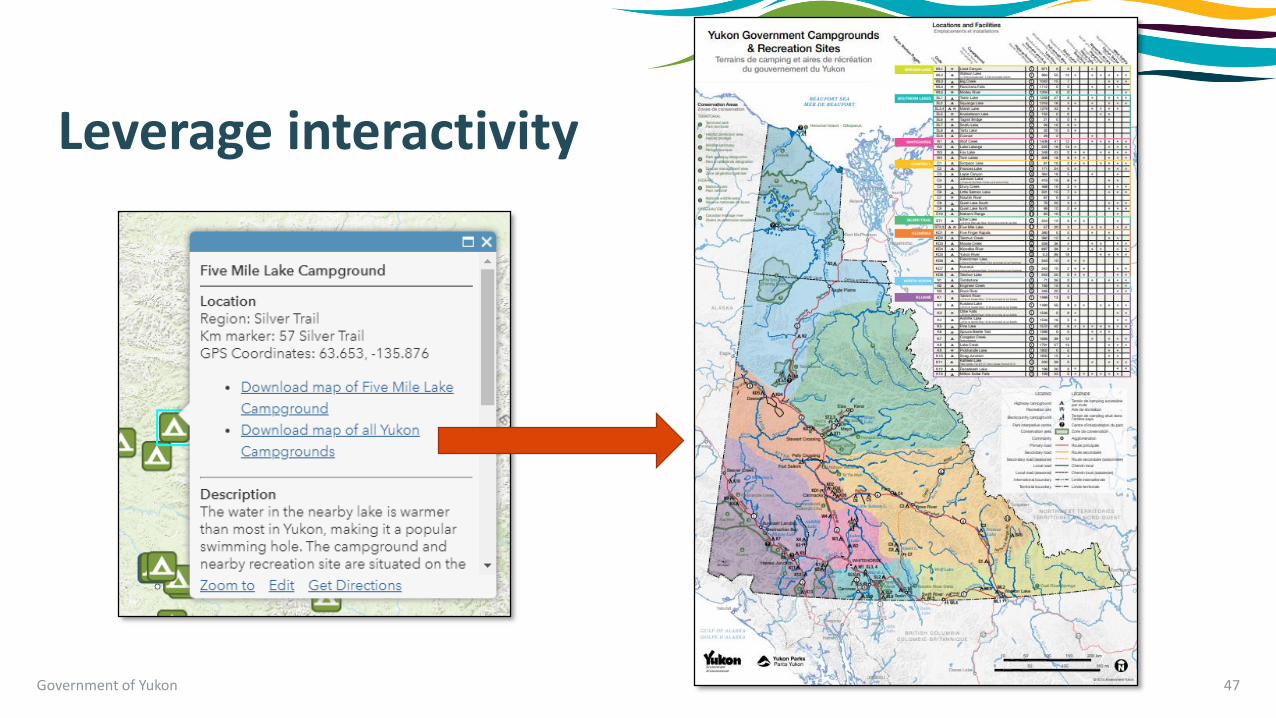
Government of Yukon 47
Leverage interactivity

Government of Yukon 48
Allow users to dive deeper

Embed in relevant locations
Government of Yukon 50

Continue to update and make revisions as required
Government of Yukon 51
• Reduce number of locations that you need to update data
• Ensure consistency across all mediums

Questions?
Government of Yukon 53

Further Reading
4x4 Model for Knowledge Content
https://medium.com/@billshander/4x4-model-for-knowledge-content-575cc7f24601
https://www.lynda.com/Design-Infographics-tutorials/Data-Visualization-Fundamentals/153776-2.html
Designing Great Maps for Web and Mobile
http://proceedings.esri.com/library/userconf/proc17/tech-workshops/tw_529-190.pdf
Do’s and Don'ts of web map design
https://www.gislounge.com/dos-and-donts-of-web-map-design/
6 Easy ways to improve your maps
https://www.esri.com/arcgis-blog/products/arcgis-online/mapping/6-easy-ways-to-improve-your-maps/
Intelligent maps checklist
https://www.esri.com/arcgis-blog/products/arcgis-online/mapping/intelligent-maps-checklist-web-maps/
Digital Resource Lifespan
https://www.explainxkcd.com/wiki/index.php/1909:_Digital_Resource_Lifespan
Google Chrome Developer Tools
https://developers.google.com/web/tools/chrome-devtools/network-performance/
Government of Yukon 54