BRANSCOMBE POSTCARDS 1900 – 1950
18
25 The road to Street (in the distance) shows extensive allotments on the south side of Culverwell Hill – the scene of a murder in 1883 (see The Shooting at Branscombe Old Pits by Barbara Farquharson and John Torrance. The Branscombe Project 2009). 26 Blue Ball cottages and the new Methodist chapel (1900). There was a shop at Blue Ball from 1875 until 1927. Street
Transcript of BRANSCOMBE POSTCARDS 1900 – 1950

25
The road to Street (in the distance) shows extensive allotments on the south side of Culverwell Hill – the scene of a murder in 1883 (see The Shooting at Branscombe Old Pits by Barbara Farquharson and John Torrance. The Branscombe Project 2009).
26
Blue Ball cottages and the new Methodist chapel (1900). There was a shop at Blue Ball from 1875 until 1927.
Street
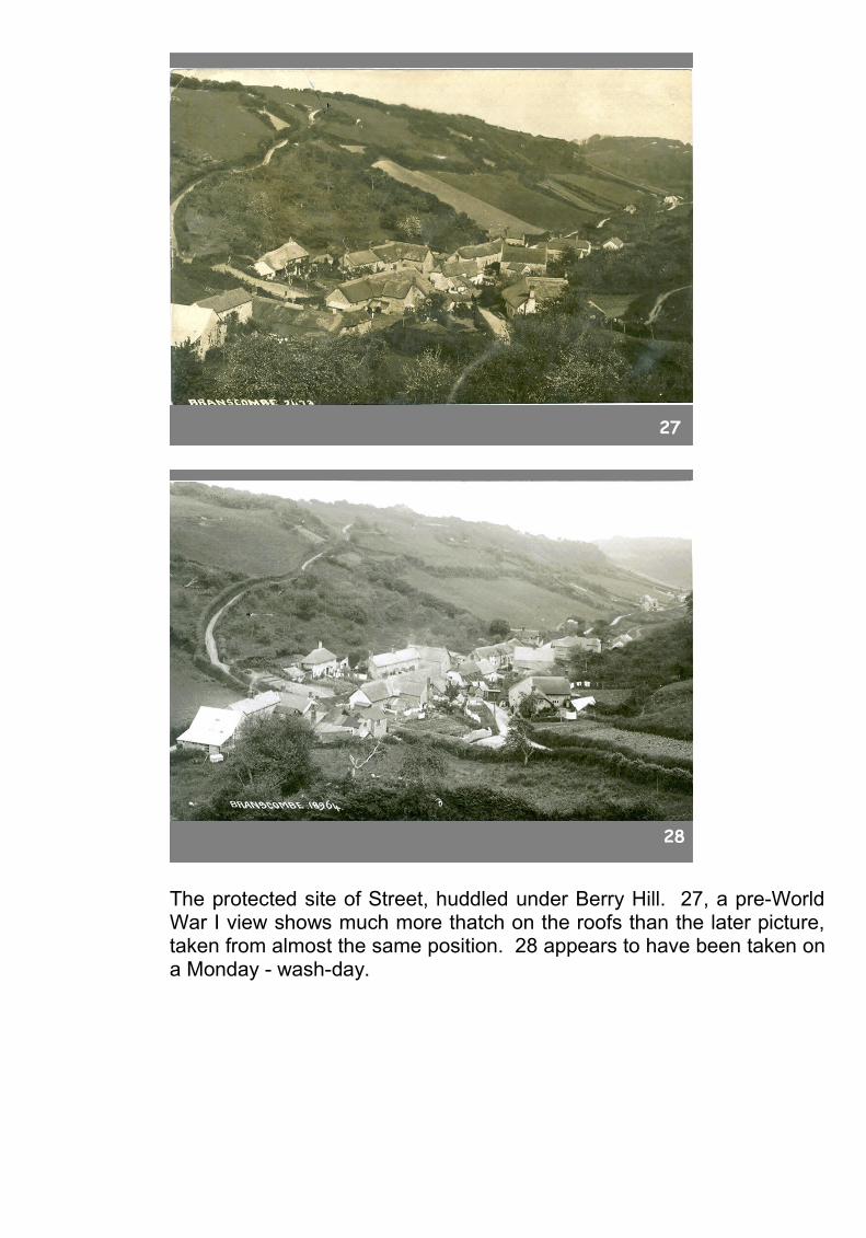
27
28
The protected site of Street, huddled under Berry Hill. 27, a pre-World War I view shows much more thatch on the roofs than the later picture, taken from almost the same position. 28 appears to have been taken on a Monday - wash-day.
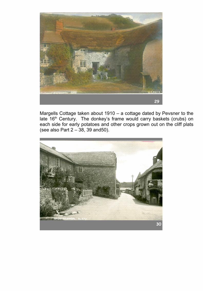
29
Margells Cottage taken about 1910 – a cottage dated by Pevsner to the late 16th Century. The donkey’s frame would carry baskets (crubs) on each side for early potatoes and other crops grown out on the cliff plats (see also Part 2 – 38, 39 and50).
30

31
One of Street’s two shutes for drinking water – transported in buckets. The first looks south towards Margells, the second north towards the Fountain Head.
31a

32
33
Three views of Beehive cottage, across the road from Margells, 31a and 32 are early views, 33 has a 1920s car (TT 6814 – a local number) parked outside.
34
35a

35
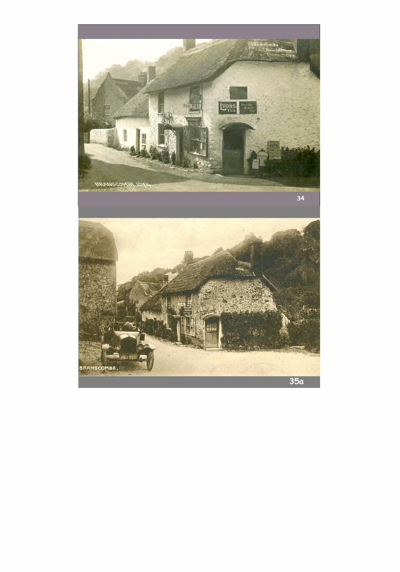
On the corner opposite Beehive Cottage, and across the road from Margells, was Susan Gill’s shop. Comparison of these three cards show that as time went on there was some refurbishment. In the first two cards, pre 1920, the Tea sign is up, but the wall are unrendered. In the third (35), the shop has a posh new display case, a new door, some new thatch and smartened up walls. The Gills were carpenters and they designed and made the model soldiers on the chimney top. The boards by the shop door (34) signify that this was indeed the centre of the universe. The board on the left advertises a monthly meeting of Branscombe Women’s Institute. Beer Women’s Institute Garden Party, sale of work and fete are listed on the central board. On the right we learn about a fete and sale of work at Seaton Congregational Church on Thursday July 1st – but which year? July 1st fell on a Thursday in 1897, 1909, 1915, 1920 and 1929 – showing the problem of dating some postcards. That board also lists a concert, sports and a baby show in Seaton – quite a lot going on in the area at that time.

36
Hub of the Street settlement: the Fountain Head Pub. The sign over the door reads ‘Thomas Gill, Retailer of Ales, Spirits and Tobacco’. At this time, Street had a forge and a blacksmith alongside the pub.
PART TWO – THE CLIFFS, AND BRANSCOMBE MOUTH TO SQUARE
The cliffs
37
Looking towards Sidmouth from Littlecombe Shoot. These impressive cliffs west of Branscombe Mouth reveal the key features of the rock

types underlying the whole parish. Chapman’s photographer has made a long haul across the pebbles for this shot which shows the two main rock formations. New red sandstones and marls form the lower portion of the cliff face. The new red rocks are capped by more recently deposited upper greensand beds which are porous. A spring line divides the two rock types. The gradient on the sandstones and marls is steep, but the photograph shows that the greensand capping towards the top of the cliff has a steeper face.
Over the centuries these features have played a significant part in the evolution of settlement and land use in Branscombe and, of course, the scenery depicted on other postcards. Farms, grazing land and settlements were established on the well-watered land below the spring line. At key points in the village the springs were piped into outlets called shutes for public water supplies. Above the spring line the soils on the porous greensand are drier and poorer. Up there farming is more difficult and the steep slopes are often covered with trees and scrubby vegetation.
38
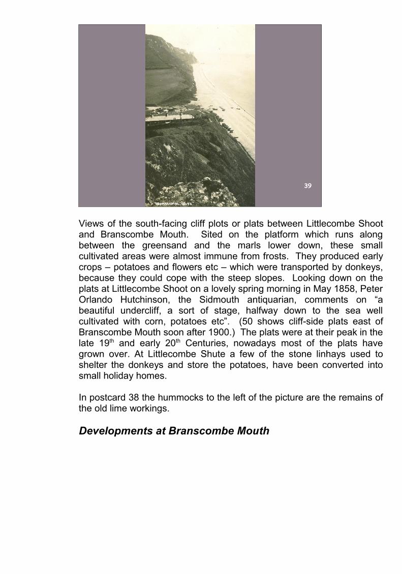
39
Views of the south-facing cliff plots or plats between Littlecombe Shoot and Branscombe Mouth. Sited on the platform which runs along between the greensand and the marls lower down, these small cultivated areas were almost immune from frosts. They produced early crops – potatoes and flowers etc – which were transported by donkeys, because they could cope with the steep slopes. Looking down on the plats at Littlecombe Shoot on a lovely spring morning in May 1858, Peter Orlando Hutchinson, the Sidmouth antiquarian, comments on “a beautiful undercliff, a sort of stage, halfway down to the sea well cultivated with corn, potatoes etc”. (50 shows cliff-side plats east of Branscombe Mouth soon after 1900.) The plats were at their peak in the late 19th and early 20th Centuries, nowadays most of the plats have grown over. At Littlecombe Shute a few of the stone linhays used to shelter the donkeys and store the potatoes, have been converted into small holiday homes.
In postcard 38 the hummocks to the left of the picture are the remains of the old lime workings.
Developments at Branscombe Mouth

40
41
The Look Out was constructed in the early part of the 19th Century as a coastguard station in response to the smuggling operations that flourished along this stretch of coast in the period from 1770 – 1830. 41 shows the Look Out from the west in the early 1920s. Seaside Farm is on the left. The land between the farm building and the cliff edge later became a major camping ground (see 45 and 46).

42
The Look Out and the old stone-walled coalyard about 1910. The yard had been used to store imported coal for the local lime industry. In the late 1920s it was transformed by Clem Ford and his wife into the Sea Shanty beach café. This turned out to be a key decision for the future of holidaymaking in Branscombe.
43
An early advert for the Sea Shanty emphasising its distinctive appearance and attractions for visitors – the tea rooms and rock gardens.
44
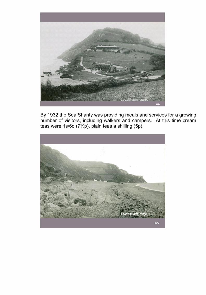
By 1932 the Sea Shanty was providing meals and services for a growing number of visitors, including walkers and campers. At this time cream teas were 1s/6d (7½p), plain teas a shilling (5p).
45

46
47
Camping holidays became popular – on the field beside Seaside Farm and on the beach.
48
49
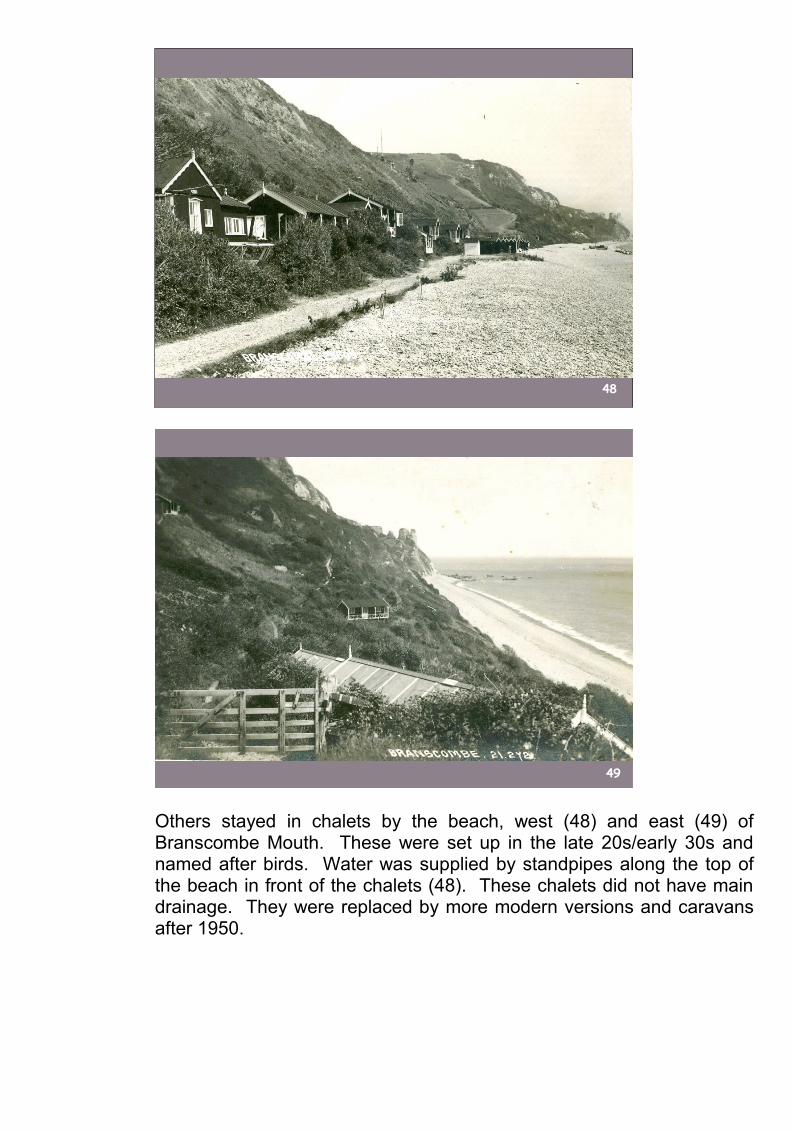
Others stayed in chalets by the beach, west (48) and east (49) of Branscombe Mouth. These were set up in the late 20s/early 30s and named after birds. Water was supplied by standpipes along the top of the beach in front of the chalets (48). These chalets did not have main drainage. They were replaced by more modern versions and caravans after 1950.
50
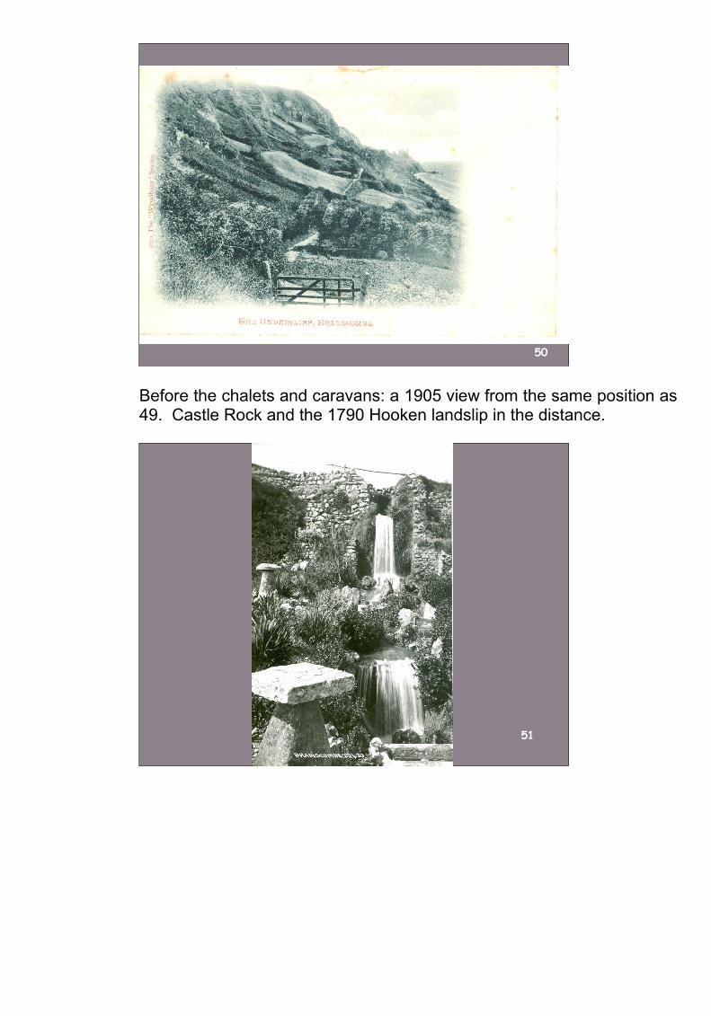
Before the chalets and caravans: a 1905 view from the same position as 49. Castle Rock and the 1790 Hooken landslip in the distance.
51

52
53
Some interwar diversions for visitors. Just round the corner from the Sea shanty, the waterfall (51), surrounded by exotic plants and ornaments and created by Clem Ford using a water-powered electric generator, was always an attraction.
54
55
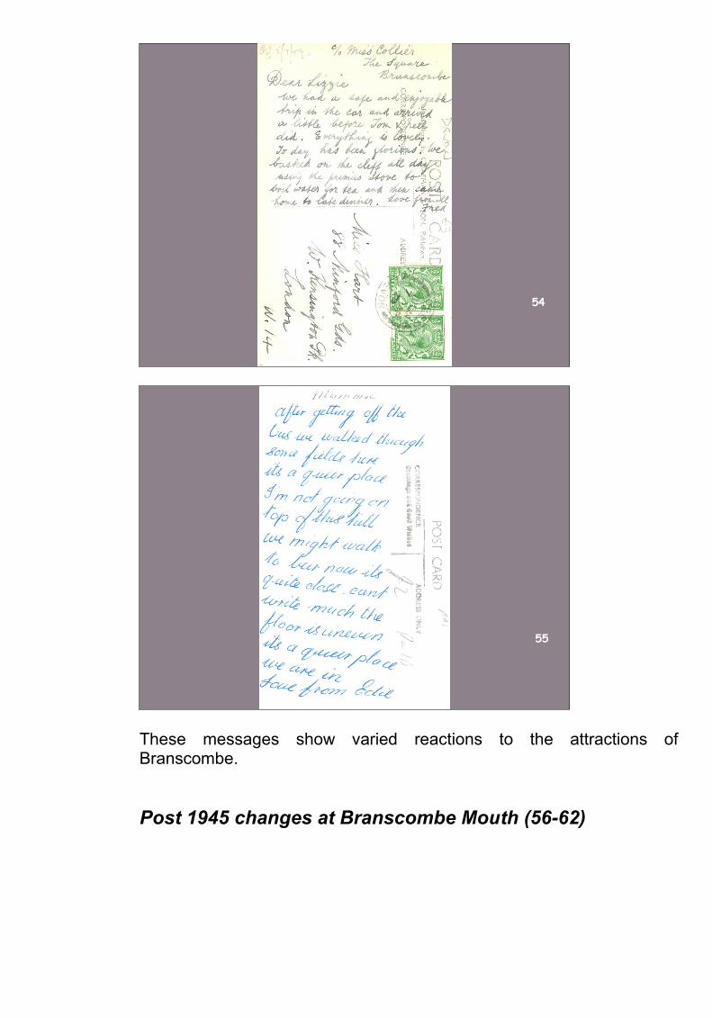
These messages show varied reactions to the attractions of Branscombe.
Post 1945 changes at Branscombe Mouth (56-62)