Tools for National MDG monitoring in India H. Borah DIRECTOR, CSO,INDIA.

Neogene active faults in eastern Idaho, traced from USGS compilation.Slide by Paul K. Linkhttp://geology.isu.edu/nsf-isugeol
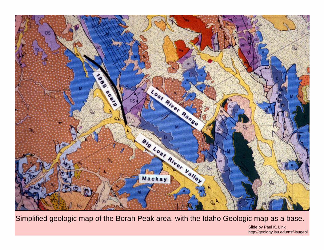
Simplified geologic map of the Borah Peak area, with the Idaho Geologic map as a base. Slide by Paul K. Linkhttp://geology.isu.edu/nsf-isugeol
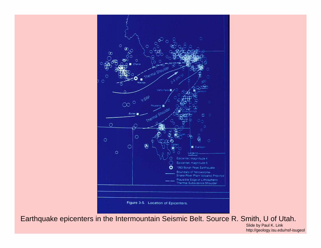
Earthquake epicenters in the Intermountain Seismic Belt. Source R. Smith, U of Utah.Slide by Paul K. Linkhttp://geology.isu.edu/nsf-isugeol
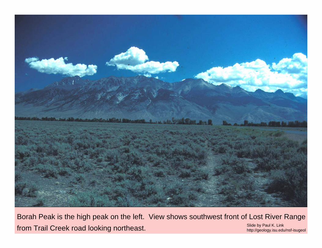
Borah Peak is the high peak on the left. View shows southwest front of Lost River Rangefrom Trail Creek road looking northeast. Slide by Paul K. Link
http://geology.isu.edu/nsf-isugeol
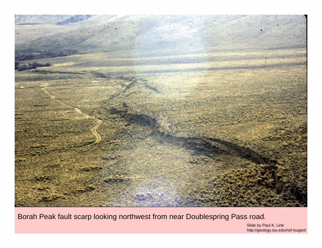
Borah Peak fault scarp looking northwest from near Doublespring Pass road.Slide by Paul K. Linkhttp://geology.isu.edu/nsf-isugeol
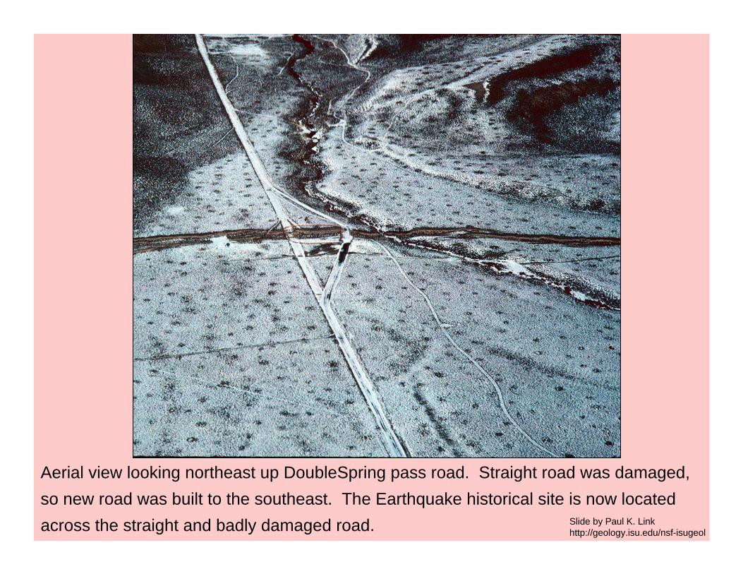
Aerial view looking northeast up DoubleSpring pass road. Straight road was damaged, so new road was built to the southeast. The Earthquake historical site is now located across the straight and badly damaged road. Slide by Paul K. Link
http://geology.isu.edu/nsf-isugeol
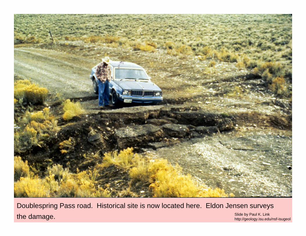
Doublespring Pass road. Historical site is now located here. Eldon Jensen surveys the damage. Slide by Paul K. Link
http://geology.isu.edu/nsf-isugeol

Fault scarp from Borah peak earthquake. Scarp runs across the photo. Roadway with white truck runs up the gully. Slide by Paul K. Link
http://geology.isu.edu/nsf-isugeol
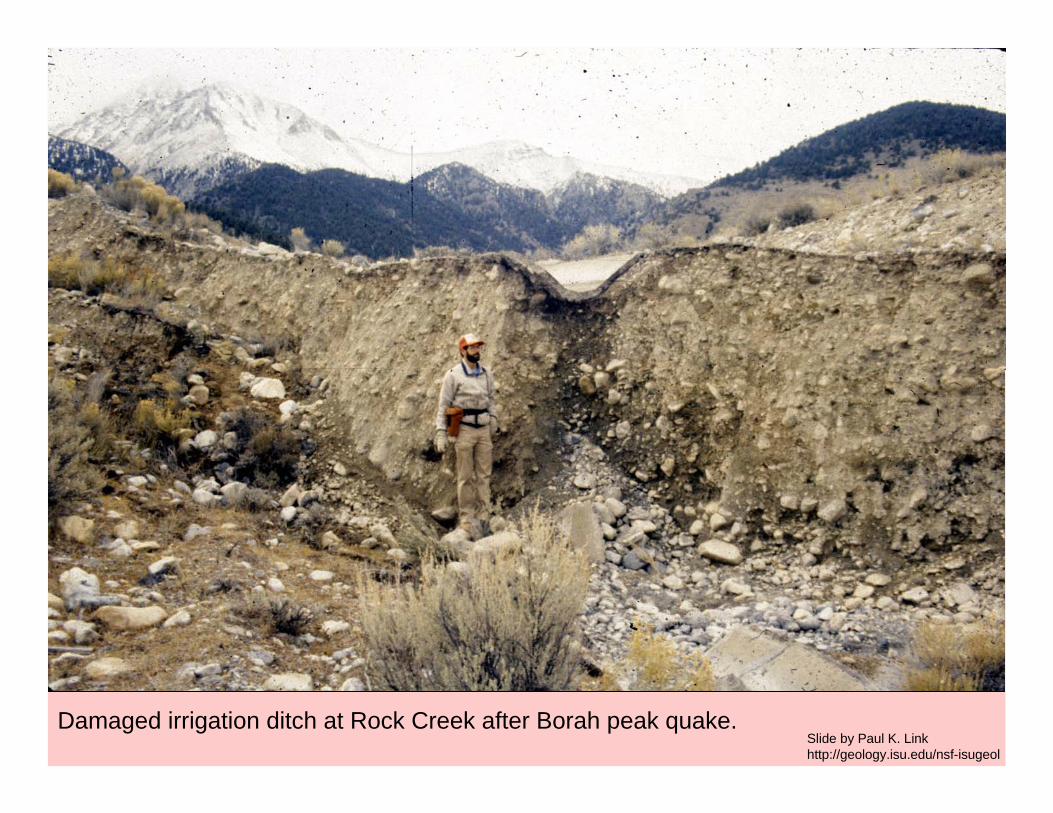
Damaged irrigation ditch at Rock Creek after Borah peak quake.Slide by Paul K. Linkhttp://geology.isu.edu/nsf-isugeol
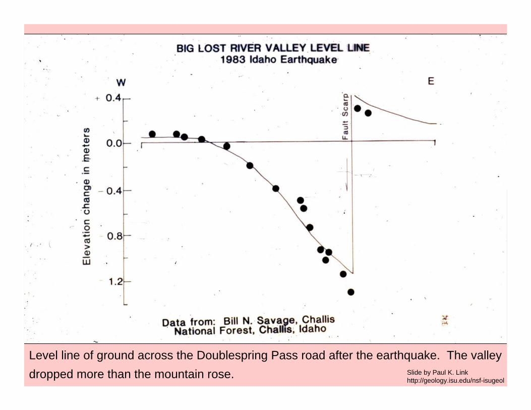
Level line of ground across the Doublespring Pass road after the earthquake. The valleydropped more than the mountain rose. Slide by Paul K. Link
http://geology.isu.edu/nsf-isugeol
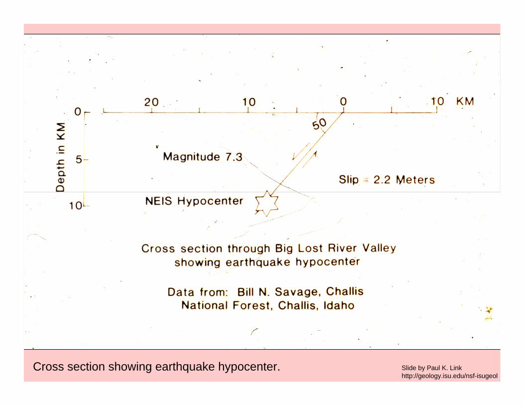
Cross section showing earthquake hypocenter. Slide by Paul K. Linkhttp://geology.isu.edu/nsf-isugeol
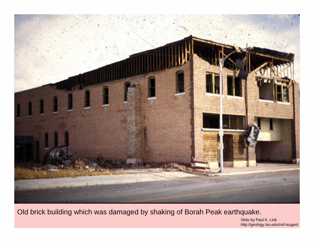
Old brick building which was damaged by shaking of Borah Peak earthquake. Slide by Paul K. Linkhttp://geology.isu.edu/nsf-isugeol
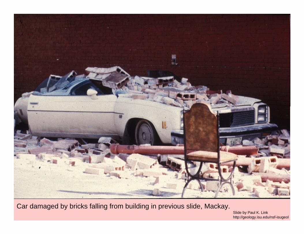
Car damaged by bricks falling from building in previous slide, Mackay.Slide by Paul K. Linkhttp://geology.isu.edu/nsf-isugeol
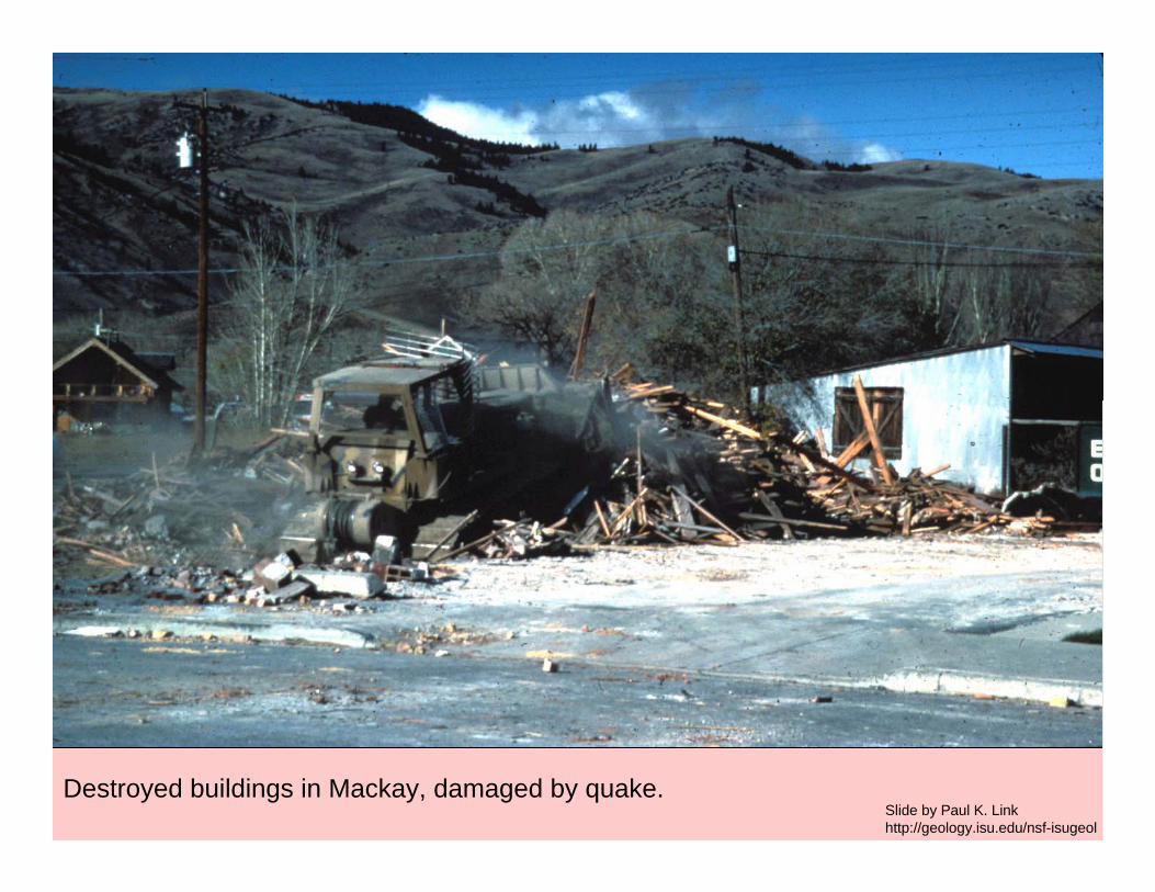
Destroyed buildings in Mackay, damaged by quake. Slide by Paul K. Linkhttp://geology.isu.edu/nsf-isugeol
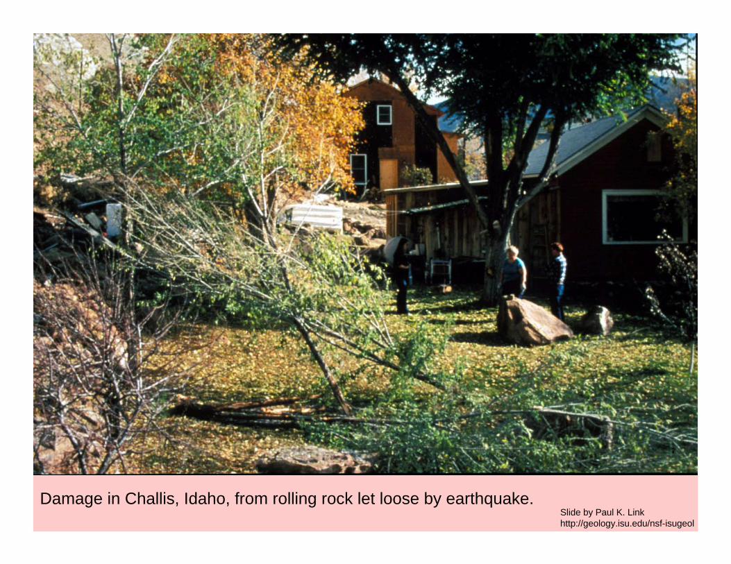
Damage in Challis, Idaho, from rolling rock let loose by earthquake.Slide by Paul K. Linkhttp://geology.isu.edu/nsf-isugeol
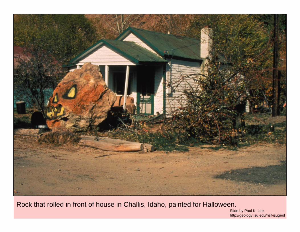
Rock that rolled in front of house in Challis, Idaho, painted for Halloween. Slide by Paul K. Linkhttp://geology.isu.edu/nsf-isugeol
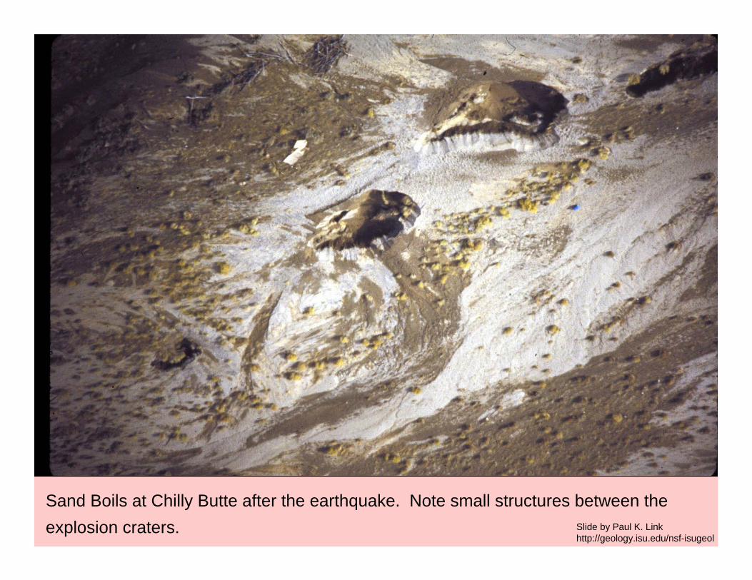
Sand Boils at Chilly Butte after the earthquake. Note small structures between the explosion craters. Slide by Paul K. Link
http://geology.isu.edu/nsf-isugeol
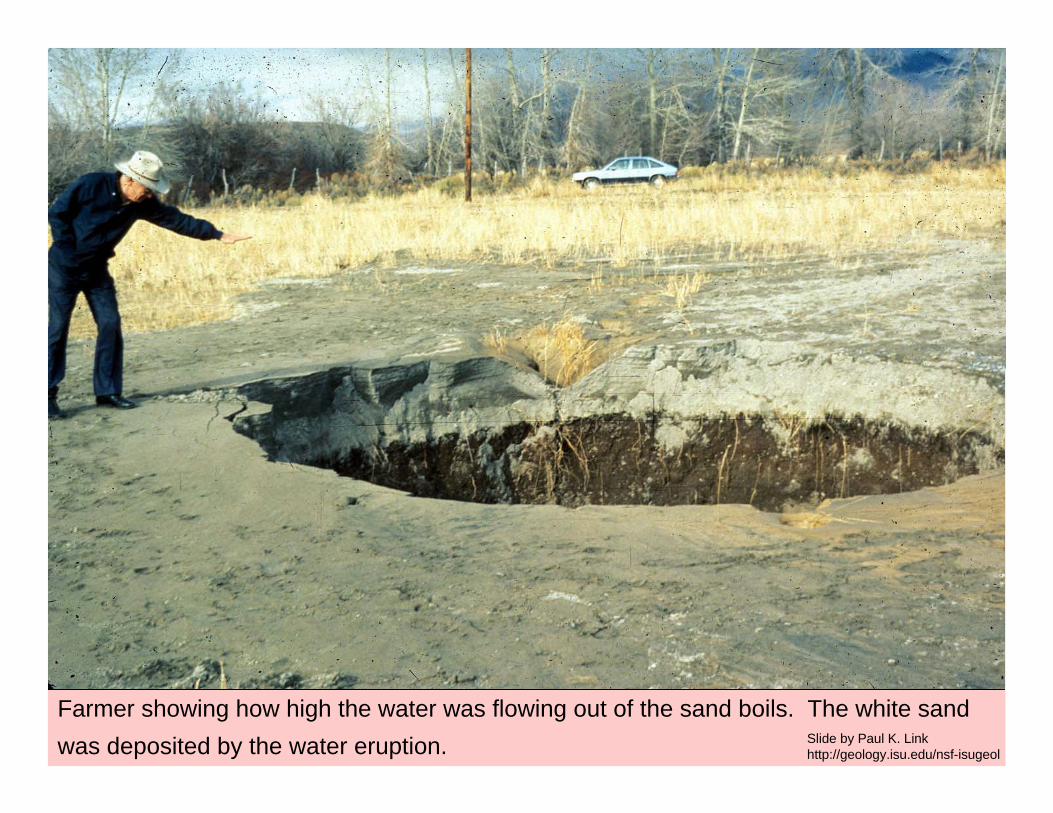
Farmer showing how high the water was flowing out of the sand boils. The white sand was deposited by the water eruption. Slide by Paul K. Link
http://geology.isu.edu/nsf-isugeol