Bombala LFP 2008 Cover - Home | NSW State … Bombala Local Flood Plan, August 2008, Sub-Plan of...
53
Transcript of Bombala LFP 2008 Cover - Home | NSW State … Bombala Local Flood Plan, August 2008, Sub-Plan of...

ii
Bombala Local Flood Plan, August 2008, Sub-Plan of Bombala Local Disaster Plan
CONTENTS
DISTRIBUTION LIST ......................................................................................................................... iv
AMENDMENT LIST.............................................................................................................................v
LIST OF ABBREVIATIONS ...............................................................................................................vi
GLOSSARY ..........................................................................................................................................vii
PART 1 - INTRODUCTION .................................................................................................................1
1.1 Purpose .....................................................................................................................................1
1.2 Authority...................................................................................................................................1
1.3 Area Covered By the Plan ........................................................................................................1
1.4 Description of Flooding and Its Effects ....................................................................................1
1.5 Responsibilities.........................................................................................................................1
1.6 Adjoining LGA Assistance Arrangements ...............................................................................9
PART 2 - PREPAREDNESS ...............................................................................................................10
2.1 Maintenance of This Plan .......................................................................................................10
2.2 Floodplain Risk Management.................................................................................................10
2.3 Development of Flood Intelligence ........................................................................................10
2.4 Development of Warning Systems .........................................................................................10
2.5 Public Education.....................................................................................................................11
2.6 Training ..................................................................................................................................11
2.7 Resources................................................................................................................................11
PART 3 - RESPONSE..........................................................................................................................12
3.1 Control ....................................................................................................................................12
3.2 Operations Centres .................................................................................................................12
3.3 Liaison ....................................................................................................................................12
3.4 Communications .....................................................................................................................12
3.5 Start of Response Operations..................................................................................................12
3.6 Flood Intelligence ...................................................................................................................13
3.7 Preliminary Deployments .......................................................................................................14
3.8 Warnings.................................................................................................................................14
3.9 Information .............................................................................................................................15
3.10 Road Control...........................................................................................................................16
3.11 Traffic Control. .......................................................................................................................16
3.12 Flood Rescue ..........................................................................................................................16
3.13 Evacuations.............................................................................................................................16
3.14 Essential Services ...................................................................................................................17
3.15 Logistics .................................................................................................................................17
3.16 Aircraft Management..............................................................................................................17
3.17 Resupply of Isolated Communities.........................................................................................17
3.18 Assistance for Animals ...........................................................................................................18
3.19 Stranded Travellers.................................................................................................................18
3.20 All Clear .................................................................................................................................18
PART 4 - RECOVERY ........................................................................................................................19
4.1 Welfare ...................................................................................................................................19
4.2 Recovery Coordination...........................................................................................................19
4.3 Arrangements for Debriefs / After Action Reviews ...............................................................19
ANNEX A - THE FLOOD THREAT ...............................................................................................A-1
ANNEX B - EFFECTS OF FLOODING ON THE COMMUNITY ..............................................B-1

iii
Bombala Local Flood Plan, August 2008, Sub-Plan of Bombala Local Disaster Plan
ANNEX C - GAUGES MONITORED BY THE BOMBALA SES UNIT .....................................C-1
ANNEX D - DISSEMINATION OF SES FLOOD BULLETINS...................................................D-1
ANNEX E - TEMPLATE EVACUATION WARNING & ORDER MESSAGES FOR
BOMBALA TOWNSHIP...................................................................................................................E-1
ANNEX F - EVACUATION ARRANGEMENTS FOR THE BOMBALA COUNCIL AREA... F-1
ANNEX G - ARRANGEMENTS FOR THE EVACUATION OF CARAVAN PARKS AND THE
RELOCATION OF CARAVANS.....................................................................................................G-1
MAP 1 - SNOWY RIVER BASIN......................................................................................................... I
MAP 2 - BOMBALA COUNCIL AREA ............................................................................................. II
MAP 3 - BOMBALA TOWN AREA ................................................................................................. III
MAP 4 - DELEGATE TOWN AREA.................................................................................................IV
MAP 5 - BIBBENLUKE AREA ........................................................................................................... V

iv
Bombala Local Flood Plan, August 2008, Sub-Plan of Bombala Local Disaster Plan
DISTRIBUTION LIST
Bombala SES Local Controller..................................................................................1
Bombala SES Unit .....................................................................................................1
Southern Highlands SES Region Headquarters .........................................................1
NSW SES State Headquarters ...................................................................................1
Bombala Council Local Emergency Operations Controller ......................................1
NSW Police, Monaro Local Area Command ............................................................1
Bombala Council Local Emergency Management Officer........................................1
Bombala Council Local Emergency Operations Centre ............................................1
Bombala Council General Manager...........................................................................1
NSW Fire Brigades, Bombala....................................................................................1
Rural Fire Service, Monaro Team .............................................................................1
Ambulance Service of NSW, Bombala .....................................................................1
Country Energy..........................................................................................................1
Telstra ........................................................................................................................1
Department of Environment and Climate Change.....................................................1
Department of Primary Industries, Sydney & South East Region.............................1
Department of Community Services, Southern .........................................................1
Roads and Traffic Authority, .....................................................................................1
Hospitals…………………………………………………………………..…...1 each
Schools…………………………………………………………………….…...1 each
Council Libraries………………………………………………………………1 each
Spare ..........................................................................................................................1

v
Bombala Local Flood Plan, August 2008, Sub-Plan of Bombala Local Disaster Plan
AMENDMENT LIST
Suggestions for amendments to this plan should be forwarded to:
The Local Controller
Bombala State Emergency Service
PO Box 108, BOMBALA NSW 2632
Amendments promulgated in the amendments list below have been entered in this
plan.
Amendment List
Number
Date Amendment
Entered By
Date

vi
Bombala Local Flood Plan, August 2008, Sub-Plan of Bombala Local Disaster Plan
LIST OF ABBREVIATIONS
The following abbreviations have been used in this plan:
AEP Annual Exceedance Probability
AHD Australian Height Datum
ARI Average Recurrence Interval (Years)
ALERT Automated Local Evaluation in Real Time
AWRC Australian Water Resources Council
CB Citizens’ Band
CBD Central Business District
CBM Commonwealth Bureau of Meteorology
DIPNR Department of Infrastructure Planning and Natural Resources
DISPLAN Disaster Plan
DoCS Department of Community Services
GIS Geographic Information System
GRN Government Radio Network
MR Main Road
PMF Probable Maximum Flood
PMR Private Mobile Radio
PSTN Public Switched Telephone Network
RTA Roads and Traffic Authority
SES State Emergency Service
SEWS Standard Emergency Warning Signal

vii
Bombala Local Flood Plan, August 2008, Sub-Plan of Bombala Local Disaster Plan
GLOSSARY
Annual Exceedance Probability (AEP). The chance of a flood of a given or larger
size occurring in any one year, usually expressed as a percentage. For example, if a
peak flood level (height) has an AEP of 5%, there is a 5% chance (that is, a one-in-20
chance) of such a level or higher occurring in any one year (see also Average
Recurrence Interval).
Assistance Animal. A guide dog, a hearing assistance dog or any other animal
trained to assist a person to alleviate the effect of a disability (Refer to Section 9 of the
Disability Discrimination Act 1992).
Australian Height Datum (AHD). A common national surface level datum
approximately corresponding to mean sea level.
Average Recurrence Interval (ARI). The long-term average number of years
between the occurrence of a flood as big as, or larger than, the selected event. For
example, floods reaching a height as great as, or greater than, the 20 year ARI flood
event will occur on average once every 20 years.
Catchment (river basin). The land area draining through the main stream, as well as
tributary streams, to a particular site. It always relates to an area above a specific
location.
Design flood (or flood standard). A flood of specified magnitude that is adopted for
planning purposes. Selections should be based on an understanding of flood
behaviour and the associated flood risk, and take account of social, economic and
environmental considerations. There may be several design floods for an individual
area.
Essential services. Those services, often provided by local government authorities,
that are considered essential to the life of organised communities. Such services
include power, lighting, water, gas, sewerage and sanitation clearance.
Flash flooding. Flooding which is sudden and often unexpected because it is caused
by sudden local or nearby heavy rainfall. It is sometimes defined as flooding which
occurs within six hours of the rain that causes it.
Flood. Relatively high water level which overtops the natural or artificial banks in
any part of a stream, river, estuary, lake or dam, and/or local overland flooding
associated with drainage before entering a watercourse, and/or coastal inundation
resulting from super-elevated sea levels and/or waves overtopping coastline defences.
Flood classifications. Locally defined flood levels used in flood warnings to give an
indication of the severity of flooding (minor, moderate or major) expected. These
levels are used by the State Emergency Service and the Commonwealth Bureau of
Meteorology in flood bulletins and flood warnings.

viii
Bombala Local Flood Plan, August 2008, Sub-Plan of Bombala Local Disaster Plan
Flood intelligence. The product of collecting, collating, analysing and interpreting
flood-related data to produce meaningful information (intelligence) to allow for the
timely preparation, planning and warning for and response to a flood.
Flood liable land. Land susceptible to flooding by the Probable Maximum Flood.
(PMF) event. This term also describes the maximum extent of a floodplain which is
an area of a river valley, adjacent to the river channel, which is subject to inundation
in floods up to this event.
Flood of record. Maximum observed historical flood.
Flood Plan. A plan that deals specifically with flooding and is a sub-plan of a
Disaster Plan. Flood plans describe agreed roles, responsibilities, functions, actions
and management arrangements for the conduct of flood operations and for preparing
for them.
Floodplain Risk Management Plan. A plan developed in accordance with the
principles and guidelines in the New South Wales Floodplain Management Manual.
Such a plan usually includes both written and diagrammatic information describing
how particular areas of flood prone land can be used and managed to achieve defined
objectives.
Floodway. An area where a significant volume of water flows during floods. Such
areas are often aligned with obvious naturally-defined channels and are areas that, if
partially blocked, would cause a significant redistribution of flood flow which may in
turn adversely affect other areas. They are often, but not necessarily, the areas of
deeper flow or the areas where higher velocities occur.
Geographic Information System (GIS). A computerised database for the capture,
storage, analysis and display of locationally defined information. commonly, a GIS
portrays a portion of the earth’s surface in the form of a map on which this
information is overlaid.
Local overland flooding. Inundation by local runoff rather than over bank discharge
from a stream, river, estuary, lake or dam.
Major flooding. Flooding which causes inundation of extensive rural areas, with
properties, villages and towns isolated and/or appreciable urban areas flooded.
Minor flooding. Flooding which inconvenience such as closing of minor roads and
the submergence of low-level bridges. The lower limit of this class of flooding, on
the reference gauge, is the initial flood level at which landholders and/or townspeople
begin to be affected in a significant manner that necessitates the issuing of a public
flood warning by the Commonwealth Bureau of Meteorology.
Moderate flooding. Flooding which inundates low-lying areas, requiring removal of
stock and/or evacuation of some houses. Main traffic routes may be covered.
Peak height. The highest level reached, at a nominated gauging station, during a
particular flood event.
ix
Bombala Local Flood Plan, August 2008, Sub-Plan of Bombala Local Disaster Plan
Probable Maximum Flood (PMF). The largest flood that could conceivably be
expected to occur at a particular location, usually estimated from probable maximum
precipitation. The PMF defines the maximum extent of flood prone land, that is, the
floodplain. It is difficult to define a meaningful Annual Exceedance Probability for
the PMF, but it is commonly assumed to be of the order of 104
to 107 (once in 10,000
to 10,000,000 years).
Runoff. The amount of rainfall which ends up as streamflow, also known as ‘rainfall
excess’ since it is the amount remaining after accounting for other processes such as
evaporation and infiltration.
Stage height. A level reached, at a nominated gauging station, during the
development of a particular flood event.
Stream gauging station. A place on a river or stream at which the stage height is
routinely measured, either daily or continuously, and where the discharge is measured
from time to time so as to develop a relationship between stage and discharge or
rating curve.
1
Bombala Local Flood Plan, August 2008, Sub-Plan of Bombala Local Disaster Plan
PART 1 - INTRODUCTION
1.1 Purpose
1.1.1 This plan covers preparedness measures, the conduct of response operations and the
coordination of immediate recovery measures from flooding within the Bombala
Council area. It covers operations for all levels of flooding within the council area.
1.2 Authority
1.2.1 This plan is issued under the authority of the State Emergency and Rescue
Management Act 1989 and the State Emergency Service Act 1989. It has been
accepted by the Southern Highlands SES Region Controller and the Bombala Council
Local Emergency Management Committee.
1.3 Area Covered By the Plan
1.3.1 The area covered by the plan is the Bombala Council area which includes the
townships of Bombala and Delegate, villages and closely settled areas of Ando,
Bibbenluke, Bungarby, Cathcart, Craigie, Creewah, Currowidgin, Merriangaa, Mila
and Rockton and rural properties.
1.3.2 The majority of the area covered by the Shire eventually drains into the Snowy River.
Tributaries include those of the Ashton Creek, Bombala River, Cambalong Creek,
Coolumbooka River, Currawong Creek, Delegate River, Little Plains River,
Maclaughlin River, Parsonage Creek, Sandy Creek, Saucy Creek and Tombong
Creek. The exception is a small area in the southern part of the Shire which drains
into the Genoa River.
1.3.3 The council area and its principal rivers and creeks are shown in Map 1.
1.3.4 The council area is in the Southern Highlands SES Region and for emergency
management purposes is part of the Monaro Emergency Management District.
1.4 Description of Flooding and Its Effects
1.4.1 The nature of flooding in the Bombala Council area is described in Annex A.
1.4.2 The effects of flooding on the community are detailed in Annex B.
1.5 Responsibilities
1.5.1 The general responsibilities of emergency service organisations and supporting
services (functional areas) are listed in the Local Disaster Plan (DISPLAN). Some
specific responsibilities are expanded upon in the following paragraphs. The extent of
their implementation will depend on the severity of the flooding.
1.5.2 Bombala SES Local Controller. The Bombala SES Local Controller is responsible
for dealing with floods as detailed in the State Flood Plan, and will:
a. Control flood operations. This includes:
2
Bombala Local Flood Plan, August 2008, Sub-Plan of Bombala Local Disaster Plan
• directing the activities of the SES units operating within the council area;
and,
• coordinating the activities of supporting agencies and organisations and
ensuring that liaison is established with them.
b. Maintain a Local Headquarters at Waterworks Hill, Cathcart Rd, Bombala
NSW 2632 in accordance with the SES Controllers’ Handbook and the SES
Operations Manual.
c. Ensure that SES members are trained to undertake operations in accordance
with current policy as laid down in the SES Controllers’ Handbook and the
SES Operations Manual.
d. Develop and operate a flood intelligence system.
e. Coordinate the development and operation of a flood warning service for the
community, in conjunction with Council.
f. Participate in floodplain risk management initiatives organised by the Bombala
Council.
g. Coordinate a public education program.
h. Ensure that the currency of this plan is maintained and that members of the
LEMC, and representatives of other organisations and agencies are aware of
their responsibilities identified in this plan.
i. Identify and monitor people and/or communities at risk of flooding.
j. Direct the conduct of flood rescue operations.
k. Direct the evacuation of people and/or communities.
l. Provide immediate welfare support for evacuated people.
m. Coordinate the provision of emergency food and medical supplies to isolated
people and/or communities.
n. Provide an information service in relation to:
• flood heights and flood behaviour,
• advice on methods of limiting property damage, and,
• confirmation of evacuation warnings.
o. Coordinate operations to protect property, for example by:
• arranging resources for sandbagging operations,
• lifting or moving household furniture,
• lifting or moving commercial stock and equipment, and,

3
Bombala Local Flood Plan, August 2008, Sub-Plan of Bombala Local Disaster Plan
• moving farm animals.
p. If SES resources are available, assist with emergency fodder supply operations
conducted by Department of Primary Industries.
q. If SES resources are available, assist the NSW Police, RTA and Council with
road closure and traffic control operations.
r. Exercise financial delegations relating to the use of emergency orders as laid
down in the SES Controllers’ Handbook.
s. Coordinate the collection of flood intelligence.
t. Submit Situation Reports to the Southern Highlands SES Region Headquarters
and agencies assisting within the council area. These will contain information
on:
• road conditions and closures,
• current flood behaviour,
• current operational activities,
• likely future flood behaviour,
• likely future operational activities, and,
• probable resource needs.
u. Keep the Local Emergency Operations Controller advised of the flood situation
and the operational response.
v. Issue the ‘All Clear’ when flood operations have been completed.
w. Ensure that appropriate After Action Reviews are held after floods.
x. Assist in the establishment of the Recovery Coordinating Committee.
1.5.3 Bombala Unit Members
a. Carry out flood response tasks. These may include:
• the management of the Bombala SES Local Headquarters operations
centre,
• gathering flood intelligence,
• flood rescue,
• evacuation,
• providing immediate welfare for evacuated people,
• delivery of warnings and information,

4
Bombala Local Flood Plan, August 2008, Sub-Plan of Bombala Local Disaster Plan
• resupply,
• sandbagging,
• lifting and/or moving household furniture and commercial stock,
• moving farm animals,
• assisting with road closure and traffic control operations, and,
• assisting with emergency fodder supply operations.
b. Assist with preparedness activities.
c. Undertake training in flood operations.
1.5.4 Ambulance Service of NSW, Bombala
a. Assist with the evacuation of elderly and/or infirm people.
b. Deploy ambulance resources to areas expected to become isolated in
consultation with the Bombala Local Controller.
1.5.5 Australian Government Bureau of Meteorology (BoM) Flood Desks (NSW &
Vic)
a. Provide Flood Watches for the East Gippsland and Snowy River Basins.
b. Provide Flood Warnings for the Bombala Gauge (222019).
c. Provide Severe Weather Warnings when flash flooding is likely to occur.
1.5.6 Bombala Council
a. Maintain a plant and equipment resource list for the council area.
b. Contribute to the development and implementation of a public education
program on flooding within the council area.
c. At the request of the Local SES Controller, deploy personnel and resources for
flood related activities.
d. Close and reopen council roads (and other roads nominated by agreement with
the RTA) and advise the Cooma-Monaro SES Local Controller, the Police and
other emergency services and members of the public of road information. This
includes the operation of a road closure inquiry service during periods of
flooding.
e. Provide filled sandbags to urban and village areas in which flooding is
expected.
f. Provide back-up radio communications.

5
Bombala Local Flood Plan, August 2008, Sub-Plan of Bombala Local Disaster Plan
g. Provide for the management of health hazards associated with flooding. This
includes maintaining water supply and sewerage systems and removing debris
and waste.
h. Ensure premises are fit and safe for reoccupation and assess any need for
demolition.
i. Deploy manpower and resources for levee maintenance, repair or improvement
tasks.
j. Maintain a Dam Safety Emergency Plan for the Delegate Retention Basin and
provide copies to the SES.
k. Provide information on the consequences of Delegate Retention Basin failure
to the SES for incorporation into planning and flood intelligence.
1.5.7 Bombala Council Local Emergency Operations Controller
a. Monitor flood operations.
b. Coordinate support to the Bombala SES Local Controller if requested to do so.
1.5.8 Bombala Council Local Emergency Management Officer
a. Provide executive support to the Local Emergency Operations Controller in
accordance with the Bombala Council Local Disaster Plan.
b. At the request of the Bombala SES Local Controller, advise appropriate
agencies and officers of the activation of this plan.
1.5.9 Caravan Park Managers, Bombala & Delegate Caravan Parks
a. Prepare an Evacuation Plan for the Caravan Park.
b. Ensure that owners and occupiers of caravans are aware that the caravan park is
flood liable and what they must do to facilitate evacuation and van relocation
when flooding occurs.
c. Ensure that occupiers are informed of flood warnings and flood watches.
d. Coordinate the evacuation of people and the relocation of moveable vans when
advised by SES.
e. Inform the SES of the progress of evacuation and/or van relocation operations
and of any need for assistance in the conduct of these tasks.
1.5.10 Childcare Centres and Preschools
a. The following childcare centres are to be contacted by the SES in the event of
possible flooding:
• Bombala Pre-School, Wellington Street.

6
Bombala Local Flood Plan, August 2008, Sub-Plan of Bombala Local Disaster Plan
• Wendy & Julie’s Day Care, Maybe Street.
b. When notified the child care centres and preschools should:
• liaise with the SES and arrange for the early release of children whose
travel arrangements are likely to be disrupted by flooding and/or road
closures, and,
• assist with coordinating the evacuation of preschools and childcare centres
1.5.11 Country Energy
a. Provide advice to the Bombala SES Local Controller of known power supply
interruptions and timetable for reconnection and any need to disconnect power
supplies.
b. Clear or make safe any hazard caused by power lines or electrical reticulation
equipment.
c. Assess the necessity for and implement the disconnection of customers’
electrical installations where these may present a hazard.
d. Advise the public with regard to electrical hazards during flooding and to the
availability or otherwise of the electricity supply.
e. Inspect, test and reconnect customers’ electrical installations as conditions
allow.
f. Assist the SES to identify infrastructure at risk of flooding for incorporation
into planning and intelligence.
1.5.12 Department of Community Services (DoCS)
a. Manage evacuation centres.
b. Provide clothing, accommodation, food and welfare services for flood affected
people, including stranded travellers.
1.5.13 Department of Water and Energy
a. Provide technical advice to the SES regarding hydrological information for
streams and rivers in the East Gippsland and Snowy River Basins.
1.5.14 Department of Primary Industries (DPI)
a. Coordinate the supply and delivery of emergency fodder.
b. Provide advice on dealing with dead and injured farm animals.
c. Provide financial, welfare and damage assessment assistance to flood affected
farm people.

7
Bombala Local Flood Plan, August 2008, Sub-Plan of Bombala Local Disaster Plan
d. Coordinate the operation of animal shelter compound, facilitate for the
domestic pets and companion animals of evacuees.
1.5.15 Department of Environment and Climate Change (National Parks and Wildlife
Service)
a. Provide personnel to assist with evacuations and warnings.
b. Provide 4WD vehicles to assist as required
1.5.16 NSW Fire Brigades (NSWFB), Bombala
a. Assist with the delivery of evacuation warnings.
b. Assist with the conduct of evacuations.
c. Provide equipment for pumping flood water out of buildings and from low-
lying areas.
d. Assist with cleanup operations, including the hosing out of flood affected
properties.
e. Deploy fire resources to areas likely to become isolated, in consultation with
the Bombala SES Local Controller.
1.5.17 NSW Police Force, Bombala
a. Assist with the delivery of evacuation warnings.
b. Assist with the conduct of evacuation operations.
c. Conduct road and traffic control operations in conjunction with council and/or
RTA. Close roads when there is a threat to public safety, reopen roads when
threats no longer exist, and advise SES and council.
d. Coordinate the registration of all evacuees.
e. Secure evacuated areas.
1.5.18 Roads and Traffic Authority (RTA) Wollongong TMC
a. Close and reopen the Monaro Highway when affected by flood waters and
advise the Bombala SES Local Controller.
b. Provide Electronic Message Warning Signs on either side of the Monaro
Highway road closure.
1.5.19 Rural Fire Service (RFS), Bombala
a. Provide personnel in rural areas and villages to:
• inform the Bombala SES Local Controller about flood conditions and
response needs of their communities, and

8
Bombala Local Flood Plan, August 2008, Sub-Plan of Bombala Local Disaster Plan
• disseminate flood information provided by the SES.
b. Provide personnel and high-clearance vehicles for flood related activities
including reconnaissance or rural roads and water crossings.
c. Assist with the delivery of evacuation warnings.
d. Assist with the conduct of evacuations.
e. Provide facilities for pumping flood water out of buildings and from low-lying
areas.
f. Provide back-up radio communications.
g. Assist with sandbagging operations.
h. Assist with clean-up operations, including the hosing out of flood affected
premises.
i. Deploy fire resources to areas likely to become isolated in consultation with the
Bombala SES Local Controller.
1.5.20 School Principals
a. Liaise with the SES and arrange for the early release of students whose travel
arrangements are likely to be disrupted by flooding and/or road closures (or
where required, for students to be moved to a suitable location until normal
school closing time).
b. Pass information to school bus drivers/companies and/or other school
principals on expected or actual impacts of flooding.
c. Provide space in schools for evacuation centres where necessary.
d. Assist in coordinating the evacuation of the following schools (if necessary):
• Bombala High School, Bright Street Bombala;
• Bombala Primary School, Bright Street Bombala;
• St Josephs Catholic School, Queen Street Bombala;
• Bombala Preschool, Wellington Street Bombala;
• Bibbenluke Public School, Burnima Street Bibbenluke;
• Ando Public School, Monaro Highway Ando; and,
• Delegate Public School, Campbell Street Delegate.
1.5.21 Service and Sporting Clubs
Rotary, Lions, Catholic Ladies and RSL Clubs may assist with the loading, unloading
and labelling of furniture during evacuations.

9
Bombala Local Flood Plan, August 2008, Sub-Plan of Bombala Local Disaster Plan
1.5.22 Department of Primary Industries (State Forests) (Bombala)
a. Provide assistance to shift furniture during evacuations.
b. Provide high clearance vehicles to assist as required.
1.5.23 Telstra
a. Maintain telephone services.
b. Repair and restore telephone facilities damaged by flooding.
c. Provide additional telecommunications support for SES Headquarters as
required.
1.5.24 Transport Services Coordinator
The Traffic Services Coordinator will arrange transport facilities for evacuations if
required.
1.6 Adjoining LGA Assistance Arrangements
1.6.1 When the north eastern part of the Bombala Council area is isolated, support to this
area will be provided by the Nimmitabel SES Unit. This will be coordinated by
Southern Highlands SES RHQ.
10
Bombala Local Flood Plan, August 2008, Sub-Plan of Bombala Local Disaster Plan
PART 2 - PREPAREDNESS
2.1 Maintenance of This Plan
2.1.1 The Bombala SES Local Controller will maintain the currency of this plan by:
a. Ensuring that all agencies, organisations and officers mentioned in it are aware
of their roles and responsibilities.
b. Conducting exercises to test arrangements.
c. Reviewing the contents of the plan:
•••• after each flood operation,
•••• when significant changes in land-use or community characteristics occur,
•••• when new information from flood studies become available,
•••• when flood control or mitigation works are implemented or altered, and,
•••• when there are changes that alter agreed plan arrangements.
2.1.2 This plan is to be reviewed no less frequently than every five years.
2.2 Floodplain Risk Management
2.2.1 The Bombala SES Local Controller will ensure that the SES:
a. Participates in floodplain management committee activities when those
committees are formed.
b. Consults with the flood prone community about the nature of the flood problem
and its management.
c. Informs the Southern Highlands SES Region Headquarters of involvement in
floodplain management activities.
2.3 Development of Flood Intelligence
2.3.1 Flood intelligence describes flood behaviour and its effects on the community.
2.3.2 The SES will develop and maintain a flood intelligence system.
2.4 Development of Warning Systems
2.4.1 The Bombala Council and BoM will establish and/or maintain a flood warning system
for areas affected by flooding. This requires:

11
Bombala Local Flood Plan, August 2008, Sub-Plan of Bombala Local Disaster Plan
a. An identification of the potential clients of flood warning information at
different levels of flooding (i.e. who would be affected in floods of differing
severities).
b. Available information about the estimated impacts of flooding at different
heights.
c. Identification of required actions and the amounts of time needed to carry them
out.
d. Appropriate means of disseminating warnings to different clients and at
different flood levels.
e. Provide this information to the SES to allow appropriate strategies to be
adopted
2.5 Public Education
2.5.1 The Bombala SES Local Controller, with the assistance of the Bombala Council, the
Southern Highlands SES Region Headquarters and SES State Headquarters, is
responsible for ensuring that the residents of the council area are aware of the flood
threat in their vicinity and how to protect themselves from it.
2.5.2 Specific strategies to be employed include:
a. Dissemination of flood-related brochures and booklets in flood liable areas.
b. Talks and displays orientated to community organisations and schools.
c. Publicity given to this plan and to flood-orientated SES activities through local
media outlets, including articles in local newspapers about the flood threat and
appropriate responses.
d. Community radio broadcasts and information sessions.
2.6 Training
2.6.1 The Bombala SES Local Controller is responsible for ensuring that the Unit’s
members are:
a. Familiar with the contents of this plan.
b. Trained in the skills necessary to carry out the tasks allocated to the SES.
2.7 Resources
2.7.1 The Bombala SES Local Controller is responsible for maintaining the condition and
state of readiness of SES equipment and the Bombala SES Local Headquarters.

12
Bombala Local Flood Plan, August 2008, Sub-Plan of Bombala Local Disaster Plan
PART 3 - RESPONSE
3.1 Control
3.1.1 The SES is the designated Combat Agency for floods and is responsible for the
control of flood operations. This includes the coordination of other agencies and
organisations for flood management tasks.
3.2 Operations Centres
3.2.1 The Bombala SES maintains an Operations Centre at Waterworks Hill, Cathcart Rd,
Bombala NSW 2632.
3.2.2 The Bombala Local Emergency Operations Centre is located adjacent to the SES
Local Headquarters at the Waterworks, Bombala.
3.3 Liaison
3.3.1 At the request of the Bombala SES Local Controller, each agency with
responsibilities identified in this plan will provide liaison (including a liaison officer
where necessary) to the Bombala SES Operations Centre.
3.3.2 Liaison officers are to:
a. have the authority to deploy the resources of their parent organisations at the
request of the Bombala SES Local Controller,
b. advise the Bombala SES Local Controller on resource availability for their
service, and
c. be able to provide communications to their own organisations.
3.4 Communications
3.4.1 The primary means of electronic communications is by telephone and facsimile.
3.4.2 The primary means of communication to and between deployed SES resources is by
GRN and / or SES PMR, with mobile phone as a backup.
3.4.3 All other organisations will provide communications as necessary to their deployed
field teams.
3.4.4 Back-up communications are provided by the Bombala Rural Fire Service radio
network.
3.5 Start of Response Operations
3.5.1 This plan is always active to ensure that preparedness actions detailed in this plan are
completed.
3.5.2 Response operation will begin:

13
Bombala Local Flood Plan, August 2008, Sub-Plan of Bombala Local Disaster Plan
d. On receipt of a Bureau of Meteorology Preliminary Flood Warning, Flood
Warning, Flood Watch, Severe Thunderstorm Warning (flash flooding) or
Severe Weather Warning (flash flooding).
e. On receipt of a dam failure alert for the Delegate Retention Basin.
f. When other evidence leads to an expectation of flooding within the council
area.
3.5.3 Contact with the Bureau of Meteorology to discuss the development of flood
warnings will normally be through the Southern Highlands SES Region Headquarters.
3.5.4 The following persons and organisations will be advised of the activation of the plan
regardless of the location and severity of the flooding anticipated:
a. Bombala Council Local Emergency Operations Controller (for transmission to
the NSW Police Local Area Command Headquarters).
b. Bombala SES Unit.
c. Southern Highlands SES Region Headquarters.
d. Bombala Council Local Emergency Management Officer (for transmission to
appropriate council officers and departments).
e. Bombala Council Mayor.
3.5.5 Other agencies listed in this plan will be advised by the LEMO on the request of the
Bombala SES Local Controller and as appropriate to the location and nature of the
threat.
3.6 Flood Intelligence
3.6.1 Sources of flood intelligence during times of flooding are:
a. Bureau of Meteorology. The Bureau provides:
• Flood Watches, which give an early appreciation of developing
meteorological situations that could lead to flooding. These are normally
provided on a whole-catchment basis for the Bega River, East Gippsland,
Snowy River, Towamba River.
• Flood Warnings for the Bombala Gauge (222019).
• Weather Forecasts warning of potential storm activity including severe
weather warnings and severe thunderstorm warnings for the Bombala
district.
b. Southern Highlands SES Region Headquarters. The Region Headquarters
provides information on flooding and its consequences, including those in
nearby council areas.

14
Bombala Local Flood Plan, August 2008, Sub-Plan of Bombala Local Disaster Plan
c. Bombala Council. Council staff can provide information on the impact of
flooding across the LGA and any known or specific threats.
d. Department of Water and Energy. This office provides data on flow rates
and rates of rise for the Bombala River. Daily river reports containing
information on gauge heights and river flows are available from the DNR
website: http://waterinfo.nsw.gov.au/.
e. Active Reconnaissance. The SES monitors, or coordinates the monitoring, of
known potential problem areas within the LGA.
3.7 Preliminary Deployments
3.7.1 When flooding is expected to be severe enough to cut road access to towns, within
towns and/or rural communities, the Bombala SES Local Controller will ensure that
resources are in place for the distribution of foodstuffs and medical supplies to the
areas that could become isolated.
3.7.2 When access between Bombala and the northern areas of the Council area are cut, the
Local Controller will contact Southern Highlands SES RHQ and request assistance
from the Nimmitabel Unit and will advise appropriate agencies so that resources
(including sandbags, fire fighting appliances, ambulances, etc.) are deployed to ensure
that operational capability is maintained.
3.8 Warnings
3.8.1 Warning services operate according to the following arrangements:
a. The Bombala SES Local Headquarters:
• provides advice to the Southern Highlands SES Region Headquarters on
current and expected impacts of flooding; and,
• coordinates the delivery of warnings to the community by door-knocking,
telephone, mobile public address systems, local radio stations and two-way
radio.
b. The Southern Highlands SES Region Headquarters issues warning information
in the form of SES Region Flood Bulletins to Media organisations and agencies
listed in Annex D.
3.8.2 Warnings are provided as follows:
a. Bureau of Meteorology Warnings:
• Flood Watches. If there are signs of impending floods, Flood Watches will
be incorporated in SES Flood Bulletins issued by the Southern Highlands
SES Region Headquarters.
• Flood Warnings. On receipt of such warnings, the Bombala SES Local
Controller will:

15
Bombala Local Flood Plan, August 2008, Sub-Plan of Bombala Local Disaster Plan
° advise the Bombala Council and the Bombala Council Local
Emergency Operations Controller, and,
° provide the Southern Highlands SES Region Headquarters with
information for inclusion in SES Flood Bulletins on the estimated
impacts of flooding at the predicted heights.
• Severe Thunderstorm Warning. These are issued direct to the media by the
BoM.
• Severe Weather Warning. These are issued direct to the media by the BoM
and incorporated into SES Bulletins.
b. SES Warnings:
• Livestock and Equipment Warnings. Following heavy rain or when
there are indications of significant creek or river rises (even to levels below
Minor Flood heights), the Bombala SES Local Controller will advise the
Southern Highlands SES Region Headquarters which will issue SES
Livestock and Equipment Warnings.
• Local Flood Advices. The SES may issue Local Flood Advices for the
gauges listed in Annex C. These are issued in SES Region Flood Bulletins
and/or direct from the Bombala SES Local Controller.
• Evacuation Warnings. A template guide to the content of evacuation
warning and evacuation order messages is at Annex E.
• Dam-Failure Warnings. If there is a possibility of severe flooding that
may have the potential to cause the failure of the Delegate Retention basin,
Region or local Flood bulletins will include these details..
• Standard Emergency Warning Signal (SEWS). This signal may be
played over radio and television stations to alert communities to
Evacuation Warnings, Special Warnings or Dam-Failure Warnings.
Approval to use the signal will be obtained by the Bombala SES Local
Headquarters from the Southern Highlands SES Region Headquarters.
3.9 Information
3.9.1 The Southern Highlands SES Region Headquarters issues SES Flood Bulletins to
media outlets and agencies on behalf of all SES units in the Region. SES Flood
Bulletins contain the following information relating to all council areas in which
flooding is occurring:
a. Current warnings, together with indications of the likely impact of flooding at
any predicted heights.
b. Current flood heights and flood behaviour.
c. Details of conditions and closures of main roads.
d. Advice on safety matters and means of protecting property.

16
Bombala Local Flood Plan, August 2008, Sub-Plan of Bombala Local Disaster Plan
3.9.2 The Bombala SES Local Headquarters provides a “phone-in” information service for
the community in relation to current warnings, river heights and flood behaviour, and
advice on safety matters and means of protecting property.
3.9.3 The Bombala SES Local Controller is to ensure that the Southern Highlands SES
Region Controller is regularly briefed on the progress of operations and on future
resource needs.
3.10 Road Control
3.10.1 A number of roads within the council area are affected by flooding. Details are
provided in ANNEX B - Effects of Flooding on the Community.
3.10.2 The Council closes and re-opens its own roads and, acting as agent for the Roads and
Traffic Authority (RTA), does the same for the Dalgety and Mount Darragh Road as
well as the Bonang, Cann Valley and Monaro Highways. This includes the placement
of road closure signs and providing a road information service to the public and
emergency services.
3.10.3 The NSW Police Force has the authority to close and re-open roads but will normally
only do so (if the council or the RTA has not already acted) if public safety requires
such action.
3.11 Traffic Control.
3.11.1 In the event of major flooding, the Bombala SES Local Controller may direct the
imposition of traffic control measures. The entry into flood affected areas will be
controlled in accordance with the provisions of the State Emergency Service Act,
1989 (Part 5, Sections 19, 20, 21 and 22) and the State Emergency Rescue
Management Act, 1989 (Part 4, Sections 60KA, 60L and 61).
3.11.2 The Council operates a `Road Flooded' sign at the Ando end of Snowy River Way.
3.12 Flood Rescue
3.12.1 The Bombala SES Local Controller is responsible for the coordination of flood
rescue.
3.12.2 Additional support can be requested through the Southern Highlands SES Region
Headquarters.
3.13 Evacuations
3.13.1 Outer Settlement Areas. Few people require evacuation from the outlying settlement
areas and some make their own decision to move into Bombala. The SES assists as
required.
3.13.2 All other evacuation arrangements are described in ANNEX F - Evacuation
Arrangements for the Bombala Council Area.

17
Bombala Local Flood Plan, August 2008, Sub-Plan of Bombala Local Disaster Plan
3.14 Essential Services
3.14.1 The Bombala SES Local Controller will ensure that the providers of essential services
(electricity, water, sewerage, medical and public health) are kept advised of the flood
situation. Essential service providers must keep the Bombala SES Local Controller
abreast of their status and ongoing ability to provide those services.
3.15 Logistics
3.15.1 The Bombala SES Local Headquarters maintains a small stock of sandbags, and back-
up supplies are available through the Southern Highlands SES Region Headquarters.
A motorised sandbag-filling machine is available if required. Alternatively, local
concrete trucks may be used.
3.16 Aircraft Management
3.16.1 Aircraft can be used for a variety of purposes during flood operations including
evacuation, rescue, resupply, reconnaissance and emergency travel.
3.16.2 Air support operations will be conducted under the control of the SES Region
Headquarters, which may allocate aircraft to units if applicable. The SES Local
Controller may task aircraft allocated by the Region Headquarters for flood operations
within the Council area.
3.16.3 Helicopter Landing Points. A suitable landing point is located at the Bombala
Showground.
3.16.4 Airport. Access to the Bombala airport remains open during flooding. An alternate
airport is located at Delegate.
3.17 Resupply of Isolated Communities
3.17.1 The SES is responsible for the coordination of the resupply of isolated communities.
If flood predictions indicate that areas are likely to become isolated, the Bombala SES
local Controller should advise communities to prepare themselves.
3.17.2 Where practicable the Bombala SES Local Controller will arrange for the delivery
from normal suppliers of essential foodstuffs, fuels or urgent medical supplies
required by an isolated property or community.
3.17.3 The SES is prepared to deliver mail to isolated communities but may not be able to do
so according to normal Australia Post timetables.
3.17.4 The SES will assist hospitals with resupply of linen and other consumables.
3.17.5 The principles to be applied when planning for the resupply of isolated properties are:
a. The SES will coordinate resupply and establish a schedule.
b. DoCS will liaise with the SES concerning property holders who place orders
with them. They will include people in dire circumstances who receive

18
Bombala Local Flood Plan, August 2008, Sub-Plan of Bombala Local Disaster Plan
resupply at no cost. DoCS has a well developed system for this situation,
including a standard list of approved resupply items.
c. If a property holder seeks resupply from the SES and claims to be, or is
considered to be, in dire circumstances, they will be referred to DoCS.
d. Local suppliers will liaise with the SES regarding delivery of resupply items to
the designated loading point.
e. Local suppliers are responsible for packaging resupply items for delivery.
3.18 Assistance for Animals
3.18.1 Matters relating to the welfare of livestock, companion animals and wildlife
(including feeding and rescue) will be referred to Department of Primary Industries.
3.18.2 Requests for emergency supply and/or delivery of fodder to stranded livestock, or for
livestock rescue, will be passed to Department of Primary Industries.
3.19 Stranded Travellers
3.19.1 Flood waters may strand travellers at Bombala. Travellers seeking assistance will be
referred to DoCS for the arrangement of temporary accommodation.
3.20 All Clear
3.20.1 When the danger to life and property has passed, the Bombala SES Local Controller
will issue an ‘All Clear’ message signifying that response operations have been
completed. This message will also advise details of arrangements for evacuated
residents to return to their homes or indicate what longer-term accommodation
arrangements have been made for those unable to do so.

19
Bombala Local Flood Plan, August 2008, Sub-Plan of Bombala Local Disaster Plan
PART 4 - RECOVERY
4.1 Welfare
4.1.1 The Department of Community Services will provide for the long-term welfare of
people who have been evacuated.
4.2 Recovery Coordination
4.2.1 The Bombala SES Local Controller will ensure that planning for long-term recovery
operations begins at the earliest opportunity. This is to be done by briefing the
chairman of the Bombala Council Local Emergency Management Committee on the
details of the flooding and assisting in the establishment of a Recovery Coordinating
Committee.
4.2.2 The Recovery Coordinating Committee is to prepare an outline plan for recovery
operations and be prepared to recommend how such operations would best be
controlled and coordinated.
4.3 Arrangements for Debriefs / After Action Reviews
4.3.1 As soon as possible after flooding has abated, the Bombala SES Local Controller will
advise participating organisations of details of response operation after action review
arrangements.
4.3.2 The Bombala SES Local Controller will ensure that adequate arrangements are in
place to record details of the after action review and each item requiring further action
is delegated to an organisation or individual to implement.
4.3.3 Follow-up to ensure the satisfactory completion of these actions will be undertaken by
the Bombala Council Local Emergency Management Committee.
A-1
Bombala Local Flood Plan, August 2008, Sub-Plan of Bombala Local Disaster Plan
ANNEX A - THE FLOOD THREAT
Landforms and River System
1. The Bombala local area adjoins the Cooma-Monaro, Snowy River, Bega and
East Gippsland local government areas.
2. Bombala is situated on the Bombala River: a major tributary of the Snowy
River which enters the sea at Orbost in Victoria. The town is located at the
confluence of the Bombala and Coolumbooka Rivers. At the junction, the
Coolumbooka River and the Bombala Rivers have catchment areas of 200 sq
km and 337 sq km respectively1. Both the Bombala and Coolumbooka Rivers
have their headwaters to the North-East of Bombala on the coastal range.
3. The Bombala River rises in the 900 – 1200m elevation coastal range which
forms the eastern boundary of the valley. The highest peak in the range is
Brown Mountain with an elevation of 1240m2.
4. Although most of the Shire area is contained within a single River Basin (the
Snowy River) the level of flood threat can vary considerably between individual
catchments.
a. Flooding in the southern catchments (Ashton Creek, Currawong Creek,
Delegate River, Little Plains River and Tombong Creek) tends not to be
as severe as in the more northerly streams.
b. Flooding in the catchments across the northern part of the Shire
(Bombala River, Cambalong Creek and Maclaughlin River) tends to
occur simultaneously because it results from rainfall along the Great
Dividing Range. Considerable variation occurs with the Annual Median
Rainfall to the west (less than 500mm at Dalgety) being significantly
less than to the east (in excess of 875mm in the top of the Bombala River
catchment).
c. Flooding in the eastern catchments (Coolumbooka River, Genoa River
and Saucy Creek) can occur independently of flooding in the other
catchments because it results from rainfall along the coastal escarpment.
d. The most severe flooding around Bombala and downstream occurs when
flooding on the Bombala River (a northern catchment) and on the
Coolumbooka River (an eastern catchment) coincide, such as occurred in
1934, 1971 and 1978. The 1983 flood was reported to be the highest
flood on record in the upper Bombala River, but there was only a minor
contribution from the Coolumbooka River. Flooding at Bombala can
1 Bombala Flood Study Report, Department of Water Resources NSW, November 1987.
2 Bombala Flood Study Report, Department of Water Resources NSW, November 1987.
A-2
Bombala Local Flood Plan, August 2008, Sub-Plan of Bombala Local Disaster Plan
therefore be caused by runoff from either river or a combination of
both3.
Storage Dams
5. There is a flood water retention basin in Delegate, designed to reduce the flow
of flood waters through Delegate township. Delegate Flood Retarding basin is
located on the outskirts of Delegate. The basin is located parallel to Haydens
Bog Rd and just south of Victoria Parade. The catchment area of the dam is
approximately 4 square kilometres and the dam stores 150ML up to the dam’s
crest level4.
The basin stores and retards floods from an unnamed creek 0.5m south of
Delegate. The dam was designed and constructed by Bombala Council in 1985
and is of earthfill construction having a maximum height of 5m5.
Downstream of the dam the creek flows for approximately 0.5km before
passing through part of the residential area of Delegate. This area is relatively
flat but is also flood prone (prompting the construction of the retarding basin)
and several houses on either side of the floodway would be expected to be
inundated to some degree if a relatively rapid dambreak event was to occur6.
The storage is normally empty, except when it holds water following rainfall
runoff and in times of flood.
The emergency spillway of the Delegate Flood retarding Basin is an unlined
irregular open channel approximately 48m wide and approximately 1m deep
with an estimated maximum capacity of 37 cubic metres/second. It is located on
the far left abutment end of the dam and it would discharge onto Haydens Bog
Rd and also onto the toe of the embankment7.
6. Coolumbooka River Dam (also known as Coolumbooka Weir) is located on the
Coolumbooka River just upstream of the confluence with the Bombala River.
The Dam has a full capacity of 245 megalitres. Reticulated water in the
Bombala Council Area is supplied from the dam8 (Delegate is supplied from the
Delegate River).
Weather Systems and Flooding
7. The highest rainfall generally occurs in the period from December to February,
with another peak in June. However, floods can occur at any time of the year.
3 Bombala Flood Study Report, Department of Water Resources NSW, November 1987
4 Delegate Retarding Basin First Surveillance Report for Bombala Council, Department of Land and
Water Conservation NSW, August 1996. 5 Delegate Retarding Basin First Surveillance Report for Bombala Council, Department of Land and
Water Conservation NSW, August 1996. 6 Delegate Retarding Basin First Surveillance Report for Bombala Council, Department of Land and
Water Conservation NSW, August 1996. 7 Delegate Retarding Basin First Surveillance Report for Bombala Council, Department of Land and
Water Conservation NSW, August 1996. 8
http://www.environmentcommissioner.act.gov.au/soe/SoE2004/Bombala/wateruse.htm, last updated 1
December 2006.

A-3
Bombala Local Flood Plan, August 2008, Sub-Plan of Bombala Local Disaster Plan
Characteristics of Flooding
8. It has been estimated that the concentration time for the Bombala River
catchment is about 14 hours and that the flood peak travel time from Glen Allen
to Bombala is about 4 hours and from Bibbenluke to Bombala is about 1 to 1½
hours.
9. The following table9 indicates the adopted flood probabilities at the Bombala
Bridge gauge (222019);
Flood Level (m)
[gauge height]
Average Recurrence
Interval (years
7.8 10
9.0 20
9.9 50
10.2 100
Flood History
10. Some recorded peak flood heights10
for the Bombala River are as follows:
�
Date Bombala Bridge
Gauge [222019]
3.20m February 1992
3.70m December 1992
4.50m November 1988
5.50m November 1985
6.00m July 1991
6.00m July 1988
6.30m October 1985
6.90m June 1991
6.90m April 1990
8.00m March 1983
10.08m June 1978
10.23m February 1971
�
11. Large floods also occurred in1934, 1941, 1943, 1945 and 1948. Flood heights
are not known but the 1934 flood was the biggest in living memory. Water
reached the level of the deck at the Cunningham's Point Bridge over the
Bombala River to the north of Bombala and much of the surrounding farmland
was flooded. Floodwaters entered the township and destroyed a number of
buildings.
12. The 1971 flood was not as severe in Bombala but still flooded a number of
buildings in the town (flood waters entered 16 houses and at least 6 business
premises on the river side of Maybe Street11
).
9 Bombala Flood Study Report, Department of Water Resources NSW, November 1987 (Table 5.1)
10 Some of these heights cannot be verified, but give an indication of peak flood levels (from 1996
LFP). 11
Bombala Flood Study Report, Department of Water Resources NSW, November 1987.

A-4
Bombala Local Flood Plan, August 2008, Sub-Plan of Bombala Local Disaster Plan
13. On the Maclaughlin River at Snowy River Way there have been 9 floods
recorded in excess of 2.1 metres between 1954 - 1996 with 4 of these exceeded
3 metres, and the highest was about 4.2 metres. The 1971 flood reached a
height of about 3.5 metres. There is no record of the consequence of these flood
levels.

B-1
Bombala Local Flood Plan, August 2008, Sub-Plan of Bombala Local Disaster Plan
ANNEX B - EFFECTS OF FLOODING ON THE
COMMUNITY
Community Profile
Census Description LGA Bombala Delegate
Total Persons 2543 1207 307
Total Dwellings 997 478 112
Total persons aged 65 years and
over 461 223 78
Total persons aged below 15
years 497 232 53
Total persons with a need for
assistance (profound / severe
disability)
124 69 15
Total persons of indigenous
origin 36 14 13
Total persons using Internet 490 217 40
Single parent families 92 41 20
Persons living alone 291 152 42
Total persons who do not speak
English well 3 4 0
Total persons who lived at a
different address 5 years ago 686 339 87
Households without vehicles 72 49 13
Total persons residing in
caravans, cabins or houseboats 0 0 0
Mean household size 2 2 2
Table B-1: Census of Housing and Population data (2006)
Specific Risk Areas
BOMBALA RIVER CATCHMENT
1. Creewah Area: This area contains the highest number of people directly affected by
flooding. It can be isolated by the Bombala River and a number of small tributaries
plus the Big Dipper, Native Dog, Dragon Swamp and Yellow Waterhole Creeks.

B-2
Bombala Local Flood Plan, August 2008, Sub-Plan of Bombala Local Disaster Plan
Limited access can be gained by 4WD vehicles under most conditions via Packers
Swamp Road which runs off the Brown Mountain Road.
2. Thoko - Glen Allen Area: Access to this area can be limited by flooding.
3. Bibbenluke: The Bombala River is crossed by a high level concrete bridge, and there
is now very little likelihood of flooding of the Monaro Highway. Flooding in this area
may affect one residence in Bibbenluke, as happened in the 1972 flood.
4. Bombala: Overbank flow commences in Bombala township when the river level at the
Bombala Bridge gauge reaches about 3 metres. This is on the western bank at the
southern end of the town near Mort Street. At about 5 metres, the Caravan Park, which
is also on the western bank, begins to be affected.
5. The first impact on the eastern bank occurs at a height between 6.5 and 7 metres when
water backs up in the Burton Street creek near Therry Street.
6. The main impact begins at about 8 metres when water starts to back up the creek at the
low end of Young Street. This affects the area behind the Manaroo Motel and then
properties on the south western side of Caveat Street - slowly filling nearly all of the
area bounded by the river and Maybe Street between Burton Street and Young Street.
7. The 1934 flood destroyed a number of buildings in Bombala. The 1971 flood resulted
in water reaching the base of the War Memorial in Forbes Street. Sixteen houses were
evacuated and 14 business premises on the river side of Maybe Street were flooded.
Both approaches to the Bombala Bridge were cut with up to 2 metres of water on the
town approach. A new bridge was erected in 1987 but both approaches could still be
cut by flooding.
COOLUMBOOKA RIVER CATCHMENT
8. Dragon Swamp Creek can cause access problems in the Cathcart area.
DELEGATE RIVER CATCHMENT
9. Delegate township is prone to minor flooding from an unnamed creek from the south
along Haydens Bog Road. Flooding may occur in the vicinity of the dwellings at the
lower end of Bombala Street between Church Street and Corrowong Road.
10. The previous level of flooding in the main street area has been reduced by the
construction of the Delegate Flood Detention Basin to the south of the town on the
unnamed creek along Haydens Bog Road
11. Flooding is likely in the vicinity of the Delegate Caravan Park requiring evacuation of
campers and vans to higher ground, most likely the Delegate Showgrounds.
Road Closures
1. CAMBALONG CREEK CATCHMENT

B-3
Bombala Local Flood Plan, August 2008, Sub-Plan of Bombala Local Disaster Plan
a. The Gunningrah Road is affected by water at Gunningrah (Cambalong Creek)
and at Bukalong Homestead - as is the Bibbenluke to Gunningrah Road.
b. Cambalong Road is cut by the Cambalong Creek at Redcliffe and east of
Cambalong as well as by the Bombala River.
c. Cambalong Creek also cuts the road at Palarang.
d. Merriangaa and Ando can be cut off from Bombala by flooding for up to 3 days.
2. CURRAWONG CREEK CATCHMENT
a. Browns Camp Road. This is affected at a low-level causeway near Baldwin's
turnoff; near Brooklands; and at Karachi by the Currawong Creek and its
tributaries.
b. Settlers Road. This is affected at a number of locations by Currawong Creek
and its tributaries.
c. Snodgrass and Kangaroo Ground Roads. These are usually accessible as far as
the Kangaroo Ground boundary where a low-level crossing can cause problems.
d. Currawidgen can be isolated by flooding for up to 5 days.
3. DELEGATE RIVER CATCHMENT
a. Browns Camp Road is affected by flooding from the Delegate River.
b. Balgownie Road is affected by numerous creeks including Church Creek at
Balgownie cattle yards and another at Alkoomie shearing shed.
c. Combens Road can be affected by Church Creek.
d. Quidong Road is affected by the Delegate River at Stephensons Crossing and
another creek at Inglewood homestead.
4. TOMBONG CREEK CATCHMENT
a. Tombong Road is cut near the property “Red Hill”, approximately 9 km from its
intersection with the Corrowong Road.
Effects on Utilities and Infrastructure
b. Bombala and Delegate Water & Sewerage systems may be affected by flooding.
c. The Bombala swimming pool may also be affected, as was the case in 1971
flood.

C-1
Bombala Local Flood Plan, August 2008, Sub-Plan of Bombala Local Disaster Plan
ANNEX C - GAUGES MONITORED BY THE
BOMBALA SES UNIT
Flood Classification Gauge Name Type AWR
C No
Stream
Min Mod Maj
Reading
Arrangements
Owner
Bombala * † ‡ Telemeter 222019 Bombala
River
3.00 5.00 8.00 Read staff gauge on
bridge, check with
DNR reading on
website.
DNR
Coolumbooka Staff Coolumb
ooka
River
Coolumbooka
Bridge, Cathcart
Road
Notes:
1. The Bureau of Meteorology provides flood warnings for the gauges marked with an
asterisk (*).
2. SES Local Flood Advices are provided for the gauges marked with a single cross (†). 3. The SES holds a Flood Intelligence Card for the gauges marked with a double cross (‡).

D-1
Bombala Local Flood Plan, August 2008, Sub-Plan of Bombala Local Disaster Plan
ANNEX D - DISSEMINATION OF SES FLOOD
BULLETINS
The Southern Highlands SES Region Headquarters distributes SES Flood Bulletins and
other flood related information (including Flood Warnings) to the following regional
media outlets:
Television Stations:
Station Location
CAPITAL Canberra
WIN Canberra
PRIME Canberra
ABC Canberra
Radio Stations:
Station Location
2XL /Snow FM Cooma (AM 918)
ABC Regional
South East
Bombala (FM 94.1)
2MNO Bombala (FM 103.7)
Newspapers:
Name Location
Bombala Times Bombala
E-1
Bombala Local Flood Plan, August 2008, Sub-Plan of Bombala Local Disaster Plan
ANNEX E - TEMPLATE EVACUATION WARNING &
ORDER MESSAGES FOR BOMBALA TOWNSHIP
�
�������������
��������� ������� �������������� �����������������
!" �#�$������%���&��'��� ��(�������������������������� �����������������
�
�
)�$��������� *�
�+�������,���-���,�., ��,��
�
Evacuation Warning for Bombala Township
Authorised By: [ ]
The Bureau of Meteorology has predicted a flood level of 8 metres at the Bombala River Gauge
adjacent to the bridge at [ ] (time). This means that the area including Maybe Street
between Cardwell and Stephen Streets, and the Bombala Caravan park may be flooded at [ ] (time).
The State Emergency Service encourages residents within these areas to maintain a vigilant watch
on the situation and to prepare to evacuate [enter time if necessary].
The State Emergency Service is monitoring the situation and will advise you when it will be necessary to leave your
property.
If flooding does occur in your area, remaining within your home or business will be dangerous and
you may need to be rescued. Even if your home or business is raised it may become a refuge for
vermin, snakes and spiders. There may be no water, sewerage, power, telephone or other services
and you may be unable to call for help in an emergency.
Evacuation centres will be established at [ ] (specify route if appropriate). At these centres
assistance will be available to meet your needs including, temporary accommodation, financial help, personal support,
refreshments and meals, clothing and personal needs and help in contacting friends and family. You may also choose to
go to a friends or relatives house.
Special transport can be provided on request if necessary, telephone [ ].
To prepare for possible evacuation you should:
�����������������/�����++�������0��������+���� ����������������������1��,

E-2
Bombala Local Flood Plan, August 2008, Sub-Plan of Bombala Local Disaster Plan
• Raise belongings by placing them on tables, beds and benches. Put electrical items on top.
You may be able to place light weight items in the roof space.
• Collect together medicines, personal and financial documents, mementos and photos
• If possible, check to see whether your neighbours need help
• Make arrangements for care of pets or other animals, you may take your pets with if you when
you evacuate
If you have to evacuate:
• Turn off the electricity and water.
• Take three days’ supply of clothes, medicines, documents, mementos and photos with you
• Continue to listen to a local radio station for updates
Don’t walk or drive through floodwaters – this is the main cause of death and injury during flooding
If you require assistance contact the SES on 132 500
�
��
�
�
�
)��1�������1��+�����������
����� �������������������������������������������������������������� ���������������
��������������

E-3
Bombala Local Flood Plan, August 2008, Sub-Plan of Bombala Local Disaster Plan
�
���������2����
��������� ������� �������������� �����������������
!" �#�$������%���&��'��� ��(�������������������������� �����������������
�
�
)�$��������� *�
�+�������,���-���,�., ��,��
Evacuation Order for [Enter locations]
Authorised By: Region Controller
The Bureau of Meteorology has predicted a flood level of 8 metres at
The Bombala Bridge river gauge (place) at [ ] (time). This means that areas including
Maybe Street between Cardwell and Stephen Streets as well as the Bombala Caravan Park will
become flooded.
The State Emergency Service instructs residents within these areas to evacuate within the next [
] hours. If you delay your evacuation, roads may be congested or closed and you could become
trapped and need to be rescued. Remaining in flooded areas is dangerous.
When you evacuate you may go to the house of a friend or relative. Alternatively, if you go to an
evacuation centre, accommodation and other assistance can be arranged for you.
If you do not attend an evacuation centre it is important to inform the State Emergency Service of
your location by calling Bombala Unit on 6458 3765
You can drive to an evacuation centre located at [ ] (specify route if
appropriate).
Special transport can be provided on request if necessary, telephone 6458 3765.
Before evacuating, you should prepare yourself and your property for flooding:
• Raise belongings by placing them on tables, beds and benches. Put electrical items on top. You
may be able to place some light-weight items in the roof space.
�����������������/�����++�������0��������+���� ����������������������1��,
3�������������������+�� ��0���� �� ��.�������+���� �
E-4
Bombala Local Flood Plan, August 2008, Sub-Plan of Bombala Local Disaster Plan
• Collect together essential medicines, important documents, mementos and photos to take these
with you.
• If possible, check to see whether your neighbours need help.
• Make arrangements for care of pets or other animals or take pets with you to an evacuation
centre.
• Turn off the electricity and gas.
• Take three days’ supply of clothes with you.
• Do not drive or walk through floodwater
• Continue to listen to a local radio station for updates
��
�
�
�
)��1�������1��+�����������
�
�
����� �������� �����������������������������������
Bombala Local Flood Plan, August 2008, Sub-Plan of Bombala Local Disaster Plan
F-1
ANNEX F - EVACUATION ARRANGEMENTS
FOR THE BOMBALA COUNCIL AREA
Background
1. Evacuations may be required when the Bombala River is likely to inundate the
area of Bombala township on the river side of Maybe Street, between Young
and Burton Streets, and prior to inundation of the Caravan park.
Arrangements
2. Control. During floods evacuations will be controlled by the NSW SES.
Small-scale evacuations will be controlled by the Bombala SES Local
Controller. Should the evacuations operations escalate beyond the capabilities
of local resources control may be handed over to the Southern Highlands
Region SES Region Controller.
3. Conduct. Evacuations will be controlled by the SES and conducted in four
phases:
a. Phase 1 - Warning.
b. Phase 2 – Withdrawal.
c. Phase 3 – Shelter.
d. Phase 4 – Return.
Phase 1 – Decision to Evacuate
4. The decision to evacuate. The responsibility for issuing any general evacuation
order during flooding rests with the Bombala SES Local Controller who
exercises his/her authority in accordance with Section 22(1) of The State
Emergency Service Act 1989. However, the decision to evacuate will usually
be made after consultation with the Local Emergency Operations Controller and
the Southern Highlands Region SES Region Controller.
5. When evacuation should occur. As far as possible, evacuation will be carried
out before inundation occurs.
6. Self-motivated evacuation. Some people will make their own decision to
evacuate earlier and move to alternative accommodation using their own
transport. These evacuees will be advised, via the media, to inform the Police
or SES of their evacuation and their temporary address.
7. Evacuation triggers.
When the river height reaches 5 meters at the Bombala Bridge gauge,
evacuations of the Caravan Park should commence.

Bombala Local Flood Plan, August 2008, Sub-Plan of Bombala Local Disaster Plan
F-2
When the river height reaches 8 meters, evacuations of low lying areas of town
should be considered.
Phase 2 – Warning
8. Evacuation warnings. On the receipt of flood warnings predicting peak
heights of 5 metres and above at the Bombala Bridge gauge; the Bombala SES
Local Controller will consult as necessary to determine the level of the threat
and the need to consider evacuations. As soon as possible after the decision to
evacuate is made, the Bombala SES Local Controller will issue evacuation
warnings to the ‘at risk’ residents, indicating what people should do before
evacuating and when actually doing so.
9. Content of Evacuation Warnings. A template guide to the content of
evacuation warning messages is at Annex E. These are disseminated via:
• The radio and TV stations listed in Annex D.
• Door-knocks by emergency service personnel.
• Public address systems from emergency service vehicles.
• Telephone.
• Two-way radio.
• Direct access to Community Radio Station 2MNO Bombala
• SES Flood Bulletins.
Phase 3 – Withdrawal
10. Introduction. Withdrawal involves the actual removal of the
community/individuals from dangerous or potentially dangerous areas to safer
areas.
11. Movement. Evacuees are to be encouraged to move using their own transport
where possible. The Bombala SES Local Controller will arrange transport for
those people without their own vehicles.
12. Evacuation routes. Evacuation routes will be determined by the Controller at
the time of issuing evacuation orders. The Controller will take into account
which roads and bridges have been or may be cut by flood waters. In Bombala,
evacuation routes will generally be to higher ground away from the river.
13. Special Needs Groups. None have been identified.
14. Animals. Assistance animals (guide dogs, hearing assistance animals, etc) will
remain in the care of their owners throughout the evacuation. This includes
transport and access into evacuation centres etc. Due to safety restrictions, it
may not be possible to allow companion animals to accompany their owners

Bombala Local Flood Plan, August 2008, Sub-Plan of Bombala Local Disaster Plan
F-3
when being transported via aircraft or flood rescue boats. Department of
Primary Industries will make separate arrangements for the evacuation and care
of companion animals.
15. Doorknocking. Field teams conducting doorknocks will record and report back
the following information back to the Operations Centre:
• Addresses and locations of houses doorknocked and/or evacuated.
• The number of occupants.
• Details of support required (such as transport, medical evacuation,
assistance to secure house and/or property and raise or move
belongings).
• Details of residents who refuse to comply with the evacuation
order.
16. Refusal to evacuate. Field teams should not waste time dealing with people
who are reluctant or refuse to comply with any evacuation order. These cases
should be referred to the Local Emergency Management Operations Controller
who will arrange for Police to ensure their evacuation.
17. Security. The NSW Police Force will provide security for evacuated areas.
18. Transport and storage. Transport and storage of furniture from flood
threatened properties will be arranged as time and resources permit.
Phase 4 – Shelter
19. Evacuation centres. The usual purpose of evacuation centres is to meet the
immediate needs of victims, not to provide them with accommodation.
Evacuees will be advised to go to or be taken to the nearest accessible
evacuation centre, which may initially be established at the direction of the
Bombala SES Local Controller but managed as soon as possible by the
Department of Community Services. Either of the following sites may be used
as evacuation centres:
a. Multi-Purpose Hall
b. Bombala High School.
20. Action on arrival. On arrival, evacuees will be:
a. registered;
b. medically checked, if necessary; and
c. provided with their immediate welfare needs.
21. Registration. The NSW Police will ensure that all evacuees are registered on
arrival at the designated evacuation centres.
Bombala Local Flood Plan, August 2008, Sub-Plan of Bombala Local Disaster Plan
F-4
22. Animal shelter compounds. Animal shelter compounds will be set up for the
domestic pets and companion animals of evacuees. These facilities will be
operated by Bombala Council.
Phase 5 – Return
23. Once it is considered safe to do so, the Bombala SES Local Controller will
authorise the return of evacuees to their normal or alternative place of residence.
This decision will be made in consultation with appropriate officers in regard to
matters such as the electrical safety of buildings.
24. The return will be controlled by the Bombala SES Local Controller and may be
conducted, at his/her request, by DoCS.

Bombala Local Flood Plan, August 2008, Sub-Plan of Bombala Local Disaster Plan
G-1
ANNEX G - ARRANGEMENTS FOR THE
EVACUATION OF CARAVAN PARKS AND THE
RELOCATION OF CARAVANS
General
1. The following caravan parks are flood liable:
a. Bombala Caravan Park
b. Delegate Caravan Park
Advising Procedures
2. Bombala Council as the Caravan Park proprietors will ensure that the owners
and occupiers of caravans are:
a. Made aware that the caravan park is flood liable by:
• Handing a printed notice to occupiers taking up residence. The notice
will indicate that the caravan park is liable to flooding and outline the
evacuation and van relocation arrangements as detailed in this Annex.
• Displaying this notice prominently in each van.
b. Made aware that if they are expecting to be absent from their vans for
extended periods, they must:
• Provide the manager with a key; in a sealed envelope; to the van.
• Provide a contact address and telephone number.
• Inform the manager if a vehicle will be required to relocate the van
during flood time.
• Leave any mobile van in a condition allowing it to be towed in an
emergency (i.e. tyres inflated, jacks wound up, personal effects secured
and annexes and lines for water, sewer, electricity and gas readily
detachable).
c. Informed when a flood is rising. At this time, occupiers will be advised to:
• Ensure that they have spare batteries for their radios.
• Listen to a local radio station for updated flood information.
• Prepare for evacuation and van relocation.

Bombala Local Flood Plan, August 2008, Sub-Plan of Bombala Local Disaster Plan
G-2
3. The Bombala SES Local Controller will ensure that the managers of caravan
parks are advised of flood warnings and the details of any evacuation order.
Evacuation of Occupants and Relocation of Vans
4. Caravan park proprietors will be encouraged to install flood depth indicators
and road alignment markers within their caravan parks.
5. When an evacuation order is given:
a. Occupiers of non-movable vans should:
• Secure their vans by tying them down to prevent flotation.
• Isolate power to their vans.
• Collect personal papers, medicines, a change of clothing, toiletries and
bedclothes.
• Lift the other contents of their vans as high as possible within the van.
• Move to a designated evacuation centre in Bombala or Delegate (as
appropriate) if they have their own transport, or move to the caravan
office to await transport.
b. Where possible, vans that can be moved will be relocated by their owners.
Park managers will arrange for the relocation of mobile vans whose owners do
not have a vehicle. Council and SES personnel will assist if required and may
be able to provide additional vehicles. Vans are to be moved to the following
locations:
• The High Street side of the disused Railway Yard in Bombala
• To the Delegate Showgrounds in Delegate.
6. Caravan park managers will be encouraged to:
a. Ensure that their caravan park is capable of being evacuated within the
timeframe required by the Bombala SES Local Controller.
b. Advise the Bombala SES Local Controller of:
• The number of people requiring transport.
• Details of any medical evacuations required.
• Whether additional assistance is required to effect the evacuation.
c. Check that no people remain in non-removable vans that are likely to be
inundated.

Bombala Local Flood Plan, August 2008, Sub-Plan of Bombala Local Disaster Plan
G-3
d. Inform the Bombala SES Local Controller when the evacuation of the
caravan park has been completed.
e. Provide the Bombala SES Local Controller with a register of people that
have been evacuated.
Return of Occupants and Vans
7. The Bombala SES Local Controller, using council resources as necessary, will
advise when it is safe for the caravan parks to be re-occupied.
8. Vans will be towed back to the caravan park(s) by van owners or by vehicles
and drivers arranged by the park managers. Council and SES personnel will
assist if available.
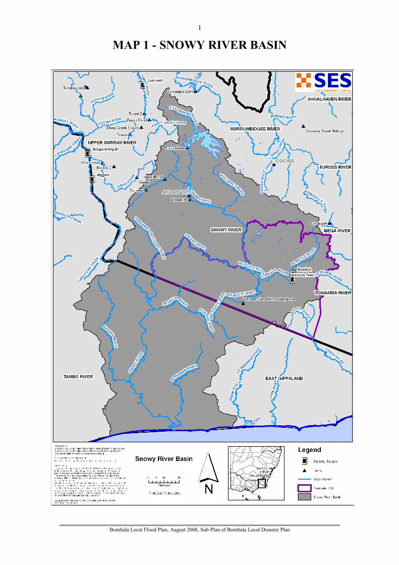
Bombala Local Flood Plan, August 2008, Sub-Plan of Bombala Local Disaster Plan
I
MAP 1 - SNOWY RIVER BASIN

Bombala Local Flood Plan, August 2008, Sub-Plan of Bombala Local Disaster Plan
II
MAP 2 - BOMBALA COUNCIL AREA

Bombala Local Flood Plan, August 2008, Sub-Plan of Bombala Local Disaster Plan
III
MAP 3 - BOMBALA TOWN AREA

Bombala Local Flood Plan, August 2008, Sub-Plan of Bombala Local Disaster Plan
IV
MAP 4 - DELEGATE TOWN AREA
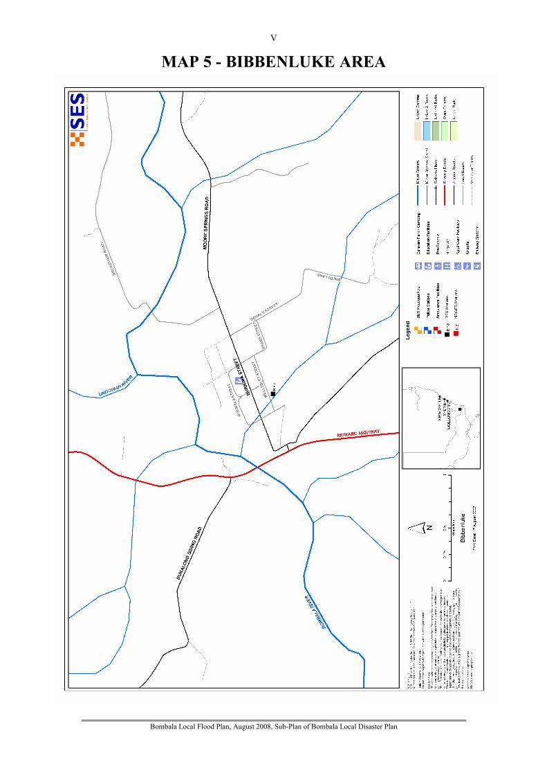
Bombala Local Flood Plan, August 2008, Sub-Plan of Bombala Local Disaster Plan
V
MAP 5 - BIBBENLUKE AREA