Black River Remedial Action Plan Black River RAP Annual... · RAP - Remedial Action Plan: a...
10
1 Black River RAP 2013 Annual Report www.blackriverrap.com 2013 ANNUAL REPORT Black River Remedial Action Plan
Transcript of Black River Remedial Action Plan Black River RAP Annual... · RAP - Remedial Action Plan: a...
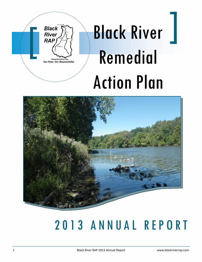
1 Black River RAP 2013 Annual Report www.blackriverrap.com
2 0 1 3 A N N U A L R E P O R T
Black River
Remedial
Action Plan
2 Black River RAP 2013 Annual Report www.blackriverrap.com
Key Terms and Acronyms 2
Message to Our Stakeholders 3
Beneficial Use Impairments of the Black River AOC 3
Improvements in Mainstem Fish Populations 4
New Assessment of Fish Tumor & Other Deformities BUI 5
Invasive Species Removal 6
Lower Black River Restoration Progress 7
Willow Creek Sub-Basin Project 7
Lorain County Septic Inventory 8
3rd Annual Black River Kayak-A-Thon 9
Black River RAP Contacts 10
Table of Contents
Key Terms and Acronyms
As major restoration efforts are underway in the Black River, scientific terms and acronyms will be used that may be unfamiliar. This will help you decipher some of the language used within this Annual Report.
AOC - Area of Concern: a geographic area that has experienced environmental degradation, as identified in the U.S.-Canada Great Lakes Water Quality Agreement (Annex 2 of the 1987 Protocol)
BUI - Beneficial Use Impairment: a change in the chemical, physical, or biological integrity of the AOC
DELT Rate- Deformities, Eroded Find, Lesions, and Tumors Rate: a physical assessment used to help determine the health of fish populations
Invasive Species: plants or animals that do not naturally occur in a particular area and produce adverse ecolog-ical, economic, and/or environmental effects
Lacustuary: a partially enclosed body of water where rivers and lakes meet
PAHs - Polycyclic Aromatic Hydrocarbons: organic compounds that are produced as byproducts of fuel burning as a result of incomplete combustion and are known to cause cancer and genetic mutations
PCBs - Polychlorinated Biphenyls: man-made organic compounds of chlorine and biphenyl, a molecule com-posed of two benzene rings, that are extremely toxic to the environment and known to cause cancer
RAP - Remedial Action Plan: a requirement of the Great Lakes Water Quality Agreement to restore and protect the 14 beneficial uses within an Area of Concern
TMDL - Total Maximum Daily Load: a regulatory term that describes the value of the maximum amount of a pollutant that a body of water can receive and still meet water quality standards
3 Black River RAP 2013 Annual Report www.blackriverrap.com
Message to Our Stakeholders
The Black River Remedial Action Plan (RAP) Coordinating Committee: Collaboration, teamwork, partnership. No matter how you interpret it, it’s a group effort that drives the forces behind all of the hard work and highlights included in this Annual Report. This year’s report features many continued successes in the Area of Concern (AOC), including improve-ments in fish populations, the removal of invasive species, and restoration efforts in the lower Black River.
Having just recently completed my first year as Chair of the RAP Committee, it is obvious that the group effort is strong and consists of many devoted people and agencies working to improve the Black River. There are also many important stakeholders that we still need at the table with us to help engage our communities and the public regarding the value
and future of the Black River.
As we move into another year, it will be important for the Committee to build upon its strengths and reassess its mission, goals, and how it functions to better serve its stakeholders and to continue in the direc-tion of de-listing the AOC. I encourage everyone to help spread the word to get more people involved in the RAP Committee. There’s strength in numbers and I look forward to working with all of you.
-Jill Lis, Chair, Black River RAP
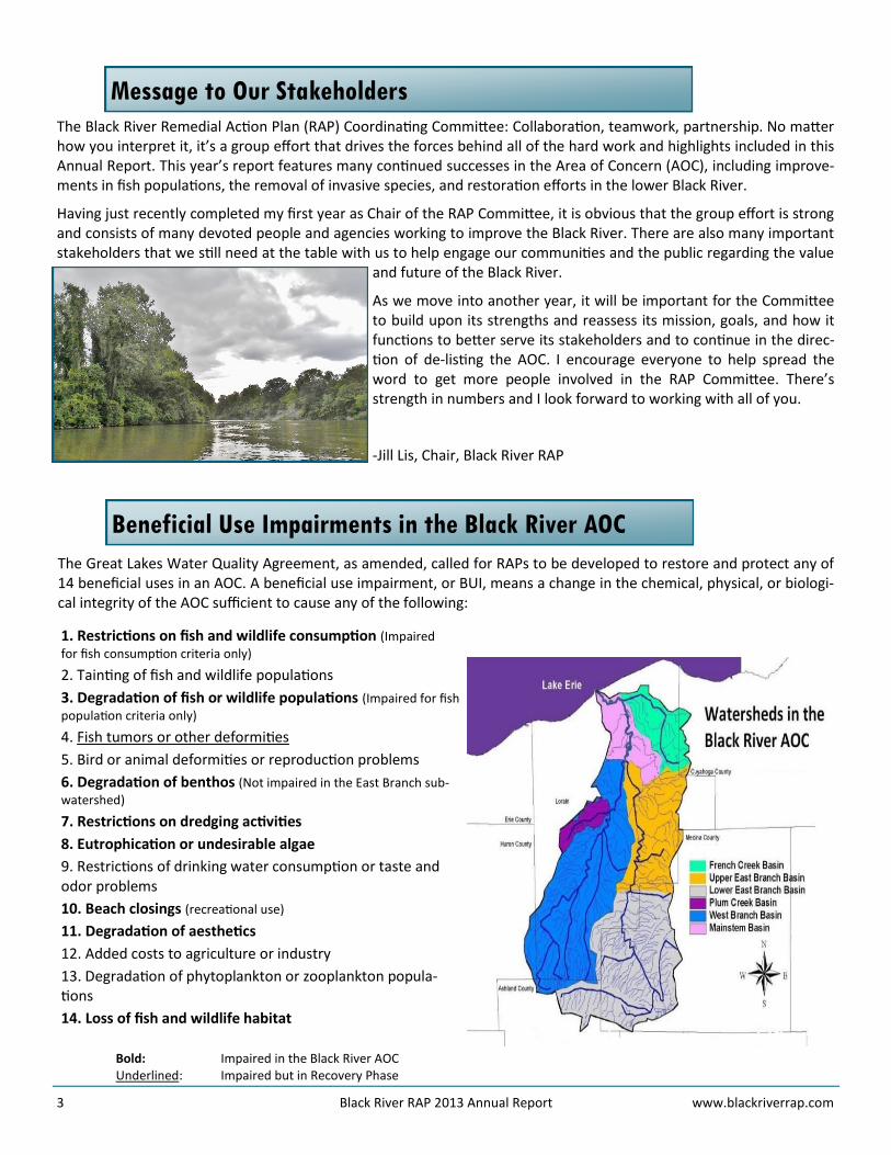
Beneficial Use Impairments in the Black River AOC
The Great Lakes Water Quality Agreement, as amended, called for RAPs to be developed to restore and protect any of 14 beneficial uses in an AOC. A beneficial use impairment, or BUI, means a change in the chemical, physical, or biologi-cal integrity of the AOC sufficient to cause any of the following:
1. Restrictions on fish and wildlife consumption (Impaired
for fish consumption criteria only)
2. Tainting of fish and wildlife populations
3. Degradation of fish or wildlife populations (Impaired for fish
population criteria only)
4. Fish tumors or other deformities
5. Bird or animal deformities or reproduction problems
6. Degradation of benthos (Not impaired in the East Branch sub-
watershed)
7. Restrictions on dredging activities
8. Eutrophication or undesirable algae
9. Restrictions of drinking water consumption or taste and odor problems
10. Beach closings (recreational use)
11. Degradation of aesthetics
12. Added costs to agriculture or industry
13. Degradation of phytoplankton or zooplankton popula-tions
14. Loss of fish and wildlife habitat
Bold: Impaired in the Black River AOC Underlined: Impaired but in Recovery Phase
4 Black River RAP 2013 Annual Report www.blackriverrap.com
Improvements in Mainstem Fish Populations
At one time, residents were warned not to consume any fish caught from the Black River mainstem, and it was known as the “River of Fish Tumors.” It has taken many years, but improvements to Black River fish populations are now be-ing documented.
Fish Consumption From tissue samples collected in 2012-2013, and as reported in the 2013 Ohio Sport Fish Consumption Advisory Table, the Black River mainstem now has only 3 fish species with consumption advisories - channel catfish, common carp, and freshwater drum. The channel catfish and common carp advisories are for the same contaminant and at the same advi-sory frequencies as for channel catfish from Lake Erie. This is representative of a regional or lake-wide contamination problem and not specific to the AOC. For this reason, these advisories are not considered an AOC impairment.
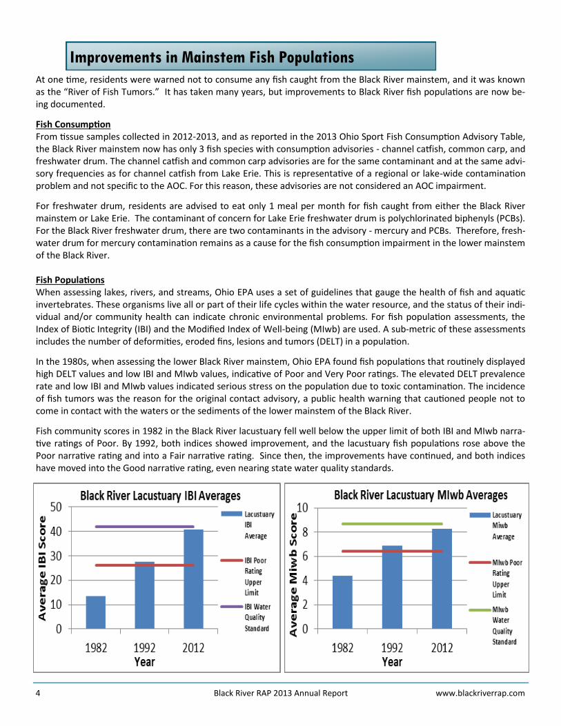
For freshwater drum, residents are advised to eat only 1 meal per month for fish caught from either the Black River mainstem or Lake Erie. The contaminant of concern for Lake Erie freshwater drum is polychlorinated biphenyls (PCBs). For the Black River freshwater drum, there are two contaminants in the advisory - mercury and PCBs. Therefore, fresh-water drum for mercury contamination remains as a cause for the fish consumption impairment in the lower mainstem of the Black River. Fish Populations When assessing lakes, rivers, and streams, Ohio EPA uses a set of guidelines that gauge the health of fish and aquatic invertebrates. These organisms live all or part of their life cycles within the water resource, and the status of their indi-vidual and/or community health can indicate chronic environmental problems. For fish population assessments, the Index of Biotic Integrity (IBI) and the Modified Index of Well-being (MIwb) are used. A sub-metric of these assessments includes the number of deformities, eroded fins, lesions and tumors (DELT) in a population.
In the 1980s, when assessing the lower Black River mainstem, Ohio EPA found fish populations that routinely displayed high DELT values and low IBI and MIwb values, indicative of Poor and Very Poor ratings. The elevated DELT prevalence rate and low IBI and MIwb values indicated serious stress on the population due to toxic contamination. The incidence of fish tumors was the reason for the original contact advisory, a public health warning that cautioned people not to come in contact with the waters or the sediments of the lower mainstem of the Black River.
Fish community scores in 1982 in the Black River lacustuary fell well below the upper limit of both IBI and MIwb narra-tive ratings of Poor. By 1992, both indices showed improvement, and the lacustuary fish populations rose above the Poor narrative rating and into a Fair narrative rating. Since then, the improvements have continued, and both indices have moved into the Good narrative rating, even nearing state water quality standards.
5 Black River RAP 2013 Annual Report www.blackriverrap.com
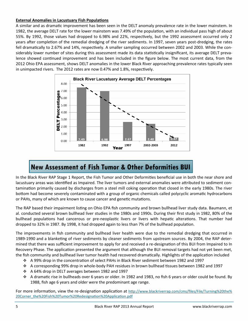
External Anomalies in Lacustuary Fish Populations A similar and as dramatic improvement has been seen in the DELT anomaly prevalence rate in the lower mainstem. In 1982, the average DELT rate for the lower mainstem was 7.49% of the population, with an individual pass high of about 55%. By 1992, those values had dropped to 6.98% and 22%, respectively, but the 1992 assessment occurred only 2 years after completion of the remedial dredging of the river sediments. In 1997, seven years post-dredging, the rates fell dramatically to 2.67% and 14%, respectively. A smaller sampling occurred between 2002 and 2003. While the con-siderably lower number of sites during this assessment made its data statistically insignificant, its average DELT preva-lence showed continued improvement and has been included in the figure below. The most current data, from the 2012 Ohio EPA assessment, shows DELT anomalies in the lower Black River approaching prevalence rates typically seen in unimpacted rivers. The 2012 rates are now 0.47% and 1.8%, respectively.
New Assessment of Fish Tumor & Other Deformities BUI
In the Black River RAP Stage 1 Report, the Fish Tumor and Other Deformities beneficial use in both the near shore and lacustuary areas was identified as Impaired. The liver tumors and external anomalies were attributed to sediment con-tamination primarily caused by discharges from a steel mill coking operation that closed in the early 1980s. The river bottom had become severely contaminated with a group of organic chemicals called polycyclic aromatic hydrocarbons or PAHs, many of which are known to cause cancer and genetic mutations.
The RAP based their impairment listing on Ohio EPA fish community and brown bullhead liver study data. Baumann, et al. conducted several brown bullhead liver studies in the 1980s and 1990s. During their first study in 1982, 80% of the bullhead populations had cancerous or pre-neoplastic livers or livers with hepatic alterations. That number had dropped to 32% in 1987. By 1998, it had dropped again to less than 7% of the bullhead population.
The improvements in fish community and bullhead liver health were due to the remedial dredging that occurred in 1989-1990 and a blanketing of river sediments by cleaner sediments from upstream sources. By 2004, the RAP deter-mined that there was sufficient improvement to apply for and received a re-designation of this BUI from Impaired to In Recovery Phase. The application presented the argument that although the BUI removal targets had not yet been met, the fish community and bullhead liver tumor health had recovered dramatically. Highlights of the application included A 99% drop in the concentration of select PAHs in Black River sediment between 1982 and 1997 A corresponding 99% drop in whole-body PAH residues in brown bullhead tissues between 1982 and 1997 A 64% drop in DELT averages between 1982 and 1997 A dramatic rise in bullheads over 6 years or older. In 1982 and 1983, no fish 6 years or older could be found. By
1988, fish age 6 years and older were the predominant age range.
For more information, view the re-designation application at http://www.blackriverrap.com/cms/files/File/Turning%20the%20Corner_the%20Fish%20Tumor%20Redesignation%20Application.pdf
6 Black River RAP 2013 Annual Report www.blackriverrap.com
One requirement of the re-designation was continued monitoring of the health of fish communities and bullhead livers until both attained current BUI removal criteria. Since 2004, the RAP and Ohio EPA reviewed new DELT data as it be-came available. By 2010, it was determined that another study of bullhead liver health was necessary to assess the cur-rent status of this BUI. Ohio EPA received funding to conduct a bullhead liver study, in association with the Midwest Biodiversity Institute and United States Geological Survey, in the Black, Cuyahoga, and Maumee River AOCs. That study was completed in 2013. In addition, Ohio EPA conducted a comprehensive assessment of the Black River watershed in 2012 that included the fish community studies in the lower mainstem. According to available data, the fish community scores (IBI and MIwb) have been improving in the Black River lacustuary, and the improvements in the fish community scores, coupled with a decline in the prevalence of external deformities, indicated that stress on the fish communities due to chemical contamination is no longer indicated.
Any assessment of the status, including discussions on the potential for removal of this BUI, is dependent upon how specific data on the health of resident fish communities relates to two targets - the prevalence of external anomalies in the general population and the liver health of the brown bullhead segment of the population. Ohio’s previous DELT delisting target was 0.5%, but it was determined that this target may have been too formidable by forcing AOCs, the worst of the worst sites in the Great Lakes, to meet a level that was expected to be found in virtually unimpacted loca-tions. During 2013, Ohio EPA RAP Coordinators revised their 2008 delisting guidance document, which should be final-ized in early 2014. For this BUI, Ohio RAP Coordinators decided that a 75th percentile was a more realistic target, and set BUI removal target values at this corresponding percentile for lacustuaries or boat sites and for smaller upstream or wading sites. The revised document states that the Fish Tumors and Other Deformities beneficial use impairment can be considered to be restored when both: External anomaly prevalence in resident fish populations (as measured by DELT) do not exceed 3.0% in lacustu-
ary or boat sites or 1.3% in wading sites AND The liver tumor prevalence rate (cancerous or precancerous) in the brown bullhead population does not ex-
ceed 5%.
Is the removal of the Fish Tumors and Other Deformities BUI on the horizon for the Black River? This is a possibility! 2013 survey data revealed that the Black River lacustuary not only met the new target (5.0%) for DELT prevalence, but they also met the old target (0.5%). This fact is very encouraging to the Black River RAP, and the Committee is watchful for results from the Ohio EPA study of bullhead liver tumors. The field work for this study, fund-ed by US EPA, was to be completed in 2012, but summer drought conditions across northern Ohio necessitated a con-tinuation of the study into 2013, with results not expected until early 2014.
Invasive Species Removal
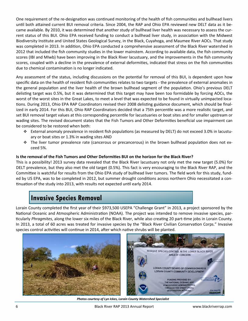
Lorain County completed the first year of their $973,500 USEPA “Challenge Grant” in 2013, a project sponsored by the National Oceanic and Atmospheric Administration (NOAA). The project was intended to remove invasive species, par-ticularly Phragmites, along the lower six miles of the Black River, while also creating 20 part-time jobs in Lorain County. In 2013, a total of 60 acres was treated for invasive species by the “Black River Civilian Conservation Corps.” Invasive species control activities will continue in 2014, after which native shrubs will be planted.
Photos courtesy of Lyn Ickes, Lorain County Watershed Specialist
7 Black River RAP 2013 Annual Report www.blackriverrap.com
Lower Black River Restoration Progress
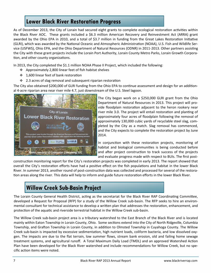
As of December 2013, the City of Lorain had secured eight grants to complete ecological restoration activities within the Black River AOC. These grants included a $6.3 million American Recovery and Reinvestment Act (ARRA) grant awarded by the Ohio EPA in 2010, and a total of $3.7 million in funding from the Great Lakes Restoration Initiative (GLRI), which was awarded by the National Oceanic and Atmospheric Administration (NOAA), U.S. Fish and Wildlife Ser-vice (USFWS), Ohio EPA, and the Ohio Department of Natural Resources (ODNR) in 2011-2013. Other partners assisting the City with these grant projects include the Lorain Port Authority, Lorain County Metro Parks, Lorain Growth Corpora-tion, and other county organizations.
In 2013, the City completed the $1.1 million NOAA Phase II Project, which included the following: Approximately 2,800 linear feet of fish habitat shelves
1,600 linear feet of bank restoration
2.3 acres of slag removal and subsequent riparian restoration
The City also obtained $200,000 of GLRI funding from the Ohio EPA to continue assessment and design for an addition-al 4-acre riparian area near river mile 4.7, just downstream of the U.S. Steel lagoon.
The City began work on a $250,000 GLRI grant from the Ohio Department of Natural Resources in 2013. This project will pro-vide floodplain restoration adjacent to the heron rookery near river mile 3.0. The project will entail restoration and planting of approximately four acres of floodplain following the removal of approximately 130,000 cubic yards of recyclable steel slag, com-pleted by the City as a match. Slag removal has commenced, and the City expects to complete the restoration project by June 2014.
In conjunction with these restoration projects, monitoring of habitat and biological communities is being conducted before and after project construction to track success of the projects and evaluate progress made with respect to BUIs. The first post-
construction monitoring report for the City’s restoration projects was completed in early 2013. The report showed that overall the City’s restoration efforts have had a positive effect on the fish populations and habitat in the lower Black River. In summer 2013, another round of post-construction data was collected and processed for several of the restora-tion areas along the river. This data will help to inform and guide future restoration efforts in the lower Black River.
Willow Creek Sub-Basin Project
The Lorain County General Health District, acting as the secretariat for the Black River RAP Coordinating Committee, developed a Request for Proposal (RFP) for a study of the Willow Creek sub-basin. The RFP seeks to hire an environ-mental consultant for technical assistance to develop a written plan that addresses the restoration, enhancement, and protection of the aquatic and riverside terrestrial habitat in the Willow Creek sub-basin.
The Willow Creek sub-basin project area is a tributary watershed to the East Branch of the Black River and is located mainly within Eaton Township in Lorain County, Ohio. Some sections extend into the City of North Ridgeville, Columbia Township, and Grafton Township in Lorain County, in addition to Olmsted Township in Cuyahoga County. The Willow Creek sub-basin is impacted by excessive sedimentation, high nutrient loads, coliform bacteria, and low dissolved oxy-gen. The impacts are due to the flat terrain, low summer flows, stream bank erosion, old and failing home sewage treatment systems, and agricultural runoff. A Total Maximum Daily Load (TMDL) and an approved Watershed Action Plan have been developed for the Black River watershed and include recommendations for Willow Creek, but no spe-cific action items were noted.
Photo courtesy of Coldwater Consulting, LLC
8 Black River RAP 2013 Annual Report www.blackriverrap.com
The Black River RAP Coordinating Committee, local municipalities, community groups, and residents will be involved with assisting the hired consultant in assembling data that is collected. Through this con-certed effort, the goal will be to develop a scientific, economically-sound, and visionary plan that will assist other efforts in the Willow Creek sub-basin. The plan will specify how restoration projects and strategies can be used to bring the basin into non-impairment status for any beneficial uses listed as Impaired. In order for the plan to be able to adapt over time, the entire aquatic habitat and ecology of the waterways within the study area need to be categorized, with priori-tized habitat protection and enhancement sites and projects identi-fied. The identification of the best geographic locations for these res-toration projects and strategies is the expected outcome of this pro-ject.
The consultant will be hired in 2014 with an anticipated project com-pletion of April 2015. Stay tuned for future updates on this project.
Willow Creek Sub-Basin Locator Map
Lorain County Septic Inventory
During the summer of 2013, the Lorain County General Health District (LCGHD) initiated a project designed to better identify household sewage treatment systems (HSTS) as non-point sources of pollution within the Black River water-shed. A watershed is an area of land that has all water within that area flowing to a specific waterway. It is important to know that what happens within a watershed does not stay in that area. All water eventually will make its way to the
water system through several different methods, in-cluding runoff and gravitational force of ground water.
Pollution can be identified through point sources, such as storm water pipes draining into a lake, or non-point sources, such as HSTS, which are less obvious. Identify-ing HSTS is a good start in determining where bacterial pollution is coming from in a watershed. For example, if elevated bacterial levels are being found during water sampling activities, the effectiveness of correcting a problem can be addressed if it is known which drainage areas have high numbers of HSTS.
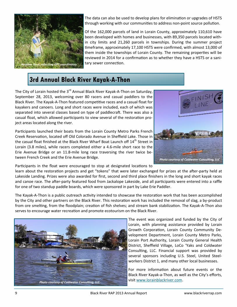
Utilizing summer interns, Heather Heck and Duane Cribley, a project was designed to inventory HSTS. LCGHD has a database with over 24,000 HSTS records; however, there are many HSTS that are unknown. Data obtained from local engineering departments on the location of sanitary sewers were used to fill in data gaps for unknown areas. Communications with LCGHD sanitarians and discussions with homeowners regarding the type of HSTS at their homes further facilitated data-base updates.
The development of a comprehensive HSTS database will benefit homeowners seeking information on their system and the numerous agencies that work with LCGHD.
Duane Cribley collecting water samples
9 Black River RAP 2013 Annual Report www.blackriverrap.com
3rd Annual Black River Kayak-A-Thon
The City of Lorain hosted the 3rd Annual Black River Kayak-A-Thon on Saturday, September 28, 2013, welcoming over 80 racers and casual paddlers to the Black River. The Kayak-A-Thon featured competitive races and a casual float for kayakers and canoers. Long and short races were included, each of which was separated into several classes based on type of paddlecraft. There was also a casual float, which allowed participants to view several of the restoration pro-ject areas located along the river.
Participants launched their boats from the Lorain County Metro Parks French Creek Reservation, located off Old Colorado Avenue in Sheffield Lake. Those in the casual float finished at the Black River Wharf Boat Launch off 14th Street in Lorain (3.8 miles), while racers completed either a 4.6-mile short race to the Erie Avenue Bridge or an 11.8-mile long race traversing the river twice be-tween French Creek and the Erie Avenue Bridge.
Participants in the float were encouraged to stop at designated locations to learn about the restoration projects and get “tokens” that were later exchanged for prizes at the after-party held at Lakeside Landing. Prizes were also awarded for first, second and third place finishers in the long and short kayak races and canoe race. The after-party featured food from Jackalope Lakeside, and all participants were entered into a raffle for one of two standup paddle boards, which were sponsored in part by Lake Erie Paddler.
The Kayak-A-Thon is a public outreach activity intended to showcase the restoration work that has been accomplished by the City and other partners on the Black River. This restoration work has included the removal of slag, a by-product from ore smelting, from the floodplain; creation of fish shelves; and stream bank stabilization. The Kayak-A-Thon also serves to encourage water recreation and promote ecotourism on the Black River.
The event was organized and funded by the City of Lorain, with planning assistance provided by Lorain Growth Corporation, Lorain County Community De-velopment Department, Lorain County Metro Parks, Lorain Port Authority, Lorain County General Health District, Sheffield Village, LoCo ‘Yaks and Coldwater Consulting, LLC. Financial support was provided by several sponsors including U.S. Steel, United Steel-workers District 1, and many other local businesses.
For more information about future events or the Black River Kayak-a-Thon, as well as the City’s efforts, visit www.lorainblackriver.com.
The data can also be used to develop plans for elimination or upgrades of HSTS through working with our communities to address non-point source pollution.
Of the 162,000 parcels of land in Lorain County, approximately 110,610 have been developed with homes and businesses, with 89,350 parcels located with-in city limits and 21,260 parcels in townships. During the summer project timeframe, approximately 17,100 HSTS were confirmed, with almost 13,000 of them inside the townships of Lorain County. The remaining properties will be reviewed in 2014 for a confirmation as to whether they have a HSTS or a sani-tary sewer connection.
Photo courtesy of Coldwater Consulting, LLC
Photo courtesy of Coldwater Consulting, LLC
Heather Heck collecting GPS coordinates
10 Black River RAP 2013 Annual Report www.blackriverrap.com
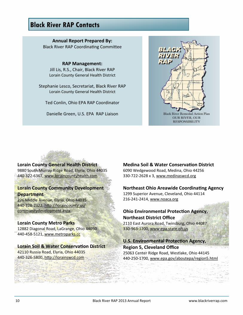
Black River RAP Contacts
Annual Report Prepared By: Black River RAP Coordinating Committee
RAP Management: Jill Lis, R.S., Chair, Black River RAP Lorain County General Health District
Stephanie Lesco, Secretariat, Black River RAP Lorain County General Health District
Ted Conlin, Ohio EPA RAP Coordinator
Danielle Green, U.S. EPA RAP Liaison
Lorain County General Health District 9880 South Murray Ridge Road, Elyria, Ohio 44035 440-322-6367, www.loraincountyhealth.com
Lorain County Community Development Department 226 Middle Avenue, Elyria, Ohio 44035 440-328-2322, http://loraincounty.us/communitydevelopment.aspx
Lorain County Metro Parks 12882 Diagonal Road, LaGrange, Ohio 44050 440-458-5121, www.metroparks.cc
Lorain Soil & Water Conservation District 42110 Russia Road, Elyria, Ohio 44035 440-326-5800, http://lorainswcd.com
Medina Soil & Water Conservation District 6090 Wedgewood Road, Medina, Ohio 44256 330-722-2628 x 3, www.medinaswcd.org
Northeast Ohio Areawide Coordinating Agency 1299 Superior Avenue, Cleveland, Ohio 44114 216-241-2414, www.noaca.org
Ohio Environmental Protection Agency, Northeast District Office 2110 East Aurora Road, Twinsburg, Ohio 44087 330-963-1200, www.epa.state.oh.us
U.S. Environmental Protection Agency, Region 5, Cleveland Office 25063 Center Ridge Road, Westlake, Ohio 44145 440-250-1700, www.epa.gov/aboutepa/region5.html


![Oswego River Remedial Action Plan Stage 1 [February 1990]](https://static.fdocuments.net/doc/165x107/616a25fb11a7b741a34f5404/oswego-river-remedial-action-plan-stage-1-february-1990.jpg)