BAR MIB
29
TECHNICAL DUE DILIGENCE xxxx PROJECT SEPTEMBER 2014
-
Upload
leris-efronda -
Category
Documents
-
view
21 -
download
3
Transcript of BAR MIB
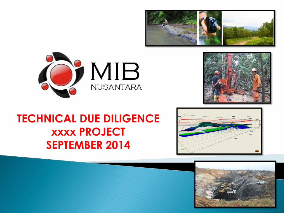
TECHNICAL DUE DILIGENCE
xxxx PROJECT
SEPTEMBER 2014

IMPORTANT INFORMATION ABOUT THIS PROJECT
i. Geological mapping at Ritan and Buluk San area of 1,223 hectares has been conducted by
PT. MIB NUSANTARA, on behalf of PT. xxxx.
ii. The concession area consists of 2(two) formations, which are Batu Ayau and Balikpapan
formation. The coal outcrops that have been identfied during in the field observation
indicated the Batu Ayau formation
iii. 12 (Twelve) coal outcrops representing the 5 coals seam have been observed and taken for
sample analysis.
iv. Drilling activities conducted by PT. XXXX in PT xxxx consist of 23 borehole. Distance before
hole is 100 m until 450 meter.
v. From the all data we got, we try to make some assumtion about caol subsurface modeling
and resources.
vi. All modeling and resources we got, was made by any additional interpretation, that
because we just have limited data.
vii. Really need additional data to proving and covered blank area.

1. PT xxxx covers an area of 1.223 Ha, located at Sub-District, East Kalimantan
Province. This area is a GREEN FIELD and really recomended to do future
exploration.
2. Coal seams is indicated part of Batu Ayau Formation with Late Miocene age.
3. Geological condition STRUCTURALLY MODERATE with gentle dipping 5 – 16 degree
to the North East.
4. Exploration drilling in the North Block has condacted by PT. XXXX . Most recent
holes with total of 23 drillholes Touch Core, NOT SUPPORTED by geophysics log
and only use Jackrow drill with AW pipe size.
5. The deposit is sub-bituminus rank with low ash and medium sulphur.
6. Quality Average
7. The project permitting is summeized below:

Samarinda to Kota Bangun is appoximatly3 hours by land road with car
And continued by boat up to Kahala which take about 4 hours.From Kahala to the site are it take about 3 hour by car
KAHALA PORT
GENERAL CONDITION, LOCATION, AND ACCESSIBILITY

GEOLOGY REGIONAL

COAL SEAM DIRECTIONAL

COAL SEAM MODELING AND RESOURCES LIMIT
1. Topography uses SRTM data
2. Coal seam modeling base is limited by 23 drill hole with:
• Maximum depth is 80 m, average depth is 58 m
• Without geophyscs logging
• Power rig drill type with AW pipe size
3. Coal seam modeling base is limited by IUP and model boundary
4. Coal seam modeling base is limited by ‘seam B’. Couple seams just have 2 point
of corellation
5. Resources parameters:
• Maximum and average of drilling depth
• Geophysics logging
• Point of coal seam corelation
• Thick of coal
• Topography condition
• Coal seam modeling

TOPOGRAPHY MAP

DRILLING POINT MAP

DATABASE GEOLOGICAL MODEL
FROM TO
DPR-06 8,55 9,75 1,20 1
DPR-06A 60,00 61,20 1,20
DPR-04 28,95 32,97 4,02
DPR-05 22,35 27,95 5,60 1
DPR-05A 30,8 34,9 4,10 2
DPR-06 36,8 41,9 5,10 3
DPR-08 17,95 21,97 4,02
DPR-09 32,00 36,02 4,02
DPR-09A 46,95 50,9 3,95 4
DPR-10A 14,7 15,2 0,50 5
DPR-11A 10,3 10,55 0,25 6
DPR-12 8,4 11,8 3,40 7
DPR-12A 34,25 35,44 1,19 8
DPR-14A 29,2 32,2 3,00 9
DPR-03 17,8 22,5 4,7 1
DPR-04 53,0 57,3 4,3 2
DPR-05A 52,8 56,8 4,0
DPR-07 31,4 35,4 4,0 3
DPR-08 42,0 47,3 5,3 4
DPR-09 56,0 61,7 5,7 5
DPR-09A 69,0 73,0 4,0
DPR-10A 15,9 19,4 3,5 6
DPR-11 17,6 22,5 4,9 7
DPR-11A 33,7 36,2 2,5 8
DPR-12 32,8 33,5 0,7 9
DPR-12 33,7 37,5 3,8 10
DPR-14A 53,5 54,8 1,3 11
POINT OF
CORELATION
3 C 3,75
1 A 1,20
2 B 3,26
No SEAM DRILL HOLECOAL
THICKAVERANGE
THICK

2D VIEW SEAM B AS BASE COAL SEAM MODELING

3D VIEW SEAM B AS BASE COAL SEAM MODELING
3D VIEW BODY SEAM B AS BASE COAL SEAM MODELING

GEOLOGICAL CROSS SECTION

GEOLOGICAL MODELING
Coal seam modeling regenerated by only 1 point drill and 1 point addetional corelation
Coal seam modeling regenerated by assumtion seam A is spreading at all concession area
Overburden and striping ratio had been calculated by computerize calculation
1. Seam A vs Topography

GEOLOGICAL MODELING
Coal seam B modeling regenerated by only 9 point drill and 3 point addetional corelation
Coal seam modeling regenerated by assumtion seam B is spreading at all concession area
Overburden and striping ratio had been calculated by computerize calculation
2. Seam B vs Topography

Coal seam C modeling regenerated by only 11 point drill and 2 point addetional corelation
Coal seam modeling regenerated by assumtion seam C is spreading at all concession area
Overburden and striping ratio had been calculated by computerize calculation
3. Seam C vs Topography
GEOLOGICAL MODELING

Coal seam D modeling regenerated by only 2 point drill and 10 point addetional corelation
Coal seam modeling regenerated by assumtion seam D is spreading at all concession area
Overburden and striping ratio had been calculated by computerize calculation
4. Seam D vs Topography
GEOLOGICAL MODELING

Coal seam E modeling regenerated by only 2 point drill and much point addetional corelation
Coal seam modeling regenerated by assumtion seam E is spreading at all concession area
Overburden and striping ratio had been calculated by computerize calculation
5. Seam E vs Topography
GEOLOGICAL MODELING
COAL SEAM CALCULATION BY SR MAP
1. Topography uses SRTM data
2. Coal seam modeling base is limited by 23 drill hole with:
• Maximum depth is 80 m, average depth is 58 m
• Without geophyscs logging
• Jackrow drill type with AW pipe size
3. Coal seam modeling base is limited by IUP and model boundary
4. Coal seam modeling base is limited by ‘seam B’. Couple seams just have 2 point
of corellation
5. Calculation parameters:
• Interburden between coal seam
• Coal thickness
• Flat SR area

COAL SR MAP SEAM A

COAL SR MAP SEAM B

COAL SR MAP SEAM C
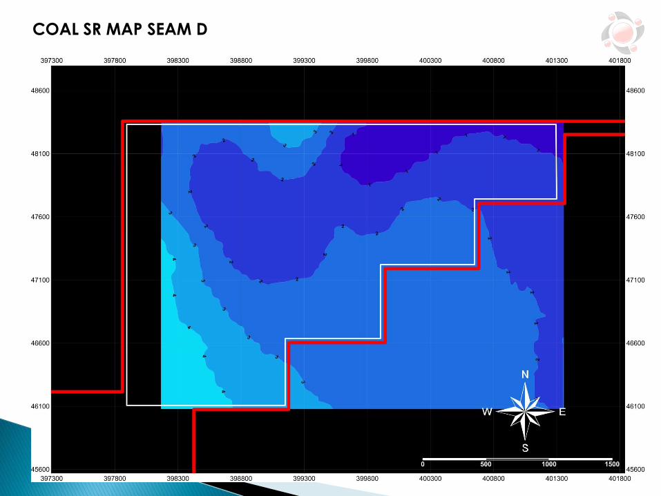
COAL SR MAP SEAM D

COAL SR MAP SEAM E

COAL CALCULATED BY SR AREA
SR AREA THICKINCRAMENTAL
TONAGETOTAL TONAGE
1 182 1,2 219 219
2 71 1,2 85 304
3 56 1,2 68 372
4 104 1,2 125 497
5 125 1,2 150 646
6 148 1,2 178 824
7 160 1,2 192 1.016
8 192 1,2 230 1.246
9 221 1,2 265 1.511
10 250 1,2 300 1.811
SR AREA THICKINCRAMENTAL
TONAGETOTAL TONAGE
1 513.250 3,26 1.673.195 1.673.195
2 473.640 3,26 1.544.066 3.217.261
3 737.967 3,26 2.405.772 5.623.034
4 619.345 3,26 2.019.065 7.642.099
5 399.045 3,26 1.300.887 8.942.985
6 171.398 3,26 558.757 9.501.743
7 103.681 3,26 338.000 9.839.743
8 91.176 3,26 297.234 10.136.977
9 90.634 3,26 295.467 10.432.443
10 87.136 3,26 284.063 10.716.507
11 83.470 3,26 272.112 10.988.619
12 79.520 3,26 259.235 11.247.854
13 75.245 3,26 245.299 11.493.153
14 70.623 3,26 230.231 11.723.384
15 65.520 3,26 213.595 11.936.979
16 59.692 3,26 194.596 12.131.575
SEAM B
SEAM A
SR AREA THICKINCRAMENTAL
TONAGETOTAL TONAGE
1 215.555 3,75 808.331 808.331
2 203.153 3,75 761.824 1.570.155
3 230.334 3,75 863.753 2.433.908
4 738.745 3,75 2.770.294 5.204.201
5 1.491.952 3,75 5.594.820 10.799.021
6 770.127 3,75 2.887.976 13.686.998
SR AREA THICKINCRAMENTAL
TONAGETOTAL TONAGE
1 463.917 1,48 686.597 686.597
2 1.782.412 1,48 2.637.970 3.324.567
3 1.778.443 1,48 2.632.096 5.956.663
4 621.516 1,48 919.844 6.876.506
SR AREA THICKINCRAMENTAL
TONAGETOTAL TONAGE
1 117.134 6,00 702.804 702.804
2 169.861 6,00 1.019.166 1.721.970
3 175.234 6,00 1.051.404 2.773.374
4 157.422 6,00 944.532 3.717.906
5 168.023 6,00 1.008.138 4.726.044
6 172.028 6,00 1.032.168 5.758.212
7 176.033 6,00 1.056.198 6.814.410
8 180.038 6,00 1.080.228 7.894.638
9 184.043 6,00 1.104.258 8.998.896
10 188.048 6,00 1.128.288 10.127.184
SEAM C
SEAM D
SEAM E

COAL CALCULATED BY SR AREA
SEAM THICK SR LIMIT COAL TONAGE
A 1,20 4 497
B 3,26 4 7.642.099
C 3,75 4 5.204.201
D 1,48 4 6.876.506
E 6,00 4 3.717.906
23.441.209
CALCULATION SUMMARY
TOTAL
SEAM THICK SR LIMIT COAL TONAGE
A 1,20 5 646
B 3,26 5 8.942.985
C 3,75 5 10.799.021
D 1,48 5 6.876.506
E 6,00 5 4.726.044
31.345.203 TOTAL
CALCULATION SUMMARY
Low confidence on Geology data - Geological database and
geological model are below suitable standard because the drill hole were
not geophysical logging
Multiple thick seam deposit with thin interburden, gentle dipping,
potentially to make big single pits along strike
Additional drilling prior to verification all old data and recovered blank
area, particularly in the sub crop/low wall area
KEY ISSUE AND RECOMMENDATION

OPTIMAL AREA SEAM A, B, C LIMITED BY SR 4

AVERAGE MIN MAX
A-B 1 32,15 32,15 32,15
B-C 9 20,60 1,20 25,65
C-D 12 8,50 4,20 13,55
D-E 0 61,63 54,00 66,00
INTERBURDENSEAM TO
SEAM
POINT OF
CORRELATION
SEAM THICK AREA SR LIMIT COAL TONAGE
B 3,26 1.664.852 4 5.427.418
C 3,75 1.664.852 4 6.243.195
D 1,48 1.664.852 4 2.463.981
14.134.593
CALCULATION SUMMARY AREA I
TOTAL
SEAM THICK AREA SR LIMIT COAL TONAGE
B 3,26 261.906 4 853.814
C 3,75 261.906 4 982.148
D 1,48 261.906 4 387.621
2.223.582
CALCULATION SUMMARY AREA II
TOTAL