Bank and Channel Modifications River Habitat...
40
Bank and Channel Modifications River Habitat Survey
Transcript of Bank and Channel Modifications River Habitat...

Bank and Channel Modifications
River Habitat Survey

Preparatory Work
• Get an idea of the site
beforehand:
• Resources
– Maps
– Geographical Information
Systems
– Google Earth

Artificial Features (Section D)
II 2
PHOTOGRAPH
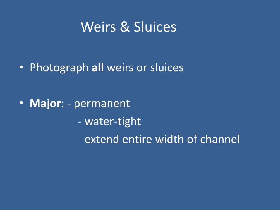
Weirs & Sluices
• Photograph all weirs or sluices
• Major: - permanent
- water-tight
- extend entire width of channel

Major Weir

Weirs & Sluices
• Intermediate
• semi-permeable
• entire width of channel
• loose rubble, inter-locked
• boulders, and logs
• allow water through interstices

Intermediate weir
Weirs & Sluices
• Minor
• Permeable
• temporary structures
• stones, cobbles, pebbles (kiddies weirs)

Culverts
• Arched, enclosed pipe structure
• Channel modification -CV
• Record land use
• Often Artificial Substrate
• NV or NK for other entries unless visible

Bridges
• Major• In-channel support (any width)
OR– wide bridges >25m bank length
• Intermediate • No in-channel support• Abutments 10 - 25m of bank length
• ~Banks often RS / RI around bridges

Major Bridge
Bridges
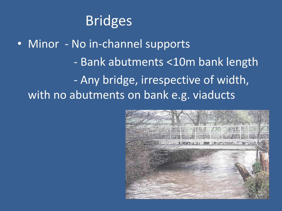
• Minor - No in-channel supports
- Bank abutments <10m bank length
- Any bridge, irrespective of width, with no abutments on bank e.g. viaducts

Outfalls/Intakes
• Discharge points
• Abstraction points
• Classify by size
• Include aprons, wing-walls & bank
protection in assessment of size
Outfalls/Intakes
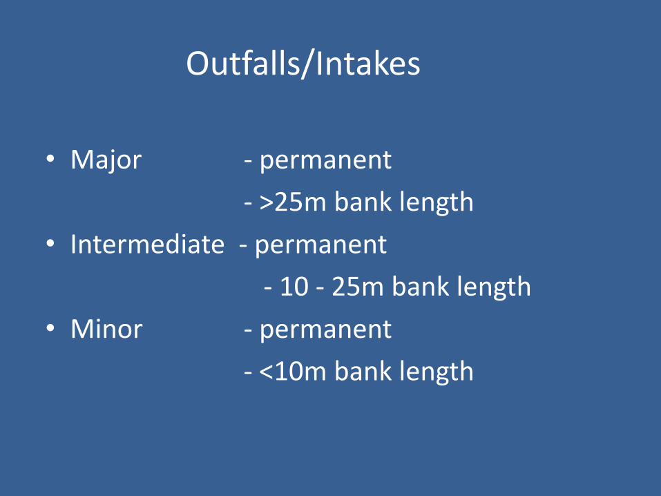
• Major - permanent
- >25m bank length
• Intermediate - permanent
- 10 - 25m bank length
• Minor - permanent
- <10m bank length

Outfall/intake

Land Drain - do not record in section D

Fords
• Permanent crossing for vehicles/machinery• Major - Bed is artificial
- Banks can be artificial or natural- Ponding upstream
• Intermediate - Banks artificial material- Channel substrate natural- Slight upstream ponding
• Minor - No artificial bed/bank

Deflectors/Groynes/Croys
• Artificial
• Part-way across channel
• Deflect currents from eroding banks
• Create in-stream habitat diversity, so often used in river enhancement schemes

Deflectors/Groynes/Croys
• Major - Extends >20% channel width
- Includes collapsed weirs
• Intermediate - Extends 10 - 20% channel width
• Minor - Extends <10% channel width

Bank Modification
Principal Bank Modifications recorded by RHS
• RESECTIONED (RS)
• REINFORCED (RI)
• POACHED
• ARTIFICIAL BERM
• EMBANKED

Indicators of Bank Resectioning
• Uniform bank profile
• No trees/uniform age trees
• Intensive land use (eg IG, TL, SU, PG)
• Channel resectioning (see channel modifications)
TIP: Look for RS and RI around bridges, weirs, sluices etc.
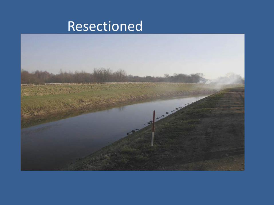
Resectioned

Old bank resectioning
• Some reaches may have been resectionedlong ago but are now naturalising
• Record RS on RHS form only where uniform banks remain
• Do not record RS where river processes have reintroduced a more natural bank form

Resectioned & Reinforced banks?
RI WHOLE BANK ONLY

Reinforced
• Whole or part of bank artificially strengthened
• Concrete CC
• Sheet Piling SP
• Wood Piling WP
• Gabions GA
• Brick or Laid Stone BR
• Rip-rap RR
• Tipped Debris TD (IF FOR BANK PROTECTION)

WOOD PILING RI
RIP RAP RI
SHEET PILINGRI WHOLE BANK
BRICK/LAID STONE RI
RS BANKS & CHANNEL,RIP RAP RI, EMBANKMENT
WEIRS

Poached
• Banks trampled/puddled by livestock
• Inc. HEAVILY trampled by humans
• Predominantly bare due to poaching = PC(B)

Artificial Berm
• Bank excavated laterally below bank top, OR Artificial ledges created to reduce low-flow channel width in over-widened channels

Embankments
• Artificial raising of banks
• Little ‘hills’ running along banktop
• If it is resectioned, record RS too
• DO NOT INCLUDE SET-BACKEMBANKMENTS IN SPOT-CHECK

Channel Modifications

Channel Modifications
• Confined to alterations to the bed
• Culvert CV
• Resectioned RS
• Reinforced RI
• Dam/weir/sluice DA
• Fords FO

Indicators of channel resectioning
• Channel
• Overdeepened
• Straightened
• Over-widened
• Uniform/low energy flow types
• Intensive surrounding land-use
• Uniform aged/no bankside trees
• Bank resectioning
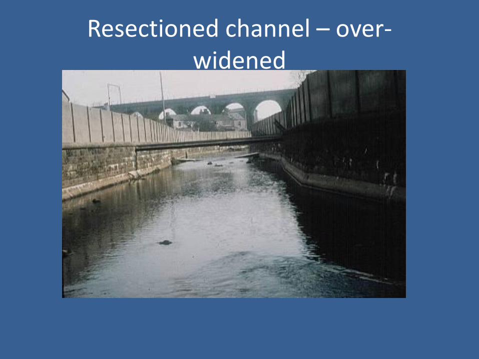
Resectioned channel – over-widened

Resectioned channel - realigned

Old channel resectioning
• Resectioned channels may persist longer than resectioned banks
• Where river processes have re-instated more natural channel dimensions or meanders, do not record RS channel

Reinforced channel & banksResectioned channel
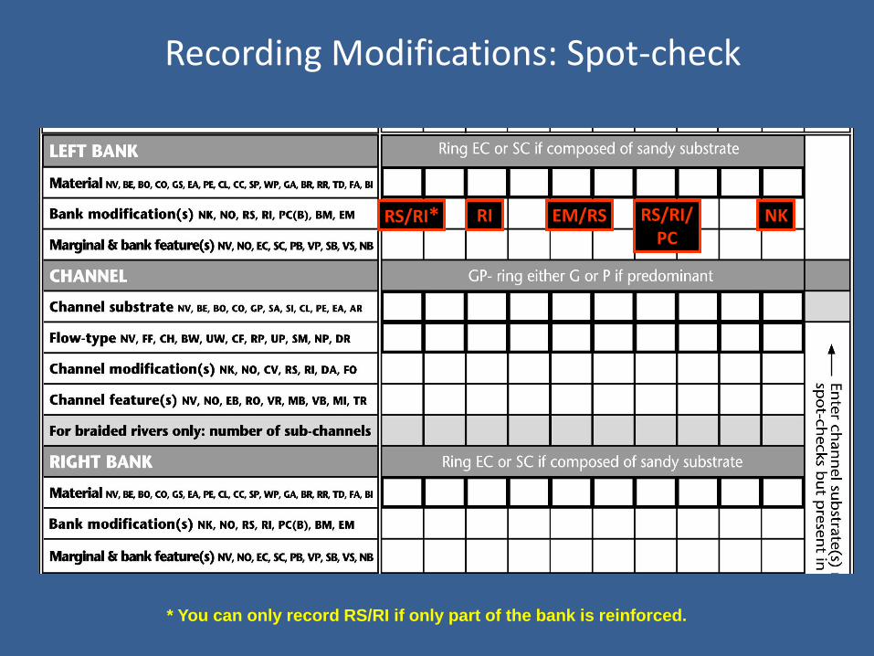
Recording Modifications: Spot-check
RS/RI/PC
NKRS/RI* RI EM/RS
* You can only record RS/RI if only part of the bank is reinforced.

RS RS RS RS RS RS RS RSEMRI
E

REMEMBER…….
• Map work before going into the field
• Evidence in field
• Photograph all major and intermediateartificial structures
• Be consistent
• Logical checks
• NK - “Not Known”• investigate before submitting forms.