Bandrban
22
Welcome to Bandrban Presented by joy
-
Upload
joy-debnath -
Category
Travel
-
view
8 -
download
0
Transcript of Bandrban

Welcome to Bandrban
Presented by joy

Key points• Introduction• Geographical boundaries• History• Christening• People and language • Attractive Locations• Festivals• conclusions

Bandarban
There is no better place in which to experience the magic of the Hill Tracts than in the lively small town of Bandarban. The town itself, which has a couple of interesting sights, isn’t overly attractive, but the surrounding countryside is some of the finest in Bangladesh and offers one of the few opportunities to really escape the masses.

Geographical boundaries• It lies on the Sangu River,
92km from Chittagong• It’s area of 4479 square
kilometers • Around Bandarban,
there lies Cox's Bazar, Chittagong, Rangamati and Khagrachhari and beside Arakan province of Myanmar and China border provinces lies.
History• It is the part of Hill Tracts of Chittagong.• in 953 the king of Arakan was right this region.• In 1240 the area was captured by the king of Tripura.• In 1550 this region had when the first map made.• in 1575 Arakan king was captured this area, and
hold up to 1666.• The Mughal Empire from 1666 to 1760, appointed by
the area under the rule. • In 1760, the British East India Company in this area
under their capture.

• In 1860, it was added as part of British India. They give the name of it as the Chittagong Hill Tracts .
• This area is part of East Pakistan in 1947• After the independence of Bangladesh in
1971, it was included in the district.• In the early eighties, the Chittagong Hill Tracts,
are divided on three District- Rangamati, Bandarban, and Khagrachchari.

Christening There is a legend about the name of Bandarban district.
The conventional form of the words of the residents that there lived monkey. The monkeys came to eat salt beside mountain. During the rain, water due to the growth of the rhymes, the monkey cross the rhyme with each other over the fringe. In view of this the people of this town, crossing the monkey scratched, the place came to be known as, "myaakachi rhyme". in Marma Myaaka means the monkeys and the dam from Ew. Over time, the name of this form of Bengali-speaking accent was as Bandarban. However, the actual name of the district in Marma “Rodh kyaoci mra".

People and language
• Total Population 388,335• More than fifteen ethnic minorities living in the
district besides the Bengalis as known as Magh, Murong, Bawm, Khyang, Tipra , Lushe, Khumi, Chak, Kuki, Chakma and Tenchungya, Riyang, Usui and Pankho.
• Talk- Bangla (official); Marma, Bawm and Mru (local)

Attractive Locations Nilgiri
• Nilgiri is the highest tourist spot of Bangladesh with nearly 3000feet.
• It is situated in Dhanchi Upazila of Bandarban District.• You can touch cloud from here in Rainy season. Both sunset
and sun rise can be seen from here in Dry season.

Golden Temple
• A Buddhist Pagoda, situated in the hill top of Balaghat, 4km away from Bandarban city.
• It is considered as one of the best Pagoda South-East Asia.• There is a small pond over the hill, named Debota pond.

Meghla Tourist Spot
• Meghla Tourist Complex is situated in Hilly District Parishad area, beside Bandarban.
• Artificial lake is created by making dam in hill shaft• It is an ideal place for family tour

Shoilo Falls
• sailaprapata is located 8 km away from Bandarban Ruma road.
• It creates wonderful natural beauty.• Here in the remote mountains life of the
indigenous community of Bom can be seen.

Nilachol
• It is located 5 km away from Bandarban district headquarters.
• It’s height approximately 1,700 feet.• From the tourism kenadra built on the hill very
pleasant view of the surrounding area can be seen.

Chimbuk Hill
• It is located 6 km from the city of Bandarban hill position and more than 2500 hundred feet height from the sea surface.
• In the monsoon , Chimbook looks clouds of heaven.
• Cimbukake is called Darjeeling of Bengal.
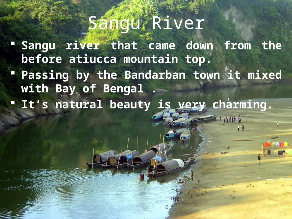
Sangu River Sangu river that came down from the before atiucca
mountain top. Passing by the Bandarban town it mixed with Bay of
Bengal . It’s natural beauty is very charming.

Tajindong Hill
• It located 25 km away from the Ruma upazila of Bandarban district.
• It’s height about 1280 meters.• In the dry season many tourists come to here
for adventure.
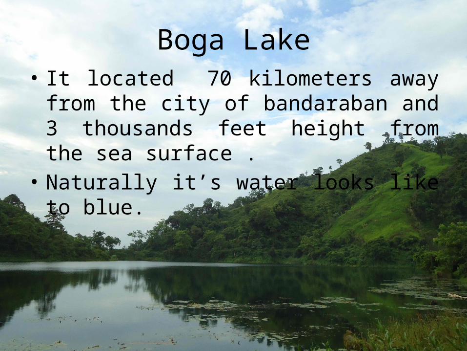
Boga Lake• It located 70 kilometers away from the city of
bandaraban and 3 thousands feet height from the sea surface .
• Naturally it’s water looks like to blue.

Nafakhum Falls
• Nafakhum is one of the most beautiful waterfalls in Bangladesh.
• Nafakhum is situated on the wild hilly Sangu River at a remote area called Remakri of Thanchi upazilla under Bandarban Hill District in Bangladesh.
• Nafakhum is also known as Nayagra of Bangladesh.
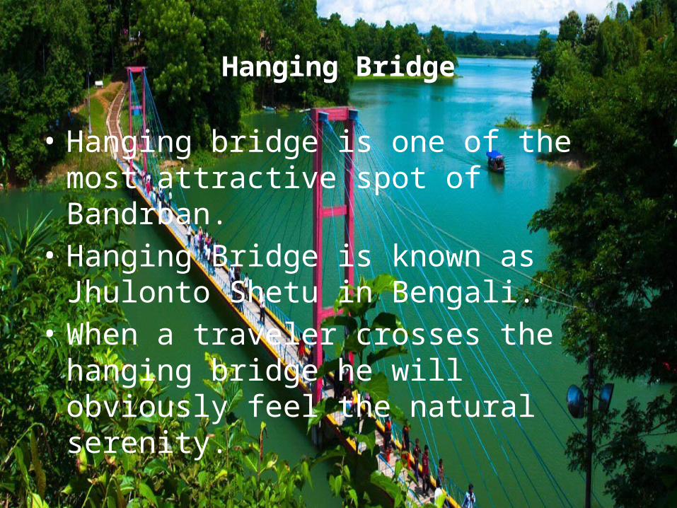
Hanging Bridge
• Hanging bridge is one of the most attractive spot of Bandrban.
• Hanging Bridge is known as Jhulonto Shetu in Bengali.
• When a traveler crosses the hanging bridge he will obviously feel the natural serenity.

Festivals
Raj Punnyah: It is ceremonial rite of paying tribute and taxes to the king of Bohmang circle, happening in mid February since 1885.

SangraiThe biggest new year festival of the Marma tribesmen, akin to Boisabi of the Tripuris and Biju of the Chakmas. Apart from the songs and dances Sangrai is marked by the water festival and magic charm competitions. It is said that splashing water is a way of declaring a love interest.

conclusions
Bandrban is one the most attractive travel destination in Bangladesh for its adventurous characteristics and heavenly scenic beauty. The scenic beauty will undoubtedly captivate your soul. Anyone can easily hike through the jungle, water falls and hilly rivers to win any of these god’s creations