Back Country Horsemen - Telegraph Trail Report
44
Kelley Cook 245 Thistle Road, Box 3, Comp 7 Eastgate, BC V0X 1R0 250-295-8649 [email protected] October 30, 2017 Desi Cheverie Ministry of Forests, Lands and Natural Resource Operations Recreation Sites and Trails BC District Recreation Officer, Quesnel - Central Cariboo 200, 640 Borland Street Williams Lake, BC V2G 4T1 Dear Desi, Here is the report on the Collin’s Overland TelegraphTrail (REC2982) in the vicinity of Whittier Creek and the Blackwater River. This report includes a brief history of the historical and cultural importance of this trail as well as the current state of the remaining trail sections identified on the ground in June 2017. This section of trail running northwest of Quesnel was originally a First Nation route which later served as main throughway for the development and settlement of what is now northern British Columbia. I have tried to include pertinent information on the trail location, the people involved and how it relates to the current objectives in regard to the future management of the trail. Condensing the history was a challenge given the many written accounts relating to the trail due to its long and important history, to not only to the Quesnel area but to the province and to Canada. Please read over my report and let me know if it includes the information you require to move ahead on the next phase of management and restoration of the trail. Sincerely yours, Kelley Cook 1
Transcript of Back Country Horsemen - Telegraph Trail Report

Kelley Cook
245 Thistle Road, Box 3, Comp 7 Eastgate, BC V0X 1R0
250-295-8649 [email protected]
October 30, 2017
Desi Cheverie Ministry of Forests, Lands and Natural Resource Operations Recreation Sites and Trails BC District Recreation Officer, Quesnel - Central Cariboo 200, 640 Borland Street Williams Lake, BC V2G 4T1
Dear Desi,
Here is the report on the Collin’s Overland TelegraphTrail (REC2982) in the vicinity of Whittier Creek and the Blackwater River.
This report includes a brief history of the historical and cultural importance of this trail as well as the current state of the remaining trail sections identified on the ground in June 2017.
This section of trail running northwest of Quesnel was originally a First Nation route which later served as main throughway for the development and settlement of what is now northern British Columbia. I have tried to include pertinent information on the trail location, the people involved and how it relates to the current objectives in regard to the future management of the trail.
Condensing the history was a challenge given the many written accounts relating to the trail due to its long and important history, to not only to the Quesnel area but to the province and to Canada.
Please read over my report and let me know if it includes the information you require to move ahead on the next phase of management and restoration of the trail.
Sincerely yours,
Kelley Cook
�1

Collin’s Overland Telegraph Trail
Prepared by Kelley Cook October 30, 2017
For Recreation Sites and Trails BC Quesnel - Central Cariboo District
Map of the Northern Interior 1912, Quesnel Museum
Historical Background
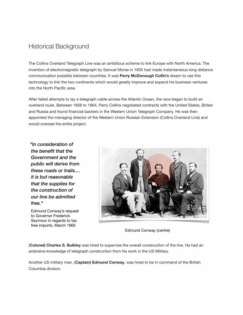
The Collins Overland Telegraph Line was an ambitious scheme to link Europe with North America. The invention of electromagnetic telegraph by Samuel Morse in 1835 had made instantaneous long distance communication possible between countries. It was Perry McDonough Collin’s dream to use this technology to link the two continents which would greatly improve and expand his business ventures into the North Pacific area.
After failed attempts to lay a telegraph cable across the Atlantic Ocean, the race began to build an overland route. Between 1858 to 1864, Perry Collins negotiated contracts with the United States, Britain and Russia and found financial backers in the Western Union Telegraph Company. He was then appointed the managing director of the Western Union Russian Extension (Collins Overland Line) and would oversee the entire project.
(Colonel) Charles S. Bulkley was hired to supervise the overall construction of the line. He had an extensive knowledge of telegraph construction from his work in the US Military.
Another US military man, (Captain) Edmund Conway, was hired to be in command of the British Columbia division.
"In consideration of the benefit that the Government and the public will derive from these roads or trails.... it is but reasonable that the supplies for the construction of our line be admitted free." Edmund Conway’s request to Governor Frederick Seymour in regards to tax free imports, March 1865
Edmund Conway (centre)

Edmund Conway arrived in British Columbia in November 1864 to take charge of construction. Conway, originally from Canada, had been a telegrapher with the Grand Trunk Railway in Montreal until he moved south to the United States to work under Charles Bulkley in the American Military Telegraph Corps. Bulkley secured Conway’s appointment for the challenging job of constructing the Collin’s line in the wilds of British Columbia for the Western Union Telegraph Company.
Exploration and Construction One of the biggest hurdles for the overland line was through the mountainous regions of British Columbia. (Major) Franklin l. Pope, an energetic young telegraph engineer was assigned to work under Conway to explore and locate a telegraph route through northern British Columbia.
The original proposed route of the Collins Overland Telegraph ( copy of original map by Pope dated 1865, University of Alaska) was to follow the Fraser River north from Quesnel and up to Fort George and continuing north. The mighty Fraser proved to be too dangerous for the exploration and construction crews.
Franklin Pope, original written account, July 1865 “During our stay of two or three days in the immediate vicinity of Quesnel, the time occupied in discussing the most available route to be pursued in reaching Fort St. James or Fort Fraser on the upper lakes.The original intention had been to proceed up the river in large boats such are used by the traders in navigating the river. But after some consideration, it was deemed best to not to attempt to do so as the river was at that time greatly swollen from the melting of the snows in the mountains, rendering its navigation at many points extremely difficult and dangerous. While at Quesnel, we learned that a tolerably well marked Indian trail existed, running across the country in a north-westerly direction to Fort Fraser. A couple of the Indians acquainted with the route were engaged to act as our guides. On the fifth of July, the party set out for Fraser Lake.”
�4
Photo above of Franklin Pope, young electrical engineer in charge of exploration of the Collin’s Line. (Edison National Historic Site, Pope 0306.)
Map of the Route of the British Columbia and Russian American Exploring Expedition by Franklin Pope,1865 (University of Northern
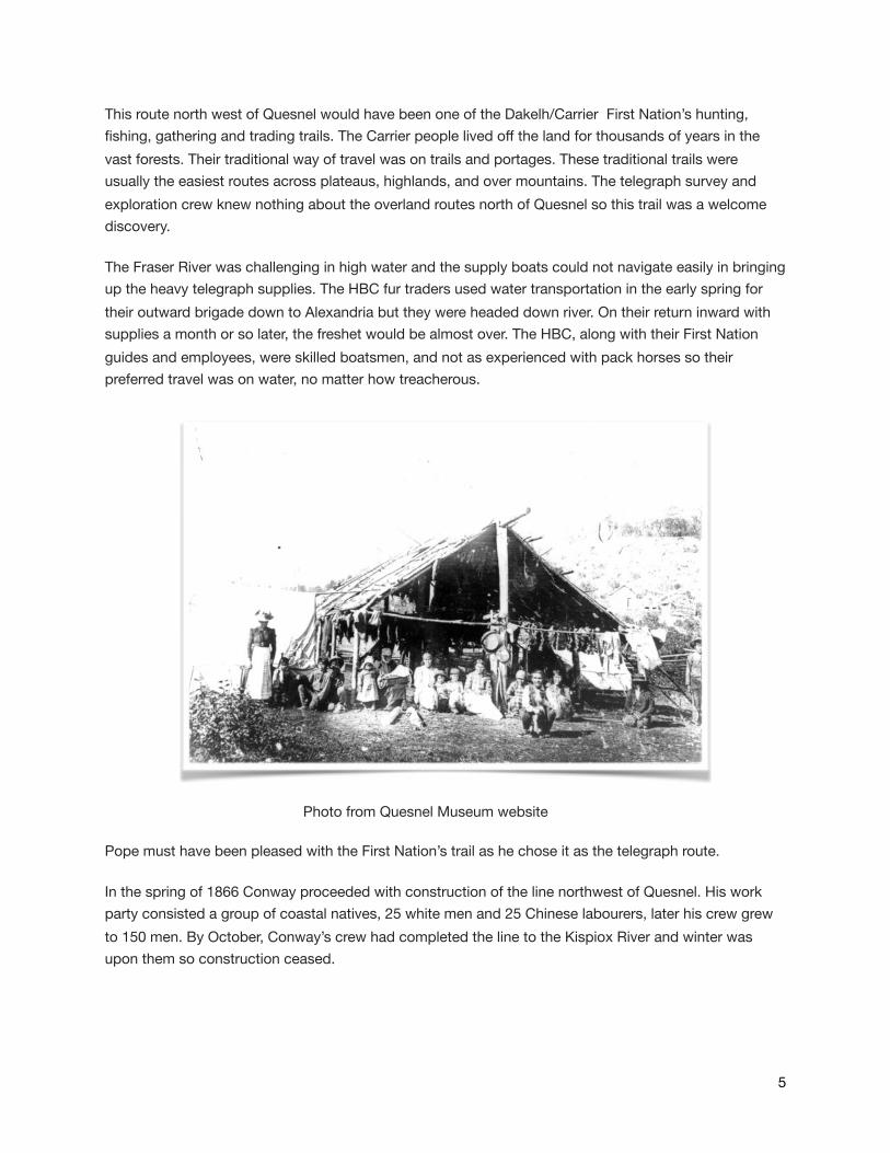
This route north west of Quesnel would have been one of the Dakelh/Carrier First Nation’s hunting, fishing, gathering and trading trails. The Carrier people lived off the land for thousands of years in the vast forests. Their traditional way of travel was on trails and portages. These traditional trails were usually the easiest routes across plateaus, highlands, and over mountains. The telegraph survey and exploration crew knew nothing about the overland routes north of Quesnel so this trail was a welcome discovery.
The Fraser River was challenging in high water and the supply boats could not navigate easily in bringing up the heavy telegraph supplies. The HBC fur traders used water transportation in the early spring for their outward brigade down to Alexandria but they were headed down river. On their return inward with supplies a month or so later, the freshet would be almost over. The HBC, along with their First Nation guides and employees, were skilled boatsmen, and not as experienced with pack horses so their preferred travel was on water, no matter how treacherous.
Photo from Quesnel Museum website
Pope must have been pleased with the First Nation’s trail as he chose it as the telegraph route.
In the spring of 1866 Conway proceeded with construction of the line northwest of Quesnel. His work party consisted a group of coastal natives, 25 white men and 25 Chinese labourers, later his crew grew to 150 men. By October, Conway’s crew had completed the line to the Kispiox River and winter was upon them so construction ceased.
�5
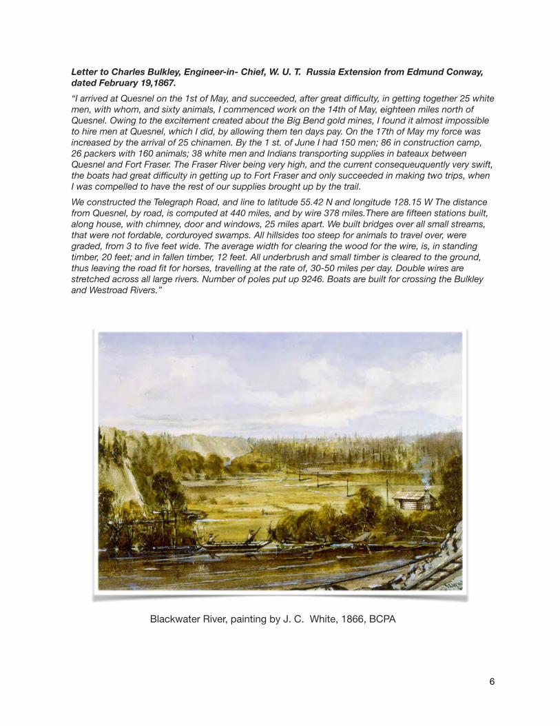
Letter to Charles Bulkley, Engineer-in- Chief, W. U. T. Russia Extension from Edmund Conway, dated February 19,1867. “I arrived at Quesnel on the 1st of May, and succeeded, after great difficulty, in getting together 25 white men, with whom, and sixty animals, I commenced work on the 14th of May, eighteen miles north of Quesnel. Owing to the excitement created about the Big Bend gold mines, I found it almost impossible to hire men at Quesnel, which I did, by allowing them ten days pay. On the 17th of May my force was increased by the arrival of 25 chinamen. By the 1 st. of June I had 150 men; 86 in construction camp, 26 packers with 160 animals; 38 white men and Indians transporting supplies in bateaux between Quesnel and Fort Fraser. The Fraser River being very high, and the current consequeuquently very swift, the boats had great difficulty in getting up to Fort Fraser and only succeeded in making two trips, when I was compelled to have the rest of our supplies brought up by the trail. We constructed the Telegraph Road, and line to latitude 55.42 N and longitude 128.15 W The distance from Quesnel, by road, is computed at 440 miles, and by wire 378 miles.There are fifteen stations built, along house, with chimney, door and windows, 25 miles apart. We built bridges over all small streams, that were not fordable, corduroyed swamps. All hillsides too steep for animals to travel over, were graded, from 3 to five feet wide. The average width for clearing the wood for the wire, is, in standing timber, 20 feet; and in fallen timber, 12 feet. All underbrush and small timber is cleared to the ground, thus leaving the road fit for horses, travelling at the rate of, 30-50 miles per day. Double wires are stretched across all large rivers. Number of poles put up 9246. Boats are built for crossing the Bulkley and Westroad Rivers.”
Blackwater River, painting by J. C. White, 1866, BCPA
�6
Exploration continued that winter in spite of news that Cyrus Field’s Atlantic underwater telegraph cable was successful and in operation. In the early spring of 1867, the Collins Overland Telegraph line was officially abandoned. It had been constructed from New Westminster to Fort Stager on the Kispiox River. The total cost of the project was said to be over three million dollars. The Colin’s Overland Telegraph project has been referred to by many as a “successful failure” and by Peter C. Newman as “one of the greatest adventures — and most magnificent failures — in commercial history”.
The telegraph line remained active as far as Quesnel (Quesnellemouth) and in 1868 it was extended to Barkerville. The section of telegraph line north of Quesnel was abandoned but the trail was used as an overland route to the Omineca, Cassiar and Klondike gold rushes. It opened up the remote northern part of the province for not only mineral exploration but for settlement. Many packers, prospectors, miners, entertainers, merchants and speculators who participated in each of the gold rushes travelled up the Cariboo Wagon Road to Quesnel and then headed northwest on the telegraph trail.
The exploration and construction of the Collin’s line was responsible for some of the gold discoveries and the introduction of steam vessels to the Nass, Skeena and Stikine Rivers. The telegraph supplies were bulky and heavy, pack trains were costly so water travel was encouraged wherever possible.
In 1901, this section of the Collin’s line from Quesnel became part of the Quesnel - Atlin (Yukon) Telegraph Line. A main telegraph office and battery room was built at Quesnel, and it prospered as the main depot for supplies and equipment. The line became part of the Yukon Telegraph Division of the Dominion Government Telegraph Service. The line remained until 1936, when spring floods wiped out major portions of the line and by then the new technology of wire-less radio communication replaced it.
�7
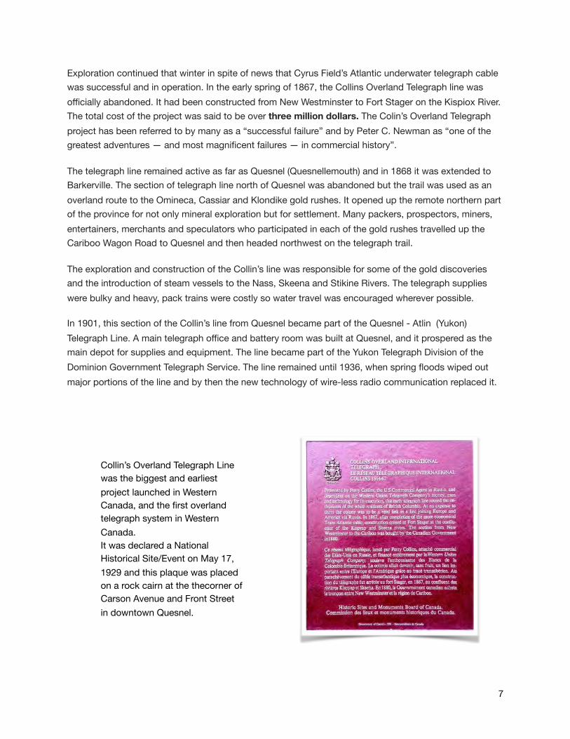
Collin’s Overland Telegraph Line was the biggest and earliest project launched in Western Canada, and the first overland telegraph system in Western Canada.It was declared a National Historical Site/Event on May 17, 1929 and this plaque was placed on a rock cairn at the thecorner of Carson Avenue and Front Street in downtown Quesnel.

Telegraph Line and Trail
The painting above by Sapper James Clayton White depicts both the telegraph line and the supply trail. White was an employee of the Department of Lands and Works and assisted on the British Columbia extension of Collin's Western Union Overland Telegraph Line in 1865-66. He drafted several maps along the route and painted a series of watercolour scenes illustrating the progress of the construction.
In most areas the trail followed the path of the wire except where steeper sections required switchbacks for the pack animals. Conway’s letter to Bulkley ( page 5), states that the wire strung from Quesnel was 378 miles and the road 440 miles, a difference of only 62 miles. It also described that all hillsides too steep for animals to travel over, were graded, from 3 to 5 feet wide. These extant sections of switch-backed trail have survived to this day and are easily identifiable in the steeper sections along the route.Thirty years after the Collin’s line was abandoned, the Dominion Government constructed the Quesnel-Atlin (Yukon) Telegraph Line which followed the original Collin’s route. This is confirmed in many books, written articles and old maps on the subject. The only documented section of telegraph line and trail that was re-routed was the crossing of the Blackwater River according to a map drawn by the late Kurt. J. Sedgwick , historian from Prince George. The lower Blackwater canyon is narrower and may have been a better location for a bridge.
�8

The
�9
The Sedgwick map above illustrates the two different routes crossing of the Blackwater River.
The map to the right, drawn by Pope in 1865, shows his exploration route and crossing over the Blackwater.

The Collin’s telegraph trail was a very popular overland route used by the early packers during the northern gold rushes and for supplying the Hudson Bay Company stores. The pack train industry provided essential transportation in the early days of British Columbia and especially in the remote north where water travel was hazardous and challenging. The northwesterly overland route of the Collin’s line provided much needed access to the northern areas and was used by many large pack trains over the years. Quesnel was at the end of the Cariboo Wagon Road and situated well on the Fraser River to accommodate the movement of supplies northward. This route was used to transport goods well into the 20th century. The well defined and heavily indented trail sections that remain today are a result of continued use long after the telegraph service ceased. Old trails, like the Collin’s, can be located due to the constant compaction of thousands of laden horses and mules, some packing as much as 300 pounds each. This concentrated animal traffic leads to soil compaction which has a negative impact on future tree growth. This ecological impact assisted in locating many of the surviving sections of the telegraph trail where it was not impacted by past industrial activities.
�10
Surviving extant section of trail that has no stumps or trees and appears as a tunnel through the forest. This is a result of the ecological impact of soil compaction from heavy and concentrated use.

�11
Typical pack trains that travelled on the trail in the early 1900s. (BCPA B-07266 above, I-76449 below )

�12
Hand built switchbacks were constructed on the steeper sections for the ease of pack trains and sleighs carrying heavy loads and supplies. These
well constructed sections are still very visible today.
�13
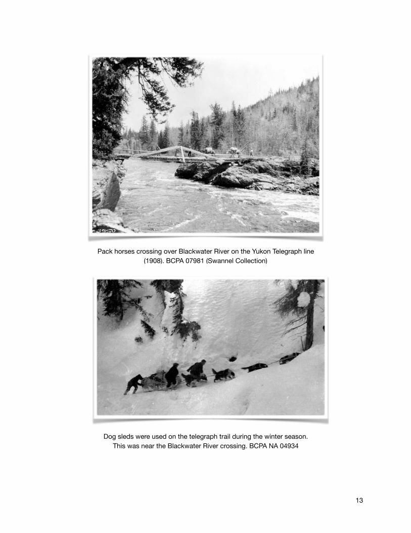
Pack horses crossing over Blackwater River on the Yukon Telegraph line (1908). BCPA 07981 (Swannel Collection)
Dog sleds were used on the telegraph trail during the winter season. This was near the Blackwater River crossing. BCPA NA 04934

�14
Atlin-Quesnelle (Yukon) Telegraph line construction (1900) with supply trail directly underneath it. BCPA F-003372

Summary
The total distance of the original Collin’s Overland Telegraph Trail (COTT) within the Quesnel Forest District, from Quesnel to the Blackwater River crossing, was approximently 60 kilometres. Settlement, road construction and timber harvesting have resulted in the loss of almost half of the trail. The remaining trail segments (later used by Dominion (Yukon) Telegraph Line) have been somewhat preserved, thanks to the late Dwight Dodge of Quesnel, as well as others. Starting in 1953, Dwight located, maintained and researched the trail’s history until his passing in 2016. His work was complied and published in a book titled “The History of the Telegraph Trail”. Dwight’s passion and dedication to the preservation of the trail was instrumental in locating the trail on the ground and his book, was an enormous help in the historical research for this project.
The construction of roads over portions of the trail is unfortunate but a reality in developing a modern transportation route for automobiles and economic development. Across British Columbia, many of the ancient travel routes of historical significance covered long distances, making their total preservation almost impossible in today’s world.
Early routes by First Nations followed the natural features of the land, such as water courses and ridge lines where travel was easier. Generally, these features are the same ones desired for road location.The Blackwater Road follows closely the overall direction and route of the trail so some sections have disappeared under the road. Many of the remaining portions are extant, very well defined and well constructed where they have not been impacted by timber harvesting.
Restoration of these sections would connect nature and history and become a recreational resource for both residents and tourists. Conveying the values of culture, history and recreation on interpretive signage will encourage long term preservation and conservation of the remaining trail as well as having positive economic benefits in the way of heritage tourism.
Connecting the sections of original trail to make a longer distance trail could increase usage. Bypasses around the Blackwater Road were laid out and started by Dwight Dodge. It could be a long term vision to develop a proposed route around missing sections and the areas through private property. Restoration of the short segments on crown land could be very rewarding. Developing interpretive signage and parking areas could be part of a longer term project.
The COTT is a symbol of all season frontier travel and reveals the rich history of northern British Columbia throughout many different eras. These remaining extant sections of the original trail evoke the feeling of a historic route and time. Restoration of these identified segments will keep the integrity of the Collin’s Overland Telegraph alive for future generations.
�15

Current Trail Conditions and Recommendations
Section 1
POC: Trailhead, approximently 35 kilometres from Quesnel, 21 km Blackwater Road. There is a picnic table and outhouse at this location. Trail starts on north side of Blackwater Road.
POT: BCHBC kiosk on 33.9 km Blackwater Road, just south of Herkyelthtie (Goose) Lake
LENGTH: 11 km ( excluded approx. 1 km of trail in private property, DL 901)
ELEVATION RANGE: 650 - 925m GAIN/LOSS: 388 m (-167)
DESCRIPTION:
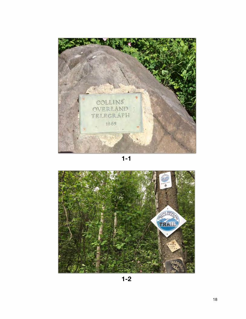
• Trailhead, parking and camping area is not very attractive or visible. Larger historical kiosk is needed at this location. (photo 1-1)
• Trail is tagged with newer blue tags along with an assortment of others. (photo 1-2)
• Trail is good condition, tread is very visible and well worn. Minimal work is required in this section due to current ongoing maintenance in the past few years.
• Rolls of old telegraph wire in a few trees along route. (photo 1-3)
• 850 m section in private property, DL90, and needs to be re-routed to the South side of Whittier creek.
• Approx. 1 km section runs along a logging road and could be an issue if being used by industrial traffic during hiking/equestrian season.
• Dwight’s Loop trail connects with COTT
• BCHBC trailhead requires larger parking area along Blackwater Road for equestrian users. (photo 1-4)
�16

�17
�18
1-1
1-2

�19
1-4
1-3

Section 2
POC: BCHBC kiosk, 33.9 km on the Blackwater Road
POT: Blackwater Road @ 3800 Road
LENGTH: 3.7 km ( excluded approx. 200 m of trail in private property, DL 6162)
ELEVATION RANGE: 919 m - 975 m GAIN/LOSS: 207 m (-170)
DESCRIPTION:
• Trail is difficult/confusing to follow in the vicinity of the fence line and gate
• Only short section may be original, most has been impacted by harvesting and fencing
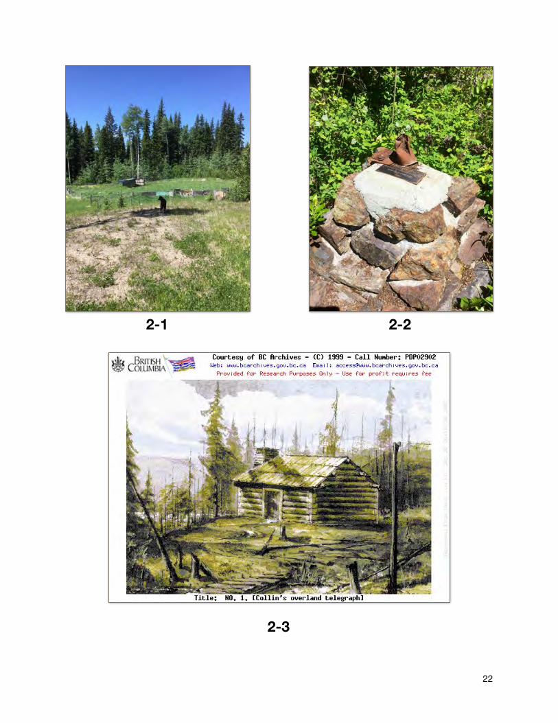
• After 320 m the trail enters private property, DL6162 (photo 2-1) for 200 m, this section could be re-routed once property corner was located.
• Long sections of trail are in cut blocks and tread is not very visible in spots. Not much remains of the original tread. The short undisturbed forested sections have moderate windfall on them.
• Original site of the first telegraph office out of Quesnel is marked by a cairn and plaque (photo 2-2). Painting by J. C. White ( 2-3 ) in 1866 is above Herkyelthtie (Goose) Lake. This is really the only real attribute of this section of trail along with a couple pieces of telegraph wire.
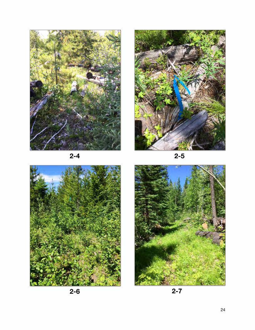
• Trail has been heavily impacted by past harvesting operations and there has been a trail flagged and cleared and is currently being used. It does follow a straight northwesterly route but it is hard to identify any remaining original trail features. ( photo 2-4)
• There was a piece of wire found in the logging debris but it could have been dragged by equipment to this location. (photo 2-5)
• Heavy brushing of the lodgepole pine and alder would be required in most of this section. (photo 2-6). Some brushing has been done on the northern end near 3800 Road.
• There is a short section (300 m) of well maintained trail heading down from the station site to the Blackwater Road near the Herkyelthtie Lake picnic site that could be used for parking and could be a place for an interpretive sign with a short connecting trail up to the historical site of the cabin.
�20

�21
22
2-1 2-2
2-3
24
2-4
2-72-6
2-5

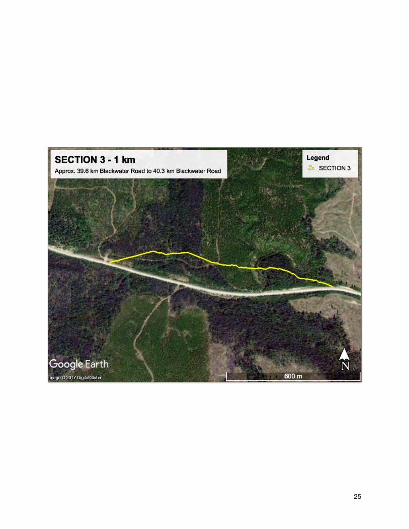
Section 3
POC: 39.6 km Blackwater Road
POT: 40.3 km Blackwater Road
LENGTH: 1 km
ELEVATION RANGE: 908 -943 m GAIN/LOSS: 8m (-38)
DESCRIPTION:
• Impacted by road construction close to the Blackwater Road but marked with old tags. (photo 3-1)
• Extant section of original trail with heavy blowdown across it. Tread very visible in forested area. (photo 3-2, 3-3)
• Large unused flat area next to Blackwater Road would allow ample room for a kiosk and parking area. (photo 3-4)
• Hand built trail construction features would be very visible on this section once it is cleared.
24
3-23-1
25

26
3-3
3-4
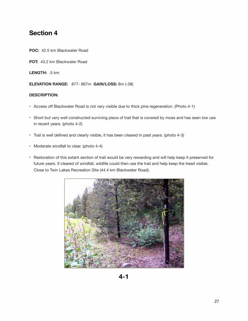
Section 4
POC: 42.5 km Blackwater Road
POT: 43.2 km Blackwater Road
LENGTH: .5 km
ELEVATION RANGE: 877- 867m GAIN/LOSS: 8m (-38)
DESCRIPTION:
• Access off Blackwater Road is not very visible due to thick pine regeneration. (Photo 4-1)
• Short but very well constructed surviving piece of trail that is covered by moss and has seen low use in recent years. (photo 4-2)
• Trail is well defined and clearly visible, it has been cleared in past years. (photo 4-3)
• Moderate windfall to clear. (photo 4-4)
• Restoration of this extant section of trail would be very rewarding and will help keep it preserved for future years. If cleared of windfall, wildlife could then use the trail and help keep the tread visible. Close to Twin Lakes Recreation Site (44.4 km Blackwater Road).
27
4-1

28

29
4-2
4-3 4-4

Section 5
POC: 51.5 km Blackwater Road
POT: East boundary of private property, DL 4686, north of Pantage (Swamp) Lake
LENGTH: 5.4 km
ELEVATION RANGE: 800-1000m GAIN/LOSS: 200m ( -111)
DESCRIPTION:
• South end of trail starts in a forested area and tread is well established and visible for first 500 meters. (photo 5-1)
• Trail use is low and is covered in moss. Trail surface is wide ,well defined and cut into the gentle slopes. (photo 5-2)
• Trail disappears into a clearcut for approx. 1.3 km and tread is hard to distinguish in sections due to thick regeneration and brush. Many Road crossings throughout block. (photo 5-3)
• Remaining section of trail is in a selectively logged area from the early 1960s which did not alter the trail. (photo 5-4)
• Moderate windfall to clear in approx. 3 km of forest. (photo 5-5)
• Trail is well marked and easily followed, some old plastic markers from years ago. (photo 5-6)
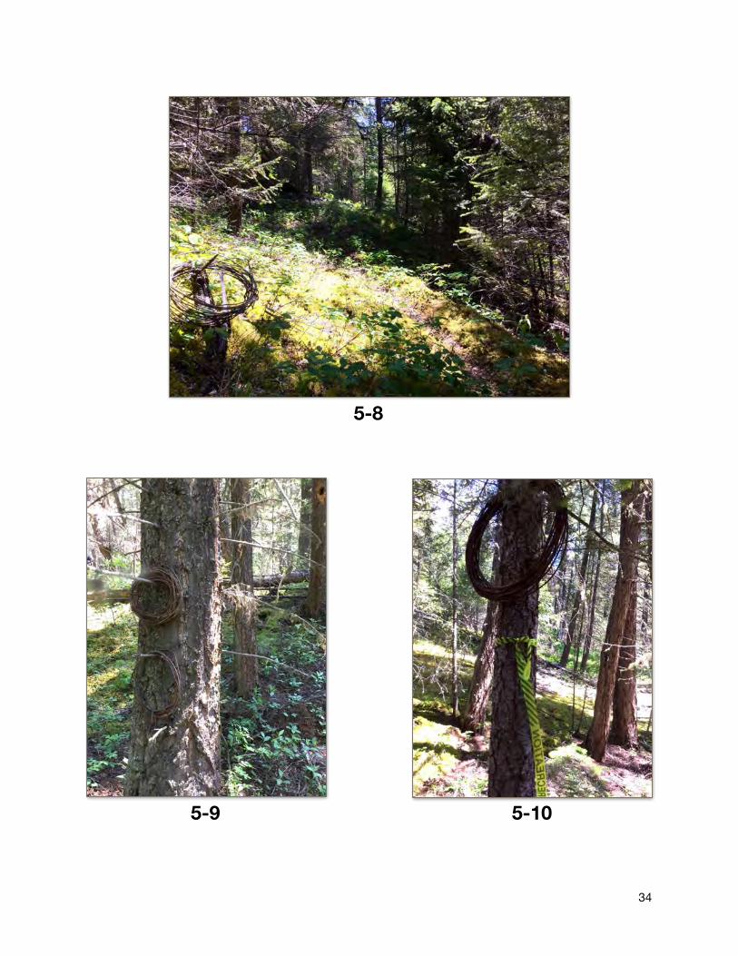
• Culturally Modified Lodgepole pine tree along route. ( photo 5-7, LONG 53.21367, LAT-123.05260)
• Many rolls of wire along this section of well preserved and undisturbed trail. (photo 5-8,9,10)
• Douglas Fir is starting to see initial attack by bark beetle and there is new orange flagging along route.
• Trail section in woodlot is very well identified and not disturbed until it reaches the POT at DL 4686 near Pantage Lake.
• Immediate contact should be made with Forest Company to protect this extant section of COTT prior to any proposed harvesting plans.
30

31

32
5-1
5-2 5-3

33
5-4 5-5
5-6 5-7
34
5-8
5-9 5-10
Section 6
POC: West boundary of private property, DL 4686 (north of approx. 58 km Blackwater Road)
POT: 65.8 km Blackwater Road
LENGTH: 6.5 km
ELEVATION RANGE: 860-750 m GAIN/LOSS: 82 m (-130)
DESCRIPTION:
• Re-route a short section of trail to the north of DL 4686 to connect with Section 5. This could be accomplished without too much difficulty due to the gentle terrain and it being crown land with good access off of the 9800 road. (59 km Blackwater Road)
• Trail tread is visible in the treed sections and has been maintained over the past. There has not been much use as of late but it was flagged with orange flagging and has new COTT tags at road crossings. (photo 6-1)
• The trail goes in and out of older cutbacks (1974 & 1981) and more recent ones. It has been re-established on what appears to be on the original route. (photo 6-2)
• Sections through the newer blocks need extensive brushing and clearing. (photo 6-3)
• Moderate windfall along some sections but recent clearing in sections closer to road access. (photo 6-4)
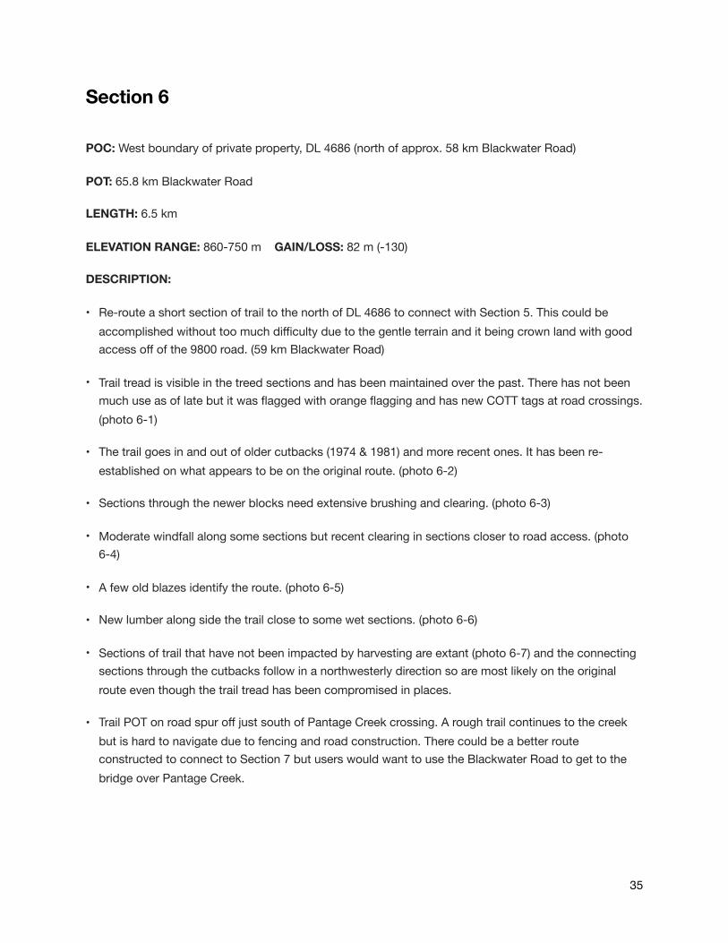
• A few old blazes identify the route. (photo 6-5)
• New lumber along side the trail close to some wet sections. (photo 6-6)
• Sections of trail that have not been impacted by harvesting are extant (photo 6-7) and the connecting sections through the cutbacks follow in a northwesterly direction so are most likely on the original route even though the trail tread has been compromised in places.
• Trail POT on road spur off just south of Pantage Creek crossing. A rough trail continues to the creek but is hard to navigate due to fencing and road construction. There could be a better route constructed to connect to Section 7 but users would want to use the Blackwater Road to get to the bridge over Pantage Creek.
35

36

37
6-1 6-2
6-3 6-4
38
6-5
6-76-6

Section 7
POC: 66 km Blackwater Road, 46 km North Blackwater ( north of Batnuni/Blackwater junction)
POT: Eastern boundary of DL 4691, south of the Blackwater River bridge
LENGTH: 2 km ( excluded approx. 500 m of trail in private property, DL 4691)
ELEVATION RANGE: 788 - 650 m GAIN/LOSS: 4m (- 100)
DESCRIPTION:
• The original route of the COTT continued north west from this point to the crossing of the Blackwater River. (see page 8 & 9 in history section of this report)
• Trail commences on the side of the Blackwater Road, just north of the major junction of Blackwater and Bantani. Lots of area for parking. (photo 7-1)
• Follows a logging spur road for approx. 1.4 km through a cutback logged in 1974. This section of trail does not appear to have survived the logging and could not be located in the block. (photo 7-2)
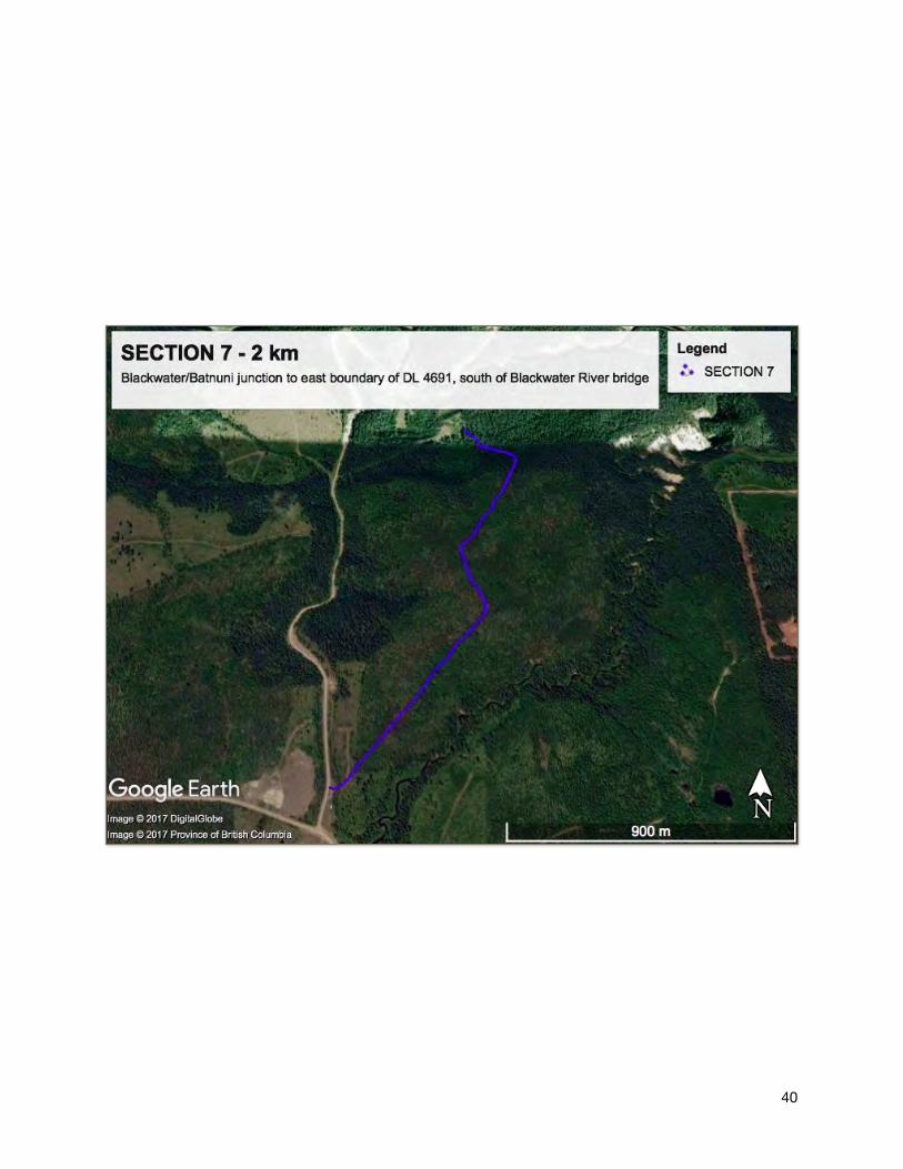
• Original trail tread appears at the end of the cut block and continues north down a series of switchbacks. (photo 7-3, 7-4)
• Trail swings to the North west and enters a bench where there is a view of the Blackwater River Valley. It this point the trail appears to have been widened and altered by a machine. (photo 7-5)
• It appears to enter private property, DL 4691, approx. 500 m from the Blackwater Road. Re-routing this section of trail to the east of DL 4691 would be challenging due to the terrain.
• Located close to the Blackwater River Recreation Site and the Alexander Mackenzie Heritage Trail parking area which links it to other recreational opportunities in the area.
39
40

41
7-1
7-2 7-3
42
7-4
7-5
GROUND SURVEY SUMMARY
The above 7 sections of trail are segments of the COTT located on the ground and could be considered as the original COTT route. Some sections have been impacted by logging but they appear to be re-established on or as close to the original route as possible.
Areas surrounding the trail were surveyed if tread was not clearly visible or not appearing authentic.
Sections 1 & 5 have many rolls of old telegraph wire which confirm they are indeed the historical telegraph line. The tread is well established and embedded in the ground in the undisturbed trail segments.
The route was very direct and overall followed mostly a northwesterly direction.
Flagged with REC Yellow flagging and blue in sections.
One .5 km section of trail identified in J. B. Webb’s 1990 report as “E” could not be located. This short section ran very close to a corner on the Blackwater Road at approx. 40 km. There appears to have been road construction work done on the eastern bank and no evidence of the trail could be located. All other sections were located during the field work in June 2017.
Surveying of the trail did not include alternate routes located and cleared by Dwight Dodge. Detailed maps of these connecting trails can be found on the maps in J.B Webb’s “Collin’s Overland Telegraph Trail, Recreation Trail Inventory Report” dated February 1990 which is in the ministry recreation files (REC2982).
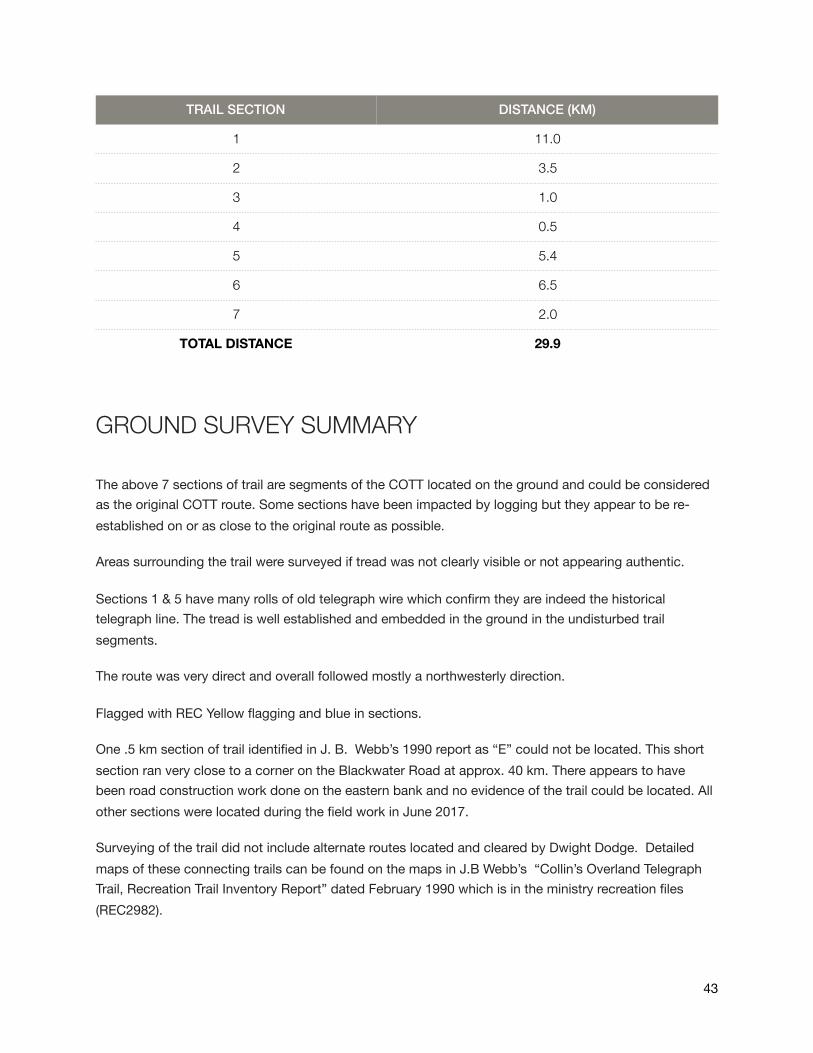
TRAIL SECTION DISTANCE (KM)
1 11.0
2 3.5
3 1.0
4 0.5
5 5.4
6 6.5
7 2.0
TOTAL DISTANCE 29.9
43

References
A History of the Telegraph Trail, Dwight Dodge (Addendum Note by Jeffrey Dinsdale)
Quesnel, Commercial Centre of the Cariboo Gold Rush, Gordon R. Elliott
Wires in the Wilderness, The Story of the Yukon Telegraph Line, Bill Miner
Collins Overland Telegraph Trail, Recreation Trail Inventory, Feb 1990, J.B. Webb
British Columbia Historical Quarterly, The Collins Overland Telegraph, Volume X, No 3 July, 1946 by Corday Mackay
Catalina, Packer Extraordinaire, Trelle A. Morrow
Through An Unknown Country, Mike Murtha & Charles Helm
Paintings by J. C. White, British Columbia Provincial Archives (BCPA)
Front Cover map, Quesnel Museum
44