Automatic vehicle locator
32
-
Upload
aishwarya-yadav -
Category
Engineering
-
view
310 -
download
3
Transcript of Automatic vehicle locator
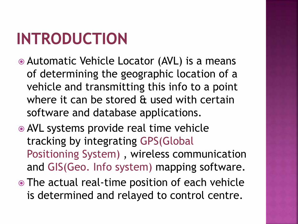
Automatic Vehicle Locator (AVL) is a means
of determining the geographic location of a
vehicle and transmitting this info to a point
where it can be stored & used with certain
software and database applications.
AVL systems provide real time vehicle
tracking by integrating GPS(Global
Positioning System) , wireless communication
and GIS(Geo. Info system) mapping software.
The actual real-time position of each vehicle
is determined and relayed to control centre.

The Global Positioning System (GPS) is a
space-based satellite navigation system that
provides location and time information in all
weather conditions , anywhere on or near
the earth where there is an unobstructed
line of sight to four or more GPS satellites.
The Geographic Information System (GIS) is a
system designed to capture , store ,
manipulate , analyze , manage ,and present
all types of geographical data.

The GPS project was developed in 1973 to
overcome the limitations of previous
navigation systems.
Previous navigation systems did not give
accurate results.
They were not trust worthy.
Gradually , with the advancement in
technology , GPS was developed.
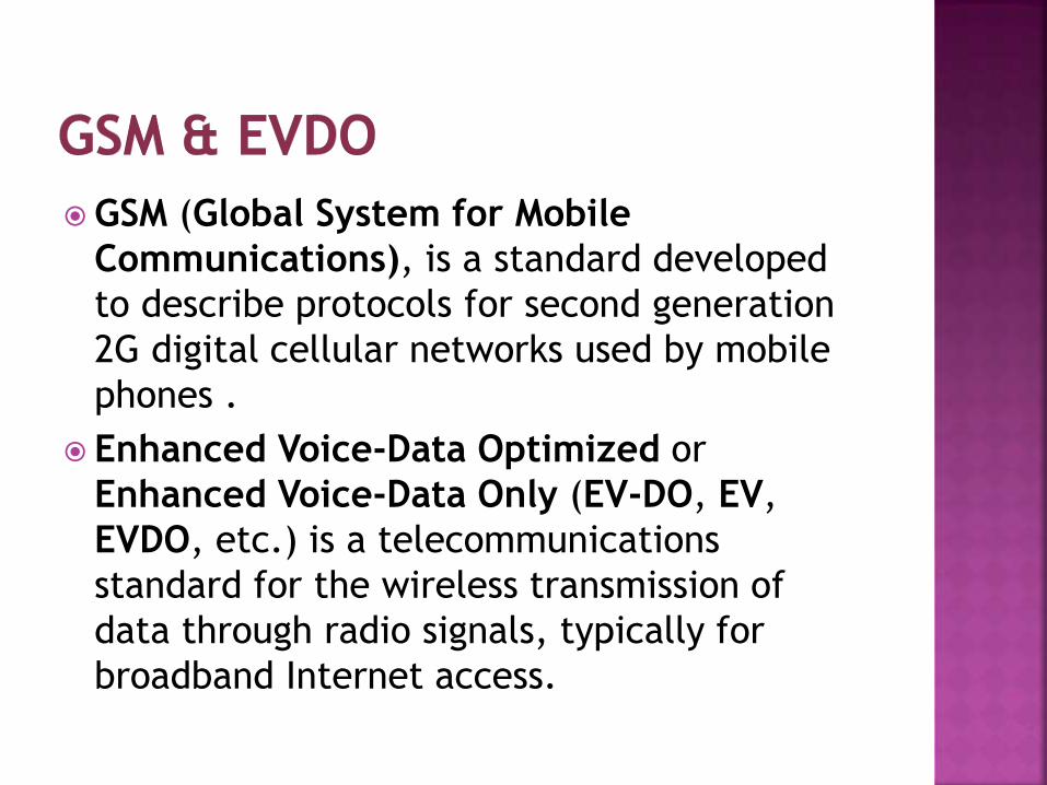
GSM (Global System for Mobile
Communications), is a standard developed
to describe protocols for second generation
2G digital cellular networks used by mobile
phones .
Enhanced Voice-Data Optimized or
Enhanced Voice-Data Only (EV-DO, EV,
EVDO, etc.) is a telecommunications
standard for the wireless transmission of
data through radio signals, typically for
broadband Internet access.
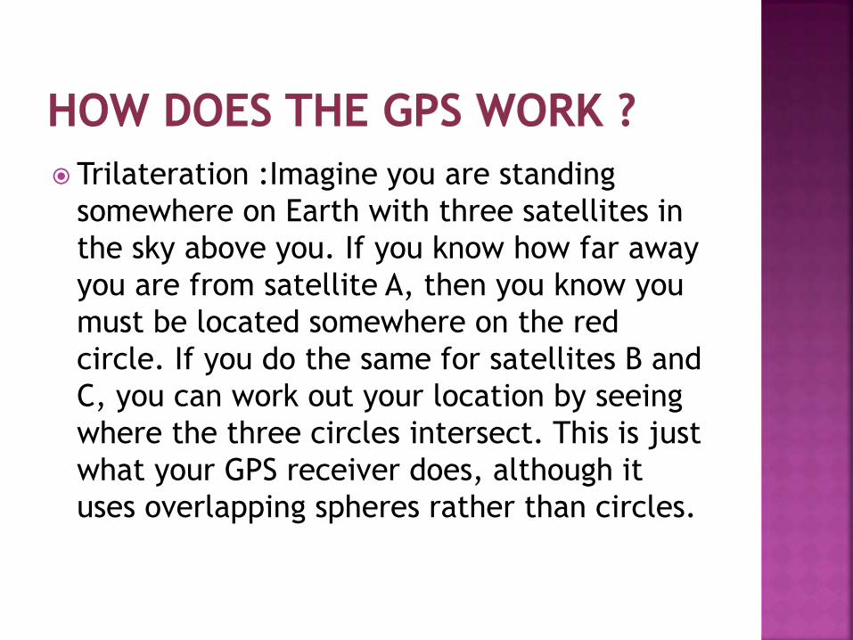
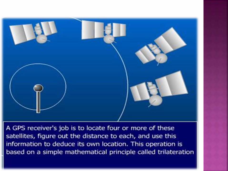
Trilateration :Imagine you are standing
somewhere on Earth with three satellites in
the sky above you. If you know how far away
you are from satellite A, then you know you
must be located somewhere on the red
circle. If you do the same for satellites B and
C, you can work out your location by seeing
where the three circles intersect. This is just
what your GPS receiver does, although it
uses overlapping spheres rather than circles.


AVL TECHNOLOGY
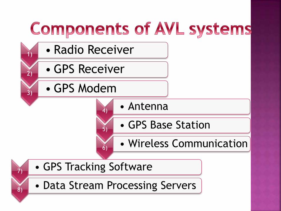
1) • Radio Receiver
2) • GPS Receiver
3) • GPS Modem
4) • Antenna
5) • GPS Base Station
6) • Wireless Communication
7) • GPS Tracking Software
8) • Data Stream Processing Servers

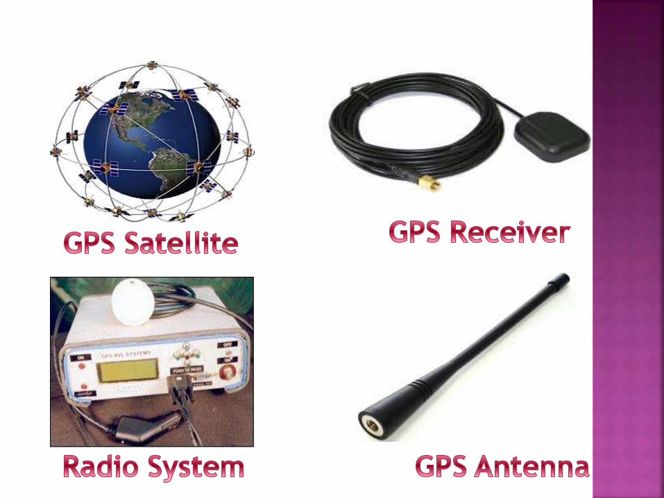
Radio receiver : a radio receiver is an electronic device that receives radio waves and converts the information carried by them to a usable form. It is used with an antenna
GPS receiver : A GPS receiver's job is to locate four or more of these satellites, figure out the distance to each, and use this information to deduce its own location.
GPS modem : A GSM modem is used to send the position of the vehicle from a remote place.

Antenna: An antenna (or aerial) is an electrical
device which converts electric power into radio
waves, and vice versa.
Base station : In a comp. network it is a
transceiver acting as a router for computers in
the network, possibly connecting them to a local
area network and/or the internet.
Wireless communication : Wireless
communication is the transfer of
information between two or more points that are
not connected by an electrical conductor.
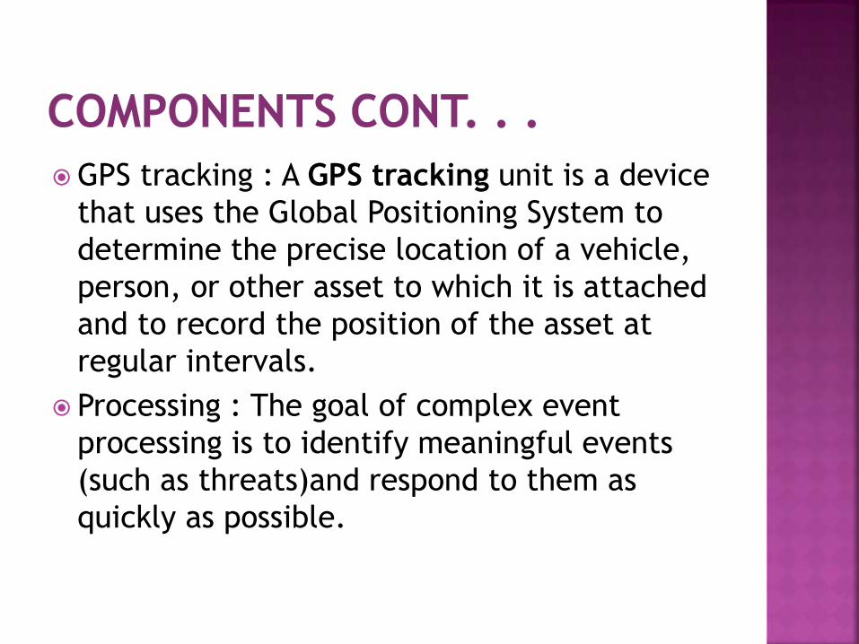
GPS tracking : A GPS tracking unit is a device
that uses the Global Positioning System to
determine the precise location of a vehicle,
person, or other asset to which it is attached
and to record the position of the asset at
regular intervals.
Processing : The goal of complex event
processing is to identify meaningful events
(such as threats)and respond to them as
quickly as possible.

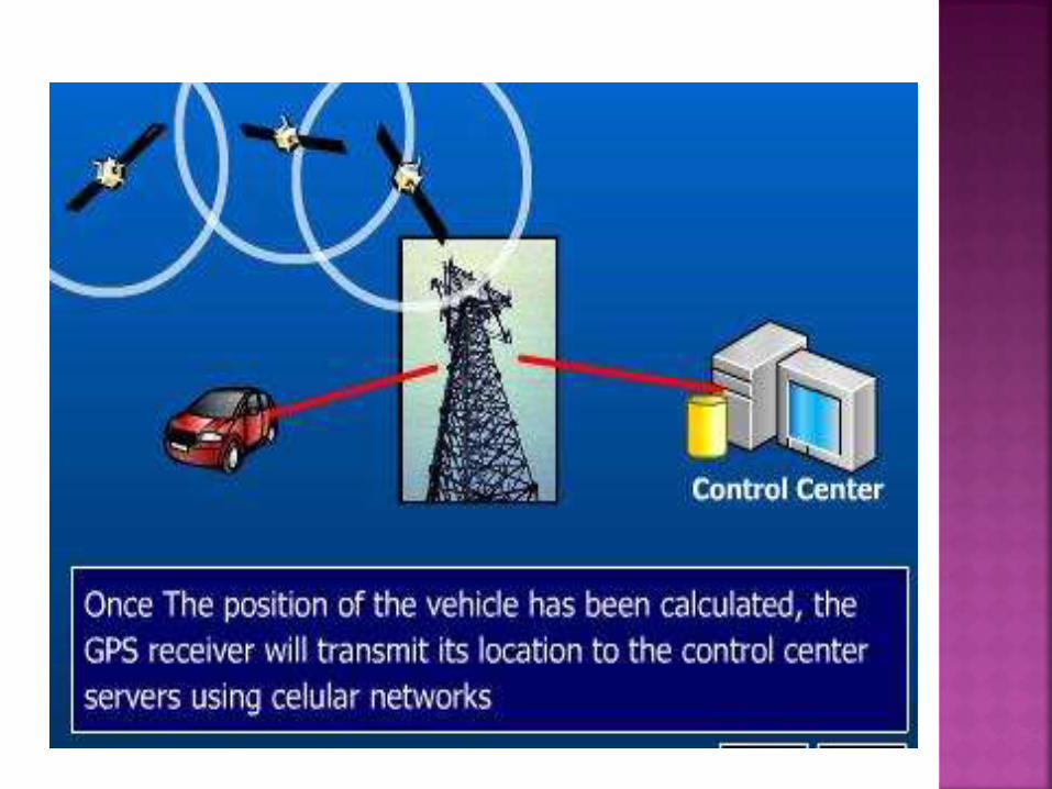
The satellites are synchronized to emit encoded
navigational information (exact positioning and
exact time).
Any vehicle equipped with a GPS receiver will
intercept these transmissions.
Using a simple mathematical formula derived from
triangulation, the receiver is able to calculate its
own longitude, latitude, velocity and even altitude.
Then this information is transmitted to a central
dispatch center.


In navigation, dead reckoning (also ded (for deduced) reckoning or DR) is the process of calculating one's current position by using a previously determined position, or fix, and advancing that position based upon known or estimated speeds over elapsed time and course.
Dead reckoning can give the best available information on position, but is subject to significant errors due to many factors as both speed and direction must be accurately known at all instants for position to be determined accurately.
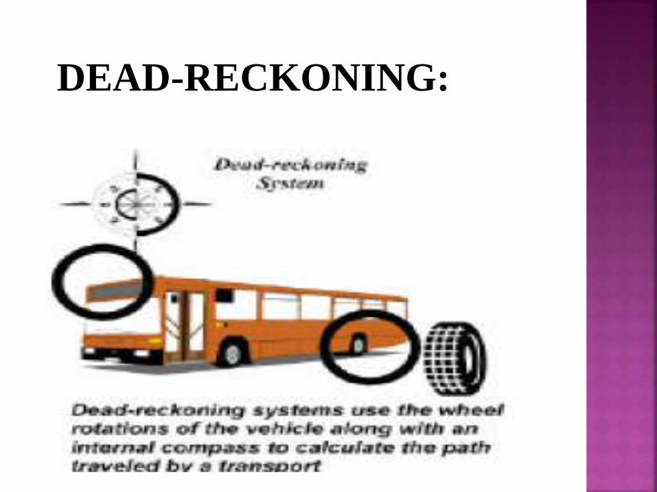
DEAD-RECKONING:

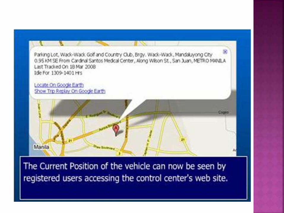
Maps allow understandable view of vehicles
location and will also allow operators to apply
local knowledge.

Ionosphere and troposphere delays - The
satellite signal slows as it passes through the
atmosphere.
Signal multipath - The GPS signal is reflected off
objects such as tall buildings before it reaches the
receiver, thus increasing the travel time of the
signal.
Receiver clock errors - A receiver's built-in clock
is not as accurate as the atomic clocks onboard the
GPS satellites.
Fleet management: when managing a fleet
of vehicles, knowing the real-time location
of all drivers allows management to meet
customer needs more efficiently. Vehicle
location information can also be used to
verify that legal requirements are being met:
for example, that drivers are taking rest
breaks and obeying speed limits.
• Passenger Information: Real-time Passenger
information systems use predictions based on AVL
input to show the expected arrival and departure
times of Public Transport services.
• Asset tracking : companies needing to track
valuable assets for insurance or other monitoring
purposes can now plot the real-time asset location
on a map and closely monitor movement and
operating status.
•Field worker management: companies with a
field service or sales workforce can use information
from vehicle tracking systems to plan field workers'
time, schedule subsequent customer visits and be
able to operate these departments efficiently.
•Covert surveillance: vehicle location devices
attached covertly by law enforcement or espionage
organizations can be used to track journeys made by
individuals who are under surveillance

AVL Benefits:

The AVL system combines a positioning hardware, a communication platform that can be used to monitor and track a commuter transport in real time.
This enables the transport management centres to observe, collect, and analyze location information about a commuter vehicle in real time.
This data will give an agency the ability to make better and more informed decisions while also providing quicker response to emergencies.
The benefits to the passengers mean better on time performance and less waiting time at bus stops.

"Glossary," Arizona Phase II Final Report: State-wide Radio Interoperability Needs Assessment, Macro Corporation and The State of Arizona, 2004, pp. 165.
http://www.gpsworld.com/gpsworld/article/articleDetail
www.calccit.org.itsdecision/serv
Murphy, Curtiss. Believable Dead Reckoning for Networked Games. Published in Game Engine Gems 2, Lengyel, Eric. AK Peters, 2011, p 308-326
S. Vitebsky (17–21 March 2002). "Performance analysis of 3G-1X EV-DO high data rate system". IEEE Wireless Communications and Networking Conference. IEEE. pp. 389–395.