
Australian Earth Science Research Spatial Information ...
15
FIG Congress 2010 Facing the Challenges – Building the Capacity Sydney, Australia, 11‐16 April 2010 1 AN ORGANISATION FOR A NATIONAL EARTH SCIENCE INFRASTRUCTURE PROGRAM Australian Earth Science Research Spatial Information Infrastructure Dr Robert Woodcock AuScope Grid - Director 2 Outline • Why build an Earth Science Spatial Information Infrastructure? • What is AuScope? • What is an Information Infrastructure? • Building an Earth Science Information Infrastructure • The AuScope Earth Science Information Infrastructure
Transcript of Australian Earth Science Research Spatial Information ...
FIG Congress 2010 Facing the Challenges – Building the Capacity Sydney, Australia, 11‐16 April 2010 1
AN ORGANISATION FOR A NATIONAL EARTH SCIENCE INFRASTRUCTURE PROGRAM
Australian Earth Science Research Spatial Information
Infrastructure
Dr Robert Woodcock
AuScope Grid - Director
2
Outline
• Why build an Earth Science Spatial Information Infrastructure?
• What is AuScope?
• What is an Information Infrastructure?
• Building an Earth Science Information Infrastructure
• The AuScope Earth Science Information Infrastructure
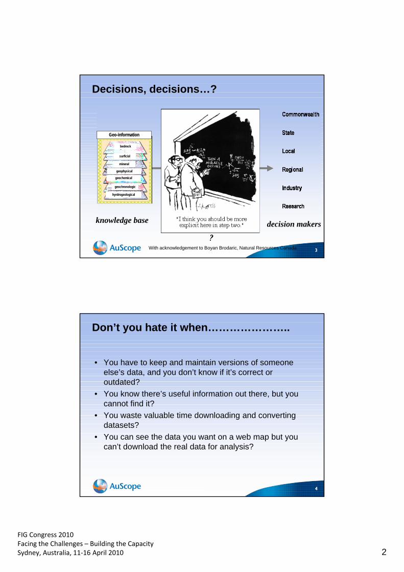
FIG Congress 2010 Facing the Challenges – Building the Capacity Sydney, Australia, 11‐16 April 2010 2
3
bedrock
surficial
mineral
geochemical
geochronologic
hyrdrogeological
Geo-information
geophysical
With acknowledgement to Boyan Brodaric, Natural Resources Canada
Decisions, decisions…?
decision makers knowledge base
4
Don’t you hate it when…………………..
• You have to keep and maintain versions of someone else’s data, and you don’t know if it’s correct or outdated?
• You know there’s useful information out there, but you cannot find it?
• You waste valuable time downloading and converting datasets?
• You can see the data you want on a web map but you can’t download the real data for analysis?
FIG Congress 2010 Facing the Challenges – Building the Capacity Sydney, Australia, 11‐16 April 2010 3
5
Data Structures
Proprietary Software
Versions of Software
Client
Part of our problem…data access is not standardised across organisations
6
Minerals Industry: Persistently driving
• Recommended actions – “Development and endorse a plan
to upgrade … the Geoscience portal..
– Endorse .. standards for company exploration data submitted to Mines Departments
– Implement web-based services …
– Develop and endorse a plan for implementation of an Australian Earth Science Grid”
See http://www.industry.gov.au/assets/documents/itrinternet/Road_to_Discovery20040702155050.pdf?CFID=284582&CFTOKEN=83266426
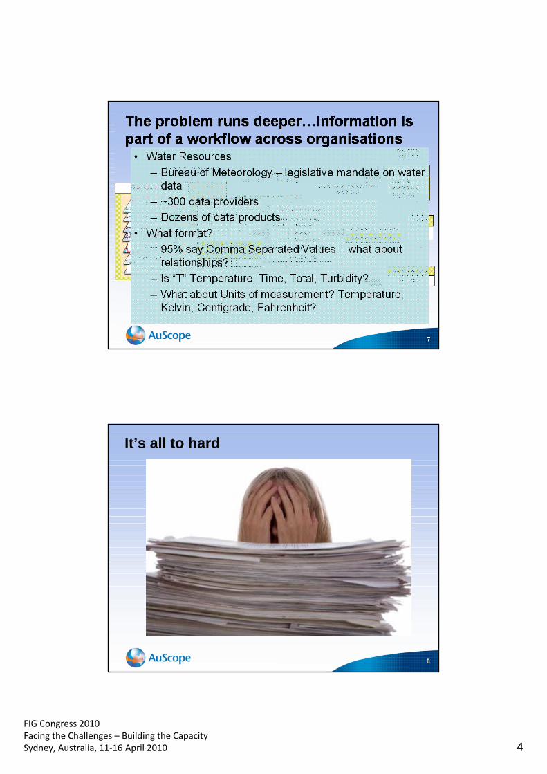
FIG Congress 2010 Facing the Challenges – Building the Capacity Sydney, Australia, 11‐16 April 2010 4
8
It’s all to hard
FIG Congress 2010 Facing the Challenges – Building the Capacity Sydney, Australia, 11‐16 April 2010 5
AN ORGANISATION FOR A NATIONAL EARTH SCIENCE INFRASTRUCTURE PROGRAM
What is AuScope?
Earth Science Research Community
10
Integration of observations, models, simulation…
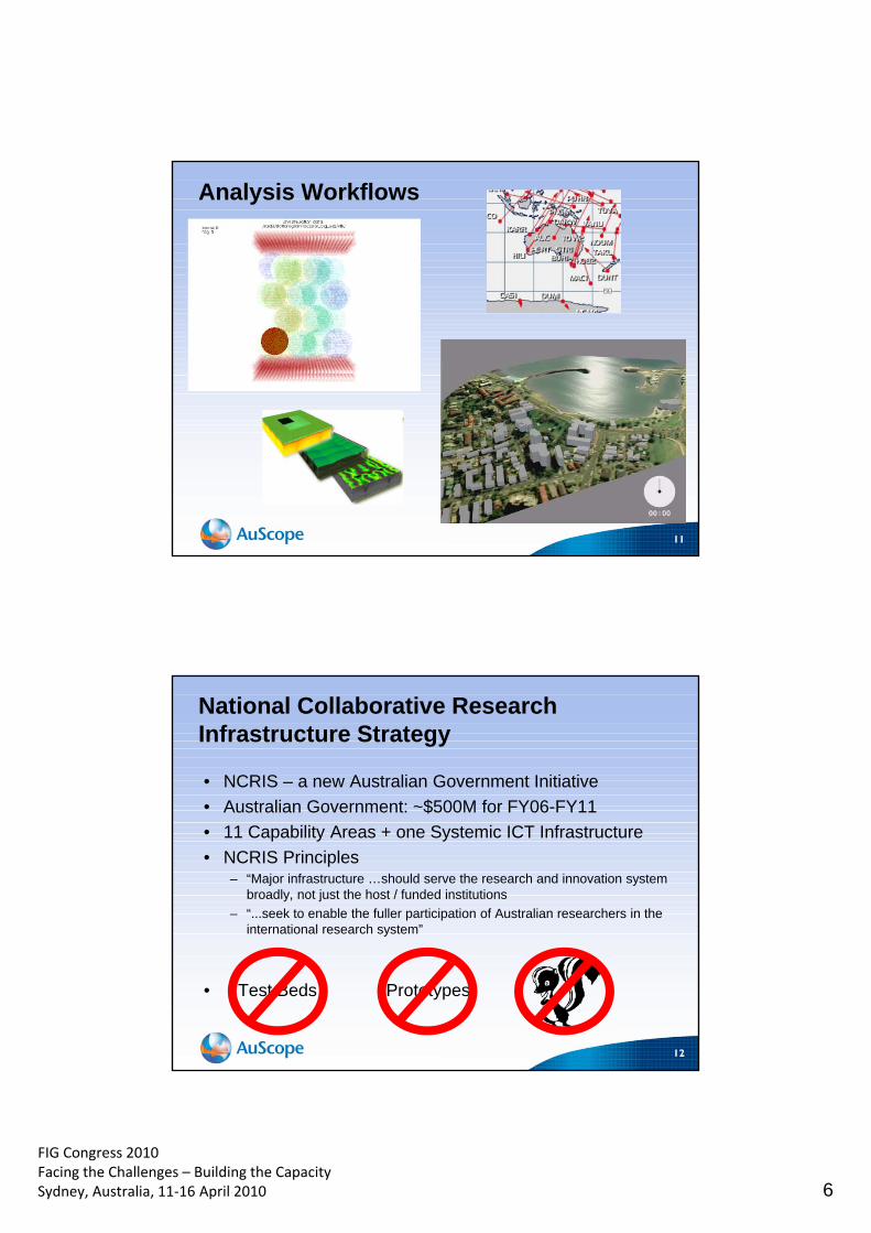
FIG Congress 2010 Facing the Challenges – Building the Capacity Sydney, Australia, 11‐16 April 2010 6
11
Analysis Workflows
12
National Collaborative Research Infrastructure Strategy
• NCRIS – a new Australian Government Initiative
• Australian Government: ~$500M for FY06-FY11
• 11 Capability Areas + one Systemic ICT Infrastructure
• NCRIS Principles – “Major infrastructure …should serve the research and innovation system
broadly, not just the host / funded institutions
– “...seek to enable the fuller participation of Australian researchers in the international research system”
• Test Beds Prototypes
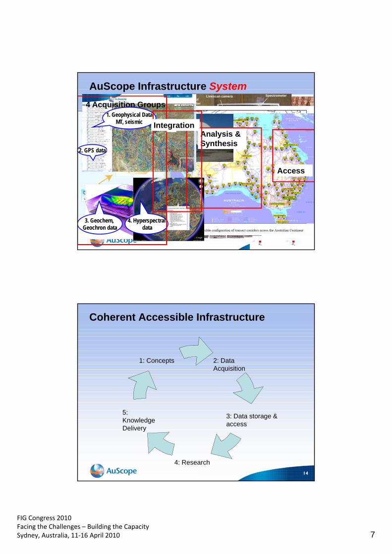
FIG Congress 2010 Facing the Challenges – Building the Capacity Sydney, Australia, 11‐16 April 2010 7
13
Spectrometer
Telescope
Robotic x/y table
Linescan camera Control
computer
Cooler
Profilometer
AuScope Infrastructure System
1. Geophysical Data MT, seismic
3. Geochem, Geochron data
4. Hyperspectral data
2. GPS data
4 Acquisition Groups
Analysis & Synthesis
Access
Integration
14
Coherent Accessible Infrastructure
1: Concepts 2: Data Acquisition
3: Data storage & access
4: Research
5: Knowledge Delivery
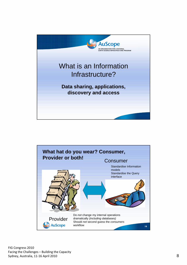
FIG Congress 2010 Facing the Challenges – Building the Capacity Sydney, Australia, 11‐16 April 2010 8
AN ORGANISATION FOR A NATIONAL EARTH SCIENCE INFRASTRUCTURE PROGRAM
What is an Information Infrastructure?
Data sharing, applications, discovery and access
16
What hat do you wear? Consumer, Provider or both!
Provider
Consumer Standardise Information models Standardise the Query interface
Do not change my internal operations dramatically (including databases) Should not second guess the consumers workflow
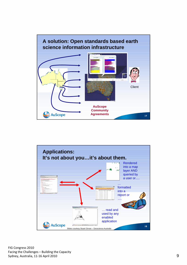
FIG Congress 2010 Facing the Challenges – Building the Capacity Sydney, Australia, 11‐16 April 2010 9
17
AuScope Community Agreements
Client
A solution: Open standards based earth science information infrastructure
18
Rendered into a map layer AND queried by a user or….
… formatted into a report or ….
… read and used by any enabled application
Slides courtesy Stuart Girvan – Geoscience Australia
Applications: It’s not about you…it’s about them.
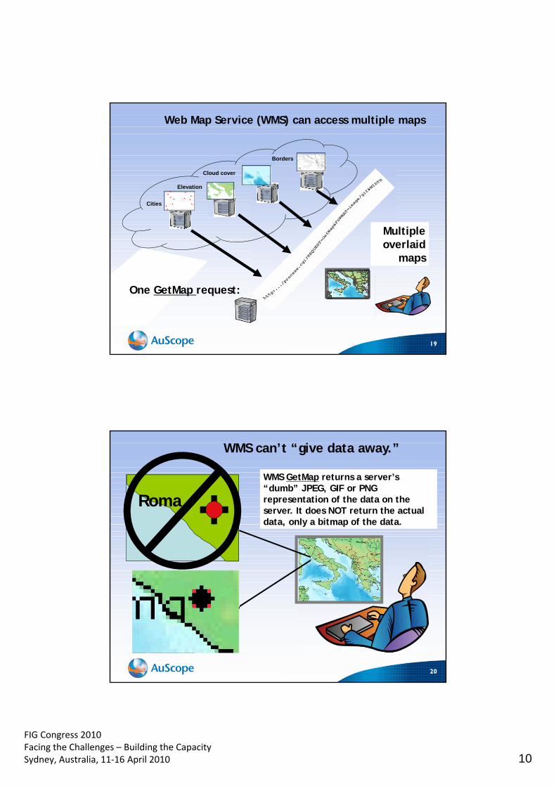
FIG Congress 2010 Facing the Challenges – Building the Capacity Sydney, Australia, 11‐16 April 2010 10
19
Multiple overlaid
maps
One GetMap request:
Web Map Service (WMS) can access multiple maps
Borders
Elevation
Cloud cover
Cities
20
WMS GetMap returns a server’s “dumb” JPEG, GIF or PNG representation of the data on the server. It does NOT return the actual data, only a bitmap of the data.
WMS can’t “give data away.”
Roma
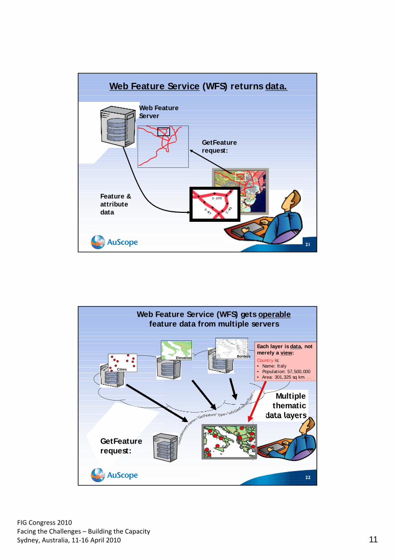
FIG Congress 2010 Facing the Challenges – Building the Capacity Sydney, Australia, 11‐16 April 2010 11
21
Web Feature Server
GetFeature request:
Feature & attribute data
Web Feature Service (WFS) returns data.
I-295
22
Multiple thematic
data layers
GetFeature request:
Web Feature Service (WFS) gets operable feature data from multiple servers
Cities
Borders Elevation
Each layer is data, not merely a view: Country is: • Name: Italy • Population: 57,500,000 • Area: 301,325 sq km. . .
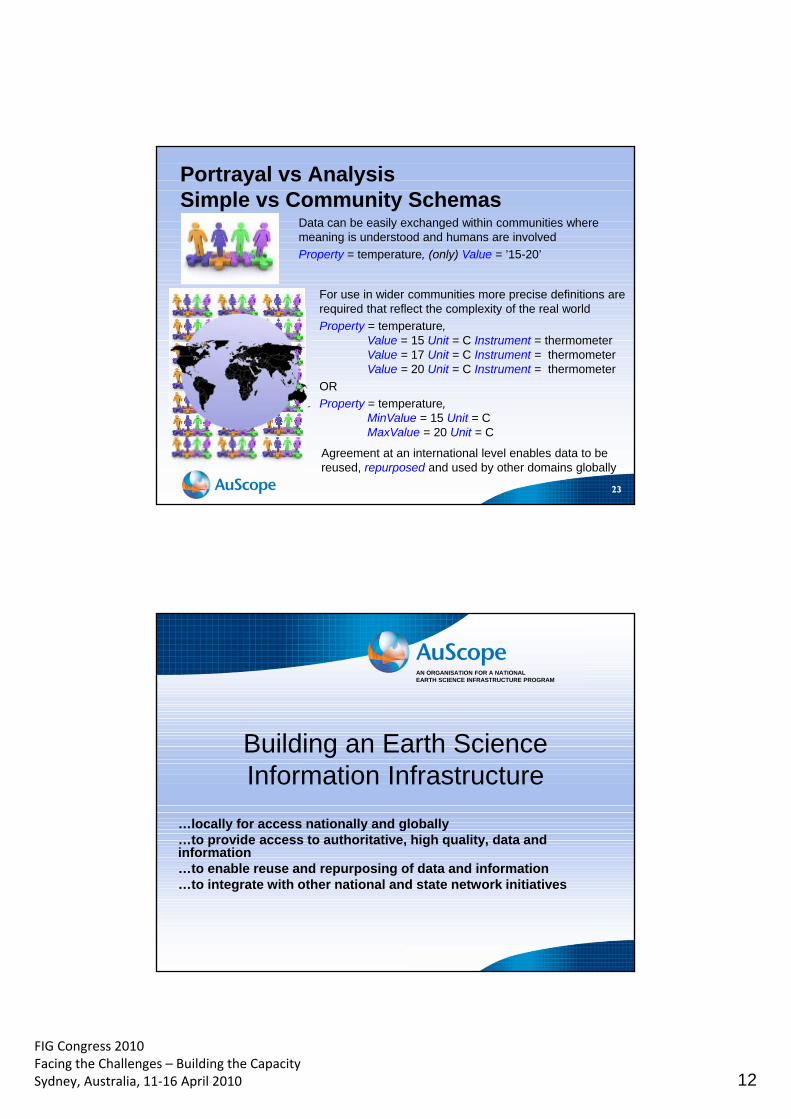
FIG Congress 2010 Facing the Challenges – Building the Capacity Sydney, Australia, 11‐16 April 2010 12
23
Portrayal vs Analysis Simple vs Community Schemas
Data can be easily exchanged within communities where meaning is understood and humans are involved
Property = temperature, (only) Value = ’15-20’
For use in wider communities more precise definitions are required that reflect the complexity of the real world
Property = temperature, Value = 15 Unit = C Instrument = thermometer Value = 17 Unit = C Instrument = thermometer Value = 20 Unit = C Instrument = thermometer
OR
Property = temperature, MinValue = 15 Unit = C MaxValue = 20 Unit = C
Agreement at an international level enables data to be reused, repurposed and used by other domains globally
AN ORGANISATION FOR A NATIONAL EARTH SCIENCE INFRASTRUCTURE PROGRAM
Building an Earth Science Information Infrastructure
…locally for access nationally and globally …to provide access to authoritative, high quality, data and information …to enable reuse and repurposing of data and information …to integrate with other national and state network initiatives
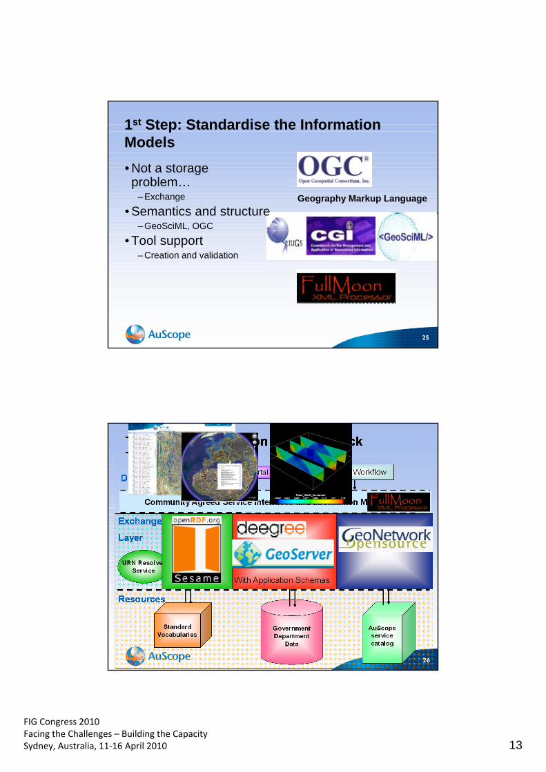
FIG Congress 2010 Facing the Challenges – Building the Capacity Sydney, Australia, 11‐16 April 2010 13
25
1st Step: Standardise the Information Models
• Not a storage problem…
– Exchange
• Semantics and structure – GeoSciML, OGC
• Tool support – Creation and validation
Geography Markup Language
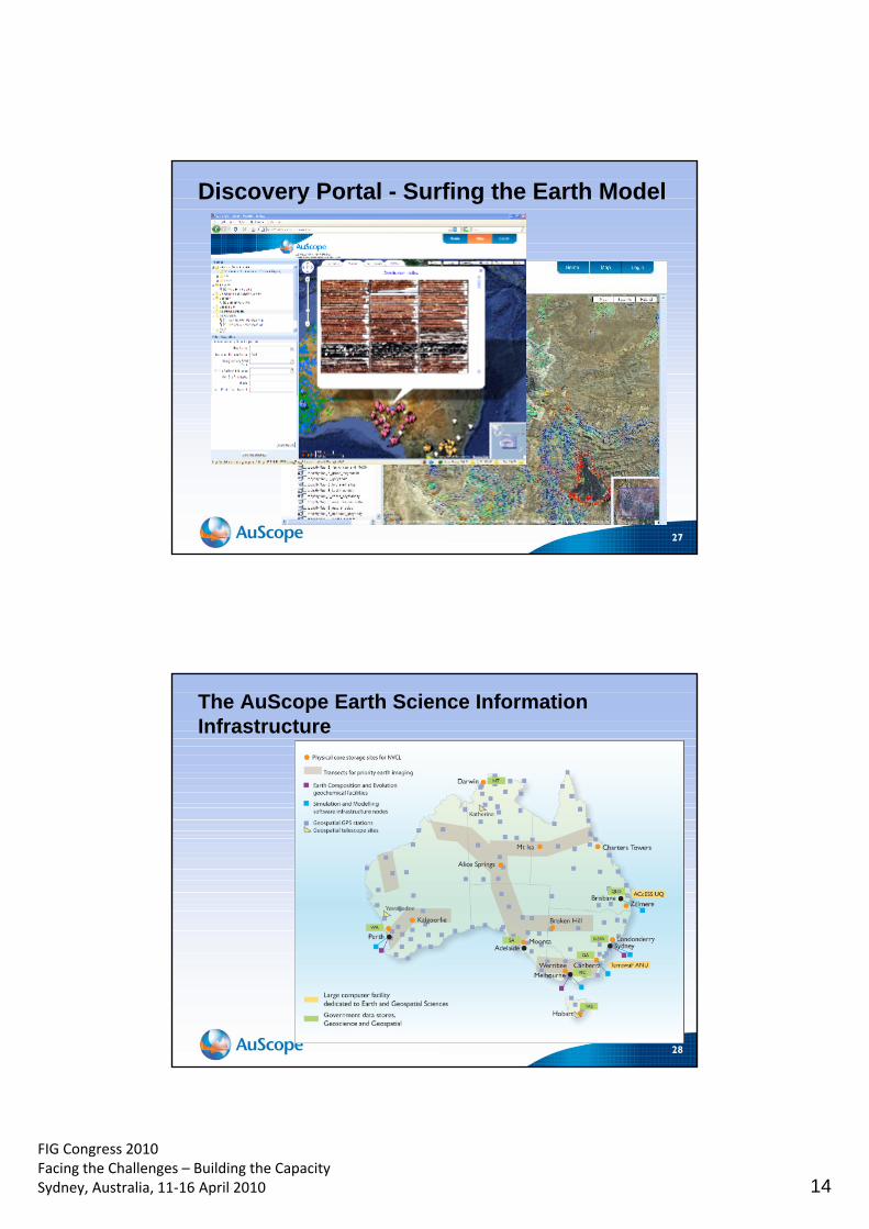
FIG Congress 2010 Facing the Challenges – Building the Capacity Sydney, Australia, 11‐16 April 2010 14
27
Discovery Portal - Surfing the Earth Model
28
The AuScope Earth Science Information Infrastructure
FIG Congress 2010 Facing the Challenges – Building the Capacity Sydney, Australia, 11‐16 April 2010 15
29
Bringing the science community together using open spatial standards


