Atmospheric Refraction Compensation in Terrestrial … · 2018-03-31 · ATMOSPHERIC REFRACTION...
8
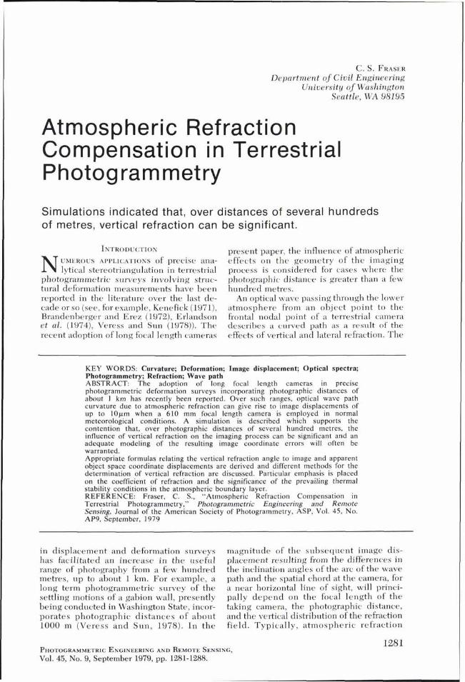
C. S. FKA~ER Department of Civil Engineering Uniuersity of Washington Seattle, WA 981Y5 Atmospheric Refraction Compensation in Terrestrial Photogrammetry Simulations indicated that, over distances of several hundreds of metres, vertical refraction can be significant. INTRODUC:TION present paper, the influence of atmospheric N UMEROUS APPLIC:A.I.IONS of precise ana- effects on the geometry of the imaging lytical stereotriangulation in terrestrial process is considered for cases where the photogrammetric surveys involving strnc- photographic distance is greater than a few turd1 deformation measurements have been hundred metres. reported in the literature over the last de- An optical wave passing through the lower cade or so (see, for example, Kenefick (1971), atmosphere from an object point to the Brandenberger and Erez (1972), Erlandson frontal nodal point of a terrestrial camera et al. (1974), Veress and Sun (1978)). The describes a curved path as a result of the recent adoption of long focal length cameras effects of vertical and lateral refraction. The KEY WORDS: Curvature; Deformation; Image displacement; Optical spectra; Photogrammetry; Refraction; Wave path ABSTRACT: The adoption of long focal length cameras in precise photogrammetric deformation surveys incorporating photographic distances of about 1 km has recently been reported. Over such ranges, optical wave path curvature due to atmospheric refraction can give rise to image displacements of up to 10pm when a 610 mm focal length camera is employed in normal meteorological conditions. A simulation is described which supports the contention that, over photographic distances of several hundred metres, the influence of vertical refraction on the imaging process can be significant and an adequate modeling of the resulting image coordinate errors will often be warranted. Appropriate formulas relating the vertical refraction angle to image and apparent object space coordinate displacements are derived and different methods for the determination of vertical refraction are discussed. Particular emphasis is placed on the coefficient of refraction and the significance of the prevailing thermal stability conditions in the atmospheric boundary layer. REFERENCE: Fraser, C. S., "Atmospheric Refraction Compensation in Terrestrial Photogrammetry," Photogrammetric Engineering and Remote Sensing, Journal of the American Society of Photogrammetry, ASP, Vol. 45, No. AP9, September, 1979 in displacement and deformation surveys has facilitated an increase in the useful range of photography from a few hundred metres, up to about 1 km. For example, a long term photogrammetric survey of the settling motions of a gabion wall, presently being conducted in Washington State, incor- porates photographic distances of about 1000 m (Veress and Sun, 1978). In the magnitude of the subsequent image dis- placement resulting from the differences in the inclination angles of the arc of the wave path and the spatial chord at the camera, for a near horizontal line of sight, will princi- pally depend on the focal length of the taking camera, the photographic distance, and the vertical distribution of the refraction field. Typically, atmospheric refraction PHOTOGRAMMETRIC ENGINEERING AND REMOTE SENSING, Vol. 45, No. 9, September 1979, pp. 1281-1288.
Transcript of Atmospheric Refraction Compensation in Terrestrial … · 2018-03-31 · ATMOSPHERIC REFRACTION...
C. S. F K A ~ E R Department of Civil Engineering
Uniuersity of Washington Seattle, WA 981Y5
Atmospheric Refraction Compensation in Terrestrial Photog rammetry
Simulations indicated that, over distances of several hundreds of metres, vertical refraction can be significant.
INTRODUC:TION present paper, the influence of atmospheric
N UMEROUS APPLIC:A.I.IONS of precise ana- effects on the geometry of the imaging lytical stereotriangulation in terrestrial process is considered for cases where the
photogrammetric surveys involving strnc- photographic distance is greater than a few turd1 deformation measurements have been hundred metres. reported in the literature over the last de- An optical wave passing through the lower cade or so (see, for example, Kenefick (1971), atmosphere from an object point to the Brandenberger and Erez (1972), Erlandson frontal nodal point of a terrestrial camera et al. (1974), Veress and Sun (1978)). The describes a curved path as a result of the recent adoption of long focal length cameras effects of vertical and lateral refraction. The
KEY WORDS: Curvature; Deformation; Image displacement; Optical spectra; Photogrammetry; Refraction; Wave path ABSTRACT: The adoption of long focal length cameras in precise photogrammetric deformation surveys incorporating photographic distances of about 1 km has recently been reported. Over such ranges, optical wave path curvature due to atmospheric refraction can give rise to image displacements of up to 10pm when a 610 mm focal length camera is employed in normal meteorological conditions. A simulation is described which supports the contention that, over photographic distances of several hundred metres, the influence of vertical refraction on the imaging process can be significant and an adequate modeling of the resulting image coordinate errors will often be warranted. Appropriate formulas relating the vertical refraction angle to image and apparent object space coordinate displacements are derived and different methods for the determination of vertical refraction are discussed. Particular emphasis is placed on the coefficient of refraction and the significance of the prevailing thermal stability conditions in the atmospheric boundary layer. REFERENCE: Fraser, C. S., "Atmospheric Refraction Compensation in Terrestrial Photogrammetry," Photogrammetric Engineering and Remote Sensing, Journal of the American Society of Photogrammetry, ASP, Vol. 45, No. AP9, September, 1979
in displacement and deformation surveys has facilitated an increase in the useful range of photography from a few hundred metres, up to about 1 km. For example, a long term photogrammetric survey of the settling motions of a gabion wall, presently being conducted in Washington State, incor- porates photographic distances of about 1000 m (Veress a n d Sun, 1978). I n the
magnitude of the subsequent image dis- placement resulting from the differences in the inclination angles of the arc of the wave path and the spatial chord at the camera, for a near horizontal line of sight, will princi- pally depend on the focal length of the taking camera, the photographic distance, and the vertical distribution of the refraction field. Typically, atmospheric refraction
PHOTOGRAMMETRIC ENGINEERING AND REMOTE SENSING, Vol. 45, No. 9, September 1979, pp. 1281-1288.

PHOTOGRAMMETRIC ENGINEERING & REMOTE SENSING, 1979
gives rise to apparent object positional dis- Based on the solution of the eikonal equa- placements of less than a millimetre over tion for geometric optics by Moritz, the fol- distances of around one hundred metres or lowing expressions for the vertical and lat- so. However, the refraction effect increases eral refraction angles have been formulated in proportion to the square of the photo- by Brunner and Angus-Leppan (1976): graphic distance and at a range of 1 km the apparent object point position can be in Vertical refraction angle A p : error by as much as 2-3 cm in normal mete- orological conditions. In precise photogram- Ap = cos f (g) metric structural deformation surveys, the S (S - Odt source of an error of this magnitude war- 0
rants consideration and hence there is a need for an adequate correction model for the effects of refraction.
In conventional aerial photography, at- mospheric refraction causes a radial dis- placement of an image. This is not the situa- tion in terrestrial photography where the camera axis is near-horizontal. In the latter case the most prominent image displace- ment is that due to vertical refraction, and this will typically result in a photo coordi- nate error Ay, assuming small kappa rotation. Thus, refraction models derived for aerial photography are not applicable in terrestrial photogrammetric surveys. In the present paper formulas are developed for the re- quired image coordinate corrections, and a simulation stlidv is carried out in order to assess the influence of particular solution techniques on the magnitude of the residual systematic errors due to vertical refraction. In addition, different methods of determin- ing the refraction angle are summarized and the influence of meteorological factors is discussed.
Fermat's principle states that when a light wave propagates through a refracting medi- um, its path of travel corresponds to that which results in the shortest travel time. For an optical wave passing through the lower atmosphere, the shortest travel time crite- rion is met by the light ray describing a curved path. The extent of curvature can be expressed in terms of the vertical and lateral refraction angles. This effect is illustrated in Figure 1.
Lateral refraction angle A a :
where dNldh and dNldT are the vertical and lateral gradients of refractivity;
p is the inclination angle of the chord; S is the chord length; and [ is the integration variable along the
chord.
Typically, applications of terrestrial pho- togrammetry involve chord lengths, S, rang- ing from a few metres up to several hundred metres. Over such distances, it can be safely assumed that the horizontal distribution within the refractivity field is uniform and, therefore, the gradient (dNldv) may be ne- glected as its value will approach zero. In the remainder of this paper, which stresses practical applications, small scale advection effects are not considered, and the treatment of the refraction correction deals only with the vertical refraction angle, A p .
Figure 2 illustrates the geometry of a typi- cal terrestrial photogrammetric survey with the light wave path, OP, being subject to a vertical refraction angle, Ap. The refraction gives rise to an error, AZ, in the Z coordinate of the object point. This error will be inde- pendent of any phi rotation, and, for a ter- restrial camera which has been leveled (kappa = O), the error, AZ, will appear as an
z h ver t i ca l at 0 flc horizon a t 0
n FIG. 2. Image coordinate correction, h y , and
FIG. 1. Wave path curvature due to refraction object space coordinate correction, AZ, for vertical effects. refraction.

ATMOSPHERIC REFRACTION COMPENSATION
image displacement, Ay, on the photograph. If the optical axis forms an angle, w, to the XY plane, then the image correction at point p ' , Ay, can be derived as
Similarly, the correction to the Z coordinate of the object point is given by
where D is the horizontal distance between 0 and P.
In cases where the photo x coordinate axis is not aligned to the horizontal, the image displacement, A, due to vertical refraction can be resolved into Ax and Ay components. For moderately small kappa and omega rota- tions, these components can be determined with sufficient accuracy by the formula
Ax = -f secyp - w)Ap sin K
If similar meteorological conditions pre- vail along the wave path, then the vertical gradient of refractivity, dNldh , can be as- sumed near-constant and Equation 1 can be simplified to the form
In certain meteorological conditions, when the wave path passes through regions of the atmospheric boundary layer which display markedly different vertical temperature dis- tributions, the assumption of near-constant dNldh is not always valid. However, it is possible to model the vertical distribution of refractivity with sufficient accuracy by em- pirical methods (Fraser, 1977) or by direct micrometeorological measurements of the components of the heat balance equation at the Earth's surfice (Brunner, 1977). Such considerations indicate the significance of the determination of Ap for the prevailing thermal stability conditions in the lower atmosphere at the time of photography.
In order to calculate the value of the angle Ap, the refractivity gradient, dNldh , must first b e determined. Refractivity, N , for optical wave propagation is given by the well-known formula of Barrel1 & Sears:
where p is the atmospheric pressure in mb;
e is the partial pressure of water vapor, also in mb; and
T is t he temperature in degrees Kelvin.
An expression for the vertical gradient of refractivity can be obtained by the differen- tiation of Equation 8 with respect to height, h . Neglecting terms in d e l d h which are insignificant in the present context, and introducing a value for the pressure gradient, dpldh , obtained from the hydrostatic equa- tion, yields the following:
From this equation it is apparent that a knowledge of the prevailing vertical tem- perature profile is all that is required for the determination of the refraction angle, Ap. However, the accurate evaluation of dTldh within some working height range can be associated with a number of practical diffi- culties and often it is appropriate to turn to tabulated values ofdTidh listed as a function of meteorological and surface conditions and obtained from very long-term empirical studies. Two such sets of tables have been given by Best et al. (1952) and Franken- berger (1955).
The determination of the refraction angle, Ap, directly in terms of dTidh has not been employed in the test evaluations of the vertical refraction correction reported here. Rather, the angle, Ap, has been obtained via the coefficient of refraction, k, which will now be introduced. The two methods are essentially equivalent, although the latter has practical advantages in the geodetic context.
The coefficient of refraction, k, is defined as the ratio of the curvature of the wave path to the Earth's curvature. Again assuming constant dNldh over the length of the ray path, k is given by
k = -R cos p ($1 . (10)
where R is the mean radius of the Earth. Combining Equations 7 and 10 yields an expression for Ap in terms of k:
This relationship (Equation 11) can also be obtained using geometrical considerations and a practical method of determining the refraction coefficient, k, is via trigonometric leveling. If the spheroidal heights of a camera station, 0, and an object point, P, are known, then an estimate of the mean value

PHOTOGRAMMETRIC ENGINEERING & REMOTE SENSING, 1979
of k can be obtained by calculating the indi- vidual coefficient, k,,,,:
k = k,,,, = 2R(S sin P,;,, - AHO,,) + 1 (12 )
(S cos p,;,,)'
where AH,,^ is the spheroidal height differ- ence between points 0 and P; and
P,;, is the elevation angle determined by theodolite observations.
If the technique of reciprocal zenith dis- tance observations is employed, then the mean value of the refraction coefficient over the chord, S, can be obtained without know- ing AH,,,, (Brunner, 1975).
In typical structural deformation surveys employing terrestrial photogrammetric tech- niques, the depth of spacing of the object points is small in comparison to the photo- graphic distance. In such cases it is often convenient to work in plane coordinates and, thus, heights based on either a sea-level or ellipsoidal datum need to be corrected for curvature. Under the assumption just stated, the transformation can be achieved Ily a simple Z coordinate correction at each camera station, this correction being given by
AZ,, = - (S cos p)'i2R (13)
where S is the distance between the camera station and the effective center of gravity of the object points; and
p is the elevation angle from the camera station to the same point.
With the AZ,, correction applied, Equation 12 can be rewritten in a form appropriate for use when the height datum is a plane:
k = 2R(S sin P,;,, - AHO,,)i(S cos P,;,,)' (14)
coefficient, yet at a height of a few tens of metres. well-mixed or near-adiabatic condi- tions can be expected, with the appropriate value of k being about 0.15.
Lack of the required equipment andior facilities lnav ureclude the direct detenni- , L
nation of the refraction coefficient by either micrometeorological or geometric tech- niques. In such cases one can turn to pub- lished tables listing k as a function of height, i n different meteorolorrical condit ions. - Tables for the monthly mean diurnal vari- ations of the refraction coefficient between the heights of 0.5 m and 500 m above the ground have been given by Brocks (1952). These tables were compiled by using mete- orological data obtained over the plains of Central and Western Europe and particular reference has been made to conditions en- countered on clear and dull days during mid-summer and winter.
In the simulation study reported here, three typical profiles of k have been con- sidered, each profile being taken from the Brocks tables. It must be remembered that the empirically derived tabular mean value for k may not be particularly representative of the actual prevailing field values. How- ever, one of the aims of this investigation was to examine the magnitude of the refrac- - tion coefficient in typically encountered meteorological conditions and, thus, mean values were deenled to be more suitable.
In order to assess quantitatively the verti- cal refraction effects in a single stereo model of a terrestrial photogrammetric survey involving photographic distances of several hundred metres, a simulation study was con- ducted. To a large degree, t he author's interest in a recent investigation of the set- -
If reciprocal vertical angles are observed be- tling motion of a gabion wall by photogram-
tween the and an object point, metric techniques provided the motivation
then a mean value of k is given by for this study. As a consequence the design Darameters adooted in the simulation are
k = RS-' cos-'p,;,, (sin p,;, + sin p,:,,)(15)
The value of k obtained from trigonometric leveling will not always be a sufficiently representative estimate for the layer of the atmosphere bounded by the working height range. Under certain meteorological condi- tions the vertical distribution of refractivity can display strong variability. As an example, a significant variation in the value of k with height may be found on a clear sunny day when the strongly superadiabatic conditions in the lowest few metres of the atmosphere produce a negative value for the refraction
similar to those found in the monitoring method for the gabion wall, the details of which have been reported by Veress and Sun (1978) . Specifically, a camera focal length of 610 mm was adopted and the co- ordinate range of the chosen object point positions corresponded to a field of view of about 11%". In addition, both camera axes were inclined to the horizontal, with an omega rotation of approximately five degrees.
Evaluation of the AZ errors was achieved through a comparison of results obtained from two solutions for the object point co-

ATMOSPHERIC REFRACTION COMPENSATION
ordinates, one incorporating a refraction cor- rection, the other not. For reasons which will become apparent, two methods of solu- tion were employed.
First, the exterior orientation elements of each camera were assumed fixed, as were the object space coordinates of the camera stations. The coordinates of the object points were then obtained by intersection, simply using the standard collinearity equations. Common areas of application of a simple intersection solution technique would, for example, be long term deformation studies where camera station mounts are anchored in such a way as to allow the reestablish- ment of the exact same camera orientation at every exposure. The mounts are assumed to be free of deformation effects.
Second, a fully analytical solution was carried out in which all parameters were allowed to "float" according to assigned a priori variances. The simulated observations were obtained by employing a normal ran- dom deviate generator to perturb an other- wise perfect data set. The magnitudes of the perturbations were determined according to assigned standard errors of + I cm for the object control points and k 2 p m for the photo coordinate observations. No a priori constraints were imposed on the elements of exterior orientation, effectively giving each element zero weight in the final adjust- ment. This second method is generally applicable in photogrammetric surveys in- volving precise measurements in an envi- ronment where object control points can be situated in 'fixed' positions, in either a rela- tive or absolute sense (see, for example, Kenefick, 1971).
The refraction coefficient has been shown to be a function of the vertical temperature profile in the lower atmosphere. However, it is common knowledge that this profile experiences a significant diurnal variation, the amplitude of which is dependent on the energy balance at the Earth's surface. In an effort to realistically reflect typically en- countered field meteorological conditions in
the simulation, three types of stratification of refraction have been considered. Brocks (1952) refers to these different stratifications as radiation type, isolation type, and transi- tion type. The appropriate extracts from Brocks' tables showing the profiles of k selected for this study are given in Table 1.
The values in Table 1 reflect profiles typi- cally found when the lower atmosphere is characterized by one of the three thermal stabil i ty regimes: uns table , neut ra l , or stable. Unstable conditions occur when the Earth's surface is strongly heated by incom- ing short-wave solar radiation (or insolation). Such atmospheric conditions are possibly the most commonly encountered during ter- restrial photogrammetric surveys as they are normally found in the atmospheric boundary layer during clear daytime periods. As the unstable turbulent regime develops, in- creased turbulence dominated by free con- vection processes results in increased mix- ing. The increased mixing in turn leads to the formation of a more homogenous refrac- tivity distribution with very little variability in the gradient, dNldh, being encountered in the region from a few tens to hundreds of metres above the ground.
Neutral, or adiabatic conditions are nor- mally found during the two daily transition periods. However, the neutral stratification is typically a short-term phenomenon rarely exceeding periods of more than a few tens of minutes. Adiabatic conditions may also pre- vail in the lower atmosphere when there is thick cloud cover accompanied by moderate winds. The principal reason for examining a profile of constant k rests in the fact that, as mentioned, near-neutral conditions are encountered in the upper region of the un- stable regime.
Stable conditions are indicated by tem- perature inversions, for example, the typical night t ime inversion generated through ground cooling by outward long-wave radia- tion. Turbulent mixing is suppressed in stable conditions and, thus, strong refrac- tivity gradients are developed. The values of
Height above Unstable Neutral or Stable ground (m) midday-summer adiabatic morning-winter
1.5 -1.7 0.8 4 -0.4 0.15 0.5
10 -0.05 0.15 0.35 40 0.12 0.15 0.25
100 0.14 0.15 0.21 800 0.15 0.15 0.20

PHOTOGRAMMETRIC ENGINEERING & REMOTE SENSING, 1979
k in the third column of Table 1 illustrate this behavior. Recent investigations (Brun- ner, 1977; Fraser and Brunner, 1977) have shown that temperature inversions offer the least favorable conditions for the adequate modeling of atmospheric refraction for geo- detic applications. However, since stable conditions are commonly found on windless cloudy days, a stable stratification of refrac- tion has been considered in the simulation study.
The coordinate errors, 62, at each of nine selected object points, due to the effect of vertical refraction, are shown for the three stability conditions in Figures 3, 4, and 5 . The most striking feature in the figures is the variation in the magnitude of the error, 6Z, between the two methods of solution. To a large extent the variations encountered are to be expected, as for the case of object point coordination by simple intersection the magnitude of 6Z is equal to the correction, AZ, given by Equation 4. In the fully ana- lytical solution a priori constraints on the five object points (1,3,5,7, and 9) selected as control points (standard error = k1 cm) bring about a considerable reduction in the Z displacements. This reduction is most pronounced in the case of stable conditions where the RMS error of 62 is reduced from 2.2 cm down to 0.2 cm. In addition, the system- atic nature of the errors arising from the first solution method is not reflected in the coordinate displacements obtained using the analytical solution. In the latter case, the systematic error is either partially or fully absorbed by an upward shift of the com- puted Z coordinate of each camera station. This shift amounts to 9 cm for the stable, 1.2 cm for the neutral, and 4 cm for the unstable k profiles. Only in the neutral conditions instance, where the refraction error is con- stant, is the entire magnitude of the error absorbed by a Z coordinate shift at each camera station.
I n t e r s e c t i o n
I Analvtical so lu t i on
I I i = . 1 5 1 1 a 2 ~ 3 0 1 1 5 m .
FIG. 4. Object space coordinate errors, 82- adiabatic conditions.
The most probable estimates of the ele- ments of exterior orientation, obtained from the analytical solution for the unstable and stable atmospheric conditions, differ slightly in value. However, whereas the differences in derived camera station coordinates amount to about 1 cm in Y and 5 cm in Z, the RMS errors in object point Z coordinates amount to only 2 2 mm and +4 mm respec- tively.
The principal influence of the vertical refraction effect is seen in apparent Z co- ordinate displacements of the object point position. However, deformation surveys typically involve the determination of the extent of lateral deflection in the structure as well as its settling. Results of the simulation study show the magnitude of errors in the determination of the X and Y coordinates, due to vertical refraction, to be in all cases less than 3 mm and in most cases ofthe order of 1 mm. These errors in lateral deflection determination arise mainly as a result of the introduction of a y-parallax component due to differential refraction. Typically, the dis- tribution of the refraction field throughout the area of survey will be sufficiently near- uniform such that resulting errors in the cal- culated X and Y coordinates of an object point will be negligible. However, differen- tial refraction can become significant if there is a large time lag between the exposure of successive photographs.
Although the atmospheric conditions
k=-.05 P l 3 l
FIG. 3. Object space coordinate errors, 6Z- FIG. 5. Object space coordinate errors, 82- stable conditions. unstable conditions.

ATMOSPHERIC REFRACTION COMPENSATION
represented by the vertical profiles of the refraction coefficient used in the simulation study will by no means adequately describe all field conditions, a few conclusions re- garding the effect of vertical refraction in terrestrial photogrammetric surveys may be drawn.
From the results presented, it is apparent that the method of solution for the object point coordinates is of considerable impor- tance. For the case where the elements of exterior orientation are assumed to be time invariant and object points are determined by intersection, the vertical refraction effect increases with the square of the photo- graphic distance. Veress and Sun (1978) have reported achieving object point coordi- nate precisions ranging from a standard error of *6 mm to *20 mm, over a photographic distance of 1 km using a modified camera of 610 mm focal length. This study has shown that, in normal meteorological conditions, the vertical refraction effect can amount to 2 cm over this range. The magnitude of the error is thus significant when compared to the attainable precision. The required cor- rection to photo coordinates, given by Equa- tion 3, should be assessed in the context of the required accuracy specifications before the refraction effect is arbitrarily deemed insignificant and neglected.
The simulation study reported has shown that, when an analytical solution is em- ployed with a priori constraint applied to the object control points, if the elements of exterior orientation are t rea ted as com- pletely unknown parameters, the errors in object point coordinates due to vertical re- fraction effects are reduced to a few mil- limetres over a photographic distance of 1 km. To a large extent the refraction effect will be absorbed by a shift in the Z coordi- nates of each camera station. However, if the elements of exterior orientation are treated as measured quantities and assigned a priori variances, then the vertical refraction effect must be considered in order to avoid the introduction of residual systematic errors into the analytical solution.
Terrestrial photogrammetric surveys often involve the monitoring of structural defor- mations over a long period of time. In such cases the problem of differential refraction between the periods of survey arises and it may prove advantageous to confine t h e photography to times of the day when the refraction distribution in the lower atmo- sphere is either similar to that encountered in the previous monitoring periods, or alter-
natively, is easily modeled by direct mea- surements or empirical means. With regard to the case of modeling the vertical profile of k, unstable (or clear day time) stratifications are most suitable as in these conditions an adiabatic profile ( k = 0.15) in the atmo- spheric boundary layer can generally b e assumed to be present above the lowest few tens of metres. In the surface layer, below the well-mixed region, k can be determined with sufficient accuracy by empirical means.
For their valuable comments and advice on the first draft of this paper, the author wishes to express his appreciation to Mr. R. M. Enoka, Dr. R. B. Forrest, and Dr. S. A. Veress.
Best, A. C., E. Knighting, R. H. Pedlow, and K. Stormonth, 1952. Temperature and humid- ity gradients in the first 100 metres over South East England, Geophysical Memoirs, 89, HMSO.
Brandenberger, A. J., and M. T. Erez, 1972. Photo- grammetric determination of displacements and deformations in large engineering struc- tures, Canadian Suroeyor, 26(2), 163-179.
Brocks, K., 1952. Die Lichtstrahlkrummung in den unteren 500 m der Atmosphare, Annalen der Meteorologie, 5, 47-57.
Brunner, F. K., 1975. Coefficients of refraction on a mountain slope, Unisuro G22, Univ. NSW, Sydney, 81-96.
, 1978. Experimental determination of the coefficients of refraction from heat flux measurements, Proc. Int. Symp. EDM and the influence of Atmos. Refraction (P. Richardus, Editor), Wageningen, The Netherlands, May, 1977.
Brunner, F. K., and P. V. Angus-Leppan, 1976. On the significance of meteorological parameters for terrestrial refraction, Unisuro G25, Univ. NSW, Sydney, 95-108.
Erlandson, J. P., J. C. Peterson, and S. A. Veress, 1974. The modification and use of the BC-4 camera for measurements of structural defor- mations, Proc. of Fall Meeting, ASP, 387-402.
Frankenberger, E., 1955. fiber uertikale Tempemtur-, Feuchte- und Wind-gradienten in den untersten 7 Dekametern der Atmos- phare, den Vertikalaustausch und den Warmehausalt an Wiesenboden bei Quick- bornlHolstein 195311 954, Berichte des Deutschen Wetterdienstes, No. 20.
Fraser, C. S., 1977. The empirical determination of sensible heat flux for refraction corrections, Unisuro G27, Univ. NSW, Sydney, 42-51.
Fraser, C. S., and F. K. Brunner, 1977. On the analysis of multiple meteorological measure-
PHOTOGRAMMETRIC ENGINEERING & REMOTE SENSING, 1979
ments for microwave EDM, Unisurv G26, metric monitoring o f a gabion wall, Photo- Univ. NSW, Sydney, 47-81. grammetric Engineering and Remote Sens-
Kenefick, J . F., 1971. Ultra-precise analytics, ing, 44(2), 205-21 1. Photogrammetric Engineering, 37(1 l), 1167- 1187. (Received November 17, 1978; revised and ac-
Veress, S .A. , and L. L. Sun, 1978. Photogram- cepted April 2 , 1979)
ANALYTICAL PLOTTER SYMPOSIUM AND WORKSHOP
at the
SHERATON INN/INTERNATIONAL CONFERENCE CENTER
RESTON, VIRGINIA
April 20-25, 1980 The American Society of Photogrammetry, through the efforts of the
Instrumentation Committee, is sponsoring a Symposium and Workshop on Analytical Plotters to provide educational information to all interested parties. All known operational Analytical Plotters will be made available to provide an opportunity for current and potential users to obtain first- hand knowledge of their capabilities. Technical sessions will be held on the first three days of the week. These will include tutorial sessions by the individual manufacturers, and other presentations for Managers, Technicians and Scientists. Concurrent workshop sessions will make over 200 hours of hands-on instrument time available to registrants. An open panel discussion with the manufacturers representatives will con- clude the week of activities. The Symposium and Workshop will be a unique forum for the exchange of information between users and manu- facturers.
Registration will be separated into two parts - The Symposium and workshop combination and the Symposium alone. The hands-on nature of the workshop necessitates a limited preregistration while the general symposium will support a larger audience. Look for preregistration forms in future issues of Photogrammetric Engineering and Remote Sensing, or inquire to:
Analytical Plotter workshop AMERICAN SOCIETY OF PHOTOGRAMMETRY
105 VIRGINIA AVENUE FALLS CHURCH, VIRGINIA 22046