Arbroath Path Network - home | Angus Council to Arbroath Path Network Arbroath is midway along the...
3
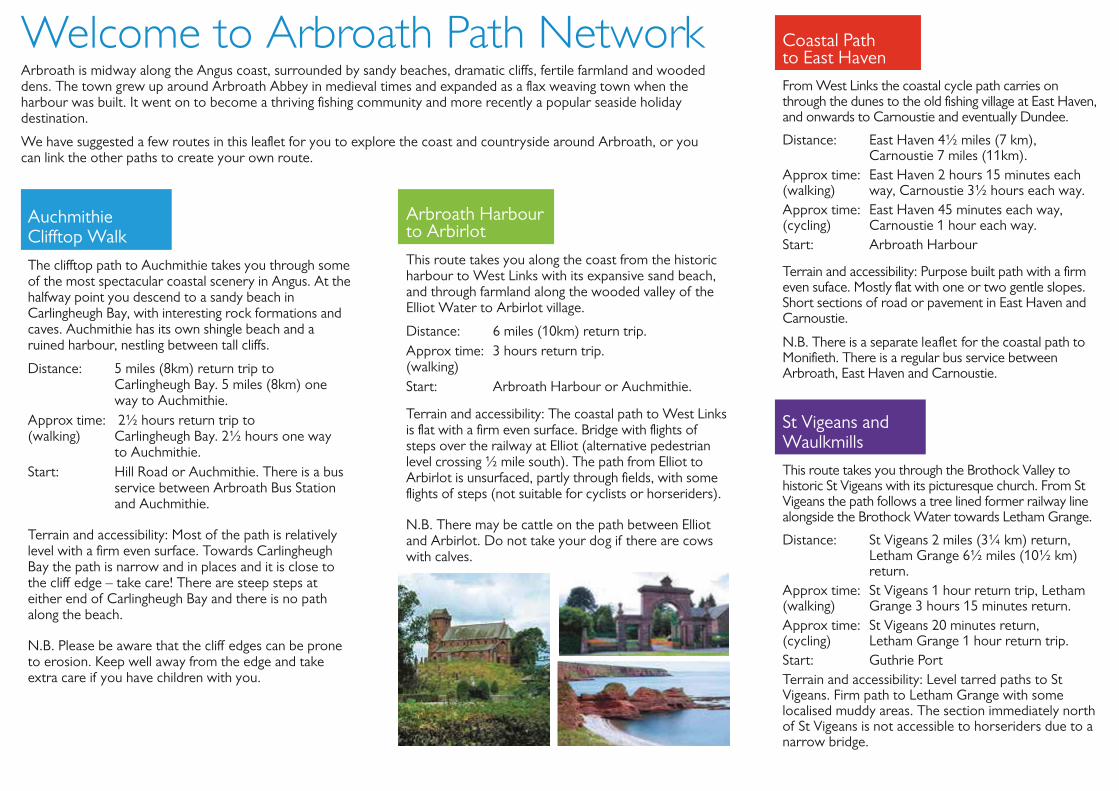
Welcome to Arbroath Path Network Arbroath is midway along the Angus coast, surrounded by sandy beaches, dramatic cliffs, fertile farmland and wooded dens. The town grew up around Arbroath Abbey in medieval times and expanded as a flax weaving town when the harbour was built. It went on to become a thriving fishing community and more recently a popular seaside holiday destination. We have suggested a few routes in this leaflet for you to explore the coast and countryside around Arbroath, or you can link the other paths to create your own route. Auchmithie Clifftop Walk The clifftop path to Auchmithie takes you through some of the most spectacular coastal scenery in Angus. At the halfway point you descend to a sandy beach in Carlingheugh Bay, with interesting rock formations and caves. Auchmithie has its own shingle beach and a ruined harbour, nestling between tall cliffs. Distance: 5 miles (8km) return trip to Carlingheugh Bay. 5 miles (8km) one way to Auchmithie. Approx time: 2½ hours return trip to (walking) Carlingheugh Bay. 2½ hours one way to Auchmithie. Start: Hill Road or Auchmithie. There is a bus service between Arbroath Bus Station and Auchmithie. Terrain and accessibility: Most of the path is relatively level with a firm even surface. Towards Carlingheugh Bay the path is narrow and in places and it is close to the cliff edge – take care! There are steep steps at either end of Carlingheugh Bay and there is no path along the beach. N.B. Please be aware that the cliff edges can be prone to erosion. Keep well away from the edge and take extra care if you have children with you. Arbroath Harbour to Arbirlot This route takes you along the coast from the historic harbour to West Links with its expansive sand beach, and through farmland along the wooded valley of the Elliot Water to Arbirlot village. Distance: 6 miles (10km) return trip. Approx time: 3 hours return trip. (walking) Start: Arbroath Harbour or Auchmithie. Terrain and accessibility: The coastal path to West Links is flat with a firm even surface. Bridge with flights of steps over the railway at Elliot (alternative pedestrian level crossing ½ mile south). The path from Elliot to Arbirlot is unsurfaced, partly through fields, with some flights of steps (not suitable for cyclists or horseriders). N.B. There may be cattle on the path between Elliot and Arbirlot. Do not take your dog if there are cows with calves. Coastal Path to East Haven From West Links the coastal cycle path carries on through the dunes to the old fishing village at East Haven, and onwards to Carnoustie and eventually Dundee. Distance: East Haven 4½ miles (7 km), Carnoustie 7 miles (11km). Approx time: East Haven 2 hours 15 minutes each (walking) way, Carnoustie 3½ hours each way. Approx time: East Haven 45 minutes each way, (cycling) Carnoustie 1 hour each way. Start: Arbroath Harbour Terrain and accessibility: Purpose built path with a firm even suface. Mostly flat with one or two gentle slopes. Short sections of road or pavement in East Haven and Carnoustie. N.B. There is a separate leaflet for the coastal path to Monifieth. There is a regular bus service between Arbroath, East Haven and Carnoustie. St Vigeans and Waulkmills This route takes you through the Brothock Valley to historic St Vigeans with its picturesque church. From St Vigeans the path follows a tree lined former railway line alongside the Brothock Water towards Letham Grange. Distance: St Vigeans 2 miles (3¼ km) return, Letham Grange 6½ miles (10½ km) return. Approx time: St Vigeans 1 hour return trip, Letham (walking) Grange 3 hours 15 minutes return. Approx time: St Vigeans 20 minutes return, (cycling) Letham Grange 1 hour return trip. Start: Guthrie Port Terrain and accessibility: Level tarred paths to St Vigeans. Firm path to Letham Grange with some localised muddy areas. The section immediately north of St Vigeans is not accessible to horseriders due to a narrow bridge.
Transcript of Arbroath Path Network - home | Angus Council to Arbroath Path Network Arbroath is midway along the...
Arbroath PathNetwork
Angus Path Networks
A92
A92A91
A92
A92A90
A90
A94
A90A9
A9
M90
Montrose
Arbroath
Forfar
Perth
Carnoustie
DunkeldBlairgowrie
CouparAngus
KirriemuirBrechin
St Andrews
ANGUS
Monifieth
Dundee
Useful Information
Arbroath Tourist Information Centre01241 872609
Arbroath Library01241 435605
Arbroath Signal Tower Museum01241 435329
www.angus.gov.uk
www.visitangus.com
www.travelinescotland.comTraveline (Public Transport Information)
Wherever possible, barriers such as stiles andsteps have been avoided, to make paths asaccessible as possible for everybody, includingdisabled people, cyclists and horseriders. Pathsurfaces vary from firm purpose build paths tofarm tracks and earth paths. Further details areincluded in the walk descriptions.
Some of the paths are on working farms andother privately owned land. Please respectland management operations, take your litterhome and keep you dog under proper control.
© Crown copyright and database right 2016. All rights reserved. 100023404.
The content of this publication can be made available in alternativeformats or translated into other community languages.
Leaflets are also available for path networks in other parts of Angus.
Please contact the Council’s ACCESSLine on 03452 777 778 for further information
E-mail: [email protected] or visit www.angus.uk www.angus.gov.uk • www.angusahead.com
Welcome to Arbroath Path Network Arbroath is midway along the Angus coast, surrounded by sandy beaches, dramatic cliffs, fertile farmland and wooded dens. The town grew up around Arbroath Abbey in medieval times and expanded as a flax weaving town when the harbour was built. It went on to become a thriving fishing community and more recently a popular seaside holiday destination.
We have suggested a few routes in this leaflet for you to explore the coast and countryside around Arbroath, or you can link the other paths to create your own route.
Auchmithie Clifftop Walk
The clifftop path to Auchmithie takes you through some of the most spectacular coastal scenery in Angus. At the halfway point you descend to a sandy beach in Carlingheugh Bay, with interesting rock formations and caves. Auchmithie has its own shingle beach and a ruined harbour, nestling between tall cliffs.
Distance: 5 miles (8km) return trip to Carlingheugh Bay. 5 miles (8km) one way to Auchmithie.
Approx time: 2½ hours return trip to (walking) Carlingheugh Bay. 2½ hours one way
to Auchmithie. Start: Hill Road or Auchmithie. There is a bus
service between Arbroath Bus Station and Auchmithie.
Terrain and accessibility: Most of the path is relatively level with a firm even surface. Towards Carlingheugh Bay the path is narrow and in places and it is close to the cliff edge – take care! There are steep steps at either end of Carlingheugh Bay and there is no path along the beach.
N.B. Please be aware that the cliff edges can be prone to erosion. Keep well away from the edge and take extra care if you have children with you.
Arbroath Harbour to Arbirlot
This route takes you along the coast from the historic harbour to West Links with its expansive sand beach, and through farmland along the wooded valley of the Elliot Water to Arbirlot village.
Distance: 6 miles (10km) return trip. Approx time: 3 hours return trip. (walking) Start: Arbroath Harbour or Auchmithie.
Terrain and accessibility: The coastal path to West Links is flat with a firm even surface. Bridge with flights of steps over the railway at Elliot (alternative pedestrian level crossing ½ mile south). The path from Elliot to Arbirlot is unsurfaced, partly through fields, with some flights of steps (not suitable for cyclists or horseriders).
N.B. There may be cattle on the path between Elliot and Arbirlot. Do not take your dog if there are cows with calves.
Coastal Path to East Haven
From West Links the coastal cycle path carries on through the dunes to the old fishing village at East Haven, and onwards to Carnoustie and eventually Dundee.
Distance: East Haven 4½ miles (7 km), Carnoustie 7 miles (11km).
Approx time: East Haven 2 hours 15 minutes each (walking) way, Carnoustie 3½ hours each way. Approx time: East Haven 45 minutes each way, (cycling) Carnoustie 1 hour each way. Start: Arbroath Harbour
Terrain and accessibility: Purpose built path with a firm even suface. Mostly flat with one or two gentle slopes. Short sections of road or pavement in East Haven and Carnoustie.
N.B. There is a separate leaflet for the coastal path to Monifieth. There is a regular bus service between Arbroath, East Haven and Carnoustie.
St Vigeans and Waulkmills
This route takes you through the Brothock Valley to historic St Vigeans with its picturesque church. From St Vigeans the path follows a tree lined former railway line alongside the Brothock Water towards Letham Grange.
Distance: St Vigeans 2 miles (3¼ km) return, Letham Grange 6½ miles (10½ km) return.
Approx time: St Vigeans 1 hour return trip, Letham (walking) Grange 3 hours 15 minutes return. Approx time: St Vigeans 20 minutes return, (cycling) Letham Grange 1 hour return trip. Start: Guthrie Port Terrain and accessibility: Level tarred paths to St Vigeans. Firm path to Letham Grange with some localised muddy areas. The section immediately north of St Vigeans is not accessible to horseriders due to a narrow bridge.

Welcome to Arbroath Path NetworkArbroath is midway along the Angus coast, surrounded by sandy beaches, dramatic cliffs, fertile farmland and woodeddens. The town grew up around Arbroath Abbey in medieval times and expanded as a flax weaving town when theharbour was built. It went on to become a thriving fishing community and more recently a popular seaside holidaydestination.
We have suggested a few routes in this leaflet for you to explore the coast and countryside around Arbroath, or youcan link the other paths to create your own route.
Coastal Path to East Haven
From West Links the coastal cycle path carries onthrough the dunes to the old fishing village at East Haven,and onwards to Carnoustie and eventually Dundee.
Distance:East Haven 4½ miles (7 km),Carnoustie 7 miles (11km).
Approx time:East Haven 2 hours 15 minutes each(walking)way, Carnoustie 3½ hours each way.Approx time:East Haven 45 minutes each way,(cycling)Carnoustie 1 hour each way.Start:Arbroath Harbour
Terrain and accessibility: Purpose built path with a firmeven suface. Mostly flat with one or two gentle slopes.Short sections of road or pavement in East Haven andCarnoustie.
N.B. There is a separate leaflet for the coastal path toMonifieth. There is a regular bus service betweenArbroath, East Haven and Carnoustie.
Arbroath Harbour to Arbirlot
This route takes you along the coast from the historicharbour to West Links with its expansive sand beach,and through farmland along the wooded valley of theElliot Water to Arbirlot village.
Distance:6 miles (10km) return trip.Approx time:3 hours return trip.(walking)Start:Arbroath Harbour or Auchmithie.
Terrain and accessibility: The coastal path to West Linksis flat with a firm even surface. Bridge with flights ofsteps over the railway at Elliot (alternative pedestrianlevel crossing ½ mile south). The path from Elliot toArbirlot is unsurfaced, partly through fields, with someflights of steps (not suitable for cyclists or horseriders).
N.B. There may be cattle on the path between Elliotand Arbirlot. Do not take your dog if there are cowswith calves.
Auchmithie Clifftop Walk
The clifftop path to Auchmithie takes you through someof the most spectacular coastal scenery in Angus. At thehalfway point you descend to a sandy beach inCarlingheugh Bay, with interesting rock formations andcaves. Auchmithie has its own shingle beach and aruined harbour, nestling between tall cliffs.
Distance:5 miles (8km) return trip toCarlingheugh Bay. 5 miles (8km) oneway to Auchmithie.
Approx time:2½ hours return trip to (walking)Carlingheugh Bay. 2½ hours one way
to Auchmithie.Start:Hill Road or Auchmithie. There is a bus
service between Arbroath Bus Stationand Auchmithie.
Terrain and accessibility: Most of the path is relativelylevel with a firm even surface. Towards CarlingheughBay the path is narrow and in places and it is close tothe cliff edge – take care! There are steep steps ateither end of Carlingheugh Bay and there is no pathalong the beach.
N.B. Please be aware that the cliff edges can be proneto erosion. Keep well away from the edge and takeextra care if you have children with you.
St Vigeans and Waulkmills
This route takes you through the Brothock Valley tohistoric St Vigeans with its picturesque church. From StVigeans the path follows a tree lined former railway linealongside the Brothock Water towards Letham Grange.
Distance:St Vigeans 2 miles (3¼ km) return,Letham Grange 6½ miles (10½ km)return.
Approx time:St Vigeans 1 hour return trip, Letham(walking)Grange 3 hours 15 minutes return.Approx time:St Vigeans 20 minutes return,(cycling)Letham Grange 1 hour return trip.Start:Guthrie PortTerrain and accessibility: Level tarred paths to StVigeans. Firm path to Letham Grange with somelocalised muddy areas. The section immediately northof St Vigeans is not accessible to horseriders due to anarrow bridge.
M90
Wherever possible, barriers such as stiles and steps have been avoided, to make paths as accessible as possible for everybody, including disabled people, cyclists and horseriders. Path surfaces vary from firm purpose build paths to farm tracks and earth paths. Further details are included in the walk descriptions.
Some of the paths are on working farms and other privately owned land. Please respect land management operations, take your litter home and keep you dog under proper control.
The content of this publication can be made available in alternative formats or translated into other community languages.
Leaflets are also available for path networks in other parts of Angus.
Please contact the Council’s ACCESSLine on 03452 777 778 for further information
E-mail: [email protected] or visit www.angus.gov.uk
A92
A92 A91
A92
A92 A90
A90
A94
A90 A9
A9
Montrose
Arbroath
Forfar
Perth
Carnoustie
Dunkeld Blairgowrie
Coupar Angus
Kirriemuir Brechin
St Andrews
ANGUS
Monifieth
Dundee
© Crown copyright and database right 2016. All rights reserved. 100023404.
Angus Path Networks
Arbroath Path Network
Useful Information
Arbroath Tourist Information Centre 01241 872609
Arbroath Library 01241 435605
Arbroath Signal Tower Museum 01241 435329
www.angus.gov.uk
www.visitangus.com
www.travelinescotland.com Traveline (Public Transport Information)
www.angus.gov.uk • www.visitangus.com

HerculesDen Burn
Elliot Water
Bankhead
Peasiehill
Birkhill
Magungie
RM Condor
Brothock Water
Millf ield
Dickmountlaw
West Seaton
Kinaldie Holdings
Tanglehall Cottages
Mains Of Kelly
Balcathie Elliot
Bank
West Woodsof Ethie
Marywell
East Seaton
Cliffburn
St Vigeans
Harbour
West Links
Hospitalfield
Wes
tway
GuthriePort
Victoria Park
Seato
n Roa
d
Mon
tros
e R
oad
Dundee Road
Forfar Road
Cairnie Road
Carlingheugh Bay
Colliston
LethamGrange
Woodville Feus
Auchmithie
Arbirlot
Lochlands
Kirkton
Waulkmills
Seaton Den
St Vigeans and Waulkmills
Coastal Path to East Haven
Path/Track Road/Pavement
Auchmithie Clifftop Walk
Arbroath Harbour to Arbirlot
Other Paths
0 1 Mile0.5
Fast road. Cross with care.
Footbridge not accessible to horseriders.
Recommended for walkers only. Do not take your dog if cows with calves are in the fields.
Footbridge over railway accessible to walkers only.
Clifftop path recommended for walkers only. Take care and keep away from the cliff edge.
On-road cy
cle ro
ute
to Lunan
Bay & M
ontrose
Coastal p
ath to
Ethie & Lu
nan Bay
Coas
tal p
ath/
cycle
rout
e to
Car
nous
tie
Roadside cycle
route to Dundee
LGGGLL
engmL
G aaan
thtn
tht amamegngarrGG
thamhthLLeL
eiggunaM
d c
esseoosrttrnntoon
y & MMoe retteuut
ooue rlleccly
d ccy
yaayn BB
ataanotohtthaatppal
nootsllioC
WW i sillmkkluaW
ll
sto
r
.
Ma
ill
f EosWeeWe
hkriB
.erah ctis wsorC. daot rsaF
t e
llewyr
diht
s sdo
ld
o Wts
oHdiealniK
annauuno LLutto
daadooar--rnn-OO
sgnild
y &aayn BB
ad c
aan
ehmAAAAA m ihttiimmchAu
annauun
e & LLutata
iiehhiEttthEEth
plaalttasstoaasCCo
sooo u FeellivoodWWW
orMM CCCoCo ddddoddConononMR
rddcc
.sredieirersro hot
c a notegdirbotoF
e
W
SS
W
S ger
WW
gcc
eeS eS gggii VStr
Weertte
aat Wkk
cckohho
tthoot
rBBr
lebissec
aaottoaat
sna
mokicD
doaa
d RR
onnoontto
walntumo
segatotChaelgnaTTa
llsll
dd R
dd
aaado
Roar RRo
a
d
arffarrf
oorF
leifillM
kii tt nntotoooKK nootokkkkkrriKK
li uuCC ff uubb
M
a
uCC
dR
aoR
seM
ornto
M
eeaSSe
bbbbbfffffffffffflililiCCCC
n
S
rrnnrnn
ss on
rrrrr
tea SttsaaaEEE
yr
neDonteaS
on
aBgheughnilraC
.egdf efile chm tory fawap ed kene arake ca. Tylns orkelaw
r od fednemmoceh rtap potffilC
p
knaB
dheak
nrun BeDseulcreH
Lo
yywwww
yyyyWW
eestst
d
n
R
alhcLo
y
ao RieenC
nirrnaiCCa
aaaayayaywwww
aw
aw
astststeeee
WWWWWWe
We
We
We
s
PPoooo ttPP
sddn
trri
PoGG hhuu ierrhhtttuG
l ff uu
i aia
u
rotciVV
bbbfffffilCCCC
nnn
kkrr Pa
on
rrr
tea StseW
in
otlribrA
.sdleie fhn tie if cra
s evlah ctis wwof cig or duoe ykkeat ton
o . Dylns oreklawr od fednemmocRe
Wt WWW
BB
nkaB
hilc
WttlliolliioEEElEls
r
ldso lddllddtt ldd
t
ddddldlf le d
tWWW
oo eeeeeeeiiiiifflflflfaaaattttiipiiippppsssooooHHHl
tlliE
lihsieeaP
reertteWaWa
r
W
d
nnRR
dd
W
dddd
k
daado RRoeednuuuunununD
in LtesW
e ovegdirbtooF
s
Har
k
b ruobHar
naegit VS
l PatsaoC
timchAu
h HtaatorbrA
a Prr ethO
s llimkluad Wns an
nevat Hsao Eh ttal P
aP
kla Wptofftfffil Ceiht
tolribro Ar toubrah H
stha
k nemevPa/daRocaTr/hta
tn
ff KMMMM fOs OniaM
yy
elclc hitalcaaaBBB
yl elef K ednuo De ttuutor
lecclyccyeddsiaadoRRo
tttt
ouC
olliE
rrolaalttasstaasooaCCo
.
e
ylns oreklao wtlebisseccayy awilarr e ovegdirbtooF
iiettisstno
uusyrrnaar
CCa
oottoeette
ouut
ellecclyycccy//chh/tthaatl pp
aaaltta
le
0.50
1 Mile
Rep
rodu
ced
by p
erm
issi
on o
f Ord
nanc
e Su
rvey
on
beha
lf H
MSO
. © C
row
n co
pyrig
ht a
nd d
atab
ase
right
201
6. A
ll rig
hts
rese
rved
. 100
0234
04.
Arbroath Path Network