Applications Of GIS In Tourism Planning -...
26
1 Applications Of GIS In Tourism Planning Presented by: Taher Al-shahari Supervised by: Dr. Baqer Al-Ramadan CRP 514: Introduction to GIS King Fahd University of Petroleum & Minerals Information & Computer Science Department
Transcript of Applications Of GIS In Tourism Planning -...

ICS 531 : Advanced Operating Systems 1
Applications Of GIS In Tourism Planning
Presented by: Taher Al-shahari
Supervised by: Dr. Baqer Al-Ramadan
CRP 514: Introduction to GIS
King Fahd University of Petroleum & Minerals
Information & Computer Science Department

ICS 531 : Advanced Operating Systems 2
OUTLINE
Introduction
Main objectives
Case study
Methodology
Results and comparisons
Conclusion and Recommendations
CRP 514: Introduction to GIS

ICS 531 : Advanced Operating Systems 3
INTRODUCTION
CRP 514: Introduction to GIS
Tourism and IT are two of the most active motivators of the rising of the global economy
GIS technology offers great opportunities for the development of modern tourism applications using maps

ICS 531 : Advanced Operating Systems 4
WHAT IS GIS?
A computer-based technology for analyzing and mapping characteristic measures of the earth to integrate database operations :
CRP 514: Introduction to GIS

ICS 531 : Advanced Operating Systems 5
Tourists flow management Resource use and facilities inventory
Tourism site selection
Sustainable tourism planning
Applications of GIS
CRP 514: Introduction to GIS
ICS 531 : Advanced Operating Systems 6
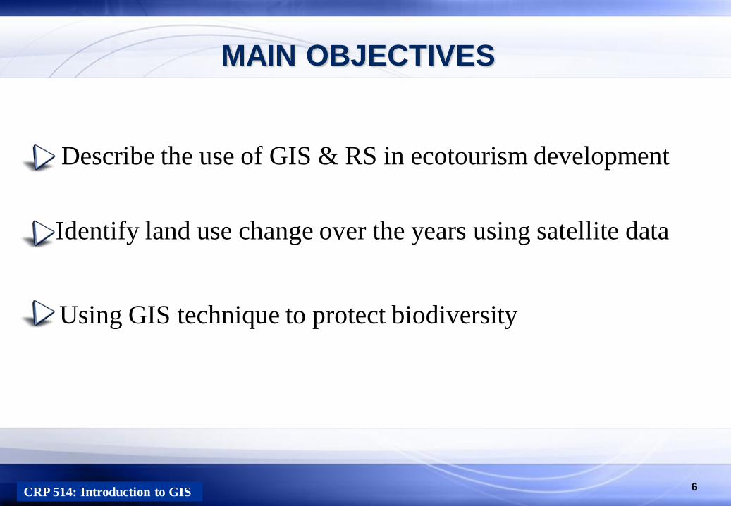
MAIN OBJECTIVES
CRP 514: Introduction to GIS
Describe the use of GIS & RS in ecotourism development
Identify land use change over the years using satellite data
Using GIS technique to protect biodiversity

ICS 531 : Advanced Operating Systems 7
CASE STUDY
Application of GIS in ecotourism development in Sundarbans
region, Bangladesh
CRP 514: Introduction to GIS
Area is approx. 139,500 hectors
Population, approx. 3 million
The largest mangrove forest
Area Description

ICS 531 : Advanced Operating Systems 8
Sundarbans’ mangrove forest
CASE STUDY
CRP 514: Introduction to GIS
200 islands
400 interconnected tidal
rivers, creeks and canals.

ICS 531 : Advanced Operating Systems 9
CASE STUDY AREA
CRP 514: Introduction to GIS
Case study motivations: Increase deforestation Lose Biodiversity
Rich biodiversity Wide range of fauna
Sundarbans’ mangrove forest

ICS 531 : Advanced Operating Systems 10 CRP 514: Introduction to GIS
Causes of land use changes
GIS is important to make guidelines for ecotourism planning and visitor management.
Tourists activities
Watching wildlife in forest,
Fishing, wood cutting, honey collection, timber production
Enjoying various local cultural festivals
Climate change effects Floods and cyclones

ICS 531 : Advanced Operating Systems 11
Recognize land use change over the last 33 years using
satellite data
Investigate causes of land use changes due to
Human activities
Natural hazards over time
Methodology
CRP 514: Introduction to GIS

ICS 531 : Advanced Operating Systems 12
Digital Image classification
Image Enhancement
Image Classification and Analysis
CRP 514: Introduction to GIS
Data collection
Raw satellite images of Sundarbans have been collected from 1977 to 2010 for land use classification
Methodology
The purpose is to identify changes in vegetation

ICS 531 : Advanced Operating Systems 13 CRP 514: Introduction to GIS
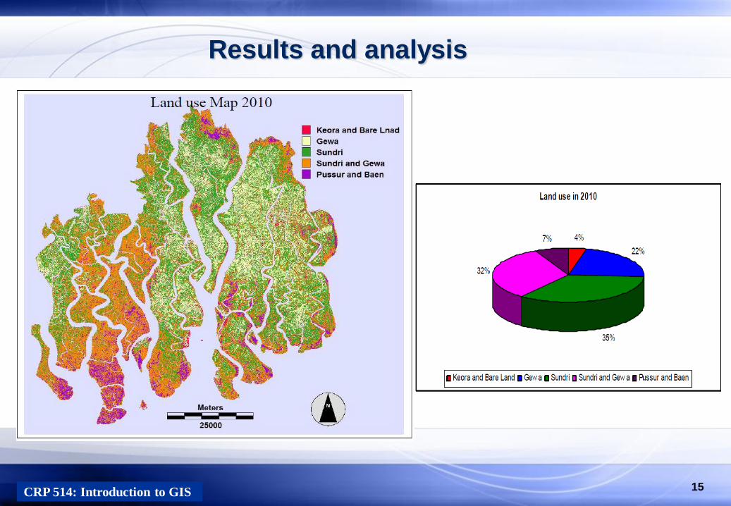
Results and analysis
The maximum likelihood classifier
To identify forest cover change

ICS 531 : Advanced Operating Systems 14 CRP 514: Introduction to GIS
Results and analysis
ICS 531 : Advanced Operating Systems 15 CRP 514: Introduction to GIS
Results and analysis

ICS 531 : Advanced Operating Systems 16
Maximum likelihood classification results
CRP 514: Introduction to GIS
Results and comparisons

ICS 531 : Advanced Operating Systems 17 CRP 514: Introduction to GIS
Results and comparisons
Normalized Differential Vegetation Index (NDVI)
Used for forest density measurements

ICS 531 : Advanced Operating Systems 18 CRP 514: Introduction to GIS
GIS DATABASE FOR ECOTOURISM PLANNING
The ultimate goal of GIS database is to produce an ecotourism map for Sundarbans, based on:
1- Administrative information map

ICS 531 : Advanced Operating Systems 19
COSTRUCTING ECOTOURISM PLANNING MAP
CRP 514: Introduction to GIS
2- Accessibility map

ICS 531 : Advanced Operating Systems 20 CRP 514: Introduction to GIS
3- Present land use map
COSTRUCTING ECOTOURISM PLANNING MAP

ICS 531 : Advanced Operating Systems 21 CRP 514: Introduction to GIS
3- Existing tourism facilities map
COSTRUCTING ECOTOURISM PLANNING MAP

ICS 531 : Advanced Operating Systems 22 CRP 514: Introduction to GIS
ECOTOURISM PLANNING MAP

ICS 531 : Advanced Operating Systems 23
CONCLUSION
CRP 514: Introduction to GIS
Tourism is a complex activity, thus, requires tools that GIS is a strong
and effective tool that can aid in tourism planning and decision-making
GIS technology can play an important role in Auditing environmental conditions
Examining suitable developments sites
Impact assessment for tourism activities
Visitor flow management
Identifying conflicting.

ICS 531 : Advanced Operating Systems 24
RECOMMENDATION
CRP 514: Introduction to GIS
It can be recommended that GIS can be used for
monitoring tourism effects over time in an
environmentally sensitive regions in KSA.

ICS 531 : Advanced Operating Systems 25
REFERENCES
CRP 514: Introduction to GIS
[1] Verka JOVANOVIĆ ,and Angelina NJEGUŠ.”THE APPLICATION OF GIS AND ITS COMPONENTS IN
TOURISM”Yugoslav Journal of Operations Research Vol 18 (2008), Number 2, 261-272 DOI:
10.2298/YUJOR0802261J
[2] Spyros .A, Evangelos .C .“G.I.S APPLICATIONS IN TOURISM PLANNING.” Technological Educational
Institution of Thessaloniki Department of Tourism Management
[3] Njeguš, A., “TOURISM DESTINATION MANAGEMENT INFORMATION SYSTEMS“, Tourism
Education Project, Ministry of Trade and Services & Faculty of Tourism and Hospitality Management,
Singidunum University, Belgrade, Serbia, 2007.
[4] Puhretmair, F., Lang, P., Tjoa, A.,M., and Wagner, R.,R., “The XML-KM approach: XML-based integration
of tourism and GIS data for HTML and WAP clients“, Institute for Applied Knowledge Processing (FAW),
Hagenberg, Austria, 2001.
[5] Wayne Giles .“GIS APPLICATIONS IN TOURISM PLANNING.” GIS 340 – GIS Seminar, November 26,
2003.
[6] Rachel J.C. Chen .“Geographic information systems (GIS) applications in retail tourism and teaching
curriculum.” Journal of Retailing and Consumer Services 14 (2007) 289–295
[7] Azizur Rahman “APPLICATION OF GIS IN ECOTOURISM DEVELOPMENT: A CASE STUDY IN
SUNDARBANS, BANGLADESH”. Mid-Sweden University June 2010 [8] Encyclopedia of Earth (2010), Sundarbans, Bangladesh. Retrieved April 25, 2010 (http://www.eoearth.org/article/Sundarbans,_Bangladesh). [9] Kim. D. (2002). GIS for a Policy Decision Support in National Tourism Portal. Retrieved April 10, 2010 (http://proceedings.esri.com/library/userconf/proc04/docs/pap1277.pdf).

ICS 531 : Advanced Operating Systems 26 CRP 514: Introduction to GIS