Appendix B – Section 10.7 Planning Certificates
343
GHD | Report for Australian Industrial Energy - Port Kembla Gas Terminal Appendix B – Section 10.7 Planning Certificates
Transcript of Appendix B – Section 10.7 Planning Certificates

GHD | Report for Australian Industrial Energy - Port Kembla Gas Terminal
Appendix B – Section 10.7 Planning Certificates

LIS | LPA | 149LONG | 03758005.DOCX
CERTIFICATE 201803300 Issued 16 July 2018
Certificate Type Sections 10.7(2) & (5)
Fee $133.00
Your Reference SECTION10.7CERTS:148824
Council Property Reference 384722 Colee Quayle
PLANNING CERTIFICATE
Issued Under Section 10.7 of the Environmental Planning and Assessment Act 1979
PROPERTY DETAILS Legal Description Lot 1 DP 203783
Location
Lot 1 Springhill Road SPRING HILL NSW 2500
This certificate provides information on how a property (such as land and buildings) may be used and the limits on its development. The
certificate contains information Council is aware of through its records and environmental plans, along with data supplied by the State
Government.
SECTION 10.7 (2) DETAILS
As at the date of this certificate, the following prescribed matters under section 10.7(2) of the Act relate to the abovementioned land:
1. NAMES OF RELEVANT PLANNING INSTRUMENTS & DEVELOPMENT CONTROL
PLANS
(1) The name of each environmental planning instrument that applies to the carrying out of
development on the land
State Environmental Planning Policy (State Significant Precincts) 2005
State Environmental Planning Policies
The Environmental Planning instruments that apply to the land according to their terms is the State Environmental planning Policy (Three Ports) 2013 and all other State Environmental Planning Policies
1) Subject to section 74 (1) of the Act and this clause, in the event of an inconsistency between this Policy and another environmental planning instrument, whether made before or after the commencement of this Policy, this Policy prevails to the extent of the inconsistency.
2) If this Policy and State Environmental Planning Policy (Exempt and Complying Development Codes) 2008 specify the same development as either exempt or complying development, State Environmental Planning Policy (Exempt and Complying Development Codes) 2008 does not apply to that development.
3) This Policy does not restrict or prohibit the carrying out of any development that is permitted to be carried out with or without development consent, or that is exempt development, under State Environmental Planning Policy (Infrastructure) 2007.

- 2 -
State Environmental Planning Policy Coastal Management 2018 (whole of lot) affected.
(2) The name of each proposed environmental planning instrument that will apply to the
carrying out of development on the land and that is or has been the subject of community
consultation or on public exhibition under the Act (unless the Director-General has notified the
council that the making of the proposed instrument has been deferred indefinitely or has not yet
been approved)
Paper Subdivisions: Draft Environmental Planning & Assessment Amendment (Subdivision works) Regulation 2013
Draft State Environmental Planning Policy - Advertising and Signage Amendments
Draft State Environmental Planning Policy - Infrastructure – Amendment (Shooting Ranges) 2013
Draft State Environmental Planning Policy - Infrastructure – Amendment (Sport and Recreation) 2013
Draft State Environmental Planning Policy – Koala Habitat Protection
Draft State Environmental Planning Policy – Infrastructure – (Amendments Review) 2017
Draft State Environmental Planning Policy – Primary Production and Rural Development.
Explanation of Intended Effect – Proposed Draft Environment SEPP (2017)
Explanation of Intended Effect – Proposed Amendment to the Mining SEPP 2007 – Air and Noise Impacts (2017)
Explanation of Intended Effect – Proposed Amendments to the SEPP 44 Koala Habitat Protection (2016)
Explanation of Intended Effect – Proposed Draft Primary Production and Rural Development SEPP 2017
Explanation of Intended Effect – Proposed Amendment to the Senior Housing SEPP – site compatibility certificates (2017)
Explanation of Intended Effect – Proposed Repeal of Two Operational SEPPs – SEPP 1 Development Standards and SEPP (Miscellaneous Consent Provisions) 2007 (2017)
Explanation of Intended Effect – Proposed Amendment to SEPP (Exempt and Complying Development ) – Proposed Greenfield Housing Code
Explanation of Intended Effect – Proposed new Remediation of Land SEPP and the Draft Planning Guidelines
Explanation of Intended Effect – Proposed Amendment to SEPP (Affordable Rental Housing) 2009
(3) The name of each development control plan that applies to the carrying out of development
on the land Wollongong Development Control Plan 2009 Wollongong Development Control Plan 2009, contains detailed development controls which

- 3 -
supplement the provisions of Wollongong Local Environmental Plan 2009. Note: The Wollongong Development Control Plan 2009 should be consulted to ascertain its
full effect on the land.
(4) In this clause, proposed environmental planning instrument includes a planning proposal for
a Local Environmental Plan or a draft environmental planning instrument.
2. ZONING AND LAND USE UNDER RELEVANT LEPs
State Environmental Planning Policy (State Significant Precincts) 2005 For each environmental planning instrument or proposed instrument referred to in clause 1 (other than a SEPP or proposed SEPP) that includes the land in any zone (however described):
1. the identity of the zone, whether by reference to a name (such as “Residential Zone” or “Heritage Area”) or by reference to a number (such as “Zone No 2(a)”)
IN3 – Heavy Industrial (Three Ports) 2013
2. the purposes for which the instrument provides that development may be carried out within the zone without the need for development consent
Environmental protection works.
3. the purposes for which the instrument provides that development may not be carried out within the zone except with development consent
Depots; Food and drink premises; Freight transport facilities; heavy industries; Port facilities; Roads; Transport depots; Warehouse or distribution centres; Waste or resource management facilities.
4. The purposes for which the instrument provides that development is prohibited within the zone.
Any development not specified in item (2) or (3).
Note: State Environmental Planning Policy (Three Ports) 2013 should be consulted to ascertain its full effect on the land.
Note: State Environmental Planning Policy (Major Development) 2005 should be consulted to ascertain its full effect on the land.
Other Relevant Provisions of State Environmental Planning Policy (State Significant Precincts)
2005
Development for subdivision requires consent except for:
a) widening a public road, b) a minor realignment of boundaries that does not create additional lots or the opportunity
for additional dwellings,

- 4 -
c) a consolidation of lots that does not create additional lots or the opportunity for additional dwellings,
d) rectifying an encroachment on a lot, e) creating a public reserve. f) excising from a lot land that is, or is intended to be, used for public purposes, including
drainage pruposes, rural fire brigade or other emergency service purposes or public toilets.
(e) Whether any development standards applying to the land fix minimum land dimensions for
the erection of a dwelling- house on the land, and if so, the minimum land dimensions so fixed
See Clauses 4.1, 4.1AA, 4.1A, 4.1B, 4.2 and 4.2A of the Local Environmental Plan.
(f) Whether the land includes or comprises critical habitat
Nil
(g) Whether the land is in a conservation area (however described)
Nil.
(h) Whether an item of environmental heritage (however described) is situated on the land
Nil.
2A. ZONING AND LAND USE UNDER STATE ENVIRONMENTAL PLANNING POLICY
(SYDNEY REGIONAL GROWTH CENTRES) 2006
To the extent that the land is within any zone (however described) under:
(a) Part 3 of the State Environmental Planning Policy (Sydney Region Growth Centres)
2006 (the 2006 SEPP), or
(b) a Precinct Plan (within the meaning of the 2006 SEPP),
(c) a proposed Precinct Plan that is or has been the subject of community consultation
or on public exhibition under the Act,
the particulars referred to in clause 2 (a) – (h) in relation to that land (with a reference to “the
instrument” in any of those paragraphs being read as a reference to Part 3 of the 2006 SEPP, or
the Precinct Plan or proposed Precinct Plan, as the case requires).
Not Applicable.
3. COMPLYING DEVELOPMENT
(1) The extent to which the land is land on which complying development may be carried out
under each of the codes for complying development because of the provisions of clauses 1.17A
(1) (c) to (e), (2), (3) and (4), 1.18 (1), (c3) and 1.19 of State Environmental Planning Policy (Exempt
and Complying Development Codes) 2008.

- 5 -
(2) The extent to which complying development may not be carried out on that land because of
the provisions of clauses 1.17A (1) (c) to (e), (2), (3) and (4), 1.18(1)(c3) and 1.19 of that Policy and
the reasons why it may not be carried out under those clauses.
(3) If the council does not have sufficient information to ascertain the extent to which complying
development may or may not be carried out on the land, a statement that a restriction applies to
the land, but it may not apply to all of the land, and that council does not have sufficient
information to ascertain the extent to which complying development may or may not be carried
out on the land.
State Environmental Planning Policy (Exempt and Complying Development Codes) 2008
(1) Subject to the terms of each code, and the zoning of the land, complying development may
be carried out for the following codes to the extent that the land has no affectation.
Housing Code (R1, R2, R3, R4, RU5)
Low Rise Medium Density Housing Code (Commencement deferred until July 2019)
Rural Housing Code (RU1, RU2, RU3, RU4, RU6, R5)
Housing Alterations Code
General Development Code
Commercial and Industrial (New Buildings and Additions) Code
Commercial and Industrial (Alterations) Code
Subdivision Code
Demolition Code
Container Recycling Facilities Code
Fire Safety Code
4B. ANNUAL CHARGES UNDER LOCAL GOVERNMENT ACT 1993 FOR COASTAL
PROTECTION SERVICES THAT RELATE TO EXISTING COASTAL PROTECTION
WORKS In relation to a coastal council- whether the owner (or any previous owner) of the land has
consented in writing to the land being subject to annual charges under section 496B of the Local
Government Act 1993 for coastal protection services that relate to existing coastal protection
works (within the meaning of section 553B of that Act) Note: “Existing coastal protection works” are works to reduce the impact of coastal hazards on the land (such as seawalls, revetments, groynes and beach nourishment) that existed before the commencement of section 553B of the Local Government Act 1993
Not applicable
5. MINE SUBSIDENCE
Whether or not the land is proclaimed to be a mine subsidence district within the meaning of
section 15 of the Mine Subsidence Compensation Act 1961

- 6 -
The land is not proclaimed to be a mine subsidence district within the meaning of section 15 of the Mine Subsidence Compensation Act 1961.
6. ROAD WIDENING AND ROAD REALIGNMENT
Whether or not the land is affected by any road widening or road realignment under:
(a) Division 2 of Part 3 of the Roads Act 1993 or
(b) Any environmental planning instrument or
(c) Any resolution of the council
Council has no record that the land is affected by any Road Widening or Road Realignment under: a) Division 2 of Part 3 of the Roads Act 1993, or
b) any environmental planning instrument, or c) any resolution of the Council.
7. COUNCIL AND OTHER PUBLIC AUTHORITY POLICIES ON HAZARD RISK
RESTRICTIONS
Whether or not the land is affected by a policy:
a) adopted by the council, or
b) adopted by any other public authority and notified to the council for the express purpose of its
adoption by that authority being referred to in planning certificates issued by the council, that
restricts the development of the land because of the likelihood of land slip, bushfire, tidal
inundation, subsidence, acid sulfate soils or any other risk (other than flooding).
Council has adopted “Wollongong Development Control Plan 2009 – Chapter E12 Geotechnical Assessment”.
Council has adopted Acid Sulfate Maps, Wollongong Local Environmental Plan 2009 – Clause 7.5 Acid Sulfate Soils.
Council has adopted “Wollongong Development Control Plan 2009 – Chapter E16 Bushfire Management”. The Rural Fire Service has endorsed the Bush Fire Prone Land map.
Unhealthy Building Land Policy, adopted by the Environmental Protection Authority.
Council has adopted Wollongong City Council Coastal Zone Study (Cardno, Lawson, Treloar 2010).
7A. FLOOD RELATED DEVELOPMENT CONTROLS INFORMATION
(1) Whether or not development on that land or part of the land for the purposes of dwelling
houses, dual occupancies, multi dwelling housing or residential flat buildings (not including
development for the purposes of group homes or seniors housing) is subject to flood related
development controls.

- 7 -
Development on the land or part of the land for the purposes of dwelling houses, dual occupancies, multi dwelling housing or residential flat buildings (not including development for the purposes of group homes or seniors housing) is subject to flood related development controls as contained in Wollongong Development Control Plan 2009 Chapter E13 Floodplain Management and Wollongong Local Environmental Plan 2009 Clause 7.3 Flood Planning.
(2) Whether or not development on that land or part of the land for any other purpose is subject
to flood related development controls.
Development on the land or part of the land for any other purpose is subject to flood related development controls as contained in Wollongong Development Control Plan 2009 Chapter E13 Floodplain Management and Wollongong Local Environmental Plan 2009 Clause 7.3 Flood Planning.
(3) Words and expressions in this clause have the same meaning as in the instrument set out in
the Schedule to the Standard Instrument (Local Environmental Plans) Order 2006
Further flood information relating to this parcel of land is available by application under section 10.7(5) of the Environmental Planning & Assessment Act 1979.
8. LAND RESERVED FOR ACQUISITION Whether or not any environmental planning instrument or proposed environmental planning
instrument referred to in clause 1 makes provision in relation to the acquisition of the land by a
public authority, as referred to in section 3.15 of the Act.
Nil.
9. CONTRIBUTION PLANS
The name of each contributions plan applying to the land.
Wollongong Section 7.12 Development Contributions Plan (2017) (previously S94A)
Note: The purposes of this contributions plan are:
To authorise the imposition of a condition on certain development consents and complying development certificates requiring the payment of a contribution pursuant to section 7.12 of the EP&A Act 1979.
To assist the council to provide the appropriate public facilities which are required to maintain and enhance amenity and service delivery within the Wollongong Local Government area.
To publicly identify the purposes for which the levies are required.
Any party wishing to undertake construction of any new, or alterations to any existing, building or other development should review this policy or contact Council to determine if any contributions may be payable.
9A. BIODIVERSITY CERTIFIED LAND
If the land biodiversity certified land under Part 8 of the Biodiversity Conservation Act 2016, a
statement to that effect.
Note: Biodiversity certified land includes land certified under Part 7AA of the Threatened Species Conservation Act 1995 that is taken to be certified under Part 8 of the Biodiversity Conservation Act 2016.
- 8 -
Nil.
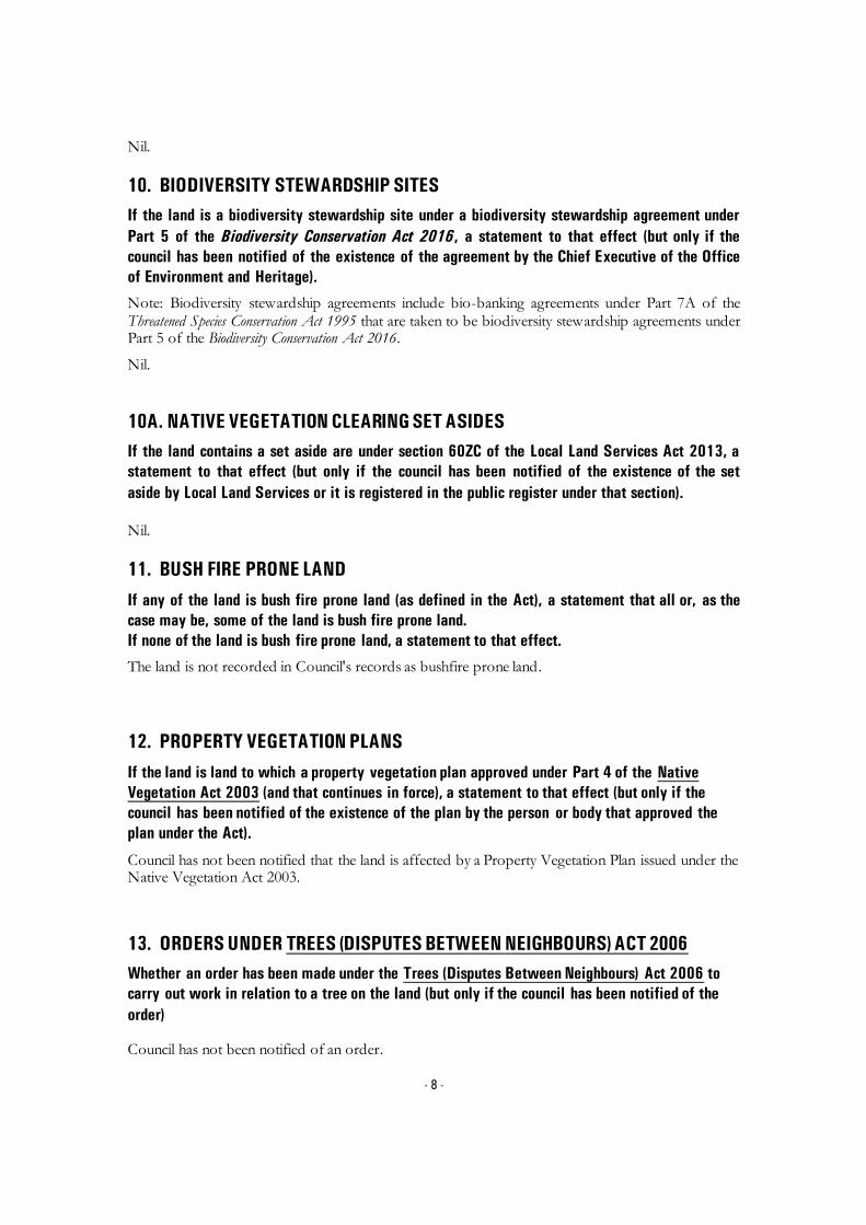
10. BIODIVERSITY STEWARDSHIP SITES
If the land is a biodiversity stewardship site under a biodiversity stewardship agreement under
Part 5 of the Biodiversity Conservation Act 2016, a statement to that effect (but only if the
council has been notified of the existence of the agreement by the Chief Executive of the Office
of Environment and Heritage).
Note: Biodiversity stewardship agreements include bio-banking agreements under Part 7A of the Threatened Species Conservation Act 1995 that are taken to be biodiversity stewardship agreements under Part 5 of the Biodiversity Conservation Act 2016.
Nil.
10A. NATIVE VEGETATION CLEARING SET ASIDES
If the land contains a set aside are under section 60ZC of the Local Land Services Act 2013, a
statement to that effect (but only if the council has been notified of the existence of the set
aside by Local Land Services or it is registered in the public register under that section).
Nil.
11. BUSH FIRE PRONE LAND
If any of the land is bush fire prone land (as defined in the Act), a statement that all or, as the
case may be, some of the land is bush fire prone land.
If none of the land is bush fire prone land, a statement to that effect.
The land is not recorded in Council's records as bushfire prone land.
12. PROPERTY VEGETATION PLANS
If the land is land to which a property vegetation plan approved under Part 4 of the Native
Vegetation Act 2003 (and that continues in force), a statement to that effect (but only if the
council has been notified of the existence of the plan by the person or body that approved the
plan under the Act).
Council has not been notified that the land is affected by a Property Vegetation Plan issued under the Native Vegetation Act 2003.
13. ORDERS UNDER TREES (DISPUTES BETWEEN NEIGHBOURS) ACT 2006
Whether an order has been made under the Trees (Disputes Between Neighbours) Act 2006 to
carry out work in relation to a tree on the land (but only if the council has been notified of the
order) Council has not been notified of an order.

- 9 -
14. STATE SIGNIFICANT DEVELOPMENT
If there is a direction by the Minister in force under section 75P (2) (c1) of the Act that a
provision of an environmental planning instrument prohibiting or restricting the carrying out of
a project or a stage of a project on the land under Part 4 of the Act does not have effect, a
statement to that effect identifying the provision that does not have effect. Nil
STATE SIGNIFICANT INFRASTRUCTURE
If there is a direction by the Minister in force under section 75P (2) (c1) of the Act that a
provision of an environmental planning instrument prohibiting or restricting the carrying out of
a project or a stage of a project on the land under Part 4 of the Act does not have effect, a
statement to that effect identifying the provision that does not have effect. Nil
15. SITE COMPATIBILITY CERTIFICATES AND CONDITIONS FOR SENIORS
HOUSING
If the land is land to which State Environmental Planning Policy (Housing for Seniors or People
with a Disability) 2004 applies:
(1) A statement of whether there is a current, site compatibility certificate (seniors housing),
of which the council is aware, in respect of proposed development on the land and, if
there is a certificate, the statement is to include:
(a) the period for which the certificate is current, and
(b) that a copy may be obtained from the head office of the Department of Planning,
and
(2) A statement setting out any terms of a kind referred to in clause 18(2) of that Policy that
have been imposed as a condition of consent to a development application granted after
11 October 2007 in respect of the land State Environmental Planning Policy (Housing for Seniors or People with a Disability) 2004
Nil.
16. SITE COMPATIBILITY CERTICATE FOR INFRASTRUCTURE A statement of whether there is a valid site compatibility certificate (infrastructure), or site
compatibility certificate (schools or TAFE establishments) of which the council is aware, in
respect of proposed development on the land and, if there is a certificate, the statement is to
include:

- 10 -
(a) the period for which the certificate is valid, and
(b) that a copy may be obtained from the head office of the Department.
State Environmental Planning Policy (Infrastructure) 2007 Nil.
17. SITE COMPATIBILITY CERTIFICATE AND CONDITIONS FOR AFFORDABLE
RENTAL HOUSING
(1) A statement of whether there is a current site compatibility certificate (affordable rental
housing), of which the council is aware, in respect of proposed development on the land
and, if there is a certificate, the statement is to include:
(a) the period for which the certificate is current, and
(b) that a copy may be obtained from the head office of the Department.
(2) A statement setting out any terms of a kind referred to in clause 17 (1) or 38 (1) of State
Environmental Planning Policy (Affordable Rental Housing) 2009 that have been imposed
as a condition of consent to a development application in respect of the land.
State Environmental Planning Policy (Affordable Rental Housing) 2009
Nil.
18. PAPER SUBDIVISION INFORMATION
(1) The name of any development plan adopted by a relevant authority that applies to the land
or that is proposed to be subject to the consent ballot.
Nil
(2) The date of any subdivision order that applies to the land.
Not applicable
(3) Words and expressions used in this clause have the same meaning as they have in Part 16C
of this Regulation.
19. SITE VERIFICATION CERTIFICATES
A statement of whether there is a current site verification certificate, of which the council is
aware, in respect of the land and, if there is a certificate, the statement is to include:
(a) the matter certified by the certificate, and

- 11 -
Note: A site verification certificate sets out the Director-General's opinion as to whether the land concerned is or is not biophysical strategic agricultural land or critical industry cluster land-see Division 3 of Part 4AA of State Environmental Planning Policy (Mining, Petroleum Production and Extractive lndustries 2007).
(b) the date on which the certificate ceases to be current (if any), and
(c) that a copy may be obtained from the head office of the Department.
Nil
20. LOOSE-FILL ASBESTOS INSULATION REGISTER
If the land includes any residential premises (within the meaning of Division 1A of Part 8 of the
Home Building Act 1989) that are listed on the register, that is required to be maintained under
that Division, a statement to that effect.
For register information contact www.fairtrading.nsw.gov.au
Nil.
21. AFFECTED BUILDING NOTICES AND BUILDING PRODUCT RECTIFICATION
ORDERS
(1) A statement of whether there is any affected building notice of which the council is aware
that is in force in respect of the land.
(2) A statement of:
(a) whether there is any building product rectification order of which the council is aware
that is in force in respect of the land and has not been fully complied with, and
(b) Whether any notice of intention to make a building product rectification order of which
the council is aware has been given in respect of the land and is outstanding.
(3) In this clause: affected building notice has the same meaning as in Part 4 of the Building
Products (Safety) Act 2017. building product rectification order has the same meaning as in the
Building Products (Safety) Act 2017.
Affected building notice has the same meaning as Part 4 of the Building Products (Safety) Act
2017 No 69
Building product rectification order has the same meaning as in the Building Products (Safety)
Act 2017 No 69
Nil.
CONTAMINATED LAND MANAGEMENT ACT 1997
Note: The following matters are prescribed by section 59 (2) of the Contaminated Land
Management Act 1997 as additional matters to be specified in a planning certificate:
(a) that the land to which the certificate relates is significantly contaminated within the
meaning of that Act- if the land (or part of the land) is significantly contaminated land
at the date when the certificate is issued,

- 12 -
(b) that the land to which the certificate relates is subject to a management order within
the meaning of the Act- if it is subject to such an order at the date when the
certificate is issued,
(c) that the land to which the certificate relates is the subject of an approved voluntary
management proposal within the meaning of that Act – if it is the subject of such an
approved proposal at the date when the certificate is issued,
(d) that the land to which the certificate relates is subject to an ongoing maintenance
order within the meaning of that Act – if it is subject to such an order at the date
when the certificate is issued,
(e) that the land to which the certificate relates is the subject of a site audit statement
within the meaning of the Act – if a copy of such a statement has been provided at
any time to the local authority issuing the certificate
Council has not been advised that:
a) The land is significantly contaminated land within the meaning of the Contaminated Land Management Act 1997
b) The land is subject to a management order within the meaning of the Contaminated Land
Management Act 1997
c) The land is subject to an approved voluntary management proposal within the meaning of the Contaminated Land Management Act 1997
d) The land is subject to an ongoing maintenance order within the meaning of the
Contaminated Land Management Act 1997
e) The land is the subject of a site audit statement within the meaning of the Contaminated Land Management Act 1997.
SECTION 10.7 (5) DETAILS
As at the date of this certificate, the following additional information, provided in good faith pursuant to section 10.7 (5) of the Act, relate to the abovementioned land. Council has selected these matters as those most likely to be of concern but they do not comprise an exhaustive list of matters likely to affect the land. When information pursuant to section 10.7 (5) is requested the Council is under no obligation to furnish any of the information supplied herein pursuant to that section. Council draws you attention to section 10.7 (6) which states that a council shall not incur any liability in respect of any advice provided in good faith pursuant to subsection (5). The absence of any reference to any matter affecting the land shall not imply that the land is not affected by any matter referred to in this certificate.
RESOLUTION TO PREPARE PLANNING PROPOSAL On 30th January 2017, Council resolved to adopt a draft Planning Proposal for the area of Port Kembla covered by the State Environmental Planning Policy (Three Ports) 2013, to make a number of amendments including permitting the temporary use of under-utilised sites and buildings within the BlueScope holdings for light industrial and office use. Council on 17 July 2017 resolved to commence the preparation of a draft Planning Proposal to

- 13 -
introduce Housing Affordability provisions or SEPP 70 Housing Affordability provisions into the Wollongong Local Environmental Plan 2009. The form of the provisions will be subject to a future report and subsequent community consultation.
PROPOSED DRAFT DEVELOPMENT CONTROL PLANS The following plans have been placed on exhibition pursuant to the provisions of section 72 of the Environmental Planning and Assessment Act 1979:
Draft Development Control Plan 2009 Review The Wollongong Development Control Plan 2009 came into force on 3 March 2010. A review commenced after 6 months of operation. The following chapters are available for public exhibition. Chapter D16 West Dapto Release Area
AND STABILITY
Council’s land constraint/stability assessment maps do not show that the land is located in an area where landslip and/or subsidence have occurred, or where land instability is suspected. If you have any doubt as to whether the land is affected by landslip and/or subsidence the services of a suitably qualified engineer should be obtained.
Note: the advice provided by Council in respect of the stability of the land is based on information contained in Council’s land constraint maps. The maps have been compiled from data received by Council and considered by Council to be reasonably reliable. Council does not warrant that its land constraint maps contain all information ever received by Council relating to the stability of the land.
FLOOD AND DRAINAGE
1 Classification of Flood Risk
Council records indicate that this property is located within a Low and Medium Flood Risk precinct.
Land that is potentially subject to inundation is classified as low, medium or high flood risk. Council has prepared a development control plan known as Wollongong Development Control Plan 2009 that provides details of flood related development controls that may be applicable.
Where the owner/applicant has detailed survey available which identifies the property to be within another risk precinct or not in one at all, it may be presented to Council for reassessment.
Definitions:
High Flood Risk (and Interim Riverine Corridor) Precinct
This has been defined as the area within the envelope of land subject to a high hydraulic hazard (in accordance with the provisional criteria outlined in the Floodplain Management Manual) in a 100 year flood event plus all land within a corridor 10m from the top of the creek bank (Interim Riverine Corridor). The high flood risk precinct is where high flood damages, potential risk to life, evacuation problems would be anticipated or development would significantly and adversely effect flood behaviour. Most development should be restricted in this precinct. In this precinct, there would be a significant risk of flood damages without compliance with flood related building and planning controls.

- 14 -
Medium Flood Risk Precinct
This has been defined as land below the 100 year flood level (plus 0.5m freeboard) that is not within the High Flood Risk (and Interim Riverine Corridor) Precinct. It is land subject to low hydraulic hazard (in accordance with the provisional criteria outlined by the Floodplain Management Manual). In this precinct there would still be a significant risk of flood damage, but these damages can be minimised by the application of appropriate development controls.
Low Flood Risk Precinct
This has been defined as all other land within the floodplain (i.e. within the extent of the probable maximum flood) but not identified within either the High Flood Risk (and Interim Riverine Corridor) or the Medium Flood Risk Precinct, where risk of damages are low for most land uses. The Low Flood Risk Precinct is that area above the 100 year flood (plus 0.5m freeboard) and most land uses would be permitted within this precinct.
2 Estimated Flood Levels
Estimated and/or historical flood levels in the vicinity of this property may be available from Council. Requests may be made by completing a Flood Enquiry Form available from council’s website, in writing or from the Level 6 front counter of the Administration Building. A cost is involved for this service. Payment must be made prior to information being provided.
Please contact Council’s Drainage Duty Officer on 42277181 to ensure the availability of information before submitting this request form. Council does not hold flood information for every property.
‘Please note that flood levels may change due to Council’s flood study and Floodplain Risk Management Study currently being reviewed. As part of the review, design parameters for these studies are changing, and therefore the flood levels, velocities and flood risks may vary from the current flood study.’
ACID SULFATE SOILS
Acid Sulfate Soil Class 5 has been mapped on this land. Acid Sulfate Soils Class 4 has been mapped on this land.
CONTAMINATED LAND
Council’s records show that because of previous uses the land may be contaminated. The services of a suitably qualified consultant should be sought to ascertain the degree of contamination, if any, on the land, and its likely effect on the land. Council’s records are incomplete and there is no certainty that the land is so affected. Council has adopted Wollongong Development Control Plan 2009, which may restrict the development of the land.
STATE SIGNIFICANT DEVELOPMENT
Nil.

- 15 -
BUILDING LINES Wollongong Development Control Plan 2009 details the setbacks applicable to the land.
OTHER HERITAGE MATTERS KNOWN TO COUNCIL
Aboriginal Heritage
All development within the Wollongong Local Government Area is subject to the Aboriginal Heritage requirements of the National Parks and Wildlife Act 1974. To determine if your property is affected by an Aboriginal Site, it is recommended that an Aboriginal Heritage Information Management System (AHIMS) search be undertaken by contacting the AHIM’S Administrator on (02) 9995 5000. Further detail on Council’s Aboriginal Heritage requirements for Development is contained within Chapter E10 of the Wollongong Development Control Plan 2009.
DEVELOPMENT HISTORY
Application may be made for a Building Certificate under section 10.7B of Environmental Planning and Assessment Act 1979 if written certification of existing buildings on the land is required.
The history of development consent approval applicable to the land may be obtained by consulting the Development Consent Register. Enquiries concerning the register may be made at Council’s Customer Service Centre, 41 Burelli Street Wollongong during office hours.
LOOSE-FILL ASBESTOS
Council recommends you make your own enquiries as to the age of the buildings on the land to which this certificate relates and, if it contains a building constructed prior to 1980, the Council also strongly recommends that any potential purchaser obtain advice form a licensed asbestos assessor to determine whether loose-fill asbestos is present in any building on the land and, if so, the health risks (if any) this may pose for the building’s occupants.
Contact NSW Fair Trading for further information.
OTHER INFORMATION
Illawarra Regional Strategy
The Minister for Planning released the Illawarra Regional Strategy on 1 February 2007. The strategy is the NSW Government 25 year land use strategy for the Illawarra Region.
The Department of Planning and Environment released the Illawarra Shoalhaven Regional Plan, November 2015.
Threatened Species – Green and Golden Bell Frog (Litoria aurea) This land provides habitat for a population of Green and Golden Bell Frog (Litoria aurea). This

- 16 -
species is listed as Endangered under Part 1 Schedule 1 of the NSW Threatened Species Conservation Act 1995 and as Vulnerable under the Commonwealth Environment Protection and Biodiversity Conservation Act 1999. The presence of this species may restrict the development potential of the land. The nature and extent of any threatened species or cultural heritage constraints should be determined following an assessment of the land by a qualified and experienced ecologist/consultant.
GENERAL INFORMATION
The following general information is brought to the attention of land owners.
1. Tree Management Policy
The Wollongong Tree Management Policy allows proper assessment to be made of the environmental importance and viability of trees before they are pruned, removed or damaged in any way. This Policy prohibits the ringbarking, cutting down, topping, lopping, removing, injuring or destruction of any tree except with the prior written consent of Council.
The Tree Management Policy applies to any tree that:
Is 3 metres or more in height,
Has a trunk diameter of 200mm or more at a height of 1 metre from the ground, or
Has a branch spread of 3 metres or more
Please note that:
A dead/dying tree is subject to the Tree Management Policy
Pruning of major structural or anchor roots is also subject to the Tree Management Policy
Some trees may be exempt and do not require a permit to prune or remove them. Following is a list of the exempt tree species:
Salix Species
Erythrina X Sykesii
Cupressus Macrocarpa “Brunniana”
Laganuria Pattersonii
Harpephyllum Caffrum
Syagrus Romanzoffina
Poplar Species
Ficus Elasrica “Decora” and hybrids
Ligustrum Lucidum
Cinnamomum Camphora
Schefflera Actinophylla
False Acacia
Peppercorn
Alnus
Acer negundo
Willow
Coral Tree
Golden Cypress
Itchy Pod Tree
Kaffir Plum
Cocos Palm
Poplar
Ornamental Rubber tree
Large Leafed Privet
Camphor Laurel
Umbrella Tree
Black Locust
Pepper Tree
Alder
Box Elder
For the full list of other exemptions please refer to the Tree Management Policy document available via Council’s website.

- 17 -
Any person acting on a permit issued under this Policy must comply with all conditions of that permit.
Any person who contravenes, or causes or permits the contravention of this Policy is guilty of an offence under the Environmental Planning and Assessment Act 1979.
Development Consents may contain restrictions relating to trees.
Further information regarding Council’s Tree Management Policy including how to lodge an application can be made by contacting Council’s Customer Service on telephone 4227 7111. Alternatively information can be obtained from Council’s website via the following link http://www.wollongong.nsw.gov.au/services/household/trees/Pages/Lodgeatmp.aspx.
2. Termite Management for Buildings
Australian Standards 3660.1-2000 (New Buildings) AS 3660.2-2000 (Existing Buildings) Termite Management, recommends that buildings be inspected and be maintained in order to achieve termite management of buildings. Licensed Pest Control Contractors should be contacted to achieve necessary termite control.
3. Lead Paint and Building Renovations
Your attention is drawn to the hazards associated with lead-based paints during building renovation. Suitable precautions should be taken when removing flaking paint or sanding painted surfaces suspected to have been treated with lead-based paint to prevent contamination of the immediate environment and associated health risk from lead dust.
AS 4361 – Part 2 – Guide to Lead Paint Management – Residential and Commercial.
4. Sewage Management Systems
Where a property has on-site sewage management system (this includes septic tanks, disposal trenches, aerated waste water treatment systems, composting toilets and pump out systems) the new owner must obtain an “Approval to Operate” from Council within 3 months of land ownership being transferred or otherwise conveyed.
5. Asbestos
Exposure to asbestos is a serious health hazard. In Australia, asbestos was gradually phased out of building materials in the 1980s and the supply and installation of asbestos containing goods has been prohibited since 31 December 2003. However, asbestos legacy materials still exist in many homes, buildings and other assets and infrastructure.
Council on the 27 October 2014 adopted an Asbestos policy which states Council’s commitment to and responsibilities for safely managing asbestos, and provides information for Council and the local community on safely managing asbestos. The policy can be viewed on Council’s website: www.wollongong.nsw.gov.au.
6. Loose-Fill Asbestos Insulation
Some residential homes located in NSW have been identified as containing loose-fill asbestos insulation, for example in the roof space. NSW Fair Trading maintains a Register of homes that are affected by loose-fill asbestos insulation.
You should make your own enquiries as to the age of the buildings on the land to which this certificate relates and if it contains a building constructed prior to 1980, the council strongly recommends that any potential purchaser obtain advice from a licenced asbestos assessor to determine whether loose-fill asbestos is present in any building on the land and, if so, the health risks (if any) this may pose for the buildings occupants.

- 18 -
Contact NSW Fair Trading for further information.
This letter is authorised by: Jamie O’Connell LIS Information Officer Section 10.7 Planning Certificates Wollongong City Council Telephone (02) 4227 7111

LIS | LPA | 149LONG | 03758067.DOCX
CERTIFICATE 201803302 Issued 16 July 2018
Certificate Type Sections 10.7(2) & (5)
Fee $133.00
Your Reference SECTION10.7CERTS:148824
Council Property Reference 384725 Colee Quayle
PLANNING CERTIFICATE
Issued Under Section 10.7 of the Environmental Planning and Assessment Act 1979
PROPERTY DETAILS Legal Description Lot 1 DP 606430
Location
Lot 1 Springhill Road SPRING HILL NSW 2500
This certificate provides information on how a property (such as land and buildings) may be used and the limits on its development. The
certificate contains information Council is aware of through its records and environmental plans, along with data supplied by the State
Government.
SECTION 10.7 (2) DETAILS
As at the date of this certificate, the following prescribed matters under section 10.7(2) of the Act relate to the abovementioned land:
1. NAMES OF RELEVANT PLANNING INSTRUMENTS & DEVELOPMENT CONTROL
PLANS
(1) The name of each environmental planning instrument that applies to the carrying out of
development on the land
State Environmental Planning Policy (State Significant Precincts) 2005
State Environmental Planning Policies
The Environmental Planning instruments that apply to the land according to their terms is the State Environmental planning Policy (Three Ports) 2013 and all other State Environmental Planning Policies
1) Subject to section 74 (1) of the Act and this clause, in the event of an inconsistency between this Policy and another environmental planning instrument, whether made before or after the commencement of this Policy, this Policy prevails to the extent of the inconsistency.
2) If this Policy and State Environmental Planning Policy (Exempt and Complying Development Codes) 2008 specify the same development as either exempt or complying development, State Environmental Planning Policy (Exempt and Complying Development Codes) 2008 does not apply to that development.
3) This Policy does not restrict or prohibit the carrying out of any development that is permitted to be carried out with or without development consent, or that is exempt development, under State Environmental Planning Policy (Infrastructure) 2007.

- 2 -
State Environmental Planning Policy – Coastal Management 2018 (part of lot) affected.
(2) The name of each proposed environmental planning instrument that will apply to the
carrying out of development on the land and that is or has been the subject of community
consultation or on public exhibition under the Act (unless the Director-General has notified the
council that the making of the proposed instrument has been deferred indefinitely or has not yet
been approved)
Paper Subdivisions: Draft Environmental Planning & Assessment Amendment (Subdivision works) Regulation 2013
Draft State Environmental Planning Policy - Advertising and Signage Amendments
Draft State Environmental Planning Policy - Infrastructure – Amendment (Shooting Ranges) 2013
Draft State Environmental Planning Policy - Infrastructure – Amendment (Sport and Recreation) 2013
Draft State Environmental Planning Policy – Koala Habitat Protection
Draft State Environmental Planning Policy – Infrastructure – (Amendments Review) 2017
Draft State Environmental Planning Policy – Primary Production and Rural Development.
Explanation of Intended Effect – Proposed Draft Environment SEPP (2017)
Explanation of Intended Effect – Proposed Amendment to the Mining SEPP 2007 – Air and Noise Impacts (2017)
Explanation of Intended Effect – Proposed Amendments to the SEPP 44 Koala Habitat Protection (2016)
Explanation of Intended Effect – Proposed Draft Primary Production and Rural Development SEPP 2017
Explanation of Intended Effect – Proposed Amendment to the Senior Housing SEPP – site compatibility certificates (2017)
Explanation of Intended Effect – Proposed Repeal of Two Operational SEPPs – SEPP 1 Development Standards and SEPP (Miscellaneous Consent Provisions) 2007 (2017)
Explanation of Intended Effect – Proposed Amendment to SEPP (Exempt and Complying Development ) – Proposed Greenfield Housing Code
Explanation of Intended Effect – Proposed new Remediation of Land SEPP and the Draft Planning Guidelines
Explanation of Intended Effect – Proposed Amendment to SEPP (Affordable Rental Housing) 2009
(3) The name of each development control plan that applies to the carrying out of development
on the land Wollongong Development Control Plan 2009 Wollongong Development Control Plan 2009, contains detailed development controls which
- 3 -
supplement the provisions of Wollongong Local Environmental Plan 2009. Note: The Wollongong Development Control Plan 2009 should be consulted to ascertain its
full effect on the land.
(4) In this clause, proposed environmental planning instrument includes a planning proposal for
a Local Environmental Plan or a draft environmental planning instrument.
2. ZONING AND LAND USE UNDER RELEVANT LEPs
State Environmental Planning Policy (State Significant Precincts) 2005 For each environmental planning instrument or proposed instrument referred to in clause 1 (other than a SEPP or proposed SEPP) that includes the land in any zone (however described):
1. the identity of the zone, whether by reference to a name (such as “Residential Zone” or “Heritage Area”) or by reference to a number (such as “Zone No 2(a)”)
IN3 – Heavy Industrial (Three Ports) 2013
2. the purposes for which the instrument provides that development may be carried out within the zone without the need for development consent
Environmental protection works.
3. the purposes for which the instrument provides that development may not be carried out within the zone except with development consent
Depots; Food and drink premises; Freight transport facilities; heavy industries; Port facilities; Roads; Transport depots; Warehouse or distribution centres; Waste or resource management facilities.
4. The purposes for which the instrument provides that development is prohibited within the zone.
Any development not specified in item (2) or (3).
Note: State Environmental Planning Policy (Three Ports) 2013 should be consulted to ascertain its full effect on the land.
Note: State Environmental Planning Policy (Major Development) 2005 should be consulted to ascertain its full effect on the land.
Other Relevant Provisions of State Environmental Planning Policy (State Significant Precincts)
2005
Development for subdivision requires consent except for:
a) widening a public road, b) a minor realignment of boundaries that does not create additional lots or the opportunity
for additional dwellings,

- 4 -
c) a consolidation of lots that does not create additional lots or the opportunity for additional dwellings,
d) rectifying an encroachment on a lot, e) creating a public reserve. f) excising from a lot land that is, or is intended to be, used for public purposes, including
drainage pruposes, rural fire brigade or other emergency service purposes or public toilets.
(e) Whether any development standards applying to the land fix minimum land dimensions for
the erection of a dwelling- house on the land, and if so, the minimum land dimensions so fixed
See Clauses 4.1, 4.1AA, 4.1A, 4.1B, 4.2 and 4.2A of the Local Environmental Plan.
(f) Whether the land includes or comprises critical habitat
Nil
(g) Whether the land is in a conservation area (however described)
Nil.
(h) Whether an item of environmental heritage (however described) is situated on the land
Nil.
2A. ZONING AND LAND USE UNDER STATE ENVIRONMENTAL PLANNING POLICY
(SYDNEY REGIONAL GROWTH CENTRES) 2006
To the extent that the land is within any zone (however described) under:
(a) Part 3 of the State Environmental Planning Policy (Sydney Region Growth Centres)
2006 (the 2006 SEPP), or
(b) a Precinct Plan (within the meaning of the 2006 SEPP),
(c) a proposed Precinct Plan that is or has been the subject of community consultation
or on public exhibition under the Act,
the particulars referred to in clause 2 (a) – (h) in relation to that land (with a reference to “the
instrument” in any of those paragraphs being read as a reference to Part 3 of the 2006 SEPP, or
the Precinct Plan or proposed Precinct Plan, as the case requires).
Not Applicable.
3. COMPLYING DEVELOPMENT
(1) The extent to which the land is land on which complying development may be carried out
under each of the codes for complying development because of the provisions of clauses 1.17A
(1) (c) to (e), (2), (3) and (4), 1.18 (1), (c3) and 1.19 of State Environmental Planning Policy (Exempt
and Complying Development Codes) 2008.
- 5 -
(2) The extent to which complying development may not be carried out on that land because of
the provisions of clauses 1.17A (1) (c) to (e), (2), (3) and (4), 1.18(1)(c3) and 1.19 of that Policy and
the reasons why it may not be carried out under those clauses.
(3) If the council does not have sufficient information to ascertain the extent to which complying
development may or may not be carried out on the land, a statement that a restriction applies to
the land, but it may not apply to all of the land, and that council does not have sufficient
information to ascertain the extent to which complying development may or may not be carried
out on the land.
State Environmental Planning Policy (Exempt and Complying Development Codes) 2008
(3) The land is identified on an Acid Sulphate Soils Map as being Acid Class 1 or Acid Class 2
(or both). A restriction applies to the land, but may not apply to all of the land. Council
does not have sufficient information to ascertain the extent to which complying
development may or may not be carried out on the land.
4B. ANNUAL CHARGES UNDER LOCAL GOVERNMENT ACT 1993 FOR COASTAL
PROTECTION SERVICES THAT RELATE TO EXISTING COASTAL PROTECTION
WORKS In relation to a coastal council- whether the owner (or any previous owner) of the land has
consented in writing to the land being subject to annual charges under section 496B of the Local
Government Act 1993 for coastal protection services that relate to existing coastal protection
works (within the meaning of section 553B of that Act) Note: “Existing coastal protection works” are works to reduce the impact of coastal hazards on the land (such as seawalls, revetments, groynes and beach nourishment) that existed before the commencement of section 553B of the Local Government Act 1993
Not applicable
5. MINE SUBSIDENCE
Whether or not the land is proclaimed to be a mine subsidence district within the meaning of
section 15 of the Mine Subsidence Compensation Act 1961
The land is not proclaimed to be a mine subsidence district within the meaning of section 15 of the Mine Subsidence Compensation Act 1961.
6. ROAD WIDENING AND ROAD REALIGNMENT
Whether or not the land is affected by any road widening or road realignment under:
(a) Division 2 of Part 3 of the Roads Act 1993 or

- 6 -
(b) Any environmental planning instrument or
(c) Any resolution of the council
Council has no record that the land is affected by any Road Widening or Road Realignment under: a) Division 2 of Part 3 of the Roads Act 1993, or
b) any environmental planning instrument, or
c) any resolution of the Council.
7. COUNCIL AND OTHER PUBLIC AUTHORITY POLICIES ON HAZARD RISK
RESTRICTIONS
Whether or not the land is affected by a policy:
a) adopted by the council, or
b) adopted by any other public authority and notified to the council for the express purpose of its
adoption by that authority being referred to in planning certificates issued by the council, that
restricts the development of the land because of the likelihood of land slip, bushfire, tidal
inundation, subsidence, acid sulfate soils or any other risk (other than flooding).
Council has adopted “Wollongong Development Control Plan 2009 – Chapter E12 Geotechnical Assessment”.
Council has adopted Acid Sulfate Maps, Wollongong Local Environmental Plan 2009 – Clause 7.5 Acid Sulfate Soils.
Council has adopted “Wollongong Development Control Plan 2009 – Chapter E16 Bushfire Management”. The Rural Fire Service has endorsed the Bush Fire Prone Land map.
Unhealthy Building Land Policy, adopted by the Environmental Protection Authority.
Council has adopted Wollongong City Council Coastal Zone Study (Cardno, Lawson, Treloar 2010).
7A. FLOOD RELATED DEVELOPMENT CONTROLS INFORMATION
(1) Whether or not development on that land or part of the land for the purposes of dwelling
houses, dual occupancies, multi dwelling housing or residential flat buildings (not including
development for the purposes of group homes or seniors housing) is subject to flood related
development controls.
Development on the land or part of the land for the purposes of dwelling houses, dual occupancies, multi dwelling housing or residential flat buildings (not including development for the purposes of group homes or seniors housing) is subject to flood related development controls as contained in Wollongong Development Control Plan 2009 Chapter E13 Floodplain Management and Wollongong Local Environmental Plan 2009 Clause 7.3 Flood Planning.
(2) Whether or not development on that land or part of the land for any other purpose is subject
to flood related development controls.
Development on the land or part of the land for any other purpose is subject to flood related development controls as contained in Wollongong Development Control Plan 2009 Chapter E13

- 7 -
Floodplain Management and Wollongong Local Environmental Plan 2009 Clause 7.3 Flood Planning.
(3) Words and expressions in this clause have the same meaning as in the instrument set out in
the Schedule to the Standard Instrument (Local Environmental Plans) Order 2006
Further flood information relating to this parcel of land is available by application under section 10.7(5) of the Environmental Planning & Assessment Act 1979.
8. LAND RESERVED FOR ACQUISITION Whether or not any environmental planning instrument or proposed environmental planning
instrument referred to in clause 1 makes provision in relation to the acquisition of the land by a
public authority, as referred to in section 3.15 of the Act.
Nil.
9. CONTRIBUTION PLANS
The name of each contributions plan applying to the land.
Wollongong Section 7.12 Development Contributions Plan (2017) (previously S94A)
Note: The purposes of this contributions plan are:
To authorise the imposition of a condition on certain development consents and complying development certificates requiring the payment of a contribution pursuant to section 7.12 of the EP&A Act 1979.
To assist the council to provide the appropriate public facilities which are required to maintain and enhance amenity and service delivery within the Wollongong Local Government area.
To publicly identify the purposes for which the levies are required.
Any party wishing to undertake construction of any new, or alterations to any existing, building or other development should review this policy or contact Council to determine if any contributions may be payable.
9A. BIODIVERSITY CERTIFIED LAND
If the land biodiversity certified land under Part 8 of the Biodiversity Conservation Act 2016, a
statement to that effect.
Note: Biodiversity certified land includes land certified under Part 7AA of the Threatened Species Conservation Act 1995 that is taken to be certified under Part 8 of the Biodiversity Conservation Act 2016.
Nil.
10. BIODIVERSITY STEWARDSHIP SITES
If the land is a biodiversity stewardship site under a biodiversity stewardship agreement under
Part 5 of the Biodiversity Conservation Act 2016, a statement to that effect (but only if the
council has been notified of the existence of the agreement by the Chief Executive of the Office
of Environment and Heritage).

- 8 -
Note: Biodiversity stewardship agreements include bio-banking agreements under Part 7A of the Threatened Species Conservation Act 1995 that are taken to be biodiversity stewardship agreements under Part 5 of the Biodiversity Conservation Act 2016.
Nil.
10A. NATIVE VEGETATION CLEARING SET ASIDES
If the land contains a set aside are under section 60ZC of the Local Land Services Act 2013, a
statement to that effect (but only if the council has been notified of the existence of the set
aside by Local Land Services or it is registered in the public register under that section).
Nil.
11. BUSH FIRE PRONE LAND
If any of the land is bush fire prone land (as defined in the Act), a statement that all or, as the
case may be, some of the land is bush fire prone land.
If none of the land is bush fire prone land, a statement to that effect.
The land is not recorded in Council's records as bushfire prone land.
12. PROPERTY VEGETATION PLANS
If the land is land to which a property vegetation plan approved under Part 4 of the Native
Vegetation Act 2003 (and that continues in force), a statement to that effect (but only if the
council has been notified of the existence of the plan by the person or body that approved the
plan under the Act).
Council has not been notified that the land is affected by a Property Vegetation Plan issued under the Native Vegetation Act 2003.
13. ORDERS UNDER TREES (DISPUTES BETWEEN NEIGHBOURS) ACT 2006
Whether an order has been made under the Trees (Disputes Between Neighbours) Act 2006 to
carry out work in relation to a tree on the land (but only if the council has been notified of the
order) Council has not been notified of an order.
14. STATE SIGNIFICANT DEVELOPMENT
If there is a direction by the Minister in force under section 75P (2) (c1) of the Act that a
provision of an environmental planning instrument prohibiting or restricting the carrying out of
a project or a stage of a project on the land under Part 4 of the Act does not have effect, a
statement to that effect identifying the provision that does not have effect. A major project application has been lodged with the Department of Planning under Part 3A of the

- 9 -
Environmental Planning and Assessment Act 1979. Purchasers are advised to make their own enquiries with the Department of Planning regarding the status of such applications.
STATE SIGNIFICANT INFRASTRUCTURE
If there is a direction by the Minister in force under section 75P (2) (c1) of the Act that a
provision of an environmental planning instrument prohibiting or restricting the carrying out of
a project or a stage of a project on the land under Part 4 of the Act does not have effect, a
statement to that effect identifying the provision that does not have effect. A major project application has been lodged with the Department of Planning under Part 3A of the Environmental Planning and Assessment Act 1979. Purchasers are advised to make their own enquiries with the Department of Planning regarding the status of such applications.
15. SITE COMPATIBILITY CERTIFICATES AND CONDITIONS FOR SENIORS
HOUSING
If the land is land to which State Environmental Planning Policy (Housing for Seniors or People
with a Disability) 2004 applies:
(1) A statement of whether there is a current, site compatibility certificate (seniors housing),
of which the council is aware, in respect of proposed development on the land and, if
there is a certificate, the statement is to include:
(a) the period for which the certificate is current, and
(b) that a copy may be obtained from the head office of the Department of Planning,
and
(2) A statement setting out any terms of a kind referred to in clause 18(2) of that Policy that
have been imposed as a condition of consent to a development application granted after
11 October 2007 in respect of the land State Environmental Planning Policy (Housing for Seniors or People with a Disability) 2004
Nil.
16. SITE COMPATIBILITY CERTICATE FOR INFRASTRUCTURE A statement of whether there is a valid site compatibility certificate (infrastructure), or site
compatibility certificate (schools or TAFE establishments) of which the council is aware, in
respect of proposed development on the land and, if there is a certificate, the statement is to
include:
(a) the period for which the certificate is valid, and
(b) that a copy may be obtained from the head office of the Department.

- 10 -
State Environmental Planning Policy (Infrastructure) 2007 Nil.
17. SITE COMPATIBILITY CERTIFICATE AND CONDITIONS FOR AFFORDABLE
RENTAL HOUSING
(1) A statement of whether there is a current site compatibility certificate (affordable rental
housing), of which the council is aware, in respect of proposed development on the land
and, if there is a certificate, the statement is to include:
(a) the period for which the certificate is current, and
(b) that a copy may be obtained from the head office of the Department.
(2) A statement setting out any terms of a kind referred to in clause 17 (1) or 38 (1) of State
Environmental Planning Policy (Affordable Rental Housing) 2009 that have been imposed
as a condition of consent to a development application in respect of the land.
State Environmental Planning Policy (Affordable Rental Housing) 2009
Nil.
18. PAPER SUBDIVISION INFORMATION
(1) The name of any development plan adopted by a relevant authority that applies to the land
or that is proposed to be subject to the consent ballot.
Nil
(2) The date of any subdivision order that applies to the land.
Not applicable
(3) Words and expressions used in this clause have the same meaning as they have in Part 16C
of this Regulation.
19. SITE VERIFICATION CERTIFICATES
A statement of whether there is a current site verification certificate, of which the council is
aware, in respect of the land and, if there is a certificate, the statement is to include:
(a) the matter certified by the certificate, and
Note: A site verification certificate sets out the Director-General's opinion as to whether the land concerned is or is not biophysical strategic agricultural land or critical industry cluster land-see Division 3 of Part 4AA of State Environmental Planning Policy (Mining, Petroleum Production and Extractive lndustries 2007).
(b) the date on which the certificate ceases to be current (if any), and
(c) that a copy may be obtained from the head office of the Department.
Nil
20. LOOSE-FILL ASBESTOS INSULATION REGISTER
- 11 -
If the land includes any residential premises (within the meaning of Division 1A of Part 8 of the
Home Building Act 1989) that are listed on the register, that is required to be maintained under
that Division, a statement to that effect.
For register information contact www.fairtrading.nsw.gov.au
Nil.
21. AFFECTED BUILDING NOTICES AND BUILDING PRODUCT RECTIFICATION
ORDERS
(1) A statement of whether there is any affected building notice of which the council is aware
that is in force in respect of the land.
(2) A statement of:
(a) whether there is any building product rectification order of which the council is aware
that is in force in respect of the land and has not been fully complied with, and
(b) Whether any notice of intention to make a building product rectification order of which
the council is aware has been given in respect of the land and is outstanding.
(3) In this clause: affected building notice has the same meaning as in Part 4 of the Building
Products (Safety) Act 2017. building product rectification order has the same meaning as in the
Building Products (Safety) Act 2017.
Affected building notice has the same meaning as Part 4 of the Building Products (Safety) Act
2017 No 69
Building product rectification order has the same meaning as in the Building Products (Safety)
Act 2017 No 69
Nil.
CONTAMINATED LAND MANAGEMENT ACT 1997
Note: The following matters are prescribed by section 59 (2) of the Contaminated Land
Management Act 1997 as additional matters to be specified in a planning certificate:
(a) that the land to which the certificate relates is significantly contaminated within the
meaning of that Act- if the land (or part of the land) is significantly contaminated land
at the date when the certificate is issued,
(b) that the land to which the certificate relates is subject to a management order within
the meaning of the Act- if it is subject to such an order at the date when the
certificate is issued,
(c) that the land to which the certificate relates is the subject of an approved voluntary
management proposal within the meaning of that Act – if it is the subject of such an
approved proposal at the date when the certificate is issued,

- 12 -
(d) that the land to which the certificate relates is subject to an ongoing maintenance
order within the meaning of that Act – if it is subject to such an order at the date
when the certificate is issued,
(e) that the land to which the certificate relates is the subject of a site audit statement
within the meaning of the Act – if a copy of such a statement has been provided at
any time to the local authority issuing the certificate
Council has not been advised that:
a) The land is significantly contaminated land within the meaning of the Contaminated Land Management Act 1997
b) The land is subject to a management order within the meaning of the Contaminated Land
Management Act 1997
c) The land is subject to an approved voluntary management proposal within the meaning of the Contaminated Land Management Act 1997
d) The land is subject to an ongoing maintenance order within the meaning of the
Contaminated Land Management Act 1997
e) The land is the subject of a site audit statement within the meaning of the Contaminated Land Management Act 1997.
SECTION 10.7 (5) DETAILS
As at the date of this certificate, the following additional information, provided in good faith pursuant to section 10.7 (5) of the Act, relate to the abovementioned land. Council has selected these matters as those most likely to be of concern but they do not comprise an exhaustive list of matters likely to affect the land. When information pursuant to section 10.7 (5) is requested the Council is under no obligation to furnish any of the information supplied herein pursuant to that section. Council draws you attention to section 10.7 (6) which states that a council shall not incur any liability in respect of any advice provided in good faith pursuant to subsection (5). The absence of any reference to any matter affecting the land shall not imply that the land is not affected by any matter referred to in this certificate.
RESOLUTION TO PREPARE PLANNING PROPOSAL Council on 17 July 2017 resolved to commence the preparation of a draft Planning Proposal to introduce Housing Affordability provisions or SEPP 70 Housing Affordability provisions into the Wollongong Local Environmental Plan 2009. The form of the provisions will be subject to a future report and subsequent community consultation. On 30th January 2017, Council resolved to adopt a draft Planning Proposal for the area of Port Kembla covered by the State Environmental Planning Policy (Three Ports) 2013, to make a number of amendments including permitting the temporary use of under-utilised sites and buildings within the BlueScope holdings for light industrial and office use.
PROPOSED DRAFT DEVELOPMENT CONTROL PLANS

- 13 -
The following plans have been placed on exhibition pursuant to the provisions of section 72 of the Environmental Planning and Assessment Act 1979:
Draft Development Control Plan 2009 Review The Wollongong Development Control Plan 2009 came into force on 3 March 2010. A review commenced after 6 months of operation. The following chapters are available for public exhibition. Chapter D16 West Dapto Release Area
LAND STABILITY
Council’s land constraint/stability assessment maps do not show that the land is located in an area where landslip and/or subsidence have occurred, or where land instability is suspected. If you have any doubt as to whether the land is affected by landslip and/or subsidence the services of a suitably qualified engineer should be obtained.
Note: the advice provided by Council in respect of the stability of the land is based on information contained in Council’s land constraint maps. The maps have been compiled from data received by Council and considered by Council to be reasonably reliable. Council does not warrant that its land constraint maps contain all information ever received by Council relating to the stability of the land.
FLOOD AND DRAINAGE
1 Classification of Flood Risk
Council records indicate that this property is located within a Low, Medium and High Flood Risk precinct.
Land that is potentially subject to inundation is classified as low, medium or high flood risk. Council has prepared a development control plan known as Wollongong Development Control Plan 2009 that provides details of flood related development controls that may be applicable.
Where the owner/applicant has detailed survey available which identifies the property to be within another risk precinct or not in one at all, it may be presented to Council for reassessment.
Definitions:
High Flood Risk (and Interim Riverine Corridor) Precinct
This has been defined as the area within the envelope of land subject to a high hydraulic hazard (in accordance with the provisional criteria outlined in the Floodplain Management Manual) in a 100 year flood event plus all land within a corridor 10m from the top of the creek bank (Interim Riverine Corridor). The high flood risk precinct is where high flood damages, potential risk to life, evacuation problems would be anticipated or development would significantly and adversely effect flood behaviour. Most development should be restricted in this precinct. In this precinct, there would be a significant risk of flood damages without compliance with flood related building and planning controls.
Medium Flood Risk Precinct
This has been defined as land below the 100 year flood level (plus 0.5m freeboard) that is not within the High Flood Risk (and Interim Riverine Corridor) Precinct. It is land subject to low hydraulic hazard (in accordance with the provisional criteria outlined by the Floodplain Management Manual). In this precinct there would still be a significant risk of flood damage, but these damages can be minimised by the application of appropriate development controls.

- 14 -
Low Flood Risk Precinct
This has been defined as all other land within the floodplain (i.e. within the extent of the probable maximum flood) but not identified within either the High Flood Risk (and Interim Riverine Corridor) or the Medium Flood Risk Precinct, where risk of damages are low for most land uses. The Low Flood Risk Precinct is that area above the 100 year flood (plus 0.5m freeboard) and most land uses would be permitted within this precinct.
2 Estimated Flood Levels
Estimated and/or historical flood levels in the vicinity of this property may be available from Council. Requests may be made by completing a Flood Enquiry Form available from council’s website, in writing or from the Level 6 front counter of the Administration Building. A cost is involved for this service. Payment must be made prior to information being provided.
Please contact Council’s Drainage Duty Officer on 42277181 to ensure the availability of information before submitting this request form. Council does not hold flood information for every property.
‘Please note that flood levels may change due to Council’s flood study and Floodplain Risk Management Study currently being reviewed. As part of the review, design parameters for these studies are changing, and therefore the flood levels, velocities and flood risks may vary from the current flood study.’
ACID SULFATE SOILS
Acid Sulfate Soils Class 1 has been mapped on this land. Acid Sulfate Soil Class 3 has been mapped on this land. Acid Sulfate Soil Class 5 has been mapped on this land. Acid Sulfate Soils Class 4 has been mapped on this land.
CONTAMINATED LAND
Council’s records show that because of previous uses the land may be contaminated. The services of a suitably qualified consultant should be sought to ascertain the degree of contamination, if any, on the land, and its likely effect on the land. Council’s records are incomplete and there is no certainty that the land is so affected. Council has adopted Wollongong Development Control Plan 2009, which may restrict the development of the land.
STATE SIGNIFICANT DEVELOPMENT
The "Dendrobium" underground coal mine, surface facilities at Nebo Mine Site, overland conveyor, Kemira Valley Coal Handling Facility, rail line to the Port Kembla Steelworks, the BHP washing facilities and thermal coal drying facility at the Steelworks, and the waste disposal area at Westcliff Colliery are State Significant Development. Department of Infrastructure Planning and Natural Resources reference number S00/001177 DA 60-03-01 and Council file number SU 17651 (exhibition date 27 April 2001).
Enquiries concerning the effect of the development should be made to the Department of Infrastructure Planning and Natural Resources.

- 15 -
BUILDING LINES Wollongong Development Control Plan 2009 details the setbacks applicable to the land.
OTHER HERITAGE MATTERS KNOWN TO COUNCIL
Aboriginal Heritage
All development within the Wollongong Local Government Area is subject to the Aboriginal Heritage requirements of the National Parks and Wildlife Act 1974. To determine if your property is affected by an Aboriginal Site, it is recommended that an Aboriginal Heritage Information Management System (AHIMS) search be undertaken by contacting the AHIM’S Administrator on (02) 9995 5000. Further detail on Council’s Aboriginal Heritage requirements for Development is contained within Chapter E10 of the Wollongong Development Control Plan 2009.
DEVELOPMENT HISTORY
Application may be made for a Building Certificate under section 10.7B of Environmental Planning and Assessment Act 1979 if written certification of existing buildings on the land is required.
The history of development consent approval applicable to the land may be obtained by consulting the Development Consent Register. Enquiries concerning the register may be made at Council’s Customer Service Centre, 41 Burelli Street Wollongong during office hours.
LOOSE-FILL ASBESTOS
Council recommends you make your own enquiries as to the age of the buildings on the land to which this certificate relates and, if it contains a building constructed prior to 1980, the Council also strongly recommends that any potential purchaser obtain advice form a licensed asbestos assessor to determine whether loose-fill asbestos is present in any building on the land and, if so, the health risks (if any) this may pose for the building’s occupants.
Contact NSW Fair Trading for further information.
OTHER INFORMATION
Illawarra Regional Strategy
The Minister for Planning released the Illawarra Regional Strategy on 1 February 2007. The strategy is the NSW Government 25 year land use strategy for the Illawarra Region.
The Department of Planning and Environment released the Illawarra Shoalhaven Regional Plan, November 2015.
Council has no record to indicate the land has been filled or partially filled during the course of subdivision, however field work indicates the site to be subject to filling. If you have any doubt as to whether the land is affected by fill material the services of a suitably qualified engineer should be

- 16 -
obtained.Threatened Species – Green and Golden Bell Frog (Litoria aurea) This land provides habitat for a population of Green and Golden Bell Frog (Litoria aurea). This species is listed as Endangered under Part 1 Schedule 1 of the NSW Threatened Species Conservation Act 1995 and as Vulnerable under the Commonwealth Environment Protection and Biodiversity Conservation Act 1999. The presence of this species may restrict the development potential of the land. The nature and extent of any threatened species or cultural heritage constraints should be determined following an assessment of the land by a qualified and experienced ecologist/consultant.
GENERAL INFORMATION
The following general information is brought to the attention of land owners.
1. Tree Management Policy
The Wollongong Tree Management Policy allows proper assessment to be made of the environmental importance and viability of trees before they are pruned, removed or damaged in any way. This Policy prohibits the ringbarking, cutting down, topping, lopping, removing, injuring or destruction of any tree except with the prior written consent of Council.
The Tree Management Policy applies to any tree that:
Is 3 metres or more in height,
Has a trunk diameter of 200mm or more at a height of 1 metre from the ground, or
Has a branch spread of 3 metres or more
Please note that:
A dead/dying tree is subject to the Tree Management Policy
Pruning of major structural or anchor roots is also subject to the Tree Management Policy
Some trees may be exempt and do not require a permit to prune or remove them. Following is a list of the exempt tree species:

- 17 -
Salix Species
Erythrina X Sykesii
Cupressus Macrocarpa “Brunniana”
Laganuria Pattersonii
Harpephyllum Caffrum
Syagrus Romanzoffina
Poplar Species
Ficus Elasrica “Decora” and hybrids
Ligustrum Lucidum
Cinnamomum Camphora
Schefflera Actinophylla
False Acacia
Peppercorn
Alnus
Acer negundo
Willow
Coral Tree
Golden Cypress
Itchy Pod Tree
Kaffir Plum
Cocos Palm
Poplar
Ornamental Rubber tree
Large Leafed Privet
Camphor Laurel
Umbrella Tree
Black Locust
Pepper Tree
Alder
Box Elder
For the full list of other exemptions please refer to the Tree Management Policy document available via Council’s website.
Any person acting on a permit issued under this Policy must comply with all conditions of that permit.
Any person who contravenes, or causes or permits the contravention of this Policy is guilty of an offence under the Environmental Planning and Assessment Act 1979.
Development Consents may contain restrictions relating to trees.
Further information regarding Council’s Tree Management Policy including how to lodge an application can be made by contacting Council’s Customer Service on telephone 4227 7111. Alternatively information can be obtained from Council’s website via the following link http://www.wollongong.nsw.gov.au/services/household/trees/Pages/Lodgeatmp.aspx.
2. Termite Management for Buildings
Australian Standards 3660.1-2000 (New Buildings) AS 3660.2-2000 (Existing Buildings) Termite Management, recommends that buildings be inspected and be maintained in order to achieve termite management of buildings. Licensed Pest Control Contractors should be contacted to achieve necessary termite control.
3. Lead Paint and Building Renovations
Your attention is drawn to the hazards associated with lead-based paints during building renovation. Suitable precautions should be taken when removing flaking paint or sanding painted surfaces suspected to have been treated with lead-based paint to prevent contamination of the immediate environment and associated health risk from lead dust.
AS 4361 – Part 2 – Guide to Lead Paint Management – Residential and Commercial.

- 18 -
4. Sewage Management Systems
Where a property has on-site sewage management system (this includes septic tanks, disposal trenches, aerated waste water treatment systems, composting toilets and pump out systems) the new owner must obtain an “Approval to Operate” from Council within 3 months of land ownership being transferred or otherwise conveyed.
5. Asbestos
Exposure to asbestos is a serious health hazard. In Australia, asbestos was gradually phased out of building materials in the 1980s and the supply and installation of asbestos containing goods has been prohibited since 31 December 2003. However, asbestos legacy materials still exist in many homes, buildings and other assets and infrastructure.
Council on the 27 October 2014 adopted an Asbestos policy which states Council’s commitment to and responsibilities for safely managing asbestos, and provides information for Council and the local community on safely managing asbestos. The policy can be viewed on Council’s website: www.wollongong.nsw.gov.au.
6. Loose-Fill Asbestos Insulation
Some residential homes located in NSW have been identified as containing loose-fill asbestos insulation, for example in the roof space. NSW Fair Trading maintains a Register of homes that are affected by loose-fill asbestos insulation.
You should make your own enquiries as to the age of the buildings on the land to which this certificate relates and if it contains a building constructed prior to 1980, the council strongly recommends that any potential purchaser obtain advice from a licenced asbestos assessor to determine whether loose-fill asbestos is present in any building on the land and, if so, the health risks (if any) this may pose for the buildings occupants.
Contact NSW Fair Trading for further information.
This letter is authorised by: Jamie O’Connell LIS Information Officer Section 10.7 Planning Certificates Wollongong City Council Telephone (02) 4227 7111

LIS | LPA | 149LONG | 03757961.DOCX
CERTIFICATE 201803299 Issued 16 July 2018
Certificate Type Sections 10.7(2) & (5)
Fee $133.00
Your Reference SECTION10.7CERTS:148824
Council Property Reference 306001 Colee Quayle
PLANNING CERTIFICATE
Issued Under Section 10.7 of the Environmental Planning and Assessment Act 1979
PROPERTY DETAILS Legal Description Lot 1 DP 606434
Location
Lot 1 Five Islands Road PORT KEMBLA NSW 2505
This certificate provides information on how a property (such as land and buildings) may be used and the limits on its development. The
certificate contains information Council is aware of through its records and environmental plans, along with data supplied by the State
Government.
SECTION 10.7 (2) DETAILS
As at the date of this certificate, the following prescribed matters under section 10.7(2) of the Act relate to the abovementioned land:
1. NAMES OF RELEVANT PLANNING INSTRUMENTS & DEVELOPMENT CONTROL
PLANS
(1) The name of each environmental planning instrument that applies to the carrying out of
development on the land
State Environmental Planning Policy (State Significant Precincts) 2005
State Environmental Planning Policies
The Environmental Planning instruments that apply to the land according to their terms is the State Environmental planning Policy (Three Ports) 2013 and all other State Environmental Planning Policies
1) Subject to section 74 (1) of the Act and this clause, in the event of an inconsistency between this Policy and another environmental planning instrument, whether made before or after the commencement of this Policy, this Policy prevails to the extent of the inconsistency.
2) If this Policy and State Environmental Planning Policy (Exempt and Complying Development Codes) 2008 specify the same development as either exempt or complying development, State Environmental Planning Policy (Exempt and Complying Development Codes) 2008 does not apply to that development.
3) This Policy does not restrict or prohibit the carrying out of any development that is permitted to be carried out with or without development consent, or that is exempt development, under State Environmental Planning Policy (Infrastructure) 2007.

- 2 -
State Environmental Planning Policy – Coastal Management 2018 (part of lot) affected.
(2) The name of each proposed environmental planning instrument that will apply to the
carrying out of development on the land and that is or has been the subject of community
consultation or on public exhibition under the Act (unless the Director-General has notified the
council that the making of the proposed instrument has been deferred indefinitely or has not yet
been approved)
Paper Subdivisions: Draft Environmental Planning & Assessment Amendment (Subdivision works) Regulation 2013
Draft State Environmental Planning Policy - Advertising and Signage Amendments
Draft State Environmental Planning Policy - Infrastructure – Amendment (Shooting Ranges) 2013
Draft State Environmental Planning Policy - Infrastructure – Amendment (Sport and Recreation) 2013
Draft State Environmental Planning Policy – Koala Habitat Protection
Draft State Environmental Planning Policy – Infrastructure – (Amendments Review) 2017
Draft State Environmental Planning Policy – Primary Production and Rural Development.
Explanation of Intended Effect – Proposed Draft Environment SEPP (2017)
Explanation of Intended Effect – Proposed Amendment to the Mining SEPP 2007 – Air and Noise Impacts (2017)
Explanation of Intended Effect – Proposed Amendments to the SEPP 44 Koala Habitat Protection (2016)
Explanation of Intended Effect – Proposed Draft Primary Production and Rural Development SEPP 2017
Explanation of Intended Effect – Proposed Amendment to the Senior Housing SEPP – site compatibility certificates (2017)
Explanation of Intended Effect – Proposed Repeal of Two Operational SEPPs – SEPP 1 Development Standards and SEPP (Miscellaneous Consent Provisions) 2007 (2017)
Explanation of Intended Effect – Proposed Amendment to SEPP (Exempt and Complying Development ) – Proposed Greenfield Housing Code
Explanation of Intended Effect – Proposed new Remediation of Land SEPP and the Draft Planning Guidelines
Explanation of Intended Effect – Proposed Amendment to SEPP (Affordable Rental Housing) 2009
(3) The name of each development control plan that applies to the carrying out of development
on the land Wollongong Development Control Plan 2009 Wollongong Development Control Plan 2009, contains detailed development controls which

- 3 -
supplement the provisions of Wollongong Local Environmental Plan 2009. Note: The Wollongong Development Control Plan 2009 should be consulted to ascertain its
full effect on the land.
(4) In this clause, proposed environmental planning instrument includes a planning proposal for
a Local Environmental Plan or a draft environmental planning instrument.
2. ZONING AND LAND USE UNDER RELEVANT LEPs
State Environmental Planning Policy (State Significant Precincts) 2005 For each environmental planning instrument or proposed instrument referred to in clause 1 (other than a SEPP or proposed SEPP) that includes the land in any zone (however described):
1. the identity of the zone, whether by reference to a name (such as “Residential Zone” or “Heritage Area”) or by reference to a number (such as “Zone No 2(a)”)
IN3 – Heavy Industrial (Three Ports) 2013
2. the purposes for which the instrument provides that development may be carried out within the zone without the need for development consent
Environmental protection works.
3. the purposes for which the instrument provides that development may not be carried out within the zone except with development consent
Depots; Food and drink premises; Freight transport facilities; heavy industries; Port facilities; Roads; Transport depots; Warehouse or distribution centres; Waste or resource management facilities.
4. The purposes for which the instrument provides that development is prohibited within the zone.
Any development not specified in item (2) or (3).
Note: State Environmental Planning Policy (Three Ports) 2013 should be consulted to ascertain its full effect on the land.
For each environmental planning instrument or proposed instrument referred to in clause 1 (other than a SEPP or proposed SEPP) that includes the land in any zone (however described): 1.the identity of the zone, whether by reference to a name (such as “Residential
Zone” or “Heritage Area”) or by reference to a number (such as “Zone No 2(a)”)
SP1 – Special Activities (Three Ports) 2013
2. the purposes for which the instrument provides that development may be
carried out within the zone without the need for development consent

- 4 -
Jetties; Moorings; Roads.
3. the purposes for which the instrument provides that development may not be carried out within the zone except with development consent
Capital dredging; Environmental facilities; Environmental protection works; Maintenance dredging; Navigation and emergency response facilities; Port facilities; Neighbourhood Shops; Wharf or boating facilities; Any other development not specified in item 2 and 4
4. The purposes for which the instrument provides that development is
prohibited within the zone.
Bulky goods premises; Business premises; Caravan parks; Cemeteries; Centre-based child care facilities; Crematoria; Educational establishments; Entertainment facilities; Function centres; Funeral homes; Garden centres; Hardware and building supplies; Medical centres; Office premises; Places of public worship; Recreation facilities (indoor); Registered clubs; Residential accommodation; Respite day care centres; Restricted premises; Shops; Tourist and visitor accommodation; Vehicle sales and hire premises. Note: State Environmental Planning Policy (Three Ports) 2013 should be consulted to ascertain its full effect on the land.
Note: State Environmental Planning Policy (Major Development) 2005 should be consulted to ascertain its full effect on the land.
Other Relevant Provisions of State Environmental Planning Policy (State Significant Precincts)
2005
Development for subdivision requires consent except for:
a) widening a public road, b) a minor realignment of boundaries that does not create additional lots or the opportunity
for additional dwellings, c) a consolidation of lots that does not create additional lots or the opportunity for
additional dwellings, d) rectifying an encroachment on a lot, e) creating a public reserve. f) excising from a lot land that is, or is intended to be, used for public purposes, including
drainage pruposes, rural fire brigade or other emergency service purposes or public toilets.
(e) Whether any development standards applying to the land fix minimum land dimensions for
the erection of a dwelling- house on the land, and if so, the minimum land dimensions so fixed
See Clauses 4.1, 4.1AA, 4.1A, 4.1B, 4.2 and 4.2A of the Local Environmental Plan.
(f) Whether the land includes or comprises critical habitat
Nil
(g) Whether the land is in a conservation area (however described)
Nil.

- 5 -
(h) Whether an item of environmental heritage (however described) is situated on the land
Nil.
2A. ZONING AND LAND USE UNDER STATE ENVIRONMENTAL PLANNING POLICY
(SYDNEY REGIONAL GROWTH CENTRES) 2006
To the extent that the land is within any zone (however described) under:
(a) Part 3 of the State Environmental Planning Policy (Sydney Region Growth Centres)
2006 (the 2006 SEPP), or
(b) a Precinct Plan (within the meaning of the 2006 SEPP),
(c) a proposed Precinct Plan that is or has been the subject of community consultation
or on public exhibition under the Act,
the particulars referred to in clause 2 (a) – (h) in relation to that land (with a reference to “the
instrument” in any of those paragraphs being read as a reference to Part 3 of the 2006 SEPP, or
the Precinct Plan or proposed Precinct Plan, as the case requires).
Not Applicable.
3. COMPLYING DEVELOPMENT
(1) The extent to which the land is land on which complying development may be carried out
under each of the codes for complying development because of the provisions of clauses 1.17A
(1) (c) to (e), (2), (3) and (4), 1.18 (1), (c3) and 1.19 of State Environmental Planning Policy (Exempt
and Complying Development Codes) 2008.
(2) The extent to which complying development may not be carried out on that land because of
the provisions of clauses 1.17A (1) (c) to (e), (2), (3) and (4), 1.18(1)(c3) and 1.19 of that Policy and
the reasons why it may not be carried out under those clauses.
(3) If the council does not have sufficient information to ascertain the extent to which complying
development may or may not be carried out on the land, a statement that a restriction applies to
the land, but it may not apply to all of the land, and that council does not have sufficient
information to ascertain the extent to which complying development may or may not be carried
out on the land.
State Environmental Planning Policy (Exempt and Complying Development Codes) 2008
(3) The land is identified on an Acid Sulphate Soils Map as being Acid Class 1 or Acid Class 2
(or both). A restriction applies to the land, but may not apply to all of the land. Council
does not have sufficient information to ascertain the extent to which complying
development may or may not be carried out on the land.

- 6 -
4B. ANNUAL CHARGES UNDER LOCAL GOVERNMENT ACT 1993 FOR COASTAL
PROTECTION SERVICES THAT RELATE TO EXISTING COASTAL PROTECTION
WORKS In relation to a coastal council- whether the owner (or any previous owner) of the land has
consented in writing to the land being subject to annual charges under section 496B of the Local
Government Act 1993 for coastal protection services that relate to existing coastal protection
works (within the meaning of section 553B of that Act) Note: “Existing coastal protection works” are works to reduce the impact of coastal hazards on the land (such as seawalls, revetments, groynes and beach nourishment) that existed before the commencement of section 553B of the Local Government Act 1993
Not applicable
5. MINE SUBSIDENCE
Whether or not the land is proclaimed to be a mine subsidence district within the meaning of
section 15 of the Mine Subsidence Compensation Act 1961
The land is not proclaimed to be a mine subsidence district within the meaning of section 15 of the Mine Subsidence Compensation Act 1961.
6. ROAD WIDENING AND ROAD REALIGNMENT
Whether or not the land is affected by any road widening or road realignment under:
(a) Division 2 of Part 3 of the Roads Act 1993 or
(b) Any environmental planning instrument or
(c) Any resolution of the council
Council has no record that the land is affected by any Road Widening or Road Realignment under: a) Division 2 of Part 3 of the Roads Act 1993, or
b) any environmental planning instrument, or c) any resolution of the Council.
7. COUNCIL AND OTHER PUBLIC AUTHORITY POLICIES ON HAZARD RISK
RESTRICTIONS
Whether or not the land is affected by a policy:
a) adopted by the council, or
b) adopted by any other public authority and notified to the council for the express purpose of its
adoption by that authority being referred to in planning certificates issued by the council, that
restricts the development of the land because of the likelihood of land slip, bushfire, tidal
inundation, subsidence, acid sulfate soils or any other risk (other than flooding).

- 7 -
Council has adopted “Wollongong Development Control Plan 2009 – Chapter E12 Geotechnical Assessment”.
Council has adopted Acid Sulfate Maps, Wollongong Local Environmental Plan 2009 – Clause 7.5 Acid Sulfate Soils.
Council has adopted “Wollongong Development Control Plan 2009 – Chapter E16 Bushfire Management”. The Rural Fire Service has endorsed the Bush Fire Prone Land map.
Unhealthy Building Land Policy, adopted by the Environmental Protection Authority.
Council has adopted Wollongong City Council Coastal Zone Study (Cardno, Lawson, Treloar 2010).
7A. FLOOD RELATED DEVELOPMENT CONTROLS INFORMATION
(1) Whether or not development on that land or part of the land for the purposes of dwelling
houses, dual occupancies, multi dwelling housing or residential flat buildings (not including
development for the purposes of group homes or seniors housing) is subject to flood related
development controls.
Development on the land or part of the land for the purposes of dwelling houses, dual occupancies, multi dwelling housing or residential flat buildings (not including development for the purposes of group homes or seniors housing) is subject to flood related development controls as contained in Wollongong Development Control Plan 2009 Chapter E13 Floodplain Management and Wollongong Local Environmental Plan 2009 Clause 7.3 Flood Planning.
(2) Whether or not development on that land or part of the land for any other purpose is subject
to flood related development controls.
Development on the land or part of the land for any other purpose is subject to flood related development controls as contained in Wollongong Development Control Plan 2009 Chapter E13 Floodplain Management and Wollongong Local Environmental Plan 2009 Clause 7.3 Flood Planning.
(3) Words and expressions in this clause have the same meaning as in the instrument set out in
the Schedule to the Standard Instrument (Local Environmental Plans) Order 2006
Further flood information relating to this parcel of land is available by application under section 10.7(5) of the Environmental Planning & Assessment Act 1979.
8. LAND RESERVED FOR ACQUISITION Whether or not any environmental planning instrument or proposed environmental planning
instrument referred to in clause 1 makes provision in relation to the acquisition of the land by a
public authority, as referred to in section 3.15 of the Act.
Nil.
9. CONTRIBUTION PLANS
The name of each contributions plan applying to the land.
Wollongong Section 7.12 Development Contributions Plan (2017) (previously S94A)
Note: The purposes of this contributions plan are:

- 8 -
To authorise the imposition of a condition on certain development consents and complying development certificates requiring the payment of a contribution pursuant to section 7.12 of the EP&A Act 1979.
To assist the council to provide the appropriate public facilities which are required to maintain and enhance amenity and service delivery within the Wollongong Local Government area.
To publicly identify the purposes for which the levies are required.
Any party wishing to undertake construction of any new, or alterations to any existing, building or other development should review this policy or contact Council to determine if any contributions may be payable.
9A. BIODIVERSITY CERTIFIED LAND
If the land biodiversity certified land under Part 8 of the Biodiversity Conservation Act 2016, a
statement to that effect.
Note: Biodiversity certified land includes land certified under Part 7AA of the Threatened Species Conservation Act 1995 that is taken to be certified under Part 8 of the Biodiversity Conservation Act 2016.
Nil.
10. BIODIVERSITY STEWARDSHIP SITES
If the land is a biodiversity stewardship site under a biodiversity stewardship agreement under
Part 5 of the Biodiversity Conservation Act 2016, a statement to that effect (but only if the
council has been notified of the existence of the agreement by the Chief Executive of the Office
of Environment and Heritage).
Note: Biodiversity stewardship agreements include bio-banking agreements under Part 7A of the Threatened Species Conservation Act 1995 that are taken to be biodiversity stewardship agreements under Part 5 of the Biodiversity Conservation Act 2016.
Nil.
10A. NATIVE VEGETATION CLEARING SET ASIDES
If the land contains a set aside are under section 60ZC of the Local Land Services Act 2013, a
statement to that effect (but only if the council has been notified of the existence of the set
aside by Local Land Services or it is registered in the public register under that section).
Nil.
11. BUSH FIRE PRONE LAND
If any of the land is bush fire prone land (as defined in the Act), a statement that all or, as the
case may be, some of the land is bush fire prone land.
If none of the land is bush fire prone land, a statement to that effect.
The land is not recorded in Council's records as bushfire prone land.

- 9 -
12. PROPERTY VEGETATION PLANS
If the land is land to which a property vegetation plan approved under Part 4 of the Native
Vegetation Act 2003 (and that continues in force), a statement to that effect (but only if the
council has been notified of the existence of the plan by the person or body that approved the
plan under the Act).
Council has not been notified that the land is affected by a Property Vegetation Plan issued under the Native Vegetation Act 2003.
13. ORDERS UNDER TREES (DISPUTES BETWEEN NEIGHBOURS) ACT 2006
Whether an order has been made under the Trees (Disputes Between Neighbours) Act 2006 to
carry out work in relation to a tree on the land (but only if the council has been notified of the
order) Council has not been notified of an order.
14. STATE SIGNIFICANT DEVELOPMENT
If there is a direction by the Minister in force under section 75P (2) (c1) of the Act that a
provision of an environmental planning instrument prohibiting or restricting the carrying out of
a project or a stage of a project on the land under Part 4 of the Act does not have effect, a
statement to that effect identifying the provision that does not have effect. A major project application has been lodged with the Department of Planning under Part 3A of the Environmental Planning and Assessment Act 1979. Purchasers are advised to make their own enquiries with the Department of Planning regarding the status of such applications.
STATE SIGNIFICANT INFRASTRUCTURE
If there is a direction by the Minister in force under section 75P (2) (c1) of the Act that a
provision of an environmental planning instrument prohibiting or restricting the carrying out of
a project or a stage of a project on the land under Part 4 of the Act does not have effect, a
statement to that effect identifying the provision that does not have effect. A major project application has been lodged with the Department of Planning under Part 3A of the Environmental Planning and Assessment Act 1979. Purchasers are advised to make their own enquiries with the Department of Planning regarding the status of such applications.
15. SITE COMPATIBILITY CERTIFICATES AND CONDITIONS FOR SENIORS
HOUSING

- 10 -
If the land is land to which State Environmental Planning Policy (Housing for Seniors or People
with a Disability) 2004 applies:
(1) A statement of whether there is a current, site compatibility certificate (seniors housing),
of which the council is aware, in respect of proposed development on the land and, if
there is a certificate, the statement is to include:
(a) the period for which the certificate is current, and
(b) that a copy may be obtained from the head office of the Department of Planning,
and
(2) A statement setting out any terms of a kind referred to in clause 18(2) of that Policy that
have been imposed as a condition of consent to a development application granted after
11 October 2007 in respect of the land State Environmental Planning Policy (Housing for Seniors or People with a Disability) 2004
Nil.
16. SITE COMPATIBILITY CERTICATE FOR INFRASTRUCTURE A statement of whether there is a valid site compatibility certificate (infrastructure), or site
compatibility certificate (schools or TAFE establishments) of which the council is aware, in
respect of proposed development on the land and, if there is a certificate, the statement is to
include:
(a) the period for which the certificate is valid, and
(b) that a copy may be obtained from the head office of the Department.
State Environmental Planning Policy (Infrastructure) 2007 Nil.
17. SITE COMPATIBILITY CERTIFICATE AND CONDITIONS FOR AFFORDABLE
RENTAL HOUSING
(1) A statement of whether there is a current site compatibility certificate (affordable rental
housing), of which the council is aware, in respect of proposed development on the land
and, if there is a certificate, the statement is to include:
(a) the period for which the certificate is current, and
(b) that a copy may be obtained from the head office of the Department.
(2) A statement setting out any terms of a kind referred to in clause 17 (1) or 38 (1) of State
Environmental Planning Policy (Affordable Rental Housing) 2009 that have been imposed
as a condition of consent to a development application in respect of the land.
State Environmental Planning Policy (Affordable Rental Housing) 2009
Nil.

- 11 -
18. PAPER SUBDIVISION INFORMATION
(1) The name of any development plan adopted by a relevant authority that applies to the land
or that is proposed to be subject to the consent ballot.
Nil
(2) The date of any subdivision order that applies to the land.
Not applicable
(3) Words and expressions used in this clause have the same meaning as they have in Part 16C
of this Regulation.
19. SITE VERIFICATION CERTIFICATES
A statement of whether there is a current site verification certificate, of which the council is
aware, in respect of the land and, if there is a certificate, the statement is to include:
(a) the matter certified by the certificate, and
Note: A site verification certificate sets out the Director-General's opinion as to whether the land concerned is or is not biophysical strategic agricultural land or critical industry cluster land-see Division 3 of Part 4AA of State Environmental Planning Policy (Mining, Petroleum Production and Extractive lndustries 2007).
(b) the date on which the certificate ceases to be current (if any), and
(c) that a copy may be obtained from the head office of the Department.
Nil
20. LOOSE-FILL ASBESTOS INSULATION REGISTER
If the land includes any residential premises (within the meaning of Division 1A of Part 8 of the
Home Building Act 1989) that are listed on the register, that is required to be maintained under
that Division, a statement to that effect.
For register information contact www.fairtrading.nsw.gov.au
Nil.
21. AFFECTED BUILDING NOTICES AND BUILDING PRODUCT RECTIFICATION
ORDERS
(1) A statement of whether there is any affected building notice of which the council is aware
that is in force in respect of the land.
(2) A statement of:
(a) whether there is any building product rectification order of which the council is aware
that is in force in respect of the land and has not been fully complied with, and
(b) Whether any notice of intention to make a building product rectification order of which
the council is aware has been given in respect of the land and is outstanding.

- 12 -
(3) In this clause: affected building notice has the same meaning as in Part 4 of the Building
Products (Safety) Act 2017. building product rectification order has the same meaning as in the
Building Products (Safety) Act 2017.
Affected building notice has the same meaning as Part 4 of the Building Products (Safety) Act
2017 No 69
Building product rectification order has the same meaning as in the Building Products (Safety)
Act 2017 No 69
Nil.
CONTAMINATED LAND MANAGEMENT ACT 1997
Note: The following matters are prescribed by section 59 (2) of the Contaminated Land
Management Act 1997 as additional matters to be specified in a planning certificate:
(a) that the land to which the certificate relates is significantly contaminated within the
meaning of that Act- if the land (or part of the land) is significantly contaminated land
at the date when the certificate is issued,
(b) that the land to which the certificate relates is subject to a management order within
the meaning of the Act- if it is subject to such an order at the date when the
certificate is issued,
(c) that the land to which the certificate relates is the subject of an approved voluntary
management proposal within the meaning of that Act – if it is the subject of such an
approved proposal at the date when the certificate is issued,
(d) that the land to which the certificate relates is subject to an ongoing maintenance
order within the meaning of that Act – if it is subject to such an order at the date
when the certificate is issued,
(e) that the land to which the certificate relates is the subject of a site audit statement
within the meaning of the Act – if a copy of such a statement has been provided at
any time to the local authority issuing the certificate
Council has not been advised that: a) The land is significantly contaminated land within the meaning of the Contaminated Land
Management Act 1997 b) The land is subject to a management order within the meaning of the Contaminated Land
Management Act 1997
c) The land is subject to an approved voluntary management proposal within the meaning of the Contaminated Land Management Act 1997
d) The land is subject to an ongoing maintenance order within the meaning of the Contaminated Land Management Act 1997
HOWEVER the land is the subject of a site audit statement within the meaning of the Contaminated Land Management Act 1997

- 13 -
SECTION 10.7 (5) DETAILS
As at the date of this certificate, the following additional information, provided in good faith pursuant to section 10.7 (5) of the Act, relate to the abovementioned land. Council has selected these matters as those most likely to be of concern but they do not comprise an exhaustive list of matters likely to affect the land. When information pursuant to section 10.7 (5) is requested the Council is under no obligation to furnish any of the information supplied herein pursuant to that section. Council draws you attention to section 10.7 (6) which states that a council shall not incur any liability in respect of any advice provided in good faith pursuant to subsection (5). The absence of any reference to any matter affecting the land shall not imply that the land is not affected by any matter referred to in this certificate.
RESOLUTION TO PREPARE PLANNING PROPOSAL On 30th January 2017, Council resolved to adopt a draft Planning Proposal for the area of Port Kembla covered by the State Environmental Planning Policy (Three Ports) 2013, to make a number of amendments including permitting the temporary use of under-utilised sites and buildings within the BlueScope holdings for light industrial and office use. Council on 17 July 2017 resolved to commence the preparation of a draft Planning Proposal to introduce Housing Affordability provisions or SEPP 70 Housing Affordability provisions into the Wollongong Local Environmental Plan 2009. The form of the provisions will be subject to a future report and subsequent community consultation.
PROPOSED DRAFT DEVELOPMENT CONTROL PLANS The following plans have been placed on exhibition pursuant to the provisions of section 72 of the Environmental Planning and Assessment Act 1979:
Draft Development Control Plan 2009 Review The Wollongong Development Control Plan 2009 came into force on 3 March 2010. A review commenced after 6 months of operation. The following chapters are available for public exhibition. Chapter D16 West Dapto Release Area
LAND STABILITY
Council’s land constraint/stability assessment maps do not show that the land is located in an area where landslip and/or subsidence have occurred, or where land instability is suspected. If you have any doubt as to whether the land is affected by landslip and/or subsidence the services of a suitably qualified engineer should be obtained.
Note: the advice provided by Council in respect of the stability of the land is based on information contained in Council’s land constraint maps. The maps have been compiled from data received by Council and considered by Council to be reasonably reliable. Council does not warrant that its land constraint maps contain all information ever received by Council relating to the stability of the land.
FLOOD AND DRAINAGE
1 Classification of Flood Risk

- 14 -
Council records indicate that this property is located within a Low, Medium and High Flood Risk precinct.
Land that is potentially subject to inundation is classified as low, medium or high flood risk. Council has prepared a development control plan known as Wollongong Development Control Plan 2009 that provides details of flood related development controls that may be applicable.
Where the owner/applicant has detailed survey available which identifies the property to be within another risk precinct or not in one at all, it may be presented to Council for reassessment.
Definitions:
High Flood Risk (and Interim Riverine Corridor) Precinct
This has been defined as the area within the envelope of land subject to a high hydraulic hazard (in accordance with the provisional criteria outlined in the Floodplain Management Manual) in a 100 year flood event plus all land within a corridor 10m from the top of the creek bank (Interim Riverine Corridor). The high flood risk precinct is where high flood damages, potential risk to life, evacuation problems would be anticipated or development would significantly and adversely effect flood behaviour. Most development should be restricted in this precinct. In this precinct, there would be a significant risk of flood damages without compliance with flood related building and planning controls.
Medium Flood Risk Precinct
This has been defined as land below the 100 year flood level (plus 0.5m freeboard) that is not within the High Flood Risk (and Interim Riverine Corridor) Precinct. It is land subject to low hydraulic hazard (in accordance with the provisional criteria outlined by the Floodplain Management Manual). In this precinct there would still be a significant risk of flood damage, but these damages can be minimised by the application of appropriate development controls.
Low Flood Risk Precinct
This has been defined as all other land within the floodplain (i.e. within the extent of the probable maximum flood) but not identified within either the High Flood Risk (and Interim Riverine Corridor) or the Medium Flood Risk Precinct, where risk of damages are low for most land uses. The Low Flood Risk Precinct is that area above the 100 year flood (plus 0.5m freeboard) and most land uses would be permitted within this precinct.
2 Estimated Flood Levels
Estimated and/or historical flood levels in the vicinity of this property may be available from Council. Requests may be made by completing a Flood Enquiry Form available from council’s website, in writing or from the Level 6 front counter of the Administration Building. A cost is involved for this service. Payment must be made prior to information being provided.
Please contact Council’s Drainage Duty Officer on 42277181 to ensure the availability of information before submitting this request form. Council does not hold flood information for every property.
‘Please note that flood levels may change due to Council’s flood study and Floodplain Risk Management Study currently being reviewed. As part of the review, design parameters for these studies are changing, and therefore the flood levels, velocities and flood risks may vary from the current flood study.’
ACID SULFATE SOILS

- 15 -
Acid Sulfate Soils Class 1 has been mapped on this land. Acid Sulfate Soil Class 3 has been mapped on this land. Acid Sulfate Soils Class 4 has been mapped on this land. Acid Sulfate Soil Class 5 has been mapped on this land.
CONTAMINATED LAND
Council’s records show that because of previous uses the land may be contaminated. The services of a suitably qualified consultant should be sought to ascertain the degree of contamination, if any, on the land, and its likely effect on the land. Council’s records are incomplete and there is no certainty that the land is so affected. Council has adopted Wollongong Development Control Plan 2009, which may restrict the development of the land.
STATE SIGNIFICANT DEVELOPMENT
The "Dendrobium" underground coal mine, surface facilities at Nebo Mine Site, overland conveyor, Kemira Valley Coal Handling Facility, rail line to the Port Kembla Steelworks, the BHP washing facilities and thermal coal drying facility at the Steelworks, and the waste disposal area at Westcliff Colliery are State Significant Development. Department of Infrastructure Planning and Natural Resources reference number S00/001177 DA 60-03-01 and Council file number SU 17651 (exhibition date 27 April 2001).
Enquiries concerning the effect of the development should be made to the Department of Infrastructure Planning and Natural Resources.
BUILDING LINES Wollongong Development Control Plan 2009 details the setbacks applicable to the land.
OTHER HERITAGE MATTERS KNOWN TO COUNCIL
Aboriginal Heritage
All development within the Wollongong Local Government Area is subject to the Aboriginal Heritage requirements of the National Parks and Wildlife Act 1974. To determine if your property is affected by an Aboriginal Site, it is recommended that an Aboriginal Heritage Information Management System (AHIMS) search be undertaken by contacting the AHIM’S Administrator on (02) 9995 5000. Further detail on Council’s Aboriginal Heritage requirements for Development is contained within Chapter E10 of the Wollongong Development Control Plan 2009.
DEVELOPMENT HISTORY
Application may be made for a Building Certificate under section 10.7B of Environmental Planning and Assessment Act 1979 if written certification of existing buildings on the land is required.
The history of development consent approval applicable to the land may be obtained by consulting the Development Consent Register. Enquiries concerning the register may be made at Council’s Customer Service Centre, 41 Burelli Street Wollongong during office hours.

- 16 -
LOOSE-FILL ASBESTOS
Council recommends you make your own enquiries as to the age of the buildings on the land to which this certificate relates and, if it contains a building constructed prior to 1980, the Council also strongly recommends that any potential purchaser obtain advice form a licensed asbestos assessor to determine whether loose-fill asbestos is present in any building on the land and, if so, the health risks (if any) this may pose for the building’s occupants.
Contact NSW Fair Trading for further information.
OTHER INFORMATION
Illawarra Regional Strategy
The Minister for Planning released the Illawarra Regional Strategy on 1 February 2007. The strategy is the NSW Government 25 year land use strategy for the Illawarra Region.
The Department of Planning and Environment released the Illawarra Shoalhaven Regional Plan, November 2015.
Threatened Species – Green and Golden Bell Frog (Litoria aurea) This land provides habitat for a population of Green and Golden Bell Frog (Litoria aurea). This species is listed as Endangered under Part 1 Schedule 1 of the NSW Threatened Species Conservation Act 1995 and as Vulnerable under the Commonwealth Environment Protection and Biodiversity Conservation Act 1999. The presence of this species may restrict the development potential of the land. The nature and extent of any threatened species or cultural heritage constraints should be determined following an assessment of the land by a qualified and experienced ecologist/consultant.
GENERAL INFORMATION
The following general information is brought to the attention of land owners.
1. Tree Management Policy
The Wollongong Tree Management Policy allows proper assessment to be made of the environmental importance and viability of trees before they are pruned, removed or damaged in any way. This Policy prohibits the ringbarking, cutting down, topping, lopping, removing, injuring or destruction of any tree except with the prior written consent of Council.
The Tree Management Policy applies to any tree that:
Is 3 metres or more in height,
Has a trunk diameter of 200mm or more at a height of 1 metre from the ground, or
Has a branch spread of 3 metres or more
Please note that:
A dead/dying tree is subject to the Tree Management Policy
Pruning of major structural or anchor roots is also subject to the Tree Management Policy
Some trees may be exempt and do not require a permit to prune or remove them. Following is a list of the exempt tree species:
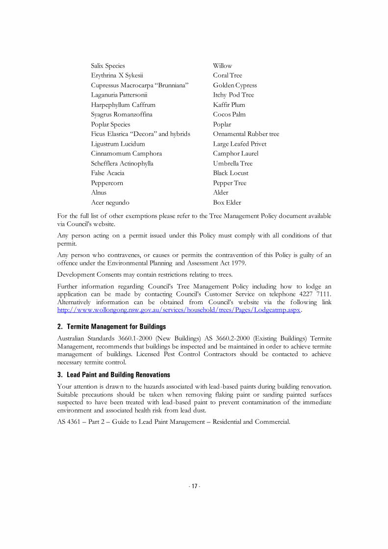
- 17 -
Salix Species
Erythrina X Sykesii
Cupressus Macrocarpa “Brunniana”
Laganuria Pattersonii
Harpephyllum Caffrum
Syagrus Romanzoffina
Poplar Species
Ficus Elasrica “Decora” and hybrids
Ligustrum Lucidum
Cinnamomum Camphora
Schefflera Actinophylla
False Acacia
Peppercorn
Alnus
Acer negundo
Willow
Coral Tree
Golden Cypress
Itchy Pod Tree
Kaffir Plum
Cocos Palm
Poplar
Ornamental Rubber tree
Large Leafed Privet
Camphor Laurel
Umbrella Tree
Black Locust
Pepper Tree
Alder
Box Elder
For the full list of other exemptions please refer to the Tree Management Policy document available via Council’s website.
Any person acting on a permit issued under this Policy must comply with all conditions of that permit.
Any person who contravenes, or causes or permits the contravention of this Policy is guilty of an offence under the Environmental Planning and Assessment Act 1979.
Development Consents may contain restrictions relating to trees.
Further information regarding Council’s Tree Management Policy including how to lodge an application can be made by contacting Council’s Customer Service on telephone 4227 7111. Alternatively information can be obtained from Council’s website via the following link http://www.wollongong.nsw.gov.au/services/household/trees/Pages/Lodgeatmp.aspx.
2. Termite Management for Buildings
Australian Standards 3660.1-2000 (New Buildings) AS 3660.2-2000 (Existing Buildings) Termite Management, recommends that buildings be inspected and be maintained in order to achieve termite management of buildings. Licensed Pest Control Contractors should be contacted to achieve necessary termite control.
3. Lead Paint and Building Renovations
Your attention is drawn to the hazards associated with lead-based paints during building renovation. Suitable precautions should be taken when removing flaking paint or sanding painted surfaces suspected to have been treated with lead-based paint to prevent contamination of the immediate environment and associated health risk from lead dust.
AS 4361 – Part 2 – Guide to Lead Paint Management – Residential and Commercial.

- 18 -
4. Sewage Management Systems
Where a property has on-site sewage management system (this includes septic tanks, disposal trenches, aerated waste water treatment systems, composting toilets and pump out systems) the new owner must obtain an “Approval to Operate” from Council within 3 months of land ownership being transferred or otherwise conveyed.
5. Asbestos
Exposure to asbestos is a serious health hazard. In Australia, asbestos was gradually phased out of building materials in the 1980s and the supply and installation of asbestos containing goods has been prohibited since 31 December 2003. However, asbestos legacy materials still exist in many homes, buildings and other assets and infrastructure.
Council on the 27 October 2014 adopted an Asbestos policy which states Council’s commitment to and responsibilities for safely managing asbestos, and provides information for Council and the local community on safely managing asbestos. The policy can be viewed on Council’s website: www.wollongong.nsw.gov.au.
6. Loose-Fill Asbestos Insulation
Some residential homes located in NSW have been identified as containing loose-fill asbestos insulation, for example in the roof space. NSW Fair Trading maintains a Register of homes that are affected by loose-fill asbestos insulation.
You should make your own enquiries as to the age of the buildings on the land to which this certificate relates and if it contains a building constructed prior to 1980, the council strongly recommends that any potential purchaser obtain advice from a licenced asbestos assessor to determine whether loose-fill asbestos is present in any building on the land and, if so, the health risks (if any) this may pose for the buildings occupants.
Contact NSW Fair Trading for further information.
This letter is authorised by: Jamie O’Connell LIS Information Officer Section 10.7 Planning Certificates Wollongong City Council Telephone (02) 4227 7111

LIS | LPA | 149LONG | 03758080.DOCX
CERTIFICATE 201803306 Issued 16 July 2018
Certificate Type Sections 10.7(2) & (5)
Fee $133.00
Your Reference SECTION10.7CERTS:148824
Council Property Reference 384726 Colee Quayle
PLANNING CERTIFICATE
Issued Under Section 10.7 of the Environmental Planning and Assessment Act 1979
PROPERTY DETAILS Legal Description Lot 1 DP 785374
Location
Lot 1 Five Islands Road SPRING HILL NSW 2500
This certificate provides information on how a property (such as land and buildings) may be used and the limits on its development. The
certificate contains information Council is aware of through its records and environmental plans, along with data supplied by the State
Government.
SECTION 10.7 (2) DETAILS
As at the date of this certificate, the following prescribed matters under section 10.7(2) of the Act relate to the abovementioned land:
1. NAMES OF RELEVANT PLANNING INSTRUMENTS & DEVELOPMENT CONTROL
PLANS
(1) The name of each environmental planning instrument that applies to the carrying out of
development on the land
State Environmental Planning Policy (State Significant Precincts) 2005
State Environmental Planning Policies
The Environmental Planning instruments that apply to the land according to their terms is the State Environmental planning Policy (Three Ports) 2013 and all other State Environmental Planning Policies
1) Subject to section 74 (1) of the Act and this clause, in the event of an inconsistency between this Policy and another environmental planning instrument, whether made before or after the commencement of this Policy, this Policy prevails to the extent of the inconsistency.
2) If this Policy and State Environmental Planning Policy (Exempt and Complying Development Codes) 2008 specify the same development as either exempt or complying development, State Environmental Planning Policy (Exempt and Complying Development Codes) 2008 does not apply to that development.
3) This Policy does not restrict or prohibit the carrying out of any development that is permitted to be carried out with or without development consent, or that is exempt development, under State Environmental Planning Policy (Infrastructure) 2007.

- 2 -
State Environmental Planning Policy Coastal Management 2018 (whole of lot) affected.
(2) The name of each proposed environmental planning instrument that will apply to the
carrying out of development on the land and that is or has been the subject of community
consultation or on public exhibition under the Act (unless the Director-General has notified the
council that the making of the proposed instrument has been deferred indefinitely or has not yet
been approved)
Paper Subdivisions: Draft Environmental Planning & Assessment Amendment (Subdivision works) Regulation 2013
Draft State Environmental Planning Policy - Advertising and Signage Amendments
Draft State Environmental Planning Policy - Infrastructure – Amendment (Shooting Ranges) 2013
Draft State Environmental Planning Policy - Infrastructure – Amendment (Sport and Recreation) 2013
Draft State Environmental Planning Policy – Koala Habitat Protection
Draft State Environmental Planning Policy – Infrastructure – (Amendments Review) 2017
Draft State Environmental Planning Policy – Primary Production and Rural Development.
Explanation of Intended Effect – Proposed Draft Environment SEPP (2017)
Explanation of Intended Effect – Proposed Amendment to the Mining SEPP 2007 – Air and Noise Impacts (2017)
Explanation of Intended Effect – Proposed Amendments to the SEPP 44 Koala Habitat Protection (2016)
Explanation of Intended Effect – Proposed Draft Primary Production and Rural Development SEPP 2017
Explanation of Intended Effect – Proposed Amendment to the Senior Housing SEPP – site compatibility certificates (2017)
Explanation of Intended Effect – Proposed Repeal of Two Operational SEPPs – SEPP 1 Development Standards and SEPP (Miscellaneous Consent Provisions) 2007 (2017)
Explanation of Intended Effect – Proposed Amendment to SEPP (Exempt and Complying Development ) – Proposed Greenfield Housing Code
Explanation of Intended Effect – Proposed new Remediation of Land SEPP and the Draft Planning Guidelines
Explanation of Intended Effect – Proposed Amendment to SEPP (Affordable Rental Housing) 2009
(3) The name of each development control plan that applies to the carrying out of development
on the land Wollongong Development Control Plan 2009 Wollongong Development Control Plan 2009, contains detailed development controls which

- 3 -
supplement the provisions of Wollongong Local Environmental Plan 2009. Note: The Wollongong Development Control Plan 2009 should be consulted to ascertain its
full effect on the land.
(4) In this clause, proposed environmental planning instrument includes a planning proposal for
a Local Environmental Plan or a draft environmental planning instrument.
2. ZONING AND LAND USE UNDER RELEVANT LEPs
State Environmental Planning Policy (State Significant Precincts) 2005 For each environmental planning instrument or proposed instrument referred to in clause 1 (other than a SEPP or proposed SEPP) that includes the land in any zone (however described):
1. the identity of the zone, whether by reference to a name (such as “Residential Zone” or “Heritage Area”) or by reference to a number (such as “Zone No 2(a)”)
IN3 – Heavy Industrial (Three Ports) 2013
2. the purposes for which the instrument provides that development may be carried out within the zone without the need for development consent
Environmental protection works.
3. the purposes for which the instrument provides that development may not be carried out within the zone except with development consent
Depots; Food and drink premises; Freight transport facilities; heavy industries; Port facilities; Roads; Transport depots; Warehouse or distribution centres; Waste or resource management facilities.
4. The purposes for which the instrument provides that development is prohibited within the zone.
Any development not specified in item (2) or (3).
Note: State Environmental Planning Policy (Three Ports) 2013 should be consulted to ascertain its full effect on the land.
Note: State Environmental Planning Policy (Major Development) 2005 should be consulted to ascertain its full effect on the land.
Other Relevant Provisions of State Environmental Planning Policy (State Significant Precincts)
2005
Development for subdivision requires consent except for:
a) widening a public road, b) a minor realignment of boundaries that does not create additional lots or the opportunity
for additional dwellings,

- 4 -
c) a consolidation of lots that does not create additional lots or the opportunity for additional dwellings,
d) rectifying an encroachment on a lot, e) creating a public reserve. f) excising from a lot land that is, or is intended to be, used for public purposes, including
drainage pruposes, rural fire brigade or other emergency service purposes or public toilets.
(e) Whether any development standards applying to the land fix minimum land dimensions for
the erection of a dwelling- house on the land, and if so, the minimum land dimensions so fixed
See Clauses 4.1, 4.1AA, 4.1A, 4.1B, 4.2 and 4.2A of the Local Environmental Plan.
(f) Whether the land includes or comprises critical habitat
Nil
(g) Whether the land is in a conservation area (however described)
Nil.
(h) Whether an item of environmental heritage (however described) is situated on the land
Nil.
2A. ZONING AND LAND USE UNDER STATE ENVIRONMENTAL PLANNING POLICY
(SYDNEY REGIONAL GROWTH CENTRES) 2006
To the extent that the land is within any zone (however described) under:
(a) Part 3 of the State Environmental Planning Policy (Sydney Region Growth Centres)
2006 (the 2006 SEPP), or
(b) a Precinct Plan (within the meaning of the 2006 SEPP),
(c) a proposed Precinct Plan that is or has been the subject of community consultation
or on public exhibition under the Act,
the particulars referred to in clause 2 (a) – (h) in relation to that land (with a reference to “the
instrument” in any of those paragraphs being read as a reference to Part 3 of the 2006 SEPP, or
the Precinct Plan or proposed Precinct Plan, as the case requires).
Not Applicable.
3. COMPLYING DEVELOPMENT
(1) The extent to which the land is land on which complying development may be carried out
under each of the codes for complying development because of the provisions of clauses 1.17A
(1) (c) to (e), (2), (3) and (4), 1.18 (1), (c3) and 1.19 of State Environmental Planning Policy (Exempt
and Complying Development Codes) 2008.

- 5 -
(2) The extent to which complying development may not be carried out on that land because of
the provisions of clauses 1.17A (1) (c) to (e), (2), (3) and (4), 1.18(1)(c3) and 1.19 of that Policy and
the reasons why it may not be carried out under those clauses.
(3) If the council does not have sufficient information to ascertain the extent to which complying
development may or may not be carried out on the land, a statement that a restriction applies to
the land, but it may not apply to all of the land, and that council does not have sufficient
information to ascertain the extent to which complying development may or may not be carried
out on the land.
State Environmental Planning Policy (Exempt and Complying Development Codes) 2008
(1) Subject to the terms of each code, and the zoning of the land, complying development may
be carried out for the following codes to the extent that the land has no affectation.
Housing Code (R1, R2, R3, R4, RU5)
Low Rise Medium Density Housing Code (Commencement deferred until July 2019)
Rural Housing Code (RU1, RU2, RU3, RU4, RU6, R5)
Housing Alterations Code
General Development Code
Commercial and Industrial (New Buildings and Additions) Code
Commercial and Industrial (Alterations) Code
Subdivision Code
Demolition Code
Container Recycling Facilities Code
Fire Safety Code
4B. ANNUAL CHARGES UNDER LOCAL GOVERNMENT ACT 1993 FOR COASTAL
PROTECTION SERVICES THAT RELATE TO EXISTING COASTAL PROTECTION
WORKS In relation to a coastal council- whether the owner (or any previous owner) of the land has
consented in writing to the land being subject to annual charges under section 496B of the Local
Government Act 1993 for coastal protection services that relate to existing coastal protection
works (within the meaning of section 553B of that Act) Note: “Existing coastal protection works” are works to reduce the impact of coastal hazards on the land (such as seawalls, revetments, groynes and beach nourishment) that existed before the commencement of section 553B of the Local Government Act 1993
Not applicable
5. MINE SUBSIDENCE
Whether or not the land is proclaimed to be a mine subsidence district within the meaning of
section 15 of the Mine Subsidence Compensation Act 1961

- 6 -
The land is not proclaimed to be a mine subsidence district within the meaning of section 15 of the Mine Subsidence Compensation Act 1961.
6. ROAD WIDENING AND ROAD REALIGNMENT
Whether or not the land is affected by any road widening or road realignment under:
(a) Division 2 of Part 3 of the Roads Act 1993 or
(b) Any environmental planning instrument or
(c) Any resolution of the council
Council has no record that the land is affected by any Road Widening or Road Realignment under: a) Division 2 of Part 3 of the Roads Act 1993, or
b) any environmental planning instrument, or c) any resolution of the Council.
7. COUNCIL AND OTHER PUBLIC AUTHORITY POLICIES ON HAZARD RISK
RESTRICTIONS
Whether or not the land is affected by a policy:
a) adopted by the council, or
b) adopted by any other public authority and notified to the council for the express purpose of its
adoption by that authority being referred to in planning certificates issued by the council, that
restricts the development of the land because of the likelihood of land slip, bushfire, tidal
inundation, subsidence, acid sulfate soils or any other risk (other than flooding).
Council has adopted “Wollongong Development Control Plan 2009 – Chapter E12 Geotechnical Assessment”.
Council has adopted Acid Sulfate Maps, Wollongong Local Environmental Plan 2009 – Clause 7.5 Acid Sulfate Soils.
Council has adopted “Wollongong Development Control Plan 2009 – Chapter E16 Bushfire Management”. The Rural Fire Service has endorsed the Bush Fire Prone Land map.
Unhealthy Building Land Policy, adopted by the Environmental Protection Authority.
Council has adopted Wollongong City Council Coastal Zone Study (Cardno, Lawson, Treloar 2010).
7A. FLOOD RELATED DEVELOPMENT CONTROLS INFORMATION
(1) Whether or not development on that land or part of the land for the purposes of dwelling
houses, dual occupancies, multi dwelling housing or residential flat buildings (not including
development for the purposes of group homes or seniors housing) is subject to flood related
development controls.

- 7 -
Development on the land or part of the land for the purposes of dwelling houses, dual occupancies, multi dwelling housing or residential flat buildings (not including development for the purposes of group homes or seniors housing) is subject to flood related development controls as contained in Wollongong Development Control Plan 2009 Chapter E13 Floodplain Management and Wollongong Local Environmental Plan 2009 Clause 7.3 Flood Planning.
(2) Whether or not development on that land or part of the land for any other purpose is subject
to flood related development controls.
Development on the land or part of the land for any other purpose is subject to flood related development controls as contained in Wollongong Development Control Plan 2009 Chapter E13 Floodplain Management and Wollongong Local Environmental Plan 2009 Clause 7.3 Flood Planning.
(3) Words and expressions in this clause have the same meaning as in the instrument set out in
the Schedule to the Standard Instrument (Local Environmental Plans) Order 2006
Further flood information relating to this parcel of land is available by application under section 10.7(5) of the Environmental Planning & Assessment Act 1979.
8. LAND RESERVED FOR ACQUISITION Whether or not any environmental planning instrument or proposed environmental planning
instrument referred to in clause 1 makes provision in relation to the acquisition of the land by a
public authority, as referred to in section 3.15 of the Act.
Nil.
9. CONTRIBUTION PLANS
The name of each contributions plan applying to the land.
Wollongong Section 7.12 Development Contributions Plan (2017) (previously S94A)
Note: The purposes of this contributions plan are:
To authorise the imposition of a condition on certain development consents and complying development certificates requiring the payment of a contribution pursuant to section 7.12 of the EP&A Act 1979.
To assist the council to provide the appropriate public facilities which are required to maintain and enhance amenity and service delivery within the Wollongong Local Government area.
To publicly identify the purposes for which the levies are required.
Any party wishing to undertake construction of any new, or alterations to any existing, building or other development should review this policy or contact Council to determine if any contributions may be payable.
9A. BIODIVERSITY CERTIFIED LAND
If the land biodiversity certified land under Part 8 of the Biodiversity Conservation Act 2016, a
statement to that effect.
Note: Biodiversity certified land includes land certified under Part 7AA of the Threatened Species Conservation Act 1995 that is taken to be certified under Part 8 of the Biodiversity Conservation Act 2016.

- 8 -
Nil.
10. BIODIVERSITY STEWARDSHIP SITES
If the land is a biodiversity stewardship site under a biodiversity stewardship agreement under
Part 5 of the Biodiversity Conservation Act 2016, a statement to that effect (but only if the
council has been notified of the existence of the agreement by the Chief Executive of the Office
of Environment and Heritage).
Note: Biodiversity stewardship agreements include bio-banking agreements under Part 7A of the Threatened Species Conservation Act 1995 that are taken to be biodiversity stewardship agreements under Part 5 of the Biodiversity Conservation Act 2016.
Nil.
10A. NATIVE VEGETATION CLEARING SET ASIDES
If the land contains a set aside are under section 60ZC of the Local Land Services Act 2013, a
statement to that effect (but only if the council has been notified of the existence of the set
aside by Local Land Services or it is registered in the public register under that section).
Nil.
11. BUSH FIRE PRONE LAND
If any of the land is bush fire prone land (as defined in the Act), a statement that all or, as the
case may be, some of the land is bush fire prone land.
If none of the land is bush fire prone land, a statement to that effect.
The land is not recorded in Council's records as bushfire prone land.
12. PROPERTY VEGETATION PLANS
If the land is land to which a property vegetation plan approved under Part 4 of the Native
Vegetation Act 2003 (and that continues in force), a statement to that effect (but only if the
council has been notified of the existence of the plan by the person or body that approved the
plan under the Act).
Council has not been notified that the land is affected by a Property Vegetation Plan issued under the Native Vegetation Act 2003.
13. ORDERS UNDER TREES (DISPUTES BETWEEN NEIGHBOURS) ACT 2006
Whether an order has been made under the Trees (Disputes Between Neighbours) Act 2006 to
carry out work in relation to a tree on the land (but only if the council has been notified of the
order) Council has not been notified of an order.

- 9 -
14. STATE SIGNIFICANT DEVELOPMENT
If there is a direction by the Minister in force under section 75P (2) (c1) of the Act that a
provision of an environmental planning instrument prohibiting or restricting the carrying out of
a project or a stage of a project on the land under Part 4 of the Act does not have effect, a
statement to that effect identifying the provision that does not have effect. Nil
STATE SIGNIFICANT INFRASTRUCTURE
If there is a direction by the Minister in force under section 75P (2) (c1) of the Act that a
provision of an environmental planning instrument prohibiting or restricting the carrying out of
a project or a stage of a project on the land under Part 4 of the Act does not have effect, a
statement to that effect identifying the provision that does not have effect. Nil
15. SITE COMPATIBILITY CERTIFICATES AND CONDITIONS FOR SENIORS
HOUSING
If the land is land to which State Environmental Planning Policy (Housing for Seniors or People
with a Disability) 2004 applies:
(1) A statement of whether there is a current, site compatibility certificate (seniors housing),
of which the council is aware, in respect of proposed development on the land and, if
there is a certificate, the statement is to include:
(a) the period for which the certificate is current, and
(b) that a copy may be obtained from the head office of the Department of Planning,
and
(2) A statement setting out any terms of a kind referred to in clause 18(2) of that Policy that
have been imposed as a condition of consent to a development application granted after
11 October 2007 in respect of the land State Environmental Planning Policy (Housing for Seniors or People with a Disability) 2004
Nil.
16. SITE COMPATIBILITY CERTICATE FOR INFRASTRUCTURE A statement of whether there is a valid site compatibility certificate (infrastructure), or site
compatibility certificate (schools or TAFE establishments) of which the council is aware, in
respect of proposed development on the land and, if there is a certificate, the statement is to
include:

- 10 -
(a) the period for which the certificate is valid, and
(b) that a copy may be obtained from the head office of the Department.
State Environmental Planning Policy (Infrastructure) 2007 Nil.
17. SITE COMPATIBILITY CERTIFICATE AND CONDITIONS FOR AFFORDABLE
RENTAL HOUSING
(1) A statement of whether there is a current site compatibility certificate (affordable rental
housing), of which the council is aware, in respect of proposed development on the land
and, if there is a certificate, the statement is to include:
(a) the period for which the certificate is current, and
(b) that a copy may be obtained from the head office of the Department.
(2) A statement setting out any terms of a kind referred to in clause 17 (1) or 38 (1) of State
Environmental Planning Policy (Affordable Rental Housing) 2009 that have been imposed
as a condition of consent to a development application in respect of the land.
State Environmental Planning Policy (Affordable Rental Housing) 2009
Nil.
18. PAPER SUBDIVISION INFORMATION
(1) The name of any development plan adopted by a relevant authority that applies to the land
or that is proposed to be subject to the consent ballot.
Nil
(2) The date of any subdivision order that applies to the land.
Not applicable
(3) Words and expressions used in this clause have the same meaning as they have in Part 16C
of this Regulation.
19. SITE VERIFICATION CERTIFICATES
A statement of whether there is a current site verification certificate, of which the council is
aware, in respect of the land and, if there is a certificate, the statement is to include:
(a) the matter certified by the certificate, and
- 11 -
Note: A site verification certificate sets out the Director-General's opinion as to whether the land concerned is or is not biophysical strategic agricultural land or critical industry cluster land-see Division 3 of Part 4AA of State Environmental Planning Policy (Mining, Petroleum Production and Extractive lndustries 2007).
(b) the date on which the certificate ceases to be current (if any), and
(c) that a copy may be obtained from the head office of the Department.
Nil
20. LOOSE-FILL ASBESTOS INSULATION REGISTER
If the land includes any residential premises (within the meaning of Division 1A of Part 8 of the
Home Building Act 1989) that are listed on the register, that is required to be maintained under
that Division, a statement to that effect.
For register information contact www.fairtrading.nsw.gov.au
Nil.
21. AFFECTED BUILDING NOTICES AND BUILDING PRODUCT RECTIFICATION
ORDERS
(1) A statement of whether there is any affected building notice of which the council is aware
that is in force in respect of the land.
(2) A statement of:
(a) whether there is any building product rectification order of which the council is aware
that is in force in respect of the land and has not been fully complied with, and
(b) Whether any notice of intention to make a building product rectification order of which
the council is aware has been given in respect of the land and is outstanding.
(3) In this clause: affected building notice has the same meaning as in Part 4 of the Building
Products (Safety) Act 2017. building product rectification order has the same meaning as in the
Building Products (Safety) Act 2017.
Affected building notice has the same meaning as Part 4 of the Building Products (Safety) Act
2017 No 69
Building product rectification order has the same meaning as in the Building Products (Safety)
Act 2017 No 69
Nil.
CONTAMINATED LAND MANAGEMENT ACT 1997
Note: The following matters are prescribed by section 59 (2) of the Contaminated Land
Management Act 1997 as additional matters to be specified in a planning certificate:
(a) that the land to which the certificate relates is significantly contaminated within the
meaning of that Act- if the land (or part of the land) is significantly contaminated land
at the date when the certificate is issued,

- 12 -
(b) that the land to which the certificate relates is subject to a management order within
the meaning of the Act- if it is subject to such an order at the date when the
certificate is issued,
(c) that the land to which the certificate relates is the subject of an approved voluntary
management proposal within the meaning of that Act – if it is the subject of such an
approved proposal at the date when the certificate is issued,
(d) that the land to which the certificate relates is subject to an ongoing maintenance
order within the meaning of that Act – if it is subject to such an order at the date
when the certificate is issued,
(e) that the land to which the certificate relates is the subject of a site audit statement
within the meaning of the Act – if a copy of such a statement has been provided at
any time to the local authority issuing the certificate
Council has not been advised that:
a) The land is significantly contaminated land within the meaning of the Contaminated Land Management Act 1997
b) The land is subject to a management order within the meaning of the Contaminated Land
Management Act 1997
c) The land is subject to an approved voluntary management proposal within the meaning of the Contaminated Land Management Act 1997
d) The land is subject to an ongoing maintenance order within the meaning of the
Contaminated Land Management Act 1997
e) The land is the subject of a site audit statement within the meaning of the Contaminated Land Management Act 1997.
SECTION 10.7 (5) DETAILS
As at the date of this certificate, the following additional information, provided in good faith pursuant to section 10.7 (5) of the Act, relate to the abovementioned land. Council has selected these matters as those most likely to be of concern but they do not comprise an exhaustive list of matters likely to affect the land. When information pursuant to section 10.7 (5) is requested the Council is under no obligation to furnish any of the information supplied herein pursuant to that section. Council draws you attention to section 10.7 (6) which states that a council shall not incur any liability in respect of any advice provided in good faith pursuant to subsection (5). The absence of any reference to any matter affecting the land shall not imply that the land is not affected by any matter referred to in this certificate.
RESOLUTION TO PREPARE PLANNING PROPOSAL On 30th January 2017, Council resolved to adopt a draft Planning Proposal for the area of Port Kembla covered by the State Environmental Planning Policy (Three Ports) 2013, to make a number of amendments including permitting the temporary use of under-utilised sites and buildings within the BlueScope holdings for light industrial and office use. Council on 17 July 2017 resolved to commence the preparation of a draft Planning Proposal to

- 13 -
introduce Housing Affordability provisions or SEPP 70 Housing Affordability provisions into the Wollongong Local Environmental Plan 2009. The form of the provisions will be subject to a future report and subsequent community consultation.
PROPOSED DRAFT DEVELOPMENT CONTROL PLANS The following plans have been placed on exhibition pursuant to the provisions of section 72 of the Environmental Planning and Assessment Act 1979:
Draft Development Control Plan 2009 Review The Wollongong Development Control Plan 2009 came into force on 3 March 2010. A review commenced after 6 months of operation. The following chapters are available for public exhibition. Chapter D16 West Dapto Release Area
LAND STABILITY
Council’s land constraint/stability assessment maps do not show that the land is located in an area where landslip and/or subsidence have occurred, or where land instability is suspected. If you have any doubt as to whether the land is affected by landslip and/or subsidence the services of a suitably qualified engineer should be obtained.
Note: the advice provided by Council in respect of the stability of the land is based on information contained in Council’s land constraint maps. The maps have been compiled from data received by Council and considered by Council to be reasonably reliable. Council does not warrant that its land constraint maps contain all information ever received by Council relating to the stability of the land.
FLOOD AND DRAINAGE
1 Classification of Flood Risk
Council records indicate that this property is located within a Low and Medium Flood Risk precinct.
Land that is potentially subject to inundation is classified as low, medium or high flood risk. Council has prepared a development control plan known as Wollongong Development Control Plan 2009 that provides details of flood related development controls that may be applicable.
Where the owner/applicant has detailed survey available which identifies the property to be within another risk precinct or not in one at all, it may be presented to Council for reassessment.
Definitions:
High Flood Risk (and Interim Riverine Corridor) Precinct
This has been defined as the area within the envelope of land subject to a high hydraulic hazard (in accordance with the provisional criteria outlined in the Floodplain Management Manual) in a 100 year flood event plus all land within a corridor 10m from the top of the creek bank (Interim Riverine Corridor). The high flood risk precinct is where high flood damages, potential risk to life, evacuation problems would be anticipated or development would significantly and adversely effect flood behaviour. Most development should be restricted in this precinct. In this precinct, there would be a significant risk of flood damages without compliance with flood related building and planning controls.

- 14 -
Medium Flood Risk Precinct
This has been defined as land below the 100 year flood level (plus 0.5m freeboard) that is not within the High Flood Risk (and Interim Riverine Corridor) Precinct. It is land subject to low hydraulic hazard (in accordance with the provisional criteria outlined by the Floodplain Management Manual). In this precinct there would still be a significant risk of flood damage, but these damages can be minimised by the application of appropriate development controls.
Low Flood Risk Precinct
This has been defined as all other land within the floodplain (i.e. within the extent of the probable maximum flood) but not identified within either the High Flood Risk (and Interim Riverine Corridor) or the Medium Flood Risk Precinct, where risk of damages are low for most land uses. The Low Flood Risk Precinct is that area above the 100 year flood (plus 0.5m freeboard) and most land uses would be permitted within this precinct.
2 Estimated Flood Levels
Estimated and/or historical flood levels in the vicinity of this property may be available from Council. Requests may be made by completing a Flood Enquiry Form available from council’s website, in writing or from the Level 6 front counter of the Administration Building. A cost is involved for this service. Payment must be made prior to information being provided.
Please contact Council’s Drainage Duty Officer on 42277181 to ensure the availability of information before submitting this request form. Council does not hold flood information for every property.
‘Please note that flood levels may change due to Council’s flood study and Floodplain Risk Management Study currently being reviewed. As part of the review, design parameters for these studies are changing, and therefore the flood levels, velocities and flood risks may vary from the current flood study.’
ACID SULFATE SOILS
Acid Sulfate Soil Class 5 has been mapped on this land.
CONTAMINATED LAND
Council’s records show that because of previous uses the land may be contaminated. The services of a suitably qualified consultant should be sought to ascertain the degree of contamination, if any, on the land, and its likely effect on the land. Council’s records are incomplete and there is no certainty that the land is so affected. Council has adopted Wollongong Development Control Plan 2009, which may restrict the development of the land.
STATE SIGNIFICANT DEVELOPMENT
Nil.
BUILDING LINES Wollongong Development Control Plan 2009 details the setbacks applicable to the land.

- 15 -
OTHER HERITAGE MATTERS KNOWN TO COUNCIL
Aboriginal Heritage
All development within the Wollongong Local Government Area is subject to the Aboriginal Heritage requirements of the National Parks and Wildlife Act 1974. To determine if your property is affected by an Aboriginal Site, it is recommended that an Aboriginal Heritage Information Management System (AHIMS) search be undertaken by contacting the AHIM’S Administrator on (02) 9995 5000. Further detail on Council’s Aboriginal Heritage requirements for Development is contained within Chapter E10 of the Wollongong Development Control Plan 2009.
DEVELOPMENT HISTORY
Application may be made for a Building Certificate under section 10.7B of Environmental Planning and Assessment Act 1979 if written certification of existing buildings on the land is required.
The history of development consent approval applicable to the land may be obtained by consulting the Development Consent Register. Enquiries concerning the register may be made at Council’s Customer Service Centre, 41 Burelli Street Wollongong during office hours.
LOOSE-FILL ASBESTOS
Council recommends you make your own enquiries as to the age of the buildings on the land to which this certificate relates and, if it contains a building constructed prior to 1980, the Council also strongly recommends that any potential purchaser obtain advice form a licensed asbestos assessor to determine whether loose-fill asbestos is present in any building on the land and, if so, the health risks (if any) this may pose for the building’s occupants.
Contact NSW Fair Trading for further information.
OTHER INFORMATION
Illawarra Regional Strategy
The Minister for Planning released the Illawarra Regional Strategy on 1 February 2007. The strategy is the NSW Government 25 year land use strategy for the Illawarra Region.
The Department of Planning and Environment released the Illawarra Shoalhaven Regional Plan, November 2015.
Threatened Species – Green and Golden Bell Frog (Litoria aurea) This land provides habitat for a population of Green and Golden Bell Frog (Litoria aurea). This species is listed as Endangered under Part 1 Schedule 1 of the NSW Threatened Species Conservation Act 1995 and as Vulnerable under the Commonwealth Environment Protection and Biodiversity Conservation Act 1999. The presence of this species may restrict the development potential of the land. The nature and extent of any threatened species or cultural heritage constraints should be determined following an assessment of the land by a qualified and experienced ecologist/consultant.

- 16 -
GENERAL INFORMATION
The following general information is brought to the attention of land owners.
1. Tree Management Policy
The Wollongong Tree Management Policy allows proper assessment to be made of the environmental importance and viability of trees before they are pruned, removed or damaged in any way. This Policy prohibits the ringbarking, cutting down, topping, lopping, removing, injuring or destruction of any tree except with the prior written consent of Council.
The Tree Management Policy applies to any tree that:
Is 3 metres or more in height,
Has a trunk diameter of 200mm or more at a height of 1 metre from the ground, or
Has a branch spread of 3 metres or more
Please note that:
A dead/dying tree is subject to the Tree Management Policy
Pruning of major structural or anchor roots is also subject to the Tree Management Policy
Some trees may be exempt and do not require a permit to prune or remove them. Following is a list of the exempt tree species:
Salix Species
Erythrina X Sykesii
Cupressus Macrocarpa “Brunniana”
Laganuria Pattersonii
Harpephyllum Caffrum
Syagrus Romanzoffina
Poplar Species
Ficus Elasrica “Decora” and hybrids
Ligustrum Lucidum
Cinnamomum Camphora
Schefflera Actinophylla
False Acacia
Peppercorn
Alnus
Acer negundo
Willow
Coral Tree
Golden Cypress
Itchy Pod Tree
Kaffir Plum
Cocos Palm
Poplar
Ornamental Rubber tree
Large Leafed Privet
Camphor Laurel
Umbrella Tree
Black Locust
Pepper Tree
Alder
Box Elder
For the full list of other exemptions please refer to the Tree Management Policy document available via Council’s website.
Any person acting on a permit issued under this Policy must comply with all conditions of that permit.
Any person who contravenes, or causes or permits the contravention of this Policy is guilty of an offence under the Environmental Planning and Assessment Act 1979.
Development Consents may contain restrictions relating to trees.
Further information regarding Council’s Tree Management Policy including how to lodge an application can be made by contacting Council’s Customer Service on telephone 4227 7111.

- 17 -
Alternatively information can be obtained from Council’s website via the following link http://www.wollongong.nsw.gov.au/services/household/trees/Pages/Lodgeatmp.aspx.
2. Termite Management for Buildings
Australian Standards 3660.1-2000 (New Buildings) AS 3660.2-2000 (Existing Buildings) Termite Management, recommends that buildings be inspected and be maintained in order to achieve termite management of buildings. Licensed Pest Control Contractors should be contacted to achieve necessary termite control.
3. Lead Paint and Building Renovations
Your attention is drawn to the hazards associated with lead-based paints during building renovation. Suitable precautions should be taken when removing flaking paint or sanding painted surfaces suspected to have been treated with lead-based paint to prevent contamination of the immediate environment and associated health risk from lead dust.
AS 4361 – Part 2 – Guide to Lead Paint Management – Residential and Commercial.
4. Sewage Management Systems
Where a property has on-site sewage management system (this includes septic tanks, disposal trenches, aerated waste water treatment systems, composting toilets and pump out systems) the new owner must obtain an “Approval to Operate” from Council within 3 months of land ownership being transferred or otherwise conveyed.
5. Asbestos
Exposure to asbestos is a serious health hazard. In Australia, asbestos was gradually phased out of building materials in the 1980s and the supply and installation of asbestos containing goods has been prohibited since 31 December 2003. However, asbestos legacy materials still exist in many homes, buildings and other assets and infrastructure.
Council on the 27 October 2014 adopted an Asbestos policy which states Council’s commitment to and responsibilities for safely managing asbestos, and provides information for Council and the local community on safely managing asbestos. The policy can be viewed on Council’s website: www.wollongong.nsw.gov.au.
6. Loose-Fill Asbestos Insulation
Some residential homes located in NSW have been identified as containing loose-fill asbestos insulation, for example in the roof space. NSW Fair Trading maintains a Register of homes that are affected by loose-fill asbestos insulation.
You should make your own enquiries as to the age of the buildings on the land to which this certificate relates and if it contains a building constructed prior to 1980, the council strongly recommends that any potential purchaser obtain advice from a licenced asbestos assessor to determine whether loose-fill asbestos is present in any building on the land and, if so, the health risks (if any) this may pose for the buildings occupants.
Contact NSW Fair Trading for further information.

- 18 -
This letter is authorised by: Jamie O’Connell LIS Information Officer Section 10.7 Planning Certificates Wollongong City Council Telephone (02) 4227 7111

LIS | LPA | 149LONG | 03758097.DOCX
CERTIFICATE 201803307 Issued 16 July 2018
Certificate Type Sections 10.7(2) & (5)
Fee $133.00
Your Reference SECTION10.7CERTS:148824
Council Property Reference 305997 Colee Quayle
PLANNING CERTIFICATE
Issued Under Section 10.7 of the Environmental Planning and Assessment Act 1979
PROPERTY DETAILS Legal Description Lot 2 DP 570107
Location
Centenary Park Five Islands Road
SPRING HILL NSW 2500
This certificate provides information on how a property (such as land and buildings) may be used and the limits on its development. The
certificate contains information Council is aware of through its records and environmental plans, along with data supplied by the State
Government.
SECTION 10.7 (2) DETAILS
As at the date of this certificate, the following prescribed matters under section 10.7(2) of the Act relate to the abovementioned land:
1. NAMES OF RELEVANT PLANNING INSTRUMENTS & DEVELOPMENT CONTROL
PLANS
(1) The name of each environmental planning instrument that applies to the carrying out of
development on the land
Wollongong Local Environmental Plan 2009
State Environmental Planning Policies
State Environmental Planning Policy (Three Ports) 2013 State Environmental Planning Policy (Rural Lands) 2008 State Environmental Planning Policy (Sydney Drinking Water Catchment) 2011 State Environmental Planning Policy (State and Regional Development) 2011 State Environmental Planning Policy (Urban Renewal) 2010 State Environmental Planning Policy (Affordable Rental Housing) 2009 State Environmental Planning Policy (Exempt and Complying Codes) 2008 (Amendment 2017) State Environmental Planning Policy (Infrastructure) 2007 State Environmental Planning Policy (Miscellaneous Consent Provisions) 2007 State Environmental Planning Policy (Mining, Petroleum Production and Extractive Industries) 2007 State Environmental Planning Policy (State Significant Precincts) 2005 State Environmental Planning Policy (Building Sustainability Index: BASIX) 2004

- 2 -
State Environmental Planning Policy (Housing for seniors or People with a Disability) 2004 State Environmental Planning Policy No 70 (Affordable Housing (Revised Schemes) State Environmental Planning Policy No. 65 – Design Quality of Residential Apartment Development State Environmental Planning Policy No. 64 – Advertising and Signage State Environmental Planning Policy No. 62 – Sustainable Aquaculture State Environmental Planning Policy No. 55 – Remediation of Land State Environmental Planning Policy No. 50 – Canal Estate Development State Environmental Planning Policy No. 44 – Koala Habitat Protection State Environmental Planning Policy No. 36 – Manufactured Home Estates State Environmental Planning Policy No. 33 – Hazardous and Offensive Development State Environmental Planning Policy No. 30 – Intensive Agriculture State Environmental Planning Policy No. 21 – Caravan Parks State Environmental Planning Policy No. 26 – Littoral Rainforests State Environmental Planning Policy No. 14 – Coastal Wetlands State Environmental Planning Policy – Vegetation (in Non Rural areas) 2017 State Environmental Planning Policy (Educational Establishments and Child Care Facilities) 2017 State Environmental Planning Policy Coastal Management 2018 (whole of lot) affected.
(2) The name of each proposed environmental planning instrument that will apply to the
carrying out of development on the land and that is or has been the subject of community
consultation or on public exhibition under the Act (unless the Director-General has notified the
council that the making of the proposed instrument has been deferred indefinitely or has not yet
been approved)
Paper Subdivisions: Draft Environmental Planning & Assessment Amendment (Subdivision works) Regulation 2013
Draft State Environmental Planning Policy - Advertising and Signage Amendments
Draft State Environmental Planning Policy - Infrastructure – Amendment (Shooting Ranges) 2013
Draft State Environmental Planning Policy - Infrastructure – Amendment (Sport and Recreation) 2013
Draft State Environmental Planning Policy – Koala Habitat Protection
Draft State Environmental Planning Policy – Infrastructure – (Amendments Review) 2017
Draft State Environmental Planning Policy – Primary Production and Rural Development.
Explanation of Intended Effect – Proposed Draft Environment SEPP (2017)
Explanation of Intended Effect – Proposed Amendment to the Mining SEPP 2007 – Air and Noise Impacts (2017)
Explanation of Intended Effect – Proposed Amendments to the SEPP 44 Koala Habitat Protection (2016)
Explanation of Intended Effect – Proposed Draft Primary Production and Rural Development SEPP 2017
Explanation of Intended Effect – Proposed Amendment to the Senior Housing SEPP – site compatibility certificates (2017)
Explanation of Intended Effect – Proposed Repeal of Two Operational SEPPs – SEPP 1 Development Standards and SEPP (Miscellaneous Consent Provisions) 2007 (2017)

- 3 -
Explanation of Intended Effect – Proposed Amendment to SEPP (Exempt and Complying Development ) – Proposed Greenfield Housing Code
Explanation of Intended Effect – Proposed new Remediation of Land SEPP and the Draft Planning Guidelines
Explanation of Intended Effect – Proposed Amendment to SEPP (Affordable Rental Housing) 2009
(3) The name of each development control plan that applies to the carrying out of development
on the land Wollongong Development Control Plan 2009 Wollongong Development Control Plan 2009, contains detailed development controls which supplement the provisions of Wollongong Local Environmental Plan 2009. Note: The Wollongong Development Control Plan 2009 should be consulted to ascertain its
full effect on the land.
(4) In this clause, proposed environmental planning instrument includes a planning proposal for
a Local Environmental Plan or a draft environmental planning instrument.
2. ZONING AND LAND USE UNDER RELEVANT LEPs
Wollongong Local Environmental Plan 2009. For each environmental planning instrument or proposed instrument referred to in clause 1 (other than a State Environmental Planning Policy or proposed State Environmental Planning Policy) that includes the land in any zone (however described): (a) the identity of the zone, whether by reference to a name (such as
“Residential Zone” or “Heritage Area”) or by reference to a number (such as “Zone No 2(a)”)
RE2 – Private Recreation
(b) the purposes for which the instrument provides that development may be
carried out within the zone without the need for development consent
Nil.
(c) the purposes for which the instrument provides that development may not be carried out within the zone except with development consent Animal boarding or training establishments; Boat building and repair facilities;

- 4 -
Boat sheds; Camping grounds; Caravan parks; Cemeteries; Centre-based child care facilities; Community facilities; Entertainment facilities; Environmental facilities; Environmental protection works; Extensive agriculture; Function Centres; Kiosks; Markets; Recreation areas; Recreation facilities (indoor); Recreation facilities (major); Recreation facilities (outdoor); Registered clubs; Respite day care centres; Restaurants or cafes; Roads; Signage; Take away food and drink premises; Water recreational structures.
(d) the purposes for which the instrument provides that development is
prohibited within the zone.
Any development not specified in subclause (2) or (3).
Note: For subdivision consent requirements see Clause 2.6, of Wollongong Local Environmental Plan 2009.
Demolition of a building or work requires consent see Clause 2.6AA, of Wollongong
Local Environmental Plan 2009. Development below the mean high water mark requires consent see Clause 5.7, of
Wollongong Local Environmental Plan 2009.
Note: Wollongong Local Environmental Plan 2009 should be consulted to ascertain its full effect on the land.
(e) Whether any development standards applying to the land fix minimum land dimensions for
the erection of a dwelling- house on the land, and if so, the minimum land dimensions so fixed
See Clauses 4.1, 4.1AA, 4.1A, 4.1B, 4.2 and 4.2A of the Local Environmental Plan.
(f) Whether the land includes or comprises critical habitat
Nil
(g) Whether the land is in a conservation area (however described)
Nil.
(h) Whether an item of environmental heritage (however described) is situated on the land
Nil.
2A. ZONING AND LAND USE UNDER STATE ENVIRONMENTAL PLANNING POLICY
(SYDNEY REGIONAL GROWTH CENTRES) 2006
To the extent that the land is within any zone (however described) under:
(a) Part 3 of the State Environmental Planning Policy (Sydney Region Growth Centres)
2006 (the 2006 SEPP), or
(b) a Precinct Plan (within the meaning of the 2006 SEPP),

- 5 -
(c) a proposed Precinct Plan that is or has been the subject of community consultation
or on public exhibition under the Act,
the particulars referred to in clause 2 (a) – (h) in relation to that land (with a reference to “the
instrument” in any of those paragraphs being read as a reference to Part 3 of the 2006 SEPP, or
the Precinct Plan or proposed Precinct Plan, as the case requires).
Not Applicable.
3. COMPLYING DEVELOPMENT
(1) The extent to which the land is land on which complying development may be carried out
under each of the codes for complying development because of the provisions of clauses 1.17A
(1) (c) to (e), (2), (3) and (4), 1.18 (1), (c3) and 1.19 of State Environmental Planning Policy (Exempt
and Complying Development Codes) 2008.
(2) The extent to which complying development may not be carried out on that land because of
the provisions of clauses 1.17A (1) (c) to (e), (2), (3) and (4), 1.18(1)(c3) and 1.19 of that Policy and
the reasons why it may not be carried out under those clauses.
(3) If the council does not have sufficient information to ascertain the extent to which complying
development may or may not be carried out on the land, a statement that a restriction applies to
the land, but it may not apply to all of the land, and that council does not have sufficient
information to ascertain the extent to which complying development may or may not be carried
out on the land.
State Environmental Planning Policy (Exempt and Complying Development Codes) 2008
(1) Subject to the terms of each code, and the zoning of the land, complying development may
be carried out for the following codes to the extent that the land has no affectation.
Housing Code (R1, R2, R3, R4, RU5)
Low Rise Medium Density Housing Code (Commencement deferred until July 2019)
Rural Housing Code (RU1, RU2, RU3, RU4, RU6, R5)
Housing Alterations Code
General Development Code
Commercial and Industrial (New Buildings and Additions) Code
Commercial and Industrial (Alterations) Code
Subdivision Code
Demolition Code
Container Recycling Facilities Code
Fire Safety Code
4B. ANNUAL CHARGES UNDER LOCAL GOVERNMENT ACT 1993 FOR COASTAL
PROTECTION SERVICES THAT RELATE TO EXISTING COASTAL PROTECTION
WORKS

- 6 -
In relation to a coastal council- whether the owner (or any previous owner) of the land has
consented in writing to the land being subject to annual charges under section 496B of the Local
Government Act 1993 for coastal protection services that relate to existing coastal protection
works (within the meaning of section 553B of that Act) Note: “Existing coastal protection works” are works to reduce the impact of coastal hazards on the land (such as seawalls, revetments, groynes and beach nourishment) that existed before the commencement of section 553B of the Local Government Act 1993
Not applicable
5. MINE SUBSIDENCE
Whether or not the land is proclaimed to be a mine subsidence district within the meaning of
section 15 of the Mine Subsidence Compensation Act 1961
The land is not proclaimed to be a mine subsidence district within the meaning of section 15 of the Mine Subsidence Compensation Act 1961.
6. ROAD WIDENING AND ROAD REALIGNMENT
Whether or not the land is affected by any road widening or road realignment under:
(a) Division 2 of Part 3 of the Roads Act 1993 or
(b) Any environmental planning instrument or
(c) Any resolution of the council
Council has no record that the land is affected by any Road Widening or Road Realignment under:
a) Division 2 of Part 3 of the Roads Act 1993, or b) any environmental planning instrument, or
c) any resolution of the Council.
7. COUNCIL AND OTHER PUBLIC AUTHORITY POLICIES ON HAZARD RISK
RESTRICTIONS
Whether or not the land is affected by a policy:
a) adopted by the council, or
b) adopted by any other public authority and notified to the council for the express purpose of its
adoption by that authority being referred to in planning certificates issued by the council, that
restricts the development of the land because of the likelihood of land slip, bushfire, tidal
inundation, subsidence, acid sulfate soils or any other risk (other than flooding).
Council has adopted “Wollongong Development Control Plan 2009 – Chapter E12 Geotechnical Assessment”.
Council has adopted Acid Sulfate Maps, Wollongong Local Environmental Plan 2009 – Clause 7.5 Acid Sulfate Soils.

- 7 -
Council has adopted “Wollongong Development Control Plan 2009 – Chapter E16 Bushfire Management”. The Rural Fire Service has endorsed the Bush Fire Prone Land map.
Unhealthy Building Land Policy, adopted by the Environmental Protection Authority.
Council has adopted Wollongong City Council Coastal Zone Study (Cardno, Lawson, Treloar 2010).
7A. FLOOD RELATED DEVELOPMENT CONTROLS INFORMATION
(1) Whether or not development on that land or part of the land for the purposes of dwelling
houses, dual occupancies, multi dwelling housing or residential flat buildings (not including
development for the purposes of group homes or seniors housing) is subject to flood related
development controls.
Development on the land or part of the land for the purposes of dwelling houses, dual occupancies, multi dwelling housing or residential flat buildings (not including development for the purposes of group homes or seniors housing) is subject to flood related development controls as contained in Wollongong Development Control Plan 2009 Chapter E13 Floodplain Management and Wollongong Local Environmental Plan 2009 Clause 7.3 Flood Planning.
(2) Whether or not development on that land or part of the land for any other purpose is subject
to flood related development controls.
Development on the land or part of the land for any other purpose is subject to flood related development controls as contained in Wollongong Development Control Plan 2009 Chapter E13 Floodplain Management and Wollongong Local Environmental Plan 2009 Clause 7.3 Flood Planning.
(3) Words and expressions in this clause have the same meaning as in the instrument set out in
the Schedule to the Standard Instrument (Local Environmental Plans) Order 2006
Further flood information relating to this parcel of land is available by application under section 10.7(5) of the Environmental Planning & Assessment Act 1979.
8. LAND RESERVED FOR ACQUISITION Whether or not any environmental planning instrument or proposed environmental planning
instrument referred to in clause 1 makes provision in relation to the acquisition of the land by a
public authority, as referred to in section 3.15 of the Act.
Nil.
9. CONTRIBUTION PLANS
The name of each contributions plan applying to the land.
Wollongong Section 7.12 Development Contributions Plan (2017) (previously S94A)
Note: The purposes of this contributions plan are:
To authorise the imposition of a condition on certain development consents and complying development certificates requiring the payment of a contribution pursuant to section 7.12 of the EP&A Act 1979.
To assist the council to provide the appropriate public facilities which are required to maintain and enhance amenity and service delivery within the Wollongong Local Government area.

- 8 -
To publicly identify the purposes for which the levies are required.
Any party wishing to undertake construction of any new, or alterations to any existing, building or other development should review this policy or contact Council to determine if any contributions may be payable.
9A. BIODIVERSITY CERTIFIED LAND
If the land biodiversity certified land under Part 8 of the Biodiversity Conservation Act 2016, a
statement to that effect.
Note: Biodiversity certified land includes land certified under Part 7AA of the Threatened Species Conservation Act 1995 that is taken to be certified under Part 8 of the Biodiversity Conservation Act 2016.
Nil.
10. BIODIVERSITY STEWARDSHIP SITES
If the land is a biodiversity stewardship site under a biodiversity stewardship agreement under
Part 5 of the Biodiversity Conservation Act 2016, a statement to that effect (but only if the
council has been notified of the existence of the agreement by the Chief Executive of the Office
of Environment and Heritage).
Note: Biodiversity stewardship agreements include bio-banking agreements under Part 7A of the Threatened Species Conservation Act 1995 that are taken to be biodiversity stewardship agreements under Part 5 of the Biodiversity Conservation Act 2016.
Nil.
10A. NATIVE VEGETATION CLEARING SET ASIDES
If the land contains a set aside are under section 60ZC of the Local Land Services Act 2013, a
statement to that effect (but only if the council has been notified of the existence of the set
aside by Local Land Services or it is registered in the public register under that section).
Nil.
11. BUSH FIRE PRONE LAND
If any of the land is bush fire prone land (as defined in the Act), a statement that all or, as the
case may be, some of the land is bush fire prone land.
If none of the land is bush fire prone land, a statement to that effect.
The land is not recorded in Council's records as bushfire prone land.
12. PROPERTY VEGETATION PLANS
- 9 -
If the land is land to which a property vegetation plan approved under Part 4 of the Native
Vegetation Act 2003 (and that continues in force), a statement to that effect (but only if the
council has been notified of the existence of the plan by the person or body that approved the
plan under the Act).
Council has not been notified that the land is affected by a Property Vegetation Plan issued under the Native Vegetation Act 2003.
13. ORDERS UNDER TREES (DISPUTES BETWEEN NEIGHBOURS) ACT 2006
Whether an order has been made under the Trees (Disputes Between Neighbours) Act 2006 to
carry out work in relation to a tree on the land (but only if the council has been notified of the
order) Council has not been notified of an order.
14. STATE SIGNIFICANT DEVELOPMENT
If there is a direction by the Minister in force under section 75P (2) (c1) of the Act that a
provision of an environmental planning instrument prohibiting or restricting the carrying out of
a project or a stage of a project on the land under Part 4 of the Act does not have effect, a
statement to that effect identifying the provision that does not have effect. Nil
STATE SIGNIFICANT INFRASTRUCTURE
If there is a direction by the Minister in force under section 75P (2) (c1) of the Act that a
provision of an environmental planning instrument prohibiting or restricting the carrying out of
a project or a stage of a project on the land under Part 4 of the Act does not have effect, a
statement to that effect identifying the provision that does not have effect. Nil
15. SITE COMPATIBILITY CERTIFICATES AND CONDITIONS FOR SENIORS
HOUSING
If the land is land to which State Environmental Planning Policy (Housing for Seniors or People
with a Disability) 2004 applies:
(1) A statement of whether there is a current, site compatibility certificate (seniors housing),
of which the council is aware, in respect of proposed development on the land and, if
there is a certificate, the statement is to include:
(a) the period for which the certificate is current, and
(b) that a copy may be obtained from the head office of the Department of Planning,
and

- 10 -
(2) A statement setting out any terms of a kind referred to in clause 18(2) of that Policy that
have been imposed as a condition of consent to a development application granted after
11 October 2007 in respect of the land State Environmental Planning Policy (Housing for Seniors or People with a Disability) 2004
Nil.
16. SITE COMPATIBILITY CERTICATE FOR INFRASTRUCTURE A statement of whether there is a valid site compatibility certificate (infrastructure), or site
compatibility certificate (schools or TAFE establishments) of which the council is aware, in
respect of proposed development on the land and, if there is a certificate, the statement is to
include:
(a) the period for which the certificate is valid, and
(b) that a copy may be obtained from the head office of the Department.
State Environmental Planning Policy (Infrastructure) 2007 Nil.
17. SITE COMPATIBILITY CERTIFICATE AND CONDITIONS FOR AFFORDABLE
RENTAL HOUSING
(1) A statement of whether there is a current site compatibility certificate (affordable rental
housing), of which the council is aware, in respect of proposed development on the land
and, if there is a certificate, the statement is to include:
(a) the period for which the certificate is current, and
(b) that a copy may be obtained from the head office of the Department.
(2) A statement setting out any terms of a kind referred to in clause 17 (1) or 38 (1) of State
Environmental Planning Policy (Affordable Rental Housing) 2009 that have been imposed
as a condition of consent to a development application in respect of the land.
State Environmental Planning Policy (Affordable Rental Housing) 2009
Nil.
18. PAPER SUBDIVISION INFORMATION
(1) The name of any development plan adopted by a relevant authority that applies to the land
or that is proposed to be subject to the consent ballot.
Nil
(2) The date of any subdivision order that applies to the land.
Not applicable

- 11 -
(3) Words and expressions used in this clause have the same meaning as they have in Part 16C
of this Regulation.
19. SITE VERIFICATION CERTIFICATES
A statement of whether there is a current site verification certificate, of which the council is
aware, in respect of the land and, if there is a certificate, the statement is to include:
(a) the matter certified by the certificate, and
Note: A site verification certificate sets out the Director-General's opinion as to whether the land concerned is or is not biophysical strategic agricultural land or critical industry cluster land-see Division 3 of Part 4AA of State Environmental Planning Policy (Mining, Petroleum Production and Extractive lndustries 2007).
(b) the date on which the certificate ceases to be current (if any), and
(c) that a copy may be obtained from the head office of the Department.
Nil
20. LOOSE-FILL ASBESTOS INSULATION REGISTER
If the land includes any residential premises (within the meaning of Division 1A of Part 8 of the
Home Building Act 1989) that are listed on the register, that is required to be maintained under
that Division, a statement to that effect.
For register information contact www.fairtrading.nsw.gov.au
Nil.
21. AFFECTED BUILDING NOTICES AND BUILDING PRODUCT RECTIFICATION
ORDERS
(1) A statement of whether there is any affected building notice of which the council is aware
that is in force in respect of the land.
(2) A statement of:
(a) whether there is any building product rectification order of which the council is aware
that is in force in respect of the land and has not been fully complied with, and
(b) Whether any notice of intention to make a building product rectification order of which
the council is aware has been given in respect of the land and is outstanding.
(3) In this clause: affected building notice has the same meaning as in Part 4 of the Building
Products (Safety) Act 2017. building product rectification order has the same meaning as in the
Building Products (Safety) Act 2017.
Affected building notice has the same meaning as Part 4 of the Building Products (Safety) Act
2017 No 69
Building product rectification order has the same meaning as in the Building Products (Safety)
Act 2017 No 69

- 12 -
Nil.
CONTAMINATED LAND MANAGEMENT ACT 1997
Note: The following matters are prescribed by section 59 (2) of the Contaminated Land
Management Act 1997 as additional matters to be specified in a planning certificate:
(a) that the land to which the certificate relates is significantly contaminated within the
meaning of that Act- if the land (or part of the land) is significantly contaminated land
at the date when the certificate is issued,
(b) that the land to which the certificate relates is subject to a management order within
the meaning of the Act- if it is subject to such an order at the date when the
certificate is issued,
(c) that the land to which the certificate relates is the subject of an approved voluntary
management proposal within the meaning of that Act – if it is the subject of such an
approved proposal at the date when the certificate is issued,
(d) that the land to which the certificate relates is subject to an ongoing maintenance
order within the meaning of that Act – if it is subject to such an order at the date
when the certificate is issued,
(e) that the land to which the certificate relates is the subject of a site audit statement
within the meaning of the Act – if a copy of such a statement has been provided at
any time to the local authority issuing the certificate
Council has not been advised that:
a) The land is significantly contaminated land within the meaning of the Contaminated Land Management Act 1997
b) The land is subject to a management order within the meaning of the Contaminated Land
Management Act 1997
c) The land is subject to an approved voluntary management proposal within the meaning of the Contaminated Land Management Act 1997
d) The land is subject to an ongoing maintenance order within the meaning of the
Contaminated Land Management Act 1997
e) The land is the subject of a site audit statement within the meaning of the Contaminated Land Management Act 1997.
SECTION 10.7 (5) DETAILS
As at the date of this certificate, the following additional information, provided in good faith pursuant to section 10.7 (5) of the Act, relate to the abovementioned land. Council has selected these matters as those most likely to be of concern but they do not comprise an exhaustive list of matters likely to affect the land. When information pursuant to section 10.7 (5) is requested the Council is under no obligation to furnish any of the information supplied herein pursuant to that section. Council draws you attention to section 10.7 (6) which states that a council shall not incur any liability in respect of any advice

- 13 -
provided in good faith pursuant to subsection (5). The absence of any reference to any matter affecting the land shall not imply that the land is not affected by any matter referred to in this certificate.
RESOLUTION TO PREPARE PLANNING PROPOSAL Council on 17 July 2017 resolved to commence the preparation of a draft Planning Proposal to introduce Housing Affordability provisions or SEPP 70 Housing Affordability provisions into the Wollongong Local Environmental Plan 2009. The form of the provisions will be subject to a future report and subsequent community consultation.
PROPOSED DRAFT DEVELOPMENT CONTROL PLANS The following plans have been placed on exhibition pursuant to the provisions of section 72 of the Environmental Planning and Assessment Act 1979:
Draft Development Control Plan 2009 Review The Wollongong Development Control Plan 2009 came into force on 3 March 2010. A review commenced after 6 months of operation. The following chapters are available for public exhibition. Chapter D16 West Dapto Release Area
LAND STABILITY
Council’s land constraint/stability assessment maps do not show that the land is located in an area where landslip and/or subsidence have occurred, or where land instability is suspected. If you have any doubt as to whether the land is affected by landslip and/or subsidence the services of a suitably qualified engineer should be obtained.
Note: the advice provided by Council in respect of the stability of the land is based on information contained in Council’s land constraint maps. The maps have been compiled from data received by Council and considered by Council to be reasonably reliable. Council does not warrant that its land constraint maps contain all information ever received by Council relating to the stability of the land.
FLOOD AND DRAINAGE
1 Classification of Flood Risk
Council records indicate that this property is located within a Low and Medium Flood Risk precinct.
Land that is potentially subject to inundation is classified as low, medium or high flood risk. Council has prepared a development control plan known as Wollongong Development Control Plan 2009 that provides details of flood related development controls that may be applicable.
Where the owner/applicant has detailed survey available which identifies the property to be within another risk precinct or not in one at all, it may be presented to Council for reassessment.
Definitions:
High Flood Risk (and Interim Riverine Corridor) Precinct
This has been defined as the area within the envelope of land subject to a high hydraulic hazard (in accordance with the provisional criteria outlined in the Floodplain Management Manual) in a 100

- 14 -
year flood event plus all land within a corridor 10m from the top of the creek bank (Interim Riverine Corridor). The high flood risk precinct is where high flood damages, potential risk to life, evacuation problems would be anticipated or development would significantly and adversely effect flood behaviour. Most development should be restricted in this precinct. In this precinct, there would be a significant risk of flood damages without compliance with flood related building and planning controls.
Medium Flood Risk Precinct
This has been defined as land below the 100 year flood level (plus 0.5m freeboard) that is not within the High Flood Risk (and Interim Riverine Corridor) Precinct. It is land subject to low hydraulic hazard (in accordance with the provisional criteria outlined by the Floodplain Management Manual). In this precinct there would still be a significant risk of flood damage, but these damages can be minimised by the application of appropriate development controls.
Low Flood Risk Precinct
This has been defined as all other land within the floodplain (i.e. within the extent of the probable maximum flood) but not identified within either the High Flood Risk (and Interim Riverine Corridor) or the Medium Flood Risk Precinct, where risk of damages are low for most land uses. The Low Flood Risk Precinct is that area above the 100 year flood (plus 0.5m freeboard) and most land uses would be permitted within this precinct.
2 Estimated Flood Levels
Estimated and/or historical flood levels in the vicinity of this property may be available from Council. Requests may be made by completing a Flood Enquiry Form available from council’s website, in writing or from the Level 6 front counter of the Administration Building. A cost is involved for this service. Payment must be made prior to information being provided.
Please contact Council’s Drainage Duty Officer on 42277181 to ensure the availability of information before submitting this request form. Council does not hold flood information for every property.
‘Please note that flood levels may change due to Council’s flood study and Floodplain Risk Management Study currently being reviewed. As part of the review, design parameters for these studies are changing, and therefore the flood levels, velocities and flood risks may vary from the current flood study.’
ACID SULFATE SOILS
Acid Sulfate Soils Class 5 has been mapped on this land, refer to Clause 7.5 of Wollongong Local Environmental Plan 2009. Acid Sulfate Soil Class 5 has been mapped on this land.
CONTAMINATED LAND
Council’s records show that because of previous uses the land may be contaminated. The services of a suitably qualified consultant should be sought to ascertain the degree of contamination, if any, on the land, and its likely effect on the land. Council’s records are incomplete and there is no certainty that the land is so affected. Council has adopted Wollongong Development Control Plan 2009, which may restrict the development of the land.
- 15 -
STATE SIGNIFICANT DEVELOPMENT
Nil.
BUILDING LINES Wollongong Development Control Plan 2009 details the setbacks applicable to the land.
OTHER HERITAGE MATTERS KNOWN TO COUNCIL
Aboriginal Heritage
All development within the Wollongong Local Government Area is subject to the Aboriginal Heritage requirements of the National Parks and Wildlife Act 1974. To determine if your property is affected by an Aboriginal Site, it is recommended that an Aboriginal Heritage Information Management System (AHIMS) search be undertaken by contacting the AHIM’S Administrator on (02) 9995 5000. Further detail on Council’s Aboriginal Heritage requirements for Development is contained within Chapter E10 of the Wollongong Development Control Plan 2009.
DEVELOPMENT HISTORY
Application may be made for a Building Certificate under section 10.7B of Environmental Planning and Assessment Act 1979 if written certification of existing buildings on the land is required.
The history of development consent approval applicable to the land may be obtained by consulting the Development Consent Register. Enquiries concerning the register may be made at Council’s Customer Service Centre, 41 Burelli Street Wollongong during office hours.
LOOSE-FILL ASBESTOS
Council recommends you make your own enquiries as to the age of the buildings on the land to which this certificate relates and, if it contains a building constructed prior to 1980, the Council also strongly recommends that any potential purchaser obtain advice form a licensed asbestos assessor to determine whether loose-fill asbestos is present in any building on the land and, if so, the health risks (if any) this may pose for the building’s occupants.
Contact NSW Fair Trading for further information.
OTHER INFORMATION
Illawarra Regional Strategy
The Minister for Planning released the Illawarra Regional Strategy on 1 February 2007. The strategy is the NSW Government 25 year land use strategy for the Illawarra Region.
The Department of Planning and Environment released the Illawarra Shoalhaven Regional Plan, November 2015.
Threatened Species – Green and Golden Bell Frog (Litoria aurea)
- 16 -
This land provides habitat for a population of Green and Golden Bell Frog (Litoria aurea). This species is listed as Endangered under Part 1 Schedule 1 of the NSW Threatened Species Conservation Act 1995 and as Vulnerable under the Commonwealth Environment Protection and Biodiversity Conservation Act 1999. The presence of this species may restrict the development potential of the land. The nature and extent of any threatened species or cultural heritage constraints should be determined following an assessment of the land by a qualified and experienced ecologist/consultant.
GENERAL INFORMATION
The following general information is brought to the attention of land owners.
1. Tree Management Policy
The Wollongong Tree Management Policy allows proper assessment to be made of the environmental importance and viability of trees before they are pruned, removed or damaged in any way. This Policy prohibits the ringbarking, cutting down, topping, lopping, removing, injuring or destruction of any tree except with the prior written consent of Council.
The Tree Management Policy applies to any tree that:
Is 3 metres or more in height,
Has a trunk diameter of 200mm or more at a height of 1 metre from the ground, or
Has a branch spread of 3 metres or more
Please note that:
A dead/dying tree is subject to the Tree Management Policy
Pruning of major structural or anchor roots is also subject to the Tree Management Policy
Some trees may be exempt and do not require a permit to prune or remove them. Following is a list of the exempt tree species:
Salix Species
Erythrina X Sykesii
Cupressus Macrocarpa “Brunniana”
Laganuria Pattersonii
Harpephyllum Caffrum
Syagrus Romanzoffina
Poplar Species
Ficus Elasrica “Decora” and hybrids
Ligustrum Lucidum
Cinnamomum Camphora
Schefflera Actinophylla
False Acacia
Peppercorn
Alnus
Acer negundo
Willow
Coral Tree
Golden Cypress
Itchy Pod Tree
Kaffir Plum
Cocos Palm
Poplar
Ornamental Rubber tree
Large Leafed Privet
Camphor Laurel
Umbrella Tree
Black Locust
Pepper Tree
Alder
Box Elder
For the full list of other exemptions please refer to the Tree Management Policy document available via Council’s website.

- 17 -
Any person acting on a permit issued under this Policy must comply with all conditions of that permit.
Any person who contravenes, or causes or permits the contravention of this Policy is guilty of an offence under the Environmental Planning and Assessment Act 1979.
Development Consents may contain restrictions relating to trees.
Further information regarding Council’s Tree Management Policy including how to lodge an application can be made by contacting Council’s Customer Service on telephone 4227 7111. Alternatively information can be obtained from Council’s website via the following link http://www.wollongong.nsw.gov.au/services/household/trees/Pages/Lodgeatmp.aspx.
2. Termite Management for Buildings
Australian Standards 3660.1-2000 (New Buildings) AS 3660.2-2000 (Existing Buildings) Termite Management, recommends that buildings be inspected and be maintained in order to achieve termite management of buildings. Licensed Pest Control Contractors should be contacted to achieve necessary termite control.
3. Lead Paint and Building Renovations
Your attention is drawn to the hazards associated with lead-based paints during building renovation. Suitable precautions should be taken when removing flaking paint or sanding painted surfaces suspected to have been treated with lead-based paint to prevent contamination of the immediate environment and associated health risk from lead dust.
AS 4361 – Part 2 – Guide to Lead Paint Management – Residential and Commercial.
4. Sewage Management Systems
Where a property has on-site sewage management system (this includes septic tanks, disposal trenches, aerated waste water treatment systems, composting toilets and pump out systems) the new owner must obtain an “Approval to Operate” from Council within 3 months of land ownership being transferred or otherwise conveyed.
5. Asbestos
Exposure to asbestos is a serious health hazard. In Australia, asbestos was gradually phased out of building materials in the 1980s and the supply and installation of asbestos containing goods has been prohibited since 31 December 2003. However, asbestos legacy materials still exist in many homes, buildings and other assets and infrastructure.
Council on the 27 October 2014 adopted an Asbestos policy which states Council’s commitment to and responsibilities for safely managing asbestos, and provides information for Council and the local community on safely managing asbestos. The policy can be viewed on Council’s website: www.wollongong.nsw.gov.au.
6. Loose-Fill Asbestos Insulation
Some residential homes located in NSW have been identified as containing loose-fill asbestos insulation, for example in the roof space. NSW Fair Trading maintains a Register of homes that are affected by loose-fill asbestos insulation.
You should make your own enquiries as to the age of the buildings on the land to which this certificate relates and if it contains a building constructed prior to 1980, the council strongly recommends that any potential purchaser obtain advice from a licenced asbestos assessor to determine whether loose-fill asbestos is present in any building on the land and, if so, the health risks (if any) this may pose for the buildings occupants.

- 18 -
Contact NSW Fair Trading for further information.
This letter is authorised by: Jamie O’Connell LIS Information Officer Section 10.7 Planning Certificates Wollongong City Council Telephone (02) 4227 7111

LIS | LPA | 149LONG | 03758072.DOCX
CERTIFICATE 201803305 Issued 16 July 2018
Certificate Type Sections 10.7(2) & (5)
Fee $133.00
Your Reference SECTION10.7CERTS:148824
Council Property Reference 381518 Colee Quayle
PLANNING CERTIFICATE
Issued Under Section 10.7 of the Environmental Planning and Assessment Act 1979
PROPERTY DETAILS Legal Description Lot 2 DP 837554
Location
Lot 2 Springhill Road SPRING HILL NSW 2500
This certificate provides information on how a property (such as land and buildings) may be used and the limits on its development. The
certificate contains information Council is aware of through its records and environmental plans, along with data supplied by the State
Government.
SECTION 10.7 (2) DETAILS
As at the date of this certificate, the following prescribed matters under section 10.7(2) of the Act relate to the abovementioned land:
1. NAMES OF RELEVANT PLANNING INSTRUMENTS & DEVELOPMENT CONTROL
PLANS
(1) The name of each environmental planning instrument that applies to the carrying out of
development on the land
State Environmental Planning Policy (State Significant Precincts) 2005
State Environmental Planning Policies
The Environmental Planning instruments that apply to the land according to their terms is the State Environmental planning Policy (Three Ports) 2013 and all other State Environmental Planning Policies
1) Subject to section 74 (1) of the Act and this clause, in the event of an inconsistency between this Policy and another environmental planning instrument, whether made before or after the commencement of this Policy, this Policy prevails to the extent of the inconsistency.
2) If this Policy and State Environmental Planning Policy (Exempt and Complying Development Codes) 2008 specify the same development as either exempt or complying development, State Environmental Planning Policy (Exempt and Complying Development Codes) 2008 does not apply to that development.
3) This Policy does not restrict or prohibit the carrying out of any development that is permitted to be carried out with or without development consent, or that is exempt development, under State Environmental Planning Policy (Infrastructure) 2007.

- 2 -
(2) The name of each proposed environmental planning instrument that will apply to the
carrying out of development on the land and that is or has been the subject of community
consultation or on public exhibition under the Act (unless the Director-General has notified the
council that the making of the proposed instrument has been deferred indefinitely or has not yet
been approved)
Paper Subdivisions: Draft Environmental Planning & Assessment Amendment (Subdivision works) Regulation 2013
Draft State Environmental Planning Policy - Advertising and Signage Amendments
Draft State Environmental Planning Policy - Infrastructure – Amendment (Shooting Ranges) 2013
Draft State Environmental Planning Policy - Infrastructure – Amendment (Sport and Recreation) 2013
Draft State Environmental Planning Policy – Koala Habitat Protection
Draft State Environmental Planning Policy – Infrastructure – (Amendments Review) 2017
Draft State Environmental Planning Policy – Primary Production and Rural Development.
Explanation of Intended Effect – Proposed Draft Environment SEPP (2017)
Explanation of Intended Effect – Proposed Amendment to the Mining SEPP 2007 – Air and Noise Impacts (2017)
Explanation of Intended Effect – Proposed Amendments to the SEPP 44 Koala Habitat Protection (2016)
Explanation of Intended Effect – Proposed Draft Primary Production and Rural Development SEPP 2017
Explanation of Intended Effect – Proposed Amendment to the Senior Housing SEPP – site compatibility certificates (2017)
Explanation of Intended Effect – Proposed Repeal of Two Operational SEPPs – SEPP 1 Development Standards and SEPP (Miscellaneous Consent Provisions) 2007 (2017)
Explanation of Intended Effect – Proposed Amendment to SEPP (Exempt and Complying Development ) – Proposed Greenfield Housing Code
Explanation of Intended Effect – Proposed new Remediation of Land SEPP and the Draft Planning Guidelines
Explanation of Intended Effect – Proposed Amendment to SEPP (Affordable Rental Housing) 2009
(3) The name of each development control plan that applies to the carrying out of development
on the land Wollongong Development Control Plan 2009 Wollongong Development Control Plan 2009, contains detailed development controls which

- 3 -
supplement the provisions of Wollongong Local Environmental Plan 2009. Note: The Wollongong Development Control Plan 2009 should be consulted to ascertain its
full effect on the land.
(4) In this clause, proposed environmental planning instrument includes a planning proposal for
a Local Environmental Plan or a draft environmental planning instrument.
2. ZONING AND LAND USE UNDER RELEVANT LEPs
State Environmental Planning Policy (State Significant Precincts) 2005 For each environmental planning instrument or proposed instrument referred to in clause 1 (other than a SEPP or proposed SEPP) that includes the land in any zone (however described):
1. the identity of the zone, whether by reference to a name (such as “Residential Zone” or “Heritage Area”) or by reference to a number (such as “Zone No 2(a)”)
IN3 – Heavy Industrial (Three Ports) 2013
2. the purposes for which the instrument provides that development may be carried out within the zone without the need for development consent
Environmental protection works.
3. the purposes for which the instrument provides that development may not be carried out within the zone except with development consent
Depots; Food and drink premises; Freight transport facilities; heavy industries; Port facilities; Roads; Transport depots; Warehouse or distribution centres; Waste or resource management facilities.
4. The purposes for which the instrument provides that development is prohibited within the zone.
Any development not specified in item (2) or (3).
Note: State Environmental Planning Policy (Three Ports) 2013 should be consulted to ascertain its full effect on the land.
Note: State Environmental Planning Policy (Major Development) 2005 should be consulted to ascertain its full effect on the land.
Other Relevant Provisions of State Environmental Planning Policy (State Significant Precincts)
2005
Development for subdivision requires consent except for:
a) widening a public road, b) a minor realignment of boundaries that does not create additional lots or the opportunity
for additional dwellings,

- 4 -
c) a consolidation of lots that does not create additional lots or the opportunity for additional dwellings,
d) rectifying an encroachment on a lot, e) creating a public reserve. f) excising from a lot land that is, or is intended to be, used for public purposes, including
drainage pruposes, rural fire brigade or other emergency service purposes or public toilets.
(e) Whether any development standards applying to the land fix minimum land dimensions for
the erection of a dwelling- house on the land, and if so, the minimum land dimensions so fixed
See Clauses 4.1, 4.1AA, 4.1A, 4.1B, 4.2 and 4.2A of the Local Environmental Plan.
(f) Whether the land includes or comprises critical habitat
Nil
(g) Whether the land is in a conservation area (however described)
Nil.
(h) Whether an item of environmental heritage (however described) is situated on the land
Nil.
2A. ZONING AND LAND USE UNDER STATE ENVIRONMENTAL PLANNING POLICY
(SYDNEY REGIONAL GROWTH CENTRES) 2006
To the extent that the land is within any zone (however described) under:
(a) Part 3 of the State Environmental Planning Policy (Sydney Region Growth Centres)
2006 (the 2006 SEPP), or
(b) a Precinct Plan (within the meaning of the 2006 SEPP),
(c) a proposed Precinct Plan that is or has been the subject of community consultation
or on public exhibition under the Act,
the particulars referred to in clause 2 (a) – (h) in relation to that land (with a reference to “the
instrument” in any of those paragraphs being read as a reference to Part 3 of the 2006 SEPP, or
the Precinct Plan or proposed Precinct Plan, as the case requires).
Not Applicable.
3. COMPLYING DEVELOPMENT
(1) The extent to which the land is land on which complying development may be carried out
under each of the codes for complying development because of the provisions of clauses 1.17A
(1) (c) to (e), (2), (3) and (4), 1.18 (1), (c3) and 1.19 of State Environmental Planning Policy (Exempt
and Complying Development Codes) 2008.

- 5 -
(2) The extent to which complying development may not be carried out on that land because of
the provisions of clauses 1.17A (1) (c) to (e), (2), (3) and (4), 1.18(1)(c3) and 1.19 of that Policy and
the reasons why it may not be carried out under those clauses.
(3) If the council does not have sufficient information to ascertain the extent to which complying
development may or may not be carried out on the land, a statement that a restriction applies to
the land, but it may not apply to all of the land, and that council does not have sufficient
information to ascertain the extent to which complying development may or may not be carried
out on the land.
State Environmental Planning Policy (Exempt and Complying Development Codes) 2008
(1) Subject to the terms of each code, and the zoning of the land, complying development may
be carried out for the following codes to the extent that the land has no affectation.
Housing Code (R1, R2, R3, R4, RU5)
Low Rise Medium Density Housing Code (Commencement deferred until July 2019)
Rural Housing Code (RU1, RU2, RU3, RU4, RU6, R5)
Housing Alterations Code
General Development Code
Commercial and Industrial (New Buildings and Additions) Code
Commercial and Industrial (Alterations) Code
Subdivision Code
Demolition Code
Container Recycling Facilities Code
Fire Safety Code
4B. ANNUAL CHARGES UNDER LOCAL GOVERNMENT ACT 1993 FOR COASTAL
PROTECTION SERVICES THAT RELATE TO EXISTING COASTAL PROTECTION
WORKS In relation to a coastal council- whether the owner (or any previous owner) of the land has
consented in writing to the land being subject to annual charges under section 496B of the Local
Government Act 1993 for coastal protection services that relate to existing coastal protection
works (within the meaning of section 553B of that Act) Note: “Existing coastal protection works” are works to reduce the impact of coastal hazards on the land (such as seawalls, revetments, groynes and beach nourishment) that existed before the commencement of section 553B of the Local Government Act 1993
Not applicable
5. MINE SUBSIDENCE
Whether or not the land is proclaimed to be a mine subsidence district within the meaning of
section 15 of the Mine Subsidence Compensation Act 1961

- 6 -
The land is not proclaimed to be a mine subsidence district within the meaning of section 15 of the Mine Subsidence Compensation Act 1961.
6. ROAD WIDENING AND ROAD REALIGNMENT
Whether or not the land is affected by any road widening or road realignment under:
(a) Division 2 of Part 3 of the Roads Act 1993 or
(b) Any environmental planning instrument or
(c) Any resolution of the council
Council has no record that the land is affected by any Road Widening or Road Realignment under: a) Division 2 of Part 3 of the Roads Act 1993, or
b) any environmental planning instrument, or c) any resolution of the Council.
7. COUNCIL AND OTHER PUBLIC AUTHORITY POLICIES ON HAZARD RISK
RESTRICTIONS
Whether or not the land is affected by a policy:
a) adopted by the council, or
b) adopted by any other public authority and notified to the council for the express purpose of its
adoption by that authority being referred to in planning certificates issued by the council, that
restricts the development of the land because of the likelihood of land slip, bushfire, tidal
inundation, subsidence, acid sulfate soils or any other risk (other than flooding).
Council has adopted “Wollongong Development Control Plan 2009 – Chapter E12 Geotechnical Assessment”.
Council has adopted Acid Sulfate Maps, Wollongong Local Environmental Plan 2009 – Clause 7.5 Acid Sulfate Soils.
Council has adopted “Wollongong Development Control Plan 2009 – Chapter E16 Bushfire Management”. The Rural Fire Service has endorsed the Bush Fire Prone Land map.
Unhealthy Building Land Policy, adopted by the Environmental Protection Authority.
Council has adopted Wollongong City Council Coastal Zone Study (Cardno, Lawson, Treloar 2010).
7A. FLOOD RELATED DEVELOPMENT CONTROLS INFORMATION
(1) Whether or not development on that land or part of the land for the purposes of dwelling
houses, dual occupancies, multi dwelling housing or residential flat buildings (not including
development for the purposes of group homes or seniors housing) is subject to flood related
development controls.

- 7 -
Development on the land or part of the land for the purposes of dwelling houses, dual occupancies, multi dwelling housing or residential flat buildings (not including development for the purposes of group homes or seniors housing) is subject to flood related development controls as contained in Wollongong Development Control Plan 2009 Chapter E13 Floodplain Management and Wollongong Local Environmental Plan 2009 Clause 7.3 Flood Planning.
(2) Whether or not development on that land or part of the land for any other purpose is subject
to flood related development controls.
Development on the land or part of the land for any other purpose is subject to flood related development controls as contained in Wollongong Development Control Plan 2009 Chapter E13 Floodplain Management and Wollongong Local Environmental Plan 2009 Clause 7.3 Flood Planning.
(3) Words and expressions in this clause have the same meaning as in the instrument set out in
the Schedule to the Standard Instrument (Local Environmental Plans) Order 2006
Further flood information relating to this parcel of land is available by application under section 10.7(5) of the Environmental Planning & Assessment Act 1979.
8. LAND RESERVED FOR ACQUISITION Whether or not any environmental planning instrument or proposed environmental planning
instrument referred to in clause 1 makes provision in relation to the acquisition of the land by a
public authority, as referred to in section 3.15 of the Act.
Nil.
9. CONTRIBUTION PLANS
The name of each contributions plan applying to the land.
Wollongong Section 7.12 Development Contributions Plan (2017) (previously S94A)
Note: The purposes of this contributions plan are:
To authorise the imposition of a condition on certain development consents and complying development certificates requiring the payment of a contribution pursuant to section 7.12 of the EP&A Act 1979.
To assist the council to provide the appropriate public facilities which are required to maintain and enhance amenity and service delivery within the Wollongong Local Government area.
To publicly identify the purposes for which the levies are required.
Any party wishing to undertake construction of any new, or alterations to any existing, building or other development should review this policy or contact Council to determine if any contributions may be payable.
9A. BIODIVERSITY CERTIFIED LAND
If the land biodiversity certified land under Part 8 of the Biodiversity Conservation Act 2016, a
statement to that effect.
Note: Biodiversity certified land includes land certified under Part 7AA of the Threatened Species Conservation Act 1995 that is taken to be certified under Part 8 of the Biodiversity Conservation Act 2016.

- 8 -
Nil.
10. BIODIVERSITY STEWARDSHIP SITES
If the land is a biodiversity stewardship site under a biodiversity stewardship agreement under
Part 5 of the Biodiversity Conservation Act 2016, a statement to that effect (but only if the
council has been notified of the existence of the agreement by the Chief Executive of the Office
of Environment and Heritage).
Note: Biodiversity stewardship agreements include bio-banking agreements under Part 7A of the Threatened Species Conservation Act 1995 that are taken to be biodiversity stewardship agreements under Part 5 of the Biodiversity Conservation Act 2016.
Nil.
10A. NATIVE VEGETATION CLEARING SET ASIDES
If the land contains a set aside are under section 60ZC of the Local Land Services Act 2013, a
statement to that effect (but only if the council has been notified of the existence of the set
aside by Local Land Services or it is registered in the public register under that section).
Nil.
11. BUSH FIRE PRONE LAND
If any of the land is bush fire prone land (as defined in the Act), a statement that all or, as the
case may be, some of the land is bush fire prone land.
If none of the land is bush fire prone land, a statement to that effect.
The land is not recorded in Council's records as bushfire prone land.
12. PROPERTY VEGETATION PLANS
If the land is land to which a property vegetation plan approved under Part 4 of the Native
Vegetation Act 2003 (and that continues in force), a statement to that effect (but only if the
council has been notified of the existence of the plan by the person or body that approved the
plan under the Act).
Council has not been notified that the land is affected by a Property Vegetation Plan issued under the Native Vegetation Act 2003.
13. ORDERS UNDER TREES (DISPUTES BETWEEN NEIGHBOURS) ACT 2006
Whether an order has been made under the Trees (Disputes Between Neighbours) Act 2006 to
carry out work in relation to a tree on the land (but only if the council has been notified of the
order) Council has not been notified of an order.

- 9 -
14. STATE SIGNIFICANT DEVELOPMENT
If there is a direction by the Minister in force under section 75P (2) (c1) of the Act that a
provision of an environmental planning instrument prohibiting or restricting the carrying out of
a project or a stage of a project on the land under Part 4 of the Act does not have effect, a
statement to that effect identifying the provision that does not have effect. Nil
STATE SIGNIFICANT INFRASTRUCTURE
If there is a direction by the Minister in force under section 75P (2) (c1) of the Act that a
provision of an environmental planning instrument prohibiting or restricting the carrying out of
a project or a stage of a project on the land under Part 4 of the Act does not have effect, a
statement to that effect identifying the provision that does not have effect. Nil
15. SITE COMPATIBILITY CERTIFICATES AND CONDITIONS FOR SENIORS
HOUSING
If the land is land to which State Environmental Planning Policy (Housing for Seniors or People
with a Disability) 2004 applies:
(1) A statement of whether there is a current, site compatibility certificate (seniors housing),
of which the council is aware, in respect of proposed development on the land and, if
there is a certificate, the statement is to include:
(a) the period for which the certificate is current, and
(b) that a copy may be obtained from the head office of the Department of Planning,
and
(2) A statement setting out any terms of a kind referred to in clause 18(2) of that Policy that
have been imposed as a condition of consent to a development application granted after
11 October 2007 in respect of the land State Environmental Planning Policy (Housing for Seniors or People with a Disability) 2004
Nil.
16. SITE COMPATIBILITY CERTICATE FOR INFRASTRUCTURE A statement of whether there is a valid site compatibility certificate (infrastructure), or site
compatibility certificate (schools or TAFE establishments) of which the council is aware, in
respect of proposed development on the land and, if there is a certificate, the statement is to
include:

- 10 -
(a) the period for which the certificate is valid, and
(b) that a copy may be obtained from the head office of the Department.
State Environmental Planning Policy (Infrastructure) 2007 Nil.
17. SITE COMPATIBILITY CERTIFICATE AND CONDITIONS FOR AFFORDABLE
RENTAL HOUSING
(1) A statement of whether there is a current site compatibility certificate (affordable rental
housing), of which the council is aware, in respect of proposed development on the land
and, if there is a certificate, the statement is to include:
(a) the period for which the certificate is current, and
(b) that a copy may be obtained from the head office of the Department.
(2) A statement setting out any terms of a kind referred to in clause 17 (1) or 38 (1) of State
Environmental Planning Policy (Affordable Rental Housing) 2009 that have been imposed
as a condition of consent to a development application in respect of the land.
State Environmental Planning Policy (Affordable Rental Housing) 2009
Nil.
18. PAPER SUBDIVISION INFORMATION
(1) The name of any development plan adopted by a relevant authority that applies to the land
or that is proposed to be subject to the consent ballot.
Nil
(2) The date of any subdivision order that applies to the land.
Not applicable
(3) Words and expressions used in this clause have the same meaning as they have in Part 16C
of this Regulation.
19. SITE VERIFICATION CERTIFICATES
A statement of whether there is a current site verification certificate, of which the council is
aware, in respect of the land and, if there is a certificate, the statement is to include:
(a) the matter certified by the certificate, and

- 11 -
Note: A site verification certificate sets out the Director-General's opinion as to whether the land concerned is or is not biophysical strategic agricultural land or critical industry cluster land-see Division 3 of Part 4AA of State Environmental Planning Policy (Mining, Petroleum Production and Extractive lndustries 2007).
(b) the date on which the certificate ceases to be current (if any), and
(c) that a copy may be obtained from the head office of the Department.
Nil
20. LOOSE-FILL ASBESTOS INSULATION REGISTER
If the land includes any residential premises (within the meaning of Division 1A of Part 8 of the
Home Building Act 1989) that are listed on the register, that is required to be maintained under
that Division, a statement to that effect.
For register information contact www.fairtrading.nsw.gov.au
Nil.
21. AFFECTED BUILDING NOTICES AND BUILDING PRODUCT RECTIFICATION
ORDERS
(1) A statement of whether there is any affected building notice of which the council is aware
that is in force in respect of the land.
(2) A statement of:
(a) whether there is any building product rectification order of which the council is aware
that is in force in respect of the land and has not been fully complied with, and
(b) Whether any notice of intention to make a building product rectification order of which
the council is aware has been given in respect of the land and is outstanding.
(3) In this clause: affected building notice has the same meaning as in Part 4 of the Building
Products (Safety) Act 2017. building product rectification order has the same meaning as in the
Building Products (Safety) Act 2017.
Affected building notice has the same meaning as Part 4 of the Building Products (Safety) Act
2017 No 69
Building product rectification order has the same meaning as in the Building Products (Safety)
Act 2017 No 69
Nil.
CONTAMINATED LAND MANAGEMENT ACT 1997
Note: The following matters are prescribed by section 59 (2) of the Contaminated Land
Management Act 1997 as additional matters to be specified in a planning certificate:
(a) that the land to which the certificate relates is significantly contaminated within the
meaning of that Act- if the land (or part of the land) is significantly contaminated land
at the date when the certificate is issued,

- 12 -
(b) that the land to which the certificate relates is subject to a management order within
the meaning of the Act- if it is subject to such an order at the date when the
certificate is issued,
(c) that the land to which the certificate relates is the subject of an approved voluntary
management proposal within the meaning of that Act – if it is the subject of such an
approved proposal at the date when the certificate is issued,
(d) that the land to which the certificate relates is subject to an ongoing maintenance
order within the meaning of that Act – if it is subject to such an order at the date
when the certificate is issued,
(e) that the land to which the certificate relates is the subject of a site audit statement
within the meaning of the Act – if a copy of such a statement has been provided at
any time to the local authority issuing the certificate
Council has not been advised that:
a) The land is significantly contaminated land within the meaning of the Contaminated Land Management Act 1997
b) The land is subject to a management order within the meaning of the Contaminated Land
Management Act 1997
c) The land is subject to an approved voluntary management proposal within the meaning of the Contaminated Land Management Act 1997
d) The land is subject to an ongoing maintenance order within the meaning of the
Contaminated Land Management Act 1997
e) The land is the subject of a site audit statement within the meaning of the Contaminated Land Management Act 1997.
SECTION 10.7 (5) DETAILS
As at the date of this certificate, the following additional information, provided in good faith pursuant to section 10.7 (5) of the Act, relate to the abovementioned land. Council has selected these matters as those most likely to be of concern but they do not comprise an exhaustive list of matters likely to affect the land. When information pursuant to section 10.7 (5) is requested the Council is under no obligation to furnish any of the information supplied herein pursuant to that section. Council draws you attention to section 10.7 (6) which states that a council shall not incur any liability in respect of any advice provided in good faith pursuant to subsection (5). The absence of any reference to any matter affecting the land shall not imply that the land is not affected by any matter referred to in this certificate.
RESOLUTION TO PREPARE PLANNING PROPOSAL On 30th January 2017, Council resolved to adopt a draft Planning Proposal for the area of Port Kembla covered by the State Environmental Planning Policy (Three Ports) 2013, to make a number of amendments including permitting the temporary use of under-utilised sites and buildings within the BlueScope holdings for light industrial and office use. Council on 17 July 2017 resolved to commence the preparation of a draft Planning Proposal to

- 13 -
introduce Housing Affordability provisions or SEPP 70 Housing Affordability provisions into the Wollongong Local Environmental Plan 2009. The form of the provisions will be subject to a future report and subsequent community consultation.
PROPOSED DRAFT DEVELOPMENT CONTROL PLANS The following plans have been placed on exhibition pursuant to the provisions of section 72 of the Environmental Planning and Assessment Act 1979:
Draft Development Control Plan 2009 Review The Wollongong Development Control Plan 2009 came into force on 3 March 2010. A review commenced after 6 months of operation. The following chapters are available for public exhibition. Chapter D16 West Dapto Release Area
LAND STABILITY
Council’s land constraint/stability assessment maps do not show that the land is located in an area where landslip and/or subsidence have occurred, or where land instability is suspected. If you have any doubt as to whether the land is affected by landslip and/or subsidence the services of a suitably qualified engineer should be obtained.
Note: the advice provided by Council in respect of the stability of the land is based on information contained in Council’s land constraint maps. The maps have been compiled from data received by Council and considered by Council to be reasonably reliable. Council does not warrant that its land constraint maps contain all information ever received by Council relating to the stability of the land.
FLOOD AND DRAINAGE
1 Classification of Flood Risk
Council records indicate that this property is located within a Low, Medium and High Flood Risk precinct.
Land that is potentially subject to inundation is classified as low, medium or high flood risk. Council has prepared a development control plan known as Wollongong Development Control Plan 2009 that provides details of flood related development controls that may be applicable.
Where the owner/applicant has detailed survey available which identifies the property to be within another risk precinct or not in one at all, it may be presented to Council for reassessment.
Definitions:
High Flood Risk (and Interim Riverine Corridor) Precinct
This has been defined as the area within the envelope of land subject to a high hydraulic hazard (in accordance with the provisional criteria outlined in the Floodplain Management Manual) in a 100 year flood event plus all land within a corridor 10m from the top of the creek bank (Interim Riverine Corridor). The high flood risk precinct is where high flood damages, potential risk to life, evacuation problems would be anticipated or development would significantly and adversely effect flood behaviour. Most development should be restricted in this precinct. In this precinct, there would be a significant risk of flood damages without compliance with flood related building and planning controls.

- 14 -
Medium Flood Risk Precinct
This has been defined as land below the 100 year flood level (plus 0.5m freeboard) that is not within the High Flood Risk (and Interim Riverine Corridor) Precinct. It is land subject to low hydraulic hazard (in accordance with the provisional criteria outlined by the Floodplain Management Manual). In this precinct there would still be a significant risk of flood damage, but these damages can be minimised by the application of appropriate development controls.
Low Flood Risk Precinct
This has been defined as all other land within the floodplain (i.e. within the extent of the probable maximum flood) but not identified within either the High Flood Risk (and Interim Riverine Corridor) or the Medium Flood Risk Precinct, where risk of damages are low for most land uses. The Low Flood Risk Precinct is that area above the 100 year flood (plus 0.5m freeboard) and most land uses would be permitted within this precinct.
2 Estimated Flood Levels
Estimated and/or historical flood levels in the vicinity of this property may be available from Council. Requests may be made by completing a Flood Enquiry Form available from council’s website, in writing or from the Level 6 front counter of the Administration Building. A cost is involved for this service. Payment must be made prior to information being provided.
Please contact Council’s Drainage Duty Officer on 42277181 to ensure the availability of information before submitting this request form. Council does not hold flood information for every property.
‘Please note that flood levels may change due to Council’s flood study and Floodplain Risk Management Study currently being reviewed. As part of the review, design parameters for these studies are changing, and therefore the flood levels, velocities and flood risks may vary from the current flood study.’
ACID SULFATE SOILS
Acid Sulfate Soil Class 5 has been mapped on this land. Acid Sulfate Soils Class 4 has been mapped on this land.
CONTAMINATED LAND
Council’s records show that because of previous uses the land may be contaminated. The services of a suitably qualified consultant should be sought to ascertain the degree of contamination, if any, on the land, and its likely effect on the land. Council’s records are incomplete and there is no certainty that the land is so affected. Council has adopted Wollongong Development Control Plan 2009, which may restrict the development of the land.
STATE SIGNIFICANT DEVELOPMENT
Nil.
- 15 -
BUILDING LINES Wollongong Development Control Plan 2009 details the setbacks applicable to the land.
OTHER HERITAGE MATTERS KNOWN TO COUNCIL
Aboriginal Heritage
All development within the Wollongong Local Government Area is subject to the Aboriginal Heritage requirements of the National Parks and Wildlife Act 1974. To determine if your property is affected by an Aboriginal Site, it is recommended that an Aboriginal Heritage Information Management System (AHIMS) search be undertaken by contacting the AHIM’S Administrator on (02) 9995 5000. Further detail on Council’s Aboriginal Heritage requirements for Development is contained within Chapter E10 of the Wollongong Development Control Plan 2009.
DEVELOPMENT HISTORY
Application may be made for a Building Certificate under section 10.7B of Environmental Planning and Assessment Act 1979 if written certification of existing buildings on the land is required.
The history of development consent approval applicable to the land may be obtained by consulting the Development Consent Register. Enquiries concerning the register may be made at Council’s Customer Service Centre, 41 Burelli Street Wollongong during office hours.
LOOSE-FILL ASBESTOS
Council recommends you make your own enquiries as to the age of the buildings on the land to which this certificate relates and, if it contains a building constructed prior to 1980, the Council also strongly recommends that any potential purchaser obtain advice form a licensed asbestos assessor to determine whether loose-fill asbestos is present in any building on the land and, if so, the health risks (if any) this may pose for the building’s occupants.
Contact NSW Fair Trading for further information.
OTHER INFORMATION
Illawarra Regional Strategy
The Minister for Planning released the Illawarra Regional Strategy on 1 February 2007. The strategy is the NSW Government 25 year land use strategy for the Illawarra Region.
The Department of Planning and Environment released the Illawarra Shoalhaven Regional Plan, November 2015.
Threatened Species – Green and Golden Bell Frog (Litoria aurea) This land provides habitat for a population of Green and Golden Bell Frog (Litoria aurea). This

- 16 -
species is listed as Endangered under Part 1 Schedule 1 of the NSW Threatened Species Conservation Act 1995 and as Vulnerable under the Commonwealth Environment Protection and Biodiversity Conservation Act 1999. The presence of this species may restrict the development potential of the land. The nature and extent of any threatened species or cultural heritage constraints should be determined following an assessment of the land by a qualified and experienced ecologist/consultant.
GENERAL INFORMATION
The following general information is brought to the attention of land owners.
1. Tree Management Policy
The Wollongong Tree Management Policy allows proper assessment to be made of the environmental importance and viability of trees before they are pruned, removed or damaged in any way. This Policy prohibits the ringbarking, cutting down, topping, lopping, removing, injuring or destruction of any tree except with the prior written consent of Council.
The Tree Management Policy applies to any tree that:
Is 3 metres or more in height,
Has a trunk diameter of 200mm or more at a height of 1 metre from the ground, or
Has a branch spread of 3 metres or more
Please note that:
A dead/dying tree is subject to the Tree Management Policy
Pruning of major structural or anchor roots is also subject to the Tree Management Policy
Some trees may be exempt and do not require a permit to prune or remove them. Following is a list of the exempt tree species:
Salix Species
Erythrina X Sykesii
Cupressus Macrocarpa “Brunniana”
Laganuria Pattersonii
Harpephyllum Caffrum
Syagrus Romanzoffina
Poplar Species
Ficus Elasrica “Decora” and hybrids
Ligustrum Lucidum
Cinnamomum Camphora
Schefflera Actinophylla
False Acacia
Peppercorn
Alnus
Acer negundo
Willow
Coral Tree
Golden Cypress
Itchy Pod Tree
Kaffir Plum
Cocos Palm
Poplar
Ornamental Rubber tree
Large Leafed Privet
Camphor Laurel
Umbrella Tree
Black Locust
Pepper Tree
Alder
Box Elder
For the full list of other exemptions please refer to the Tree Management Policy document available via Council’s website.
- 17 -
Any person acting on a permit issued under this Policy must comply with all conditions of that permit.
Any person who contravenes, or causes or permits the contravention of this Policy is guilty of an offence under the Environmental Planning and Assessment Act 1979.
Development Consents may contain restrictions relating to trees.
Further information regarding Council’s Tree Management Policy including how to lodge an application can be made by contacting Council’s Customer Service on telephone 4227 7111. Alternatively information can be obtained from Council’s website via the following link http://www.wollongong.nsw.gov.au/services/household/trees/Pages/Lodgeatmp.aspx.
2. Termite Management for Buildings
Australian Standards 3660.1-2000 (New Buildings) AS 3660.2-2000 (Existing Buildings) Termite Management, recommends that buildings be inspected and be maintained in order to achieve termite management of buildings. Licensed Pest Control Contractors should be contacted to achieve necessary termite control.
3. Lead Paint and Building Renovations
Your attention is drawn to the hazards associated with lead-based paints during building renovation. Suitable precautions should be taken when removing flaking paint or sanding painted surfaces suspected to have been treated with lead-based paint to prevent contamination of the immediate environment and associated health risk from lead dust.
AS 4361 – Part 2 – Guide to Lead Paint Management – Residential and Commercial.
4. Sewage Management Systems
Where a property has on-site sewage management system (this includes septic tanks, disposal trenches, aerated waste water treatment systems, composting toilets and pump out systems) the new owner must obtain an “Approval to Operate” from Council within 3 months of land ownership being transferred or otherwise conveyed.
5. Asbestos
Exposure to asbestos is a serious health hazard. In Australia, asbestos was gradually phased out of building materials in the 1980s and the supply and installation of asbestos containing goods has been prohibited since 31 December 2003. However, asbestos legacy materials still exist in many homes, buildings and other assets and infrastructure.
Council on the 27 October 2014 adopted an Asbestos policy which states Council’s commitment to and responsibilities for safely managing asbestos, and provides information for Council and the local community on safely managing asbestos. The policy can be viewed on Council’s website: www.wollongong.nsw.gov.au.
6. Loose-Fill Asbestos Insulation
Some residential homes located in NSW have been identified as containing loose-fill asbestos insulation, for example in the roof space. NSW Fair Trading maintains a Register of homes that are affected by loose-fill asbestos insulation.
You should make your own enquiries as to the age of the buildings on the land to which this certificate relates and if it contains a building constructed prior to 1980, the council strongly recommends that any potential purchaser obtain advice from a licenced asbestos assessor to determine whether loose-fill asbestos is present in any building on the land and, if so, the health risks (if any) this may pose for the buildings occupants.

- 18 -
Contact NSW Fair Trading for further information.
This letter is authorised by: Jamie O’Connell LIS Information Officer Section 10.7 Planning Certificates Wollongong City Council Telephone (02) 4227 7111

LIS | LPA | 149LONG | 03757811.DOCX
CERTIFICATE 201803288 Issued 16 July 2018
Certificate Type Sections 10.7(2) & (5)
Fee $133.00
Your Reference SECTION10.7CERTS:148824
Council Property Reference 388623 Collee Quayle
PLANNING CERTIFICATE
Issued Under Section 10.7 of the Environmental Planning and Assessment Act 1979
PROPERTY DETAILS Legal Description Lot 2 DP 1125445
Location
Lot 2 Springhill Road PORT KEMBLA NSW 2505
This certificate provides information on how a property (such as land and buildings) may be used and the limits on its development. The
certificate contains information Council is aware of through its records and environmental plans, along with data supplied by the State
Government.
SECTION 10.7 (2) DETAILS
As at the date of this certificate, the following prescribed matters under section 10.7(2) of the Act relate to the abovementioned land:
1. NAMES OF RELEVANT PLANNING INSTRUMENTS & DEVELOPMENT CONTROL
PLANS
(1) The name of each environmental planning instrument that applies to the carrying out of
development on the land
State Environmental Planning Policy (State Significant Precincts) 2005
State Environmental Planning Policies
State Environmental Planning Policy Coastal Management 2018 (whole of lot) affected. The Environmental Planning instruments that apply to the land according to their terms is the State Environmental planning Policy (Three Ports) 2013 and all other State Environmental Planning Policies
1) Subject to section 74 (1) of the Act and this clause, in the event of an inconsistency between this Policy and another environmental planning instrument, whether made before or after the commencement of this Policy, this Policy prevails to the extent of the inconsistency.
2) If this Policy and State Environmental Planning Policy (Exempt and Complying Development Codes) 2008 specify the same development as either exempt or complying development, State Environmental Planning Policy (Exempt and Complying Development Codes) 2008 does not apply to that development.
3) This Policy does not restrict or prohibit the carrying out of any development that is permitted to be carried out with or without development consent, or that is exempt

- 2 -
development, under State Environmental Planning Policy (Infrastructure) 2007.
(2) The name of each proposed environmental planning instrument that will apply to the
carrying out of development on the land and that is or has been the subject of community
consultation or on public exhibition under the Act (unless the Director-General has notified the
council that the making of the proposed instrument has been deferred indefinitely or has not yet
been approved)
Paper Subdivisions: Draft Environmental Planning & Assessment Amendment (Subdivision works) Regulation 2013
Draft State Environmental Planning Policy - Advertising and Signage Amendments
Draft State Environmental Planning Policy - Infrastructure – Amendment (Shooting Ranges) 2013
Draft State Environmental Planning Policy - Infrastructure – Amendment (Sport and Recreation) 2013
Draft State Environmental Planning Policy – Koala Habitat Protection
Draft State Environmental Planning Policy – Infrastructure – (Amendments Review) 2017
Draft State Environmental Planning Policy – Primary Production and Rural Development.
Explanation of Intended Effect – Proposed Draft Environment SEPP (2017)
Explanation of Intended Effect – Proposed Amendment to the Mining SEPP 2007 – Air and Noise Impacts (2017)
Explanation of Intended Effect – Proposed Amendments to the SEPP 44 Koala Habitat Protection (2016)
Explanation of Intended Effect – Proposed Draft Primary Production and Rural Development SEPP 2017
Explanation of Intended Effect – Proposed Amendment to the Senior Housing SEPP – site compatibility certificates (2017)
Explanation of Intended Effect – Proposed Repeal of Two Operational SEPPs – SEPP 1 Development Standards and SEPP (Miscellaneous Consent Provisions) 2007 (2017)
Explanation of Intended Effect – Proposed Amendment to SEPP (Exempt and Complying Development ) – Proposed Greenfield Housing Code
Explanation of Intended Effect – Proposed new Remediation of Land SEPP and the Draft Planning Guidelines
Explanation of Intended Effect – Proposed Amendment to SEPP (Affordable Rental Housing) 2009
(3) The name of each development control plan that applies to the carrying out of development
on the land Wollongong Development Control Plan 2009 Wollongong Development Control Plan 2009, contains detailed development controls which

- 3 -
supplement the provisions of Wollongong Local Environmental Plan 2009. Note: The Wollongong Development Control Plan 2009 should be consulted to ascertain its
full effect on the land.
(4) In this clause, proposed environmental planning instrument includes a planning proposal for
a Local Environmental Plan or a draft environmental planning instrument.
2. ZONING AND LAND USE UNDER RELEVANT LEPs
State Environmental Planning Policy (State Significant Precincts) 2005 For each environmental planning instrument or proposed instrument referred to in clause 1 (other than a SEPP or proposed SEPP) that includes the land in any zone (however described): 1.the identity of the zone, whether by reference to a name (such as “Residential
Zone” or “Heritage Area”) or by reference to a number (such as “Zone No 2(a)”)
SP1 – Special Activities (Three Ports) 2013
2. the purposes for which the instrument provides that development may be
carried out within the zone without the need for development consent
Jetties; Moorings; Roads.
3. the purposes for which the instrument provides that development may not be carried out within the zone except with development consent
Capital dredging; Environmental facilities; Environmental protection works; Maintenance dredging; Navigation and emergency response facilities; Port facilities; Neighbourhood Shops; Wharf or boating facilities; Any other development not specified in item 2 and 4
4. The purposes for which the instrument provides that development is
prohibited within the zone.
Bulky goods premises; Business premises; Caravan parks; Cemeteries; Centre-based child care facilities; Crematoria; Educational establishments; Entertainment facilities; Function centres; Funeral homes; Garden centres; Hardware and building supplies; Medical centres; Office premises; Places of public worship; Recreation facilities (indoor); Registered clubs; Residential accommodation; Respite day care centres; Restricted premises; Shops; Tourist and visitor accommodation; Vehicle sales and hire premises.
Note: State Environmental Planning Policy (Three Ports) 2013 should be consulted to ascertain its full effect on the land.

- 4 -
Note: State Environmental Planning Policy (Major Development) 2005 should be consulted to ascertain its full effect on the land.
Other Relevant Provisions of State Environmental Planning Policy (State Significant Precincts)
2005
Development for subdivision requires consent except for:
a) widening a public road, b) a minor realignment of boundaries that does not create additional lots or the opportunity
for additional dwellings, c) a consolidation of lots that does not create additional lots or the opportunity for
additional dwellings, d) rectifying an encroachment on a lot, e) creating a public reserve. f) excising from a lot land that is, or is intended to be, used for public purposes, including
drainage pruposes, rural fire brigade or other emergency service purposes or public toilets.
(e) Whether any development standards applying to the land fix minimum land dimensions for
the erection of a dwelling- house on the land, and if so, the minimum land dimensions so fixed
See Clauses 4.1, 4.1AA, 4.1A, 4.1B, 4.2 and 4.2A of the Local Environmental Plan.
(f) Whether the land includes or comprises critical habitat
Nil
(g) Whether the land is in a conservation area (however described)
Nil.
(h) Whether an item of environmental heritage (however described) is situated on the land
Nil.
2A. ZONING AND LAND USE UNDER STATE ENVIRONMENTAL PLANNING POLICY
(SYDNEY REGIONAL GROWTH CENTRES) 2006
To the extent that the land is within any zone (however described) under:
(a) Part 3 of the State Environmental Planning Policy (Sydney Region Growth Centres)
2006 (the 2006 SEPP), or
(b) a Precinct Plan (within the meaning of the 2006 SEPP),
(c) a proposed Precinct Plan that is or has been the subject of community consultation
or on public exhibition under the Act,
the particulars referred to in clause 2 (a) – (h) in relation to that land (with a reference to “the
instrument” in any of those paragraphs being read as a reference to Part 3 of the 2006 SEPP, or
the Precinct Plan or proposed Precinct Plan, as the case requires).
Not Applicable.

- 5 -
3. COMPLYING DEVELOPMENT
(1) The extent to which the land is land on which complying development may be carried out
under each of the codes for complying development because of the provisions of clauses 1.17A
(1) (c) to (e), (2), (3) and (4), 1.18 (1), (c3) and 1.19 of State Environmental Planning Policy (Exempt
and Complying Development Codes) 2008.
(2) The extent to which complying development may not be carried out on that land because of
the provisions of clauses 1.17A (1) (c) to (e), (2), (3) and (4), 1.18(1)(c3) and 1.19 of that Policy and
the reasons why it may not be carried out under those clauses.
(3) If the council does not have sufficient information to ascertain the extent to which complying
development may or may not be carried out on the land, a statement that a restriction applies to
the land, but it may not apply to all of the land, and that council does not have sufficient
information to ascertain the extent to which complying development may or may not be carried
out on the land.
State Environmental Planning Policy (Exempt and Complying Development Codes) 2008
(1) Subject to the terms of each code, and the zoning of the land, complying development may
be carried out for the following codes to the extent that the land has no affectation.
Housing Code (R1, R2, R3, R4, RU5)
Low Rise Medium Density Housing Code (Commencement deferred until July 2019)
Rural Housing Code (RU1, RU2, RU3, RU4, RU6, R5)
Housing Alterations Code
General Development Code
Commercial and Industrial (New Buildings and Additions) Code
Commercial and Industrial (Alterations) Code
Subdivision Code
Demolition Code
Container Recycling Facilities Code
Fire Safety Code
4B. ANNUAL CHARGES UNDER LOCAL GOVERNMENT ACT 1993 FOR COASTAL
PROTECTION SERVICES THAT RELATE TO EXISTING COASTAL PROTECTION
WORKS In relation to a coastal council- whether the owner (or any previous owner) of the land has
consented in writing to the land being subject to annual charges under section 496B of the Local
Government Act 1993 for coastal protection services that relate to existing coastal protection
works (within the meaning of section 553B of that Act) Note: “Existing coastal protection works” are works to reduce the impact of coastal hazards on the land (such as seawalls, revetments, groynes and beach nourishment) that existed before the commencement of section 553B of the Local Government Act 1993
Not applicable

- 6 -
5. MINE SUBSIDENCE
Whether or not the land is proclaimed to be a mine subsidence district within the meaning of
section 15 of the Mine Subsidence Compensation Act 1961
The land is not proclaimed to be a mine subsidence district within the meaning of section 15 of the Mine Subsidence Compensation Act 1961.
6. ROAD WIDENING AND ROAD REALIGNMENT
Whether or not the land is affected by any road widening or road realignment under:
(a) Division 2 of Part 3 of the Roads Act 1993 or
(b) Any environmental planning instrument or
(c) Any resolution of the council
Council has no record that the land is affected by any Road Widening or Road Realignment under: a) Division 2 of Part 3 of the Roads Act 1993, or
b) any environmental planning instrument, or c) any resolution of the Council.
7. COUNCIL AND OTHER PUBLIC AUTHORITY POLICIES ON HAZARD RISK
RESTRICTIONS
Whether or not the land is affected by a policy:
a) adopted by the council, or
b) adopted by any other public authority and notified to the council for the express purpose of its
adoption by that authority being referred to in planning certificates issued by the council, that
restricts the development of the land because of the likelihood of land slip, bushfire, tidal
inundation, subsidence, acid sulfate soils or any other risk (other than flooding).
Council has adopted “Wollongong Development Control Plan 2009 – Chapter E12 Geotechnical Assessment”.
Council has adopted Acid Sulfate Maps, Wollongong Local Environmental Plan 2009 – Clause 7.5 Acid Sulfate Soils.
Council has adopted “Wollongong Development Control Plan 2009 – Chapter E16 Bushfire Management”. The Rural Fire Service has endorsed the Bush Fire Prone Land map.
Unhealthy Building Land Policy, adopted by the Environmental Protection Authority.
Council has adopted Wollongong City Council Coastal Zone Study (Cardno, Lawson, Treloar 2010).
7A. FLOOD RELATED DEVELOPMENT CONTROLS INFORMATION

- 7 -
(1) Whether or not development on that land or part of the land for the purposes of dwelling
houses, dual occupancies, multi dwelling housing or residential flat buildings (not including
development for the purposes of group homes or seniors housing) is subject to flood related
development controls.
Development on the land or part of the land for the purposes of dwelling houses, dual occupancies, multi dwelling housing or residential flat buildings (not including development for the purposes of group homes or seniors housing) is subject to flood related development controls as contained in Wollongong Development Control Plan 2009 Chapter E13 Floodplain Management and Wollongong Local Environmental Plan 2009 Clause 7.3 Flood Planning.
(2) Whether or not development on that land or part of the land for any other purpose is subject
to flood related development controls.
Development on the land or part of the land for any other purpose is subject to flood related development controls as contained in Wollongong Development Control Plan 2009 Chapter E13 Floodplain Management and Wollongong Local Environmental Plan 2009 Clause 7.3 Flood Planning.
(3) Words and expressions in this clause have the same meaning as in the instrument set out in
the Schedule to the Standard Instrument (Local Environmental Plans) Order 2006
Further flood information relating to this parcel of land is available by application under section 10.7(5) of the Environmental Planning & Assessment Act 1979.
8. LAND RESERVED FOR ACQUISITION Whether or not any environmental planning instrument or proposed environmental planning
instrument referred to in clause 1 makes provision in relation to the acquisition of the land by a
public authority, as referred to in section 3.15 of the Act.
Nil.
9. CONTRIBUTION PLANS
The name of each contributions plan applying to the land.
Wollongong Section 7.12 Development Contributions Plan (2017) (previously S94A)
Note: The purposes of this contributions plan are:
To authorise the imposition of a condition on certain development consents and complying development certificates requiring the payment of a contribution pursuant to section 7.12 of the EP&A Act 1979.
To assist the council to provide the appropriate public facilities which are required to maintain and enhance amenity and service delivery within the Wollongong Local Government area.
To publicly identify the purposes for which the levies are required.
Any party wishing to undertake construction of any new, or alterations to any existing, building or other development should review this policy or contact Council to determine if any contributions may be payable.
9A. BIODIVERSITY CERTIFIED LAND

- 8 -
If the land biodiversity certified land under Part 8 of the Biodiversity Conservation Act 2016, a
statement to that effect.
Note: Biodiversity certified land includes land certified under Part 7AA of the Threatened Species Conservation Act 1995 that is taken to be certified under Part 8 of the Biodiversity Conservation Act 2016.
Nil.
10. BIODIVERSITY STEWARDSHIP SITES
If the land is a biodiversity stewardship site under a biodiversity stewardship agreement under
Part 5 of the Biodiversity Conservation Act 2016, a statement to that effect (but only if the
council has been notified of the existence of the agreement by the Chief Executive of the Office
of Environment and Heritage).
Note: Biodiversity stewardship agreements include bio-banking agreements under Part 7A of the Threatened Species Conservation Act 1995 that are taken to be biodiversity stewardship agreements under Part 5 of the Biodiversity Conservation Act 2016.
Nil.
10A. NATIVE VEGETATION CLEARING SET ASIDES
If the land contains a set aside are under section 60ZC of the Local Land Services Act 2013, a
statement to that effect (but only if the council has been notified of the existence of the set
aside by Local Land Services or it is registered in the public register under that section).
Nil.
11. BUSH FIRE PRONE LAND
If any of the land is bush fire prone land (as defined in the Act), a statement that all or, as the
case may be, some of the land is bush fire prone land.
If none of the land is bush fire prone land, a statement to that effect.
The land is not recorded in Council's records as bushfire prone land.
12. PROPERTY VEGETATION PLANS
If the land is land to which a property vegetation plan approved under Part 4 of the Native
Vegetation Act 2003 (and that continues in force), a statement to that effect (but only if the
council has been notified of the existence of the plan by the person or body that approved the
plan under the Act).
Council has not been notified that the land is affected by a Property Vegetation Plan issued under the Native Vegetation Act 2003.
13. ORDERS UNDER TREES (DISPUTES BETWEEN NEIGHBOURS) ACT 2006
- 9 -
Whether an order has been made under the Trees (Disputes Between Neighbours) Act 2006 to
carry out work in relation to a tree on the land (but only if the council has been notified of the
order) Council has not been notified of an order.
14. STATE SIGNIFICANT DEVELOPMENT
If there is a direction by the Minister in force under section 75P (2) (c1) of the Act that a
provision of an environmental planning instrument prohibiting or restricting the carrying out of
a project or a stage of a project on the land under Part 4 of the Act does not have effect, a
statement to that effect identifying the provision that does not have effect. Nil
STATE SIGNIFICANT INFRASTRUCTURE
If there is a direction by the Minister in force under section 75P (2) (c1) of the Act that a
provision of an environmental planning instrument prohibiting or restricting the carrying out of
a project or a stage of a project on the land under Part 4 of the Act does not have effect, a
statement to that effect identifying the provision that does not have effect. Nil
15. SITE COMPATIBILITY CERTIFICATES AND CONDITIONS FOR SENIORS
HOUSING
If the land is land to which State Environmental Planning Policy (Housing for Seniors or People
with a Disability) 2004 applies:
(1) A statement of whether there is a current, site compatibility certificate (seniors housing),
of which the council is aware, in respect of proposed development on the land and, if
there is a certificate, the statement is to include:
(a) the period for which the certificate is current, and
(b) that a copy may be obtained from the head office of the Department of Planning,
and
(2) A statement setting out any terms of a kind referred to in clause 18(2) of that Policy that
have been imposed as a condition of consent to a development application granted after
11 October 2007 in respect of the land State Environmental Planning Policy (Housing for Seniors or People with a Disability) 2004
Nil.
16. SITE COMPATIBILITY CERTICATE FOR INFRASTRUCTURE

- 10 -
A statement of whether there is a valid site compatibility certificate (infrastructure), or site
compatibility certificate (schools or TAFE establishments) of which the council is aware, in
respect of proposed development on the land and, if there is a certificate, the statement is to
include:
(a) the period for which the certificate is valid, and
(b) that a copy may be obtained from the head office of the Department.
State Environmental Planning Policy (Infrastructure) 2007 Nil.
17. SITE COMPATIBILITY CERTIFICATE AND CONDITIONS FOR AFFORDABLE
RENTAL HOUSING
(1) A statement of whether there is a current site compatibility certificate (affordable rental
housing), of which the council is aware, in respect of proposed development on the land
and, if there is a certificate, the statement is to include:
(a) the period for which the certificate is current, and
(b) that a copy may be obtained from the head office of the Department.
(2) A statement setting out any terms of a kind referred to in clause 17 (1) or 38 (1) of State
Environmental Planning Policy (Affordable Rental Housing) 2009 that have been imposed
as a condition of consent to a development application in respect of the land.
State Environmental Planning Policy (Affordable Rental Housing) 2009
Nil.
18. PAPER SUBDIVISION INFORMATION
(1) The name of any development plan adopted by a relevant authority that applies to the land
or that is proposed to be subject to the consent ballot.
Nil
(2) The date of any subdivision order that applies to the land.
Not applicable
(3) Words and expressions used in this clause have the same meaning as they have in Part 16C
of this Regulation.
19. SITE VERIFICATION CERTIFICATES
A statement of whether there is a current site verification certificate, of which the council is
aware, in respect of the land and, if there is a certificate, the statement is to include:
(a) the matter certified by the certificate, and

- 11 -
Note: A site verification certificate sets out the Director-General's opinion as to whether the land concerned is or is not biophysical strategic agricultural land or critical industry cluster land-see Division 3 of Part 4AA of State Environmental Planning Policy (Mining, Petroleum Production and Extractive lndustries 2007).
(b) the date on which the certificate ceases to be current (if any), and
(c) that a copy may be obtained from the head office of the Department.
Nil
20. LOOSE-FILL ASBESTOS INSULATION REGISTER
If the land includes any residential premises (within the meaning of Division 1A of Part 8 of the
Home Building Act 1989) that are listed on the register, that is required to be maintained under
that Division, a statement to that effect.
For register information contact www.fairtrading.nsw.gov.au
Nil.
21. AFFECTED BUILDING NOTICES AND BUILDING PRODUCT RECTIFICATION
ORDERS
(1) A statement of whether there is any affected building notice of which the council is aware
that is in force in respect of the land.
(2) A statement of:
(a) whether there is any building product rectification order of which the council is aware
that is in force in respect of the land and has not been fully complied with, and
(b) Whether any notice of intention to make a building product rectification order of which
the council is aware has been given in respect of the land and is outstanding.
(3) In this clause: affected building notice has the same meaning as in Part 4 of the Building
Products (Safety) Act 2017. building product rectification order has the same meaning as in the
Building Products (Safety) Act 2017.
Affected building notice has the same meaning as Part 4 of the Building Products (Safety) Act
2017 No 69
Building product rectification order has the same meaning as in the Building Products (Safety)
Act 2017 No 69
Nil.
CONTAMINATED LAND MANAGEMENT ACT 1997
Note: The following matters are prescribed by section 59 (2) of the Contaminated Land
Management Act 1997 as additional matters to be specified in a planning certificate:
(a) that the land to which the certificate relates is significantly contaminated within the
meaning of that Act- if the land (or part of the land) is significantly contaminated land
at the date when the certificate is issued,

- 12 -
(b) that the land to which the certificate relates is subject to a management order within
the meaning of the Act- if it is subject to such an order at the date when the
certificate is issued,
(c) that the land to which the certificate relates is the subject of an approved voluntary
management proposal within the meaning of that Act – if it is the subject of such an
approved proposal at the date when the certificate is issued,
(d) that the land to which the certificate relates is subject to an ongoing maintenance
order within the meaning of that Act – if it is subject to such an order at the date
when the certificate is issued,
(e) that the land to which the certificate relates is the subject of a site audit statement
within the meaning of the Act – if a copy of such a statement has been provided at
any time to the local authority issuing the certificate
Council has not been advised that:
a) The land is significantly contaminated land within the meaning of the Contaminated Land Management Act 1997
b) The land is subject to a management order within the meaning of the Contaminated Land
Management Act 1997
c) The land is subject to an approved voluntary management proposal within the meaning of the Contaminated Land Management Act 1997
d) The land is subject to an ongoing maintenance order within the meaning of the
Contaminated Land Management Act 1997
e) The land is the subject of a site audit statement within the meaning of the Contaminated Land Management Act 1997.
SECTION 10.7 (5) DETAILS
As at the date of this certificate, the following additional information, provided in good faith pursuant to section 10.7 (5) of the Act, relate to the abovementioned land. Council has selected these matters as those most likely to be of concern but they do not comprise an exhaustive list of matters likely to affect the land. When information pursuant to section 10.7 (5) is requested the Council is under no obligation to furnish any of the information supplied herein pursuant to that section. Council draws you attention to section 10.7 (6) which states that a council shall not incur any liability in respect of any advice provided in good faith pursuant to subsection (5). The absence of any reference to any matter affecting the land shall not imply that the land is not affected by any matter referred to in this certificate.
RESOLUTION TO PREPARE PLANNING PROPOSAL On 30th January 2017, Council resolved to adopt a draft Planning Proposal for the area of Port Kembla covered by the State Environmental Planning Policy (Three Ports) 2013, to make a number of amendments including permitting the temporary use of under-utilised sites and buildings within the BlueScope holdings for light industrial and office use. Council on 17 July 2017 resolved to commence the preparation of a draft Planning Proposal to

- 13 -
introduce Housing Affordability provisions or SEPP 70 Housing Affordability provisions into the Wollongong Local Environmental Plan 2009. The form of the provisions will be subject to a future report and subsequent community consultation.
PROPOSED DRAFT DEVELOPMENT CONTROL PLANS The following plans have been placed on exhibition pursuant to the provisions of section 72 of the Environmental Planning and Assessment Act 1979:
Draft Development Control Plan 2009 Review The Wollongong Development Control Plan 2009 came into force on 3 March 2010. A review commenced after 6 months of operation. The following chapters are available for public exhibition. Chapter D16 West Dapto Release Area
LAND STABILITY
Council’s land constraint/stability assessment maps do not show that the land is located in an area where landslip and/or subsidence have occurred, or where land instability is suspected. If you have any doubt as to whether the land is affected by landslip and/or subsidence the services of a suitably qualified engineer should be obtained.
Note: the advice provided by Council in respect of the stability of the land is based on information contained in Council’s land constraint maps. The maps have been compiled from data received by Council and considered by Council to be reasonably reliable. Council does not warrant that its land constraint maps contain all information ever received by Council relating to the stability of the land.
FLOOD AND DRAINAGE
1 Classification of Flood Risk
Council records indicate that this property is located within a Low and Medium Flood Risk precinct.
Land that is potentially subject to inundation is classified as low, medium or high flood risk. Council has prepared a development control plan known as Wollongong Development Control Plan 2009 that provides details of flood related development controls that may be applicable.
Where the owner/applicant has detailed survey available which identifies the property to be within another risk precinct or not in one at all, it may be presented to Council for reassessment.
Definitions:
High Flood Risk (and Interim Riverine Corridor) Precinct
This has been defined as the area within the envelope of land subject to a high hydraulic hazard (in accordance with the provisional criteria outlined in the Floodplain Management Manual) in a 100 year flood event plus all land within a corridor 10m from the top of the creek bank (Interim Riverine Corridor). The high flood risk precinct is where high flood damages, potential risk to life, evacuation problems would be anticipated or development would significantly and adversely effect flood behaviour. Most development should be restricted in this precinct. In this precinct, there would be a significant risk of flood damages without compliance with flood related building and planning controls.
Medium Flood Risk Precinct
This has been defined as land below the 100 year flood level (plus 0.5m freeboard) that is not within

- 14 -
the High Flood Risk (and Interim Riverine Corridor) Precinct. It is land subject to low hydraulic hazard (in accordance with the provisional criteria outlined by the Floodplain Management Manual). In this precinct there would still be a significant risk of flood damage, but these damages can be minimised by the application of appropriate development controls.
Low Flood Risk Precinct
This has been defined as all other land within the floodplain (i.e. within the extent of the probable maximum flood) but not identified within either the High Flood Risk (and Interim Riverine Corridor) or the Medium Flood Risk Precinct, where risk of damages are low for most land uses. The Low Flood Risk Precinct is that area above the 100 year flood (plus 0.5m freeboard) and most land uses would be permitted within this precinct.
2 Estimated Flood Levels
Estimated and/or historical flood levels in the vicinity of this property may be available from Council. Requests may be made by completing a Flood Enquiry Form available from council’s website, in writing or from the Level 6 front counter of the Administration Building. A cost is involved for this service. Payment must be made prior to information being provided.
Please contact Council’s Drainage Duty Officer on 42277181 to ensure the availability of information before submitting this request form. Council does not hold flood information for every property.
‘Please note that flood levels may change due to Council’s flood study and Floodplain Risk Management Study currently being reviewed. As part of the review, design parameters for these studies are changing, and therefore the flood levels, velocities and flood risks may vary from the current flood study.’
ACID SULFATE SOILS
Acid Sulfate Soils Class 4 has been mapped on this land.
CONTAMINATED LAND
Council’s records show that because of previous uses the land may be contaminated. The services of a suitably qualified consultant should be sought to ascertain the degree of contamination, if any, on the land, and its likely effect on the land. Council’s records are incomplete and there is no certainty that the land is so affected. Council has adopted Wollongong Development Control Plan 2009, which may restrict the development of the land.
STATE SIGNIFICANT DEVELOPMENT
Nil.
BUILDING LINES Wollongong Development Control Plan 2009 details the setbacks applicable to the land.
OTHER HERITAGE MATTERS KNOWN TO COUNCIL

- 15 -
Aboriginal Heritage
All development within the Wollongong Local Government Area is subject to the Aboriginal Heritage requirements of the National Parks and Wildlife Act 1974. To determine if your property is affected by an Aboriginal Site, it is recommended that an Aboriginal Heritage Information Management System (AHIMS) search be undertaken by contacting the AHIM’S Administrator on (02) 9995 5000. Further detail on Council’s Aboriginal Heritage requirements for Development is contained within Chapter E10 of the Wollongong Development Control Plan 2009.
DEVELOPMENT HISTORY
Application may be made for a Building Certificate under section 10.7B of Environmental Planning and Assessment Act 1979 if written certification of existing buildings on the land is required.
The history of development consent approval applicable to the land may be obtained by consulting the Development Consent Register. Enquiries concerning the register may be made at Council’s Customer Service Centre, 41 Burelli Street Wollongong during office hours.
LOOSE-FILL ASBESTOS
Council recommends you make your own enquiries as to the age of the buildings on the land to which this certificate relates and, if it contains a building constructed prior to 1980, the Council also strongly recommends that any potential purchaser obtain advice form a licensed asbestos assessor to determine whether loose-fill asbestos is present in any building on the land and, if so, the health risks (if any) this may pose for the building’s occupants.
Contact NSW Fair Trading for further information.
OTHER INFORMATION
Illawarra Regional Strategy
The Minister for Planning released the Illawarra Regional Strategy on 1 February 2007. The strategy is the NSW Government 25 year land use strategy for the Illawarra Region.
The Department of Planning and Environment released the Illawarra Shoalhaven Regional Plan, November 2015.
Threatened Species – Green and Golden Bell Frog (Litoria aurea) This land provides habitat for a population of Green and Golden Bell Frog (Litoria aurea). This species is listed as Endangered under Part 1 Schedule 1 of the NSW Threatened Species Conservation Act 1995 and as Vulnerable under the Commonwealth Environment Protection and Biodiversity Conservation Act 1999. The presence of this species may restrict the development potential of the land. The nature and extent of any threatened species or cultural heritage constraints should be determined following an assessment of the land by a qualified and experienced ecologist/consultant.
GENERAL INFORMATION
The following general information is brought to the attention of land owners.
1. Tree Management Policy

- 16 -
The Wollongong Tree Management Policy allows proper assessment to be made of the environmental importance and viability of trees before they are pruned, removed or damaged in any way. This Policy prohibits the ringbarking, cutting down, topping, lopping, removing, injuring or destruction of any tree except with the prior written consent of Council.
The Tree Management Policy applies to any tree that:
Is 3 metres or more in height,
Has a trunk diameter of 200mm or more at a height of 1 metre from the ground, or
Has a branch spread of 3 metres or more
Please note that:
A dead/dying tree is subject to the Tree Management Policy
Pruning of major structural or anchor roots is also subject to the Tree Management Policy
Some trees may be exempt and do not require a permit to prune or remove them. Following is a list of the exempt tree species:
Salix Species
Erythrina X Sykesii
Cupressus Macrocarpa “Brunniana”
Laganuria Pattersonii
Harpephyllum Caffrum
Syagrus Romanzoffina
Poplar Species
Ficus Elasrica “Decora” and hybrids
Ligustrum Lucidum
Cinnamomum Camphora
Schefflera Actinophylla
False Acacia
Peppercorn
Alnus
Acer negundo
Willow
Coral Tree
Golden Cypress
Itchy Pod Tree
Kaffir Plum
Cocos Palm
Poplar
Ornamental Rubber tree
Large Leafed Privet
Camphor Laurel
Umbrella Tree
Black Locust
Pepper Tree
Alder
Box Elder
For the full list of other exemptions please refer to the Tree Management Policy document available via Council’s website.
Any person acting on a permit issued under this Policy must comply with all conditions of that permit.
Any person who contravenes, or causes or permits the contravention of this Policy is guilty of an offence under the Environmental Planning and Assessment Act 1979.
Development Consents may contain restrictions relating to trees.
Further information regarding Council’s Tree Management Policy including how to lodge an application can be made by contacting Council’s Customer Service on telephone 4227 7111. Alternatively information can be obtained from Council’s website via the following link http://www.wollongong.nsw.gov.au/services/household/trees/Pages/Lodgeatmp.aspx.
2. Termite Management for Buildings

- 17 -
Australian Standards 3660.1-2000 (New Buildings) AS 3660.2-2000 (Existing Buildings) Termite Management, recommends that buildings be inspected and be maintained in order to achieve termite management of buildings. Licensed Pest Control Contractors should be contacted to achieve necessary termite control.
3. Lead Paint and Building Renovations
Your attention is drawn to the hazards associated with lead-based paints during building renovation. Suitable precautions should be taken when removing flaking paint or sanding painted surfaces suspected to have been treated with lead-based paint to prevent contamination of the immediate environment and associated health risk from lead dust.
AS 4361 – Part 2 – Guide to Lead Paint Management – Residential and Commercial.
4. Sewage Management Systems
Where a property has on-site sewage management system (this includes septic tanks, disposal trenches, aerated waste water treatment systems, composting toilets and pump out systems) the new owner must obtain an “Approval to Operate” from Council within 3 months of land ownership being transferred or otherwise conveyed.
5. Asbestos
Exposure to asbestos is a serious health hazard. In Australia, asbestos was gradually phased out of building materials in the 1980s and the supply and installation of asbestos containing goods has been prohibited since 31 December 2003. However, asbestos legacy materials still exist in many homes, buildings and other assets and infrastructure.
Council on the 27 October 2014 adopted an Asbestos policy which states Council’s commitment to and responsibilities for safely managing asbestos, and provides information for Council and the local community on safely managing asbestos. The policy can be viewed on Council’s website: www.wollongong.nsw.gov.au.
6. Loose-Fill Asbestos Insulation
Some residential homes located in NSW have been identified as containing loose-fill asbestos insulation, for example in the roof space. NSW Fair Trading maintains a Register of homes that are affected by loose-fill asbestos insulation.
You should make your own enquiries as to the age of the buildings on the land to which this certificate relates and if it contains a building constructed prior to 1980, the council strongly recommends that any potential purchaser obtain advice from a licenced asbestos assessor to determine whether loose-fill asbestos is present in any building on the land and, if so, the health risks (if any) this may pose for the buildings occupants.
Contact NSW Fair Trading for further information.
This letter is authorised by: Jamie O’Connell LIS Information Officer Section 10.7 Planning Certificates Wollongong City Council Telephone (02) 4227 7111

LIS | LPA | 149LONG | 03757944.DOCX
CERTIFICATE 201803297 Issued 16 July 2018
Certificate Type Sections 10.7(2) & (5)
Fee $133.00
Your Reference SECTION10.7CERTS:148824
Council Property Reference 356652 Colee Quayle
PLANNING CERTIFICATE
Issued Under Section 10.7 of the Environmental Planning and Assessment Act 1979
PROPERTY DETAILS Legal Description Lot 3 DP 837554
Location
Lot 3 Springhill Road SPRING HILL NSW 2500
This certificate provides information on how a property (such as land and buildings) may be used and the limits on its development. The
certificate contains information Council is aware of through its records and environmental plans, along with data supplied by the State
Government.
SECTION 10.7 (2) DETAILS
As at the date of this certificate, the following prescribed matters under section 10.7(2) of the Act relate to the abovementioned land:
1. NAMES OF RELEVANT PLANNING INSTRUMENTS & DEVELOPMENT CONTROL
PLANS
(1) The name of each environmental planning instrument that applies to the carrying out of
development on the land
State Environmental Planning Policy (State Significant Precincts) 2005
State Environmental Planning Policies
The Environmental Planning instruments that apply to the land according to their terms is the State Environmental planning Policy (Three Ports) 2013 and all other State Environmental Planning Policies
1) Subject to section 74 (1) of the Act and this clause, in the event of an inconsistency between this Policy and another environmental planning instrument, whether made before or after the commencement of this Policy, this Policy prevails to the extent of the inconsistency.
2) If this Policy and State Environmental Planning Policy (Exempt and Complying Development Codes) 2008 specify the same development as either exempt or complying development, State Environmental Planning Policy (Exempt and Complying Development Codes) 2008 does not apply to that development.
3) This Policy does not restrict or prohibit the carrying out of any development that is permitted to be carried out with or without development consent, or that is exempt development, under State Environmental Planning Policy (Infrastructure) 2007.

- 2 -
State Environmental Planning Policy – Coastal Management 2018 (part of lot) affected.
(2) The name of each proposed environmental planning instrument that will apply to the
carrying out of development on the land and that is or has been the subject of community
consultation or on public exhibition under the Act (unless the Director-General has notified the
council that the making of the proposed instrument has been deferred indefinitely or has not yet
been approved)
Paper Subdivisions: Draft Environmental Planning & Assessment Amendment (Subdivision works) Regulation 2013
Draft State Environmental Planning Policy - Advertising and Signage Amendments
Draft State Environmental Planning Policy - Infrastructure – Amendment (Shooting Ranges) 2013
Draft State Environmental Planning Policy - Infrastructure – Amendment (Sport and Recreation) 2013
Draft State Environmental Planning Policy – Koala Habitat Protection
Draft State Environmental Planning Policy – Infrastructure – (Amendments Review) 2017
Draft State Environmental Planning Policy – Primary Production and Rural Development.
Explanation of Intended Effect – Proposed Draft Environment SEPP (2017)
Explanation of Intended Effect – Proposed Amendment to the Mining SEPP 2007 – Air and Noise Impacts (2017)
Explanation of Intended Effect – Proposed Amendments to the SEPP 44 Koala Habitat Protection (2016)
Explanation of Intended Effect – Proposed Draft Primary Production and Rural Development SEPP 2017
Explanation of Intended Effect – Proposed Amendment to the Senior Housing SEPP – site compatibility certificates (2017)
Explanation of Intended Effect – Proposed Repeal of Two Operational SEPPs – SEPP 1 Development Standards and SEPP (Miscellaneous Consent Provisions) 2007 (2017)
Explanation of Intended Effect – Proposed Amendment to SEPP (Exempt and Complying Development ) – Proposed Greenfield Housing Code
Explanation of Intended Effect – Proposed new Remediation of Land SEPP and the Draft Planning Guidelines
Explanation of Intended Effect – Proposed Amendment to SEPP (Affordable Rental Housing) 2009
(3) The name of each development control plan that applies to the carrying out of development
on the land Wollongong Development Control Plan 2009 Wollongong Development Control Plan 2009, contains detailed development controls which

- 3 -
supplement the provisions of Wollongong Local Environmental Plan 2009. Note: The Wollongong Development Control Plan 2009 should be consulted to ascertain its
full effect on the land.
(4) In this clause, proposed environmental planning instrument includes a planning proposal for
a Local Environmental Plan or a draft environmental planning instrument.
2. ZONING AND LAND USE UNDER RELEVANT LEPs
State Environmental Planning Policy (State Significant Precincts) 2005 For each environmental planning instrument or proposed instrument referred to in clause 1 (other than a SEPP or proposed SEPP) that includes the land in any zone (however described):
1. the identity of the zone, whether by reference to a name (such as “Residential Zone” or “Heritage Area”) or by reference to a number (such as “Zone No 2(a)”)
IN3 – Heavy Industrial (Three Ports) 2013
2. the purposes for which the instrument provides that development may be carried out within the zone without the need for development consent
Environmental protection works.
3. the purposes for which the instrument provides that development may not be carried out within the zone except with development consent
Depots; Food and drink premises; Freight transport facilities; heavy industries; Port facilities; Roads; Transport depots; Warehouse or distribution centres; Waste or resource management facilities.
4. The purposes for which the instrument provides that development is prohibited within the zone.
Any development not specified in item (2) or (3).
Note: State Environmental Planning Policy (Three Ports) 2013 should be consulted to ascertain its full effect on the land.
Note: State Environmental Planning Policy (Major Development) 2005 should be consulted to ascertain its full effect on the land.
Other Relevant Provisions of State Environmental Planning Policy (State Significant Precincts)
2005
Development for subdivision requires consent except for:
a) widening a public road, b) a minor realignment of boundaries that does not create additional lots or the opportunity
for additional dwellings,

- 4 -
c) a consolidation of lots that does not create additional lots or the opportunity for additional dwellings,
d) rectifying an encroachment on a lot, e) creating a public reserve. f) excising from a lot land that is, or is intended to be, used for public purposes, including
drainage pruposes, rural fire brigade or other emergency service purposes or public toilets.
(e) Whether any development standards applying to the land fix minimum land dimensions for
the erection of a dwelling- house on the land, and if so, the minimum land dimensions so fixed
See Clauses 4.1, 4.1AA, 4.1A, 4.1B, 4.2 and 4.2A of the Local Environmental Plan.
(f) Whether the land includes or comprises critical habitat
Nil
(g) Whether the land is in a conservation area (however described)
Nil.
(h) Whether an item of environmental heritage (however described) is situated on the land
Nil.
2A. ZONING AND LAND USE UNDER STATE ENVIRONMENTAL PLANNING POLICY
(SYDNEY REGIONAL GROWTH CENTRES) 2006
To the extent that the land is within any zone (however described) under:
(a) Part 3 of the State Environmental Planning Policy (Sydney Region Growth Centres)
2006 (the 2006 SEPP), or
(b) a Precinct Plan (within the meaning of the 2006 SEPP),
(c) a proposed Precinct Plan that is or has been the subject of community consultation
or on public exhibition under the Act,
the particulars referred to in clause 2 (a) – (h) in relation to that land (with a reference to “the
instrument” in any of those paragraphs being read as a reference to Part 3 of the 2006 SEPP, or
the Precinct Plan or proposed Precinct Plan, as the case requires).
Not Applicable.
3. COMPLYING DEVELOPMENT
(1) The extent to which the land is land on which complying development may be carried out
under each of the codes for complying development because of the provisions of clauses 1.17A
(1) (c) to (e), (2), (3) and (4), 1.18 (1), (c3) and 1.19 of State Environmental Planning Policy (Exempt
and Complying Development Codes) 2008.

- 5 -
(2) The extent to which complying development may not be carried out on that land because of
the provisions of clauses 1.17A (1) (c) to (e), (2), (3) and (4), 1.18(1)(c3) and 1.19 of that Policy and
the reasons why it may not be carried out under those clauses.
(3) If the council does not have sufficient information to ascertain the extent to which complying
development may or may not be carried out on the land, a statement that a restriction applies to
the land, but it may not apply to all of the land, and that council does not have sufficient
information to ascertain the extent to which complying development may or may not be carried
out on the land.
State Environmental Planning Policy (Exempt and Complying Development Codes) 2008
(1) Subject to the terms of each code, and the zoning of the land, complying development may
be carried out for the following codes to the extent that the land has no affectation.
Housing Code (R1, R2, R3, R4, RU5)
Low Rise Medium Density Housing Code (Commencement deferred until July 2019)
Rural Housing Code (RU1, RU2, RU3, RU4, RU6, R5)
Housing Alterations Code
General Development Code
Commercial and Industrial (New Buildings and Additions) Code
Commercial and Industrial (Alterations) Code
Subdivision Code
Demolition Code
Container Recycling Facilities Code
Fire Safety Code
4B. ANNUAL CHARGES UNDER LOCAL GOVERNMENT ACT 1993 FOR COASTAL
PROTECTION SERVICES THAT RELATE TO EXISTING COASTAL PROTECTION
WORKS In relation to a coastal council- whether the owner (or any previous owner) of the land has
consented in writing to the land being subject to annual charges under section 496B of the Local
Government Act 1993 for coastal protection services that relate to existing coastal protection
works (within the meaning of section 553B of that Act) Note: “Existing coastal protection works” are works to reduce the impact of coastal hazards on the land (such as seawalls, revetments, groynes and beach nourishment) that existed before the commencement of section 553B of the Local Government Act 1993
Not applicable
5. MINE SUBSIDENCE
Whether or not the land is proclaimed to be a mine subsidence district within the meaning of
section 15 of the Mine Subsidence Compensation Act 1961

- 6 -
The land is not proclaimed to be a mine subsidence district within the meaning of section 15 of the Mine Subsidence Compensation Act 1961.
6. ROAD WIDENING AND ROAD REALIGNMENT
Whether or not the land is affected by any road widening or road realignment under:
(a) Division 2 of Part 3 of the Roads Act 1993 or
(b) Any environmental planning instrument or
(c) Any resolution of the council
Council has no record that the land is affected by any Road Widening or Road Realignment under: a) Division 2 of Part 3 of the Roads Act 1993, or
b) any environmental planning instrument, or c) any resolution of the Council.
7. COUNCIL AND OTHER PUBLIC AUTHORITY POLICIES ON HAZARD RISK
RESTRICTIONS
Whether or not the land is affected by a policy:
a) adopted by the council, or
b) adopted by any other public authority and notified to the council for the express purpose of its
adoption by that authority being referred to in planning certificates issued by the council, that
restricts the development of the land because of the likelihood of land slip, bushfire, tidal
inundation, subsidence, acid sulfate soils or any other risk (other than flooding).
Council has adopted “Wollongong Development Control Plan 2009 – Chapter E12 Geotechnical Assessment”.
Council has adopted Acid Sulfate Maps, Wollongong Local Environmental Plan 2009 – Clause 7.5 Acid Sulfate Soils.
Council has adopted “Wollongong Development Control Plan 2009 – Chapter E16 Bushfire Management”. The Rural Fire Service has endorsed the Bush Fire Prone Land map.
Unhealthy Building Land Policy, adopted by the Environmental Protection Authority.
Council has adopted Wollongong City Council Coastal Zone Study (Cardno, Lawson, Treloar 2010).
7A. FLOOD RELATED DEVELOPMENT CONTROLS INFORMATION
(1) Whether or not development on that land or part of the land for the purposes of dwelling
houses, dual occupancies, multi dwelling housing or residential flat buildings (not including
development for the purposes of group homes or seniors housing) is subject to flood related
development controls.

- 7 -
Development on the land or part of the land for the purposes of dwelling houses, dual occupancies, multi dwelling housing or residential flat buildings (not including development for the purposes of group homes or seniors housing) is subject to flood related development controls as contained in Wollongong Development Control Plan 2009 Chapter E13 Floodplain Management and Wollongong Local Environmental Plan 2009 Clause 7.3 Flood Planning.
(2) Whether or not development on that land or part of the land for any other purpose is subject
to flood related development controls.
Development on the land or part of the land for any other purpose is subject to flood related development controls as contained in Wollongong Development Control Plan 2009 Chapter E13 Floodplain Management and Wollongong Local Environmental Plan 2009 Clause 7.3 Flood Planning.
(3) Words and expressions in this clause have the same meaning as in the instrument set out in
the Schedule to the Standard Instrument (Local Environmental Plans) Order 2006
Further flood information relating to this parcel of land is available by application under section 10.7(5) of the Environmental Planning & Assessment Act 1979.
8. LAND RESERVED FOR ACQUISITION Whether or not any environmental planning instrument or proposed environmental planning
instrument referred to in clause 1 makes provision in relation to the acquisition of the land by a
public authority, as referred to in section 3.15 of the Act.
Nil.
9. CONTRIBUTION PLANS
The name of each contributions plan applying to the land.
Wollongong Section 7.12 Development Contributions Plan (2017) (previously S94A)
Note: The purposes of this contributions plan are:
To authorise the imposition of a condition on certain development consents and complying development certificates requiring the payment of a contribution pursuant to section 7.12 of the EP&A Act 1979.
To assist the council to provide the appropriate public facilities which are required to maintain and enhance amenity and service delivery within the Wollongong Local Government area.
To publicly identify the purposes for which the levies are required.
Any party wishing to undertake construction of any new, or alterations to any existing, building or other development should review this policy or contact Council to determine if any contributions may be payable.
9A. BIODIVERSITY CERTIFIED LAND
If the land biodiversity certified land under Part 8 of the Biodiversity Conservation Act 2016, a
statement to that effect.
Note: Biodiversity certified land includes land certified under Part 7AA of the Threatened Species Conservation Act 1995 that is taken to be certified under Part 8 of the Biodiversity Conservation Act 2016.

- 8 -
Nil.
10. BIODIVERSITY STEWARDSHIP SITES
If the land is a biodiversity stewardship site under a biodiversity stewardship agreement under
Part 5 of the Biodiversity Conservation Act 2016, a statement to that effect (but only if the
council has been notified of the existence of the agreement by the Chief Executive of the Office
of Environment and Heritage).
Note: Biodiversity stewardship agreements include bio-banking agreements under Part 7A of the Threatened Species Conservation Act 1995 that are taken to be biodiversity stewardship agreements under Part 5 of the Biodiversity Conservation Act 2016.
Nil.
10A. NATIVE VEGETATION CLEARING SET ASIDES
If the land contains a set aside are under section 60ZC of the Local Land Services Act 2013, a
statement to that effect (but only if the council has been notified of the existence of the set
aside by Local Land Services or it is registered in the public register under that section).
Nil.
11. BUSH FIRE PRONE LAND
If any of the land is bush fire prone land (as defined in the Act), a statement that all or, as the
case may be, some of the land is bush fire prone land.
If none of the land is bush fire prone land, a statement to that effect.
The land is not recorded in Council's records as bushfire prone land.
12. PROPERTY VEGETATION PLANS
If the land is land to which a property vegetation plan approved under Part 4 of the Native
Vegetation Act 2003 (and that continues in force), a statement to that effect (but only if the
council has been notified of the existence of the plan by the person or body that approved the
plan under the Act).
Council has not been notified that the land is affected by a Property Vegetation Plan issued under the Native Vegetation Act 2003.
13. ORDERS UNDER TREES (DISPUTES BETWEEN NEIGHBOURS) ACT 2006
Whether an order has been made under the Trees (Disputes Between Neighbours) Act 2006 to
carry out work in relation to a tree on the land (but only if the council has been notified of the
order) Council has not been notified of an order.

- 9 -
14. STATE SIGNIFICANT DEVELOPMENT
If there is a direction by the Minister in force under section 75P (2) (c1) of the Act that a
provision of an environmental planning instrument prohibiting or restricting the carrying out of
a project or a stage of a project on the land under Part 4 of the Act does not have effect, a
statement to that effect identifying the provision that does not have effect. Nil
STATE SIGNIFICANT INFRASTRUCTURE
If there is a direction by the Minister in force under section 75P (2) (c1) of the Act that a
provision of an environmental planning instrument prohibiting or restricting the carrying out of
a project or a stage of a project on the land under Part 4 of the Act does not have effect, a
statement to that effect identifying the provision that does not have effect. Nil
15. SITE COMPATIBILITY CERTIFICATES AND CONDITIONS FOR SENIORS
HOUSING
If the land is land to which State Environmental Planning Policy (Housing for Seniors or People
with a Disability) 2004 applies:
(1) A statement of whether there is a current, site compatibility certificate (seniors housing),
of which the council is aware, in respect of proposed development on the land and, if
there is a certificate, the statement is to include:
(a) the period for which the certificate is current, and
(b) that a copy may be obtained from the head office of the Department of Planning,
and
(2) A statement setting out any terms of a kind referred to in clause 18(2) of that Policy that
have been imposed as a condition of consent to a development application granted after
11 October 2007 in respect of the land State Environmental Planning Policy (Housing for Seniors or People with a Disability) 2004
Nil.
16. SITE COMPATIBILITY CERTICATE FOR INFRASTRUCTURE A statement of whether there is a valid site compatibility certificate (infrastructure), or site
compatibility certificate (schools or TAFE establishments) of which the council is aware, in
respect of proposed development on the land and, if there is a certificate, the statement is to
include:

- 10 -
(a) the period for which the certificate is valid, and
(b) that a copy may be obtained from the head office of the Department.
State Environmental Planning Policy (Infrastructure) 2007 Nil.
17. SITE COMPATIBILITY CERTIFICATE AND CONDITIONS FOR AFFORDABLE
RENTAL HOUSING
(1) A statement of whether there is a current site compatibility certificate (affordable rental
housing), of which the council is aware, in respect of proposed development on the land
and, if there is a certificate, the statement is to include:
(a) the period for which the certificate is current, and
(b) that a copy may be obtained from the head office of the Department.
(2) A statement setting out any terms of a kind referred to in clause 17 (1) or 38 (1) of State
Environmental Planning Policy (Affordable Rental Housing) 2009 that have been imposed
as a condition of consent to a development application in respect of the land.
State Environmental Planning Policy (Affordable Rental Housing) 2009
Nil.
18. PAPER SUBDIVISION INFORMATION
(1) The name of any development plan adopted by a relevant authority that applies to the land
or that is proposed to be subject to the consent ballot.
Nil
(2) The date of any subdivision order that applies to the land.
Not applicable
(3) Words and expressions used in this clause have the same meaning as they have in Part 16C
of this Regulation.
19. SITE VERIFICATION CERTIFICATES
A statement of whether there is a current site verification certificate, of which the council is
aware, in respect of the land and, if there is a certificate, the statement is to include:
(a) the matter certified by the certificate, and

- 11 -
Note: A site verification certificate sets out the Director-General's opinion as to whether the land concerned is or is not biophysical strategic agricultural land or critical industry cluster land-see Division 3 of Part 4AA of State Environmental Planning Policy (Mining, Petroleum Production and Extractive lndustries 2007).
(b) the date on which the certificate ceases to be current (if any), and
(c) that a copy may be obtained from the head office of the Department.
Nil
20. LOOSE-FILL ASBESTOS INSULATION REGISTER
If the land includes any residential premises (within the meaning of Division 1A of Part 8 of the
Home Building Act 1989) that are listed on the register, that is required to be maintained under
that Division, a statement to that effect.
For register information contact www.fairtrading.nsw.gov.au
Nil.
21. AFFECTED BUILDING NOTICES AND BUILDING PRODUCT RECTIFICATION
ORDERS
(1) A statement of whether there is any affected building notice of which the council is aware
that is in force in respect of the land.
(2) A statement of:
(a) whether there is any building product rectification order of which the council is aware
that is in force in respect of the land and has not been fully complied with, and
(b) Whether any notice of intention to make a building product rectification order of which
the council is aware has been given in respect of the land and is outstanding.
(3) In this clause: affected building notice has the same meaning as in Part 4 of the Building
Products (Safety) Act 2017. building product rectification order has the same meaning as in the
Building Products (Safety) Act 2017.
Affected building notice has the same meaning as Part 4 of the Building Products (Safety) Act
2017 No 69
Building product rectification order has the same meaning as in the Building Products (Safety)
Act 2017 No 69
Nil.
CONTAMINATED LAND MANAGEMENT ACT 1997
Note: The following matters are prescribed by section 59 (2) of the Contaminated Land
Management Act 1997 as additional matters to be specified in a planning certificate:
(a) that the land to which the certificate relates is significantly contaminated within the
meaning of that Act- if the land (or part of the land) is significantly contaminated land
at the date when the certificate is issued,
- 12 -
(b) that the land to which the certificate relates is subject to a management order within
the meaning of the Act- if it is subject to such an order at the date when the
certificate is issued,
(c) that the land to which the certificate relates is the subject of an approved voluntary
management proposal within the meaning of that Act – if it is the subject of such an
approved proposal at the date when the certificate is issued,
(d) that the land to which the certificate relates is subject to an ongoing maintenance
order within the meaning of that Act – if it is subject to such an order at the date
when the certificate is issued,
(e) that the land to which the certificate relates is the subject of a site audit statement
within the meaning of the Act – if a copy of such a statement has been provided at
any time to the local authority issuing the certificate
Council has not been advised that:
a) The land is significantly contaminated land within the meaning of the Contaminated Land Management Act 1997
b) The land is subject to a management order within the meaning of the Contaminated Land
Management Act 1997
c) The land is subject to an approved voluntary management proposal within the meaning of the Contaminated Land Management Act 1997
d) The land is subject to an ongoing maintenance order within the meaning of the
Contaminated Land Management Act 1997
e) The land is the subject of a site audit statement within the meaning of the Contaminated Land Management Act 1997.
SECTION 10.7 (5) DETAILS
As at the date of this certificate, the following additional information, provided in good faith pursuant to section 10.7 (5) of the Act, relate to the abovementioned land. Council has selected these matters as those most likely to be of concern but they do not comprise an exhaustive list of matters likely to affect the land. When information pursuant to section 10.7 (5) is requested the Council is under no obligation to furnish any of the information supplied herein pursuant to that section. Council draws you attention to section 10.7 (6) which states that a council shall not incur any liability in respect of any advice provided in good faith pursuant to subsection (5). The absence of any reference to any matter affecting the land shall not imply that the land is not affected by any matter referred to in this certificate.
RESOLUTION TO PREPARE PLANNING PROPOSAL On 30th January 2017, Council resolved to adopt a draft Planning Proposal for the area of Port Kembla covered by the State Environmental Planning Policy (Three Ports) 2013, to make a number of amendments including permitting the temporary use of under-utilised sites and buildings within the BlueScope holdings for light industrial and office use. Council on 17 July 2017 resolved to commence the preparation of a draft Planning Proposal to

- 13 -
introduce Housing Affordability provisions or SEPP 70 Housing Affordability provisions into the Wollongong Local Environmental Plan 2009. The form of the provisions will be subject to a future report and subsequent community consultation.
PROPOSED DRAFT DEVELOPMENT CONTROL PLANS The following plans have been placed on exhibition pursuant to the provisions of section 72 of the Environmental Planning and Assessment Act 1979:
Draft Development Control Plan 2009 Review The Wollongong Development Control Plan 2009 came into force on 3 March 2010. A review commenced after 6 months of operation. The following chapters are available for public exhibition. Chapter D16 West Dapto Release Area
LAND STABILITY
Council’s land constraint/stability assessment maps do not show that the land is located in an area where landslip and/or subsidence have occurred, or where land instability is suspected. If you have any doubt as to whether the land is affected by landslip and/or subsidence the services of a suitably qualified engineer should be obtained.
Note: the advice provided by Council in respect of the stability of the land is based on information contained in Council’s land constraint maps. The maps have been compiled from data received by Council and considered by Council to be reasonably reliable. Council does not warrant that its land constraint maps contain all information ever received by Council relating to the stability of the land.
FLOOD AND DRAINAGE
1 Classification of Flood Risk
Council records indicate that this property is located within a Low and Medium Flood Risk precinct.
Land that is potentially subject to inundation is classified as low, medium or high flood risk. Council has prepared a development control plan known as Wollongong Development Control Plan 2009 that provides details of flood related development controls that may be applicable.
Where the owner/applicant has detailed survey available which identifies the property to be within another risk precinct or not in one at all, it may be presented to Council for reassessment.
Definitions:
High Flood Risk (and Interim Riverine Corridor) Precinct
This has been defined as the area within the envelope of land subject to a high hydraulic hazard (in accordance with the provisional criteria outlined in the Floodplain Management Manual) in a 100 year flood event plus all land within a corridor 10m from the top of the creek bank (Interim Riverine Corridor). The high flood risk precinct is where high flood damages, potential risk to life, evacuation problems would be anticipated or development would significantly and adversely effect flood behaviour. Most development should be restricted in this precinct. In this precinct, there would be a significant risk of flood damages without compliance with flood related building and planning controls.

- 14 -
Medium Flood Risk Precinct
This has been defined as land below the 100 year flood level (plus 0.5m freeboard) that is not within the High Flood Risk (and Interim Riverine Corridor) Precinct. It is land subject to low hydraulic hazard (in accordance with the provisional criteria outlined by the Floodplain Management Manual). In this precinct there would still be a significant risk of flood damage, but these damages can be minimised by the application of appropriate development controls.
Low Flood Risk Precinct
This has been defined as all other land within the floodplain (i.e. within the extent of the probable maximum flood) but not identified within either the High Flood Risk (and Interim Riverine Corridor) or the Medium Flood Risk Precinct, where risk of damages are low for most land uses. The Low Flood Risk Precinct is that area above the 100 year flood (plus 0.5m freeboard) and most land uses would be permitted within this precinct.
2 Estimated Flood Levels
Estimated and/or historical flood levels in the vicinity of this property may be available from Council. Requests may be made by completing a Flood Enquiry Form available from council’s website, in writing or from the Level 6 front counter of the Administration Building. A cost is involved for this service. Payment must be made prior to information being provided.
Please contact Council’s Drainage Duty Officer on 42277181 to ensure the availability of information before submitting this request form. Council does not hold flood information for every property.
‘Please note that flood levels may change due to Council’s flood study and Floodplain Risk Management Study currently being reviewed. As part of the review, design parameters for these studies are changing, and therefore the flood levels, velocities and flood risks may vary from the current flood study.’
ACID SULFATE SOILS
Acid Sulfate Soil Class 5 has been mapped on this land.
CONTAMINATED LAND
Council’s records show that because of previous uses the land may be contaminated. The services of a suitably qualified consultant should be sought to ascertain the degree of contamination, if any, on the land, and its likely effect on the land. Council’s records are incomplete and there is no certainty that the land is so affected. Council has adopted Wollongong Development Control Plan 2009, which may restrict the development of the land.
STATE SIGNIFICANT DEVELOPMENT
Nil.
BUILDING LINES Wollongong Development Control Plan 2009 details the setbacks applicable to the land.

- 15 -
OTHER HERITAGE MATTERS KNOWN TO COUNCIL
Aboriginal Heritage
All development within the Wollongong Local Government Area is subject to the Aboriginal Heritage requirements of the National Parks and Wildlife Act 1974. To determine if your property is affected by an Aboriginal Site, it is recommended that an Aboriginal Heritage Information Management System (AHIMS) search be undertaken by contacting the AHIM’S Administrator on (02) 9995 5000. Further detail on Council’s Aboriginal Heritage requirements for Development is contained within Chapter E10 of the Wollongong Development Control Plan 2009.
DEVELOPMENT HISTORY
Application may be made for a Building Certificate under section 10.7B of Environmental Planning and Assessment Act 1979 if written certification of existing buildings on the land is required.
The history of development consent approval applicable to the land may be obtained by consulting the Development Consent Register. Enquiries concerning the register may be made at Council’s Customer Service Centre, 41 Burelli Street Wollongong during office hours.
LOOSE-FILL ASBESTOS
Council recommends you make your own enquiries as to the age of the buildings on the land to which this certificate relates and, if it contains a building constructed prior to 1980, the Council also strongly recommends that any potential purchaser obtain advice form a licensed asbestos assessor to determine whether loose-fill asbestos is present in any building on the land and, if so, the health risks (if any) this may pose for the building’s occupants.
Contact NSW Fair Trading for further information.
OTHER INFORMATION
Illawarra Regional Strategy
The Minister for Planning released the Illawarra Regional Strategy on 1 February 2007. The strategy is the NSW Government 25 year land use strategy for the Illawarra Region.
The Department of Planning and Environment released the Illawarra Shoalhaven Regional Plan, November 2015.
Threatened Species – Green and Golden Bell Frog (Litoria aurea) This land provides habitat for a population of Green and Golden Bell Frog (Litoria aurea). This species is listed as Endangered under Part 1 Schedule 1 of the NSW Threatened Species Conservation Act 1995 and as Vulnerable under the Commonwealth Environment Protection and Biodiversity Conservation Act 1999. The presence of this species may restrict the development potential of the land. The nature and extent of any threatened species or cultural heritage constraints should be determined following an assessment of the land by a qualified and experienced ecologist/consultant.

- 16 -
GENERAL INFORMATION
The following general information is brought to the attention of land owners.
1. Tree Management Policy
The Wollongong Tree Management Policy allows proper assessment to be made of the environmental importance and viability of trees before they are pruned, removed or damaged in any way. This Policy prohibits the ringbarking, cutting down, topping, lopping, removing, injuring or destruction of any tree except with the prior written consent of Council.
The Tree Management Policy applies to any tree that:
Is 3 metres or more in height,
Has a trunk diameter of 200mm or more at a height of 1 metre from the ground, or
Has a branch spread of 3 metres or more
Please note that:
A dead/dying tree is subject to the Tree Management Policy
Pruning of major structural or anchor roots is also subject to the Tree Management Policy
Some trees may be exempt and do not require a permit to prune or remove them. Following is a list of the exempt tree species:
Salix Species
Erythrina X Sykesii
Cupressus Macrocarpa “Brunniana”
Laganuria Pattersonii
Harpephyllum Caffrum
Syagrus Romanzoffina
Poplar Species
Ficus Elasrica “Decora” and hybrids
Ligustrum Lucidum
Cinnamomum Camphora
Schefflera Actinophylla
False Acacia
Peppercorn
Alnus
Acer negundo
Willow
Coral Tree
Golden Cypress
Itchy Pod Tree
Kaffir Plum
Cocos Palm
Poplar
Ornamental Rubber tree
Large Leafed Privet
Camphor Laurel
Umbrella Tree
Black Locust
Pepper Tree
Alder
Box Elder
For the full list of other exemptions please refer to the Tree Management Policy document available via Council’s website.
Any person acting on a permit issued under this Policy must comply with all conditions of that permit.
Any person who contravenes, or causes or permits the contravention of this Policy is guilty of an offence under the Environmental Planning and Assessment Act 1979.
Development Consents may contain restrictions relating to trees.
Further information regarding Council’s Tree Management Policy including how to lodge an application can be made by contacting Council’s Customer Service on telephone 4227 7111.

- 17 -
Alternatively information can be obtained from Council’s website via the following link http://www.wollongong.nsw.gov.au/services/household/trees/Pages/Lodgeatmp.aspx.
2. Termite Management for Buildings
Australian Standards 3660.1-2000 (New Buildings) AS 3660.2-2000 (Existing Buildings) Termite Management, recommends that buildings be inspected and be maintained in order to achieve termite management of buildings. Licensed Pest Control Contractors should be contacted to achieve necessary termite control.
3. Lead Paint and Building Renovations
Your attention is drawn to the hazards associated with lead-based paints during building renovation. Suitable precautions should be taken when removing flaking paint or sanding painted surfaces suspected to have been treated with lead-based paint to prevent contamination of the immediate environment and associated health risk from lead dust.
AS 4361 – Part 2 – Guide to Lead Paint Management – Residential and Commercial.
4. Sewage Management Systems
Where a property has on-site sewage management system (this includes septic tanks, disposal trenches, aerated waste water treatment systems, composting toilets and pump out systems) the new owner must obtain an “Approval to Operate” from Council within 3 months of land ownership being transferred or otherwise conveyed.
5. Asbestos
Exposure to asbestos is a serious health hazard. In Australia, asbestos was gradually phased out of building materials in the 1980s and the supply and installation of asbestos containing goods has been prohibited since 31 December 2003. However, asbestos legacy materials still exist in many homes, buildings and other assets and infrastructure.
Council on the 27 October 2014 adopted an Asbestos policy which states Council’s commitment to and responsibilities for safely managing asbestos, and provides information for Council and the local community on safely managing asbestos. The policy can be viewed on Council’s website: www.wollongong.nsw.gov.au.
6. Loose-Fill Asbestos Insulation
Some residential homes located in NSW have been identified as containing loose-fill asbestos insulation, for example in the roof space. NSW Fair Trading maintains a Register of homes that are affected by loose-fill asbestos insulation.
You should make your own enquiries as to the age of the buildings on the land to which this certificate relates and if it contains a building constructed prior to 1980, the council strongly recommends that any potential purchaser obtain advice from a licenced asbestos assessor to determine whether loose-fill asbestos is present in any building on the land and, if so, the health risks (if any) this may pose for the buildings occupants.
Contact NSW Fair Trading for further information.

- 18 -
This letter is authorised by: Jamie O’Connell LIS Information Officer Section 10.7 Planning Certificates Wollongong City Council Telephone (02) 4227 7111
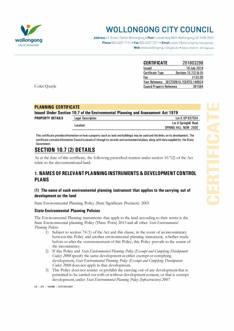
LIS | LPA | 149LONG | 03757954.DOCX
CERTIFICATE 201803298 Issued 16 July 2018
Certificate Type Sections 10.7(2) & (5)
Fee $133.00
Your Reference SECTION10.7CERTS:148824
Council Property Reference 381564 Colee Quayle
PLANNING CERTIFICATE
Issued Under Section 10.7 of the Environmental Planning and Assessment Act 1979
PROPERTY DETAILS Legal Description Lot 6 DP 837554
Location
Lot 6 Springhill Road SPRING HILL NSW 2500
This certificate provides information on how a property (such as land and buildings) may be used and the limits on its development. The
certificate contains information Council is aware of through its records and environmental plans, along with data supplied by the State
Government.
SECTION 10.7 (2) DETAILS
As at the date of this certificate, the following prescribed matters under section 10.7(2) of the Act relate to the abovementioned land:
1. NAMES OF RELEVANT PLANNING INSTRUMENTS & DEVELOPMENT CONTROL
PLANS
(1) The name of each environmental planning instrument that applies to the carrying out of
development on the land
State Environmental Planning Policy (State Significant Precincts) 2005
State Environmental Planning Policies
The Environmental Planning instruments that apply to the land according to their terms is the State Environmental planning Policy (Three Ports) 2013 and all other State Environmental Planning Policies
1) Subject to section 74 (1) of the Act and this clause, in the event of an inconsistency between this Policy and another environmental planning instrument, whether made before or after the commencement of this Policy, this Policy prevails to the extent of the inconsistency.
2) If this Policy and State Environmental Planning Policy (Exempt and Complying Development Codes) 2008 specify the same development as either exempt or complying development, State Environmental Planning Policy (Exempt and Complying Development Codes) 2008 does not apply to that development.
3) This Policy does not restrict or prohibit the carrying out of any development that is permitted to be carried out with or without development consent, or that is exempt development, under State Environmental Planning Policy (Infrastructure) 2007.

- 2 -
(2) The name of each proposed environmental planning instrument that will apply to the
carrying out of development on the land and that is or has been the subject of community
consultation or on public exhibition under the Act (unless the Director-General has notified the
council that the making of the proposed instrument has been deferred indefinitely or has not yet
been approved)
Paper Subdivisions: Draft Environmental Planning & Assessment Amendment (Subdivision works) Regulation 2013
Draft State Environmental Planning Policy - Advertising and Signage Amendments
Draft State Environmental Planning Policy - Infrastructure – Amendment (Shooting Ranges) 2013
Draft State Environmental Planning Policy - Infrastructure – Amendment (Sport and Recreation) 2013
Draft State Environmental Planning Policy – Koala Habitat Protection
Draft State Environmental Planning Policy – Infrastructure – (Amendments Review) 2017
Draft State Environmental Planning Policy – Primary Production and Rural Development.
Explanation of Intended Effect – Proposed Draft Environment SEPP (2017)
Explanation of Intended Effect – Proposed Amendment to the Mining SEPP 2007 – Air and Noise Impacts (2017)
Explanation of Intended Effect – Proposed Amendments to the SEPP 44 Koala Habitat Protection (2016)
Explanation of Intended Effect – Proposed Draft Primary Production and Rural Development SEPP 2017
Explanation of Intended Effect – Proposed Amendment to the Senior Housing SEPP – site compatibility certificates (2017)
Explanation of Intended Effect – Proposed Repeal of Two Operational SEPPs – SEPP 1 Development Standards and SEPP (Miscellaneous Consent Provisions) 2007 (2017)
Explanation of Intended Effect – Proposed Amendment to SEPP (Exempt and Complying Development ) – Proposed Greenfield Housing Code
Explanation of Intended Effect – Proposed new Remediation of Land SEPP and the Draft Planning Guidelines
Explanation of Intended Effect – Proposed Amendment to SEPP (Affordable Rental Housing) 2009
(3) The name of each development control plan that applies to the carrying out of development
on the land Wollongong Development Control Plan 2009 Wollongong Development Control Plan 2009, contains detailed development controls which

- 3 -
supplement the provisions of Wollongong Local Environmental Plan 2009. Note: The Wollongong Development Control Plan 2009 should be consulted to ascertain its
full effect on the land.
(4) In this clause, proposed environmental planning instrument includes a planning proposal for
a Local Environmental Plan or a draft environmental planning instrument.
2. ZONING AND LAND USE UNDER RELEVANT LEPs
State Environmental Planning Policy (State Significant Precincts) 2005 For each environmental planning instrument or proposed instrument referred to in clause 1 (other than a SEPP or proposed SEPP) that includes the land in any zone (however described):
1. the identity of the zone, whether by reference to a name (such as “Residential Zone” or “Heritage Area”) or by reference to a number (such as “Zone No 2(a)”)
IN3 – Heavy Industrial (Three Ports) 2013
2. the purposes for which the instrument provides that development may be carried out within the zone without the need for development consent
Environmental protection works.
3. the purposes for which the instrument provides that development may not be carried out within the zone except with development consent
Depots; Food and drink premises; Freight transport facilities; heavy industries; Port facilities; Roads; Transport depots; Warehouse or distribution centres; Waste or resource management facilities.
4. The purposes for which the instrument provides that development is prohibited within the zone.
Any development not specified in item (2) or (3).
Note: State Environmental Planning Policy (Three Ports) 2013 should be consulted to ascertain its full effect on the land.
Note: State Environmental Planning Policy (Major Development) 2005 should be consulted to ascertain its full effect on the land.
Other Relevant Provisions of State Environmental Planning Policy (State Significant Precincts)
2005
Development for subdivision requires consent except for:
a) widening a public road, b) a minor realignment of boundaries that does not create additional lots or the opportunity
for additional dwellings,

- 4 -
c) a consolidation of lots that does not create additional lots or the opportunity for additional dwellings,
d) rectifying an encroachment on a lot, e) creating a public reserve. f) excising from a lot land that is, or is intended to be, used for public purposes, including
drainage pruposes, rural fire brigade or other emergency service purposes or public toilets.
(e) Whether any development standards applying to the land fix minimum land dimensions for
the erection of a dwelling- house on the land, and if so, the minimum land dimensions so fixed
See Clauses 4.1, 4.1AA, 4.1A, 4.1B, 4.2 and 4.2A of the Local Environmental Plan.
(f) Whether the land includes or comprises critical habitat
Nil
(g) Whether the land is in a conservation area (however described)
Nil.
(h) Whether an item of environmental heritage (however described) is situated on the land
Nil.
2A. ZONING AND LAND USE UNDER STATE ENVIRONMENTAL PLANNING POLICY
(SYDNEY REGIONAL GROWTH CENTRES) 2006
To the extent that the land is within any zone (however described) under:
(a) Part 3 of the State Environmental Planning Policy (Sydney Region Growth Centres)
2006 (the 2006 SEPP), or
(b) a Precinct Plan (within the meaning of the 2006 SEPP),
(c) a proposed Precinct Plan that is or has been the subject of community consultation
or on public exhibition under the Act,
the particulars referred to in clause 2 (a) – (h) in relation to that land (with a reference to “the
instrument” in any of those paragraphs being read as a reference to Part 3 of the 2006 SEPP, or
the Precinct Plan or proposed Precinct Plan, as the case requires).
Not Applicable.
3. COMPLYING DEVELOPMENT
(1) The extent to which the land is land on which complying development may be carried out
under each of the codes for complying development because of the provisions of clauses 1.17A
(1) (c) to (e), (2), (3) and (4), 1.18 (1), (c3) and 1.19 of State Environmental Planning Policy (Exempt
and Complying Development Codes) 2008.

- 5 -
(2) The extent to which complying development may not be carried out on that land because of
the provisions of clauses 1.17A (1) (c) to (e), (2), (3) and (4), 1.18(1)(c3) and 1.19 of that Policy and
the reasons why it may not be carried out under those clauses.
(3) If the council does not have sufficient information to ascertain the extent to which complying
development may or may not be carried out on the land, a statement that a restriction applies to
the land, but it may not apply to all of the land, and that council does not have sufficient
information to ascertain the extent to which complying development may or may not be carried
out on the land.
State Environmental Planning Policy (Exempt and Complying Development Codes) 2008
(1) Subject to the terms of each code, and the zoning of the land, complying development may
be carried out for the following codes to the extent that the land has no affectation.
Housing Code (R1, R2, R3, R4, RU5)
Low Rise Medium Density Housing Code (Commencement deferred until July 2019)
Rural Housing Code (RU1, RU2, RU3, RU4, RU6, R5)
Housing Alterations Code
General Development Code
Commercial and Industrial (New Buildings and Additions) Code
Commercial and Industrial (Alterations) Code
Subdivision Code
Demolition Code
Container Recycling Facilities Code
Fire Safety Code
4B. ANNUAL CHARGES UNDER LOCAL GOVERNMENT ACT 1993 FOR COASTAL
PROTECTION SERVICES THAT RELATE TO EXISTING COASTAL PROTECTION
WORKS In relation to a coastal council- whether the owner (or any previous owner) of the land has
consented in writing to the land being subject to annual charges under section 496B of the Local
Government Act 1993 for coastal protection services that relate to existing coastal protection
works (within the meaning of section 553B of that Act) Note: “Existing coastal protection works” are works to reduce the impact of coastal hazards on the land (such as seawalls, revetments, groynes and beach nourishment) that existed before the commencement of section 553B of the Local Government Act 1993
Not applicable
5. MINE SUBSIDENCE
Whether or not the land is proclaimed to be a mine subsidence district within the meaning of
section 15 of the Mine Subsidence Compensation Act 1961

- 6 -
The land is not proclaimed to be a mine subsidence district within the meaning of section 15 of the Mine Subsidence Compensation Act 1961.
6. ROAD WIDENING AND ROAD REALIGNMENT
Whether or not the land is affected by any road widening or road realignment under:
(a) Division 2 of Part 3 of the Roads Act 1993 or
(b) Any environmental planning instrument or
(c) Any resolution of the council
Council has no record that the land is affected by any Road Widening or Road Realignment under: a) Division 2 of Part 3 of the Roads Act 1993, or
b) any environmental planning instrument, or c) any resolution of the Council.
7. COUNCIL AND OTHER PUBLIC AUTHORITY POLICIES ON HAZARD RISK
RESTRICTIONS
Whether or not the land is affected by a policy:
a) adopted by the council, or
b) adopted by any other public authority and notified to the council for the express purpose of its
adoption by that authority being referred to in planning certificates issued by the council, that
restricts the development of the land because of the likelihood of land slip, bushfire, tidal
inundation, subsidence, acid sulfate soils or any other risk (other than flooding).
Council has adopted “Wollongong Development Control Plan 2009 – Chapter E12 Geotechnical Assessment”.
Council has adopted Acid Sulfate Maps, Wollongong Local Environmental Plan 2009 – Clause 7.5 Acid Sulfate Soils.
Council has adopted “Wollongong Development Control Plan 2009 – Chapter E16 Bushfire Management”. The Rural Fire Service has endorsed the Bush Fire Prone Land map.
Unhealthy Building Land Policy, adopted by the Environmental Protection Authority.
Council has adopted Wollongong City Council Coastal Zone Study (Cardno, Lawson, Treloar 2010).
7A. FLOOD RELATED DEVELOPMENT CONTROLS INFORMATION
(1) Whether or not development on that land or part of the land for the purposes of dwelling
houses, dual occupancies, multi dwelling housing or residential flat buildings (not including
development for the purposes of group homes or seniors housing) is subject to flood related
development controls.

- 7 -
Development on the land or part of the land for the purposes of dwelling houses, dual occupancies, multi dwelling housing or residential flat buildings (not including development for the purposes of group homes or seniors housing) is subject to flood related development controls as contained in Wollongong Development Control Plan 2009 Chapter E13 Floodplain Management and Wollongong Local Environmental Plan 2009 Clause 7.3 Flood Planning.
(2) Whether or not development on that land or part of the land for any other purpose is subject
to flood related development controls.
Development on the land or part of the land for any other purpose is subject to flood related development controls as contained in Wollongong Development Control Plan 2009 Chapter E13 Floodplain Management and Wollongong Local Environmental Plan 2009 Clause 7.3 Flood Planning.
(3) Words and expressions in this clause have the same meaning as in the instrument set out in
the Schedule to the Standard Instrument (Local Environmental Plans) Order 2006
Further flood information relating to this parcel of land is available by application under section 10.7(5) of the Environmental Planning & Assessment Act 1979.
8. LAND RESERVED FOR ACQUISITION Whether or not any environmental planning instrument or proposed environmental planning
instrument referred to in clause 1 makes provision in relation to the acquisition of the land by a
public authority, as referred to in section 3.15 of the Act.
Nil.
9. CONTRIBUTION PLANS
The name of each contributions plan applying to the land.
Wollongong Section 7.12 Development Contributions Plan (2017) (previously S94A)
Note: The purposes of this contributions plan are:
To authorise the imposition of a condition on certain development consents and complying development certificates requiring the payment of a contribution pursuant to section 7.12 of the EP&A Act 1979.
To assist the council to provide the appropriate public facilities which are required to maintain and enhance amenity and service delivery within the Wollongong Local Government area.
To publicly identify the purposes for which the levies are required.
Any party wishing to undertake construction of any new, or alterations to any existing, building or other development should review this policy or contact Council to determine if any contributions may be payable.
9A. BIODIVERSITY CERTIFIED LAND
If the land biodiversity certified land under Part 8 of the Biodiversity Conservation Act 2016, a
statement to that effect.
Note: Biodiversity certified land includes land certified under Part 7AA of the Threatened Species Conservation Act 1995 that is taken to be certified under Part 8 of the Biodiversity Conservation Act 2016.

- 8 -
Nil.
10. BIODIVERSITY STEWARDSHIP SITES
If the land is a biodiversity stewardship site under a biodiversity stewardship agreement under
Part 5 of the Biodiversity Conservation Act 2016, a statement to that effect (but only if the
council has been notified of the existence of the agreement by the Chief Executive of the Office
of Environment and Heritage).
Note: Biodiversity stewardship agreements include bio-banking agreements under Part 7A of the Threatened Species Conservation Act 1995 that are taken to be biodiversity stewardship agreements under Part 5 of the Biodiversity Conservation Act 2016.
Nil.
10A. NATIVE VEGETATION CLEARING SET ASIDES
If the land contains a set aside are under section 60ZC of the Local Land Services Act 2013, a
statement to that effect (but only if the council has been notified of the existence of the set
aside by Local Land Services or it is registered in the public register under that section).
Nil.
11. BUSH FIRE PRONE LAND
If any of the land is bush fire prone land (as defined in the Act), a statement that all or, as the
case may be, some of the land is bush fire prone land.
If none of the land is bush fire prone land, a statement to that effect.
The land is not recorded in Council's records as bushfire prone land.
12. PROPERTY VEGETATION PLANS
If the land is land to which a property vegetation plan approved under Part 4 of the Native
Vegetation Act 2003 (and that continues in force), a statement to that effect (but only if the
council has been notified of the existence of the plan by the person or body that approved the
plan under the Act).
Council has not been notified that the land is affected by a Property Vegetation Plan issued under the Native Vegetation Act 2003.
13. ORDERS UNDER TREES (DISPUTES BETWEEN NEIGHBOURS) ACT 2006
Whether an order has been made under the Trees (Disputes Between Neighbours) Act 2006 to
carry out work in relation to a tree on the land (but only if the council has been notified of the
order) Council has not been notified of an order.

- 9 -
14. STATE SIGNIFICANT DEVELOPMENT
If there is a direction by the Minister in force under section 75P (2) (c1) of the Act that a
provision of an environmental planning instrument prohibiting or restricting the carrying out of
a project or a stage of a project on the land under Part 4 of the Act does not have effect, a
statement to that effect identifying the provision that does not have effect. Nil
STATE SIGNIFICANT INFRASTRUCTURE
If there is a direction by the Minister in force under section 75P (2) (c1) of the Act that a
provision of an environmental planning instrument prohibiting or restricting the carrying out of
a project or a stage of a project on the land under Part 4 of the Act does not have effect, a
statement to that effect identifying the provision that does not have effect. Nil
15. SITE COMPATIBILITY CERTIFICATES AND CONDITIONS FOR SENIORS
HOUSING
If the land is land to which State Environmental Planning Policy (Housing for Seniors or People
with a Disability) 2004 applies:
(1) A statement of whether there is a current, site compatibility certificate (seniors housing),
of which the council is aware, in respect of proposed development on the land and, if
there is a certificate, the statement is to include:
(a) the period for which the certificate is current, and
(b) that a copy may be obtained from the head office of the Department of Planning,
and
(2) A statement setting out any terms of a kind referred to in clause 18(2) of that Policy that
have been imposed as a condition of consent to a development application granted after
11 October 2007 in respect of the land State Environmental Planning Policy (Housing for Seniors or People with a Disability) 2004
Nil.
16. SITE COMPATIBILITY CERTICATE FOR INFRASTRUCTURE A statement of whether there is a valid site compatibility certificate (infrastructure), or site
compatibility certificate (schools or TAFE establishments) of which the council is aware, in
respect of proposed development on the land and, if there is a certificate, the statement is to
include:
- 10 -
(a) the period for which the certificate is valid, and
(b) that a copy may be obtained from the head office of the Department.
State Environmental Planning Policy (Infrastructure) 2007 Nil.
17. SITE COMPATIBILITY CERTIFICATE AND CONDITIONS FOR AFFORDABLE
RENTAL HOUSING
(1) A statement of whether there is a current site compatibility certificate (affordable rental
housing), of which the council is aware, in respect of proposed development on the land
and, if there is a certificate, the statement is to include:
(a) the period for which the certificate is current, and
(b) that a copy may be obtained from the head office of the Department.
(2) A statement setting out any terms of a kind referred to in clause 17 (1) or 38 (1) of State
Environmental Planning Policy (Affordable Rental Housing) 2009 that have been imposed
as a condition of consent to a development application in respect of the land.
State Environmental Planning Policy (Affordable Rental Housing) 2009
Nil.
18. PAPER SUBDIVISION INFORMATION
(1) The name of any development plan adopted by a relevant authority that applies to the land
or that is proposed to be subject to the consent ballot.
Nil
(2) The date of any subdivision order that applies to the land.
Not applicable
(3) Words and expressions used in this clause have the same meaning as they have in Part 16C
of this Regulation.
19. SITE VERIFICATION CERTIFICATES
A statement of whether there is a current site verification certificate, of which the council is
aware, in respect of the land and, if there is a certificate, the statement is to include:
(a) the matter certified by the certificate, and

- 11 -
Note: A site verification certificate sets out the Director-General's opinion as to whether the land concerned is or is not biophysical strategic agricultural land or critical industry cluster land-see Division 3 of Part 4AA of State Environmental Planning Policy (Mining, Petroleum Production and Extractive lndustries 2007).
(b) the date on which the certificate ceases to be current (if any), and
(c) that a copy may be obtained from the head office of the Department.
Nil
20. LOOSE-FILL ASBESTOS INSULATION REGISTER
If the land includes any residential premises (within the meaning of Division 1A of Part 8 of the
Home Building Act 1989) that are listed on the register, that is required to be maintained under
that Division, a statement to that effect.
For register information contact www.fairtrading.nsw.gov.au
Nil.
21. AFFECTED BUILDING NOTICES AND BUILDING PRODUCT RECTIFICATION
ORDERS
(1) A statement of whether there is any affected building notice of which the council is aware
that is in force in respect of the land.
(2) A statement of:
(a) whether there is any building product rectification order of which the council is aware
that is in force in respect of the land and has not been fully complied with, and
(b) Whether any notice of intention to make a building product rectification order of which
the council is aware has been given in respect of the land and is outstanding.
(3) In this clause: affected building notice has the same meaning as in Part 4 of the Building
Products (Safety) Act 2017. building product rectification order has the same meaning as in the
Building Products (Safety) Act 2017.
Affected building notice has the same meaning as Part 4 of the Building Products (Safety) Act
2017 No 69
Building product rectification order has the same meaning as in the Building Products (Safety)
Act 2017 No 69
Nil.
CONTAMINATED LAND MANAGEMENT ACT 1997
Note: The following matters are prescribed by section 59 (2) of the Contaminated Land
Management Act 1997 as additional matters to be specified in a planning certificate:
(a) that the land to which the certificate relates is significantly contaminated within the
meaning of that Act- if the land (or part of the land) is significantly contaminated land
at the date when the certificate is issued,

- 12 -
(b) that the land to which the certificate relates is subject to a management order within
the meaning of the Act- if it is subject to such an order at the date when the
certificate is issued,
(c) that the land to which the certificate relates is the subject of an approved voluntary
management proposal within the meaning of that Act – if it is the subject of such an
approved proposal at the date when the certificate is issued,
(d) that the land to which the certificate relates is subject to an ongoing maintenance
order within the meaning of that Act – if it is subject to such an order at the date
when the certificate is issued,
(e) that the land to which the certificate relates is the subject of a site audit statement
within the meaning of the Act – if a copy of such a statement has been provided at
any time to the local authority issuing the certificate
Council has not been advised that:
a) The land is significantly contaminated land within the meaning of the Contaminated Land Management Act 1997
b) The land is subject to a management order within the meaning of the Contaminated Land
Management Act 1997
c) The land is subject to an approved voluntary management proposal within the meaning of the Contaminated Land Management Act 1997
d) The land is subject to an ongoing maintenance order within the meaning of the
Contaminated Land Management Act 1997
e) The land is the subject of a site audit statement within the meaning of the Contaminated Land Management Act 1997.
SECTION 10.7 (5) DETAILS
As at the date of this certificate, the following additional information, provided in good faith pursuant to section 10.7 (5) of the Act, relate to the abovementioned land. Council has selected these matters as those most likely to be of concern but they do not comprise an exhaustive list of matters likely to affect the land. When information pursuant to section 10.7 (5) is requested the Council is under no obligation to furnish any of the information supplied herein pursuant to that section. Council draws you attention to section 10.7 (6) which states that a council shall not incur any liability in respect of any advice provided in good faith pursuant to subsection (5). The absence of any reference to any matter affecting the land shall not imply that the land is not affected by any matter referred to in this certificate.
RESOLUTION TO PREPARE PLANNING PROPOSAL On 30th January 2017, Council resolved to adopt a draft Planning Proposal for the area of Port Kembla covered by the State Environmental Planning Policy (Three Ports) 2013, to make a number of amendments including permitting the temporary use of under-utilised sites and buildings within the BlueScope holdings for light industrial and office use. Council on 17 July 2017 resolved to commence the preparation of a draft Planning Proposal to

- 13 -
introduce Housing Affordability provisions or SEPP 70 Housing Affordability provisions into the Wollongong Local Environmental Plan 2009. The form of the provisions will be subject to a future report and subsequent community consultation.
PROPOSED DRAFT DEVELOPMENT CONTROL PLANS The following plans have been placed on exhibition pursuant to the provisions of section 72 of the Environmental Planning and Assessment Act 1979:
Draft Development Control Plan 2009 Review The Wollongong Development Control Plan 2009 came into force on 3 March 2010. A review commenced after 6 months of operation. The following chapters are available for public exhibition. Chapter D16 West Dapto Release Area
LAND STABILITY
Council’s land constraint/stability assessment maps do not show that the land is located in an area where landslip and/or subsidence have occurred, or where land instability is suspected. If you have any doubt as to whether the land is affected by landslip and/or subsidence the services of a suitably qualified engineer should be obtained.
Note: the advice provided by Council in respect of the stability of the land is based on information contained in Council’s land constraint maps. The maps have been compiled from data received by Council and considered by Council to be reasonably reliable. Council does not warrant that its land constraint maps contain all information ever received by Council relating to the stability of the land.
FLOOD AND DRAINAGE
1 Classification of Flood Risk
Council records indicate that this property is located within a Low, Medium and High Flood Risk precinct.
Land that is potentially subject to inundation is classified as low, medium or high flood risk. Council has prepared a development control plan known as Wollongong Development Control Plan 2009 that provides details of flood related development controls that may be applicable.
Where the owner/applicant has detailed survey available which identifies the property to be within another risk precinct or not in one at all, it may be presented to Council for reassessment.
Definitions:
High Flood Risk (and Interim Riverine Corridor) Precinct
This has been defined as the area within the envelope of land subject to a high hydraulic hazard (in accordance with the provisional criteria outlined in the Floodplain Management Manual) in a 100 year flood event plus all land within a corridor 10m from the top of the creek bank (Interim Riverine Corridor). The high flood risk precinct is where high flood damages, potential risk to life, evacuation problems would be anticipated or development would significantly and adversely effect flood behaviour. Most development should be restricted in this precinct. In this precinct, there would be a significant risk of flood damages without compliance with flood related building and planning controls.

- 14 -
Medium Flood Risk Precinct
This has been defined as land below the 100 year flood level (plus 0.5m freeboard) that is not within the High Flood Risk (and Interim Riverine Corridor) Precinct. It is land subject to low hydraulic hazard (in accordance with the provisional criteria outlined by the Floodplain Management Manual). In this precinct there would still be a significant risk of flood damage, but these damages can be minimised by the application of appropriate development controls.
Low Flood Risk Precinct
This has been defined as all other land within the floodplain (i.e. within the extent of the probable maximum flood) but not identified within either the High Flood Risk (and Interim Riverine Corridor) or the Medium Flood Risk Precinct, where risk of damages are low for most land uses. The Low Flood Risk Precinct is that area above the 100 year flood (plus 0.5m freeboard) and most land uses would be permitted within this precinct.
2 Estimated Flood Levels
Estimated and/or historical flood levels in the vicinity of this property may be available from Council. Requests may be made by completing a Flood Enquiry Form available from council’s website, in writing or from the Level 6 front counter of the Administration Building. A cost is involved for this service. Payment must be made prior to information being provided.
Please contact Council’s Drainage Duty Officer on 42277181 to ensure the availability of information before submitting this request form. Council does not hold flood information for every property.
‘Please note that flood levels may change due to Council’s flood study and Floodplain Risk Management Study currently being reviewed. As part of the review, design parameters for these studies are changing, and therefore the flood levels, velocities and flood risks may vary from the current flood study.’
ACID SULFATE SOILS
Acid Sulfate Soil Class 5 has been mapped on this land. Acid Sulfate Soils Class 4 has been mapped on this land.
CONTAMINATED LAND
Council’s records show that because of previous uses the land may be contaminated. The services of a suitably qualified consultant should be sought to ascertain the degree of contamination, if any, on the land, and its likely effect on the land. Council’s records are incomplete and there is no certainty that the land is so affected. Council has adopted Wollongong Development Control Plan 2009, which may restrict the development of the land.
STATE SIGNIFICANT DEVELOPMENT
Nil.

- 15 -
BUILDING LINES Wollongong Development Control Plan 2009 details the setbacks applicable to the land.
OTHER HERITAGE MATTERS KNOWN TO COUNCIL
Aboriginal Heritage
All development within the Wollongong Local Government Area is subject to the Aboriginal Heritage requirements of the National Parks and Wildlife Act 1974. To determine if your property is affected by an Aboriginal Site, it is recommended that an Aboriginal Heritage Information Management System (AHIMS) search be undertaken by contacting the AHIM’S Administrator on (02) 9995 5000. Further detail on Council’s Aboriginal Heritage requirements for Development is contained within Chapter E10 of the Wollongong Development Control Plan 2009.
DEVELOPMENT HISTORY
Application may be made for a Building Certificate under section 10.7B of Environmental Planning and Assessment Act 1979 if written certification of existing buildings on the land is required.
The history of development consent approval applicable to the land may be obtained by consulting the Development Consent Register. Enquiries concerning the register may be made at Council’s Customer Service Centre, 41 Burelli Street Wollongong during office hours.
LOOSE-FILL ASBESTOS
Council recommends you make your own enquiries as to the age of the buildings on the land to which this certificate relates and, if it contains a building constructed prior to 1980, the Council also strongly recommends that any potential purchaser obtain advice form a licensed asbestos assessor to determine whether loose-fill asbestos is present in any building on the land and, if so, the health risks (if any) this may pose for the building’s occupants.
Contact NSW Fair Trading for further information.
OTHER INFORMATION
Illawarra Regional Strategy
The Minister for Planning released the Illawarra Regional Strategy on 1 February 2007. The strategy is the NSW Government 25 year land use strategy for the Illawarra Region.
The Department of Planning and Environment released the Illawarra Shoalhaven Regional Plan, November 2015.
Threatened Species – Green and Golden Bell Frog (Litoria aurea) This land provides habitat for a population of Green and Golden Bell Frog (Litoria aurea). This

- 16 -
species is listed as Endangered under Part 1 Schedule 1 of the NSW Threatened Species Conservation Act 1995 and as Vulnerable under the Commonwealth Environment Protection and Biodiversity Conservation Act 1999. The presence of this species may restrict the development potential of the land. The nature and extent of any threatened species or cultural heritage constraints should be determined following an assessment of the land by a qualified and experienced ecologist/consultant.
GENERAL INFORMATION
The following general information is brought to the attention of land owners.
1. Tree Management Policy
The Wollongong Tree Management Policy allows proper assessment to be made of the environmental importance and viability of trees before they are pruned, removed or damaged in any way. This Policy prohibits the ringbarking, cutting down, topping, lopping, removing, injuring or destruction of any tree except with the prior written consent of Council.
The Tree Management Policy applies to any tree that:
Is 3 metres or more in height,
Has a trunk diameter of 200mm or more at a height of 1 metre from the ground, or
Has a branch spread of 3 metres or more
Please note that:
A dead/dying tree is subject to the Tree Management Policy
Pruning of major structural or anchor roots is also subject to the Tree Management Policy
Some trees may be exempt and do not require a permit to prune or remove them. Following is a list of the exempt tree species:
Salix Species
Erythrina X Sykesii
Cupressus Macrocarpa “Brunniana”
Laganuria Pattersonii
Harpephyllum Caffrum
Syagrus Romanzoffina
Poplar Species
Ficus Elasrica “Decora” and hybrids
Ligustrum Lucidum
Cinnamomum Camphora
Schefflera Actinophylla
False Acacia
Peppercorn
Alnus
Acer negundo
Willow
Coral Tree
Golden Cypress
Itchy Pod Tree
Kaffir Plum
Cocos Palm
Poplar
Ornamental Rubber tree
Large Leafed Privet
Camphor Laurel
Umbrella Tree
Black Locust
Pepper Tree
Alder
Box Elder
For the full list of other exemptions please refer to the Tree Management Policy document available via Council’s website.

- 17 -
Any person acting on a permit issued under this Policy must comply with all conditions of that permit.
Any person who contravenes, or causes or permits the contravention of this Policy is guilty of an offence under the Environmental Planning and Assessment Act 1979.
Development Consents may contain restrictions relating to trees.
Further information regarding Council’s Tree Management Policy including how to lodge an application can be made by contacting Council’s Customer Service on telephone 4227 7111. Alternatively information can be obtained from Council’s website via the following link http://www.wollongong.nsw.gov.au/services/household/trees/Pages/Lodgeatmp.aspx.
2. Termite Management for Buildings
Australian Standards 3660.1-2000 (New Buildings) AS 3660.2-2000 (Existing Buildings) Termite Management, recommends that buildings be inspected and be maintained in order to achieve termite management of buildings. Licensed Pest Control Contractors should be contacted to achieve necessary termite control.
3. Lead Paint and Building Renovations
Your attention is drawn to the hazards associated with lead-based paints during building renovation. Suitable precautions should be taken when removing flaking paint or sanding painted surfaces suspected to have been treated with lead-based paint to prevent contamination of the immediate environment and associated health risk from lead dust.
AS 4361 – Part 2 – Guide to Lead Paint Management – Residential and Commercial.
4. Sewage Management Systems
Where a property has on-site sewage management system (this includes septic tanks, disposal trenches, aerated waste water treatment systems, composting toilets and pump out systems) the new owner must obtain an “Approval to Operate” from Council within 3 months of land ownership being transferred or otherwise conveyed.
5. Asbestos
Exposure to asbestos is a serious health hazard. In Australia, asbestos was gradually phased out of building materials in the 1980s and the supply and installation of asbestos containing goods has been prohibited since 31 December 2003. However, asbestos legacy materials still exist in many homes, buildings and other assets and infrastructure.
Council on the 27 October 2014 adopted an Asbestos policy which states Council’s commitment to and responsibilities for safely managing asbestos, and provides information for Council and the local community on safely managing asbestos. The policy can be viewed on Council’s website: www.wollongong.nsw.gov.au.
6. Loose-Fill Asbestos Insulation
Some residential homes located in NSW have been identified as containing loose-fill asbestos insulation, for example in the roof space. NSW Fair Trading maintains a Register of homes that are affected by loose-fill asbestos insulation.
You should make your own enquiries as to the age of the buildings on the land to which this certificate relates and if it contains a building constructed prior to 1980, the council strongly recommends that any potential purchaser obtain advice from a licenced asbestos assessor to determine whether loose-fill asbestos is present in any building on the land and, if so, the health risks (if any) this may pose for the buildings occupants.

- 18 -
Contact NSW Fair Trading for further information.
This letter is authorised by: Jamie O’Connell LIS Information Officer Section 10.7 Planning Certificates Wollongong City Council Telephone (02) 4227 7111

LIS | LPA | 149LONG | 03757853.DOCX
CERTIFICATE 201803290 Issued 16 July 2018
Certificate Type Sections 10.7(2) & (5)
Fee $133.00
Your Reference SECTION10.7CERTS:148824
Council Property Reference 394727 Colee Quayle
PLANNING CERTIFICATE
Issued Under Section 10.7 of the Environmental Planning and Assessment Act 1979
PROPERTY DETAILS Legal Description Lot 10 DP 1182111
Location
Lot 10 Springhill Road PORT KEMBLA NSW 2505
This certificate provides information on how a property (such as land and buildings) may be used and the limits on its development. The
certificate contains information Council is aware of through its records and environmental plans, along with data supplied by the State
Government.
SECTION 10.7 (2) DETAILS
As at the date of this certificate, the following prescribed matters under section 10.7(2) of the Act relate to the abovementioned land:
1. NAMES OF RELEVANT PLANNING INSTRUMENTS & DEVELOPMENT CONTROL
PLANS
(1) The name of each environmental planning instrument that applies to the carrying out of
development on the land
State Environmental Planning Policy (State Significant Precincts) 2005
State Environmental Planning Policies
The Environmental Planning instruments that apply to the land according to their terms is the State Environmental planning Policy (Three Ports) 2013 and all other State Environmental Planning Policies
1) Subject to section 74 (1) of the Act and this clause, in the event of an inconsistency between this Policy and another environmental planning instrument, whether made before or after the commencement of this Policy, this Policy prevails to the extent of the inconsistency.
2) If this Policy and State Environmental Planning Policy (Exempt and Complying Development Codes) 2008 specify the same development as either exempt or complying development, State Environmental Planning Policy (Exempt and Complying Development Codes) 2008 does not apply to that development.
3) This Policy does not restrict or prohibit the carrying out of any development that is permitted to be carried out with or without development consent, or that is exempt development, under State Environmental Planning Policy (Infrastructure) 2007.

- 2 -
State Environmental Planning Policy Coastal Management 2018 (whole of lot) affected.
(2) The name of each proposed environmental planning instrument that will apply to the
carrying out of development on the land and that is or has been the subject of community
consultation or on public exhibition under the Act (unless the Director-General has notified the
council that the making of the proposed instrument has been deferred indefinitely or has not yet
been approved)
Paper Subdivisions: Draft Environmental Planning & Assessment Amendment (Subdivision works) Regulation 2013
Draft State Environmental Planning Policy - Advertising and Signage Amendments
Draft State Environmental Planning Policy - Infrastructure – Amendment (Shooting Ranges) 2013
Draft State Environmental Planning Policy - Infrastructure – Amendment (Sport and Recreation) 2013
Draft State Environmental Planning Policy – Koala Habitat Protection
Draft State Environmental Planning Policy – Infrastructure – (Amendments Review) 2017
Draft State Environmental Planning Policy – Primary Production and Rural Development.
Explanation of Intended Effect – Proposed Draft Environment SEPP (2017)
Explanation of Intended Effect – Proposed Amendment to the Mining SEPP 2007 – Air and Noise Impacts (2017)
Explanation of Intended Effect – Proposed Amendments to the SEPP 44 Koala Habitat Protection (2016)
Explanation of Intended Effect – Proposed Draft Primary Production and Rural Development SEPP 2017
Explanation of Intended Effect – Proposed Amendment to the Senior Housing SEPP – site compatibility certificates (2017)
Explanation of Intended Effect – Proposed Repeal of Two Operational SEPPs – SEPP 1 Development Standards and SEPP (Miscellaneous Consent Provisions) 2007 (2017)
Explanation of Intended Effect – Proposed Amendment to SEPP (Exempt and Complying Development ) – Proposed Greenfield Housing Code
Explanation of Intended Effect – Proposed new Remediation of Land SEPP and the Draft Planning Guidelines
Explanation of Intended Effect – Proposed Amendment to SEPP (Affordable Rental Housing) 2009
(3) The name of each development control plan that applies to the carrying out of development
on the land Wollongong Development Control Plan 2009 Wollongong Development Control Plan 2009, contains detailed development controls which

- 3 -
supplement the provisions of Wollongong Local Environmental Plan 2009. Note: The Wollongong Development Control Plan 2009 should be consulted to ascertain its
full effect on the land.
(4) In this clause, proposed environmental planning instrument includes a planning proposal for
a Local Environmental Plan or a draft environmental planning instrument.
2. ZONING AND LAND USE UNDER RELEVANT LEPs
State Environmental Planning Policy (State Significant Precincts) 2005 For each environmental planning instrument or proposed instrument referred to in clause 1 (other than a SEPP or proposed SEPP) that includes the land in any zone (however described): 1.the identity of the zone, whether by reference to a name (such as “Residential
Zone” or “Heritage Area”) or by reference to a number (such as “Zone No 2(a)”)
SP1 – Special Activities (Three Ports) 2013
2. the purposes for which the instrument provides that development may be
carried out within the zone without the need for development consent
Jetties; Moorings; Roads.
3. the purposes for which the instrument provides that development may not be carried out within the zone except with development consent
Capital dredging; Environmental facilities; Environmental protection works; Maintenance dredging; Navigation and emergency response facilities; Port facilities; Neighbourhood Shops; Wharf or boating facilities; Any other development not specified in item 2 and 4
4. The purposes for which the instrument provides that development is
prohibited within the zone.
Bulky goods premises; Business premises; Caravan parks; Cemeteries; Centre-based child care facilities; Crematoria; Educational establishments; Entertainment facilities; Function centres; Funeral homes; Garden centres; Hardware and building supplies; Medical centres; Office premises; Places of public worship; Recreation facilities (indoor); Registered clubs; Residential accommodation; Respite day care centres; Restricted premises; Shops; Tourist and visitor accommodation; Vehicle sales and hire premises.
Note: State Environmental Planning Policy (Three Ports) 2013 should be consulted to ascertain its full effect on the land.

- 4 -
Note: State Environmental Planning Policy (Major Development) 2005 should be consulted to ascertain its full effect on the land.
Other Relevant Provisions of State Environmental Planning Policy (State Significant Precincts)
2005
Development for subdivision requires consent except for:
a) widening a public road, b) a minor realignment of boundaries that does not create additional lots or the opportunity
for additional dwellings, c) a consolidation of lots that does not create additional lots or the opportunity for
additional dwellings, d) rectifying an encroachment on a lot, e) creating a public reserve. f) excising from a lot land that is, or is intended to be, used for public purposes, including
drainage pruposes, rural fire brigade or other emergency service purposes or public toilets.
(e) Whether any development standards applying to the land fix minimum land dimensions for
the erection of a dwelling- house on the land, and if so, the minimum land dimensions so fixed
See Clauses 4.1, 4.1AA, 4.1A, 4.1B, 4.2 and 4.2A of the Local Environmental Plan.
(f) Whether the land includes or comprises critical habitat
Nil
(g) Whether the land is in a conservation area (however described)
Nil.
(h) Whether an item of environmental heritage (however described) is situated on the land
Nil.
2A. ZONING AND LAND USE UNDER STATE ENVIRONMENTAL PLANNING POLICY
(SYDNEY REGIONAL GROWTH CENTRES) 2006
To the extent that the land is within any zone (however described) under:
(a) Part 3 of the State Environmental Planning Policy (Sydney Region Growth Centres)
2006 (the 2006 SEPP), or
(b) a Precinct Plan (within the meaning of the 2006 SEPP),
(c) a proposed Precinct Plan that is or has been the subject of community consultation
or on public exhibition under the Act,
the particulars referred to in clause 2 (a) – (h) in relation to that land (with a reference to “the
instrument” in any of those paragraphs being read as a reference to Part 3 of the 2006 SEPP, or
the Precinct Plan or proposed Precinct Plan, as the case requires).
Not Applicable.

- 5 -
3. COMPLYING DEVELOPMENT
(1) The extent to which the land is land on which complying development may be carried out
under each of the codes for complying development because of the provisions of clauses 1.17A
(1) (c) to (e), (2), (3) and (4), 1.18 (1), (c3) and 1.19 of State Environmental Planning Policy (Exempt
and Complying Development Codes) 2008.
(2) The extent to which complying development may not be carried out on that land because of
the provisions of clauses 1.17A (1) (c) to (e), (2), (3) and (4), 1.18(1)(c3) and 1.19 of that Policy and
the reasons why it may not be carried out under those clauses.
(3) If the council does not have sufficient information to ascertain the extent to which complying
development may or may not be carried out on the land, a statement that a restriction applies to
the land, but it may not apply to all of the land, and that council does not have sufficient
information to ascertain the extent to which complying development may or may not be carried
out on the land.
State Environmental Planning Policy (Exempt and Complying Development Codes) 2008
(1) Subject to the terms of each code, and the zoning of the land, complying development may
be carried out for the following codes to the extent that the land has no affectation.
Housing Code (R1, R2, R3, R4, RU5)
Low Rise Medium Density Housing Code (Commencement deferred until July 2019)
Rural Housing Code (RU1, RU2, RU3, RU4, RU6, R5)
Housing Alterations Code
General Development Code
Commercial and Industrial (New Buildings and Additions) Code
Commercial and Industrial (Alterations) Code
Subdivision Code
Demolition Code
Container Recycling Facilities Code
Fire Safety Code
4B. ANNUAL CHARGES UNDER LOCAL GOVERNMENT ACT 1993 FOR COASTAL
PROTECTION SERVICES THAT RELATE TO EXISTING COASTAL PROTECTION
WORKS In relation to a coastal council- whether the owner (or any previous owner) of the land has
consented in writing to the land being subject to annual charges under section 496B of the Local
Government Act 1993 for coastal protection services that relate to existing coastal protection
works (within the meaning of section 553B of that Act) Note: “Existing coastal protection works” are works to reduce the impact of coastal hazards on the land (such as seawalls, revetments, groynes and beach nourishment) that existed before the commencement of section 553B of the Local Government Act 1993
Not applicable

- 6 -
5. MINE SUBSIDENCE
Whether or not the land is proclaimed to be a mine subsidence district within the meaning of
section 15 of the Mine Subsidence Compensation Act 1961
The land is not proclaimed to be a mine subsidence district within the meaning of section 15 of the Mine Subsidence Compensation Act 1961.
6. ROAD WIDENING AND ROAD REALIGNMENT
Whether or not the land is affected by any road widening or road realignment under:
(a) Division 2 of Part 3 of the Roads Act 1993 or
(b) Any environmental planning instrument or
(c) Any resolution of the council
Council has no record that the land is affected by any Road Widening or Road Realignment under: a) Division 2 of Part 3 of the Roads Act 1993, or
b) any environmental planning instrument, or c) any resolution of the Council.
7. COUNCIL AND OTHER PUBLIC AUTHORITY POLICIES ON HAZARD RISK
RESTRICTIONS
Whether or not the land is affected by a policy:
a) adopted by the council, or
b) adopted by any other public authority and notified to the council for the express purpose of its
adoption by that authority being referred to in planning certificates issued by the council, that
restricts the development of the land because of the likelihood of land slip, bushfire, tidal
inundation, subsidence, acid sulfate soils or any other risk (other than flooding).
Council has adopted “Wollongong Development Control Plan 2009 – Chapter E12 Geotechnical Assessment”.
Council has adopted Acid Sulfate Maps, Wollongong Local Environmental Plan 2009 – Clause 7.5 Acid Sulfate Soils.
Council has adopted “Wollongong Development Control Plan 2009 – Chapter E16 Bushfire Management”. The Rural Fire Service has endorsed the Bush Fire Prone Land map.
Unhealthy Building Land Policy, adopted by the Environmental Protection Authority.
Council has adopted Wollongong City Council Coastal Zone Study (Cardno, Lawson, Treloar 2010).
7A. FLOOD RELATED DEVELOPMENT CONTROLS INFORMATION

- 7 -
(1) Whether or not development on that land or part of the land for the purposes of dwelling
houses, dual occupancies, multi dwelling housing or residential flat buildings (not including
development for the purposes of group homes or seniors housing) is subject to flood related
development controls.
Development on the land or part of the land for the purposes of dwelling houses, dual occupancies, multi dwelling housing or residential flat buildings (not including development for the purposes of group homes or seniors housing) is subject to flood related development controls as contained in Wollongong Development Control Plan 2009 Chapter E13 Floodplain Management and Wollongong Local Environmental Plan 2009 Clause 7.3 Flood Planning.
(2) Whether or not development on that land or part of the land for any other purpose is subject
to flood related development controls.
Development on the land or part of the land for any other purpose is subject to flood related development controls as contained in Wollongong Development Control Plan 2009 Chapter E13 Floodplain Management and Wollongong Local Environmental Plan 2009 Clause 7.3 Flood Planning.
(3) Words and expressions in this clause have the same meaning as in the instrument set out in
the Schedule to the Standard Instrument (Local Environmental Plans) Order 2006
Further flood information relating to this parcel of land is available by application under section 10.7(5) of the Environmental Planning & Assessment Act 1979.
8. LAND RESERVED FOR ACQUISITION Whether or not any environmental planning instrument or proposed environmental planning
instrument referred to in clause 1 makes provision in relation to the acquisition of the land by a
public authority, as referred to in section 3.15 of the Act.
Nil.
9. CONTRIBUTION PLANS
The name of each contributions plan applying to the land.
Wollongong Section 7.12 Development Contributions Plan (2017) (previously S94A)
Note: The purposes of this contributions plan are:
To authorise the imposition of a condition on certain development consents and complying development certificates requiring the payment of a contribution pursuant to section 7.12 of the EP&A Act 1979.
To assist the council to provide the appropriate public facilities which are required to maintain and enhance amenity and service delivery within the Wollongong Local Government area.
To publicly identify the purposes for which the levies are required.
Any party wishing to undertake construction of any new, or alterations to any existing, building or other development should review this policy or contact Council to determine if any contributions may be payable.
9A. BIODIVERSITY CERTIFIED LAND

- 8 -
If the land biodiversity certified land under Part 8 of the Biodiversity Conservation Act 2016, a
statement to that effect.
Note: Biodiversity certified land includes land certified under Part 7AA of the Threatened Species Conservation Act 1995 that is taken to be certified under Part 8 of the Biodiversity Conservation Act 2016.
Nil.
10. BIODIVERSITY STEWARDSHIP SITES
If the land is a biodiversity stewardship site under a biodiversity stewardship agreement under
Part 5 of the Biodiversity Conservation Act 2016, a statement to that effect (but only if the
council has been notified of the existence of the agreement by the Chief Executive of the Office
of Environment and Heritage).
Note: Biodiversity stewardship agreements include bio-banking agreements under Part 7A of the Threatened Species Conservation Act 1995 that are taken to be biodiversity stewardship agreements under Part 5 of the Biodiversity Conservation Act 2016.
Nil.
10A. NATIVE VEGETATION CLEARING SET ASIDES
If the land contains a set aside are under section 60ZC of the Local Land Services Act 2013, a
statement to that effect (but only if the council has been notified of the existence of the set
aside by Local Land Services or it is registered in the public register under that section).
Nil.
11. BUSH FIRE PRONE LAND
If any of the land is bush fire prone land (as defined in the Act), a statement that all or, as the
case may be, some of the land is bush fire prone land.
If none of the land is bush fire prone land, a statement to that effect.
The land is not recorded in Council's records as bushfire prone land.
12. PROPERTY VEGETATION PLANS
If the land is land to which a property vegetation plan approved under Part 4 of the Native
Vegetation Act 2003 (and that continues in force), a statement to that effect (but only if the
council has been notified of the existence of the plan by the person or body that approved the
plan under the Act).
Council has not been notified that the land is affected by a Property Vegetation Plan issued under the Native Vegetation Act 2003.
13. ORDERS UNDER TREES (DISPUTES BETWEEN NEIGHBOURS) ACT 2006

- 9 -
Whether an order has been made under the Trees (Disputes Between Neighbours) Act 2006 to
carry out work in relation to a tree on the land (but only if the council has been notified of the
order) Council has not been notified of an order.
14. STATE SIGNIFICANT DEVELOPMENT
If there is a direction by the Minister in force under section 75P (2) (c1) of the Act that a
provision of an environmental planning instrument prohibiting or restricting the carrying out of
a project or a stage of a project on the land under Part 4 of the Act does not have effect, a
statement to that effect identifying the provision that does not have effect. A major project application has been lodged with the Department of Planning under Part 3A of the Environmental Planning and Assessment Act 1979. Purchasers are advised to make their own enquiries with the Department of Planning regarding the status of such applications.
STATE SIGNIFICANT INFRASTRUCTURE
If there is a direction by the Minister in force under section 75P (2) (c1) of the Act that a
provision of an environmental planning instrument prohibiting or restricting the carrying out of
a project or a stage of a project on the land under Part 4 of the Act does not have effect, a
statement to that effect identifying the provision that does not have effect. A major project application has been lodged with the Department of Planning under Part 3A of the Environmental Planning and Assessment Act 1979. Purchasers are advised to make their own enquiries with the Department of Planning regarding the status of such applications.
15. SITE COMPATIBILITY CERTIFICATES AND CONDITIONS FOR SENIORS
HOUSING
If the land is land to which State Environmental Planning Policy (Housing for Seniors or People
with a Disability) 2004 applies:
(1) A statement of whether there is a current, site compatibility certificate (seniors housing),
of which the council is aware, in respect of proposed development on the land and, if
there is a certificate, the statement is to include:
(a) the period for which the certificate is current, and
(b) that a copy may be obtained from the head office of the Department of Planning,
and

- 10 -
(2) A statement setting out any terms of a kind referred to in clause 18(2) of that Policy that
have been imposed as a condition of consent to a development application granted after
11 October 2007 in respect of the land State Environmental Planning Policy (Housing for Seniors or People with a Disability) 2004
Nil.
16. SITE COMPATIBILITY CERTICATE FOR INFRASTRUCTURE A statement of whether there is a valid site compatibility certificate (infrastructure), or site
compatibility certificate (schools or TAFE establishments) of which the council is aware, in
respect of proposed development on the land and, if there is a certificate, the statement is to
include:
(a) the period for which the certificate is valid, and
(b) that a copy may be obtained from the head office of the Department.
State Environmental Planning Policy (Infrastructure) 2007 Nil.
17. SITE COMPATIBILITY CERTIFICATE AND CONDITIONS FOR AFFORDABLE
RENTAL HOUSING
(1) A statement of whether there is a current site compatibility certificate (affordable rental
housing), of which the council is aware, in respect of proposed development on the land
and, if there is a certificate, the statement is to include:
(a) the period for which the certificate is current, and
(b) that a copy may be obtained from the head office of the Department.
(2) A statement setting out any terms of a kind referred to in clause 17 (1) or 38 (1) of State
Environmental Planning Policy (Affordable Rental Housing) 2009 that have been imposed
as a condition of consent to a development application in respect of the land.
State Environmental Planning Policy (Affordable Rental Housing) 2009
Nil.
18. PAPER SUBDIVISION INFORMATION
(1) The name of any development plan adopted by a relevant authority that applies to the land
or that is proposed to be subject to the consent ballot.
Nil
(2) The date of any subdivision order that applies to the land.
Not applicable

- 11 -
(3) Words and expressions used in this clause have the same meaning as they have in Part 16C
of this Regulation.
19. SITE VERIFICATION CERTIFICATES
A statement of whether there is a current site verification certificate, of which the council is
aware, in respect of the land and, if there is a certificate, the statement is to include:
(a) the matter certified by the certificate, and
Note: A site verification certificate sets out the Director-General's opinion as to whether the land concerned is or is not biophysical strategic agricultural land or critical industry cluster land-see Division 3 of Part 4AA of State Environmental Planning Policy (Mining, Petroleum Production and Extractive lndustries 2007).
(b) the date on which the certificate ceases to be current (if any), and
(c) that a copy may be obtained from the head office of the Department.
Nil
20. LOOSE-FILL ASBESTOS INSULATION REGISTER
If the land includes any residential premises (within the meaning of Division 1A of Part 8 of the
Home Building Act 1989) that are listed on the register, that is required to be maintained under
that Division, a statement to that effect.
For register information contact www.fairtrading.nsw.gov.au
Nil.
21. AFFECTED BUILDING NOTICES AND BUILDING PRODUCT RECTIFICATION
ORDERS
(1) A statement of whether there is any affected building notice of which the council is aware
that is in force in respect of the land.
(2) A statement of:
(a) whether there is any building product rectification order of which the council is aware
that is in force in respect of the land and has not been fully complied with, and
(b) Whether any notice of intention to make a building product rectification order of which
the council is aware has been given in respect of the land and is outstanding.
(3) In this clause: affected building notice has the same meaning as in Part 4 of the Building
Products (Safety) Act 2017. building product rectification order has the same meaning as in the
Building Products (Safety) Act 2017.
Affected building notice has the same meaning as Part 4 of the Building Products (Safety) Act
2017 No 69
Building product rectification order has the same meaning as in the Building Products (Safety)
Act 2017 No 69

- 12 -
Nil.
CONTAMINATED LAND MANAGEMENT ACT 1997
Note: The following matters are prescribed by section 59 (2) of the Contaminated Land
Management Act 1997 as additional matters to be specified in a planning certificate:
(a) that the land to which the certificate relates is significantly contaminated within the
meaning of that Act- if the land (or part of the land) is significantly contaminated land
at the date when the certificate is issued,
(b) that the land to which the certificate relates is subject to a management order within
the meaning of the Act- if it is subject to such an order at the date when the
certificate is issued,
(c) that the land to which the certificate relates is the subject of an approved voluntary
management proposal within the meaning of that Act – if it is the subject of such an
approved proposal at the date when the certificate is issued,
(d) that the land to which the certificate relates is subject to an ongoing maintenance
order within the meaning of that Act – if it is subject to such an order at the date
when the certificate is issued,
(e) that the land to which the certificate relates is the subject of a site audit statement
within the meaning of the Act – if a copy of such a statement has been provided at
any time to the local authority issuing the certificate
Council has not been advised that:
a) The land is significantly contaminated land within the meaning of the Contaminated Land Management Act 1997
b) The land is subject to a management order within the meaning of the Contaminated Land
Management Act 1997
c) The land is subject to an approved voluntary management proposal within the meaning of the Contaminated Land Management Act 1997
d) The land is subject to an ongoing maintenance order within the meaning of the
Contaminated Land Management Act 1997
e) The land is the subject of a site audit statement within the meaning of the Contaminated Land Management Act 1997.
SECTION 10.7 (5) DETAILS
As at the date of this certificate, the following additional information, provided in good faith pursuant to section 10.7 (5) of the Act, relate to the abovementioned land. Council has selected these matters as those most likely to be of concern but they do not comprise an exhaustive list of matters likely to affect the land. When information pursuant to section 10.7 (5) is requested the Council is under no obligation to furnish any of the information supplied herein pursuant to that section. Council draws you attention to section 10.7 (6) which states that a council shall not incur any liability in respect of any advice

- 13 -
provided in good faith pursuant to subsection (5). The absence of any reference to any matter affecting the land shall not imply that the land is not affected by any matter referred to in this certificate.
RESOLUTION TO PREPARE PLANNING PROPOSAL On 30th January 2017, Council resolved to adopt a draft Planning Proposal for the area of Port Kembla covered by the State Environmental Planning Policy (Three Ports) 2013, to make a number of amendments including permitting the temporary use of under-utilised sites and buildings within the BlueScope holdings for light industrial and office use. Council on 17 July 2017 resolved to commence the preparation of a draft Planning Proposal to introduce Housing Affordability provisions or SEPP 70 Housing Affordability provisions into the Wollongong Local Environmental Plan 2009. The form of the provisions will be subject to a future report and subsequent community consultation.
PROPOSED DRAFT DEVELOPMENT CONTROL PLANS The following plans have been placed on exhibition pursuant to the provisions of section 72 of the Environmental Planning and Assessment Act 1979:
Draft Development Control Plan 2009 Review The Wollongong Development Control Plan 2009 came into force on 3 March 2010. A review commenced after 6 months of operation. The following chapters are available for public exhibition. Chapter D16 West Dapto Release Area
LAND STABILITY
Council’s land constraint/stability assessment maps do not show that the land is located in an area where landslip and/or subsidence have occurred, or where land instability is suspected. If you have any doubt as to whether the land is affected by landslip and/or subsidence the services of a suitably qualified engineer should be obtained.
Note: the advice provided by Council in respect of the stability of the land is based on information contained in Council’s land constraint maps. The maps have been compiled from data received by Council and considered by Council to be reasonably reliable. Council does not warrant that its land constraint maps contain all information ever received by Council relating to the stability of the land.
FLOOD AND DRAINAGE
1 Classification of Flood Risk
Council records indicate that this property is located within a Low Flood Risk precinct.
Land that is potentially subject to inundation is classified as low, medium or high flood risk. Council has prepared a development control plan known as Wollongong Development Control Plan 2009 that provides details of flood related development controls that may be applicable.
Where the owner/applicant has detailed survey available which identifies the property to be within another risk precinct or not in one at all, it may be presented to Council for reassessment.

- 14 -
Definitions:
High Flood Risk (and Interim Riverine Corridor) Precinct
This has been defined as the area within the envelope of land subject to a high hydraulic hazard (in accordance with the provisional criteria outlined in the Floodplain Management Manual) in a 100 year flood event plus all land within a corridor 10m from the top of the creek bank (Interim Riverine Corridor). The high flood risk precinct is where high flood damages, potential risk to life, evacuation problems would be anticipated or development would significantly and adversely effect flood behaviour. Most development should be restricted in this precinct. In this precinct, there would be a significant risk of flood damages without compliance with flood related building and planning controls.
Medium Flood Risk Precinct
This has been defined as land below the 100 year flood level (plus 0.5m freeboard) that is not within the High Flood Risk (and Interim Riverine Corridor) Precinct. It is land subject to low hydraulic hazard (in accordance with the provisional criteria outlined by the Floodplain Management Manual). In this precinct there would still be a significant risk of flood damage, but these damages can be minimised by the application of appropriate development controls.
Low Flood Risk Precinct
This has been defined as all other land within the floodplain (i.e. within the extent of the probable maximum flood) but not identified within either the High Flood Risk (and Interim Riverine Corridor) or the Medium Flood Risk Precinct, where risk of damages are low for most land uses. The Low Flood Risk Precinct is that area above the 100 year flood (plus 0.5m freeboard) and most land uses would be permitted within this precinct.
2 Estimated Flood Levels
Estimated and/or historical flood levels in the vicinity of this property may be available from Council. Requests may be made by completing a Flood Enquiry Form available from council’s website, in writing or from the Level 6 front counter of the Administration Building. A cost is involved for this service. Payment must be made prior to information being provided.
Please contact Council’s Drainage Duty Officer on 42277181 to ensure the availability of information before submitting this request form. Council does not hold flood information for every property.
‘Please note that flood levels may change due to Council’s flood study and Floodplain Risk Management Study currently being reviewed. As part of the review, design parameters for these studies are changing, and therefore the flood levels, velocities and flood risks may vary from the current flood study.’
ACID SULFATE SOILS
Acid Sulfate Soil Class 3 has been mapped on this land.
CONTAMINATED LAND
Council’s records show that because of previous uses the land may be contaminated. The services of a suitably qualified consultant should be sought to ascertain the degree of contamination, if any,
- 15 -
on the land, and its likely effect on the land. Council’s records are incomplete and there is no certainty that the land is so affected. Council has adopted Wollongong Development Control Plan 2009, which may restrict the development of the land.
STATE SIGNIFICANT DEVELOPMENT
Nil.
BUILDING LINES Wollongong Development Control Plan 2009 details the setbacks applicable to the land.
OTHER HERITAGE MATTERS KNOWN TO COUNCIL
Aboriginal Heritage
All development within the Wollongong Local Government Area is subject to the Aboriginal Heritage requirements of the National Parks and Wildlife Act 1974. To determine if your property is affected by an Aboriginal Site, it is recommended that an Aboriginal Heritage Information Management System (AHIMS) search be undertaken by contacting the AHIM’S Administrator on (02) 9995 5000. Further detail on Council’s Aboriginal Heritage requirements for Development is contained within Chapter E10 of the Wollongong Development Control Plan 2009.
DEVELOPMENT HISTORY
Application may be made for a Building Certificate under section 10.7B of Environmental Planning and Assessment Act 1979 if written certification of existing buildings on the land is required.
The history of development consent approval applicable to the land may be obtained by consulting the Development Consent Register. Enquiries concerning the register may be made at Council’s Customer Service Centre, 41 Burelli Street Wollongong during office hours.
LOOSE-FILL ASBESTOS
Council recommends you make your own enquiries as to the age of the buildings on the land to which this certificate relates and, if it contains a building constructed prior to 1980, the Council also strongly recommends that any potential purchaser obtain advice form a licensed asbestos assessor to determine whether loose-fill asbestos is present in any building on the land and, if so, the health risks (if any) this may pose for the building’s occupants.
Contact NSW Fair Trading for further information.
OTHER INFORMATION
Illawarra Regional Strategy
The Minister for Planning released the Illawarra Regional Strategy on 1 February 2007. The strategy is the NSW Government 25 year land use strategy for the Illawarra Region.
The Department of Planning and Environment released the Illawarra Shoalhaven Regional Plan, November 2015.

- 16 -
Threatened Species – Green and Golden Bell Frog (Litoria aurea) This land provides habitat for a population of Green and Golden Bell Frog (Litoria aurea). This species is listed as Endangered under Part 1 Schedule 1 of the NSW Threatened Species Conservation Act 1995 and as Vulnerable under the Commonwealth Environment Protection and Biodiversity Conservation Act 1999. The presence of this species may restrict the development potential of the land. The nature and extent of any threatened species or cultural heritage constraints should be determined following an assessment of the land by a qualified and experienced ecologist/consultant.
GENERAL INFORMATION
The following general information is brought to the attention of land owners.
1. Tree Management Policy
The Wollongong Tree Management Policy allows proper assessment to be made of the environmental importance and viability of trees before they are pruned, removed or damaged in any way. This Policy prohibits the ringbarking, cutting down, topping, lopping, removing, injuring or destruction of any tree except with the prior written consent of Council.
The Tree Management Policy applies to any tree that:
Is 3 metres or more in height,
Has a trunk diameter of 200mm or more at a height of 1 metre from the ground, or
Has a branch spread of 3 metres or more
Please note that:
A dead/dying tree is subject to the Tree Management Policy
Pruning of major structural or anchor roots is also subject to the Tree Management Policy
Some trees may be exempt and do not require a permit to prune or remove them. Following is a list of the exempt tree species:

- 17 -
Salix Species
Erythrina X Sykesii
Cupressus Macrocarpa “Brunniana”
Laganuria Pattersonii
Harpephyllum Caffrum
Syagrus Romanzoffina
Poplar Species
Ficus Elasrica “Decora” and hybrids
Ligustrum Lucidum
Cinnamomum Camphora
Schefflera Actinophylla
False Acacia
Peppercorn
Alnus
Acer negundo
Willow
Coral Tree
Golden Cypress
Itchy Pod Tree
Kaffir Plum
Cocos Palm
Poplar
Ornamental Rubber tree
Large Leafed Privet
Camphor Laurel
Umbrella Tree
Black Locust
Pepper Tree
Alder
Box Elder
For the full list of other exemptions please refer to the Tree Management Policy document available via Council’s website.
Any person acting on a permit issued under this Policy must comply with all conditions of that permit.
Any person who contravenes, or causes or permits the contravention of this Policy is guilty of an offence under the Environmental Planning and Assessment Act 1979.
Development Consents may contain restrictions relating to trees.
Further information regarding Council’s Tree Management Policy including how to lodge an application can be made by contacting Council’s Customer Service on telephone 4227 7111. Alternatively information can be obtained from Council’s website via the following link http://www.wollongong.nsw.gov.au/services/household/trees/Pages/Lodgeatmp.aspx.
2. Termite Management for Buildings
Australian Standards 3660.1-2000 (New Buildings) AS 3660.2-2000 (Existing Buildings) Termite Management, recommends that buildings be inspected and be maintained in order to achieve termite management of buildings. Licensed Pest Control Contractors should be contacted to achieve necessary termite control.
3. Lead Paint and Building Renovations
Your attention is drawn to the hazards associated with lead-based paints during building renovation. Suitable precautions should be taken when removing flaking paint or sanding painted surfaces suspected to have been treated with lead-based paint to prevent contamination of the immediate environment and associated health risk from lead dust.
AS 4361 – Part 2 – Guide to Lead Paint Management – Residential and Commercial.

- 18 -
4. Sewage Management Systems
Where a property has on-site sewage management system (this includes septic tanks, disposal trenches, aerated waste water treatment systems, composting toilets and pump out systems) the new owner must obtain an “Approval to Operate” from Council within 3 months of land ownership being transferred or otherwise conveyed.
5. Asbestos
Exposure to asbestos is a serious health hazard. In Australia, asbestos was gradually phased out of building materials in the 1980s and the supply and installation of asbestos containing goods has been prohibited since 31 December 2003. However, asbestos legacy materials still exist in many homes, buildings and other assets and infrastructure.
Council on the 27 October 2014 adopted an Asbestos policy which states Council’s commitment to and responsibilities for safely managing asbestos, and provides information for Council and the local community on safely managing asbestos. The policy can be viewed on Council’s website: www.wollongong.nsw.gov.au.
6. Loose-Fill Asbestos Insulation
Some residential homes located in NSW have been identified as containing loose-fill asbestos insulation, for example in the roof space. NSW Fair Trading maintains a Register of homes that are affected by loose-fill asbestos insulation.
You should make your own enquiries as to the age of the buildings on the land to which this certificate relates and if it contains a building constructed prior to 1980, the council strongly recommends that any potential purchaser obtain advice from a licenced asbestos assessor to determine whether loose-fill asbestos is present in any building on the land and, if so, the health risks (if any) this may pose for the buildings occupants.
Contact NSW Fair Trading for further information.
This letter is authorised by: Jamie O’Connell LIS Information Officer Section 10.7 Planning Certificates Wollongong City Council Telephone (02) 4227 7111

LIS | LPA | 149LONG | 03757828.DOCX
CERTIFICATE 201803289 Issued 16 July 2018
Certificate Type Sections 10.7(2) & (5)
Fee $133.00
Your Reference SECTION10.7CERTS:148824
Council Property Reference 394728 Colee Quayle
PLANNING CERTIFICATE
Issued Under Section 10.7 of the Environmental Planning and Assessment Act 1979
PROPERTY DETAILS Legal Description Lot 11 DP 1182111
Location
Lot 11 Springhill Road PORT KEMBLA NSW 2505
This certificate provides information on how a property (such as land and buildings) may be used and the limits on its development. The
certificate contains information Council is aware of through its records and environmental plans, along with data supplied by the State
Government.
SECTION 10.7 (2) DETAILS
As at the date of this certificate, the following prescribed matters under section 10.7(2) of the Act relate to the abovementioned land:
1. NAMES OF RELEVANT PLANNING INSTRUMENTS & DEVELOPMENT CONTROL
PLANS
(1) The name of each environmental planning instrument that applies to the carrying out of
development on the land
State Environmental Planning Policy (State Significant Precincts) 2005
State Environmental Planning Policies
The Environmental Planning instruments that apply to the land according to their terms is the State Environmental planning Policy (Three Ports) 2013 and all other State Environmental Planning Policies
1) Subject to section 74 (1) of the Act and this clause, in the event of an inconsistency between this Policy and another environmental planning instrument, whether made before or after the commencement of this Policy, this Policy prevails to the extent of the inconsistency.
2) If this Policy and State Environmental Planning Policy (Exempt and Complying Development Codes) 2008 specify the same development as either exempt or complying development, State Environmental Planning Policy (Exempt and Complying Development Codes) 2008 does not apply to that development.
3) This Policy does not restrict or prohibit the carrying out of any development that is permitted to be carried out with or without development consent, or that is exempt development, under State Environmental Planning Policy (Infrastructure) 2007.

- 2 -
State Environmental Planning Policy Coastal Management 2018 (whole of lot) affected.
(2) The name of each proposed environmental planning instrument that will apply to the
carrying out of development on the land and that is or has been the subject of community
consultation or on public exhibition under the Act (unless the Director-General has notified the
council that the making of the proposed instrument has been deferred indefinitely or has not yet
been approved)
Paper Subdivisions: Draft Environmental Planning & Assessment Amendment (Subdivision works) Regulation 2013
Draft State Environmental Planning Policy - Advertising and Signage Amendments
Draft State Environmental Planning Policy - Infrastructure – Amendment (Shooting Ranges) 2013
Draft State Environmental Planning Policy - Infrastructure – Amendment (Sport and Recreation) 2013
Draft State Environmental Planning Policy – Koala Habitat Protection
Draft State Environmental Planning Policy – Infrastructure – (Amendments Review) 2017
Draft State Environmental Planning Policy – Primary Production and Rural Development.
Explanation of Intended Effect – Proposed Draft Environment SEPP (2017)
Explanation of Intended Effect – Proposed Amendment to the Mining SEPP 2007 – Air and Noise Impacts (2017)
Explanation of Intended Effect – Proposed Amendments to the SEPP 44 Koala Habitat Protection (2016)
Explanation of Intended Effect – Proposed Draft Primary Production and Rural Development SEPP 2017
Explanation of Intended Effect – Proposed Amendment to the Senior Housing SEPP – site compatibility certificates (2017)
Explanation of Intended Effect – Proposed Repeal of Two Operational SEPPs – SEPP 1 Development Standards and SEPP (Miscellaneous Consent Provisions) 2007 (2017)
Explanation of Intended Effect – Proposed Amendment to SEPP (Exempt and Complying Development ) – Proposed Greenfield Housing Code
Explanation of Intended Effect – Proposed new Remediation of Land SEPP and the Draft Planning Guidelines
Explanation of Intended Effect – Proposed Amendment to SEPP (Affordable Rental Housing) 2009
(3) The name of each development control plan that applies to the carrying out of development
on the land Wollongong Development Control Plan 2009 Wollongong Development Control Plan 2009, contains detailed development controls which

- 3 -
supplement the provisions of Wollongong Local Environmental Plan 2009. Note: The Wollongong Development Control Plan 2009 should be consulted to ascertain its
full effect on the land.
(4) In this clause, proposed environmental planning instrument includes a planning proposal for
a Local Environmental Plan or a draft environmental planning instrument.
2. ZONING AND LAND USE UNDER RELEVANT LEPs
State Environmental Planning Policy (State Significant Precincts) 2005 For each environmental planning instrument or proposed instrument referred to in clause 1 (other than a SEPP or proposed SEPP) that includes the land in any zone (however described): 1.the identity of the zone, whether by reference to a name (such as “Residential
Zone” or “Heritage Area”) or by reference to a number (such as “Zone No 2(a)”)
SP1 – Special Activities (Three Ports) 2013
2. the purposes for which the instrument provides that development may be
carried out within the zone without the need for development consent
Jetties; Moorings; Roads.
3. the purposes for which the instrument provides that development may not be carried out within the zone except with development consent
Capital dredging; Environmental facilities; Environmental protection works; Maintenance dredging; Navigation and emergency response facilities; Port facilities; Neighbourhood Shops; Wharf or boating facilities; Any other development not specified in item 2 and 4
4. The purposes for which the instrument provides that development is
prohibited within the zone.
Bulky goods premises; Business premises; Caravan parks; Cemeteries; Centre-based child care facilities; Crematoria; Educational establishments; Entertainment facilities; Function centres; Funeral homes; Garden centres; Hardware and building supplies; Medical centres; Office premises; Places of public worship; Recreation facilities (indoor); Registered clubs; Residential accommodation; Respite day care centres; Restricted premises; Shops; Tourist and visitor accommodation; Vehicle sales and hire premises.
Note: State Environmental Planning Policy (Three Ports) 2013 should be consulted to ascertain its full effect on the land.

- 4 -
Note: State Environmental Planning Policy (Major Development) 2005 should be consulted to ascertain its full effect on the land.
Other Relevant Provisions of State Environmental Planning Policy (State Significant Precincts)
2005
Development for subdivision requires consent except for:
a) widening a public road, b) a minor realignment of boundaries that does not create additional lots or the opportunity
for additional dwellings, c) a consolidation of lots that does not create additional lots or the opportunity for
additional dwellings, d) rectifying an encroachment on a lot, e) creating a public reserve. f) excising from a lot land that is, or is intended to be, used for public purposes, including
drainage pruposes, rural fire brigade or other emergency service purposes or public toilets.
(e) Whether any development standards applying to the land fix minimum land dimensions for
the erection of a dwelling- house on the land, and if so, the minimum land dimensions so fixed
See Clauses 4.1, 4.1AA, 4.1A, 4.1B, 4.2 and 4.2A of the Local Environmental Plan.
(f) Whether the land includes or comprises critical habitat
Nil
(g) Whether the land is in a conservation area (however described)
Nil.
(h) Whether an item of environmental heritage (however described) is situated on the land
Nil.
2A. ZONING AND LAND USE UNDER STATE ENVIRONMENTAL PLANNING POLICY
(SYDNEY REGIONAL GROWTH CENTRES) 2006
To the extent that the land is within any zone (however described) under:
(a) Part 3 of the State Environmental Planning Policy (Sydney Region Growth Centres)
2006 (the 2006 SEPP), or
(b) a Precinct Plan (within the meaning of the 2006 SEPP),
(c) a proposed Precinct Plan that is or has been the subject of community consultation
or on public exhibition under the Act,
the particulars referred to in clause 2 (a) – (h) in relation to that land (with a reference to “the
instrument” in any of those paragraphs being read as a reference to Part 3 of the 2006 SEPP, or
the Precinct Plan or proposed Precinct Plan, as the case requires).
Not Applicable.

- 5 -
3. COMPLYING DEVELOPMENT
(1) The extent to which the land is land on which complying development may be carried out
under each of the codes for complying development because of the provisions of clauses 1.17A
(1) (c) to (e), (2), (3) and (4), 1.18 (1), (c3) and 1.19 of State Environmental Planning Policy (Exempt
and Complying Development Codes) 2008.
(2) The extent to which complying development may not be carried out on that land because of
the provisions of clauses 1.17A (1) (c) to (e), (2), (3) and (4), 1.18(1)(c3) and 1.19 of that Policy and
the reasons why it may not be carried out under those clauses.
(3) If the council does not have sufficient information to ascertain the extent to which complying
development may or may not be carried out on the land, a statement that a restriction applies to
the land, but it may not apply to all of the land, and that council does not have sufficient
information to ascertain the extent to which complying development may or may not be carried
out on the land.
State Environmental Planning Policy (Exempt and Complying Development Codes) 2008
(1) Subject to the terms of each code, and the zoning of the land, complying development may
be carried out for the following codes to the extent that the land has no affectation.
Housing Code (R1, R2, R3, R4, RU5)
Low Rise Medium Density Housing Code (Commencement deferred until July 2019)
Rural Housing Code (RU1, RU2, RU3, RU4, RU6, R5)
Housing Alterations Code
General Development Code
Commercial and Industrial (New Buildings and Additions) Code
Commercial and Industrial (Alterations) Code
Subdivision Code
Demolition Code
Container Recycling Facilities Code
Fire Safety Code
4B. ANNUAL CHARGES UNDER LOCAL GOVERNMENT ACT 1993 FOR COASTAL
PROTECTION SERVICES THAT RELATE TO EXISTING COASTAL PROTECTION
WORKS In relation to a coastal council- whether the owner (or any previous owner) of the land has
consented in writing to the land being subject to annual charges under section 496B of the Local
Government Act 1993 for coastal protection services that relate to existing coastal protection
works (within the meaning of section 553B of that Act) Note: “Existing coastal protection works” are works to reduce the impact of coastal hazards on the land (such as seawalls, revetments, groynes and beach nourishment) that existed before the commencement of section 553B of the Local Government Act 1993
Not applicable

- 6 -
5. MINE SUBSIDENCE
Whether or not the land is proclaimed to be a mine subsidence district within the meaning of
section 15 of the Mine Subsidence Compensation Act 1961
The land is not proclaimed to be a mine subsidence district within the meaning of section 15 of the Mine Subsidence Compensation Act 1961.
6. ROAD WIDENING AND ROAD REALIGNMENT
Whether or not the land is affected by any road widening or road realignment under:
(a) Division 2 of Part 3 of the Roads Act 1993 or
(b) Any environmental planning instrument or
(c) Any resolution of the council
Council has no record that the land is affected by any Road Widening or Road Realignment under: a) Division 2 of Part 3 of the Roads Act 1993, or
b) any environmental planning instrument, or c) any resolution of the Council.
7. COUNCIL AND OTHER PUBLIC AUTHORITY POLICIES ON HAZARD RISK
RESTRICTIONS
Whether or not the land is affected by a policy:
a) adopted by the council, or
b) adopted by any other public authority and notified to the council for the express purpose of its
adoption by that authority being referred to in planning certificates issued by the council, that
restricts the development of the land because of the likelihood of land slip, bushfire, tidal
inundation, subsidence, acid sulfate soils or any other risk (other than flooding).
Council has adopted “Wollongong Development Control Plan 2009 – Chapter E12 Geotechnical Assessment”.
Council has adopted Acid Sulfate Maps, Wollongong Local Environmental Plan 2009 – Clause 7.5 Acid Sulfate Soils.
Council has adopted “Wollongong Development Control Plan 2009 – Chapter E16 Bushfire Management”. The Rural Fire Service has endorsed the Bush Fire Prone Land map.
Unhealthy Building Land Policy, adopted by the Environmental Protection Authority.
Council has adopted Wollongong City Council Coastal Zone Study (Cardno, Lawson, Treloar 2010).
7A. FLOOD RELATED DEVELOPMENT CONTROLS INFORMATION
- 7 -
(1) Whether or not development on that land or part of the land for the purposes of dwelling
houses, dual occupancies, multi dwelling housing or residential flat buildings (not including
development for the purposes of group homes or seniors housing) is subject to flood related
development controls.
Development on the land or part of the land for the purposes of dwelling houses, dual occupancies, multi dwelling housing or residential flat buildings (not including development for the purposes of group homes or seniors housing) is subject to flood related development controls as contained in Wollongong Development Control Plan 2009 Chapter E13 Floodplain Management and Wollongong Local Environmental Plan 2009 Clause 7.3 Flood Planning.
(2) Whether or not development on that land or part of the land for any other purpose is subject
to flood related development controls.
Development on the land or part of the land for any other purpose is subject to flood related development controls as contained in Wollongong Development Control Plan 2009 Chapter E13 Floodplain Management and Wollongong Local Environmental Plan 2009 Clause 7.3 Flood Planning.
(3) Words and expressions in this clause have the same meaning as in the instrument set out in
the Schedule to the Standard Instrument (Local Environmental Plans) Order 2006
Further flood information relating to this parcel of land is available by application under section 10.7(5) of the Environmental Planning & Assessment Act 1979.
8. LAND RESERVED FOR ACQUISITION Whether or not any environmental planning instrument or proposed environmental planning
instrument referred to in clause 1 makes provision in relation to the acquisition of the land by a
public authority, as referred to in section 3.15 of the Act.
Nil.
9. CONTRIBUTION PLANS
The name of each contributions plan applying to the land.
Wollongong Section 7.12 Development Contributions Plan (2017) (previously S94A)
Note: The purposes of this contributions plan are:
To authorise the imposition of a condition on certain development consents and complying development certificates requiring the payment of a contribution pursuant to section 7.12 of the EP&A Act 1979.
To assist the council to provide the appropriate public facilities which are required to maintain and enhance amenity and service delivery within the Wollongong Local Government area.
To publicly identify the purposes for which the levies are required.
Any party wishing to undertake construction of any new, or alterations to any existing, building or other development should review this policy or contact Council to determine if any contributions may be payable.
9A. BIODIVERSITY CERTIFIED LAND
- 8 -
If the land biodiversity certified land under Part 8 of the Biodiversity Conservation Act 2016, a
statement to that effect.
Note: Biodiversity certified land includes land certified under Part 7AA of the Threatened Species Conservation Act 1995 that is taken to be certified under Part 8 of the Biodiversity Conservation Act 2016.
Nil.
10. BIODIVERSITY STEWARDSHIP SITES
If the land is a biodiversity stewardship site under a biodiversity stewardship agreement under
Part 5 of the Biodiversity Conservation Act 2016, a statement to that effect (but only if the
council has been notified of the existence of the agreement by the Chief Executive of the Office
of Environment and Heritage).
Note: Biodiversity stewardship agreements include bio-banking agreements under Part 7A of the Threatened Species Conservation Act 1995 that are taken to be biodiversity stewardship agreements under Part 5 of the Biodiversity Conservation Act 2016.
Nil.
10A. NATIVE VEGETATION CLEARING SET ASIDES
If the land contains a set aside are under section 60ZC of the Local Land Services Act 2013, a
statement to that effect (but only if the council has been notified of the existence of the set
aside by Local Land Services or it is registered in the public register under that section).
Nil.
11. BUSH FIRE PRONE LAND
If any of the land is bush fire prone land (as defined in the Act), a statement that all or, as the
case may be, some of the land is bush fire prone land.
If none of the land is bush fire prone land, a statement to that effect.
The land is not recorded in Council's records as bushfire prone land.
12. PROPERTY VEGETATION PLANS
If the land is land to which a property vegetation plan approved under Part 4 of the Native
Vegetation Act 2003 (and that continues in force), a statement to that effect (but only if the
council has been notified of the existence of the plan by the person or body that approved the
plan under the Act).
Council has not been notified that the land is affected by a Property Vegetation Plan issued under the Native Vegetation Act 2003.
13. ORDERS UNDER TREES (DISPUTES BETWEEN NEIGHBOURS) ACT 2006

- 9 -
Whether an order has been made under the Trees (Disputes Between Neighbours) Act 2006 to
carry out work in relation to a tree on the land (but only if the council has been notified of the
order) Council has not been notified of an order.
14. STATE SIGNIFICANT DEVELOPMENT
If there is a direction by the Minister in force under section 75P (2) (c1) of the Act that a
provision of an environmental planning instrument prohibiting or restricting the carrying out of
a project or a stage of a project on the land under Part 4 of the Act does not have effect, a
statement to that effect identifying the provision that does not have effect. A major project application has been lodged with the Department of Planning under Part 3A of the Environmental Planning and Assessment Act 1979. Purchasers are advised to make their own enquiries with the Department of Planning regarding the status of such applications.
STATE SIGNIFICANT INFRASTRUCTURE
If there is a direction by the Minister in force under section 75P (2) (c1) of the Act that a
provision of an environmental planning instrument prohibiting or restricting the carrying out of
a project or a stage of a project on the land under Part 4 of the Act does not have effect, a
statement to that effect identifying the provision that does not have effect. A major project application has been lodged with the Department of Planning under Part 3A of the Environmental Planning and Assessment Act 1979. Purchasers are advised to make their own enquiries with the Department of Planning regarding the status of such applications.
15. SITE COMPATIBILITY CERTIFICATES AND CONDITIONS FOR SENIORS
HOUSING
If the land is land to which State Environmental Planning Policy (Housing for Seniors or People
with a Disability) 2004 applies:
(1) A statement of whether there is a current, site compatibility certificate (seniors housing),
of which the council is aware, in respect of proposed development on the land and, if
there is a certificate, the statement is to include:
(a) the period for which the certificate is current, and
(b) that a copy may be obtained from the head office of the Department of Planning,
and

- 10 -
(2) A statement setting out any terms of a kind referred to in clause 18(2) of that Policy that
have been imposed as a condition of consent to a development application granted after
11 October 2007 in respect of the land State Environmental Planning Policy (Housing for Seniors or People with a Disability) 2004
Nil.
16. SITE COMPATIBILITY CERTICATE FOR INFRASTRUCTURE A statement of whether there is a valid site compatibility certificate (infrastructure), or site
compatibility certificate (schools or TAFE establishments) of which the council is aware, in
respect of proposed development on the land and, if there is a certificate, the statement is to
include:
(a) the period for which the certificate is valid, and
(b) that a copy may be obtained from the head office of the Department.
State Environmental Planning Policy (Infrastructure) 2007 Nil.
17. SITE COMPATIBILITY CERTIFICATE AND CONDITIONS FOR AFFORDABLE
RENTAL HOUSING
(1) A statement of whether there is a current site compatibility certificate (affordable rental
housing), of which the council is aware, in respect of proposed development on the land
and, if there is a certificate, the statement is to include:
(a) the period for which the certificate is current, and
(b) that a copy may be obtained from the head office of the Department.
(2) A statement setting out any terms of a kind referred to in clause 17 (1) or 38 (1) of State
Environmental Planning Policy (Affordable Rental Housing) 2009 that have been imposed
as a condition of consent to a development application in respect of the land.
State Environmental Planning Policy (Affordable Rental Housing) 2009
Nil.
18. PAPER SUBDIVISION INFORMATION
(1) The name of any development plan adopted by a relevant authority that applies to the land
or that is proposed to be subject to the consent ballot.
Nil
(2) The date of any subdivision order that applies to the land.
Not applicable

- 11 -
(3) Words and expressions used in this clause have the same meaning as they have in Part 16C
of this Regulation.
19. SITE VERIFICATION CERTIFICATES
A statement of whether there is a current site verification certificate, of which the council is
aware, in respect of the land and, if there is a certificate, the statement is to include:
(a) the matter certified by the certificate, and
Note: A site verification certificate sets out the Director-General's opinion as to whether the land concerned is or is not biophysical strategic agricultural land or critical industry cluster land-see Division 3 of Part 4AA of State Environmental Planning Policy (Mining, Petroleum Production and Extractive lndustries 2007).
(b) the date on which the certificate ceases to be current (if any), and
(c) that a copy may be obtained from the head office of the Department.
Nil
20. LOOSE-FILL ASBESTOS INSULATION REGISTER
If the land includes any residential premises (within the meaning of Division 1A of Part 8 of the
Home Building Act 1989) that are listed on the register, that is required to be maintained under
that Division, a statement to that effect.
For register information contact www.fairtrading.nsw.gov.au
Nil.
21. AFFECTED BUILDING NOTICES AND BUILDING PRODUCT RECTIFICATION
ORDERS
(1) A statement of whether there is any affected building notice of which the council is aware
that is in force in respect of the land.
(2) A statement of:
(a) whether there is any building product rectification order of which the council is aware
that is in force in respect of the land and has not been fully complied with, and
(b) Whether any notice of intention to make a building product rectification order of which
the council is aware has been given in respect of the land and is outstanding.
(3) In this clause: affected building notice has the same meaning as in Part 4 of the Building
Products (Safety) Act 2017. building product rectification order has the same meaning as in the
Building Products (Safety) Act 2017.
Affected building notice has the same meaning as Part 4 of the Building Products (Safety) Act
2017 No 69
Building product rectification order has the same meaning as in the Building Products (Safety)
Act 2017 No 69

- 12 -
Nil.
CONTAMINATED LAND MANAGEMENT ACT 1997
Note: The following matters are prescribed by section 59 (2) of the Contaminated Land
Management Act 1997 as additional matters to be specified in a planning certificate:
(a) that the land to which the certificate relates is significantly contaminated within the
meaning of that Act- if the land (or part of the land) is significantly contaminated land
at the date when the certificate is issued,
(b) that the land to which the certificate relates is subject to a management order within
the meaning of the Act- if it is subject to such an order at the date when the
certificate is issued,
(c) that the land to which the certificate relates is the subject of an approved voluntary
management proposal within the meaning of that Act – if it is the subject of such an
approved proposal at the date when the certificate is issued,
(d) that the land to which the certificate relates is subject to an ongoing maintenance
order within the meaning of that Act – if it is subject to such an order at the date
when the certificate is issued,
(e) that the land to which the certificate relates is the subject of a site audit statement
within the meaning of the Act – if a copy of such a statement has been provided at
any time to the local authority issuing the certificate
Council has not been advised that:
a) The land is significantly contaminated land within the meaning of the Contaminated Land Management Act 1997
b) The land is subject to a management order within the meaning of the Contaminated Land
Management Act 1997
c) The land is subject to an approved voluntary management proposal within the meaning of the Contaminated Land Management Act 1997
d) The land is subject to an ongoing maintenance order within the meaning of the
Contaminated Land Management Act 1997
e) The land is the subject of a site audit statement within the meaning of the Contaminated Land Management Act 1997.
SECTION 10.7 (5) DETAILS
As at the date of this certificate, the following additional information, provided in good faith pursuant to section 10.7 (5) of the Act, relate to the abovementioned land. Council has selected these matters as those most likely to be of concern but they do not comprise an exhaustive list of matters likely to affect the land. When information pursuant to section 10.7 (5) is requested the Council is under no obligation to furnish any of the information supplied herein pursuant to that section. Council draws you attention to section 10.7 (6) which states that a council shall not incur any liability in respect of any advice

- 13 -
provided in good faith pursuant to subsection (5). The absence of any reference to any matter affecting the land shall not imply that the land is not affected by any matter referred to in this certificate.
RESOLUTION TO PREPARE PLANNING PROPOSAL Council on 17 July 2017 resolved to commence the preparation of a draft Planning Proposal to introduce Housing Affordability provisions or SEPP 70 Housing Affordability provisions into the Wollongong Local Environmental Plan 2009. The form of the provisions will be subject to a future report and subsequent community consultation. On 30th January 2017, Council resolved to adopt a draft Planning Proposal for the area of Port Kembla covered by the State Environmental Planning Policy (Three Ports) 2013, to make a number of amendments including permitting the temporary use of under-utilised sites and buildings within the BlueScope holdings for light industrial and office use.
PROPOSED DRAFT DEVELOPMENT CONTROL PLANS The following plans have been placed on exhibition pursuant to the provisions of section 72 of the Environmental Planning and Assessment Act 1979:
Draft Development Control Plan 2009 Review The Wollongong Development Control Plan 2009 came into force on 3 March 2010. A review commenced after 6 months of operation. The following chapters are available for public exhibition. Chapter D16 West Dapto Release Area
LAND STABILITY
Council’s land constraint/stability assessment maps do not show that the land is located in an area where landslip and/or subsidence have occurred, or where land instability is suspected. If you have any doubt as to whether the land is affected by landslip and/or subsidence the services of a suitably qualified engineer should be obtained.
Note: the advice provided by Council in respect of the stability of the land is based on information contained in Council’s land constraint maps. The maps have been compiled from data received by Council and considered by Council to be reasonably reliable. Council does not warrant that its land constraint maps contain all information ever received by Council relating to the stability of the land.
FLOOD AND DRAINAGE
1 Classification of Flood Risk
Council records indicate that this property is located within a Medium and High Flood Risk precinct.
Land that is potentially subject to inundation is classified as low, medium or high flood risk. Council has prepared a development control plan known as Wollongong Development Control Plan 2009 that provides details of flood related development controls that may be applicable.
Where the owner/applicant has detailed survey available which identifies the property to be w ithin another risk precinct or not in one at all, it may be presented to Council for reassessment.

- 14 -
Definitions:
High Flood Risk (and Interim Riverine Corridor) Precinct
This has been defined as the area within the envelope of land subject to a high hydraulic hazard (in accordance with the provisional criteria outlined in the Floodplain Management Manual) in a 100 year flood event plus all land within a corridor 10m from the top of the creek bank (Interim Riverine Corridor). The high flood risk precinct is where high flood damages, potential risk to life, evacuation problems would be anticipated or development would significantly and adversely effect flood behaviour. Most development should be restricted in this precinct. In this precinct, there would be a significant risk of flood damages without compliance with flood related building and planning controls.
Medium Flood Risk Precinct
This has been defined as land below the 100 year flood level (plus 0.5m freeboard) that is not within the High Flood Risk (and Interim Riverine Corridor) Precinct. It is land subject to low hydraulic hazard (in accordance with the provisional criteria outlined by the Floodplain Management Manual). In this precinct there would still be a significant risk of flood damage, but these damages can be minimised by the application of appropriate development controls.
Low Flood Risk Precinct
This has been defined as all other land within the floodplain (i.e. within the extent of the probable maximum flood) but not identified within either the High Flood Risk (and Interim Riverine Corridor) or the Medium Flood Risk Precinct, where risk of damages are low for most land uses. The Low Flood Risk Precinct is that area above the 100 year flood (plus 0.5m freeboard) and most land uses would be permitted within this precinct.
2 Estimated Flood Levels
Estimated and/or historical flood levels in the vicinity of this property may be available from Council. Requests may be made by completing a Flood Enquiry Form available from council’s website, in writing or from the Level 6 front counter of the Administration Building. A cost is involved for this service. Payment must be made prior to information being provided.
Please contact Council’s Drainage Duty Officer on 42277181 to ensure the availability of information before submitting this request form. Council does not hold flood information for every property.
‘Please note that flood levels may change due to Council’s flood study and Floodplain Risk Management Study currently being reviewed. As part of the review, design parameters for these studies are changing, and therefore the flood levels, velocities and flood risks may vary from the current flood study.’
ACID SULFATE SOILS
Acid Sulfate Soils Class 4 has been mapped on this land.
CONTAMINATED LAND
Council’s records show that because of previous uses the land may be contaminated. The services of a suitably qualified consultant should be sought to ascertain the degree of contamination, if any,

- 15 -
on the land, and its likely effect on the land. Council’s records are incomplete and there is no certainty that the land is so affected. Council has adopted Wollongong Development Control Plan 2009, which may restrict the development of the land.
STATE SIGNIFICANT DEVELOPMENT
Nil.
BUILDING LINES Wollongong Development Control Plan 2009 details the setbacks applicable to the land.
OTHER HERITAGE MATTERS KNOWN TO COUNCIL
Aboriginal Heritage
All development within the Wollongong Local Government Area is subject to the Aboriginal Heritage requirements of the National Parks and Wildlife Act 1974. To determine if your property is affected by an Aboriginal Site, it is recommended that an Aboriginal Heritage Information Management System (AHIMS) search be undertaken by contacting the AHIM’S Administrator on (02) 9995 5000. Further detail on Council’s Aboriginal Heritage requirements for Development is contained within Chapter E10 of the Wollongong Development Control Plan 2009.
DEVELOPMENT HISTORY
Application may be made for a Building Certificate under section 10.7B of Environmental Planning and Assessment Act 1979 if written certification of existing buildings on the land is required.
The history of development consent approval applicable to the land may be obtained by consulting the Development Consent Register. Enquiries concerning the register may be made at Council’s Customer Service Centre, 41 Burelli Street Wollongong during office hours.
LOOSE-FILL ASBESTOS
Council recommends you make your own enquiries as to the age of the buildings on the land to which this certificate relates and, if it contains a building constructed prior to 1980, the Council also strongly recommends that any potential purchaser obtain advice form a licensed asbestos assessor to determine whether loose-fill asbestos is present in any building on the land and, if so, the health risks (if any) this may pose for the building’s occupants.
Contact NSW Fair Trading for further information.
OTHER INFORMATION
Illawarra Regional Strategy
The Minister for Planning released the Illawarra Regional Strategy on 1 February 2007. The strategy is the NSW Government 25 year land use strategy for the Illawarra Region.
The Department of Planning and Environment released the Illawarra Shoalhaven Regional Plan, November 2015.

- 16 -
Threatened Species – Green and Golden Bell Frog (Litoria aurea) This land provides habitat for a population of Green and Golden Bell Frog (Litoria aurea). This species is listed as Endangered under Part 1 Schedule 1 of the NSW Threatened Species Conservation Act 1995 and as Vulnerable under the Commonwealth Environment Protection and Biodiversity Conservation Act 1999. The presence of this species may restrict the development potential of the land. The nature and extent of any threatened species or cultural heritage constraints should be determined following an assessment of the land by a qualified and experienced ecologist/consultant.
GENERAL INFORMATION
The following general information is brought to the attention of land owners.
1. Tree Management Policy
The Wollongong Tree Management Policy allows proper assessment to be made of the environmental importance and viability of trees before they are pruned, removed or damaged in any way. This Policy prohibits the ringbarking, cutting down, topping, lopping, removing, injuring or destruction of any tree except with the prior written consent of Council.
The Tree Management Policy applies to any tree that:
Is 3 metres or more in height,
Has a trunk diameter of 200mm or more at a height of 1 metre from the ground, or
Has a branch spread of 3 metres or more
Please note that:
A dead/dying tree is subject to the Tree Management Policy
Pruning of major structural or anchor roots is also subject to the Tree Management Policy
Some trees may be exempt and do not require a permit to prune or remove them. Following is a list of the exempt tree species:

- 17 -
Salix Species
Erythrina X Sykesii
Cupressus Macrocarpa “Brunniana”
Laganuria Pattersonii
Harpephyllum Caffrum
Syagrus Romanzoffina
Poplar Species
Ficus Elasrica “Decora” and hybrids
Ligustrum Lucidum
Cinnamomum Camphora
Schefflera Actinophylla
False Acacia
Peppercorn
Alnus
Acer negundo
Willow
Coral Tree
Golden Cypress
Itchy Pod Tree
Kaffir Plum
Cocos Palm
Poplar
Ornamental Rubber tree
Large Leafed Privet
Camphor Laurel
Umbrella Tree
Black Locust
Pepper Tree
Alder
Box Elder
For the full list of other exemptions please refer to the Tree Management Policy document available via Council’s website.
Any person acting on a permit issued under this Policy must comply with all conditions of that permit.
Any person who contravenes, or causes or permits the contravention of this Policy is guilty of an offence under the Environmental Planning and Assessment Act 1979.
Development Consents may contain restrictions relating to trees.
Further information regarding Council’s Tree Management Policy including how to lodge an application can be made by contacting Council’s Customer Service on telephone 4227 7111. Alternatively information can be obtained from Council’s website via the following link http://www.wollongong.nsw.gov.au/services/household/trees/Pages/Lodgeatmp.aspx.
2. Termite Management for Buildings
Australian Standards 3660.1-2000 (New Buildings) AS 3660.2-2000 (Existing Buildings) Termite Management, recommends that buildings be inspected and be maintained in order to achieve termite management of buildings. Licensed Pest Control Contractors should be contacted to achieve necessary termite control.
3. Lead Paint and Building Renovations
Your attention is drawn to the hazards associated with lead-based paints during building renovation. Suitable precautions should be taken when removing flaking paint or sanding painted surfaces suspected to have been treated with lead-based paint to prevent contamination of the immediate environment and associated health risk from lead dust.
AS 4361 – Part 2 – Guide to Lead Paint Management – Residential and Commercial.

- 18 -
4. Sewage Management Systems
Where a property has on-site sewage management system (this includes septic tanks, disposal trenches, aerated waste water treatment systems, composting toilets and pump out systems) the new owner must obtain an “Approval to Operate” from Council within 3 months of land ownership being transferred or otherwise conveyed.
5. Asbestos
Exposure to asbestos is a serious health hazard. In Australia, asbestos was gradually phased out of building materials in the 1980s and the supply and installation of asbestos containing goods has been prohibited since 31 December 2003. However, asbestos legacy materials still exist in many homes, buildings and other assets and infrastructure.
Council on the 27 October 2014 adopted an Asbestos policy which states Council’s commitment to and responsibilities for safely managing asbestos, and provides information for Council and the local community on safely managing asbestos. The policy can be viewed on Council’s website: www.wollongong.nsw.gov.au.
6. Loose-Fill Asbestos Insulation
Some residential homes located in NSW have been identified as containing loose-fill asbestos insulation, for example in the roof space. NSW Fair Trading maintains a Register of homes that are affected by loose-fill asbestos insulation.
You should make your own enquiries as to the age of the buildings on the land to which this certificate relates and if it contains a building constructed prior to 1980, the council strongly recommends that any potential purchaser obtain advice from a licenced asbestos assessor to determine whether loose-fill asbestos is present in any building on the land and, if so, the health risks (if any) this may pose for the buildings occupants.
Contact NSW Fair Trading for further information.
This letter is authorised by: Jamie O’Connell LIS Information Officer Section 10.7 Planning Certificates Wollongong City Council Telephone (02) 4227 7111

LIS | LPA | 149LONG | 03757863.DOCX
CERTIFICATE 201803291 Issued 16 July 2018
Certificate Type Sections 10.7(2) & (5)
Fee $133.00
Your Reference SECTION10.7CERTS:148824
Council Property Reference 394729 Colee Quayle
PLANNING CERTIFICATE
Issued Under Section 10.7 of the Environmental Planning and Assessment Act 1979
PROPERTY DETAILS Legal Description Lot 12 DP 1182111
Location
Lot 12 Springhill Road PORT KEMBLA NSW 2505
This certificate provides information on how a property (such as land and buildings) may be used and the limits on its development. The
certificate contains information Council is aware of through its records and environmental plans, along with data supplied by the State
Government.
SECTION 10.7 (2) DETAILS
As at the date of this certificate, the following prescribed matters under section 10.7(2) of the Act relate to the abovementioned land:
1. NAMES OF RELEVANT PLANNING INSTRUMENTS & DEVELOPMENT CONTROL
PLANS
(1) The name of each environmental planning instrument that applies to the carrying out of
development on the land
State Environmental Planning Policy (State Significant Precincts) 2005
State Environmental Planning Policies
The Environmental Planning instruments that apply to the land according to their terms is the State Environmental planning Policy (Three Ports) 2013 and all other State Environmental Planning Policies
1) Subject to section 74 (1) of the Act and this clause, in the event of an inconsistency between this Policy and another environmental planning instrument, whether made before or after the commencement of this Policy, this Policy prevails to the extent of the inconsistency.
2) If this Policy and State Environmental Planning Policy (Exempt and Complying Development Codes) 2008 specify the same development as either exempt or complying development, State Environmental Planning Policy (Exempt and Complying Development Codes) 2008 does not apply to that development.
3) This Policy does not restrict or prohibit the carrying out of any development that is permitted to be carried out with or without development consent, or that is exempt development, under State Environmental Planning Policy (Infrastructure) 2007.
- 2 -
State Environmental Planning Policy Coastal Management 2018 (whole of lot) affected.
(2) The name of each proposed environmental planning instrument that will apply to the
carrying out of development on the land and that is or has been the subject of community
consultation or on public exhibition under the Act (unless the Director-General has notified the
council that the making of the proposed instrument has been deferred indefinitely or has not yet
been approved)
Paper Subdivisions: Draft Environmental Planning & Assessment Amendment (Subdivision works) Regulation 2013
Draft State Environmental Planning Policy - Advertising and Signage Amendments
Draft State Environmental Planning Policy - Infrastructure – Amendment (Shooting Ranges) 2013
Draft State Environmental Planning Policy - Infrastructure – Amendment (Sport and Recreation) 2013
Draft State Environmental Planning Policy – Koala Habitat Protection
Draft State Environmental Planning Policy – Infrastructure – (Amendments Review) 2017
Draft State Environmental Planning Policy – Primary Production and Rural Development.
Explanation of Intended Effect – Proposed Draft Environment SEPP (2017)
Explanation of Intended Effect – Proposed Amendment to the Mining SEPP 2007 – Air and Noise Impacts (2017)
Explanation of Intended Effect – Proposed Amendments to the SEPP 44 Koala Habitat Protection (2016)
Explanation of Intended Effect – Proposed Draft Primary Production and Rural Development SEPP 2017
Explanation of Intended Effect – Proposed Amendment to the Senior Housing SEPP – site compatibility certificates (2017)
Explanation of Intended Effect – Proposed Repeal of Two Operational SEPPs – SEPP 1 Development Standards and SEPP (Miscellaneous Consent Provisions) 2007 (2017)
Explanation of Intended Effect – Proposed Amendment to SEPP (Exempt and Complying Development ) – Proposed Greenfield Housing Code
Explanation of Intended Effect – Proposed new Remediation of Land SEPP and the Draft Planning Guidelines
Explanation of Intended Effect – Proposed Amendment to SEPP (Affordable Rental Housing) 2009
(3) The name of each development control plan that applies to the carrying out of development
on the land Wollongong Development Control Plan 2009 Wollongong Development Control Plan 2009, contains detailed development controls which

- 3 -
supplement the provisions of Wollongong Local Environmental Plan 2009. Note: The Wollongong Development Control Plan 2009 should be consulted to ascertain its
full effect on the land.
(4) In this clause, proposed environmental planning instrument includes a planning proposal for
a Local Environmental Plan or a draft environmental planning instrument.
2. ZONING AND LAND USE UNDER RELEVANT LEPs
State Environmental Planning Policy (State Significant Precincts) 2005 For each environmental planning instrument or proposed instrument referred to in clause 1 (other than a SEPP or proposed SEPP) that includes the land in any zone (however described): 1.the identity of the zone, whether by reference to a name (such as “Residential
Zone” or “Heritage Area”) or by reference to a number (such as “Zone No 2(a)”)
SP1 – Special Activities (Three Ports) 2013
2. the purposes for which the instrument provides that development may be
carried out within the zone without the need for development consent
Jetties; Moorings; Roads.
3. the purposes for which the instrument provides that development may not be carried out within the zone except with development consent
Capital dredging; Environmental facilities; Environmental protection works; Maintenance dredging; Navigation and emergency response facilities; Port facilities; Neighbourhood Shops; Wharf or boating facilities; Any other development not specified in item 2 and 4
4. The purposes for which the instrument provides that development is
prohibited within the zone.
Bulky goods premises; Business premises; Caravan parks; Cemeteries; Centre-based child care facilities; Crematoria; Educational establishments; Entertainment facilities; Function centres; Funeral homes; Garden centres; Hardware and building supplies; Medical centres; Office premises; Places of public worship; Recreation facilities (indoor); Registered clubs; Residential accommodation; Respite day care centres; Restricted premises; Shops; Tourist and visitor accommodation; Vehicle sales and hire premises.
Note: State Environmental Planning Policy (Three Ports) 2013 should be consulted to ascertain its full effect on the land.
- 4 -
Note: State Environmental Planning Policy (Major Development) 2005 should be consulted to ascertain its full effect on the land.
Other Relevant Provisions of State Environmental Planning Policy (State Significant Precincts)
2005
Development for subdivision requires consent except for:
a) widening a public road, b) a minor realignment of boundaries that does not create additional lots or the opportunity
for additional dwellings, c) a consolidation of lots that does not create additional lots or the opportunity for
additional dwellings, d) rectifying an encroachment on a lot, e) creating a public reserve. f) excising from a lot land that is, or is intended to be, used for public purposes, including
drainage pruposes, rural fire brigade or other emergency service purposes or public toilets.
(e) Whether any development standards applying to the land fix minimum land dimensions for
the erection of a dwelling- house on the land, and if so, the minimum land dimensions so fixed
See Clauses 4.1, 4.1AA, 4.1A, 4.1B, 4.2 and 4.2A of the Local Environmental Plan.
(f) Whether the land includes or comprises critical habitat
Nil
(g) Whether the land is in a conservation area (however described)
Nil.
(h) Whether an item of environmental heritage (however described) is situated on the land
Nil.
2A. ZONING AND LAND USE UNDER STATE ENVIRONMENTAL PLANNING POLICY
(SYDNEY REGIONAL GROWTH CENTRES) 2006
To the extent that the land is within any zone (however described) under:
(a) Part 3 of the State Environmental Planning Policy (Sydney Region Growth Centres)
2006 (the 2006 SEPP), or
(b) a Precinct Plan (within the meaning of the 2006 SEPP),
(c) a proposed Precinct Plan that is or has been the subject of community consultation
or on public exhibition under the Act,
the particulars referred to in clause 2 (a) – (h) in relation to that land (with a reference to “the
instrument” in any of those paragraphs being read as a reference to Part 3 of the 2006 SEPP, or
the Precinct Plan or proposed Precinct Plan, as the case requires).
Not Applicable.

- 5 -
3. COMPLYING DEVELOPMENT
(1) The extent to which the land is land on which complying development may be carried out
under each of the codes for complying development because of the provisions of clauses 1.17A
(1) (c) to (e), (2), (3) and (4), 1.18 (1), (c3) and 1.19 of State Environmental Planning Policy (Exempt
and Complying Development Codes) 2008.
(2) The extent to which complying development may not be carried out on that land because of
the provisions of clauses 1.17A (1) (c) to (e), (2), (3) and (4), 1.18(1)(c3) and 1.19 of that Policy and
the reasons why it may not be carried out under those clauses.
(3) If the council does not have sufficient information to ascertain the extent to which complying
development may or may not be carried out on the land, a statement that a restriction applies to
the land, but it may not apply to all of the land, and that council does not have sufficient
information to ascertain the extent to which complying development may or may not be carried
out on the land.
State Environmental Planning Policy (Exempt and Complying Development Codes) 2008
(3) The land is identified on an Acid Sulphate Soils Map as being Acid Class 1 or Acid Class 2
(or both). A restriction applies to the land, but may not apply to all of the land. Council
does not have sufficient information to ascertain the extent to which complying
development may or may not be carried out on the land.
4B. ANNUAL CHARGES UNDER LOCAL GOVERNMENT ACT 1993 FOR COASTAL
PROTECTION SERVICES THAT RELATE TO EXISTING COASTAL PROTECTION
WORKS In relation to a coastal council- whether the owner (or any previous owner) of the land has
consented in writing to the land being subject to annual charges under section 496B of the Local
Government Act 1993 for coastal protection services that relate to existing coastal protection
works (within the meaning of section 553B of that Act) Note: “Existing coastal protection works” are works to reduce the impact of coastal hazards on the land (such as seawalls, revetments, groynes and beach nourishment) that existed before the commencement of section 553B of the Local Government Act 1993
Not applicable
5. MINE SUBSIDENCE
Whether or not the land is proclaimed to be a mine subsidence district within the meaning of
section 15 of the Mine Subsidence Compensation Act 1961
The land is not proclaimed to be a mine subsidence district within the meaning of section 15 of the Mine Subsidence Compensation Act 1961.

- 6 -
6. ROAD WIDENING AND ROAD REALIGNMENT
Whether or not the land is affected by any road widening or road realignment under:
(a) Division 2 of Part 3 of the Roads Act 1993 or
(b) Any environmental planning instrument or
(c) Any resolution of the council
Council has no record that the land is affected by any Road Widening or Road Realignment under: a) Division 2 of Part 3 of the Roads Act 1993, or
b) any environmental planning instrument, or c) any resolution of the Council.
7. COUNCIL AND OTHER PUBLIC AUTHORITY POLICIES ON HAZARD RISK
RESTRICTIONS
Whether or not the land is affected by a policy:
a) adopted by the council, or
b) adopted by any other public authority and notified to the council for the express purpose of its
adoption by that authority being referred to in planning certificates issued by the council, that
restricts the development of the land because of the likelihood of land slip, bushfire, tidal
inundation, subsidence, acid sulfate soils or any other risk (other than flooding).
Council has adopted “Wollongong Development Control Plan 2009 – Chapter E12 Geotechnical Assessment”.
Council has adopted Acid Sulfate Maps, Wollongong Local Environmental Plan 2009 – Clause 7.5 Acid Sulfate Soils.
Council has adopted “Wollongong Development Control Plan 2009 – Chapter E16 Bushfire Management”. The Rural Fire Service has endorsed the Bush Fire Prone Land map.
Unhealthy Building Land Policy, adopted by the Environmental Protection Authority.
Council has adopted Wollongong City Council Coastal Zone Study (Cardno, Lawson, Treloar 2010).
7A. FLOOD RELATED DEVELOPMENT CONTROLS INFORMATION
(1) Whether or not development on that land or part of the land for the purposes of dwelling
houses, dual occupancies, multi dwelling housing or residential flat buildings (not including
development for the purposes of group homes or seniors housing) is subject to flood related
development controls.
Development on the land or part of the land for the purposes of dwelling houses, dual occupancies, multi dwelling housing or residential flat buildings (not including development for the purposes of group homes or seniors housing) is subject to flood related development controls as contained in Wollongong Development Control Plan 2009 Chapter E13 Floodplain Management and Wollongong Local Environmental Plan 2009 Clause 7.3 Flood Planning.

- 7 -
(2) Whether or not development on that land or part of the land for any other purpose is subject
to flood related development controls.
Development on the land or part of the land for any other purpose is subject to flood related development controls as contained in Wollongong Development Control Plan 2009 Chapter E13 Floodplain Management and Wollongong Local Environmental Plan 2009 Clause 7.3 Flood Planning.
(3) Words and expressions in this clause have the same meaning as in the instrument set out in
the Schedule to the Standard Instrument (Local Environmental Plans) Order 2006
Further flood information relating to this parcel of land is available by application under section 10.7(5) of the Environmental Planning & Assessment Act 1979.
8. LAND RESERVED FOR ACQUISITION Whether or not any environmental planning instrument or proposed environmental planning
instrument referred to in clause 1 makes provision in relation to the acquisition of the land by a
public authority, as referred to in section 3.15 of the Act.
Nil.
9. CONTRIBUTION PLANS
The name of each contributions plan applying to the land.
Wollongong Section 7.12 Development Contributions Plan (2017) (previously S94A)
Note: The purposes of this contributions plan are:
To authorise the imposition of a condition on certain development consents and complying development certificates requiring the payment of a contribution pursuant to section 7.12 of the EP&A Act 1979.
To assist the council to provide the appropriate public facilities which are required to maintain and enhance amenity and service delivery within the Wollongong Local Government area.
To publicly identify the purposes for which the levies are required.
Any party wishing to undertake construction of any new , or alterations to any existing, building or other development should review this policy or contact Council to determine if any contributions may be payable.
9A. BIODIVERSITY CERTIFIED LAND
If the land biodiversity certified land under Part 8 of the Biodiversity Conservation Act 2016, a
statement to that effect.
Note: Biodiversity certified land includes land certified under Part 7AA of the Threatened Species Conservation Act 1995 that is taken to be certified under Part 8 of the Biodiversity Conservation Act 2016.
Nil.
10. BIODIVERSITY STEWARDSHIP SITES

- 8 -
If the land is a biodiversity stewardship site under a biodiversity stewardship agreement under
Part 5 of the Biodiversity Conservation Act 2016, a statement to that effect (but only if the
council has been notified of the existence of the agreement by the Chief Executive of the Office
of Environment and Heritage).
Note: Biodiversity stewardship agreements include bio-banking agreements under Part 7A of the Threatened Species Conservation Act 1995 that are taken to be biodiversity stewardship agreements under Part 5 of the Biodiversity Conservation Act 2016.
Nil.
10A. NATIVE VEGETATION CLEARING SET ASIDES
If the land contains a set aside are under section 60ZC of the Local Land Services Act 2013, a
statement to that effect (but only if the council has been notified of the existence of the set
aside by Local Land Services or it is registered in the public register under that section).
Nil.
11. BUSH FIRE PRONE LAND
If any of the land is bush fire prone land (as defined in the Act), a statement that all or, as the
case may be, some of the land is bush fire prone land.
If none of the land is bush fire prone land, a statement to that effect.
The land is not recorded in Council's records as bushfire prone land.
12. PROPERTY VEGETATION PLANS
If the land is land to which a property vegetation plan approved under Part 4 of the Native
Vegetation Act 2003 (and that continues in force), a statement to that effect (but only if the
council has been notified of the existence of the plan by the person or body that approved the
plan under the Act).
Council has not been notified that the land is affected by a Property Vegetation Plan issued under the Native Vegetation Act 2003.
13. ORDERS UNDER TREES (DISPUTES BETWEEN NEIGHBOURS) ACT 2006
Whether an order has been made under the Trees (Disputes Between Neighbours) Act 2006 to
carry out work in relation to a tree on the land (but only if the council has been notified of the
order) Council has not been notified of an order.
- 9 -
14. STATE SIGNIFICANT DEVELOPMENT
If there is a direction by the Minister in force under section 75P (2) (c1) of the Act that a
provision of an environmental planning instrument prohibiting or restricting the carrying out of
a project or a stage of a project on the land under Part 4 of the Act does not have effect, a
statement to that effect identifying the provision that does not have effect. A major project application has been lodged with the Department of Planning under Part 3A of the Environmental Planning and Assessment Act 1979. Purchasers are advised to make their own enquiries with the Department of Planning regarding the status of such applications.
STATE SIGNIFICANT INFRASTRUCTURE
If there is a direction by the Minister in force under section 75P (2) (c1) of the Act that a
provision of an environmental planning instrument prohibiting or restricting the carrying out of
a project or a stage of a project on the land under Part 4 of the Act does not have effect, a
statement to that effect identifying the provision that does not have effect. A major project application has been lodged with the Department of Planning under Part 3A of the Environmental Planning and Assessment Act 1979. Purchasers are advised to make their own enquiries with the Department of Planning regarding the status of such applications.
15. SITE COMPATIBILITY CERTIFICATES AND CONDITIONS FOR SENIORS
HOUSING
If the land is land to which State Environmental Planning Policy (Housing for Seniors or People
with a Disability) 2004 applies:
(1) A statement of whether there is a current, site compatibility certificate (seniors housing),
of which the council is aware, in respect of proposed development on the land and, if
there is a certificate, the statement is to include:
(a) the period for which the certificate is current, and
(b) that a copy may be obtained from the head office of the Department of Planning,
and
(2) A statement setting out any terms of a kind referred to in clause 18(2) of that Policy that
have been imposed as a condition of consent to a development application granted after
11 October 2007 in respect of the land State Environmental Planning Policy (Housing for Seniors or People with a Disability) 2004
Nil.

- 10 -
16. SITE COMPATIBILITY CERTICATE FOR INFRASTRUCTURE A statement of whether there is a valid site compatibility certificate (infrastructure), or site
compatibility certificate (schools or TAFE establishments) of which the council is aware, in
respect of proposed development on the land and, if there is a certificate, the statement is to
include:
(a) the period for which the certificate is valid, and
(b) that a copy may be obtained from the head office of the Department.
State Environmental Planning Policy (Infrastructure) 2007 Nil.
17. SITE COMPATIBILITY CERTIFICATE AND CONDITIONS FOR AFFORDABLE
RENTAL HOUSING
(1) A statement of whether there is a current site compatibility certificate (affordable rental
housing), of which the council is aware, in respect of proposed development on the land
and, if there is a certificate, the statement is to include:
(a) the period for which the certificate is current, and
(b) that a copy may be obtained from the head office of the Department.
(2) A statement setting out any terms of a kind referred to in clause 17 (1) or 38 (1) of State
Environmental Planning Policy (Affordable Rental Housing) 2009 that have been imposed
as a condition of consent to a development application in respect of the land.
State Environmental Planning Policy (Affordable Rental Housing) 2009
Nil.
18. PAPER SUBDIVISION INFORMATION
(1) The name of any development plan adopted by a relevant authority that applies to the land
or that is proposed to be subject to the consent ballot.
Nil
(2) The date of any subdivision order that applies to the land.
Not applicable
(3) Words and expressions used in this clause have the same meaning as they have in Part 16C
of this Regulation.
19. SITE VERIFICATION CERTIFICATES
A statement of whether there is a current site verification certificate, of which the council is
aware, in respect of the land and, if there is a certificate, the statement is to include:
(a) the matter certified by the certificate, and

- 11 -
Note: A site verification certificate sets out the Director-General's opinion as to whether the land concerned is or is not biophysical strategic agricultural land or critical industry cluster land-see Division 3 of Part 4AA of State Environmental Planning Policy (Mining, Petroleum Production and Extractive lndustries 2007).
(b) the date on which the certificate ceases to be current (if any), and
(c) that a copy may be obtained from the head office of the Department.
Nil
20. LOOSE-FILL ASBESTOS INSULATION REGISTER
If the land includes any residential premises (within the meaning of Division 1A of Part 8 of the
Home Building Act 1989) that are listed on the register, that is required to be maintained under
that Division, a statement to that effect.
For register information contact www.fairtrading.nsw.gov.au
Nil.
21. AFFECTED BUILDING NOTICES AND BUILDING PRODUCT RECTIFICATION
ORDERS
(1) A statement of whether there is any affected building notice of which the council is aware
that is in force in respect of the land.
(2) A statement of:
(a) whether there is any building product rectification order of which the council is aware
that is in force in respect of the land and has not been fully complied with, and
(b) Whether any notice of intention to make a building product rectification order of which
the council is aware has been given in respect of the land and is outstanding.
(3) In this clause: affected building notice has the same meaning as in Part 4 of the Building
Products (Safety) Act 2017. building product rectification order has the same meaning as in the
Building Products (Safety) Act 2017.
Affected building notice has the same meaning as Part 4 of the Building Products (Safety) Act
2017 No 69
Building product rectification order has the same meaning as in the Building Products (Safety)
Act 2017 No 69
Nil.
CONTAMINATED LAND MANAGEMENT ACT 1997
Note: The following matters are prescribed by section 59 (2) of the Contaminated Land
Management Act 1997 as additional matters to be specified in a planning certificate:
(a) that the land to which the certificate relates is significantly contaminated within the
meaning of that Act- if the land (or part of the land) is significantly contaminated land
at the date when the certificate is issued,

- 12 -
(b) that the land to which the certificate relates is subject to a management order within
the meaning of the Act- if it is subject to such an order at the date when the
certificate is issued,
(c) that the land to which the certificate relates is the subject of an approved voluntary
management proposal within the meaning of that Act – if it is the subject of such an
approved proposal at the date when the certificate is issued,
(d) that the land to which the certificate relates is subject to an ongoing maintenance
order within the meaning of that Act – if it is subject to such an order at the date
when the certificate is issued,
(e) that the land to which the certificate relates is the subject of a site audit statement
within the meaning of the Act – if a copy of such a statement has been provided at
any time to the local authority issuing the certificate
Council has not been advised that:
a) The land is significantly contaminated land within the meaning of the Contaminated Land Management Act 1997
b) The land is subject to a management order within the meaning of the Contaminated Land
Management Act 1997
c) The land is subject to an approved voluntary management proposal within the meaning of the Contaminated Land Management Act 1997
d) The land is subject to an ongoing maintenance order within the meaning of the
Contaminated Land Management Act 1997
e) The land is the subject of a site audit statement within the meaning of the Contaminated Land Management Act 1997.
SECTION 10.7 (5) DETAILS
As at the date of this certificate, the following additional information, provided in good faith pursuant to section 10.7 (5) of the Act, relate to the abovementioned land. Council has selected these matters as those most likely to be of concern but they do not comprise an exhaustive list of matters likely to affect the land. When information pursuant to section 10.7 (5) is requested the Council is under no obligation to furnish any of the information supplied herein pursuant to that section. Council draws you attention to section 10.7 (6) which states that a council shall not incur any liability in respect of any advice provided in good faith pursuant to subsection (5). The absence of any reference to any matter affecting the land shall not imply that the land is not affected by any matter referred to in this certificate.
RESOLUTION TO PREPARE PLANNING PROPOSAL Council on 17 July 2017 resolved to commence the preparation of a draft Planning Proposal to introduce Housing Affordability provisions or SEPP 70 Housing Affordability provisions into the Wollongong Local Environmental Plan 2009. The form of the provisions will be subject to a future report and subsequent community consultation. On 30th January 2017, Council resolved to adopt a draft Planning Proposal for the area of Port

- 13 -
Kembla covered by the State Environmental Planning Policy (Three Ports) 2013, to make a number of amendments including permitting the temporary use of under-utilised sites and buildings within the BlueScope holdings for light industrial and office use.
PROPOSED DRAFT DEVELOPMENT CONTROL PLANS The following plans have been placed on exhibition pursuant to the provisions of section 72 of the Environmental Planning and Assessment Act 1979:
Draft Development Control Plan 2009 Review The Wollongong Development Control Plan 2009 came into force on 3 March 2010. A review commenced after 6 months of operation. The following chapters are available for public exhibition. Chapter D16 West Dapto Release Area
LAND STABILITY
Council’s land constraint/stability assessment maps do not show that the land is located in an area where landslip and/or subsidence have occurred, or where land instability is suspected. If you have any doubt as to whether the land is affected by landslip and/or subsidence the services of a suitably qualified engineer should be obtained.
Note: the advice provided by Council in respect of the stability of the land is based on information contained in Council’s land constraint maps. The maps have been compiled from data received by Council and considered by Council to be reasonably reliable. Council does not warrant that its land constraint maps contain all information ever received by Council relating to the stability of the land.
FLOOD AND DRAINAGE
1 Classification of Flood Risk
Council records indicate that this property is located within a Low, Medium and High Flood Risk precinct.
Land that is potentially subject to inundation is classified as low, medium or high flood risk. Council has prepared a development control plan known as Wollongong Development Control Plan 2009 that provides details of flood related development controls that may be applicable.
Where the owner/applicant has detailed survey available which identifies the property to be within another risk precinct or not in one at all, it may be presented to Council for reassessment.
Definitions:
High Flood Risk (and Interim Riverine Corridor) Precinct
This has been defined as the area within the envelope of land subject to a high hydraulic hazard (in accordance with the provisional criteria outlined in the Floodplain Management Manual) in a 100 year flood event plus all land within a corridor 10m from the top of the creek bank (Interim Riverine Corridor). The high flood risk precinct is where high flood damages, potential risk to life, evacuation problems would be anticipated or development would significantly and adversely effect flood behaviour. Most development should be restricted in this precinct. In this precinct, there would be a significant risk of flood damages without compliance with flood related building and planning controls.

- 14 -
Medium Flood Risk Precinct
This has been defined as land below the 100 year flood level (plus 0.5m freeboard) that is not within the High Flood Risk (and Interim Riverine Corridor) Precinct. It is land subject to low hydraulic hazard (in accordance with the provisional criteria outlined by the Floodplain Management Manual). In this precinct there would still be a significant risk of flood damage, but these damages can be minimised by the application of appropriate development controls.
Low Flood Risk Precinct
This has been defined as all other land within the floodplain (i.e. within the extent of the probable maximum flood) but not identified within either the High Flood Risk (and Interim Riverine Corridor) or the Medium Flood Risk Precinct, where risk of damages are low for most land uses. The Low Flood Risk Precinct is that area above the 100 year flood (plus 0.5m freeboard) and most land uses would be permitted within this precinct.
2 Estimated Flood Levels
Estimated and/or historical flood levels in the vicinity of this property may be available from Council. Requests may be made by completing a Flood Enquiry Form available from council’s website, in writing or from the Level 6 front counter of the Administration Building. A cost is involved for this service. Payment must be made prior to information being provided.
Please contact Council’s Drainage Duty Officer on 42277181 to ensure the availability of information before submitting this request form. Council does not hold flood information for every property.
‘Please note that flood levels may change due to Council’s flood study and Floodplain Risk Management Study currently being reviewed. As part of the review, design parameters for these studies are changing, and therefore the flood levels, velocities and flood risks may vary from the current flood study.’
ACID SULFATE SOILS
Acid Sulfate Soils Class 4 has been mapped on this land. Acid Sulfate Soil Class 3 has been mapped on this land. Acid Sulfate Soils Class 1 has been mapped on this land.
CONTAMINATED LAND
Council’s records show that because of previous uses the land may be contaminated. The services of a suitably qualified consultant should be sought to ascertain the degree of contamination, if any, on the land, and its likely effect on the land. Council’s records are incomplete and there is no certainty that the land is so affected. Council has adopted Wollongong Development Control Plan 2009, which may restrict the development of the land.
STATE SIGNIFICANT DEVELOPMENT
Nil.

- 15 -
BUILDING LINES Wollongong Development Control Plan 2009 details the setbacks applicable to the land.
OTHER HERITAGE MATTERS KNOWN TO COUNCIL
Aboriginal Heritage
All development within the Wollongong Local Government Area is subject to the Aboriginal Heritage requirements of the National Parks and Wildlife Act 1974. To determine if your property is affected by an Aboriginal Site, it is recommended that an Aboriginal Heritage Information Management System (AHIMS) search be undertaken by contacting the AHIM’S Administrator on (02) 9995 5000. Further detail on Council’s Aboriginal Heritage requirements for Development is contained within Chapter E10 of the Wollongong Development Control Plan 2009.
DEVELOPMENT HISTORY
Application may be made for a Building Certificate under section 10.7B of Environmental Planning and Assessment Act 1979 if written certification of existing buildings on the land is required.
The history of development consent approval applicable to the land may be obtained by consulting the Development Consent Register. Enquiries concerning the register may be made at Council’s Customer Service Centre, 41 Burelli Street Wollongong during office hours.
LOOSE-FILL ASBESTOS
Council recommends you make your own enquiries as to the age of the buildings on the land to which this certificate relates and, if it contains a building constructed prior to 1980, the Council also strongly recommends that any potential purchaser obtain advice form a licensed asbestos assessor to determine whether loose-fill asbestos is present in any building on the land and, if so, the health risks (if any) this may pose for the building’s occupants.
Contact NSW Fair Trading for further information.
OTHER INFORMATION
Illawarra Regional Strategy
The Minister for Planning released the Illawarra Regional Strategy on 1 February 2007. The strategy is the NSW Government 25 year land use strategy for the Illawarra Region.
The Department of Planning and Environment released the Illawarra Shoalhaven Regional Plan, November 2015.
Threatened Species – Green and Golden Bell Frog (Litoria aurea) This land provides habitat for a population of Green and Golden Bell Frog (Litoria aurea). This species is listed as Endangered under Part 1 Schedule 1 of the NSW Threatened Species Conservation Act 1995 and as Vulnerable under the Commonwealth Environment Protection and Biodiversity Conservation Act 1999. The presence of this species may restrict the development potential of the land. The nature and extent of any threatened species or cultural heritage constraints should be determined

- 16 -
following an assessment of the land by a qualified and experienced ecologist/consultant.
GENERAL INFORMATION
The following general information is brought to the attention of land owners.
1. Tree Management Policy
The Wollongong Tree Management Policy allows proper assessment to be made of the environmental importance and viability of trees before they are pruned, removed or damaged in any way. This Policy prohibits the ringbarking, cutting down, topping, lopping, removing, injuring or destruction of any tree except with the prior written consent of Council.
The Tree Management Policy applies to any tree that:
Is 3 metres or more in height,
Has a trunk diameter of 200mm or more at a height of 1 metre from the ground, or
Has a branch spread of 3 metres or more
Please note that:
A dead/dying tree is subject to the Tree Management Policy
Pruning of major structural or anchor roots is also subject to the Tree Management Policy
Some trees may be exempt and do not require a permit to prune or remove them. Following is a list of the exempt tree species:
Salix Species
Erythrina X Sykesii
Cupressus Macrocarpa “Brunniana”
Laganuria Pattersonii
Harpephyllum Caffrum
Syagrus Romanzoffina
Poplar Species
Ficus Elasrica “Decora” and hybrids
Ligustrum Lucidum
Cinnamomum Camphora
Schefflera Actinophylla
False Acacia
Peppercorn
Alnus
Acer negundo
Willow
Coral Tree
Golden Cypress
Itchy Pod Tree
Kaffir Plum
Cocos Palm
Poplar
Ornamental Rubber tree
Large Leafed Privet
Camphor Laurel
Umbrella Tree
Black Locust
Pepper Tree
Alder
Box Elder
For the full list of other exemptions please refer to the Tree Management Policy document available via Council’s website.
Any person acting on a permit issued under this Policy must comply with all conditions of that permit.
Any person who contravenes, or causes or permits the contravention of this Policy is guilty of an offence under the Environmental Planning and Assessment Act 1979.

- 17 -
Development Consents may contain restrictions relating to trees.
Further information regarding Council’s Tree Management Policy including how to lodge an application can be made by contacting Council’s Customer Service on telephone 4227 7111. Alternatively information can be obtained from Council’s website via the following link http://www.wollongong.nsw.gov.au/services/household/trees/Pages/Lodgeatmp.aspx.
2. Termite Management for Buildings
Australian Standards 3660.1-2000 (New Buildings) AS 3660.2-2000 (Existing Buildings) Termite Management, recommends that buildings be inspected and be maintained in order to achieve termite management of buildings. Licensed Pest Control Contractors should be contacted to achieve necessary termite control.
3. Lead Paint and Building Renovations
Your attention is drawn to the hazards associated with lead-based paints during building renovation. Suitable precautions should be taken when removing flaking paint or sanding painted surfaces suspected to have been treated with lead-based paint to prevent contamination of the immediate environment and associated health risk from lead dust.
AS 4361 – Part 2 – Guide to Lead Paint Management – Residential and Commercial.
4. Sewage Management Systems
Where a property has on-site sewage management system (this includes septic tanks, disposal trenches, aerated waste water treatment systems, composting toilets and pump out systems) the new owner must obtain an “Approval to Operate” from Council within 3 months of land ownership being transferred or otherwise conveyed.
5. Asbestos
Exposure to asbestos is a serious health hazard. In Australia, asbestos was gradually phased out of building materials in the 1980s and the supply and installation of asbestos containing goods has been prohibited since 31 December 2003. However, asbestos legacy materials still exist in many homes, buildings and other assets and infrastructure.
Council on the 27 October 2014 adopted an Asbestos policy which states Council’s commitment to and responsibilities for safely managing asbestos, and provides information for Council and the local community on safely managing asbestos. The policy can be viewed on Council’s website: www.wollongong.nsw.gov.au.
6. Loose-Fill Asbestos Insulation
Some residential homes located in NSW have been identified as containing loose-fill asbestos insulation, for example in the roof space. NSW Fair Trading maintains a Register of homes that are affected by loose-fill asbestos insulation.
You should make your own enquiries as to the age of the buildings on the land to which this certificate relates and if it contains a building constructed prior to 1980, the council strongly recommends that any potential purchaser obtain advice from a licenced asbestos assessor to determine whether loose-fill asbestos is present in any building on the land and, if so, the health risks (if any) this may pose for the buildings occupants.
Contact NSW Fair Trading for further information.

- 18 -
This letter is authorised by: Jamie O’Connell LIS Information Officer Section 10.7 Planning Certificates Wollongong City Council Telephone (02) 4227 7111
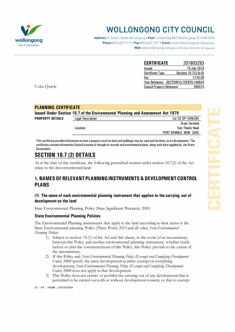
LIS | LPA | 149LONG | 03757879.DOCX
CERTIFICATE 201803293 Issued 16 July 2018
Certificate Type Sections 10.7(2) & (5)
Fee $133.00
Your Reference SECTION10.7CERTS:148824
Council Property Reference 390015 Colee Quayle
PLANNING CERTIFICATE
Issued Under Section 10.7 of the Environmental Planning and Assessment Act 1979
PROPERTY DETAILS Legal Description Lot 20 DP 1046295
Location
Grain Terminal Tom Thumb Road
PORT KEMBLA NSW 2505
This certificate provides information on how a property (such as land and buildings) may be used and the limits on its development. The
certificate contains information Council is aware of through its records and environmental plans, along with data supplied by the State
Government.
SECTION 10.7 (2) DETAILS
As at the date of this certificate, the following prescribed matters under section 10.7(2) of the Act relate to the abovementioned land:
1. NAMES OF RELEVANT PLANNING INSTRUMENTS & DEVELOPMENT CONTROL
PLANS
(1) The name of each environmental planning instrument that applies to the carrying out of
development on the land
State Environmental Planning Policy (State Significant Precincts) 2005
State Environmental Planning Policies
The Environmental Planning instruments that apply to the land according to their terms is the State Environmental planning Policy (Three Ports) 2013 and all other State Environmental Planning Policies
1) Subject to section 74 (1) of the Act and this clause, in the event of an inconsistency between this Policy and another environmental planning instrument, whether made before or after the commencement of this Policy, this Policy prevails to the extent of the inconsistency.
2) If this Policy and State Environmental Planning Policy (Exempt and Complying Development Codes) 2008 specify the same development as either exempt or complying development, State Environmental Planning Policy (Exempt and Complying Development Codes) 2008 does not apply to that development.
3) This Policy does not restrict or prohibit the carrying out of any development that is permitted to be carried out with or without development consent, or that is exempt

- 2 -
development, under State Environmental Planning Policy (Infrastructure) 2007. State Environmental Planning Policy Coastal Management 2018 (whole of lot) affected.
(2) The name of each proposed environmental planning instrument that will apply to the
carrying out of development on the land and that is or has been the subject of community
consultation or on public exhibition under the Act (unless the Director-General has notified the
council that the making of the proposed instrument has been deferred indefinitely or has not yet
been approved)
Paper Subdivisions: Draft Environmental Planning & Assessment Amendment (Subdivision works) Regulation 2013
Draft State Environmental Planning Policy - Advertising and Signage Amendments
Draft State Environmental Planning Policy - Infrastructure – Amendment (Shooting Ranges) 2013
Draft State Environmental Planning Policy - Infrastructure – Amendment (Sport and Recreation) 2013
Draft State Environmental Planning Policy – Koala Habitat Protection
Draft State Environmental Planning Policy – Infrastructure – (Amendments Review) 2017
Draft State Environmental Planning Policy – Primary Production and Rural Development.
Explanation of Intended Effect – Proposed Draft Environment SEPP (2017)
Explanation of Intended Effect – Proposed Amendment to the Mining SEPP 2007 – Air and Noise Impacts (2017)
Explanation of Intended Effect – Proposed Amendments to the SEPP 44 Koala Habitat Protection (2016)
Explanation of Intended Effect – Proposed Draft Primary Production and Rural Development SEPP 2017
Explanation of Intended Effect – Proposed Amendment to the Senior Housing SEPP – site compatibility certificates (2017)
Explanation of Intended Effect – Proposed Repeal of Two Operational SEPPs – SEPP 1 Development Standards and SEPP (Miscellaneous Consent Provisions) 2007 (2017)
Explanation of Intended Effect – Proposed Amendment to SEPP (Exempt and Complying Development ) – Proposed Greenfield Housing Code
Explanation of Intended Effect – Proposed new Remediation of Land SEPP and the Draft Planning Guidelines
Explanation of Intended Effect – Proposed Amendment to SEPP (Affordable Rental Housing) 2009
(3) The name of each development control plan that applies to the carrying out of development
on the land Wollongong Development Control Plan 2009

- 3 -
Wollongong Development Control Plan 2009, contains detailed development controls which supplement the provisions of Wollongong Local Environmental Plan 2009. Note: The Wollongong Development Control Plan 2009 should be consulted to ascertain its
full effect on the land.
(4) In this clause, proposed environmental planning instrument includes a planning proposal for
a Local Environmental Plan or a draft environmental planning instrument.
2. ZONING AND LAND USE UNDER RELEVANT LEPs
State Environmental Planning Policy (State Significant Precincts) 2005 For each environmental planning instrument or proposed instrument referred to in clause 1 (other than a SEPP or proposed SEPP) that includes the land in any zone (however described): 1.the identity of the zone, whether by reference to a name (such as “Residential
Zone” or “Heritage Area”) or by reference to a number (such as “Zone No 2(a)”)
SP1 – Special Activities (Three Ports) 2013
2. the purposes for which the instrument provides that development may be
carried out within the zone without the need for development consent
Jetties; Moorings; Roads.
3. the purposes for which the instrument provides that development may not be carried out within the zone except with development consent
Capital dredging; Environmental facilities; Environmental protection works; Maintenance dredging; Navigation and emergency response facilities; Port facilities; Neighbourhood Shops; Wharf or boating facilities; Any other development not specified in item 2 and 4
4. The purposes for which the instrument provides that development is
prohibited within the zone.
Bulky goods premises; Business premises; Caravan parks; Cemeteries; Centre-based child care facilities; Crematoria; Educational establishments; Entertainment facilities; Function centres; Funeral homes; Garden centres; Hardware and building supplies; Medical centres; Office premises; Places of public worship; Recreation facilities (indoor); Registered clubs; Residential accommodation; Respite day care centres; Restricted premises; Shops; Tourist and visitor accommodation; Vehicle sales and hire premises.
Note: State Environmental Planning Policy (Three Ports) 2013 should be consulted to ascertain its full effect on the land.

- 4 -
Note: State Environmental Planning Policy (Major Development) 2005 should be consulted to ascertain its full effect on the land.
Other Relevant Provisions of State Environmental Planning Policy (State Significant Precincts)
2005
Development for subdivision requires consent except for:
a) widening a public road, b) a minor realignment of boundaries that does not create additional lots or the opportunity
for additional dwellings, c) a consolidation of lots that does not create additional lots or the opportunity for
additional dwellings, d) rectifying an encroachment on a lot, e) creating a public reserve. f) excising from a lot land that is, or is intended to be, used for public purposes, including
drainage pruposes, rural fire brigade or other emergency service purposes or public toilets.
(e) Whether any development standards applying to the land fix minimum land dimensions for
the erection of a dwelling- house on the land, and if so, the minimum land dimensions so fixed
See Clauses 4.1, 4.1AA, 4.1A, 4.1B, 4.2 and 4.2A of the Local Environmental Plan.
(f) Whether the land includes or comprises critical habitat
Nil
(g) Whether the land is in a conservation area (however described)
Nil.
(h) Whether an item of environmental heritage (however described) is situated on the land
Nil.
2A. ZONING AND LAND USE UNDER STATE ENVIRONMENTAL PLANNING POLICY
(SYDNEY REGIONAL GROWTH CENTRES) 2006
To the extent that the land is within any zone (however described) under:
(a) Part 3 of the State Environmental Planning Policy (Sydney Region Growth Centres)
2006 (the 2006 SEPP), or
(b) a Precinct Plan (within the meaning of the 2006 SEPP),
(c) a proposed Precinct Plan that is or has been the subject of community consultation
or on public exhibition under the Act,
the particulars referred to in clause 2 (a) – (h) in relation to that land (with a reference to “the
instrument” in any of those paragraphs being read as a reference to Part 3 of the 2006 SEPP, or
the Precinct Plan or proposed Precinct Plan, as the case requires).
- 5 -
Not Applicable.
3. COMPLYING DEVELOPMENT
(1) The extent to which the land is land on which complying development may be carried out
under each of the codes for complying development because of the provisions of clauses 1.17A
(1) (c) to (e), (2), (3) and (4), 1.18 (1), (c3) and 1.19 of State Environmental Planning Policy (Exempt
and Complying Development Codes) 2008.
(2) The extent to which complying development may not be carried out on that land because of
the provisions of clauses 1.17A (1) (c) to (e), (2), (3) and (4), 1.18(1)(c3) and 1.19 of that Policy and
the reasons why it may not be carried out under those clauses.
(3) If the council does not have sufficient information to ascertain the extent to which complying
development may or may not be carried out on the land, a statement that a restriction applies to
the land, but it may not apply to all of the land, and that council does not have sufficient
information to ascertain the extent to which complying development may or may not be carried
out on the land.
State Environmental Planning Policy (Exempt and Complying Development Codes) 2008
(1) Subject to the terms of each code, and the zoning of the land, complying development may
be carried out for the following codes to the extent that the land has no affectation.
Housing Code (R1, R2, R3, R4, RU5)
Low Rise Medium Density Housing Code (Commencement deferred until July 2019)
Rural Housing Code (RU1, RU2, RU3, RU4, RU6, R5)
Housing Alterations Code
General Development Code
Commercial and Industrial (New Buildings and Additions) Code
Commercial and Industrial (Alterations) Code
Subdivision Code
Demolition Code
Container Recycling Facilities Code
Fire Safety Code
4B. ANNUAL CHARGES UNDER LOCAL GOVERNMENT ACT 1993 FOR COASTAL
PROTECTION SERVICES THAT RELATE TO EXISTING COASTAL PROTECTION
WORKS In relation to a coastal council- whether the owner (or any previous owner) of the land has
consented in writing to the land being subject to annual charges under section 496B of the Local
Government Act 1993 for coastal protection services that relate to existing coastal protection
works (within the meaning of section 553B of that Act)

- 6 -
Note: “Existing coastal protection works” are works to reduce the impact of coastal hazards on the land (such as seawalls, revetments, groynes and beach nourishment) that existed before the commencement of section 553B of the Local Government Act 1993
Not applicable
5. MINE SUBSIDENCE
Whether or not the land is proclaimed to be a mine subsidence district within the meaning of
section 15 of the Mine Subsidence Compensation Act 1961
The land is not proclaimed to be a mine subsidence district within the meaning of section 15 of the Mine Subsidence Compensation Act 1961.
6. ROAD WIDENING AND ROAD REALIGNMENT
Whether or not the land is affected by any road widening or road realignment under:
(a) Division 2 of Part 3 of the Roads Act 1993 or
(b) Any environmental planning instrument or
(c) Any resolution of the council
Council has no record that the land is affected by any Road Widening or Road Realignment under: a) Division 2 of Part 3 of the Roads Act 1993, or
b) any environmental planning instrument, or c) any resolution of the Council.
7. COUNCIL AND OTHER PUBLIC AUTHORITY POLICIES ON HAZARD RISK
RESTRICTIONS
Whether or not the land is affected by a policy:
a) adopted by the council, or
b) adopted by any other public authority and notified to the council for the express purpose of its
adoption by that authority being referred to in planning certificates issued by the council, that
restricts the development of the land because of the likelihood of land slip, bushfire, tidal
inundation, subsidence, acid sulfate soils or any other risk (other than flooding).
Council has adopted “Wollongong Development Control Plan 2009 – Chapter E12 Geotechnical Assessment”.
Council has adopted Acid Sulfate Maps, Wollongong Local Environmental Plan 2009 – Clause 7.5 Acid Sulfate Soils.
Council has adopted “Wollongong Development Control Plan 2009 – Chapter E16 Bushfire Management”. The Rural Fire Service has endorsed the Bush Fire Prone Land map.
Unhealthy Building Land Policy, adopted by the Environmental Protection Authority.
Council has adopted Wollongong City Council Coastal Zone Study (Cardno, Lawson, Treloar 2010).

- 7 -
7A. FLOOD RELATED DEVELOPMENT CONTROLS INFORMATION
(1) Whether or not development on that land or part of the land for the purposes of dwelling
houses, dual occupancies, multi dwelling housing or residential flat buildings (not including
development for the purposes of group homes or seniors housing) is subject to flood related
development controls.
Development on the land or part of the land for the purposes of dwelling houses, dual occupancies, multi dwelling housing or residential flat buildings (not including development for the purposes of group homes or seniors housing) is subject to flood related development controls as contained in Wollongong Development Control Plan 2009 Chapter E13 Floodplain Management and Wollongong Local Environmental Plan 2009 Clause 7.3 Flood Planning.
(2) Whether or not development on that land or part of the land for any other purpose is subject
to flood related development controls.
Development on the land or part of the land for any other purpose is subject to flood related development controls as contained in Wollongong Development Control Plan 2009 Chapter E13 Floodplain Management and Wollongong Local Environmental Plan 2009 Clause 7.3 Flood Planning.
(3) Words and expressions in this clause have the same meaning as in the instrument set out in
the Schedule to the Standard Instrument (Local Environmental Plans) Order 2006
Further flood information relating to this parcel of land is available by application under section 10.7(5) of the Environmental Planning & Assessment Act 1979.
8. LAND RESERVED FOR ACQUISITION Whether or not any environmental planning instrument or proposed environmental planning
instrument referred to in clause 1 makes provision in relation to the acquisition of the land by a
public authority, as referred to in section 3.15 of the Act.
Nil.
9. CONTRIBUTION PLANS
The name of each contributions plan applying to the land.
Wollongong Section 7.12 Development Contributions Plan (2017) (previously S94A)
Note: The purposes of this contributions plan are:
To authorise the imposition of a condition on certain development consents and complying development certificates requiring the payment of a contribution pursuant to section 7.12 of the EP&A Act 1979.
To assist the council to provide the appropriate public facilities which are required to maintain and enhance amenity and service delivery within the Wollongong Local Government area.
To publicly identify the purposes for which the levies are required.
Any party wishing to undertake construction of any new, or alterations to any existing, building or other development should review this policy or contact Council to determine if any contributions may be payable.

- 8 -
9A. BIODIVERSITY CERTIFIED LAND
If the land biodiversity certified land under Part 8 of the Biodiversity Conservation Act 2016, a
statement to that effect.
Note: Biodiversity certified land includes land certified under Part 7AA of the Threatened Species Conservation Act 1995 that is taken to be certified under Part 8 of the Biodiversity Conservation Act 2016.
Nil.
10. BIODIVERSITY STEWARDSHIP SITES
If the land is a biodiversity stewardship site under a biodiversity stewardship agreement under
Part 5 of the Biodiversity Conservation Act 2016, a statement to that effect (but only if the
council has been notified of the existence of the agreement by the Chief Executive of the Office
of Environment and Heritage).
Note: Biodiversity stewardship agreements include bio-banking agreements under Part 7A of the Threatened Species Conservation Act 1995 that are taken to be biodiversity stewardship agreements under Part 5 of the Biodiversity Conservation Act 2016.
Nil.
10A. NATIVE VEGETATION CLEARING SET ASIDES
If the land contains a set aside are under section 60ZC of the Local Land Services Act 2013, a
statement to that effect (but only if the council has been notified of the existence of the set
aside by Local Land Services or it is registered in the public register under that section).
Nil.
11. BUSH FIRE PRONE LAND
If any of the land is bush fire prone land (as defined in the Act), a statement that all or, as the
case may be, some of the land is bush fire prone land.
If none of the land is bush fire prone land, a statement to that effect.
The land is not recorded in Council's records as bushfire prone land.
12. PROPERTY VEGETATION PLANS
If the land is land to which a property vegetation plan approved under Part 4 of the Native
Vegetation Act 2003 (and that continues in force), a statement to that effect (but only if the
council has been notified of the existence of the plan by the person or body that approved the
plan under the Act).
Council has not been notified that the land is affected by a Property Vegetation Plan issued under the Native Vegetation Act 2003.

- 9 -
13. ORDERS UNDER TREES (DISPUTES BETWEEN NEIGHBOURS) ACT 2006
Whether an order has been made under the Trees (Disputes Between Neighbours) Act 2006 to
carry out work in relation to a tree on the land (but only if the council has been notified of the
order) Council has not been notified of an order.
14. STATE SIGNIFICANT DEVELOPMENT
If there is a direction by the Minister in force under section 75P (2) (c1) of the Act that a
provision of an environmental planning instrument prohibiting or restricting the carrying out of
a project or a stage of a project on the land under Part 4 of the Act does not have effect, a
statement to that effect identifying the provision that does not have effect. A major project application has been lodged with the Department of Planning under Part 3A of the Environmental Planning and Assessment Act 1979. Purchasers are advised to make their own enquiries with the Department of Planning regarding the status of such applications.
STATE SIGNIFICANT INFRASTRUCTURE
If there is a direction by the Minister in force under section 75P (2) (c1) of the Act that a
provision of an environmental planning instrument prohibiting or restricting the carrying out of
a project or a stage of a project on the land under Part 4 of the Act does not have effect, a
statement to that effect identifying the provision that does not have effect. A major project application has been lodged with the Department of Planning under Part 3A of the Environmental Planning and Assessment Act 1979. Purchasers are advised to make their own enquiries with the Department of Planning regarding the status of such applications.
15. SITE COMPATIBILITY CERTIFICATES AND CONDITIONS FOR SENIORS
HOUSING
If the land is land to which State Environmental Planning Policy (Housing for Seniors or People
with a Disability) 2004 applies:
(1) A statement of whether there is a current, site compatibility certificate (seniors housing),
of which the council is aware, in respect of proposed development on the land and, if
there is a certificate, the statement is to include:
(a) the period for which the certificate is current, and
(b) that a copy may be obtained from the head office of the Department of Planning,
and

- 10 -
(2) A statement setting out any terms of a kind referred to in clause 18(2) of that Policy that
have been imposed as a condition of consent to a development application granted after
11 October 2007 in respect of the land State Environmental Planning Policy (Housing for Seniors or People with a Disability) 2004
Nil.
16. SITE COMPATIBILITY CERTICATE FOR INFRASTRUCTURE A statement of whether there is a valid site compatibility certificate (infrastructure), or site
compatibility certificate (schools or TAFE establishments) of which the council is aware, in
respect of proposed development on the land and, if there is a certificate, the statement is to
include:
(a) the period for which the certificate is valid, and
(b) that a copy may be obtained from the head office of the Department.
State Environmental Planning Policy (Infrastructure) 2007 Nil.
17. SITE COMPATIBILITY CERTIFICATE AND CONDITIONS FOR AFFORDABLE
RENTAL HOUSING
(1) A statement of whether there is a current site compatibility certificate (affordable rental
housing), of which the council is aware, in respect of proposed development on the land
and, if there is a certificate, the statement is to include:
(a) the period for which the certificate is current, and
(b) that a copy may be obtained from the head office of the Department.
(2) A statement setting out any terms of a kind referred to in clause 17 (1) or 38 (1) of State
Environmental Planning Policy (Affordable Rental Housing) 2009 that have been imposed
as a condition of consent to a development application in respect of the land.
State Environmental Planning Policy (Affordable Rental Housing) 2009
Nil.
18. PAPER SUBDIVISION INFORMATION
(1) The name of any development plan adopted by a relevant authority that applies to the land
or that is proposed to be subject to the consent ballot.
Nil
(2) The date of any subdivision order that applies to the land.
Not applicable

- 11 -
(3) Words and expressions used in this clause have the same meaning as they have in Part 16C
of this Regulation.
19. SITE VERIFICATION CERTIFICATES
A statement of whether there is a current site verification certificate, of which the council is
aware, in respect of the land and, if there is a certificate, the statement is to include:
(a) the matter certified by the certificate, and
Note: A site verification certificate sets out the Director-General's opinion as to whether the land concerned is or is not biophysical strategic agricultural land or critical industry cluster land-see Division 3 of Part 4AA of State Environmental Planning Policy (Mining, Petroleum Production and Extractive lndustries 2007).
(b) the date on which the certificate ceases to be current (if any), and
(c) that a copy may be obtained from the head office of the Department.
Nil
20. LOOSE-FILL ASBESTOS INSULATION REGISTER
If the land includes any residential premises (within the meaning of Division 1A of Part 8 of the
Home Building Act 1989) that are listed on the register, that is required to be maintained under
that Division, a statement to that effect.
For register information contact www.fairtrading.nsw.gov.au
Nil.
21. AFFECTED BUILDING NOTICES AND BUILDING PRODUCT RECTIFICATION
ORDERS
(1) A statement of whether there is any affected building notice of which the council is aware
that is in force in respect of the land.
(2) A statement of:
(a) whether there is any building product rectification order of which the council is aware
that is in force in respect of the land and has not been fully complied with, and
(b) Whether any notice of intention to make a building product rectification order of which
the council is aware has been given in respect of the land and is outstanding.
(3) In this clause: affected building notice has the same meaning as in Part 4 of the Building
Products (Safety) Act 2017. building product rectification order has the same meaning as in the
Building Products (Safety) Act 2017.
Affected building notice has the same meaning as Part 4 of the Building Products (Safety) Act
2017 No 69
Building product rectification order has the same meaning as in the Building Products (Safety)
Act 2017 No 69

- 12 -
Nil.
CONTAMINATED LAND MANAGEMENT ACT 1997
Note: The following matters are prescribed by section 59 (2) of the Contaminated Land
Management Act 1997 as additional matters to be specified in a planning certificate:
(a) that the land to which the certificate relates is significantly contaminated within the
meaning of that Act- if the land (or part of the land) is significantly contaminated land
at the date when the certificate is issued,
(b) that the land to which the certificate relates is subject to a management order within
the meaning of the Act- if it is subject to such an order at the date when the
certificate is issued,
(c) that the land to which the certificate relates is the subject of an approved voluntary
management proposal within the meaning of that Act – if it is the subject of such an
approved proposal at the date when the certificate is issued,
(d) that the land to which the certificate relates is subject to an ongoing maintenance
order within the meaning of that Act – if it is subject to such an order at the date
when the certificate is issued,
(e) that the land to which the certificate relates is the subject of a site audit statement
within the meaning of the Act – if a copy of such a statement has been provided at
any time to the local authority issuing the certificate
Council has not been advised that:
a) The land is significantly contaminated land within the meaning of the Contaminated Land Management Act 1997
b) The land is subject to a management order within the meaning of the Contaminated Land
Management Act 1997
c) The land is subject to an approved voluntary management proposal within the meaning of the Contaminated Land Management Act 1997
d) The land is subject to an ongoing maintenance order within the meaning of the
Contaminated Land Management Act 1997
e) The land is the subject of a site audit statement within the meaning of the Contaminated Land Management Act 1997.
SECTION 10.7 (5) DETAILS
As at the date of this certificate, the following additional information, provided in good faith pursuant to section 10.7 (5) of the Act, relate to the abovementioned land. Council has selected these matters as those most likely to be of concern but they do not comprise an exhaustive list of matters likely to affect the land. When information pursuant to section 10.7 (5) is requested the Council is under no obligation to furnish any of the information supplied herein pursuant to that section. Council draws you attention to section 10.7 (6) which states that a council shall not incur any liability in respect of any advice

- 13 -
provided in good faith pursuant to subsection (5). The absence of any reference to any matter affecting the land shall not imply that the land is not affected by any matter referred to in this certificate.
RESOLUTION TO PREPARE PLANNING PROPOSAL Council on 17 July 2017 resolved to commence the preparation of a draft Planning Proposal to introduce Housing Affordability provisions or SEPP 70 Housing Affordability provisions into the Wollongong Local Environmental Plan 2009. The form of the provisions will be subject to a future report and subsequent community consultation. On 30th January 2017, Council resolved to adopt a draft Planning Proposal for the area of Port Kembla covered by the State Environmental Planning Policy (Three Ports) 2013, to make a number of amendments including permitting the temporary use of under-utilised sites and buildings within the BlueScope holdings for light industrial and office use.
PROPOSED DRAFT DEVELOPMENT CONTROL PLANS The following plans have been placed on exhibition pursuant to the provisions of section 72 of the Environmental Planning and Assessment Act 1979:
Draft Development Control Plan 2009 Review The Wollongong Development Control Plan 2009 came into force on 3 March 2010. A review commenced after 6 months of operation. The following chapters are available for public exhibition. Chapter D16 West Dapto Release Area
LAND STABILITY
Council’s land constraint/stability assessment maps do not show that the land is located in an area where landslip and/or subsidence have occurred, or where land instability is suspected. If you have any doubt as to whether the land is affected by landslip and/or subsidence the services of a suitably qualified engineer should be obtained.
Note: the advice provided by Council in respect of the stability of the land is based on information contained in Council’s land constraint maps. The maps have been compiled from data received by Council and considered by Council to be reasonably reliable. Council does not warrant that its land constraint maps contain all information ever received by Council relating to the stability of the land.
FLOOD AND DRAINAGE
1 Classification of Flood Risk
Council records indicate that this property is located within a Low Flood Risk precinct.
Land that is potentially subject to inundation is classified as low, medium or high flood risk. Council has prepared a development control plan known as Wollongong Development Control Plan 2009 that provides details of flood related development controls that may be applicable.
Where the owner/applicant has detailed survey available which identifies the property to be within another risk precinct or not in one at all, it may be presented to Council for reassessment.

- 14 -
Definitions:
High Flood Risk (and Interim Riverine Corridor) Precinct
This has been defined as the area within the envelope of land subject to a high hydraulic hazard (in accordance with the provisional criteria outlined in the Floodplain Management Manual) in a 100 year flood event plus all land within a corridor 10m from the top of the creek bank (Interim Riverine Corridor). The high flood risk precinct is where high flood damages, potential risk to life, evacuation problems would be anticipated or development would significantly and adversely effect flood behaviour. Most development should be restricted in this precinct. In this precinct, there would be a significant risk of flood damages without compliance with flood related building and planning controls.
Medium Flood Risk Precinct
This has been defined as land below the 100 year flood level (plus 0.5m freeboard) that is not within the High Flood Risk (and Interim Riverine Corridor) Precinct. It is land subject to low hydraulic hazard (in accordance with the provisional criteria outlined by the Floodplain Management Manual). In this precinct there would still be a significant risk of flood damage, but these damages can be minimised by the application of appropriate development controls.
Low Flood Risk Precinct
This has been defined as all other land within the floodplain (i.e. within the extent of the probable maximum flood) but not identified within either the High Flood Risk (and Interim Riverine Corridor) or the Medium Flood Risk Precinct, where risk of damages are low for most land uses. The Low Flood Risk Precinct is that area above the 100 year flood (plus 0.5m freeboard) and most land uses would be permitted within this precinct.
2 Estimated Flood Levels
Estimated and/or historical flood levels in the vicinity of this property may be available from Council. Requests may be made by completing a Flood Enquiry Form available from council’s website, in writing or from the Level 6 front counter of the Administration Building. A cost is involved for this service. Payment must be made prior to information being provided.
Please contact Council’s Drainage Duty Officer on 42277181 to ensure the availability of information before submitting this request form. Council does not hold flood information for every property.
‘Please note that flood levels may change due to Council’s flood study and Floodplain Risk Management Study currently being reviewed. As part of the review, design parameters for these studies are changing, and therefore the flood levels, velocities and flood risks may vary from the current flood study.’
ACID SULFATE SOILS
Acid Sulfate Soil Class 3 has been mapped on this land. Acid Sulfate Soils Class 4 has been mapped on this land.
CONTAMINATED LAND
Council’s records show that because of previous uses the land may be contaminated. The services

- 15 -
of a suitably qualified consultant should be sought to ascertain the degree of contamination, if any, on the land, and its likely effect on the land. Council’s records are incomplete and there is no certainty that the land is so affected. Council has adopted Wollongong Development Control Plan 2009, which may restrict the development of the land.
STATE SIGNIFICANT DEVELOPMENT
Nil.
BUILDING LINES Wollongong Development Control Plan 2009 details the setbacks applicable to the land.
OTHER HERITAGE MATTERS KNOWN TO COUNCIL
Aboriginal Heritage
All development within the Wollongong Local Government Area is subject to the Aboriginal Heritage requirements of the National Parks and Wildlife Act 1974. To determine if your property is affected by an Aboriginal Site, it is recommended that an Aboriginal Heritage Information Management System (AHIMS) search be undertaken by contacting the AHIM’S Administrator on (02) 9995 5000. Further detail on Council’s Aboriginal Heritage requirements for Development is contained within Chapter E10 of the Wollongong Development Control Plan 2009.
DEVELOPMENT HISTORY
Application may be made for a Building Certificate under section 10.7B of Environmental Planning and Assessment Act 1979 if written certification of existing buildings on the land is required.
The history of development consent approval applicable to the land may be obtained by consulting the Development Consent Register. Enquiries concerning the register may be made at Council’s Customer Service Centre, 41 Burelli Street Wollongong during office hours.
LOOSE-FILL ASBESTOS
Council recommends you make your own enquiries as to the age of the buildings on the land to which this certificate relates and, if it contains a building constructed prior to 1980, the Council also strongly recommends that any potential purchaser obtain advice form a licensed asbestos assessor to determine whether loose-fill asbestos is present in any building on the land and, if so, the health risks (if any) this may pose for the building’s occupants.
Contact NSW Fair Trading for further information.
OTHER INFORMATION
Illawarra Regional Strategy
The Minister for Planning released the Illawarra Regional Strategy on 1 February 2007. The strategy is the NSW Government 25 year land use strategy for the Illawarra Region.
The Department of Planning and Environment released the Illawarra Shoalhaven Regional Plan, November 2015.

- 16 -
Threatened Species – Green and Golden Bell Frog (Litoria aurea) This land provides habitat for a population of Green and Golden Bell Frog (Litoria aurea). This species is listed as Endangered under Part 1 Schedule 1 of the NSW Threatened Species Conservation Act 1995 and as Vulnerable under the Commonwealth Environment Protection and Biodiversity Conservation Act 1999. The presence of this species may restrict the development potential of the land. The nature and extent of any threatened species or cultural heritage constraints should be determined following an assessment of the land by a qualified and experienced ecologist/consultant.
GENERAL INFORMATION
The following general information is brought to the attention of land owners.
1. Tree Management Policy
The Wollongong Tree Management Policy allows proper assessment to be made of the environmental importance and viability of trees before they are pruned, removed or damaged in any way. This Policy prohibits the ringbarking, cutting down, topping, lopping, removing, injuring or destruction of any tree except with the prior written consent of Council.
The Tree Management Policy applies to any tree that:
Is 3 metres or more in height,
Has a trunk diameter of 200mm or more at a height of 1 metre from the ground, or
Has a branch spread of 3 metres or more
Please note that:
A dead/dying tree is subject to the Tree Management Policy
Pruning of major structural or anchor roots is also subject to the Tree Management Policy
Some trees may be exempt and do not require a permit to prune or remove them. Following is a list of the exempt tree species:

- 17 -
Salix Species
Erythrina X Sykesii
Cupressus Macrocarpa “Brunniana”
Laganuria Pattersonii
Harpephyllum Caffrum
Syagrus Romanzoffina
Poplar Species
Ficus Elasrica “Decora” and hybrids
Ligustrum Lucidum
Cinnamomum Camphora
Schefflera Actinophylla
False Acacia
Peppercorn
Alnus
Acer negundo
Willow
Coral Tree
Golden Cypress
Itchy Pod Tree
Kaffir Plum
Cocos Palm
Poplar
Ornamental Rubber tree
Large Leafed Privet
Camphor Laurel
Umbrella Tree
Black Locust
Pepper Tree
Alder
Box Elder
For the full list of other exemptions please refer to the Tree Management Policy document available via Council’s website.
Any person acting on a permit issued under this Policy must comply with all conditions of that permit.
Any person who contravenes, or causes or permits the contravention of this Policy is guilty of an offence under the Environmental Planning and Assessment Act 1979.
Development Consents may contain restrictions relating to trees.
Further information regarding Council’s Tree Management Policy including how to lodge an application can be made by contacting Council’s Customer Service on telephone 4227 7111. Alternatively information can be obtained from Council’s website via the following link http://www.wollongong.nsw.gov.au/services/household/trees/Pages/Lodgeatmp.aspx.
2. Termite Management for Buildings
Australian Standards 3660.1-2000 (New Buildings) AS 3660.2-2000 (Existing Buildings) Termite Management, recommends that buildings be inspected and be maintained in order to achieve termite management of buildings. Licensed Pest Control Contractors should be contacted to achieve necessary termite control.
3. Lead Paint and Building Renovations
Your attention is drawn to the hazards associated with lead-based paints during building renovation. Suitable precautions should be taken when removing flaking paint or sanding painted surfaces suspected to have been treated with lead-based paint to prevent contamination of the immediate environment and associated health risk from lead dust.
AS 4361 – Part 2 – Guide to Lead Paint Management – Residential and Commercial.

- 18 -
4. Sewage Management Systems
Where a property has on-site sewage management system (this includes septic tanks, disposal trenches, aerated waste water treatment systems, composting toilets and pump out systems) the new owner must obtain an “Approval to Operate” from Council within 3 months of land ownership being transferred or otherwise conveyed.
5. Asbestos
Exposure to asbestos is a serious health hazard. In Australia, asbestos was gradually phased out of building materials in the 1980s and the supply and installation of asbestos containing goods has been prohibited since 31 December 2003. However, asbestos legacy materials still exist in many homes, buildings and other assets and infrastructure.
Council on the 27 October 2014 adopted an Asbestos policy which states Council’s commitment to and responsibilities for safely managing asbestos, and provides information for Council and the local community on safely managing asbestos. The policy can be viewed on Council’s website: www.wollongong.nsw.gov.au.
6. Loose-Fill Asbestos Insulation
Some residential homes located in NSW have been identified as containing loose-fill asbestos insulation, for example in the roof space. NSW Fair Trading maintains a Register of homes that are affected by loose-fill asbestos insulation.
You should make your own enquiries as to the age of the buildings on the land to which this certificate relates and if it contains a building constructed prior to 1980, the council strongly recommends that any potential purchaser obtain advice from a licenced asbestos assessor to determine whether loose-fill asbestos is present in any building on the land and, if so, the health risks (if any) this may pose for the buildings occupants.
Contact NSW Fair Trading for further information.
This letter is authorised by: Jamie O’Connell LIS Information Officer Section 10.7 Planning Certificates Wollongong City Council Telephone (02) 4227 7111

LIS | LPA | 149LONG | 03757872.DOCX
CERTIFICATE 201803292 Issued 16 July 2018
Certificate Type Sections 10.7(2) & (5)
Fee $133.00
Your Reference SECTION10.7CERTS:148824
Council Property Reference 390016 Colee Quayle
PLANNING CERTIFICATE
Issued Under Section 10.7 of the Environmental Planning and Assessment Act 1979
PROPERTY DETAILS Legal Description Lot 21 DP 1046295
Location
Grain Terminal Tom Thumb Road
PORT KEMBLA NSW 2505
This certificate provides information on how a property (such as land and buildings) may be used and the limits on its development. The
certificate contains information Council is aware of through its records and environmental plans, along with data supplied by the State
Government.
SECTION 10.7 (2) DETAILS
As at the date of this certificate, the following prescribed matters under section 10.7(2) of the Act relate to the abovementioned land:
1. NAMES OF RELEVANT PLANNING INSTRUMENTS & DEVELOPMENT CONTROL
PLANS
(1) The name of each environmental planning instrument that applies to the carrying out of
development on the land
State Environmental Planning Policy (State Significant Precincts) 2005
State Environmental Planning Policies
The Environmental Planning instruments that apply to the land according to their terms is the State Environmental planning Policy (Three Ports) 2013 and all other State Environmental Planning Policies
1) Subject to section 74 (1) of the Act and this clause, in the event of an inconsistency between this Policy and another environmental planning instrument, whether made before or after the commencement of this Policy, this Policy prevails to the extent of the inconsistency.
2) If this Policy and State Environmental Planning Policy (Exempt and Complying Development Codes) 2008 specify the same development as either exempt or complying development, State Environmental Planning Policy (Exempt and Complying Development Codes) 2008 does not apply to that development.
3) This Policy does not restrict or prohibit the carrying out of any development that is permitted to be carried out with or without development consent, or that is exempt

- 2 -
development, under State Environmental Planning Policy (Infrastructure) 2007. State Environmental Planning Policy Coastal Management 2018 (whole of lot) affected.
(2) The name of each proposed environmental planning instrument that will apply to the
carrying out of development on the land and that is or has been the subject of community
consultation or on public exhibition under the Act (unless the Director-General has notified the
council that the making of the proposed instrument has been deferred indefinitely or has not yet
been approved)
Paper Subdivisions: Draft Environmental Planning & Assessment Amendment (Subdivision works) Regulation 2013
Draft State Environmental Planning Policy - Advertising and Signage Amendments
Draft State Environmental Planning Policy - Infrastructure – Amendment (Shooting Ranges) 2013
Draft State Environmental Planning Policy - Infrastructure – Amendment (Sport and Recreation) 2013
Draft State Environmental Planning Policy – Koala Habitat Protection
Draft State Environmental Planning Policy – Infrastructure – (Amendments Review) 2017
Draft State Environmental Planning Policy – Primary Production and Rural Development.
Explanation of Intended Effect – Proposed Draft Environment SEPP (2017)
Explanation of Intended Effect – Proposed Amendment to the Mining SEPP 2007 – Air and Noise Impacts (2017)
Explanation of Intended Effect – Proposed Amendments to the SEPP 44 Koala Habitat Protection (2016)
Explanation of Intended Effect – Proposed Draft Primary Production and Rural Development SEPP 2017
Explanation of Intended Effect – Proposed Amendment to the Senior Housing SEPP – site compatibility certificates (2017)
Explanation of Intended Effect – Proposed Repeal of Two Operational SEPPs – SEPP 1 Development Standards and SEPP (Miscellaneous Consent Provisions) 2007 (2017)
Explanation of Intended Effect – Proposed Amendment to SEPP (Exempt and Complying Development ) – Proposed Greenfield Housing Code
Explanation of Intended Effect – Proposed new Remediation of Land SEPP and the Draft Planning Guidelines
Explanation of Intended Effect – Proposed Amendment to SEPP (Affordable Rental Housing) 2009
(3) The name of each development control plan that applies to the carrying out of development
on the land Wollongong Development Control Plan 2009

- 3 -
Wollongong Development Control Plan 2009, contains detailed development controls which supplement the provisions of Wollongong Local Environmental Plan 2009. Note: The Wollongong Development Control Plan 2009 should be consulted to ascertain its
full effect on the land.
(4) In this clause, proposed environmental planning instrument includes a planning proposal for
a Local Environmental Plan or a draft environmental planning instrument.
2. ZONING AND LAND USE UNDER RELEVANT LEPs
State Environmental Planning Policy (State Significant Precincts) 2005 For each environmental planning instrument or proposed instrument referred to in clause 1 (other than a SEPP or proposed SEPP) that includes the land in any zone (however described): 1.the identity of the zone, whether by reference to a name (such as “Residential
Zone” or “Heritage Area”) or by reference to a number (such as “Zone No 2(a)”)
SP1 – Special Activities (Three Ports) 2013
2. the purposes for which the instrument provides that development may be
carried out within the zone without the need for development consent
Jetties; Moorings; Roads.
3. the purposes for which the instrument provides that development may not be carried out within the zone except with development consent
Capital dredging; Environmental facilities; Environmental protection works; Maintenance dredging; Navigation and emergency response facilities; Port facilities; Neighbourhood Shops; Wharf or boating facilities; Any other development not specified in item 2 and 4
4. The purposes for which the instrument provides that development is
prohibited within the zone.
Bulky goods premises; Business premises; Caravan parks; Cemeteries; Centre-based child care facilities; Crematoria; Educational establishments; Entertainment facilities; Function centres; Funeral homes; Garden centres; Hardware and building supplies; Medical centres; Office premises; Places of public worship; Recreation facilities (indoor); Registered clubs; Residential accommodation; Respite day care centres; Restricted premises; Shops; Tourist and visitor accommodation; Vehicle sales and hire premises.
Note: State Environmental Planning Policy (Three Ports) 2013 should be consulted to ascertain its full effect on the land.

- 4 -
Note: State Environmental Planning Policy (Major Development) 2005 should be consulted to ascertain its full effect on the land.
Other Relevant Provisions of State Environmental Planning Policy (State Significant Precincts)
2005
Development for subdivision requires consent except for:
a) widening a public road, b) a minor realignment of boundaries that does not create additional lots or the opportunity
for additional dwellings, c) a consolidation of lots that does not create additional lots or the opportunity for
additional dwellings, d) rectifying an encroachment on a lot, e) creating a public reserve. f) excising from a lot land that is, or is intended to be, used for public purposes, including
drainage pruposes, rural fire brigade or other emergency service purposes or public toilets.
(e) Whether any development standards applying to the land fix minimum land dimensions for
the erection of a dwelling- house on the land, and if so, the minimum land dimensions so fixed
See Clauses 4.1, 4.1AA, 4.1A, 4.1B, 4.2 and 4.2A of the Local Environmental Plan.
(f) Whether the land includes or comprises critical habitat
Nil
(g) Whether the land is in a conservation area (however described)
Nil.
(h) Whether an item of environmental heritage (however described) is situated on the land
Nil.
2A. ZONING AND LAND USE UNDER STATE ENVIRONMENTAL PLANNING POLICY
(SYDNEY REGIONAL GROWTH CENTRES) 2006
To the extent that the land is within any zone (however described) under:
(a) Part 3 of the State Environmental Planning Policy (Sydney Region Growth Centres)
2006 (the 2006 SEPP), or
(b) a Precinct Plan (within the meaning of the 2006 SEPP),
(c) a proposed Precinct Plan that is or has been the subject of community consultation
or on public exhibition under the Act,
the particulars referred to in clause 2 (a) – (h) in relation to that land (with a reference to “the
instrument” in any of those paragraphs being read as a reference to Part 3 of the 2006 SEPP, or
the Precinct Plan or proposed Precinct Plan, as the case requires).
Not Applicable.

- 5 -
3. COMPLYING DEVELOPMENT
(1) The extent to which the land is land on which complying development may be carried out
under each of the codes for complying development because of the provisions of clauses 1.17A
(1) (c) to (e), (2), (3) and (4), 1.18 (1), (c3) and 1.19 of State Environmental Planning Policy (Exempt
and Complying Development Codes) 2008.
(2) The extent to which complying development may not be carried out on that land because of
the provisions of clauses 1.17A (1) (c) to (e), (2), (3) and (4), 1.18(1)(c3) and 1.19 of that Policy and
the reasons why it may not be carried out under those clauses.
(3) If the council does not have sufficient information to ascertain the extent to which complying
development may or may not be carried out on the land, a statement that a restriction applies to
the land, but it may not apply to all of the land, and that council does not have sufficient
information to ascertain the extent to which complying development may or may not be carried
out on the land.
State Environmental Planning Policy (Exempt and Complying Development Codes) 2008
(1) Subject to the terms of each code, and the zoning of the land, complying development may
be carried out for the following codes to the extent that the land has no affectation.
Housing Code (R1, R2, R3, R4, RU5)
Low Rise Medium Density Housing Code (Commencement deferred until July 2019)
Rural Housing Code (RU1, RU2, RU3, RU4, RU6, R5)
Housing Alterations Code
General Development Code
Commercial and Industrial (New Buildings and Additions) Code
Commercial and Industrial (Alterations) Code
Subdivision Code
Demolition Code
Container Recycling Facilities Code
Fire Safety Code
4B. ANNUAL CHARGES UNDER LOCAL GOVERNMENT ACT 1993 FOR COASTAL
PROTECTION SERVICES THAT RELATE TO EXISTING COASTAL PROTECTION
WORKS In relation to a coastal council- whether the owner (or any previous owner) of the land has
consented in writing to the land being subject to annual charges under section 496B of the Local
Government Act 1993 for coastal protection services that relate to existing coastal protection
works (within the meaning of section 553B of that Act)

- 6 -
Note: “Existing coastal protection works” are works to reduce the impact of coastal hazards on the land (such as seawalls, revetments, groynes and beach nourishment) that existed before the commencement of section 553B of the Local Government Act 1993
Not applicable
5. MINE SUBSIDENCE
Whether or not the land is proclaimed to be a mine subsidence district within the meaning of
section 15 of the Mine Subsidence Compensation Act 1961
The land is not proclaimed to be a mine subsidence district within the meaning of section 15 of the Mine Subsidence Compensation Act 1961.
6. ROAD WIDENING AND ROAD REALIGNMENT
Whether or not the land is affected by any road widening or road realignment under:
(a) Division 2 of Part 3 of the Roads Act 1993 or
(b) Any environmental planning instrument or
(c) Any resolution of the council
Council has no record that the land is affected by any Road Widening or Road Realignment under: a) Division 2 of Part 3 of the Roads Act 1993, or
b) any environmental planning instrument, or c) any resolution of the Council.
7. COUNCIL AND OTHER PUBLIC AUTHORITY POLICIES ON HAZARD RISK
RESTRICTIONS
Whether or not the land is affected by a policy:
a) adopted by the council, or
b) adopted by any other public authority and notified to the council for the express purpose of its
adoption by that authority being referred to in planning certificates issued by the council, that
restricts the development of the land because of the likelihood of land slip, bushfire, tidal
inundation, subsidence, acid sulfate soils or any other risk (other than flooding).
Council has adopted “Wollongong Development Control Plan 2009 – Chapter E12 Geotechnical Assessment”.
Council has adopted Acid Sulfate Maps, Wollongong Local Environmental Plan 2009 – Clause 7.5 Acid Sulfate Soils.
Council has adopted “Wollongong Development Control Plan 2009 – Chapter E16 Bushfire Management”. The Rural Fire Service has endorsed the Bush Fire Prone Land map.
Unhealthy Building Land Policy, adopted by the Environmental Protection Authority.
Council has adopted Wollongong City Council Coastal Zone Study (Cardno, Lawson, Treloar 2010).

- 7 -
7A. FLOOD RELATED DEVELOPMENT CONTROLS INFORMATION
(1) Whether or not development on that land or part of the land for the purposes of dwelling
houses, dual occupancies, multi dwelling housing or residential flat buildings (not including
development for the purposes of group homes or seniors housing) is subject to flood related
development controls.
Development on the land or part of the land for the purposes of dwelling houses, dual occupancies, multi dwelling housing or residential flat buildings (not including development for the purposes of group homes or seniors housing) is subject to flood related development controls as contained in Wollongong Development Control Plan 2009 Chapter E13 Floodplain Management and Wollongong Local Environmental Plan 2009 Clause 7.3 Flood Planning.
(2) Whether or not development on that land or part of the land for any other purpose is subject
to flood related development controls.
Development on the land or part of the land for any other purpose is subject to flood related development controls as contained in Wollongong Development Control Plan 2009 Chapter E13 Floodplain Management and Wollongong Local Environmental Plan 2009 Clause 7.3 Flood Planning.
(3) Words and expressions in this clause have the same meaning as in the instrument set out in
the Schedule to the Standard Instrument (Local Environmental Plans) Order 2006
Further flood information relating to this parcel of land is available by application under section 10.7(5) of the Environmental Planning & Assessment Act 1979.
8. LAND RESERVED FOR ACQUISITION Whether or not any environmental planning instrument or proposed environmental planning
instrument referred to in clause 1 makes provision in relation to the acquisition of the land by a
public authority, as referred to in section 3.15 of the Act.
Nil.
9. CONTRIBUTION PLANS
The name of each contributions plan applying to the land.
Wollongong Section 7.12 Development Contributions Plan (2017) (previously S94A)
Note: The purposes of this contributions plan are:
To authorise the imposition of a condition on certain development consents and complying development certificates requiring the payment of a contribution pursuant to section 7.12 of the EP&A Act 1979.
To assist the council to provide the appropriate public facilities which are required to maintain and enhance amenity and service delivery within the Wollongong Local Government area.
To publicly identify the purposes for which the levies are required.
Any party wishing to undertake construction of any new, or alterations to any existing, building or other development should review this policy or contact Council to determine if any contributions may be payable.

- 8 -
9A. BIODIVERSITY CERTIFIED LAND
If the land biodiversity certified land under Part 8 of the Biodiversity Conservation Act 2016, a
statement to that effect.
Note: Biodiversity certified land includes land certified under Part 7AA of the Threatened Species Conservation Act 1995 that is taken to be certified under Part 8 of the Biodiversity Conservation Act 2016.
Nil.
10. BIODIVERSITY STEWARDSHIP SITES
If the land is a biodiversity stewardship site under a biodiversity stewardship agreement under
Part 5 of the Biodiversity Conservation Act 2016, a statement to that effect (but only if the
council has been notified of the existence of the agreement by the Chief Executive of the Office
of Environment and Heritage).
Note: Biodiversity stewardship agreements include bio-banking agreements under Part 7A of the Threatened Species Conservation Act 1995 that are taken to be biodiversity stewardship agreements under Part 5 of the Biodiversity Conservation Act 2016.
Nil.
10A. NATIVE VEGETATION CLEARING SET ASIDES
If the land contains a set aside are under section 60ZC of the Local Land Services Act 2013, a
statement to that effect (but only if the council has been notified of the existence of the set
aside by Local Land Services or it is registered in the public register under that section).
Nil.
11. BUSH FIRE PRONE LAND
If any of the land is bush fire prone land (as defined in the Act), a statement that all or, as the
case may be, some of the land is bush fire prone land.
If none of the land is bush fire prone land, a statement to that effect.
The land is not recorded in Council's records as bushfire prone land.
12. PROPERTY VEGETATION PLANS
If the land is land to which a property vegetation plan approved under Part 4 of the Native
Vegetation Act 2003 (and that continues in force), a statement to that effect (but only if the
council has been notified of the existence of the plan by the person or body that approved the
plan under the Act).

- 9 -
Council has not been notified that the land is affected by a Property Vegetation Plan issued under the Native Vegetation Act 2003.
13. ORDERS UNDER TREES (DISPUTES BETWEEN NEIGHBOURS) ACT 2006
Whether an order has been made under the Trees (Disputes Between Neighbours) Act 2006 to
carry out work in relation to a tree on the land (but only if the council has been notified of the
order) Council has not been notified of an order.
14. STATE SIGNIFICANT DEVELOPMENT
If there is a direction by the Minister in force under section 75P (2) (c1) of the Act that a
provision of an environmental planning instrument prohibiting or restricting the carrying out of
a project or a stage of a project on the land under Part 4 of the Act does not have effect, a
statement to that effect identifying the provision that does not have effect. A major project application has been lodged with the Department of Planning under Part 3A of the Environmental Planning and Assessment Act 1979. Purchasers are advised to make their own enquiries with the Department of Planning regarding the status of such applications.
STATE SIGNIFICANT INFRASTRUCTURE
If there is a direction by the Minister in force under section 75P (2) (c1) of the Act that a
provision of an environmental planning instrument prohibiting or restricting the carrying out of
a project or a stage of a project on the land under Part 4 of the Act does not have effect, a
statement to that effect identifying the provision that does not have effect. A major project application has been lodged with the Department of Planning under Part 3A of the Environmental Planning and Assessment Act 1979. Purchasers are advised to make their own enquiries with the Department of Planning regarding the status of such applications.
15. SITE COMPATIBILITY CERTIFICATES AND CONDITIONS FOR SENIORS
HOUSING
If the land is land to which State Environmental Planning Policy (Housing for Seniors or People
with a Disability) 2004 applies:
(1) A statement of whether there is a current, site compatibility certificate (seniors housing),
of which the council is aware, in respect of proposed development on the land and, if
there is a certificate, the statement is to include:
(a) the period for which the certificate is current, and

- 10 -
(b) that a copy may be obtained from the head office of the Department of Planning,
and
(2) A statement setting out any terms of a kind referred to in clause 18(2) of that Policy that
have been imposed as a condition of consent to a development application granted after
11 October 2007 in respect of the land State Environmental Planning Policy (Housing for Seniors or People with a Disability) 2004
Nil.
16. SITE COMPATIBILITY CERTICATE FOR INFRASTRUCTURE A statement of whether there is a valid site compatibility certificate (infrastructure), or site
compatibility certificate (schools or TAFE establishments) of which the council is aware, in
respect of proposed development on the land and, if there is a certificate, the statement is to
include:
(a) the period for which the certificate is valid, and
(b) that a copy may be obtained from the head office of the Department.
State Environmental Planning Policy (Infrastructure) 2007 Nil.
17. SITE COMPATIBILITY CERTIFICATE AND CONDITIONS FOR AFFORDABLE
RENTAL HOUSING
(1) A statement of whether there is a current site compatibility certificate (affordable rental
housing), of which the council is aware, in respect of proposed development on the land
and, if there is a certificate, the statement is to include:
(a) the period for which the certificate is current, and
(b) that a copy may be obtained from the head office of the Department.
(2) A statement setting out any terms of a kind referred to in clause 17 (1) or 38 (1) of State
Environmental Planning Policy (Affordable Rental Housing) 2009 that have been imposed
as a condition of consent to a development application in respect of the land.
State Environmental Planning Policy (Affordable Rental Housing) 2009
Nil.
18. PAPER SUBDIVISION INFORMATION

- 11 -
(1) The name of any development plan adopted by a relevant authority that applies to the land
or that is proposed to be subject to the consent ballot.
Nil
(2) The date of any subdivision order that applies to the land.
Not applicable
(3) Words and expressions used in this clause have the same meaning as they have in Part 16C
of this Regulation.
19. SITE VERIFICATION CERTIFICATES
A statement of whether there is a current site verification certificate, of which the council is
aware, in respect of the land and, if there is a certificate, the statement is to include:
(a) the matter certified by the certificate, and
Note: A site verification certificate sets out the Director-General's opinion as to whether the land concerned is or is not biophysical strategic agricultural land or critical industry cluster land-see Division 3 of Part 4AA of State Environmental Planning Policy (Mining, Petroleum Production and Extractive lndustries 2007).
(b) the date on which the certificate ceases to be current (if any), and
(c) that a copy may be obtained from the head office of the Department.
Nil
20. LOOSE-FILL ASBESTOS INSULATION REGISTER
If the land includes any residential premises (within the meaning of Division 1A of Part 8 of the
Home Building Act 1989) that are listed on the register, that is required to be maintained under
that Division, a statement to that effect.
For register information contact www.fairtrading.nsw.gov.au
Nil.
21. AFFECTED BUILDING NOTICES AND BUILDING PRODUCT RECTIFICATION
ORDERS
(1) A statement of whether there is any affected building notice of which the council is aware
that is in force in respect of the land.
(2) A statement of:
(a) whether there is any building product rectification order of which the council is aware
that is in force in respect of the land and has not been fully complied with, and
(b) Whether any notice of intention to make a building product rectification order of which
the council is aware has been given in respect of the land and is outstanding.

- 12 -
(3) In this clause: affected building notice has the same meaning as in Part 4 of the Building
Products (Safety) Act 2017. building product rectification order has the same meaning as in the
Building Products (Safety) Act 2017.
Affected building notice has the same meaning as Part 4 of the Building Products (Safety) Act
2017 No 69
Building product rectification order has the same meaning as in the Building Products (Safety)
Act 2017 No 69
Nil.
CONTAMINATED LAND MANAGEMENT ACT 1997
Note: The following matters are prescribed by section 59 (2) of the Contaminated Land
Management Act 1997 as additional matters to be specified in a planning certificate:
(a) that the land to which the certificate relates is significantly contaminated within the
meaning of that Act- if the land (or part of the land) is significantly contaminated land
at the date when the certificate is issued,
(b) that the land to which the certificate relates is subject to a management order within
the meaning of the Act- if it is subject to such an order at the date when the
certificate is issued,
(c) that the land to which the certificate relates is the subject of an approved voluntary
management proposal within the meaning of that Act – if it is the subject of such an
approved proposal at the date when the certificate is issued,
(d) that the land to which the certificate relates is subject to an ongoing maintenance
order within the meaning of that Act – if it is subject to such an order at the date
when the certificate is issued,
(e) that the land to which the certificate relates is the subject of a site audit statement
within the meaning of the Act – if a copy of such a statement has been provided at
any time to the local authority issuing the certificate
Council has not been advised that:
a) The land is significantly contaminated land within the meaning of the Contaminated Land Management Act 1997
b) The land is subject to a management order within the meaning of the Contaminated Land
Management Act 1997
c) The land is subject to an approved voluntary management proposal within the meaning of the Contaminated Land Management Act 1997
d) The land is subject to an ongoing maintenance order within the meaning of the
Contaminated Land Management Act 1997
e) The land is the subject of a site audit statement within the meaning of the Contaminated Land Management Act 1997.

- 13 -
SECTION 10.7 (5) DETAILS
As at the date of this certificate, the following additional information, provided in good faith pursuant to section 10.7 (5) of the Act, relate to the abovementioned land. Council has selected these matters as those most likely to be of concern but they do not comprise an exhaustive list of matters likely to affect the land. When information pursuant to section 10.7 (5) is requested the Council is under no obligation to furnish any of the information supplied herein pursuant to that section. Council draws you attention to section 10.7 (6) which states that a council shall not incur any liability in respect of any advice provided in good faith pursuant to subsection (5). The absence of any reference to any matter affecting the land shall not imply that the land is not affected by any matter referred to in this certificate.
RESOLUTION TO PREPARE PLANNING PROPOSAL On 30th January 2017, Council resolved to adopt a draft Planning Proposal for the area of Port Kembla covered by the State Environmental Planning Policy (Three Ports) 2013, to make a number of amendments including permitting the temporary use of under-utilised sites and buildings within the BlueScope holdings for light industrial and office use. Council on 17 July 2017 resolved to commence the preparation of a draft Planning Proposal to introduce Housing Affordability provisions or SEPP 70 Housing Affordability provisions into the Wollongong Local Environmental Plan 2009. The form of the provisions will be subject to a future report and subsequent community consultation.
PROPOSED DRAFT DEVELOPMENT CONTROL PLANS The following plans have been placed on exhibition pursuant to the provisions of section 72 of the Environmental Planning and Assessment Act 1979:
Draft Development Control Plan 2009 Review The Wollongong Development Control Plan 2009 came into force on 3 March 2010. A review commenced after 6 months of operation. The following chapters are available for public exhibition. Chapter D16 West Dapto Release Area
LAND STABILITY
Council’s land constraint/stability assessment maps do not show that the land is located in an area where landslip and/or subsidence have occurred, or where land instability is suspected. If you have any doubt as to whether the land is affected by landslip and/or subsidence the services of a suitably qualified engineer should be obtained.
Note: the advice provided by Council in respect of the stability of the land is based on information contained in Council’s land constraint maps. The maps have been compiled from data received by Council and considered by Council to be reasonably reliable. Council does not warrant that its land constraint maps contain all information ever received by Council relating to the stability of the land.
FLOOD AND DRAINAGE
1 Classification of Flood Risk
Council records indicate that this property is located within a Low Flood Risk precinct.

- 14 -
Land that is potentially subject to inundation is classified as low, medium or high flood risk. Council has prepared a development control plan known as Wollongong Development Control Plan 2009 that provides details of flood related development controls that may be applicable.
Where the owner/applicant has detailed survey available which identifies the property to be within another risk precinct or not in one at all, it may be presented to Council for reassessment.
Definitions:
High Flood Risk (and Interim Riverine Corridor) Precinct
This has been defined as the area within the envelope of land subject to a high hydraulic hazard (in accordance with the provisional criteria outlined in the Floodplain Management Manual) in a 100 year flood event plus all land within a corridor 10m from the top of the creek bank (Interim Riverine Corridor). The high flood risk precinct is where high flood damages, potential risk to life, evacuation problems would be anticipated or development would significantly and adversely effect flood behaviour. Most development should be restricted in this precinct. In this precinct, there would be a significant risk of flood damages without compliance with flood related building and planning controls.
Medium Flood Risk Precinct
This has been defined as land below the 100 year flood level (plus 0.5m freeboard) that is not within the High Flood Risk (and Interim Riverine Corridor) Precinct. It is land subject to low hydraulic hazard (in accordance with the provisional criteria outlined by the Floodplain Management Manual). In this precinct there would still be a significant risk of flood damage, but these damages can be minimised by the application of appropriate development controls.
Low Flood Risk Precinct
This has been defined as all other land within the floodplain (i.e. within the extent of the probable maximum flood) but not identified within either the High Flood Risk (and Interim Riverine Corridor) or the Medium Flood Risk Precinct, where risk of damages are low for most land uses. The Low Flood Risk Precinct is that area above the 100 year flood (plus 0.5m freeboard) and most land uses would be permitted within this precinct.
2 Estimated Flood Levels
Estimated and/or historical flood levels in the vicinity of this property may be available from Council. Requests may be made by completing a Flood Enquiry Form available from council’s website, in writing or from the Level 6 front counter of the Administration Building. A cost is involved for this service. Payment must be made prior to information being provided.
Please contact Council’s Drainage Duty Officer on 42277181 to ensure the availability of information before submitting this request form. Council does not hold flood information for every property.
‘Please note that flood levels may change due to Council’s flood study and Floodplain Risk Management Study currently being reviewed. As part of the review, design parameters for these studies are changing, and therefore the flood levels, velocities and flood risks may vary from the current flood study.’
ACID SULFATE SOILS
Acid Sulfate Soil Class 3 has been mapped on this land.

- 15 -
CONTAMINATED LAND
Council’s records show that because of previous uses the land may be contaminated. The services of a suitably qualified consultant should be sought to ascertain the degree of contamination, if any, on the land, and its likely effect on the land. Council’s records are incomplete and there is no certainty that the land is so affected. Council has adopted Wollongong Development Control Plan 2009, which may restrict the development of the land.
STATE SIGNIFICANT DEVELOPMENT
Nil.
BUILDING LINES Wollongong Development Control Plan 2009 details the setbacks applicable to the land.
OTHER HERITAGE MATTERS KNOWN TO COUNCIL
Aboriginal Heritage
All development within the Wollongong Local Government Area is subject to the Aboriginal Heritage requirements of the National Parks and Wildlife Act 1974. To determine if your property is affected by an Aboriginal Site, it is recommended that an Aboriginal Heritage Information Management System (AHIMS) search be undertaken by contacting the AHIM’S Administrator on (02) 9995 5000. Further detail on Council’s Aboriginal Heritage requirements for Development is contained within Chapter E10 of the Wollongong Development Control Plan 2009.
DEVELOPMENT HISTORY
Application may be made for a Building Certificate under section 10.7B of Environmental Planning and Assessment Act 1979 if written certification of existing buildings on the land is required.
The history of development consent approval applicable to the land may be obtained by consulting the Development Consent Register. Enquiries concerning the register may be made at Council’s Customer Service Centre, 41 Burelli Street Wollongong during office hours.
LOOSE-FILL ASBESTOS
Council recommends you make your own enquiries as to the age of the buildings on the land to which this certificate relates and, if it contains a building constructed prior to 1980, the Council also strongly recommends that any potential purchaser obtain advice form a licensed asbestos assessor to determine whether loose-fill asbestos is present in any building on the land and, if so, the health risks (if any) this may pose for the building’s occupants.
Contact NSW Fair Trading for further information.
OTHER INFORMATION

- 16 -
Illawarra Regional Strategy
The Minister for Planning released the Illawarra Regional Strategy on 1 February 2007. The strategy is the NSW Government 25 year land use strategy for the Illawarra Region.
The Department of Planning and Environment released the Illawarra Shoalhaven Regional Plan, November 2015.
Threatened Species – Green and Golden Bell Frog (Litoria aurea) This land provides habitat for a population of Green and Golden Bell Frog (Litoria aurea). This species is listed as Endangered under Part 1 Schedule 1 of the NSW Threatened Species Conservation Act 1995 and as Vulnerable under the Commonwealth Environment Protection and Biodiversity Conservation Act 1999. The presence of this species may restrict the development potential of the land. The nature and extent of any threatened species or cultural heritage constraints should be determined following an assessment of the land by a qualified and experienced ecologist/consultant.
GENERAL INFORMATION
The following general information is brought to the attention of land owners.
1. Tree Management Policy
The Wollongong Tree Management Policy allows proper assessment to be made of the environmental importance and viability of trees before they are pruned, removed or damaged in any way. This Policy prohibits the ringbarking, cutting down, topping, lopping, removing, injuring or destruction of any tree except with the prior written consent of Council.
The Tree Management Policy applies to any tree that:
Is 3 metres or more in height,
Has a trunk diameter of 200mm or more at a height of 1 metre from the ground, or
Has a branch spread of 3 metres or more
Please note that:
A dead/dying tree is subject to the Tree Management Policy
Pruning of major structural or anchor roots is also subject to the Tree Management Policy
Some trees may be exempt and do not require a permit to prune or remove them. Following is a list of the exempt tree species:

- 17 -
Salix Species
Erythrina X Sykesii
Cupressus Macrocarpa “Brunniana”
Laganuria Pattersonii
Harpephyllum Caffrum
Syagrus Romanzoffina
Poplar Species
Ficus Elasrica “Decora” and hybrids
Ligustrum Lucidum
Cinnamomum Camphora
Schefflera Actinophylla
False Acacia
Peppercorn
Alnus
Acer negundo
Willow
Coral Tree
Golden Cypress
Itchy Pod Tree
Kaffir Plum
Cocos Palm
Poplar
Ornamental Rubber tree
Large Leafed Privet
Camphor Laurel
Umbrella Tree
Black Locust
Pepper Tree
Alder
Box Elder
For the full list of other exemptions please refer to the Tree Management Policy document available via Council’s website.
Any person acting on a permit issued under this Policy must comply with all conditions of that permit.
Any person who contravenes, or causes or permits the contravention of this Policy is guilty of an offence under the Environmental Planning and Assessment Act 1979.
Development Consents may contain restrictions relating to trees.
Further information regarding Council’s Tree Management Policy including how to lodge an application can be made by contacting Council’s Customer Service on telephone 4227 7111. Alternatively information can be obtained from Council’s website via the following link http://www.wollongong.nsw.gov.au/services/household/trees/Pages/Lodgeatmp.aspx.
2. Termite Management for Buildings
Australian Standards 3660.1-2000 (New Buildings) AS 3660.2-2000 (Existing Buildings) Termite Management, recommends that buildings be inspected and be maintained in order to achieve termite management of buildings. Licensed Pest Control Contractors should be contacted to achieve necessary termite control.
3. Lead Paint and Building Renovations
Your attention is drawn to the hazards associated with lead-based paints during building renovation. Suitable precautions should be taken when removing flaking paint or sanding painted surfaces suspected to have been treated with lead-based paint to prevent contamination of the immediate environment and associated health risk from lead dust.
AS 4361 – Part 2 – Guide to Lead Paint Management – Residential and Commercial.

- 18 -
4. Sewage Management Systems
Where a property has on-site sewage management system (this includes septic tanks, disposal trenches, aerated waste water treatment systems, composting toilets and pump out systems) the new owner must obtain an “Approval to Operate” from Council within 3 months of land ownership being transferred or otherwise conveyed.
5. Asbestos
Exposure to asbestos is a serious health hazard. In Australia, asbestos was gradually phased out of building materials in the 1980s and the supply and installation of asbestos containing goods has been prohibited since 31 December 2003. However, asbestos legacy materials still exist in many homes, buildings and other assets and infrastructure.
Council on the 27 October 2014 adopted an Asbestos policy which states Council’s commitment to and responsibilities for safely managing asbestos, and provides information for Council and the local community on safely managing asbestos. The policy can be viewed on Council’s website: www.wollongong.nsw.gov.au.
6. Loose-Fill Asbestos Insulation
Some residential homes located in NSW have been identified as containing loose-fill asbestos insulation, for example in the roof space. NSW Fair Trading maintains a Register of homes that are affected by loose-fill asbestos insulation.
You should make your own enquiries as to the age of the buildings on the land to which this certificate relates and if it contains a building constructed prior to 1980, the council strongly recommends that any potential purchaser obtain advice from a licenced asbestos assessor to determine whether loose-fill asbestos is present in any building on the land and, if so, the health risks (if any) this may pose for the buildings occupants.
Contact NSW Fair Trading for further information.
This letter is authorised by: Jamie O’Connell LIS Information Officer Section 10.7 Planning Certificates Wollongong City Council Telephone (02) 4227 7111

LIS | LPA | 149LONG | 03757808.DOCX
CERTIFICATE 201803287 Issued 16 July 2018
Certificate Type Sections 10.7(2) & (5)
Fee $133.00
Your Reference SECTION10.7CERTS:148824
Council Property Reference 389043 Colee Quayle
PLANNING CERTIFICATE
Issued Under Section 10.7 of the Environmental Planning and Assessment Act 1979
PROPERTY DETAILS Legal Description Lot 22 DP 1128396
Location
Lot 22 Port Kembla Road PORT KEMBLA NSW 2505
This certificate provides information on how a property (such as land and buildings) may be used and the limits on its development. The
certificate contains information Council is aware of through its records and environmental plans, along with data supplied by the State
Government.
SECTION 10.7 (2) DETAILS
As at the date of this certificate, the following prescribed matters under section 10.7(2) of the Act relate to the abovementioned land:
1. NAMES OF RELEVANT PLANNING INSTRUMENTS & DEVELOPMENT CONTROL
PLANS
(1) The name of each environmental planning instrument that applies to the carrying out of
development on the land
State Environmental Planning Policy (State Significant Precincts) 2005
State Environmental Planning Policies
The Environmental Planning instruments that apply to the land according to their terms is the State Environmental planning Policy (Three Ports) 2013 and all other State Environmental Planning Policies
1) Subject to section 74 (1) of the Act and this clause, in the event of an inconsistency between this Policy and another environmental planning instrument, whether made before or after the commencement of this Policy, this Policy prevails to the extent of the inconsistency.
2) If this Policy and State Environmental Planning Policy (Exempt and Complying Development Codes) 2008 specify the same development as either exempt or complying development, State Environmental Planning Policy (Exempt and Complying Development Codes) 2008 does not apply to that development.
3) This Policy does not restrict or prohibit the carrying out of any development that is permitted to be carried out with or without development consent, or that is exempt development, under State Environmental Planning Policy (Infrastructure) 2007.

- 2 -
State Environmental Planning Policy Coastal Management 2018 (whole of lot) affected.
(2) The name of each proposed environmental planning instrument that will apply to the
carrying out of development on the land and that is or has been the subject of community
consultation or on public exhibition under the Act (unless the Director-General has notified the
council that the making of the proposed instrument has been deferred indefinitely or has not yet
been approved)
Paper Subdivisions: Draft Environmental Planning & Assessment Amendment (Subdivision works) Regulation 2013
Draft State Environmental Planning Policy - Advertising and Signage Amendments
Draft State Environmental Planning Policy - Infrastructure – Amendment (Shooting Ranges) 2013
Draft State Environmental Planning Policy - Infrastructure – Amendment (Sport and Recreation) 2013
Draft State Environmental Planning Policy – Koala Habitat Protection
Draft State Environmental Planning Policy – Infrastructure – (Amendments Review) 2017
Draft State Environmental Planning Policy – Primary Production and Rural Development.
Explanation of Intended Effect – Proposed Draft Environment SEPP (2017)
Explanation of Intended Effect – Proposed Amendment to the Mining SEPP 2007 – Air and Noise Impacts (2017)
Explanation of Intended Effect – Proposed Amendments to the SEPP 44 Koala Habitat Protection (2016)
Explanation of Intended Effect – Proposed Draft Primary Production and Rural Development SEPP 2017
Explanation of Intended Effect – Proposed Amendment to the Senior Housing SEPP – site compatibility certificates (2017)
Explanation of Intended Effect – Proposed Repeal of Two Operational SEPPs – SEPP 1 Development Standards and SEPP (Miscellaneous Consent Provisions) 2007 (2017)
Explanation of Intended Effect – Proposed Amendment to SEPP (Exempt and Complying Development ) – Proposed Greenfield Housing Code
Explanation of Intended Effect – Proposed new Remediation of Land SEPP and the Draft Planning Guidelines
Explanation of Intended Effect – Proposed Amendment to SEPP (Affordable Rental Housing) 2009
(3) The name of each development control plan that applies to the carrying out of development
on the land Wollongong Development Control Plan 2009 Wollongong Development Control Plan 2009, contains detailed development controls which

- 3 -
supplement the provisions of Wollongong Local Environmental Plan 2009. Note: The Wollongong Development Control Plan 2009 should be consulted to ascertain its
full effect on the land.
(4) In this clause, proposed environmental planning instrument includes a planning proposal for
a Local Environmental Plan or a draft environmental planning instrument.
2. ZONING AND LAND USE UNDER RELEVANT LEPs
State Environmental Planning Policy (State Significant Precincts) 2005 For each environmental planning instrument or proposed instrument referred to in clause 1 (other than a SEPP or proposed SEPP) that includes the land in any zone (however described): 1.the identity of the zone, whether by reference to a name (such as “Residential
Zone” or “Heritage Area”) or by reference to a number (such as “Zone No 2(a)”)
SP1 – Special Activities (Three Ports) 2013
2. the purposes for which the instrument provides that development may be
carried out within the zone without the need for development consent
Jetties; Moorings; Roads.
3. the purposes for which the instrument provides that development may not be carried out within the zone except with development consent
Capital dredging; Environmental facilities; Environmental protection works; Maintenance dredging; Navigation and emergency response facilities; Port facilities; Neighbourhood Shops; Wharf or boating facilities; Any other development not specified in item 2 and 4
4. The purposes for which the instrument provides that development is
prohibited within the zone.
Bulky goods premises; Business premises; Caravan parks; Cemeteries; Centre-based child care facilities; Crematoria; Educational establishments; Entertainment facilities; Function centres; Funeral homes; Garden centres; Hardware and building supplies; Medical centres; Office premises; Places of public worship; Recreation facilities (indoor); Registered clubs; Residential accommodation; Respite day care centres; Restricted premises; Shops; Tourist and visitor accommodation; Vehicle sales and hire premises.
Note: State Environmental Planning Policy (Three Ports) 2013 should be consulted to ascertain its full effect on the land.

- 4 -
Note: State Environmental Planning Policy (Major Development) 2005 should be consulted to ascertain its full effect on the land.
Other Relevant Provisions of State Environmental Planning Policy (State Significant Precincts)
2005
Development for subdivision requires consent except for:
a) widening a public road, b) a minor realignment of boundaries that does not create additional lots or the opportunity
for additional dwellings, c) a consolidation of lots that does not create additional lots or the opportunity for
additional dwellings, d) rectifying an encroachment on a lot, e) creating a public reserve. f) excising from a lot land that is, or is intended to be, used for public purposes, including
drainage pruposes, rural fire brigade or other emergency service purposes or public toilets.
(e) Whether any development standards applying to the land fix minimum land dimensions for
the erection of a dwelling- house on the land, and if so, the minimum land dimensions so fixed
See Clauses 4.1, 4.1AA, 4.1A, 4.1B, 4.2 and 4.2A of the Local Environmental Plan.
(f) Whether the land includes or comprises critical habitat
Nil
(g) Whether the land is in a conservation area (however described)
Nil.
(h) Whether an item of environmental heritage (however described) is situated on the land
Nil.
2A. ZONING AND LAND USE UNDER STATE ENVIRONMENTAL PLANNING POLICY
(SYDNEY REGIONAL GROWTH CENTRES) 2006
To the extent that the land is within any zone (however described) under:
(a) Part 3 of the State Environmental Planning Policy (Sydney Region Growth Centres)
2006 (the 2006 SEPP), or
(b) a Precinct Plan (within the meaning of the 2006 SEPP),
(c) a proposed Precinct Plan that is or has been the subject of community consultation
or on public exhibition under the Act,
the particulars referred to in clause 2 (a) – (h) in relation to that land (with a reference to “the
instrument” in any of those paragraphs being read as a reference to Part 3 of the 2006 SEPP, or
the Precinct Plan or proposed Precinct Plan, as the case requires).
Not Applicable.

- 5 -
3. COMPLYING DEVELOPMENT
(1) The extent to which the land is land on which complying development may be carried out
under each of the codes for complying development because of the provisions of clauses 1.17A
(1) (c) to (e), (2), (3) and (4), 1.18 (1), (c3) and 1.19 of State Environmental Planning Policy (Exempt
and Complying Development Codes) 2008.
(2) The extent to which complying development may not be carried out on that land because of
the provisions of clauses 1.17A (1) (c) to (e), (2), (3) and (4), 1.18(1)(c3) and 1.19 of that Policy and
the reasons why it may not be carried out under those clauses.
(3) If the council does not have sufficient information to ascertain the extent to which complying
development may or may not be carried out on the land, a statement that a restriction applies to
the land, but it may not apply to all of the land, and that council does not have sufficient
information to ascertain the extent to which complying development may or may not be carried
out on the land.
State Environmental Planning Policy (Exempt and Complying Development Codes) 2008
(3) The land is identified on an Acid Sulphate Soils Map as being Acid Class 1 or Acid Class 2
(or both). A restriction applies to the land, but may not apply to all of the land. Council
does not have sufficient information to ascertain the extent to which complying
development may or may not be carried out on the land.
State Environmental Planning Policy (Exempt and Complying Development Codes) 2008 (1) Subject to the terms of each code, and the zoning of the land, complying development may
be carried out for the following codes to the extent that the land is not affected by the provisions identified at (2) below.
Housing Code (R1, R2, R3, R4, RU5)
Low Rise Medium Density Housing Code (Commencement deferred until July 2019)
Rural Housing Code (RU1, RU2, RU3, RU4, RU6, R5)
Housing Alterations Code
General Development Code
Commercial and Industrial (New Buildings and Additions) Code
Commercial and Industrial (Alterations) Code
Subdivision Code
Demolition Code
Container Recycling Facilities CodeFire Safety Code (2) Complying development may not be carried out on the land to the extent that it is partially
affected by Coastal Wetlands and a 100m Buffer Area because of the provisions of clauses 1.17A, 1.18 or 1.19 of State Environmental Planning Policy (Exempt and Complying Development Codes) 2008
Housing Code (R1, R2, R3, R4, RU5)
Low Rise Medium Density Housing Code (Commencement deferred until July 2019)
Rural Housing Code (RU1, RU2, RU3, RU4, RU6, R5)

- 6 -
Commercial and Industrial (New Buildings and Additions) Code
4B. ANNUAL CHARGES UNDER LOCAL GOVERNMENT ACT 1993 FOR COASTAL
PROTECTION SERVICES THAT RELATE TO EXISTING COASTAL PROTECTION
WORKS In relation to a coastal council- whether the owner (or any previous owner) of the land has
consented in writing to the land being subject to annual charges under section 496B of the Local
Government Act 1993 for coastal protection services that relate to existing coastal protection
works (within the meaning of section 553B of that Act) Note: “Existing coastal protection works” are works to reduce the impact of coastal hazards on the land (such as seawalls, revetments, groynes and beach nourishment) that existed before the commencement of section 553B of the Local Government Act 1993
Not applicable
5. MINE SUBSIDENCE
Whether or not the land is proclaimed to be a mine subsidence district within the meaning of
section 15 of the Mine Subsidence Compensation Act 1961
The land is not proclaimed to be a mine subsidence district within the meaning of section 15 of the Mine Subsidence Compensation Act 1961.
6. ROAD WIDENING AND ROAD REALIGNMENT
Whether or not the land is affected by any road widening or road realignment under:
(a) Division 2 of Part 3 of the Roads Act 1993 or
(b) Any environmental planning instrument or
(c) Any resolution of the council
Council has no record that the land is affected by any Road Widening or Road Realignment under:
a) Division 2 of Part 3 of the Roads Act 1993, or b) any environmental planning instrument, or
c) any resolution of the Council.
7. COUNCIL AND OTHER PUBLIC AUTHORITY POLICIES ON HAZARD RISK
RESTRICTIONS
Whether or not the land is affected by a policy:
a) adopted by the council, or
b) adopted by any other public authority and notified to the council for the express purpose of its
adoption by that authority being referred to in planning certificates issued by the council, that

- 7 -
restricts the development of the land because of the likelihood of land slip, bushfire, tidal
inundation, subsidence, acid sulfate soils or any other risk (other than flooding).
Council has adopted “Wollongong Development Control Plan 2009 – Chapter E12 Geotechnical Assessment”.
Council has adopted Acid Sulfate Maps, Wollongong Local Environmental Plan 2009 – Clause 7.5 Acid Sulfate Soils.
Council has adopted “Wollongong Development Control Plan 2009 – Chapter E16 Bushfire Management”. The Rural Fire Service has endorsed the Bush Fire Prone Land map.
Unhealthy Building Land Policy, adopted by the Environmental Protection Authority.
Council has adopted Wollongong City Council Coastal Zone Study (Cardno, Lawson, Treloar 2010).
7A. FLOOD RELATED DEVELOPMENT CONTROLS INFORMATION
(1) Whether or not development on that land or part of the land for the purposes of dwelling
houses, dual occupancies, multi dwelling housing or residential flat buildings (not including
development for the purposes of group homes or seniors housing) is subject to flood related
development controls.
Development on the land or part of the land for the purposes of dwelling houses, dual occupancies, multi dwelling housing or residential flat buildings (not including development for the purposes of group homes or seniors housing) is subject to flood related development controls as contained in Wollongong Development Control Plan 2009 Chapter E13 Floodplain Management and Wollongong Local Environmental Plan 2009 Clause 7.3 Flood Planning.
(2) Whether or not development on that land or part of the land for any other purpose is subject
to flood related development controls.
Development on the land or part of the land for any other purpose is subject to flood related development controls as contained in Wollongong Development Control Plan 2009 Chapter E13 Floodplain Management and Wollongong Local Environmental Plan 2009 Clause 7.3 Flood Planning.
(3) Words and expressions in this clause have the same meaning as in the instrument set out in
the Schedule to the Standard Instrument (Local Environmental Plans) Order 2006
Further flood information relating to this parcel of land is available by application under section 10.7(5) of the Environmental Planning & Assessment Act 1979.
8. LAND RESERVED FOR ACQUISITION Whether or not any environmental planning instrument or proposed environmental planning
instrument referred to in clause 1 makes provision in relation to the acquisition of the land by a
public authority, as referred to in section 3.15 of the Act.
Nil.
9. CONTRIBUTION PLANS
The name of each contributions plan applying to the land.

- 8 -
Wollongong Section 7.12 Development Contributions Plan (2017) (previously S94A)
Note: The purposes of this contributions plan are:
To authorise the imposition of a condition on certain development consents and complying development certificates requiring the payment of a contribution pursuant to section 7.12 of the EP&A Act 1979.
To assist the council to provide the appropriate public facilities which are required to maintain and enhance amenity and service delivery within the Wollongong Local Government area.
To publicly identify the purposes for which the levies are required.
Any party wishing to undertake construction of any new , or alterations to any existing, building or other development should review this policy or contact Council to determine if any contributions may be payable.
9A. BIODIVERSITY CERTIFIED LAND
If the land biodiversity certified land under Part 8 of the Biodiversity Conservation Act 2016, a
statement to that effect.
Note: Biodiversity certified land includes land certified under Part 7AA of the Threatened Species Conservation Act 1995 that is taken to be certified under Part 8 of the Biodiversity Conservation Act 2016.
Nil.
10. BIODIVERSITY STEWARDSHIP SITES
If the land is a biodiversity stewardship site under a biodiversity stewardship agreement under
Part 5 of the Biodiversity Conservation Act 2016, a statement to that effect (but only if the
council has been notified of the existence of the agreement by the Chief Executive of the Office
of Environment and Heritage).
Note: Biodiversity stewardship agreements include bio-banking agreements under Part 7A of the Threatened Species Conservation Act 1995 that are taken to be biodiversity stewardship agreements under Part 5 of the Biodiversity Conservation Act 2016.
Nil.
10A. NATIVE VEGETATION CLEARING SET ASIDES
If the land contains a set aside are under section 60ZC of the Local Land Services Act 2013, a
statement to that effect (but only if the council has been notified of the existence of the set
aside by Local Land Services or it is registered in the public register under that section).
Nil.
11. BUSH FIRE PRONE LAND
If any of the land is bush fire prone land (as defined in the Act), a statement that all or, as the
case may be, some of the land is bush fire prone land.

- 9 -
If none of the land is bush fire prone land, a statement to that effect.
The land is not recorded in Council's records as bushfire prone land.
12. PROPERTY VEGETATION PLANS
If the land is land to which a property vegetation plan approved under Part 4 of the Native
Vegetation Act 2003 (and that continues in force), a statement to that effect (but only if the
council has been notified of the existence of the plan by the person or body that approved the
plan under the Act).
Council has not been notified that the land is affected by a Property Vegetation Plan issued under the Native Vegetation Act 2003.
13. ORDERS UNDER TREES (DISPUTES BETWEEN NEIGHBOURS) ACT 2006
Whether an order has been made under the Trees (Disputes Between Neighbours) Act 2006 to
carry out work in relation to a tree on the land (but only if the council has been notified of the
order) Council has not been notified of an order.
14. STATE SIGNIFICANT DEVELOPMENT
If there is a direction by the Minister in force under section 75P (2) (c1) of the Act that a
provision of an environmental planning instrument prohibiting or restricting the carrying out of
a project or a stage of a project on the land under Part 4 of the Act does not have effect, a
statement to that effect identifying the provision that does not have effect. A major project application has been lodged with the Department of Planning under Part 3A of the Environmental Planning and Assessment Act 1979. Purchasers are advised to make their own enquiries with the Department of Planning regarding the status of such applications.
STATE SIGNIFICANT INFRASTRUCTURE
If there is a direction by the Minister in force under section 75P (2) (c1) of the Act that a
provision of an environmental planning instrument prohibiting or restricting the carrying out of
a project or a stage of a project on the land under Part 4 of the Act does not have effect, a
statement to that effect identifying the provision that does not have effect. A major project application has been lodged with the Department of Planning under Part 3A of the Environmental Planning and Assessment Act 1979. Purchasers are advised to make their own enquiries with the Department of Planning regarding the status of such applications.

- 10 -
15. SITE COMPATIBILITY CERTIFICATES AND CONDITIONS FOR SENIORS
HOUSING
If the land is land to which State Environmental Planning Policy (Housing for Seniors or People
with a Disability) 2004 applies:
(1) A statement of whether there is a current, site compatibility certificate (seniors housing),
of which the council is aware, in respect of proposed development on the land and, if
there is a certificate, the statement is to include:
(a) the period for which the certificate is current, and
(b) that a copy may be obtained from the head office of the Department of Planning,
and
(2) A statement setting out any terms of a kind referred to in clause 18(2) of that Policy that
have been imposed as a condition of consent to a development application granted after
11 October 2007 in respect of the land State Environmental Planning Policy (Housing for Seniors or People with a Disability) 2004
Nil.
16. SITE COMPATIBILITY CERTICATE FOR INFRASTRUCTURE A statement of whether there is a valid site compatibility certificate (infrastructure), or site
compatibility certificate (schools or TAFE establishments) of which the council is aware, in
respect of proposed development on the land and, if there is a certificate, the statement is to
include:
(a) the period for which the certificate is valid, and
(b) that a copy may be obtained from the head office of the Department.
State Environmental Planning Policy (Infrastructure) 2007 Nil.
17. SITE COMPATIBILITY CERTIFICATE AND CONDITIONS FOR AFFORDABLE
RENTAL HOUSING
(1) A statement of whether there is a current site compatibility certificate (affordable rental
housing), of which the council is aware, in respect of proposed development on the land
and, if there is a certificate, the statement is to include:
(a) the period for which the certificate is current, and
(b) that a copy may be obtained from the head office of the Department.

- 11 -
(2) A statement setting out any terms of a kind referred to in clause 17 (1) or 38 (1) of State
Environmental Planning Policy (Affordable Rental Housing) 2009 that have been imposed
as a condition of consent to a development application in respect of the land.
State Environmental Planning Policy (Affordable Rental Housing) 2009
Nil.
18. PAPER SUBDIVISION INFORMATION
(1) The name of any development plan adopted by a relevant authority that applies to the land
or that is proposed to be subject to the consent ballot.
Nil
(2) The date of any subdivision order that applies to the land.
Not applicable
(3) Words and expressions used in this clause have the same meaning as they have in Part 16C
of this Regulation.
19. SITE VERIFICATION CERTIFICATES
A statement of whether there is a current site verification certificate, of which the council is
aware, in respect of the land and, if there is a certificate, the statement is to include:
(a) the matter certified by the certificate, and
Note: A site verification certificate sets out the Director-General's opinion as to whether the land concerned is or is not biophysical strategic agricultural land or critical industry cluster land-see Division 3 of Part 4AA of State Environmental Planning Policy (Mining, Petroleum Production and Extractive lndustries 2007).
(b) the date on which the certificate ceases to be current (if any), and
(c) that a copy may be obtained from the head office of the Department.
Nil
20. LOOSE-FILL ASBESTOS INSULATION REGISTER
If the land includes any residential premises (within the meaning of Division 1A of Part 8 of the
Home Building Act 1989) that are listed on the register, that is required to be maintained under
that Division, a statement to that effect.
For register information contact www.fairtrading.nsw.gov.au
Nil.
21. AFFECTED BUILDING NOTICES AND BUILDING PRODUCT RECTIFICATION
ORDERS
(1) A statement of whether there is any affected building notice of which the council is aware
that is in force in respect of the land.

- 12 -
(2) A statement of:
(a) whether there is any building product rectification order of which the council is aware
that is in force in respect of the land and has not been fully complied with, and
(b) Whether any notice of intention to make a building product rectification order of which
the council is aware has been given in respect of the land and is outstanding.
(3) In this clause: affected building notice has the same meaning as in Part 4 of the Building
Products (Safety) Act 2017. building product rectification order has the same meaning as in the
Building Products (Safety) Act 2017.
Affected building notice has the same meaning as Part 4 of the Building Products (Safety) Act
2017 No 69
Building product rectification order has the same meaning as in the Building Products (Safety)
Act 2017 No 69
Nil.
CONTAMINATED LAND MANAGEMENT ACT 1997
Note: The following matters are prescribed by section 59 (2) of the Contaminated Land
Management Act 1997 as additional matters to be specified in a planning certificate:
(a) that the land to which the certificate relates is significantly contaminated within the
meaning of that Act- if the land (or part of the land) is significantly contaminated land
at the date when the certificate is issued,
(b) that the land to which the certificate relates is subject to a management order within
the meaning of the Act- if it is subject to such an order at the date when the
certificate is issued,
(c) that the land to which the certificate relates is the subject of an approved voluntary
management proposal within the meaning of that Act – if it is the subject of such an
approved proposal at the date when the certificate is issued,
(d) that the land to which the certificate relates is subject to an ongoing maintenance
order within the meaning of that Act – if it is subject to such an order at the date
when the certificate is issued,
(e) that the land to which the certificate relates is the subject of a site audit statement
within the meaning of the Act – if a copy of such a statement has been provided at
any time to the local authority issuing the certificate
Council has not been advised that:
a) The land is significantly contaminated land within the meaning of the Contaminated Land Management Act 1997
b) The land is subject to a management order within the meaning of the Contaminated Land
Management Act 1997
c) The land is subject to an approved voluntary management proposal within the meaning of the Contaminated Land Management Act 1997

- 13 -
d) The land is subject to an ongoing maintenance order within the meaning of the Contaminated Land Management Act 1997
e) The land is the subject of a site audit statement within the meaning of the Contaminated
Land Management Act 1997.
SECTION 10.7 (5) DETAILS
As at the date of this certificate, the following additional information, provided in good faith pursuant to section 10.7 (5) of the Act, relate to the abovementioned land. Council has selected these matters as those most likely to be of concern but they do not comprise an exhaustive list of matters likely to affect the land. When information pursuant to section 10.7 (5) is requested the Council is under no obligation to furnish any of the information supplied herein pursuant to that section. Council draws you attention to section 10.7 (6) which states that a council shall not incur any liability in respect of any advice provided in good faith pursuant to subsection (5). The absence of any reference to any matter affecting the land shall not imply that the land is not affected by any matter referred to in this certificate.
RESOLUTION TO PREPARE PLANNING PROPOSAL On 30th January 2017, Council resolved to adopt a draft Planning Proposal for the area of Port Kembla covered by the State Environmental Planning Policy (Three Ports) 2013, to make a number of amendments including permitting the temporary use of under-utilised sites and buildings within the BlueScope holdings for light industrial and office use. Council on 17 July 2017 resolved to commence the preparation of a draft Planning Proposal to introduce Housing Affordability provisions or SEPP 70 Housing Affordability provisions into the Wollongong Local Environmental Plan 2009. The form of the provisions will be subject to a future report and subsequent community consultation.
PROPOSED DRAFT DEVELOPMENT CONTROL PLANS The following plans have been placed on exhibition pursuant to the provisions of section 72 of the Environmental Planning and Assessment Act 1979:
Draft Development Control Plan 2009 Review The Wollongong Development Control Plan 2009 came into force on 3 March 2010. A review commenced after 6 months of operation. The following chapters are available for public exhibition. Chapter D16 West Dapto Release Area
LAND STABILITY
Council’s land constraint/stability assessment maps do not show that the land is located in an area where landslip and/or subsidence have occurred, or where land instability is suspected. If you have any doubt as to whether the land is affected by landslip and/or subsidence the services of a suitably qualified engineer should be obtained.
Note: the advice provided by Council in respect of the stability of the land is based on information contained in Council’s land constraint maps. The maps have been compiled from data received by Council and considered by Council to be reasonably reliable. Council does not warrant that its land

- 14 -
constraint maps contain all information ever received by Council relating to the stability of the land.
FLOOD AND DRAINAGE
1 Classification of Flood Risk
Council records indicate that this property is located within a Low, Medium and High Flood Risk precinct.
Land that is potentially subject to inundation is classified as low, medium or high flood risk. Council has prepared a development control plan known as Wollongong Development Control Plan 2009 that provides details of flood related development controls that may be applicable.
Where the owner/applicant has detailed survey available which identifies the property to be within another risk precinct or not in one at all, it may be presented to Council for reassessment.
Definitions:
High Flood Risk (and Interim Riverine Corridor) Precinct
This has been defined as the area within the envelope of land subject to a high hydraulic hazard (in accordance with the provisional criteria outlined in the Floodplain Management Manual) in a 100 year flood event plus all land within a corridor 10m from the top of the creek bank (Interim Riverine Corridor). The high flood risk precinct is where high flood damages, potential risk to life, evacuation problems would be anticipated or development would significantly and adversely effect flood behaviour. Most development should be restricted in this precinct. In this precinct, there would be a significant risk of flood damages without compliance with flood related building and planning controls.
Medium Flood Risk Precinct
This has been defined as land below the 100 year flood level (plus 0.5m freeboard) that is not within the High Flood Risk (and Interim Riverine Corridor) Precinct. It is land subject to low hydraulic hazard (in accordance with the provisional criteria outlined by the Floodplain Management Manual). In this precinct there would still be a significant risk of flood damage, but these damages can be minimised by the application of appropriate development controls.
Low Flood Risk Precinct
This has been defined as all other land within the floodplain (i.e. within the extent of the probable maximum flood) but not identified within either the High Flood Risk (and Interim Riverine Corridor) or the Medium Flood Risk Precinct, where risk of damages are low for most land uses. The Low Flood Risk Precinct is that area above the 100 year flood (plus 0.5m freeboard) and most land uses would be permitted within this precinct.
2 Estimated Flood Levels
Estimated and/or historical flood levels in the vicinity of this property may be available from Council. Requests may be made by completing a Flood Enquiry Form available from council’s website, in writing or from the Level 6 front counter of the Administration Building. A cost is involved for this service. Payment must be made prior to information being provided.
Please contact Council’s Drainage Duty Officer on 42277181 to ensure the availability of information before submitting this request form. Council does not hold flood information for every property.
‘Please note that flood levels may change due to Council’s flood study and Floodplain Risk Management Study currently being reviewed. As part of the review, design parameters for these studies are changing, and therefore the flood levels, velocities and flood risks may vary from the

- 15 -
current flood study.’
ACID SULFATE SOILS
Acid Sulfate Soils Class 1 has been mapped on this land. Acid Sulfate Soil Class 3 has been mapped on this land. Acid Sulfate Soils Class 4 has been mapped on this land.
CONTAMINATED LAND
Council’s records show that because of previous uses the land may be contaminated. The services of a suitably qualified consultant should be sought to ascertain the degree of contamination, if any, on the land, and its likely effect on the land. Council’s records are incomplete and there is no certainty that the land is so affected. Council has adopted Wollongong Development Control Plan 2009, which may restrict the development of the land.
STATE SIGNIFICANT DEVELOPMENT
Nil.
BUILDING LINES Wollongong Development Control Plan 2009 details the setbacks applicable to the land.
OTHER HERITAGE MATTERS KNOWN TO COUNCIL
Aboriginal Heritage
All development within the Wollongong Local Government Area is subject to the Aboriginal Heritage requirements of the National Parks and Wildlife Act 1974. To determine if your property is affected by an Aboriginal Site, it is recommended that an Aboriginal Heritage Information Management System (AHIMS) search be undertaken by contacting the AHIM’S Administrator on (02) 9995 5000. Further detail on Council’s Aboriginal Heritage requirements for Development is contained within Chapter E10 of the Wollongong Development Control Plan 2009.
DEVELOPMENT HISTORY
Application may be made for a Building Certificate under section 10.7B of Environmental Planning and Assessment Act 1979 if written certification of existing buildings on the land is required.
The history of development consent approval applicable to the land may be obtained by consulting the Development Consent Register. Enquiries concerning the register may be made at Council’s Customer Service Centre, 41 Burelli Street Wollongong during office hours.
LOOSE-FILL ASBESTOS

- 16 -
Council recommends you make your own enquiries as to the age of the buildings on the land to which this certificate relates and, if it contains a building constructed prior to 1980, the Council also strongly recommends that any potential purchaser obtain advice form a licensed asbestos assessor to determine whether loose-fill asbestos is present in any building on the land and, if so, the health risks (if any) this may pose for the building’s occupants.
Contact NSW Fair Trading for further information.
OTHER INFORMATION
Illawarra Regional Strategy
The Minister for Planning released the Illawarra Regional Strategy on 1 February 2007. The strategy is the NSW Government 25 year land use strategy for the Illawarra Region.
The Department of Planning and Environment released the Illawarra Shoalhaven Regional Plan, November 2015.
The land is within State Environment Planning Policy (Coastal Management) 2018 – Coastal Wetlands buffer area. Threatened Species – Green and Golden Bell Frog (Litoria aurea) This land provides habitat for a population of Green and Golden Bell Frog (Litoria aurea). This species is listed as Endangered under Part 1 Schedule 1 of the NSW Threatened Species Conservation Act 1995 and as Vulnerable under the Commonwealth Environment Protection and Biodiversity Conservation Act 1999. The presence of this species may restrict the development potential of the land. The nature and extent of any threatened species or cultural heritage constraints should be determined following an assessment of the land by a qualified and experienced ecologist/consultant.
GENERAL INFORMATION
The following general information is brought to the attention of land owners.
1. Tree Management Policy
The Wollongong Tree Management Policy allows proper assessment to be made of the environmental importance and viability of trees before they are pruned, removed or damaged in any way. This Policy prohibits the ringbarking, cutting down, topping, lopping, removing, injuring or destruction of any tree except with the prior written consent of Council.
The Tree Management Policy applies to any tree that:
Is 3 metres or more in height,
Has a trunk diameter of 200mm or more at a height of 1 metre from the ground, or
Has a branch spread of 3 metres or more
Please note that:
A dead/dying tree is subject to the Tree Management Policy
Pruning of major structural or anchor roots is also subject to the Tree Management Policy

- 17 -
Some trees may be exempt and do not require a permit to prune or remove them. Following is a list of the exempt tree species:
Salix Species
Erythrina X Sykesii
Cupressus Macrocarpa “Brunniana”
Laganuria Pattersonii
Harpephyllum Caffrum
Syagrus Romanzoffina
Poplar Species
Ficus Elasrica “Decora” and hybrids
Ligustrum Lucidum
Cinnamomum Camphora
Schefflera Actinophylla
False Acacia
Peppercorn
Alnus
Acer negundo
Willow
Coral Tree
Golden Cypress
Itchy Pod Tree
Kaffir Plum
Cocos Palm
Poplar
Ornamental Rubber tree
Large Leafed Privet
Camphor Laurel
Umbrella Tree
Black Locust
Pepper Tree
Alder
Box Elder
For the full list of other exemptions please refer to the Tree Management Policy document available via Council’s website.
Any person acting on a permit issued under this Policy must comply with all conditions of that permit.
Any person who contravenes, or causes or permits the contravention of this Policy is guilty of an offence under the Environmental Planning and Assessment Act 1979.
Development Consents may contain restrictions relating to trees.
Further information regarding Council’s Tree Management Policy including how to lodge an application can be made by contacting Council’s Customer Service on telephone 4227 7111. Alternatively information can be obtained from Council’s website via the following link http://www.wollongong.nsw.gov.au/services/household/trees/Pages/Lodgeatmp.aspx.
2. Termite Management for Buildings
Australian Standards 3660.1-2000 (New Buildings) AS 3660.2-2000 (Existing Buildings) Termite Management, recommends that buildings be inspected and be maintained in order to achieve termite management of buildings. Licensed Pest Control Contractors should be contacted to achieve necessary termite control.
3. Lead Paint and Building Renovations
Your attention is drawn to the hazards associated with lead-based paints during building renovation. Suitable precautions should be taken when removing flaking paint or sanding painted surfaces suspected to have been treated with lead-based paint to prevent contamination of the immediate environment and associated health risk from lead dust.
AS 4361 – Part 2 – Guide to Lead Paint Management – Residential and Commercial.
4. Sewage Management Systems
Where a property has on-site sewage management system (this includes septic tanks, disposal trenches, aerated waste water treatment systems, composting toilets and pump out systems) the new

- 18 -
owner must obtain an “Approval to Operate” from Council within 3 months of land ownership being transferred or otherwise conveyed.
5. Asbestos
Exposure to asbestos is a serious health hazard. In Australia, asbestos was gradually phased out of building materials in the 1980s and the supply and installation of asbestos containing goods has been prohibited since 31 December 2003. However, asbestos legacy materials still exist in many homes, buildings and other assets and infrastructure.
Council on the 27 October 2014 adopted an Asbestos policy which states Council’s commitment to and responsibilities for safely managing asbestos, and provides information for Council and the local community on safely managing asbestos. The policy can be viewed on Council’s website: www.wollongong.nsw.gov.au.
6. Loose-Fill Asbestos Insulation
Some residential homes located in NSW have been identified as containing loose-fill asbestos insulation, for example in the roof space. NSW Fair Trading maintains a Register of homes that are affected by loose-fill asbestos insulation.
You should make your own enquiries as to the age of the buildings on the land to which this certificate relates and if it contains a building constructed prior to 1980, the council strongly recommends that any potential purchaser obtain advice from a licenced asbestos assessor to determine whether loose-fill asbestos is present in any building on the land and, if so, the health risks (if any) this may pose for the buildings occupants.
Contact NSW Fair Trading for further information.
This letter is authorised by: Jamie O’Connell LIS Information Officer Section 10.7 Planning Certificates Wollongong City Council Telephone (02) 4227 7111

LIS | LPA | 149LONG | 03758046.DOCX
CERTIFICATE 201803301 Issued 16 July 2018
Certificate Type Sections 10.7(2) & (5)
Fee $133.00
Your Reference SECTION10.7CERTS:148824
Council Property Reference 457461 Colee Quayle
PLANNING CERTIFICATE
Issued Under Section 10.7 of the Environmental Planning and Assessment Act 1979
PROPERTY DETAILS Legal Description Lot 64 DP 1188514
Location
Lot 64 Springhill Road PORT KEMBLA NSW 2505
This certificate provides information on how a property (such as land and buildings) may be used and the limits on its development. The
certificate contains information Council is aware of through its records and environmental plans, along with data supplied by the State
Government.
SECTION 10.7 (2) DETAILS
As at the date of this certificate, the following prescribed matters under section 10.7(2) of the Act relate to the abovementioned land:
1. NAMES OF RELEVANT PLANNING INSTRUMENTS & DEVELOPMENT CONTROL
PLANS
(1) The name of each environmental planning instrument that applies to the carrying out of
development on the land
Wollongong Local Environmental Plan 2009State Environmental Planning Policy (State Significant Precincts) 2005
State Environmental Planning Policies
The Environmental Planning instruments that apply to the land according to their terms is the State Environmental planning Policy (Three Ports) 2013 and all other State Environmental Planning Policies
1) Subject to section 74 (1) of the Act and this clause, in the event of an inconsistency between this Policy and another environmental planning instrument, whether made before or after the commencement of this Policy, this Policy prevails to the extent of the inconsistency.
2) If this Policy and State Environmental Planning Policy (Exempt and Complying Development Codes) 2008 specify the same development as either exempt or complying development, State Environmental Planning Policy (Exempt and Complying Development Codes) 2008 does not apply to that development.
3) This Policy does not restrict or prohibit the carrying out of any development that is permitted to be carried out with or without development consent, or that is exempt

- 2 -
development, under State Environmental Planning Policy (Infrastructure) 2007. State Environmental Planning Policy (Three Ports) 2013 State Environmental Planning Policy (Rural Lands) 2008 State Environmental Planning Policy (Sydney Drinking Water Catchment) 2011 State Environmental Planning Policy (State and Regional Development) 2011 State Environmental Planning Policy (Urban Renewal) 2010 State Environmental Planning Policy (Affordable Rental Housing) 2009 State Environmental Planning Policy (Exempt and Complying Codes) 2008 (Amendment 2017) State Environmental Planning Policy (Infrastructure) 2007 State Environmental Planning Policy (Miscellaneous Consent Provisions) 2007 State Environmental Planning Policy (Mining, Petroleum Production and Extractive Industries) 2007 State Environmental Planning Policy (State Significant Precincts) 2005 State Environmental Planning Policy (Building Sustainability Index: BASIX) 2004 State Environmental Planning Policy (Housing for seniors or People with a Disability) 2004 State Environmental Planning Policy No 70 (Affordable Housing (Revised Schemes) State Environmental Planning Policy No. 65 – Design Quality of Residential Apartment Development State Environmental Planning Policy No. 64 – Advertising and Signage State Environmental Planning Policy No. 62 – Sustainable Aquaculture State Environmental Planning Policy No. 55 – Remediation of Land State Environmental Planning Policy No. 50 – Canal Estate Development State Environmental Planning Policy No. 44 – Koala Habitat Protection State Environmental Planning Policy No. 36 – Manufactured Home Estates State Environmental Planning Policy No. 33 – Hazardous and Offensive Development State Environmental Planning Policy No. 30 – Intensive Agriculture State Environmental Planning Policy No. 21 – Caravan Parks State Environmental Planning Policy No. 26 – Littoral Rainforests State Environmental Planning Policy No. 14 – Coastal Wetlands State Environmental Planning Policy – Vegetation (in Non Rural areas) 2017 State Environmental Planning Policy (Educational Establishments and Child Care Facilities) 2017 State Environmental Planning Policy – Coastal Management 2018 (part of lot) affected.
(2) The name of each proposed environmental planning instrument that will apply to the
carrying out of development on the land and that is or has been the subject of community
consultation or on public exhibition under the Act (unless the Director-General has notified the
council that the making of the proposed instrument has been deferred indefinitely or has not yet
been approved)
Paper Subdivisions: Draft Environmental Planning & Assessment Amendment (Subdivision works) Regulation 2013
Draft State Environmental Planning Policy - Advertising and Signage Amendments
Draft State Environmental Planning Policy - Infrastructure – Amendment (Shooting Ranges) 2013
Draft State Environmental Planning Policy - Infrastructure – Amendment (Sport and Recreation) 2013
Draft State Environmental Planning Policy – Koala Habitat Protection

- 3 -
Draft State Environmental Planning Policy – Infrastructure – (Amendments Review) 2017
Draft State Environmental Planning Policy – Primary Production and Rural Development.
Explanation of Intended Effect – Proposed Draft Environment SEPP (2017)
Explanation of Intended Effect – Proposed Amendment to the Mining SEPP 2007 – Air and Noise Impacts (2017)
Explanation of Intended Effect – Proposed Amendments to the SEPP 44 Koala Habitat Protection (2016)
Explanation of Intended Effect – Proposed Draft Primary Production and Rural Development SEPP 2017
Explanation of Intended Effect – Proposed Amendment to the Senior Housing SEPP – site compatibility certificates (2017)
Explanation of Intended Effect – Proposed Repeal of Two Operational SEPPs – SEPP 1 Development Standards and SEPP (Miscellaneous Consent Provisions) 2007 (2017)
Explanation of Intended Effect – Proposed Amendment to SEPP (Exempt and Complying Development ) – Proposed Greenfield Housing Code
Explanation of Intended Effect – Proposed new Remediation of Land SEPP and the Draft Planning Guidelines
Explanation of Intended Effect – Proposed Amendment to SEPP (Affordable Rental Housing) 2009
(3) The name of each development control plan that applies to the carrying out of development
on the land Wollongong Development Control Plan 2009 Wollongong Development Control Plan 2009, contains detailed development controls which supplement the provisions of Wollongong Local Environmental Plan 2009. Note: The Wollongong Development Control Plan 2009 should be consulted to ascertain its
full effect on the land.
(4) In this clause, proposed environmental planning instrument includes a planning proposal for
a Local Environmental Plan or a draft environmental planning instrument.
2. ZONING AND LAND USE UNDER RELEVANT LEPs
Wollongong Local Environmental Plan 2009. For each environmental planning instrument or proposed instrument referred to in clause 1 (other than a State Environmental Planning Policy or proposed State Environmental Planning Policy) that includes the land in any zone (however described):

- 4 -
(a) the identity of the zone, whether by reference to a name (such as “Residential Zone” or “Heritage Area”) or by reference to a number (such as “Zone No 2(a)”)
SP2 – Infrastructure (Railway)
(b) the purposes for which the instrument provides that development may be
carried out within the zone without the need for development consent
Building identification signs.
(c) the purposes for which the instrument provides that development may not be carried out within the zone except with development consent
The purpose shown on the Land Zoning Map, including any development that is ordinarily incidental or ancillary to development for that purpose; Advertising structures; Business identification signs; Centre-based child care facilities; Community facilities; Recreation areas; Recreation facilities (indoor); Recreation facilities (major); Recreation facilities (outdoor); Respite day care centres; Roads.
Maps are available on the NSW Department of Planning website www.planning.nsw.gov.au
(d) the purposes for which the instrument provides that development is
prohibited within the zone.
Any development not specified in subclause (2) or (3).
Note:For subdivision consent requirements see Clause 2.6, of Wollongong Local Environmental Plan 2009.
Demolition of a building or work requires consent see Clause 2.6AA, of Wollongong
Local Environmental Plan 2009. Development below the mean high water mark requires consent see Clause 5.7, of
Wollongong Local Environmental Plan 2009.
Note: Wollongong Local Environmental Plan 2009 should be consulted to ascertain its full effect on the land.
State Environmental Planning Policy (State Significant Precincts) 2005
For each environmental planning instrument or proposed instrument referred to in clause 1 (other than a SEPP or proposed SEPP) that includes the land in any zone (however described):
1. the identity of the zone, whether by reference to a name (such as “Residential Zone” or “Heritage Area”) or by reference to a number (such as “Zone No 2(a)”)
IN3 – Heavy Industrial (Three Ports) 2013

- 5 -
2. the purposes for which the instrument provides that development may be carried out within the zone without the need for development consent
Environmental protection works.
3. the purposes for which the instrument provides that development may not be carried out within the zone except with development consent
Depots; Food and drink premises; Freight transport facilities; heavy industries; Port facilities; Roads; Transport depots; Warehouse or distribution centres; Waste or resource management facilities.
4. The purposes for which the instrument provides that development is prohibited within the zone.
Any development not specified in item (2) or (3).
Note: State Environmental Planning Policy (Three Ports) 2013 should be consulted to ascertain its full effect on the land.
Note: State Environmental Planning Policy (Major Development) 2005 should be consulted to ascertain its full effect on the land.
Other Relevant Provisions of State Environmental Planning Policy (State Significant Precincts)
2005
Development for subdivision requires consent except for:
a) widening a public road, b) a minor realignment of boundaries that does not create additional lots or the opportunity
for additional dwellings, c) a consolidation of lots that does not create additional lots or the opportunity for
additional dwellings, d) rectifying an encroachment on a lot, e) creating a public reserve. f) excising from a lot land that is, or is intended to be, used for public purposes, including
drainage pruposes, rural fire brigade or other emergency service purposes or public toilets.
(e) Whether any development standards applying to the land fix minimum land dimensions for
the erection of a dwelling- house on the land, and if so, the minimum land dimensions so fixed
See Clauses 4.1, 4.1AA, 4.1A, 4.1B, 4.2 and 4.2A of the Local Environmental Plan.
(f) Whether the land includes or comprises critical habitat
Nil
(g) Whether the land is in a conservation area (however described)
Nil.
(h) Whether an item of environmental heritage (however described) is situated on the land
Nil.

- 6 -
2A. ZONING AND LAND USE UNDER STATE ENVIRONMENTAL PLANNING POLICY
(SYDNEY REGIONAL GROWTH CENTRES) 2006
To the extent that the land is within any zone (however described) under:
(a) Part 3 of the State Environmental Planning Policy (Sydney Region Growth Centres)
2006 (the 2006 SEPP), or
(b) a Precinct Plan (within the meaning of the 2006 SEPP),
(c) a proposed Precinct Plan that is or has been the subject of community consultation
or on public exhibition under the Act,
the particulars referred to in clause 2 (a) – (h) in relation to that land (with a reference to “the
instrument” in any of those paragraphs being read as a reference to Part 3 of the 2006 SEPP, or
the Precinct Plan or proposed Precinct Plan, as the case requires).
Not Applicable.
3. COMPLYING DEVELOPMENT
(1) The extent to which the land is land on which complying development may be carried out
under each of the codes for complying development because of the provisions of clauses 1.17A
(1) (c) to (e), (2), (3) and (4), 1.18 (1), (c3) and 1.19 of State Environmental Planning Policy (Exempt
and Complying Development Codes) 2008.
(2) The extent to which complying development may not be carried out on that land because of
the provisions of clauses 1.17A (1) (c) to (e), (2), (3) and (4), 1.18(1)(c3) and 1.19 of that Policy and
the reasons why it may not be carried out under those clauses.
(3) If the council does not have sufficient information to ascertain the extent to which complying
development may or may not be carried out on the land, a statement that a restriction applies to
the land, but it may not apply to all of the land, and that council does not have sufficient
information to ascertain the extent to which complying development may or may not be carried
out on the land.
State Environmental Planning Policy (Exempt and Complying Development Codes) 2008
(1) Subject to the terms of each code, and the zoning of the land, complying development may
be carried out for the following codes to the extent that the land has no affectation.
Housing Code (R1, R2, R3, R4, RU5)
Low Rise Medium Density Housing Code (Commencement deferred until July 2019)
Rural Housing Code (RU1, RU2, RU3, RU4, RU6, R5)
Housing Alterations Code
General Development Code
Commercial and Industrial (New Buildings and Additions) Code
Commercial and Industrial (Alterations) Code
Subdivision Code

- 7 -
Demolition Code
Container Recycling Facilities Code
Fire Safety Code
4B. ANNUAL CHARGES UNDER LOCAL GOVERNMENT ACT 1993 FOR COASTAL
PROTECTION SERVICES THAT RELATE TO EXISTING COASTAL PROTECTION
WORKS In relation to a coastal council- whether the owner (or any previous owner) of the land has
consented in writing to the land being subject to annual charges under section 496B of the Local
Government Act 1993 for coastal protection services that relate to existing coastal protection
works (within the meaning of section 553B of that Act) Note: “Existing coastal protection works” are works to reduce the impact of coastal hazards on the land (such as seawalls, revetments, groynes and beach nourishment) that existed before the commencement of section 553B of the Local Government Act 1993
Not applicable
5. MINE SUBSIDENCE
Whether or not the land is proclaimed to be a mine subsidence district within the meaning of
section 15 of the Mine Subsidence Compensation Act 1961
The land is not proclaimed to be a mine subsidence district within the meaning of section 15 of the Mine Subsidence Compensation Act 1961.
6. ROAD WIDENING AND ROAD REALIGNMENT
Whether or not the land is affected by any road widening or road realignment under:
(a) Division 2 of Part 3 of the Roads Act 1993 or
(b) Any environmental planning instrument or
(c) Any resolution of the council
Council has no record that the land is affected by any Road Widening or Road Realignment under:
a) Division 2 of Part 3 of the Roads Act 1993, or b) any environmental planning instrument, or
c) any resolution of the Council.
7. COUNCIL AND OTHER PUBLIC AUTHORITY POLICIES ON HAZARD RISK
RESTRICTIONS
Whether or not the land is affected by a policy:
a) adopted by the council, or

- 8 -
b) adopted by any other public authority and notified to the council for the express purpose of its
adoption by that authority being referred to in planning certificates issued by the council, that
restricts the development of the land because of the likelihood of land slip, bushfire, tidal
inundation, subsidence, acid sulfate soils or any other risk (other than flooding).
Council has adopted “Wollongong Development Control Plan 2009 – Chapter E12 Geotechnical Assessment”.
Council has adopted Acid Sulfate Maps, Wollongong Local Environmental Plan 2009 – Clause 7.5 Acid Sulfate Soils.
Council has adopted “Wollongong Development Control Plan 2009 – Chapter E16 Bushfire Management”. The Rural Fire Service has endorsed the Bush Fire Prone Land map.
Unhealthy Building Land Policy, adopted by the Environmental Protection Authority.
Council has adopted Wollongong City Council Coastal Zone Study (Cardno, Lawson, Treloar 2010).
7A. FLOOD RELATED DEVELOPMENT CONTROLS INFORMATION
(1) Whether or not development on that land or part of the land for the purposes of dwelling
houses, dual occupancies, multi dwelling housing or residential flat buildings (not including
development for the purposes of group homes or seniors housing) is subject to flood related
development controls.
Development on the land or part of the land for the purposes of dwelling houses, dual occupancies, multi dwelling housing or residential flat buildings (not including development for the purposes of group homes or seniors housing) is subject to flood related development controls as contained in Wollongong Development Control Plan 2009 Chapter E13 Floodplain Management and Wollongong Local Environmental Plan 2009 Clause 7.3 Flood Planning.
(2) Whether or not development on that land or part of the land for any other purpose is subject
to flood related development controls.
Development on the land or part of the land for any other purpose is subject to flood related development controls as contained in Wollongong Development Control Plan 2009 Chapter E13 Floodplain Management and Wollongong Local Environmental Plan 2009 Clause 7.3 Flood Planning.
(3) Words and expressions in this clause have the same meaning as in the instrument set out in
the Schedule to the Standard Instrument (Local Environmental Plans) Order 2006
Further flood information relating to this parcel of land is available by application under section 10.7(5) of the Environmental Planning & Assessment Act 1979.
8. LAND RESERVED FOR ACQUISITION Whether or not any environmental planning instrument or proposed environmental planning
instrument referred to in clause 1 makes provision in relation to the acquisition of the land by a
public authority, as referred to in section 3.15 of the Act.
Nil.
9. CONTRIBUTION PLANS
The name of each contributions plan applying to the land.
- 9 -
Wollongong Section 7.12 Development Contributions Plan (2017) (previously S94A)
Note: The purposes of this contributions plan are:
To authorise the imposition of a condition on certain development consents and complying development certificates requiring the payment of a contribution pursuant to section 7.12 of the EP&A Act 1979.
To assist the council to provide the appropriate public facilities which are required to maintain and enhance amenity and service delivery within the Wollongong Local Government area.
To publicly identify the purposes for which the levies are required.
Any party wishing to undertake construction of any new, or alterations to any existing, building or other development should review this policy or contact Council to determine if any contributions may be payable.
9A. BIODIVERSITY CERTIFIED LAND
If the land biodiversity certified land under Part 8 of the Biodiversity Conservation Act 2016, a
statement to that effect.
Note: Biodiversity certified land includes land certified under Part 7AA of the Threatened Species Conservation Act 1995 that is taken to be certified under Part 8 of the Biodiversity Conservation Act 2016.
Nil.
10. BIODIVERSITY STEWARDSHIP SITES
If the land is a biodiversity stewardship site under a biodiversity stewardship agreement under
Part 5 of the Biodiversity Conservation Act 2016, a statement to that effect (but only if the
council has been notified of the existence of the agreement by the Chief Executive of the Office
of Environment and Heritage).
Note: Biodiversity stewardship agreements include bio-banking agreements under Part 7A of the Threatened Species Conservation Act 1995 that are taken to be biodiversity stewardship agreements under Part 5 of the Biodiversity Conservation Act 2016.
Nil.
10A. NATIVE VEGETATION CLEARING SET ASIDES
If the land contains a set aside are under section 60ZC of the Local Land Services Act 2013, a
statement to that effect (but only if the council has been notified of the existence of the set
aside by Local Land Services or it is registered in the public register under that section).
Nil.
11. BUSH FIRE PRONE LAND
If any of the land is bush fire prone land (as defined in the Act), a statement that all or, as the
case may be, some of the land is bush fire prone land.

- 10 -
If none of the land is bush fire prone land, a statement to that effect.
The land is not recorded in Council's records as bushfire prone land.
12. PROPERTY VEGETATION PLANS
If the land is land to which a property vegetation plan approved under Part 4 of the Native
Vegetation Act 2003 (and that continues in force), a statement to that effect (but only if the
council has been notified of the existence of the plan by the person or body that approved the
plan under the Act).
Council has not been notified that the land is affected by a Property Vegetation Plan issued under the Native Vegetation Act 2003.
13. ORDERS UNDER TREES (DISPUTES BETWEEN NEIGHBOURS) ACT 2006
Whether an order has been made under the Trees (Disputes Between Neighbours) Act 2006 to
carry out work in relation to a tree on the land (but only if the council has been notified of the
order) Council has not been notified of an order.
14. STATE SIGNIFICANT DEVELOPMENT
If there is a direction by the Minister in force under section 75P (2) (c1) of the Act that a
provision of an environmental planning instrument prohibiting or restricting the carrying out of
a project or a stage of a project on the land under Part 4 of the Act does not have effect, a
statement to that effect identifying the provision that does not have effect. Nil
STATE SIGNIFICANT INFRASTRUCTURE
If there is a direction by the Minister in force under section 75P (2) (c1) of the Act that a
provision of an environmental planning instrument prohibiting or restricting the carrying out of
a project or a stage of a project on the land under Part 4 of the Act does not have effect, a
statement to that effect identifying the provision that does not have effect. Nil
15. SITE COMPATIBILITY CERTIFICATES AND CONDITIONS FOR SENIORS
HOUSING
If the land is land to which State Environmental Planning Policy (Housing for Seniors or People
with a Disability) 2004 applies:

- 11 -
(1) A statement of whether there is a current, site compatibility certificate (seniors housing),
of which the council is aware, in respect of proposed development on the land and, if
there is a certificate, the statement is to include:
(a) the period for which the certificate is current, and
(b) that a copy may be obtained from the head office of the Department of Planning,
and
(2) A statement setting out any terms of a kind referred to in clause 18(2) of that Policy that
have been imposed as a condition of consent to a development application granted after
11 October 2007 in respect of the land State Environmental Planning Policy (Housing for Seniors or People with a Disability) 2004
Nil.
16. SITE COMPATIBILITY CERTICATE FOR INFRASTRUCTURE A statement of whether there is a valid site compatibility certificate (infrastructure), or site
compatibility certificate (schools or TAFE establishments) of which the council is aware, in
respect of proposed development on the land and, if there is a certificate, the statement is to
include:
(a) the period for which the certificate is valid, and
(b) that a copy may be obtained from the head office of the Department.
State Environmental Planning Policy (Infrastructure) 2007 Nil.
17. SITE COMPATIBILITY CERTIFICATE AND CONDITIONS FOR AFFORDABLE
RENTAL HOUSING
(1) A statement of whether there is a current site compatibility certificate (affordable rental
housing), of which the council is aware, in respect of proposed development on the land
and, if there is a certificate, the statement is to include:
(a) the period for which the certificate is current, and
(b) that a copy may be obtained from the head office of the Department.
(2) A statement setting out any terms of a kind referred to in clause 17 (1) or 38 (1) of State
Environmental Planning Policy (Affordable Rental Housing) 2009 that have been imposed
as a condition of consent to a development application in respect of the land.
State Environmental Planning Policy (Affordable Rental Housing) 2009
Nil.

- 12 -
18. PAPER SUBDIVISION INFORMATION
(1) The name of any development plan adopted by a relevant authority that applies to the land
or that is proposed to be subject to the consent ballot.
Nil
(2) The date of any subdivision order that applies to the land.
Not applicable
(3) Words and expressions used in this clause have the same meaning as they have in Part 16C
of this Regulation.
19. SITE VERIFICATION CERTIFICATES
A statement of whether there is a current site verification certificate, of which the council is
aware, in respect of the land and, if there is a certificate, the statement is to include:
(a) the matter certified by the certificate, and
Note: A site verification certificate sets out the Director-General's opinion as to whether the land concerned is or is not biophysical strategic agricultural land or critical industry cluster land-see Division 3 of Part 4AA of State Environmental Planning Policy (Mining, Petroleum Production and Extractive lndustries 2007).
(b) the date on which the certificate ceases to be current (if any), and
(c) that a copy may be obtained from the head office of the Department.
Nil
20. LOOSE-FILL ASBESTOS INSULATION REGISTER
If the land includes any residential premises (within the meaning of Division 1A of Part 8 of the
Home Building Act 1989) that are listed on the register, that is required to be maintained under
that Division, a statement to that effect.
For register information contact www.fairtrading.nsw.gov.au
Nil.
21. AFFECTED BUILDING NOTICES AND BUILDING PRODUCT RECTIFICATION
ORDERS
(1) A statement of whether there is any affected building notice of which the council is aware
that is in force in respect of the land.
(2) A statement of:
(a) whether there is any building product rectification order of which the council is aware
that is in force in respect of the land and has not been fully complied with, and

- 13 -
(b) Whether any notice of intention to make a building product rectification order of which
the council is aware has been given in respect of the land and is outstanding.
(3) In this clause: affected building notice has the same meaning as in Part 4 of the Building
Products (Safety) Act 2017. building product rectification order has the same meaning as in the
Building Products (Safety) Act 2017.
Affected building notice has the same meaning as Part 4 of the Building Products (Safety) Act
2017 No 69
Building product rectification order has the same meaning as in the Building Products (Safety)
Act 2017 No 69
Nil.
CONTAMINATED LAND MANAGEMENT ACT 1997
Note: The following matters are prescribed by section 59 (2) of the Contaminated Land
Management Act 1997 as additional matters to be specified in a planning certificate:
(a) that the land to which the certificate relates is significantly contaminated within the
meaning of that Act- if the land (or part of the land) is significantly contaminated land
at the date when the certificate is issued,
(b) that the land to which the certificate relates is subject to a management order within
the meaning of the Act- if it is subject to such an order at the date when the
certificate is issued,
(c) that the land to which the certificate relates is the subject of an approved voluntary
management proposal within the meaning of that Act – if it is the subject of such an
approved proposal at the date when the certificate is issued,
(d) that the land to which the certificate relates is subject to an ongoing maintenance
order within the meaning of that Act – if it is subject to such an order at the date
when the certificate is issued,
(e) that the land to which the certificate relates is the subject of a site audit statement
within the meaning of the Act – if a copy of such a statement has been provided at
any time to the local authority issuing the certificate
Council has not been advised that:
a) The land is significantly contaminated land within the meaning of the Contaminated Land Management Act 1997
b) The land is subject to a management order within the meaning of the Contaminated Land
Management Act 1997
c) The land is subject to an approved voluntary management proposal within the meaning of the Contaminated Land Management Act 1997
d) The land is subject to an ongoing maintenance order within the meaning of the
Contaminated Land Management Act 1997
e) The land is the subject of a site audit statement within the meaning of the Contaminated

- 14 -
Land Management Act 1997.
SECTION 10.7 (5) DETAILS
As at the date of this certificate, the following additional information, provided in good faith pursuant to section 10.7 (5) of the Act, relate to the abovementioned land. Council has selected these matters as those most likely to be of concern but they do not comprise an exhaustive list of matters likely to affect the land. When information pursuant to section 10.7 (5) is requested the Council is under no obligation to furnish any of the information supplied herein pursuant to that section. Council draws you attention to section 10.7 (6) which states that a council shall not incur any liability in respect of any advice provided in good faith pursuant to subsection (5). The absence of any reference to any matter affecting the land shall not imply that the land is not affected by any matter referred to in this certificate.
RESOLUTION TO PREPARE PLANNING PROPOSAL Council on 17 July 2017 resolved to commence the preparation of a draft Planning Proposal to introduce Housing Affordability provisions or SEPP 70 Housing Affordability provisions into the Wollongong Local Environmental Plan 2009. The form of the provisions will be subject to a future report and subsequent community consultation. On 30th January 2017, Council resolved to adopt a draft Planning Proposal for the area of Port Kembla covered by the State Environmental Planning Policy (Three Ports) 2013, to make a number of amendments including permitting the temporary use of under-utilised sites and buildings within the BlueScope holdings for light industrial and office use.
PROPOSED DRAFT DEVELOPMENT CONTROL PLANS The following plans have been placed on exhibition pursuant to the provisions of section 72 of the Environmental Planning and Assessment Act 1979:
Draft Development Control Plan 2009 Review The Wollongong Development Control Plan 2009 came into force on 3 March 2010. A review commenced after 6 months of operation. The following chapters are available for public exhibition. Chapter D16 West Dapto Release Area
LAND STABILITY
Council’s land constraint/stability assessment maps do not show that the land is located in an area where landslip and/or subsidence have occurred, or where land instability is suspected. If you have any doubt as to whether the land is affected by landslip and/or subsidence the services of a suitably qualified engineer should be obtained.
Note: the advice provided by Council in respect of the stability of the land is based on information contained in Council’s land constraint maps. The maps have been compiled from data received by Council and considered by Council to be reasonably reliable. Council does not warrant that its land constraint maps contain all information ever received by Council relating to the stability of the land.
FLOOD AND DRAINAGE

- 15 -
1 Classification of Flood Risk
Council records indicate that this property is located within a Low, Medium and High Flood Risk precinct.
Land that is potentially subject to inundation is classified as low, medium or high flood risk. Council has prepared a development control plan known as Wollongong Development Control Plan 2009 that provides details of flood related development controls that may be applicable.
Where the owner/applicant has detailed survey available which identifies the property to be within another risk precinct or not in one at all, it may be presented to Council for reassessment.
Definitions:
High Flood Risk (and Interim Riverine Corridor) Precinct
This has been defined as the area within the envelope of land subject to a high hydraulic hazard (in accordance with the provisional criteria outlined in the Floodplain Management Manual) in a 100 year flood event plus all land within a corridor 10m from the top of the creek bank (Interim Riverine Corridor). The high flood risk precinct is where high flood damages, potential risk to life, evacuation problems would be anticipated or development would significantly and adversely effect flood behaviour. Most development should be restricted in this precinct. In this precinct, there would be a significant risk of flood damages without compliance with flood related building and planning controls.
Medium Flood Risk Precinct
This has been defined as land below the 100 year flood level (plus 0.5m freeboard) that is not within the High Flood Risk (and Interim Riverine Corridor) Precinct. It is land subject to low hydraulic hazard (in accordance with the provisional criteria outlined by the Floodplain Management Manual). In this precinct there would still be a significant risk of flood damage, but these damages can be minimised by the application of appropriate development controls.
Low Flood Risk Precinct
This has been defined as all other land within the floodplain (i.e. within the extent of the probable maximum flood) but not identified within either the High Flood Risk (and Interim Riverine Corridor) or the Medium Flood Risk Precinct, where risk of damages are low for most land uses. The Low Flood Risk Precinct is that area above the 100 year flood (plus 0.5m freeboard) and most land uses would be permitted within this precinct.
2 Estimated Flood Levels
Estimated and/or historical flood levels in the vicinity of this property may be available from Council. Requests may be made by completing a Flood Enquiry Form available from council’s website, in writing or from the Level 6 front counter of the Administration Building. A cost is involved for this service. Payment must be made prior to information being provided.
Please contact Council’s Drainage Duty Officer on 42277181 to ensure the availability of information before submitting this request form. Council does not hold flood information for every property.
‘Please note that flood levels may change due to Council’s flood study and Floodplain Risk Management Study currently being reviewed. As part of the review, design parameters for these studies are changing, and therefore the flood levels, velocities and flood risks may vary from the current flood study.’

- 16 -
ACID SULFATE SOILS
Acid Sulfate Soils Class 4 has been mapped on this land. Acid Sulfate Soil Class 5 has been mapped on this land.
CONTAMINATED LAND
Council’s records show that because of previous uses the land may be contaminated. The services of a suitably qualified consultant should be sought to ascertain the degree of contamination, if any, on the land, and its likely effect on the land. Council’s records are incomplete and there is no certainty that the land is so affected. Council has adopted Wollongong Development Control Plan 2009, which may restrict the development of the land.
STATE SIGNIFICANT DEVELOPMENT
Nil.
BUILDING LINES Wollongong Development Control Plan 2009 details the setbacks applicable to the land.
OTHER HERITAGE MATTERS KNOWN TO COUNCIL
Aboriginal Heritage
All development within the Wollongong Local Government Area is subject to the Aboriginal Heritage requirements of the National Parks and Wildlife Act 1974. To determine if your property is affected by an Aboriginal Site, it is recommended that an Aboriginal Heritage Information Management System (AHIMS) search be undertaken by contacting the AHIM’S Administrator on (02) 9995 5000. Further detail on Council’s Aboriginal Heritage requirements for Development is contained within Chapter E10 of the Wollongong Development Control Plan 2009.
DEVELOPMENT HISTORY
Application may be made for a Building Certificate under section 10.7B of Environmental Planning and Assessment Act 1979 if written certification of existing buildings on the land is required.
The history of development consent approval applicable to the land may be obtained by consulting the Development Consent Register. Enquiries concerning the register may be made at Council’s Customer Service Centre, 41 Burelli Street Wollongong during office hours.
LOOSE-FILL ASBESTOS
Council recommends you make your own enquiries as to the age of the buildings on the land to which this certificate relates and, if it contains a building constructed prior to 1980, the Council also strongly recommends that any potential purchaser obtain advice form a licensed asbestos assessor to determine whether loose-fill asbestos is present in any building on the land and, if so, the health risks (if any) this may pose for the building’s occupants.
Contact NSW Fair Trading for further information.

- 17 -
OTHER INFORMATION
Illawarra Regional Strategy
The Minister for Planning released the Illawarra Regional Strategy on 1 February 2007. The strategy is the NSW Government 25 year land use strategy for the Illawarra Region.
The Department of Planning and Environment released the Illawarra Shoalhaven Regional Plan, November 2015.
Threatened Species – Green and Golden Bell Frog (Litoria aurea) This land provides habitat for a population of Green and Golden Bell Frog (Litoria aurea). This species is listed as Endangered under Part 1 Schedule 1 of the NSW Threatened Species Conservation Act 1995 and as Vulnerable under the Commonwealth Environment Protection and Biodiversity Conservation Act 1999. The presence of this species may restrict the development potential of the land. The nature and extent of any threatened species or cultural heritage constraints should be determined following an assessment of the land by a qualified and experienced ecologist/consultant.
GENERAL INFORMATION
The following general information is brought to the attention of land owners.
1. Tree Management Policy
The Wollongong Tree Management Policy allows proper assessment to be made of the environmental importance and viability of trees before they are pruned, removed or damaged in any way. This Policy prohibits the ringbarking, cutting down, topping, lopping, removing, injuring or destruction of any tree except with the prior written consent of Council.
The Tree Management Policy applies to any tree that:
Is 3 metres or more in height,
Has a trunk diameter of 200mm or more at a height of 1 metre from the ground, or
Has a branch spread of 3 metres or more
Please note that:
A dead/dying tree is subject to the Tree Management Policy
Pruning of major structural or anchor roots is also subject to the Tree Management Policy
Some trees may be exempt and do not require a permit to prune or remove them. Following is a list of the exempt tree species:

- 18 -
Salix Species
Erythrina X Sykesii
Cupressus Macrocarpa “Brunniana”
Laganuria Pattersonii
Harpephyllum Caffrum
Syagrus Romanzoffina
Poplar Species
Ficus Elasrica “Decora” and hybrids
Ligustrum Lucidum
Cinnamomum Camphora
Schefflera Actinophylla
False Acacia
Peppercorn
Alnus
Acer negundo
Willow
Coral Tree
Golden Cypress
Itchy Pod Tree
Kaffir Plum
Cocos Palm
Poplar
Ornamental Rubber tree
Large Leafed Privet
Camphor Laurel
Umbrella Tree
Black Locust
Pepper Tree
Alder
Box Elder
For the full list of other exemptions please refer to the Tree Management Policy document available via Council’s website.
Any person acting on a permit issued under this Policy must comply with all conditions of that permit.
Any person who contravenes, or causes or permits the contravention of this Policy is guilty of an offence under the Environmental Planning and Assessment Act 1979.
Development Consents may contain restrictions relating to trees.
Further information regarding Council’s Tree Management Policy including how to lodge an application can be made by contacting Council’s Customer Service on telephone 4227 7111. Alternatively information can be obtained from Council’s website via the following link http://www.wollongong.nsw.gov.au/services/household/trees/Pages/Lodgeatmp.aspx.
2. Termite Management for Buildings
Australian Standards 3660.1-2000 (New Buildings) AS 3660.2-2000 (Existing Buildings) Termite Management, recommends that buildings be inspected and be maintained in order to achieve termite management of buildings. Licensed Pest Control Contractors should be contacted to achieve necessary termite control.
3. Lead Paint and Building Renovations
Your attention is drawn to the hazards associated with lead-based paints during building renovation. Suitable precautions should be taken when removing flaking paint or sanding painted surfaces suspected to have been treated with lead-based paint to prevent contamination of the immediate environment and associated health risk from lead dust.
AS 4361 – Part 2 – Guide to Lead Paint Management – Residential and Commercial.

- 19 -
4. Sewage Management Systems
Where a property has on-site sewage management system (this includes septic tanks, disposal trenches, aerated waste water treatment systems, composting toilets and pump out systems) the new owner must obtain an “Approval to Operate” from Council within 3 months of land ownership being transferred or otherwise conveyed.
5. Asbestos
Exposure to asbestos is a serious health hazard. In Australia, asbestos was gradually phased out of building materials in the 1980s and the supply and installation of asbestos containing goods has been prohibited since 31 December 2003. However, asbestos legacy materials still exist in many homes, buildings and other assets and infrastructure.
Council on the 27 October 2014 adopted an Asbestos policy which states Council’s commitment to and responsibilities for safely managing asbestos, and provides information for Council and the local community on safely managing asbestos. The policy can be viewed on Council’s website: www.wollongong.nsw.gov.au.
6. Loose-Fill Asbestos Insulation
Some residential homes located in NSW have been identified as containing loose-fill asbestos insulation, for example in the roof space. NSW Fair Trading maintains a Register of homes that are affected by loose-fill asbestos insulation.
You should make your own enquiries as to the age of the buildings on the land to which this certificate relates and if it contains a building constructed prior to 1980, the council strongly recommends that any potential purchaser obtain advice from a licenced asbestos assessor to determine whether loose-fill asbestos is present in any building on the land and, if so, the health risks (if any) this may pose for the buildings occupants.
Contact NSW Fair Trading for further information.
This letter is authorised by: Jamie O’Connell LIS Information Officer Section 10.7 Planning Certificates Wollongong City Council Telephone (02) 4227 7111

LIS | LPA | 149LONG | 03757927.DOCX
CERTIFICATE 201803296 Issued 16 July 2018
Certificate Type Sections 10.7(2) & (5)
Fee $133.00
Your Reference SECTION10.7CERTS:148824
Council Property Reference 392675 Colee Quayle
PLANNING CERTIFICATE
Issued Under Section 10.7 of the Environmental Planning and Assessment Act 1979
PROPERTY DETAILS Legal Description Lot 81 DP 1170187
Location
Grain Terminal Tom Thumb Road
PORT KEMBLA NSW 2505
This certificate provides information on how a property (such as land and buildings) may be used and the limits on its development. The
certificate contains information Council is aware of through its records and environmental plans, along with data supplied by the State
Government.
SECTION 10.7 (2) DETAILS
As at the date of this certificate, the following prescribed matters under section 10.7(2) of the Act relate to the abovementioned land:
1. NAMES OF RELEVANT PLANNING INSTRUMENTS & DEVELOPMENT CONTROL
PLANS
(1) The name of each environmental planning instrument that applies to the carrying out of
development on the land
State Environmental Planning Policy (State Significant Precincts) 2005
State Environmental Planning Policies
The Environmental Planning instruments that apply to the land according to their terms is the State Environmental planning Policy (Three Ports) 2013 and all other State Environmental Planning Policies
1) Subject to section 74 (1) of the Act and this clause, in the event of an inconsistency between this Policy and another environmental planning instrument, whether made before or after the commencement of this Policy, this Policy prevails to the extent of the inconsistency.
2) If this Policy and State Environmental Planning Policy (Exempt and Complying Development Codes) 2008 specify the same development as either exempt or complying development, State Environmental Planning Policy (Exempt and Complying Development Codes) 2008 does not apply to that development.
3) This Policy does not restrict or prohibit the carrying out of any development that is permitted to be carried out with or without development consent, or that is exempt

- 2 -
development, under State Environmental Planning Policy (Infrastructure) 2007. State Environmental Planning Policy Coastal Management 2018 (whole of lot) affected.
(2) The name of each proposed environmental planning instrument that will apply to the
carrying out of development on the land and that is or has been the subject of community
consultation or on public exhibition under the Act (unless the Director-General has notified the
council that the making of the proposed instrument has been deferred indefinitely or has not yet
been approved)
Paper Subdivisions: Draft Environmental Planning & Assessment Amendment (Subdivision works) Regulation 2013
Draft State Environmental Planning Policy - Advertising and Signage Amendments
Draft State Environmental Planning Policy - Infrastructure – Amendment (Shooting Ranges) 2013
Draft State Environmental Planning Policy - Infrastructure – Amendment (Sport and Recreation) 2013
Draft State Environmental Planning Policy – Koala Habitat Protection
Draft State Environmental Planning Policy – Infrastructure – (Amendments Review) 2017
Draft State Environmental Planning Policy – Primary Production and Rural Development.
Explanation of Intended Effect – Proposed Draft Environment SEPP (2017)
Explanation of Intended Effect – Proposed Amendment to the Mining SEPP 2007 – Air and Noise Impacts (2017)
Explanation of Intended Effect – Proposed Amendments to the SEPP 44 Koala Habitat Protection (2016)
Explanation of Intended Effect – Proposed Draft Primary Production and Rural Development SEPP 2017
Explanation of Intended Effect – Proposed Amendment to the Senior Housing SEPP – site compatibility certificates (2017)
Explanation of Intended Effect – Proposed Repeal of Two Operational SEPPs – SEPP 1 Development Standards and SEPP (Miscellaneous Consent Provisions) 2007 (2017)
Explanation of Intended Effect – Proposed Amendment to SEPP (Exempt and Complying Development ) – Proposed Greenfield Housing Code
Explanation of Intended Effect – Proposed new Remediation of Land SEPP and the Draft Planning Guidelines
Explanation of Intended Effect – Proposed Amendment to SEPP (Affordable Rental Housing) 2009
(3) The name of each development control plan that applies to the carrying out of development
on the land Wollongong Development Control Plan 2009

- 3 -
Wollongong Development Control Plan 2009, contains detailed development controls which supplement the provisions of Wollongong Local Environmental Plan 2009. Note: The Wollongong Development Control Plan 2009 should be consulted to ascertain its
full effect on the land.
(4) In this clause, proposed environmental planning instrument includes a planning proposal for
a Local Environmental Plan or a draft environmental planning instrument.
2. ZONING AND LAND USE UNDER RELEVANT LEPs
State Environmental Planning Policy (State Significant Precincts) 2005 For each environmental planning instrument or proposed instrument referred to in clause 1 (other than a SEPP or proposed SEPP) that includes the land in any zone (however described): 1.the identity of the zone, whether by reference to a name (such as “Residential
Zone” or “Heritage Area”) or by reference to a number (such as “Zone No 2(a)”)
SP1 – Special Activities (Three Ports) 2013
2. the purposes for which the instrument provides that development may be
carried out within the zone without the need for development consent
Jetties; Moorings; Roads.
3. the purposes for which the instrument provides that development may not be carried out within the zone except with development consent
Capital dredging; Environmental facilities; Environmental protection works; Maintenance dredging; Navigation and emergency response facilities; Port facilities; Neighbourhood Shops; Wharf or boating facilities; Any other development not specified in item 2 and 4
4. The purposes for which the instrument provides that development is
prohibited within the zone.
Bulky goods premises; Business premises; Caravan parks; Cemeteries; Centre-based child care facilities; Crematoria; Educational establishments; Entertainment facilities; Function centres; Funeral homes; Garden centres; Hardware and building supplies; Medical centres; Office premises; Places of public worship; Recreation facilities (indoor); Registered clubs; Residential accommodation; Respite day care centres; Restricted premises; Shops; Tourist and visitor accommodation; Vehicle sales and hire premises.
Note: State Environmental Planning Policy (Three Ports) 2013 should be consulted to ascertain its full effect on the land.

- 4 -
Note: State Environmental Planning Policy (Major Development) 2005 should be consulted to ascertain its full effect on the land.
Other Relevant Provisions of State Environmental Planning Policy (State Significant Precincts)
2005
Development for subdivision requires consent except for:
a) widening a public road, b) a minor realignment of boundaries that does not create additional lots or the opportunity
for additional dwellings, c) a consolidation of lots that does not create additional lots or the opportunity for
additional dwellings, d) rectifying an encroachment on a lot, e) creating a public reserve. f) excising from a lot land that is, or is intended to be, used for public purposes, including
drainage pruposes, rural fire brigade or other emergency service purposes or public toilets.
(e) Whether any development standards applying to the land fix minimum land dimensions for
the erection of a dwelling- house on the land, and if so, the minimum land dimensions so fixed
See Clauses 4.1, 4.1AA, 4.1A, 4.1B, 4.2 and 4.2A of the Local Environmental Plan.
(f) Whether the land includes or comprises critical habitat
Nil
(g) Whether the land is in a conservation area (however described)
Nil.
(h) Whether an item of environmental heritage (however described) is situated on the land
Nil.
2A. ZONING AND LAND USE UNDER STATE ENVIRONMENTAL PLANNING POLICY
(SYDNEY REGIONAL GROWTH CENTRES) 2006
To the extent that the land is within any zone (however described) under:
(a) Part 3 of the State Environmental Planning Policy (Sydney Region Growth Centres)
2006 (the 2006 SEPP), or
(b) a Precinct Plan (within the meaning of the 2006 SEPP),
(c) a proposed Precinct Plan that is or has been the subject of community consultation
or on public exhibition under the Act,
the particulars referred to in clause 2 (a) – (h) in relation to that land (with a reference to “the
instrument” in any of those paragraphs being read as a reference to Part 3 of the 2006 SEPP, or
the Precinct Plan or proposed Precinct Plan, as the case requires).
Not Applicable.

- 5 -
3. COMPLYING DEVELOPMENT
(1) The extent to which the land is land on which complying development may be carried out
under each of the codes for complying development because of the provisions of clauses 1.17A
(1) (c) to (e), (2), (3) and (4), 1.18 (1), (c3) and 1.19 of State Environmental Planning Policy (Exempt
and Complying Development Codes) 2008.
(2) The extent to which complying development may not be carried out on that land because of
the provisions of clauses 1.17A (1) (c) to (e), (2), (3) and (4), 1.18(1)(c3) and 1.19 of that Policy and
the reasons why it may not be carried out under those clauses.
(3) If the council does not have sufficient information to ascertain the extent to which complying
development may or may not be carried out on the land, a statement that a restriction applies to
the land, but it may not apply to all of the land, and that council does not have sufficient
information to ascertain the extent to which complying development may or may not be carried
out on the land.
State Environmental Planning Policy (Exempt and Complying Development Codes) 2008
(1) Subject to the terms of each code, and the zoning of the land, complying development may
be carried out for the following codes to the extent that the land has no affectation.
Housing Code (R1, R2, R3, R4, RU5)
Low Rise Medium Density Housing Code (Commencement deferred until July 2019)
Rural Housing Code (RU1, RU2, RU3, RU4, RU6, R5)
Housing Alterations Code
General Development Code
Commercial and Industrial (New Buildings and Additions) Code
Commercial and Industrial (Alterations) Code
Subdivision Code
Demolition Code
Container Recycling Facilities Code
Fire Safety Code
4B. ANNUAL CHARGES UNDER LOCAL GOVERNMENT ACT 1993 FOR COASTAL
PROTECTION SERVICES THAT RELATE TO EXISTING COASTAL PROTECTION
WORKS In relation to a coastal council- whether the owner (or any previous owner) of the land has
consented in writing to the land being subject to annual charges under section 496B of the Local
Government Act 1993 for coastal protection services that relate to existing coastal protection
works (within the meaning of section 553B of that Act) Note: “Existing coastal protection works” are works to reduce the impact of coastal hazards on the land (such as seawalls, revetments, groynes and beach nourishment) that existed before the commencement of section 553B of the Local Government Act 1993

- 6 -
Not applicable
5. MINE SUBSIDENCE
Whether or not the land is proclaimed to be a mine subsidence district within the meaning of
section 15 of the Mine Subsidence Compensation Act 1961
The land is not proclaimed to be a mine subsidence district within the meaning of section 15 of the Mine Subsidence Compensation Act 1961.
6. ROAD WIDENING AND ROAD REALIGNMENT
Whether or not the land is affected by any road widening or road realignment under:
(a) Division 2 of Part 3 of the Roads Act 1993 or
(b) Any environmental planning instrument or
(c) Any resolution of the council
Council has no record that the land is affected by any Road Widening or Road Realignment under:
a) Division 2 of Part 3 of the Roads Act 1993, or b) any environmental planning instrument, or
c) any resolution of the Council.
7. COUNCIL AND OTHER PUBLIC AUTHORITY POLICIES ON HAZARD RISK
RESTRICTIONS
Whether or not the land is affected by a policy:
a) adopted by the council, or
b) adopted by any other public authority and notified to the council for the express purpose of its
adoption by that authority being referred to in planning certificates issued by the council, that
restricts the development of the land because of the likelihood of land slip, bushfire, tidal
inundation, subsidence, acid sulfate soils or any other risk (other than flooding).
Council has adopted “Wollongong Development Control Plan 2009 – Chapter E12 Geotechnical Assessment”.
Council has adopted Acid Sulfate Maps, Wollongong Local Environmental Plan 2009 – Clause 7.5 Acid Sulfate Soils.
Council has adopted “Wollongong Development Control Plan 2009 – Chapter E16 Bushfire Management”. The Rural Fire Service has endorsed the Bush Fire Prone Land map.
Unhealthy Building Land Policy, adopted by the Environmental Protection Authority.
Council has adopted Wollongong City Council Coastal Zone Study (Cardno, Lawson, Treloar 2010).
7A. FLOOD RELATED DEVELOPMENT CONTROLS INFORMATION

- 7 -
(1) Whether or not development on that land or part of the land for the purposes of dwelling
houses, dual occupancies, multi dwelling housing or residential flat buildings (not including
development for the purposes of group homes or seniors housing) is subject to flood related
development controls.
Development on the land or part of the land for the purposes of dwelling houses, dual occupancies, multi dwelling housing or residential flat buildings (not including development for the purposes of group homes or seniors housing) is subject to flood related development controls as contained in Wollongong Development Control Plan 2009 Chapter E13 Floodplain Management and Wollongong Local Environmental Plan 2009 Clause 7.3 Flood Planning.
(2) Whether or not development on that land or part of the land for any other purpose is subject
to flood related development controls.
Development on the land or part of the land for any other purpose is subject to flood related development controls as contained in Wollongong Development Control Plan 2009 Chapter E13 Floodplain Management and Wollongong Local Environmental Plan 2009 Clause 7.3 Flood Planning.
(3) Words and expressions in this clause have the same meaning as in the instrument set out in
the Schedule to the Standard Instrument (Local Environmental Plans) Order 2006
Further flood information relating to this parcel of land is available by application under section 10.7(5) of the Environmental Planning & Assessment Act 1979.
8. LAND RESERVED FOR ACQUISITION Whether or not any environmental planning instrument or proposed environmental planning
instrument referred to in clause 1 makes provision in relation to the acquisition of the land by a
public authority, as referred to in section 3.15 of the Act.
Nil.
9. CONTRIBUTION PLANS
The name of each contributions plan applying to the land.
Wollongong Section 7.12 Development Contributions Plan (2017) (previously S94A)
Note: The purposes of this contributions plan are:
To authorise the imposition of a condition on certain development consents and complying development certificates requiring the payment of a contribution pursuant to section 7.12 of the EP&A Act 1979.
To assist the council to provide the appropriate public facilities which are required to maintain and enhance amenity and service delivery within the Wollongong Local Government area.
To publicly identify the purposes for which the levies are required.
Any party wishing to undertake construction of any new, or alterations to any existing, building or other development should review this policy or contact Council to determine if any contributions may be payable.
9A. BIODIVERSITY CERTIFIED LAND

- 8 -
If the land biodiversity certified land under Part 8 of the Biodiversity Conservation Act 2016, a
statement to that effect.
Note: Biodiversity certified land includes land certified under Part 7AA of the Threatened Species Conservation Act 1995 that is taken to be certified under Part 8 of the Biodiversity Conservation Act 2016.
Nil.
10. BIODIVERSITY STEWARDSHIP SITES
If the land is a biodiversity stewardship site under a biodiversity stewardship agreement under
Part 5 of the Biodiversity Conservation Act 2016, a statement to that effect (but only if the
council has been notified of the existence of the agreement by the Chief Executive of the Office
of Environment and Heritage).
Note: Biodiversity stewardship agreements include bio-banking agreements under Part 7A of the Threatened Species Conservation Act 1995 that are taken to be biodiversity stewardship agreements under Part 5 of the Biodiversity Conservation Act 2016.
Nil.
10A. NATIVE VEGETATION CLEARING SET ASIDES
If the land contains a set aside are under section 60ZC of the Local Land Services Act 2013, a
statement to that effect (but only if the council has been notified of the existence of the set
aside by Local Land Services or it is registered in the public register under that section).
Nil.
11. BUSH FIRE PRONE LAND
If any of the land is bush fire prone land (as defined in the Act), a statement that all or, as the
case may be, some of the land is bush fire prone land.
If none of the land is bush fire prone land, a statement to that effect.
The land is not recorded in Council's records as bushfire prone land.
12. PROPERTY VEGETATION PLANS
If the land is land to which a property vegetation plan approved under Part 4 of the Native
Vegetation Act 2003 (and that continues in force), a statement to that effect (but only if the
council has been notified of the existence of the plan by the person or body that approved the
plan under the Act).
Council has not been notified that the land is affected by a Property Vegetation Plan issued under the Native Vegetation Act 2003.
13. ORDERS UNDER TREES (DISPUTES BETWEEN NEIGHBOURS) ACT 2006

- 9 -
Whether an order has been made under the Trees (Disputes Between Neighbours) Act 2006 to
carry out work in relation to a tree on the land (but only if the council has been notified of the
order) Council has not been notified of an order.
14. STATE SIGNIFICANT DEVELOPMENT
If there is a direction by the Minister in force under section 75P (2) (c1) of the Act that a
provision of an environmental planning instrument prohibiting or restricting the carrying out of
a project or a stage of a project on the land under Part 4 of the Act does not have effect, a
statement to that effect identifying the provision that does not have effect. Nil
STATE SIGNIFICANT INFRASTRUCTURE
If there is a direction by the Minister in force under section 75P (2) (c1) of the Act that a
provision of an environmental planning instrument prohibiting or restricting the carrying out of
a project or a stage of a project on the land under Part 4 of the Act does not have effect, a
statement to that effect identifying the provision that does not have effect. Nil
15. SITE COMPATIBILITY CERTIFICATES AND CONDITIONS FOR SENIORS
HOUSING
If the land is land to which State Environmental Planning Policy (Housing for Seniors or People
with a Disability) 2004 applies:
(1) A statement of whether there is a current, site compatibility certificate (seniors housing),
of which the council is aware, in respect of proposed development on the land and, if
there is a certificate, the statement is to include:
(a) the period for which the certificate is current, and
(b) that a copy may be obtained from the head office of the Department of Planning,
and
(2) A statement setting out any terms of a kind referred to in clause 18(2) of that Policy that
have been imposed as a condition of consent to a development application granted after
11 October 2007 in respect of the land State Environmental Planning Policy (Housing for Seniors or People with a Disability) 2004

- 10 -
Nil.
16. SITE COMPATIBILITY CERTICATE FOR INFRASTRUCTURE A statement of whether there is a valid site compatibility certificate (infrastructure), or site
compatibility certificate (schools or TAFE establishments) of which the council is aware, in
respect of proposed development on the land and, if there is a certificate, the statement is to
include:
(a) the period for which the certificate is valid, and
(b) that a copy may be obtained from the head office of the Department.
State Environmental Planning Policy (Infrastructure) 2007 Nil.
17. SITE COMPATIBILITY CERTIFICATE AND CONDITIONS FOR AFFORDABLE
RENTAL HOUSING
(1) A statement of whether there is a current site compatibility certificate (affordable rental
housing), of which the council is aware, in respect of proposed development on the land
and, if there is a certificate, the statement is to include:
(a) the period for which the certificate is current, and
(b) that a copy may be obtained from the head office of the Department.
(2) A statement setting out any terms of a kind referred to in clause 17 (1) or 38 (1) of State
Environmental Planning Policy (Affordable Rental Housing) 2009 that have been imposed
as a condition of consent to a development application in respect of the land.
State Environmental Planning Policy (Affordable Rental Housing) 2009
Nil.
18. PAPER SUBDIVISION INFORMATION
(1) The name of any development plan adopted by a relevant authority that applies to the land
or that is proposed to be subject to the consent ballot.
Nil
(2) The date of any subdivision order that applies to the land.
Not applicable
(3) Words and expressions used in this clause have the same meaning as they have in Part 16C
of this Regulation.
19. SITE VERIFICATION CERTIFICATES

- 11 -
A statement of whether there is a current site verification certificate, of which the council is
aware, in respect of the land and, if there is a certificate, the statement is to include:
(a) the matter certified by the certificate, and
Note: A site verification certificate sets out the Director-General's opinion as to whether the land concerned is or is not biophysical strategic agricultural land or critical industry cluster land-see Division 3 of Part 4AA of State Environmental Planning Policy (Mining, Petroleum Production and Extractive lndustries 2007).
(b) the date on which the certificate ceases to be current (if any), and
(c) that a copy may be obtained from the head office of the Department.
Nil
20. LOOSE-FILL ASBESTOS INSULATION REGISTER
If the land includes any residential premises (within the meaning of Division 1A of Part 8 of the
Home Building Act 1989) that are listed on the register, that is required to be maintained under
that Division, a statement to that effect.
For register information contact www.fairtrading.nsw.gov.au
Nil.
21. AFFECTED BUILDING NOTICES AND BUILDING PRODUCT RECTIFICATION
ORDERS
(1) A statement of whether there is any affected building notice of which the council is aware
that is in force in respect of the land.
(2) A statement of:
(a) whether there is any building product rectification order of which the council is aware
that is in force in respect of the land and has not been fully complied with, and
(b) Whether any notice of intention to make a building product rectification order of which
the council is aware has been given in respect of the land and is outstanding.
(3) In this clause: affected building notice has the same meaning as in Part 4 of the Building
Products (Safety) Act 2017. building product rectification order has the same meaning as in the
Building Products (Safety) Act 2017.
Affected building notice has the same meaning as Part 4 of the Building Products (Safety) Act
2017 No 69
Building product rectification order has the same meaning as in the Building Products (Safety)
Act 2017 No 69
Nil.
CONTAMINATED LAND MANAGEMENT ACT 1997

- 12 -
Note: The following matters are prescribed by section 59 (2) of the Contaminated Land
Management Act 1997 as additional matters to be specified in a planning certificate:
(a) that the land to which the certificate relates is significantly contaminated within the
meaning of that Act- if the land (or part of the land) is significantly contaminated land
at the date when the certificate is issued,
(b) that the land to which the certificate relates is subject to a management order within
the meaning of the Act- if it is subject to such an order at the date when the
certificate is issued,
(c) that the land to which the certificate relates is the subject of an approved voluntary
management proposal within the meaning of that Act – if it is the subject of such an
approved proposal at the date when the certificate is issued,
(d) that the land to which the certificate relates is subject to an ongoing maintenance
order within the meaning of that Act – if it is subject to such an order at the date
when the certificate is issued,
(e) that the land to which the certificate relates is the subject of a site audit statement
within the meaning of the Act – if a copy of such a statement has been provided at
any time to the local authority issuing the certificate
Council has not been advised that:
a) The land is significantly contaminated land within the meaning of the Contaminated Land Management Act 1997
b) The land is subject to a management order within the meaning of the Contaminated Land
Management Act 1997
c) The land is subject to an approved voluntary management proposal within the meaning of the Contaminated Land Management Act 1997
d) The land is subject to an ongoing maintenance order within the meaning of the
Contaminated Land Management Act 1997
e) The land is the subject of a site audit statement within the meaning of the Contaminated Land Management Act 1997.
SECTION 10.7 (5) DETAILS
As at the date of this certificate, the following additional information, provided in good faith pursuant to section 10.7 (5) of the Act, relate to the abovementioned land. Council has selected these matters as those most likely to be of concern but they do not comprise an exhaustive list of matters likely to affect the land. When information pursuant to section 10.7 (5) is requested the Council is under no obligation to furnish any of the information supplied herein pursuant to that section. Council draws you attention to section 10.7 (6) which states that a council shall not incur any liability in respect of any advice provided in good faith pursuant to subsection (5). The absence of any reference to any matter affecting the land shall not imply that the land is not affected by any matter referred to in this certificate.

- 13 -
RESOLUTION TO PREPARE PLANNING PROPOSAL On 30th January 2017, Council resolved to adopt a draft Planning Proposal for the area of Port Kembla covered by the State Environmental Planning Policy (Three Ports) 2013, to make a number of amendments including permitting the temporary use of under-utilised sites and buildings within the BlueScope holdings for light industrial and office use. Council on 17 July 2017 resolved to commence the preparation of a draft Planning Proposal to introduce Housing Affordability provisions or SEPP 70 Housing Affordability provisions into the Wollongong Local Environmental Plan 2009. The form of the provisions will be subject to a future report and subsequent community consultation.
PROPOSED DRAFT DEVELOPMENT CONTROL PLANS The following plans have been placed on exhibition pursuant to the provisions of section 72 of the Environmental Planning and Assessment Act 1979:
Nil.
LAND STABILITY
Council’s land constraint/stability assessment maps do not show that the land is located in an area where landslip and/or subsidence have occurred, or where land instability is suspected. If you have any doubt as to whether the land is affected by landslip and/or subsidence the services of a suitably qualified engineer should be obtained.
Note: the advice provided by Council in respect of the stability of the land is based on information contained in Council’s land constraint maps. The maps have been compiled from data received by Council and considered by Council to be reasonably reliable. Council does not warrant that its land constraint maps contain all information ever received by Council relating to the stability of the land.
FLOOD AND DRAINAGE
1 Classification of Flood Risk
Council records indicate that this property is located within a Low, Medium and High Flood Risk precinct.
Land that is potentially subject to inundation is classified as low, medium or high flood risk. Council has prepared a development control plan known as Wollongong Development Control Plan 2009 that provides details of flood related development controls that may be applicable.
Where the owner/applicant has detailed survey available which identifies the property to be within another risk precinct or not in one at all, it may be presented to Council for reassessment.
Definitions:
High Flood Risk (and Interim Riverine Corridor) Precinct
This has been defined as the area within the envelope of land subject to a high hydraulic hazard (in accordance with the provisional criteria outlined in the Floodplain Management Manual) in a 100 year flood event plus all land within a corridor 10m from the top of the creek bank (Interim Riverine Corridor). The high flood risk precinct is where high flood damages, potential risk to life, evacuation problems would be anticipated or development would significantly and adversely effect flood behaviour. Most development should be restricted in this precinct. In this precinct, there

- 14 -
would be a significant risk of flood damages without compliance with flood related building and planning controls.
Medium Flood Risk Precinct
This has been defined as land below the 100 year flood level (plus 0.5m freeboard) that is not within the High Flood Risk (and Interim Riverine Corridor) Precinct. It is land subject to low hydraulic hazard (in accordance with the provisional criteria outlined by the Floodplain Management Manual). In this precinct there would still be a significant risk of flood damage, but these damages can be minimised by the application of appropriate development controls.
Low Flood Risk Precinct
This has been defined as all other land within the floodplain (i.e. within the extent of the probable maximum flood) but not identified within either the High Flood Risk (and Interim Riverine Corridor) or the Medium Flood Risk Precinct, where risk of damages are low for most land uses. The Low Flood Risk Precinct is that area above the 100 year flood (plus 0.5m freeboard) and most land uses would be permitted within this precinct.
2 Estimated Flood Levels
Estimated and/or historical flood levels in the vicinity of this property may be available from Council. Requests may be made by completing a Flood Enquiry Form available from council’s website, in writing or from the Level 6 front counter of the Administration Building. A cost is involved for this service. Payment must be made prior to information being provided.
Please contact Council’s Drainage Duty Officer on 42277181 to ensure the availability of information before submitting this request form. Council does not hold flood information for every property.
‘Please note that flood levels may change due to Council’s flood study and Floodplain Risk Management Study currently being reviewed. As part of the review, design parameters for these studies are changing, and therefore the flood levels, velocities and flood risks may vary from the current flood study.’
ACID SULFATE SOILS
Acid Sulfate Soil Class 3 has been mapped on this land. Acid Sulfate Soils Class 4 has been mapped on this land.
CONTAMINATED LAND
Council’s records show that because of previous uses the land may be contaminated. The services of a suitably qualified consultant should be sought to ascertain the degree of contamination, if any, on the land, and its likely effect on the land. Council’s records are incomplete and there is no certainty that the land is so affected. Council has adopted Wollongong Development Control Plan 2009, which may restrict the development of the land.
STATE SIGNIFICANT DEVELOPMENT
Nil.

- 15 -
BUILDING LINES Wollongong Development Control Plan 2009 details the setbacks applicable to the land.
OTHER HERITAGE MATTERS KNOWN TO COUNCIL
Aboriginal Heritage
All development within the Wollongong Local Government Area is subject to the Aboriginal Heritage requirements of the National Parks and Wildlife Act 1974. To determine if your property is affected by an Aboriginal Site, it is recommended that an Aboriginal Heritage Information Management System (AHIMS) search be undertaken by contacting the AHIM’S Administrator on (02) 9995 5000. Further detail on Council’s Aboriginal Heritage requirements for Development is contained within Chapter E10 of the Wollongong Development Control Plan 2009.
DEVELOPMENT HISTORY
Application may be made for a Building Certificate under section 10.7B of Environmental Planning and Assessment Act 1979 if written certification of existing buildings on the land is required.
The history of development consent approval applicable to the land may be obtained by consulting the Development Consent Register. Enquiries concerning the register may be made at Council’s Customer Service Centre, 41 Burelli Street Wollongong during office hours.
LOOSE-FILL ASBESTOS
Council recommends you make your own enquiries as to the age of the buildings on the land to which this certificate relates and, if it contains a building constructed prior to 1980, the Council also strongly recommends that any potential purchaser obtain advice form a licensed asbestos assessor to determine whether loose-fill asbestos is present in any building on the land and, if so, the health risks (if any) this may pose for the building’s occupants.
Contact NSW Fair Trading for further information.
OTHER INFORMATION
Illawarra Regional Strategy
The Minister for Planning released the Illawarra Regional Strategy on 1 February 2007. The strategy is the NSW Government 25 year land use strategy for the Illawarra Region.
The Department of Planning and Environment released the Illawarra Shoalhaven Regional Plan, November 2015.
Threatened Species – Green and Golden Bell Frog (Litoria aurea) This land provides habitat for a population of Green and Golden Bell Frog (Litoria aurea). This species is listed as Endangered under Part 1 Schedule 1 of the NSW Threatened Species Conservation Act 1995 and as Vulnerable under the Commonwealth Environment Protection and Biodiversity Conservation Act 1999. The presence of this species may restrict the development potential of the land. The

- 16 -
nature and extent of any threatened species or cultural heritage constraints should be determined following an assessment of the land by a qualified and experienced ecologist/consultant.
GENERAL INFORMATION
The following general information is brought to the attention of land owners.
1. Tree Management Policy
The Wollongong Tree Management Policy allows proper assessment to be made of the environmental importance and viability of trees before they are pruned, removed or damaged in any way. This Policy prohibits the ringbarking, cutting down, topping, lopping, removing, injuring or destruction of any tree except with the prior written consent of Council.
The Tree Management Policy applies to any tree that:
Is 3 metres or more in height,
Has a trunk diameter of 200mm or more at a height of 1 metre from the ground, or
Has a branch spread of 3 metres or more
Please note that:
A dead/dying tree is subject to the Tree Management Policy
Pruning of major structural or anchor roots is also subject to the Tree Management Policy
Some trees may be exempt and do not require a permit to prune or remove them. Following is a list of the exempt tree species:
Salix Species
Erythrina X Sykesii
Cupressus Macrocarpa “Brunniana”
Laganuria Pattersonii
Harpephyllum Caffrum
Syagrus Romanzoffina
Poplar Species
Ficus Elasrica “Decora” and hybrids
Ligustrum Lucidum
Cinnamomum Camphora
Schefflera Actinophylla
False Acacia
Peppercorn
Alnus
Acer negundo
Willow
Coral Tree
Golden Cypress
Itchy Pod Tree
Kaffir Plum
Cocos Palm
Poplar
Ornamental Rubber tree
Large Leafed Privet
Camphor Laurel
Umbrella Tree
Black Locust
Pepper Tree
Alder
Box Elder
For the full list of other exemptions please refer to the Tree Management Policy document available via Council’s website.
Any person acting on a permit issued under this Policy must comply with all conditions of that permit.

- 17 -
Any person who contravenes, or causes or permits the contravention of this Policy is guilty of an offence under the Environmental Planning and Assessment Act 1979.
Development Consents may contain restrictions relating to trees.
Further information regarding Council’s Tree Management Policy including how to lodge an application can be made by contacting Council’s Customer Service on telephone 4227 7111. Alternatively information can be obtained from Council’s website via the following link http://www.wollongong.nsw.gov.au/services/household/trees/Pages/Lodgeatmp.aspx.
2. Termite Management for Buildings
Australian Standards 3660.1-2000 (New Buildings) AS 3660.2-2000 (Existing Buildings) Termite Management, recommends that buildings be inspected and be maintained in order to achieve termite management of buildings. Licensed Pest Control Contractors should be contacted to achieve necessary termite control.
3. Lead Paint and Building Renovations
Your attention is drawn to the hazards associated with lead-based paints during building renovation. Suitable precautions should be taken when removing flaking paint or sanding painted surfaces suspected to have been treated with lead-based paint to prevent contamination of the immediate environment and associated health risk from lead dust.
AS 4361 – Part 2 – Guide to Lead Paint Management – Residential and Commercial.
4. Sewage Management Systems
Where a property has on-site sewage management system (this includes septic tanks, disposal trenches, aerated waste water treatment systems, composting toilets and pump out systems) the new owner must obtain an “Approval to Operate” from Council within 3 months of land ownership being transferred or otherwise conveyed.
5. Asbestos
Exposure to asbestos is a serious health hazard. In Australia, asbestos was gradually phased out of building materials in the 1980s and the supply and installation of asbestos containing goods has been prohibited since 31 December 2003. However, asbestos legacy materials still exist in many homes, buildings and other assets and infrastructure.
Council on the 27 October 2014 adopted an Asbestos policy which states Council’s commitment to and responsibilities for safely managing asbestos, and provides information for Council and the local community on safely managing asbestos. The policy can be viewed on Council’s website: www.wollongong.nsw.gov.au.
6. Loose-Fill Asbestos Insulation
Some residential homes located in NSW have been identified as containing loose-fill asbestos insulation, for example in the roof space. NSW Fair Trading maintains a Register of homes that are affected by loose-fill asbestos insulation.
You should make your own enquiries as to the age of the buildings on the land to which this certificate relates and if it contains a building constructed prior to 1980, the council strongly recommends that any potential purchaser obtain advice from a licenced asbestos assessor to determine whether loose-fill asbestos is present in any building on the land and, if so, the health risks (if any) this may pose for the buildings occupants.
Contact NSW Fair Trading for further information.

- 18 -
This letter is authorised by: Jamie O’Connell LIS Information Officer Section 10.7 Planning Certificates Wollongong City Council Telephone (02) 4227 7111

LIS | LPA | 149LONG | 03757919.DOCX
CERTIFICATE 201803295 Issued 16 July 2018
Certificate Type Sections 10.7(2) & (5)
Fee $133.00
Your Reference SECTION10.7CERTS:148824
Council Property Reference 381517 Colee Quayle
PLANNING CERTIFICATE
Issued Under Section 10.7 of the Environmental Planning and Assessment Act 1979
PROPERTY DETAILS Legal Description Lot 103 DP 801243
Location
Lot 103 Springhill Road SPRING HILL NSW 2500
This certificate provides information on how a property (such as land and buildings) may be used and the limits on its development. The
certificate contains information Council is aware of through its records and environmental plans, along with data supplied by the State
Government.
SECTION 10.7 (2) DETAILS
As at the date of this certificate, the following prescribed matters under section 10.7(2) of the Act relate to the abovementioned land:
1. NAMES OF RELEVANT PLANNING INSTRUMENTS & DEVELOPMENT CONTROL
PLANS
(1) The name of each environmental planning instrument that applies to the carrying out of
development on the land
State Environmental Planning Policy (State Significant Precincts) 2005
State Environmental Planning Policies
The Environmental Planning instruments that apply to the land according to their terms is the State Environmental planning Policy (Three Ports) 2013 and all other State Environmental Planning Policies
1) Subject to section 74 (1) of the Act and this clause, in the event of an inconsistency between this Policy and another environmental planning instrument, whether made before or after the commencement of this Policy, this Policy prevails to the extent of the inconsistency.
2) If this Policy and State Environmental Planning Policy (Exempt and Complying Development Codes) 2008 specify the same development as either exempt or complying development, State Environmental Planning Policy (Exempt and Complying Development Codes) 2008 does not apply to that development.
3) This Policy does not restrict or prohibit the carrying out of any development that is permitted to be carried out with or without development consent, or that is exempt development, under State Environmental Planning Policy (Infrastructure) 2007.

- 2 -
(2) The name of each proposed environmental planning instrument that will apply to the
carrying out of development on the land and that is or has been the subject of community
consultation or on public exhibition under the Act (unless the Director-General has notified the
council that the making of the proposed instrument has been deferred indefinitely or has not yet
been approved)
Paper Subdivisions: Draft Environmental Planning & Assessment Amendment (Subdivision works) Regulation 2013
Draft State Environmental Planning Policy - Advertising and Signage Amendments
Draft State Environmental Planning Policy - Infrastructure – Amendment (Shooting Ranges) 2013
Draft State Environmental Planning Policy - Infrastructure – Amendment (Sport and Recreation) 2013
Draft State Environmental Planning Policy – Koala Habitat Protection
Draft State Environmental Planning Policy – Infrastructure – (Amendments Review) 2017
Draft State Environmental Planning Policy – Primary Production and Rural Development.
Explanation of Intended Effect – Proposed Draft Environment SEPP (2017)
Explanation of Intended Effect – Proposed Amendment to the Mining SEPP 2007 – Air and Noise Impacts (2017)
Explanation of Intended Effect – Proposed Amendments to the SEPP 44 Koala Habitat Protection (2016)
Explanation of Intended Effect – Proposed Draft Primary Production and Rural Development SEPP 2017
Explanation of Intended Effect – Proposed Amendment to the Senior Housing SEPP – site compatibility certificates (2017)
Explanation of Intended Effect – Proposed Repeal of Two Operational SEPPs – SEPP 1 Development Standards and SEPP (Miscellaneous Consent Provisions) 2007 (2017)
Explanation of Intended Effect – Proposed Amendment to SEPP (Exempt and Complying Development ) – Proposed Greenfield Housing Code
Explanation of Intended Effect – Proposed new Remediation of Land SEPP and the Draft Planning Guidelines
Explanation of Intended Effect – Proposed Amendment to SEPP (Affordable Rental Housing) 2009
(3) The name of each development control plan that applies to the carrying out of development
on the land Wollongong Development Control Plan 2009 Wollongong Development Control Plan 2009, contains detailed development controls which

- 3 -
supplement the provisions of Wollongong Local Environmental Plan 2009. Note: The Wollongong Development Control Plan 2009 should be consulted to ascertain its
full effect on the land.
(4) In this clause, proposed environmental planning instrument includes a planning proposal for
a Local Environmental Plan or a draft environmental planning instrument.
2. ZONING AND LAND USE UNDER RELEVANT LEPs
State Environmental Planning Policy (State Significant Precincts) 2005 For each environmental planning instrument or proposed instrument referred to in clause 1 (other than a SEPP or proposed SEPP) that includes the land in any zone (however described):
1. the identity of the zone, whether by reference to a name (such as “Residential Zone” or “Heritage Area”) or by reference to a number (such as “Zone No 2(a)”)
IN3 – Heavy Industrial (Three Ports) 2013
2. the purposes for which the instrument provides that development may be carried out within the zone without the need for development consent
Environmental protection works.
3. the purposes for which the instrument provides that development may not be carried out within the zone except with development consent
Depots; Food and drink premises; Freight transport facilities; heavy industries; Port facilities; Roads; Transport depots; Warehouse or distribution centres; Waste or resource management facilities.
4. The purposes for which the instrument provides that development is prohibited within the zone.
Any development not specified in item (2) or (3).
Note: State Environmental Planning Policy (Three Ports) 2013 should be consulted to ascertain its full effect on the land.
Note: State Environmental Planning Policy (Major Development) 2005 should be consulted to ascertain its full effect on the land.
Other Relevant Provisions of State Environmental Planning Policy (State Significant Precincts)
2005
Development for subdivision requires consent except for:
a) widening a public road, b) a minor realignment of boundaries that does not create additional lots or the opportunity
for additional dwellings,

- 4 -
c) a consolidation of lots that does not create additional lots or the opportunity for additional dwellings,
d) rectifying an encroachment on a lot, e) creating a public reserve. f) excising from a lot land that is, or is intended to be, used for public purposes, including
drainage pruposes, rural fire brigade or other emergency service purposes or public toilets.
(e) Whether any development standards applying to the land fix minimum land dimensions for
the erection of a dwelling- house on the land, and if so, the minimum land dimensions so fixed
See Clauses 4.1, 4.1AA, 4.1A, 4.1B, 4.2 and 4.2A of the Local Environmental Plan.
(f) Whether the land includes or comprises critical habitat
Nil
(g) Whether the land is in a conservation area (however described)
Nil.
(h) Whether an item of environmental heritage (however described) is situated on the land
Nil.
2A. ZONING AND LAND USE UNDER STATE ENVIRONMENTAL PLANNING POLICY
(SYDNEY REGIONAL GROWTH CENTRES) 2006
To the extent that the land is within any zone (however described) under:
(a) Part 3 of the State Environmental Planning Policy (Sydney Region Growth Centres)
2006 (the 2006 SEPP), or
(b) a Precinct Plan (within the meaning of the 2006 SEPP),
(c) a proposed Precinct Plan that is or has been the subject of community consultation
or on public exhibition under the Act,
the particulars referred to in clause 2 (a) – (h) in relation to that land (with a reference to “the
instrument” in any of those paragraphs being read as a reference to Part 3 of the 2006 SEPP, or
the Precinct Plan or proposed Precinct Plan, as the case requires).
Not Applicable.
3. COMPLYING DEVELOPMENT
(1) The extent to which the land is land on which complying development may be carried out
under each of the codes for complying development because of the provisions of clauses 1.17A
(1) (c) to (e), (2), (3) and (4), 1.18 (1), (c3) and 1.19 of State Environmental Planning Policy (Exempt
and Complying Development Codes) 2008.

- 5 -
(2) The extent to which complying development may not be carried out on that land because of
the provisions of clauses 1.17A (1) (c) to (e), (2), (3) and (4), 1.18(1)(c3) and 1.19 of that Policy and
the reasons why it may not be carried out under those clauses.
(3) If the council does not have sufficient information to ascertain the extent to which complying
development may or may not be carried out on the land, a statement that a restriction applies to
the land, but it may not apply to all of the land, and that council does not have sufficient
information to ascertain the extent to which complying development may or may not be carried
out on the land.
State Environmental Planning Policy (Exempt and Complying Development Codes) 2008
(1) Subject to the terms of each code, and the zoning of the land, complying development may
be carried out for the following codes to the extent that the land has no affectation.
Housing Code (R1, R2, R3, R4, RU5)
Low Rise Medium Density Housing Code (Commencement deferred until July 2019)
Rural Housing Code (RU1, RU2, RU3, RU4, RU6, R5)
Housing Alterations Code
General Development Code
Commercial and Industrial (New Buildings and Additions) Code
Commercial and Industrial (Alterations) Code
Subdivision Code
Demolition Code
Container Recycling Facilities Code
Fire Safety Code
4B. ANNUAL CHARGES UNDER LOCAL GOVERNMENT ACT 1993 FOR COASTAL
PROTECTION SERVICES THAT RELATE TO EXISTING COASTAL PROTECTION
WORKS In relation to a coastal council- whether the owner (or any previous owner) of the land has
consented in writing to the land being subject to annual charges under section 496B of the Local
Government Act 1993 for coastal protection services that relate to existing coastal protection
works (within the meaning of section 553B of that Act) Note: “Existing coastal protection works” are works to reduce the impact of coastal hazards on the land (such as seawalls, revetments, groynes and beach nourishment) that existed before the commencement of section 553B of the Local Government Act 1993
Not applicable
5. MINE SUBSIDENCE
Whether or not the land is proclaimed to be a mine subsidence district within the meaning of
section 15 of the Mine Subsidence Compensation Act 1961

- 6 -
The land is not proclaimed to be a mine subsidence district within the meaning of section 15 of the Mine Subsidence Compensation Act 1961.
6. ROAD WIDENING AND ROAD REALIGNMENT
Whether or not the land is affected by any road widening or road realignment under:
(a) Division 2 of Part 3 of the Roads Act 1993 or
(b) Any environmental planning instrument or
(c) Any resolution of the council
Council has no record that the land is affected by any Road Widening or Road Realignment under: a) Division 2 of Part 3 of the Roads Act 1993, or
b) any environmental planning instrument, or c) any resolution of the Council.
7. COUNCIL AND OTHER PUBLIC AUTHORITY POLICIES ON HAZARD RISK
RESTRICTIONS
Whether or not the land is affected by a policy:
a) adopted by the council, or
b) adopted by any other public authority and notified to the council for the express purpose of its
adoption by that authority being referred to in planning certificates issued by the council, that
restricts the development of the land because of the likelihood of land slip, bushfire, tidal
inundation, subsidence, acid sulfate soils or any other risk (other than flooding).
Council has adopted “Wollongong Development Control Plan 2009 – Chapter E12 Geotechnical Assessment”.
Council has adopted Acid Sulfate Maps, Wollongong Local Environmental Plan 2009 – Clause 7.5 Acid Sulfate Soils.
Council has adopted “Wollongong Development Control Plan 2009 – Chapter E16 Bushfire Management”. The Rural Fire Service has endorsed the Bush Fire Prone Land map.
Unhealthy Building Land Policy, adopted by the Environmental Protection Authority.
Council has adopted Wollongong City Council Coastal Zone Study (Cardno, Lawson, Treloar 2010).
7A. FLOOD RELATED DEVELOPMENT CONTROLS INFORMATION
(1) Whether or not development on that land or part of the land for the purposes of dwelling
houses, dual occupancies, multi dwelling housing or residential flat buildings (not including
development for the purposes of group homes or seniors housing) is subject to flood related
development controls.

- 7 -
Development on the land or part of the land for the purposes of dwelling houses, dual occupancies, multi dwelling housing or residential flat buildings (not including development for the purposes of group homes or seniors housing) is subject to flood related development controls as contained in Wollongong Development Control Plan 2009 Chapter E13 Floodplain Management and Wollongong Local Environmental Plan 2009 Clause 7.3 Flood Planning.
(2) Whether or not development on that land or part of the land for any other purpose is subject
to flood related development controls.
Development on the land or part of the land for any other purpose is subject to flood related development controls as contained in Wollongong Development Control Plan 2009 Chapter E13 Floodplain Management and Wollongong Local Environmental Plan 2009 Clause 7.3 Flood Planning.
(3) Words and expressions in this clause have the same meaning as in the instrument set out in
the Schedule to the Standard Instrument (Local Environmental Plans) Order 2006
Further flood information relating to this parcel of land is available by application under section 10.7(5) of the Environmental Planning & Assessment Act 1979.
8. LAND RESERVED FOR ACQUISITION Whether or not any environmental planning instrument or proposed environmental planning
instrument referred to in clause 1 makes provision in relation to the acquisition of the land by a
public authority, as referred to in section 3.15 of the Act.
Nil.
9. CONTRIBUTION PLANS
The name of each contributions plan applying to the land.
Wollongong Section 7.12 Development Contributions Plan (2017) (previously S94A)
Note: The purposes of this contributions plan are:
To authorise the imposition of a condition on certain development consents and complying development certificates requiring the payment of a contribution pursuant to section 7.12 of the EP&A Act 1979.
To assist the council to provide the appropriate public facilities which are required to maintain and enhance amenity and service delivery within the Wollongong Local Government area.
To publicly identify the purposes for which the levies are required.
Any party wishing to undertake construction of any new, or alterations to any existing, building or other development should review this policy or contact Council to determine if any contributions may be payable.
9A. BIODIVERSITY CERTIFIED LAND
If the land biodiversity certified land under Part 8 of the Biodiversity Conservation Act 2016, a
statement to that effect.
Note: Biodiversity certified land includes land certified under Part 7AA of the Threatened Species Conservation Act 1995 that is taken to be certified under Part 8 of the Biodiversity Conservation Act 2016.

- 8 -
Nil.
10. BIODIVERSITY STEWARDSHIP SITES
If the land is a biodiversity stewardship site under a biodiversity stewardship agreement under
Part 5 of the Biodiversity Conservation Act 2016, a statement to that effect (but only if the
council has been notified of the existence of the agreement by the Chief Executive of the Office
of Environment and Heritage).
Note: Biodiversity stewardship agreements include bio-banking agreements under Part 7A of the Threatened Species Conservation Act 1995 that are taken to be biodiversity stewardship agreements under Part 5 of the Biodiversity Conservation Act 2016.
Nil.
10A. NATIVE VEGETATION CLEARING SET ASIDES
If the land contains a set aside are under section 60ZC of the Local Land Services Act 2013, a
statement to that effect (but only if the council has been notified of the existence of the set
aside by Local Land Services or it is registered in the public register under that section).
Nil.
11. BUSH FIRE PRONE LAND
If any of the land is bush fire prone land (as defined in the Act), a statement that all or, as the
case may be, some of the land is bush fire prone land.
If none of the land is bush fire prone land, a statement to that effect.
The land is not recorded in Council's records as bushfire prone land.
12. PROPERTY VEGETATION PLANS
If the land is land to which a property vegetation plan approved under Part 4 of the Native
Vegetation Act 2003 (and that continues in force), a statement to that effect (but only if the
council has been notified of the existence of the plan by the person or body that approved the
plan under the Act).
Council has not been notified that the land is affected by a Property Vegetation Plan issued under the Native Vegetation Act 2003.
13. ORDERS UNDER TREES (DISPUTES BETWEEN NEIGHBOURS) ACT 2006
Whether an order has been made under the Trees (Disputes Between Neighbours) Act 2006 to
carry out work in relation to a tree on the land (but only if the council has been notified of the
order) Council has not been notified of an order.

- 9 -
14. STATE SIGNIFICANT DEVELOPMENT
If there is a direction by the Minister in force under section 75P (2) (c1) of the Act that a
provision of an environmental planning instrument prohibiting or restricting the carrying out of
a project or a stage of a project on the land under Part 4 of the Act does not have effect, a
statement to that effect identifying the provision that does not have effect. Nil
STATE SIGNIFICANT INFRASTRUCTURE
If there is a direction by the Minister in force under section 75P (2) (c1) of the Act that a
provision of an environmental planning instrument prohibiting or restricting the carrying out of
a project or a stage of a project on the land under Part 4 of the Act does not have effect, a
statement to that effect identifying the provision that does not have effect. Nil
15. SITE COMPATIBILITY CERTIFICATES AND CONDITIONS FOR SENIORS
HOUSING
If the land is land to which State Environmental Planning Policy (Housing for Seniors or People
with a Disability) 2004 applies:
(1) A statement of whether there is a current, site compatibility certificate (seniors housing),
of which the council is aware, in respect of proposed development on the land and, if
there is a certificate, the statement is to include:
(a) the period for which the certificate is current, and
(b) that a copy may be obtained from the head office of the Department of Planning,
and
(2) A statement setting out any terms of a kind referred to in clause 18(2) of that Policy that
have been imposed as a condition of consent to a development application granted after
11 October 2007 in respect of the land State Environmental Planning Policy (Housing for Seniors or People with a Disability) 2004
Nil.
16. SITE COMPATIBILITY CERTICATE FOR INFRASTRUCTURE A statement of whether there is a valid site compatibility certificate (infrastructure), or site
compatibility certificate (schools or TAFE establishments) of which the council is aware, in
respect of proposed development on the land and, if there is a certificate, the statement is to
include:

- 10 -
(a) the period for which the certificate is valid, and
(b) that a copy may be obtained from the head office of the Department.
State Environmental Planning Policy (Infrastructure) 2007 Nil.
17. SITE COMPATIBILITY CERTIFICATE AND CONDITIONS FOR AFFORDABLE
RENTAL HOUSING
(1) A statement of whether there is a current site compatibility certificate (affordable rental
housing), of which the council is aware, in respect of proposed development on the land
and, if there is a certificate, the statement is to include:
(a) the period for which the certificate is current, and
(b) that a copy may be obtained from the head office of the Department.
(2) A statement setting out any terms of a kind referred to in clause 17 (1) or 38 (1) of State
Environmental Planning Policy (Affordable Rental Housing) 2009 that have been imposed
as a condition of consent to a development application in respect of the land.
State Environmental Planning Policy (Affordable Rental Housing) 2009
Nil.
18. PAPER SUBDIVISION INFORMATION
(1) The name of any development plan adopted by a relevant authority that applies to the land
or that is proposed to be subject to the consent ballot.
Nil
(2) The date of any subdivision order that applies to the land.
Not applicable
(3) Words and expressions used in this clause have the same meaning as they have in Part 16C
of this Regulation.
19. SITE VERIFICATION CERTIFICATES
A statement of whether there is a current site verification certificate, of which the council is
aware, in respect of the land and, if there is a certificate, the statement is to include:
(a) the matter certified by the certificate, and

- 11 -
Note: A site verification certificate sets out the Director-General's opinion as to whether the land concerned is or is not biophysical strategic agricultural land or critical industry cluster land-see Division 3 of Part 4AA of State Environmental Planning Policy (Mining, Petroleum Production and Extractive lndustries 2007).
(b) the date on which the certificate ceases to be current (if any), and
(c) that a copy may be obtained from the head office of the Department.
Nil
20. LOOSE-FILL ASBESTOS INSULATION REGISTER
If the land includes any residential premises (within the meaning of Division 1A of Part 8 of the
Home Building Act 1989) that are listed on the register, that is required to be maintained under
that Division, a statement to that effect.
For register information contact www.fairtrading.nsw.gov.au
Nil.
21. AFFECTED BUILDING NOTICES AND BUILDING PRODUCT RECTIFICATION
ORDERS
(1) A statement of whether there is any affected building notice of which the council is aware
that is in force in respect of the land.
(2) A statement of:
(a) whether there is any building product rectification order of which the council is aware
that is in force in respect of the land and has not been fully complied with, and
(b) Whether any notice of intention to make a building product rectification order of which
the council is aware has been given in respect of the land and is outstanding.
(3) In this clause: affected building notice has the same meaning as in Part 4 of the Building
Products (Safety) Act 2017. building product rectification order has the same meaning as in the
Building Products (Safety) Act 2017.
Affected building notice has the same meaning as Part 4 of the Building Products (Safety) Act
2017 No 69
Building product rectification order has the same meaning as in the Building Products (Safety)
Act 2017 No 69
Nil.
CONTAMINATED LAND MANAGEMENT ACT 1997
Note: The following matters are prescribed by section 59 (2) of the Contaminated Land
Management Act 1997 as additional matters to be specified in a planning certificate:
(a) that the land to which the certificate relates is significantly contaminated within the
meaning of that Act- if the land (or part of the land) is significantly contaminated land
at the date when the certificate is issued,

- 12 -
(b) that the land to which the certificate relates is subject to a management order within
the meaning of the Act- if it is subject to such an order at the date when the
certificate is issued,
(c) that the land to which the certificate relates is the subject of an approved voluntary
management proposal within the meaning of that Act – if it is the subject of such an
approved proposal at the date when the certificate is issued,
(d) that the land to which the certificate relates is subject to an ongoing maintenance
order within the meaning of that Act – if it is subject to such an order at the date
when the certificate is issued,
(e) that the land to which the certificate relates is the subject of a site audit statement
within the meaning of the Act – if a copy of such a statement has been provided at
any time to the local authority issuing the certificate
Council has not been advised that:
a) The land is significantly contaminated land within the meaning of the Contaminated Land Management Act 1997
b) The land is subject to a management order within the meaning of the Contaminated Land
Management Act 1997
c) The land is subject to an approved voluntary management proposal within the meaning of the Contaminated Land Management Act 1997
d) The land is subject to an ongoing maintenance order within the meaning of the
Contaminated Land Management Act 1997
e) The land is the subject of a site audit statement within the meaning of the Contaminated Land Management Act 1997.
SECTION 10.7 (5) DETAILS
As at the date of this certificate, the following additional information, provided in good faith pursuant to section 10.7 (5) of the Act, relate to the abovementioned land. Council has selected these matters as those most likely to be of concern but they do not comprise an exhaustive list of matters likely to affect the land. When information pursuant to section 10.7 (5) is requested the Council is under no obligation to furnish any of the information supplied herein pursuant to that section. Council draws you attention to section 10.7 (6) which states that a council shall not incur any liability in respect of any advice provided in good faith pursuant to subsection (5). The absence of any reference to any matter affecting the land shall not imply that the land is not affected by any matter referred to in this certificate.
RESOLUTION TO PREPARE PLANNING PROPOSAL On 30th January 2017, Council resolved to adopt a draft Planning Proposal for the area of Port Kembla covered by the State Environmental Planning Policy (Three Ports) 2013, to make a number of amendments including permitting the temporary use of under-utilised sites and buildings within the BlueScope holdings for light industrial and office use. Council on 17 July 2017 resolved to commence the preparation of a draft Planning Proposal to

- 13 -
introduce Housing Affordability provisions or SEPP 70 Housing Affordability provisions into the Wollongong Local Environmental Plan 2009. The form of the provisions will be subject to a future report and subsequent community consultation.
PROPOSED DRAFT DEVELOPMENT CONTROL PLANS The following plans have been placed on exhibition pursuant to the provisions of section 72 of the Environmental Planning and Assessment Act 1979:
Draft Development Control Plan 2009 Review The Wollongong Development Control Plan 2009 came into force on 3 March 2010. A review commenced after 6 months of operation. The following chapters are available for public exhibition. Chapter D16 West Dapto Release Area
LAND STABILITY
Council’s land constraint/stability assessment maps do not show that the land is located in an area where landslip and/or subsidence have occurred, or where land instability is suspected. If you have any doubt as to whether the land is affected by landslip and/or subsidence the services of a suitably qualified engineer should be obtained.
Note: the advice provided by Council in respect of the stability of the land is based on information contained in Council’s land constraint maps. The maps have been compiled from data received by Council and considered by Council to be reasonably reliable. Council does not warrant that its land constraint maps contain all information ever received by Council relating to the stability of the land.
FLOOD AND DRAINAGE
1 Classification of Flood Risk
Council records indicate that this property is located within a Low and Medium Flood Risk precinct.
Land that is potentially subject to inundation is classified as low, medium or high flood risk. Council has prepared a development control plan known as Wollongong Development Control Plan 2009 that provides details of flood related development controls that may be applicable.
Where the owner/applicant has detailed survey available which identifies the property to be within another risk precinct or not in one at all, it may be presented to Council for reassessment.
Definitions:
High Flood Risk (and Interim Riverine Corridor) Precinct
This has been defined as the area within the envelope of land subject to a high hydraulic hazard (in accordance with the provisional criteria outlined in the Floodplain Management Manual) in a 100 year flood event plus all land within a corridor 10m from the top of the creek bank (Interim Riverine Corridor). The high flood risk precinct is where high flood damages, potential risk to life, evacuation problems would be anticipated or development would significantly and adversely effect flood behaviour. Most development should be restricted in this precinct. In this precinct, there would be a significant risk of flood damages without compliance with flood related building and planning controls.

- 14 -
Medium Flood Risk Precinct
This has been defined as land below the 100 year flood level (plus 0.5m freeboard) that is not within the High Flood Risk (and Interim Riverine Corridor) Precinct. It is land subject to low hydraulic hazard (in accordance with the provisional criteria outlined by the Floodplain Management Manual). In this precinct there would still be a significant risk of flood damage, but these damages can be minimised by the application of appropriate development controls.
Low Flood Risk Precinct
This has been defined as all other land within the floodplain (i.e. within the extent of the probable maximum flood) but not identified within either the High Flood Risk (and Interim Riverine Corridor) or the Medium Flood Risk Precinct, where risk of damages are low for most land uses. The Low Flood Risk Precinct is that area above the 100 year flood (plus 0.5m freeboard) and most land uses would be permitted within this precinct.
2 Estimated Flood Levels
Estimated and/or historical flood levels in the vicinity of this property may be available from Council. Requests may be made by completing a Flood Enquiry Form available from council’s website, in writing or from the Level 6 front counter of the Administration Building. A cost is involved for this service. Payment must be made prior to information being provided.
Please contact Council’s Drainage Duty Officer on 42277181 to ensure the availability of information before submitting this request form. Council does not hold flood information for every property.
‘Please note that flood levels may change due to Council’s flood study and Floodplain Risk Management Study currently being reviewed. As part of the review, design parameters for these studies are changing, and therefore the flood levels, velocities and flood risks may vary from the current flood study.’
ACID SULFATE SOILS
Acid Sulfate Soil Class 5 has been mapped on this land.
CONTAMINATED LAND
Council’s records show that because of previous uses the land may be contaminated. The services of a suitably qualified consultant should be sought to ascertain the degree of contamination, if any, on the land, and its likely effect on the land. Council’s records are incomplete and there is no certainty that the land is so affected. Council has adopted Wollongong Development Control Plan 2009, which may restrict the development of the land.
STATE SIGNIFICANT DEVELOPMENT
Nil.
BUILDING LINES Wollongong Development Control Plan 2009 details the setbacks applicable to the land.

- 15 -
OTHER HERITAGE MATTERS KNOWN TO COUNCIL
Aboriginal Heritage
All development within the Wollongong Local Government Area is subject to the Aboriginal Heritage requirements of the National Parks and Wildlife Act 1974. To determine if your property is affected by an Aboriginal Site, it is recommended that an Aboriginal Heritage Information Management System (AHIMS) search be undertaken by contacting the AHIM’S Administrator on (02) 9995 5000. Further detail on Council’s Aboriginal Heritage requirements for Development is contained within Chapter E10 of the Wollongong Development Control Plan 2009.
DEVELOPMENT HISTORY
Application may be made for a Building Certificate under section 10.7B of Environmental Planning and Assessment Act 1979 if written certification of existing buildings on the land is required.
The history of development consent approval applicable to the land may be obtained by consulting the Development Consent Register. Enquiries concerning the register may be made at Council’s Customer Service Centre, 41 Burelli Street Wollongong during office hours.
LOOSE-FILL ASBESTOS
Council recommends you make your own enquiries as to the age of the buildings on the land to which this certificate relates and, if it contains a building constructed prior to 1980, the Council also strongly recommends that any potential purchaser obtain advice form a licensed asbestos assessor to determine whether loose-fill asbestos is present in any building on the land and, if so, the health risks (if any) this may pose for the building’s occupants.
Contact NSW Fair Trading for further information.
OTHER INFORMATION
Illawarra Regional Strategy
The Minister for Planning released the Illawarra Regional Strategy on 1 February 2007. The strategy is the NSW Government 25 year land use strategy for the Illawarra Region.
The Department of Planning and Environment released the Illawarra Shoalhaven Regional Plan, November 2015.
GENERAL INFORMATION
The following general information is brought to the attention of land owners.
1. Tree Management Policy

- 16 -
The Wollongong Tree Management Policy allows proper assessment to be made of the environmental importance and viability of trees before they are pruned, removed or damaged in any way. This Policy prohibits the ringbarking, cutting down, topping, lopping, removing, injuring or destruction of any tree except with the prior written consent of Council.
The Tree Management Policy applies to any tree that:
Is 3 metres or more in height,
Has a trunk diameter of 200mm or more at a height of 1 metre from the ground, or
Has a branch spread of 3 metres or more
Please note that:
A dead/dying tree is subject to the Tree Management Policy
Pruning of major structural or anchor roots is also subject to the Tree Management Policy
Some trees may be exempt and do not require a permit to prune or remove them. Following is a list of the exempt tree species:
Salix Species
Erythrina X Sykesii
Cupressus Macrocarpa “Brunniana”
Laganuria Pattersonii
Harpephyllum Caffrum
Syagrus Romanzoffina
Poplar Species
Ficus Elasrica “Decora” and hybrids
Ligustrum Lucidum
Cinnamomum Camphora
Schefflera Actinophylla
False Acacia
Peppercorn
Alnus
Acer negundo
Willow
Coral Tree
Golden Cypress
Itchy Pod Tree
Kaffir Plum
Cocos Palm
Poplar
Ornamental Rubber tree
Large Leafed Privet
Camphor Laurel
Umbrella Tree
Black Locust
Pepper Tree
Alder
Box Elder
For the full list of other exemptions please refer to the Tree Management Policy document available via Council’s website.
Any person acting on a permit issued under this Policy must comply with all conditions of that permit.
Any person who contravenes, or causes or permits the contravention of this Policy is guilty of an offence under the Environmental Planning and Assessment Act 1979.
Development Consents may contain restrictions relating to trees.
Further information regarding Council’s Tree Management Policy including how to lodge an application can be made by contacting Council’s Customer Service on telephone 4227 7111. Alternatively information can be obtained from Council’s website via the following link http://www.wollongong.nsw.gov.au/services/household/trees/Pages/Lodgeatmp.aspx.
2. Termite Management for Buildings

- 17 -
Australian Standards 3660.1-2000 (New Buildings) AS 3660.2-2000 (Existing Buildings) Termite Management, recommends that buildings be inspected and be maintained in order to achieve termite management of buildings. Licensed Pest Control Contractors should be contacted to achieve necessary termite control.
3. Lead Paint and Building Renovations
Your attention is drawn to the hazards associated with lead-based paints during building renovation. Suitable precautions should be taken when removing flaking paint or sanding painted surfaces suspected to have been treated with lead-based paint to prevent contamination of the immediate environment and associated health risk from lead dust.
AS 4361 – Part 2 – Guide to Lead Paint Management – Residential and Commercial.
4. Sewage Management Systems
Where a property has on-site sewage management system (this includes septic tanks, disposal trenches, aerated waste water treatment systems, composting toilets and pump out systems) the new owner must obtain an “Approval to Operate” from Council within 3 months of land ownership being transferred or otherwise conveyed.
5. Asbestos
Exposure to asbestos is a serious health hazard. In Australia, asbestos was gradually phased out of building materials in the 1980s and the supply and installation of asbestos containing goods has been prohibited since 31 December 2003. However, asbestos legacy materials still exist in many homes, buildings and other assets and infrastructure.
Council on the 27 October 2014 adopted an Asbestos policy which states Council’s commitment to and responsibilities for safely managing asbestos, and provides information for Council and the local community on safely managing asbestos. The policy can be viewed on Council’s website: www.wollongong.nsw.gov.au.
6. Loose-Fill Asbestos Insulation
Some residential homes located in NSW have been identified as containing loose-fill asbestos insulation, for example in the roof space. NSW Fair Trading maintains a Register of homes that are affected by loose-fill asbestos insulation.
You should make your own enquiries as to the age of the buildings on the land to which this certificate relates and if it contains a building constructed prior to 1980, the council strongly recommends that any potential purchaser obtain advice from a licenced asbestos assessor to determine whether loose-fill asbestos is present in any building on the land and, if so, the health risks (if any) this may pose for the buildings occupants.
Contact NSW Fair Trading for further information.
This letter is authorised by: Jamie O’Connell LIS Information Officer Section 10.7 Planning Certificates Wollongong City Council Telephone (02) 4227 7111

LIS | LPA | 149LONG | 03757898.DOCX
CERTIFICATE 201803294 Issued 16 July 2018
Certificate Type Sections 10.7(2) & (5)
Fee $133.00
Your Reference SECTION10.7CERTS:148824
Council Property Reference 390429 Colee Quayle
PLANNING CERTIFICATE
Issued Under Section 10.7 of the Environmental Planning and Assessment Act 1979
PROPERTY DETAILS Legal Description Lot 103 DP 1141089
Location
Lot 103 Springhill Road PORT KEMBLA NSW 2505
This certificate provides information on how a property (such as land and buildings) may be used and the limits on its development. The
certificate contains information Council is aware of through its records and environmental plans, along with data supplied by the State
Government.
SECTION 10.7 (2) DETAILS
As at the date of this certificate, the following prescribed matters under section 10.7(2) of the Act relate to the abovementioned land:
1. NAMES OF RELEVANT PLANNING INSTRUMENTS & DEVELOPMENT CONTROL
PLANS
(1) The name of each environmental planning instrument that applies to the carrying out of
development on the land
State Environmental Planning Policy (State Significant Precincts) 2005
State Environmental Planning Policies
The Environmental Planning instruments that apply to the land according to their terms is the State Environmental planning Policy (Three Ports) 2013 and all other State Environmental Planning Policies
1) Subject to section 74 (1) of the Act and this clause, in the event of an inconsistency between this Policy and another environmental planning instrument, whether made before or after the commencement of this Policy, this Policy prevails to the extent of the inconsistency.
2) If this Policy and State Environmental Planning Policy (Exempt and Complying Development Codes) 2008 specify the same development as either exempt or complying development, State Environmental Planning Policy (Exempt and Complying Development Codes) 2008 does not apply to that development.
3) This Policy does not restrict or prohibit the carrying out of any development that is permitted to be carried out with or without development consent, or that is exempt development, under State Environmental Planning Policy (Infrastructure) 2007.

- 2 -
State Environmental Planning Policy Coastal Management 2018 (whole of lot) affected.
(2) The name of each proposed environmental planning instrument that will apply to the
carrying out of development on the land and that is or has been the subject of community
consultation or on public exhibition under the Act (unless the Director-General has notified the
council that the making of the proposed instrument has been deferred indefinitely or has not yet
been approved)
Paper Subdivisions: Draft Environmental Planning & Assessment Amendment (Subdivision works) Regulation 2013
Draft State Environmental Planning Policy - Advertising and Signage Amendments
Draft State Environmental Planning Policy - Infrastructure – Amendment (Shooting Ranges) 2013
Draft State Environmental Planning Policy - Infrastructure – Amendment (Sport and Recreation) 2013
Draft State Environmental Planning Policy – Koala Habitat Protection
Draft State Environmental Planning Policy – Infrastructure – (Amendments Review) 2017
Draft State Environmental Planning Policy – Primary Production and Rural Development.
Explanation of Intended Effect – Proposed Draft Environment SEPP (2017)
Explanation of Intended Effect – Proposed Amendment to the Mining SEPP 2007 – Air and Noise Impacts (2017)
Explanation of Intended Effect – Proposed Amendments to the SEPP 44 Koala Habitat Protection (2016)
Explanation of Intended Effect – Proposed Draft Primary Production and Rural Development SEPP 2017
Explanation of Intended Effect – Proposed Amendment to the Senior Housing SEPP – site compatibility certificates (2017)
Explanation of Intended Effect – Proposed Repeal of Two Operational SEPPs – SEPP 1 Development Standards and SEPP (Miscellaneous Consent Provisions) 2007 (2017)
Explanation of Intended Effect – Proposed Amendment to SEPP (Exempt and Complying Development ) – Proposed Greenfield Housing Code
Explanation of Intended Effect – Proposed new Remediation of Land SEPP and the Draft Planning Guidelines
Explanation of Intended Effect – Proposed Amendment to SEPP (Affordable Rental Housing) 2009
(3) The name of each development control plan that applies to the carrying out of development
on the land Wollongong Development Control Plan 2009 Wollongong Development Control Plan 2009, contains detailed development controls which

- 3 -
supplement the provisions of Wollongong Local Environmental Plan 2009. Note: The Wollongong Development Control Plan 2009 should be consulted to ascertain its
full effect on the land.
(4) In this clause, proposed environmental planning instrument includes a planning proposal for
a Local Environmental Plan or a draft environmental planning instrument.
2. ZONING AND LAND USE UNDER RELEVANT LEPs
State Environmental Planning Policy (State Significant Precincts) 2005 For each environmental planning instrument or proposed instrument referred to in clause 1 (other than a SEPP or proposed SEPP) that includes the land in any zone (however described): 1.the identity of the zone, whether by reference to a name (such as “Residential
Zone” or “Heritage Area”) or by reference to a number (such as “Zone No 2(a)”)
SP1 – Special Activities (Three Ports) 2013
2. the purposes for which the instrument provides that development may be
carried out within the zone without the need for development consent
Jetties; Moorings; Roads.
3. the purposes for which the instrument provides that development may not be carried out within the zone except with development consent
Capital dredging; Environmental facilities; Environmental protection works; Maintenance dredging; Navigation and emergency response facilities; Port facilities; Neighbourhood Shops; Wharf or boating facilities; Any other development not specified in item 2 and 4
4. The purposes for which the instrument provides that development is
prohibited within the zone.
Bulky goods premises; Business premises; Caravan parks; Cemeteries; Centre-based child care facilities; Crematoria; Educational establishments; Entertainment facilities; Function centres; Funeral homes; Garden centres; Hardware and building supplies; Medical centres; Office premises; Places of public worship; Recreation facilities (indoor); Registered clubs; Residential accommodation; Respite day care centres; Restricted premises; Shops; Tourist and visitor accommodation; Vehicle sales and hire premises.
Note: State Environmental Planning Policy (Three Ports) 2013 should be consulted to ascertain its full effect on the land.

- 4 -
Note: State Environmental Planning Policy (Major Development) 2005 should be consulted to ascertain its full effect on the land.
Other Relevant Provisions of State Environmental Planning Policy (State Significant Precincts)
2005
Development for subdivision requires consent except for:
a) widening a public road, b) a minor realignment of boundaries that does not create additional lots or the opportunity
for additional dwellings, c) a consolidation of lots that does not create additional lots or the opportunity for
additional dwellings, d) rectifying an encroachment on a lot, e) creating a public reserve. f) excising from a lot land that is, or is intended to be, used for public purposes, including
drainage pruposes, rural fire brigade or other emergency service purposes or public toilets.
(e) Whether any development standards applying to the land fix minimum land dimensions for
the erection of a dwelling- house on the land, and if so, the minimum land dimensions so fixed
See Clauses 4.1, 4.1AA, 4.1A, 4.1B, 4.2 and 4.2A of the Local Environmental Plan.
(f) Whether the land includes or comprises critical habitat
Nil
(g) Whether the land is in a conservation area (however described)
Nil.
(h) Whether an item of environmental heritage (however described) is situated on the land
Nil.
2A. ZONING AND LAND USE UNDER STATE ENVIRONMENTAL PLANNING POLICY
(SYDNEY REGIONAL GROWTH CENTRES) 2006
To the extent that the land is within any zone (however described) under:
(a) Part 3 of the State Environmental Planning Policy (Sydney Region Growth Centres)
2006 (the 2006 SEPP), or
(b) a Precinct Plan (within the meaning of the 2006 SEPP),
(c) a proposed Precinct Plan that is or has been the subject of community consultation
or on public exhibition under the Act,
the particulars referred to in clause 2 (a) – (h) in relation to that land (with a reference to “the
instrument” in any of those paragraphs being read as a reference to Part 3 of the 2006 SEPP, or
the Precinct Plan or proposed Precinct Plan, as the case requires).
Not Applicable.
3. COMPLYING DEVELOPMENT

- 5 -
(1) The extent to which the land is land on which complying development may be carried out
under each of the codes for complying development because of the provisions of clauses 1.17A
(1) (c) to (e), (2), (3) and (4), 1.18 (1), (c3) and 1.19 of State Environmental Planning Policy (Exempt
and Complying Development Codes) 2008.
(2) The extent to which complying development may not be carried out on that land because of
the provisions of clauses 1.17A (1) (c) to (e), (2), (3) and (4), 1.18(1)(c3) and 1.19 of that Policy and
the reasons why it may not be carried out under those clauses.
(3) If the council does not have sufficient information to ascertain the extent to which complying
development may or may not be carried out on the land, a statement that a restriction applies to
the land, but it may not apply to all of the land, and that council does not have sufficient
information to ascertain the extent to which complying development may or may not be carried
out on the land.
State Environmental Planning Policy (Exempt and Complying Development Codes) 2008
(1) Subject to the terms of each code, and the zoning of the land, complying development may be carried out for the following codes to the extent that the land is not affected by the provisions identified at (2) below.
Housing Code (R1, R2, R3, R4, RU5)
Low Rise Medium Density Housing Code (Commencement deferred until July 2019)
Rural Housing Code (RU1, RU2, RU3, RU4, RU6, R5)
Housing Alterations Code
General Development Code
Commercial and Industrial (New Buildings and Additions) Code
Commercial and Industrial (Alterations) Code
Subdivision Code
Demolition Code
Container Recycling Facilities CodeFire Safety Code (2) Complying development may not be carried out on the land to the extent that it is partially
affected by Coastal Wetlands and a 100m Buffer Area because of the provisions of clauses 1.17A, 1.18 or 1.19 of State Environmental Planning Policy (Exempt and Complying Development Codes) 2008
Housing Code (R1, R2, R3, R4, RU5)
Low Rise Medium Density Housing Code (Commencement deferred until July 2019)
Rural Housing Code (RU1, RU2, RU3, RU4, RU6, R5)
Commercial and Industrial (New Buildings and Additions) Code
State Environmental Planning Policy (Exempt and Complying Development Codes) 2008
(1) Subject to the terms of each code, and the zoning of the land, complying development may be carried out for the following codes to the extent that the land is not affected by the provisions identified at (2) below.
Housing Code (R1, R2, R3, R4, RU5)
Low Rise Medium Density Housing Code (Commencement deferred until July 2019)

- 6 -
Rural Housing Code (RU1, RU2, RU3, RU4, RU6, R5)
Housing Alterations Code
General Development Code
Commercial and Industrial (New Buildings and Additions) Code
Commercial and Industrial (Alterations) Code
Subdivision Code
Demolition Code
Container Recycling Facilities CodeFire Safety Code (2) Complying development may not be carried out on the land to the extent that it is partially
affected by Coastal Wetlands because of the provisions of clauses 1.17A, 1.18 or 1.19 of State Environmental Planning Policy (Exempt and Complying Development Codes) 2008
Housing Code (R1, R2, R3, R4, RU5)
Low Rise Medium Density Housing Code (Commencement deferred until July 2019)
Rural Housing Code (RU1, RU2, RU3, RU4, RU6, R5)
Commercial and Industrial (New Buildings and Additions) Code
State Environmental Planning Policy (Exempt and Complying Development Codes) 2008
(3) The land is identified on an Acid Sulphate Soils Map as being Acid Class 1 or Acid Class 2
(or both). A restriction applies to the land, but may not apply to all of the land. Council
does not have sufficient information to ascertain the extent to which complying
development may or may not be carried out on the land.
4B. ANNUAL CHARGES UNDER LOCAL GOVERNMENT ACT 1993 FOR COASTAL
PROTECTION SERVICES THAT RELATE TO EXISTING COASTAL PROTECTION
WORKS In relation to a coastal council- whether the owner (or any previous owner) of the land has
consented in writing to the land being subject to annual charges under section 496B of the Local
Government Act 1993 for coastal protection services that relate to existing coastal protection
works (within the meaning of section 553B of that Act) Note: “Existing coastal protection works” are works to reduce the impact of coastal hazards on the land (such as seawalls, revetments, groynes and beach nourishment) that existed before the commencement of section 553B of the Local Government Act 1993
Not applicable

- 7 -
5. MINE SUBSIDENCE
Whether or not the land is proclaimed to be a mine subsidence district within the meaning of
section 15 of the Mine Subsidence Compensation Act 1961
The land is not proclaimed to be a mine subsidence district within the meaning of section 15 of the Mine Subsidence Compensation Act 1961.
6. ROAD WIDENING AND ROAD REALIGNMENT
Whether or not the land is affected by any road widening or road realignment under:
(a) Division 2 of Part 3 of the Roads Act 1993 or
(b) Any environmental planning instrument or
(c) Any resolution of the council
Council has no record that the land is affected by any Road Widening or Road Realignment under: a) Division 2 of Part 3 of the Roads Act 1993, or
b) any environmental planning instrument, or c) any resolution of the Council.
7. COUNCIL AND OTHER PUBLIC AUTHORITY POLICIES ON HAZARD RISK
RESTRICTIONS
Whether or not the land is affected by a policy:
a) adopted by the council, or
b) adopted by any other public authority and notified to the council for the express purpose of its
adoption by that authority being referred to in planning certificates issued by the council, that
restricts the development of the land because of the likelihood of land slip, bushfire, tidal
inundation, subsidence, acid sulfate soils or any other risk (other than flooding).
Council has adopted “Wollongong Development Control Plan 2009 – Chapter E12 Geotechnical Assessment”.
Council has adopted Acid Sulfate Maps, Wollongong Local Environmental Plan 2009 – Clause 7.5 Acid Sulfate Soils.
Council has adopted “Wollongong Development Control Plan 2009 – Chapter E16 Bushfire Management”. The Rural Fire Service has endorsed the Bush Fire Prone Land map.
Unhealthy Building Land Policy, adopted by the Environmental Protection Authority.
Council has adopted Wollongong City Council Coastal Zone Study (Cardno, Lawson, Treloar 2010).
7A. FLOOD RELATED DEVELOPMENT CONTROLS INFORMATION
(1) Whether or not development on that land or part of the land for the purposes of dwelling
houses, dual occupancies, multi dwelling housing or residential flat buildings (not including

- 8 -
development for the purposes of group homes or seniors housing) is subject to flood related
development controls.
Development on the land or part of the land for the purposes of dwelling houses, dual occupancies, multi dwelling housing or residential flat buildings (not including development for the purposes of group homes or seniors housing) is subject to flood related development controls as contained in Wollongong Development Control Plan 2009 Chapter E13 Floodplain Management and Wollongong Local Environmental Plan 2009 Clause 7.3 Flood Planning.
(2) Whether or not development on that land or part of the land for any other purpose is subject
to flood related development controls.
Development on the land or part of the land for any other purpose is subject to flood related development controls as contained in Wollongong Development Control Plan 2009 Chapter E13 Floodplain Management and Wollongong Local Environmental Plan 2009 Clause 7.3 Flood Planning.
(3) Words and expressions in this clause have the same meaning as in the instrument set out in
the Schedule to the Standard Instrument (Local Environmental Plans) Order 2006
Further flood information relating to this parcel of land is available by application under section 10.7(5) of the Environmental Planning & Assessment Act 1979.
8. LAND RESERVED FOR ACQUISITION Whether or not any environmental planning instrument or proposed environmental planning
instrument referred to in clause 1 makes provision in relation to the acquisition of the land by a
public authority, as referred to in section 3.15 of the Act.
Nil.
9. CONTRIBUTION PLANS
The name of each contributions plan applying to the land.
Wollongong Section 7.12 Development Contributions Plan (2017) (previously S94A)
Note: The purposes of this contributions plan are:
To authorise the imposition of a condition on certain development consents and complying development certificates requiring the payment of a contribution pursuant to section 7.12 of the EP&A Act 1979.
To assist the council to provide the appropriate public facilities which are required to maintain and enhance amenity and service delivery within the Wollongong Local Government area.
To publicly identify the purposes for which the levies are required.
Any party wishing to undertake construction of any new, or alterations to any existing, building or other development should review this policy or contact Council to determine if any contributions may be payable.
9A. BIODIVERSITY CERTIFIED LAND
If the land biodiversity certified land under Part 8 of the Biodiversity Conservation Act 2016, a
statement to that effect.

- 9 -
Note: Biodiversity certified land includes land certified under Part 7AA of the Threatened Species Conservation Act 1995 that is taken to be certified under Part 8 of the Biodiversity Conservation Act 2016.
Nil.
10. BIODIVERSITY STEWARDSHIP SITES
If the land is a biodiversity stewardship site under a biodiversity stewardship agreement under
Part 5 of the Biodiversity Conservation Act 2016, a statement to that effect (but only if the
council has been notified of the existence of the agreement by the Chief Executive of the Office
of Environment and Heritage).
Note: Biodiversity stewardship agreements include bio-banking agreements under Part 7A of the Threatened Species Conservation Act 1995 that are taken to be biodiversity stewardship agreements under Part 5 of the Biodiversity Conservation Act 2016.
Nil.
10A. NATIVE VEGETATION CLEARING SET ASIDES
If the land contains a set aside are under section 60ZC of the Local Land Services Act 2013, a
statement to that effect (but only if the council has been notified of the existence of the set
aside by Local Land Services or it is registered in the public register under that section).
Nil.
11. BUSH FIRE PRONE LAND
If any of the land is bush fire prone land (as defined in the Act), a statement that all or, as the
case may be, some of the land is bush fire prone land.
If none of the land is bush fire prone land, a statement to that effect.
The land is not recorded in Council's records as bushfire prone land.
12. PROPERTY VEGETATION PLANS
If the land is land to which a property vegetation plan approved under Part 4 of the Native
Vegetation Act 2003 (and that continues in force), a statement to that effect (but only if the
council has been notified of the existence of the plan by the person or body that approved the
plan under the Act).
Council has not been notified that the land is affected by a Property Vegetation Plan issued under the Native Vegetation Act 2003.
13. ORDERS UNDER TREES (DISPUTES BETWEEN NEIGHBOURS) ACT 2006
Whether an order has been made under the Trees (Disputes Between Neighbours) Act 2006 to
carry out work in relation to a tree on the land (but only if the council has been notified of the
order)

- 10 -
Council has not been notified of an order.
14. STATE SIGNIFICANT DEVELOPMENT
If there is a direction by the Minister in force under section 75P (2) (c1) of the Act that a
provision of an environmental planning instrument prohibiting or restricting the carrying out of
a project or a stage of a project on the land under Part 4 of the Act does not have effect, a
statement to that effect identifying the provision that does not have effect. Nil
STATE SIGNIFICANT INFRASTRUCTURE
If there is a direction by the Minister in force under section 75P (2) (c1) of the Act that a
provision of an environmental planning instrument prohibiting or restricting the carrying out of
a project or a stage of a project on the land under Part 4 of the Act does not have effect, a
statement to that effect identifying the provision that does not have effect. Nil
15. SITE COMPATIBILITY CERTIFICATES AND CONDITIONS FOR SENIORS
HOUSING
If the land is land to which State Environmental Planning Policy (Housing for Seniors or People
with a Disability) 2004 applies:
(1) A statement of whether there is a current, site compatibility certificate (seniors housing),
of which the council is aware, in respect of proposed development on the land and, if
there is a certificate, the statement is to include:
(a) the period for which the certificate is current, and
(b) that a copy may be obtained from the head office of the Department of Planning,
and
(2) A statement setting out any terms of a kind referred to in clause 18(2) of that Policy that
have been imposed as a condition of consent to a development application granted after
11 October 2007 in respect of the land State Environmental Planning Policy (Housing for Seniors or People with a Disability) 2004
Nil.
16. SITE COMPATIBILITY CERTICATE FOR INFRASTRUCTURE A statement of whether there is a valid site compatibility certificate (infrastructure), or site
compatibility certificate (schools or TAFE establishments) of which the council is aware, in

- 11 -
respect of proposed development on the land and, if there is a certificate, the statement is to
include:
(a) the period for which the certificate is valid, and
(b) that a copy may be obtained from the head office of the Department.
State Environmental Planning Policy (Infrastructure) 2007 Nil.
17. SITE COMPATIBILITY CERTIFICATE AND CONDITIONS FOR AFFORDABLE
RENTAL HOUSING
(1) A statement of whether there is a current site compatibility certificate (affordable rental
housing), of which the council is aware, in respect of proposed development on the land
and, if there is a certificate, the statement is to include:
(a) the period for which the certificate is current, and
(b) that a copy may be obtained from the head office of the Department.
(2) A statement setting out any terms of a kind referred to in clause 17 (1) or 38 (1) of State
Environmental Planning Policy (Affordable Rental Housing) 2009 that have been imposed
as a condition of consent to a development application in respect of the land.
State Environmental Planning Policy (Affordable Rental Housing) 2009
Nil.
18. PAPER SUBDIVISION INFORMATION
(1) The name of any development plan adopted by a relevant authority that applies to the land
or that is proposed to be subject to the consent ballot.
Nil
(2) The date of any subdivision order that applies to the land.
Not applicable
(3) Words and expressions used in this clause have the same meaning as they have in Part 16C
of this Regulation.
19. SITE VERIFICATION CERTIFICATES
A statement of whether there is a current site verification certificate, of which the council is
aware, in respect of the land and, if there is a certificate, the statement is to include:
(a) the matter certified by the certificate, and
Note: A site verification certificate sets out the Director-General's opinion as to whether the land concerned is or is not biophysical strategic agricultural land or critical industry cluster land-see Division 3 of Part 4AA of State Environmental Planning Policy (Mining, Petroleum Production and Extractive lndustries 2007).

- 12 -
(b) the date on which the certificate ceases to be current (if any), and
(c) that a copy may be obtained from the head office of the Department.
Nil
20. LOOSE-FILL ASBESTOS INSULATION REGISTER
If the land includes any residential premises (within the meaning of Division 1A of Part 8 of the
Home Building Act 1989) that are listed on the register, that is required to be maintained under
that Division, a statement to that effect.
For register information contact www.fairtrading.nsw.gov.au
Nil.
21. AFFECTED BUILDING NOTICES AND BUILDING PRODUCT RECTIFICATION
ORDERS
(1) A statement of whether there is any affected building notice of which the council is aware
that is in force in respect of the land.
(2) A statement of:
(a) whether there is any building product rectification order of which the council is aware
that is in force in respect of the land and has not been fully complied with, and
(b) Whether any notice of intention to make a building product rectification order of which
the council is aware has been given in respect of the land and is outstanding.
(3) In this clause: affected building notice has the same meaning as in Part 4 of the Building
Products (Safety) Act 2017. building product rectification order has the same meaning as in the
Building Products (Safety) Act 2017.
Affected building notice has the same meaning as Part 4 of the Building Products (Safety) Act
2017 No 69
Building product rectification order has the same meaning as in the Building Products (Safety)
Act 2017 No 69
Nil.
CONTAMINATED LAND MANAGEMENT ACT 1997
Note: The following matters are prescribed by section 59 (2) of the Contaminated Land
Management Act 1997 as additional matters to be specified in a planning certificate:
(a) that the land to which the certificate relates is significantly contaminated within the
meaning of that Act- if the land (or part of the land) is significantly contaminated land
at the date when the certificate is issued,
(b) that the land to which the certificate relates is subject to a management order within
the meaning of the Act- if it is subject to such an order at the date when the
certificate is issued,

- 13 -
(c) that the land to which the certificate relates is the subject of an approved voluntary
management proposal within the meaning of that Act – if it is the subject of such an
approved proposal at the date when the certificate is issued,
(d) that the land to which the certificate relates is subject to an ongoing maintenance
order within the meaning of that Act – if it is subject to such an order at the date
when the certificate is issued,
(e) that the land to which the certificate relates is the subject of a site audit statement
within the meaning of the Act – if a copy of such a statement has been provided at
any time to the local authority issuing the certificate
Council has not been advised that:
a) The land is significantly contaminated land within the meaning of the Contaminated Land Management Act 1997
b) The land is subject to a management order within the meaning of the Contaminated Land
Management Act 1997
c) The land is subject to an approved voluntary management proposal within the meaning of the Contaminated Land Management Act 1997
d) The land is subject to an ongoing maintenance order within the meaning of the
Contaminated Land Management Act 1997
e) The land is the subject of a site audit statement within the meaning of the Contaminated Land Management Act 1997.
SECTION 10.7 (5) DETAILS
As at the date of this certificate, the following additional information, provided in good faith pursuant to section 10.7 (5) of the Act, relate to the abovementioned land. Council has selected these matters as those most likely to be of concern but they do not comprise an exhaustive list of matters likely to affect the land. When information pursuant to section 10.7 (5) is requested the Council is under no obligation to furnish any of the information supplied herein pursuant to that section. Council draws you attention to section 10.7 (6) which states that a council shall not incur any liability in respect of any advice provided in good faith pursuant to subsection (5). The absence of any reference to any matter affecting the land shall not imply that the land is not affected by any matter referred to in this certificate.
RESOLUTION TO PREPARE PLANNING PROPOSAL On 30th January 2017, Council resolved to adopt a draft Planning Proposal for the area of Port Kembla covered by the State Environmental Planning Policy (Three Ports) 2013, to make a number of amendments including permitting the temporary use of under-utilised sites and buildings within the BlueScope holdings for light industrial and office use. Council on 17 July 2017 resolved to commence the preparation of a draft Planning Proposal to introduce Housing Affordability provisions or SEPP 70 Housing Affordability provisions into the Wollongong Local Environmental Plan 2009. The form of the provisions will be subject to a future report and subsequent community consultation.

- 14 -
PROPOSED DRAFT DEVELOPMENT CONTROL PLANS The following plans have been placed on exhibition pursuant to the provisions of section 72 of the Environmental Planning and Assessment Act 1979:
Draft Development Control Plan 2009 Review The Wollongong Development Control Plan 2009 came into force on 3 March 2010. A review commenced after 6 months of operation. The following chapters are available for public exhibition. Chapter D16 West Dapto Release Area
LAND STABILITY
Council’s land constraint/stability assessment maps do not show that the land is located in an area where landslip and/or subsidence have occurred, or where land instability is suspected. If you have any doubt as to whether the land is affected by landslip and/or subsidence the services of a suitably qualified engineer should be obtained.
Note: the advice provided by Council in respect of the stability of the land is based on information contained in Council’s land constraint maps. The maps have been compiled from data received by Council and considered by Council to be reasonably reliable. Council does not warrant that its land constraint maps contain all information ever received by Council relating to the stability of the land.
FLOOD AND DRAINAGE
1 Classification of Flood Risk
Council records indicate that this property is located within a Low, Medium and High Flood Risk precinct.
Land that is potentially subject to inundation is classified as low, medium or high flood risk. Council has prepared a development control plan known as Wollongong Development Control Plan 2009 that provides details of flood related development controls that may be applicable.
Where the owner/applicant has detailed survey available which identifies the property to be within another risk precinct or not in one at all, it may be presented to Council for reassessment.
Definitions:
High Flood Risk (and Interim Riverine Corridor) Precinct
This has been defined as the area within the envelope of land subject to a high hydraulic hazard (in accordance with the provisional criteria outlined in the Floodplain Management Manual) in a 100 year flood event plus all land within a corridor 10m from the top of the creek bank (Interim Riverine Corridor). The high flood risk precinct is where high flood damages, potential risk to life, evacuation problems would be anticipated or development would significantly and adversely effect flood behaviour. Most development should be restricted in this precinct. In this precinct, there would be a significant risk of flood damages without compliance with flood related building and planning controls.
Medium Flood Risk Precinct
This has been defined as land below the 100 year flood level (plus 0.5m freeboard) that is not within the High Flood Risk (and Interim Riverine Corridor) Precinct. It is land subject to low hydraulic hazard (in accordance with the provisional criteria outlined by the Floodplain Management Manual). In this precinct there would still be a significant risk of flood damage, but these damages can be

- 15 -
minimised by the application of appropriate development controls.
Low Flood Risk Precinct
This has been defined as all other land within the floodplain (i.e. within the extent of the probable maximum flood) but not identified within either the High Flood Risk (and Interim Riverine Corridor) or the Medium Flood Risk Precinct, where risk of damages are low for most land uses. The Low Flood Risk Precinct is that area above the 100 year flood (plus 0.5m freeboard) and most land uses would be permitted within this precinct.
2 Estimated Flood Levels
Estimated and/or historical flood levels in the vicinity of this property may be available from Council. Requests may be made by completing a Flood Enquiry Form available from council’s website, in writing or from the Level 6 front counter of the Administration Building. A cost is involved for this service. Payment must be made prior to information being provided.
Please contact Council’s Drainage Duty Officer on 42277181 to ensure the availability of information before submitting this request form. Council does not hold flood information for every property.
‘Please note that flood levels may change due to Council’s flood study and Floodplain Risk Management Study currently being reviewed. As part of the review, design parameters for these studies are changing, and therefore the flood levels, velocities and flood risks may vary from the current flood study.’
ACID SULFATE SOILS
Acid Sulfate Soils Class 1 has been mapped on this land. Acid Sulfate Soil Class 3 has been mapped on this land. Acid Sulfate Soils Class 2 has been mapped on this land. Acid Sulfate Soils Class 4 has been mapped on this land.
CONTAMINATED LAND
Council’s records show that because of previous uses the land may be contaminated. The services of a suitably qualified consultant should be sought to ascertain the degree of contamination, if any, on the land, and its likely effect on the land. Council’s records are incomplete and there is no certainty that the land is so affected. Council has adopted Wollongong Development Control Plan 2009, which may restrict the development of the land.
STATE SIGNIFICANT DEVELOPMENT
Nil.
BUILDING LINES Wollongong Development Control Plan 2009 details the setbacks applicable to the land.
OTHER HERITAGE MATTERS KNOWN TO COUNCIL

- 16 -
Aboriginal Heritage
All development within the Wollongong Local Government Area is subject to the Aboriginal Heritage requirements of the National Parks and Wildlife Act 1974. To determine if your property is affected by an Aboriginal Site, it is recommended that an Aboriginal Heritage Information Management System (AHIMS) search be undertaken by contacting the AHIM’S Administrator on (02) 9995 5000. Further detail on Council’s Aboriginal Heritage requirements for Development is contained within Chapter E10 of the Wollongong Development Control Plan 2009.
DEVELOPMENT HISTORY
Application may be made for a Building Certificate under section 10.7B of Environmental Planning and Assessment Act 1979 if written certification of existing buildings on the land is required.
The history of development consent approval applicable to the land may be obtained by consulting the Development Consent Register. Enquiries concerning the register may be made at Council’s Customer Service Centre, 41 Burelli Street Wollongong during office hours.
LOOSE-FILL ASBESTOS
Council recommends you make your own enquiries as to the age of the buildings on the land to which this certificate relates and, if it contains a building constructed prior to 1980, the Council also strongly recommends that any potential purchaser obtain advice form a licensed asbestos assessor to determine whether loose-fill asbestos is present in any building on the land and, if so, the health risks (if any) this may pose for the building’s occupants.
Contact NSW Fair Trading for further information.
OTHER INFORMATION
Illawarra Regional Strategy
The Minister for Planning released the Illawarra Regional Strategy on 1 February 2007. The strategy is the NSW Government 25 year land use strategy for the Illawarra Region.
The Department of Planning and Environment released the Illawarra Shoalhaven Regional Plan, November 2015.
The land is within State Environment Planning Policy (Coastal Management) 2018 – Coastal Wetlands buffer area. The land is within State Environment Planning Policy (Coastal Management) 2018 – Coastal Wetlands. Threatened Species – Green and Golden Bell Frog (Litoria aurea) This land provides habitat for a population of Green and Golden Bell Frog (Litoria aurea). This species is listed as Endangered under Part 1 Schedule 1 of the NSW Threatened Species Conservation Act 1995 and as Vulnerable under the Commonwealth Environment Protection and Biodiversity Conservation Act 1999. The presence of this species may restrict the development potential of the land. The nature and extent of any threatened species or cultural heritage constraints should be determined following an assessment of the land by a qualified and experienced ecologist/consultant.

- 17 -
GENERAL INFORMATION
The following general information is brought to the attention of land owners.
1. Tree Management Policy
The Wollongong Tree Management Policy allows proper assessment to be made of the environmental importance and viability of trees before they are pruned, removed or damaged in any way. This Policy prohibits the ringbarking, cutting down, topping, lopping, removing, injuring or destruction of any tree except with the prior written consent of Council.
The Tree Management Policy applies to any tree that:
Is 3 metres or more in height,
Has a trunk diameter of 200mm or more at a height of 1 metre from the ground, or
Has a branch spread of 3 metres or more
Please note that:
A dead/dying tree is subject to the Tree Management Policy
Pruning of major structural or anchor roots is also subject to the Tree Management Policy
Some trees may be exempt and do not require a permit to prune or remove them. Following is a list of the exempt tree species:
Salix Species
Erythrina X Sykesii
Cupressus Macrocarpa “Brunniana”
Laganuria Pattersonii
Harpephyllum Caffrum
Syagrus Romanzoffina
Poplar Species
Ficus Elasrica “Decora” and hybrids
Ligustrum Lucidum
Cinnamomum Camphora
Schefflera Actinophylla
False Acacia
Peppercorn
Alnus
Acer negundo
Willow
Coral Tree
Golden Cypress
Itchy Pod Tree
Kaffir Plum
Cocos Palm
Poplar
Ornamental Rubber tree
Large Leafed Privet
Camphor Laurel
Umbrella Tree
Black Locust
Pepper Tree
Alder
Box Elder
For the full list of other exemptions please refer to the Tree Management Policy document available via Council’s website.
Any person acting on a permit issued under this Policy must comply with all conditions of that permit.
Any person who contravenes, or causes or permits the contravention of this Policy is guilty of an offence under the Environmental Planning and Assessment Act 1979.
Development Consents may contain restrictions relating to trees.
Further information regarding Council’s Tree Management Policy including how to lodge an application can be made by contacting Council’s Customer Service on telephone 4227 7111.

- 18 -
Alternatively information can be obtained from Council’s website via the following link http://www.wollongong.nsw.gov.au/services/household/trees/Pages/Lodgeatmp.aspx.
2. Termite Management for Buildings
Australian Standards 3660.1-2000 (New Buildings) AS 3660.2-2000 (Existing Buildings) Termite Management, recommends that buildings be inspected and be maintained in order to achieve termite management of buildings. Licensed Pest Control Contractors should be contacted to achieve necessary termite control.
3. Lead Paint and Building Renovations
Your attention is drawn to the hazards associated with lead-based paints during building renovation. Suitable precautions should be taken when removing flaking paint or sanding painted surfaces suspected to have been treated with lead-based paint to prevent contamination of the immediate environment and associated health risk from lead dust.
AS 4361 – Part 2 – Guide to Lead Paint Management – Residential and Commercial.
4. Sewage Management Systems
Where a property has on-site sewage management system (this includes septic tanks, disposal trenches, aerated waste water treatment systems, composting toilets and pump out systems) the new owner must obtain an “Approval to Operate” from Council within 3 months of land ownership being transferred or otherwise conveyed.
5. Asbestos
Exposure to asbestos is a serious health hazard. In Australia, asbestos was gradually phased out of building materials in the 1980s and the supply and installation of asbestos containing goods has been prohibited since 31 December 2003. However, asbestos legacy materials still exist in many homes, buildings and other assets and infrastructure.
Council on the 27 October 2014 adopted an Asbestos policy which states Council’s commitment to and responsibilities for safely managing asbestos, and provides information for Council and the local community on safely managing asbestos. The policy can be viewed on Council’s website: www.wollongong.nsw.gov.au.
6. Loose-Fill Asbestos Insulation
Some residential homes located in NSW have been identified as containing loose-fill asbestos insulation, for example in the roof space. NSW Fair Trading maintains a Register of homes that are affected by loose-fill asbestos insulation.
You should make your own enquiries as to the age of the buildings on the land to which this certificate relates and if it contains a building constructed prior to 1980, the council strongly recommends that any potential purchaser obtain advice from a licenced asbestos assessor to determine whether loose-fill asbestos is present in any building on the land and, if so, the health risks (if any) this may pose for the buildings occupants.
Contact NSW Fair Trading for further information.

- 19 -
This letter is authorised by: Jamie O’Connell LIS Information Officer Section 10.7 Planning Certificates Wollongong City Council Telephone (02) 4227 7111