Antarctic Digital Database
17
Antarctic Digital Database A Paul R Cooper (GIS Manager)
-
Upload
cherokee-stewart -
Category
Documents
-
view
37 -
download
0
description
Antarctic Digital Database. A Paul R Cooper (GIS Manager). Outline. What is the Antarctic Digital database? How has it developed? How is it accessed?. What is the ADD?. A topographic database Primarily a vector database Originally derived from published maps Maintained for SCAR by BAS. - PowerPoint PPT Presentation
Transcript of Antarctic Digital Database

Antarctic Digital Database
A Paul R Cooper
(GIS Manager)
Outline
• What is the Antarctic Digital database?• How has it developed?• How is it accessed?

What is the ADD?
• A topographic database• Primarily a vector database• Originally derived from published maps• Maintained for SCAR by BAS
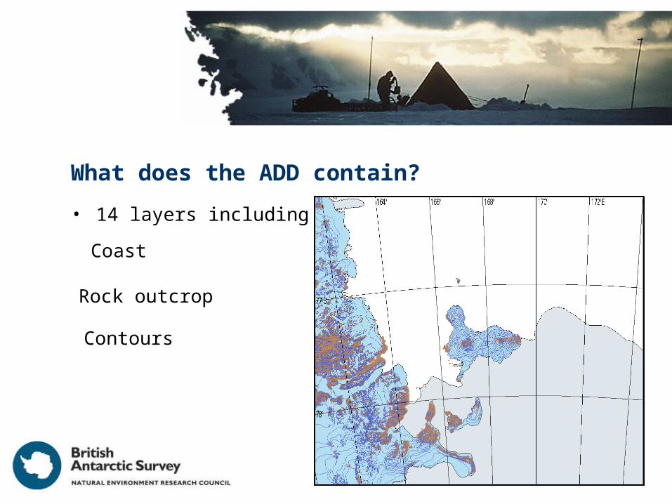
What does the ADD contain?
• 14 layers including
Coast
Rock outcrop
Contours

What are the ADD’s sources?
• Published maps– 7 nations supplied digital data.
– 3 nations gave permission for maps to be digitised.
• Ice sheets derived from SPRI folio– digitised from 1:3 000 000 compilation sheets.
• Coastline updated from remotely sensed images.
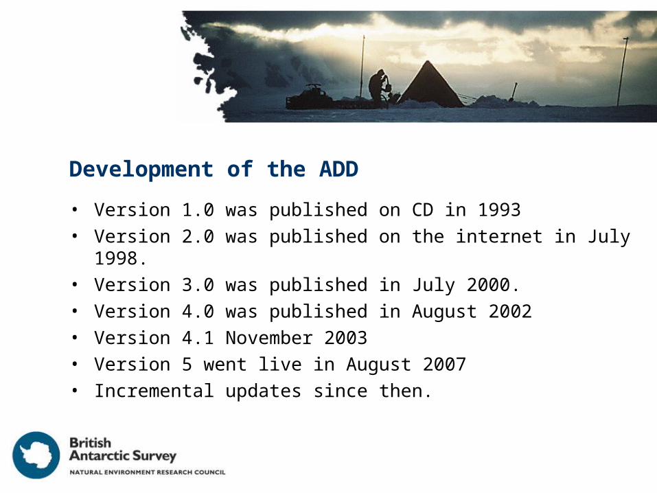
Development of the ADD
• Version 1.0 was published on CD in 1993• Version 2.0 was published on the internet in July 1998.• Version 3.0 was published in July 2000.• Version 4.0 was published in August 2002• Version 4.1 November 2003• Version 5 went live in August 2007• Incremental updates since then.

Version 2.0
• First version on the Internet– http://www.add.scar.org/
• Included many structural corrections.• Some new data between 0 and 90°W.

Version 3.0
• The first major upgrade to the content of the ADD• Ice sheet contours replaced
– Based on altimetric DEM provided by Byrd Polar Research Center.
– Result of collaboration between BPRC and BAS

Improved contours
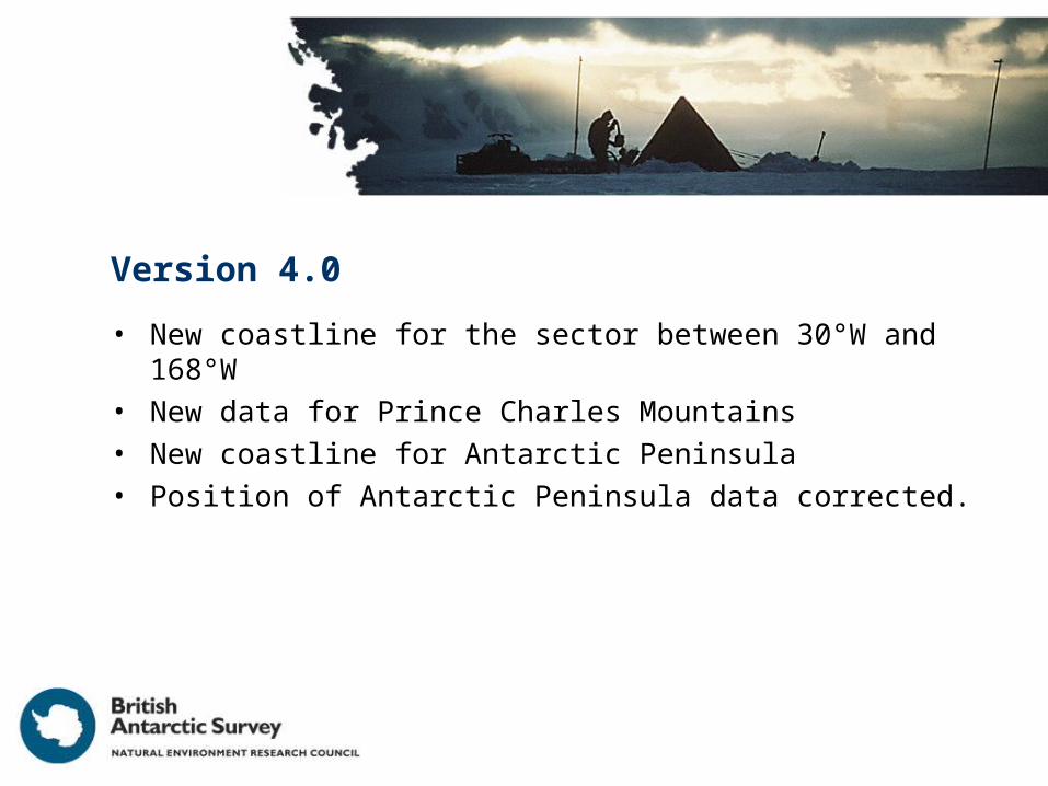
Version 4.0
• New coastline for the sector between 30°W and 168°W• New data for Prince Charles Mountains• New coastline for Antarctic Peninsula• Position of Antarctic Peninsula data corrected.

Version 4.1
• New rock outcrop for the Antarctic Peninsula.• Detailed corrections to coast in Antarctic Peninsula

Version 5.0
• Complete revision of the web site• Provision of Web Feature service• Provision of Web Map service• New data including:
– Coastal change in the Antarctic peninsula– Subantarctic Islands
• South Georgia• Heard and Macquarie Islands
• Made compatible with the Antarctic Spatial Data Infrastructure • Went “Live” in August 2007• Continuing incremental upgrades

ADD Data management
• Originally held as tiled ARC/INFO coverages• Still edited and maintained as coverages
– Maintained using ESRI software
• Working copy held in PostgreSQL/PostGIS

ADD and data standards
• ADD originated when there were no standards to follow!• Now provided in wide variety of OGC compliant formats including:
– WFS (OGC WMS 1.1.1)
– WMS (OGC WFS 1.0 )
– GML (ISO 19136 and OGC)
– KML (became OGC standard recently)
• Working towards compliance with:– ISO 19115 (Metadata)
– ISO 19110 (Antarctic Feature Catalogue, maintained by Australia)

Added Value Products
• Antarctic Maps for Garmin GPS– BAS has created maps for use in Garmin GPS with map display
• Hill shaded topography• Contours (labelled where accurate)• Rock outcrop• Coast, ice shelf, ice rumple
– Field tested 2008-2009 field season
– Modifications in line with experience being implemented
– Contact BAS for further information
– Will only be made available to experienced Antarctic operators.

The Future?
• Improve data content• Add new data layers• Improve access• Integrate with other data sources:
– Composite Gazetteer of Antarctica
– UK Antarctic Placenames Committee

Conclusions
• ADD provides the best topographic data for the whole of Antarctica.
• ADD provides the essential underpinning for:– Operations.
– Scientific investigations.
• ADD is an ongoing programme.– Mapping Antarctica is a work in progress!