Anjal prakash - Guwahati Dialogue, 10th September, 2013
17
Workshop on Transnational Policy Dialogue for Improved Water Governance of Brahmaputra River Anjal Prakash and Poulomi Banerjee September 10, 2013 Guwahati, India
-
Upload
saciwaters -
Category
Education
-
view
169 -
download
6
Transcript of Anjal prakash - Guwahati Dialogue, 10th September, 2013

Workshop on Transnational Policy Dialogue for Improved Water Governance of Brahmaputra River
Anjal Prakash and Poulomi Banerjee
September 10, 2013Guwahati, India


The Brahmaputra River Basin..
Principal arm of GBM System; Total basin area 651,335 sq kmTotal 58 tributaries (22 in Tibet, 33 in India and 3 in Bangladesh)
China (50%) India (33.6%) Bangladesh (8.1%), Bhutan(7.8%)
Highest specific discharge system in the world , highly braided channels, large flood prone areas, bank erosion, channel migration
Seismically unstable zone, part of indo-Burma bio diversity hotspots


Arunachal Pradesh(41.95), Assam (36.3%), Meghalaya(6.1%), Nagaland (5.6%), Sikkim (3.8%) west Bengal (6.3%)
Accounts 30% of the total water resources and 40 % of the hydel power potential of the country
Utilization is much less with <5% in hydropower, 10% in irrigation, 4% groundwater
Arunachal Pradesh (69350 sq km ) is the greenest state of the region; it has been called the State with highest hydropower potential of 50,000 MW
Assam is the worst flood affected state of the country with 15 major floods (1954-2012)
High dependence on agriculture, widespread practice of traditional farming, low usage of modern farm inputs, inadequate agricultural infrastructure, low productivity, low income
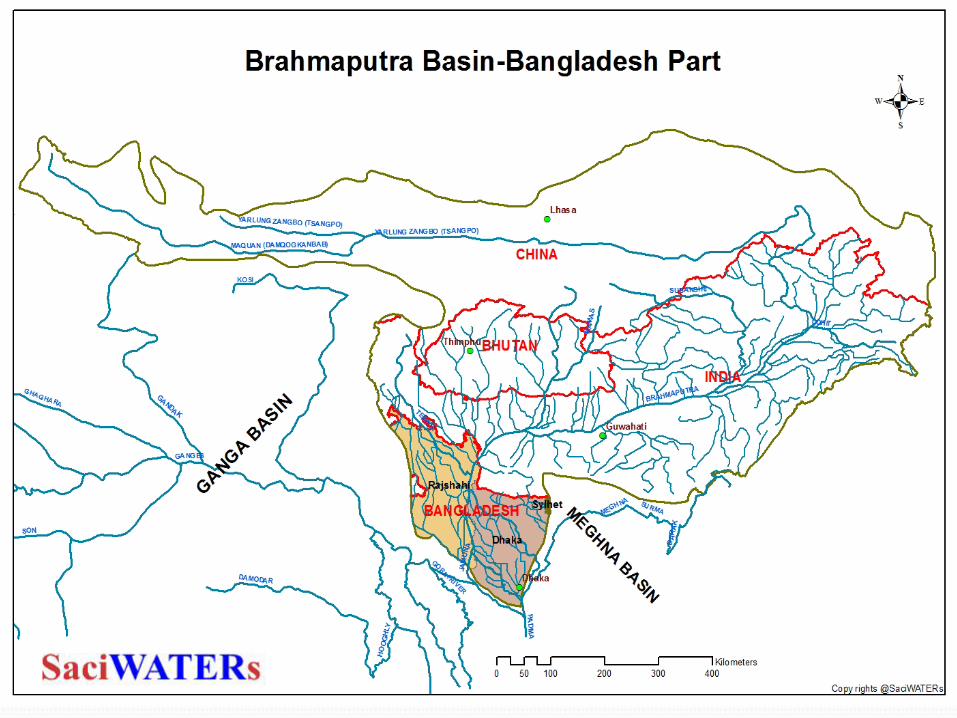


Some facts on Bangladesh part of Brahmaputra basin Brahmaputra-Jamuna system constitute of Rajshahi, Dhaka and
shyllet divisions of Bangladesh with total catchment area of 5,83,000 sq km
Enters at Kurigram district (at the border of Kurigram Sadar and Ulipur upazilas)
Brahmaputra-Jamuna is 276 km long, of which Brahmaputra is only 69 km
The Teesta is principal tributary inputs, while Old Brahmaputra and the Dhaleswari are major distributaries
Experiencing large-scale avulsion, widening and westerly migration and rapid bank erosion in response to large floods
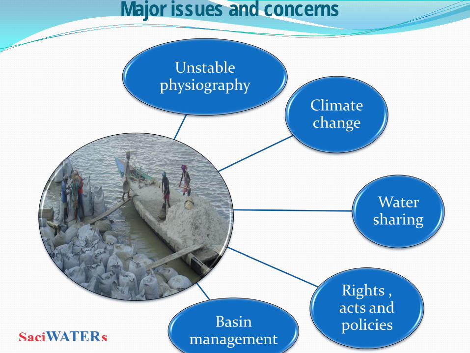
Major issues and concerns
Unstable physiography
Climate change
Water sharing
Rights , acts and policies Basin
management

physiographic conditions aggravated by climate change
Rising temperatures, recession of glaciers,
intense rainfall triggered by cloud burst impacting the entire eco and human
system
Districts of north east India ranked high in
agricultural, water and forest vulnerability index
High seismicity and sedimentation impacting
the hydrologic characteristics and
morphology of the river
Salt water ingression; sea level rise impacting the hydrology of the system
Floods and drought co-exist
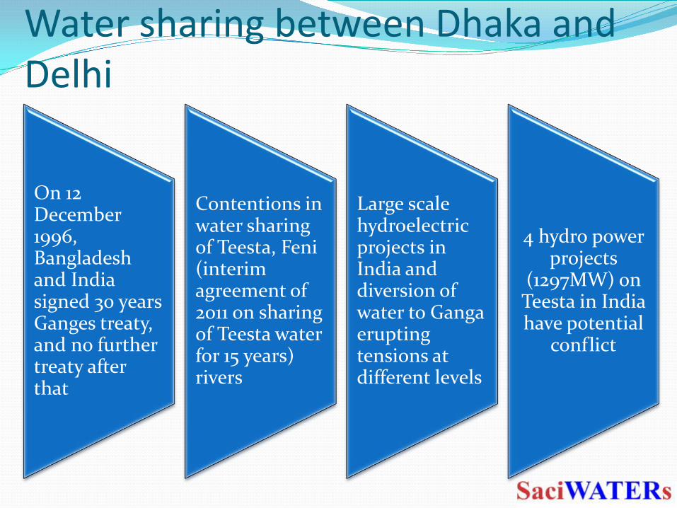
Water sharing between Dhaka and Delhi
On 12 December 1996, Bangladesh and India signed 30 years Ganges treaty, and no further treaty after that
Contentions in water sharing of Teesta, Feni(interim agreement of 2011 on sharing of Teesta water for 15 years) rivers
Large scale hydroelectric projects in India and diversion of water to Ganga erupting tensions at different levels
4 hydro power projects
(1297MW) on Teesta in India have potential
conflict

Issues for regional cooperation on water sharing
Lack of bilateral/multilateral agreements, treaties(none of the riparian countries signed the UN water convention 1997)
Lack of apathy of the government to understand the fragility of the system, widespread corruption, deteriorating law and order and lack of transparency
Technological biasness (India largely focusing on hydro-power ) and its slow reach of leading to poor adaption
Lack of sharing of scientific information, lack of joint researches
Modification of river flow due to barrage, sluice gate and water retention structures affecting connectivity and river depth

Way forwards..
Hydro-diplomacy and consultation
backed by technical
knowledge to manage riparian
relations between the two
Shift from the issue being bilateral to
multilateral
Co-management of the Brahmaputra
River in integrated framework
Track III and IV diplomacy
required to build confidence
between two countries

Thank You

Actor and Stakeholders’ mapping for Organisations\institutions that influence the
management of Brahmaputra River
Key actors What is their mandate?
How interested they are in the management? (High, Med, Low)
How much power do they have?(High, Med, Low)
Degree of involvement(Active, Passive, Fence sitter)
Key means to influence them?
Policy MakersExecutorsUsersExperts