An analysis of observed daily maximum wind gusts in the UK · 2012-10-16 · An analysis of...
12
An analysis of observed daily maximum wind gusts in the UK Richard Hewston a,n , Stephen R. Dorling b a Department of Meteorology, University of Hawaii at Manoa, Honolulu, HI, USA b School of Environmental Sciences, University of East Anglia, Norwich, UK article info Article history: Received 7 May 2010 Received in revised form 28 April 2011 Accepted 6 June 2011 Available online 28 June 2011 Keywords: Wind gusts PRECIS Dynamical downscaling Climate variability abstract The greatest attention to the UK wind climatology has focused upon mean windspeeds, despite a knowledge of gust speeds being essential to a variety of users. This paper goes some way to redressing this imbalance by analysing observed daily maximum gust speeds from a 43-station network over the period 1980–2005. Complementing these data are dynamically downscaled reanalysis data, generated using the PRECIS Regional Climate Modelling system, for the period 1959–2001. Inter-annual variations in both the observed and downscaled reanalysis gust speeds are presented, with a statistically significant (at the 95% confidence interval) 5% increase across the network in daily maximum gust speeds between 1959 and the early 1990s, followed by an apparent decrease. The benefit of incorporating dynamically downscaled reanalysis data is revealed by the fact that the decrease in gust speeds since 1993 may be placed in the context of a very slight increase displayed over the longer 1959–2001 period. Furthermore, the severity of individual windstorm events is considered, with high profile recent events placed into the context of the long term record. A daily cycle is identified from the station observations in the timing of the daily maximum gust speeds, with an afternoon peak occurring between 12:00–15:00, exhibiting spatial and intra-annual variations. & 2011 Elsevier Ltd. All rights reserved. 1. Introduction While the surface mean wind regime of the UK is reasonably well documented (Barrow and Hulme, 1997; Palutikof et al., 1997; Sinden, 2005), literature regarding observed gust speeds is rather sparse. It is desirable to first establish the difference between mean windspeed and gust speed. The World Meteor- ological Organisation refers to mean windspeeds as the average windspeed recorded over a 10- to 60-min period, while gust speeds are typically measured over 2–3 s (WMO, 2008). Long, continuous, homogeneous records of both mean windspeeds and gust speeds in Europe, though highly desirable, are largely unavailable (Rockel and Woth, 2007). A knowledge of the local characteristics of gust speeds is directly relevant, for example, to those involved in the design of structures (Ambrose and Vergun, 1995), sailing activities (Spark and Connor, 2004; Strefford, 2002), wind energy (Pryor et al., 2005; Sinden, 2007), the insurance sector (Klawa and Ulbrich, 2003; Leckebusch et al., 2007), aviation (Manasseh and Middleton, 1999), the forestry industry (Usbeck et al., 2010) and those considering the effects of wind driven rain (Choi, 1997). The Association of British Insurers estimates that average annual insured losses from wind-related domestic property damage in the UK are in excess of £340 m (ABI, 2005), with over 200,000 properties suffering damage each year (Blackmore and Tsokri, 2004). The impact of windstorms on the UK is significant, with record economic losses in the region of £5bn (in 2011 values) for the 16th October 1987 event (Munich Re, 1999). Wind damage, and subsequently insured loss, is disproportionately related to the peak gust speed of a storm (Munich Re, 2002; Spence et al., 1998), with Hawker (2007) reporting that a 25% increase in peak gust speed can result in a 650% increase in damage. Compounding this is the increase in the number of people living in areas at risk from windstorm damage (ABI, 2005; IPCC, 2007). The effect of wind gusts on structures (gust loading) has traditionally been assessed by multiplying the mean wind force by a Gust Loading Factor (Kareem and Zhou, 2003). Wind loading effects over the course of a lifetime of a structure have long been a subject of research and design codes (e.g. the Eurocode for wind loading BSEN 1991-1-4). The majority of research into the effects of extreme wind and gust speeds on structures utilise statistical methods (Bierbooms and Cheng, 2002; Cook, 1982; Pandy et al., 2001; Bierbooms et al., 2001), in order to establish values with return periods in excess of several hundred years (which clearly exceed the length of any observational records). Temporal trends in gust speeds may be of particular impor- tance to several sectors, including those involved in the design Contents lists available at ScienceDirect journal homepage: www.elsevier.com/locate/jweia Journal of Wind Engineering and Industrial Aerodynamics 0167-6105/$ - see front matter & 2011 Elsevier Ltd. All rights reserved. doi:10.1016/j.jweia.2011.06.004 n Corresponding author. Tel.: þ1 808 956 4593; fax: þ1 808 956 2877. E-mail address: [email protected] (R. Hewston). J. Wind Eng. Ind. Aerodyn. 99 (2011) 845–856
Transcript of An analysis of observed daily maximum wind gusts in the UK · 2012-10-16 · An analysis of...

J. Wind Eng. Ind. Aerodyn. 99 (2011) 845–856
Contents lists available at ScienceDirect
Journal of Wind Engineeringand Industrial Aerodynamics
0167-61
doi:10.1
n Corr
E-m
journal homepage: www.elsevier.com/locate/jweia
An analysis of observed daily maximum wind gusts in the UK
Richard Hewston a,n, Stephen R. Dorling b
a Department of Meteorology, University of Hawaii at Manoa, Honolulu, HI, USAb School of Environmental Sciences, University of East Anglia, Norwich, UK
a r t i c l e i n f o
Article history:
Received 7 May 2010
Received in revised form
28 April 2011
Accepted 6 June 2011Available online 28 June 2011
Keywords:
Wind gusts
PRECIS
Dynamical downscaling
Climate variability
05/$ - see front matter & 2011 Elsevier Ltd. A
016/j.jweia.2011.06.004
esponding author. Tel.: þ1 808 956 4593; fax
ail address: [email protected] (R. Hewston
a b s t r a c t
The greatest attention to the UK wind climatology has focused upon mean windspeeds, despite a
knowledge of gust speeds being essential to a variety of users. This paper goes some way to redressing
this imbalance by analysing observed daily maximum gust speeds from a 43-station network over the
period 1980–2005. Complementing these data are dynamically downscaled reanalysis data, generated
using the PRECIS Regional Climate Modelling system, for the period 1959–2001. Inter-annual variations
in both the observed and downscaled reanalysis gust speeds are presented, with a statistically
significant (at the 95% confidence interval) 5% increase across the network in daily maximum gust
speeds between 1959 and the early 1990s, followed by an apparent decrease. The benefit of
incorporating dynamically downscaled reanalysis data is revealed by the fact that the decrease in gust
speeds since 1993 may be placed in the context of a very slight increase displayed over the longer
1959–2001 period. Furthermore, the severity of individual windstorm events is considered, with high
profile recent events placed into the context of the long term record. A daily cycle is identified from the
station observations in the timing of the daily maximum gust speeds, with an afternoon peak occurring
between 12:00–15:00, exhibiting spatial and intra-annual variations.
& 2011 Elsevier Ltd. All rights reserved.
1. Introduction
While the surface mean wind regime of the UK is reasonablywell documented (Barrow and Hulme, 1997; Palutikof et al.,1997; Sinden, 2005), literature regarding observed gust speedsis rather sparse. It is desirable to first establish the differencebetween mean windspeed and gust speed. The World Meteor-ological Organisation refers to mean windspeeds as the averagewindspeed recorded over a 10- to 60-min period, while gustspeeds are typically measured over 2–3 s (WMO, 2008). Long,continuous, homogeneous records of both mean windspeeds andgust speeds in Europe, though highly desirable, are largelyunavailable (Rockel and Woth, 2007). A knowledge of the localcharacteristics of gust speeds is directly relevant, for example, tothose involved in the design of structures (Ambrose and Vergun,1995), sailing activities (Spark and Connor, 2004; Strefford, 2002),wind energy (Pryor et al., 2005; Sinden, 2007), the insurancesector (Klawa and Ulbrich, 2003; Leckebusch et al., 2007), aviation(Manasseh and Middleton, 1999), the forestry industry (Usbecket al., 2010) and those considering the effects of wind driven rain(Choi, 1997).
ll rights reserved.
: þ1 808 956 2877.
).
The Association of British Insurers estimates that average annualinsured losses from wind-related domestic property damage in theUK are in excess of £340 m (ABI, 2005), with over 200,000 propertiessuffering damage each year (Blackmore and Tsokri, 2004). Theimpact of windstorms on the UK is significant, with record economiclosses in the region of £5bn (in 2011 values) for the 16th October1987 event (Munich Re, 1999). Wind damage, and subsequentlyinsured loss, is disproportionately related to the peak gust speed of astorm (Munich Re, 2002; Spence et al., 1998), with Hawker (2007)reporting that a 25% increase in peak gust speed can result in a 650%increase in damage. Compounding this is the increase in the numberof people living in areas at risk from windstorm damage (ABI, 2005;IPCC, 2007).
The effect of wind gusts on structures (gust loading) hastraditionally been assessed by multiplying the mean wind forceby a Gust Loading Factor (Kareem and Zhou, 2003). Wind loadingeffects over the course of a lifetime of a structure have long been asubject of research and design codes (e.g. the Eurocode for windloading BSEN 1991-1-4). The majority of research into the effectsof extreme wind and gust speeds on structures utilise statisticalmethods (Bierbooms and Cheng, 2002; Cook, 1982; Pandy et al.,2001; Bierbooms et al., 2001), in order to establish values withreturn periods in excess of several hundred years (which clearlyexceed the length of any observational records).
Temporal trends in gust speeds may be of particular impor-tance to several sectors, including those involved in the design
R. Hewston, S.R. Dorling / J. Wind Eng. Ind. Aerodyn. 99 (2011) 845–856846
and construction of structures. A limited number of studiesconsider the historic variability of the upper percentiles ofobserved (Hanson and Goodess, 2004) and modelled (Knippertzet al., 2000; Rockel and Woth, 2007) mean windspeeds but notgust speeds, nor do they consider any pattern to the time of theday when these high windspeeds tend to occur or the associatedwind directions. The time of the day that the highest meanwindspeeds and gust speeds are recorded can significantly influ-ence the severity of their impact. For example, casualties duringthe 16th October 1987 windstorm in the UK would likely havebeen substantially greater had the peak windspeeds occurredduring daylight hours, when more people would have beenoutside and/or travelling (Baxter et al., 2001). Preferred winddirections associated with the highest gust speeds may also haveimplications in the design of the built environment.
In order to remedy the lack of a documented gust speeddatabase for the UK, a long, continuous record of gust speeds ispresented here for a network of 43 stations. Unlike existingrecords, this paper focuses upon long-term measurements ofwind gusts rather than mean windspeeds, which are of directrelevance to several sectors. In addition to observed gust speeds,dynamically downscaled data generated by a regional climatemodel are also considered, permitting an analysis of the UK windgust regime back to 1959. Dynamical downscaling is a method ofgenerating high-resolution climate information from relativelycoarse-resolution global climate models (GCMs). Typical GCMspatial resolutions exceed 200 km, while many impact modelsrequire information at a scale of 50 km or less, thus necessitatingan approach to estimate finer-scale information. Dynamicaldownscaling utilises a limited-area, high-resolution model (aregional climate model, or RCM) driven by boundary conditionsfrom a GCM to derive more detailed finer-resolution information.
The following section describes the data and methodology,including a discussion of how the modelled windspeed data aregenerated. Inter- and intra-annual temporal and spatial variationsin gust speeds are identified and quantified in Section 3, inaddition to several notable features of the wind gust regime.The final section summarises the outcomes, draws a number ofconclusions, and highlights potential applications of the datasetestablished here.
2. Methods and materials
2.1. Observed wind data
This study analyses hourly surface windspeed observations (mea-sured at the standard 10-metre height) from 43 UK Met Officestations across the UK over the period 1980–2005. Wind data wereextracted from two UK Met Office datasets: the Met Office LandSurface Data (UK Met Office, 2006b) and Met Office Integrated DataArchive System (MIDAS) Land Surface Observations Station data(UK Met Office, 2006a), stored at the British Atmospheric Data Centre.The daily maximum gust speed (DMGS), i.e. the highest gust speedobserved in the period 00:00–23:59 UTC each day, is extracted foreach station, along with the associated hour of occurrence and winddirection. The ‘‘gust speed’’ measurement is in fact a 3-s averagewindspeed, with the Met Office observing stations typically reportingthe maximum value recorded in each hour. Given the nature of thisdiscourse, it is important to differentiate between the gust speedsanalysed here and ‘‘extreme windspeeds’’ discussed elsewhere in theliterature (e.g. Hanson and Goodess, 2004; Hanson et al., 2004;Leckebusch and Ulbrich, 2004; Rockel and Woth, 2007). Extremewindspeeds generally refer to the upper percentiles (e.g. 95th or 98th)of mean windspeeds (usually a 10-min average windspeed). Section 3of this paper includes a discussion of extreme DMGS, hereby defined
as the 98th percentile of DMGS, which by definition refers to the 190days in the 1980–2005 record with the highest observed gust speeds.The 98th percentile threshold is specifically selected as it is ofparticular importance to those considering the various wind applica-tions previously described. The 98th percentile value of DMGS hasbeen shown to be related to wind damage and subsequent insuredloss in Germany (Klawa and Ulbrich, 2003) and Great Britain(Hewston, 2008).
Due to changes in the UK Met Office monitoring networkthroughout the years, a small percentage of gust speeds are measuredover 1.5 s (e.g. manually analysed anemographs and certain auto-matic weather stations). However, due to scaling errors (of approxi-mately 5%) in some automatic weather stations the differencebetween the 3-s measurement and 1.5-s measurement may be offset(UK Met Office, 2007). Furthermore, calibration errors (likely in theregion of 5%) in manually derived anemographs exist, which againmay offset the reduced measurement period (UK Met Office, 2007).A lack of meta-data prevents the identification of periods when theseerrors may have occurred. However, given that these errors arewithin the bounds of the maximum measurement error of 10%stipulated by the UK Met Office, in conjunction with the lack ofmeta-data, no data transformation is applied to account for thesepotential inhomogeneities.
Station moves are common within the UK Met Office network.Several stations with documented moves were excluded from thisstudy following the discovery of inhomogeneities in the windspeedrecords. However, two stations with documented moves wereretained since no statistically significant differences could be foundin the windspeed data before and after their relocation. This is likelydue to the short distance of the station displacement (less than200 metres in both cases). A further source of inhomogeneity may liein the changing instrumentation throughout the years. However, thisis generally restricted to issues of anemometer start-up speeds, andtherefore redundant when considering DMGS, as these are, bydefinition, at the high end of the gust speed distribution. Thedifficulties of establishing a long, homogeneous record of windspeed,briefly highlighted here, are well understood, and further detailed byBest et al. (2008), Usbeck et al. (2010) and Tuller (2004) amongstothers. Overall, the errors in the data appear to be less than 10%, theupper UK Met Office limit of error, which should be borne in mindduring the interpretation of the results.
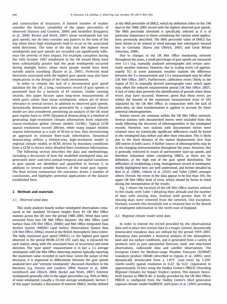
Fig. 1 shows the location of the UK Met Office stations utilisedin this study, with Table 1 detailing their altitude and the numberof days with missing data. Stations with greater than 5% ofmissing days were removed from the network. One exception,Durham, exceeds this threshold, but is retained due to the dearthof windspeed information in the north-east of England.
2.2. Regional climate model wind data
In order to extend the record provided by the observationaldata and to place this station data in a longer context, dynamicallydownscaled reanalysis data are utilised for the period 1959–2001.Reanalysis data provides a historical analysis of the atmosphere,land and sea surface conditions, and is generated from a variety ofproducts such as past operational forecasts, land- and ship-basedobservations, radiosonde data and satellite observations. TheEuropean Centre for Medium-range Weather Forecasts (ECMWF)reanalysis product, ERA40 (described in Uppala et al., 2005), weredynamically downscaled from a 1.8751 (east–west) by 1.2501(north–south) spatial resolution to 0.221 by 0.221 (equivalent toapproximately 25 km) using the Hadley Centre’s PRECIS (ProvidingREgional Climates for Impact Studies) system. This dataset, hence-forth known as PRECIS-Re, is kindly provided by the UK Met Office.PRECIS is configured from the Hadley Centre’s third generationregional climate model HadRM3P, with Jones et al. (2004) providing

Table 1Elevation and data capture of wind monitoring network.
No. Station Elevation(m above sea level)
% Missing days
1 Culdrose 78 3.61
2 Camborne 87 0.04
3 Plymouth Mountbatten 50 1.33
4 St Mawgan 103 0.01
5 Hurn 10 3.71
6 Yeovilton 20 1.12
7 Chivenor 6 3.29
8 Middle Wallop 90 0.47
9 East Malling 33 2.32
10 Manston 44 0.51
11 Heathrow 25 0.28
12 Lyneham 145 1.95
13 Wattisham 89 0.01
14 Aberporth 115 0.14
15 Bedford 85 0.88
16 Wittering 73 0.49
17 Coltishall 17 0.19
18 Shawbury 72 3.39
19 Bala 163 2.83
20 Nottingham Watnall 117 0.22
21 Cranwell 62 0.36
22 Coningsby 6 1.21
23 Waddington 68 0.22
24 Valley 10 0.4
25 Ringway 69 1.18
26 Blackpool Squires Gate 10 1.39
27 Bingley 262 3.04
28 Church Fenton 8 0.52
29 Ronaldsway 16 0.18
30 Leeming 32 0.2
31 Aldergrove 68 0.41
32 Durham 102 7.57
33 West Freugh 11 0.06
34 Eskdalemuir 242 0.48
35 Machrihanish 10 0.2
36 Salsburgh 277 2.53
37 Leuchars 10 0.43
38 Dunstaffnage 3 1.76
39 Kinloss 5 3.78
40 Lossiemouth 6 0.03
41 Stornoway Airport 15 0.28
42 Kirkwall 26 0.65
43 Lerwick 82 0.15
Fig. 1. Location of stations in wind monitoring network.
R. Hewston, S.R. Dorling / J. Wind Eng. Ind. Aerodyn. 99 (2011) 845–856 847
a thorough description of the system and full technical details of themodel. HadRM3P does not incorporate gust parameterisation,instead a daily maximum windspeed is output based on the 5762.5-min mean windspeeds simulated for each day. While themagnitude of daily maximum windspeeds simulated by regionalclimate models is underestimated in comparison to observations,they do provide a reasonable proxy when considering temporaltrends (Jungo et al., 2002; Leckebusch et al., 2006).
It is instructive here to consider the relative strengths andweaknesses of the observed and PRECIS-Re datasets. Surfacewindspeeds in reanalysis data are largely governed by modelphysics and the observational data assimilated into the reanalysismodel. Although downscaling results in a significant increase inresolution, the PRECIS model still simulates windspeeds at aspatial resolution (25 km) that does not completely resolve smallscale features at the surface (e.g. convective turbulent effects,small scale eddies and channelling of flow in urban environ-ments). Such features are more likely to be captured in theobserved dataset. However, observed data may be subject toinhomogeneities due to instrumental changes, stations moves,land use changes, and missing data. With careful quality controlby the UK Met Office and the authors the observational datautilised in this study may be considered as being largely free ofsuch inhomogeneities.
The comparison of gridded climate model data to station observa-tions carries with it its own limitations, described by Moberg andJones (2004) and Osborn and Hulme (1997) amongst others. In orderto directly compare gridded data with station observations, data areextracted from the grid cell whose centre has the nearest coordinatesto the observation station. If that grid cell is ‘‘wet’’ (i.e. over the modelsea) then data from the nearest ‘‘dry’’ (land) grid cell is utilised (butnot one which is more than two moves north–south or east–west).PRECIS-Re is subsequently presented and discussed in terms of
stations (directly comparable to the observation stations), althoughclearly the values represent those of whole grid-cells. It is not theintention here to thoroughly assess the reliability of the downscalingprocess, but merely to utilise the data in order to extend the gustspeed record prior to 1980.
3. Results and discussion
3.1. Geographic variation of DMGS
The highest recorded gust speed in the 1980–2005 period inthe monitoring network of 43 stations analysed here is the50 ms�1 gust recorded at Kirkwall (station 42), Orkney on 29thJanuary 2000. This figure may be compared with other stationrecords (which are not considered here due to length of recorddiscrepancies); the record low-altitude gust speed published bythe UK Met Office is 63.3 ms�1 at Fraserburgh, Aberdeenshire, on13th February 1989, while the record high-altitude value is77.3 ms�1 at Cairngorm (1245 m above sea level), on 20th March1986 (UK Met Office, 2010). During the course of the studyAberporth (14), Lerwick (43), Salsburgh (36) and Stornoway

Fig. 2. Boxplot of DMGS recorded across the wind monitoring network. The
minimum and maximum values are indicated by the ends of the whiskers, with
the mean, 25th and 75th percentile values marked by the middle, lower and upper
part of the box, respectively.
R. Hewston, S.R. Dorling / J. Wind Eng. Ind. Aerodyn. 99 (2011) 845–856848
Airport (41) all recorded gusts exceeding 45 ms�1. Fig. 2 presents arange of DMGS statistics for each of the stations in the network. Thedirections from which the DMGS originated at each station, a sampleof which are presented in Fig. 3, are dominated by the south-westsector of the compass. Station mean values vary from 1891 to 2161,and in this respect DMGS wind roses show little difference to meanwindspeed roses. If only extreme DMGS values (i.e. those exceedingthe 98th percentile, and shown to be related to structural damage)are considered a similar pattern is revealed by the wind roses,although the prevalence of DMGSs in the south-west sector is evenmore pronounced.
Geographic variations of DMGS (and indeed extreme DMGS)are partly dictated by the proximity of stations to the coast, inparticular the west coast (despite an east coast station, Kirkwall,recording the highest maximum gust speed); higher gust speedsare recorded at stations located on the south-west Englandpeninsular and the Welsh and Scottish coasts, compared to thoserecorded further inland. These results are expected since reducedfriction over the sea results in increased windspeeds on the coast,given an appropriate fetch. These results are in line with spatialvariations of mean windspeeds across the UK described byPalutikof et al. (1997) and Wheeler and Mayes (1997). This offers
some validation to the quality of the dataset, and the network ofstations, utilised here.
Inland, gust speeds are generally lowest in the south-east region ofEngland, and increase with latitude. However, the prominence ofcoastal stations in Scotland (there are only two inland Scottishstations in the network considered here) acts to mask latitudinalvariations. Stations located at higher latitudes tend to be exposed to agreater number of extratropical cyclones, and subsequently recordhigher DMGS values; baroclinic zones along the polar front promotecyclone development, which then track across the North Atlantic withtheir centres commonly following a path between Scotland andIceland. This is not to say southern parts of the UK are exempt fromdamaging windspeeds, as testified by the October 1987 storm.However, return periods for high windspeeds tend to be lower withincreasing latitude. For a more thorough description of the temporaland spatial variations of the North Atlantic storm track readers aredirected to Rogers (1997) and Dacre and Gray (2009) and referencestherein.
3.2. Temporal variations of DMGS
It is common in the wind energy sector to use ‘‘wind indices’’to assess long term wind variation (e.g. Garrad Hassan, 2010;Windmonitor, 2010). Such an index enables temporal variationsacross a number of stations to be assessed, without the inherentspatial variation in windspeeds unduly impacting the results. In orderto assess the long-term variation in DMGS values across the network,annual means of DMGS are calculated for each station. In order thatgeographic variations in absolute DMGS values do not unduly bias theresults, annual mean values are compared to the long-term average(1980–2001). These annual anomalies are subsequently averagedacross the network, and presented in the form of percentages inFig. 4, and as such may be directly comparable to wind indices.Positive values indicate stronger than average gust speeds, andnegative values imply below average gust speeds.
Trends in the annual anomalies of PRECIS-Re and observedgust speeds between 1980 and 2001, shown in Fig. 4, correlatewell (R2
¼0.83), enhancing confidence in the PRECIS-Re valuesprior to 1980. A clear downturn can be seen since 1993, withobserved values dropping more than 6% by 2005, compared to thelong term average. This trend is in line with Atkinson et al. (2006)and Boccard (2009), who also identify a drop in windspeedsacross Europe between the early 1990s and 2005. It is of interestto note that annual anomalies of extreme DMGS (not shown) (i.e.just the top 2% of DMGS) reveal a very similar pattern, with nearlya 15% decrease from 1993 to 2005 in the observed values, whilethe PRECIS-Re value drops 5% between 1993 and 2001. This peakin gust speeds in the early 1990s is in line with Usbeck et al.(2010) who, for the period 1931–2007, report a peak in the early1990s in the number of days on which the highest maximum gustspeeds occurred in Zurich.
Across the station network observed DMGS values display aslight, but statistically significant, decline of 5% (equivalent to0.02 ms�1 per year) from 1980 to 2005 (statistical significance isconsidered at the 95% confidence interval throughout this paper).Observed DMGS trends downward at 35 stations (of which 12exhibit statistically significant decreases), while significantupward trends are found at two stations. There appears to beno coherent spatial pattern in these trends with significantdecreases seen at stations across the UK, while the two statisti-cally significant increases occur at Culdrose (1) and Heathrow(11). For comparison, over a similar period (limited to 1980–2001by data availability) PRECIS-Re data also suggest a similar declinein DMGS values. However, over the longer 1959–2001 periodPRECIS-Re data reveal an increase in values at all locations, withthe network as a whole exhibiting a statistically significant 3%

Fig. 3. Wind roses of DMGS at select stations from the wind monitoring network.
R. Hewston, S.R. Dorling / J. Wind Eng. Ind. Aerodyn. 99 (2011) 845–856 849
increase (equivalent to 0.01 ms�1 per year). The greatestincreases are found at locations in northern England and inScotland. The period over which inter-annual variations areconsidered is crucial with regard to the evidence and robustnessof the trends identified here.
Long-term seasonal variations in DMGS values are also evi-dent. Between 1980 and 2005, autumn (September–November)observed DMGS values decrease by 8% (0.04 ms�1 per year), withover a quarter of the stations displaying statistically significantdecreases. The majority of these stations are located in Scotland,with two in Cornwall and three in central and northern England.Significant decreases are found at 8 stations in summer (June–August) and 7 stations in spring (March–May), with winter(December–February) exhibiting the weakest downward trendin DMGS values, with only 3 stations showing significantdecreases and one showing a significant increase. The stationsexhibiting decreases in spring, summer and winter mean valuesgenerally correspond with those showing the decreasing trends inautumn described above. Meanwhile, long-term variation in
winter and autumn values of DMGS in the PRECIS-Re data appearto be the drivers in the upward trend of annual values, withincreases found at all stations in these seasons between 1959and 2001.
If only extreme DMGS are considered observed values indicatea (statistically insignificant) decline of 8% (0.08 ms�1 per year)between 1980 and 2005. Of the 38 stations exhibiting downwardtrends 12 show significant decreases. Six of these stations arelocated in southern England, with five in northern England andsouthern Scotland. The greatest decreases in these stations areshown in southern England at Camborne (2) (0.21 ms�1 per year),St Mawgan (4) (0.10 ms�1 per year), East Malling (9) (0.14 ms�1
per year) and Manston (10) (0.19 ms�1 per year).In the period 1980–2001 extreme DMGS values in the PRECIS-Re
dataset suggest no spatially coherent long-term trend across the UK,with network annual mean value increasing less than 0.004 ms�1 peryear. However between 1959 and 2001 a (statistically insignificant)decrease of 6% in extreme DMGS values is seen (equivalent to adecrease of 0.02 ms�1 per year).

-10
-8
-6
-4
-2
0
2
4
6
8
10
1959
1961
1963
1965
1967
1969
1971
1973
1975
1977
1979
1981
1983
1985
1987
1989
1991
1993
1995
1997
1999
2001
2003
2005
Ann
ual A
nom
aly
(%)
Observations Observations (5-year moving average)PRECIS-Re PRECIS-Re (5-year moving average)
Fig. 4. Network average annual anomaly (%) of DMGS.
0
100
200
300
400
500
600
700
1959
1961
1963
1965
1967
1969
1971
1973
1975
1977
1979
1981
1983
1985
1987
1989
1991
1993
1995
1997
1999
2001
2003
2005
Num
ber o
f day
s re
cord
ing
extre
me
DM
GS
Observed PRECIS-Re
Fig. 5. Number of days per year on which extreme DMGS (i.e. those in the top 2 percentile) are recorded.
R. Hewston, S.R. Dorling / J. Wind Eng. Ind. Aerodyn. 99 (2011) 845–856850
Further examination of the inter-annual trends in observedand PRECIS-Re DMGS values reveal that they are largely driven bywinter values. Winter is also the dominant season for theoccurrence of extreme gusts, with 59% (63%) of observed (PRE-CIS-Re) extreme DMGSs occurring in this season. A major mode ofatmospheric variability in the Northern Hemisphere is the NorthAtlantic Oscillation (NAO), which exhibits strong inter-decadalvariability. The strength of the NAO is assessed using an indexbased on the difference between the normalised sea level pres-sure between Gibraltar and Southwest Iceland (Jones et al., 1997).Inter-annual variations in observed and PRECIS-Re DMGS areconsistent with known NAO variations. Generally, a more positiveNAO index coincides with higher DMGS values; logical given thatduring this phase the prevailing westerly winds are stronger.Although a thorough investigation of this relationship is beyondthe scope of this paper the upward trend in the NAO indexbetween the late 1960s and early 1990s, linked to increases ingeostrophic windspeeds in that period (Alexandersson et al.,2000; Matulla et al., 2007), is likely driving the upward trendshown by the PRECIS-Re data.
Observed DMGS values are lowest in 1987, with the annualmean anomaly 1.5 ms�1 (equivalent to 9.5%) below the long termaverage, while extreme values are nearly 3 ms�1 below average.The Great Storm of 16th October 1987 set records for insured lossin the UK, causing extensive structural damage across largeswaths of the UK. Results presented here suggest gust speedswere markedly below average that year, and this may havecontributed to the degree of damage experienced during thestorm, with structures and trees not recently exposed to highwindspeeds.
While the analysis of annual mean anomalies of DMGS providevaluable information, it is also informative to consider theinterannual variability of the occurrence of extreme DMGSs.Fig. 5 shows the number of days per year on which the extremeDMGSs (i.e. the highest 2%) occur. Yet again a maximum isreached in the early 1990s in both the observed and PRECIS-Revalues. However, it is interesting to note that while several of thepeaks in Fig. 5 match those in Fig. 4 (e.g. 1974 and 1990), thereare several years when this is not the case (e.g. 1962 and 1993). Itseems that in these years, despite having below average DMGS, an

R. Hewston, S.R. Dorling / J. Wind Eng. Ind. Aerodyn. 99 (2011) 845–856 851
above average number of extreme DMGS occurred. To emphasisethis the UK experienced a severe windstorm in January 1962,which caused extensive structural damage (Palutikof et al., 1997;Lamb and Frydendahl, 1991). This demonstrates that even in an‘‘average’’ year in terms of wind gust speeds (the 1962 annual meanDMGS anomaly is þ0.6%) the potential for structural damageresulting from high windspeeds is not necessarily reduced.
Fig. 5 demonstrates that PRECIS-Re is skilful in accuratelycapturing inter-annual variations in the frequency of high-per-centile gusts, with respect to observations. Nevertheless it shouldbe noted that negative biases in the absolute magnitude ofPRECIS-Re DMGS, arising largely from unresolved small-scaleprocesses, are significant (approaching 40%) and are analysedand discussed in detail by Hewston (2008). As outlined inSection 2.2, reliably modelling maximum gust speeds with RCMspresents a major challenge due to the length of the modeltimesteps involved. Methodologies to derive gust speeds fromRCM output, through gust parameterisation and, or in combina-tion with, statistical methods, are largely based on the surfacemean windspeed variable (Cvitan, 2003; Goyette et al., 2003;Pinto et al., 2009a). Values of surface windpseed, and theirvariability, are generally reliably captured by RCMs, and therefore
0
5000
10000
15000
20000
25000
30000
35000
40000
00:0
0-00
:59
01:0
0-01
:59
02:0
0-02
:59
03:0
0-03
:59
04:0
0-04
:59
05:0
0-05
:59
06:0
0-06
:59
07:0
0-07
:59
08:0
0-08
:59
09:0
0-09
:59
10:0
0-10
:59
11:0
0-11
:59
Freq
uenc
y (a
ll D
MG
S)
Tim
DMGS Extreme DMGS
Fig. 6. Daily variation in the time of occurrence of observed DMGS (bars) an
0
2000
4000
6000
8000
10000
12000
00:0
0-00
:59
01:0
0-01
:59
02:0
0-02
:59
03:0
0-03
:59
04:0
0-04
:59
05:0
0-05
:59
06:0
0-06
:59
07:0
0-07
:59
08:0
0-08
:59
09:0
0-09
:59
10:0
0-10
:59
Freq
uenc
y
Winter Summer
Fig. 7. Daily variation in the time of occurrence of winter (black) and summ
analyses of relative (rather than absolute) trends in model gustspeeds may be considered indicative of trends in observed gusts(Leckebusch et al., 2006).
3.3. Time of occurrence of DMGS
The hour in which the DGMS is recorded each day, at every stationin the period 1980–2005, is shown in Fig. 6. A clear and smoothdiurnal cycle is evident, with prominent peaks at 13:00–15:00 and23:00–01:00 UTC. The average DMGS recorded in each time bandranges from 11.8 ms�1 (at 15:00–15:59) to 14.6 ms�1 (04:00–04:59).If this analysis is limited to extreme DMGS, a similar pattern isrevealed by the network as a whole, and also by individualstations (Fig. 8). This pattern is still evident when the analyses arelimited to DMGS exceeding absolute thresholds of 20, 25 and30 ms�1. These are significant thresholds since it is a commonpractice for insurance companies to validate claims for wind-relateddamage when a nearby observation station measures a gust speedexceeding 20–25 ms�1.
The peak in occurrence of the DMGS in the afternoon resultsfrom a greater likelihood of atmospheric instability since a
050100150200250300350400450500
12:0
0-12
:59
13:0
0-13
:59
14:0
0-14
:59
15:0
0-15
:59
16:0
0-16
:59
17:0
0-17
:59
18:0
0-18
:59
19:0
0-19
:59
20:0
0-20
:59
21:0
0-21
:59
22:0
0-22
:59
23:0
0-23
:59
Freq
uenc
y (E
xtre
me
DM
GS
)
e
d extreme DMGS (line) recorded across the wind monitoring network.
11:0
0-11
:59
12:0
0-12
:59
13:0
0-13
:59
14:0
0-14
:59
15:0
0-15
:59
16:0
0-16
:59
17:0
0-17
:59
18:0
0-18
:59
19:0
0-19
:59
20:0
0-20
:59
21:0
0-21
:59
22:0
0-22
:59
23:0
0-23
:59
Time
er (grey) observed DMGS recorded across the wind monitoring network.

R. Hewston, S.R. Dorling / J. Wind Eng. Ind. Aerodyn. 99 (2011) 845–856852
positively driven lapse rate (temperature falling with height dueto surface heating) facilitates mixing and downdrafts from thesynoptically driven winds at a higher level; thermally drivenvertical mixing leads to the transfer of momentum to the surfacemanifesting in the form of gusts. Since this process is dependenton solar radiation it follows that the afternoon peak in the timingof DMGS should vary seasonally, as demonstrated in Fig. 7, withthe afternoon maximum occurring 1–2 h earlier in winter com-pared with summer.
The presence of a nocturnal peak may, in part, be an artefact ofthe method in which DMGS data are recorded. While more recentwind observations report the maximum gust speed in each hour,data extracted from anemographs only include the maximumgust speed observed in the 24-h period 00:00–23:59 UTC. Hence,in order to maintain consistency the DMGS variable utilised hereis calculated over this 24-h period. However, if a storm, forexample, passes over a station at 23:45 recording the DMGS, it islikely that the DMGS for the following day will be associated withthe same storm, and would likely be recorded in the 00:00–00:59time band. This may result in some double counting in the period22:00–02:00, with the same weather feature registering twice in
Fig. 8. Timing of occurrence of observed DMGS at select stations from the wind mo
the DMGS record, producing a misleading nocturnal peak. In orderto quantify the degree to which this may impact results, a seriesof sensitivity tests were conducted. A ‘buffer’ period was intro-duced, whereby a DMGS on two consecutive days could not berecorded within 4, 6, 8, 10 and 12 h of each other (i.e. iftwo successive DMGS are recorded in the period 22:00–01:59,21:00–02:59, 20:00–03:59, 19:00–04:59 and 18:00–05:59, respecti-vely, the lower value is discarded). As a result the frequency of DMGSin the 22:00–02:00 period was reduced by 9%, 13%, 16%, 19% and 22%,respectively, demonstrating that the nocturnal peak is moderatedbut not entirely removed by this methodology. Results shown inFigs. 6–8 are those produced utilising a 12-h buffer period, andfurther demonstrate the apparent robustness of the nocturnalmaximum.
Fig. 8 presents a selection of histograms displaying the diurnalvariation in the timing of DMGSs at select individual stations.Coastal stations show a reduction in the afternoon peak comparedwith inland stations, epitomised by Aberporth (14), whichrecorded over 750 instances of the DMGS occurring between23:00–23:59 UTC, while just over 400 were recorded between12:00–12:59 UTC. Inland stations tend to produce histograms
nitoring network, grouped in hourly bands from 00:00–00:59 to 23:00–23:59.

R. Hewston, S.R. Dorling / J. Wind Eng. Ind. Aerodyn. 99 (2011) 845–856 853
with a more emphasised maximum in the afternoon. Afternoonmaxima likely result from surface heating and subsequentinstability in surface layers through convection. Such a processwill be damped at more temperate coastal stations, and hence themagnitudes of the afternoon peaks are reduced. In these locationsthe time of occurrence of DMGS is largely governed by thesomewhat random passage of frontal systems.
The histograms produced at the inland stations Middle Wallop (8),Nottingham Watnall (20), Bingley (27) and Salsburgh (36), increasingconsecutively in latitude, suggest that the afternoon peak occursprogressively later with latitude. This demonstrates the effect oflonger day lengths at higher latitudes in summer months.
3.4. Storm severity index
Downscaled reanalysis data (PRECIS-Re) provides an opportu-nity to assess the severity of individual windstorm eventsoccurring prior to observational record. In a similar vein tothe ‘Storm Catalogue’ presented by Palutikof et al. (1997), who
0
10
20
30
40
50
60
70
80
90
100
1959
1961
1963
1965
1967
1969
1971
1973
1975
1977
1979
Sto
rm S
ever
ity In
dex
(%)
12/6
/195
9
1/11
/196
22/
16/1
962
12/1
6/19
6211
/18/
1963
11/1
/196
5
1/15
/196
8
2/11
/197
412
/26/
1974
1/10
/197
912
/27/
1979
0
10
20
30
40
50
60
70
80
90
100
1959
1961
1963
1965
1967
1969
1971
1973
1975
1977
1979
Sto
rm S
ever
ity In
dex
(%)
Fig. 9. Time series of storms with a Storm Severity Index exceeding 10%, calculated u
(bottom) (1959–2001).
rank windstorms based on their maximum recorded windspeed,duration and area affected, the relative severities of individualwindstorm events are estimated here using the DMGS and thenumber of affected properties. A proposed severity index ispresented here, designed to reflect the potential destructivenessof the storm, as well as incorporating some measure of the socio-economic exposure to it. Therefore, a windstorm with exceptionalgust speeds over northern Scotland (with a sparse propertydensity), may result in a lower severity index than a storm withlower gust speeds centred over London.
The severity index is calculated in the following manner. Initiallyextreme DMGS values are scaled by the local 98th percentile value ofDMGS at each station, producing values that can be consideredrepresentative of storm intensity independent of non-meteorologicalfactors such as altitude and exposure. The local 98th percentile valueis utilised as this has been shown to be a threshold for wind damage(Klawa and Ulbrich, 2003; Hewston, 2008). These values are thencubed (since the advection of kinetic energy is proportional to thecube of windspeed) and interpolated across the UK; a methodology
1/13
/198
4
3/27
/198
710
/16/
1987
1/25
/199
0
2/26
/199
0
1/24
/199
3
3/17
/199
5
12/2
4/19
9712
/26/
1998
10/3
0/20
00
10/2
7/20
02
1/8/
2005
1981
1983
1985
1987
1989
1991
1993
1995
1997
1999
2001
2003
2005
2/1/
1983
1/12
/198
4
1/14
/198
63/
27/1
987
2/9/
1988
2/26
/199
010
/17/
1991
1/24
/199
312
/9/1
993
12/8
/199
410
/25/
1995
12/2
6/19
98
1981
1983
1985
1987
1989
1991
1993
1995
1997
1999
2001
2003
2005
sing observed gust speed data (top) (1980–2005) and PRECIS-Re gust speed data

R. Hewston, S.R. Dorling / J. Wind Eng. Ind. Aerodyn. 99 (2011) 845–856854
consistent with Dorland et al. (2000) and Klawa and Ulbrich (2003).From the interpolated layer a value is extracted for each postcodesector in the UK, and scaled according to the number of properties inthat sector. In order that storms may be directly comparable theproperty density from 2001 is utilised in all cases to calculate thestorm severity. The severity index of each storm is reported as apercentage of the most severe storm in the record. Storm events witha severity index exceeding 10% are shown in Fig. 9.
In addition to the peak in gust speeds in the early 1990s describedabove, the occurrence of severe storm events also peaks in thatdecade. The number of storms with a severity index exceeding 5%occurring in the 1990s is nearly double the number in any otherdecade in the record. While it is difficult to assess the accuracy ofFig. 9 due to a lack of appropriate data (e.g. insured loss information),similarities do exist between this record and that suggested byPalutikof et al. (1997). Notable events occurring in both datasetsinclude 16th February 1962, 9th February 1988 and 1st February1983, which rank 1st, 2nd and 8th, respectively, in the Palutikof et al.(1997) catalogue in the period 1959–1990. This may prove a valuabletool in placing recent or future windstorms into a long-term context,especially as historical evidence may be somewhat limited for stormsprior to 1980, as they were often under-reported.
4. Conclusions
The characteristics of UK wind gust regime are presented here,based on data from a 43-station observation network over acontinuous 26-year period. Spatial variations have been identi-fied, with stations located on the west coast shown to consis-tently record higher daily maximum gust speeds (DMGSs) thanthose on the east coast and inland. The prevalence of DMGSs fromthe south-west quadrant of the compass is even more emphasisedwhen only extreme DMGSs (i.e. the highest 2% of DMGSs, whichare those related structural damage) are considered.
Temporal trends in DMGS and extreme DMGS values may besummarised in the following manner:
(i)
Observed DMGS values show a statistically significant declinebetween 1980 and 2005, dropping 5% (equivalent to0.02 ms�1 per year) across the network. Negative trends aresimilarly found in the PRECIS-Re data between 1980 and2001. However, if the longer (1959–2001) PRECIS-Re datasetis considered a slight, but statistically significant, increase of3% (equivalent to 0.01 ms�1 per year) in DMGS values issuggested. This increase is driven by marked increases inDMGS values in northern England and Scotland. These trendsare in line with those identified in mean windspeeds byAtkinson et al. (2006) and Boccard (2009).(ii)
Observed extreme DMGS exhibit a statistically significantdecline of 8% (equivalent to 0.08 ms�1 per year) between1980 and 2005. These decreases are greatest (up to 0.22 ms�1per year) in stations in southern England. No statisticallysignificant trend is shown by extreme DMGS values in thePRECIS-Re dataset in either the corresponding period (1980–2001), or in the longer 1959–2001 period.
By considering the observed data in conjunction with thePRECIS-Re data it appears that values of DMGS rose steadily from1959, peaking in the early 1990s, and subsequently underwent amore rapid decline into the 21st century. Both DMGS and extremeDMGS wind indices peaked in 1993, a result in line with otherwind indices calculated for various other regions in north-westEurope (Atkinson et al., 2006; Boccard, 2009). However, somecaution must be exercised in the interpretation of the decline invalues post-1993, due to the extent of data available after the
peak (PRECIS-Re terminates in 2001, and the observed data in 2005).In addition to the peak in DMGS values in the early 1990s, thefrequency of extreme DMGSs appear to peak at the same time, aresult in line with (Usbeck et al., 2010). These variations are likelydriven by decadal variations in the large scale atmospheric circula-tion, with temporal variations in the NAO index correlating well withthe inter-annual variations in DMGS and extreme DMGS.
Various metrics calculated in this study suggest interannualvariations in observed gust speeds are in general agreement withthose derived from dynamically downscaled reanalysis data (i.e.PRECIS-Re). However, long term temporal variations in observedmean windspeeds and those derived from reanalyses have beenshown to differ in other locations, such as in the Netherlands(Smits et al., 2005), the USA (Pryor et al., 2009) and Australia(McVicar et al., 2008). The reliability of the PRECIS-Re data isdependent upon the quality and reliability of data assimilation inthe ERA40 project. This dataset is generated by employing historicobservational data to constrain models producing information onthe background state of the atmosphere. Biases in these analysescan therefore be reduced by incorporating more observationaldata. Greater reliability of reanalysis data has been demonstratedfor the period following the introduction of meteorologicalobservations from satellites (1979 onwards) (Bengtsson et al.,2004; Simmons et al., 2004), and should be borne in mind whenconsidering the PRECIS-Re data for the period 1959–1979.
In addition to putting recent inter-annual variations in theobserved record of DMGS in context, the PRECIS-Re data allow theimpact of historic windstorms to be compared to those occurringin the more recent past, which tend to be better documented (e.g.windstorm Erwin (8th January 2005), the Burns’ Day Storm (25thJanuary 1990) and the Great Storm (16th October 1987)). A stormseverity index is proposed here using DMGS data and the numberof impacted properties. Several potentially high-impact stormsare identified dating back to 1959, a timeseries likely to be ofinterest to those in a number of sectors, including building designand the insurance industry.
The presence of an afternoon maximum in the time ofoccurrence of DMGS, even for the highest gust speeds, has beenidentified at every station considered in this study. Spatialvariations in this peak do exist, with the maxima at stations inthe northern parts of the UK lagging up to 2 h compared withstations in the south. While this peak is primarily of meteorolo-gical interest, the timing of maximum wind gusts does have somebearing on the vulnerability of people during windstorms.
As identified at the outset, part of the structural design processincludes estimating the gust loading on a building. Extreme gustspeed values required in building design codes cannot be calcu-lated directly from the wind gust record generated here as eventhe 42-year PRECIS-Re dataset is too short to be used to directlyextract gust speeds with 100–250-year return periods. However,the dataset could be used in conjunction with statistcial methods(e.g. Payer and Kuchenhoff, 2004) to improve estimates ofextreme gust speeds with return periods in that range.
The ability of future generations to efficiently adapt to futureclimates is partially reliant on the current generation proactivelyand profitably managing climate change (e.g. alterations ofbuilding and urban design) (Roaf et al., 2009). Historic changesin the UK wind gust regime have been quantified in this paper,and provide a basis on which to assess the potential risk posed byfuture severe windstorms in a changed climate. It is highly likelythat the frequency and intensity of extreme extratropical cycloneswill vary in the future (IPCC, 2007). Yin (2005) and Knippertz et al.(2000) project a poleward shift in the extratropical cyclone trackin the Northern Hemisphere over the course of this century. Thislikely explains the findings by Leckebusch et al. (2006), whoproject increases of up to 8% in winter extreme mean windspeeds

R. Hewston, S.R. Dorling / J. Wind Eng. Ind. Aerodyn. 99 (2011) 845–856 855
over the UK in the period 2071–2100, with simultaneous decreases inthe total number of extratropical cyclones. Future UK climatesimulations reveal a reduced return period for extreme windspeeds(Della-Marta and Pinto, 2009) in conjunction with an increasednumber of extreme cyclones (Pinto et al., 2009b). The link betweenthe positive phase of the NAO and high gust speeds in the UK hasbeen confirmed in this paper, with a similar relationship to highwindspeeds in Europe shown by Gulev et al. (2001), Pinto et al.(2009b) and Raible (2007). Increases in the frequency of futureextreme windspeeds described in the above studies is likely a resultof the tendency to a more positive phase of the NAO in futureclimates simulated by most GCMs (Stephenson et al., 2006).
Acknowledgments
Funding for this work was kindly provided by the WorshipfulCompany of Insurers, and was undertaken at the University ofEast Anglia. Thanks must go to the British Atmospheric DataCentre (BADC) and UK Met Office for providing the windspeeddata, and to the UK Met Office for the PRECIS-Re dataset. Ourthanks also to anonymous reviewers for their valuable sugges-tions of improvements to the paper. Interested parties wishing toaccess the observed windspeed data may, for research purposes,apply for access through the BADC. Current work undertaken bythe authors and Nick Earl, at the University of East Anglia, willlead to the publication online of updates to long term trends inboth mean UK windspeeds and gust speeds.
References
ABI, 2005. Financial Risks of Climate Change—Technical Annex, p. 132.Alexandersson, H., Tuomenvirta, H., Schmith, T., Iden, K., 2000. Trends of storms in
NW Europe derived from an updated pressure data set. Clim. Res. 14, 71–73.Ambrose, J.E., Vergun, D., 1995. Simplified Building Design for Wind and Earth-
quake Forces, 3rd ed. J. Wiley, New York, p. 355.Atkinson, N., Harman, K., Lynn, M., Schwarz, A., Tindal, A., 2006. Long-term wind
speed trends in north-western Europe. Garrad Hassan, Bristol, p. 4.Barrow, E., Hulme, M., 1997. Describing the surface climate of the British Isles.
In: Hulme, M., Barrow, E. (Eds.), Climates of the British Isles Past, Present andFuture. Routledge, London and New York, pp. 33–61.
Baxter, P.J., Lee, B.E., Wyatt, T.A., Spence, R.J., 2001. Windstorms and climatechange. In: Department of Health (Ed.), Health Effects of Climate Change in theUK—Expert Group on Climate Change and Health in the UK, p. 238.
Bengtsson, L., Hodges, K.I., Hagemann, S., 2004. Sensitivity of the ERA40 reanalysisto the observing system: determination of the global atmospheric circulationfrom reduced observations. Tellus A 56, 456–471.
Best, M., Brown, A., Clark, P., Hollis, D., Middleton, D., Rooney, G., Thomson, D.,Wilson, C., 2008. Small-Scale Wind Energy—Technical Report. Urban WindEnergy Research Project Part 1—A Review of Existing Knowledge, UK MetOffice, Exeter, p. 131.
Bierbooms, W., Cheng, P.-W., 2002. Stochastic gust model for design calculationsof wind turbines. J. Wind Eng. Ind. Aerodyn. 90, 1237–1251.
Bierbooms, W., Cheng, P.-W., Larsen, G., Pedersen, B.J., 2001. Modelling of ExtremeGusts for Design Calculations—NewGust. Report for The European Commision,Delft University of Technology, Delft, p. 25.
Blackmore, P., Tsokri, E., 2004. Windstorm damage to buildings and structures inthe UK during 2002. Weather 59, 336–339.
Boccard, N., 2009. Capacity factor of wind power realized values vs. estimates.Energy Policy 37, 2679–2688.
Choi, E.C.C., 1997. Numerical modelling of gust effect on wind-driven rain. J. WindEng. Ind. Aerodyn. 72, 107–116.
Cook, N.J., 1982. Towards better estimation of extreme winds. J. Wind Eng. Ind.Aerodyn. 9, 295–323.
Cvitan, L., 2003. Determining wind gusts using mean hourly wind speed. Geofizika20, 63–74.
Dacre, H.F., Gray, S.L., 2009. The spatial distribution and evolution characteristicsof North Atlantic cyclones. Mon. Weather Rev. 137, 99–115.
Della-Marta, P.M., Pinto, J.G., 2009. Statistical uncertainty of changes in winterstorms over the North Atlantic and Europe in an ensemble of transient climatesimulations. Geophys. Res. Lett. 36 L14703-L14703.
Dorland, K., Palutikof, J., Tol, R., 2000. Modelling storm damage in the Netherlandsand the UK. In: Tol, R.S.J. (Ed.), Weather Impacts on Natural, Social andEconomic Systems in the Netherlands. Vrije Universiteit, Amsterdam, Institutefor Environmental Studies, pp. 57–81.
Garrad Hassan, 2010. UK Wind Index. /www.garradhassan.com/services/eds/ukindex.phpS (last accessed on 3 March 2010).
Goyette, S., Brasseur, O., Beniston, M., 2003. Application of a new wind gustparameterization: multiscale case studies performed with the Canadianregional climate model. J. Geophys. Res. 108, 4374.
Gulev, S.K., Zolina, O., Grigoriev, S., 2001. Extratropical cyclone variability in theNorthern Hemisphere winter from the NCEP/NCAR reanalysis data. Clim.Dynam. 17, 795–809.
Hanson, C., Goodess, C.M., 2004. Predicting Future Changes in Wind, BETWIXTTechnical Briefiing Note 5, p. 27.
Hanson, C., Holt, T., Palutikof, J., 2004. An Integrated Assessment of the Potentialfor Change in Storm Activity Over Europe: Implications for Insurance andForestry in the UK. Tyndall Centre, Norwich, p. 98.
Hawker, M., 2007. Climate change and the global insurance industry. Geneva Pap.Risk Insur. 32, 22–28.
Hewston, R., 2008. Quantifying the Impact of Historical and Future Climate Changeon Windstorm Insured Loss in Great Britain. Ph.D. Thesis, School of Environ-mental Sciences, University of East Anglia, Norwich, p. 333.
IPCC, 2007. Climate change 2007: impacts, adaptation and vulnerability. In: Parry,M.L., Canziani, O.F., Palutikof, J.P., van der Linden, P.J., Hanson, C.E. (Eds.),Contribution of Working Group II to the Fourth Assessment Report of theIntergovernmental Panel on Climate Change, Cambridge University Press,Cambridge, UK, p. 976.
Jones, P.D., Jonsson, T., Wheeler, D., 1997. Extension to the North Atlanticoscillation using early instrumental pressure observations from Gibraltarand south-west Iceland. Int. J. Climatol. 17, 1433–1450.
Jones, R.G., Noguer, M., Hassell, D.C., Hudson, D., Wilson, S.S., Jenkins, G.J., Mitchell,J.F.B., 2004. Generating high resolution climate change scenarios using PRECIS.Hadley Centre, UK Meteorological Office, Exeter, p. 35.
Jungo, P., Goyette, S., Beniston, M., 2002. Daily wind gust speed probabilities overSwitzerland according to three types of synoptic circulation. Int. J. Climatol.22, 485–499.
Kareem, A., Zhou, Y., 2003. Gust loading factor—past, present and future. J. WindEng. Ind. Aerodyn. 91, 1301–1328.
Klawa, M., Ulbrich, U., 2003. A model for the estimation of storm losses and theidentification of severe winter storms in Germany. Nat. Hazards Earth Syst. Sci.3, 725–732.
Knippertz, P., Ulbrich, U., Speth, P., 2000. Changing cyclones and surface windspeeds over the North Atlantic and Europe in a transient GHG experiment.Clim. Res. 15, 109–122.
Lamb, H.H., Frydendahl, K., 1991. Historic Storms of the North Sea. CambridgeUniversity Press, British Isles and Northwest Europe, p. 228.
Leckebusch, G., Ulbrich, U., 2004. On the relationship between cyclones andextreme windstorm events over Europe under climate change. Global Planet.Change 44, 181–193.
Leckebusch, G., Ulbrich, U., Frohlich, L., Pinto, J.G., 2007. Property loss potentials forEuropean midlatitude storms in a changing climate. Geophys. Res. Lett. 34, L05703.
Leckebusch, G.C., Koffi, B., Ulbrich, U., Pinto, J.G., Spangehl, T., Zacharias, S., 2006.Analysis of frequency and intensity of European winter storm events from amulti-model perspective, at synoptic and regional scales. Clim. Res. 31, 59–84.
Manasseh, R., Middleton, J.H., 1999. The surface wind gust regime and aircraftoperations at Sydney Airport. J. Wind Eng. Ind. Aerodyn. 79, 269–288.
Matulla, C., Schoner, W., Alexandersson, H., von Storch, H., Wang, X.L., 2007.European storminess: late nineteenth century to present. Clim. Dynam..doi:10.1007/ s00382-00007-00333-y.
McVicar, T.R., Van Niel, T.G., Li, L.T., Roderick, M.L., Rayner, D.P., Ricciardulli, L., Donohue,R.J., 2008. Wind speed climatology and trends for Australia, 1975–2006: capturingthe stilling phenomenon and comparison with near-surface reanalysis output.Geophys. Res. Lett. 35, L20403.
Moberg, A., Jones, P.D., 2004. Regional climate model simulations of dailymaximum and minimum near-surface temperatures across Europe comparedwith observed station data 1961–1990. Clim. Dynam. 23, 695–715.
Munich Re, 1999. Topics 2000: Natural Catastrophes—The Current Position.Munich Reinsurance Company, Munich, p. 126.
Munich Re, 2002. Topics—Annual Review: Natural Catastrophes 2001. MunichReinsurance Company, Munich, p. 49.
Osborn, T.J., Hulme, M., 1997. Development of a relationship between station and grid-box rainday frequencies for climate model evaluation. J. Clim. 10, 1885–1908.
Palutikof, J., Holt, T., Skellern, A., 1997. Wind: resource and hazard. In: Hulme, M.,Barrow, E. (Eds.), Climates of the British Isles : Present, Past and Future.Routledge, London, pp. 221–242.
Pandy, M.D., Gelder, P.H.A.J.M.V., Vrijling, J.K., 2001. The estimation of extremequantiles of wind velocity using L-moments in the peaks-over-thresholdapproach. Struct. Saf. 23, 179–192.
Payer, T., Kuchenhoff, H., 2004. Modelling extreme wind speeds at a Germanweather station as basic input for a subsequent risk analysis for high-speedtrains. J. Wind Eng. Ind. Aerodyn. 92, 241–261.
Pinto, J., Neuhaus, C., Kruger, A., Kerchgens, M., 2009a. Assessment of the windgust estimate method in mesoscale modeling of storm events over WestGermany. Meteorol. Z. 18, 495–506.
Pinto, J., Zacharias, S., Fink, A., Leckebusch, G., Ulbrich, U., 2009b. Factorscontributing to the development of extreme North Atlantic cyclones and theirrelationship with the NAO. Clim. Dynam. 32, 711–737.
Pryor, S.C., Barthelmie, R.J., Kjellstrom, E., 2005. Potential climate change impacton wind energy resources in northern Europe: analyses using a regionalclimate model. Clim. Dynam. 25, 815–835.

R. Hewston, S.R. Dorling / J. Wind Eng. Ind. Aerodyn. 99 (2011) 845–856856
Pryor, S.C., Barthelmie, R.J., Young, D.T., Takle, E.S., Arritt, R.W., Flory, D., GutowskiJr., W.J., Nunes, A., Roads, J., 2009. Wind speed trends over the contiguousUnited States. J. Geophys. Res., 114.
Raible, C.C., 2007. On the relation between extremes of midlatitude cyclones and theatmospheric circulation using ERA40. Geophys. Res. Lett. 34 L07703-L07703.
Roaf, S., Crichton, D., Nicol, F., 2009. Adapting Building and Cities for Climate Change:A 21st Century Survival Guide, 2nd ed. Architectural Press, Oxford, UK, p. 400.
Rockel, B., Woth, K., 2007. Extremes of near-surface wind speed over Europe andtheir future changes as estimated from an ensemble of RCM simulations.Climatic Change 81, 267–280.
Rogers, J.C., 1997. North Atlantic storm track variability and its association to theNorth Atlantic oscillation and climate variability of Northern Europe. J. Clim.10, 1635–1647.
Simmons, A.J., Jones, P.D., Bechtold, V.d.C., Beljaars, A.C.M., Kallberg, P.W.,Saarinen, S., Uppala, S.M., Viterbo, P., Wedi, N., 2004. Comparison of trendsand low-frequency variability in CRU, ERA-40, and NCEP/NCAR analyses ofsurface air temperature. J. Geophys. Res. 109, D24115.
Sinden, G., 2005. Wind Power and the UK Wind Resource. Environmental ChangeInstitue, Oxford, p. 14.
Sinden, G., 2007. Characteristics of the UK wind resource: long term patterns andrelationship to electricity demand. Energy Policy 35, 112–127.
Smits, A., Tank, A.M.G.K., Konnen, G.P., 2005. Trends in storminess over theNetherlands, 1962–2002. Int. J. Climatol. 25, 1331–1344.
Spark, E., Connor, G., 2004. Wind forecasting for the sailing events at the Sydney2000 Olympic and Paralympic Games. Weather Forecast. 19, 181–199.
Spence, R., Fawcett, W., Brown, A., Coburn, A., 1998. The windstorm vulnerabilityof the UK building stock. In: Proceedings of the 4th UK Conference on WindEngineering, p. 3.
Stephenson, D., Pavan, V., Collins, M., Junge, M., Quadrelli, R., 2006. North Atlanticoscillation response to transient greenhouse gas forcing and the impact onEuropean winter climate: a CMIP2 multi-model assessment. Clim. Dynam. 27,401–420.
Strefford, S., 2002. Weather and sailing. Weather 57, 224–225.Tuller, S.E., 2004. Measured wind speed trends on the west coast of Canada. Int.
J. Climatol. 24, 1359–1374.UK Met Office, 2006a. Land Surface Stations data (1900–2000). /http://badc.nerc.
ac.uk/data/surface/S (last accessed on 16 December 2006).UK Met Office, 2006b. MIDAS Land Surface Stations Data. /http://badc.nerc.ac.uk/
data/ukmo-midasS (last accessed on 16 December 2006).UK Met Office, 2007. Met Office Surface Data Users Guide. /http://badc.nerc.ac.uk/
data/ukmo-midas/ukmo_guide.html#5.5S (last accessed on 20 October 2009).UK Met Office, 2010. Weather Extremes. /http://metoffice.gov.uk/climate/uk/
extremes/S (last accessed on 3 March 2010).Uppala, S.M., Kallberg, P.W., Simmons, A.J., Andrae, U., da Costa Bechtold, V., Fiorino,
M., Gibson, J.K., Haseler, J., Hernandez, A., Kelly, G.A., Li, X., Onogi, K., Saarinen, S.,Sokka, N., Allan, R.P., Andersson, E., Arpe, K., Balmaseda, M.A., Beljaars, A.C.M.,van de Berg, L., Bidlot, J., Bormann, N., Caires, S., Chevallier, F., Dethof, A.,Dragosavac, M., Fisher, M., Fuentes, M., Hagemann, S., Holm, E., Hoskins, B.J.,Isaksen, L., Janssen, P.A.E.M., Jenne, R., McNally, A.P., Mahfouf, J.-F., Morcrette, J.-J.,Rayner, N.A., Saunders, R.W., Simon, P., Sterl, A., Trenberth, K.E., Untch, A.,Vasiljevic, D., Viterbo, P., Woollen, J., 2005. The ERA-40 re-analysis. Q. J. R.Meteorol. Soc. 131, 2961–3012.
Usbeck, T., Wohlgemuth, T., Pfister, C., Volz, R., Beniston, M., Dobbertin, M., 2010.Wind speed measurements and forest damage in Canton Zurich (CentralEurope) from 1891 to winter 2007. Int. J. Climatol. 30, 347–358.
Wheeler, D., Mayes, J. (Eds.), 1997. Regional Climate of the British Isles, Routledge,London and New York, p. 343.
Windmonitor, 2010. Wind Index for Germany. /http://reisi.iset.uni-kassel.de/pls/w3reisiwebdad/www_reisi_page_new.show_page?page_nr=243&lang=engS(last accessed on 18 February 2010).
WMO, 2008. WMO Guide to Meteorological Instruments and Methods of Observa-tion, seventh ed. WMO, p. 681.
Yin, J.H., 2005. A consistent poleward shift of the storm tracks in simulations of21st century climate. Geophys. Res. Lett. 32, L18701.