An AIM listed Oil and Gas Exploration and Production Company
37
An AIM listed Oil and Gas Exploration and Production Company whose near term tactical objective is to: “Build a strong stable platform of assets, generating sufficient cash flow to operate and grow the business.” seftonresources.com
-
Upload
yetta-owen -
Category
Documents
-
view
52 -
download
3
description
An AIM listed Oil and Gas Exploration and Production Company whose near term tactical objective is to: “Build a strong stable platform of assets, generating sufficient cash flow to operate and grow the business.” seftonresources.com. Who We Are. - PowerPoint PPT Presentation
Transcript of An AIM listed Oil and Gas Exploration and Production Company
An AIM listed Oil and Gas Exploration and Production Company
whose near term tactical objective is to:
“Build a strong stable platform of assets, generating sufficient cash flow to operate
and grow the business.”
seftonresources.com
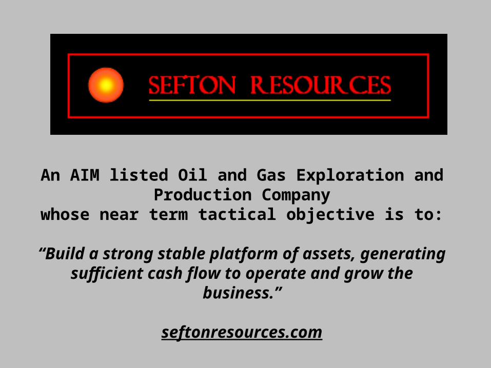
Who We Are Sefton Resources, Inc., a British Virgin
Island corporation, in the business of oil and gas production through wholly owned subsidiaries TEG Oil & Gas USA Inc. and TEG Mid-Continent Inc. Corporate offices located in Denver, Colorado.
The company trades on the London Stock Exchange AIM Market. The trading symbol is SER.
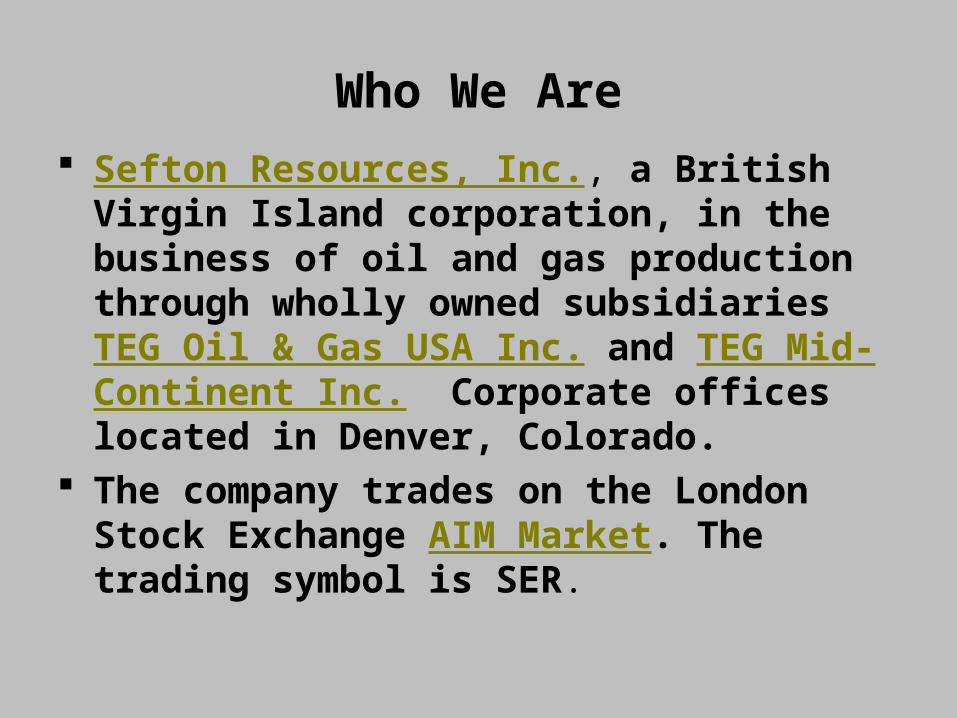
Management BiosJeremy Delmar-Morgan Non-executive Director; Chairman of the Board,
SeftonOver twenty-five years’ experience in the investment and brokerage community. Recently Chairman of Hitchens Harrison, Deputy Director of the Board of the London Symphony Orchestra and Director of a number of private companies. A member of Sefton’s compensation committee and Chairman of the audit committee.
Jim Ellerton Executive Director and CEO, SeftonThirty years’ experience in the development and evaluation of oil and gas prospects throughout the major basins of North America. Was one of the original founders of Sefton Resources.
Harry Barnum Executive Director, Sefton; President, TEG USA, Inc.Vice President of Operations and Engineering for Sefton, and the President of TEG Oil & Gas USA, Inc. Has more than twenty-five years’ industry experience and is responsible for the day-to-day operations of the Company’s California assets.
Bruce Mackay Executive Director, Sefton; President, TEG Mid-ContinentVice President Legal, Land and Business Development for Sefton. Has more than thirty years’ industry experience and is responsible for the day-to-day operations of the Company’s Kansas assets.
Tony Ashton Non-executive DirectorA trained Geologist with over forty-five years in the Oil and Gas industry. In 2001, retired as CEO and President of Canada Southern Petroleum LTD. A member of Sefton’s Audit Committee and Chairman of the compensation committee.
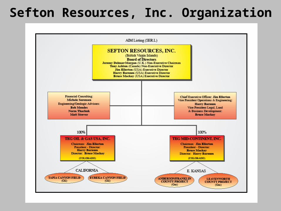
Sefton Resources, Inc. Organization
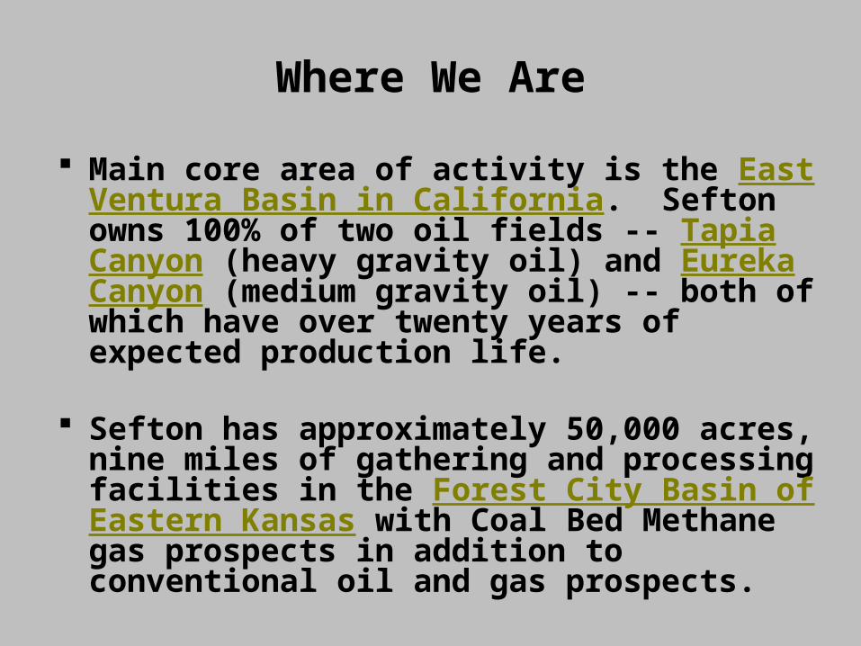
Where We Are
Main core area of activity is the East Ventura Basin in California. Sefton owns 100% of two oil fields -- Tapia Canyon (heavy gravity oil) and Eureka Canyon (medium gravity oil) -- both of which have over twenty years of expected production life.
Sefton has approximately 50,000 acres, nine miles of gathering and processing facilities in the Forest City Basin of Eastern Kansas with Coal Bed Methane gas prospects in addition to conventional oil and gas prospects.
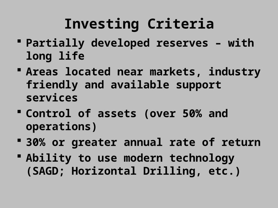
Investing Criteria Partially developed reserves – with
long life Areas located near markets,
industry friendly and available support services
Control of assets (over 50% and operations)
30% or greater annual rate of return Ability to use modern technology
(SAGD; Horizontal Drilling, etc.)
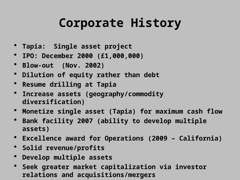
Corporate History
Tapia: Single asset project IPO: December 2000 (£1,000,000) Blow-out (Nov. 2002) Dilution of equity rather than debt Resume drilling at Tapia Increase assets (geography/commodity
diversification) Monetize single asset (Tapia) for maximum cash flow Bank facility 2007 (ability to develop multiple assets) Excellence award for Operations (2009 – California) Solid revenue/profits Develop multiple assets Seek greater market capitalization via investor
relations and acquisitions/mergers
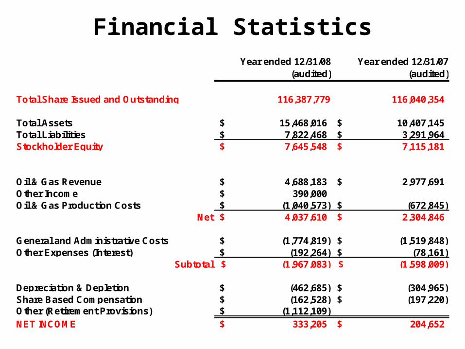
Financial StatisticsYear ended 12/31/08
(audited)Year ended 12/31/07
(audited)
Total Share Issued and Outstanding 116,387,779 116,040,354
Total Assets 15,468,016$ 10,407,145$ Total Liabilities 7,822,468$ 3,291,964$ Stockholder Equity 7,645,548$ 7,115,181$
Oil & Gas Revenue 4,688,183$ 2,977,691$ Other Income 390,000$ Oil & Gas Production Costs (1,040,573)$ (672,845)$
Net 4,037,610$ 2,304,846$
General and Administrative Costs (1,774,819)$ (1,519,848)$ Other Expenses (Interest) (192,264)$ (78,161)$
Subtotal (1,967,083)$ (1,598,009)$
Depreciation & Depletion (462,685)$ (304,965)$ Share Based Compensation (162,528)$ (197,220)$ Other (Retirement Provisions) (1,112,109)$ NET INCOME 333,205$ 204,652$
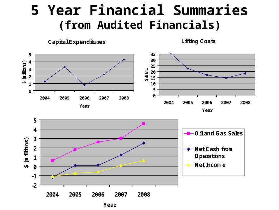
5 Year Financial Summaries(from Audited Financials)
Capital Expenditures
0
1
2
3
4
5
2004 2005 2006 2007 2008
Year
$ (
mill
ion
s)
-2
-1
0
1
2
3
4
5
2004 2005 2006 2007 2008
Year
$ (m
illio
ns)
Oil and Gas Sales
Net Cash fromOperations
Net Income
Lifting Costs
05
101520253035
2004 2005 2006 2007 2008
Year
$/B
BL
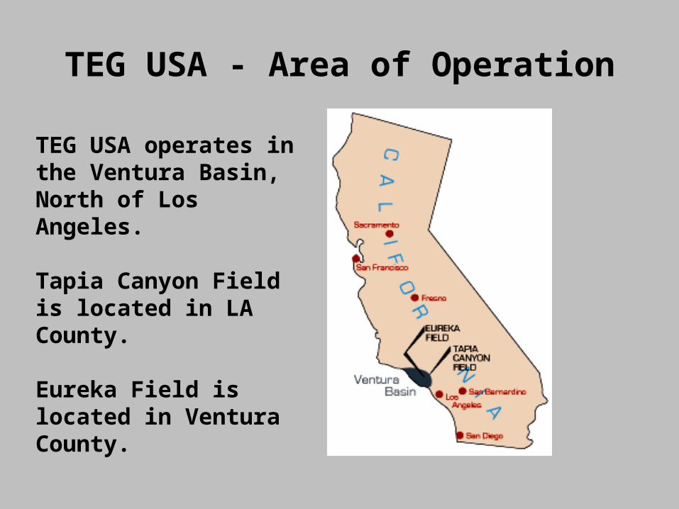
TEG USA - Area of Operation
TEG USA operates in the Ventura Basin, North of Los Angeles.
Tapia Canyon Field is located in LA County.
Eureka Field is located in Ventura County.
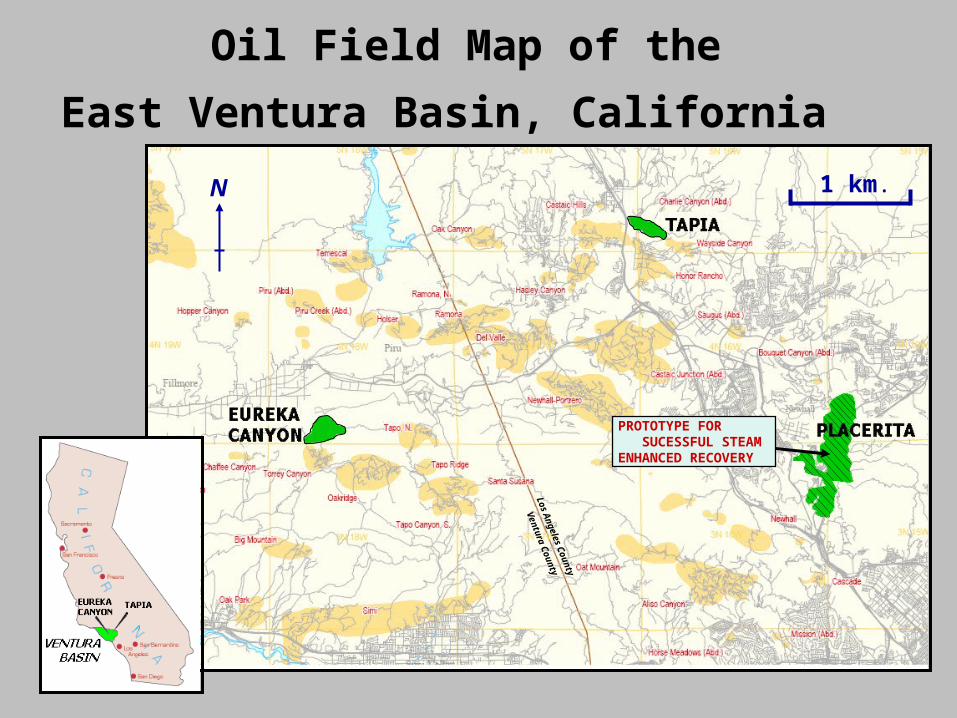
Oil Field Map of the
East Ventura Basin, California 1 km.N
PROTOTYPE FOR SUCESSFUL STEAM ENHANCED RECOVERY
Los An
geles Co
unty
Ventura C
ounty
Town ofTown of CASTAIC, CACASTAIC, CA
Interstate 5
Interstate 5
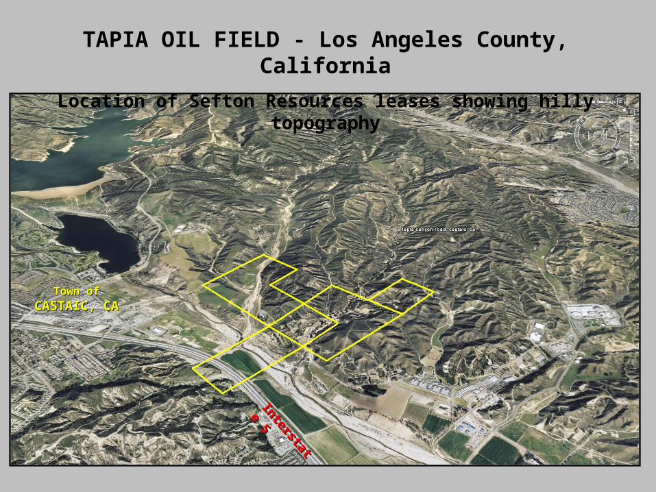
TAPIA OIL FIELD - Los Angeles County, California
Location of Sefton Resources leases showing hilly topography
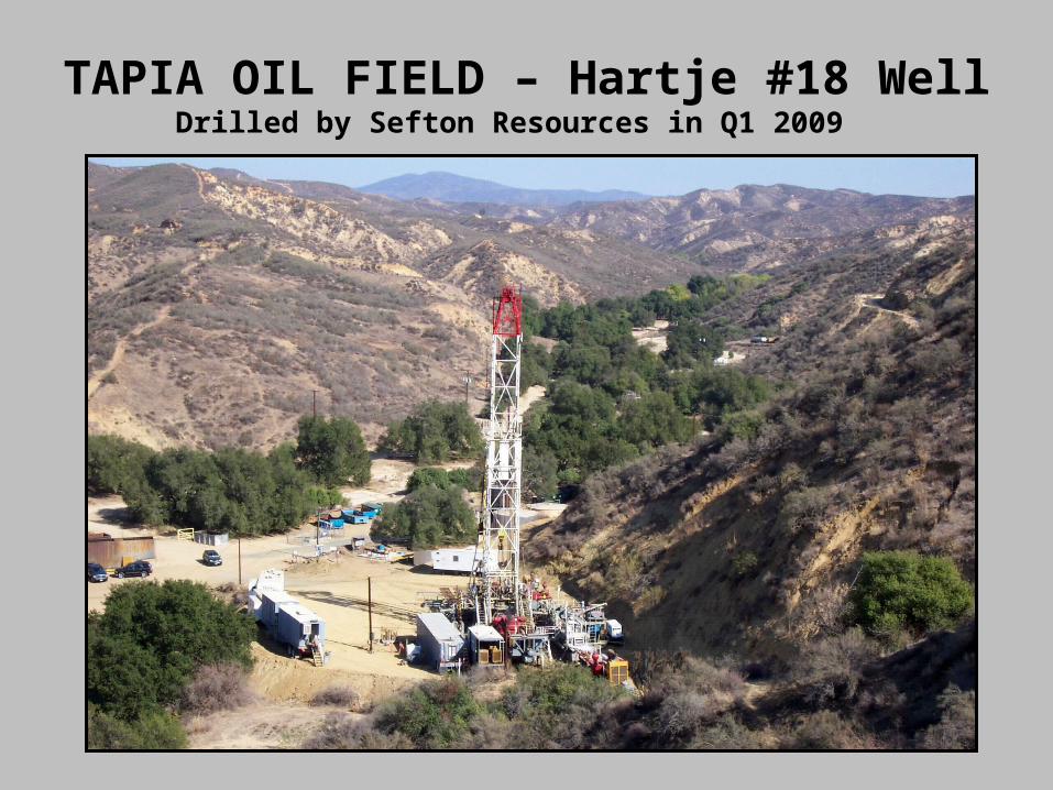
TAPIA OIL FIELD – Hartje #18 WellDrilled by Sefton Resources in Q1 2009
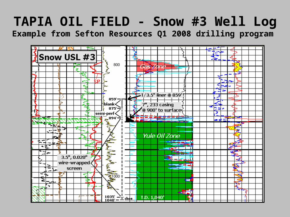
TAPIA OIL FIELD - Snow #3 Well LogExample from Sefton Resources Q1 2008 drilling program
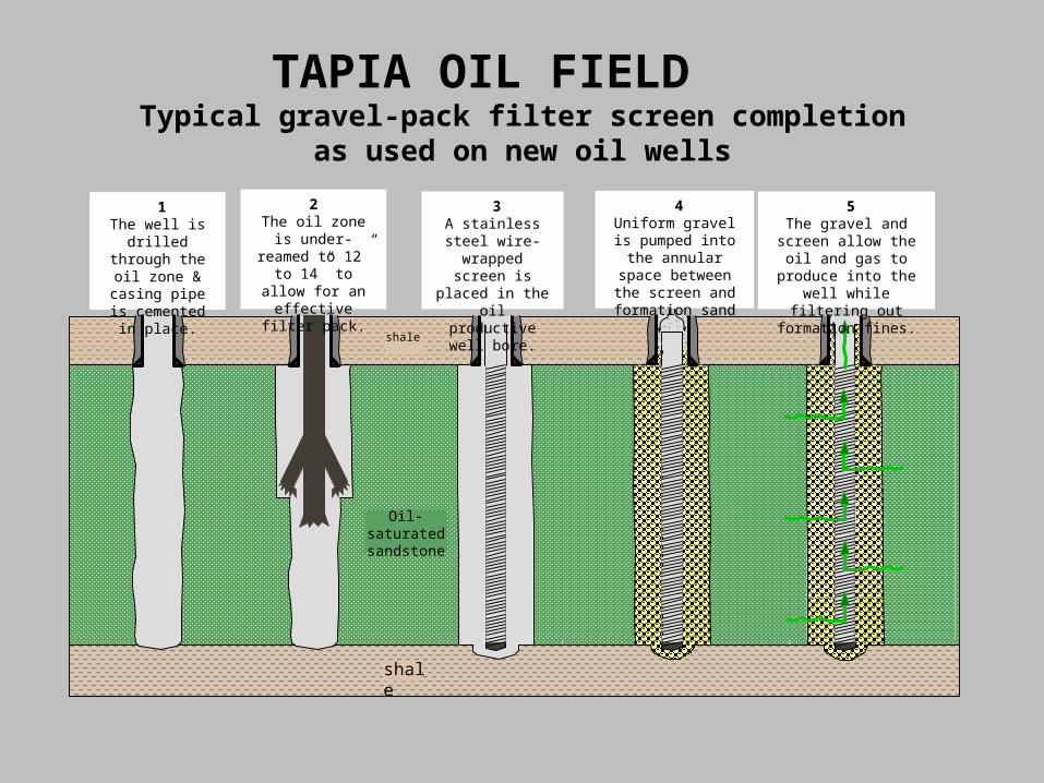
1The well is drilled
through the oil zone & casing
pipe is cemented in place.
2The oil zone is
under-reamed to 12” to 14” to allow
for an effective filter pack.
3A stainless steel
wire-wrapped screen is placed in the oil productive
well bore.
4Uniform gravel is pumped into the annular space
between the screen and formation sand
5The gravel and screen allow the oil and gas to produce into the well
while filtering out formation fines.
Oil-saturated sandstone
shale
shale
TAPIA OIL FIELD Typical gravel-pack filter screen completion
as used on new oil wells
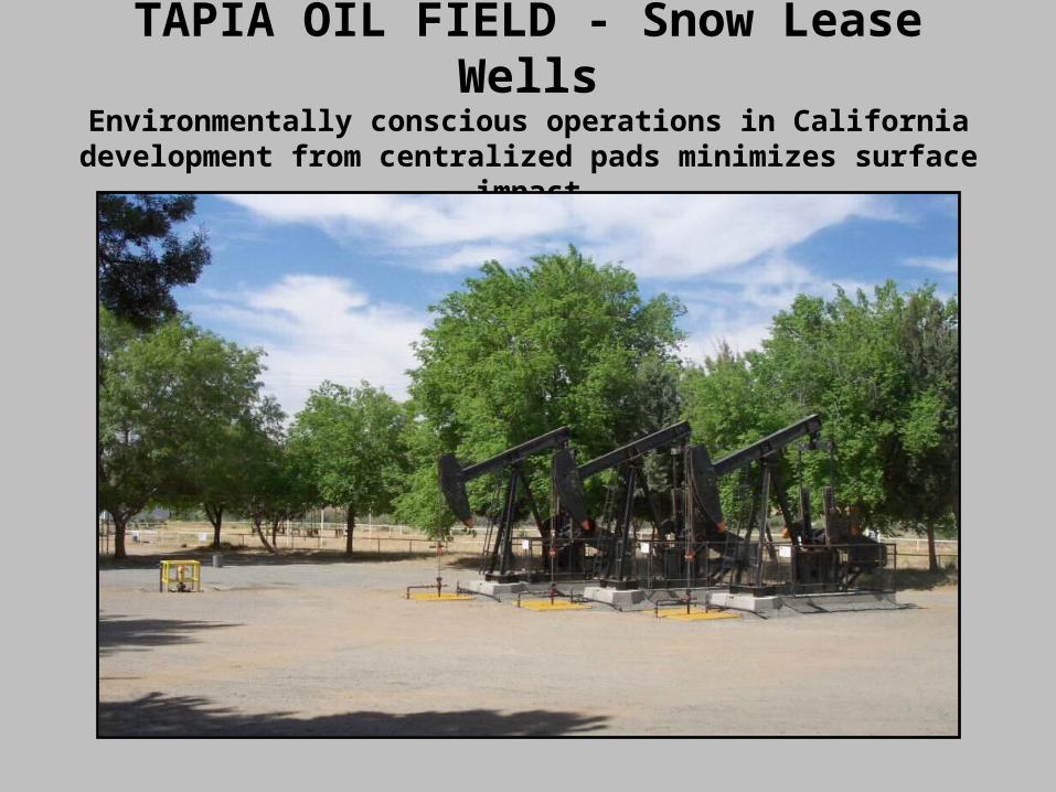
TAPIA OIL FIELD - Snow Lease Wells
Environmentally conscious operations in Californiadevelopment from centralized pads minimizes surface
impact
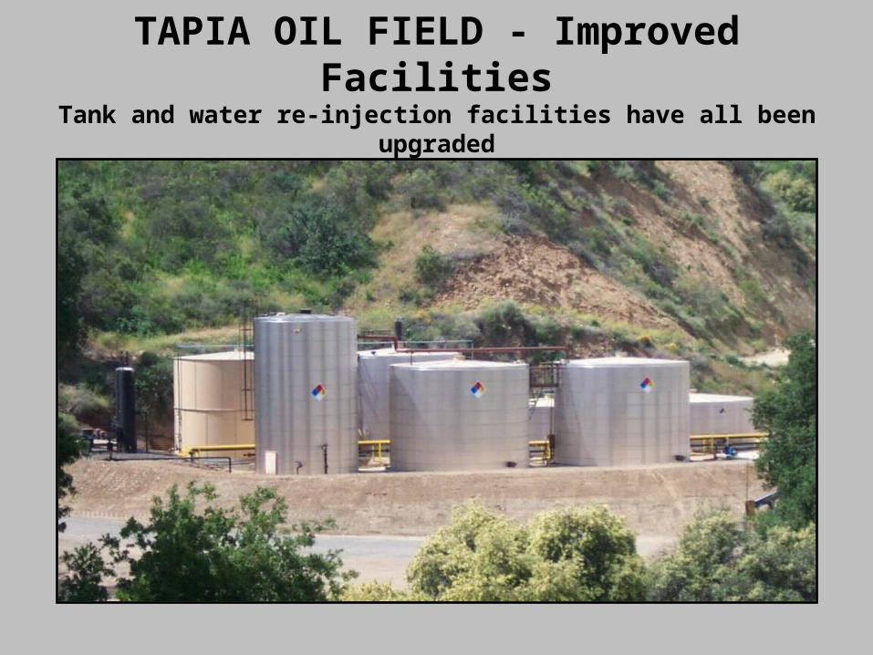
TAPIA OIL FIELD - Improved FacilitiesTank and water re-injection facilities have all been
upgraded
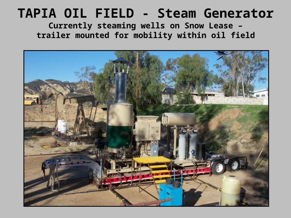
TAPIA OIL FIELD - Steam GeneratorCurrently steaming wells on Snow Lease –trailer mounted for mobility within oil field
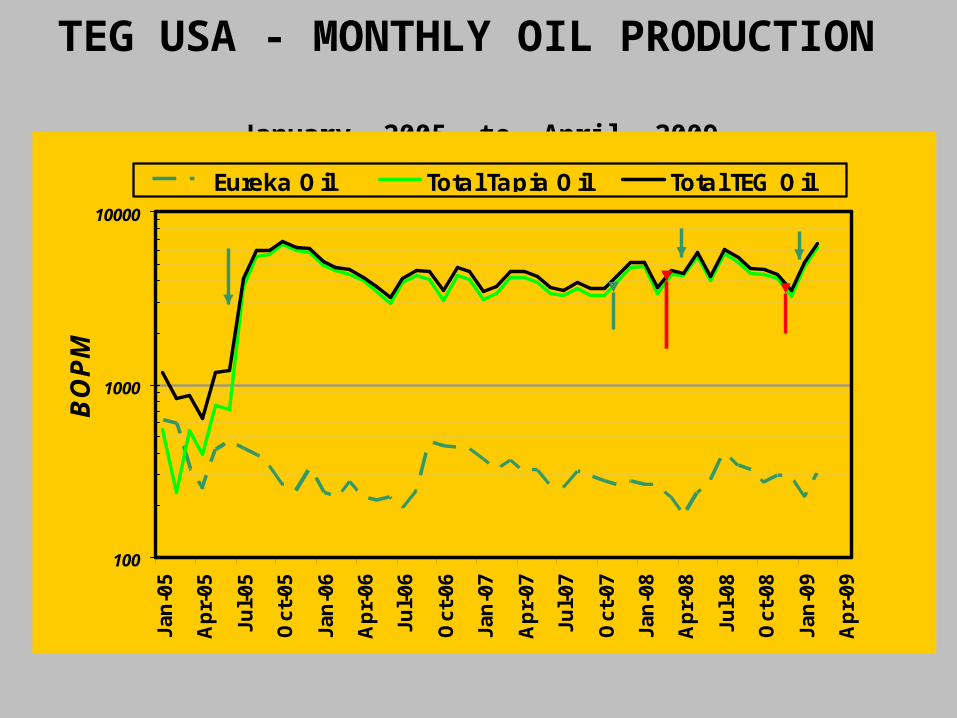
TEG USA - MONTHLY OIL PRODUCTION January, 2005 to April, 2009
100
1000
10000
Jan
-05
Ap
r-05
Jul-
05
Oct
-05
Jan
-06
Ap
r-06
Jul-
06
Oct
-06
Jan
-07
Ap
r-07
Jul-
07
Oct
-07
Jan
-08
Ap
r-08
Jul-
08
Oct
-08
Jan
-09
Ap
r-09
BO
PM
Eureka Oil Total Tapia Oil Total TEG Oil
5 WELLS DRILLED4 WELLS DRILLED
2 WELLS DRILLED
STEAM PILOT INITIATED
SNOW #5 STEAMED
2 WELLS DRILLED
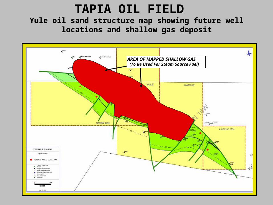
TAPIA OIL FIELD Yule oil sand structure map showing future well
locations and shallow gas deposit
AREA OF MAPPED SHALLOW GAS(To Be Used For Steam Source Fuel)
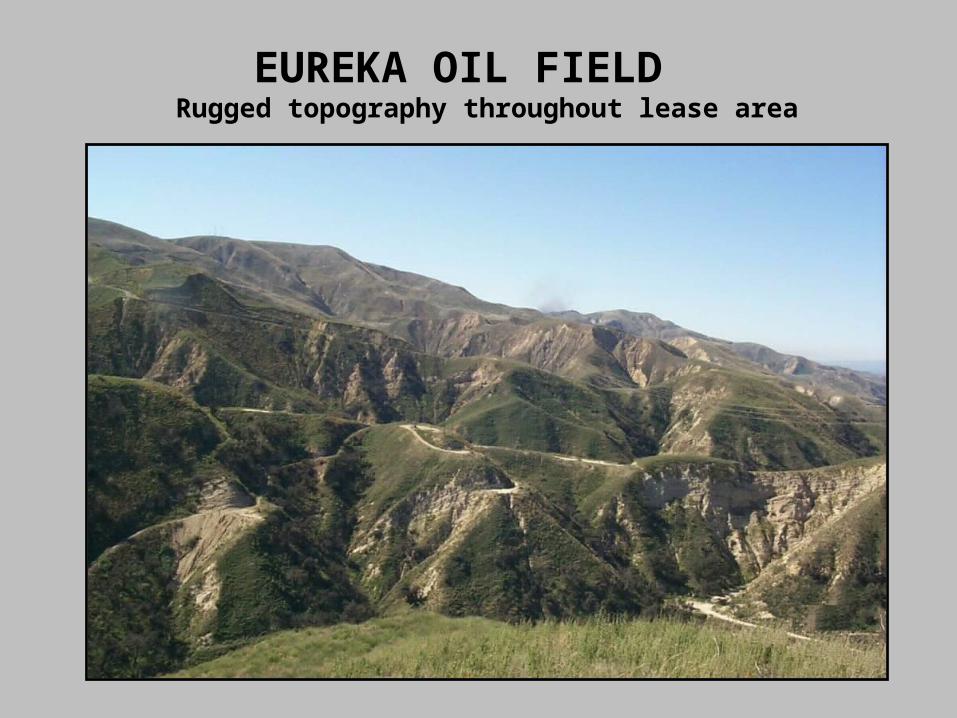
EUREKA OIL FIELD Rugged topography throughout lease area
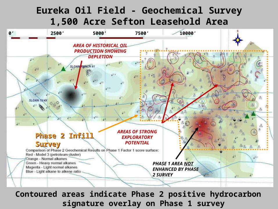
Eureka Oil Field - Geochemical Survey1,500 Acre Sefton Leasehold Area
AREA OF HISTORICAL OIL PRODUCTION SHOWING
DEPLETION
AREAS OF STRONG EXPLORATORY
POTENTIAL
PHASE 1 AREA NOT ENHANCED BY PHASE 2 SURVEY
0’ 2500’ 5000’ 7500’ 10000’
Phase 2 Infill SurveyPhase 2 Infill Survey
Contoured areas indicate Phase 2 positive hydrocarbon signature overlay on Phase 1 survey
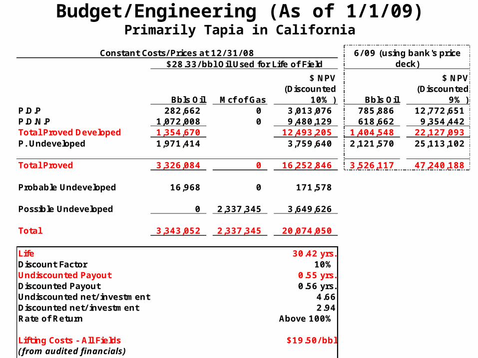
Budget/Engineering (As of 1/1/09)Primarily Tapia in California
Bbls Oil Mcf of Gas
$ NPV (Discounted
10% ) Bbls Oil
$ NPV (Discounted
9% )P.D.P 282,662 0 3,013,076 785,886 12,772,651 P.D.N.P 1,072,008 0 9,480,129 618,662 9,354,442 Total Proved Developed 1,354,670 12,493,205 1,404,548 22,127,093 P. Undeveloped 1,971,414 3,759,640 2,121,570 25,113,102
Total Proved 3,326,084 0 16,252,846 3,526,117 47,240,188
Probable Undeveloped 16,968 0 171,578
Possible Undeveloped 0 2,337,345 3,649,626
Total 3,343,052 2,337,345 20,074,050
Life 30.42 yrs.Discount Factor 10%Undiscounted Payout 0.55 yrs.Discounted Payout 0.56 yrs.Undiscounted net/ investment 4.66Discounted net/ investment 2.94Rate of Return Above 100%
Lifting Costs - All Fields $19.50/ bbl(from audited financials)
CAPEX $13,000,000
$28.33/ bbl Oil Used for Life of Field6/ 09 (using bank's price
deck)Constant Costs/ Prices at 12/ 31/ 08
TEG MidContine
nt
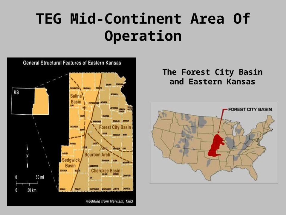
TEG Mid-Continent Area Of Operation
The Forest City Basin and Eastern Kansas
Project Overview TEG MidContinent has secured 43,000 acres in the
Anderson and Franklin County project and 7,000 acres in the Leavenworth County project.
“Anderson and Franklin counties have tremendous CBM potential, and they are economically attractive when gas prices and marketing conditions are favorable” (Onat Report). In addition, there are significant underlying conventional oil and gas opportunities.
Leavenworth County has non-depleted conventional gas fields that have not produced in over 10 years as a result of no active gas gathering facilities tying to major transportation pipelines. Providing gathering facilities to existing and future wells will open up this whole area, including recently discovered CBM opportunities.
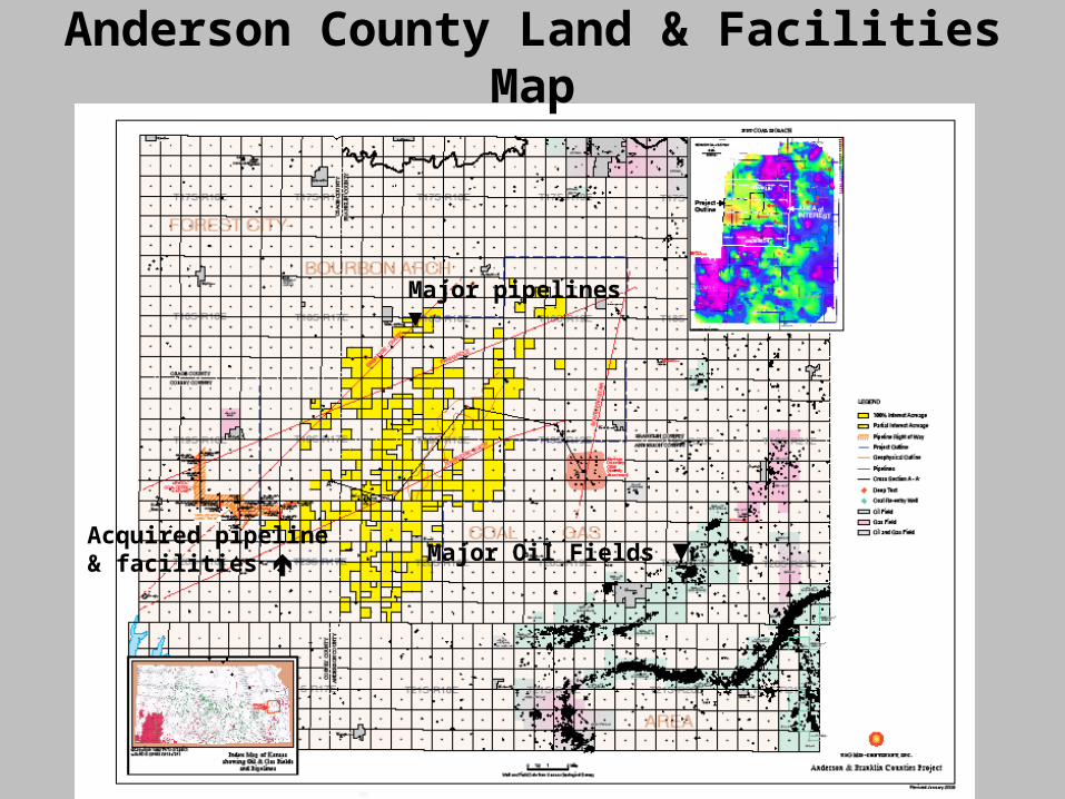
Major pipelines ▼
Acquired pipeline & facilities
Anderson County Land & Facilities Map
Major Oil Fields ▼
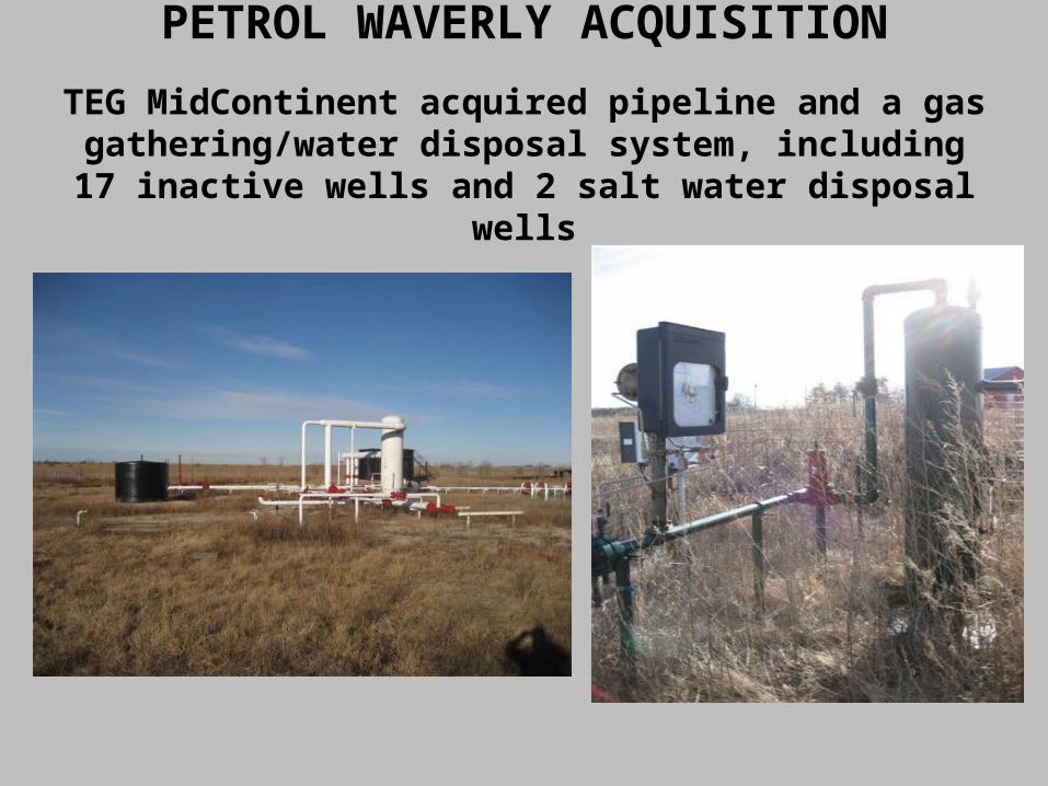
PETROL WAVERLY ACQUISITION
TEG MidContinent acquired pipeline and a gas gathering/water disposal system, including 17 inactive wells and 2 salt water disposal wells
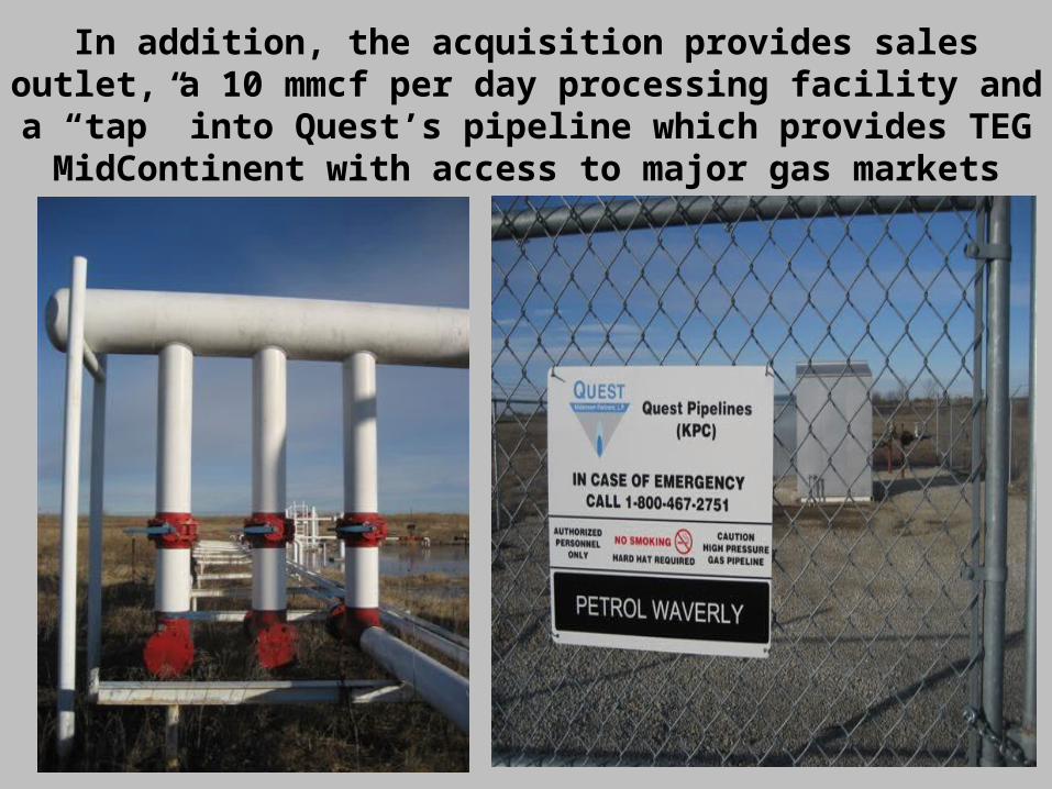
In addition, the acquisition provides sales outlet, a 10 mmcf per day processing facility and a “tap”
into Quest’s pipeline which provides TEG MidContinent with access to major gas markets
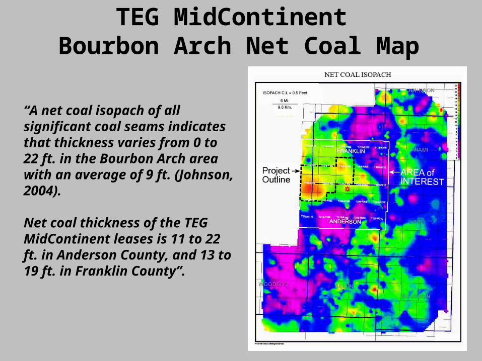
TEG MidContinent Bourbon Arch Net Coal Map
“A net coal isopach of all significant coal seams indicates that thickness varies from 0 to 22 ft. in the Bourbon Arch area with an average of 9 ft. (Johnson, 2004).
Net coal thickness of the TEG MidContinent leases is 11 to 22 ft. in Anderson County, and 13 to 19 ft. in Franklin County”.