An Additional Catalog of Programs and Data · An Additional Catalog of Programs and Data for 100...
45
NTIA-REPO RT -79 -15 An Additional Catalog of Programs and Data for 100 MHz -100 GHz Radio System Predictions J.T. Collins F.K. Steele u.s. DEPARTMENT OF COMMERCE Juanita M. Kreps, Secretary Henry Geller, Assistant Secretary for Communications and Information January 1979
Transcript of An Additional Catalog of Programs and Data · An Additional Catalog of Programs and Data for 100...
NTIA-REPO RT -79 -15
An Additional Catalogof Programs and Data
for 100 MHz -100 GHzRadio System Predictions
J.T. Collins
F.K. Steele
u.s. DEPARTMENT OF COMMERCEJuanita M. Kreps, Secretary
Henry Geller, Assistant Secretaryfor Communications and Information
January 1979


PREFACE
The sole purpose of this publication is to provide the
public with a list of existing computer aids for the
evaluation of radio systems which operate in any part of the
radio spectrum. Consequently, neither the Department of
Commerce (DoC), nor the National Telecommunications and
Information Administration (NTIA) approves of, recommends,
or endorses any particular proprietary product or service
mentioned in this publication. Accordingly, no reference
should be made to NTIA, DOC, or this publication that (1)
implies or states the contrary, or (2) has as its purpose
the recommendation, directly or indirectly, for the purchase
of any particular proprietary product or service listed in
this publication.
iii


TABLE OF CONTENTS
Page
ABSTRACT 1
1.
2.
INTRODUCTION
COMPUTER PROGRAMS AND DATA BASES
2
2
Category 1. Computations of TransmissionLoss and Radar Returned Power 4
1-1 COSPEM, Communication System PerformanceModel. 4
1-2 ION, The Bent Ionospheric Model. 6
1-3 AMAP, Atmospheric Microwave Analysis Program 7
1-4 SPHERE 9
1-5 CSPM, Communication System Performance
Model. 10
1-6 SLAM, Slant-Path Absorption Model. 12
1-7 MRRPR, Microwave Radio Relay PathPropagation Reliability Models forOverland Multipath Fading. 14
1-8 RMRRPP, Reliability of Microwave RadioRelay Paths with Precipitation. 15
1-9 PCTDCP, Partially Correlated TropoDiversity Calculation Program. 16
1-10 SELSP, Satellite to Earth Location SignalPower. 17
1-11 LCP, Link Calculator Program. 19
1-12 RADREF, Radar Refraction. 20
Category 2. computations on Desired-to-UndesiredSignal Ratios 22
2-1 TSPD, Terrestrial Surface Power FluxDensity Limits for Services UsingSatellites.
2-2 IMP, Interference Modeling Program.
v
22
23

TABLE OF CONTENTS (cont.)
Page
Category 3. Computations of Atmospheric andPrecipitation Parameters 25
3-1 FAP, Frequency Analysis Program. 25
3-2 MWPE, Millimeter Wave PropagationExperiment Central Data Reduction Program. 26
3-3 RPP, Rain Propagation Prediction. 27
Category 4. Data Bases and Associated Programs 28
4-1 ZPRARS, Z Profile and Rain Attenuationfrom Rain Scatter.
4-2 RAT, Rain Attenuation vs Time.
28
29
Category 5. Performance of Digital CommunicationSystems 30
5-1 DTCM, Digital Telecommunication ConversionModel. 30
5-2 DTGTAP, Digital Tropo Generalized TimeAvailability Program 31
Category 6. Miscellaneous Programs 33
6-1 MAIM, Multipath Analysis of ILS and MLS. 33
6-2 Y, Earth Coverage Footprints fromGeostationary Satellite Antennas. 34
6-3 JRWOOl, Transionospheric Ray Tracing withInteractive Homing. 35
6-4 RAYTRA, A versatile three-dimensional raytracing computer program for radio wavesin the ionosphere. 36
6-5 WTC-MBA/LASL. 37
vi

An Additional Catalog of Programs and Datafor 100 MHz - lOOGHz Radio System Predictions
Jack T. Collins* and F. K. Steele**
Analysis aids and data bases for predictingthe performance of 100 MHz - 100 GHz communicationsystems are presented and briefly described. Theyare loosely grouped into the following functionalcatagories:
1) Computations of transmission loss andradar returned power.
2) Computations of desired-to-undesiredsignal ratios.
3) Computations of atmospheric andprecipitation parameters.
4) Data bases and associated programs.
5) Performance of digital communicationsystems.
6) Miscellaneous programs.
Sources are given for the analysis aids, databases, and additional information.
ey Words: atmosphere: computer programs: databases: desired signal: digitalcommunications: precipitation:propagation prediction; radarpower: transmission -loss:undesired signal.
* Mr. Collins is with Potomac Research, Inc., Denver Office,Lakewood, Colorado 80228.
** Mr. Steele is with the u.s. Department of Commerce, NationalTelecommunications and Information Administration, Institutefor Telecommunication Sciences, Boulder, Colorado 80303.

1. INTRODUCTION
This catalog is the second publication in a continuing
effort to compile a comprehensive set of computer programs
and data bases to predict the performance of radio systems.
The first catalog, published in March 1978 as OT Report
78-141, concentrated on the 10 - 100 GHz portion of the
spectrum. Additional catalogs are planned, so that
eventually the entire radio spectrum will be covered.
Most of the programs in OT Report 78-141 were developed
at the National Telecommunications and Information
Administration, Institute for Telecommunication Sciences.
For this report, programs have been solicited from
universities and private industry as well as various
government agencies. These reports should be viewed as
complementing each other since many of the programs in the
previous publication cover the frequency range of this
report, but have not been listed in this catalog.
2. COMPUTER PROGRAMS AND DATA BASES
Each catalog entry contains brief information about the
program's function or content, user inputs, limitations,
current status, references, and information contacts for
that program. This information is supplied so that
searchers can rapidly identify analysis aids or data bases
of interest which they can pursue through the given
information contact.
The entries have been arranged alphabetically within
the following catagories:
1) Computations of transmission loss and radar
returned power.
2) Computations of desired-to-undesired signal ratio.
2

3) Computations of atmospheric and precipitation
parameters.
4) Data bases and associated programs.
5) Performance of digital communication systems.
6) Miscellaneous programs.
3

Category 1
Computations of Transmission Lossand Radar Returned Power
Item: 1-1
Title: COSPEM, Communication System Performance Model
Computes: This is a communication system performance model
that computes the probability of successful communications,
(ps)' versus range or other variables (e.g., transmitter
power, antenna gain or height, etc.). The model also
computes operational range of a radio system for a specified
required probability of success, p sr . It will compute for
up to three systems simultaneously, with graphics and line
printer output.
Input: The required input consists of system parameters
(transmitter power, antenna gains, transmission line losses,
receiver noise figure, and modulation information);
propagation parameters (Longley-Rice input plus vegetation
and urbanization information); noise environment category;
and operational parameters (required channel quality and
reliability, fixed or mobile).
Limitations: This program has the basic limitations of the
1977 version of the Longley-Rice model.
(Frequency ~ 20 MHz). CCIR Reports 258 and 322 noise models
limit the frequency to ~ 300 MHz, although the noise model
can be extended to 20 GHz. Antenna heights are permitted
from I m to 3 km.
Current Status: The program is operational and available to
the public by contract with SRI International. It is
written in FORTRAN for the CDC 6400, but can be converted
for use on other computers. Its output agrees well with
measured data for FM voice systems from Fort Hood, TX, and
Fulda, FRG (30-76 MHz).
4

References:
Tupper, B. C., and G. H. Hagn (1978), Nap-of-the-earth
communication program for u.s. Army helicopters, final
report, SRI Project 4979, Contract DAAB07-76-C-0868, SRI
International, Menlo Park, CA,
For more information contact: G. H. Hagn, SRI
International, 1611 N. Kent Street, Arlington, VA 22209,
(703)524-2053; B. C. Tupper, SRI International, 333
Ravenswood Avenue, Menlo Park, CA 94025, (415) 326-6200,
ext. 3821.
5

Item: 1-2
Title: ION, The Bent Ionospheric Model.
computes: For a given condition consisting of station,
satellite, date, and time information, the electron density
versus height profile is computed from which range, range
rate, and angular refraction correction, as well as vertical
and total angular electron content, are obtained. The model
has the additional capability of improving its predictions
by updating with actual ionospheric observations.
Input: The required input parameters are transmission
frequency, station latitude and longitude, elevation angle
to satellite, azimuth angle, satellite height, elevation
rate, altitude rate, year, month, day, time, daily solar
flux for month, 12-month running average of sunspot number
and of solar flux. Optional input consists of the same
information for updating with actual ionospheric
observations.
Limitations: The program removes only between 75% and 90%
of the ionospheric effects under solar maximum conditions.
Current Status: The program is well documented and has been
used extensively on a Sigma 7 computer. Slight
modifications may be necessary for other machines. The
program is written in FORTRAN.
References:
Llewellyn, S. K., and R. B. Bent (1973), Documentation
and description of the Bent ionospheric model, Atlantic
Science Corporation.
For more information contact: Judy Lipofsky, Atlantic
Science Corp., P.O. Box 3201, Indialantic, FL 32903, (305)
773-1300.
6

Item: 1-3
Title: AMAP, Atmospheric Microwave Analysis Program.
computes: The program computes attenuation, refraction, and
dispersion for ground-to-aircraft or ground-to-satellite
paths. It includes the effects of water vapor (both
uncondensed and condensed), molecular oxygen, clouds, and
rain. The MSFC 4-D Atmospheric Model is used for
temperature, humidity, and density profiling from the ground
to 25 km height. Above 25 km, exponential atmosphere is
assumed. The user may choose any of nine standard cloud
models or may specify his own model. Precipitation rates
may be specified, or the program will default to values
typical of the cloud model. The location of the cloud with
respect to the ground terminal must be specified.
Attenuations due to uncondensed water vapor, molecular
oxygen, condensed water, and rain are printed separately and
summed, so that an evaluation of contributions can be made.
The path length is computed both along the line of sight and
along the ray path for listing of both range errors and
apparent refraction. DeLay excess is printed.
Input: The required input parameters are latitude and
longitude of ground station; month of year; frequency; cloud
type; distance to storm center and storm radius; height of
rain cell and precipitation rate; satellite or aircraft
height; thickness of ~tmospheric slices; starting value and
number of increments of ray takeoff elevation; and choice of
mean or best/worst case analysis.
Limitations: The frequency range is 0.5 - 100 GHz,
although the accuracy above 30 GHz has not been evaluated.
The graphic output requires CDC DD280 plot routines and
hardware.
7

Current Status: The program is operational on the CDC 6500
at Martin Marietta Company/Denver Division. The program
source listing is proprietary.
For more information contact: D. Lund, Martin Marietta
Aerospace, P.O. Box 179, Denver, CO 80201, (303) 973-3326.
8

Item: 1-4
Title: SPHERE
computes: The program computes the basic transmission loss
over the earth for microwaves.
Input: The required input parameters are station
separation, station heights, and wavelength.
Limitations: The program accounts for reflection,
refraction, diffraction, but not tropospheric scatter or
ionosphere refraction. It also assumes perfect
conductivity.
Current Status: The published version assumes a "4/3
earth;" other earth factors can be obtained by scaling the
distances and the wavelength. The in-house version has an
input for earth factor.
References:
1976 Microwave Engineers Handbook, Microwave Journal,
1976. The program evaluates the solution given by V. Fock,
Electromagnetic diffraction and propagation problems,~ 1965,
Chap. 12.
For more information contact: Dr. Ira Gilbert or Dr. J. J.
G. McCue, Lincoln Laboratory, MIT, Lexington, MA 02173.
9

Item: 1-5
Title: CSPM, Communication System Performance Model.
Computes: This automated model uses the point-to-point
version of the Longley-Rice propagation loss model to
estimate communication system performance throughout a
defined geographical area. The model calculates radio path
terrain profiles and statistically characterized basic
transmission loss, power density, received signal level, and
ultimately, communication reliability for a large number of
specific paths within the geographical area. All computed
data are available in either tabulated or plotted forms, at
the option of the user.
Input: The required input are the coordinates of a fixed
antenna and the coordinates of the bounds of a geographical
area. Opportunity is provided for specifying a large number
of other parameters which characterize the technical aspects
of the problem and define the desired mode for running the
model and the desired form of the output data. The
technical data which may be specified as input include
frequency, antenna heights and gains, polarization,
transmitter output power, threshold 'received signal level,
ground dielectric constant and conductivity, surface
refractivity, climate code, and coordinates defining the
geographical area bounds. When not specified, nominal or.
computed values are assigned to these parameters.
Limitations: Radio frequencies must be between 20 MHz and
20 GHz. Antenna heights are restricted to 0.5 to 3000 m and
only vertical or horizontal polarizations may be specified.
Current Status: The program is operational on CDC 6000
series computer systems. Documentation is complete and
available from the NTIS. The program can be provided on
magnetic tape.
10
References:
Jennings, R. D., and S. J. Paulson (1977),
Communication system performance model for VHF and higher
frequencies, OT Report 77-128, (NTIS PB274-458/AS).
For more information contact: R. D. Jennings, NTIA/ITS,
u.s. Dept. of Commerce, Boulder, CO 80303, (303) 499-1000,
ext. 3233 or FTS 323-4303 or 323-3233; S. J. Paulson,
NTIA/ITS, u.S. Dept. of Commerce, Boulder, CO 80303 1 (303)
499-1000, ext. 3874 or FTS 323-3874.
11

Item: 1-6
Title: SLAM, Slant-Path Absorption Model.
computes: The program computes the molecular attenuation of
microwave and submillimeter waves in earth's atmosphere.
For a fixed frequency (ern-I) and a given atmospheric model,
it computes horizontal (dB/km) and upward- and downward
looking vertical (dB) attenuations vs altitude. The
complete exponential term for induced emission is employed.
Input: Required are a modified binary tape version of AFCRL
(AFGL) line parameter compilation; constituent molecule(s);
atmospheric model (from 1966 supplement to 1962 u.s.Standard); line profile (Van Vleck-Weisskopf, Gross,
Lorentz, Voight-type); frequency range; and "bound." This
determines furthest lines used.
Limitations: The program computes molecular attenuation
only (no aerosol or clouds). It computes fixed-frequency
calculations at intervals of 0.001 cm- l (~ 30 MHz). There
is no continuum correction included, and "interference" is
neglected. The Voigt-type approximation is only
approximately valid above 40 km. The AFCRL data out to
550 cm- 1 (= 16.5 THz) is employed.
Current Status: The FORTRAN program and associated binary
data is stored on magnetic tape. It is immediately usable
on disc-oriented XDS Sigma-series computers, but is
straightforwardly convertible for other computers with
FORTRAN IV compilers.
References:
Greenebaum, M., and D. Koppel (1975), A study of
millimeter and submillimeter wave attenuation and dispersion
in the earth's atmosphere, final report F-l/306-3-14,
Riverside Research Institute, New York, NY 10023
(AD-A015544) •
12

Koppel, D. (1976), Present status of the RRI slant-path
absorption model (SLAM) computer program, Tech. Rept.
T-2/306-3-14, Riverside Research Institute, New York, NY
10023.
For more information contact: Dr. Michael Greenebaum, RRI,
80 West End Avenue, New York, NY 10012, (212) 873-4000, ext.
347.
13

Item: 1-7
Title: MRRPR, Microwave Radio Relay Path Propagation
Reliability Models for Overland Multipath Fading.
Computes: The program computes median fade duration and
time distribution; overland earth and atmospheric multipath
fading outage in accordance with the Bell and CCIR criteria
4, 5-ms-mean distributions; and CCIR criteria 3, I-min-mean
distributions; and fade margin difference for a given
outage. In addition, the program computes space and
frequency diversity improvement factors, path roughness
factors, and minimum path lengths at which multipath fading
can be expected.
Input: The required input parameters are frequency, fade
margin, path distance and roughness, geographic factors, and
annual mean temperature.
Limitations: The applicab,le frequency range is from 4 to
18 GHz.
Current Status: The program is operational on the HP 67
calculator.
References: No published references.
For more information contact: H. J. Sartori, Collins
Commercial Telecommunications Group, P.O. Box 10462, Dallas,
TX 75201, (214) 690-5000.
14

Item: 1-8
Title: RMRRPP, Reliability of Microwave Radio Relay Paths
with Precipitation.
Computes: The program computes the annual rainfall outage
time and cumulative rainfall time distribution as a function
of path distance and surfaee point rainfall rate.
Input: The required input parameters are frequency, fade
depth, path distance, annual rainfall, and thunderstorm
ratio.
Limitations: The applicable frequency range is from 4 to
18 GHz.
Current status: The program is operational on the HP 67/97
calculator.
References: No published references.
For more information contact: H. J. Sartori, Collins
Commercial Telecommunications Group, P.O. Box 10462, Dallas,
TX 75201, (214) 690-5000.
15

Item: 1-9
Title: PCTDCP, Partially Correlated Tropo Diversity
Calculation Program.
Computes: This program computes the probability that the
output of a maximal ratio combiner will be above some
threshold value as a function of the signal power in a given
channel.
Input: The program requires a complex correlation matrix of
the tropo system. This matrix has elements relating the
fading on each diversity branch to all other diversity
branches. The correlation matrix is square and is, at most,
4 by 4. The elements may be written in the form PIJ where P
is the complex correlation coefficient between the amplitude
fluctuations (fading) on the ith and jth diversity branch.
If the complex correlation coefficient is not available, it
may be approximated by the square root of the envelope
correlation coefficient, which is the correlation commonly
measured experimentally.
Limitations: The program is limited to making calculations
for dual or quad diversity systems.
Current Status: The program is in FORTRAN and is
operational on an IBM 370.
References:
Pierce, J~ N., and S. Stein (1960), Multiple diversity
with nonindependent fading, Proc. IRE, ~ No.1.
For more information contact: Dr. J. Wick, Mail Stop A160,
The MITRE Corporation, Bedford, MA 01730, (617) 271-4590 or
AUTOVON 478-1001, ext. 75-4590.
16

Item: 1-10
Title: SELSP, Satellite to Earth Location Signal Power.
computes: The program computes the following data for
satellites in earth orbit, for any given ground point:
Slant range in kilometers.
Satellite cone angle in degrees.
Satellite clock angle in degrees.
Ground point location elevation to satellite.
Ground point location azimuth to satellite.
Power flux density at ground point location in dBw/m 2•
Path loss in dB.
Elapsed time in seconds.
The program was primarily intended for the analysis of
potential interference between satellites and earth stations
of different services, but it can be used in a generalized
manner without modification. The program performs an orbit
inclination test and informs the user if the orbit
inclination and ground point location preclude any view
periods. The program also retains information used in the
computations, which can easily be accessed by a trained
operator. Once initialized, the program runs until
commanded to stop by the user. Typical run times vary from
a few minutes upward depending on the quantity of output
required. Data is output at time increments determined by
the user.
Input: An interactive segment of the program leads the user
through the necessary input steps.
Required input parameters are:
Orbit altitude at perigee.
Orbit inclination.
Longitude of ascending node.
17

Angle between ascending node and perigee.
Orbit ellipticity.
GMT at ascending node.
Time increment for data during track.
Ground station longitude and latitude.
Ground station minimum elevation angle.
Transmitter frequency.
E.I.R.P.
Initial elliptical angle.
Limitations: Atmospheric effects are not included.
Earth radius is assumed constant (6378.16 km). Calculates
data only for one satellite and one ground point per run.
Current Status: The program is operational and available.
It is written for HP 9815A desk top computer, but could be
converted for use on other machines.
For more information contact: Dennis Nightingale, Jet
Propulsion Laboratory, California Institute of Technology,
4800 Oak Grove Drive, Pasadena, CA 91103, (213) 354-6326 or
FTS 792-6326.
18

Item: 1-11
Title: LCP, Link Calculator Program.
Computes: This program computes the path loss, modulation
losses, threshold parameters, Doppler, as well as link
margins for FM, AM, and PM systems.
Input: The required input parameters are antenna gains,
system temperature, losses, modulation-type, modulation
parameters, range, frequency, and accuracy required.
Limitations: The program uses only a simplified model for
atmospheric efforts that is custom designed for NASA STDN
links for VHF and S-band frequencies.
Current Status: The program is currently operational.
References:
STDN Link Analysis Handbook, Volumes I, II, and III,
June 1977, November 1977.
For more information contact: Frank Stocklin, Goddard Space
Flight Center, Code 861.3, Greenbelt, MD 20071, (301) 982
5712.
19

Item: 1-12
Title: RADREF, Radar Refraction.
Computes: The program computes radar angular deviation and
range inaccuracies which occur when electromagnetic waves
traverse the earth's atmosphere. Both the troposphere and
the ionosphere are considered in the program. The outputs
are primarily the errors in elevation angle and range as
functions of apparent elevation and apparent range, but
various types of associated data can be broken down into the
various components resulting from retardation and bending,
from both the troposphere and the ionosphere. The program
is available in both a double-precision version and a
single-precision version.
Input: Program input consist primarily of data parameters
which define the refractive profile of the earth's
atmosphere (troposphere and ionosphere), plus radar
frequency, and various computational control and output
selection parameters. The indices of refraction in the
troposphere can be either input directly or computed as a
function of surface temperature, pressure, and water vapor
pressure, as well as height. The indices of refraction in
the ionosphere are computed as a function of the latitude
and either the electron density or the plasma frequency.
Limitations: Primary limitations of the program are that
the program assumes a spherically symmetric atmosphere.
Computations are also currently accomplished using a
"stratified layer method," in which the vertical profile of
the atmosphere is approximated by a series of thin layers
each of constant refractivity. The program currently
assumes that the radar site is on the ground; there is no
provision for air- or space-borne sensors. Studies have
indicated that the single-precision version of the program
provides good computational results (i.e., truncation errors
20

are not the dominant accuracy limitation) when the program
is run on a computer with 48 or more bits per word; however,
the double-precision version of the program is recommended
for machines with 36 or fewer bits per word. Usable
frequency is from 30 MHz thru 3 GHz.
Current status: The current version of the program (RADREF
IV) is in the final stages of debugging and testing. The
program is written in standard FORTRAN IV. It has been used
on the Honeywell 6080 and 6060 and the Philco 212 computers,
but is easily convertible for use on other computers which
have a FORTRAN IV compiler.
References:
Technical Memorandum, 78-1, RADREF IV Documentation by
St Clair Hultsman, Directorate of Analysis DCS/Plans and
Programs Headquarters NORAD/ADCOM.
For more information contact: St Clair Hultsman or Preston
M. Landry, HQ ADCOM, Peterson AFB CO 80914, (303) 635-8911,
ext. 3535.
21

Category 2
Computations on Desired-to-UndesiredSignal Ratios
Item: 2-1
Title: TSPD, Terrestrial Surface Power Flux Density Limits
for Services Using Satellites.
Computes: The program computes the probable impact of
various levels of power flux density at the earth's surface
upon terrestrial systems as a function of percentage of
terrestrial systems affected.
Input: The Government Master File provides terminal
locations and required equipment parameters.
Limitations: The program is limited to the information
available on the Government Master File.
Current Status: The program is currently running on the DOC
CDC 6600 computer.
References:
Haydon, G. W., and R. K. Rosich (1973), Technical
considerations in the efficient use of the spectrum: Part 1
- terrestrial surface power flux density limits for services
using satellites, OT Report 73-19 (NTIS, COM75-10863/AS).
For more information contact: George W. Haydon, NTIA/ITS,
U.S. Dept. of Commerce, Boulder, CO 80303, (303) 499-1000,
ext. 3583 or FTS 323-3583; Dr. Rayner K. Rosich, NTIA/ITS,
U.S. Dept. of Commerce, Boulder, CO 80303, (303) 499-1000,
ext. 3109 or FTS 323-3109.
22

Item: 2-2
Title: IMP, Interference Modeling Program.
Computes: The program computes the following data for
interference at DSN ground stations tracking real-time
mission spacecraft from either satellites or from other
active spacecraft not being tracked:
Elapsed time in seconds.
Satellite azimuth and elevation.
Angle off boresight between sun and mission spacecraft.
Angle off boresight between satellite and mission
spacecraft.
Satellite power flux density at ground station.
Power from satellite in dBW.
Signal to interference ratio in dB.
The output is tabularized by ground station - a maximum of
three can be used - and by satellite and mission spacecraft.
Output is directly to the user terminal in demand mode or to
a line printer in batch mode. Future plans call for
selected output to go to data files, which may be used for
plotting.
Input: The program requires responses to prompting for some
input and accesses other parameter files for additional
data. Some of this additional data is stored on tape,
principally that concerning future potential space missions
for deep space research. The required input parameters are:
Operating frequency band.
Satellite name(s).
Mission spacecraft ID and operating parameters.
Names of ground stations (three maximum).
Start time of run.
Time increment for data (for mission to mission
interference only, otherwise fixed by program).
23

Limi tat ions: Not all known satell ites ar.e cur rently filed.
The output data format is presently limited to 80 characters
per line to allow direct extraction into 8-1/2 x 11 pages.
Thus, not all available computed data are printed. Also,
the effect of weather, sun, planets, etc., on system noise
temperatures is ignored.
Current Status:' Program is still under development for use
on Univac 1108 computer e (Note that "canned" data available
at JPL's 1108 computers are essential). It is written in
FORTRAN IV.
References:
Newton, R. R. (1960), Astronomy for the non-astronomer,
IRE TRANS. on Space Electronics and Telemetry, 1-16.
For more information contact: Dennis Nightingale, Jet
Propulsion Laboratory, California ~nstitute of Technology,
4800 Oak Grove Drive, Pasadena, CA 91103, (213) 354-6326 or
FTS 792-6326.
24

Category 3
Computations of Atmospheric andPrecipitation Parameters
Item: 3-1
Title: FAP, Frequency Analysis Program.
Computes: The program computes and tabulates the frequency
of occurrence of 10 weather classes with clear and dry at
one extreme and heavy rain at the other.
Input: The program is designed to operate on the Rand
collection of weather data called RAWDAB. There are
approximately 90 stations in the collection covering the
Northern Hemisphere. Data is most dense in Central Europe.
Limitations: The chief limitation is data input. Some
stations have poor observations and a limited length of
record.
Current Status: Operating.
References:
Deirmendjian, D. (1969), Electromagnetic Scattering on
Spherical Polydispersions, American Elsevier Publishing Co.,
Inc., New York.
Deirmendjian, D. (1975), Far-infrared and submillimeter
wave attenuation by clouds and rain, J. Appl. Meteor., Vol.
14, No.8, 1584-1593.
For more information contact: Charles Schutz or Jeanine
Lamar, Rand Corp., 1700 Main Street, Santa Monica, CA
90406, (213) 393-0411.
25

Item: 3-2
Title: MWPE, Millimeter Wave Propagation Experiment Central
Data Reduction Program.
Computes: The program computes rain attenuation and related
statistics (rain rate, radar backscatter, radiometric
temperture, etc.) from measurements on an earth-space
propagation path using satellite beacons.
Input: The required input parameters are received signal
levels (calibrated), rain gauge tips, ambient temperature
and pressure, radar reflectivity, etc. - all from ground
station equipment.
Limitations: The program is designed for the specific
requirements of the NASA terminals at Rosman, N. C., and
GSFC, Greenbelt, MD. Approximately 36 inputs are used to
develop 24 plots and printouts.
Current Status: The program has been operatinal since 1969
at GSFC. It has been used (with modifications) on the
ATS-S, ATS-6, CTC, and COMSTAR satellite programs.
References:
Numerous reports and references in open literature
available on request.
For more information contact: Louis J. Ippolito, NASA
Goddard Space Flight Center, Code 953, Greenbelt, MD, (301)
982-6716.
26

Item: 3-3
Title: RPP, Rain Propagation Prediction.
Computes: The program computes the attenuation, isolation,
and phase shift of millimeter wave signals passing through a
rain/ice medium.
Input: The required input parameters are frequency,
elevation angle, transmit/receive antenna polarization
states, and rain/ice parameters. The rain medium can be
divided into 10 segments with different characteristics.
Limitations: The program has been designed for use at 11,
19, 30 GHz with rain rate from 1 to 300 mm/hr.
Current Status: The program is operational on an IBM 370 and
is written in FORTRAN IV.
For more information contact: Dr. W. L. Stutzman, Virginia
Tech, Electrical Engineering Dept., Blacksburg, VA. 24061,
(703) 951-6834.
27

Computes:
over each
The
The
The
The
The
The
The
The
Category 4
Data Bases and Associated Programs
Item: 4-1
Title: ZPRARS, Z Profile and Rain Attenuation from Rain
Scatter.
This program computes the following parameters
adjacent radar range bin:
height of the pulse volume (km),.
range of the pulse volume (km).
received power (dBm).
number of tape units.
reflectivity factor of rain (mm 6/m 3 and dBZ).
attenuation coefficient (dB/km) at a frequency, f.
cumulative attenuation (dB) at a frequency, f.
Marshall-Palmer rain rate (mm/hr).
Input: The input parameters are radar constant, calibration
slope and intercept, number of range bins to be processed,
drop size distribution parameters, file number to be
processed, and time.
Limitations: This program is written for a PDP-8-IBM
compatible format. The PDP-8 minicomputer controls the
radar and injects the output on line onto an IBM tape.
Current Status: This program is operational.
References:
Goldhirsh, J. (1977), Analysis of single and multiple
wavelength radar systems for estimating slant path
attenuation through rain at frequencies greater than 10 GHz,
APL/JHU internal memo SlR77U-036.
For more information contact: J. Goldhirsh, Applied Physics
Laboratory, The Johns Hopkins University, Johns Hopkins
Road, Laurel, MD 20810, (301) 953-7100, ext. 2779.
28

Item: 4-2
Title: RAT, Rain Attenuation vs Time.
computes: This program computes the estimated attenuation
due to rain for three arbitrary frequencies depending upon
the drop size distributions assumed. These attenuations
correspond to the path along the radar beam where the
attenuation contribution due to each adjacent range bin is
considered.
Input: The input parameters are radar constant, calibration
slope and intercept, number of range bins to be processed,
drop size distribution parameters, file numbers, time
interval to be processed, and sampling interval.
Limitations: This program is written for a PDP-8-IBM
compatible format. The PDP-8 minicomputer controls the
radar and injects the output on line onto an IBM tape.
Current Status: This program is operational.
References:
Goldhirsh, J. (1978), Prediction of attenuation of the
28 GHz COMSTAR beacon signal using radar and measured rain
drop spectra, APL/JHU internal memo SlR78U-009.
For more information contact: J. Goldhirsh, Applied Physics
Laboratory, The Johns Hopkins University, Johns Hopkins
Road, Laurel, MD 20810, (301) 953-7100, ext. 2779.
29

Category 5
Performance of Digital Communication 'Systems
Item: 5-1
Title: DTCM, Digital Telecommunication Conversion Model.
Computes: The program computes the mean, standard
deviation, and probability functions of the number of
bits/message for message mixtures which arrive at a digital
telecommunication network station for conversion to
electronic messages.
Input: The required input parameters are the percentages of
digital data on magnetic tape or cards, the percentage of
alphanumeric messages on paper, the percentage of graphic
messages on paper, data compression ratios, and lines per
inch facsimile scanning ratios.
Current Status: The program is operational. The program is
docum~nted and described in the two references given below.
The program is written in FORTRAN IV for a CDC 6600.
References:
McManamon, P. (1975), A digital telecommunication
conversion model for electronic message mixtures, u.S.
Postal Service Report, (NTIS PB252-183).
Miles, M. (1975), Analysis of a digital
telecommunications message model, u.S. Postal Service
Report, (NTIS PB252-184).
For more information contact: Dr. P. McManamon, NTIA/ITS,
U.S. Dept. of Commerce, Boulder, CO 80303, (303) 499-1000,
ext. 3570 or FTS 323-3570; R. Marcotte, USPSR&D Center,
11711 Park1awn Drive, Rockville, MD 20853, (301) 443-6100
or FTS 443-6100.
30

Item: 5-2
Title: DTGTAP, Digital Tropo Generalized Time Availability
Program.
computes: This program computes the generalized time
availability of a digital troposcatter system at a given
service probability.
Input: The program requires the following input data:
A. The mean and variance of the energy-per-bit to noise
ratio (Eb/No) supplied to the modem.
B. The mean and variance of the distribution of
multipath spread characterized by its two sigma width.
C. Fifteen samples from the modem performance curve.
This is the plot of required mean Eb/No vs mean multipath
spread for which the digital troposcatter modem will produce
a given average bit error rate.
Limitations: The accuracy of the program degrades when the
modem is operated under multipath conditions where its
performance is significantly degraded by intersymbol
interference. The computational problem is a consequence of
the steep slope of typical modem performance curves in this
region.
Current Status: The program is operational. Running time
could be significantly reduced by refinement of the two
dimensional integration algorithm used.
References:
Sherwood, A., S. Wenglin, and J. Wick, An experimental
program leading to development of a tactical digital
troposcatter system, to be published in the proceedings of
the AGARD EPP symposium on "Aspects of Electromagnetic
Scattering in Radio Communication," 3-7 October, Cambridge,
MA.
31

For more information contact: Dr. J. Wick, Mail Stop A160,
The MITRE Corporation, Bedford, MA 01730, (617) 271-4590, or
AUTOVON 478-1001, ext. 75-4590.
32
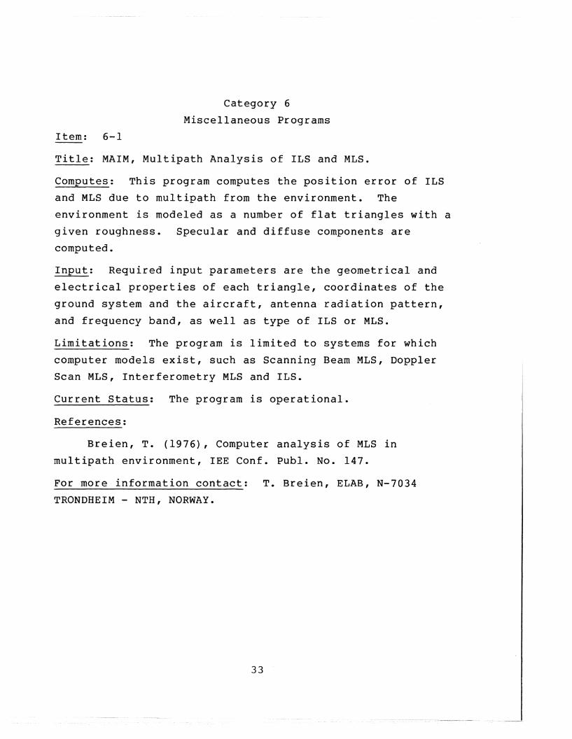
Category 6
Miscellaneous Programs
Item: 6-1
Title: MAIM, Multipath Analysis of ILS and MLS.
Computes: This program computes the position error of ILS
and MLS due to multipath from the environment. The
environment is modeled as a number of flat triangles with a
given roughness. Specular and diffuse components are
computed.
Input: Required input parameters are the geometrical and
electrical properties of each triangle, coordinates of the
ground system and the aircraft, antenna radiation pattern,
and frequency band, as well as type of ILS or MLS.
Limitations: The program is limited to systems for which
computer models exist, such as Scanning Beam MLS, Doppler
Scan MLS, Interferometry MLS and ILS.
Current Status: The program is operational.
References:
Breien, T. (1976), Computer analysis of MLS in
multipath environment, lEE Conf. Publ. No. 147.
For more information contact: T. Breien, ELAB, N-7034
TRONDHEIM - NTH, NORWAY.
33

Item: 6-2
Title: Y, Earth Coverage Footprints from Geostationary
Satellite Antennas.
Computes: The program contains an algorithm for generating
on microfilm output, earth coverage footprints from
geostationary satellite antennas. Also, a separate
algorithm is included for determining whether given
coordinates or ground points are included in or excluded
from a particular footprint. The antenna beam can be
elliptic in cross-section with an arbitrary orientation of
semi-minor and semi-major axes.
Input: The required inputs are data giving latitude and
longitudes of continental u.s. plus state boundaries or
latitude and longitude of political boundaries on world map,
longitude of satellite and distance from earth center,
latitude and longitude of antenna aim point, semi-minor and
semi-major axes, and rotation angle of elliptic pattern.
Current Status: The program is operating and available on
request.
References:
Ott, R. H. (1975), A numerical method for generating
earth coverage footprints from geostationary antennas,
report prepared for Advanced Mail Systems Directorate, U.S.
Postal Service, Rockville, MD 20852.
For more information contact:
Dept. of Commerce, Boulder, CO
3353.
Dr. R. H. Ott, NTIA/ITS, U.S.
80303, (303) 499-1000, ext.
34

Item: 6-3
Titl~.: JRWOOl, Transionospheric Ray Tracing with Iterative
Homing.
Computes: This program is designed to perform ray tracing
of radio waves through a spherically-stratified model
ionosphere, using Snell's Law iterated at each layer. A
homing capability is included so that the actual path which
will connect transmitter and receiver will be determined to
whatever accuracy is specified. 0 and X waves are traced
separately and Faraday Rotation obtained from their phase
path length difference. Various model ionospheres can be
used, including profiles derived from ionosondes. Different
models of the geomagnetic field can be specified.
Input: The required input parameters are frequency, trans
mitter location, receiver location, parameters to define
ionosphere profile (N(h», and parameters to define geo
magnetic field model.
Limitations: The program uses a spherically stratified
ionosphere. There are no frequency limits: although, of
course, it is assumed that the rays do penetrate the
ionosphere.
Current Status: Program was converted to run on the
NOAA/ERL CDC 6600 in November 1976. Due to the number of
subroutines used, this would be a very difficult program to
convert to run on other computers.
References:
Lawrence, R. S., and D. J. Posakony (1961), A digital
ray-tracing program for ionospheric research, SPACE RESEARCH
II, Proc. Second International Space Science Symposium.
For more information contact: Judy Stephenson, NOAA/SEL,
u.S. Dept. of Commerce, Boulder, CO 80303, (303) 499-1000,
ext. 3997: R. B. Fritz, NOAA/SEL, u.S. Dept. of Commerce,
Boulder, CO 80303, (303) 499-1000, ext. 6523.35

Item: 6-4
Title: RAYTRA, A versatile three-dimensional ray tracing
computer program for radio waves in the ionosphere.
computes: Th~s program will trace rays through an
anisotropic medium whose index of refraction varies
continuously in three dimensions. The program can represent
the refractive index by either the Appleton-Hartree or the
Sen-Wyller formula, and has several ionospheric models for
electron density, perturbations to the electron density, the
earth's magnetic fi~ld, and electron collision frequency.
For each path, the program can calculate group path length,
phase path length, absorption, Doppler shift due to a time
varying ionosphere, and geometrical path length. In
addition to printing these parameters and the direction of
the wave normal at various points along the ray path, the
program can plot the projection of the ray path on any
vertical plane or on the ground and punch the main
characteristics of each ray path on cards.
Input: The input parameters are transmitter location
(longitude, latitude, and height above the ground), the
frequency of the wave, the direction of transmission (both
elevation and azimuth), the receiver height, and the maximum
number of hops desired.
Limitations: The program has no homing capability.
Current Status: The program is written in FORTRAN, is on
cards, and is operational on a CDC 6600.
Reference: Jones, R. M., and J. J. Stephenson (1975), A
versatile three-dimensional ray tracing computer program for
radio waves in the ionosphere, OT Report 75-76.
For more information contact: R. M. Jones, NOAA/SEL, u.S.
Dept. of Commerce, Boulder, CO 80303, (303) 499-1000, ext.
6494 or J. J. Stephenson~ NOAA/SEL, u.S. Dept. of Commerce,
Boulder, CO 80303, (303) 499-1000, ext. 3997.
36

Item: 6-5
Title: WTC-MBA/LASL.
computes: The program computes the transient response of
thin-wire antennas or scatterers connected to circuits. The
solution is obtained by timestepping. The circuit may
contain nonlinear elements. The program was designed to
analyze the transient response of wire objects. Wideband
frequency domain results are also available through a
Fourier transform. structures modeled by grids of wires can
also be handled. The current on each wire segment and the
voltage of each node of the circuit is available for all
tirnesteps. Far field electric field intensities can be found
also.
Input: The required input parameters are antenna geometry,
antenna loading, circuit element values, exciting fields or
voltages, and the desired timestep increment. The desired
far field observation direction and polarization can also be
input.
Limitations: Approximately 12 wire segments per wavelength
are required to model the wire structure. This limits the
structure complexity to approximately 300 segments for a
CDC 7600. The ratio of the wire segment length to diameter
must be greater than one. The time-step increment must be
approximately equal to the length of the longest wire
segment divided by the velocity of light.
Current Status: This program is operational and will be
available when documentation is complete. It is written in
FORTRAN for a CDC 7600.
References:
Landt, J. A., E. K. Miller, and M. Van Blavicum (1974),
WT-MBA/LLLIB: A computer program for the time-domain
electromagnetic response of thin-wire structures,
37

UCRL-51585, Lawrence Livermore Laboratory, Livermore, CA
(Same as WTC-MBA/LASL except for circuit loading).
Miller, E. K., and J. A. Landt (1976), Direct time
domain techniques for transient radiation and scattering,
UCRL-52315, Lawrence Livermore Laboratory, Livermore, CA.
For more information contact: J. A. Landt, MS-429, Los
Alamos Scientific Laboratory, Los Alamos, NM 87545, (505)
667-7558 or FTS 843-7558.
38

FORM OT-29(3-73)
u.s. DEPARTMENT OF COMMERCEOFFICE OF TELECOMMUNICATIONS
BIBLIOGRAPHIC DATA SHEET
1. PUBLICATION OR REPORT NO.2. Gov't Accession No.3. Recipient's Accession No.
NTIA Report 79-154. TITLE AND SUBTITLE 5. Publication Date
January 19796. Performing Organization Code
An Additional Catalog of Programs and Data 1-----------------1for 100 MHz - 100 GHz Radio System Predictions
7. AUTHOR(S)Jack T. Collins and F. K. Steele
9•. Project/Task/Work Unit No.
8. PERFORMING ORGANIZATION NAME AND ADDRESS
U.S. Department of CommerceNTIA/ITS325 BroadwayBoulder, CO 80303
10. Contract/Grant No.
11. Sponsoring Organization Name and Address
U.S. Department of CommerceNTIA/ITS325 BroadwayBoulder, CO 80303
12. Type of Report and Period Covered
13.
14. SUPPLEMENTARY NOTES
15. A!3S!RACT (A 2?O-word or less factual summary of most significant information. If document includes a significantbIblIography of lIterature survey, mention it here.)
Analysis aids and data bases for predicting the performance of100 MHz - 100 GHz communication systems are presented and brieflydescribed. They are loosely grouped into the following functionalcatagories:
1) Computations of transmission loss and radar returned power.2) Computations of desired-to-undesired signal ratios.3) Computations of atmospheric and precipitation parameters.4) Data bases and associated programs.5) Perfor,mance of digital communication systems.6) Miscellaneous programs.
Sources are given for the analysis aids, data bases, and additional information.
16. Key Words (Alphabetical order, separated by semicolons)
atmosphere; computer programs; data bases; desired signal; digitalcommunications; precipitation; propagation prediction; radar power;transmission loss; undesired signal.
17. AVAILABILITY STATEMENT 18. Sec uri ty Class (This report) 20. Number of pages
QS UNLIMITED. UNCLASSIFIED 48
o FOR OFFICIAL DISTRIBUTION.
19. Security Class (This page)
UNCLASSIFIED21. Price:
~u.s. GOVERNMENT PRINTING OFFICE: 1979-0-678-684/328 L'SCOMM-DC 29716-P73