Alessandro Zorzi’s sketch maps
32
Alessandro Zorzi’s sketch maps Luis A. Robles Macías Brussels Map Circle’s Map Afternoon 22 April 2017
Transcript of Alessandro Zorzi’s sketch maps

Alessandro Zorzi’s sketch maps
Luis A. Robles Macías
Brussels Map Circle’s Map Afternoon
22 April 2017
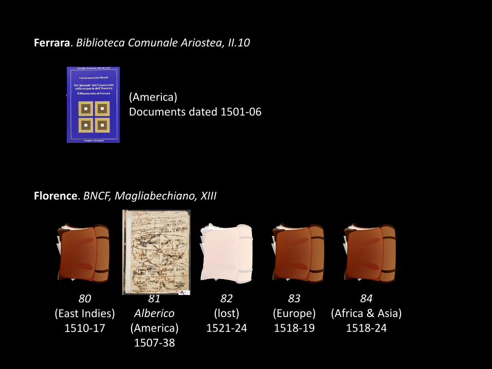
Florence. BNCF, Magliabechiano, XIII
Ferrara. Biblioteca Comunale Ariostea, II.10
80(East Indies)
1510-17
81Alberico
(America)1507-38
82(lost)
1521-24
83(Europe)1518-19
84(Africa & Asia)
1518-24
(America)Documents dated 1501-06

The Alberico Codex is a compilation of printed and manuscript news about the New World. It includes many marginalia – from single words to multi-page maps.
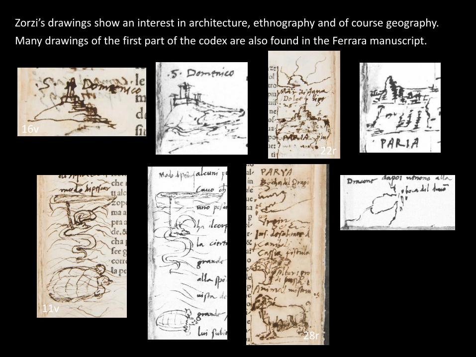
11v
16v
28r
22r
Zorzi’s drawings show an interest in architecture, ethnography and of course geography.
Many drawings of the first part of the codex are also found in the Ferrara manuscript.

But who was Alessandro Zorzi?
Alberico codex, 31v. ”Jo Alex[andr]o Zorzi”
Roberto Almagià, 1936: “a cultivated man”
Laura Laurencich-Minelli, 1985: “a curious man, with a broad but superficial culture”
Perhaps both were right, but describing Zorzi at different ages?

Map of Cuba

Alberico codex, 10v. Book IV of the Paesi... (1507) about Columbus’s 2nd voyage
Ferrara manuscript, 19r. A. Trevisano’s 1501 letter about Columbus’s 2nd voyage
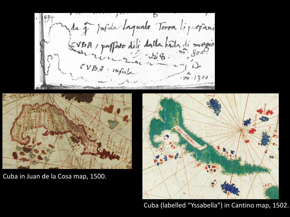
Cuba (labelled “Yssabella”) in Cantino map, 1502.
Cuba in Juan de la Cosa map, 1500.
Map of Hispaniola

Ferrara ms., 17vA. Trevisano’s 1501 letter aboutColumbus’s 2nd voyage(rotated 90° left)
Alberico codex, 10rBook IV of the Paesi... (1507) about Columbus’s 2nd voyage
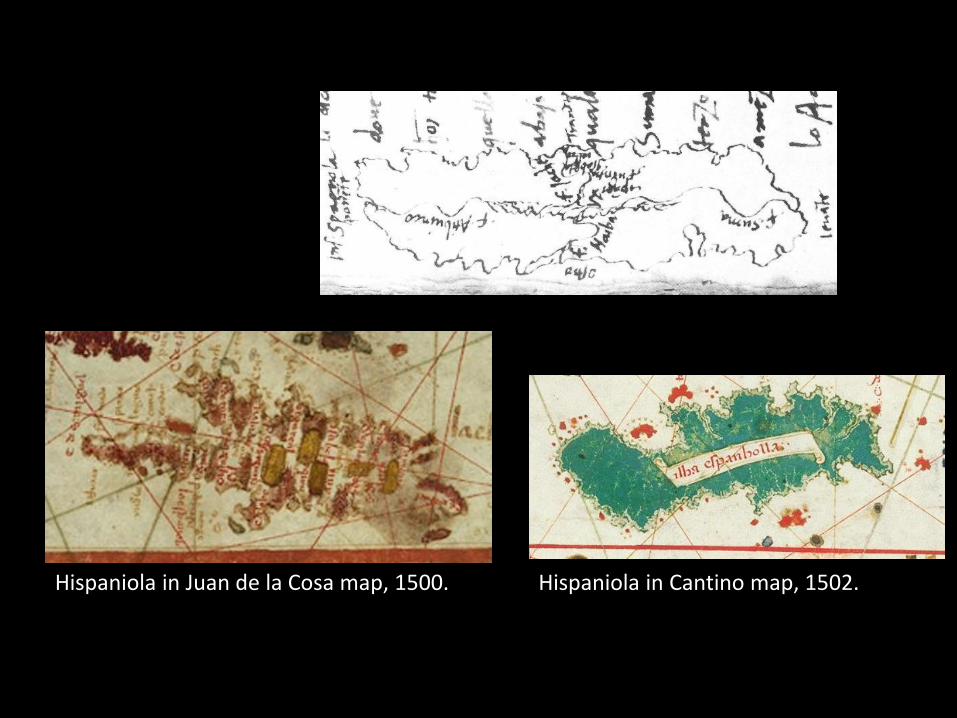
Hispaniola in Cantino map, 1502.Hispaniola in Juan de la Cosa map, 1500.

Detail of Rosselli map, 1508.

Ferrara manuscript, 16r. A. Trevisano’s 1501 letter about Columbus’s 2nd voyage
Lo Admirante fece el Cifrone, che è uno loco propinquo ad uno porto, per fabbricarvi una cità. Et incominció a fabricar et far una chiesa...
Bonus: La Isabela’s church
Earliest (and only) depiction of the first Christian church in America, or just Zorzi’s imagination?

Columbus letter’s maps

Alberico codex, 56v-57r. Amended translation of Christopher Columbus’s July
1503 letter from Jamaica (published Venice, 1505)

Alberico codex, 60v. Amended translation of Christopher Columbus’s July 1503
letter from Jamaica (published Venice, 1505)

Ferrara ms, 63v and 70v. Amended translation of Christopher Columbus’s July
1503 letter from Jamaica (published Venice, 1505)
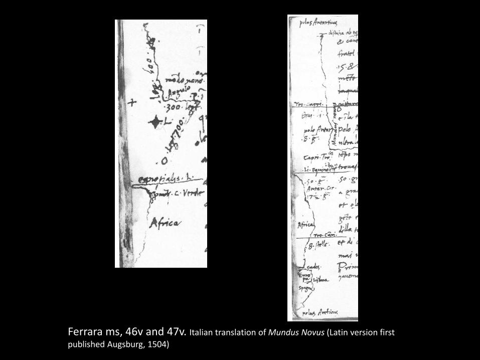
Ferrara ms, 46v and 47v. Italian translation of Mundus Novus (Latin version first
published Augsburg, 1504)
Zuan Rames’s map

Alberico codex, 89v-90rCopy of a letter from Spain to Zuan Rames (undated).

1519 Portuguese planisphere, attributed to Reinel (facsimile at BNF)This Iberian map does not yet show the Gulf of Mexico.
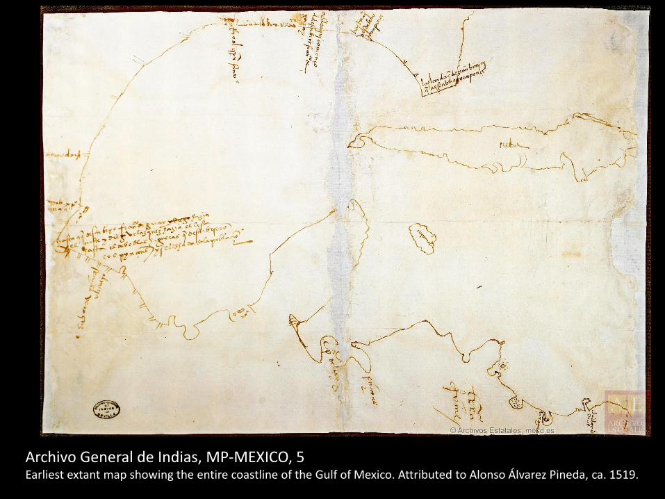
Archivo General de Indias, MP-MEXICO, 5Earliest extant map showing the entire coastline of the Gulf of Mexico. Attributed to Alonso Álvarez Pineda, ca. 1519.
Map of Mexico

Alberico codex, 126r and 126vItalian translation of Hernán Cortés’s secondletter from New Spain (1520), published in Latin in Nüremberg in 1524.
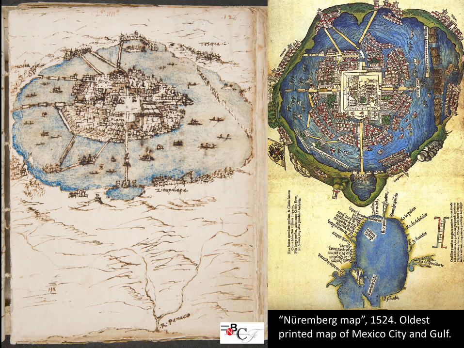
“Nüremberg map”, 1524. Oldestprinted map of Mexico City and Gulf.

G. B. Ramusio, Delle Navigationi..., Vol. 3, 1565

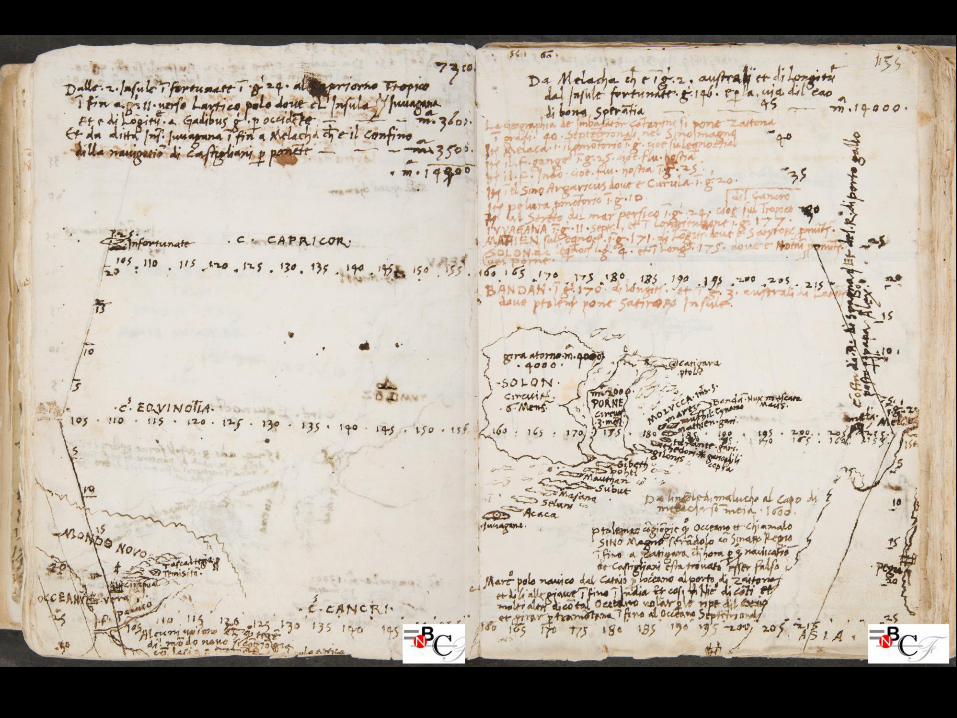
World mapin trapezoidal projection, with south at top (“Abbozzo di carta di tutto il mondo (…) in proiezione trapezoidale, col sud alto”)
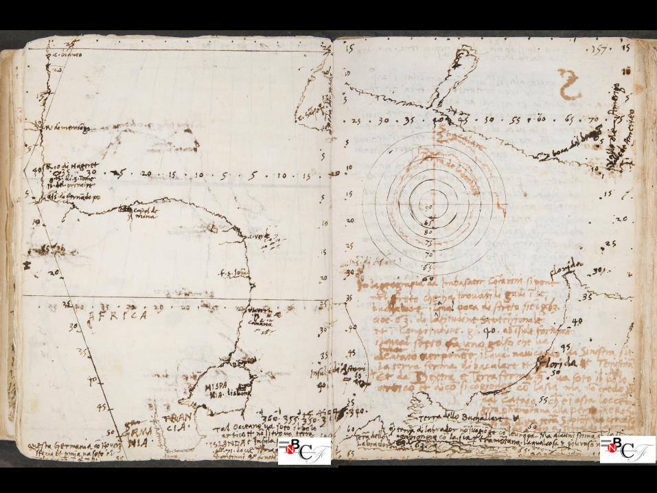
Alberico codex, 153v-157r

G. B. Ramusio, Delle Navigationi..., Vol. 1, 1554

Some final observations
• Zorzi copied a few maps that are now lost or extremely rare.
• He also drew cartographic sketches to make sense of information in travel accounts.
• Positioning of maps followed an intentional program: illustrating the travel accounts.
• In conclusion, a precursor to G. B. Ramusio.