Aintree Technology Day SDK & Monitoring
52
KOREC Technology Day Trimble Express Aintree, May 2013
-
Upload
korec-group -
Category
Documents
-
view
220 -
download
3
description
Jason Rossback talks through Trimble SDK and Martin Janousek discussed Monitoring technology
Transcript of Aintree Technology Day SDK & Monitoring

KOREC
Technology Day
Trimble Express
Aintree, May 2013

Trimble Developer Network
Putting your Data to Work Jason Rossback – Marketing Manager – Trimble

Platform for Growth
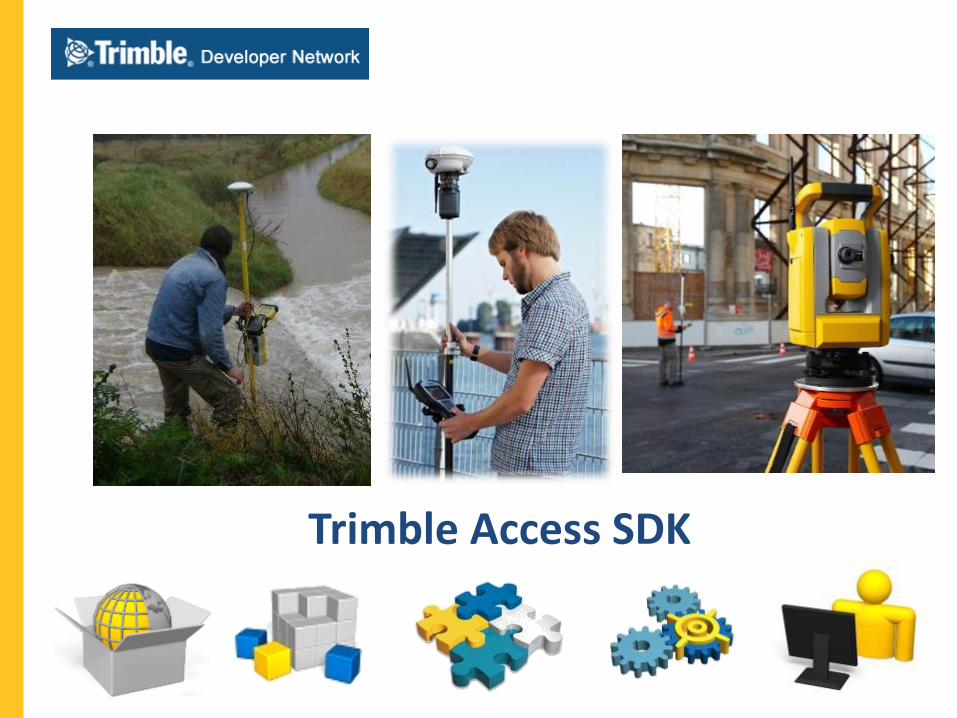
Trimble Access SDK
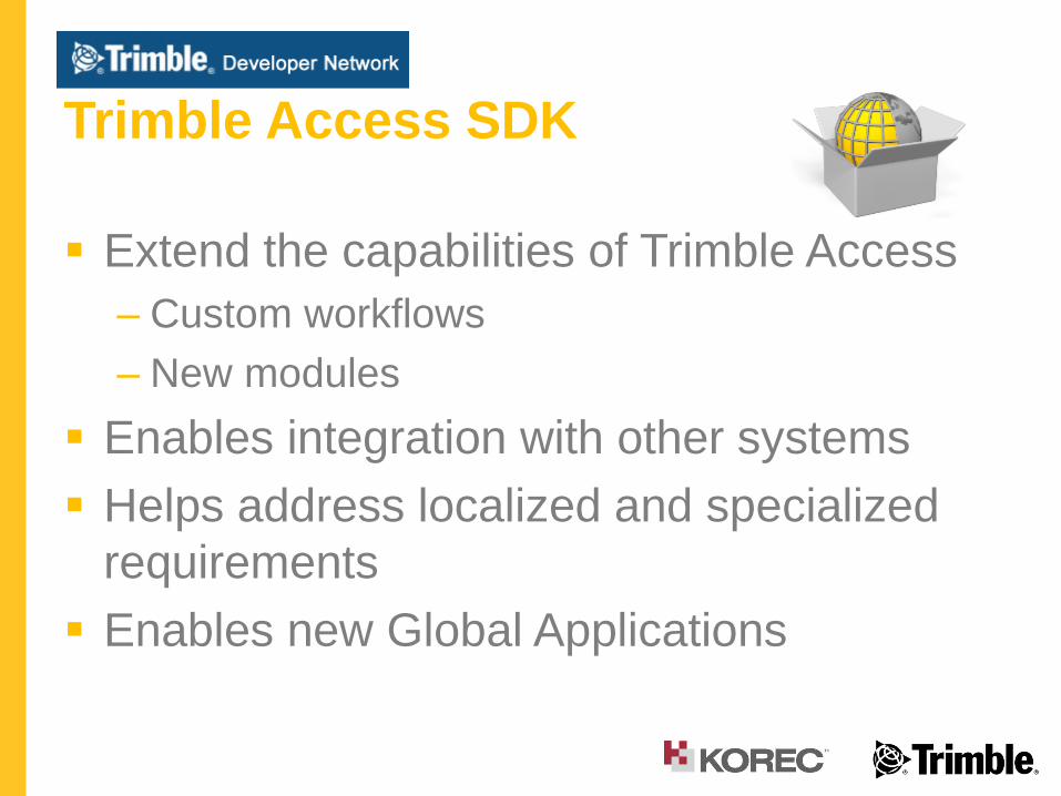
Trimble Access SDK
Extend the capabilities of Trimble Access
– Custom workflows
– New modules
Enables integration with other systems
Helps address localized and specialized
requirements
Enables new Global Applications

Trimble Precision SDK

Trimble Precision SDK
Trimble’s modern software solution to
instrument-level access
Enables connecting, and controlling our
sensors from 3rd party software
applications
Augments low-level commands in an
easy-to-use SDK
Trimble Pathfinder Toolkit
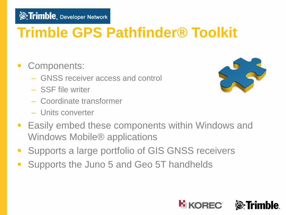
Trimble GPS Pathfinder® Toolkit
Components:
– GNSS receiver access and control
– SSF file writer
– Coordinate transformer
– Units converter
Easily embed these components within Windows and
Windows Mobile® applications
Supports a large portfolio of GIS GNSS receivers
Supports the Juno 5 and Geo 5T handhelds

Trimble Positions Software Suite
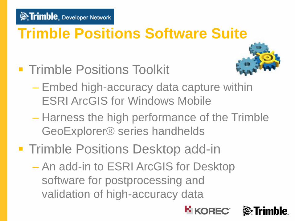
Trimble Positions Software Suite
Trimble Positions Toolkit
– Embed high-accuracy data capture within
ESRI ArcGIS for Windows Mobile
– Harness the high performance of the Trimble
GeoExplorer® series handhelds
Trimble Positions Desktop add-in
– An add-in to ESRI ArcGIS for Desktop
software for postprocessing and
validation of high-accuracy data
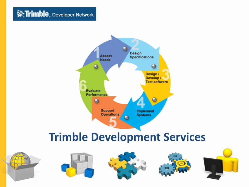
Trimble Development Services

Trimble Development Services
New service offering from the Survey Solutions Group
Provides software development services for:
– Trimble Access modules: Workflows, New Applications
– Trimble Access “exports”: style-sheet development
– Trimble Business Center custom imports / exports

Trimble Development Services
Pricing:
– Determined based on level of effort to
complete the project
– Likely ranges from $7,500 to $30,000
– We provide estimates at no cost

Enabling Solutions
• Project Details: – A Trimble Access Application with Netherland-specific
workflows
– Geometius paid for development by Trimble Development Services
• Customer requirements: – modification / simplification of workflow
– convenient input and overview of feature codes and attributes
– record data without requiring a point measurement

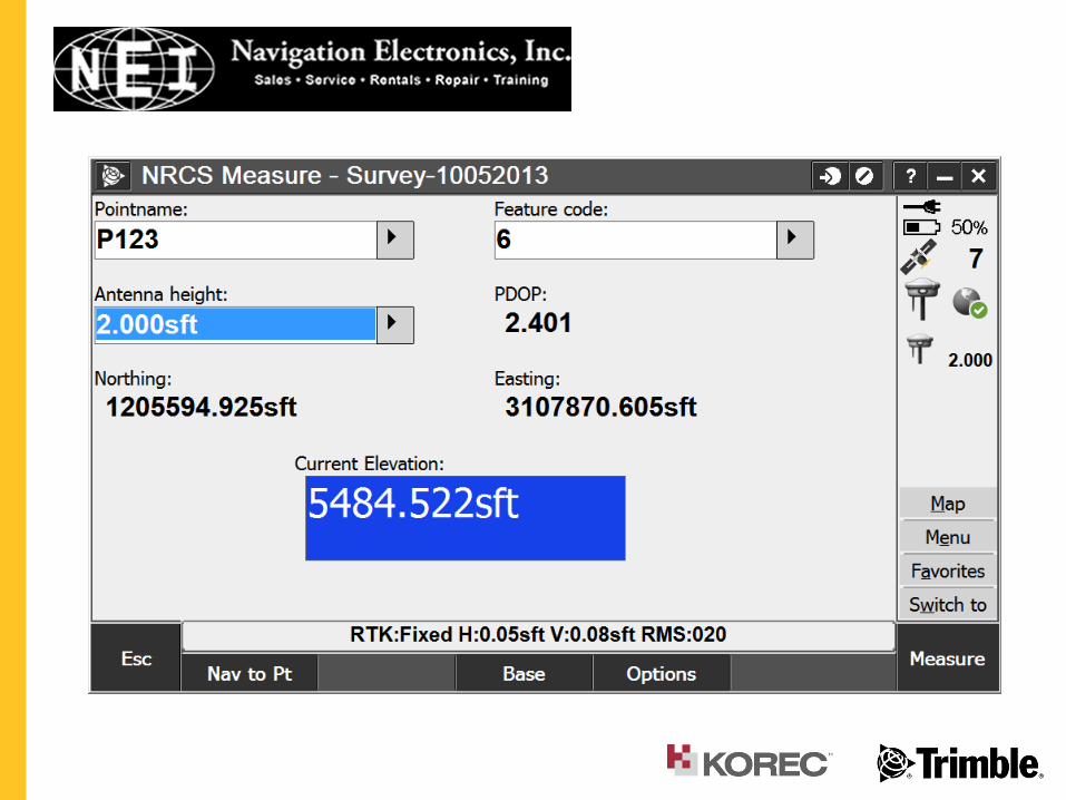
• Customer using Trimble Access and GNSS for river and coastal surveys
• Current Solution not optimal for one user, one button-press operations
• Customer contacted NEI about their problem
• NEI called Trimble Development Services: – Cost to the customer: $6500
– Deliverable was a custom Trimble Access Application branded for the customer
• Daewoo Shipbuilding & Marine Engineering
• Created a Shipbuilding application utilizing precise measurements from a Total Station
• Workflow was inefficient
• GeoSystems recognized the opportunity – Studied the workers to understand the job they needed done
– Developed an optimized application using the Trimble M3 called “BlockSync”

• GeoSystems is now offering this application to other customers
• Keys: – Recognized the opportunity
– Leveraged Trimble Platform
– Opened up a new market
• Results – Enabled new M3 sales
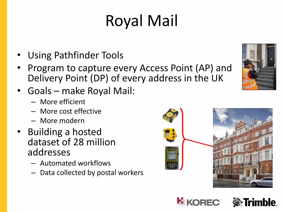
Royal Mail
• Using Pathfinder Tools • Program to capture every Access Point (AP) and
Delivery Point (DP) of every address in the UK • Goals – make Royal Mail:
– More efficient – More cost effective – More modern
• Building a hosted dataset of 28 million addresses – Automated workflows – Data collected by postal workers
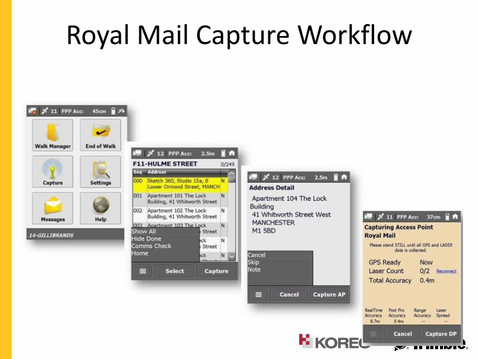
Royal Mail Capture Workflow
Level Me
• Trig-leveling solution for Trimble Total Stations
• Supports full portfolio – M Series and S Series
• Solution makes a Trimble Total Station usable in more situations – Finding elevations in challenging terrain
– Useful when no digital level available
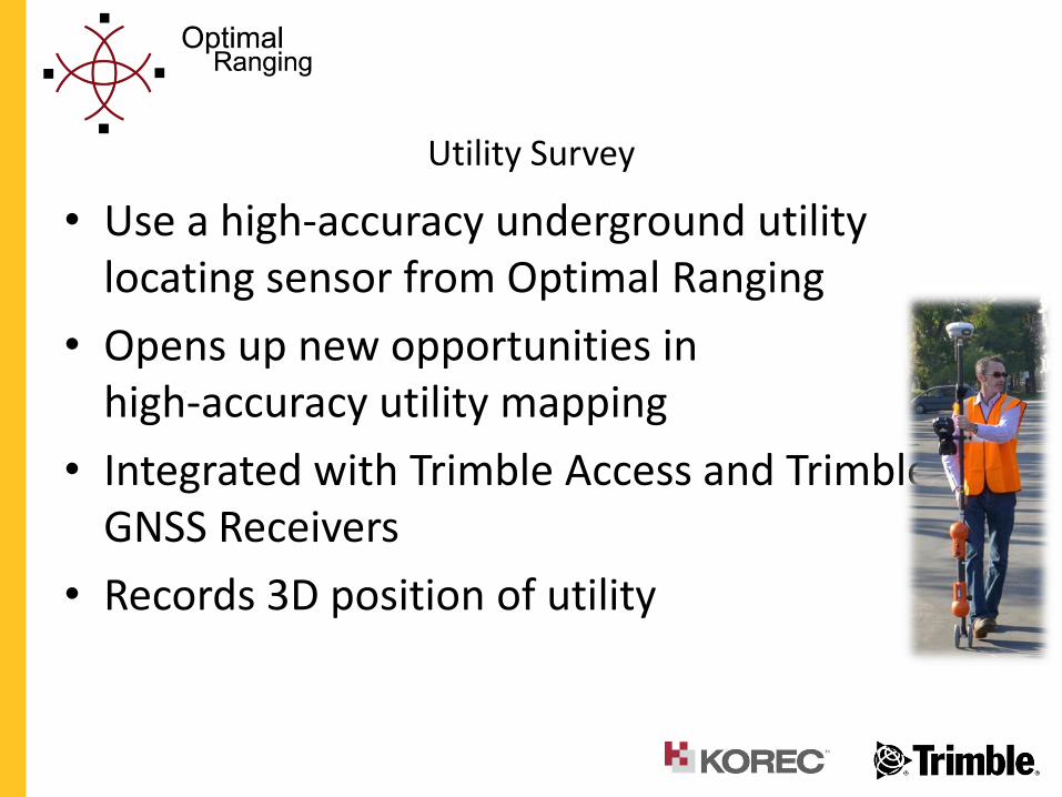
Utility Survey
• Use a high-accuracy underground utility locating sensor from Optimal Ranging
• Opens up new opportunities in high-accuracy utility mapping
• Integrated with Trimble Access and Trimble GNSS Receivers
• Records 3D position of utility
Summary
• Take advantage of the breadth of tools
• Utilize Trimble Development Services
• Leverage Korec’s knowledge of Trimble solutions to your advantage
• Make your data work for you

Modern geodetic solutions for
automated observation
Martin Janousek, Trimble
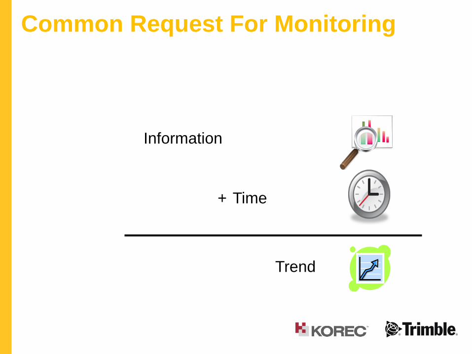
Information
Trend
+ Time
Common Request For Monitoring
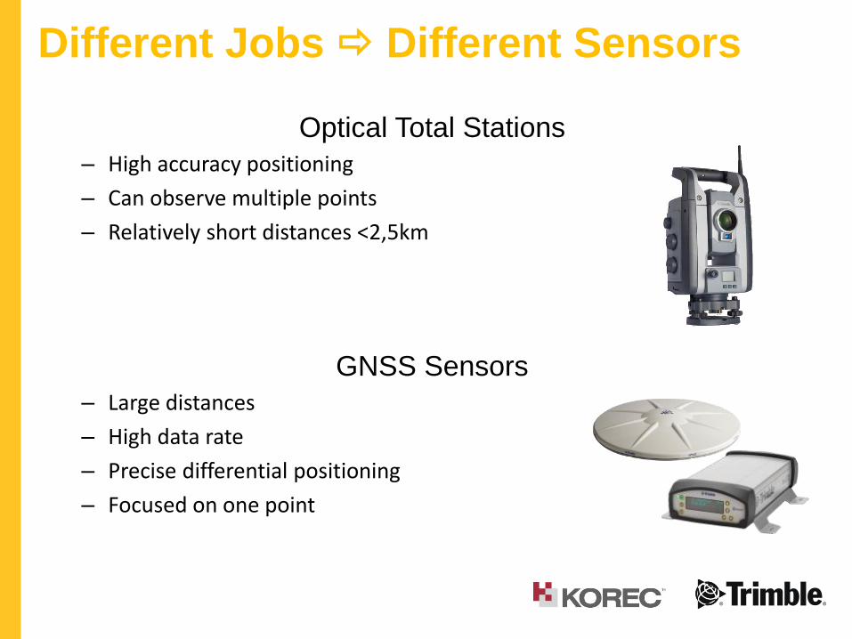
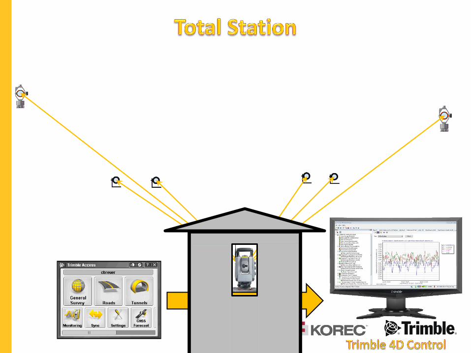
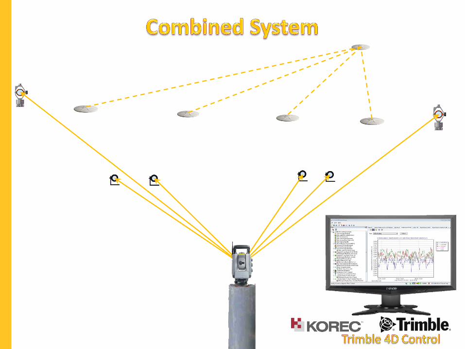
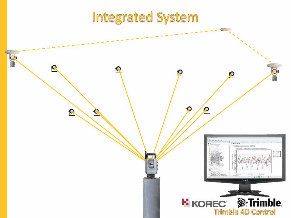
Optical Total Stations
– High accuracy positioning
– Can observe multiple points
– Relatively short distances <2,5km
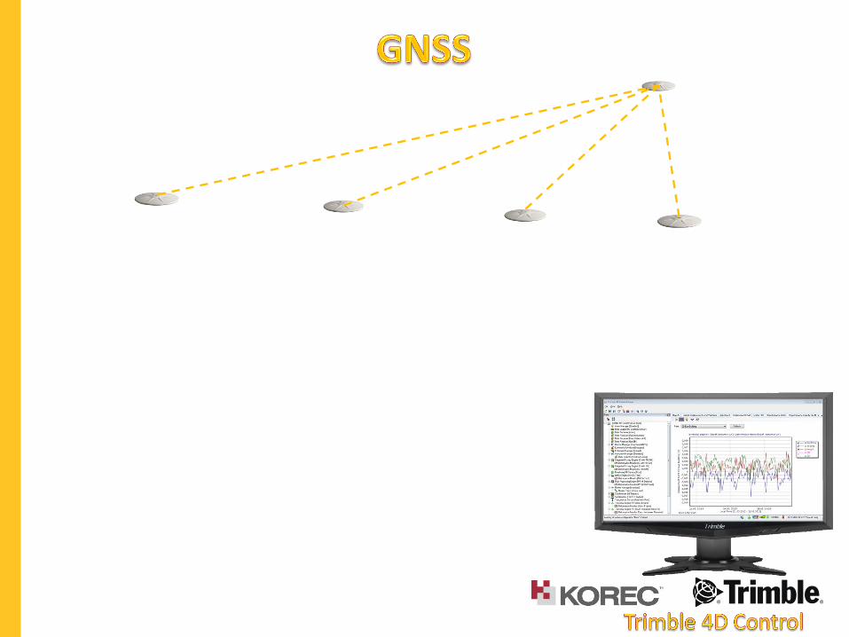
GNSS Sensors
– Large distances
– High data rate
– Precise differential positioning
– Focused on one point
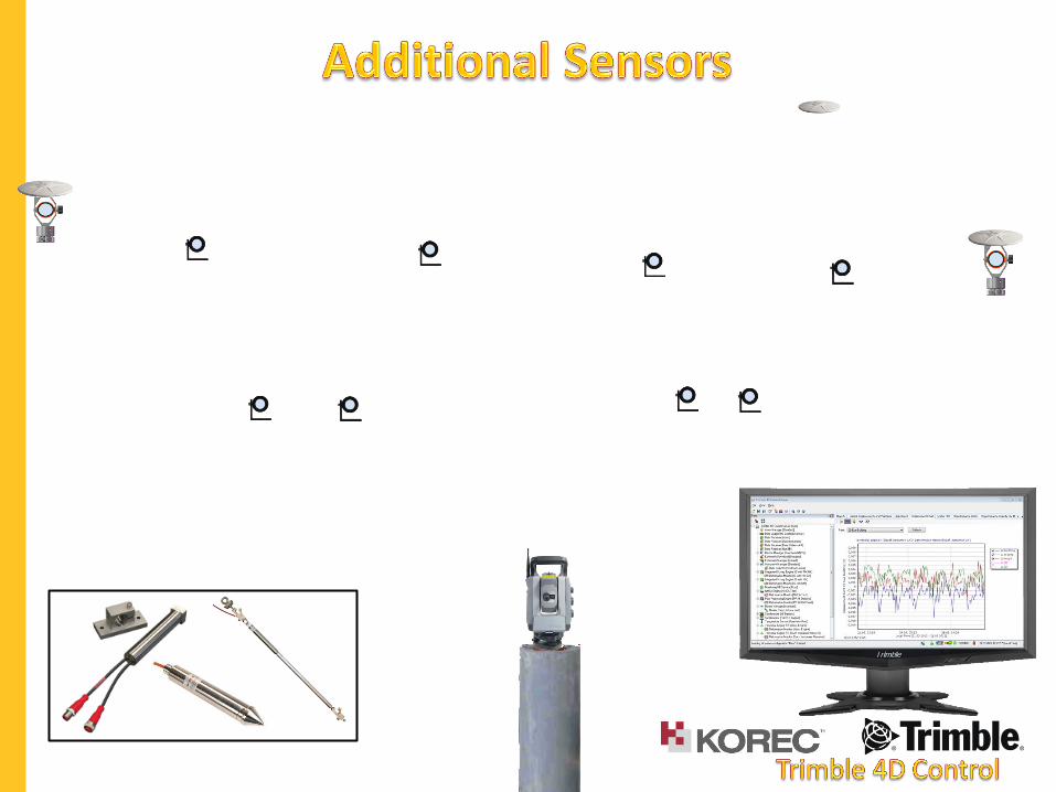
Different Jobs Different Sensors
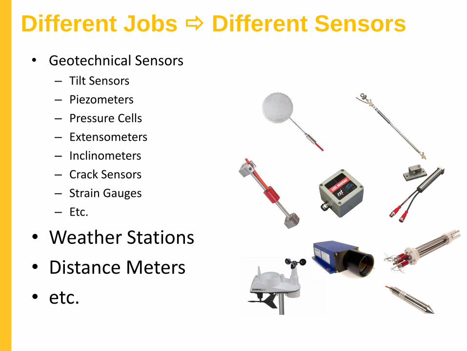
• Geotechnical Sensors – Tilt Sensors
– Piezometers
– Pressure Cells
– Extensometers
– Inclinometers
– Crack Sensors
– Strain Gauges
– Etc.
• Weather Stations
• Distance Meters
• etc.
Different Jobs Different Sensors

Different Jobs Different Sensors
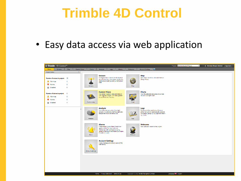
Trimble 4D Control
• Easy data access via web application
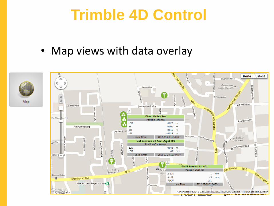
Trimble 4D Control
• Map views with data overlay
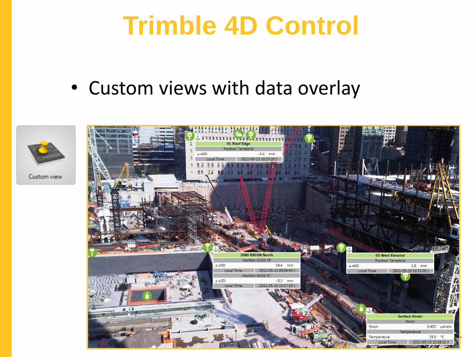
Trimble 4D Control
• Custom views with data overlay
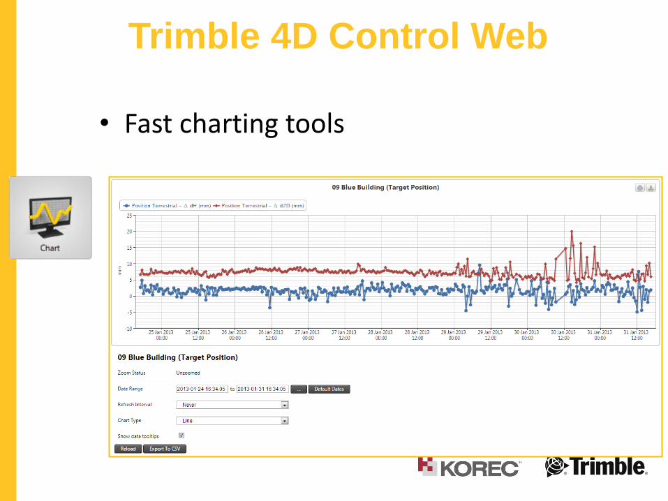
Trimble 4D Control Web
• Fast charting tools
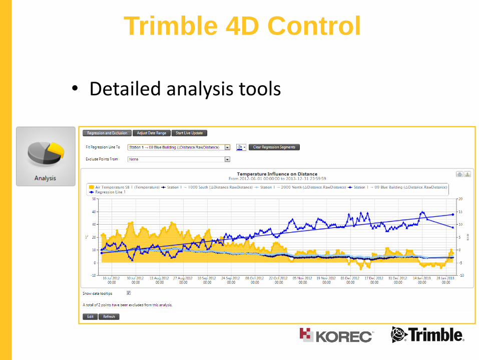
Trimble 4D Control
• Detailed analysis tools

Trimble 4D Control Comprehensive alarming functions
• Comprehensive alarming functions
GNSS applied to land slide Monitoring
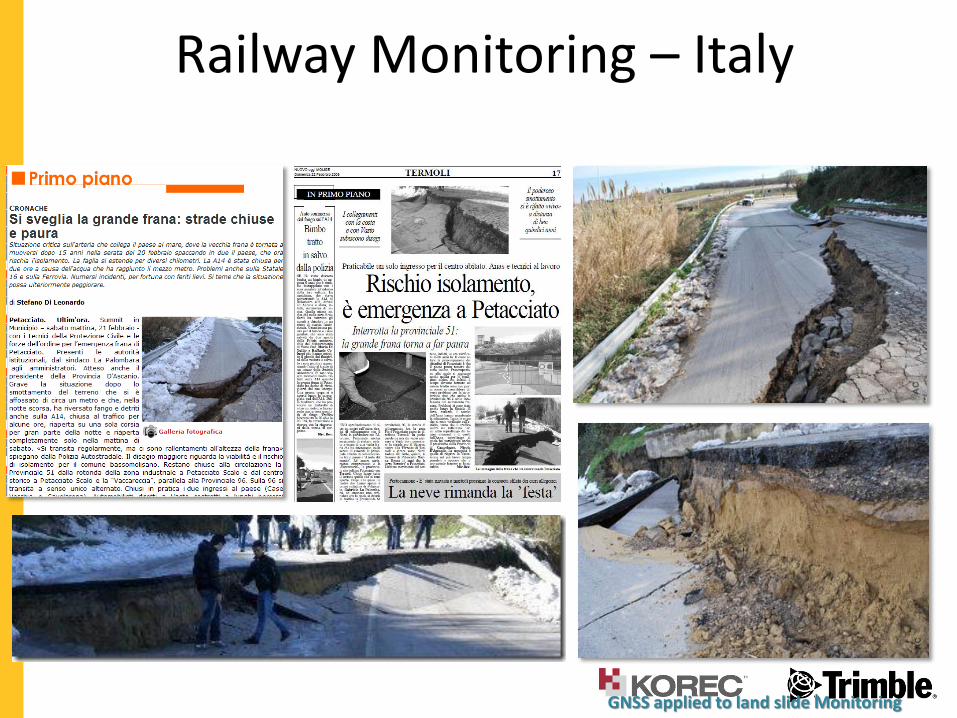
Railway Monitoring – Italy
GNSS applied to land slide Monitoring
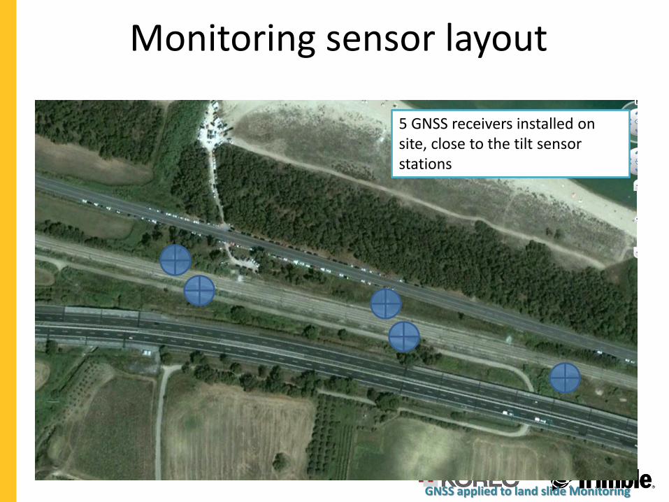
5 GNSS receivers installed on site, close to the tilt sensor stations
Monitoring sensor layout
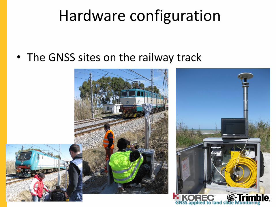
• The GNSS sites on the railway track
GNSS applied to land slide Monitoring
Hardware configuration

Railroad Oslo, Norway
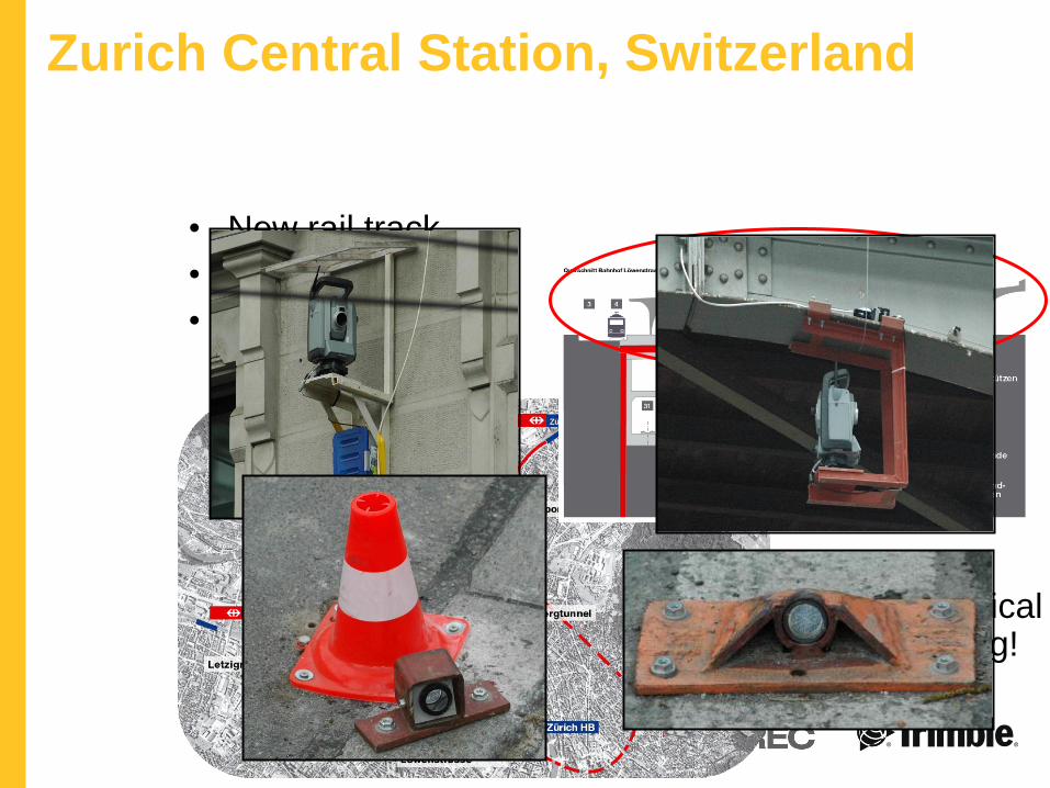
Zurich Central Station, Switzerland
• New rail track
• New train station
• New tunnel
Real-time optical monitoring!

Cotter Dam Canberra, Australia
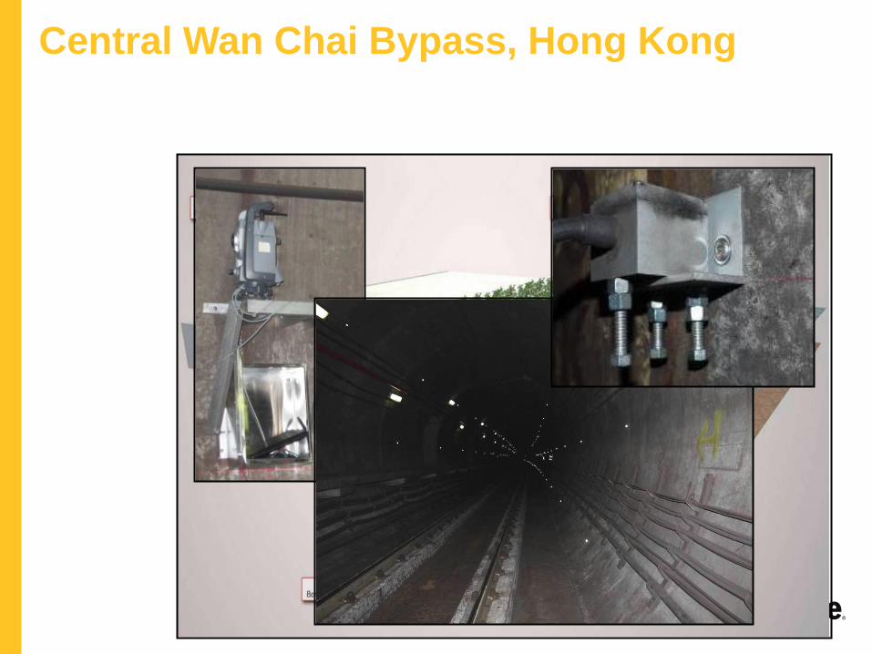
Central Wan Chai Bypass, Hong Kong

www.trimble.com/infrastructure

Nicholas Johnson
Cadsoft Solutions Ltd Creating & Presenting professional 3D models with SketchUp Pro