An archipelago – chain of islands Known as “the land of the rising sun”

BAHARI RESOURCES: AN INTRODUCTION TO THE COMOROS ISLANDS ARCHIPELAGO

COMOROS Eastern Archipelago Offshore Potential
• H.E. Idi Nadhoim • Vice-President
• L’Union des Comores
Where are the Comoros?

Source: United Nations, 2004
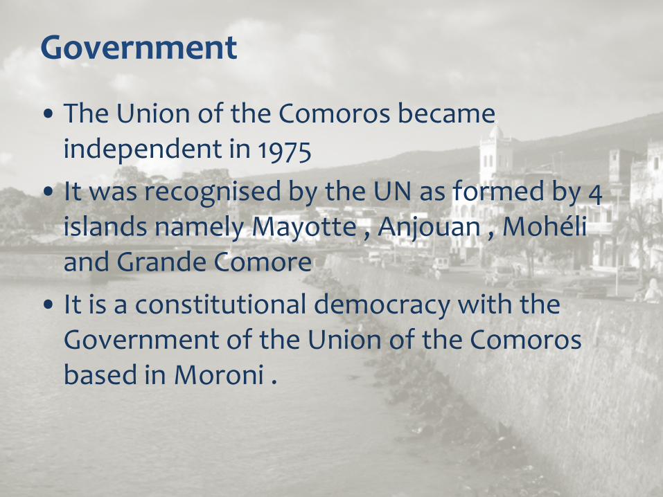
Government
• The Union of the Comoros became independent in 1975
• It was recognised by the UN as formed by 4 islands namely Mayotte , Anjouan , Mohéli and Grande Comore
• It is a constitutional democracy with the Government of the Union of the Comoros based in Moroni .

Territorial Waters

Economy
• The population is 750,000 • GDP is approximately $MM400 • GDP per capita is approximately $600
– the Comoros one of the poorest countries in the world.
• Major exports are vanilla, cloves and essential oils from ylang-ylang
• Tourism is a fledgling industry in the Comoros

Comoros Topography

Regional Geology
• The Rovuma Fan and Davies Fracture zone are prominent features
• The main islands show up as bright red (positive Gravity anomalies) as they are dominantly Volcanic rocks (quite dense) surrounded by water.
• The Volcanism of the Comoros islands is reported to be relatively young, commencing about 15 million years ago.
• Younger sediments of the Rovuma Fan should on-lap the western Flanks of the Islands, forming combination structural/stratigraphic traps.
• The older sediments of the fan and ocean basin may be present beneath the flanks of the volcanics.

Airbourne Gravity Data
Basement and sediment outcrops onshore and Gravity data offshore

Petroleum Exploration Potential
• This is a “frontier exploration” region of East Africa • The main potential appears to be the extension of the
Rovuma Delta into the Comoros, possibly lapping onto Grande Comore
• The Rovuma Delta shows a working petroleum system in the Mnazi Bay discovery near-shore

Bathymetry
PRINCIPAL PLAYS ARE (I) DEEPWATER FAN OF THE ROVUMA DELTA IN DEEPWATER (II) ONLAPPING FLANK OF GRAND COMORE ISLAND

Geologic Plays
• Geologically, the Comoros is separated from East Africa by a transform fault system in the ocean called the Davies Ridge.
• The Bathymetry suggests that the Delta of the Rovuma River has prograded beyond the Davies ridge into 3000 meters+ water depths.
• Faulting along the ridge is known to have created large anticlinal structures.
• In addition one would expect large deepwater fans to be present that could be prospective stratigraphic traps, like the deepwater fans of the Campos Basin of Brazil.

Bahari Exploration Program
• 4-Year Initial Exploration Period – Desk-Top Studies
• Integration of non-proprietary data • Extrapolation of geological trends from the successful Rovuma
Delta geological play
– Develop Lead and Prospect Inventory • Acquire 2D data to refine the geological model • Develop and refine sub-surface studies to mature prospect
inventory
– Rank exploration targets
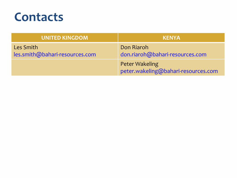
Contacts UNITED KINGDOM KENYA
Les Smith [email protected]
Don Riaroh [email protected]
Peter Wakeling [email protected]