Agent-Based Model of Vertical Tsunami Evacuation Location ...
16
Agent-Based Model of Vertical Tsunami Evacuation Location, Seaside, Oregon Presenter: Jacky Xiaomin Chen Mentors: Dr. Haizhong Wang and Dr. Dan Cox Graduate Students: Alireza Mostafizi, Shangjia Dong August 12, 2016 0 Source from TownMapsUSA
Transcript of Agent-Based Model of Vertical Tsunami Evacuation Location ...

Agent-Based Model of Vertical Tsunami
Evacuation Location, Seaside, Oregon
Presenter: Jacky Xiaomin Chen
Mentors: Dr. Haizhong Wang and Dr. Dan Cox
Graduate Students: Alireza Mostafizi, Shangjia Dong
August 12, 20160
Source from TownMapsUSA

Introduction: Vertical-Evacuation-Structure (VES)
August 12, 20161
• Vertically vs. Horizontally
• Shelters Within the Inundation Area
• Typical VES: Parking garages, commercial buildings,
school facilities etc.

Introduction: VES Capacity
August 12, 20162
Under-100 Level
Source form FEMA, 2009
800 LevelOver-1000 Level

August 12, 20163
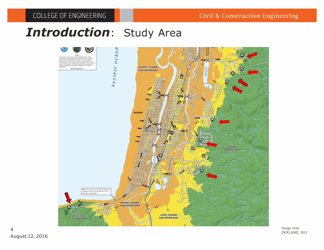
Introduction: Study Area
Images From GoogleMap,
• The city of Seaside, OR, has been identified as having
a high exposure to the CSZ Tsunami (Wood, 2007)
• The city with 83% of its population, 89% of its
employees and almost 100% of its critical facilities in
the tsunami inundation zone (OSSPAC, 2013)
August 12, 20164
Introduction: Study Area
Image from DOGAMI, 2013

Methodology: Agent-based Model Interface
August 12, 20165

Methodology: Agent-based Model Interface
August 12, 20166

August 12, 20167
Methodology: Agent-based Model Interface
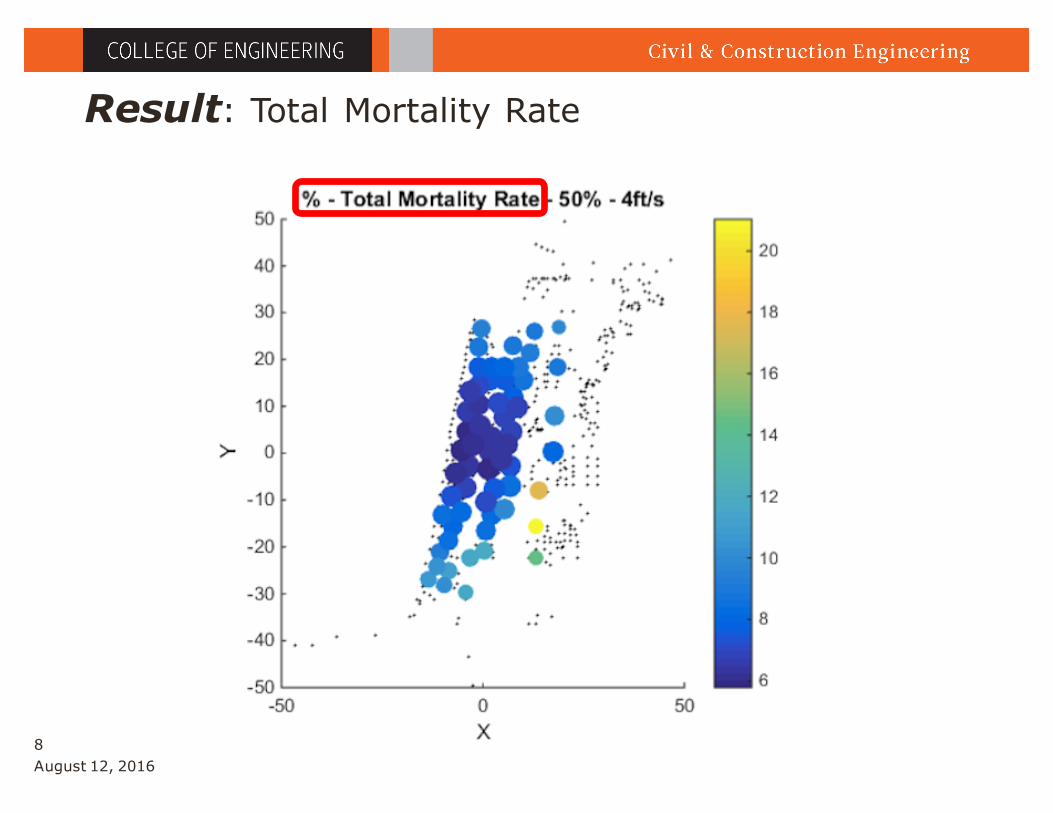
Result: Total Mortality Rate
August 12, 20168

Result: Mortality rate vs. Walking speed
August 12, 20169
VES_100% 3ft/s 4ft/s 5ft/s
Mortality Rate Range: 63.8% - 10.5% 30.8% - 1.6% 6.2% - 0.2%
August 12, 201610
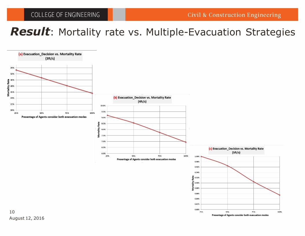
Result: Mortality rate vs. Multiple-Evacuation Strategies
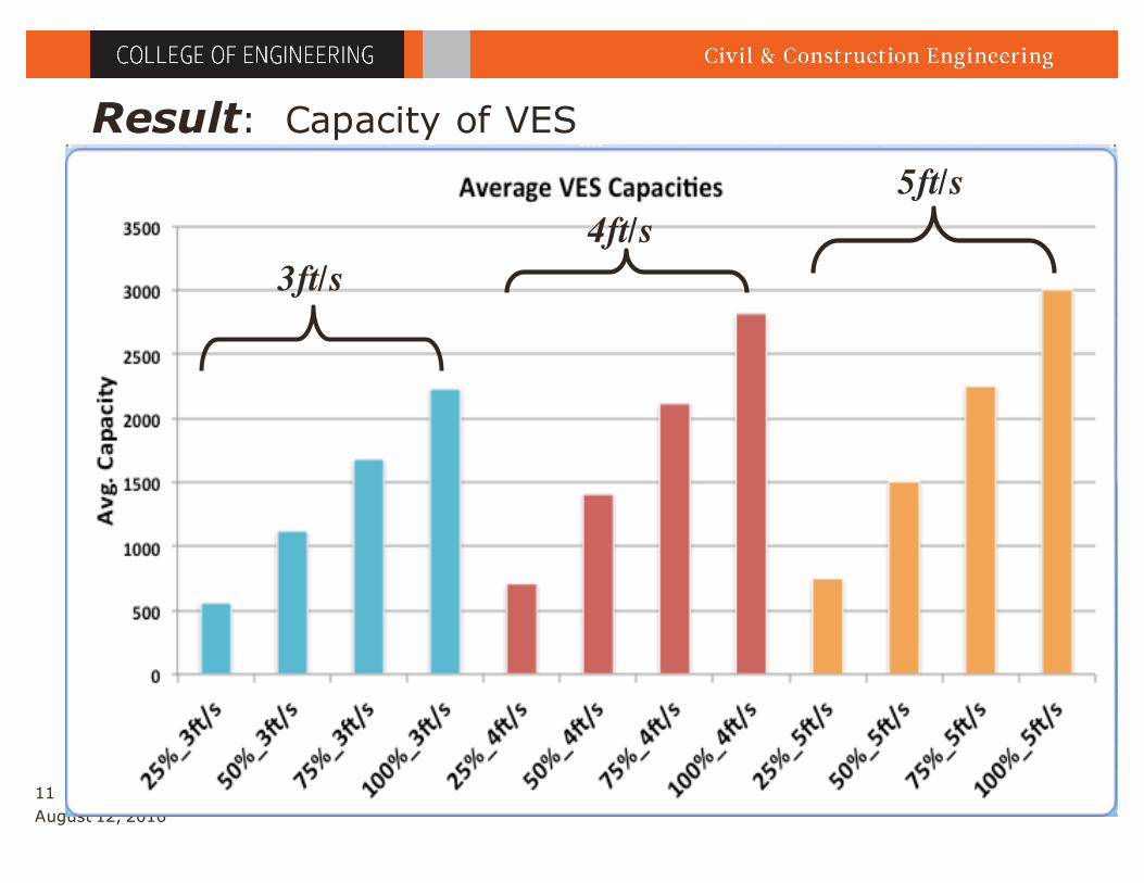
Result: Capacity of VES
August 12, 201611
3ft/s4ft/s
5ft/s
• Mortality Rate Decrease:1. Walking Speed Increase 2. More Population Evacuate Horizontally AND Vertically
• VES Capacity: 60% of Population
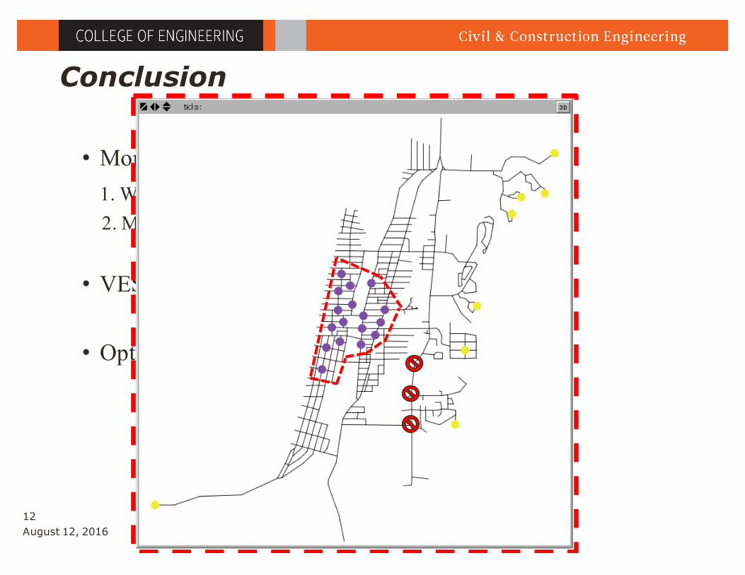
• Optimal Area
Conclusion
August 12, 201612

Acknowledgements
• Prof. Haizhong Wang, Ph.D
• Prof. Daniel Cox, Ph.D
• Alireza Mostafizi,
• Shangjia Dong,
August 12, 201613
Thank You All !
Q & A

Acknowledgement
The authors would like to acknowledge the funding support from Oregon Sea Grant and National Science Foundation (NSF).
Acknowledgement
The authors would like to acknowledge the funding support from Oregon Sea Grant, and National Science Foundation (NSF) through project #1563618.

Bibliography
• Department of Geology and Mineral Industries. Oregon Tsunami Evacuation Route Maps. N.p., 13 June 2013.
• FEMA P646A. "Vertical Evacuation from Tsunamis: A Guide for Community Officials." FEMA.gov. N.p., June 2009. Web.
• Wood, N., 2007. Variations in City Exposure and Sensitivity to Tsunami Hazards in Oregon. Tech. Rep. 5283, U.S.
Geological Survey Scientific Investigations Report.
• OSSPAC. The Oregon Resilience Plan Reducing Risk and Improving Recovery for the next Cascadia Earthquake and
Tsunami. Salem, Or.: Oregon Seismic Safety Policy Advisory Commission, 2013. Print.
August 12, 201615