Adressing Floods and Drought in GEF supported TDA/SAPs IWC-7 October 2013 Peter Bjornsen, UNEP-DHI...
16
Adressing Floods and Drought in GEF supported TDA/SAPs IWC-7 October 2013 Peter Bjornsen, UNEP-DHI Centre
-
Upload
matilda-waters -
Category
Documents
-
view
217 -
download
2
Transcript of Adressing Floods and Drought in GEF supported TDA/SAPs IWC-7 October 2013 Peter Bjornsen, UNEP-DHI...

Adressing Floods and Droughtin GEF supported TDA/SAPs
IWC-7October 2013
Peter Bjornsen, UNEP-DHI Centre

TDA SAPVolta Basin X (X)Senegal River Basin X XLake Chad Basin X XOrange-Senqu River Basin X Danube river Basin X XSão Francisco river Basin (DAB)
X X
Okavango River Basin X Lake Victoria Basin X XLake Tanganyika X XLake Shkoder X Pantanal Basin (in portuguese)
X
Kura River Basin X Lake Peipsi X San Juan River Basin X Bermejo River Basin X XDnipro River Basin X XNiger River Basin X XAmazon river basin XTumen River Basin X

Causes Impacts Events describedQualitatively
Monitoring
Flood events*: Above average rainfall,inapropriately used dams, unsustainable agriculture and mining, Illegal diversion of river channels for mining.Droughts :Increased water demand, deforestation,longer dry seasons,lack of transboundary coordination and efficient governance (also for floods).
Flood events: Loss of infrastructure, Loss of livelihoods, Droughts: Poverty, Increased migration,Social instability. Land degradation, Biodiversity loss. Coastal ecosystem erosion; Aquatic invasive species; Increased sedimentation,Loss of soil and vegetative cover, Deteriorating water quality.
Changes in the overall aggregate volume available, and changes in the temporal and seasonal distribution of water availability observed. Water shortages have become more intense and less predictable.
Develop and establish national/ regional land-basedactivities data and information management systemDevelop capabilities of GIS use/Monitor supply and quality of water in major rivers/
Volta Basin

Climatic variability and change
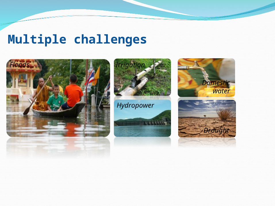
Multiple challenges
Floods Irrigation
Hydropower
Domesticwater
Drought

Why Decision Support Systems?
Provide an opportunity to embed IT and analytical tools more thoroughly in WR agencies’ workflow;
Provide a technical platform for collaboration internally and externally;
The DSS concept matches well with implementation of IWRM processes by WR agencies

Real-time
SAP
TDAScreeningand assessment
Informationmanagement
Prevention and mitigation
Climate change adaptation
Operational forecasting
Emergencymanagement

Typical Technical Frameworks of DSSs
….with an array of underlying generic tools

Linkage to observation networks and data sources;
Formulation of appropriate data collection programs;
Data processing & analysis tools; Procedures for data transfer &
sharing; Approve / quality control of data /
information

Main Components of DSSs
Assessments of current situation; Evaluating planning scenarios; Climate change impacts & adaptation; Water allocation procedures; Disaster management ;

Structured analysis and use of data; Understanding complex cause-effect relationships; Consistent scenario modelling
Process oriented models
Planning oriented models

Main Components of DSSs
Sharing of data / information ; Publishing plans / reports; Stakeholder involvement; Providing learning tools.

Tools
Scenario AnalysisScripting
Multi Criteria Analysis
Time Series ProcessingGIS
Spread Sheets WEB Publishing
Simulation codes
Data Bridges
Access Control
Optimisers Scheduling
Indicators
Visualisation
Adapters Down scaling


How does DSS fit with IWRM at river basin level ?RecognitionIdentify problems and needs
Public awarenessAssessmentsCourse of actionsDraft Planning
CoordinationReaching agreements
Final basin PlanImplementationMonitoring & evaluation