adeca.alabama.govadeca.alabama.gov/Divisions/owr/floodplain/NFIP/Model Flood Damage... · Web...
56
ALABAMA MODEL FLOOD DAMAGE PREVENTION ORDINANCE Riverine (non-coastal) Communities Notes to Users: (1) Where there is {red bracketed and underlined } lettering, the community is to insert the language that is applicable for local information and convert the lettering to match the document’s font. (2) Where there is bold and underlined blue lettering, that indicates administrative notes to the user for guidance regarding use of the required or optional ordinance language. Remove these reference prior to finalizing the ordinance for publication. (3) Where there is blue italicized lettering, that indicates optional language which is generally more restrictive, higher standards or for more clarification that the community may use if it chooses to. It is advised that the community’s attorney be consulted for possible conflicts with other local ordinances or preferences. Convert the lettering to match the document’s font if used. If the community has adopted the State Building Codes, some of these provisions may be redundant with those codes. (4) Please remove the current language in the h e a d e r s a n d footers before publishing the ordinance. Either leave them blank or replace language applicable to the community. FLOOD DAMAGE PREVENTION ORDINANCE {Community } {Ordinance No. } ARTICLE 1 Statutory Authorization, Findings of Fact, Purpose And Objectives SECTION A STATUTORY AUTHORIZATION The Legislature of the State of Alabama has in Title 11, Chapter 19, Sections 1-24, Chapter 45, Sections 1-11, Chapter 52, Sections 1-84, and Title 41, Chapter 9, Section 166 of the Code of Alabama, 1975, authorized local government units to adopt regulations designed to promote the public health, safety, and general welfare of its citizenry. Therefore, the {Governing Body }, of {Community }, Alabama, does ordain as follows:
Transcript of adeca.alabama.govadeca.alabama.gov/Divisions/owr/floodplain/NFIP/Model Flood Damage... · Web...
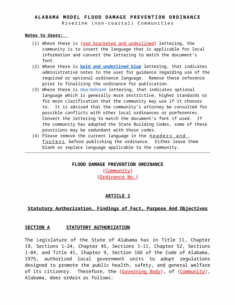
A L A B A M A M O D E L F L O O D D A M A G E P R E V E N T I O N O R D I N A N C ER i v e r i n e ( n o n - c o a s t a l ) C o m m u n i ti e s
Notes to Users:
(1) Where there is {red bracketed and underlined} lettering, the community is to insert the language that is applicable for local information and convert the lettering to match the document’s font.
(2) Where there is bold and underlined blue lettering, that indicates administrative notes to the user for guidance regarding use of the required or optional ordinance language. Remove these reference prior to finalizing the ordinance for publication.
(3) Where there is blue italicized lettering, that indicates optional language which is generally more restrictive, higher standards or for more clarification that the community may use if it chooses to. It is advised that the community’s attorney be consulted for possible conflicts with other local ordinances or preferences. Convert the lettering to match the document’s font if used. If the community has adopted the State Building Codes, some of these provisions may be redundant with those codes.
(4) Please remove the current language in the h e a d e r s a n d f o o t e r s before publishing the ordinance. Either leave them blank or replace language applicable to the community.
FLOOD DAMAGE PREVENTION ORDINANCE{Community}
{Ordinance No.}
ARTICLE 1
Statutory Authorization, Findings of Fact, Purpose And Objectives
SECTION A STATUTORY AUTHORIZATION
The Legislature of the State of Alabama has in Title 11, Chapter 19, Sections 1-24, Chapter 45, Sections 1-11, Chapter 52, Sections 1-84, and Title 41, Chapter 9, Section 166 of the Code of Alabama, 1975, authorized local government units to adopt regulations designed to promote the public health, safety, and general welfare of its citizenry. Therefore, the {Governing Body}, of {Community}, Alabama, does ordain as follows:
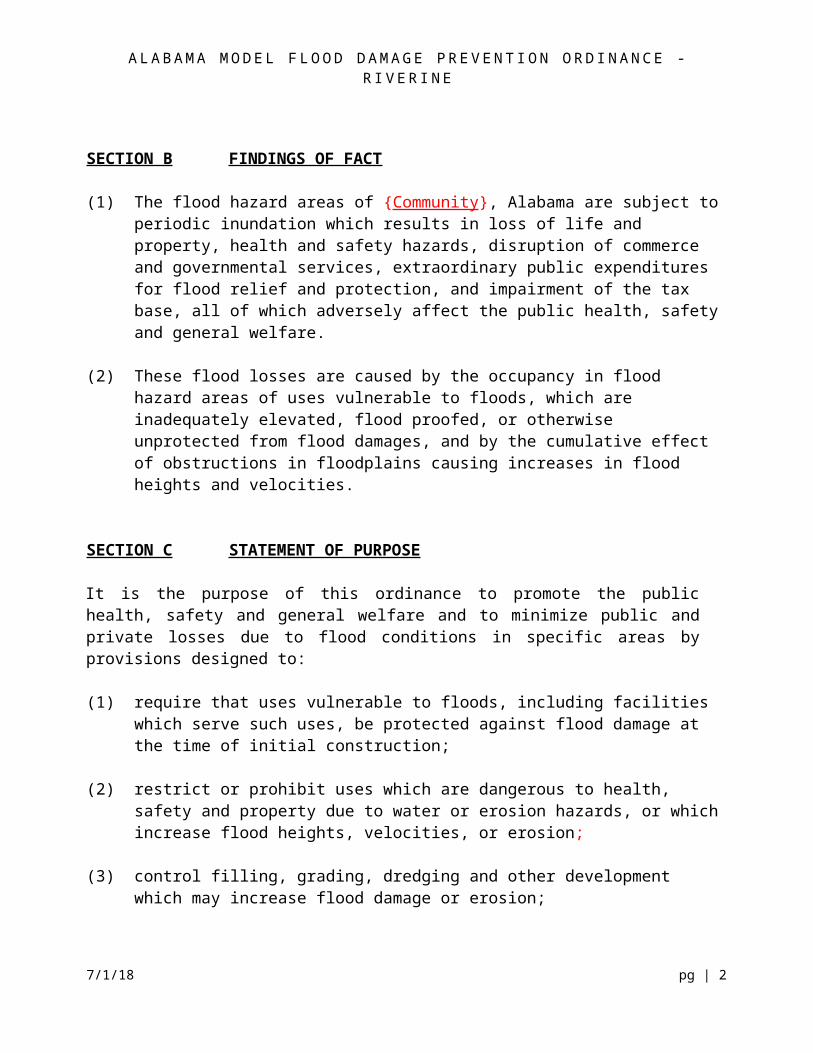
SECTION B FINDINGS OF FACT (1) The flood hazard areas of {Community}, Alabama are subject to periodic inundation which
results in loss of life and property, health and safety hazards, disruption of commerce and governmental services, extraordinary public expenditures for flood relief and protection, and impairment of the tax base, all of which adversely affect the public health, safety and general welfare.
(2) These flood losses are caused by the occupancy in flood hazard areas of uses vulnerable to
floods, which are inadequately elevated, flood proofed, or otherwise unprotected from flood damages, and by the cumulative effect of obstructions in floodplains causing increases in flood heights and velocities.
A L A B A M A M O D E L F L O O D D A M A G E P R E V E N T I O N O R D I N A N C E - R I V E R I N E
SECTION C STATEMENT OF PURPOSE It is the purpose of this ordinance to promote the public health, safety and general welfare and to minimize public and private losses due to flood conditions in specific areas by provisions designed to: (1) require that uses vulnerable to floods, including facilities which serve such uses, be
protected against flood damage at the time of initial construction; (2) restrict or prohibit uses which are dangerous to health, safety and property due to water or
erosion hazards, or which increase flood heights, velocities, or erosion; (3) control filling, grading, dredging and other development which may increase flood damage
or erosion; (4) prevent or regulate the construction of flood barriers which will unnaturally divert flood
waters or which may increase flood hazards to other lands; and (5) control the alteration of natural floodplains, stream channels, and natural protective barriers
which are involved in the accommodation of flood waters. SECTION D OBJECTIVES The objectives of this ordinance are: (1) to protect human life and health; (2) to minimize damage to public facilities and utilities such as water and gas mains, electric,
telephone and sewer lines, streets and bridges located in floodplains; (3) to help maintain a stable tax base by providing for the sound use and development of flood
prone areas in such a manner as to minimize flood blight areas, (4) to minimize expenditure of public money for costly flood control projects; (5) to minimize the need for rescue and relief efforts associated with flooding and generally
undertaken at the expense of the general public; (6) to minimize prolonged business interruptions, and (7) to ensure that potential home buyers are notified that property is in a flood area.
ARTICLE 27/1/18 pg | 2
A L A B A M A M O D E L F L O O D D A M A G E P R E V E N T I O N O R D I N A N C E - R I V E R I N E
GENERAL PROVISIONS
SECTION A LANDS TO WHICH THIS ORDINANCE APPLIES This ordinance shall apply to all Areas of Special Flood Hazard within the jurisdiction of {Community}, Alabama. SECTION B BASIS FOR AREA OF SPECIAL FLOOD HAZARD The Areas of Special Flood Hazard identified by the Federal Emergency Management Agency in its Flood Insurance Study (FIS), dated {date of effective FIS/FIRM}, with accompanying maps and other supporting data and any revision thereto, are adopted by reference and declared a part of this ordinance. For those land areas acquired by a municipality through annexation, the current effective FIS and data for {corresponding county} are hereby adopted by reference. Areas of Special Flood Hazard may also include those areas known to have flooded historically or defined through standard engineering analysis by governmental agencies or private parties but not yet incorporated in the FIS. {Identify specific areas here, including study title and date along with maps}
When Preliminary Flood Insurance Studies and Flood Insurance Rate Maps have been provided by FEMA to the {Community}:
(1) Prior to the issuance of a Letter of Final Determination (LFD) by FEMA, the use of the preliminary flood hazard data shall only be required where no base flood elevations and/or floodway areas exist or where the preliminary base flood elevations or floodway area exceed the base flood elevations and/or floodway widths in the effective flood hazard data provided by FEMA. Such preliminary data may be subject to revision through valid appeals.
(2) Upon the issuance of a Letter of Final Determination (LFD) by FEMA, the revised flood hazard data shall be used and replace all previously effective flood hazard data provided by FEMA for the purposes of administrating these regulations.
Where adopted regulatory standards conflict, the more stringent base flood elevation shall prevail. Preliminary FIS data may be subject to change by a valid appeal. [added 2/15/2018]
SECTION C: ESTABLISHMENT OF A FLOODPLAIN DEVELOPMENT PERMIT
A Development Permit shall be required in conformance with the provisions of this ordinance PRIOR to the commencement of any development activities in identified areas of special flood hazard and community flood hazard areas within the community.
SECTION D. COMPLIANCE
7/1/18 pg | 3
A L A B A M A M O D E L F L O O D D A M A G E P R E V E N T I O N O R D I N A N C E - R I V E R I N E
No structure or land shall hereafter be located, extended, converted or altered without full compliance with the terms of this ordinance and other applicable regulations.
SECTION E. ABROGATION AND GREATER RESTRICTIONS
This ordinance is not intended to repeal, abrogate, or impair any existing ordinance, easements, covenants, or deed restrictions. However, where this ordinance and another conflict or overlap, whichever imposes the more stringent restrictions shall prevail.
SECTION F. INTERPRETATION
In the interpretation and application of this ordinance all provisions shall be: (1) considered as minimum requirements; (2) liberally construed in favor of the governing body, and; (3) deemed neither to limit nor repeal any other powers granted under state statutes.
SECTION G. WARNING AND DISCLAIMER OF LIABILITY
The degree of flood protection required by this ordinance is considered reasonable for regulatory purposes and is based on scientific and engineering considerations. Larger floods can and will occur; flood heights may be increased by man-made or natural causes. This ordinance does not imply that land outside the Areas of Special Flood Hazard or uses permitted within such areas will be free from flooding or flood damages. This ordinance shall not create liability on the part of {Community} or by any officer or employee thereof for any flood damages that result from reliance on this ordinance or any administrative decision lawfully made thereunder.
SECTION H. PENALTIES FOR VIOLATION
(1) Notice of Violation. If the community determines that an applicant or other responsible person has failed to comply with the terms and conditions of a permit, or the provisions of this ordinance, it shall issue a written notice of violation, by certified return receipt mail, to such applicant or other responsible person. Where the person is engaged in activity covered by this ordinance without having first secured a permit, the notice shall be served on the owner or the responsible person in charge of the activity being conducted on the site. The notice of violation shall contain:(a) The name and address of the owner or the applicant or the responsible person;(b) The address or other description of the site upon which the violation is occurring; (c) A statement specifying the nature of the violation;(d) A description of the remedial measures necessary to bring the action or inaction
into compliance with the permit or this ordinance and the date for the completion of such remedial action;
(e) A statement of the penalty or penalties that may be assessed against the person to whom the notice of violation is directed, and;
(f) A statement that the determination of violation may be appealed to the community by filing a written notice of appeal within thirty days after the notice of violation (except, that in the event the violation constitutes an immediate danger to public health or public safety, 24-hour notice shall be sufficient).
[added 2/15/2018]7/1/18 pg | 4
A L A B A M A M O D E L F L O O D D A M A G E P R E V E N T I O N O R D I N A N C E - R I V E R I N E
(2) Additional Enforcement Actions. If the remedial measures described in the Notice of Violation have not been completed by the date set forth for such completion in the Notice of Violation, any one or more of the following enforcement actions may be enacted against the person to whom the Notice of Violation was directed. Before taking any of the following actions or imposing any of the following penalties, the {Community} shall first notify the applicant or other responsible person in writing of its intended action. The {Community} shall provide reasonable opportunity, of not less than ten days (except, that in the event the violation constitutes an immediate danger to public health or public safety, 24-hour notice shall be sufficient) to cure such violation. In the event the applicant or other responsible person fails to cure such violation after such notice and cure period, the {Community} may take or impose any one or more of the following enforcement actions or penalties:
NOTE: The Community may choose which enforcement options it chooses to utilize in addition to the “Notice of Violation” described above.
(a) Stop Work Order : The community may issue a stop work order, which shall be served on the applicant or other responsible person. The stop work order shall remain in effect -until the applicant or other responsible person has taken the remedial measures set forth in the notice of violation or has otherwise cured the violation or violations described therein, provided the stop work order may be withdrawn or modified to enable the applicant or other responsible person to take the necessary remedial measures to cure such violation or violations.
(b) Termination of water service and/or withhold or revoke Certificate of Occupancy: The community may terminate utilities and/or refuse to issue and/or revoke a certificate of occupancy for the building or other improvements and/or repairs conducted or being conducted on the site until the applicant or other responsible person has taken the remedial measures set forth in the notice of violation or has otherwise cured the violation or violations described therein.
(c) Suspension, revocation, or modifications of permit : The community may suspend, revoke, or modify the permit authorizing the development project. A suspended, revoked, or modified permit may be reinstated after the applicant or other responsible person has taken the remedial measures set forth in the notice of violation or has otherwise cured the violations described therein, provided such permit may be reinstated (upon such conditions as the community may deem necessary) to enable the applicant or other responsible person to take the necessary remedial measures to cure such violations.
(d) Civil penalties : Violation of the provisions of this ordinance or failure to comply with any of its requirements, including violation of conditions and safeguards established in connection with grants of variance or special exceptions shall constitute a misdemeanor. Any person who violates this ordinance or fails to comply with any of its requirements shall, upon conviction thereof, be fined not more than {$500.00} or imprisoned for not more than {30} days, or both, and in addition, shall pay all costs and expenses involved in the case: Each day such violation continues shall be considered a separate offense. Nothing herein contained shall prevent the {Community} from taking such other lawful actions as is necessary to prevent or remedy any violation.
7/1/18 pg | 5
A L A B A M A M O D E L F L O O D D A M A G E P R E V E N T I O N O R D I N A N C E - R I V E R I N E
(e) Section 1316 Declaration: Section 1316 of the National Flood Insurance Act authorizes FEMA to deny flood insurance to a property declared by the State, County, or Municipal government to be in violation of the local floodplain management ordinance. A Section 1316 declaration shall be used when all other legal means to remedy a violation have been exhausted and the structure is noncompliant. Once invoked, the property’s flood insurance coverage will be terminated and no new or renewal policy can be issued; no flood insurance claim can be paid on any policy on the property, and disaster assistance will be denied.
The declaration must be in writing (letter or citation), from the community to the property owner and the applicable FEMA Regional Office, and must contain the following items:
i. The name(s) of the property owner(s) and address or legal description of the property sufficient to confirm its identity and location;
ii. A clear and unequivocal declaration that the property is in violation of a cited State or local law, regulation or ordinance;
iii. A clear statement that the public body making the declaration has authority to do so and a citation to that authority;
iv. Evidence that the property owner has been provided notice of the violation and the prospective denial of insurance; and
v. A clear statement that the declaration is being submitted pursuant to section 1316 of the National Flood Insurance Act of 1968, as amended.
If a structure that has received a Section 1316 declaration is made compliant with the community’s floodplain management ordinance, then the Section 1316 declaration can be rescinded by the community and flood insurance eligibility restored.
[added 2/15/2018]
(3) Administrative appeal; judicial review. Any person receiving a Notice of Violation may appeal the determination of the community, including but not limited to the issuance of a stop work order, the assessment of an administratively-imposed monetary penalty, the suspension, revocation, modification, or grant with condition of a permit by the community upon finding that the holder is in violation of permit conditions, or that the holder is in violation of any applicable ordinance or any of the community's rules and regulations, or the issuance of a notice of bond forfeiture.
The Notice of Appeal must be in writing and must be received within ten days from the date of the Notice of Violation. A hearing on the appeal shall take place within thirty days from the date of receipt of the Notice of Appeal by the Floodplain Administrator.[added 2/15/2018]
(4) All appeals shall be heard and decided by the community's designated Appeal Board, which shall be {title of government body}, or their designees. The Appeal Board shall have the power to affirm, modify, or reject the original penalty, including the right to increase or decrease the amount of any monetary penalty and the right to add or delete remedial actions required for correction of the violation and compliance with the community's flood damage
7/1/18 pg | 6
A L A B A M A M O D E L F L O O D D A M A G E P R E V E N T I O N O R D I N A N C E - R I V E R I N E
prevention ordinance, and any other applicable local, state, or federal requirements. The decision of the Appeal Board shall be final.[added 2/15/2018]
(5) A judicial review can be requested by any person aggrieved by a decision or order of the community, after exhausting his/her administrative remedies. They shall have the right to appeal de novo to the {appropriate court}.[added 2/15/2018]
SECTION I. SAVINGS CLAUSE
If any section, subsection, sentence, clause, phrase, or word of this ordinance is for any reason held to be noncompliant with 44 Code of Federal Regulation 59-78, such decision shall not affect the validity of the remaining portions of this ordinance.
ARTICLE 3
ADMINISTRATION
SECTION A DESIGN ATION OF FLOODPLAIN AD MINISTRATOR
The {Office/Division/Position Title} is hereby appointed to administer and implement the provisions of this ordinance. SECTION B PERMIT PROCEDURES
Application for a Development Permit shall be made to the Floodplain Administrator on forms furnished by the community PRIOR to any development activities, and may include, but not be limited to, the following: Plans in duplicate drawn to scale showing the elevations of the area in question and the nature, location, dimensions, of existing or proposed structures, fill placement, storage of materials or equipment, and drainage facilities.
Specifically, the following procedures and information are required for all projects in the Special Flood Hazard Areas within the jurisdiction of {Community}: (1) Application Stage [revised 7/1/2018]
Plot plans are to include:
(a) The Base Flood Elevation (BFE) where provided as set forth in Article 2, Section B; Article 4, Section C; or Article 5, Section D;
(b) Boundary of the Special Flood Hazard Area and floodway(s) as delineated on the FIRM or other flood map as determined in Article 2, Section B;
(c) Flood zone designation of the proposed development area as determined on the FIRM or other flood map as determined in Article 2, Section B;
7/1/18 pg | 7
A L A B A M A M O D E L F L O O D D A M A G E P R E V E N T I O N O R D I N A N C E - R I V E R I N E
(d) Elevation in relation to mean sea level (or highest adjacent grade) of the regulatory lowest floor level, including basement, of all proposed structures;
(e) Elevation in relation to mean sea level to which any non-residential structure will be flood proofed;
(f) Design certification from a registered professional engineer or architect that any proposed non-residential flood-proofed structure will meet the flood-proofing criteria of Article 4, Sections B(2) and E(2);
(g) A Foundation Plan, drawn to scale, that shall include details of the proposed foundation system to ensure all provisions of this ordinance are met. These details include, but are not limited to, the proposed method of elevation (i.e., fill, solid foundation perimeter wall, solid backfilled foundation, open foundation on columns/posts/piers/piles/shear walls) and description of any flood openings required in accordance with Article 4, Sections B(1), B(3), D(7), and E(1) when solid foundation perimeter walls are used.
(h) Usage details of any enclosed areas below the lowest floor shall be described. (i) Plans and/or details for the protection of public utilities and facilities such as sewer,
gas, electrical, and water systems to be located and constructed to minimize flood damage.
(j) Description of the extent to which any watercourse will be altered or relocated as a result of a proposed development including current and proposed locations of the watercourse. An engineering report shall be provided on the effects of the proposed project on the flood-carrying capacity of the watercourse and the effects to properties located both upstream and downstream. The affected properties shall be depicted on a map or on the plot plan.
(k) Certification of the plot plan by a licensed professional engineer or surveyor in the State of Alabama is required.
(2) Construction Stage [revised 7/1/2018]
For all new construction and substantial improvements, the permit holder shall provide to the Floodplain Administrator an as-built certification of the regulatory floor elevation or flood-proofing level using appropriate FEMA elevation or floodproofing certificate immediately after the lowest floor or flood proofing is completed. When flood proofing is utilized for non-residential structures, said certification shall be prepared by or under the direct supervision of a professional engineer or architect and certified by same.
Any work undertaken prior to submission of these certifications shall be at the permit holder's risk. The Floodplain Administrator shall review the above referenced certification data submitted. Deficiencies detected by such review shall be corrected by the permit holder immediately and prior to further progressive work being allowed to proceed. Failure to submit certification or failure to make said corrections required hereby, shall be cause to issue a stop-work order for the project. As the work pursuant to a floodplain development permit progresses, the Floodplain Administrator shall make as many inspections of the work as may be necessary
The Floodplain Administrator shall make periodic inspections of projects during construction throughout the Special Flood Hazard Areas within the jurisdiction of the
7/1/18 pg | 8
A L A B A M A M O D E L F L O O D D A M A G E P R E V E N T I O N O R D I N A N C E - R I V E R I N E
community to ensure that the work is being done according to the provisions of the local ordinance and the terms of the permit. Members of his or her inspections/engineering department shall have a right, upon presentation of proper credentials, to enter on any premises within the territorial jurisdiction of the department at any reasonable hour for the purposes of inspection or other enforcement action.
The Floodplain Administrator may revoke and require the return of the floodplain development permit by notifying the permit holder in writing stating the reason(s) for the revocation. Permits shall be revoked for any substantial departure from the approved application, plans, and specifications; for refusal or failure to comply with the requirements of State or local laws; or for false statements or misrepresentations made in securing the permit. Any floodplain development permit mistakenly issued in violation of an applicable State or local law may also be revoked.
In any lot or lots/areas that will be or have been removed from the special flood hazard area utilizing a Letter of Map Revision Based on Fill (LOMR-F), the top of fill level must meet the community's freeboard elevation at that location. If the top of fill level is below the freeboard elevation, all new structures, additions to existing buildings or substantial improvement must meet the required community freeboard elevation. [added 2/15/2018]
(3) Finished Construction [added 7/1/2018]
Upon completion of construction, a FEMA elevation certificate (FEMA Form81-31), which depicts all finished construction elevations, is required to be submitted to the Floodplain Administrator prior to issuance of a Certificate of Occupancy. If the project includes a floodproofing measure, a FEMA floodproofing certificate is required to be submitted by the permit holder to the Floodplain Administrator.
The Floodplain Administrator shall review the certificate(s) data submitted. Deficiencies detected by such review shall be corrected by the permit holder immediately and prior to Certificate of Compliance/Occupancy issuance. In some instances, another certification may be required to certify corrected as-built construction. Failure to submit the certification or failure to make required corrections shall be cause to withhold the issuance of a Certificate of Compliance/Occupancy.
Documentation regarding completion and compliance with the requirements stated in the permit application and with Article 3, Section B(1) of this ordinance shall be provided to the local Floodplain Administrator at the completion of construction or records shall be maintained throughout the Construction Stage by inspectors for the Floodplain Administrator. Failure to provide the required documentation shall be cause to withhold the issuance of a Certificate of Compliance/Occupancy.
All records that pertain to the administration of this ordinance shall be maintained and made available for public inspection, recognizing that such information may be subject to the Privacy Act of 1974, as amended.
SECTION C DUTIES AND RESPONSIBILITIES OF THE ADMINISTRATOR7/1/18 pg | 9
A L A B A M A M O D E L F L O O D D A M A G E P R E V E N T I O N O R D I N A N C E - R I V E R I N E
Duties of the Floodplain Administrator shall include, but shall not be limited to: (1) Review all development permits to assure that the permit requirements of this ordinance
have been satisfied; and assure th at development si tes are reasonably safe from flooding. (2) Review copies of all necessary permits from governmental agencies from which approval is
required by Federal or State law, including section 404 of the Federal Water Pollution Control Act Amendments of 1972, 33 U.S.C. 1334. Maintain such permits permanently with floodplain development permit file.
(3) When Base Flood Elevation data or floodway data have not been provided in accordance
with Article 2, Section B then the Floodplain Administrator shall obtain, review and reasonably utilize any base flood elevation and floodway data available from a Federal, State, or other sources in order to administer the provisions of Article 4.
(4) Verify and record the actual elevation in relation to mean sea level (or highest adjacent
grade) of the regulatory floor level, including basement, of all new construction or substantially improved structures in accordance with Article 3, Section B.
(5) Verify and record the actual elevation, in relation to mean sea level to which any new or
substantially improved structures have been flood-proofed, in accordance with Article 4, Sections B(2) and E(2).
(6) When flood proofing is utilized for a structure, the Floodplain Administrator shall obtain
certification of design criteria from a registered professional engineer or architect in accordance with Article 3, Section B(1)(c) and Article 4, Section B(2) or E(2).
(7) Notify adjacent communities and the Alabama Department of Natural Resources prior to
any alteration or relocation of a watercourse and submit evidence of such notification to the Federal Emergency Management Agency (FEMA), and the Alabama Department of Economic and Community Affairs/Office of Water Resources/NFIP State Coordinator’s Office.
(8) For any altered or relocated watercourse, submit engineering data/analysis within six (6)
months to FEMA and State to ensure accuracy of community flood maps through the Letter of Map Revision process. Assure flood carrying capacity of any altered or relocated watercourse is maintained.
(9) Where interpretation is needed as to the exact location of boundaries of the Areas of Special
Flood Hazard (for example, where there appears to be a conflict between a mapped boundary and actual field conditions) the Floodplain Administrator shall make the necessary interpretation. Any person contesting the location of the boundary shall be given a reasonable opportunity to appeal the interpretation as provided in this Ordinance.
(10) All records pertaining to the provisions of this ordinance shall be maintained in the office of the Floodplain Administrator and shall be open for public inspection.
7/1/18 pg | 10
A L A B A M A M O D E L F L O O D D A M A G E P R E V E N T I O N O R D I N A N C E - R I V E R I N E
(11) In addition, the Floodplain Administrator and his or her designated staff is hereby authorized and directed to enforce the provisions of this ordinance. The Administrator is further authorized to render interpretations of this ordinance, which are consistent with its spirit and purpose. [added 2/15/2018]
(a) Right of Entryi. Whenever necessary to make an inspection to enforce any of the provisions of
this ordinance, or whenever the Administrator has reasonable cause to believe that there exists in any building or upon any premises any condition or ordinance violation which makes such building, structure or premises unsafe, dangerous or hazardous, the Administrator may enter such building, structure or premises at all reasonable times to inspect the same or perform any duty imposed upon the Administrator by this ordinance.
ii. If such building or premises are occupied, the Administrator shall first present proper credentials and request entry. If such building, structure, or premises are unoccupied, he shall first make a reasonable effort to locate the owner or other persons having charge or control of such building or premises.
iii. If entry is refused, the Administrator shall have recourse to every remedy provided by law to secure entry.
iv. When the Administrator shall have first obtained a proper inspection warrant or other remedy provided by law to secure entry, no owner or occupant or any other persons having charge, care or control of any building, structure, or premises shall fail or neglect, after proper request is made as herein provided, to promptly permit entry therein by the Administrator for the purpose of inspection and examination pursuant to this ordinance.
(b) Stop Work Ordersi. Upon notice from the Administrator, work on any building, structure or premises
that is being performed contrary to the provisions of this ordinance shall immediately cease.
ii. Such notice shall be in writing and shall be given to the owner of the property, or to his or her agent, or to the person doing the work, and shall state the conditions under which work may be resumed.
(c) Revocation of Permitsi. The Administrator may revoke a permit or approval, issued under the provisions
of this ordinance, in case there has been any false statement or misrepresentation as to the material fact in the application or plans on which the permit or approval was based.
ii. The Administrator may revoke a permit upon determination that the construction, erection, alteration, repair, moving, demolition, installation, or replacement of the structure for which the permit was issued is in violation of, or not in conformity with, the provisions of this ordinance.
[added 2/15/2018] 7/1/18 pg | 11
A L A B A M A M O D E L F L O O D D A M A G E P R E V E N T I O N O R D I N A N C E - R I V E R I N E
ARTICLE 4
PROVISIONS FOR FLOOD HAZARD REDUCTION
SECTION A GENERAL STANDARDS In ALL Areas of Special Flood Hazard the following provisions are required:
(1) Require copies of all necessary permits from governmental agencies from which approval is required by Federal or State law, including section 404 of the Federal Water Pollution Control Act Amendments of 1972, 33 U.S.C. 1334. Maintain such permits be on file.
(2) New construction and substantial improvements of existing structures shall be anchored to prevent flotation, collapse and lateral movement of the structure.
(3) New construction and substantial improvements of existing structures shall be constructed with materials and utility equipment resistant to flood damage.
(4) New construction and substantial improvements of existing structures shall be constructed by methods and practices that minimize flood damage: (a) All subdivision proposals shall be consistent with the need to minimize flood
damage; (b) All subdivision proposals shall have public utilities and facilities such as sewer, gas,
electrical and water systems located and constructed to minimize flood damage; (c) All subdivision proposals shall have adequate drainage provided to reduce exposure
to flood hazards.
(5) All heating and air conditioning equipment and components, all electrical, ventilation, plumbing, and other service facilities shall be designed and/or located so as to prevent water from entering or accumulating within the components during conditions of flooding.
(6) Manufactured homes shall be anchored to prevent flotation, collapse, and lateral movement. Methods of anchoring may include, but are not limited to, use of over-the-top or frame ties to ground anchors. This standard shall be in addition to and consistent with applicable State requirements for resisting wind forces.
(7) New and replacement water supply systems shall be designed to minimize or eliminate infiltration of flood waters into the system.
(8) New and replacement sanitary sewage systems shall be designed to minimize or eliminate infiltration of flood waters into the systems and discharges from the systems into flood waters.
7/1/18 pg | 12
A L A B A M A M O D E L F L O O D D A M A G E P R E V E N T I O N O R D I N A N C E - R I V E R I N E
(9) On-site waste disposal systems shall be located and constructed to avoid impairment to them or contamination from them during flooding.
(10) Any alteration, repair, reconstruction or improvement to a structure which is not compliant with the provisions of this ordinance, shall be undertaken only if the non- conformity is not furthered, extended or replaced.
(11) Proposed new construction and substantial improvements that are partially located in an area of special flood hazard shall have the entire structure meet the standards for new construction. [added 2/15/2018]
(12) Proposed new construction and substantial improvements that are located in multiple flood hazard risk zones or in a flood hazard risk zone with multiple base flood elevations shall have the entire structure meet the standards for the most hazardous flood hazard risk zone and the highest base flood elevation. [added 2/15/2018]
SECTION B SPECIFIC STANDARDS In ALL Areas of Special Flood Hazard designated as A1-30, AE, AH, A (with engineered or estimated base flood elevation), the following provisions are required:
(1) Residential and Non-residential Structures - Where base flood elevation data is available, new construction and substantial improvement of any structure or manufactured home shall have the lowest floor, including basement, elevated no lower than one foot above the base flood elevation. Should solid foundation perimeter walls be used to elevate a structure, openings sufficient to facilitate the unimpeded movements of flood waters shall be provided in accordance with standards of Article 4, Section B(3).
(2) Non-Residential Structures - New construction and substantial improvement of any non-
residential structure located in A1-30, AE, or AH zones, may be floodproofed in lieu of elevation. The structure, together with attendant utility and sanitary facilities, must be designed to be water tight to one (1) foot above the base flood elevation, with walls substantially impermeable to the passage of water, and structural components having the capability of resisting hydrostatic and hydrodynamic loads and the effect of buoyancy. A registered professional engineer or architect shall certify that the design and methods of construction are in accordance with accepted standards of practice for meeting the provisions above, and shall provide such certification to the official as set forth above and in Article 3, Section C(6).
Dry floodproofing is allowed only where flood velocities are less than or equal to five feet per second. A registered professional engineer or architect shall certify that the standards of this subsection are satisfied. A Flood Emergency Operation Plan and an Inspection and Maintenance Plan must be provided by the design professional for the building. Such certification shall be provided to the Floodplain Administrator. [added 2/15/2018]
(3) Enclosures for Elevated Buildings - All new construction and substantial improvements of
existing structures that include ANY fully enclosed area below the base flood elevation, 7/1/18 pg | 13
A L A B A M A M O D E L F L O O D D A M A G E P R E V E N T I O N O R D I N A N C E - R I V E R I N E
located below the lowest floor formed by the foundation and other exterior walls shall be designed so as to be an unfinished or flood resistant enclosure. The enclosure shall be designed to equalize hydrostatic flood forces on exterior walls by allowing for the automatic entry and exit of flood waters. [revised 2/15/2018]
(a) Designs for complying with this requirement must either be certified by a
professional engineer or architect or meet the following minimum criteria: (i) Provide a minimum of two openings having a total net area of not less than
one square inch for every square foot of enclosed area subject to flooding (if a structure has more than one enclosed area below the base flood elevation, each shall have openings on exterior walls);
(ii) The bottom of all openings shall be no higher than one foot above grade; and (iii) Openings may be equipped with screens, louvers, valves and other coverings
and devices provided they permit the automatic flow of floodwater in both directions.
(b) So as not to violate the "Lowest Floor" criteria of this ordinance, the unfinished or flood resistant enclosure shall only be used for parking of vehicles, limited storage of maintenance equipment used in connection with the premises, or entry to the elevated area.
(c) The interior portion of such enclosed area shall not be partitioned or finished into separate rooms. All interior walls, ceilings and floors below the base flood elevation shall be unfinished and/or constructed of flood resistant materials. [revised 2/15/2018]
(d) Mechanical, electrical or plumbing devices shall not be installed below the Base Flood Elevation. The interior portion of such enclosed area(s) shall be void of utilities except for essential lighting and power as required.
(e) Property owners shall be required to execute a flood openings/venting affidavit acknowledging that all openings will be maintained as flood vents, and that the elimination or alteration of the openings in any way will violate the requirements for enclosures below the base flood elevation. Periodic inspections will be conducted by the Floodplain Administrator to ensure compliance. [added 2/15/2018]
(f) Property owners shall agree, certify, and declare to the following conditions and restrictions placed on the affected property as a condition for granting a permit. A binding agreement, referred to as a Non-conversion Agreement, is required to be executed and recorded with the Deed. It shall obligate the Owner to the following terms and conditions: (i) That the enclosed area(s) shall remain fully compliant with all parts of the
section Enclosures for Elevated Buildings of this Ordinance unless otherwise modified to be fully compliant with the applicable sections of the Flood Damage Prevention Ordinance in effect at the time of conversion.
(ii) A duly appointed representative of the {City/Town/County} is authorized to enter the property for the purpose of inspecting the exterior and interior of the enclosed area to verify compliance with the Agreement and Permit.
(iii) The community may take any appropriate legal action to correct any violation pertaining to the Agreement and the subject Permit.
[added 2/15/2018] 7/1/18 pg | 14
A L A B A M A M O D E L F L O O D D A M A G E P R E V E N T I O N O R D I N A N C E - R I V E R I N E
(4) Standards for Manufactured Homes and Recreational Vehicles - Where base flood elevation data are available:
(a) All manufactured homes placed and substantially improved on:
(i) individual lots or parcels, (ii) in new or substantially improved manufactured home parks or subdivisions, (iii) in expansions to existing manufactured home parks or subdivisions, or (iv) on a site in an existing manufactured home park or subdivision where a
manufactured home has incurred "substantial damage" as the result of a flood, must have the lowest floor including basement elevated no lower than one foot above the base flood elevation.
(b) Manufactured homes placed and substantially improved in an existing manufactured home park or subdivision may be elevated so that either: (i) the lowest floor of the manufactured home is elevated no lower than one foot
above the level of the base flood elevation, or (ii) where no Base Flood Elevation exists, the manufactured home chassis and
supporting equipment is supported by reinforced piers or other foundation elements of at least equivalent strength and is elevated to a maximum of 60 inches (five feet) above grade.
(c) All Manufactured homes must be securely anchored to an adequately anchored foundation system to resist flotation, collapse and lateral movement.
(d) All recreational vehicles placed on sites must either: (i) be on the site for fewer than 180 consecutive days, fully licensed and ready
for highway use if it is licensed, on its wheels or jacking system, attached to the site only by quick disconnect type utilities and security devices, and has no permanently attached structures or additions; or
(ii) the recreational vehicle must meet all the requirements for "New Construction," including the anchoring and elevation requirements of Article 4, Section B, provisions (3)(a) and (3)(c).
(5) Requi re , until a regulatory floodway is designated , that no new construction, substantial improvements, or other development (including fill) shall be permitted within Zones A1-30 and AE on the {Community} FIRM, unless it is demonstrated that the cumulative effect of the proposed development, when combined with all other existing and anticipated development, will not increase the water surface elevation of the base flood more than one foot at any point within the community. [added 2/15/2018]
(6) Accessory Structures (also referred to as appurtenant structures) – This provision generally applies to new and substantially improved accessory structures. When an accessory structure complies with all other provisions of this ordinance (including floodway encroachment), represents a minimal investment (less than {$____}), and meets the requirements outlined below, these structures may be wet-floodproofed and do not have to be elevated or dry floodproofed. [added 2/15/2018]
NOTE: Community to designate the value that defines “minimal investment” for its own community. Values typically range between $300 - $1,000.
7/1/18 pg | 15
A L A B A M A M O D E L F L O O D D A M A G E P R E V E N T I O N O R D I N A N C E - R I V E R I N E
Accessory structures include, but are not limited to, residential structures such as detached garages, storage sheds for garden tools or woodworking, gazebos, picnic pavilions, boathouses, small pole barns, and similar buildings. The following provisions apply to accessory structures built below the base flood elevation:
(a) A permit shall be required prior to construction or installation. (b) Must be low value (less than {$____}) and not be used for human habitation. (c) Use must be restricted to parking of personal vehicles or limited storage (low-cost
items that cannot be conveniently stored in the principal structure). (d) Must be designed with an unfinished interior and constructed with flood damage-
resistant materials below the BFE. (e) Must be adequately anchored to prevent flotation, collapse, or lateral movement. (f) Must have adequate flood openings as described in Article 4, Section A (5) and be
designed to otherwise have low flood damage potential. (g) Shall be constructed and placed on the building site so as to offer the minimum
resistance to the flow of floodwaters. (h) Any mechanical and other utility equipment in the structure must be elevated to or
above the BFE or must be floodproofed. (i) Under limited circumstances communities may issue variances to permit
construction of wet-floodproofed accessory structures. Communities should not grant variances to entire subdivisions for accessory structures, especially detached garages. Variances should only be reviewed and issued on an individual or case-by-case basis and be based on the unique characteristics of the site.
(j) If located in a V Zone, the structure must be elevated on posts, piles, piers, or columns; consistent with all V Zone building standards.
[added 2/15/2018]
SECTION C FLOODWAYS Located within Areas of Special Flood Hazard established in Article 2, Section B, are areas designated as floodway. A floodway may be an extremely hazardous area due to velocity floodwaters, debris or erosion potential. In addition, the area must remain free of encroachment in order to allow for the discharge of the base flood without increased flood heights. Therefore, the following provisions shall apply: (1) The community shall select and adopt a regulatory floodway based on the principle that the
area chosen for the regulatory floodway must be designed to carry the waters of the base flood, without increasing the water surface elevation of that flood more than one foot at any point;
(2) Encroachments are prohibited, including fill, new construction, substantial improvements or
other development within the adopted regulatory floodway. Development may be permitted however, provided it is demonstrated through hydrologic and hydraulic analyses performed in accordance with standard engineering practice that the encroachment shall not result in any increase in flood levels or floodway widths during a base flood discharge. A registered professional engineer must provide supporting technical data and certification thereof;
7/1/18 pg | 16
A L A B A M A M O D E L F L O O D D A M A G E P R E V E N T I O N O R D I N A N C E - R I V E R I N E
(3) A community may permit encroachments within the adopted regulatory floodway that would result in an increase in base flood elevations, provided that the community first applies for a conditional letter of map revision (CLOMR) and floodway revision, fulfills the requirements for such revisions as established under the provisions of § 65.12, and receives the approval of FEMA;
(4) ONLY if Article 4, Section C, provisions (1) through (3) are satisfied, then any new
construction or substantial improvement shall comply with all other applicable flood hazard reduction provisions of Article 4.
OR, if a community wishes to prohibit all development within the floodway, adopt the following language in place of paragraphs (2) through (4) from Section C shown above.
(2) Encroachments, including fill, new construction, placement of manufactured homes, substantial improvements, and other development, are prohibited. [added 2/15/2018]
(3) As long as no fill, structures (including additions), or other impediments to flow are added, permissible uses within the floodway may include: lawns, gardens, athletic fields, play areas, picnic grounds, and hiking/biking/horseback riding trails, general farming, pasture, outdoor plant nurseries, horticulture, forestry, wildlife sanctuary, game farm, and other similar agricultural, wildlife, and related uses. The uses in this subsection are permissible only if and to the extent that they do not cause any increase in flood levels during the base flood discharge. [added 2/15/2018]
SECTION D BUILDING STANDARDS FOR STREAMS WITHOUT ESTABLISHED BASE FLOOD ELEVATIONS (APPROXIMATE A-ZONES)
Located within the Areas of Special Flood Hazard established in Article 2, Section B, where streams exist but no base flood data have been provided (Approximate A-Zones), the following provisions apply: (1) Base flood elevation data shall be provided for subdivision proposals and all other proposed
development, including manufactured home parks and subdivisions, greater than fifty (50) lots or five (5) acres, whichever is the lesser.
(2) When base flood elevation data or floodway data have not been provided in accordance with Article 2, Section B then the Floodplain Administrator shall obtain, review, and reasonably utilize any scientific or historic Base Flood Elevation and floodway data available from a Federal, State, or other source, in order to administer the provisions of Article 4. ONLY if data are not available from these sources, then Article 4, Section D, provisions (5) and (6) shall apply:
(3) No encroachments, including structures or fill material, shall be located within an area equal to the width of the stream or twenty-five feet, whichever is greater, measured from the top of the stream bank, unless certification by a registered professional engineer is provided
7/1/18 pg | 17
A L A B A M A M O D E L F L O O D D A M A G E P R E V E N T I O N O R D I N A N C E - R I V E R I N E
demonstrating that such encroachment shall not result in any increase in flood levels during the occurrence of the base flood discharge.
(4) All development in Zone A must meet the requirements of Article 4, Section A and Section B(1) through B(4).
(5) In special flood hazard areas without base flood elevation data, new construction and substantial improvements of existing structures shall have the lowest floor (for the lowest enclosed area; including basement) elevated no less than three (3) feet above the highest adjacent grade.
(6) In the absence of a base flood elevation, a manufactured home must also meet the elevation requirements of Article 4, Section B(4)(b)(ii) in that the structure must be elevated to a maximum of 60 inches (5 feet).
(7) Openings sufficient to facilitate automatic equalization of flood water hydrostatic forces on exterior walls shall be provided in accordance with standards of Article 4, Section B(3)(a). The Floodplain Administrator shall certify the lowest floor elevation level and the record shall become a permanent part of the permit file.
(8) Fill within the area of special flood hazard shall result in no net loss of natural floodplain storage. The volume of loss of floodwater storage due to filling in the special flood hazard area shall be offset by providing an equal volume of flood storage by excavation or other compensatory measures at or adjacent to the development site. Any excavation or other measures taken for compensatory storage shall be properly designed to provide protection against erosion or overgrowth of vegetation in order to preserve the storage volume. Proper maintenance measures shall also be undertaken to ensure the intended storage volume remains in perpetuity. [added 2/15/2018]
SECTION E STANDARDS FOR AREAS OF SHALLOW FLOODING (AO ZONES) Areas of Special Flood Hazard established in Article 2, Section B may include designated "AO" shallow flooding areas. These areas have base flood depths of one to three feet (1'-3') above ground, with no clearly defined channel. The following provisions apply: (1) All new construction and substantial improvements of residential and nonresidential
structures shall have the lowest floor, including basement, elevated above the highest adjacent grade at least as high as the depth number specified on the Flood Insurance Rate Map (FIRM) plus one foot of freeboard. If no depth number is specified, the lowest floor, including basement, shall be elevated at least three (3) fe et above the hig hest adjacent grade. Openings sufficient to facilitate the unimpeded movements of flood waters shall be provided in accordance with standards of Article 4, Section B(3).[revised 2/15/2018]
7/1/18 pg | 18
A L A B A M A M O D E L F L O O D D A M A G E P R E V E N T I O N O R D I N A N C E - R I V E R I N E
The Floodplain Administrator shall certify the lowest floor elevation level and the record shall become a permanent part of the permit file.
(2) New construction and the substantial improvement of a non-residential structure may be flood-proofed in lieu of elevation. The structure, together with attendant utility and sanitary facilities, must be designed to be water tight to the spe cified flood level in Article 4, Section E(1) o r three (3) feet (if no depth number is specified), above highest adjacent grade, with walls substantially impermeable to the passage of water, and structural components having the capability of resisting hydrostatic and hydrodynamic loads and the effect of buoyancy. A registered professional engineer or architect shall certify that the design and methods of construction are in accordance with accepted standards of practice for meeting the provisions above, and shall provide such certification to the official as set forth above and as required in Article 3, Section B(1)(c) and (2).
(3) Drainage paths shall be provided to guide floodwater around and away from any proposed structure.
SECTION F STANDARDS FOR SUBDIVISIONS [added 2/15/2018]
(1) All subdivision proposals shall be consistent with the need to minimize flood damage.
(2) All subdivision proposals shall have public utilities and facilities such as sewer, gas, electrical and water systems located and constructed to minimize flood damage.
(3) All subdivision proposals shall have adequate drainage provided to reduce exposure to flood hazards, and;
(4) Base flood elevation data shall be provided for all new subdivision proposals and other proposed development (including manufactured home parks and subdivisions), which is greater than fifty lots or five acres; whichever is the lesser.
(5) All subdivision and other development proposals which involve disturbing more than {area designated by community} square feet of land shall include a stormwater management plan which is designed to limit peak runoff from the site to predevelopment levels for the one, ten, and 100-year rainfall event. These plans shall be designed to limit adverse impacts to downstream channels and floodplains. Single residential lots involving less than one acre of land disturbance are not subject to this regulation.
(6) All preliminary plans for platted subdivisions shall identify the flood hazard area and the elevation of the base flood.
(7) All final subdivision plats will provide the boundary of the special flood hazard area, the floodway boundary, and the base flood elevations.
(8) In platted subdivisions, all proposed lots or parcels that will be future building sites shall have a minimum buildable area outside the natural (non-filled) 1% chance annual floodplain. The buildable area shall be large enough to accommodate any primary structure
7/1/18 pg | 19
A L A B A M A M O D E L F L O O D D A M A G E P R E V E N T I O N O R D I N A N C E - R I V E R I N E
and associated structures such as sheds, barns, swimming pools, detached garages, on-site sewage disposal systems, and water supply wells, where applicable.
SECTION G. CRITICAL FACILITIES [added 2/15/2018]
Construction of new and substantially improved critical facilities shall be located outside the limits of the special flood hazard area (one percent annual chance floodplain). Construction of new critical facilities shall be permissible within the SFHA only if no feasible alternative site is available and access to the facilities remains available during a 0.2 percent chance flood.
(1) Critical facilities constructed within the SFHA shall have the lowest floor elevated three feet above the base flood elevation at the site (or to the 0.2 percent chance flood elevation whichever is greater).
(2) Floodproofing and sealing measures must be implemented to ensure that any and all on-site toxic substances will not be displaced by or released into floodwaters.
(3) Multiple access routes, elevated to or above the 0.2 percent flood elevation, shall be provided to all critical facilities to the maximum extent possible.
(4) Critical facilities must be protected to or above the 0.2 percent chance flood and must remain operable during such an event.
a. The community’s flood response plan must list facilities considered critical in a flood.
b. Other facilities in low risk flood zones that may also be needed to support flood response efforts must be included on the critical facility list.
(5) The use of any structure shall not be changed to a critical facility, where such a change in use will render the new critical facility out of conformance with this section.
ARTICLE 5
VARIANCE PROCEDURES[Article revised 2/15/2018]
SECTION A. DESIGNATION OF VARIANCE AND APPEALS BOARD
The {Appointed Board} as established by the {Governing Body} of {Community} shall hear and decide requests for appeals or variance from the requirements of this ordinance.
SECTION B. DUTIES OF BOARD
The Board shall hear and decide appeals when it is alleged an error in any requirement, decision, or determination is made by the Floodplain Administrator in the enforcement or administration of this ordinance. Any person aggrieved by the decision of the {Appointed Board} may appeal such decision to the {Appropriate Court}, as provided in {State statute}.
7/1/18 pg | 20
A L A B A M A M O D E L F L O O D D A M A G E P R E V E N T I O N O R D I N A N C E - R I V E R I N E
SECTION C. VARIANCE PROCEDURES
In reviewing requests for variance, the {Appointed Board} shall consider all technical evaluations, relevant factors, and standards specified in other sections of this ordinance, and:
(1) Variances may be issued for development necessary for the conduct of a functionally dependent use, provided the criteria of this Article are met, no reasonable alternative exists, the development is protected by methods that minimize flood damage during the base flood, and it creates no additional threats to public safety.
(2) Variances shall not be issued within any designated floodway if ANY increase in flood levels during the base flood discharge would result.
(3) The evaluation must be based on the characteristics unique to that property and not be shared by adjacent parcels. The characteristics must pertain to the land itself, not to the structure, its inhabitants, or its owners.
(4) Variances should never be granted for multiple lots, phases of subdivisions, or entire subdivisions.
(5) The danger of life and property due to flooding or erosion damage including materials that may be swept onto other lands to the injury of others.
(6) The susceptibility of the proposed facility and its contents to flood damage and the effect of such damage on the individual owner and the community.
(7) The safety of access to the property during flood conditions for daily traffic and emergency vehicles.
(8) The importance of the services provided by the proposed facility to the community.
(9) The necessity of the facility to be at a waterfront location, where applicable.
(10) The compatibility of the proposed use with existing and anticipated development based on the community’s comprehensive plan for that area.
(11) The expected heights, velocity, duration, rate of rise, and sediment transport of the floodwaters and the effects of wave action, if applicable, expected at the site.
(12) The costs associated with providing governmental services to the development during and after flood conditions, including maintenance and repair of public utilities and facilities such as sewer, gas, electrical, and water systems, and community infrastructure such as streets, bridges, and culverts.
7/1/18 pg | 21
A L A B A M A M O D E L F L O O D D A M A G E P R E V E N T I O N O R D I N A N C E - R I V E R I N E
Upon consideration of factors listed above, and the purpose of this ordinance, the {Appointed Board} may attach such conditions to the granting of variances as it deems necessary to further the purposes of this ordinance.
SECTION D. VARIANCES FOR HISTORIC STRUCTURES
Variances may be issued for the repair or rehabilitation of Historic Structures upon a determination that the proposed repair or rehabilitation will not preclude the structure's continued designation as a Historic Structure and the variance is the minimum to preserve the historic character and design of the structure.
SECTION E. CONDITIONS FOR VARIANCES
The provisions of this Ordinance are minimum standards for flood loss reduction, therefore any deviation from the standards must be weighed carefully. Variances shall only be issued upon a determination that the variance is the minimum necessary, considering the flood hazard, to afford relief.
(1) In the instance of a Historic Structure, a determination is required that the variance is the minimum necessary so as not to destroy the historic character and design of the building.
(2) A variance shall be issued ONLY when there is:
(a) A finding of good and sufficient cause; (b) A determination that failure to grant the variance would result in exceptional
hardship; and (c) A determination that the granting of a variance will not result in increased flood
heights, additional threats to public safety, extraordinary public expense, create nuisance, cause fraud on or victimization of the public, or conflict with existing local laws or ordinances.
(3) Variances shall not be issued “after the fact.”
SECTION E. VARIANCE NOTIFICATION AND RECORDS
Any applicant to whom a variance is granted shall be given written notice over the signature of a community official that:
(1) Specifies the difference between the base flood elevation and the elevation of the proposed lowest floor and stating that the cost of flood insurance will be commensurate with an increased risk to life and property resulting from the reduced lowest floor elevation. It could result in rate increases in the hundreds and possibly thousands of dollars annually depending on structure and site specific conditions.
(2) The Floodplain Administrator shall maintain a record of all variance actions and appeal actions, including justification for their issuance. Report any variances to the Federal
7/1/18 pg | 22
A L A B A M A M O D E L F L O O D D A M A G E P R E V E N T I O N O R D I N A N C E - R I V E R I N E
Emergency Management Agency Region 4 and the Alabama Department of Economic and Community Affairs/Office of Water Resources upon request.
(3) A copy of the notice shall be recorded by the Floodplain Administrator in the Office of the {Community City Clerk} or {County Administrator} and shall be recorded in a manner so that it appears in the chain of title of the affected parcel of land.
ARTICLE 6
DEFINITIONS
Unless specifically defined below, words or phrases used in this ordinance shall be interpreted so as to give them the meaning they have in common usage and to give this ordinance its most reasonable application.
A Zone means the Area of Special Flood Hazard without base flood elevations determined. [added 2/15/18]
Accessory Structure (also referred to as appurtenant structures) means a structure which is located on the same parcel of property as a principal structure to be insured and the use of which is incidental to the use of the principal structure. They should constitute a minimal initial investment, may not be used for human habitation, and be designed to have minimal flood damage potential. These structures are used solely for parking (two-car detached garages or smaller) or limited storage (small, low cost storage sheds). They are included under the general definition of structure and are consequently subject to all floodplain management regulations pertaining to structures. [added 7/27/16]
Addition (to an existing building) means any improvement that increases the square footage of a structure. These include lateral additions added to the front, side, or rear of a structure, vertical additions added on top of a structure, and enclosures added underneath a structure. NFIP regulations for new construction apply to any addition that is considered a perimeter expansion or enclosure beneath a structure. If it is considered to be a substantial improvement (more than 50% of market value) to a structure, the existing structure will also need to be treated as new construction.
Depending on the flood zone and details of the project, the existing building may not have to be elevated. The determining factors are the common wall and what improvements are made to the existing structure. If the common wall is demolished as part of the project, then the entire structure must be elevated. If only a doorway is knocked through it and only minimal finishing is done, then only the addition has to be elevated.
AE Zone means the Area of Special Flood Hazard with base flood elevations determined. [added 2/15/18]
AH Zone means an area of one percent chance of shallow flooding where depths are between one to three feet (usually shallow ponding), with base flood elevations shown. [added 2/15/18]
7/1/18 pg | 23
A L A B A M A M O D E L F L O O D D A M A G E P R E V E N T I O N O R D I N A N C E - R I V E R I N E
AO Zone means an area of one percent chance of shallow flooding where depths are between one to three feet (usually sheet flow on sloping terrain), with depth numbers shown. [added 2/15/18]
Appeal means a request for a review of the {Appointed Officials} interpretation of any provision of this ordinance.
AR/AE, AR/AH, AR/AO, and AR/A Zones means a flood zone that results from the decertification of a previously accredited flood protection system or levee that is in the process of being restored to provide a one percent chance or greater level of flood protection. After restoration is complete, these areas will still experience residual flooding from other flooding sources. [added 2/15/18]
A99 Zone means that part of the special flood hazard area inundated by the one percent annual chance flood to be protected from the one percent chance flood by a Federal flood protection system or levee under construction, no base flood elevations are determined. [added 2/15/18]
Area of shallow flooding means a designated AO or AH Zone on a community's Flood Insurance Rate Map (FIRM) with base flood depths from one to three feet, and/or where a clearly defined channel does not exist, where the path of flooding is unpredictable and indeterminate, and where velocity flow may be evident. Area of special flood hazard (also see “Special flood hazard area”) means the land in the floodplain within a community subject to a one percent or greater chance of flooding in any given year. In the absence of official designation by the Federal Emergency Management Agency, Areas of Special Flood Hazard shall be those designated by the local community and referenced in Article 2, Section B. Base flood means the flood having a one percent chance of being equaled or exceeded in any given year (also referred to as the “one percent chance flood”). Base flood elevation means the computed elevation to which floodwater is anticipated to rise during the base flood. It is also the elevation of surface water resulting from a flood that has a 1% chance of equaling or exceeding that level in any given year. Base Flood Elevations are shown in the FIS and on the Flood Insurance Rate Map (FIRM) for zones AE, AH, A1–A30, AR, AR/A, AR/AE, AR/A1– A30, AR/AH, AR/AO, V1–V30 and VE. [added 7/27/16] Basement means any portion of a building having its floor sub grade (below ground level) on all sides.
Building (also see Structure) means (1) A structure with 2 or more outside rigid walls and a fully secured roof, that is affixed to a permanent site; or (2) a manufactured home (a “manufactured home,” also known as a mobile home, is a structure built on a permanent chassis, transported to its site in 1 or more sections, and affixed to a permanent foundation); or (3) a travel trailer without wheels, built on a chassis and affixed to a permanent foundation, that is regulated under the community’s floodplain management and building ordinances or laws.
7/1/18 pg | 24
A L A B A M A M O D E L F L O O D D A M A G E P R E V E N T I O N O R D I N A N C E - R I V E R I N E
Community means a political entity and/or its authorized agents or representatives that have the authority to adopt and enforce floodplain ordinances for the area under its jurisdiction. [added 2/15/18]
Community Rating System (CRS) means a program developed by the Federal Insurance Administration to provide incentives for those communities in the Regular Program that have gone beyond the minimum floodplain management requirements to develop extra measures to provide protection from flooding. [added 2/15/18]
Critical facility (aka, critical action) means facilities for which the effects of even a slight chance of flooding would be too great. The minimum floodplain of concern for critical facilities is the 0.2 percent chance flood level. Critical facilities include, but are not limited to facilities critical to the health and safety of the public such as: emergency operations centers, designated public shelters, schools, nursing homes, hospitals, police, fire and emergency response installations, vital data storage centers, power generation and water and other utilities (including related infrastructure such as principal points of utility systems) and installations which produce, use or store hazardous materials or hazardous waste (as defined under the Clean Water Act and other Federal statutes and regulations). [added 2/15/18]
D Zone means an area in which the flood hazard is undetermined. [added 2/15/18]
Dam means any artificial barrier, including appurtenant works, constructed to impound or divert water, waste water, liquid borne materials, or solids that may flow if saturated. All structures necessary to maintain the water level in an impoundment or to divert a stream from its course will be considered a dam. [added 2/15/18]
Development means any man-made change to improved or unimproved real estate, including, but not limited to, buildings or other structures, mining, dredging, filling, grading, paving, excavation, drilling operations, or storage of equipment or materials.
Dry Floodproofing means any combination of structural and nonstructural additions, changes, or adjustments to structures, which reduce or eliminate flood damages to real estate or improved real estate property, water, and sanitary facilities, structures, and their contents. Structures shall be floodproofed with a minimum of 12 inches above the base flood elevation (more is recommended). Dry floodproofing of a pre-FIRM residential structure that has not been substantially damaged or improved is allowed. Dry floodproofing of a post-FIRM residential building is not allowed. Non-residential structures may be dry floodproofed in all flood zones with the exception of the Coastal High Hazard Area or the Coastal AE Zone. [added 2/15/18]
Elevated building means a non-basement building which has its lowest elevated floor raised above ground level by foundation walls, pilings, posts, columns, piers, or shear walls.
Elevation Certificate means a FEMA form used as a certified statement that verifies a building’s elevation information. [added 2/15/18]
7/1/18 pg | 25
A L A B A M A M O D E L F L O O D D A M A G E P R E V E N T I O N O R D I N A N C E - R I V E R I N E
Encroachment means the advance or infringement of uses, plant growth, fill, excavation, buildings, structures or development into a floodplain, which may impede or alter the flow capacity of a floodplain. [added 2/15/18]
Existing Construction means any structure for which the "start of construction" commenced before {date of community’s initial floodplain management ordinance adoption date} [i.e., the effective date of the FIRST floodplain management code or ordinance adopted by the community as a basis for that community's participation in the National Flood Insurance Program (NFIP)] or before January 1, 1975, for FIRMs effective before that date. Existing construction may also be referred to as existing structures. [revised 2/15/18] Existing manufactured home park or subdivision means a manufactured home park or subdivision for which the construction of facilities for servicing the lots on which the manufactured homes are to be affixed (including at a minimum the installation of utilities, the construction of streets, and final site grading or the pouring of concrete pads) is completed before {date of community’s initial floodplain management ordinance adoption date}. Expansion to an existing manufactured home park or subdivision means the preparation of additional sites by the construction of facilities for servicing the lots on which the manufactured homes are to be affixed, including the installation of utilities, the construction of streets, and either final site grading or the pouring of concrete pads. Flood or flooding means a general and temporary condition of partial or complete inundation of normally dry land areas from:
a. The overflow of inland or tidal waters; or b. The unusual and rapid accumulation or runoff of surface waters from any source. c. Mudslides which are proximately caused by flooding as described in part “b.” of this
definition and are akin to a river of liquid and flowing mud on the surfaces of normally dry land areas, as when earth is carried by a current of water and deposited along the path of the current. [added 2/15/18]
d. The collapse or subsidence of land along the shore of a lake or other body of water as a result of erosion or undermining caused by waves or currents of water exceeding anticipated cyclical levels or suddenly caused by an unusually highwater level in a natural body of water, accompanied by a severe storm, or by an unanticipated force of nature, such as flash flood or an abnormal tidal surge, or by some similarly unusual and unforeseeable event which results in flooding as defined in part “a.” of this definition. [added 2/15/18]
Flood Hazard Boundary Map (FHBM) means an official map of a community, issued by the Federal Insurance Administration, where the boundaries of areas of special flood hazard have been designated as Zone A. Flood Insurance Rate Map (FIRM) means an official map of a community, on which the Federal Emergency Management Agency has delineated the areas of special flood hazard and/or risk premium zones applicable to the community. 7/1/18 pg | 26
A L A B A M A M O D E L F L O O D D A M A G E P R E V E N T I O N O R D I N A N C E - R I V E R I N E
Flood Insurance Study/ Flood Elevation Study means an examination, evaluation and determination of flood hazards and, if appropriate, corresponding water surface elevations, or an examination, evaluation and determination of mudslide and/or flood-related erosion hazards. Floodplain means any land area susceptible to being inundated by water from any source.
Floodplain management means the operation of an overall program of corrective and preventive measures for reducing flood damage and preserving and enhancing, where possible, natural resources in the floodplain, including but not limited to emergency preparedness plans, flood control works, floodplain management regulations, and open space plans. [added 2/15/18]
Floodplain management regulations means this ordinance and other zoning ordinances, subdivision regulations, building codes, health regulations, special purpose ordinances, and other applications of police power which control development in flood-prone areas. This term describes federal, state, or local regulations in any combination thereof, which provide standards for preventing and reducing flood loss and damage. [added 2/15/18]
Floodproofing means any combination of structural and nonstructural additions, changes or adjustments to structures, which reduce or eliminate risk of flood damage to real estate or improved real property, water and sanitation facilities or structures with their contents. [added 7/27/16] Floodway (Regulatory Floodway) means the channel of a river or other watercourse and the adjacent land areas that must be reserved in order to discharge the base flood without cumulatively increasing the water surface elevation more than a designated height.
Floodway fringe means that area of the special flood hazard area on either side of the regulatory floodway. [added 2/15/18]
Flood Protection Elevation means the base flood elevation plus the community freeboard. In areas where no base flood elevations exist from any authoritative source, the flood protection elevation can be historical flood elevations or base flood elevations determined and/or approved by the floodplain administrator plus freeboard. [added 2/15/18]
Freeboard means a factor of safety usually expressed in feet above the Base Flood Elevation (BFE) for purposes of floodplain management which tends to compensate for the many unknown factors that could contribute to flood heights greater than the height calculated for a selected size flood and floodway conditions, such as wave action, bridge openings, and the hydrological effect of urbanization of the watershed. Used to determine the level for a building's lowest floor elevation or level of floodproofing required to be in compliance with the community's floodplain management regulations.
Functionally dependent facility means a facility which cannot be used for its intended purpose unless it is located or carried out in close proximity to water. The term includes only docking facilities, port facility that are necessary for the loading and unloading of cargo or passengers, and shipbuilding, and ship repair facilities. The term does not include long-term storage or related manufacturing facilities.
7/1/18 pg | 27
A L A B A M A M O D E L F L O O D D A M A G E P R E V E N T I O N O R D I N A N C E - R I V E R I N E
Hardship (as related to variances of this ordinance) means the exceptional difficulty that would result from a failure to grant the requested variance. The {Governing Body} requires that the variance is exceptional, unusual, and peculiar to the property involved. Mere economic or financial hardship alone is NOT exceptional. Inconvenience, aesthetic considerations, physical handicaps, personal preferences, or the disapproval of one’s neighbors likewise cannot, as a rule, qualify as an exceptional hardship. All of these problems can be resolved through other means without granting a variance, even if the alternative is more expensive, or requires the property owner to build elsewhere or put the parcel to a different use than originally intended. [added 2/15/18]
Highest adjacent grade means the highest natural elevation of the ground surface, prior to construction, next to the proposed walls of a structure. Historic Structure means any structure that is;
a. Listed individually in the National Register of Historic Places (a listing maintained by the U.S. Department of Interior) or preliminarily determined by the Secretary of the Interior as meeting the requirements for individual listing on the National Register:
b. Certified or preliminarily determined by the Secretary of the Interior as contributing to the historical significance of a registered historic district or a district preliminarily determined by the Secretary to qualify as a registered historic district:
c. Individually listed on a state inventory of historic places and determined as eligible by states with historic preservation programs which have been approved by the Secretary of the Interior; or
d. Individually listed on a local inventory of historic places and determined as eligible by communities with historic preservation programs that have been certified either:
1. By an approved state program as determined by the Secretary of the Interior, or
2. Directly by the Secretary of the Interior in states without approved programs. Letter of Map Change (LOMC) is an official FEMA determination, by letter, to amend or revise effective Flood Insurance Rate Maps, Flood Boundary and Floodway Maps, and Flood Insurance Studies. LOMC’s are broken down into the following categories: [added 2/15/18]
Letter of Map Amendment (LOMA)An amendment based on technical data showing that a property was incorrectly included in a designated SFHA, was not elevated by fill (only by a natural grade elevation), and will not be inundated by the one percent chance flood. A LOMA amends the current effective FIRM and establishes that a specific property is not located in a SFHA.
Letter of Map Revision (LOMR)A revision based on technical data that, usually due to manmade changes, shows changes to flood zones, flood elevations, floodplain and floodway delineations, and planimetric features. One common type of LOMR, a LOMR-F, is a determination concerning whether a structure or parcel has been elevated by fill above the BFE and is, therefore, excluded from the SFHA.
7/1/18 pg | 28
A L A B A M A M O D E L F L O O D D A M A G E P R E V E N T I O N O R D I N A N C E - R I V E R I N E
Conditional Letter of Map Revision (CLOMR)A formal review and comment by FEMA as to whether a proposed project complies with the minimum NFIP floodplain management criteria. A CLOMR does not revise effective Flood Insurance Rate Maps, Flood Boundary and Floodway Maps, or Flood Insurance Studies.
Levee means a man-made structure, usually an earthen embankment, designed and constructed in accordance with sound engineering practices to contain, control, or divert the flow of water so as to provide protection from temporary flooding. [only required in communities with levees] Levee System means a flood protection system which consists of a levee, or levees, and associated structures, such as closure and drainage devices, which are constructed and operated in accordance with sound engineering practices. [only required in communities with levees] Lowest adjacent grade means the point of the ground level immediately next to a building. This may be the sidewalk, patio, deck support, or basement entryway immediately next to the structure after the completion of construction. It does not include earth that is placed for aesthetic or landscape reasons around a foundation wall. It does include natural ground or properly compacted fill that comprises a component of a building’s foundation system. [added 2/15/18]
Lowest floor means the lowest floor of the lowest enclosed area (including basement). An unfinished or flood resistant enclosure, used solely for parking of vehicles, building access, or storage, in an area other than a basement, is not considered a building's lowest floor, provided that such enclosure is not built so as to render the structure in violation of other provisions of this code. Manufactured home means a building, transportable in one or more section, built on a permanent chassis and designed to be used with or without a permanent foundation when connected to the required utilities. The term also includes park trailers, travel trailers, and similar transportable structures placed on a site for 180 consecutive days or longer and intended to be improved property. Manufactured home park or subdivision means a parcel (or contiguous parcels) of land divided into two or more manufactured home lots for rent or sale. Market value means the property value (as agreed between a willing buyer and seller), excluding the value of land as established by what the local real estate market will bear. Market value can be established by independent certified appraisal; replacement cost depreciated by age of building (Actual Cash Value); or adjusted assessed values. [added 2/15/18]
Mean Sea Level means the average height of the sea for all stages of the tide. It is used as a reference for the base flood elevations shown on a community’s Flood Insurance Rate Map (FIRM). For purposes of this ordinance, the term is synonymous with National Geodetic Vertical Datum (NGVD) of 1929, North American Vertical Datum (NAVD) of 1988, or other datum. [revised 2/15/18]
7/1/18 pg | 29
A L A B A M A M O D E L F L O O D D A M A G E P R E V E N T I O N O R D I N A N C E - R I V E R I N E
National Flood Insurance Program (NFIP) means the federal program that makes flood insurance available to owners of property in participating communities nationwide through the cooperative efforts of the Federal Government and the private insurance industry. [added 2/15/18]
National Geodetic Vertical Datum (NGVD) means as corrected in 1929 is a vertical control used as a reference for establishing varying elevations within the floodplain. New construction means ANY structure (see definition) for which the "start of construction" commenced after {date of community’s initial floodplain management ordinance adoption date} and includes any subsequent improvements (including additions) to such structures. [revised 7/27/16] New manufactured home park or subdivision means a manufactured home park or subdivision for which the construction of facilities for servicing the lots on which the manufactured homes are to be affixed (including at a minimum, the installation of utilities, the construction of streets, and either final site grading or the pouring of concrete pads) is completed on or after {date of community’s initial floodplain management ordinance adoption date}.
Non-Residential means, but is not limited to; small business concerns, churches, schools, farm buildings (including grain bins and silos), pool houses, clubhouses, recreational buildings, mercantile structures, agricultural and industrial structures, warehouses, and hotels and motels with normal room rentals for less than 6 months duration. [added 2/15/18]
North American Vertical Datum (NAVD) of 1988 means a vertical control, corrected in 1988, used as a reference for establishing varying elevations within the floodplain. [added 2/15/18]
Obstruction means, but is not limited to, any dam, wall, wharf, embankment, levee, dike, pile, abutment, protection, excavation, channel construction, bridge, culvert, building, wire, fence, rock, gravel, refuse, fill, structure, vegetation or other material in, along, across or projecting into any watercourse which may alter, impede, retard or change the direction and/or velocity of the flow of water, or due to its location, its propensity to snare or collect debris carried by the flow of water, or its likelihood of being carried downstream. [added 2/15/18]
One Percent Flood (aka 100-Year Flood) is the flood that has a one percent chance of being equaled or exceeded in any given year. Any flood zone that begins with the letter A or V is subject to inundation by the one percent chance flood. Over the life of a 30-year loan, there is a 26-percent chance of experiencing such a flood within the SFHA. [added 2/15/18]
Participating Community is any community that voluntarily elects to participate in the NFIP by adopting and enforcing floodplain management regulations that are consistent with the standards of the NFIP. [added 2/15/18]
Post-FIRM Construction means new construction and substantial improvements for which start of construction occurred after December 31, 1974, or on or after the effective date of the initial FIRM of the community, whichever is later. [added 2/15/18]
7/1/18 pg | 30
A L A B A M A M O D E L F L O O D D A M A G E P R E V E N T I O N O R D I N A N C E - R I V E R I N E
Pre-FIRM Construction means new construction and substantial improvements for which start of construction occurred on or before December 31, 1974, or before the effective date of the initial FIRM of the community, whichever is later. [added 2/15/18]
Probation means an action taken by FEMA to formally notify participating communities of the first of the two NFIP sanctions due to their failure to correct violations and deficiencies in the administration and enforcement of the local floodplain management regulations. [added 2/15/18]
Public safety and nuisance means anything which is injurious to the safety or health of an entire community or neighborhood, or any considerable number of persons, or unlawfully obstructs the free passage or use, in the customary manner, of any navigable lake, or river, bay, stream, canal, or basin. [added 2/15/18] Recreational vehicle means a vehicle which is:
a. Licensed and titled as a recreational vehicle or park model; [added 2/15/18] b. Built on a single chassis; c. 400 square feet or less when measured at the largest horizontal projection; d. Has no attached deck, porch, or shed; [added 2/15/18] e. Has quick-disconnect sewage, water, and electrical connectors; [added 2/15/18] f. Designed to be self-propelled or permanently towable by a light duty truck; and
[added 2/15/18] g. Designed primarily not for use as a permanent dwelling but as temporary living
quarters for recreational, camping, travel, or seasonal use. Regular Program means the second phase of the community’s participation in the NFIP in which second layer coverage is available based upon risk premium rates only after FEMA has completed a flood risk study for the community. [added 2/15/18]
Regulatory floodway see Floodway.
Remedy a violation means to bring the structure or other development into compliance with State or local floodplain management regulations, or, if this is not possible, to reduce the impacts of its noncompliance. Ways that impacts may be reduced include protecting the structure or other affected development from flood damages, implementing the enforcement provisions of the ordinance or otherwise deterring future similar violations, or reducing Federal financial exposure with regard to the structure or other development.
Repetitive Loss means flood-related damages sustained by a structure on two separate occasions during a 10-year period for which the cost of repairs at the time of each such flood event, on the average, equals or exceeds 25 percent of the market value of the structure before the damages occurred. Repetitive Loss Property means any insurable structure for which two or more claims of more than $1,000 were paid by the National Flood Insurance Program (NFIP) within any rolling 10-year period, since 1978. At least two of the claims must be more than ten days apart but, within ten years of each other. A repetitive loss property may or may not be currently insured by the NFIP. 7/1/18 pg | 31
A L A B A M A M O D E L F L O O D D A M A G E P R E V E N T I O N O R D I N A N C E - R I V E R I N E
[added 2/15/18]
Section 1316 means no new flood insurance policy or federal disaster assistance shall be provided for any property which the Administrator finds has been declared by a duly constituted State or local zoning authority or other authorized public body, to be in violation of State or local laws, regulations or ordinances which are intended to discourage or otherwise restrict land development or occupancy in floodprone areas. If the structure is made compliant with the applicable community’s floodplain management ordinance, then the Section 1316 declaration can be rescinded by the community and flood insurance and disaster assistance eligibility restored. [revised 2/15/18] Severe Repetitive Loss Structure means any insured property that has met at least one of the following paid flood loss criteria since 1978, regardless of ownership:
a. Four or more separate claim payments of more than $5,000 each (including building and contents payments); or
b. Two or more separate claim payments (building payments only) where the total of the payments exceeds the current market value of the property.
In either case, two of the claim payments must have occurred within ten years of each other. Multiple losses at the same location within ten days of each other are counted as one loss, with the payment amounts added together. [added 2/15/18]
Special flood hazard area (SFHA) means that portion of the floodplain subject to inundation by the base flood and/or flood-related erosion hazards as shown on a FHBM or FIRM as Zones A, AE, AH, AO, AR, AR/AE, AR/AO, AR/AH, AR/A, A99, or VE. [added 2/15/18]
Start of construction (for other than new construction or substantial improvements under the Coastal Barrier Resources Act (Pub. L. 97-348)) means the date the development or building permit was issued (includes substantial improvement), provided the actual start of construction, repair, reconstruction, or improvement was within 180 days of the permit date. The actual start means the first placement of permanent construction of the structure (including a manufactured home) on a site, such as the pouring of slabs or footings, installation of piles, construction of columns, or any work beyond the stage of excavation, and includes the placement of a manufactured home on a foundation.
“Permanent construction” does not include initial land preparation, such as clearing, grading and filling; nor does it include the installation of streets and/or walkways; nor does it include excavation for a basement, footings, piers or foundations or the erection of temporary forms; nor does it include the installation on the property of buildings appurtenant to the permitted structure, such as garages or sheds not occupied as dwelling units or part of the main structure. (NOTE: accessory structures are NOT exempt from any ordinance requirements). For a substantial improvement, the actual start of construction means the first alteration of any wall, ceiling, floor, or other structural part of a building, whether or not that alteration affects the external dimensions of the building. Structure means a walled and roofed building, including a liquid or gas storage tank, that is principally above ground, as well as a manufactured home.
7/1/18 pg | 32

A L A B A M A M O D E L F L O O D D A M A G E P R E V E N T I O N O R D I N A N C E - R I V E R I N E
Substantial damage means damage of any origin sustained by a structure whereby the cost of restoring the structure to it before damaged condition would equal or exceed 50 percent of the market value of the structure before the damage occurred. Substantial damage also means flood related damages sustained by a structure on two separate occasions during a 10-year period for which the cost of repairs at the time of each such flood event, on the average, equals or exceeds 25 percent of the market value of the structure before the damages occurred. [OR replace the “50 percent” and “25 percent” with lower values for stricter standards]
Substantial improvement means any reconstruction, rehabilitation, addition, or other improvement of a structure, the cost of which equals or exceeds 50 percent of the market value of the structure before the “start of construction” of the improvement. This term includes structures which have incurred “repetitive loss” or “substantial damage”, regardless of the actual repair work performed. The market value of the building should be (1) the appraised value of the structure prior to the start of the initial repair or improvement, or (2) in the case of damage, the value of the structure prior to the damage occurring. [If lower values are used in the above definition for “Substantial damage”, then include the same lower values for stricter standards for this defintion]
[OR replace “means any reconstruction, rehabilitation, addition, or other improvement of a structure, the cost of which equals or exceeds 50 percent of the market value of the structure before the “start of construction” of the improvement” with the following:]means any combination of reconstruction, alteration, or improvement to a building, taking place during a 5-year [or 10-year] period, in which the cumulative percentage of improvement equals or exceeds 50 percent of the current market value of the structure before the “start of construction” of the initial improvement. Any subsequent improvement project costs shall be added to the initial costs for the initial improvement project. At the end of a 5-year [or 10-year] period from the initial improvement project, an updated valuation for the structure can be used for the next time period.
For the purposes of this definition, "substantial improvement" is considered to occur when the first alteration of any wall, ceiling, floor, or other structural part of the building commences, whether or not that alteration affects the external dimensions of the building. The term does not, however, include either:
a. Any project for improvement of a structure to correct existing violations of state or local health, sanitary, or safety code specifications which have been identified by the local code enforcement official and which are the minimum necessary to assure safe living conditions (provided that said code deficiencies were not caused by neglect or lack of maintenance on the part of the current or previous owners) or; [revised 2/15/18]
b. Any alteration of a “historic structure”, provided that the alteration will not preclude the structure’s continued designation as a “historic structure”.
Substantially improved existing manufactured home parks or subdivisions is where the repair, reconstruction, rehabilitation or improvement of the streets, utilities and pads equals or exceeds 50 percent of the value of the streets, utilities and pads before the repair, reconstruction or improvement commenced.
7/1/18 pg | 33
A L A B A M A M O D E L F L O O D D A M A G E P R E V E N T I O N O R D I N A N C E - R I V E R I N E
[If lower values are used in the definition above for “Substantial improvement”, then include the same lower values for stricter standards for this definition] Suspension means the removal, with or without probation, of a participating community from the NFIP because the community failed to adopt and enforce the compliant floodplain management regulations required for participation in the NFIP. [added 2/15/18]
Variance means a grant of relief from the requirements of this ordinance which permits construction in a manner otherwise prohibited by this ordinance.
Violation means the failure of a structure or other development to be fully compliant with the community's floodplain management regulations. A structure or other development without the elevation certificate, other certifications, or other evidence of compliance required in the Code of Federal Regulations (CFR) §44, Sec. 60.3(b)(5), (c)(4), (c)(10), (d)(3), (e)(2), (e)(4), or (e)(5) and corresponding parts of this ordinance is presumed to be in violation until such time as that documentation is provided.
Watercourse means any flowing body of water including a river, creek, stream, or a branch. [added 2/15/18]
Water surface elevation means the height, in relation to the National Geodetic Vertical Datum (NGVD) of 1929, the North American Vertical Datum (NAVD) of 1988, (or other datum, where specified) of floods of various magnitudes and frequencies in the floodplains of coastal or riverine areas. [added 2/15/18]
Wet floodproofing means a method of construction which allows water to enter a structure in such a way that will minimize damage to the structure and its contents. Wet floodproofing is appropriate for functionally dependent use and uses that facilitate open space use by variance only, structures utilized for parking or limited storage, or when all other techniques are not technically feasible. Wet floodproofing shall not be utilized as a method to satisfy the requirements of this ordinance for bringing substantially damaged or improved structures into compliance. Wet floodproofing is not allowed in lieu of complying with the lowest floor elevation requirements for new residential buildings. [added 2/15/18]
X Zones (shaded) are areas of 0.2 percent chance flood that are outside of the SFHA subject to the one percent chance flood with average depths of less than one foot, or with contributing drainage area less than one square mile, and areas protected by certified levees from the base flood. [added 2/15/18]
X Zones (unshaded) are areas determined to be outside the 0.2 percent chance floodplain. [added 2/15/18]
Zone means a geographical area shown on a Flood Hazard Boundary Map or a Flood Insurance Rate Map that reflects the severity or type of flooding in the area. [added 2/15/18]
7/1/18 pg | 34
A L A B A M A M O D E L F L O O D D A M A G E P R E V E N T I O N O R D I N A N C E - R I V E R I N E
ARTICLE 7
SEVERABILITY
If any section, clause, sentence, or phrase of this Ordinance is held to be invalid or unconstitutional by any court of competent jurisdiction, then said holding shall in no way effect the validity of the remaining portions of this Ordinance. Ordinance adopted on __________________________________. BY: _____________________________ _____________________________ _____________________________ _____________________________ _____________________________ _____________________________ _____________________________ (Signature of Governing Board) Certified by: _______________________ SEAL Date: _____________________________
7/1/18 pg | 35