Active deformation across the Sumatran forearc over the...
4
99 Geology, February 2007; v. 35; no. 2; p. 99–102; doi: 10.1130/G22993A.1; 3 figures. © 2007 Geological Society of America. For permission to copy, contact Copyright Permissions, GSA, or [email protected]. Active deformation across the Sumatran forearc over the December 2004 M w 9.2 rupture Donald Fisher Department of Geosciences, Pennsylvania State University, University Park, Pennsylvania 16802, USA David Mosher Natural Resources Canada, Geological Survey of Canada–Atlantic, 1 Challenger Drive, Dartmouth, Nova Scotia B2Y 4A2, Canada James A. Austin Jr. Institute for Geophysics, John A. and Katherine G. Jackson School of Geosciences, Sean P.S. Gulick University of Texas, Austin, Texas 78759-8500, USA Timothy Masterlark Department of Geological Sciences, University of Alabama, Tuscaloosa, Alabama 35487, USA Kathryn Moran Graduate School of Oceanography and Department of Ocean Engineering, University of Rhode Island, Narragansett, Rhode Island 02882, USA INTRODUCTION Plate boundary segments undergoing large moment release during subduction earthquakes are associated with overlying forearc basins and negative, trench-parallel, free-air gravity anoma- lies (Wells et al., 2003; Song and Simons, 2003). Such patterns suggest that processes controlling asperity positions along megathrusts may be manifested in long-term behavior of the forearc and in evolution of forearc structure (Fuller et al., 2006). Along accretionary margins, where large subduction earthquakes occur (e.g., the Aleutians), perhaps 70% of forearc deformation occurs within several million years after accre- tion near the toe, with an exponential decrease in total shortening rate landward (von Huene and Klaeschen, 1999). The Kodiak Formation, or the exposed inner high of the Aleutian forearc, records large ductile strains (>50% shortening from 73 to 60 Ma), but little to no ductile strain during subsequent subduction when accretion was farther outboard (Fisher and Byrne, 1992). Such observations suggest that the inner forearc is stable and strong, acting as a backstop for younger, actively deforming wedge sediments in the outer forearc (Wang and Hu, 2006). Structural history and distribution of deforma- tion in the forearc are important for under- standing patterns of interplate coupling, ground motion, and tsunamigenic potential. To evaluate structures across the Sumatran forearc in the area of greatest moment release associated with the December 26, 2004, M w 9.2 earthquake (Lay et al., 2005), seismic reflection profiles imaged a series of slope basins that overlie the region of ini- tial large moment release, as defined by inversion of teleseismic data (Ammon et al., 2005; Chlieh et al., 2007). We use a single, cross-prism profile from the Sumatra Earthquake and Tsunami Off- shore Survey (SEATOS), Line 1, to characterize shallow accretionary structures across >200 km of the forearc (Fig. 1). These observations sug- gest that convergence-related deformation occurs predominantly in young accreted sediments, decoupled from older, deformed terrain, which acts as a backstop. BACKGROUND The December 2004 M w 9.2 earthquake initiated offshore north-central Sumatra and propagated ~1200 km to the north-northwest, with maximum slip offshore northern Sumatra of >10 m (Ammon et al., 2005) (Fig. 1). At the southern edge of the 2004 rupture, Eocene oceanic crust subducts along with 2–3 km of Nicobar Fan strata, overlain by a trench sediment wedge ~500 m thick (Karig et al., 1979). Offshore central Sumatra (Karig et al., 1980; Moore et al., 1980; Moore and Cur- ray, 1980) and farther southeast (Schlüter et al., 2002), structure along the deformation front is typically a seaward-vergent, fault-related fold. In contrast, offshore northern Sumatra, frontal structures are both arcward and seaward ver- gent, and vergence switches in discrete segments along strike (Moore et al., 1980; Henstock et al., 2006). In this region, trench-slope basins that are arcward of the frontal thrust record the Neogene distribution of forearc shortening. METHODS In May 2005, a high-resolution, single- channel seismic (SCS) survey was conducted across the northern Sumatran forearc. SEATOS surveying was guided by the HMS Scott swath bathymetry survey, conducted earlier in 2005 (Fig. 1; Henstock et al., 2006). The seismic source was a 2-gun array of generator-injector air guns totaling 420 in 3 . Reflections were received by hydrophones in a 61-m-long Tele- dyne streamer towed at ~4 m depth. Process- ing included bandpass filtering, gain recovery, and FK-migration. Here we interpret Line 1, a 220-km-long profile from the northwestern tip of Sumatra to undeformed Sunda Trench sediment on the incoming India-Australia plate (Figs. 1 and 2). RESULTS The forearc exhibits three component mor- phologies: (1) a steep (8° or more), southwest- facing outer slope, (2) a broad upper slope defin- ing a topographic low between inner and outer highs, and (3) a steep northeast-facing slope into the forearc basin bordering the volcanic arc. The resultant sinusoidal bathymetry contrasts the general view of a convex-up accretionary wedge exhibiting homoclinal slope toward a trench (Zhao et al., 1986). Off northern Sumatra, the highest point in the forearc is ~55 km arcward of the deformation front, at the seaward edge of the upper slope (Fig. 2). From this high land- ward, the top of the prism defines a broad bathy- metric depression between two forearc highs (Fig. 2). First, the prism surface drops to the ABSTRACT A 220-km-long, single-channel seismic reflection profile crosses the northern Sumatra margin and presumed rupture zone of the December 2004 M w 9.2 tsunamigenic earthquake and images active deformation across the forearc. At the largest wavelength (tens of kilometers), the forearc surface is defined by a steep, 55-km-wide outer slope, a 110-km-wide upper slope forming a broad depression between two forearc highs, and a 25-km-wide steep inner slope between the landward high and forearc basin. Superimposed on these prism-wide variations are anticlinal ridges spaced ~13 km apart; the inner and outer slopes are characterized by landward and sea- ward fold vergence, respectively. Between anticlines, growth strata deposited in slope basins are folded at ~2–3 km wavelengths. These small folds deform the seafloor and increase in amplitude with depth, verging toward anticlinal hinges. We suggest that long-wavelength variations are consistent with variations in strength across the forearc. The ~13 km anticline spacing implies deformation of a slope apron that deforms independently of a stronger wedge interior. Growth strata geometries indicate ongoing deformation within individual basins. Our model for prism architecture suggests that the wedge interior advances during great earthquakes like the 2004 M w 9.2 event, peeling up shallower and less competent trench fill, deforming the toe and the upper slope of the forearc, and producing seabottom uplift responsible for the tsunami. Keywords: forearc, Sumatra, growth sedimentation, wedge, tsunami.
Transcript of Active deformation across the Sumatran forearc over the...

GEOLOGY, February 2007 99Geology, February 2007; v. 35; no. 2; p. 99–102; doi: 10.1130/G22993A.1; 3 fi gures.© 2007 Geological Society of America. For permission to copy, contact Copyright Permissions, GSA, or [email protected].
Active deformation across the Sumatran forearc over the December 2004 Mw9.2 ruptureDonald Fisher Department of Geosciences, Pennsylvania State University, University Park, Pennsylvania 16802, USADavid Mosher Natural Resources Canada, Geological Survey of Canada–Atlantic, 1 Challenger Drive,
Dartmouth, Nova Scotia B2Y 4A2, CanadaJames A. Austin Jr. Institute for Geophysics, John A. and Katherine G. Jackson School of Geosciences, Sean P.S. Gulick University of Texas, Austin, Texas 78759-8500, USATimothy Masterlark Department of Geological Sciences, University of Alabama, Tuscaloosa, Alabama 35487, USAKathryn Moran Graduate School of Oceanography and Department of Ocean Engineering,
University of Rhode Island, Narragansett, Rhode Island 02882, USA
INTRODUCTIONPlate boundary segments undergoing large
moment release during subduction earthquakes are associated with overlying forearc basins and negative, trench-parallel, free-air gravity anoma-lies (Wells et al., 2003; Song and Simons, 2003). Such patterns suggest that processes controlling asperity positions along megathrusts may be manifested in long-term behavior of the forearc and in evolution of forearc structure (Fuller et al., 2006). Along accretionary margins, where large subduction earthquakes occur (e.g., the Aleutians), perhaps 70% of forearc deformation occurs within several million years after accre-tion near the toe, with an exponential decrease in total shortening rate landward (von Huene and Klaeschen, 1999). The Kodiak Forma tion, or the exposed inner high of the Aleutian forearc, records large ductile strains (>50% shortening from 73 to 60 Ma), but little to no ductile strain during subsequent subduction when accretion was farther outboard (Fisher and Byrne, 1992). Such observations suggest that the inner forearc is stable and strong, acting as a backstop for younger, actively deforming wedge sediments in the outer forearc (Wang and Hu, 2006).
Structural history and distribution of deforma-tion in the forearc are important for under-
standing patterns of interplate coupling, ground motion, and tsunamigenic potential. To evaluate structures across the Sumatran forearc in the area of greatest moment release associated with the December 26, 2004, Mw9.2 earthquake (Lay et al., 2005), seismic refl ection profi les imaged a series of slope basins that overlie the region of ini-tial large moment release, as defi ned by inversion of teleseismic data (Ammon et al., 2005; Chlieh et al., 2007). We use a single, cross-prism profi le from the Sumatra Earthquake and Tsunami Off-shore Survey (SEATOS), Line 1, to characterize shallow accretionary structures across >200 km of the forearc (Fig. 1). These observations sug-gest that convergence-related deformation occurs predominantly in young accreted sediments, decoupled from older, deformed terrain, which acts as a backstop.
BACKGROUNDThe December 2004 Mw9.2 earthquake initiated
offshore north-central Sumatra and propagated ~1200 km to the north-northwest, with maximum slip offshore northern Sumatra of >10 m (Ammon et al., 2005) (Fig. 1). At the southern edge of the 2004 rupture, Eocene oceanic crust subducts along with 2–3 km of Nicobar Fan strata, overlain by a trench sediment wedge ~500 m thick (Karig
et al., 1979). Offshore central Sumatra (Karig et al., 1980; Moore et al., 1980; Moore and Cur-ray, 1980) and farther southeast (Schlüter et al., 2002), structure along the deformation front is typically a seaward-vergent, fault-related fold. In contrast, offshore northern Sumatra, frontal structures are both arcward and seaward ver-gent, and vergence switches in discrete segments along strike (Moore et al., 1980; Henstock et al., 2006). In this region, trench-slope basins that are arcward of the frontal thrust record the Neogene distribution of forearc shortening.
METHODSIn May 2005, a high-resolution, single-
channel seismic (SCS) survey was conducted across the northern Sumatran forearc. SEATOS surveying was guided by the HMS Scott swath bathymetry survey, conducted earlier in 2005 (Fig. 1; Henstock et al., 2006). The seismic source was a 2-gun array of generator-injector air guns totaling 420 in3. Refl ections were received by hydrophones in a 61-m-long Tele-dyne streamer towed at ~4 m depth. Process-ing included bandpass fi ltering, gain recovery, and FK-migration. Here we interpret Line 1, a 220-km-long profi le from the northwestern tip of Sumatra to undeformed Sunda Trench sediment on the incoming India-Australia plate (Figs. 1 and 2).
RESULTSThe forearc exhibits three component mor-
phologies: (1) a steep (8° or more), southwest-facing outer slope, (2) a broad upper slope defi n-ing a topographic low between inner and outer highs, and (3) a steep northeast-facing slope into the forearc basin bordering the volcanic arc. The resultant sinusoidal bathymetry contrasts the general view of a convex-up accretionary wedge exhibiting homoclinal slope toward a trench (Zhao et al., 1986). Off northern Sumatra, the highest point in the forearc is ~55 km arcward of the deformation front, at the seaward edge of the upper slope (Fig. 2). From this high land-ward, the top of the prism defi nes a broad bathy-metric depression between two forearc highs (Fig. 2). First, the prism surface drops to the
ABSTRACTA 220-km-long, single-channel seismic refl ection profi le crosses the northern Sumatra margin
and presumed rupture zone of the December 2004 Mw9.2 tsunamigenic earthquake and images active deformation across the forearc. At the largest wavelength (tens of kilometers), the forearc surface is defi ned by a steep, 55-km-wide outer slope, a 110-km-wide upper slope forming a broad depression between two forearc highs, and a 25-km-wide steep inner slope between the landward high and forearc basin. Superimposed on these prism-wide variations are anticlinal ridges spaced ~13 km apart; the inner and outer slopes are characterized by landward and sea-ward fold vergence, respectively. Between anticlines, growth strata deposited in slope basins are folded at ~2–3 km wavelengths. These small folds deform the seafl oor and increase in amplitude with depth, verging toward anticlinal hinges. We suggest that long-wavelength variations are consistent with variations in strength across the forearc. The ~13 km anticline spacing implies deformation of a slope apron that deforms independently of a stronger wedge interior. Growth strata geometries indicate ongoing deformation within individual basins. Our model for prism architecture suggests that the wedge interior advances during great earthquakes like the 2004 Mw9.2 event, peeling up shallower and less competent trench fi ll, deforming the toe and the upper slope of the forearc, and producing seabottom uplift responsible for the tsunami.
Keywords: forearc, Sumatra, growth sedimentation, wedge, tsunami.

100 GEOLOGY, February 2007
northeast, toward the arc, for ~75 km (Fig. 2). Farther landward, the prism then rises gently for ~40 km to the second forearc high (Fig. 2). Finally, the prism drops again, this time along a steep northeast-facing slope into the largest of the slope basins (Fig. 2).
Superimposed on forearc-wide bathy metric variations is a repeated, shorter-wavelength variability related to structural highs and inter-vening slope basins. Highs are spaced at ~13 km intervals, and 14 such culminations occur across
~200 km of forearc (Fig. 2). Sediments within individual slope basins are in turn deformed, at ~2–3 km wavelengths, including locally the sea-fl oor (Fig. 3).
Outer SlopeAt the seaward end of Line 1, we interpret fl at-
lying refl ections as sediments fi lling the Sunda Trench to thicknesses of 2 km or more (Fig. 2). Near the deformation front, two small, symmet-ric, upright folds produce ridges on a 5-km-wide
culmination. Farther northeast, sediments tilt along a synclinal axis to form a dip slope, ~12°, that rises from the trench fl oor to the top of the fi rst of 14 ~13-km-wavelength culminations between the trench and the forearc basin (1 in Fig. 2). A ridge midway up this slope (Fig. 3A) is a small landward-vergent fold that may be parasitic to the larger anticline. Still higher, the outer slope is scarred by what we interpret as a landslide that truncates seaward-dipping strata on the southwest side of the same anticline (1 in Fig. 2). On the landward limb, an 8-km-wide compound basin contains three small ridges, each defi ned by smaller, fault-bounded anticlines that verge seaward (Fig. 3A). Sediments within this compound basin appear increasingly deformed downsection, suggesting growth sedimentation. The seafl oor rises >2 km in a series of steps to the highest point in the forearc (4 in Fig. 2), ~55 km landward of the deformation front.
Upper SlopeWe defi ne the upper slope as an ~115-km-
wide region (Fig. 2) that characterizes a bathy-metric depression between the two highest points in the forearc. Eight anticlinal ridges (5–12 in Fig. 2) and seven intervening basins punctuate this depression. The basin closest to the outer forearc high appears starved of recent sediments (~75 km thick, Fig. 2); all of the other struc-tural lows contain up to 0.5 s (~0.5 km) of fi ll (Figs. 3B, 3C). These basins show evidence for increasing deformation with depth; sedimentary layers thin or onlap growing anticlines (Fig. 3). Folding at ~2–3 km wavelengths suggests con-tinued shortening throughout the seismically observable history of slope sedimentation across the prism (Fig. 2). In all but two of these basins, intrabasin folding involves the seafl oor. Small-scale folds are generally symmetric within individual basins, but show vergence consistent with fl exural shear on the fl anks of larger anti-clines (Fig. 3C).
Inner Forearc and Forearc BasinThe inner forearc high is ~180 km from the
deformation front (Fig. 2). Landward of this high, the prism drops ~1.3 km to two anticlinal highs en route to the base of the inner forearc basin slope (Fig. 2). These folds verge seaward, toward the inner forearc high (Fig. 3D). At the base of the slope, a thick sedimentary package is observed along strike of the Aceh Basin to the south-east. Stratifi ed sedimentary basin fi ll is ~1.5 s (~1.5 km) thick, overlying a seismically chaotic package. Deeper fi ll along the seaward edge of the basin appears deformed into folds, where it abuts the more highly deformed forearc wedge (Fig. 3D). In contrast, the upper stratifi ed fi ll thins and onlaps the landward side of the basin, above a seaward-dipping refl ector resembling an angu-lar unconformity bounding the southwest side of the Sumatran volcanic arc (Figs. 1 and 3D).
92°
2°
4°
6°
8°
10°
12°
14°
16°
18°N
94° 96° 98°E
N9.3
AndamanAndamanIslandsIslands
NicobarNicobarIslandsIslands
0 600400200
kilometers NiasNias
SimeulueSimeulue
AndamanBasin
Line
1
Line
1
Bande Aceh
Phuket
Sumatra
Sumatra
Sunda
Trench
Inse
t
Line 1
Figure 1. Seismo-tectonic setting of northern Sumatran accretionary margin. Focal mecha-nism shows epicenter of 26 December 2004, Mw 9.2 earthquake. Tectonics modifi ed from U.S. Geological Survey poster of the M9.0 Sumatra–Andaman Islands earthquake of 26 December 2004 (U.S. Geological Survey, 2004). Aftershock data from U.S. Geological Survey (2006) and relief data from National Geophysical Data Center (2006). Yellow rectangles represent surface projections of rupture segmentation, estimated via displacement measurements of global positioning system stations and inverse methods (Chlieh et al., 2007). Inset: Digital elevation model of northern Sumatra forearc based on HMS Scott swath multibeam data (Henstock et al., 2006).

GEOLOGY, February 2007 101
DISCUSSIONLine 1 shows that Sunda forearc structure and
bathymetry vary at three distinct wavelengths: (1) tens of kilometers, defi ned by the steep outer slope (Figs. 2 and 3A), gentle upper slope (Figs. 2 and 3B, 3C), and steep inner forearc (Figs. 2 and 3D), (2) ~13 km, the wavelength of 14 structural culminations characterizing the prism surface (Fig. 2), and (3) ~2–3 km, the wavelength of folds within individual slope basins (Figs. 3A–3D).
The long-wavelength variations (Fig. 2) have important implications for bulk wedge prop-erties, when viewed in the context of critical wedge mechanics (Davis et al., 1983). In any such system, the wedge taper (defi ned as surface slope, α + basal décollement dip, β) is a stable confi guration that refl ects the strength of the wedge interior and shear stress along the basal décollement. The observed 8°–12° outer slope (Fig. 3A), combined with an estimate of 5° for the basal décollement dip (Kieckhefer et al., 1981), is consistent with a wider taper than most accretionary wedges (Davis et al., 1983; Wang and Hu, 2006). We suggest that this implies either deformation of weak trench sediments in the wedge interior or a higher shear stress along the basal décollement at the updip end of this plate boundary. Increased basal friction beneath the outer wedge is predicted to occur during great earthquakes (Wang and Hu, 2006).
The slope break at the outer forearc high (Fig. 2) suggests either an increase in wedge strength landward or a drop in shear stress across this part of the décollement (e.g., Zhao et al., 1986). However, such variations in wedge and décollement properties are not enough to explain the observed gentle arcward slope that occurs for ~60 km (Fig. 2) to the center of the observed upper slope topographic depres-sion. The position where the wedge goes from positive α to negative α, the outer forearc high, could correspond with increasing arcward dip on the basal décollement (e.g., Fuller et al., 2006).
The consistent ~13 km spacing between active structural ridges across the top of the prism (Fig. 2) is consistent with dominant wavelength theory and buckling of a near-surface mechanical layer (e.g., Fletcher, 1974). We suspect that the observed shortening is restricted to near-surface rocks, likely com-
posed of deformed slope sediments. Moreover, the spacing is consistent with a mechanical layer thickness of only kilometers, not the full thickness of the wedge. The vergence of ~13-km-wavelength folding reverses across the two forearc highs in the long-wavelength bathym-etry (Figs. 3A, 3D), suggesting fl exural fl ow. The observed deformation probably occurs within a passive roof (e.g., Banks and Warbur-ton, 1986) that is delaminated from a strong wedge not seismically imaged. The sharp break in slope seaward of the outer forearc high (~65 km, Fig. 2) could represent the updip limit of this stronger wedge.
Slope basin strata along Line 1 are increas-ingly deformed with depth, much like slope basin deposits exposed on Nias Island to the south (Moore and Karig, 1980; Fig. 3D). Ver-gence of these structures changes across the forearc (Fig. 3C), and is consistent with fl exural shear toward anticlinal culminations (Fig. 2). Shortening of individual basins has created some low-amplitude structural highs (Fig. 3B); slope basin sediment fi ll then onlaps, thins, and
is incorporated into upward-growing anticlines. This pattern suggests that there was once a more extensive slope apron that is now folded to form these highs (Fig. 2). Along the southwest edge of the largest basin, sediments are being incorporated into an adjacent forearc ridge along a steep, northeast-facing deformation front (Fig. 3D). SEATOS seafl oor samples from structural highs consist of calcareous and clastic sediments, indicating that much of the material now exposed at the seafl oor may originally have been derived from Sumatra. Continuing forearc deformation has isolated deposition into pro-gressively smaller basins (Figs. 2 and 3). Sedi-ment dispersal from Sumatra possibly crossed the whole forearc until the late Neogene, when subduction of thick Nicobar Fan strata built up the forearc suffi ciently to block sediment path-ways from the arc (e.g., Moore et al., 1982).
Our observations of ongoing folding at dif-ferent prism positions (Fig. 2) indicate that near-surface shortening is active across the ~200 km expanse of the forearc. Deformation appears restricted to an upper slope apron that we sus-
0
1
2
3
4
5
6
7
8
Tw
o-w
aytr
avel
time
(s)
0 25 50
kilometers
A
B C
D
Sunda Trench
Toe Thrust
Accretionary WedgeForearc High
Aceh Basin
Depression
1 2
3
4
5 6 7 8
9 1011
1213
14
Figure 2. Single channel seismic refl ection profi le, Line 1, of SEATOS expe-dition (Sumatra Earth -quake and Tsunami Off-shore Survey; see Fig. 1 inset for location). Anti-clinal ridges are num-bered (1–14) from Sunda Trench to Aceh (forearc) Basin. A–D are basin structures (see Fig. 3).
BPiggyback basins,filled by up to 0.5 kmof growth sediments
~12° Anticline
Seaward-vergent folds
Parasitic fold?
A compound basin C Slope basins, foldingincreasing down-section
DeformingAceh Basin fill
Seaward-verging anticlines
Southwest-vergentNortheast-vergent
D
Figure 3. Highlights of slope basins and forearc basin structures across Sumatra accretion-ary prism: (A) frontal toe region, (B) basins on upper slope, (C) slope basins within larger depression (showing landward and seaward vergent 2–3 km wavelength folding), and (D) example of sedimentary fi ll of forearc basin. See Figure 2 for locations of profi le segments along Line 1.
102 GEOLOGY, February 2007
pect deforms independently of a stronger wedge interior. A similar process occurs along the Cas-cadia subduction zone (Adam et al., 2004) and many mountain fronts like the Canadian Rock-ies, Pyrenees, and Brooks Range that border thick, incoming foreland basin sequences (Vann et al., 1986). Such a model requires that the roof exhibit arcward or landward vergence along the deformation front. Multibeam bathymetry (Hen-stock et al., 2006), a 1970s multi-channel seismic survey (Moore et al., 1980), and SEATOS SCS data collected elsewhere (Fig. 2) make it clear that the deformation front, though segmented along strike, is landward vergent southeast of Line 1. Landward vergence has been attributed to low shear stress and high fl uid pressures on the décollement (e.g., Mackay, 1995), but such low shear stress would lead to a narrow taper, and our seismic observations suggest a wide taper near the deformation front (Fig. 2). Landward-vergent frontal structures (Henstock et al., 2006) and the presence of a syncline rather than a seaward-vergent thrust at the deformation front suggest that shallow sediments are weakly coupled with the seaward-vergent plate boundary system.
CONCLUSIONSSeismic observations of active folding within
basins at different prism positions indicate that near-surface shortening is actively occurring across the entire northern Sumatra forearc, from the deformation front to the Aceh Basin. Deformation may be restricted to an upper slope apron that buckles at a wavelength of ~13 km, independent of a stronger wedge interior. We conclude that in this forearc, great earthquakes initiate the following sequence: (1) advance of the strong inner wedge, (2) movement of the outer forearc high seaward, deformation at the prism toe, and peeling up of weaker, shallower trench fi ll, and (3) shortening and uplift of the upper slope. This combination of processes can enhance uplift across a substantial portion of the forearc and therefore could have important implications for tsunamigenesis of the Decem-ber 26, 2004 event.
ACKNOWLEDGMENTSPrimary funding was provided by the British
Broadcasting Corporation and the Discovery Chan-nel. Supplemental funding for additional ship time and fuel was provided by Science Applications Inter-national Corporation and BP Marine Limited. Science support funding was provided by the University of Rhode Island, British Geological Survey, Geologi-cal Survey of Canada, Alfred P. Sloan Foundation’s Census of Marine Life, University of New Hampshire Center for Coastal and Ocean Mapping, Institute for Geophysics at the University of Texas Austin, Penn-sylvania State University, Institut de Recherche pour le Dévelopement–“Géosciences Azur”–Observatoire Océanologique, and L’ecole Normale Superieure de Cachan. Oceaneering International Corporation provided the M/V The Performer. We thank the cap-tain and crew; Julian Ware and Ed Wardle of Darlow Smithson Production; and David Mearns of Bluewater
Recoveries. We also thank the United Kingdom Min-istry of Defense and Hydrographic Offi ce, the Brit-ish Embassy Jakarta, the Republic of Indonesia, and K. Wang and an anonymous reviewer for construc-tive comments. University of Texas Insitute for Geo-physics contribution 1831.
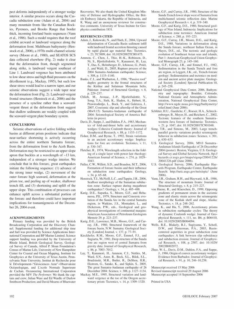
REFERENCES CITEDAdam, J., Kukowski, N., and Flüeh, E., 2004, Upward
delamination of Cascadia Basin sediment infi ll with landward frontal accretion thrusting caused by rapid glacial age material fl ux: Tectonics, v. 23, TC3009, doi: 10,1029/2002TC001475.
Ammon, C., Chen, J., Thio, H.-K., Robinson, D., Ni, S., Hjorleifsdottir, V., Kanamori, H., Lay, T., Das, S., Helmberger, D., Ichinose, G., Polet, J., and Wald, D., 2005, Rupture process of the 2004 Sumatra-Andaman earthquake: Science, v. 308, p. 1133–1140.
Banks, C.J., and Warburton, J., 1986, “Passive roof” duplex geometry in the frontal structures of the Kirthar and Sulaiman Mountain belts, Pakistan: Journal of Structural Geology, v. 8, p. 229–237.
Chlieh, M., Avouac, J.-P., Hjorleifsdottir, V., Song, T.A., Sieh, K., Sladen, A., Hebert, H., Prawirodirdjo, L., Bock, Y., and Galetzca, J., 2007, Coseismic slip and afterslip of the Great (Mw9.15) Sumatra-Andaman earthquake of 2004: Seismological Society of America Bul-letin (in press).
Davis, D., Suppe, J., and Dahlen, F.A., 1983, Mechan-ics of fold-and-thrust belts and accretionary wedges: Cohesive Coulomb theory: Journal of Geophysical Research, v. 88, p. 1153–1172.
Fisher, D.M., and Byrne, T., 1992, Strain variations in an ancient accretionary wedge: Implica-tions for fore arc evolution: Tectonics, v. 11, p. 330–347.
Fletcher, R., 1974, Wavelength selection in the fold-ing of a single layer with power-law rheology: American Journal of Science, v. 274, p. 1029–1043.
Fuller, C.W., Willett, S.D., and Brandon, M.T., 2006, Formation of forearc basins and their infl uence on subduction zone earthquakes: Geology, v. 34, p. 65–68.
Henstock, T.J., McNeill, L.C., and Tappin, J.R., 2006, Seafl oor morphology of the Sumatran subduc-tion zone: Surface rupture during megathrust earthquakes?: Geology, v. 34, p. 485–488.
Karig, D.E., Suparka, S., Moore, G.F., and Heha-nussa, P.E., 1979, Structure and Cenozoic evo-lution of the Sunda Arc in the central Sumatra region, in Watkins, J.S., Montadert, L., and Dickerson, P.W., eds., Geological and geo-physical investigations of continental margins: American Association of Petroleum Geologists Memoir 29, p. 223–237.
Karig, D.E., Lawrence, M.B., Moore, G.F., and Cur-ray, J.R., 1980, Structural framework of the forearc basin, N.W. Sumatra: Geological Soci-ety [London] Journal, v. 137, p. 77–91.
Kieckhefer, R.M., Moore, G.F., Emmel, F.J., and Sugiarta, W., 1981, Deep structure of the Sunda fore arc region west of central Sumatra from gravity data: Journal of Geophysical Research, v. 86, p. 7003–7012.
Lay, T., Kanamori, H., Ammon, C.J., Nettles, M., Ward, S.N., Aster, R., Beck, S.L., Bilek, S.L., Brudzinski, M.R., Butler, R., DeShon, H.R., Ekstrom, G., Satake, K., and Sipkin, S., 2005, The great Sumatra-Andaman earthquake of 26 December 2004: Science, v. 308, p. 1127–1134.
Mackay, M.E., 1995, Structural variation and land-ward vergence at the toe of the Oregon accre-tionary prism: Tectonics, v. 14, p. 1309–1320.
Moore, G.F., and Curray, J.R., 1980, Structure of the Sunda Trench lower slope west of Sumatra from multichannel seismic refl ection data: Marine Geophysical Research v. 4, p. 319–340.
Moore, G.F., and Karig, D.E., 1980, Structural geol-ogy of Nias Island, Indonesia: Implications for subduction zone tectonics: American Journal of Science, v. 280, p. 193–223.
Moore, G.F., Curray, J.R., Moore, D.G., and Karig, D.E., 1980, Variations in deformation along the Sunda forearc, northeast Indian Ocean, in Hayes, D.E., ed., The tectonic and geologic evolution of Southeast Asian seas and islands, Part 1: American Geophysical Union Geophys-ical Monograph 23, p. 145–160.
Moore, G.F., Curray, J.R., and Emmel, F.J., 1982, Sedimentation in the Sunda Trench and fore arc region, in Leggett, J.K., ed., Trench-forearc geology: Sedimentation and tectonics on mod-ern and ancient active plate margins: Geologi-cal Society [London] Special Publication 10, p. 245–258.
National Geophysical Data Center, 2006, Bathym-etry and topography: Boulder, Colorado, National Oceanic and Atmospheric Admin-istration, National Geophysical Data Center, http://www.ngdc.noaa.gov/mgg/bathymetry/relief.html (June 2006).
Schlüter, H.U., Gaedicke, C., Roeser, H.A., Schreck-enberger, B., Meyer, H., and Reichert, C., 2002, Tectonic features of the southern Sumatra–western Java forearc of Indonesia: Tectonics, v. 21, p. 1047, doi: 10.1029/2001TC901048.
Song, T.R., and Simons, M., 2003, Large trench-parallel gravity variations predict seismogenic behavior in subduction zones: Science, v. 301, p. 630–633.
U.S. Geological Survey, 2004, M9.0 Sumatra–Andaman Islands Earthquake of 26 December 2004 (poster): Reston, Virginia, U.S. Geologi-cal Survey and Global Seismic Network, ftp://hazards.cr.usgs.gov/maps/sigeqs/20041226/20041226.pdf (June 2006).
U.S. Geological Survey, 2006, Earthquake Haz-ards Program, Earthquake Center, Earthquake Search: http://neic.usgs.gov/neis/epic/ (June 2006).
Vann, I.R., Graham, R.H., and Hayward, A.B., 1986, The structure of mountain fronts: Journal of Structural Geology, v. 8, p. 215–227.
von Huene, R., and Klaeschen, D., 1999, Opposing gradients of permanent strain in the aseismic zone and elastic strain across the seismogenic zone of the Kodiak shelf and slope, Alaska: Tectonics, v. 18, p. 248–262.
Wang, K., and Hu, Y., 2006, Accretionary prisms in subduction earthquake cycles: The theory of dynamic Coulomb wedge: Journal of Geo-physical Research, v. 111, no. B6, p. B06410, doi: 10.1029/2005JB004094.
Wells, R.E., Blakely, R.J., Sugiyama, Y., Scholl, D.W., and Dinterman, P.A., 2003, Basin-centered asperities in great subduction zone earthquakes: A link between slip sub sidence and subduction erosion: Journal of Geophysi-cal Research, v. 108, p. 2507, doi: 10.1029/2002JB002072.
Zhao, W.-L., Davis, D.M., Dahlen, F.A., and Suppe, J., 1986, Origin of convex accretionary wedges: Evidence from Barbados: Journal of Geophysi-cal Research, v. 91, p. 10, 246–10,258.
Manuscript received 15 May 2006Revised manuscript received 29 August 2006Manuscript accepted 14 September 2006
Printed in USA