ACHIEVING AIR SUPERIORITY WITHOUT SPACE ... WAR COLLEGE AIR UNIVERSITY ACHIEVING AIR SUPERIORITY...
38
AIR WAR COLLEGE AIR UNIVERSITY ACHIEVING AIR SUPERIORITY WITHOUT SPACE SUPERIORITY: Not in a Timely Manner! By Steven T. Hiss, Lt Col, USAF A Professional Studies Paper Submitted to the Faculty In Partial Fulfillment of the Graduation Requirements Maxwell Air Force Base, Alabama 17 February 2006
Transcript of ACHIEVING AIR SUPERIORITY WITHOUT SPACE ... WAR COLLEGE AIR UNIVERSITY ACHIEVING AIR SUPERIORITY...
AIR WAR COLLEGE
AIR UNIVERSITY
ACHIEVING AIR SUPERIORITY WITHOUT
SPACE SUPERIORITY: Not in a Timely Manner!
By
Steven T. Hiss, Lt Col, USAF
A Professional Studies Paper Submitted to the Faculty
In Partial Fulfillment of the Graduation Requirements
Maxwell Air Force Base, Alabama
17 February 2006

CERTIFICATE
I have read and understand the Academic Integrity Section of the Student Guide. I certify that I
have not used another student’s research work and that the creative process of researching,
organizing, and writing this research report represents only my own work. I have read the
instructions regarding purpose, scope, format and content of this effort and have accomplished
the research paper in accordance with guidance presented in the Student Guide.
______________________________
(Signature)
DISCLAIMER
The views expressed in this academic research paper are those of the author(s) and do not reflect
the official policy or position of the U.S. government or the Department of Defense. In
accordance with Air Force Instruction 51-303, it is not copyrighted, but is the property of the
United States government.
2

Contents
Page
ABSTRACT.........................................................................................................................4
INTRODUCTION ...............................................................................................................5
FIXED TARGETS...............................................................................................................7 Locating Fixed Targets............................................................................................8 Striking Fixed Targets ...........................................................................................10
TIME-SENSITIVE/EMERGING TARGETS...................................................................14 Locating Time-Sensitive Targets...........................................................................15 Striking Time-Sensitive Targets ............................................................................18
COMMAND, CONTROL AND COMMUNICATIONS..................................................21 Communications....................................................................................................21 Situational Awareness ...........................................................................................23 Reachback..............................................................................................................25
IMPACTS AND RECOMMENDATIONS.......................................................................28 Recommendations .................................................................................................31
CONCLUSION..................................................................................................................33
APPENDIX A: ACRONYMS ..........................................................................................34
NOTES...............................................................................................................................35
BIBLIOGRAPHY..............................................................................................................37
3
Abstract
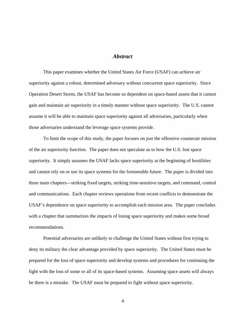
This paper examines whether the United States Air Force (USAF) can achieve air
superiority against a robust, determined adversary without concurrent space superiority. Since
Operation Desert Storm, the USAF has become so dependent on space-based assets that it cannot
gain and maintain air superiority in a timely manner without space superiority. The U.S. cannot
assume it will be able to maintain space superiority against all adversaries, particularly when
those adversaries understand the leverage space systems provide.
To limit the scope of this study, the paper focuses on just the offensive counterair mission
of the air superiority function. The paper does not speculate as to how the U.S. lost space
superiority. It simply assumes the USAF lacks space superiority at the beginning of hostilities
and cannot rely on or use its space systems for the foreseeable future. The paper is divided into
three main chapters—striking fixed targets, striking time-sensitive targets, and command, control
and communications. Each chapter reviews operations from recent conflicts to demonstrate the
USAF’s dependence on space superiority to accomplish each mission area. The paper concludes
with a chapter that summarizes the impacts of losing space superiority and makes some broad
recommendations.
Potential adversaries are unlikely to challenge the United States without first trying to
deny its military the clear advantage provided by space superiority. The United States must be
prepared for the loss of space superiority and develop systems and procedures for continuing the
fight with the loss of some or all of its space-based systems. Assuming space assets will always
be there is a mistake. The USAF must be prepared to fight without space superiority.
4

Chapter 1
Introduction
Air Superiority: That degree of dominance in the air battle of one force over another which permits the conduct of operations by the former and its related land, sea, and air forces at a given time and place without prohibitive interference by the opposing force.1
--Air Force Doctrine Document (AFDD) 2-1.1
This paper examines whether the United States Air Force can achieve air superiority
against a robust, determined adversary without concurrent space superiority. Since Operation
Desert Storm, the USAF has become increasingly dependent on space assets to accomplish its
mission. From command and control, communications, and weather forecasting to missile
warning, navigation, and precision targeting, the USAF now relies heavily on space. In fact, the
USAF has become so dependent on space-based assets that it cannot gain and maintain air
superiority in a timely manner without space superiority. The U.S. simply cannot assume it will
be able to maintain space superiority against all adversaries, particularly when those adversaries
understand the leverage space systems provide.
To limit the scope of this study, the paper focuses on just the offensive counterair mission
of the air superiority function. AFDD 2-1.1 defines offensive counterair as “operations to
destroy, disrupt, or neutralize enemy aircraft, missiles, launch platforms, and their supporting
structures and systems both before and after launch, but as close to their source as possible.”2
5

The paper does not speculate as to how the U.S. lost space superiority because how it was lost is
not germane to the argument. Suffice it to say, however, that losing space superiority is a real
possibility. For example, one nuclear weapon exploded in the atmosphere over the battlefield
would significantly impact most space-based systems. The paper simply assumes the USAF
lacks space superiority at the beginning of hostilities and cannot rely on or use its space systems
for the foreseeable future.
Space pervades all aspects of the offensive counterair mission, so dividing the paper into
logical, non-overlapping mission areas is not possible. For instance, communications satellites
play a significant role in such diverse mission areas as weather forecasting, targeting, and
command and control. Because no approach is necessarily better than another, the paper is
divided into three main chapters—striking fixed targets, striking time-sensitive targets, and
command, control and communications. Each chapter reviews operations from recent conflicts
to demonstrate the USAF’s dependence on space superiority to accomplish the respective
mission area. Although the U.S. did not face a robust adversary during Operations Enduring and
Iraqi Freedoms, the space architecture required to achieve air superiority was in place. Using
these conflicts as data points is still relevant. The paper concludes with a chapter that
summarizes the impacts of losing space superiority and makes some broad recommendations.
6

Chapter 2
Fixed Targets
NATO forces rapidly achieved air supremacy in the theater by destroying Serb interceptor aircraft in the air and on the ground and by destroying or damaging their airbases…However, reducing the Serb defensive radar-guided surface-to-air missile systems that are effective against aircraft flying at higher altitudes proved more difficult than anticipated as a result of the tactics employed by the Serbs.3
--Report to Congress
Kosovo/Operation Allied Force After-Action Report
Achieving air superiority begins by destroying and/or suppressing the adversary’s
Integrated Air Defense System (IADS). An IADS has many fixed target sets—some obvious,
some not. The obvious, “primary” targets include long-range acquisition radars, strategic (non-
mobile) surface-to-air missile (SAM) sites, command and control headquarters, and airfields—to
list just a few. The not-so-obvious target set includes facilities that support the primary targets,
such as a power generation plant supplying electricity to one of the long-range acquisition radars.
Suppressing these fixed targets is a critical first step to achieving air superiority because active
enemy air defenses, in particular radar-guided SAMs and antiaircraft artillery (AAA), put all
aircraft at significant risk. For example, during the first week of Operation Desert Storm—the
last time the U.S. faced a robust IADS threat—all 17 coalition aircraft lost to enemy action were
downed by Iraqi SAMs and AAA.4 Active air defenses also keep intelligence, surveillance and
reconnaissance (ISR), command and control, air refueling, and other support aircraft farther from
the battlespace.
7

Locating Fixed Targets
Satellites play an absolutely vital role in locating fixed targets, especially pre-war when
aircraft overflight of enemy territory is nearly impossible. Intelligence analysts locate fixed
targets primarily through signals intelligence (SIGINT) and near real-time imagery intelligence
(IMINT). Although the U.S. keeps most of its SIGINT and IMINT capabilities highly classified,
the intelligence community has acknowledged it operates satellites with these capabilities.5
While it is true that ISR aircraft can also perform this mission, they do so at great peril against an
effective enemy IADS. For instance, the U.S. lost two U-2 aircraft to enemy SAMs in the early
1960s, one over the Soviet Union and one over Cuba, while they were attempting to collect
IMINT.6 More recently, China forced down a U.S. Navy EP-3 while it was conducting a
SIGINT mission in international airspace.7
Because they orbit “freely” in space, satellites are not restricted by enemy territorial
boundaries or airspace and offer the ability to gather intelligence practically anytime and
anywhere. ISR aircraft may be able to collect significant SIGINT data while flying in
international airspace off the North Korean coast, but they are much less capable of collecting
that data from deep inside China, mainly due to the line-of-sight requirement. In other words,
SIGINT sensors must be able to “see” their target in order to collect the data necessary to
determine an accurate location. Terrain features, such as mountains or hills, and the curvature of
the Earth have a considerable impact on the sensor’s ability to gather that data. Operating from
high above the terrain, however, satellites have a nearly unrestricted line-of-sight capability to
any location on the planet.
Once a SIGINT satellite or aircraft has located a suspected radar or communications site,
IMINT satellites come into play. With their near-persistent surveillance capability, IMINT
satellites allow intelligence analysts to determine the purpose and exact geographic coordinates
8
of a fixed target. During peacetime, ISR aircraft cannot generally gather meaningful imagery
without violating international law and potentially escalating a conflict. IMINT satellites also
offer the ability to monitor change at a given location. For example, analysts can often
determine the operational status of a new SAM site or airfield by monitoring activity at the
construction site. Of course, IMINT satellites do not rely solely on SIGINT cues to locate fixed
targets. Analysts can “find” new targets by studying wide-area photos. Once they have
discovered a target of interest, they can re-task the satellite to take a close-up photo to study the
area in greater detail. IMINT satellites can also be cued by human intelligence, such as an
attaché or foreign contractor with knowledge about a new enemy air defense system.
Satellites play an equally important role in helping to determine the exact geographic
coordinates of fixed targets. Before the advent of precision-guided munitions, aircrews only
needed a target’s general location in order to drop their “dumb” bombs. Since Operation Desert
Storm, however, the U.S. has increasingly relied on “smart” weapons to increase accuracy and
decrease collateral damage. During Operation Iraqi Freedom, for example, 68.3% of the 29,199
munitions released were precision-guided. In contrast, only 7.5% of the 227,000 munitions
released during Operation Desert Storm were precision-guided.8 More accurate weapons mean
fewer weapons to destroy a given target, fewer non-combatant injuries, and fewer coalition
sorties over the target area. This efficiency significantly reduces aircrew exposure to enemy air
defenses.
Most precision-guided weapons, and certainly the GPS-aided variety such as the Joint
Direct Attack Munition (JDAM), require highly-accurate coordinates in order to strike the
intended target. There are essentially two methods to determine these coordinates, and both rely
heavily on space superiority. The first method involves “lifting” mensurated coordinates from an
9
imagery photo, the vast majority of which are collected by satellites. The second method
requires an individual to stand at the intended target while holding a GPS receiver or to use a
laser range finder (either airborne or ground based) to extrapolate the target’s coordinates.
Naturally, obtaining permission from North Korean officials to stand on one of their runways in
order to determine its exact coordinates may be difficult. Intelligence analysts also use IMINT to
select desired mean points of impact, or DMPIs, for a given target. So, for instance, an analyst
might select four DMPIs along a 10,000-foot runway, or one weapon impact every 2,000 feet, to
render the runway unusable. Analysts use the same concept to target a SAM site or a power
generation facility.
Striking Fixed Targets
Satellites play an equally vital role during the execution phase of strike operations, from
helping to forecast the weather to guiding precision weapons into their targets. The U.S. now
depends on multiple, different satellite systems to strike the fixed targets of an enemy’s air
defenses. Satellites are also key components of the global command and control network that
enables precision strike, but this subject will be discussed in more depth in Chapter 4.
Satellites have revolutionized weather forecasting, making it more of a science than an
art. Although not a military example, nothing illustrates this fact more than Hurricane Katrina,
which likely would have killed thousands of more people had weather satellites not alerted New
Orleanians of its approach. The U.S. has also come to rely on weather satellites to accomplish its
mission. From Operation Desert Storm to Iraqi Freedom, accurate and timely weather forecasts
have allowed U.S. strike aircraft to render almost any fixed target vulnerable to attack, either
during the day or at night. On 24 January 1991, for example, Defense Meteorological Satellite
Program (DMSP) imagery depicted an overcast Basra and a clear Baghdad, but a second readout
10
less than two hours later indicated the opposite. Given these conditions, DMSP—along with
civilian weather satellites—enabled the most sophisticated air campaign in history.9 Adverse
weather also hampers target acquisition and identification, increases risk to aircrews, and
complicates collateral damage concerns and bomb damage assessment. During Operation Allied
Force, cloud cover was greater than 50 percent more than 70 percent of the time. In fact,
weather conditions allowed for unimpeded air strikes on only 24 of 78 days.10
Accurate weather forecasting has taken on even more importance as the USAF has been
forced to operate from widely dispersed bases, many far removed from the target area. During
all three of the recent operations, air operations and strike execution were impacted by the
requirement for favorable weather conditions in up to four geographically dispersed locations.
These locations were the target area, the base from which the strike aircraft were operating, the
base from which the supporting aircraft were operating, and the orbit location for the refueling
and ISR aircraft.11 Current weather data also proved especially useful for enhancement of night
vision and infrared targeting. In this regard, DMSP weather data proved vital for the success of
precision-guided laser and optical weapons, which rely on clear skies for accurate target
designation.12
GPS-guided munitions, on the other hand, do not require clear skies to hit their targets,
but they do require space superiority. Over the past 10 years, the U.S. has increasingly grown to
rely on these types of weapons. In the opening days of Operation Allied Force, for instance, the
coalition employed cruise missiles to limit the exposure of manned aircraft to enemy air
defenses, as well as to minimize collateral damage.13 The conflict’s after action report to
Congress summed it up best. “Sea-launched and air-launched cruise missiles…provided the
capability to penetrate enemy air defenses and attack a wide spectrum of targets throughout the
11

battlespace. Attacking day or night in any weather, GPS-guided weapons placed all target sets at
risk, denying the enemy sanctuaries created by weather or the use of heavily concentrated
defenses.”14 During Operation Iraqi Freedom, 33 percent of all precision-guided munitions
employed were all-weather capable.15
GPS satellites add tremendous military capability beyond just helping to guide bombs
and missiles to their targets. They also guide special operations forces (SOF) and aircrew to
their destinations. In the opening hours of the 1991 Gulf War, SOF Pave Low helicopters
equipped with GPS teamed with U.S. Army Apache attack helicopters to destroy two Iraqi radar
sites, creating a major gap in the Iraqi air defense system.16 During Operation Iraqi Freedom,
GPS-equipped SOF and CIA paramilitary units were operating deep inside Iraq prior to the
formal onset of hostilities. These units moved rapidly to secure key infrastructure, such as Iraqi
airfields, once the shooting began.17 Additionally, GPS provides the highly-accurate navigation
signal required for the synchronization of complex airborne operations.18 An attack that
originates from widely dispersed bases, is extremely synchronized and concentrated over the
target area, and is very dispersed on egress has the best chance of achieving the desired surprise
and effect. GPS enables precise approaches to SAM sites, command and control nodes, and
enemy airfields by exploiting the weaknesses at the “seams” of an IADS and provides the
opportunity to conduct that operation in any weather. To orchestrate such an attack, aircrew and
battle management centers need to know precise position, speed and time for routing and
waypoint arrival times. GPS provides these parameters and enables high-reliability and efficient
marshalling to enhance operational security.19
Lastly, the highly-accurate GPS time signal facilitates this airborne synchronization by
allowing all players to communicate via the HAVE QUICK radio. HAVE QUICK radios use
12
frequency hopping as a means of thwarting enemy jamming. Although not technically “secure”
communications, HAVE QUICK radios change frequencies so often (many times per second)
that enemy forces have great difficulty either intercepting or jamming the communications. In
order to function properly, HAVE QUICK radios require a “time of day” (TOD) input so all
users can hop among the frequencies at the same time and rate.20 Over the past several years,
GPS has become the common “place” all users go to get that current TOD.
Destroying and/or suppressing the fixed targets of an adversary’s IADS is a necessary
first step to achieving air superiority. Left unchecked, a robust IADS puts all coalition aircraft at
significant risk and threatens all USAF missions. History shows the impact of a robust IADS,
with enemy SAM and AAA systems responsible for downing numerous friendly aircraft. The
U.S. has come to rely on its space-based assets to first locate and then strike the fixed targets on
an adversary’s IADS.
13
Chapter 3
Time-Sensitive/Emerging Targets
In Afghanistan…special operations forces communicate directly with B-52s as they call in close air support. Near-real-time video signals from unmanned air vehicles are used to identify and then engage targets. That soldier on the ground calling in CAS could care less whether his signal bounced off a satellite…and even less what specific satellite it was! Likewise, the pilot dropping the JDAM on a time-critical target didn’t care that his targeting information originated from a UAV and was relayed via a satellite system. The only thing they’re concerned with is that the capability is available when and where needed.21
--General Lance W. Lord Commander, Air Force Space Command
Locating and striking time-sensitive targets—also commonly referred to as either mobile
or emerging targets—is a much more complex task than locating and striking fixed targets.
Whereas planners can develop a methodical air campaign to suppress and destroy the fixed
targets of an enemy’s IADS, they cannot do the same for mobile targets (primarily because they
have yet to locate them). In particular, mobile SAMs pose a very credible threat to coalition
aircraft during the opening days of hostilities, and they continue to do so as long as they remain
operational. Table 3.1 illustrates just how effective mobile SAMs have been against USAF
aircraft since Operation Desert Storm. Note that mobile SAMs (SA-6, 9, 13 and 16) shot down
nine of the thirteen USAF aircraft during that time, and there is some speculation the Serbs used
radars from mobile SAMs to cue the SA-3s during Operation Allied Force.22 Mobile SAMs, of
course, represent just one type of time-sensitive target. Since 1991, when the USAF
14

demonstrated how effectively it could destroy the fixed targets of Iraq’s IADS, adversaries have
increasingly relied on mobility to “hide” from USAF aircraft. This has made locating and
destroying these time-sensitive targets that much more important. The USAF cannot accomplish
this mission without space superiority.
Date Type Enemy Weapon Guidance Time
19 Jan 1991 F-15E SA-2E Radar Night 19 Jan 1991 F-16C SA-6 Radar Night 19 Jan 1991 F-16C SA-3 Radar Day 31 Jan 1991 AC-130H SA-16 Infrared Day 2 Feb 1991 A-10A SA-16 Infrared Day 15 Feb 1991 A-10A SA-13 Infrared Day 15 Feb 1991 A-10A SA-13 Infrared Day 19 Feb 1991 OA-10 SA-9 Infrared Day 22 Feb 1991 A-10A SA-16 Infrared Day 27 Feb 1991 OA-10A SA-16 Infrared Day 2 Jun 1995 F-16C SA-6 Radar Day
27 Mar 1999 F-117 SA-3 Radar? Night 2 May 1999 F-16CG SA-3 Radar? Night
Table 3.1: USAF Manned Aircraft Combat Losses Since 199123
Locating Time-Sensitive Targets
Satellites are involved, either directly or indirectly, with practically every aspect of
locating time-sensitive targets. Whether it is the Defense Support Program (DSP) or
communications satellites that enable both control of unmanned air vehicles (UAV) and data
relay for ISR aircraft, space systems now play a critical role in the hunt for mobile targets. So
critical, in fact, that locating time-sensitive targets without satellites hardly seems imaginable.
DSP has been in operation since the early 1970s, originally designed to detect
intercontinental ballistic missile launches from the former Soviet Union. DSP proved its worth
to theater commanders, however, during Operation Desert Storm, when DSP satellites detected
15

the launch of Iraqi Scud missiles and provided warning to coalition forces.24 Using infrared
sensors to detect heat from missile and booster plumes against the Earth’s background, DSP has
the capability to detect a missile launch within 30 seconds and can provide the geographic
coordinates of the launcher as well as the missile’s projected impact point.25 In 1995, the USAF
made technological improvements to the DSP’s ground processing systems, giving it the
capability to detect the launch of even smaller missiles.26
While DSP has revolutionized theater missile defense, it is the communications satellites
that have revolutionized time-sensitive targeting—in more ways than one might imagine.
Although the communications satellites certainly enable global command and control (more on
that subject in Chapter 4), they are absolutely vital to UAV operations. They also play a critical
role in disseminating airborne ISR data.
UAVs have come a long way since Operation Desert Storm, where they played a minor
role and the only reconnaissance drone available was the Pioneer. First in the Balkans, then in
Afghanistan, and most recently in Iraq, UAVs are the key enabler in the time-sensitive targeting
process. They scout for enemy targets and relay that information to strike elements.27 UAV
operations, however, would be nearly impossible without the communications links back to their
operators—links that are provided almost exclusively by communications satellites. While it is
true that tactical UAVs, such as the MQ-1 Predator, can be controlled through line-of-sight
communications with their launch and recovery elements, these links do not extend far enough to
allow for operations over enemy territory. Controlling larger UAVs, such as the new Global
Hawk, would be impossible without satellite communications as they launch and recover
thousands of miles from the target area. Of course, gaining real-time intelligence from the UAV
fleet would also be impossible without satellite communications links.
16

To say the U.S. has become dependent on UAVs for real-time intelligence and time-
sensitive targeting would be an understatement. As of October 2005, Predators alone were
logging 4,000 hours a month in support of the war on terrorism and other operations. Since the
September 11, 2001 terrorist attacks, Predators have flown more than 103,000 combat hours in
global operations, including a monthly record of 4,700 in July 2005.28 While it is true that many
of these hours supported more than just the offensive counterair mission, the sheer number
demonstrates how reliant the U.S. has become on the Predator. It has endeared itself to the
warfighter because it provides a persistent eye in the sky over dangerous areas, with
sophisticated sensors and cameras feeding full-motion video to ground troops and aircraft.29
A closer tie to the offensive counterair mission can be seen from the Global Hawk’s
second-ever operational deployment in support of Operation Iraqi Freedom. During that
deployment, the Global Hawk flew just fifteen missions, accounting for only three percent of the
U.S. airborne imagery. However, those 4,800 images helped lead to the destruction of more than
half of the time-sensitive targets (including 13 SAM batteries, 50 SAM launchers, 70 SAM
transporters, and 300 SAM canisters).30 Not only would controlling Predators and Global
Hawks be impossible without communications satellites, but the vital images and videos they
collect could not be downloaded in a timely fashion without that same space-based
communications architecture.
Communications satellites are also vital to relaying information collected by airborne ISR
platforms. The E-8C Joint STARS (Joint Surveillance Target Attack Radar System), for
example, is an airborne battle management platform designed to provide theater ground and air
commanders with ground surveillance to support attack operations and targeting. The plane’s
phased array radar can detect ground moving targets (i.e. a mobile SAM) and cue other sensors
17

and/or strike aircraft.31 In addition to the Joint STARS, communications satellites are used to
control and relay data from U-2s, RC-135s and E-3 AWACS (Airborne Warning and Control
System), among other aircraft. Without space superiority, the USAF would have great difficulty
locating and identifying time-sensitive targets.
Striking Time-Sensitive Targets
Locating a time-sensitive target is, of course, only the first step in the “sensor-to-shooter”
kill chain. As much as the USAF has come to rely on space-based systems to locate and identify
mobile targets, it relies even more on them to complete the kill chain and strike the target. Since
Operation Allied Force, the USAF’s rapid and dynamic targeting capability involves reachback,
distributed operations and real-time ISR collection to shorten the sensor-to-shooter timeline.
Satellites play a key role in detecting and relaying real-time threat information to the combined
air operations center (CAOC), enabling commanders to make strike decisions and pass orders to
strike aircraft. With those orders, strike aircraft then use space-based systems to navigate to the
target area and precisely deliver their weapons.32
Nowhere is the shortening of the sensor-to-shooter kill chain more apparent than in the
UAV force, particularly the Predator. Able to penetrate heavily defended airspace without the
concern for loss of life, the Predator is an ideal offensive counterair platform. As previously
discussed, the Predator can locate a target using its own on-board sensors or be cued to one by
another ISR platform or ground element, among others. Once located, the MQ-1 can strike the
target with up to two AGM-114 Hellfire missiles. In the near future, the USAF will field the
MQ-9 Predator B, able to carry a payload up to 3,000 pounds, including numerous missiles and
precision-guided bombs (both laser- and GPS-guided). The MQ-9 will also have a synthetic
aperture radar (SAR), featuring an all-weather and ground moving target indicator capability.33
18

Predator B will provide a hunter-killer capability and feature the ability to use SAR to hunt for
targets, then cross-cue target data to the electro-optic/infrared sensor.34 Lt Gen Walter E.
Buchanan, Commander of U.S. Central Command Air Forces, appropriately described the
UAVs’ contribution to time-sensitive targeting. “I have seen our unmanned aircraft system force
evolve from one that was principally an intelligence-collection platform in Bosnia to one that
today has a very potent air-to-ground capability and represents a truly flexible, combat
platform.”35 It would be impossible to use the UAV force in this manner without space-based
systems.
Satellites are also revolutionizing the way conventional aircraft strike time-sensitive
targets. During Operation Allied Force, space systems allowed for the incorporation of the
Multi-Source Tactical System into the cockpit of U.S. bombers. “The system displayed space-
derived information (intelligence), to include near real-time information of threats, position and
status of friendly platforms, mission rehearsal data and updated target parameters and
imagery.”36 The system proved so successful that on several occasions, commanders were able
to retarget bombers en route to their targets, allowing the first-ever CAS push37 for the B-1.
Additionally, the USAF equipped the B-2 with digital satellite radios, which allowed pilots to
receive target coordinates from command centers and feed them directly into the aircraft’s
computers. Pilots were then able to get mission updates on the fly digitally, versus trying to do it
over voice radio and manually entering the target data into their computers.38 Rapid information
allowed the optimization of weapon systems and enabled a shorter observe-orient-decide-act
(OODA) loop.39 By the ground phase of Operation Iraqi Freedom, the CAOC was able to put
bombs on target within 20 minutes of being alerted by intelligence. In all, coalition air forces
struck 700 targets based on dynamic retargeting in support of ground forces, and carried out over
19
150 missions against time-sensitive targets.40 Again, many of these targets were outside the
offensive counterair mission (i.e. leadership, WMD, etc), but the employment concepts still
apply.
U.S. Special Forces are leveraging satellites to bring airpower to bear on their emerging
targets as well. During Operation Enduring Freedom, for example, specially trained combat
controllers determined a target’s geographic coordinates by using a laser range-finder connected
to a hand-held GPS receiver. These coordinates were then passed by radio (sometimes UHF,
sometimes SATCOM) to aircraft loitering overhead and entered into GPS-guided JDAMs.
Operating in this manner, a relatively small number of SOF personnel, about 300 by the fall of
Kandahar, were able to dramatically increase the effectiveness of U.S. precision strikes.41
Locating and striking an adversary’s time-sensitive targets is just as vital to achieving air
superiority as attacking its fixed targets. Since Operation Desert Storm, when the U.S.
demonstrated how effectively it could destroy the fixed targets of Iraq’s IADS, adversaries have
increasingly relied on mobility to evade detection. This had made locating and destroying these
time-sensitive targets that much more important. The USAF cannot accomplish this mission
without space superiority.
20
Chapter 4
Command, Control and Communications
You cannot execute the American way of war without rapid communications, and the CAOC relied on gigabytes of data flowing in and out of the center. Bandwidth was increased by about 600 percent over pre-OIF operations to support daily operations. DSCS satellites were repositioned to provide two prime and three residual satellites coverage of the region. As a result, they were able to boost the capability to approximately 700 Megabytes/second (Mbps) in the region and carry 80 percent of theater traffic.42
--Brig Gen Larry D. New
OIF Joint Director of Space Forces
Gaining and maintaining air superiority requires effective command and control, and
effective command and control requires a robust and reliable communications capability. From
the launch of the first communications satellite, the USAF has relied on both military and
commercial satellites to carry an ever-increasing volume of its voice and data communications.
Since Operation Desert Storm, the USAF has also grown to depend on communications satellites
to improve situational awareness among its command and control centers and its aircraft. Lastly,
with the transition to an expeditionary force, the USAF now deploys fewer personnel into the
theater, relying on the “reachback” concept to distribute the CAOC’s workload to centers of
excellence around the world.
Communications
To this day, the USAF relies on communications satellites more than any other space-
based system to accomplish its missions. Satellite communications allow the USAF to deploy to
21

any hotspot in the world and still remain in contact with leadership, whether it is the local, in-
theater headquarters or the President and Secretary of Defense.43 They also allow units to
deploy to bare-base locations with austere infrastructure and begin operations within just a few
days of arrival. In addition, communications satellites support many common services, such as
the Defense Switching Network (DSN) service and video-teleconferencing (VTC) capability, as
well as access to e-mail services, the Non-Secure Internet Protocol Router Network (NIPRNET),
and the Secure Internet Protocol Router Network (SIPRNET).44
The demand for satellite communications is constantly growing. General Mike Ryan,
former Chief of Staff of the Air Force, stated that the amount of bandwidth required for
Operation Allied Force was five times the amount required for Operation Desert Storm and that
the network connected 40 different locations in 15 countries. While some of this network used
landlines, much of it was made possible only through the use of satellites.45 During Operation
Iraqi Freedom, satellite bandwidth was approximately 42 times the capacity available during
Operation Desert Storm and significantly enhanced command and control. For example, an
upgraded Military Satellite Communications System (MILSTAR) could securely transmit an air
tasking order (ATO) in six seconds rather than an hour, as was previously required. This
provided tremendous capabilities that allowed the USAF to execute agile, responsive air
operations as the threats and targets changed.46 Additionally, the Global Broadcast Service
(GBS) provided over 350 Megabytes/second of worldwide throughput and directly contributed to
combat operations by supplying 1.25 terabytes per day of very large video streams and data files
to the U.S. Central Command area of responsibility. Frequently, combat units established their
GBS connection as soon as they encamped and were receiving current intelligence, imagery
products and multiple video broadcasts within minutes.47
22
As if all this bandwidth was not enough, U.S. Strategic Command leaders predict the
need for additional bandwidth will triple in the next few years, likely outstripping the Wideband
Gapfiller Satellites now under development.48 This increased need for bandwidth is primarily
being driven by the proliferation of UAVs, which has the potential to cause bandwidth shortages
and impact other operations. As an example, the U.S. European Command operated just two
Predators simultaneously from Bosnia during Operation Allied Force. Each needed 6 Mbps to
support video dissemination within the theater and the U.S., a requirement that severely stressed
the Defense Information Systems Network architecture and required preemption of lower-
priority channels while the UAVs were in flight. Even with only a handful of UAVs operating in
Kosovo, military communications systems were stressed to the point where operational trade-
offs were required and some activities had to be delayed or cancelled.49 With communications
satellites either degraded or completely out of service, commanders would be forced to make
even more tradeoffs to at least maintain some UAV capability.
Situational Awareness
Space-based systems have enabled extraordinary levels of situational awareness among
warfighters at all levels—the CAOC, other command and control centers, widely dispersed
wings, and even aircraft in flight. From tracking aircraft, personnel and equipment as they
deploy into the theater, to controlling aircraft in the fight, to gathering post-flight intelligence and
maintenance information, satellites allow commanders to “stay in the know” and actively control
the fight more than ever before. Without this “common operational picture” (COP), the USAF
would have great difficulty gaining and maintaining air superiority.
An integral component of the COP is the Global Command and Control System (GCCS).
Although not a space-based system, GCCS relies on satellites to lash together several hundred
23

sites worldwide via the DoD’s SIPRNET. It incorporates the force planning and readiness
assessment applications required by battlefield commanders to effectively plan and execute
operations. The COP function of GCCS correlates and fuses data from multiple intelligence
sources and sensors to provide warfighters the situational awareness needed to be able to act and
react decisively. The COP also provides the CAOC with near real-time “blue force tracking”
data, much of it gathered and/or relayed by space-based systems, and it serves as the critical link
among warfighters, national agencies, and a variety of dissemination architectures.50 Finally,
GCCS provides an extensive suite of integrated office automation, messaging, and collaborative
applications that allow CAOC and wing mission planners to both develop the air campaign and
control its execution phase.51
During the execution phase, space-based systems are key enablers that allow the CAOC
to maintain a high level of situational awareness. Satellites provide the capability to receive,
process, and exploit SIGINT data from selected national and theater sensors, and receive,
process, exploit, and generate timely intelligence and information. During Operation Iraqi
Freedom, this time to access theater and national imagery was reduced by as much as six to ten
hours, and national and theater SIGINT support for targeting operations was reduced by as much
as thirty minutes to two hours.52 A variety of airborne ISR sources also down-linked their data
via satellites into the CAOC, where operators analyzed the information, integrated the target
lists, and provided strike approval. As a result, the Joint Forces Air Component Commander
(JFACC) was able to gain enhanced situational awareness and improve his CAOC’s ability to
shape the battlespace.53 In fact, this entire process reinforced the dictum that centralized control
and decentralized execution of air and space forces are critical to force effectiveness.54
24

Finally, satellites have significantly enhanced situational awareness for combat search
and rescue. During both Operations Allied Force and Iraqi Freedom, space systems ensured the
CAOC not only had the exact location of the downed aircrew, but also gave the rescue aircraft
situational awareness on the surface-to-air threats. Thanks to space, none of the downed aircrew
in these operations became prisoners of war. In fact, the two aviators shot down over Iraq were
rescued within 90 minutes of ejecting. As General John P. Jumper, former Chief of Staff of the
Air Force, said, “space took the search out of search and rescue.”55 Most of this situational
awareness would not be possible without space-based systems.
Reachback
Reachback is a concept of operation that absolutely could not work without the
bandwidth and connectivity provided by communications satellites. First used extensively
during Operation Allied Force,56 reachback is the concept of distributing the CAOC’s workload
to other centers of excellence throughout the world. This not only reduces the demand on the
already overworked CAOC, but it also allows the USAF to deploy fewer support personnel and
less equipment into the theater, thereby reducing both the strain on the transportation system and
the personnel tempo. In addition to reachback, AFDD 2-8, Command and Control, describes
distributed operations as independent and interdependent nodes that participate in the operational
planning and decision-making process to accomplish missions for engaged commanders.57
Reachback can be as simple as a VTC, an e-mail, or a website. During Operation Allied
Force, for example, space-based systems made possible the exchange of large amounts of data,
such as VTCs and high-resolution imagery. In addition, the extensive growth and availability in
defense data and communications networks enabled remarkable coordination via secure e-mail
by staffs in European commands and supporting commands outside Europe. The SIPRNET also
25

permitted personnel engaged in the theater to access up-to-date information posted for their use
on military websites around the world.58 VTCs have become a way of life in Operations
Enduring and Iraqi Freedom. With permanent headquarters at Shaw Air Force Base in South
Carolina and expeditionary headquarters at Al Udeid Air Base in Qatar, the U.S. Central
Command Air Forces maintains its battle rhythm through extensive use of VTCs. The CAOC
also participates in almost daily VTCs with U.S. Central Command, Combined Forces
Command-Afghanistan, and Multinational Force-Iraq to oversee and coordinate current and
future operations.59
Reachback has revolutionized the targeting and bomb damage assessment (BDA)
processes. In Kosovo and the Federal Republic of Yugoslavia, for instance, targets were
developed through the combined efforts of numerous agencies in the U.S. cooperating closely
with headquarters in Europe. Planning and integration of air-launched cruise missile attacks
from B-52s operating from the continental U.S. and the United Kingdom were closely
coordinated by commanders and planners who were widely separated geographically. BDA of
strikes made against targets in Kosovo was conducted by agencies and commands located in the
U.S. in close coordination with commands in Europe. This system of using geographically-
dispersed activities to perform and integrate bomb damage assessment became known as
federated BDA.60 The concept was used extensively by the CAOC to support both Operations
Enduring and Iraqi Freedom and is still in use today.61
The USAF used reachback during Operation Allied Force to support a number of ISR
platforms. The aircraft deployed forward, but the data reduction and analysis components
remained at the home base. Reconnaissance systems, such as the U-2 aircraft, collected data in
the theater, then transmitted that data stateside so it could be processed and returned to the
26
theater as information for the appropriate command and control and operational nodes.62 As
discussed earlier, the USAF used this reachback technique as part of the federated intelligence
process to perform timely BDA, thus reducing the number of scarce imagery analysts required to
deploy to the theater.63 The Global Hawk also used reachback to reduce its in-theater footprint
during Operation Iraqi Freedom. About one-third of the 100 people who supported the missions
worked in the comfort of an air-conditioned building in the U.S. Logistics costs shrank because
fewer tactical command shelters were needed in theater. Reachback cut the Global Hawk’s price
tag and operating costs. On the operational side, the USAF will be able to trim payroll costs by
keeping stateside about 40 people, including imagery analysts, sensor operators, pilots, and
contractor support teams.
The USAF must have effective, reliable command and control to achieve air superiority.
From the launch of the first communications satellite, the USAF has come to depend on both
military and civilian satellites to establish its command and control network. The USAF uses
this critical network to maintain operational control of its aircraft, as well as to provide
situational awareness among its command centers and its aircraft. The USAF also needs
communications satellites to employ its reachback concept so it can distribute the CAOC’s
workload to centers of excellence around the world. These employment concepts would not be
possible without space superiority.
27

Chapter 5
Impacts and Recommendations
Loss of space superiority would clearly impact every level of waging modern war. From deliberate planning, tracking friend and foe, to target development, engaging targets and assessing damage. Imagine for a second…reliving [recent operations] without precise navigation and timing…or eliminating the use of precision-guided munitions, which rely on space-borne assets.64
--General Lance W. Lord
The U.S. Air Force has become so dependent on space-based assets that it cannot gain
and maintain air superiority in a timely manner without space superiority, especially against a
well-equipped and determined adversary. As General Lord notes, the USAF now depends on
space to support practically every mission area, from deploying to the fight to conducting bomb
damage assessment to reordering spare parts. This luxury of uncontested space superiority,
however, has allowed the USAF to become complacent. A determined adversary will take
advantage of this complacency, attack the USAF’s space-based assets, and extend the time it
takes for the USAF to achieve air superiority. Unfortunately, the USAF will certainly lose
additional aircraft and personnel while it attempts to reestablish space superiority.
To briefly illustrate just how much the USAF has come to rely on space superiority,
compare a typical bombing mission from World War II to one from Operation Iraqi Freedom.
During both conflicts, bombers launched from Great Britain to strike distant targets. In the early
1940s, B-17 mission planners relied on intelligence that was, at best, days old and not that
28

detailed. If they were lucky, mission planners could give the crews an overhead photograph, but
again it was probably days to weeks old and likely did not show BDA from recent missions.
When the B-17 crews stepped to their aircraft, they got best guesses for target area threats and
weather. After takeoff, they essentially lost communications with their command and control
elements and had no way of receiving mid-mission updates. Navigation and bombing were
primitive. It would not be uncommon for the B-17s to arrive over the target area and find it
covered by clouds. If they could release their weapons, many fell well outside the target area
and caused extensive collateral damage. On the way home, the crews had no way of providing
BDA or strike effectiveness back to command and control headquarters. Time-sensitive
targeting did not exist.
Things were much different for the B-52s in 2003. Their mission planners had access to
intelligence (imagery, threat and target analysis, etc.) that was sometimes seconds old and had
been processed at centers of excellence throughout the world. They had exact coordinates of
many of the threats and could therefore optimize their ingress and egress routes to minimize
exposure. They had exact target coordinates, allowing the crews to release one GPS-aided
weapon on the target. If threats or the targets changed while the B-52s were en route, command
and control elements could contact them anytime and provide updated information. The crews
also had accurate, detailed weather forecasts for the entire flight and, again, could be contacted in
flight if the weather changed. The B-52s participated in time-sensitive targeting because they
were linked to numerous ISR platforms, command and control headquarters, and the tactical air
control parties on the ground. After they released their weapons, the B-52 crews could provide
immediate reports and BDA to all players, enabling the CAOC to order a re-strike, if necessary.
29
While losing space superiority would not set back the USAF to the days of World War II,
it would significantly hamper the current generation of Airmen from achieving air superiority in
a timely manner. To begin with, just locating the adversary’s fixed targets would be much more
difficult. Without satellites, the USAF would have no capability to collect current imagery of
targets deep within the adversary’s territory, unless it decided to risk low-density ISR aircraft.
The USAF would also be unable to collect SIGINT data on many IADS components. Even if the
USAF was able to collect SIGINT “hits” with its ISR aircraft (i.e. RC-135, EP-3), it would be
unable to cross-cue to an IMINT satellite and determine target-quality geographic coordinates.
The U.S. could insert SOF personnel, or possibly rely on HUMINT sources, to determine target
coordinates, but they would need GPS data to determine target-quality coordinates.
Striking fixed targets without space superiority is an equally daunting task. The
timeliness and accuracy of weather forecasts would dramatically decrease. Aircrews would
frequently be “surprised” by en route and/or target area weather. Adverse weather can severely
impact air refueling, marshalling, and weapons employment. Aircrews could also arrive over the
target area with improper weapons (i.e. carrying laser-guided bombs) that cannot be employed
through a cloud deck. With non-existent or degraded GPS data, GPS-aided munitions would
lose critical accuracy, impacting both collateral damage considerations and effects. Additionally,
unreliable GPS data would expose coalition aircraft to an increased threat from the adversary’s
IADS. Aircrews would no longer be able to precisely navigate through the weaknesses of the
IADS “seams.”
Locating and striking time-sensitive targets becomes a near impossibility without space
superiority. From DSP to ISR aircraft to SOF personnel on the ground, nearly all information to
locate a mobile target flows either from or through space. Likewise, nearly all the information
30
and command and control required to analyze and prosecute mobile targets also travels through
space. To put it bluntly, time-sensitive targeting without space superiority is simply not possible.
As for command, control, and communications, it too would be severely degraded by a
lack of space superiority. It is difficult to imagine the USAF conducting an air campaign without
today’s communications satellites. Simply distributing the voluminous ATO would require the
USAF to revert to the Operation Desert Storm days of flying it out to the aircraft carrier. Having
to rely solely on land lines would also affect the USAF’s widely distributed operations, making
NIPRNET and SIPRNET connectivity much less universal. This would impact, as just one
example, the entire transportation system. Personnel rotation, spare parts, and replacement
weapons would all be impacted. The USAF would quickly revert to the days of having to open a
crate to discover its content.
Today’s concepts of situational awareness and reachback are also not possible without
space superiority. Decreased situational awareness would inevitably lead to increased
fratricide—of both ground forces and aircraft—and an overall decrease in airpower’s
effectiveness. Although land lines could potentially pick up some traffic to support the
reachback mission, there is no way to use land lines to connect widely dispersed sites (many of
them expeditionary sites located at bare bases). With limited reachback capability, the USAF
would be forced to deploy more personnel into the theater, and the CAOC would lose vital
connectivity to non-deployable centers of excellence.
Recommendations
This paper is focused on showing the impacts to achieving air superiority without having
concurrent space superiority. The paper’s intent is not to recommend detailed solutions. Some
broad recommendations, however, are in order and deserve further research. First, the USAF is
31

spending considerable resources to develop methods to defend its space systems. Unfortunately,
“hiding” satellites from a potential adversary is quite difficult, especially when that adversary has
the capability to locate and track satellites. A future, determined adversary will likely go to great
lengths to degrade and/or destroy the USAF’s space capabilities, knowing it will seriously
impact the USAF’s ability to wage war.
In addition to developing methods to “protect” its satellites, the USAF must develop
systems and procedures for continuing the fight with the loss of some or all of its space-based
systems. In particular, communications satellites have clearly become the USAF’s Achilles’
heel. Waging war without them seems unimaginable and a determined adversary will certainly
attempt to degrade that capability. The USAF must continue its research and development
efforts into small, tactical satellites that can launch on short notice and high-altitude balloons that
can stay aloft for several weeks. Either way, the USAF must develop and field systems that are
inexpensive, and potentially expendable, so that it can quickly replace the capability offered by
its current space systems.
32

Chapter 6
Conclusion
This paper examined whether the United States Air Force could achieve air superiority
against a robust, determined adversary without concurrent space superiority. Since Operation
Desert Storm, the USAF has become increasingly dependent on space assets to accomplish its
mission. From command and control, communications, and weather forecasting to missile
warning, navigation, and precision targeting, the USAF now relies heavily on space. In fact, the
USAF has become so dependent on space-based assets that it cannot gain and maintain air
superiority in a timely manner without space superiority.
Potential adversaries are unlikely to challenge the United States without first trying to
deny its military the clear advantages provided by space superiority. By examining several
mission areas—striking fixed targets, striking time-sensitive targets, and command, control, and
communications—this paper has demonstrated that the USAF now depends on space to
accomplish the offensive counterair mission. The United States must be prepared for the loss of
space superiority. It must develop systems and procedures for continuing the fight with the loss
of some or all of its current space-based systems. Assuming those systems will always be
available is a mistake. The USAF must be prepared to fight without them.
33
Appendix A: Acronyms
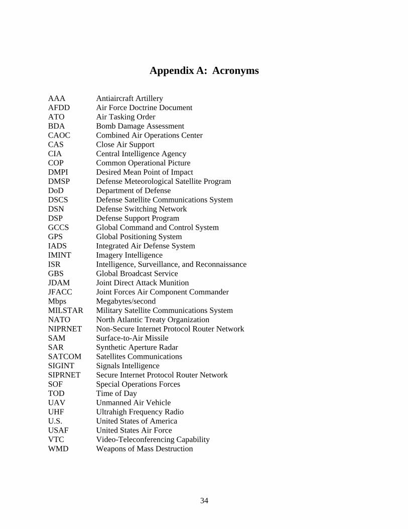
AAA Antiaircraft Artillery AFDD Air Force Doctrine Document ATO Air Tasking Order BDA Bomb Damage Assessment CAOC Combined Air Operations Center CAS Close Air Support CIA Central Intelligence Agency COP Common Operational Picture DMPI Desired Mean Point of Impact DMSP Defense Meteorological Satellite Program DoD Department of Defense DSCS Defense Satellite Communications System DSN Defense Switching Network DSP Defense Support Program GCCS Global Command and Control System GPS Global Positioning System IADS Integrated Air Defense System IMINT Imagery Intelligence ISR Intelligence, Surveillance, and Reconnaissance GBS Global Broadcast Service JDAM Joint Direct Attack Munition JFACC Joint Forces Air Component Commander Mbps Megabytes/second MILSTAR Military Satellite Communications System NATO North Atlantic Treaty Organization NIPRNET Non-Secure Internet Protocol Router Network SAM Surface-to-Air Missile SAR Synthetic Aperture Radar SATCOM Satellites Communications SIGINT Signals Intelligence SIPRNET Secure Internet Protocol Router Network SOF Special Operations Forces TOD Time of Day UAV Unmanned Air Vehicle UHF Ultrahigh Frequency Radio U.S. United States of America USAF United States Air Force VTC Video-Teleconferencing Capability WMD Weapons of Mass Destruction
34
Notes
(All notes appear in shortened form. For full details, see the appropriate entry in the bibliography.)
1 AFDD 2-1.1, 31. 2 Ibid., 33. 3 OAF After-Action Report, 65. 4 Conduct of the Persian Gulf War, 180. 5 National Reconnaissance Office, “NRO Fact Sheet.” 6 Encyclopaedia Britannica, 15th ed., s.v. “U-2.” 7 Chinoy and Wallace, “U.S. Surveillance Plane Lands in China.” 8 Zaloga, “Precision-Guided Weapons Rule,” 173. 9 Spires, Beyond Horizons, 257-258. 10 OAF After-Action Report, 60. 11 Ibid., 98. 12 Spires, Beyond Horizons, 258. 13 OAF After-Action Report, 86. 14 Ibid., 91. 15 Krepinevich, Operation Iraqi Freedom, 20. 16 Spires, Beyond Horizons, 257. 17 Krepinevich, Operation Iraqi Freedom, 9. 18 OAF After-Action Report, 124. 19 Tovrea and Pinker, “Contributions of the GPS.” 20 Harris Corporation, “HAVEQUICK I/II Radio Data Sheet.” 21 Lord, address to Air Force Association's C2ISR Summit. 22 Haulman, USAF Manned Aircraft Combat Losses, 2. 23 Ibid. 24 Air Force Link, “DSP Fact Sheet.” 25 Lambeth, “The Synergy of Air and Space.” 26 Air Force Link, “DSP Fact Sheet.” 27 Krepinevich, Operation Iraqi Freedom, 17. 28 McGee, “Predator’s Success Ups Procurement.” 29 Ibid. 30 Kaufman, “U.S. Air Force Reveals,” 23. 31 Air Force Link, “E-8C Joint STARS Fact Sheet.” 32 OAF After-Action Report, 95. 33 Airforce-Technology.com, “Predator RQ-1/MQ-1/MQ-9 UAV.” 34 McGee, “Predator’s Success Ups Procurement.” 35 Ibid. 36 Amrine, “The Command of Space,” 35.
35
37 CAS push refers to the concept of launching CAS sorties to a pre-determined location
without a pre-assigned target. During intensive ground operations, the USAF launches numerous CAS sorties to orbit points, where they hold until called in by joint terminal attack controllers.
38 Kaufman, “U.S. Air Force Reveals,” 23. 39 Amrine, “The Command of Space,” 35. 40 Krepinevich, Operation Iraqi Freedom, 17. 41 Ibid., 16-17. 42 James, “Bringing Space to the Fight,” 15. 43 Amrine, “The Command of Space,” 33. 44 Dodgen, “Space – Enabling the Potential.” 45 Amrine, “The Command of Space,” 33. 46 James, “Bringing Space to the Fight,” 15-16. 47 Ibid., 16. 48 Kaufman, “Iraq War Lessons Discussed,” 46. 49 Klausner, “Command and Control.” 50 Ibid. 51 Defense Information Systems Agency, “What is the GCCS-J.” 52 Dodgen, “Space – Enabling the Potential.” 53 Ibid. 54 OAF After-Action Report, 45. 55 Leaf, “Providing Combat Effects,” 4. 56 OAF After-Action Report, 55. 57 Klausner, “Command and Control.” 58 OAF After-Action Report, 124. 59 Personal Experience. The author was deployed to the Combined Air Operations Center at
Al Udeid Air Base, Qatar, from September 2004 to January 2005. 60 OAF After-Action Report, 123-124. 61 Personal Experience. 62 Klausner, “Command and Control.” 63 OAF After-Action Report, 55. 64 Lord, address to Air Force Association’s National Air and Space Conference.
36

Bibliography
Air Force Doctrine Document (AFDD) 2-1.1, Counterair Operations, 26 April 2002.
Air Force Link. “Defense Support Program Satellites Fact Sheet.” http://www.af.mil/ factsheets/factsheet.asp?id=96.
Air Force Link. “E-8C Joint STARS Fact Sheet.” http://www.af.mil/factsheets/factsheet.asp?id= 100.
Airforce-Technology.com. “Predator RQ-1/MQ-1/MQ-9 Unmanned Aerial Vehicle.” http:// www.airforce-technology.com/projects/predator.
Amrine, Lt Col John M. “The Command of Space: A National Vision for American Prosperity and Security.” Maxwell AFB, AL: Air War College, March 2000.
Chinoy, Mike and Wallace, Kelly. “U.S. Surveillance Plane Lands in China after Collision with Fighter.” CNN.com, 1 April 2001. http://archives.cnn.com/2001/US/04/01/us.china.plane.
Defense Information Systems Agency. “What is the Joint Global Command & Control Systems (GCCS-J).” http://gccs.disa.mil/gccs.
Dodgen, Lt Gen Larry J. “Space – Enabling the Potential of Our Joint Warfighter.” Quest for Space Magazine (2005). http://www.smdc.army.mil/PubAff/05Press/Space.html.
Harris Corporation. “AN/PRC-117F(C)-HQ: Ground-to-Air HAVEQUICK I/II Radio Data Sheet.” http://www.rfcomm.harris.com/products/tactical-radio-communications/an-prc-117f -hq.pdf.
Haulman, Dr. Daniel L. USAF Manned Aircraft Combat Losses, 1990-2002. Maxwell AFB, AL: Air Force Historical Research Agency, 9 December 2002.
James, Brig Gen Larry D. “Bringing Space to the Fight: The Senior Space Officer in Operation Iraqi Freedom.” High Frontier (Summer 2005), 14-16.
Kaufman, Gail. “Iraq War Lessons Discussed at Annual Space Symposium.” Defense News, 5 April 2004, 46.
Kaufman, Gail. “U.S. Air Force Reveals Iraq Air War Tactics: Program Officials Highlight New Technologies.” Defense News, 1 September 2003, 23.
Klausner, Lt Col Kurt A. “Command and Control of Air and Space Forces Requires Significant Attention to Bandwidth.” Air & Space Power Journal (Winter 2002). http://www.airpower. maxwell.af.mil/airchronicles/apj/apj02/win02/klausner.html.
37

Krepinevich, Andrew F. Operation Iraqi Freedom: A First-Blush Assessment. Washington DC: Center for Strategic and Budgetary Assessments, 2003.
Lambeth, Dr. Benjamin S. “The Synergy of Air and Space.” Aerospace Power Journal (Summer 1998). http://www.airpower.maxwell.af.mil/airchronicles/apj/apj98/sum98/lambeth.html.
Leaf, Lt Gen Dan P. “Providing Combat Effects to the Battlefield.” High Frontier (Summer 2005), 4-5.
Lord, Gen Lance W., Commander, Air Force Space Command. “Space Supremacy.” Air Force Association’s National Air and Space Conference, Washington, DC, 14 September 2004. http://www.peterson.af.mil/hqafspc/Library/speeches/Speeches.asp?YearList=2004&SpeechChoice=79.
Lord, Gen Lance W., Commander, Air Force Space Command. “Framework for the Future—Air Force Space Command and C2ISR.” Air Force Association C2ISR Summit, Danvers, MA, 24 April 2002. http://www.peterson.af.mil/hqafspc/Library/speeches/Speeches.asp? YearList=2002&SpeechChoice=22.
McGee, Chris. “Predator’s Success Ups Procurement and Development.” U.S. Air Force AIM POINTS, 27 October 2005. http://aimpoints.hq.af.mil/display.cfm?id=7480.
National Reconnaissance Office. “NRO Fact Sheet.” http://www.nro.gov/nro_factsheet.doc.
Spires, David N. Beyond Horizons: A Half Century of Air Force Space Leadership. Maxwell AFB, AL: Air University Press, 1998.
Tovrea, Lt Col G. and Pinker, Dr. Aron. “Contributions of the Global Positioning System to Air Force Competencies.” Air & Space Power Chronicles – Chronicles Online Journal. http://www.airpower.maxwell.af.mil/airchronicles/cc/pinker.html (accessed 28 September 2005).
U.S. Department of Defense. Final Report to Congress: Conduct of the Persian Gulf War. Washington, DC: Office of the Undersecretary of Defense for Policy, April 1992.
U.S. Department of Defense. Report to Congress: Kosovo/Operation Allied Force After-Action Report. Washington, DC: Office of the Secretary of Defense, 31 January 2000.
Zaloga, Steven J. “Precision-Guided Weapons Rule.” Aviation Week & Space Technology, 19 January 2004, 173-176.
38