Abu Dhabi Surface Transport Master Plan
184
Surface Transport Master Plan A Vision for Connecting Abu Dhabi The Plan June 2009
description
Transport plan for development of Abu Dhabi, UAE
Transcript of Abu Dhabi Surface Transport Master Plan

Surface Transport Master PlanA Vision for Connecting Abu Dhabi
The PlanJune 2009


Surface Transport Master PlanA Vision for Connecting Abu Dhabi

The PlanJune 2009
Surface Transport Master PlanA Vision for Connecting Abu Dhabi
His Highness Sheikh Khalifa bin Zayed Al Nahyan
President of the United Arab Emirates, Ruler of Abu Dhabi

The PlanJune 2009
Surface Transport Master PlanA Vision for Connecting Abu Dhabi
His Highness General Sheikh Mohamed bin Zayed Al Nahyan,
Crown Prince of Abu Dhabi, Deputy Supreme Commander of the
UAE Armed Forces and Chairman of the Abu Dhabi Executive

The PlanJune 2009
Surface Transport Master PlanA Vision for Connecting Abu Dhabi
List of Contents
Part A – Context
A1 Introduction
A2 Role of the Department of Transport
A3 The Policy Framework
A4 Vision for Transport in Abu Dhabi
A5 Goals and Objectives
A6 The Process
A7 Consultation and Participation
A8 References
Part B – The Challenges
B1 Economic Growth
B2 Economic Diversification
B3 Spatial Change
B4 Mobility
B5 Environmental Implications
B6 Economic Implications
B7 Social and Cultural Implications
B8 References
Part C – The Choices
C1 Overview
C2 The Evaluation Process
C3 Identification of Alternative Scenarios
C4 First Stage Evaluation
C5 Second Stage Evaluation
C6 Summary
C7 References
Part D – The Plan
D1 Congestion Management Strategy
D2 Accessibility Strategy
D3 Health, Safety and Security Strategy
D4 Pedestrian Realm Improvement Strategy
Page
1
2
3
5
7
8
8
11
15
16
16
17
20
21
21
22
25
25
30
37
38
57
57
62
73
75
81

The PlanJune 2009
Surface Transport Master PlanA Vision for Connecting Abu Dhabi
Page
82
85
88
92
98
111
111
113
114
115
121
135
143
151
157
163
D5 Freight Management Strategy
D6 Low Carbon Strategy
D7 Environmental Protection Strategy
D8 Infrastructure Components of the Plan
D9 References
Part E – Delivery
E1 The Challenge
E2 Gearing up for Delivery
E3 The Role of the Private Sector
E4 Funding the Plan
E5 Performance Monitoring
Part F – Action Plan
F1 Overview
F2 2010 Summary
F3 2015 Summary
F4 2020 Summary
F5 2025 Summary
F6 2030 Summary
Acknowledgements
Appendices (in separate volumes)
A Base Year Conditions and Key Issues
B The Enhanced Transport Model
C Land Use Scenarios
D Identification and Evaluation of Alternative Scenarios
E Evaluation of the Preferred Scenario

The PlanJune 2009
Surface Transport Master PlanA Vision for Connecting Abu Dhabi
List of Abreviations
ADFEC - Abu Dhabi Future Energy Company
ADM - Abu Dhabi Municipality
ADNEC - Abu Dhabi National Exhibition Centre
ADTCo - Abu Dhabi Transport Company (proposed)
ADUPC - Abu Dhabi Urban Planning Council
AED - United Arab Emirates Dirham (currency)
ATC - Automatic Traffic Count
AUH - Abu Dhabi International Airport
C02 - Carbon Dioxide
CBD - Central Business District
CCTV - Closed Circuit Television
CDM - United Nations Clean Development Mechanism
CNG - Compressed Natural Gas
DM - Demand Management
DoT - Department of Transport
EAD - Environment Agency Abu Dhabi
EHS - Environmental Health and Safety
EHS MS - Environmental Health and Safety Management System
EHSIA - Environmental Health and Safety Impact Assessment
EIA - Environmental Impact Assessment
GCC - Gulf Cooperation Council
GDP - Gross Domestic Product
GPS - Global Positioning System
HRAR - Health Risk Assessment Report
ICAD - Industrial City of Abu Dhabi
IMO - International Maritime Organisation
ISA - Independent Speed Adaptation
ITS - Intelligent Transport Systems

The PlanJune 2009
Surface Transport Master PlanA Vision for Connecting Abu Dhabi
KPIZ - Khalifa Port and Industrial Zone
KSA - Kingdom of Saudi Arabia
NILU - Norwegian Institute for Air Research
NOx - Nitrogen Oxides
NPV - Net Present Value
NTA - National Transport Authority
PRT - Personal Rapid Transit
PV - Present Value
RDC - Regional Distribution Centre
RoadCo - DoT Roads Company (proposed)
ROGS - Rail and Other Guided Transport System
RSA - Road Safety Audit
SALIK - The Dubai Electronic Toll Collection System
SEF - Strategic Evaluation Framework
SO2 - Sulphur Dioxide
STMP - Surface Transport Master Plan
UAE - United Arab Emirates
UTMC - Urban Traffic Management and Control
VMS - Variable Message Sign

The PlanJune 2009
Surface Transport Master PlanA Vision for Connecting Abu Dhabi

Part AContext

The PlanJune 2009
Surface Transport Master PlanA Vision for Connecting Abu Dhabi

1
The PlanJune 2009
Surface Transport Master PlanA Vision for Connecting Abu Dhabi
A Context
A1 Introduction
Abu Dhabi is undergoing an impressive, rapid and visionary transformation
designed to establish it as a world-leading city by 2030. The inspiration for
this is Plan Abu Dhabi 20301, an urban structure framework providing an
overarching structure for planning and development efforts over the next
quarter of a century, which anticipates a trebling of the city’s population
to 3.1 million. Further planning for the Al Ain2 and Al Gharbia3 regions,
which followed the publication of Plan Abu Dhabi 2030, raises the projected
population for the Emirate to 5 million by 2030. Plan Abu Dhabi 2030 offers
a unified vision for Abu Dhabi’s future and provides policy directions in a
variety of areas including the natural environment, land use, transport, open
space, urban design, housing and the economy.
The Surface Transport Master Plan (the Plan) was commissioned to deliver
a world-class transport system for Abu Dhabi that will support the Plan
Abu Dhabi 2030 vision. The Plan addresses the regional transport needs of
the Emirate as a whole, while focusing particular attention on Metropolitan
Abu Dhabi. It is a strategic plan, designed as part of an ongoing process
of delivery, whereby the various elements of the Plan will be subject to
detailed study, design and refinement but always within the same strategic
framework. The Plan will be continuously monitored and updated by the
Department of Transport (DoT), remaining a ‘live’ document, which is vital
given the dynamic nature of Abu Dhabi’s development.
This document contains a technical description of the Plan, and is divided
into six parts:
A – Context provides the background to the development of the Plan
B – The Challenges outlines the principal issues facing the transport sector
up to 2030
C – The Choices describes how alternative transport scenarios were
identified and tested
D – The Plan sets out the infrastructure schemes and policies that make up
the Plan
E – Delivery describes how the Plan will be implemented
F – Action Plan summarises the phasing of the Plan and the actions needed
to deliver it
The main focus of the Plan is the Metropolitan area. The urban structure framework plan for this area was published in September 2007.
The population of the three regions of the Emirate is forecast to increase to nearly 5 million in 2030.

2
The PlanJune 2009
Surface Transport Master PlanA Vision for Connecting Abu Dhabi
The six parts are supplemented by a set of appendices, which in turn refer
to a series of working papers and reports completed as part of the study
process.
A companion document, Surface Transport Master Plan – A Vision for
Connecting Abu Dhabi4, was published in March 2009 to celebrate the official
launch of the Plan.
The Plan documentation can be viewed at and downloaded from the project
website: www.transportabudhabi.ae.
A2 Role of the Department of Transport
The DoT was established in 2006 under Law 4/2006 to bring under one roof
responsibilities for all the main transport modes: civil aviation, maritime
transport, highways and road transport, and public transport. Before this,
these responsibilities were scattered among several disconnected agencies.
Initially only civil aviation and maritime transport – where DoT plays mainly
a regulatory role – were transferred. Now, following Law 5/2008, the main
highway network, road transport and public transport have also been
brought into DoT’s areas of responsibility. For these, DoT will be regulator,
developer, manager and, where appropriate, operator.
An important reason for bringing all transport modes together is the
recognition that, with burgeoning demand, an integrated transport
solution is needed, one that combines project planning with broader policy
initiatives to bring about preferred outcomes. With Abu Dhabi’s metropolitan
population expected to triple by 2030, and tourist arrivals currently rising
annually by over a third, DoT needs to consider carefully what investments
in infrastructure and service capacity are needed, and what supporting

3
The PlanJune 2009
Surface Transport Master PlanA Vision for Connecting Abu Dhabi
measures are required to ensure that the transport system as a whole
operates with efficiency, safety, demand-responsiveness and minimal
negative environmental impact. The Plan sets out how this is to be achieved.
The DoT is also the nominated Sector Authority for the transport sector
under the Government’s 2006 Environmental, Health and Safety (EHS)
Policy. Its EHS management framework covers all employees, contractors,
stakeholders, local communities and customers – including all those affected
by this Plan. Its responsibilities under the Plan encompass all aspects of EHS
risk management and their associated processes, practices, procedures and
resources.
A3 The Policy Framework
The Plan was developed within the framework set by Plan Abu Dhabi 2030
and also took account of the emerging 2030 Plans for Al Ain and Al Gharbia,
as well as the Abu Dhabi Economic Vision 20305 and the Abu Dhabi Policy
Agenda 2007 - 2008 6 .
Plan Abu Dhabi 2030 was created to deliver the vision of His Highness
Sheikh Khalifa bin Zayed Al Nahyan, President of the UAE and Ruler of Abu
Dhabi, for the continued fulfilment of the grand design envisaged by the late
Sheikh Zayed bin Sultan Al Nahyan, and to promote the ongoing evolution of
Abu Dhabi as a global capital city.
To accommodate a more sustainable pattern of urban development within
Abu Dhabi, rather than dispersed developments dictating urban form, Plan
Abu Dhabi 2030 acknowledges the need for a systematic approach towards
integrating transport and land uses.
Two major themes underpin Plan Abu Dhabi 2030 and have had a significant
influence on the Plan as follows:
‘Sustainability – It is essential to accommodate major new population
growth without over development, by conserving and respecting natural
and cultural resources and without unnecessarily tearing buildings down.
Oil has brought considerable wealth to the city, but it is a finite resource.
Abu Dhabi’s future lies in its ability to cautiously use existing wealth, to
actively explore renewable energy production, to reduce the consumption
of nonrenewable resources and to educate future generations. Resource
efficiency is vital.’
4
The PlanJune 2009
Surface Transport Master PlanA Vision for Connecting Abu Dhabi
‘Connectivity – Abu Dhabi cannot rely solely on the private car when the
population reaches three million. The city will need a multi-layered trans-
port network to connect the downtown core with new growth nodes and
the developed islands. In the same sense, connectivity should be apparent
in a hierarchical system of formal and informal open spaces and biologically
significant protected areas.’
Linkages between future sustainable land use patterns and the impact that
the transport network has on the City (and beyond) were emphasised in Plan
Abu Dhabi 2030.
‘Transportation – The best transport plan is a good land use plan. The
establishment of two city centres – one in the downtown area of Abu Dhabi
Island and the other in the new Capital District – will facilitate a balanced
traffic flow in two directions, thus minimizing congestion. The city will also
need a layered transport network when the population reaches three million.
This will significantly reduce the number of cars on the road, creating a
better experience for those who continue to drive. The transport network
should include high-speed rail to distant destinations, a local metro railway,
freight rail, a surface network of buses, streetcars and light rail, and a fine
grain of interconnected streets. The potential for walking must also be
enhanced, to increase the tendency for people to walk, especially over short
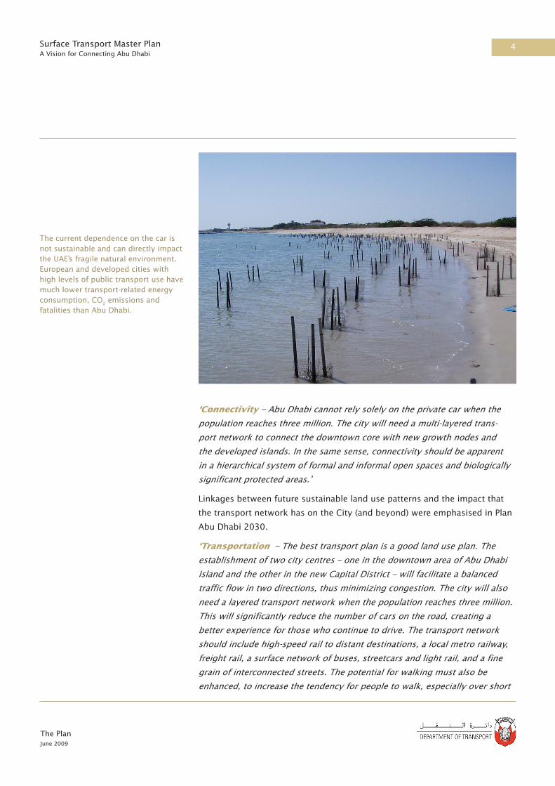
The current dependence on the car is not sustainable and can directly impact the UAE’s fragile natural environment. European and developed cities with high levels of public transport use have much lower transport-related energy consumption, CO2 emissions and fatalities than Abu Dhabi.

5
The PlanJune 2009
Surface Transport Master PlanA Vision for Connecting Abu Dhabi
distances.’
Although Plan Abu Dhabi 2030 can be considered a framework plan – one
that deals with the conceptual and broad nature of land use and transport
distribution – it made a number of recommendations that helped to facilitate
the progress of sustainable transport planning in the Emirate, including
Policy T-2 recommending the basis for the Surface Transport Master Plan:
‘Complete a City-Wide Comprehensive Transportation Plan as soon as
possible for multiple modes, full arrangements for goods movement, and
roads with a finely distributed pattern of streets and automobile access.’
A4 Vision for Transport in Abu Dhabi
In aspiring to become one of the world’s truly great places, Abu Dhabi has
set out to create a truly great transport system. Accordingly, the vision of
the Plan is to be a world leader. Although Plan Abu Dhabi 2030 sets out a
clear vision for future land use development in the Emirate, the vision for
transport in Abu Dhabi is shaped around a cultural shift in the relationship
between Abu Dhabi’s citizens and the role that transport plays in their lives.
Abu Dhabi cannot continue to rely on the private car if it wishes to achieve
the sustainable goals of Plan Abu Dhabi 2030. At present, it has more
opportunities than most cities to develop a truly world-class system and in
doing so to change forever the dependency on private vehicles.
Although individual countries and cities have unique transport systems,
a number of key attributes of a world-class system have become widely
The Plan’s vision is to develop ‘A world-leading transport system that meets the needs of residents, visitors and businesses in the most efficient, safe, attractive and environmentally sustainable way.’
Cities have recognised the need for large scale investment in transport infrastructure to maintain their global competitiveness. In the United Kingdom, for example, AED 80 Billion will be invested in the Crossrail project to improve mobility across Central London.

6
The PlanJune 2009
Surface Transport Master PlanA Vision for Connecting Abu Dhabi
recognised. They are:
• reduced dependency on the use of private cars
• a high proportion of trips made by public transport
• a high degree of integration within the transport system
• close integration of land use and transport planning/development
• reduced carbon emissions
• promotion of non-motorised movements
These key attributes were all taken into account as the Plan developed. The
transport systems of many leading cities were examined to see what lessons,
both negative and positive, could be applied to Abu Dhabi.
A5 Goals and Objectives
A set of goals and objectives was defined at the start of the study process to
guide the Plan’s development based on the sustainable planning foundation
that underpins Plan Abu Dhabi 2030. More specifically, the three pillars of
sustainable development guided the framework as follows:
Goal 1 – Economy: promote economic competitiveness and vitality through
efficient, high-quality transport services for passengers and freight
Goal 2 – Society and culture: protect and enrich people’s lives by
maximising safety and access to opportunities for all
Goal 3 – Environment: deliver world-leading performance in environmental
sustainability, through responsible use of resources, minimising pollution,
and preserving Abu Dhabi’s unique environment.
In Singapore 70% of peak hour trips into the centre are by public transport.

7
The PlanJune 2009
Surface Transport Master PlanA Vision for Connecting Abu Dhabi
A set of objectives and measurable indicators was derived from these goals,
designed to ensure that the development of the Plan met more specific needs
and so contributions made by the Plan could be quantified. The objectives
are:
• Minimise congestion on Abu Dhabi’s road network for residents, visitors
and businesses
• Reduce reliance on the automobile and encourage alternative modes of
travel
• Develop a low carbon economy in Abu Dhabi
• Improve the international connectivity of Abu Dhabi
• Improve the regional connectivity within the Emirate of Abu Dhabi
• Improve connectivity within the Abu Dhabi Metropolitan area
• Encourage sustainable and efficient freight distribution
• Preserve the natural environment that makes Abu Dhabi unique
• Protect and enhance the cultural heritage, landmarks, national symbols
and monuments of Abu Dhabi
• Reduce traffic noise and improve local air quality
• Improve safety, particularly for pedestrians
• Enhance the pedestrian realm
A6 The Process
The study was completed in three main phases, which were:
Phase 1 – Assessment
A comprehensive review of existing conditions, policies and plans was
undertaken to identify the key issues and options to be addressed and
the additional information needed to evaluate future policy and planning
scenarios.
Phase 2 – Evaluation
A comprehensive analysis of the probable impacts of alternative scenarios
for the management and development of the transport system was made.
A range of alternative policy and planning scenarios were formulated,
reflecting different ways of achieving the project goals and objectives. The
In order to develop a Transport Plan that can realistically achieve the aims of Plan Abu Dhabi 2030, a clear understanding of the transport goals and objectives was necessary.

8
The PlanJune 2009
Surface Transport Master PlanA Vision for Connecting Abu Dhabi
contribution of these scenarios was assessed against the objectives of the
Plan using a wide range of criteria to quantify impacts on the economy,
environment, society and other issues. From this phase, a Preferred Scenario
was developed.
Phase 3 – Implementation Plan
This final stage involved deriving implementation schedules and action
plans, together with recommendations for ensuring that stakeholders have
the capability and resources to carry out their assigned tasks effectively, and
a financing plan that identifies the sources of funds.
At the completion of this three-phase process, the Plan was produced;
it comprises a comprehensive set of policies and plans for the transport
network throughout the Emirate, made up of more than 200 different
components.
A7 Consultation and Participation
The study process was transparent, with consultation and stakeholder
involvement critical to the overall success of the Plan. It was controlled by a
high-level steering committee and run by a technical committee made up of
representatives of the following key organisations:
• Department of Transport (leading)
• Abu Dhabi Urban Planning Council
• Abu Dhabi Municipality
• Al Ain Municipality
• Al Gharbia Municipality
Regular specialist workshops were held, as well as three major interactive
workshops at key points in the process, each attended by up to 200
delegates. The feedback and contributions received provided information
about specific schemes and helped to shape and refine numerous initiatives
for the Plan.7
Local consultation on the Plan itself and its component initiatives was also
undertaken. Two major consultation exercises using focus groups were held
to gauge the opinion of all demographics on the impact and acceptability
of various policies and schemes. Advertisements were placed in local print
media, and a text message to all Abu Dhabi mobile telephone numbers
elicited over 400 responses.

9
The PlanJune 2009
Surface Transport Master PlanA Vision for Connecting Abu Dhabi
A website for the Plan (www.transportabudhabi.ae) was established and
provided information on the study, details of technical papers, and feedback
forms where members of the public could respond directly throughout the
process. The website remains open as a publicly accessible source of the
finished Plan documentation.
At the final major interactive workshop, held in November 2008, a panel
of 11 international experts were invited to Abu Dhabi to contribute to the
study process. Without exception, this group of transport professionals
acknowledged that implementation of Plan 2030 will be a world first. Some
highlights from their comments include:
‘The vision represents what we all have aspired to but, realistically, have not
expected or been able to deliver. The vision is realistic and clearly reflects
the best that any community can conceive relative to achieving true balance.
Indeed, it is an impressive piece of work, which obviously required a lot of
thought, ingenuity and energy to produce.’
‘Vision 2030 is challenging but achievable but it is important that the vision,
commitment and clarity of objectives that characterise its inception are
maintained through its design and development, its implementation and
its continuing delivery, maintenance and refinement. Stay true to the Vision
- creating it was the easy bit – the test will be the ability and courage to
implement it.’
‘Implementation will be more than simply converting the plan into
reality. Creating and managing positive expectations must be undertaken
immediately via a communication strategy and plan but then the
implementation will be critical in developing and reinforcing the ongoing
communication.’
The study process was driven by effective consultation and coordination with key organisations and stakeholders and members of the public. Major interactive workshops were held during the process that ensured a shared understanding of transport issues and priorities and to coordinate transport infrastructure planning on all levels within the Plan.
A series of newspaper advertisements sought feedback from the general public.

10
The PlanJune 2009
Surface Transport Master PlanA Vision for Connecting Abu Dhabi
‘Besides providing all the physical hardware, it is even more important to set
out to change the public mindset with regards to the use of public transport.
The public needs to be convinced and won over, not coerced. It will require a
massive public education and publicity programme.’
‘The 2030 Plan states that land use planning will have the single biggest
impact on transportation system performance. This is an unusually
enlightened view which provides a very strong foundation assuming that
land use planning is closely coordinated with rail planning as quickly as
possible.’
‘A good public transport system is reliable, frequent, clean, safe and secure.
It is important to set strict regulatory standards to ensure that the services
provided comply with the requirements set by the authorities. There needs
to be frequent monitoring and enforcement done to ensure that operators
perform well.’
‘What is required are transit systems of first choice rather than of last resort.
One of the most important passenger requirements is a coordinated fare
structure for the entire system with one fare media a ‘transit smartcard.’
‘There is very little urban space and service for pedestrians within the Abu
Dhabi CBD when compared with European Cities, be it for the climate,
societal or cultural reasons. This should be changed as part of urban
renewal providing easy access for pedestrians to hotels, shopping malls,
mosques etc., by reducing parking on the public space to the benefit of
pedestrians and by at the same time providing access via public transport
systems.’
A panel of 11 experts from around the world visited Abu Dhabi and reviewed the Plan.

11
The PlanJune 2009
Surface Transport Master PlanA Vision for Connecting Abu Dhabi
‘The problem with the highway network is primarily one of management
in the Abu Dhabi metropolitan area. The contrast in service levels between
the peak and off-peak hours is enormous, and if the highway network
is to perform more effectively in the near- and long-term futures a new
approach to its management is required. Concurrently with road expansion,
the DoT should look at ways to maximise the existing capacity of the
road infrastructure and networks by leveraging on traffic management
technologies.’
‘Currently parking demand far outpaces supply and enforcement seems to be
very minimal. Bringing demand in line with supply is preferable to greatly
increasing supply. This cannot be done without a tremendous increase in the
availability of travel options.’
A8 References
1. Plan Abu Dhabi 2030: Urban Structure Framework Plan. Urban Planning
Council. Sep 2007.
2. Plan Al Ain 2030: Urban Structure Framework Plan. Urban Planning Council.
Apr 2009.
3. Plan Al Gharbia 2030: Urban Structure Framework Plan. Urban Planning
Council. Under production.
4. Surface Transport Master Plan – A Vision for Connecting Abu Dhabi.
Department of Transport. Mar 2009.
5. The Abu Dhabi Economic Vision 2030. The Government of Abu Dhabi. Nov
2008.
6. Abu Dhabi Policy Agenda. Executive Council 2007.
7. Appendix E Consultation. Abu Dhabi Surface Transport Master Plan. Apr
2009.

The PlanJune 2009
Surface Transport Master PlanA Vision for Connecting Abu Dhabi

Part BThe Challenges

The PlanJune 2009
Surface Transport Master PlanA Vision for Connecting Abu Dhabi

15
The PlanJune 2009
Surface Transport Master PlanA Vision for Connecting Abu Dhabi
B1 Economic Growth
The population of the Emirate, and of the Metropolitan area in particular,
has been increasing rapidly in the last few years. The population of the
Metropolitan area rose by over 25% between 2005 and 2008 and the total
population of the Emirate is now around 1.6 million. This increase has been
accompanied by a major construction boom, with the total developed floor
area increasing by 46% over the same period.
Table B1 Population Growth 2005-2008 (million residents).
By 2030 the planned population of Metropolitan Abu Dhabi will exceed 3
million residents.3 When combined with planned growth in Al Ain and Al
Gharbia this will take the population of the whole Emirate to nearly 5 million.
The total Gross Domestic Product (GDP) of the Emirate is expected to grow
five fold over this period from AED280 billion to AED1,500 billion.4
Figure B1: Expected Population Growth 2008-2030
B The Challenges
20051 20082
Abu Dhabi 0.74 0.94
Al Ain 0.38 0.52
Al Gharbia 0.14 0.14
Total 1.26 1.60
The Abu Dhabi economy will grow five fold in the next twenty years, putting enormous strain on the Emirate’s transport infrastructure.
6
5
4
3
2
1
0
Popula
tion (
mill
ions)
Abu Dhabi Metropolitan area
Al Ain Al Gharbia Total Emirate
2008
2030

16
The PlanJune 2009
Surface Transport Master PlanA Vision for Connecting Abu Dhabi
B2 Economic Diversification
The development plans for the Emirate are designed to reduce the current
dependence on the oil sector and to expand the non-oil commercial and
industrial sectors together with the retail and tourism sectors. In the
Metropolitan area alone Plan Abu Dhabi 2030 predicts a four fold increase in
tourist visits and a five fold increase in business activity. The public sector
will be developed in parallel to serve this enormous growth.
B3 Spatial Change
The economic development plans require a phenomenal change in the
existing distribution of land use. The headline figures in Table B2 illustrate
the scale of change in land use required in the Abu Dhabi Metropolitan
and Al Ain areas, as set out in their respective 2030 plans. The growth of
the city will be delivered primarily through the planning of new mainland
neighbourhoods by the government, large-scale urban developments on the
islands around Abu Dhabi Island, and redevelopment and infill of existing
developed areas.
Table B2: Expected Changes in Land Use 2008-2030
(*) Gross Floor Area
The change in land use will be delivered primarily through a number of very
large scale developments, either on re-developed sites or (the majority) on
previously undeveloped land, particularly the Islands to the east of Abu
Dhabi Island.
Some of the key challenges this poses for the Plan are:
• The sheer scale and pace of change throughout the Emirate and hence
demand for trip making
• Creation of a second growth pole - the Capital City District - in the
Metropolitan area generating significant local and regional travel demand
Land Use Abu Dhabi Metropolitan3 Al Ain5
Residential Units 506,000 135,012
Retail GFA(*) 3,140,000 640,000
Office GFA (*) 6,100,000 450,000
Industrial GFA (*) 11,000,000 1,175,000
Hotel Rooms 64,500 3,204
x5
x4
x3
x2
Population
2007 2013 2020 2030
BusinessTourists
The construction of the Capital City District on the mainland will fundamentally alter the urban structure of the Metropolitan area.
The commercial and tourism sectors will grow four to five fold by 2030.3
Figure B2: Expected Growth in Business and Tourism

17
The PlanJune 2009
Surface Transport Master PlanA Vision for Connecting Abu Dhabi
• Providing access to developments on Islands that have a limited number
of access points
• Maximising the opportunity to reduce longer distance trip making and
internalise journey to work, educational, social and other trips within
developments
B4 Mobility
B4.1 Car Dominance
The majority of surface transport in the Emirate is by private car, taxi or
contract bus, with a small but rapidly developing public bus system (there is
virtually no maritime public transport).
Figure B3: 2008 Base Year Modal Split 6
The existing highway network is generally constructed to a high standard
but is already reaching its operational capacity at peak times, both within the
metropolitan areas of Abu Dhabi and Al Ain and on some inter-city routes.
Traffic modelling has demonstrated that peak hour trips will increase five-
fold between 2008 and 2030 and that if no improvements are made to the
transport network large scale traffic gridlock will follow, as illustrated in
Figure B4.7
B4.2 Buses
In mid 2008, the provision of bus services in Abu Dhabi was overhauled
by the DoT. By the start of 2009 nine new timetabled routes operated by
a new fleet of 120 modern air-conditioned buses had been introduced in
1%
48%
Car
Taxi
Walk
Contract Bus
Public Transport
8%
10%
33%
Traffic congestion is already a serious issue in the urban areas. The number of vehicles registered in Abu Dhabi increased by 49% between 2006 and 2008 and congestion will get worse as this trend continues.
The DoT introduced an interim fleet of 120 new buses in 2008.

18
The PlanJune 2009
Surface Transport Master PlanA Vision for Connecting Abu Dhabi
the Abu Dhabi Metropolitan area carrying around 50,000 passengers per
weekday. The DOT is in the process of purchasing an additional 1360 buses,
of which 860 will be in operation by the end of 2009. The service was free
until February 2009 when a new fare system, Ojra, was introduced, which
charges Dh1 for a single ride, Dh3 for a day pass and Dh40 for a month.
Although the new bus services have been successful, it is apparent that they
will not be the sole solution to the traffic congestion problems in Abu Dhabi,
especially as they share the same space as all other road traffic.
By 2030, with no change to existing plans for highways and public transport, the majority of highways in the Metropolitan area will be over capacity and average journey time will increase up to six fold.
Figure B4: Traffic Congestion in the Metropolitan Area - 2030 Morning Peak

19
The PlanJune 2009
Surface Transport Master PlanA Vision for Connecting Abu Dhabi
New taxis were introduced in 2007.
B4.3 Taxis
Historically, taxis have provided the only form of mobility for non-car
owners, apart from contract worker and school buses. In 2006, a new
corporate body -TransAD - was set up by the DoT to develop and introduce
a new taxi system and subsequently to regulate and monitor it. TransAD set
up a franchise system with initially 7 private franchisee companies licensed
to operate approximately 1,000 taxis each. The new operators are slowly
phasing out the traditional white and gold taxis with a new fleet of higher
specification silver vehicles together with re-trained drivers. The taxi system
will always play an important role in Abu Dhabi, as in any country, but the
reliance on it as the main form of public transit must clearly change.
B4.4 Walking and Cycling
Both walking and cycling are difficult and dangerous in the car dominated
transport system, which only serves to reinforce the use of the private car for
many short trips. Although the hot summer climate clearly makes walking
and cycling very uncomfortable, improved street design can mitigate this and
for over half the year the climate is quite suitable for this type of movement.
B4.5 Parking
The supply of parking space has not been able to keep up with demand and
there are serious problems with illegal parking throughout the Metropolitan
area in particular. A Parking Management Plan has been prepared for the
metropolitan CBD that aims to re-organise on-street parking and introduce
parking charges to encourage the use of a number of under-utilised
underground car parks (which are charged for). However, even with these
measures the demand for car parking will exceed supply.
B4.6 Freight
The movement of freight, the majority of which is by road, is a significant
challenge to achieving 2030 objectives. Road freight is treated very much
as a second priority to the private car and is often restricted to prescribed
routes (and time periods in urban areas). These routes nearly always result
in longer journey times than the corresponding car routes (in the case of the
route to Dubai it is a 50% longer distance) with commensurate increases in
operating costs. This creates a barrier to the creation of an efficient freight
sector, and hence the realisation of some of the industrial and commercial
objectives of the 2030 vision
Walking and cycling in the urban areas of Abu Dhabi is both unpleasant and unsafe.
The availability of car parking is a serious issue in the Abu Dhabi metropolitan area.

20
The PlanJune 2009
Surface Transport Master PlanA Vision for Connecting Abu Dhabi
B4.7 Road Safety
The number of fatalities and injuries resulting from road crashes is
unacceptably high in the Emirate. Pedestrians, in particular, are highly
vulnerable, accounting for around 40% of all road related fatalities. A
number of factors contribute towards this including poor driving standards,
excessive speeding and lack of pedestrian crossings. This situation clearly
has to change.
Figure B5: International Comparison of Traffic Accident Fatalities 8
B5 Environmental Implications
B5.1 Global Climate Implications
The UAE has one of the highest per capita carbon emissions in the world and
transport is one of the main contributors to this. The Kyoto Protocol requires
industrialised countries to reduce their total emissions of greenhouse gases
by about five per cent compared to 1990 levels by 2012. Although the UAE
was not required to meet quantitative emission targets, the international
community is now working towards a successor agreement to the Kyoto
Protocol. It is therefore likely that the UAE will face pressure in the near
future to substantially reduce its carbon emissions, including those derived
from transport.
Abu Dhabi’s future lies in its ability to pursue renewable energy production,
and to drastically reduce fossil fuel demand for transport. Resource
efficiency and carbon management are vital to the sustainable development
of Abu Dhabi.
Abu Dhabi has a very high level of traffic accident fatalities per head of population, at 50% greater than recorded in the United States, and four times higher than the United Kingdom.
30
25
20
15
10
5
0
No.
of
fata
litie
s
South
Afr
ica
25
.3
24
.0
22
.5
21
.0
14
.5
14
.0
11
.0
8.7
7.9
6.2
6.1
5.5
5.4
4.6
Mal
aysi
a
Spai
n
Japan
Swed
en
Russ
ia F
eder
atio
n
USA
Fran
ce
Ger
man
y
Net
her
lands
Abu D
hab
i
Pola
nd
Aust
ralia UK

21
The PlanJune 2009
Surface Transport Master PlanA Vision for Connecting Abu Dhabi
Figure B6: Per Capita Carbon Emissions 9
B5.2 Local Environmental Implications
In addition to carbon emissions, there are more local environmental issues,
such as habitat degradation and pollution, to be considered. Increasing traffic
levels have led to visual intrusion, air emissions and noise, which impact on
human health and quality of life. There are also significant environmental
issues related to freight, whether it is by road or sea. National heritage sites
provide a link to the Emirate’s cultural roots and rich traditions, but are
under pressure from expanding development. The current demand placed
on the Emirate’s finite natural resources is leading to depletion, and without
more efficient use the capacity to provide for continued development will be
compromised.
B6 Economic Implications
Time wasted while delayed on traffic congested roads imposes significant
costs on the economy. Many leading cities have recognised that an excellent
transport system is vital to maintaining their competitiveness. In a global
economy, ease of movement is an important criterion when footloose
enterprises, which Abu Dhabi needs to attract, are considering locations.
B7 Social and Cultural Implications
Abu Dhabi’s quite unique cultural mix poses its own challenges to the
provision of public transport. Only 15% of the population are nationals,
Traffic congestion imposes high economic costs. Recent studies have shown that the cost of traffic congestion in the UK is equivalent to 1.4% of the country’s GDP. In Dubai the cost was estimated to be 2.4% of GDP.
The UAE has one of the highest per capita carbon emissions in the world - a significant amount of which is transport generated.
30
25
20
15
10
5
0
CO
2 p
er C
apit
a (t
housa
nd m
etri
c to
nnes
of
CO
2 p
er c
apit
a -
20
03
)
United Arab Emirates
United States of America
Singapore Japan United Kingdom
Sweden
23.7
19.5
10.69.8 9.1
6.1

22
The PlanJune 2009
Surface Transport Master PlanA Vision for Connecting Abu Dhabi
with expatriates making up the majority. The expatriate population consists
of several different categories ranging from a professional class to a large
number of modestly paid industrial workers. Any system must take account
of this wide disparity in incomes and the needs of different gender and social
groups for segregation.
It is obvious that the strong car culture needs to change if the traffic gridlock
in other similar cities is to be avoided. At first this seems a big obstacle to
overcome, but less so when it is considered that much of the expatriate
population is accustomed to using public transport in their home countries.
Moreover, consultation undertaken at the start of the Plan demonstrated that
a wide cross section of society would be willing to use alternative modes to
the car.
There is strong evidence of worsening health in Abu Dhabi in the form of
increasing levels of obesity, childhood diabetes and heart disease. If healthier
options for travelling were introduced, and people were encouraged out of
their cars, this could provide a strong boost to health. Walking 20 minutes
a day is one way to incorporate exercise into a daily routine to maintain a
minimum level of fitness, but if there is no infrastructure to allow this, then
car use will be preferred, even for the shortest trips.
B8 References
1. UAE Census 2005.
2. Department of Planning and Economy, Abu Dhabi.
3. Plan Abu Dhabi 2030: Urban Structure Framework Plan. Urban Planning
Council. Sep 2007.
4. Abu Dhabi Policy Agenda. Executive Council 2007.
5. Plan Al Ain 2030: Urban Structure Framework Plan. Urban Planning Council.
Apr 2009.
6. Validated 2008 Abu Dhabi Enhanced Transport Model
7. Appendix B Traffic Modelling. Abu Dhabi Surface Transport Master Plan.
May 2009.
8. Various sources.
9. International Energy Agency (IEA) Statistics Division 2006.

Part CThe Choices

The PlanJune 2009
Surface Transport Master PlanA Vision for Connecting Abu Dhabi

25
The PlanJune 2009
Surface Transport Master PlanA Vision for Connecting Abu Dhabi
Part C – The Choices
C1 Overview
In order to determine the best transport system for Abu Dhabi in 2030, it
was necessary to evaluate a wide range of choices. A rigorous technical
process was applied, based on international best practice whereby
alternative scenarios were identified, modelled, evaluated and further
developed by an iterative process in order to define a preferred scenario. The
preferred scenario was in turn refined through a further set of modelling and
evaluation exercises to reach the final Plan.
C2 The Evaluation Process
C2.1 Overview
The evaluation was based on a two stage process (Figure C1). In the first
stage, four alternative scenarios were defined and subject to a broad
evaluation against the project objectives. In parallel to this, a first sift of
policy and physical components was made to identify priorities and to reject
components that were considered to be undeliverable. A comparison of the
scenarios was then made in order to identify an emerging preferred scenario.
In the second stage, this emerging preferred scenario was subject to
iterative testing of packages of components and policies. The results
enabled an overview to be taken of the performance of each package against
each objective. Concurrently, a qualitative evaluation of each scenario
component was made against the key Plan objectives. This analysis of
individual components provided an understanding of which components
contribute best to the achievement of objectives and informed the choice
of components to be included in the preferred scenario; it also acted as a
mechanism to screen out components that made little contribution to the
objectives. Stakeholders were involved at key decision points in the process,
contributing to the selection of the alternatives, the identification of the
emerging preferred scenario and the selection of the preferred scenario.

26
The PlanJune 2009
Surface Transport Master PlanA Vision for Connecting Abu Dhabi
C2.2 Setting Goals, Objectives and Indicators
As discussed in Part A, the Plan has a vision, a set of goals and a set of
objectives. The vision is to develop:
A world-leading transport system that meets the needs of residents, visitors
and businesses in the most efficient, safe, attractive and environmentally
sustainable way.
The goals are:
Goal 1: Economy – Promoting economic competitiveness and vitality
through efficient, high quality transport services for passengers and freight.
Goal 2: Society and Culture - Protecting and enriching people’s lives by
maximising safety and access to opportunities for all.
Goal 3: Environment - Delivering world leading performance in
environmental sustainability, through responsible use of resources,
minimising pollution, and preserving Abu Dhabi’s unique environment.
In order to measure the contribution of the alternative scenarios to the goals,
ten objectives were set to provide more direction to the design of the Plan
(Table C1). Each of these objectives has one or more measurable indicators
that were used to assess the contribution of the alternatives to the objective.
C2.3 The Strategic Evaluation Framework
In order to evaluate the alternative scenarios and the individual schemes, a
Strategic Evaluation Framework (SEF) was developed. The SEF was developed
Transport Modelling Evaluation
Comparisonof Scenarios
Incremental Modelling ofComponent Packages
EmergingPreferred Scenario
Preferred Scenario
The Master Plan
Evaluation SummaryTable
Scenario 1
Evaluation SummaryTable
Scenario 2
Consultation
Consultation
Policy Review
Evaluation SummaryTable
Scenario 3
Evaluation SummaryTable
Scenario 4
Scenario 1 Scenario 2 Scenario 3 Scenario 4
Stag
e 1
Eva
luat
ion
Stag
e 2
Ev
aluat
ion
Figure C1: The Evaluation Process

27
The PlanJune 2009
Surface Transport Master PlanA Vision for Connecting Abu Dhabi
using international best practice and existing elements of guidance already
used in Abu Dhabi. The multi-criteria framework approach used provides
decision makers with a more comprehensive understanding of the main
beneficial and adverse impacts of each scenario measured using common
criteria (economic, environmental and social). It aims to ensure that all
relevant impacts are captured in some way, even if they cannot be quantified
and valued in the same way as the components of a conventional cost-
benefit analysis (see Appendix D).
Table C1: Objectives and Indicators
Objective Indicators
ENVIRONMENT GOAL
Develop a low carbon economy in Abu Dhabi by 2030
CO2 emissionsQualitative assessment of impact on fuel and energy use
Preserve the critical natural environment that makes Abu Dhabi unique
Qualitative assessment of impact on natural environment (biodiversity, water, soil)
Protect and enhance the cultural heritage, landmarks, national symbols and monuments of Abu Dhabi
Qualitative assessment of impact on townscape character, landscape & heritage
Other Environment ( noise and local air quality)
Qualitative assessment of impact on noise and local air quality
SOCIETY & CULTURE GOAL
Improve the international connectivity of Abu Dhabi
Qualitative assessment of access to neighbouring Emirates & countries and airports
Improve regional connectivity within the Emirate of Abu Dhabi
Qualitative assessment of access between Abu Dhabi metropolitan area, Al Ain and Al Gharbia
Improve connectivity within the Abu Dhabi Metropolitan area
Qualitative assessment of access to key employment, business and tourist destinations within Abu Dhabi Metropolitan area, including Suwa Island, Saadiyat Island, Marina Mall, Capital District, Central Market Station
Encourage sustainable and efficient freight distribution
Qualitative evaluation of sustainability of multi-modal access to Mussafah and KPIZ
Improve health and safety for the workforce passengers and communities
Qualitative assessment of impact on number of road traffic accidents
Enhance the pedestrian realm Qualitative assessment of impact on pedestrian realm
ECONOMY GOAL
Minimise congestion on Abu Dhabi’s road network for residents, visitors and businesses
Vehicle hours delay per vehicle
Reduce reliance on the automobile and encourage alternative modes of travel
Percent mode share of public transport

28
The PlanJune 2009
Surface Transport Master PlanA Vision for Connecting Abu Dhabi
C2.4 The Enhanced Transport Model
In order to develop, test and evaluate the alternative scenarios, a transport
model is an essential tool. The existing Abu Dhabi Municipality model (ADM)
was not suitable for this purpose as it could only simulate road traffic.
Within the timeframe available for the study, the new model was developed
from the ADM and is based on the same trip generation relationships that
were calibrated and validated using data that is now some eight years old.
Although Abu Dhabi has changed significantly in the interim period, the ADM
and the Enhanced models are both based on the trip making characteristics
of representative individuals and households.
Most other aspects of the model, from distribution to mode choice and
assignment have been significantly enhanced. The most significant change
was for mode choice where the network of services and the level of service
of each mode of transport was incorporated into the mode choice model.
This was required to enable the testing and evaluation of regional rail, metro,
tram, bus and ferry alternatives as components of the Plan.
To calibrate the enhanced model, the 2008 base year land use and socio-
economic data was developed, based on detailed information from the
2005 Census adjusted to 2008 conditions based on the best available data
on population changes and information on newly completed buildings. To
complement available traffic data for Abu Dhabi Metropolitan area, and the
rest of the Emirate, traffic counts, vehicle occupancy surveys and journey
time surveys were also undertaken in May 2008 covering each of the model
time periods:
• Morning (AM) peak 07:00 – 08:00
• Afternoon (PM) peak 14:00 – 15:00
• Evening (EV) peak 19:00 – 20:00
The Enhanced Model has been validated against these traffic counts and
journey time surveys for each of the model time periods (see Appendix B).
The comparison of observed and modelled journey times and flows on links,
as illustrated by the examples presented in Figures C2 and C3, was found
to be acceptable giving confidence in the application of the model under
different scenarios.

29
The PlanJune 2009
Surface Transport Master PlanA Vision for Connecting Abu Dhabi
Figure C2 Example of Journey Time Validation Observed v Modelled Morning Peak Journey Times for Route 3 Southbound
Figure C3 Example of Traffic Count Validation Observed v Modelled Morning Peak Car Volumes by Link
Based on close coordination with ADUPC, the expected 2030 land use and
socio economic scenario, as described in Part B, was distributed across
the 931 traffic zones used within the model, based largely on planned
development changes from the 2008 base year. The 2030 scenario reflects
the Plan Abu Dhabi 2030 vision for development. On the basis of indicative
phasing of developments, a process of interpolation was adopted to generate
corresponding land use and socio economic scenarios for the intermediate
years of 2015, 2020 and 2025 (for details see Appendix C).
Model
led v
olu
me
Observed volume
y=0.9827x - 16.442
R2 = 0.8754
7,000
6,000
5,000
4,000
3,000
2,000
1,000
1,000 2,000 3,000 4,000 5,000 6,000 7,000
100
90
80
70
60
50
40
30
20
10
0
1 2 3 4 5 6 7 8 9 10 11 12 13 14 15 16 17 18 19 20 2122 23 24 25 26 27 28 29 30 31 32 33
Observed
Journ
ey T
ime
(min
)
Modelled

30
The PlanJune 2009
Surface Transport Master PlanA Vision for Connecting Abu Dhabi
The Enhanced model was then used as a tool for developing, testing and
evaluating the alternative scenarios, described in subsequent sections. In
each case, model runs were carried out for all three model time periods
although for simplicity only the morning peak results are presented since
these represent the time with the greatest travel demand. The model has
also been used to test the phasing of components and to determine when
major elements of the Plan need to be in operation.
C3 Identification of Alternative Scenarios
C3.1 Overview
The future scenarios had to represent a variety of different ways in which
transport could meet the Plan goals and objectives. The scenarios needed
to be challenging and wide ranging in order that all possible solutions were
considered in reaching the final Plan. The scenarios were put together in a
strategic workshop in which key stakeholders and the project team brain-
stormed a wide range of potential solutions, for which four broad scenarios,
in addition to a reference (baseline) case, were developed. These scenarios
included both physical infrastructure components as well as policy measures,
as follows:
• Scenario 1: A highways based scenario designed to facilitate road based
transport.
• Scenario 2: A public transport and car alternatives scenario designed to
encourage use of non-car modes.
• Scenario 3: A demand management scenario designed to influence the
mode of travel through mechanisms such as pricing.
• Scenario 4: A low carbon scenario designed to reduce carbon emissions.
C3.2 The Reference Case
The Reference Case comprises the existing highway network plus already
committed highway schemes and the planned improvements to bus services,
and forms the basis for comparison with the alternative scenarios.
The key committed schemes included in the Reference Case are:
• Sheikh Zayed Bridge
• Saadiyat - Shahama Freeway
The Reference Case includes committed schemes and is the basis for comparison with the alternative scenarios.

31
The PlanJune 2009
Surface Transport Master PlanA Vision for Connecting Abu Dhabi
• Shahama Freeway Extension to E11
• Mafraq – Ghwaifat Upgrading (E11)
• Gayathi - Madinat Zayed Road
• Salaam Street Tunnel with 4 grade separated junctions
• Saadiyat Bridge to Al Meena Street Tunnel
• Bridges connecting CBD to Suwa Island
• Bridges connecting Suwa Island to Reem Island
• Al Ain to Dubai Highway (E66) Upgrading
• Lulu Highway
• Al Ain Northern Bypass
• Implementation of the Parking Management Strategy within the Abu
Dhabi CBD
The following projects were also included as committed, but are subject to
final ratification:
• Lulu Island tunnel links and associated junction improvements
• Electra Street underpasses at Junctions 6 and 4
• Bainuna Street widening
In terms of public transport, the Reference Case is limited to the roll-out of
the planned DoT bus fleet of 1,360 buses.
C3.3 The Highways Scenario
The highways based scenario was designed to meet the Plan objectives
through the provision of a highway system alone, which would cater for
private vehicle movements as well as road-based public transport and a
road-based freight network. This would involve expansion of the existing
road network including the development of some additional routes for both
general traffic and freight traffic. It would require significant land take for
new highways infrastructure and also involve provision of extensive parking
within key locations such as the CBD and Capital City.
This scenario includes the following components in addition to those in the
Reference Case:
• An increase in the road network capacity through widening of existing
The Highways Scenario was designed to test if increased highway capacity could solve 2030 transport needs.

32
The PlanJune 2009
Surface Transport Master PlanA Vision for Connecting Abu Dhabi
freeways including the E10, E11, E20 and E22, upgrading selected key
routes within Abu Dhabi to freeways with provision of grade separated
junctions, upgrading existing distributor roads and provision of some
new roads
• Development of some additional strategic links including the Mid Island
Parkway, Desert Highway extension and a new link from Capital City to
Abu Dhabi Island to provide additional capacity from the mainland to Abu
Dhabi Island
• Upgrading the E15, E65 and E90 to two lanes in each direction to
improve safety
• Definition of a road hierarchy that would assist in imposing controls over
the network
• Introducing traffic management measures to improve traffic flows and
capacity, traffic calming and a comprehensive system for real-time traffic
management
• Improving safety on the road network through improved driver education
and training, greater enforcement of traffic violations, increased vehicle
safety checks and regulations for freight vehicles
• Introduction and enforcement of a Highway Code to regulate driving
conditions in the Emirate and allow for increased enforcement of
violations
• Development of a rapid bus-based transit system that would follow key
corridors and freeways
• Introduction of a network of local bus services to link in with the rapid
bus services
• Transfer of some road space to high-volume public transit and high
occupancy vehicle lanes and provision of some private toll lanes on
freeways to accommodate drivers prepared to pay a fee to bypass traffic
congestion
• Increased provision of taxis including formalised shared taxis, with
improved taxi infrastructure such as additional taxi ranks at locations
outside of those already provided at hotels and malls, a centralised taxi
booking service and use of a GPS booking system for taxis
• Encouraging greater use of school buses and bus services for key
employment and educational facilities

33
The PlanJune 2009
Surface Transport Master PlanA Vision for Connecting Abu Dhabi
• Provision of new highway capacity for freight, including a dedicated
truck route from Mussafah to Khalifa Port via an alignment parallel to the
E11, extension of existing freight routes, improved signage and strategic
location of distribution centres and new truck stops and parking
• Extensive event management strategy for concerts, sporting and
religious events to manage the impact on the highway network
• Extensive parking strategy, which includes both on and off-street parking
management, extension of controlled parking zones and standards for
new developments
• Extensive provision of new on and off-street parking within
developments in Abu Dhabi.
In this scenario, management of the highway network would be critical in
maintaining the flow of traffic around the network and traffic enforcement
would be an important component in managing the demand for parking
space and the efficient movement of freight.
C3.4 The Public Transport Scenario
The public transport scenario was designed to meet the Plan objectives
by maximising the quality and availability of public transport to provide
an effective, easy to use and popular alternative to the private car and to
encourage non-car modes. This scenario proposed a substantial expansion
of the public transport network compared to the Reference Case, including
regional rail, metro, tram, bus, passenger ferries and personal rapid transit.
The public transport network would be fully integrated to ensure entire trips
can be made from “door to door”. In addition, there would be wholesale
provision of segregated pedestrian and cycling facilities and use of water
transport for passenger services.
This scenario includes the following components in addition to those in the
Reference Case:
• Introducing traffic management measures to improve traffic flows and
capacity, traffic calming and a comprehensive system for real-time traffic
management
• Upgrading the E15, E65 and E90 to two lanes in each direction to
improve safety
• Development of a regional rail network throughout the Emirate including
A very comprehensive public transport system was identified for the Public Transport Scenario.

34
The PlanJune 2009
Surface Transport Master PlanA Vision for Connecting Abu Dhabi
high speed rail links to Dubai, Al Ain and potentially Qatar with regional
stopping services where appropriate, including potential stops at Ruwais,
KPIZ, Shahama and Mafraq
• Development of an extensive Metro network, which would provide high
quality mass transit around Abu Dhabi and the Capital City, with direct
links to the Abu Dhabi International Airport and key locations around the
metropolitan area
• Development of an extensive network of trams, light rail transit and bus
rapid transit throughout the Abu Dhabi metropolitan area to link Metro
stations with education and health facilities, commercial developments
and other key development areas around the city. The development of
this network would provide a high capacity public transport alternative
where Metro services could not be developed or justified
• A fine grained network of local bus services to link residential areas,
commercial districts, and other key developments with tram and metro
stops in order to provide an integrated public transport network
• An enhanced inter-regional long distance coach network between key
locations in the Emirate
• Development of relevant support infrastructure for the public transport
network including smartcard technology to facilitate integrated ticketing
for the whole network and real time travel information for passengers
• Development of key multi-modal interchanges to allow passengers
to easily transfer between the Metro, tram and bus services. The
development of interchanges is imperative as it would focus the network
on key points and make it easier to navigate around the public transport
network
• Improvements around Metro stations and key interchanges to improve
conditions for pedestrians including air-conditioned walkways, quality
signage and on-street pedestrian improvements
• Provision of park and ride sites at key locations to encourage transfer
of trips on to the public transport network. To support interchange,
controlled parking measures could be introduced around Metro stations
• Development of a water-based public transport passenger network
including a mix of scheduled ferry services around Abu Dhabi, water
taxis, long-distance services to Dubai and other regional locations and
improved regulation of use of waterways in Abu Dhabi to improve safety

35
The PlanJune 2009
Surface Transport Master PlanA Vision for Connecting Abu Dhabi
• Development of a freight distribution network that reduces the demand
on movements of goods on the highway network including new rail lines
to Dubai and Al Ain from KPIZ and a network of distribution centres in
key locations
• Provision of improved cycle facilities around interchanges, development
of pedestrian-only streets in key locations, provision of pedestrian-only
phases at traffic signal junctions and new mid-block pedestrian-only
traffic signals in the CBD.
C3.5 The Demand Management Scenario
International experience has demonstrated that a public transport system
has to be complemented by demand management measures if it is to be
fully effective. The Demand Management Scenario, therefore, was designed
to meet the Plan objectives by introducing a variety of measures to control
highway traffic demand combined with provision of an extensive public
transport network.
The Demand Management Scenario contains the following components in
addition to those in the Public Transport Scenario:
• Introduction of congestion charging as well as cordon pricing for
entering the Abu Dhabi metropolitan area
• Free public transport fares and park-and-ride fares in the Metropolitan
area
• Improved management of parking, including on and off-street parking
charges and extension of controlled parking zones
• Removal of fuel subsidies, introduction of a tax on fuel and annual
vehicle registration fees and safety tests
• Provision of information services including improved communication and
marketing of public transport services and initiatives, travel planning
for individuals, workplaces and education facilities and improved event
management strategies
• Encouragement of car-clubs in the metropolitan area to reduce vehicle
usage and development of extensive network of Variable Message Signs
(VMS) to improve network management and inform drivers of road
conditions.
A full range of demand management tools was incorporated in the Demand Management Scenario to assess the scale of complementary measures that might be required to meet 2030 needs.

36
The PlanJune 2009
Surface Transport Master PlanA Vision for Connecting Abu Dhabi
C3.6 The Low Carbon Scenario
The Low Carbon Scenario was designed to meet the environmental objectives
of the Plan through the reduction of carbon emissions arising from transport
by encouraging environmentally friendly forms of transport and introducing
alternative energy and fuels. This could be viewed as extending the carbon
neutral, zero waste principles adopted for Masdar to the whole Emirate to
achieve One Planet Living.
This scenario sought to complement public transport by encouraging a shift
to alternative fuels in order to reduce carbon emissions. It also included a
range of measures to encourage non-polluting forms of transport through
provision of sustainable infrastructure for walking and cycling and measures,
both voluntary and mandatory, for reducing car use.
The Low Carbon Scenario contains the following components in addition to
those in the Public Transport Scenario:
• Use of alternative fuels (such as hydrogen) and low-emission buses on
the public transport network in Abu Dhabi together with some routes
operating on a “demand responsive” system where buses serve stops
when required
• Provision of passive cooling and shading rather than air-conditioning,
where feasible
• Introduction of a low emission zone for Abu Dhabi, Suwa, Al Reem and
Saadiyat Islands, which would charge vehicles for entering the zone
depending on their carbon emissions
• Introduction of a low emission zone for Capital City District, which
would charge vehicles for entering the zone depending on their carbon
emissions
• Introduction of a vehicle tax depending on emission levels
• Introduction of subsidies for alternative fuels and parking charges
according to the fuel efficiency of vehicles
• Improved management of parking including extension of controlled
parking zones
• Transhipment of freight and deliveries from distribution locations by
electric, low pollution vehicles or freight trams
• Provision of improved cycle facilities around interchanges and cycle hire
schemes
The Low Carbon Scenario was identified in order to test the impact of a wide range of carbon reduction measures.

37
The PlanJune 2009
Surface Transport Master PlanA Vision for Connecting Abu Dhabi
• Development of Personal Rapid Transit (PRT) networks.
Many of the measures proposed were complementary to the provision
of a public transport network and reflected the desire to manage growth
through pricing, policy and physical measures that reduce the level of carbon
emissions.
C4 First Stage Evaluation
The Enhanced Transport Model was used to test the Reference Case and
each of the alternative scenarios. The model results indicated that the
Reference Case and the Highways Scenario, in particular, would result in
severe overloading of the highway network and unacceptable journey times.
The results are presented in Figure C4. However, these are only indicative
for the Reference and Highway Cases as the model was unable to converge
satisfactorily to balance the traffic demand with the available supply of
road space due to the large growth in overall travel demand and the lack of
alternatives.
Figure C4: Results of First Phase Transport Modelling - 2030 morning peak
The initial assessment indicated that the Reference Case and Highways
Scenario had significant environmental, economic and social impacts that
would be detrimental to Abu Dhabi and would not support the Plan goals.
Whilst the initial environmental, economic and social assessment of the
Demand Management and Low Carbon Scenarios indicated that their impacts
4.5
4
3.5
3
2.5
2
1.5
1
0.5
0
20
08
Public
Tra
nsp
ort
Ref
eren
ce C
ase
Dem
and m
anag
emen
t
Low
car
bon
Hig
hw
ays
Hours per car trip
Hours
per
tri
p
Hours per Public Transport trip

38
The PlanJune 2009
Surface Transport Master PlanA Vision for Connecting Abu Dhabi
would be far less than the other scenarios, it became clear from the Strategic
Evaluation Framework (SEF) that no single scenario as initially presented
would ultimately satisfy the requirements of Plan Abu Dhabi 2030.
As a result of the initial modelling and the corresponding environmental,
economic and social assessment, it became apparent that a hybrid of all the
scenarios would be required to achieve the Plan vision.
Figure C5: The Evaluation of Scenarios
C5 Second Stage Evaluation
C5.1 Identifying the Emerging Preferred Scenario
An Emerging Preferred Scenario was developed from the results of the initial
testing and evaluation. The components and policies that were combined to
make up the Emerging Preferred Scenario included infrastructure and policy
elements from all scenarios developed throughout the study process.
The infrastructure components included in the Emerging Preferred Scenario
were those with positive environmental, economic and social impacts as well
as those contributing positively to meeting the overall travel demand on the
transport network. The combination of these measures provided a base from
which to test further elements and specifically different levels of demand
management policy interventions.
The development of the Emerging Preferred Scenario also provided the
opportunity to remove those components that were not to be taken
through for more detailed evaluation, such as those with severe adverse
environmental impacts.
The first stage of evaluation demonstrated that elements of all the scenarios would be needed to achieve the Plan Goals.
Reference Case
Scenario 1Highways
Scenario 2Public Transport
Scenario 3
Scenario 4
(Demand Management)
Emerging Preferred Scenario
(Low Carbon)
Unacceptable
Traffic congestion
Acceptable but prejudices Plan objectives
Very high
Possible Solution
Key stakeholders were consulted at each stage of the evaluation.

39
The PlanJune 2009
Surface Transport Master PlanA Vision for Connecting Abu Dhabi
The Emerging Preferred Scenario was discussed at a workshop with over 200
key stakeholders in November 2008, with feedback used in the evaluation
of scenario components. A review by a panel of eleven international experts
was a key component of this process.
The Enhanced Transport Model was used to run a significant number of
different iterations over varying time periods, testing alternative levels of
demand management measures, policies and the location or composition
of different schemes. At the same time, individual assessments of each
component were completed using the SEF. As a result of this, and the
consultation, a number of schemes were dropped and a number of policies
were strengthened or removed and the Preferred Scenario was identified.
C5.2 Testing the Preferred Scenario
C5.2.1 Overview
In order to ensure that the modelling tools being used during the evaluation
of the Preferred Scenario were suitable, a number of alterations were made to
the model matrices and networks. A number of presentations were made on
the interim results of the network alterations and guidance provided by the
DoT, ADUPC and other stakeholders on where aspects of the model needed to
be addressed. Upon completion of these base runs and strengthening of the
model network, further model runs were carried out to assess the impacts
of alterations, such as inclusion of a new scheme or stronger demand
management measures. A significant number of tests were conducted that
examined proposed changes which had come from:
• Stakeholder Workshops
• Experts’ feedback
• Feedback from Public Consultation exercise
• Individual sessions with stakeholders
• Technical sessions with DoT and ADUPC.
C5.2.2 Modelling of Demand Management
The inclusion of demand management measures within the Preferred
Scenario has been subject to extensive evaluation throughout the study
process. In the assessment of the Preferred Scenario a range of demand
management measures was tested in combination with different packages
of infrastructure in order to identify the optimal balance of infrastructure

40
The PlanJune 2009
Surface Transport Master PlanA Vision for Connecting Abu Dhabi
provision and demand management. The principal measures tested were
parking charges, fuel taxes and congestion charges. These were broad
measures designed to ascertain the order of magnitude of intervention that
will be needed to achieve good future levels of transport service. The exact
form of the measures and the level of charges needed will be determined
following further assessment (see Section D1.4). The measures tested for
2030 (with all prices in 2008 values) were:
• Parking charges between AED5 and 10 per hour in the CBD and Capital
City District
• Global fuel tax between AED0.25 and 1.0 per km on all vehicles
• Congestion charge on inner cordon (bridges to Abu Dhabi Island)
between AED10 and 20 per vehicle
• Congestion charge on outer cordon (Shahama Freeway and Mid Island
Parkway) between AED5 and 10 per vehicle
The modelling assumed that public transport fares will be maintained at low
levels to maximise patronage with a flat fare on Metro, tram and bus services
of AED 3 per trip, with a supplement of AED 0.7 per km on long distance
regional rail trips.
C5.2.3 Results of the Modelling
The modelling of the various combinations of infrastructure improvements
and demand management measures demonstrated that all of the schemes
identified in the Public Transport Scenario together with a large number
of highway components will be needed, in addition to significant demand
management measures, if acceptable levels of transport service are to be
achieved in 2030. A summary of the infrastructure components and key
demand management elements which were shown to be needed in the
modelling is set out in Table C2.
The results of the modelling are summarised in Figures C6 – C11, which
present separate comparisons for each model time period, ie morning,
lunchtime and evening peaks respectively. The top figure of each pair
illustrates that without the Plan the highway network in the Metropolitan
area will be largely over–capacity (and in many areas extremely so) in 2030.
The lower figure of each pair illustrates that with the Plan infrastructure
components and a full range of demand management measures, as set
out in Table C2, congestion can be managed and the majority of the

41
The PlanJune 2009
Surface Transport Master PlanA Vision for Connecting Abu Dhabi
transport network will be within capacity, with the public transport network
accommodating around 40% of peak hour trips.
Table C2 Key Elements of the Preferred Scenario
Element Description
Regional Passenger Rail590km system of inter-regional rail forming part of a future UAE and GCC-wide passenger rail system
Freight Rail (Union Railway)1300km system of inter-regional rail forming part of a future UAE and GCC-wide freight rail system
Metro130km of segregated railway in Abu Dhabi Metropolitan area
Tram340km of street running tram in Abu Dhabi Metropolitan area
Personal Rapid TransitDemand-responsive system planned for Masdar, and potentially Lulu
BusA fine grained bus network will be provided in all urban areas not served by tram or metro
Water TransportA system of scheduled ferry services along both sides of Abu Dhabi island
Highways 1500km of new or upgraded highways
Parking charges Charge of AED10 per hour in the CBD and Capital City District
Global fuel tax Tax equivalent to AED1 per km on all vehicles
Congestion charge on inner cordon (bridges to Abu Dhabi Island)
Charge of AED20 per cordon crossing
Congestion charge on outer cordon (Shahama Freeway and Mid Island Parkway)
Charge of AED10 per cordon crossing
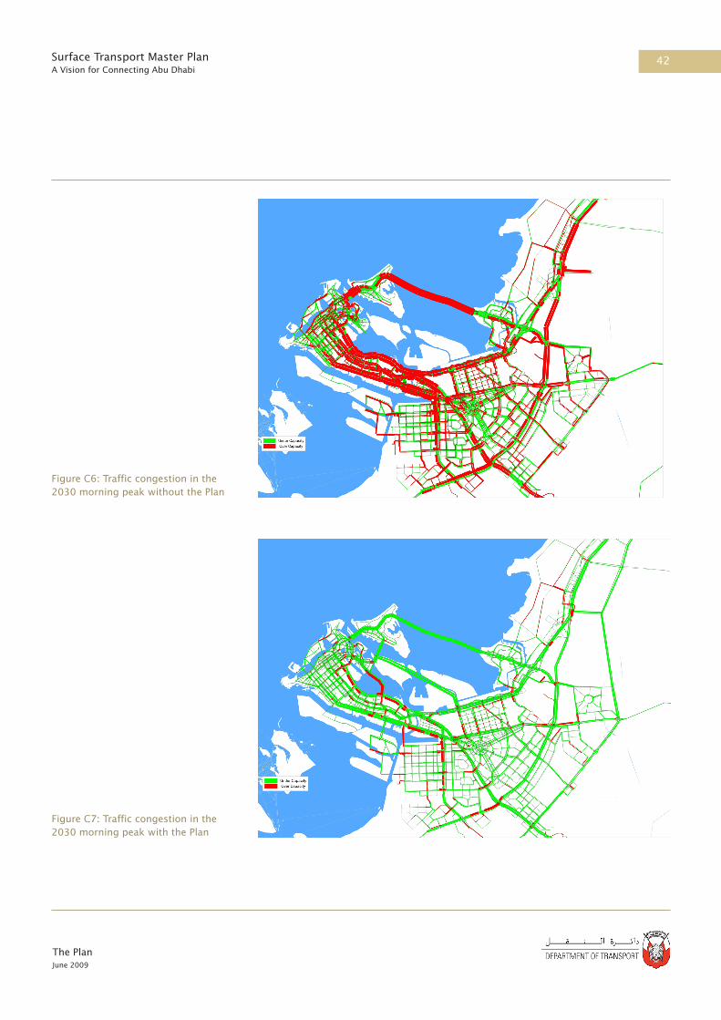
42
The PlanJune 2009
Surface Transport Master PlanA Vision for Connecting Abu Dhabi
Figure C6: Traffic congestion in the 2030 morning peak without the Plan
Figure C7: Traffic congestion in the 2030 morning peak with the Plan

43
The PlanJune 2009
Surface Transport Master PlanA Vision for Connecting Abu Dhabi
Figure C8: Traffic congestion in the 2030 lunchtime peak without the Plan
Figure C9: Traffic congestion in the 2030 lunchtime peak with the Plan

44
The PlanJune 2009
Surface Transport Master PlanA Vision for Connecting Abu Dhabi
Figure C10: Traffic congestion in the 2030 evening peak without the Plan
Figure C11: Traffic congestion in the 2030 evening peak with the Plan

45
The PlanJune 2009
Surface Transport Master PlanA Vision for Connecting Abu Dhabi
C5.2.4 Environmental Evaluation
The environmental evaluation measured the contribution of the Preferred
Scenario towards the environmental goal of:
‘Delivering world leading performance in environmental sustainability,
through responsible use of resources, minimising pollution, and preserving
Abu Dhabi’s unique environment.’
This goal has the following second level objectives:
• Develop a low carbon economy in Abu Dhabi by 2030
• Preserve the critical natural environment in Abu Dhabi
• Protect and enhance cultural heritage, landmarks, symbols and
monuments
• Other environmental evaluation criteria including:
•Local air quality
•Noise
Develop a Low Carbon Economy in Abu Dhabi by 2030
Reduction in carbon use and CO2 emissions is a key requirement for the Plan
to strive towards sustainability. The Preferred Scenario contained extensive
public transport components as part of a low carbon approach, alongside
world leading sustainable transport components such as PRT systems,
low emissions zones, alternative fuel initiatives, passive cooling of public
transport facilities, cycling schemes, freight movements transferred to rail,
multimodal distribution centres and car free areas.
The Preferred Scenario showed an overall beneficial impact in achieving a
low carbon economy in Abu Dhabi by 2030 in comparison to the Reference
Case. However, a large number of highways components required to
provide sufficient transport capacity remained in the Preferred Scenario after
the secondary evaluation. Figure C12 illustrates the number of scenario
components according to their SEF score. The highways components resulted
in the remaining adverse scores towards achieving the low carbon objective.
The reduction of Carbon Emissions is central to the Plan and to reducing the impacts of climate change on Abu Dhabi’s unique environment.

46
The PlanJune 2009
Surface Transport Master PlanA Vision for Connecting Abu Dhabi
Figure C12: Contribution of Plan Components to Low Carbon Objective
In comparison with the 2030 Reference Case, the Preferred Scenario
showed a 35% reduction in CO2 emissions. This reduction in CO2 emissions
significantly reduces Abu Dhabi’s contribution to global greenhouse gases
and thus impact on global warming and climate change. However, it should
be emphasised that real reductions from today’s emission levels are urgently
required to stabilise global emissions and to counteract climate change.
The magnitude of reduction required to fulfil international obligations of
a reduction of 80% in CO2 emissions by 2050 will only be achieved by
far greater effort. To this end, any policies to encourage greater use of
renewable energy for transport are strongly encouraged. This may be better
achieved with a largely electrically powered public transport system, which
could include trolley buses in place of diesel buses.
These emissions calculations did not consider reduction of CO2 produced at
the power station by electricity generation for the electrified regional rail,
metro, trams and PRT. If this electricity was provided by a low carbon source
such as renewables, this would further reduce CO2 emissions.
This evaluation of the Preferred Scenario revealed that for a truly world
leading effort in carbon emissions reduction, the Preferred Scenario should
be operated with all electrical energy generated from renewables and low
carbon sources. A commitment in energy and carbon policy will be required
calling on collaboration between the Abu Dhabi government and energy
industry stakeholders.
50
45
40
35
30
25
20
15
10
5
0
Freq
uen
cy o
f co
mponen
ts
0 0
27
37
47
24
39
Adverse Neutral Beneficial
-3 -2 -1 +1 +2 +30

47
The PlanJune 2009
Surface Transport Master PlanA Vision for Connecting Abu Dhabi
Preserve the Natural Environment in Abu Dhabi
Abu Dhabi’s islands, sand dunes, sea, coastlines and native wildlife all blend
to create Abu Dhabi’s incredibly intricate, sensitive and unique natural
environment. As shown in Figure C13 the evaluation showed there were
components in the Preferred Scenario with potentially significant negative
impact on the critical natural environment of Abu Dhabi. The potential
impacts of these remaining components were therefore studied in more
detail.
Figure C13: Contribution of Preferred Scenario Components to Natural Environment Objective
Protect and Enhance Cultural Heritage, Landmarks, Symbols and
Monuments
The Plan makes a commitment to protect key heritage sites, landmarks,
national monuments and key townscapes of the urban environment. Overall,
the Preferred Scenario was shown to have a neutral impact on cultural
heritage landmarks and symbols of Abu Dhabi, as seen in Figure C14.
Effort will be made to ensure the design of all infrastructure and associated
buildings of the Plan act to provide a positive enhancement of the cultural
heritage of the Emirate.
The Plan aims to protect sensitive aspects of Abu Dhabi’s natural environment.
The Plan seeks to minimize the impact on Abu Dhabi’s cultural heritage
90
80
70
60
50
40
30
20
10
0
Freq
uen
cy o
f co
mponen
ts
-3
4
29
13
82
43
2 1
-2 -1 +1 +2 +30
Adverse Neutral Beneficial

48
The PlanJune 2009
Surface Transport Master PlanA Vision for Connecting Abu Dhabi
Figure C14: Contribution of Preferred Scenario Components to Cultural
Heritage, Landmarks, Symbols and Monuments Objecive
Other Environmental Evaluation Criteria (Noise and Local Air Quality)
Noise nuisance from transport can adversely affect the quality of living in
local communities. Exhaust emissions from transport currently reduce local
air quality leading to damage to human health and impacts on the urban
environment. The Preferred Scenario was shown to have a positive impact
on local air quality and noise in comparison to the Reference Case, as shown
in Figure C15. Noise and local air quality are already close to statutory limits
in some parts of the Emirate. This evaluation has highlighted a potential for
negative impacts and every effort will need to be made to avoid, minimise
and mitigate these, especially in these areas already close to statutory limits.
Figure C15: Contribution of Preferred Scenario Components to Noise and
Local Air Quality Objective
C5.2.5 Social Evaluation
The contribution of the Preferred Scenario to the society and culture goal of
“Protecting and enriching people’s lives by maximising safety and access to
The Preferred Scenario will improve air quality compared to the Reference Case.
140
120
100
80
60
40
20
0
Freq
uen
cy o
f co
mponen
ts
-3
21
130
1372 01
-2 -1 +1 +2 +30
Adverse Neutral Beneficial
60
50
40
30
20
10
0Freq
uen
cy o
f co
mponen
ts
-3
31 34
48 50
61
4
-2 -1 +1 +2 +30
Adverse Neutral Beneficial

49
The PlanJune 2009
Surface Transport Master PlanA Vision for Connecting Abu Dhabi
opportunities” has five second level objectives:
• Improve international connectivity
• Improve regional connectivity
• Improve connectivity within the Abu Dhabi Metropolitan area
• Improve health and safety
• Enhance the pedestrian realm
Improve International Connectivity
International connectivity is vital to the economic development of
Abu Dhabi and is reflected in the objectives of Plan Abu Dhabi 2030.
Changes in international accessibility have been evaluated using public
transport journey times to Dubai and Abu Dhabi International Airport (AUH)
as proxies for journeys outside Abu Dhabi. Table C3 shows that the Preferred
Scenario results in a 46% reduction compared to the Reference Case.
Table C3: Indicators for Improvement of International Connectivity
( Public Transport Journey Time - mins)
Note: journey times are for the AM peak in 2030
Improve Regional Connectivity
Regional connectivity is essential for a more cohesive and inclusive Abu
Dhabi, particularly because of the differences (in terms of infrastructure and
opportunities) between the capital and the other regions. Changes in regional
accessibility have been evaluated on the basis of a reduction in public
transport journey times to Al Ain and Al Gharbia from the Metropolitan area.
Table C4 shows that the Preferred Scenario results in a 42% travel time saving
Selected JourneysReference
CasePreferred Scenario
Percentage Improvement
To AUH from CBD 82 36 56%
To AUH from Capital District 40 14 65%
To Dubai from CBD 135 84 38%
To Dubai from Capital District 106 63 41%
Overall 46%
Journey times to and from Abu Dhabi International Airport from the CBD will be reduced by 50% compared to the Reference Case.

50
The PlanJune 2009
Surface Transport Master PlanA Vision for Connecting Abu Dhabi
compared to the Reference Case.
Table C4: Indicators for Improvement of Regional Connectivity
(Public Transport Journey Time - mins)
Note: journey times are for the AM peak in 2030
Improve Connectivity within the Abu Dhabi Metropolitan Area
Local connectivity is essential for daily mobility requirements, such as
access to jobs, education, shopping and leisure activities. Changes in local
accessibility have been evaluated on the basis of a reduction in the public
transport journey times within the Metropolitan area. Table C5 shows that
the Preferred Scenario results in a time saving of 56% compared to the
Reference Case.
Table C5: Indicators for Improvement of Local Connectivity
(Public Transport Journey Time - mins)
Note: journey times are for the AM peak in 2030
Improve Health and Safety
The transfer of trips from car to public transport within the Preferred
Scenario will result in a reduction in the number of personal injury accidents
as accident rates for public transport are generally substantially lower than
accident rates for private cars, as illustrated in Figure C16.
Journey times from Abu Dhabi CBD to Al Gharbia will be reduced by over 50% compared to the Reference Case.
Selected JourneysReference
CasePreferred Scenario
Percentage Improvement
To Al Ain from CBD 136 97 29%
To Al Ain from Capital District 108 76 30%
To Al Gharbia from CBD 221 113 49%
To Al Gharbia from Capital District 192 97 50%
Overall 42%
Journey times from the CBD to the Grand Mosque will be reduced by over 70% compared to the Reference Case.
Selected JourneysReference
CasePreferred Scenario
Percentage Improvement
CBD to Saadiyat Island 34 11 68%
CBD to Central Market Station 8 3 62%
CBD to Masdar 76 41 46%
CBD to Grand Mosque 83 33 60%
Overall 56%

51
The PlanJune 2009
Surface Transport Master PlanA Vision for Connecting Abu Dhabi
This trend will be reinforced by Plan measures to reduce speeds, improve
driver behavior and, very importantly, to reduce the number of accidents
involving pedestrians and cyclists through improving street design and other
measures.
Figure C16: Example Accident Rates from the United Kingdom1
Enhance the Pedestrian Realm
The enhancement of the pedestrian realm is one of the key transport
objectives of the Plan. Pedestrian improvements, which are often
synonymous with enhancement of the public realm, are a constant theme
throughout Plan Abu Dhabi 2030. In the comparative assessment carried out,
the Preferred Scenario has the highest frequency of positive impacts and the
lowest number of negative impacts as shown in Figure C17.
Figure C17: Contribution to Pedestrian Realm Objective
The Preferred Scenario will generate significant benefits for the Pedestrian Realm.
7
6
5
4
3
2
1
01980 1985 1990 1995 2000 2005
Car Bus or Coach AirVanRail
50
45
40
35
30
25
20
15
10
5
0
Freq
uen
cy o
f co
mponen
ts
-3
9 118
35
43
53
15
-2 -1 +1 +2 +30
Adverse Neutral Beneficial
Billi
on P
asse
nger
Km
s

52
The PlanJune 2009
Surface Transport Master PlanA Vision for Connecting Abu Dhabi
C5.2.4 Economic Evaluation
The economic evaluation is designed to measure the contribution of the
preferred scenario to the economy goal of:
‘Promoting economic competitiveness and vitality through efficient, high-
quality transport services for passengers and freight.’
This goal has three second level objectives as follows:
• Minimise congestion on the road network
• Reduce reliance on cars and encourage alternative modes
• Encourage sustainable and efficient freight distribution
Further economic evaluation criteria include:
• Economic efficiency
• Economic activity
Minimise Congestion on Abu Dhabi’s Road Network
Changes in congestion have been measured using average travel time per
car trip to reflect congestion, and the travel time per passenger on public
transport using direct output from the Enhanced Transport Model. The
number of hours per vehicle (car) per trip and the hours per passenger on
public transport (in vehicle time) are shown in Table C6. The results clearly
demonstrate that the Preferred Scenario shows a substantial improvement as
compared to the Reference Case.
Table C6: Indicators for the Impact on Minimising Congestion
Note: journey times are for the AM peak in 2030
Reduce Reliance on Cars and Encourage Alternative Modes
Changes in the level of reliance on cars and the use of alternative modes
have been evaluated on the basis of the changes in mode share of car, taxi,
private transport and public transport using direct output from the study
Overall journey times by car will improve by 50% compared to the Reference Case.
Selected JourneysReference
CasePreferred Scenario
Percentage Improvement
Car Trip 85 40 53%
Public Transport Trip 26 21 18%

53
The PlanJune 2009
Surface Transport Master PlanA Vision for Connecting Abu Dhabi
Enhanced Model. The mode share of car, taxi, private transport and public
transport is shown in Table C7. A key objective of the Plan is to increase the
public transport mode share, and this has clearly been achieved. It should
be noted that the modelled Reference Case mode share for public transport
(buses) is very optimistic and that the shift in use of Public Transport
between the Reference Case and the Preferred Scenario is likely to be higher
than that indicated.
Table C7: Indicators for the Impacts on Mode Share
Note: Mode shares are for the AM peak in 2030
Encourage Sustainable and Efficient Freight Distribution
Freight and passengers share a significant proportion of common
infrastructure and consequently many of the transport objectives also have
implications for the freight distribution system. The associated benefits are
included within the overall evaluation.
In order to develop efficient freight distribution, the Preferred Scenario
proposes a number of regional distribution centres within Abu Dhabi. The
beneficial impacts of these include:
• Increased consolidation supports higher vehicle utilisation, thereby
raising the efficiency of the freight transport system through reducing
vehicle movements and lowers unit costs
• Promotion of multi-modal distribution centres (road, rail or water)
provides scope for shifting of distribution away from road-based haulage
• Multi-modal distribution centres outside the urban centres offer the
scope for re-consolidating inbound and return retail deliveries for single
drop, rather than multiple delivery
• Central consolidation centres provide greater scope for the establishment
and regulation of enhancements to safety and environment standards.
Reductions in traffic congestion will generate benefits for freight tranport.
Selected JourneysReference
CasePreferred Scenario
Percentage Change
Car Mode Share 59% 43% -16%
Taxi Mode Share 11% 8% -3%
Private Transport Mode Share 10% 7% -3%
Public Transport Mode Share 20% 41% 22%

54
The PlanJune 2009
Surface Transport Master PlanA Vision for Connecting Abu Dhabi
C5.2.5 Economic Efficiency
The impacts of the Preferred Scenario on the economic efficiency of the
transport system were analysed on the basis of outputs from the transport
model. The assessment quantified how reductions in congestion resulting
from the provision of new transport infrastructure and modal shift from
highways to public transport will generate savings in the costs of operating
vehicles (the most important of which is fuel) and in terms of travel time
saved by transport users.
By comparing the total monetary value of the transport benefits generated
by the Preferred Scenario over its lifecycle, with the costs of constructing,
operating and maintaining the system it is possible to establish the economic
return of the investment. It is important to note that the economic return
measures the contribution of the investment to overall society and reflects
how efficiently resources are being used which is quite distinct from a
financial assessment where the direct cash receipts from the investment are
compared to its costs.
A standard discounted cashflow analysis methodology was used to calculate
economic performance whereby all costs and benefits were projected for
a 45 year assessment period (20 years construction to 2030 and 25 years
operation) and discounted back to present year values for comparison using
a range of discount rates from 3.1% to 5.0% to reflect different assumptions
regarding the opportunity cost of capital in Abu Dhabi. The results are shown
in Table C8.
The majority of benefits from the Preferred Scenario accrue from savings in
travel time to transport users due to the significant congestion alleviation,
which (as shown in C5.2.3) will reduce travel times by around 50% compared
to the Reference Case.
Table C8 Economic Efficiency Benefits Generated by the Preferred Scenario (Present Values AED 1000 million in 2008 prices)
Benefit3.1% Discount
Rate5.0% Discount
Rate
Travel time savings 1,394 1,404
Vehicle operating cost savings 178 116
Total 1,572 1,520

55
The PlanJune 2009
Surface Transport Master PlanA Vision for Connecting Abu Dhabi
When compared to the present value of the costs of constructing, operating
and maintaining the system (Table C9) it is apparent that the benefits of
the Preferred Scenario are significantly greater than its costs, with Benefit
to Cost ratios in the order of 5:1 to 6:1, indicating that the investment
is economically justified and indeed will contribute significantly to the
economic efficiency of transport operations in Abu Dhabi.
Table C9 Summary of Results of the Economic Evaluation of the Preferred Scenario (Present Values AED 1000 million in 2008 prices)
Economic Activity
The wider economic impacts of the different scenarios are wide ranging in
terms of their nature and geographical coverage. Wider economic benefits
arise as businesses and employees take advantage of increased accessibility
from improved transport links – accessibility to jobs, markets, suppliers and
other organisations resulting in productivity gains outside of conventional
transport appraisal. At the same time, there are direct socio-economic
impacts, predominately arising from effects on the labour market and the
construction industry during the time of construction.
The scale of such benefits tends to be greater with public transport systems
in densely populated urban areas. Certainly, highway improvements along
transport corridors tend to generate lesser - though usually positive -
improvements in the efficient working of the labour market, the promotion of
agglomeration impacts, and tackling imperfect competition.
Analysis based upon schemes in other countries suggests that schemes
with the characteristics of the Preferred Scenario will typically deliver
agglomeration benefits that may add 25-35% to conventionally measured
user benefits. Agglomeration benefits are more associated with public
transport schemes than highway schemes, particularly where there are
dramatic improvements in accessibility as with mass rapid rail schemes.
Other benefits arising from labour market impacts and other mechanisms
Benefit/Cost3.1% Discount
Rate5.0% Discount
Rate
Present Value Benefits 1,572 1,520
Present Value Costs 333 249
Net Present Value 1,239 1,271
Benefit cost ratio 4.7 6.1

56
The PlanJune 2009
Surface Transport Master PlanA Vision for Connecting Abu Dhabi
The Plan will support the wider economic objectives of the 2030 vision, including stimulation of the tourism sector.
noted above can add a further 10-15% to conventionally measured benefits.
Again such benefits tend to be higher with public transport schemes with
exceptions in cases where the highway scheme is a ‘missing link’ in terms of
road infrastructure.
The construction workforce required to implement the Preferred Scenario
will be substantial. It is estimated that the Preferred Scenario will require an
average workforce of some 30,000-40,000 per annum over the 20 years to
2030. Operating and maintaining the transport system will then involve a
continuing requirement of 20,000-30,000 employees per annum.
The inclusion of the impacts on the wider economy has the potential to add
35-50% to the transport benefits of the Preferred Scenario, given its inclusion
of significant elements of major public transport improvement. This could
contribute a boost to the local economy in the order of AED 20 billion/year at
2008 prices when the schemes are fully implemented.
C6 Summary
On the basis of a rigorous evaluation process, a robust Preferred Scenario
was identified and tested. This Preferred Scenario will significantly reduce
traffic congestion and generate sustainable use of public transport, as
illustrated in Figures C18 and C19 overleaf.
The Preferred Scenario was subject to consultation at key stages, including
a review by a panel of international experts, and sought to accommodate,
as far as possible, the needs of all stakeholders. This approved Preferred
Scenario is presented as the Plan, which is set out in Section D.
C7 References
Road Casualties Great Britain’ Annual Report 2007

57
The PlanJune 2009
Surface Transport Master PlanA Vision for Connecting Abu Dhabi
Figure C18: Traffic congestion in the 2030 morning peak without the Plan
Figure C19: Traffic congestion in the 2030 morning peak with the Plan

The PlanJune 2009
Surface Transport Master PlanA Vision for Connecting Abu Dhabi

Part DThe Plan

The PlanJune 2009
Surface Transport Master PlanA Vision for Connecting Abu Dhabi
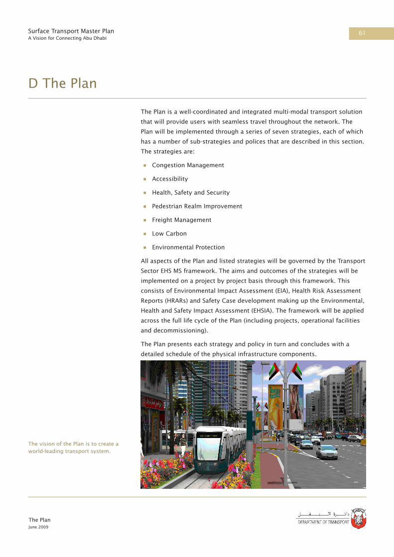
61
The PlanJune 2009
Surface Transport Master PlanA Vision for Connecting Abu Dhabi
D The Plan
The Plan is a well-coordinated and integrated multi-modal transport solution
that will provide users with seamless travel throughout the network. The
Plan will be implemented through a series of seven strategies, each of which
has a number of sub-strategies and polices that are described in this section.
The strategies are:
• Congestion Management
• Accessibility
• Health, Safety and Security
• Pedestrian Realm Improvement
• Freight Management
• Low Carbon
• Environmental Protection
All aspects of the Plan and listed strategies will be governed by the Transport
Sector EHS MS framework. The aims and outcomes of the strategies will be
implemented on a project by project basis through this framework. This
consists of Environmental Impact Assessment (EIA), Health Risk Assessment
Reports (HRARs) and Safety Case development making up the Environmental,
Health and Safety Impact Assessment (EHSIA). The framework will be applied
across the full life cycle of the Plan (including projects, operational facilities
and decommissioning).
The Plan presents each strategy and policy in turn and concludes with a
detailed schedule of the physical infrastructure components.
The vision of the Plan is to create a world-leading transport system.

62
The PlanJune 2009
Surface Transport Master PlanA Vision for Connecting Abu Dhabi
D1 Congestion Management Strategy
The congestion management strategy underpins the successful delivery
of the Plan. The concept of a layered hierarchy of public transport was
proposed in Plan Abu Dhabi 20301 and has been developed into an extremely
comprehensive and integrated system. When combined with other measures
this system will carry between 30 and 40% of peak period passenger trips
and will create an efficient transport system for 2030 and beyond.
D1.1 Provide High Quality Alternatives to the Car
D1.1.1 Provide a New Public Transport Hierarchy
A key component of the Plan is the provision of a comprehensive, fine-
grained and integrated public transport system that provides regular and
reliable services accessible to all and offers an attractive, high quality
alternative to the private car. In urban areas, the Plan aims to ensure that no-
one will need to walk more than 300 metres to their nearest public transport
stop.
The Plan incorporates the ongoing DoT initiative to purchase 1360 buses.
Regional rail and metro will provide high capacity and frequent services for longer journeys.

63
The PlanJune 2009
Surface Transport Master PlanA Vision for Connecting Abu Dhabi
For longer journeys, regional rail and metro stations will be at key locations
so travellers will be able to transfer directly from local services to fast long-
distance services. Parking will be provided at key interchanges to enable
travellers to park-and-ride.
The complete public transport network will be designed and operated as a
single integrated system so that a high level of accessibility is maintained
irrespective of location or service. There will be a single fare system that
does not impose extra transfer costs, a timetable that minimises waiting
times and real-time information for all potential travellers, including
updates in the event of delays or disruptions. Provision will also be made
for convenient and safe walking and cycling to access the public transport
system and to serve more local journeys.
Safe and convenient pedestrian access will be a key feature.
The layered hierarchy of public transport will cater for a wide range of travel needs from short distance trips by bus or tram to longer distance trips by metro and rail.
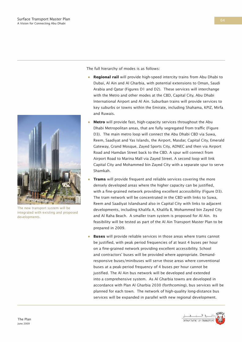
64
The PlanJune 2009
Surface Transport Master PlanA Vision for Connecting Abu Dhabi
The full hierarchy of modes is as follows:
• Regional rail will provide high-speed intercity trains from Abu Dhabi to
Dubai, Al Ain and Al Gharbia, with potential extensions to Oman, Saudi
Arabia and Qatar (Figures D1 and D2). These services will interchange
with the Metro and other modes at the CBD, Capital City, Abu Dhabi
International Airport and Al Ain. Suburban trains will provide services to
key suburbs or towns within the Emirate, including Shahama, KPIZ, Mirfa
and Ruwais.
• Metro will provide fast, high-capacity services throughout the Abu
Dhabi Metropolitan areas, that are fully segregated from traffic (Figure
D3). The main metro loop will connect the Abu Dhabi CBD via Suwa,
Reem, Saadiyat and Yas Islands, the Airport, Masdar, Capital City, Emerald
Gateway, Grand Mosque, Zayed Sports City, ADNEC and then via Airport
Road and Hamdan Street back to the CBD. A spur will connect from
Airport Road to Marina Mall via Zayed Street. A second loop will link
Capital City and Mohammed bin Zayed City with a separate spur to serve
Shamkah.
• Trams will provide frequent and reliable services covering the more
densely developed areas where the higher capacity can be justified,
with a fine-grained network providing excellent accessibility (Figure D3).
The tram network will be concentrated in the CBD with links to Suwa,
Reem and Saadiyat Islandsand also in Capital City with links to adjacent
developments, including Khalifa A, Khalifa B, Mohammed bin Zayed City
and Al Raha Beach. A smaller tram system is proposed for Al Ain. Its
feasibility will be tested as part of the Al Ain Transport Master Plan to be
prepared in 2009.
• Buses will provide reliable services in those areas where trams cannot
be justified, with peak period frequencies of at least 4 buses per hour
on a fine-grained network providing excellent accessibility. School
and contractors’ buses will be provided where appropriate. Demand-
responsive buses/minibuses will serve those areas where conventional
buses at a peak-period frequency of 4 buses per hour cannot be
justified. The Al Ain bus network will be developed and extended
into a comprehensive system. As Al Gharbia towns are developed in
accordance with Plan Al Gharbia 2030 (forthcoming), bus services will be
planned for each town. The network of high-quality long-distance bus
services will be expanded in parallel with new regional development.
The new transport system will be integrated with existing and proposed developments.

65
The PlanJune 2009
Surface Transport Master PlanA Vision for Connecting Abu Dhabi
• Taxis will continue to provide a door-to-door service for those willing to
pay the higher fares.
• Ferry services will provide connections along the coastline, and
between islands. These services will be complemented by water taxis
where appropriate.
In order to address short-term issues, to support provision of park and ride,
and to enhance the existing bus services there is a need for bus priority
measures to be introduced.
To ensure that the transport infrastructure projects contribute towards
the strategy of providing high quality alternatives to the private car; the
following initiatives will also be developed.
D1.1.2 Provide Cycle Routes and Facilities
For much of the year, temperatures allow cycling as a mode of transport.
The Plan supports the development of a network of safe cycle routes
serving new and existing developments, short-term hire of cycles (which
could be encouraged in workplaces, through clubs or at major passenger
interchanges), cycle parking and storage facilities and the promotion of
cycling as a healthy alternative to the car.
D1.1.3 Provide High Quality Passenger Interchanges and Stations
Interchanges will be required to facilitate some of the more complex travel
patterns in Abu Dhabi. Their design will reflect international best practice in
ensuring easy and convenient climate controlled transfer between modes,
including catering for the needs of women and children. Climate-controlled
shelters will also be provided at all bus, tram and ferry stops. Where
appropriate, well-shaded and passively-cooled waiting areas will be provided
as a more environmentally sustainable alternative to air-conditioning.
Stations will be located to provide convenient, secure and sheltered access
to adjacent developments and public areas. Comprehensive Station Precinct
One of the first self-service rental bike schemes has been set up in Paris. The scheme has been hugely successful and the idea is now being exported around the world.

66
The PlanJune 2009
Surface Transport Master PlanA Vision for Connecting Abu Dhabi
Hong Kong’s Octupus Card is used on all public transport modes.
Plans will be prepared for the Capital City District Central Station, the CBD
Central Station and other landmark stations to create high quality public
places around them.
D1.1.4 Provide a High Quality Passenger Experience
All public transport vehicles will be air conditioned and fitted to a high level
of comfort. Health Risk Assessment Reports as part of the Environmental
Health and Safety Impact Assessment will be used to maximise passenger
health benefits. Where practicable, provision will also be made for separate
facilities for women and children. All vehicles will also be designed to cater
for the mobility-impaired and those with luggage, shopping, or pushchairs
with young children.
D1.1.5 Simple and Integrated Ticketing
A single smart card ticketing system will be provided for all public transport
services (similar to the Octopus card in Hong Kong and the Oyster card in
London). The aim is to make it as easy as possible for anyone to use public
transport without any concerns about how to pay, having the correct fare,
paying the correct fare for their actual journey or having to pay again for
changes of mode or unexpected changes of plan during a trip. The use of
the card to pay for parking, tolls and even for small retail purchases may be
extended.
D1.1.6 Provide integrated public transport service information
To make the public transport system as easy to use as possible, it is
important that up-to-date route and real-time operational information is
easily available at all times for all services. Some of the required data can
Best international practice will be used in the design of passenger interchange.

67
The PlanJune 2009
Surface Transport Master PlanA Vision for Connecting Abu Dhabi
be easily collected from the operators, but this must then be disseminated
to potential travellers by means of displays at stations and stops, within
developments, on personal communication devices or displays in individual
residences or offices and through a journey planning website. This system
will be integrated with the traffic information system [D1.2.3] to encourage
modal transfer.
D1.2 Provide an Appropriate and Well Managed Highway
Network
Abu Dhabi already has an extensive highway network that will be adapted,
managed, and in some areas expanded to meet the Plan’s objectives. The
design of urban roads and the whole urban streetscape is under review by
the ADUPC in line with Plan 20301 to create a more liveable environment.
This initiative is strongly supported by the Plan.
D1.2.1 Implement and Enforce an Effective Road Hierarchy
The road network will be managed and controlled according to the following
hierarchy:
• Freeway – high capacity, higher speed as determined by the urban or
rural context, controlled access, with grade-separated junctions and no
building plot frontages
• Highway – high capacity, higher speed as determined by the urban
or rural context, some controlled access and some grade separated
junctions, with frontages on controlled access points
• Rural Road – speed varies with the context, at-grade with no controlled
access.
• Urban Streets – a hierarchy of streets, as defined in the “Abu Dhabi Urban
Street Design and Mobility Standards Manual” (see D4.1.1), covering all
streets in the urban areas of the Emirate, except for urban freeways, and
are characterised by lower vehicle speeds, public transport priority and
pedestrian and bicycle convenience and safety.
The Plan is focused on the main road network in the Metropolitan area and
does not address the re-design of roads within city blocks or the opening of
additional roads through city blocks to provide a fine grained road network.
This issue will be subject to the findings of the ongoing ADUPC work which
will be summarised in the Abu Dhabi Urban Street Design and Mobility
Standards Manual.
State of the art traffic management and control systems will be used
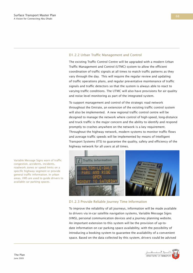
68
The PlanJune 2009
Surface Transport Master PlanA Vision for Connecting Abu Dhabi
D1.2.2 Urban Traffic Management and Control
The existing Traffic Control Centre will be upgraded with a modern Urban
Traffic Management and Control (UTMC) system to allow the efficient
coordination of traffic signals at all times to match traffic patterns as they
vary through the day. This will require the regular review and updating
of traffic operations plans, and regular preventative maintenance of traffic
signals and traffic detectors so that the system is always able to react to
varying traffic conditions. The UTMC will also have provisions for air quality
and noise level monitoring as part of the integrated system.
To support management and control of the strategic road network
throughout the Emirate, an extension of the existing traffic control system
will also be implemented. A new regional traffic control centre will be
designed to manage the network where control of high-speed, long-distance
and truck traffic is the major concern and the ability to identify and respond
promptly to crashes anywhere on the network is a key requirement.
Throughout the highway network, modern systems to monitor traffic flows
and average traffic speeds will be implemented by means of Intelligent
Transport Systems (ITS) to guarantee the quality, safety and efficiency of the
highway network for all users at all times.
D1.2.3 Provide Reliable Journey Time Information
To improve the reliability of all journeys, information will be made available
to drivers via in-car satellite navigation systems, Variable Message Signs
(VMS), personal communication devices and a journey planning website.
An important extension to this system will be the provision of up-to-
date information on car parking space availability, with the possibility of
introducing a booking system to guarantee the availability of a convenient
space. Based on the data collected by this system, drivers could be advised
Variable Message Signs warn of traffic congestion, accidents, incidents, roadwork zones or speed limits on a specific highway segment or provide general traffic information. In urban areas, VMS are used to guide drivers to available car parking spaces.

69
The PlanJune 2009
Surface Transport Master PlanA Vision for Connecting Abu Dhabi
to use park-and-ride and public transport if, for example, there was severe
congestion on Abu Dhabi Island.
D1.2.4 Event and Incident Management
Management systems will be put in place to proactively manage the
traffic impacts of construction, incidents and major events, such as the
F1 Grand Prix and exhibitions at ADNEC and the new cultural district.
This management system will be integrated with Emirate-wide emergency
response and preparedness planning.
D1.3 Transit and Pedestrian Oriented Development
A transport system should not simply meet the travel demands generated
by current and planned developments; it is also important that the location,
magnitude and nature of new developments recognise their impact on the
transport system and that both land-use development patterns and transport
networks are planned together. This will require continued close coordination
between the DoT, ADUPC, Municipalities and developers.
D1.3.1 Establish Effective Land-use Planning Controls
The ADUPC’s Development Management Program will provide more detailed
planning direction in the context of the Abu Dhabi, Al Ain and Al Gharbia
2030 Framework Plans. It will ensure that developments are planned to
minimise traffic impacts by strongly encouraging the use of public transport,
cycling and walking. As part of this process, the current approach to traffic
impact assessment will be overhauled and extended to become a multi-
modal transport impact assessment, incorporating consideration of provision
for pedestrians, access to public transport and the preparation of Travel Plans
(D1.3.3).
The Development Management Program will provide more specific direction
on the distribution of development, within the context of the 2030
Framework Plans, so that more intensive development is located where it
can be well serviced by the public transport network, and will not aggravate
congestion on the designated street network.
D1.3.2 Regulate Parking Standards
In association with the , new parking standards that are consistent with
the Plan will be applied to all new developments as part of the Development
Management Program. The level of parking permitted will depend on the
type of development, its location and its accessibility to public transport.

70
The PlanJune 2009
Surface Transport Master PlanA Vision for Connecting Abu Dhabi
Parking standards will also specify the capacity to be provided for visitor
parking to make most effective use of the on-street parking capacity. As
described below under Demand Management, policies to manage parking
supply and demand will also be introduced.
D1.3.3 Introduce Travel Plans
Travel Plans will include a range of additional measures that can be provided
within a development to reduce the need for motor vehicle travel, and will be
linked to the Estidama Communities Pearl Rating System.
In order to encourage efficient use of the transport system, developers will
be required to provide travel plans for all new developments as part of the
enhanced process for transport assessments. A travel plan is a package
of measures developed to encourage alternative travel modes rather than
single-occupancy car use. A travel plan can include car sharing schemes,
cycle improvements, changes to bus services and car parking management.
It may also review and promote changes to working practices.
Travel plans have been used successfully in other countries for many years
and are an important tool for promoting sustainable travel, e.g. walking,
cycling and public transport, and help to reduce single occupancy car use.
Travel plans also encourage effective use of current transport networks and
can be used to secure the provision of sustainable travel choices, both to
new developments and to extensions of existing sites.
D1.4 Demand Management
Demand management is a toolkit of techniques to influence the demand
for travel – mainly to encourage people to utilise non-car modes or to make
fewer trips. They can include pricing and other measures to alter people’s
travel choices. The Plan includes a mixture of measures, all of which were
demonstrated as being necessary in the transport modelling carried out for
the study (section C5.2), consisting of parking charges, fuel taxation and
congestion charging. The phasing of the measures, and their design, will be
subject to further study. However, it is clear that most of the measures will
only be introduced after public transport, walking and cycling alternatives to
the car have been improved.
D1.4.1 Implement Parking Management
The introduction of parking management areas in the CBD, which were
planned prior to study, will begin the process of bringing parking supply
Travel Plans will be introduced to encourage the use of sustainable transportation

71
The PlanJune 2009
Surface Transport Master PlanA Vision for Connecting Abu Dhabi
and demand into balance and will require a strong policy of enforcement of
parking violations. At the same time, the re-organisation of parking spaces
and improvements to the pedestrian realm will be implemented in a staged
programme.
In many areas it is not practicable to provide additional parking spaces at
ground level, and indeed in many areas it will be appropriate to reduce
parking spaces in order to improve facilities for pedestrians and public
transport and to improve the urban streetscape and the safety of residents
and visitors. Further studies will be carried out to determine whether, where
and when to provide new underground or multi-storey parking structures, a
schedule for their construction will be developed by the ADUPC and DOT as
part of the City Centre Block Revitalisation Programme.
A vital component of the parking management strategy will be to balance
the proportion of long-term and short-term parking spaces. Parking charges
will be reviewed on a regular basis for both on-street and off-street parking
to help address the congestion caused by unrestrained long-term parking in
the CBD by residents and commuters and to address the changing balance
between demand and supply.
D1.4.2 Improve Public Information
The change from a car-based culture to one in which public transport is the
mode of choice will require significant changes in public perceptions and
The limited availability of car parking space is currently a major problem in the city centre. Rigorous measures are supported to address this.

72
The PlanJune 2009
Surface Transport Master PlanA Vision for Connecting Abu Dhabi
behaviour. Publicity campaigns will be an important element in influencing
local attitudes and changing such behaviour; these will need to be introduced
as soon as bus services provide a satisfactory alternative to the private car
and will require strong reinforcement once metro and tram services begin
operation.
D1.4.3 Implement Road User Charges
The evaluation of alternative scenarios demonstrated that a form of road user
charging and potentially fuel taxation will need to be introduced to manage
congestion directly. Congestion charging is in operation in major cities such
as Singapore, London and Stockholm, where the impacts on successfully
managing congestion have been demonstrated. A range of approaches and
technologies could be employed and these will develop as the technology
options improve over time. The most equitable method of charging for
road use would be based on the distance travelled within a zone, or the
time spent travelling, or indeed some combination to reflect local traffic
conditions at the time. Alternatively, a fee may be charged for crossing a
cordon (as in London and Singapore). The method to be introduced in Abu
Dhabi will be assessed by a Pricing Strategy Study.
D1.4.4 Provide Park and Ride Schemes
Park and Ride schemes will provide a more reliable and convenient
alternative to driving in to the metropolitan area of Abu Dhabi. To facilitate
this, Park and Ride sites are planned at key locations on the mainland to
intercept traffic approaching the Islands and Capital City.
The Singapore Electronic Road Pricing (ERP) system has been successful in managing traffic congestion.
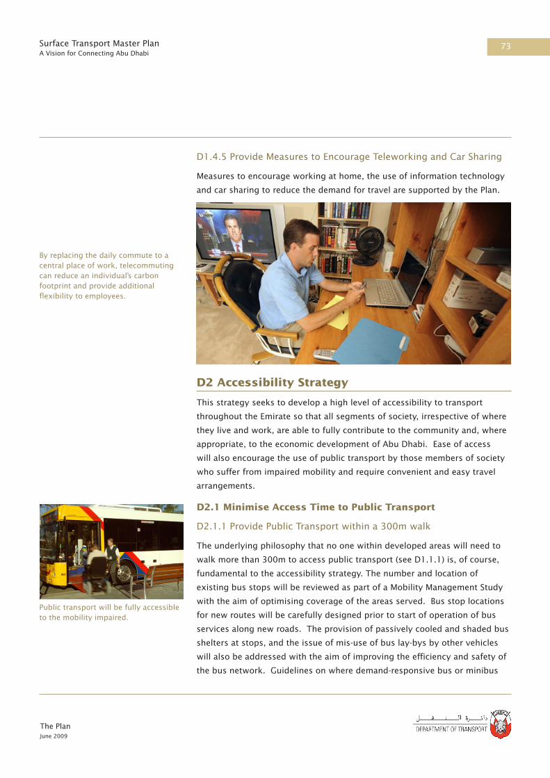
73
The PlanJune 2009
Surface Transport Master PlanA Vision for Connecting Abu Dhabi
D1.4.5 Provide Measures to Encourage Teleworking and Car Sharing
Measures to encourage working at home, the use of information technology
and car sharing to reduce the demand for travel are supported by the Plan.
D2 Accessibility Strategy
This strategy seeks to develop a high level of accessibility to transport
throughout the Emirate so that all segments of society, irrespective of where
they live and work, are able to fully contribute to the community and, where
appropriate, to the economic development of Abu Dhabi. Ease of access
will also encourage the use of public transport by those members of society
who suffer from impaired mobility and require convenient and easy travel
arrangements.
D2.1 Minimise Access Time to Public Transport
D2.1.1 Provide Public Transport within a 300m walk
The underlying philosophy that no one within developed areas will need to
walk more than 300m to access public transport (see D1.1.1) is, of course,
fundamental to the accessibility strategy. The number and location of
existing bus stops will be reviewed as part of a Mobility Management Study
with the aim of optimising coverage of the areas served. Bus stop locations
for new routes will be carefully designed prior to start of operation of bus
services along new roads. The provision of passively cooled and shaded bus
shelters at stops, and the issue of mis-use of bus lay-bys by other vehicles
will also be addressed with the aim of improving the efficiency and safety of
the bus network. Guidelines on where demand-responsive bus or minibus
By replacing the daily commute to a central place of work, telecommuting can reduce an individual’s carbon footprint and provide additional flexibility to employees.
Public transport will be fully accessible to the mobility impaired.

74
The PlanJune 2009
Surface Transport Master PlanA Vision for Connecting Abu Dhabi
services should be operated will also be prepared.
The location of tram stops will also be carefully planned to provide a similar
high quality coverage, especially within the CBD and Capital City where
trams are intended to form the backbone of the local transit network.
D2.2 Providing Access for All
D2.2.1 Provide Access for the Mobility Impaired
All public transport will be fully accessible to the mobility impaired. Vehicles
will be designed according to best international practice and lifts will be
provided at interchanges and stations. The pedestrian environment will be
made more accessible through the provision of tactile paving at crossing
points (for the visually impaired) and so that all areas can be accessed by
wheelchair users.
D2.2.2 Implement Inclusive Fare Policies
Fares will be set at a level to ensure that users on lower incomes are not
prevented from accessing the public transport system, as well as to achieve
the broader objectives of the Plan.
D2.2.3 Provide for Women and Children using Public Transport
Where and when practicable, segregated facilities will be provided for women
and children, including separate compartments on rail and metro trains and
on trams.
D2.2.4 Taxis and Minibuses
The current gradual switch from the old white and gold taxis to the new
silver franchised taxi operators is supported. It will however be important
that TransAD carefully monitors the service level provided and increases the
taxi fleet to match supply to demand on a regular basis.
The existing white and gold taxis are complemented by a fleet of minibuses
that together provide a service for shared transport, which in terms of cost
lies between that of a taxi and the new bus service. In theory these shared
services would be unnecessary if and when the full transport network
provided by the Plan is completed, however in practice there may be a need
to continue these services in limited areas for certain purposes, eg to serve
construction workers and labour camp residents. A Taxi and Minibus Study
will be commissioned to consider the future role for this type of service and
will also review the scale of provision appropriate for school and contract
Facilities for women and children will be provided.

75
The PlanJune 2009
Surface Transport Master PlanA Vision for Connecting Abu Dhabi
buses, and what new policies may become appropriate as the Plan’s public
transport network emerges.
D3 Health, Safety & Security Strategy
The objective of this strategy is to create an integrated transport system
of road and rail options that is safe and secure. In particular, the integrated
systems will be designed to encourage a switch from the current high use of
cars and thereby reduce the current unacceptably high level of fatalities and
injuries on the road network. All future transport projects and operations will
need to be subjected to a formal process of health and safety assessment
through a Safety Case regime and Health Risk Assessment Report (HRAR)
respectively.
D3.1 Road Safety
A key component of the strategy is the development of a series of road
safety measures to reduce the existing accident rate. The introduction of
effective road safety mitigation measures, based on international experience
and best practice, is likely to include a combination of engineering,
enforcement and educational solutions. The Strategic Road Safety Plan
commissioned by the DoT in 2009 will address these issues (Part F).
The reduction of fatalities and injuries due to transport is a key part of the Plan. This includes the general public and all those involved in operating and building the system.
76
The PlanJune 2009
Surface Transport Master PlanA Vision for Connecting Abu Dhabi
D3.1.1 Speed Management
Existing speed limits will be reviewed and amended as necessary to ensure
that appropriate posted speed limits are in place on all sections of the
highway network. A speed management strategy will then be introduced
including the use of static cameras. The speed management policy will
set limits that achieve good speed compliance through education and
enforcement and help to contribute to the overall target of reducing the
numbers of casualties. Independent speed adaptation of vehicles could also
be introduced in the longer term, once this capability becomes generally
available.
D3.1.2 Pedestrian Safety
There is a high rate of pedestrian casualties in road accidents, exacerbated
by the relatively poor provision of pedestrian crossings. As part of
the Pedestrian Realm Improvement Strategy (see D4) a comprehensive
programme of improvements to pedestrian infrastructure will be delivered.
This will be prioritised according to available accident investigations and
will reflect those locations with significant pedestrian demand to cross busy
roads.
Key elements will include, where needed, pedestrian phases at traffic-signal
controlled junctions and mid-block locations and grade-separated crossings
on high-speed highways. Specific measures will also be introduced at
locations such as schools, hospitals and transport interchanges. The delivery
of the physical improvement measures will be supported by an educational
programme targeted towards vulnerable groups.
D3.1.3 Driver Training and Education
In order to improve the current standard of driving behaviour, the existing
driving test will be reviewed and compared to the standards set for
other countries. The development of a more stringent driving test will be
supported by the introduction of a Highway Code, the development of
which will be based on local needs and international best practice. The new
Highway Code will eventually form part of the revised driving test and a
policy of mandatory re-training and re-testing will be considered for current
drivers who are identified though accidents or an accumulation of penalty
points.

77
The PlanJune 2009
Surface Transport Master PlanA Vision for Connecting Abu Dhabi
Education will be one of several initiatives to improve road safety.
D3.1.4 Road Safety Education
It is not only drivers who need to learn about road safety; everyone who
ventures outside their home needs to be aware of the possible dangers. The
planned Highway Code will cover all types of street activity including the
needs of pedestrians, cyclists and the mobility impaired and the priority to
be afforded to each, on all types of road and shared space.
International experience shows clearly that teaching children about road
safety is a good investment, and can substantially reduce the numbers of
children killed or injured on the roads. A policy whereby all schoolchildren
are given at least one full day of road safety training each year will be
introduced as soon as the necessary facilities can be provided.
D3.1.5 Accident Investigation
A crash database will be established to enable the identification of multiple
crash sites and causes and so that remedial measures can be developed
and introduced to address the identified road safety issues. Prior to the
development of the database, accident investigation will be completed using
existing crash data collected from the police.
D3.1.6 Road Safety Audits
In order to reduce crash rates, Road Safety Audits (RSAs) will be completed
to identify and mitigate against road safety hazards. The RSA qualitatively
estimates and reports on potential road safety issues and identifies
opportunities for improvements in safety. The introduction of a programme
of RSAs will require the development of road safety audit guidelines for
Abu Dhabi, based on international best practice. RSAs will also need to be
completed by a suitably qualified road safety audit team at all stages of
design from preliminary design to completed scheme so that all new roads
meet the highest standards for all road users.
D3.1.7 Traffic and Vehicle Regulations
To support the overall road safety strategy, new traffic and vehicle
regulations will be required. To meet this requirement the following will be
introduced:
• The scope of vehicle inspections for both commercial and private
vehicles will be enhanced to improve the condition of all vehicles by
enforcing an annual test on key maintenance issues and by introducing
emission tests to assist in reducing CO2 emissions.
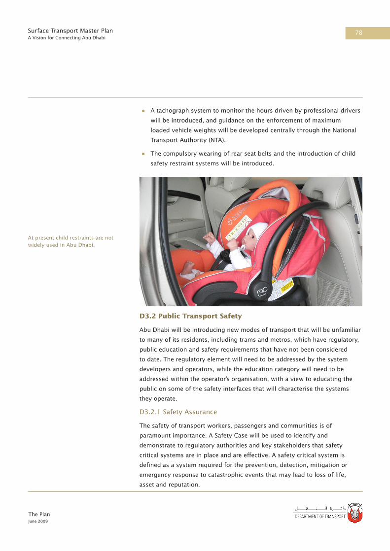
78
The PlanJune 2009
Surface Transport Master PlanA Vision for Connecting Abu Dhabi
• A tachograph system to monitor the hours driven by professional drivers
will be introduced, and guidance on the enforcement of maximum
loaded vehicle weights will be developed centrally through the National
Transport Authority (NTA).
• The compulsory wearing of rear seat belts and the introduction of child
safety restraint systems will be introduced.
D3.2 Public Transport Safety
Abu Dhabi will be introducing new modes of transport that will be unfamiliar
to many of its residents, including trams and metros, which have regulatory,
public education and safety requirements that have not been considered
to date. The regulatory element will need to be addressed by the system
developers and operators, while the education category will need to be
addressed within the operator’s organisation, with a view to educating the
public on some of the safety interfaces that will characterise the systems
they operate.
D3.2.1 Safety Assurance
The safety of transport workers, passengers and communities is of
paramount importance. A Safety Case will be used to identify and
demonstrate to regulatory authorities and key stakeholders that safety
critical systems are in place and are effective. A safety critical system is
defined as a system required for the prevention, detection, mitigation or
emergency response to catastrophic events that may lead to loss of life,
asset and reputation.
At present child restraints are not widely used in Abu Dhabi.

79
The PlanJune 2009
Surface Transport Master PlanA Vision for Connecting Abu Dhabi
A comprehensive safety assurance process will be deployed to ensure that
the technical integrity of all safety critical systems associated with public
transport activities are maintained to within agreed goals or performance
standards. Performance standards are parameters that will be measured or
assessed so the suitability and effectiveness of each safety critical system
can be assured and verified. Safety assurance will be regulated by DoT and
will include Independent Safety Assessments from third party companies.
D3.2.2 Public Safety Education
A public awareness campaign will be needed regarding safety risks
associated with their new transport system. This is particularly critical for
the street running tram system where both car users and pedestrians have to
interact with the new transport mode. Extensive experience of these issues
has been gained in other cities around the world where trams have been
introduced to predominantly car-based societies and these could be adapted
to the situation in Abu Dhabi.
D3.3 Transport Security
The provision of effective door-to-door security is an important element in
Safety Critical System
Learning for
future projects
DESIGN
PROCURE
BUILD
QA/QC
RECOMMISSION
COMMISSION
OPERATE
INSPECT
CORROSION
MANAGEMENT
MAINTAIN
REVIEW/
IMPROVE
CHANGE
DECOMMISSION
DISPOSECONCEPT
Technical Integrity Life Cycle of Safety Critical Systems

80
The PlanJune 2009
Surface Transport Master PlanA Vision for Connecting Abu Dhabi
a successful public transport system. This includes a combination of safety
measures to make pedestrians and public transport users feel safer using
the public realm and associated infrastructure. The introduction of security
measures may include passive surveillance from adjacent land uses, CCTV,
good lighting and the application of safe urban design principles.
D3.3.1 Increase Security for Transport Users
The implementation of improved pedestrian infrastructure as outlined in D2
and D4 is likely to contribute towards a sense of well-being and personal
security. The existing poor pedestrian infrastructure and accessibility to
public transport may discourage trips on foot and using public transport due
to a fear of conflicts with other vehicles. In addition, pedestrians, and those
waiting at public transport facilities and using public transport services, may
fear for their security due to their sex, ethnic group or age. Improvements
to the pedestrian realm, with a degree of priority over traffic, will act as
a strong counter to any feelings of insecurity. This will be amplified by
encouraging adjacent land uses to overlook the street (passive surveillance)
and through creation of an active street life, which is also an aim of Plan Abu
Dhabi 2030.
D3.4 Transport and Health
All future transport projects and operations will be subjected to the formal
Health Risk Assessment ( HRA) process. HRA addresses the life cycle of any
operation and takes account of all employees, contractors, third parties
and the public. All health hazards will be identified, their risk assessed and
mitigation measures defined for all activities, operations and products,
including chemical, biological, physical, psychological, ergonomics, etc.
In addition, health benefits will be realised from other Plan strategies, which
will include:
• Promoting walking and cycling (see D1.3.2, D1.3.4, D4.1.1, D4.2.1)
• Improving access to public transport (see D2.1.1, D2.2.1, D2.2.3)
• Improving the waiting environment and accessibility of streets for
all, especially those with impaired mobility, to reduce social isolation.
(D4.1.1)
• Improving the ability to access services (e.g. retail, health, leisure and
education) (D1.1.1, D2.1.1)
CCTV cameras will be used to increase personal security at interchanges or inside metros, trams or buses as necessary

81
The PlanJune 2009
Surface Transport Master PlanA Vision for Connecting Abu Dhabi
D4 Pedestrian Realm Improvement Strategy
Areas where pedestrians have priority over cars are a feature of many
world class cities and is one of the key factors in attracting tourists.
The enhancement of the pedestrian realm is therefore a constant theme
throughout Plan Abu Dhabi 2030 and a key objective of the Plan. In addition
to promoting walking as an alternative mode of travel in its own right,
a high-quality public realm also makes the use of public transport more
attractive by improving passenger experience and accessibility.
D4.1 Improved Pedestrian Environments
The existing pedestrian realm in Abu Dhabi provides a poor level of
accessibility and safety and actively discourages pedestrian activity at street
level. Indeed, it seems that the private car takes absolute priority and
pedestrians are frequently expected to take whatever space is not dominated
by traffic and parked cars. To achieve a world class city will require a high
quality public realm where pedestrian activity is convenient and comfortable,
and where priority is more equitably allocated to suit the particular situation.
D4.1.1 Adoption of Abu Dhabi Urban Street Design and Mobility
Standards Manual
The “Abu Dhabi Urban Street Design and Mobility Standards Manual” will be
issued by the ADUPC in the third quarter of 2009. In addition to the ADUPC
and DoT, the Technical Advisory Committee formed for this project includes
representatives from the Municipalities, the Traffic Police, Civil Defence
agencies (fire protection), the Health Authority, and from developers and
utility providers. A programme for implementing its recommendations will
be developed so that over the period to 2030 the public realm in all new
developments and a majority of existing developments is upgraded to the
latest pedestrian-friendly standards.
The re-design of streets to create a more pedestrian friendly environment is an important part of the Plan.

82
The PlanJune 2009
Surface Transport Master PlanA Vision for Connecting Abu Dhabi
D4.2 Pedestrian Routes
In order to encourage use of public transport, and indeed walking for shorter
trips, it is strongly recommended that a comprehensive network of walkways
is provided throughout developed areas of the Emirate. A critical aspect in
achieving an active street life is the provision of extensive shading, and even
cooled links in the busiest locations.
D4.2.1 Effective Walkway Provision
Walkways for pedestrians will be provided in locations where there are
high volumes of pedestrian movements and along links between transport
interchanges and key developments. Inevitably pedestrians will need to
cross busy roads and the design of the public realm will guide this towards
convenient and safe locations where subways or pedestrian-controlled
traffic signals will be provided. In busy areas, the updating of existing
junction controls will include signals for traffic turning right that provide an
opportunity for pedestrians to cross.
To ensure that a comprehensive and inter-connected pedestrian network can
be achieved over the Plan period, a Pedestrian Master Plan will be developed.
A similar Bikeway Master Plan will also be commissioned to develop a
comprehensive cycle network for cycle travel throughout the urban areas, to
complement walking and public transport as well as for leisure activities.
D5 Freight Management Strategy
This strategy seeks to enhance the effectiveness and efficiency of freight
movement within Abu Dhabi. The aim is to support the development of
a sustainable freight distribution system that provides an appropriate
balance between alternative transport modes, improves the utilisation of
the transport resources deployed, and lowers the unit cost of freight based
services.
A strategy will comprise elements that are directly related to the freight
sector, plus many initiatives that are common to both passenger and freight
transport. This includes aspects related to noise, air quality, safety and the
impacts upon the natural and built environment.

83
The PlanJune 2009
Surface Transport Master PlanA Vision for Connecting Abu Dhabi
Regional Freight Distribution Centres will be set up at key locations.
D5.1 Support Freight Transhipment and Modal Shift
D5.1.1 Develop Regional Distribution Centres
The Plan promotes the development of key Regional Distribution Centres
(RDC’s) in KPIZ, Mussafah/ICAD, Abu Dhabi International Airport, Al Ain,
and within Mina Zayed. RDC’s provide effective transhipment locations for
consolidation, processing and onward transfer of freight between primary
and secondary distribution flows, thereby improving the overall efficiency
and effectiveness of Abu Dhabi’s freight transport system.
The multimodal aspects of selective RDC’s will also promote the case for
the interchange of freight between alternative road, rail or coastal shipping
services, promoting broader freight transport connectivity across the
Emirate. This may encourage a gradual shift from road based haulage to
alternative rail and shipping services on key routes. Consolidation of freight
at the RDC will benefit from the promotion of freight market information
services, providing transport operators with the opportunity to minimise
empty backhaul movements or sub-optimum loading, and improving the
co-ordination between road, rail, and shipping services. Concentration
of freight road haulage interchange at the RDC also provides scope for
enhanced vehicle regulation, thereby addressing related safety issues and the
opportunity for driver training and education.
D5.1.2 Facilitate the Freight Rail Line
The Plan promotes alternative rail and shipping based transport options
for those types of cargo where such modes are viable. This will require
implementation of Union Rail’s planned GCC-wide freight line from KPIZ to
Mussafah/ICAD, and links to Al Ain, Ruwais, Dubai, KSA and beyond. This
could result in substantial increases in freight movement coming by rail into
Abu Dhabi rather than being unloaded directly at a local port or travelling
overland by road. Further consideration will need to be given to the most
The freight rail line is an integral part of the Plan.

84
The PlanJune 2009
Surface Transport Master PlanA Vision for Connecting Abu Dhabi
appropriate means to promote coastal shipments from Khalifa Port through
the Mina Zayed RDC and Mussafah Port. This will be addressed as part of a
Freight Logistics Study to be commissioned by the DoT.
D5.2 Freight Traffic Management
In order to enhance the efficiency of freight haulage services and to reduce
their adverse impacts on developments adjacent to major highways, it has
become clear that substantial improvements to the quality of the freight
haulage industry are required. These issues will be addressed through
a combination of regulations to raise the technical quality of vehicles
deployed, to define and enforce restrictions in vehicle loading and through
improvements in operator and driver training and education. Many of these
issues are closely related to road safety and are described further under
safety and security (Part D3).
D5.2.1Rationalise Truck Routes
The current policy forcing trucks to use truck routes that often result in
considerably extended journey times and distances, and hence economic
costs, will be reviewed as part of the Freight Logistics Study.
D5.2.2 Promote Alternative Routes
The current policy of goods vehicle restrictions by route and time of day
should be continued; however a policy to encourage use of alternative
methods of delivery, e.g. by water, should also be encouraged where
appropriate. To complement these restrictions, it is also proposed that a
system of truck signage and real-time traffic information be introduced to
provide an improved service to truck operators and drivers and to make
most efficient use of the available road network at all times.
D5.2.3 Use Real Time Journey Information
The provision of real-time journey information can result in significant
efficiency gains by truck operators, and demand for this service may act
as an encouragement to a private sector provider to enter the market with
a commercial product. This will also enable limited use of certain routes
within Abu Dhabi Island by trucks during the day to improve the efficiency of
construction and redevelopment activity.

85
The PlanJune 2009
Surface Transport Master PlanA Vision for Connecting Abu Dhabi
D.6 Low Carbon Strategy
The Low Carbon Strategy guides and steers the Abu Dhabi transport network
towards a more sustainable future, predominantly by reducing the carbon
footprint. Key low carbon objectives in the Plan will be carried forward,
ambitious targets established, and the implementation of measures to
achieve such targets initiated in collaboration with a Sustainable Transport
Taskforce.
D6.1 Sustainable Transport Taskforce
The Sustainable Transport Taskforce will comprise high-level representatives
from DoT, Masdar, EAD and ADUPC, and will be responsible for implementing
the concept of sustainable transport in Abu Dhabi. A framework of
sustainability policies and codes of practice will be developed and applied to
transport planning across the Emirate.
The establishment of a Sustainable Transport Taskforce recognises that
environmental and sustainability issues in transport have many interfaces,
and therefore robust management will require close collaboration between
key government and regulatory bodies.
D6.1.1 Life Cycle Sustainability Management
Sustainability will be integrated into management of transport in Abu Dhabi
across the full life cycle from design, through procurement, construction,
operation and decommissioning.
The Plan has been derived with sustainability (environmental, social and
economic) embedded into its development and decision making from the
outset (Section A3). A continued focus on sustainability will be necessary to
ensure that the overall vision and goals of the Plan are realised.
A sustainable transport taskforce will be chaired by the DoT to coordinate cross-agency initiatives to reduce the carbon footprint.

86
The PlanJune 2009
Surface Transport Master PlanA Vision for Connecting Abu Dhabi
A sustainability framework will be developed in consultation with the
Sustainable Transport Taskforce. In developing the framework, the
key requirements of Estidama (under development) and international
sustainability standards and systems, will be combined to create a locally
appropriate and robust approach for ongoing management of sustainability
in Abu Dhabi’s surface transport.
D6.2 Low Carbon Commitment
Strong commitment to a low carbon, sustainable transport system is
essential, from inception through to implementation. DoT’s lead on this
commitment, through the Sustainable Transport Taskforce, will carry forward
the sustainable transport agenda in Abu Dhabi.
D6.3 Regulatory Framework
The Sustainable Transport Taskforce will oversee a comprehensive suite of
new policy and regulation to embed low-carbon policy into decision- making.
The following Strategies are complementary to the Low Carbon Strategy:
• Congestion Management (D1)
• Freight Management (D5)
• Pedestrian Realm (D4)
• Environmental Protection (D7)
In addition to the above strategies, implementation of the following energy
policy strategy component will provide a further and significant push
towards a Low Carbon Economy as envisioned by Plan Abu Dhabi 2030.1
D6.3.1 Energy policy for mass transit
The Plan provides a unique opportunity to make an aggressive move towards
renewable and low-carbon sources of energy for transport in Abu Dhabi.
The power demands of the electrically-powered public transport system of
regional road, metro and tram, and potentially trolleybuses, could reach 1GW
in 2030, the output of a large power station. This demand should be used
to drive investment and development into low-carbon energy generation
from renewable sources. DoT, working with the Abu Dhabi government and
energy industry stakeholders, will initiate the development of this new power
generation capacity.
Strategic objectives for low carbon and low energy use within the Plan,
The use of Renewable and low-carbon sourses for mass transit is supported by the Plan.

87
The PlanJune 2009
Surface Transport Master PlanA Vision for Connecting Abu Dhabi
defined by the Sustainable Transport Taskforce, will provide support in the
development of the Low Carbon Strategy and energy policy.
This strategy component complements the Masdar Initiative and actions
stemming from it may constitute eligibility for carbon credits under the
United Nations Clean Development Mechanism (CDM), although further
investigation would be required in order to confirm and plan for such
eligibility.
D6.3.2 Environmentally-friendly Public Transport Fleets
The development of a completely new public transport system presents a
unique opportunity to adopt world leading environmentally-friendly public
transport vehicle fleets system-wide throughout Abu Dhabi. This opportunity
will also bring about benefits to various sustainability aspects such as carbon
and local pollutant emissions reduction, passenger safety and environmental
protection.
D6.3.3 Vehicle Registration Schemes
A reduction in total air and noise pollution in the Emirate will be achieved by
developing a vehicle registration fee scheme, preferably Federal, that takes
into consideration the emissions level and fuel type of vehicles. Broader Plan
cost recovery and demand management objectives will also be factored in
the strategy development. Significant discounts, up to 100%, from standard
fees for low emission vehicles and those utilising low carbon fuels or
Compressed Natural Gas (CNG) should be available. The fee scheme should
especially cover freight vehicles.
D6.3.4 Low Emission Zones
Reduction of air pollution in areas where local pollutant levels would
otherwise be unacceptable will be achieved and air quality targets
established for defined low emission zones. A method of applying an
emissions charge/fine for entering the zone should be developed in
consultation with NTA to encourage cross-Emirate co-operation and the
utilisation of common technology standards such as the SALIK tag system.
Co-ordination will be required with any congestion charging mechanism. The
low emissions zone strategy could be tied in with the Vehicle Registration
Scheme in order for all vehicles to be classified by level of emissions, the
data for which could be stored on an electronic tag such as used by SALIK. Low Emission Zones will be implemented to improve air quality.

88
The PlanJune 2009
Surface Transport Master PlanA Vision for Connecting Abu Dhabi
D6.3.5 Priority Parking for Low Emission Vehicles
Prioritised and/or subsidised parking rates for low emissions vehicles
within the overarching parking surcharge will be introduced in support
of the Congestion Management Strategy. Designs of parking areas for
developments, such as new stations and park and ride sites, would include
the low emission parking schemes.
D6.3.6 Awareness Raising Campaigns
Promotion and awareness raising on the Environmental Protection and Low
Carbon Strategies by means of appropriately targeted campaigns will be
essential in maximising the success of these strategies. Campaigns will focus
on the reasons for change in Abu Dhabi transport and will celebrate the
resulting economic, social and environmental benefits. Increased awareness
and understanding aims to promote the modal shift to new public transport
systems available and catalyse a change towards low carbon and sustainable
practices in all aspects of life in Abu Dhabi.
Educational messages on issues relating to sustainability, carbon
footprint and environmental stewardship will be incorporated in all future
programmes. Promotion through a variety of media, alongside potential
collaboration with the EAD education and awareness raising department, will
maximise coverage and impact of campaigns.
D7 Environmental Protection Strategy
Stewardship of Abu Dhabi’s unique natural and built environment will aim
to protect and highlight their long-term value and connections with human
health, economic prosperity, quality of life and cultural heritage.
Environmental protection has been embedded into the process from the
outset. Implementation of the Plan continues to focus on environmental
aspects in order to protect and enhance the very attributes that attract
people to live, work and invest in Abu Dhabi.
Key environmental objectives identified as part of the Plan will be carried
forward, ambitious targets established, and implementation of such targets
achieved through the Sustainable Transport Taskforce.

89
The PlanJune 2009
Surface Transport Master PlanA Vision for Connecting Abu Dhabi
D7.1 Sustainable Transport Taskforce
As noted previously, the Sustainable Transport Taskforce will comprise
high-level representatives from DoT, Masdar, EAD and ADUPC. In addition
to the Low Carbon Strategy, the taskforce will champion the Environmental
Protection Strategy.
D7.2 Environmental Commitment
A strong commitment to sustainable transport is essential for the Plan to
be effective. This commitment will uphold environmental stewardship and
initiate self-regulation in those aspects with less developed or emerging
environmental legislation.
The DoT will take the lead, through the Sustainable Transport Taskforce,
to continue carrying forward the sustainable transport agenda in Abu
Dhabi. As part of this commitment, one of the first steps will be to review
key environmental objectives identified as part of the Plan, and establish
associated targets and an implementation programme. These targets will be
ambitious but also achievable and measurable.
The Plan will support existing and emerging EAD and UPC environmental
and sustainability programmes. For example, one critical area will be the
environmental challenges of infrastructure development on and between
islands. Some of the most important and sensitive assets of Abu Dhabi are
the marine and coastal resources. Under the environmental commitment,
all of the Plan’s projects that have a marine or coastal interface will support
and promote the emerging UPC coastal development guidelines. They will
be committed to protecting the natural form and biodiversity of these areas,
alongside striving to enhance the aesthetics, recreational and educational
value of these resources.
The impacts of transport on natural environments will be fully assessed.

90
The PlanJune 2009
Surface Transport Master PlanA Vision for Connecting Abu Dhabi
Public awareness raising campaigns will establish wider support and
uptake of sustainable transport in order to successfully implement the
Environmental Protection Strategy.
D7.3 Regulatory Framework
An existing regulatory framework for environmental permitting of new
projects is legislated by Federal Law No. 24 of 1999 for the Protection and
Development of the Environment; and imposed by Local Orders within each
Emirate. The DoT, defined as the Sector Authority for the Transport Sector
under EHS Policy 2006, soon to be EHS law, will implement the EHS MS
Framework (see Part A).
The regulatory frameworks described above will be utilised for delivery,
including Environmental Impact Statement (EIS) and Environmental Impact
Assessment (EIA), whilst also going beyond minimum statutory requirements
in key environmental and sustainability aspects of concern.
Policies and codes of practice to advance the sustainable transport agenda
will be developed covering the following aspects.
D7.3.1 Air Quality and Noise
A transport specific air quality and noise strategy will address these two key
environmental issues, which have significant human health implications,
and will facilitate improvements to communities and the urban environment.
Development of a robust strategy will be achieved through interface with
the Abu Dhabi Air Quality Committee and by addressing the Emirate wide
emerging policy and strategy on air and noise pollution in Abu Dhabi from
EAD.
The overarching air quality strategy will also support the emissions reduction
components of the Low Carbon Strategy, such as:
• Vehicle registration schemes (D6.3.3)
• Low emission zones (D6.3.4)
• Priority parking for low emission vehicles (D6.3.5)
Immediate actions required for air quality and noise are:
1. Compile existing baseline data for the Emirate, and identify any major data
gaps of concern;

91
The PlanJune 2009
Surface Transport Master PlanA Vision for Connecting Abu Dhabi
2. Commission additional baseline monitoring in order to address any
significant data gaps;
3. Establish zoned targets and minimum standards for air quality and noise,
in parallel with 1 and 2 above;
4. Set out and implement an action plan in order to achieve agreed targets
and minimum standards. Key actions will include design requirements for
new transport infrastructure and emission reduction policies such as those
outlined in the low carbon strategy.
D7.3.2 The Natural Environment
Environmental protection zones are currently being developed by ADUPC
and EAD for the Emirate of Abu Dhabi. Minimisation of the impact of
transport infrastructure development on sensitive natural environments will
be delivered by incorporating such environmental protection zones into all
levels of planning, including prevention of encroachment on, or damage to,
critical natural resource areas.
Immediate actions required for the natural environment are:
1. Environmental Impact Assessment (EIA) as part of Environmental Health
and Safety Management System (EHS MS) requirements;
2. Environmental baseline assessments, prior to development of transport
infrastructure in specific areas of concern;
3. Long-term environmental monitoring, management and reporting, during
construction and operation of transport infrastructure;
4. Initiatives to enhance, restore and support important environmental assets.
D7.3.3 The Built Environment, Cultural Heritage and Archaeology
Existing cultural or heritage landmarks, buildings, public open space, cultural
heritage and archaeology will be protected. Minimisation of the impact of
transport infrastructure development on sensitive built environments, either
directly by land-take or indirectly by changing access and/or views, will be
achieved through:
• Prevention of encroachment or damage to identified areas;
• Avoiding disruption to important pedestrian access routes;
• Maintaining and enhancing public access to open space, and provide
additional open space where possible;
The Plan will protect and enhance Abu Dhabi’s cultural heritage.

92
The PlanJune 2009
Surface Transport Master PlanA Vision for Connecting Abu Dhabi
• Protecting views to significant features of the built environment (e.g.
Sheikh Zayed Mosque);
• Seeking to enhance the built environment, for example by incorporation
of traditional Arab architecture into designs;
• Seeking to contribute to balanced, liveable communities.
D7.3.4 Marine Transport
A new marine transport code will protect the highly sensitive marine
environment from further degradation. The Abu Dhabi marine environment,
and wider Arabian Gulf, is already under severe stress due to human
activities including dredging and land reclamation, power and desalination
plants, marine infrastructure and marine traffic. It will therefore be critical
that additional transport infrastructure and traffic does not add further
stress to the marine environment. Good planning and regulation will seek to
alleviate existing transport-related marine impacts, restoring and managing
natural habitats wherever possible.
Aspects of the code will include:
• Restricted access and vessel speed restrictions to prevent damage to
environmentally sensitive marine and coastal areas, caused by effects
such as vessel wake wash and pollution;
• Strict controls on the release of ballast from ships;
• A fee structure for marina berthing dependant on fuel type and emissions
of vessels;
• Support in ratifying Annex VI of the IMO’s Marine Pollution Convention
regulating air pollutants SO2 and NOx from ships.
The current DoT maritime department with ADTCo is in consultation with the
Abu Dhabi Ports Authority and will be responsible for leading this strategy.
D8 Infrastructure Components of the Plan
D8.1 Overview
The Plan consists of a series of infrastructure schemes and other initiatives
that have been costed and included in the Plan budget (not published). The
Plan incorporates ongoing and committed schemes and initiatives as well as
new ones identified as part of the study process.

93
The PlanJune 2009
Surface Transport Master PlanA Vision for Connecting Abu Dhabi
The key infrastructure components (as described in D1.1) are set out in
Table D1. The exact configuration of all the components will be subject to
alteration as the Plan implementation studies refine and finalise the system
designs over the next two years. Each individual component in the tables is
given a reference that also appears on the corresponding figures. Details of
the phased implementation of these schemes are set out in Section F.
Table D1: Summary of Infrastructure Components
D8.2 Regional Passenger Rail
The regional passenger rail network will link the three Abu Dhabi regions
together (providing a suburban rail service in the Abu Dhabi Metropolitan
area) and give connections to the rest of the UAE, Oman, Qatar and the
Kingdom of Saudi Arabia, thus forming part of a unified GCC-wide passenger
rail network (Table D2 and Figures D1 and D2).
Table D2: Regional Passenger Rail
The technology for the regional railways services will be defined by the
implementation studies, but the Plan envisages the following:
Component Description
Regional Passenger Rail590km system of inter-regional rail forming part of a future UAE and GCC-wide passenger rail system
Freight Rail (Union Railway)
1300km system of inter-regional rail forming part of a future UAE and GCC-wide freight rail system
Metro130km of segregated railway in Abu Dhabi Metropolitan area
Tram340km of street running tram in Abu Dhabi Metropolitan area
Personal Rapid TransitDemand-responsive system planned for Masdar, and potentially Lulu
BusA fine grained bus network will be provided in all urban areas not served by tram
Water TransportA system of scheduled ferry services along both sides of Abu Dhabi island
Highways 1500km of new or upgraded highways
A high speed rail network will provide inter-regional and international services.
Ref Scheme
PR1Abu Dhabi CBD to Dubai via Capital City & Abu Dhabi International Airport
PR2 Capital City to Qatar and Saudi Arabia via Ruwais
PR3 Abu Dhabi CBD to Al Ain via Capital City

94
The PlanJune 2009
Surface Transport Master PlanA Vision for Connecting Abu Dhabi
• High speed services: electrically powered multiple units with speeds
exceeding 300km/hr. Approximately 500 seated passengers per train.
• Regional railway services to Dubai: electrically powered multiple units.
Approximately 700 passengers per train seated and standing.
• Regional railway services to Al Ain and Al Gharbia: electro-diesel multiple
units with speeds up to 200km/hr. Approximately 350 passengers per
train seated and standing.
D8.3 Freight Rail
The freight railway concept under development by Union Railway is
supported by the Plan. This rail network will provide dedicated rail freight
services and form part of the GCC-wide railway network. The railway consists
of 5 main elements within the Emirate (Table D3 and Figure D1).
Table D3: Freight Rail
The technology proposed for the freight line is diesel powered locomotives,
with speeds of up to 160km/hr and a loading gauge capable of containing
doublestack freight wagons. Safeguarding of the alignment allows for a
double track railway. Outside the Metropolitan area, the freight rail and
regional passenger rail share the same corridors, as far as practicable.
D8.4 Metro
The Plan includes a modern, high capacity Metro network throughout the
Abu Dhabi metropolitan area that will provide the backbone for the new
integrated public transport network linking key areas such as Capital City
and the airport with central Abu Dhabi. The Metro will be fully segregated
from the highway network, either above or below ground, to provide travel
times competitive with those by road and will use electrically powered
trains, travelling at speeds of up to 130km/hr, with the number of carriages
The Metro will provide the backbone for the public transport system in the Metropolitan area.
Ref Scheme
FR1 Freight main line from KSA to Dubai border
FR2 Freight line from Khalifa Port to main line
FR3 Freight line from Al Ain/Oman border to main line
FR4 Freight spur from Mussafah/ICAD to main line
FR5 Freight spur from AUH airport free zone to main line

95
The PlanJune 2009
Surface Transport Master PlanA Vision for Connecting Abu Dhabi
depending on the passenger loadings and service route. High quality and
secure interchanges will be located throughout the network to link into
complementary public transport services such as the tram and bus networks.
The metro consists of 4 main elements (Table D4 and Figure D3).
Table D4: Metro
The services operated over these elements will be defined by the Metro
Feasibility Study, but the Plan has identified several routes including a
dedicated Airport Express from the CBD to Abu Dhabi International Airport.
D8.5 Tram
A comprehensive tram network is set out in the Plan to provide frequent and
reliable services covering the denser development areas, where the higher
capacity can be justified, with tram stops planned roughly every 500 metres
to provide a fine-grained coverage and excellent accessibility. The Tram
Feasibility Study will refine the alignment and location of the tram tracks
and the individual routes to be operated, and will also determine whether
some routes would be more appropriate as Bus Rapid Transit (BRT). The
Plan presents (Figure D5) the current best estimate of where tram routes are
required and also shows a number of potential alternative alignments that
require further study.
D8.6 Personal Rapid Transit (PRT)
PRT is a largely unproven system that provides a flexible demand responsive
public transport using small electrically powered vehicles. The developers
of Masdar City are proposing a PRT system, which is supported by the Plan
and subject to the success at Masdar, a similar system for Lulu is suggested.
For Masdar, the system will be located at basement level and will provide the
main mobility option in the city of 100,000 residents using a fleet of around
2,200 passenger and 800 freight PRT vehicles (Figure D3).
D8.7 Water Transport
Formal maritime public transport will be introduced in the Abu Dhabi
A very extensive street running tram system will provide high quality services to much of the Metropolitan area.
The implementation of Personal Rapid Transit in new developments is supported by the Plan.
Ref Scheme
MT1 CBD - Airport - Capital City loop
MT2 Marina Mall Spur
MT3 Capital City - Mohammed Bin Zayed loop
MT4 Shamkhah Spur
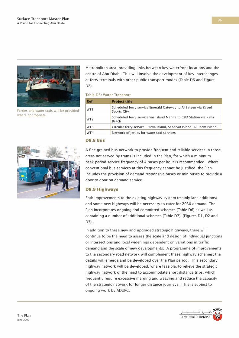
96
The PlanJune 2009
Surface Transport Master PlanA Vision for Connecting Abu Dhabi
Metropolitan area, providing links between key waterfront locations and the
centre of Abu Dhabi. This will involve the development of key interchanges
at ferry terminals with other public transport modes (Table D6 and Figure
D2).
Table D5: Water Transport
D8.8 Bus
A fine-grained bus network to provide frequent and reliable services in those
areas not served by trams is included in the Plan, for which a minimum
peak period service frequency of 4 buses per hour is recommended. Where
conventional bus services at this frequency cannot be justified, the Plan
includes the provision of demand-responsive buses or minibuses to provide a
door-to-door on-demand service.
D8.9 Highways
Both improvements to the existing highway system (mainly lane additions)
and some new highways will be necessary to cater for 2030 demand. The
Plan incorporates ongoing and committed schemes (Table D6) as well as
containing a number of additional schemes (Table D7). (Figures D1, D2 and
D3).
In addition to these new and upgraded strategic highways, there will
continue to be the need to assess the scale and design of individual junctions
or intersections and local widenings dependent on variations in traffic
demand and the scale of new developments. A programme of improvements
to the secondary road network will complement these highway schemes; the
details will emerge and be developed over the Plan period. This secondary
highway network will be developed, where feasible, to relieve the strategic
highway network of the need to accommodate short distance trips, which
frequently require excessive merging and weaving and reduce the capacity
of the strategic network for longer distance journeys. This is subject to
ongoing work by ADUPC.
Ferries and water taxis will be provided where appropriate.
Ref Project title
WT1Scheduled ferry service Emerald Gateway to Al Bateen via Zayed Sports City
WT2Scheduled ferry service Yas Island Marina to CBD Station via Raha Beach
WT3 Circular ferry service - Suwa Island, Saadiyat Island, Al Reem Island
WT4 Network of jetties for water taxi services

97
The PlanJune 2009
Surface Transport Master PlanA Vision for Connecting Abu Dhabi
Ref Project title Description
CH1 Sheikh Zayed Bridge NC (2x4)
CH2 Saadiyat - Shahama Freeway NC (2x5)
CH3 Shahama Freeway Extension to E11 NC (2x4)
CH4 Mafraq - Ghwaifat (E11) W (1)
CH5 Gayathi - Madinat Zayed Rd NC (1x2)
CH6Salaam Street Tunnel (includes four grade separated junctions on Salam Street)
NC (2x4), G5
CH7 Saadiyat Bridge to Mina Road Tunnel NC (2x4)
CH8 Connecting City to Suwa Island - Bridges 1- 4 NC (2x3)
CH9 Connecting City to Suwa Island - Bridges 5-7 NC (2x3)
CH10 Connecting Suwa and Reem Islands - Bridges 8-10 NC (2x3)
CH11 Connecting Suwa and Reem Islands - Bridges 11-13 NC (2x3)
CH12 Al Ain to Dubai Highway (E66) Upgrading W (1)
CH13Lulu Highway (with bridge links from Marina Mall to Mina Zayed)
NC (2x3)
CH14 Al Ain Northern Bypass NC (2x4)
CH15 Bainuna Street widening W (1)
CH16 Electra Street Tunnels at Junctions 6 and 4 GS
CH17 Tunnels linking Lulu Island to Abu Dhabi Island NC (2x2)
Table D6: Ongoing and Committed Highway Schemes
NC – New Construction (carriageways x lanes)
GS – Grade Separated Junctions
W – Widening (number of extra lanes for each direction)
Table D7: New Highway Schemes
Ref Project title Description
NH1 Shahama Freeway Extension from E11 to NH2 NC (2x4)
NH2 Second Abu Dhabi - Dubai Highway (as far as E30) NC (2x4)
NH3 Reem Island to Abu Dhabi NC (2x4)
NH4 Saadiyat to Reem Island Bridge NC (2x5)
NH5 Mid Island Parkway NC (2x4)
NH6 Al Ain to KPIZ Highway NC (2x2)
NH7 Mussafah to Abu Dhabi Island new link NC (2x3)
NH8 Desert Highway Extension NC (2x2)
NH9 Marina Mall/Corniche Grade Separated Junction GS
NH10 Upgraded E10 Freeway from Sheikh Zayed Bridge to E11 W (1)
NH11 Upgraded E20 Freeway form Mussafah Bridge to E11 W (1)
NH12 Upgraded E22 Freeway from Maqta Bridge to E11 W (1)

98
The PlanJune 2009
Surface Transport Master PlanA Vision for Connecting Abu Dhabi
NC – New Construction (carriageways x lanes)
GS – Grade Separated Junctions
W – Widening (number of extra lanes for each direction)
D8.10 Freight
The Plan supports the implementation of a number of regional freight
distribution centres (Table D8) and the construction of the UAE freight
railway (Figure D3).
Table D8: Freight Schemes
D9 References
1. Plan Abu Dhabi 2030: Urban Structure Framework Plan. Urban Planning
Council. Sep 2007.
The transfer of freight from road to rail is a key policy of the Plan.
Ref Project title
FS1Multimodal waterfront distribution centre at ICAD and secondary bimodal waterfront distribution centre at Mina Zayed
FS2 Multimodal distribution centre at Khalifa Port
FS3 Multimodal distribution centre at Airport free trade zone
FS4 Freight rail line (see D8.3)
FS5 Water freight service from Mussafah to KPIZ
FS6 New Multimodal distribution centre at Al Ain
Ref Project title Description
NH14 Airport Western Link W (2)
NH15 South Hodariyat - link from Mussafah NC (2x3)
NH16 South Hodariyat - link to Abu Dhabi Island NC (2x4)
NH17 Upgrade E15 to Dual 2 W (1)
NH18 Upgrade E65 to Dual 2 W (1)
NH19 Upgrade E90 to Dual 2 W (1)
NH20Second Link From Reem Island to Saadiyat - Abu Dhabi Island link
NC (2x4)
NH21 Muroor Road Extension to Capital City NC (2x3)
NH22 Tunnel from Reem Island to 31st Street NC (2x4)
NH23 Khaleej Al Arabi upgrading (including ADNEC tunnel) NC (2x6)

Madinat Zayed
Liwa
RuwaisSila
Mafraq
Mussafah
Shahama
Khalifa Port
Al Qua'a
Gayathi
Al Mirfa Tarif
Jebel DhannaAl Khatim
Dubai
Oman
Oman
Qatar
See Figure D.2 for more detail in this area
Saudi Arabia
FR4
FR4
PR2
PR2
CH5
CH4
CH4
NH19
NH17
NH18
c
c
cc
c
c
c
c
c
c
Figure D.1 - Abu Dhabi Emirate 2030
0 20 40 60 8010Kilometres
Abu Dhabi Surface Transport Master Plan
Regional Passenger Rail (PR)
Passenger Rail Stations
Freight Rail (FR)
Abu Dhabi
Al Ain
New or Improved HighwaysCH - Committed SchemesNH - New Schemes
Revision: May 2009All alignments are suject to revision pending further study (see part F)
PR - Components - See Table D.2
NH - Components - See Table D.7
FR - Components - See Table D.3
CH - Components - See Table D.6
Ferry Route

Abu Dhabi
Al Ain
Mafraq
Mussafah
Shahama
Khalifa Port
Al Khatim
Dubai
Oman
Oman
FR5
FR2
FR1
FR1
FR4
FR1
FR3
FR3
PR2
PR1
PR3
PR3
NH6
NH2
NH6
NH8
CH12
CH12
CH14
c
c
c
c
c
c
c
c
c
c
See Figure D.3 for more detail in this area
Figure D.2 - Abu Dhabi and Al Ain 2030
0 8 16 24 324Kilometres
Abu Dhabi Surface Transport Master Plan
Regional Passenger Rail (PR)
Revision: June 2009All alignments are subject to revision pending further study (see part F)
New or Improved HighwaysCH - Committed SchemesNH - New Schemes PR - Components - See Table D.2
NH - Components - See Table D.7
FR - Components - See Table D.3
CH - Components - See Table D.6
Freight Rail (FR)
Passenger Rail Stations

Abu Dhabi
Mafraq
Mussafah
Shahama
Abu DhabiInternationalAirport
Lulu Island
Saadiyat Island
Yas Island
Khalifah City A
Khalifah City B
Capital City District
Masdar
Hydra City
Al Falah
New Wathba
MohammedBin Zayed City
Raha Beach
Al Reem Island
Al Suwa Island
0 2.5 5 7.5 101.25Kilometres
Regional Passenger Rail
Freight RailMetro StationsMetro Lines
Water Taxi/Ferry JettiesFerry RoutesPersonal Rapid Transit (PRT)
Mina Zayed
Figure D.3 - Abu Dhabi Metropolitan Area 2030
Abu Dhabi Surface Transport Master Plan
New or Improved Highways
Revision: June 2009All alignments are subject to revision pending further study (see part F)
Potential Alternative Tram LinesTram Lines
Passenger Rail Stations
Park & Ride Site

Abu Dhabi
Mafraq
Mussafah
Shahama
Abu DhabiInternationalAirport
Lulu Island
Saadiyat Island
Yas Island
Khalifah City A
Khalifah City B
Capital City District
Masdar
Hydra City
Al Falah
New Wathba
MohammedBin Zayed City
Raha Beach
Al Reem Island
Al Suwa Island
MT1
PR1
WT1
WT1
PR3
FR5
FR4
FR4
PR2
PR1
PR1
PR3
MT2
MT2
MT1
MT1
MT1
MT1
MT1
MT3
MT3
MT4
MT4
WT3
WT3
WT2
WT2
WT2
WT2
c
c
Mina Zayed
c
c
0 2 4 6 81Kilometres
Water Taxi/Ferry JettiesPersonal Rapid Transit (PRT)
Figure D.4 - Abu Dhabi Metropolitan Area 2030- Rail and Ferry Components
Abu Dhabi Surface Transport Master Plan
Regional Passenger Rail (PR)
Freight Rail (FR)
Metro Lines (MT)Metro Stations
Revision: June 2009All alignments are subject to revision pending further study (see part F)
PR - Components - See Table D.2
WT - Components - See Table D.5
FR - Components - See Table D.3
MT - Components - See Table D.4
Passenger Rail StationsFerry Routes (WT)
Park & Ride Site

Abu Dhabi
Mafraq
Mussafah
Shahama
Abu DhabiInternationalAirport
Lulu Island
Saadiyat Island
Yas Island
Khalifah City A
Khalifah City B
Capital City District
Masdar
Hydra City
Al Falah
MohammedBin Zayed City
Raha Beach
Al Reem Island
Al Suwa Island
New Wathba
Mina Zayed
0 2 4 6 81Kilometres
Personal Rapid Transit (PRT)
Figure D.5 - Abu Dhabi Metropolitan Area 2030- Tram Components
Abu Dhabi Surface Transport Master Plan
Tram Lines (TR)
c
c
c
c
c
c
c
c
cc
c
c
c
c
c
c
c
c
See Figure D.7 for more detail in this area
See Figure D.8 for more detail in this area
Revision: June 2009All alignments are subject to revision pending further study (see part F)
Potential Alternative Tram Lines

Abu Dhabi
Mafraq
Mussafah
Shahama
Abu DhabiInternationalAirport
Lulu Island
Saadiyat Island
Yas Island
Khalifah City A
Khalifah City B
Capital City District
Masdar
Hydra City
Al Falah
MohammedBin Zayed City
Raha Beach
Al Reem Island
Al Suwa Island
New Wathba
NH8
NH2
NH7
NH5
CH4
CH1
CH2
CH3
NH1
NH2
NH23
NH21 NH14
NH10
NH16
NH15
Mina Zayed
0 2 4 6 81Kilometres
Personal Rapid Transit (PRT)
Figure D.6 - Abu Dhabi Metropolitan Area 2030- Highway Components
Abu Dhabi Surface Transport Master Plan
c
c
c
cc
c
cc
cc
c
c
c
c
c
c
c
cc
c
c c
c
c c
c
c
cc
c
New or Improved HighwaysCH - Committed SchemesNH - New Schemes
Revision: June 2009All alignments are subject to revision pending further study (see part F)
See Figure D.9 for more detail in this area
NH - Components - See Table D.7
CH - Components - See Table D.6
Park & Ride Site
c
c

Lulu Island
Saadiyat Island
Al Reem Island
Al Suwa Island
PR1
MT2
MT2
MT1
MT1
WT3
WT3
WT2
WT2
Mina Zayed
0 0.6 1.2 1.8 2.40.3Kilometres
Personal Rapid Transit (PRT)
Figure D.7 - Abu Dhabi Island CBD 2030 - Tram Components
Abu Dhabi Surface Transport Master Plan
Tram Lines (TR) Abi Dhabi IslandWater Taxi/Ferry Jetties
Regional Passenger Rail (PR)
Freight Rail (FR)
Metro Lines (MT)
Revision: June 2009All alignments are subject to revision pending further study (see part F)
PR - Components - See Table D.2
WT - Components - See Table D.5
MT - Components - See Table D.4
Passenger Rail Stations Metro Stations
Potential Alternative Tram Lines
Ferry Routes (WT)

Khalifah City A
Khalifah City B
Capital City District
MohammedBin Zayed City
MT1
WT1
PR2
PR1
PR3
MT1
MT3
MT40 0.6 1.2 1.8 2.40.3
Kilometres
Personal Rapid Transit (PRT)
Figure D.8 - Capital City District 2030 - Tram Components
Abu Dhabi Surface Transport Master Plan
Tram Lines (TR)
Water Taxi/Ferry Jetties
Regional Passenger Rail (PR) Metro Lines (MT)
Ferry Routes (PW)
Revision: June 2009All alignments are subject to revision pending further study (see part F)
PR - Components - See Table D.2
WT - Components - See Table D.5
MT - Components - See Table D.4
Metro StationsPotential AlternativeTram Lines
Park & Ride Site

Abu Dhabi Island
Lulu Island
Mina Zayed
Al Reem Island
Al Suwa Island
Saadiyat Island
NH5
CH7
CH8
CH9
CH8
CH8
CH8
CH8
CH9
CH9
NH3
CH7
CH6
NH9
CH10
CH10
CH11
CH11
CH11
CH17
CH17
CH17
CH17
CH17
CH16
CH16
CH13
NH20
CH15
0 0.5 1 1.5 20.25Kilometres
c
c
c
cc
c
ccc
c
c
ccc
cc
c
c
c
c
c
c
cc
c c
cccc
cc
c c
cc
c
c
c cc cc
c c
c
c
ccc
Figure D.9 - Abu Dhabi Island CBD 2030 - Highway Components
Abu Dhabi Surface Transport Master Plan
NH - Components - See Table D.7
CH - Components - See Table D.6
New or Improved HighwaysCH - Committed SchemesNH - New Schemes
Revision: June 2009All alignments are subject to revision pending further study (see part F)


Part EDelivery

The PlanJune 2009
Surface Transport Master PlanA Vision for Connecting Abu Dhabi

111
The PlanJune 2009
Surface Transport Master PlanA Vision for Connecting Abu Dhabi
E1 The Challenge
Delivering the Plan will be extremely challenging. Out of the total
programme around 110km of Metro, 50 km of tramway and 1000 km of
new or expanded highway may have to be constructed in a six-year period
(subject to further detailed study), from practically a standing start.
The scale of the challenge can be illustrated by a number of examples:
• The Singapore and Hong Kong systems took approximately 30 years to
extend to 100km length
• The Dublin-based procurement agency for metro and tram has a staff
complement of 200 to deliver a network less than 100km in total
• The planned Crossrail railway under London has been planned for many
years and has a procurement agency that will soon be expanding its staff
from 200 today to 600 when the project is under construction
• Berlin has a passenger transport authority with 450 staff to plan, procure
and monitor multi-modal services in that city of 3.4 million people.
In all the above cases, the private sector play an important role.
E2 Gearing up for Delivery
E2.1 Proposed Institutional Structure
The DoT has full responsibility for delivering the Plan. To do this it will need:
• streamlined procurement procedures supported by a new law
• full support from other government agencies
• new executive agencies to implement its strategy and plans
• to engage private sector skills to supplement its resources while these
agencies develop
• strong governance through the EHS MS framework (see Part A for details).
DoT will work closely with a number of Government agencies including:
• the ADUPC: to ensure a close coordination of land development and
transport infrastructure provision and the implementation of planning
guidance and controls that embody the philosophy and strategies of the
Plan and Plan Abu Dhabi 2030
E Delivery
The Abu Dhabi Metro will be of similar scale to Singapore’s, but will have to be built in a much shorter time scale.

112
The PlanJune 2009
Surface Transport Master PlanA Vision for Connecting Abu Dhabi
• the Municipalities: to ensure that the Plan policies are carried through to
the street level and that the transfer of responsibilities and staff to the
DoT and its agencies happens smoothly
• the National Transport Authority: whose actions at the Federal level on
aspects of driver, vehicle and operator regulation have the potential to
support Emirate policies and magnify their effectiveness
• Union Rail: when it is created with its Federal freight and passenger rail
responsibilities, with whom an integrated national rail network will need
to be planned
• The EAD, in development of the Plan’s low carbon and environmental
strategies, for current environmental regulation of projects and as the
authority responsible for supervising the implementation of the EHS MS.
The DoT will create two new statutory implementation agencies to
implement the Plan:
• a public transport agency Abu Dhabi Transport Company (‘ADTCo’) to
deliver bus, ferry and car park services, procure the construction and
operation of the new tram, metro and regional rail network and ensure a
seamless passenger experience across all modes
• a roads agency (‘RoadCo’) to maintain the road network and to procure
the construction, maintenance and operation of the strategic highway
network.
These new agencies will work in parallel with DoT’s successful taxi agency,
TransAD.
The skills, capacity and resources of the private sector must be used to the
maximum to achieve the challenging timescales demanded by the Plan. In
particular, the private sector will need to play a role in the following areas:
• coordinating and ensuring delivery of the wide range of Plan projects and
strategies
• designing and developing projects and strategies from concept to
feasibility level
• designing, building, maintaining and operating infrastructure and
procuring, maintaining and operating rolling stock, vessels or vehicles to
provide the transport services
• financing selected projects or the procurement of moveable assets.

113
The PlanJune 2009
Surface Transport Master PlanA Vision for Connecting Abu Dhabi
E3 The Role of the Private Sector
To coordinate and ensure delivery of the wide range of projects and
strategies that form the Plan, the DoT will engage Programme Management
Consultants (PMCs) to oversee the procurement of the highway and
public transport programmes. The strengthening of central planning and
coordination may also involve the private sector.
The private sector will play a critical role in delivering the bulk of the Plan
programme in partnership with ADTCo and RoadCo. A variety of partnership
arrangements will be adopted to tap the capability and capacity of global and
local contractors, manufacturers and operators to design, build and operate
major Plan components. These contractual arrangements and competitive
tendering should ensure that the contractors and service providers have
strong incentives to deliver the operational specifications and performance
that the DoT, or its agencies, have specified.
A variety of models for delivery has been considered and will be further
developed during preliminary design. They vary by mode but all take the
form of transferring delivery, cost and performance risk to the private
sector and giving the contractor, supplier and operator as much freedom as
practicable to develop the detailed solutions to deliver a service specification
defined by the DoT. Revenue (fare) policy will not be transferred, since DOT
will wish to control fares as an integral part of the Plan.
Probable business models include:
• for highways – design, finance, build, operate and transfer solutions and
a variety of performance based operations and maintenance contracts
• for buses – competitive franchising of defined services, including vehicle
purchase in the future
• for the Metro – traditional procurement of the civil infrastructure of
the initial system, because of its magnitude, with the possible supply
of systems and/or rolling stock on an availability basis and operating
concessions thereafter. Extensions may be procured on a turnkey basis
• for the tram – turnkey procurement of sub-networks may be attractive,
with options for how rolling stock and operations are procured.
• for the regional rail system – this is farther into the future and options
are open depending on the developing concepts for inter-Emirate and
international services.
The Private Sector will have a critical role in delivering the Plan, for example with provision of rolling stock.
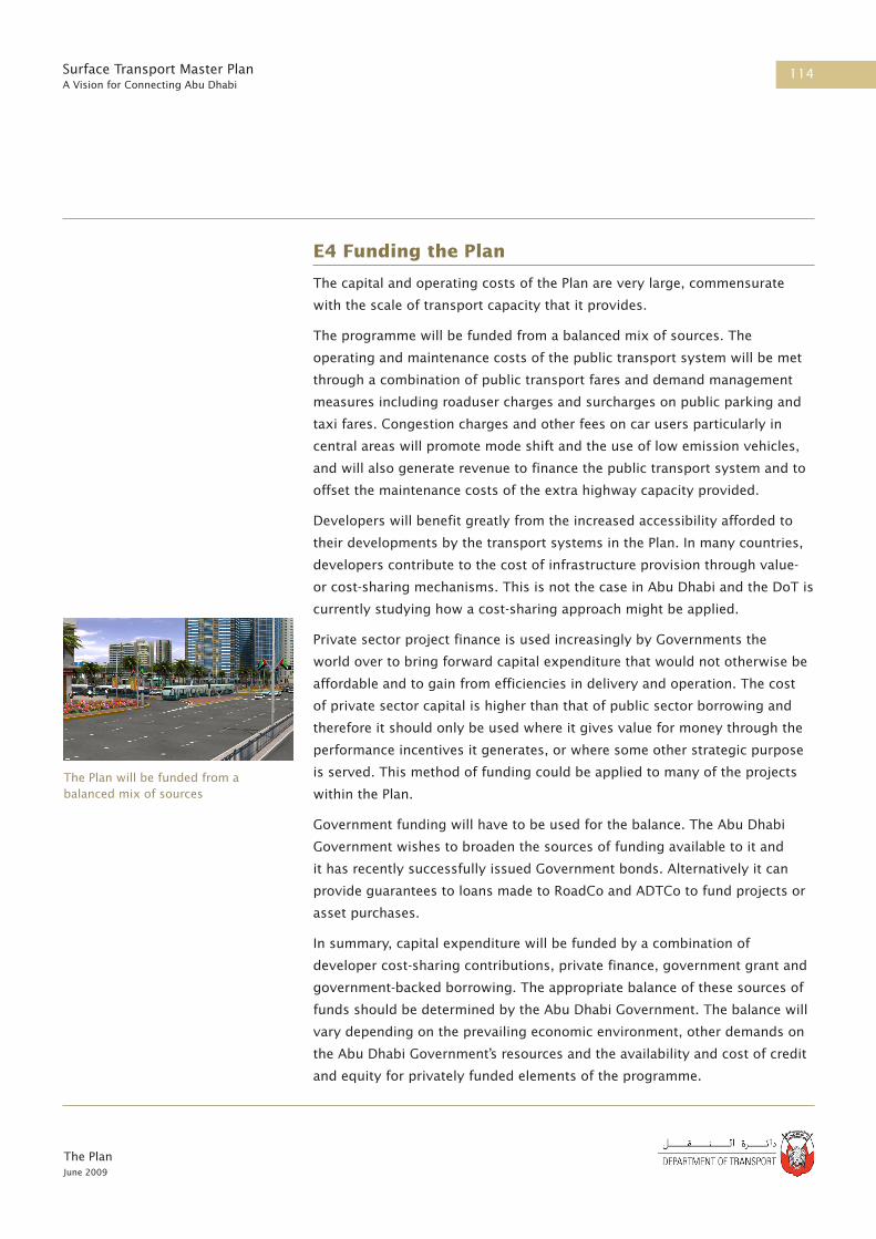
114
The PlanJune 2009
Surface Transport Master PlanA Vision for Connecting Abu Dhabi
E4 Funding the Plan
The capital and operating costs of the Plan are very large, commensurate
with the scale of transport capacity that it provides.
The programme will be funded from a balanced mix of sources. The
operating and maintenance costs of the public transport system will be met
through a combination of public transport fares and demand management
measures including roaduser charges and surcharges on public parking and
taxi fares. Congestion charges and other fees on car users particularly in
central areas will promote mode shift and the use of low emission vehicles,
and will also generate revenue to finance the public transport system and to
offset the maintenance costs of the extra highway capacity provided.
Developers will benefit greatly from the increased accessibility afforded to
their developments by the transport systems in the Plan. In many countries,
developers contribute to the cost of infrastructure provision through value-
or cost-sharing mechanisms. This is not the case in Abu Dhabi and the DoT is
currently studying how a cost-sharing approach might be applied.
Private sector project finance is used increasingly by Governments the
world over to bring forward capital expenditure that would not otherwise be
affordable and to gain from efficiencies in delivery and operation. The cost
of private sector capital is higher than that of public sector borrowing and
therefore it should only be used where it gives value for money through the
performance incentives it generates, or where some other strategic purpose
is served. This method of funding could be applied to many of the projects
within the Plan.
Government funding will have to be used for the balance. The Abu Dhabi
Government wishes to broaden the sources of funding available to it and
it has recently successfully issued Government bonds. Alternatively it can
provide guarantees to loans made to RoadCo and ADTCo to fund projects or
asset purchases.
In summary, capital expenditure will be funded by a combination of
developer cost-sharing contributions, private finance, government grant and
government-backed borrowing. The appropriate balance of these sources of
funds should be determined by the Abu Dhabi Government. The balance will
vary depending on the prevailing economic environment, other demands on
the Abu Dhabi Government’s resources and the availability and cost of credit
and equity for privately funded elements of the programme.
The Plan will be funded from a balanced mix of sources

115
The PlanJune 2009
Surface Transport Master PlanA Vision for Connecting Abu Dhabi
E5 Performance Monitoring
To successfully deliver the Plan, it will be important to monitor progress. The
performance monitoring for the Plan will:
• focus on key outcomes rather than outputs;
• provide a hierarchy of performance indicators;
• make best use of available data sources and collect statistically reliable
data;
• include targets and trajectories;
• monitor the external influences and impacts that might influence delivery
of the programme and the desired outcomes; and
• include a balanced set of indicators measuring technical performance,
value for money and customer satisfaction.
A significant amount of data needs to be collected and analysed to effectively
assess the performance of the transport strategy and its impacts on the
economy, society and the environment. An early action will be to develop
a detailed survey programme to provide the base-line data required. The
programme will include surveys at different times of year to reflect changing
travel patterns and measures that will vary with the seasons, with some
surveys being annual and others monthly.
In assessing whether the Plan objectives are on course to be delivered,
targets and trajectories will be set to enable progress to be monitored every
year and for corrective actions to be planned. Targets will be set according
to international benchmarks, where appropriate, to ensure that the Plan is
delivering world class performance.
The performance indicators collected and monitored will extend beyond
the confines of technical performance, such as traffic flows, mode shares,
accident statistics, and the environment, and will ensure that value for
money and customer perceptions are also captured.
The performance monitoring system will also address the indicators
contained in the Strategic Plan and the Environmental Health and Safety (EHS)
performance requirements as stipulated by EHS law. DoT corporate EHS will
require each of the DoT sectors to develop an EHS performance monitoring
plan on an annual basis, of which the Plan and project-related performance
monitoring will be an important component.
Detailed monitoring of traffic and many other indicators will be required to assess delivery of the Plan’s performance outcomes.

116
The PlanJune 2009
Surface Transport Master PlanA Vision for Connecting Abu Dhabi
The planning, monitoring and review cycle will be supported by a set of
reports and meetings to include:
• A monthly monitoring meeting – supported by a monthly monitoring
report;
• A quarterly review meeting – supported by a quarterly monitoring report;
• An annual review meeting – supported by a more detailed monitoring
report that is also aimed at external stakeholders, the public and the
media; and
• A 5-yearly strategy review – supported by a detailed review of the 5-year
implementation plan and a revised Plan document.
The annual review will consider the full range of performance metrics,
financial and scheme delivery information. Progress towards all key
outcomes and Key Performance Indicators (KPIs) would be presented in
an internal monitoring report, identifying variations from the Plan and
identifying clearly the reasons why, through analysis of the other indicators
in the KPI hierarchy as well as external influences. Where necessary, the
scope of corrective actions to keep the Plan outcomes on track will also be
defined.
A detailed Action Plan for the following year would also be agreed at
the meeting. The information would be used to prepare a report for
stakeholders, the public and the media, which would ‘sell’ the successes from
the year and set out key goals for the year ahead.
The annual review would be linked to the agencies’ service level agreement
reviews, and individual staff appraisal reviews to ensure that all aspects of
the performance management system are aligned towards achieving the Plan
objectives.
The 5-yearly strategy review will take a 20-year forward perspective on
the Plan, reviewing the goals and objectives as well as the strategies and
programmes of work required to deliver them. The review of the Plan will
involve extensive stakeholder consultation and engagement and would result
in an updated document for both internal and external consumption. The
revised Plan will drive the direction of the surface transport strategy for the
next five years.
The outputs from the Strategy Review process will be adjustments to:

117
The PlanJune 2009
Surface Transport Master PlanA Vision for Connecting Abu Dhabi
• Vision, Mission, Values, Policies, and Corporate Structure;
• Updated Plan;
• Updated budget projection (next year, 5yr, 20yr); and
• Input to the next year Delivery Plan - Critical Success Factors, Key
Objectives and Targets.

The PlanJune 2009
Surface Transport Master PlanA Vision for Connecting Abu Dhabi

Part FAction Plan

The PlanJune 2009
Surface Transport Master PlanA Vision for Connecting Abu Dhabi

121
The PlanJune 2009
Surface Transport Master PlanA Vision for Connecting Abu Dhabi
F 1 Overview
The Action Plan for implementation is broken down into a series of five year
plans, as follows:
• 2009 to end 2010 – the 2010 Action Plan
• 2011 to end 2015 – the 2015 Action Plan
• 2016 to end 2020 – the 2020 Action Plan
• 2021 to end 2025 – the 2025 Action Plan
• 2026 to end 2030 – the 2030 Action Plan
Each contains:
• a summary of the schemes and strategies to be completed in each period
• an implementation schedule for each infrastructure component
Figures F.1 to F.5 show the phasing of the Plan. This is driven mainly by the
need to put infrastructure in place to meet travel demand: the phasing of the
Plan, which forecasts a step-change in land use by 2015, requires the core
Metro system and a number of key tram and highway components to be
open by then.
The Action Plan will be subject to annual review. The first major review will
be published at the end of the first plan period (2010) as the large number
of initiatives that are either ongoing or due to start in the first plan period
are expected substantially to influence phasing and implementation. It is
also possible that further detailed evaluation may result in the exclusion of
a limited number of schemes, in particular, Bainuna Street widening [CH15],
Electra Street tunnels [CH16], and tunnels linking Lulu Island [CH 17], and
those with adverse environmental impacts.
F Action Plan

The PlanJune 2009
Surface Transport Master PlanA Vision for Connecting Abu Dhabi

Abu Dhabi
Madinat Zayed
Liwa
Al AinRuwaisSila
Mafraq
Mussafah
Shahama
Khalifa Port
Al Qua'a
Gayathi
Al Mirfa Tarif
Jebel DhannaAl Khatim
Dubai
Oman
Oman
Qatar
0 20 40 60 8010Kilometres
Figure F.1 - Abu Dhabi Emirate Wide Highway Phasing Plan
Abu Dhabi Surface Transport Master Plan
Highway schemes in operation by:
2010
2030
2020
2025
2015
Revision: May 2009All alignments are suject to revision pending further study (see part F)
Saudi Arabia
2015
Ferry Route in operation by:

Madinat Zayed
Liwa
RuwaisSila
Mafraq
Mussafah
Shahama
Khalifa Port
Al Qua'a
Gayathi
Al Mirfa Tarif
Jebel DhannaAl Khatim
Dubai
Oman
Qatar
Saudi Arabia
Abu Dhabi
Al Ain
0 20 40 60 8010Kilometres
Figure F.2 - Abu Dhabi Emirate Wide Rail Phasing Plan
Abu Dhabi Surface Transport Master Plan
Passenger Rail in operation by: Freight Rail in operation by:2020
Revision: June 2009All alignments are subject to revision pending further study (see part F)
20252030

Lulu Island
Mina Zayed Saadiyat Island
Yas Island
Mussafah
Al Falah
Shamkah
Mafraq
Capital City District
Shahama
Airport
Khalifa City AMasdar
Al Reem Island
Hydra City
New Wathba
Khalifa City B
Al Raha Beach
Mohammed Bin Zayed City
South Hodariyat Island
Al Suwa Island
Abu Dhabi Island
0 2 4 6 81Kilometres
Figure F.3 - Abu Dhabi Metropolitan Area - Highway Phasing 2010
Abu Dhabi Surface Transport Master Plan
Lulu Island
Mina Zayed Saadiyat Island
Yas Island
Mussafah
Shamkah
Mafraq
Shahama
Airport
Khalifa City AMasdar
Hydra City
New Wathba
Khalifa City B
Al Raha Beach
Mohammed Bin Zayed City
South Hodariyat Island
Al Suwa Island
Al Falah
Capital City District
Al Reem Island
Abu Dhabi Island
0 2 4 6 81Kilometres
Figure F.4 - Abu Dhabi Metropolitan Area - Highway Phasing 2015
Abu Dhabi Surface Transport Master Plan
Highways routes in operation by:
Highways routes in operation by: Park & Ride in operation by:
All alignments are subject to revision pending further study (see part F)
All alignments are subject to revision pending further study (see part F)
Revision: June 2009
Revision: June 2009
2010
2010 20152015

Lulu Island
Mina Zayed Saadiyat Island
Yas Island
Mussafah
Al Falah
Shamkah
Mafraq
Capital City District
Shahama
Airport
Khalifa City AMasdar
Al Reem Island
Hydra City
New Wathba
Khalifa City B
Al Raha Beach
Mohammed Bin Zayed City
South Hodariyat Island
Al Suwa Island
Abu Dhabi Island
0 2 4 6 81Kilometres
Figure F.5 - Abu Dhabi Metropolitan Area - Highway Phasing 2020
Abu Dhabi Surface Transport Master Plan
Lulu Island
Mina Zayed Saadiyat Island
Yas Island
Mussafah
Shamkah
Mafraq
Shahama
Airport
Khalifa City AMasdar
Hydra City
New Wathba
Khalifa City B
Al Raha Beach
Mohammed Bin Zayed City
South Hodariyat Island
Al Suwa Island
Al Falah
Capital City District
Al Reem Island
Abu Dhabi Island
0 2 4 6 81Kilometres
Figure F.6 - Abu Dhabi Metropolitan Area - Highway Phasing 2025
Abu Dhabi Surface Transport Master Plan
Highways routes in operation by:
Highways routes in operation by: Park & Ride in operation by:
2015
2020
2015
Park & Ride in operation by:
20152015
All alignments are subject to revision pending further study (see part F)
All alignments are subject to revision pending further study (see part F)
Revision: June 2009
Revision: June 2009
2010
2010
2020
2025

Lulu Island
Mina Zayed Saadiyat Island
Yas Island
Mussafah
Shamkah
Mafraq
Shahama
Airport
Khalifa City AMasdar
Hydra City
New Wathba
Khalifa City B
Al Raha Beach
Mohammed Bin Zayed City
South Hodariyat Island
Al Suwa Island
Al Falah
Capital City District
Al Reem Island
Abu Dhabi Island
0 2 4 6 81Kilometres
Figure F.7 - Abu Dhabi Metropolitan Area - Highway Phasing 2030
Abu Dhabi Surface Transport Master Plan
Highways routes in operation by: Park & Ride in operation by:
All alignments are subject to revision pending further study (see part F) Revision: June 2009
2010
2020
20302015
2025
2015

Lulu Island
Mina Zayed Saadiyat Island
Yas Island
Mussafah
Al Falah
Shamkah
Mafraq
Capital City
Shahama
Airport
Khalifa City AMasdar
Al Reem Island
Hydra City
New Wathba
Khalifa City B
Al Raha Beach
Mohammed Bin Zayed City
South Hodariyat Island
Al Suwa Island
Abu Dhabi Island
Lulu Island
Mina Zayed Saadiyat Island
Yas Island
Mussafah
Shamkah
Mafraq
Shahama
Airport
Khalifa City AMasdar
Hydra City
New Wathba
Khalifa City B
Al Raha Beach
Mohammed Bin Zayed City
South Hodariyat Island
Al Suwa Island
Al Falah
Capital City
Al Reem Island
Abu Dhabi Island
0 2.5 5 7.5 101.25Kilometres
Figure F.9 - Abu Dhabi Metropolitan Area - Metro & Ferry Phasing 2020
Abu Dhabi Surface Transport Master Plan
Metro routes in operation by: Ferry routes in operation by:
All alignments are suject to revision pending further study (see part F)
Revision: June 2009
Revision: June 2009
0 2.5 5 7.5 101.25Kilometres
Figure F.8 - Abu Dhabi Metropolitan Area - Metro & Ferry Phasing 2015
Abu Dhabi Surface Transport Master Plan
Metro routes in operation by: Ferry routes in operation by:
All alignments are suject to revision pending further study (see part F)
2015 2015
2015
2020
2015

Lulu Island
Mina Zayed Saadiyat Island
Yas Island
Mussafah
Al Falah
Shamkah
Mafraq
Capital City
Shahama
Airport
Khalifa City AMasdar
Al Reem Island
Hydra City
New Wathba
Khalifa City B
Al Raha Beach
Mohammed Bin Zayed City
South Hodariyat Island
Al Suwa Island
Abu Dhabi Island
0 2.5 5 7.5 101.25Kilometres
Figure F.10 - Abu Dhabi Metropolitan Area - Metro & Ferry Phasing 2025
Abu Dhabi Surface Transport Master Plan
Metro routes in operation by: Ferry routes in operation by:
All alignments are suject to revision pending further study (see part F) Revision: June 2009
2015
2020
2025
2015

Lulu Island
Mina Zayed Saadiyat Island
Yas Island
Mussafah
Al Falah
Shamkah
Mafraq
Capital City District
Shahama
Airport
Khalifa City AMasdar
Al Reem Island
Hydra City
New Wathba
Khalifa City B
Al Raha Beach
Mohammed Bin Zayed City
South Hodariyat Island
Al Suwa Island
Abu Dhabi Island
0 2 4 6 81Kilometres
Figure F.11 - Abu Dhabi Metropolitan Area - Tram Phasing 2015
Abu Dhabi Surface Transport Master Plan
Lulu Island
Mina Zayed Saadiyat Island
Yas Island
Mussafah
Shamkah
Mafraq
Shahama
Airport
Khalifa City AMasdar
Hydra City
New Wathba
Khalifa City B
Al Raha Beach
Mohammed Bin Zayed City
South Hodariyat Island
Al Suwa Island
Al Falah
Capital City District
Al Reem Island
Abu Dhabi Island
0 2 4 6 81Kilometres
Figure F.12 - Abu Dhabi Metropolitan Area - Tram Phasing 2020
Abu Dhabi Surface Transport Master Plan
Tram routes in operation by:
Tram routes in operation by:
All alignments are subject to revision pending further study (see part F)
All alignments are subject to revision pending further study (see part F)
Revision: June 2009
Revision: June 2009
2015
2015
2020

Lulu Island
Mina Zayed Saadiyat Island
Yas Island
Mussafah
Al Falah
Shamkah
Mafraq
Capital City District
Shahama
Airport
Khalifa City AMasdar
Al Reem Island
Hydra City
New Wathba
Khalifa City B
Al Raha Beach
Mohammed Bin Zayed City
South Hodariyat Island
Al Suwa Island
Abu Dhabi Island
0 2 4 6 81Kilometres
Figure F.13 - Abu Dhabi Metropolitan Area - Tram Phasing 2025
Abu Dhabi Surface Transport Master Plan
Lulu Island
Mina Zayed Saadiyat Island
Yas Island
Mussafah
Shamkah
Mafraq
Shahama
Airport
Khalifa City AMasdar
Hydra City
New Wathba
Khalifa City B
Al Raha Beach
Mohammed Bin Zayed City
South Hodariyat Island
Al Suwa Island
Al Falah
Capital City District
Al Reem Island
Abu Dhabi Island
0 2 4 6 81Kilometres
Figure F.14 - Abu Dhabi Metropolitan Area - Tram Phasing 2030
Abu Dhabi Surface Transport Master Plan
Tram routes in operation by:
Tram routes in operation by:
All alignments are subject to revision pending further study (see part F)
All alignments are subject to revision pending further study (see part F)
Revision: June 2009
Revision: June 2009
2025
2020
2015
2015
2020
2030
2025

The PlanJune 2009
Surface Transport Master PlanA Vision for Connecting Abu Dhabi

The PlanJune 2009
Surface Transport Master PlanA Vision for Connecting Abu Dhabi
2010 Action Plan

The PlanJune 2009
Surface Transport Master PlanA Vision for Connecting Abu Dhabi

135
The PlanJune 2009
Surface Transport Master PlanA Vision for Connecting Abu Dhabi
F2 2010 Summary
F2.1 Infrastructure Components
The infrastructure components in the Plan period 2009-10 are set out in
Table F1, which shows the latest dates to start the necessary feasibility study
and design, the suggested start of construction and the planned opening
date by when the Plan indicates the component is required. This table, and
those in subsequent sections, shade those activities to be carried out within
this Action Plan
Only a limited number of schemes, already committed prior to the Plan, will
be open by the end of 2010, including 1,360 new buses to be purchased and
the continnuing upgrading of the taxi fleet.
There will be an intensive study and design effort to validate and develop the
Plan proposals. The following major studies will be started:
• Regional Rail Safeguarding Study
• Metro Feasibility Study
• Tram Feasibility Study
• Ferry Feasibility Study
In addition, a detailed transport masterplan for Al Ain will be prepared and
intensive modelling of the Abu Dhabi Metropolitan CBD and Capital City
District completed. Measures to address short term congestion issues in
this period will also be addressed through a DoT programme of immediate
alleviation measures on Abu Dhabi Island.
Table F1: Action Plan 2010 Infrastructure Components
Ref. Project title Start Study & Design
Start Constr-uction
Open
COMMITTED HIGHWAY SCHEMES
CH1 Sheikh Zayed Bridge 2004 2006 2010
CH2 Saadiyat - Shahama Freeway 2003 2006 2009
CH3Shahama Freeway Extension between E10 and E11
2004 2006 2010
CH4 Mafraq - Ghwaifat Highway (E11) 2007 2009 2013
CH5 Gayathi - Madinat Zayed Rd 2004 2006 2010

136
The PlanJune 2009
Surface Transport Master PlanA Vision for Connecting Abu Dhabi
Ref. Project title Start Study & Design
Start Constr-uction
Open
CH6Salaam Street Tunnel (includes grade separated junctions on Salaam Street)
2005 2009 2011
CH7 Saadiyat Bridge to Mina Road Tunnel 2009 2011 2015
CH8 Connecting City to Suwa Island - Bridges 1-4 2004 2007 2010
CH9 Connecting City to Suwa Island - Bridges 5-7 2009 2011 2015
CH10Connecting Suwa and Reem Islands -
Bridges 11-132004 2006 2010
CH11Connecting Suwa and Reem Islands -
Bridges 8 - 102009 2011 2015
CH12 Al Ain to Dubai Highway (E66) Upgrading 2009 2012 2015
CH13Lulu Highway (with bridge links from Marina Mall to Mina Zayed)
2009 2012 2015
CH14 Al Ain Northern Bypass 2008 2009 2011
CH15 Bainuna Street widening 2009
CH16 Electra Street Tunnels at Junctions 6 and 4 2009
CH17Tunnels linking Lulu Island to Abu Dhabi Island
2009
PROPOSED HIGHWAY SCHEMES
NH1Shahama Freeway Extension between E11 and NH2
2009 2011 2015
NH2 Second Abu Dhabi – Dubai Highway 2009 2012 2015
NH3 Reem Island to Abu Dhabi 2006 2008 2010
NH5 Mid Island Parkway 2009 2017 2020
NH6 Al Ain to KPIZ Highway 2009 2017 2020
NH7 Mussafah to Abu Dhabi Island new link 2009 2011 2015
NH9Marina Mall/Corniche Grade Separated Junction
2010 2012 2015
NH10Widen E10 Freeway from Sheikh Zayed Bridge to E11
2009 2009 2012
NH15 South Hodariyat - link from Mussafah 2009 2011 2015
NH16 South Hodariyat - link to Abu Dhabi Island 2009 2011 2015
NH17Upgrade E15 to Dual 2 with grade separated junctions and crossings (from E11 to south of Gayathi)
2010 2012 2015
NH17Upgrade E15 to Dual 2 with grade separated junctions and crossings (remainder)
2010 2027 2030

137
The PlanJune 2009
Surface Transport Master PlanA Vision for Connecting Abu Dhabi
Ref. Project title Start Study & Design
Start Constr-uction
Open
NH19Upgrade E90 to Dual 2 with grade separated junctions and crossings
2010 2012 2015
NH20Second Link from Reem Island to Saadiyat - Abu Dhabi Island Bridge
2010 2012 2015
NH22 Tunnel from Reem Island to 31st Street 2009 2013 2015
NH23Khaleej Al Arabi upgrading (including ADNEC tunnel)
2009 2011 2015
METRO
MT1 CBD - Airport - Capital City loop 2009 2010 2015
MT2 Link to Marina Mall 2009 2012 2015
TRAM
TR1First stage route linking Reem, Suwa, CBD and Marina Mall
2009 2010 2012
TR2Independent route linking Raha, Yas, Masdar and Airport
2009 2010 2012
TR3Second stage route extensions to serve Saadiyat and Capital City
2009 2011 2015
TR4
Completion of tram network on Abu Dhabi Island, including connections to ADNEC, Zayed Sports City, Grand Mosque and Lulu Island
2009 2016 2020
TR5Extension of Capital City network with links around Airport to Al Falah
2009 2016 2020
TR6
Extend tram network, in stages as appropriate, to serve Musaffah, South Hodariyat, Mohammed bin Zayed City, ICAD and Mafraq
2009 2021 2025
TR7Extend tram network, in stages as appropriate, to serve Shahama and to complete planned network
2009 2026 2030
PERSONAL RAPID TRANSIT
RT1 PRT Masdar City 2009 2010 2015
BUS
BS1Fine grained network of local buses with bus priority
2009 2010 2015
BS2Enhanced inter-regional long-distance coach network
2010 2012 2015
WATER TRANSPORT
WT1Scheduled ferry service Emerald Gateway to Al Bateen via Zayed Sports City/ADNEC
2010 2012 2015
WT2Scheduled ferry service Yas Island Marina to CBD Station via Raha Beach
2010 2012 2015

138
The PlanJune 2009
Surface Transport Master PlanA Vision for Connecting Abu Dhabi
F2.2 Other Plan Initiatives
The following studies and measures will be implemented to develop the Plan
strategies as set out in Part D:
Congestion Management (D1)
• Develop interchange planning strategy and best practice guidance
(D1.1.3)
• Complete the development of the Emirate-wide roads and streets
hierarchy that will be identified for urban streets in the “Abu Dhabi Urban
Street Design and Mobility Standards Manual”. (D1.2.1)
• Develop transit-oriented development guidelines in the Abu Dhabi
Development Management Programme (D1.3.1)
• Develop parking standards guidance for new developments (D1.3.2)
• Develop and implement fares policy (D2.2.2)
• ITS Feasibility Study (D1.2.2)
• Pricing Strategy Study (D1.4.3)
• Park and Ride Locations Study (D1.4.4)
• Bus Priority Study (D1.1.1)
• Start introduction of Parking Management in CBD (D1.4.1)
• Bikeway Master Plan (D1.1.2)
Ref. Project title Start Study & Design
Start Constr-uction
Open
WT3Circular ferry service - Suwa Island, Saadiyat, Reem Island
2010 2012 2015
WT4 Network of jetties for water taxi services 2010 2012 2015
FREIGHT
FS1Multimodal distribution centres at ICAD and Mina Zayed
2010 2012 2015
FS2 Multimodal distribution centre at Khalifa Port 2010 2012 2015
FS3Multimodal distribution centre at Airport free trade zone
2010 2012 2015
FS4 Union Railways freight rail lines 2010 2018 2020
FS5 E40 Truck Route extension to E11 (ICAD) 2009

139
The PlanJune 2009
Surface Transport Master PlanA Vision for Connecting Abu Dhabi
Accessibility (D2)
• Mobility Management Study (D2.1.1)
• Mobility Impaired Study (D2.2.1)
• Review bus stop locations with respect to catchment areas and increase
number and quality (D2.1.1)
• Taxi and Minibus Study (D2.2.4)
Safety and Security (D3)
• Strategic Road Safety Plan (D3.1)
• Road safety promotion / education campaign (D3.1.4)
• Identify and implement pedestrian safety priorities (D3.1.2)
• Accident investigation programme (D3.1.5)
• Develop a speed management policy and implement speed limit changes
(D3.1.1)
• Develop security standards for interchanges and public transport
vehicles (D3.2)
Pedestrian Realm (D4)
• Pedestrian Master Plan (D4.2.1)
• Complete Abu Dhabi Urban Street Design and Mobility Standards Manual
(ADUPC) (D4.1.1)
• Start pilot implementation of Abu Dhabi Urban Street Design and Mobility
Standards Manual (ADUPC) (D4.1.1)
Freight Management (D5)
• Freight Logistics Study (D5.2)
• Promote the Development of RDCs (D5.1.1)
• Facilitate the Freight Rail Line (D5.1.2)
Low Carbon (D6)
• Establish ‘Sustainable Transport Taskforce’ (D6.1 & D7.1)
• Strategic objectives setting for low carbon strategy (D6.1 & D7.1)
• Develop Life Cycle Sustainability Management Framework (D6.1.1)

140
The PlanJune 2009
Surface Transport Master PlanA Vision for Connecting Abu Dhabi
• Develop Low Carbon Framework and regulatory documents (D6.3)
• CDM study ( D6.3.1)
• Develop system of incentives for low carbon vehicle fleet purchase by
bus and taxi operators (D6.3.2)
Environment (D7)
• Establish ‘Sustainable Transport Taskforce’ (D6.1 & D7.1 )
• Set strategic objectives for Environment strategy (D6.1 & D7.1)
• Environmental Baseline Studies (D7.3)
The PlanJune 2009
Surface Transport Master PlanA Vision for Connecting Abu Dhabi
2015 Action Plan

The PlanJune 2009
Surface Transport Master PlanA Vision for Connecting Abu Dhabi

143
The PlanJune 2009
Surface Transport Master PlanA Vision for Connecting Abu Dhabi
F3 2015 Summary
F3.1 Infrastructure Components
There will be intensive construction activity during this period. The status of
infrastructure components at the end of the 2011-2015 period is set out in
Table F2.
The DoT will manage and coordinate this construction programme to
miminise impacts on traffic movements, including implementation of short-
term measures such as temporary park-and-ride sites and bus priority.
Table F2: Action Plan 2015 Infrastructure Components
Ref. Project title Start Study & Design
Start Constr-uction
Open
COMMITTED HIGHWAY SCHEMES
CH4 Mafraq - Ghwaifat Highway (E11) 2007 2009 2013
CH6Salaam Street Tunnel (includes grade separated junctions on Salaam Street)
2005 2009 2011
CH7 Saadiyat Bridge to Mina Road Tunnel 2009 2011 2015
CH9 Connecting City to Suwa Island - Bridges 5-7 2009 2011 2015
CH11 Connecting Suwa and Reem Islands - Bridges 8-10 2009 2011 2015
CH12 Al Ain to Dubai Highway (E66) Upgrading 2009 2012 2015
CH13Lulu Highway (with bridge links from Marina Mall to Mina Zayed)
2009 2012 2015
CH14 Al Ain Northern Bypass 2008 2009 2011
PROPOSED HIGHWAY SCHEMES
NH1Shahama Freeway Extension between E11 and NH2
2009 2011 2015
NH2 Second Abu Dhabi – Dubai Highway 2009 2012 2015
NH7 Mussafah to Abu Dhabi Island new link 2009 2011 2015
NH9 Marina Mall/Corniche Grade Separated Junction 2010 2012 2015
NH10Widen E10 Freeway from Sheikh Zayed Bridge to E11
2009 2009 2012
NH11Upgrade E20 Freeway from Mussafah Bridge to E11
2014 2017 2020
NH15 South Hodariyat - link from Mussafah 2009 2011 2015
NH16 South Hodariyat - link to Abu Dhabi Island 2009 2011 2015
NH17Upgrade E15 to Dual 2 with grade separated junctions and crossings (from E11 to South of Gayathi)
2010 2012 2015

144
The PlanJune 2009
Surface Transport Master PlanA Vision for Connecting Abu Dhabi
Ref. Project title Start Study & Design
Start Constr-uction
Open
NH19Upgrade E90 to Dual 2 with grade separated junctions and crossings
2010 2012 2015
NH20Second Link from Reem Island to Saadiyat- Abu Dhabi Island Bridge
2010 2012 2015
NH22 Tunnel from Reem Island to 31st Street 2009 2013 2015
NH23Khaleej Al Arabi upgrading (including ADNEC tunnel)
2009 2011 2015
METRO
MT1 CBD - Airport - Capital City loop 2009 2010 2015
MT2 Link to Marina Mall 2009 2012 2015
MT3 Capital City - Mohammed Bin Zayed loop 2014 2018 2020
TRAM
TR1First stage route linking Reem, Suwa, CBD and Marina Mall
2009 2010 2012
TR2Independent route linking Raha, Yas, Masdar and Airport
2009 2010 2012
TR3Second stage route extensions to serve Saadiyat and Capital City
2009 2011 2015
PERSONAL RAPID TRANSIT
RT1 PRT Masdar City 2009 2010 2015
RT2 PRT Lulu Island 2014 2016 2020
BUS
BS1Fine grained network of local buses with bus priority
2009 2010 2015
BS2Enhanced inter-regional long-distance coach network
2010 2012 2015
WATER TRANSPORT
WT1Scheduled ferry service Emerald Gateway to Al Bateen via Zayed Sports City/ADNEC
2010 2012 2015
WT2Scheduled ferry service Yas Island Marina to CBD Station via Raha Beach
2010 2012 2015
WT3Circular ferry service - Suwa Island, Saadiyat, Reem Island
2010 2012 2015
WT4 Network of jetties for water taxi services 2010 2012 2015
FREIGHT
FS1Multimodal distribution centre at ICAD and Mina Zayed
2010 2012 2015
FS2 Multimodal distribution centre at Khalifa Port 2010 2012 2015

145
The PlanJune 2009
Surface Transport Master PlanA Vision for Connecting Abu Dhabi
F3.2 Other Plan Initiatives
The following studies and measures will also be implemented by 2015:
Congestion Management (D1)
• Enhance and expand UTC system (D1.2.2)
• Provide reliable journey time information system (D1.2.3)
• Develop detailed cycle strategy and design guidance (D1.1.2)
• Introduce integrated smartcard ticketing (D1.1.5)
• Upgrade and extend Traffic Management Control Centre (D1.2.2)
• Implement ITS measures (D1.2.2)
• Implement most urgent bus priority measures (D1.1.1)
• Introduce initial Park and Ride (D 1.4.4)
• Implement the first stage of road user charging (D1.4.3)
• Monitor and further expand parking management in the CBD (D1.4.1)
• Promote teleworking and other measures to reduce trip making (D1.4.5)
• Develop and implement management plans for events and incidents
(D1.2.4)
• Develop detailed strategy for travel plans for new developments (D1.3.3)
• Develop and implement public travel behaviour change campaign
(D1.4.2)
Accessibility (D2)
• Monitor performance of taxi service and adjust taxi numbers as required
(D2.2.4)
• Develop policy for women and children using public transport (D2.2.3)
• Develop accessibility design guidance for infrastructure and services (D2)
Ref. Project title Start Study & Design
Start Constr-uction
Open
FS3Multimodal distribution centre at Airport free trade zone
2010 2012 2015
FS4 Union Railways freight rail lines 2010 2018 2020
FS5 E40 Truck Route extension to E11 (ICAD) 2009

146
The PlanJune 2009
Surface Transport Master PlanA Vision for Connecting Abu Dhabi
• Mobility improvement measures (D2.2)
• Increase number and quality of bus stops (D2.1.1)
Safety and Security (D3)
• Improved traffic enforcement and speed management (D3.1.1)
• Introduce road safety education programme (D3.1.4)
• Develop a new Highway Code (D3.1.3)
• Carry out road safety audits on all roads (D3.1.6)
• Develop and implement vehicle regulations – safety, emissions, HGV
loads / driving hours, annual safety checks (D3.1.7)
Pedestrian Realm (D4)
• Pilot street re-design (D4.1)
• Identify priority areas for pedestrian realm improvements (D4.1)
Freight Management (D5)
• Promote freight transport modal shift (D5.1)
• Active freight traffic management (D5.2)
Low Carbon (D6)
• Initiate implementation of Life Cycle Sustainability Management, subject
to development of framework (D6.1.1)
• Initiate Low Carbon Framework implementation and regulation subject to
development of framework and regulatory documents (D6.3)
• Implement system of providing incentives for low carbon vehicle fleet
purchase by bus and taxi operators (D6.3.2)
• Low carbon energy from renewables and energy policy for transport
study (D6.3.1)
• Emissions based vehicle registration scheme study (D6.3.3)
• Low emissions zone study (D6.3.4)
• Priority parking for Low Emissions vehicles study (D6.3.5)
• Continued awareness raising campaign based on campaign plan (D6.3.6)

147
The PlanJune 2009
Surface Transport Master PlanA Vision for Connecting Abu Dhabi
Environment (D7)
• Develop robust air quality and noise strategy for transport based on
outcomes of baseline monitoring and studies and emirate wide emissions
policy (D7.3.1)
• Develop environmental protection zones, regulations/principles/
guidance documentation (natural environment) for infrastructure
and environmental enhancement programmes based on outcomes of
environmental baselines and emirate environmental protection zones
(D7.3.2)
• Develop environmental protection zones, regulations/principles/
guidance documentation (built environment) for infrastructure and
environmental enhancement programmes based on outcomes of
environmental baselines and emirate environmental sites, buildings and
landscape viewsheds (D7.3.3)
• Draft marine code based on outcome of environmental baselines (D7.3.4)

The PlanJune 2009
Surface Transport Master PlanA Vision for Connecting Abu Dhabi

The PlanJune 2009
Surface Transport Master PlanA Vision for Connecting Abu Dhabi
2020 Action Plan

The PlanJune 2009
Surface Transport Master PlanA Vision for Connecting Abu Dhabi

151
The PlanJune 2009
Surface Transport Master PlanA Vision for Connecting Abu Dhabi
F4 2020 Summary
F4.1 Infrastructure Components
The status of infrastructure components in the 2016-2020 period is set out
in Table F3.
Table F.3 Action Plan 2020 Infrastructure Components
Ref. Project title Start Study & Design
Start Constr-uction
Open
PROPOSED HIGHWAY SCHEMES
NH4 Saadiyat to Reem Island Bridge 2019 2021 2025
NH5 Mid Island Parkway 2009 2017 2020
NH6 Al Ain to KPIZ Highway 2009 2017 2020
NH11Upgraded E20 Freeway from Mussafah Bridge to E11
2014 2017 2020
NH12 Upgraded E22 Freeway from Maqta Bridge to E11 2019 2021 2025
NH14 Airport Western Link 2019 2021 2025
NH18Upgrade E65 to Dual 2 with grade separated junctions and crossings
2015 2016 2020
REGIONAL RAIL
PR1Abu Dhabi to Dubai via Capital City & Airport Midfield Terminal
2019 2023 2025
PR3 Abu Dhabi to Al Ain 2019 2023 2025
METRO
MT3 Capital City - Mohammed Bin Zayed loop 2014 2018 2020
MT4 Shamkhah to Capital City spur 2019 2023 2025
TRAM
TR4Completion of tram network on Abu Dhabi Island, including connections to ADNEC, Zayed Sports City, Grand Mosque and Lulu Island
2009 2016 2020
TR5Extension of Capital City network with links around Airport to Al Falah
2009 2016 2020
PERSONAL RAPID TRANSIT
RT2 PRT Lulu Island 2014 2016 2020
FREIGHT
FS4 Union Railways freight rail line 2010 2018 2020
FS6 Water freight service from Mussafah to KPIZ 2017 2018 2020

152
The PlanJune 2009
Surface Transport Master PlanA Vision for Connecting Abu Dhabi
F4.2 Other Plan Initiatives
The following studies and other measures will also be implemented in this
period:
Congestion Management (D1)
• Continued implementation of ITS measures (D1.2.2)
• Continued implementation of road charging (D1.4.3)
• Continued implementation of bus priority measures (D1.1.1)
• Expansion of parking management beyond CBD and to Capital City
(D1.4.1)
• Continued implementation of teleworking and other measures to reduce
trip making (D1.4.5)
Accessibility (D2)
• Continued implementation of mobility improvement measures (D2.2)
• Increase number and quality of bus stops (D2.1.1)
Safety and Security (D3)
• Continued implementation of improved enforcement and speed
management (D3.1.1)
• Continued implementation of improved vehicle regulations (D3.1.7)
• Continued implementation of education programme (D3.1.4)
• Continued implementation of road safety audits on all road schemes
(D3.1.6)
Pedestrian Realm (D4)
• Street re-designs rolled out (D4.1)
Low Carbon (D6)
• Continued implementation, regulation and reporting on Life Cycle
Sustainability Management framework (D6.1.1)
• Continued implementation, regulation and reporting on Low Carbon
Framework (D6.3)
• Continued implementation, regulation and reporting on low carbon
vehicle fleet procurement (D6.3.2)

153
The PlanJune 2009
Surface Transport Master PlanA Vision for Connecting Abu Dhabi
• Initiate low carbon energy from renewables projects based on outcome
of study (D6.3.1)
• Initiate change in energy policy based on outcome of study (D6.3.1)
• Establish scaled emissions based vehicle registration scheme based on
outcome of study (D6.3.3)
• Establish low emissions zones based on study (D6.3.4)
• Establish priority parking for low emissions vehicles based on study
(D6.3.5)
• Continued awareness raising campaign based on campaign plan (D6.3.6)
Environment (D7)
• Continued update and reporting on air quality and noise strategy (D7.3.1)
• Implementation of natural environment guidance documentation
(subject to development), environmental enhancement programmes and
proactive environmental management (D7.3.2)
• Implementation of built environment guidance documentation including
that on incorporation of traditional Arabic features into design (subject to
development), environmental enhancement programmes and proactive
environmental management (D7.3.3)
• Implementation and regulation of marine code (D7.3.4)

The PlanJune 2009
Surface Transport Master PlanA Vision for Connecting Abu Dhabi

The PlanJune 2009
Surface Transport Master PlanA Vision for Connecting Abu Dhabi
2025 Action Plan

The PlanJune 2009
Surface Transport Master PlanA Vision for Connecting Abu Dhabi

157
The PlanJune 2009
Surface Transport Master PlanA Vision for Connecting Abu Dhabi
F5 2025 Summary
F5.1 Infrastructure Components
The status of infrastructure components in the 2021-2025 period is set out
in Table F4.
Table F.4 Action Plan 2025 Infrastructure Components
Ref. Project title Start Study & Design
Start Constr-uction
Open
PROPOSED HIGHWAY SCHEMES
NH4 Saadiyat to Reem Island Bridge 2019 2021 2025
NH8 Desert Highway Extension (E20 to E11/E65) 2024 2026 2030
NH12 Upgraded E22 Freeway from Maqta Bridge to E11 2019 2021 2025
NH14 Airport Western Link 2019 2021 2025
NH21 Muroor Road Extension to Capital City 2024 2027 2030
REGIONAL RAIL
PR1Abu Dhabi to Dubai via Capital City & Airport Midfield Terminal
2019 2023 2025
PR2 Capital City to Al Gharbia & KSA/Qatar via Ruwais 2024 2028 2030
PR3 Abu Dhabi to Al Ain 2019 2023 2025
METRO
MT4 Shamkhah to Capital City spur 2019 2023 2025
TRAM
TR6Extend tram network, in stages as appropriate, to serve Musaffah, South Hodariyat, Mohammed bin Zayed City, ICAD and Mafraq
2009 2021 2025
FREIGHT
FS7 New Multimodal distribution centre at Al Ain 2025 2027 2030

158
The PlanJune 2009
Surface Transport Master PlanA Vision for Connecting Abu Dhabi
F5.2 Other Plan Initiatives
The following studies and measures will also be implemented:
Congestion Management (D1)
• Continued implementation of ITS measures (D1.2.2)
• Continued implementation of road charging (D1.4.3)
• Continued implementation of bus priority measures (D1.1.1)
• Further expansion of parking management (D1.4.1)
• Continued implementation of teleworking and other measures to reduce
trip making (D1.4.5)
Accessibility (D2)
• Continued implementation of mobility improvement measures (D2.2)
• Increase number and quality of bus stops (D2.1.1)
Safety and Security (D3)
• Continued implementation of improved enforcement and speed
management (D3.1.1)
• Continued implementation of improved vehicle regulations (D3.1.7)
• Continued implementation of education programme (D3.1.4)
• Continued implementation of road safety audits on all road schemes
(D3.1.6)
Pedestrian Realm (D4)
• Street re-designs rolled out (D4.1)
Low Carbon (D6)
• Continued implementation, regulation and reporting on Life Cycle
Sustainability Management framework (D6.1.1)
• Continued implementation, regulation and reporting on Low Carbon
Framework (D6.3)
• Continued implementation, regulation and reporting on low carbon
vehicle fleet procurement (D6.3.2)
• Expand low carbon energy from renewables projects (D6.3.1)
• Full implementation of scaled emissions based vehicle registration

159
The PlanJune 2009
Surface Transport Master PlanA Vision for Connecting Abu Dhabi
scheme (D6.3.3)
• Operation and enforcement of low emissions zones and associated
monitoring (D6.3.4)
• Expand amount of priority parking for low emissions vehicles (D6.3.5)
• Continued awareness raising campaign based on campaign plan (D6.3.6)
Environment (D7)
• Continued update and reporting on air quality and noise strategy (D7.3.1)
• Update and continued use of natural environment guidance
documentation (subject to development), environmental enhancement
programmes and proactive environmental management (D7.3.2)
• Update and continued use of built environment guidance documentation
including that on incorporation of traditional Arabic features into design
(subject to development), environmental enhancement programmes and
proactive environmental management (D7.3.3)
• Continued regulation of marine code (D7.3.4)

The PlanJune 2009
Surface Transport Master PlanA Vision for Connecting Abu Dhabi

The PlanJune 2009
Surface Transport Master PlanA Vision for Connecting Abu Dhabi
2030 Action Plan

The PlanJune 2009
Surface Transport Master PlanA Vision for Connecting Abu Dhabi

163
The PlanJune 2009
Surface Transport Master PlanA Vision for Connecting Abu Dhabi
F6 2030 Summary
F6.1 Infrastructure Components
The status of infrastructure components in the period 2026-2030 is set out
in Table F5.
Table F5: Action Plan 2030 Infrastructure Components
F6.2 Other Plan Initiatives
The following studies and measures will also be implemented:
Congestion Management (D1)
• Continued implementation of ITS measures (D1.2.2)
• Continued implementation of road charging (D1.4.3)
• Continued implementation of bus priority measures (D1.1.1)
• Further expansion of parking management (D1.4.1)
• Continued implementation of teleworking and other measures to reduce
trip making (D1.4.5)
Accessibility (D2)
• Continued implementation of mobility improvement measures (D2.2)
Ref. Project title Start Study & Design
Start Constr-uction
Open
PROPOSED HIGHWAY SCHEMES
NH8 Desert Highway Extension (E20 to E11/E65) 2024 2026 2030
NH17Upgrade E15 to Dual 2 with grade separated junctions and crossings (remainder)
2010 2027 2030
NH21 Muroor Road Extension to Capital City 2024 2027 2030
REGIONAL RAIL
PR2 Capital City to Al Gharbia & KSA/Qatar via Ruwais 2024 2028 2030
TRAM
TR7Extend tram network, in stages as appropriate, to serve Shahama and to complete planned network
2009 2026 2030
FREIGHT
FS7 Multimodal distribution centre at Al Ain 2025 2027 2030

164
The PlanJune 2009
Surface Transport Master PlanA Vision for Connecting Abu Dhabi
Safety and Security (D3)
• Continued implementation of improved enforcement and speed
management (D3.1.1)
• Continued implementation of improved vehicle regulations (D3.1.7)
• Continued implementation of education programme (D3.1.4)
• Continued implementation of road safety audits on all road schemes
(D3.1.6)
Pedestrian Realm (D4)
• Street re-designs rolled out (D4.1)
Low Carbon (D6)
• Continued implementation, regulation and reporting on Life Cycle
Sustainability Management framework (D6.1.1)
• Continued implementation, regulation and reporting on Low Carbon
Framework (D6.3)
• Continued implementation, regulation and reporting on low carbon
vehicle fleet procurement (D6.3.2)
• Expand low carbon energy from renewables projects (D6.3.1)
• Full implementation of scaled emissions based vehicle registration
scheme (D6.3.3)
• Operation and enforcement of low emissions zones and associated
monitoring (D6.3.4)
• Expand amount of priority parking for low emissions vehicles (D6.3.5)
• Continued awareness raising campaign based on campaign plan (D6.3.6)
Environment (D7)
• Continued update and reporting on air quality and noise strategy (D7.3.1)
• Update and continued use of natural environment guidance
documentation (subject to development), environmental enhancement
programmes and proactive environmental management (D7.3.2)
• Update and continued use of built environment guidance documentation
including that on incorporation of traditional Arabic features into design
(subject to development), environmental enhancement programmes and

165
The PlanJune 2009
Surface Transport Master PlanA Vision for Connecting Abu Dhabi
proactive environmental management (D7.3.3)
• Continued regulation of marine code (D7.3.4)

The PlanJune 2009
Surface Transport Master PlanA Vision for Connecting Abu Dhabi

Acknowledgements

The PlanJune 2009
Surface Transport Master PlanA Vision for Connecting Abu Dhabi

169
The PlanJune 2009
Surface Transport Master PlanA Vision for Connecting Abu Dhabi
Study Higher Committee
• H.E. Abdulla Rashed Al Otaiba – Chairman, Department of Transport
• H.E. Falah Mohammed Al Ahbabi – General Manager, Urban Planning
Council
• H.E. Ahmad M. Shareef – Undersecretry, Department of Municipal Affairs
• H.E. Khalifa Mohamed Al Mazrouie – Director General, Abu Dhabi
Municipality
• H.E. Awad Al Darmaky – Director, Al Ain Municipality
• H.E. Hmode Al Mansouri – Director General, Al Gharbia Municipality
• Mr. Khalid Mohammed Hashim – Director, Department of Transport
Key Individuals on the Study Technical Committee
Department of Transport:
• H.E. Mohamed Hareb Al Yousef
• Khalid Mohammed Hashim
• Faisal Al Suwaidi
• Bader Al Qamzi
• Saeed Al Hameli
• Abdelgader El Shabani
• Ahmad Al-Akhras
• John Lee
• Saleh Mumayiz
• Jumana Nabti
• Khaled Shammout
• Abdulla Al Mehairbi
• Khaled El Qutob
• Aizaz Ahmed
• Richard Rawnsley

170
The PlanJune 2009
Surface Transport Master PlanA Vision for Connecting Abu Dhabi
Urban Planning Council
• Jamal Al Hosani
• Alan Perkins
• Bill Lashbrook
• Ibrahim Al Hmoudi
• Peter Wong
Abu Dhabi Municipality
• Swedan Al Kitby
• Ali Al Darmaky
Al Gharbia (Western Region) Municipality
• Omar Abdulaziz Almubarak
• Mohamed Salim Bamedhaf
Other key individuals
Department of Transport
• Amal Al Nuaimi
• Mahmoud Ahmed El Asheri
• Sara Al Ghonaim
• Abeer Makki
Mott MacDonald
• Andrew Clarke
• Colin Sherwood
• Mike Barron
• Martin Shenfield
• Denis de Cala
• David Hunter
• Anthony Feigl
• Chris Swiderski

171
The PlanJune 2009
Surface Transport Master PlanA Vision for Connecting Abu Dhabi
• Majid Adeeb
• Clive Richards
• Andrew Sheekey
• Juliet Fulwood
• Georg Vitt
• Richard Easteal
• Dario Menichetti
• Zhenhua Chen
• Richard Pemberton
• Aiham Tayar
• Hecan Deng
Steer Davies Gleave
• Luis Willumsen
• Hugh Ashton
• Martin Tillman
• Simon Nielsen
• Maria-Teresa Molina
• Gwen Chu
International Experts
• Salem Al Shafiei – Dubai Real Estate Institute, Dubai, UAE
• Michael J. Blaylock – Jacksonville Transportation Authority, Jacksonville,
Florida, USA
• Choi Chik Cheong – Land Transport Authority, Singapore
• Hartmut Keller – Munich University of Technology, Munich, Germany
• Cheryl L. King – Transit Planning Board, Atlanta, Georgia, USA
• Douglas B. Moore – Central Ohio Transit Authority, Columbus, Ohio, USA
• Nick Newton – MVA Consultancy, London, United Kingdom
• Phaik Hwa Saw – President & CEO, SMRT Corporation Ltd, Singapore

172
The PlanJune 2009
Surface Transport Master PlanA Vision for Connecting Abu Dhabi
• Derek Scrafton – University of Adelaide, SA, Australia
• Wang Kai Yeng – Urban Redevelopment Authority, Singapore
Government departments and other organisations
• Abu Dhabi Airports Company
• Abu Dhabi Future Energy Company – Masdar
• Abu Dhabi Municipality
• Abu Dhabi Port Company
• Al Ain Municipality
• Al Gharbia Municipality
• Aldar Properties PJSC
• Economic Development Department
• Environment Agency of Abu Dhabi
• General Directorate of Abu Dhabi Police
• Office of the Brand of Abu Dhabi
• National Transport Authority
• Tourism Development & Investment Company
• Urban Planning Council