A REGIONAL SCALE MANUAL FOR LOW IMPACT … rev 1.pdf · Prince Georges County, MD LID Design...
28
A REGIONAL SCALE MANUAL A REGIONAL SCALE MANUAL FOR LOW IMPACT SITE DESIGN FOR LOW IMPACT SITE DESIGN Presentation To: Rapidan Regional Commission Presentation To: Rapidan Regional Commission Land Use and Environmental Committee Land Use and Environmental Committee July 29, 2008 July 29, 2008
-
Upload
duongthuan -
Category
Documents
-
view
217 -
download
0
Transcript of A REGIONAL SCALE MANUAL FOR LOW IMPACT … rev 1.pdf · Prince Georges County, MD LID Design...
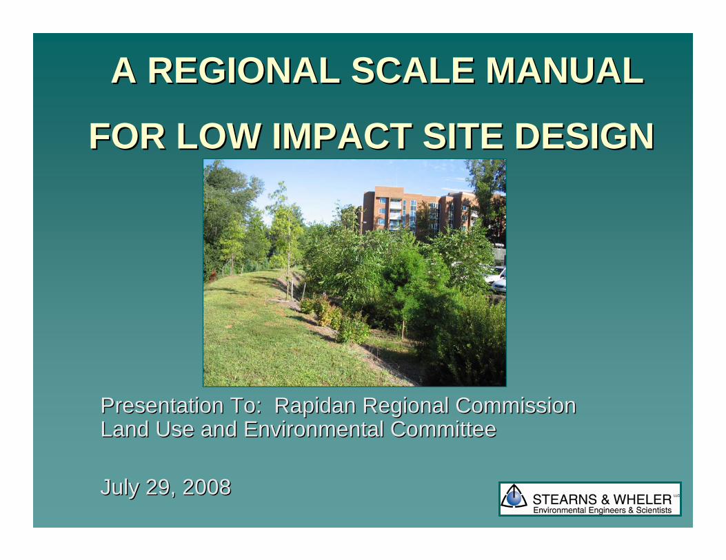
A REGIONAL SCALE MANUAL A REGIONAL SCALE MANUAL
FOR LOW IMPACT SITE DESIGNFOR LOW IMPACT SITE DESIGN
Presentation To: Rapidan Regional Commission Presentation To: Rapidan Regional Commission Land Use and Environmental CommitteeLand Use and Environmental Committee
July 29, 2008July 29, 2008
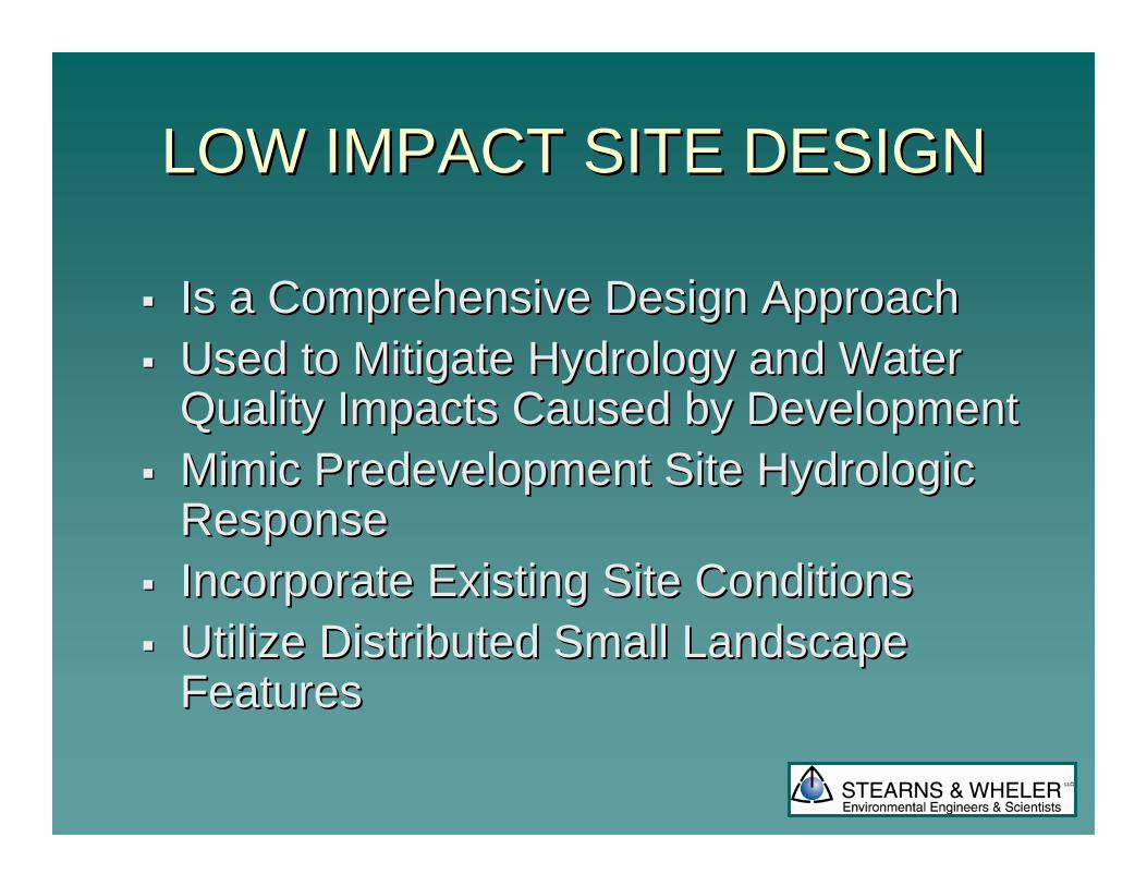
LOW IMPACT SITE DESIGNLOW IMPACT SITE DESIGN
Is a Comprehensive Design ApproachIs a Comprehensive Design ApproachUsed to Mitigate Hydrology and Water Used to Mitigate Hydrology and Water Quality Impacts Caused by DevelopmentQuality Impacts Caused by DevelopmentMimic Predevelopment Site Hydrologic Mimic Predevelopment Site Hydrologic ResponseResponseIncorporate Existing Site ConditionsIncorporate Existing Site ConditionsUtilize Distributed Small Landscape Utilize Distributed Small Landscape FeaturesFeatures
LID GOALS LID GOALS
Provide Improved TechnologyProvide Improved TechnologyProvide Economic Incentives that Provide Economic Incentives that Encourage Sound DevelopmentEncourage Sound DevelopmentBuild Communities Based on StewardshipBuild Communities Based on StewardshipReduce Construction and Maintenance Reduce Construction and Maintenance CostsCostsEncourage Flexibility in Regulations that Encourage Flexibility in Regulations that Promote Promote ““Smart GrowthSmart Growth””
(Courtesy Prince Georges County, 1999)(Courtesy Prince Georges County, 1999)

BIORETENTIONBIORETENTION
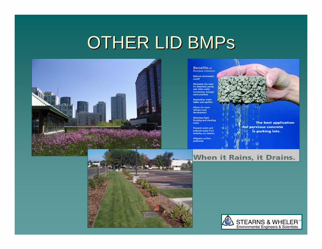
OTHER LID BMPsOTHER LID BMPs
The Northern Shenandoah Valley Regional Urban The Northern Shenandoah Valley Regional Urban Manual for Low Impact Site Design Manual for Low Impact Site Design
(A Supplement to the Virginia Stormwater Management Handbook)(A Supplement to the Virginia Stormwater Management Handbook)
The The NSVRCNSVRC’’ss GoalsGoals
Identify the Stakeholders and their needs Identify the Stakeholders and their needs Create a Regional Manual that would Create a Regional Manual that would
meet the needs of the Stakeholdersmeet the needs of the StakeholdersAllow for a range of implementation Allow for a range of implementation
mechanismsmechanisms
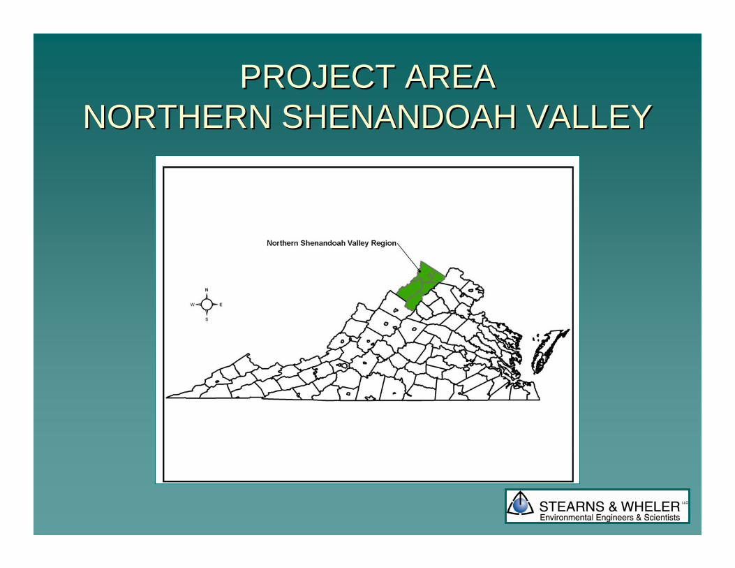
PROJECT AREAPROJECT AREANORTHERN SHENANDOAH VALLEYNORTHERN SHENANDOAH VALLEY
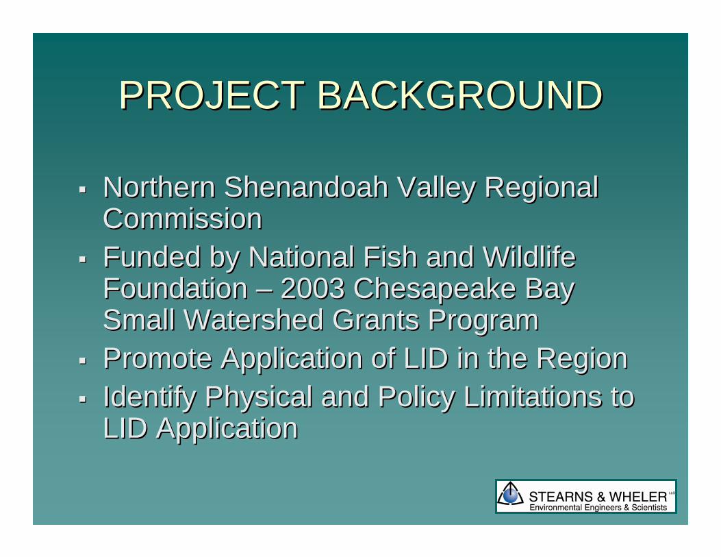
PROJECT BACKGROUNDPROJECT BACKGROUND
Northern Shenandoah Valley Regional Northern Shenandoah Valley Regional Commission Commission Funded by National Fish and Wildlife Funded by National Fish and Wildlife Foundation Foundation –– 2003 Chesapeake Bay 2003 Chesapeake Bay Small Watershed Grants ProgramSmall Watershed Grants ProgramPromote Application of LID in the RegionPromote Application of LID in the RegionIdentify Physical and Policy Limitations to Identify Physical and Policy Limitations to LID ApplicationLID Application
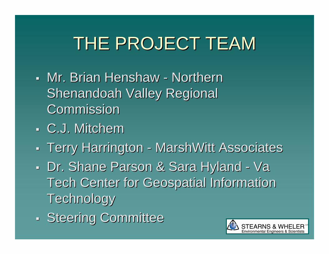
THE PROJECT TEAMTHE PROJECT TEAM
Mr. Brian Mr. Brian HenshawHenshaw -- Northern Northern Shenandoah Valley Regional Shenandoah Valley Regional CommissionCommissionC.J. MitchemC.J. MitchemTerry Harrington Terry Harrington -- MarshWittMarshWitt Associates Associates Dr. Shane Parson & Sara Hyland Dr. Shane Parson & Sara Hyland -- Va Va Tech Center for Geospatial Information Tech Center for Geospatial Information TechnologyTechnologySteering CommitteeSteering Committee
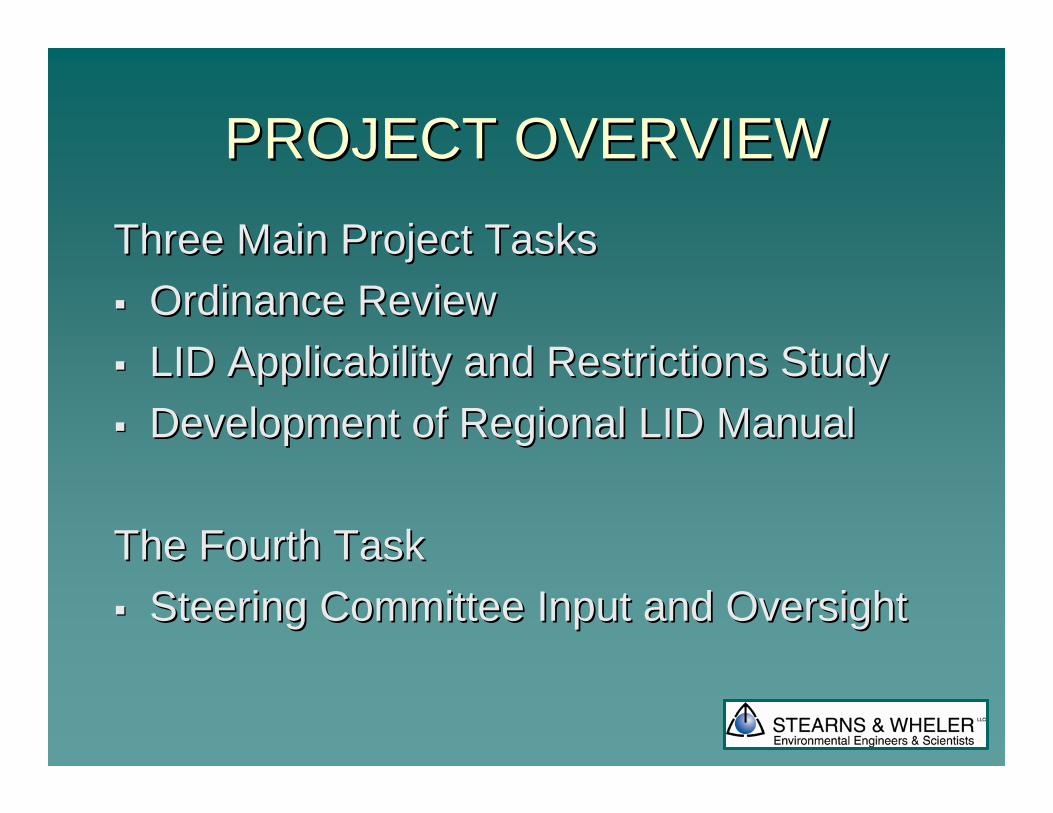
PROJECT OVERVIEWPROJECT OVERVIEWThree Main Project TasksThree Main Project Tasks
Ordinance ReviewOrdinance ReviewLID Applicability and Restrictions Study LID Applicability and Restrictions Study Development of Regional LID ManualDevelopment of Regional LID Manual
The Fourth TaskThe Fourth TaskSteering Committee Input and OversightSteering Committee Input and Oversight
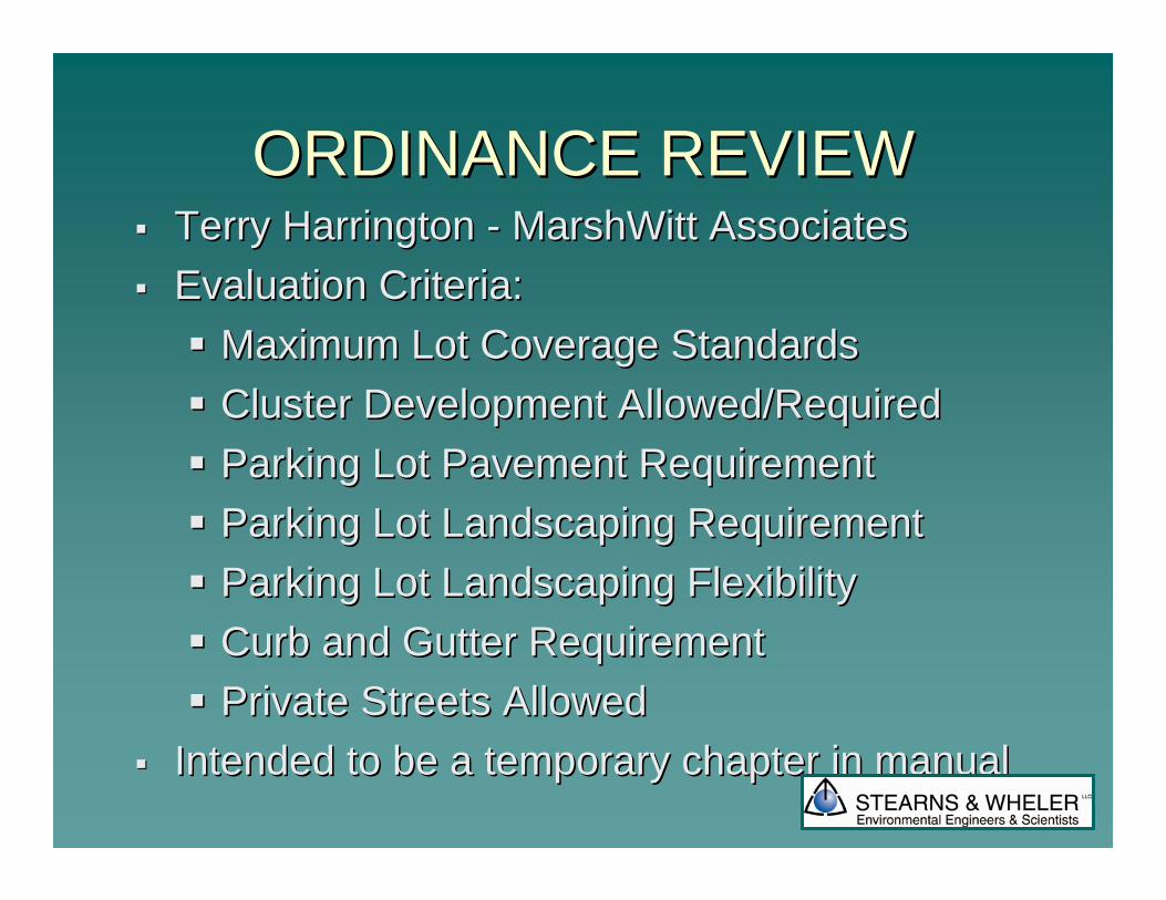
ORDINANCE REVIEWORDINANCE REVIEWTerry Harrington Terry Harrington -- MarshWittMarshWitt Associates Associates Evaluation Criteria:Evaluation Criteria:
Maximum Lot Coverage StandardsMaximum Lot Coverage StandardsCluster Development Allowed/RequiredCluster Development Allowed/RequiredParking Lot Pavement RequirementParking Lot Pavement RequirementParking Lot Landscaping RequirementParking Lot Landscaping RequirementParking Lot Landscaping FlexibilityParking Lot Landscaping FlexibilityCurb and Gutter RequirementCurb and Gutter RequirementPrivate Streets AllowedPrivate Streets Allowed
Intended to be a temporary chapter in manualIntended to be a temporary chapter in manual
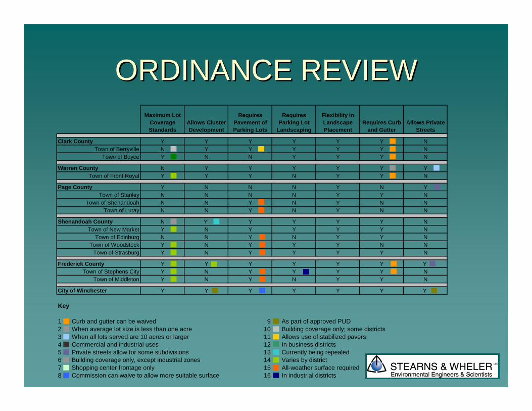
ORDINANCE REVIEWORDINANCE REVIEWMaximum Lot
Coverage Standards
Allows Cluster Development
Requires Pavement of Parking Lots
Requires Parking Lot
Landscaping
Flexibility in Landscape Placement
Requires Curb and Gutter
Allows Private Streets
Clark County Y Y Y Y Y Y NTown of Berryville N Y Y Y Y Y N
Town of Boyce Y N N Y Y Y N
Warren County N Y Y Y Y Y YTown of Front Royal Y Y Y N Y Y N
Page County Y N N N Y N YTown of Stanley N N N N Y Y N
Town of Shenandoah N N Y N Y N NTown of Luray N N Y N Y N N
Shenandoah County N Y Y Y Y Y NTown of New Market Y N Y Y Y Y N
Town of Edinburg N N Y N Y Y NTown of Woodstock Y N Y Y Y N N
Town of Strasburg Y N Y Y Y Y N
Frederick County Y Y Y Y Y Y Y Town of Stephens City Y N Y Y Y Y N
Town of Middleton Y N Y N Y Y N
City of Winchester Y Y Y Y Y Y Y
Key
1 Curb and gutter can be waived 9 As part of approved PUD2 When average lot size is less than one acre 10 Building coverage only; some districts3 When all lots served are 10 acres or larger 11 Allows use of stabilized pavers4 Commercial and industrial uses 12 In business districts5 Private streets allow for some subdivisions 13 Currently being repealed6 Building coverage only, except industrial zones 14 Varies by district 7 Shopping center frontage only 15 All-weather surface required8 Commission can waive to allow more suitable surface 16 In industrial districts
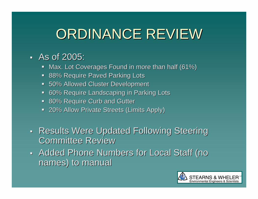
ORDINANCE REVIEWORDINANCE REVIEWAs of 2005:As of 2005:
Max. Lot Coverages Found in more than half (61%)Max. Lot Coverages Found in more than half (61%)88% Require Paved Parking Lots88% Require Paved Parking Lots50% Allowed Cluster Development 50% Allowed Cluster Development 60% Require Landscaping in Parking Lots60% Require Landscaping in Parking Lots80% Require Curb and Gutter80% Require Curb and Gutter20% Allow Private Streets (Limits Apply)20% Allow Private Streets (Limits Apply)
Results Were Updated Following Steering Results Were Updated Following Steering Committee ReviewCommittee ReviewAdded Phone Numbers for Local Staff (no Added Phone Numbers for Local Staff (no names) to manualnames) to manual
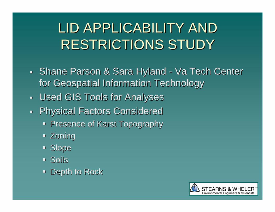
LID APPLICABILITY AND LID APPLICABILITY AND RESTRICTIONS STUDYRESTRICTIONS STUDY
Shane Parson & Sara Hyland Shane Parson & Sara Hyland -- Va Tech Center Va Tech Center for Geospatial Information Technologyfor Geospatial Information TechnologyUsed GIS Tools for AnalysesUsed GIS Tools for AnalysesPhysical Factors ConsideredPhysical Factors Considered
Presence of Presence of KarstKarst TopographyTopographyZoning Zoning SlopeSlopeSoilsSoilsDepth to RockDepth to Rock
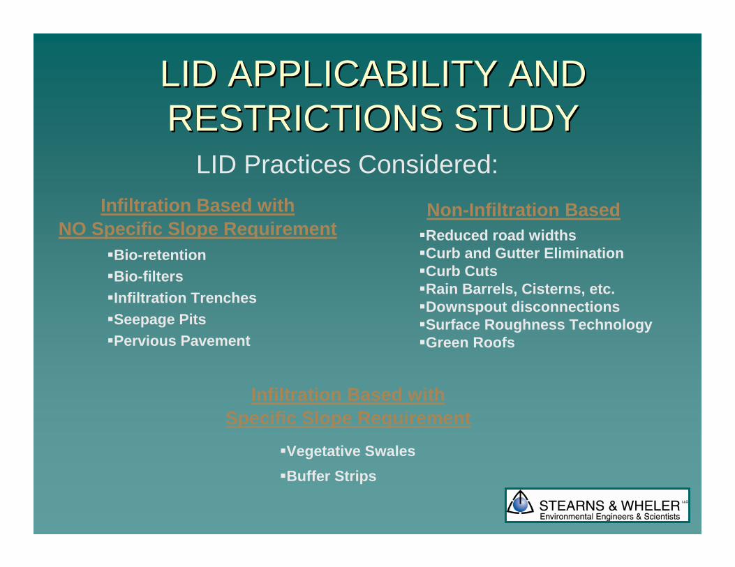
Bio-retentionBio-filtersInfiltration TrenchesSeepage PitsPervious Pavement
LID APPLICABILITY AND LID APPLICABILITY AND RESTRICTIONS STUDYRESTRICTIONS STUDY
Reduced road widthsCurb and Gutter EliminationCurb CutsRain Barrels, Cisterns, etc.Downspout disconnectionsSurface Roughness TechnologyGreen Roofs
Infiltration Based withSpecific Slope Requirement
Non-Infiltration BasedInfiltration Based withNO Specific Slope Requirement
Vegetative SwalesBuffer Strips
LID Practices Considered:
LID APPLICABILITY AND LID APPLICABILITY AND RESTRICTIONS STUDYRESTRICTIONS STUDY
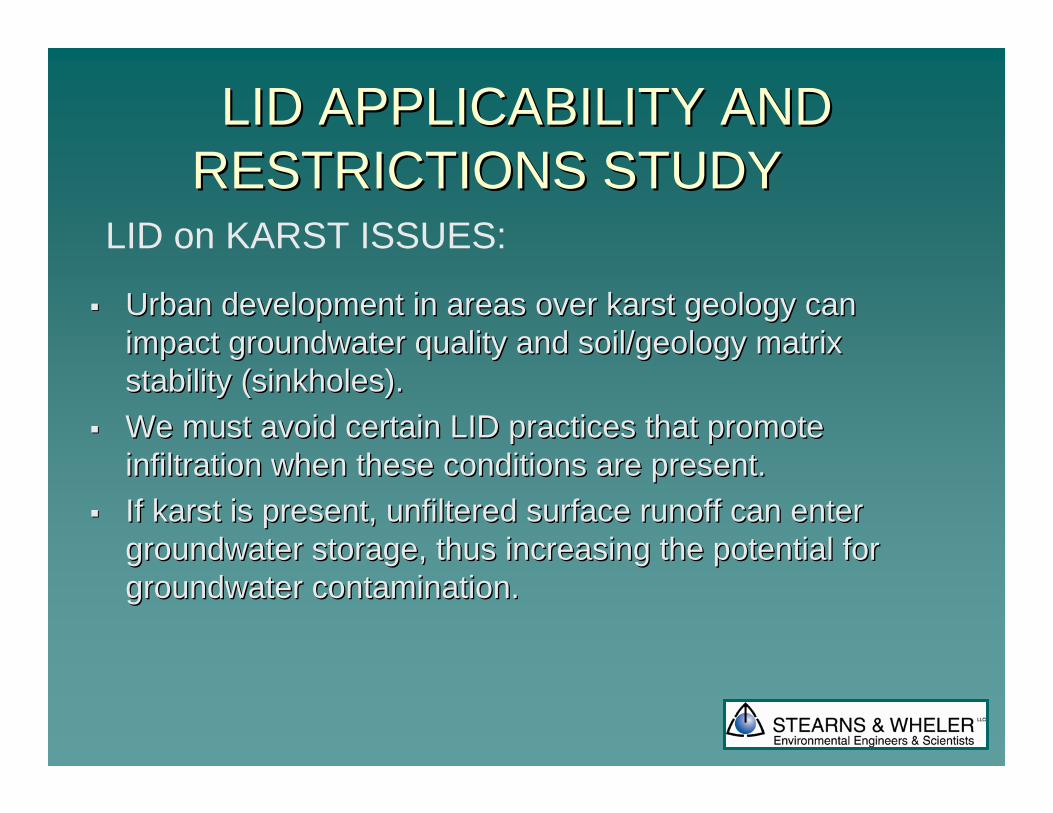
Urban development in areas over karst geology can Urban development in areas over karst geology can impact groundwater quality and soil/geology matrix impact groundwater quality and soil/geology matrix stability (sinkholes).stability (sinkholes).We must avoid certain LID practices that promote We must avoid certain LID practices that promote infiltration when these conditions are present.infiltration when these conditions are present.If karst is present, unfiltered surface runoff can enter If karst is present, unfiltered surface runoff can enter groundwater storage, thus increasing the potential for groundwater storage, thus increasing the potential for groundwater contamination.groundwater contamination.
LID on KARST ISSUES:
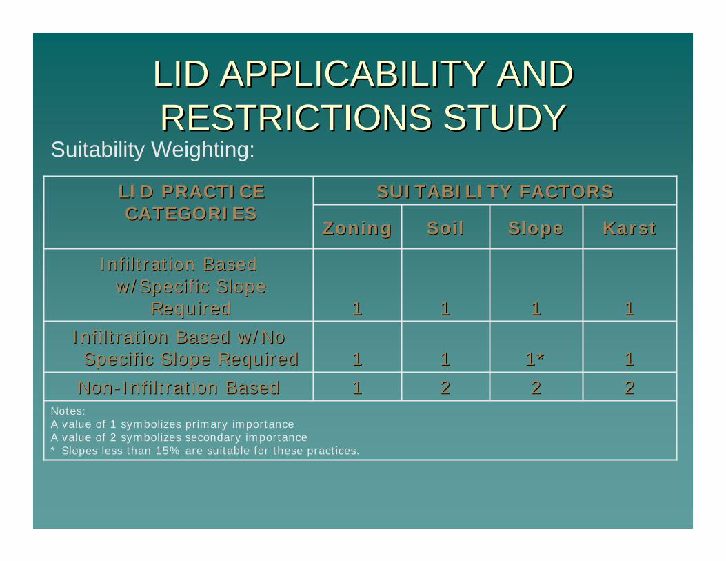
Notes:A value of 1 symbolizes primary importanceA value of 2 symbolizes secondary importance* Slopes less than 15% are suitable for these practices.
22222211NonNon--Infiltration BasedInfiltration Based
111*1*1111Infiltration Based w/No Infiltration Based w/No Specific Slope RequiredSpecific Slope Required
11111111
Infiltration Based Infiltration Based w/Specific Slope w/Specific Slope
RequiredRequired
KarstKarstSlopeSlopeSoilSoilZoningZoning
LID PRACTICE LID PRACTICE CATEGORIESCATEGORIES
SUITABILITY FACTORSSUITABILITY FACTORS
LID APPLICABILITY AND LID APPLICABILITY AND RESTRICTIONS STUDYRESTRICTIONS STUDY
Suitability Weighting:
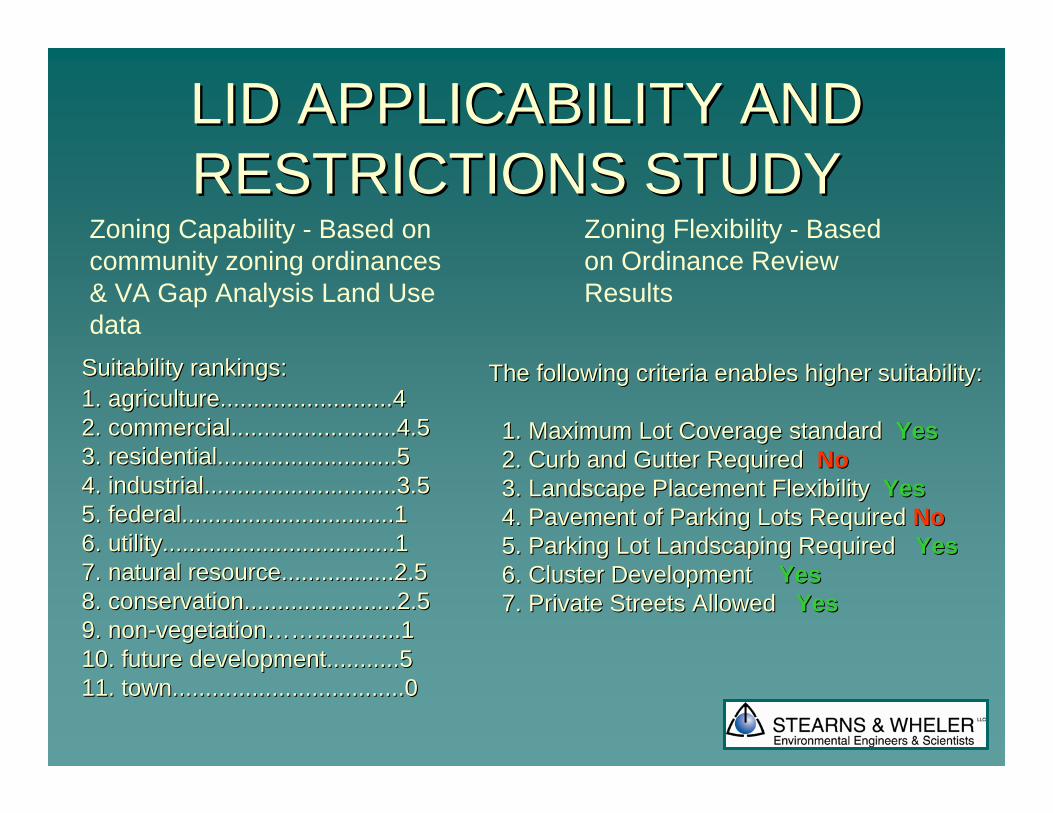
Suitability rankings:Suitability rankings:1. agriculture..........................41. agriculture..........................42. commercial.........................4.52. commercial.........................4.53. residential...........................53. residential...........................54. industrial.............................3.54. industrial.............................3.55. federal................................15. federal................................16. utility...................................16. utility...................................17. natural resource.................2.57. natural resource.................2.58. conservation.......................2.58. conservation.......................2.59. non9. non--vegetationvegetation………….............1.............110. future development...........510. future development...........511. town...................................011. town...................................0
Zoning Capability - Based on community zoning ordinances & VA Gap Analysis Land Use data
The following criteria enables higher suitability:The following criteria enables higher suitability:
1. Maximum Lot Coverage standard1. Maximum Lot Coverage standard YesYes2. Curb and Gutter Required2. Curb and Gutter Required NoNo3.3. Landscape Placement FlexibilityLandscape Placement Flexibility YesYes4. Pavement of Parking Lots Required4. Pavement of Parking Lots Required NoNo5. Parking Lot Landscaping Required5. Parking Lot Landscaping Required YesYes6. Cluster Development6. Cluster Development YesYes7. Private Streets Allowed7. Private Streets Allowed YesYes
Zoning Flexibility - Based on Ordinance Review Results
LID APPLICABILITY AND LID APPLICABILITY AND RESTRICTIONS STUDYRESTRICTIONS STUDY
LID APPLICABILITY AND LID APPLICABILITY AND RESTRICTIONS STUDYRESTRICTIONS STUDY
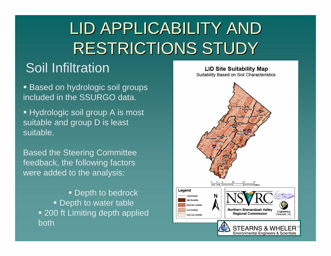
Based on hydrologic soil groups included in the SSURGO data.
Hydrologic soil group A is most suitable and group D is least suitable.
Based the Steering Committee feedback, the following factors were added to the analysis:
Depth to bedrockDepth to water table
200 ft Limiting depth applied both
Soil Infiltration
LID APPLICABILITY and LID APPLICABILITY and RESTRICTIONS STUDYRESTRICTIONS STUDY
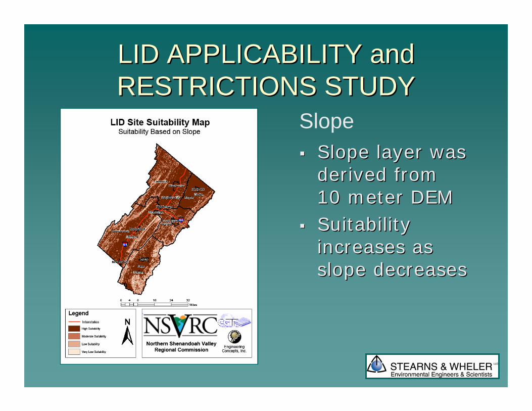
Slope layer was Slope layer was derived from derived from 10 meter DEM10 meter DEMSuitability Suitability increases as increases as slope decreasesslope decreases
Slope
LID APPLICABILITY and LID APPLICABILITY and RESTRICTIONS STUDYRESTRICTIONS STUDY
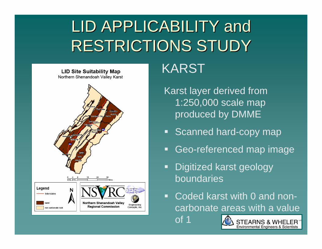
Karst layer derived from 1:250,000 scale map produced by DMME
Scanned hard-copy map
Geo-referenced map image
Digitized karst geology boundaries
Coded karst with 0 and non-carbonate areas with a value of 1
KARST
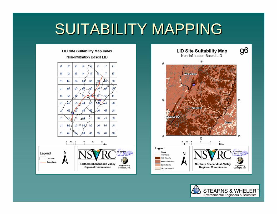
SUITABILITY MAPPINGSUITABILITY MAPPING
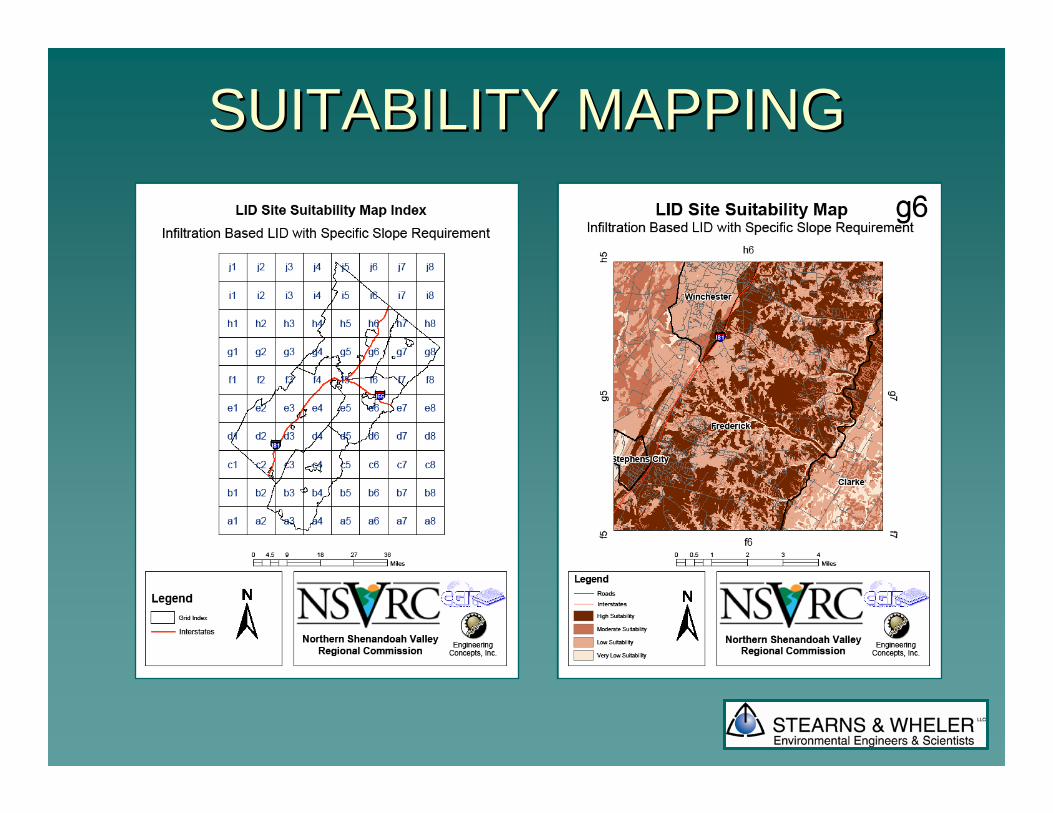
SUITABILITY MAPPINGSUITABILITY MAPPING
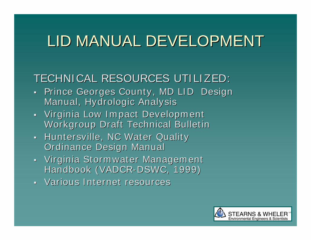
LID MANUAL DEVELOPMENTLID MANUAL DEVELOPMENT
TECHNICAL RESOURCES UTILIZED:TECHNICAL RESOURCES UTILIZED:Prince Georges County, MD LID Design Prince Georges County, MD LID Design Manual, Hydrologic AnalysisManual, Hydrologic AnalysisVirginia Low Impact Development Virginia Low Impact Development Workgroup Draft Technical BulletinWorkgroup Draft Technical BulletinHuntersville, NC Water Quality Huntersville, NC Water Quality Ordinance Design Manual Ordinance Design Manual Virginia Stormwater Management Virginia Stormwater Management Handbook (VADCRHandbook (VADCR--DSWC, 1999)DSWC, 1999)Various Internet resourcesVarious Internet resources
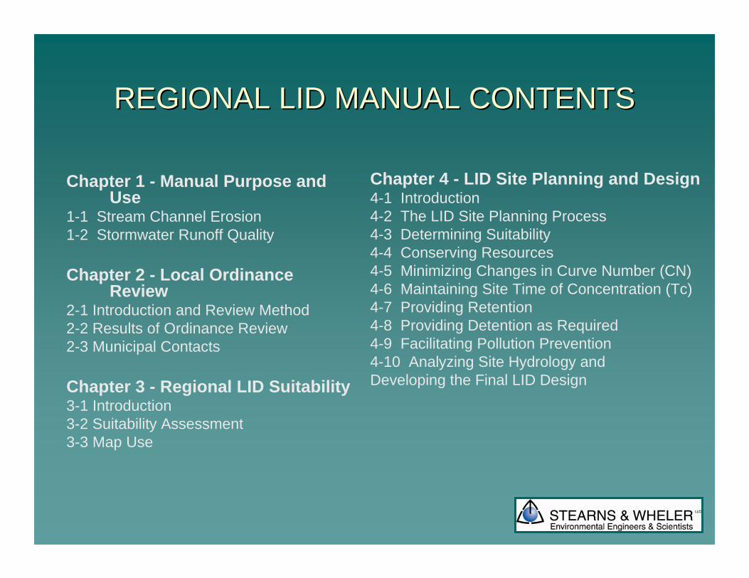
REGIONAL LID MANUAL CONTENTSREGIONAL LID MANUAL CONTENTS
Chapter 1 - Manual Purpose and Use
1-1 Stream Channel Erosion1-2 Stormwater Runoff Quality
Chapter 2 - Local Ordinance Review
2-1 Introduction and Review Method2-2 Results of Ordinance Review 2-3 Municipal Contacts
Chapter 3 - Regional LID Suitability 3-1 Introduction3-2 Suitability Assessment3-3 Map Use
Chapter 4 - LID Site Planning and Design 4-1 Introduction4-2 The LID Site Planning Process4-3 Determining Suitability 4-4 Conserving Resources 4-5 Minimizing Changes in Curve Number (CN)4-6 Maintaining Site Time of Concentration (Tc) 4-7 Providing Retention4-8 Providing Detention as Required4-9 Facilitating Pollution Prevention4-10 Analyzing Site Hydrology and Developing the Final LID Design

REGIONAL LID MANUAL CONTENTSREGIONAL LID MANUAL CONTENTS
Chapter 5 - Hydrologic Analysis Methodology for LID5-1 Introduction5-2 Summary of Hydrologic Analysis Methods5-3 Hydrologic Comparison Between Conventional and LID Approaches5-4 LID Hydrologic Analysis Methodology (Prince George’s County
Chapter 6 - LID BMP Minimum Standards6-1 Bioretention Basins6-2 Bioretention Filters6-3 Infiltration Trenches 6-4 Vegetative Swales6-5 Vegetated Filter Strips 6-6 Level Spreaders6-7 Roof System BMPs
6-8 Roof Water Retention (Rain Barrels and Cisterns)6-9 Roof Downspout Infiltration Systems6-10 Roof Downspout Disconnections6-11 Green Roofs6-12 Other Roadway and Parking Lot BMPs6-13 Porous Pavement6-14 Reduced Road Widths6-15 Curb and Gutter Elimination6-16 Curb Cuts6-17 Surface Roughening6-18 Manufactured BMP Systems
Chapter 7 - Incentives to Utilize LID for Stormwater Management7-1 Environmental Incentives7-2 Financial Incentives7-3 Other Incentives
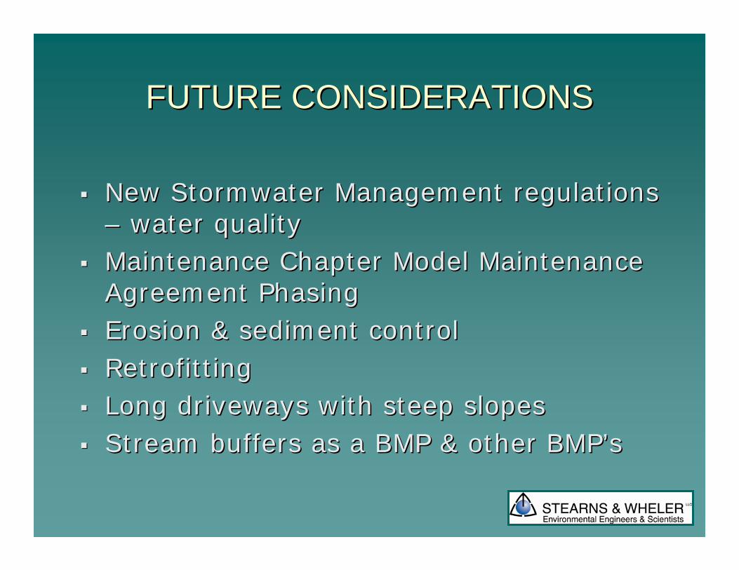
FUTURE CONSIDERATIONSFUTURE CONSIDERATIONS
New New StormwaterStormwater Management regulations Management regulations –– water qualitywater qualityMaintenance Chapter Model Maintenance Maintenance Chapter Model Maintenance Agreement PhasingAgreement PhasingErosion & sediment controlErosion & sediment controlRetrofittingRetrofittingLong driveways with steep slopesLong driveways with steep slopesStream buffers as a BMP & other Stream buffers as a BMP & other BMPBMP’’ss
Questions?Questions?