May 15, 2009 Texas A&M University - Corpus Christi Fiscal Forum 1.
Upload
ricky-battCategory
view
213download
0
A Microwave Retrieval Algorithm of Above-Cloud Electric Fields
Michael J. PetersonThe University of Utah
Chuntao LiuTexas A & M University – Corpus Christi
Douglas MachGlobal Hydrology and Climate Center
Wiebke Deierling Christina Kalb
National Center for Atmospheric Research

The Global Electric Circuit (GEC)
Ionosphere
FairWeatherCurrents
WilsonCurrents
250 kV
0 VGround

How is the GEC Studied?
• Direct E field observations
• Limited domain and sample size
• Continuous global observations
• Thunderstorms only

Goal
• To create an algorithm that can estimate above-cloud electric fields that uses commonly-available global satellite productso Passive microwave
- SSMI
- TMI
- GMI
o Radar- TRMM PR
- GPM DPR

Objectives
• To provide a unique tool for examining:o Individual cases and global electricityo Long-term variations in global electricityo Relative contributions of different cloud types to the
GEC
• To provide validation for the FESD:ECCWES effort

Theoretical Basis
Ice Particle Collisions
Hydrometeor Charging
Charge Separatio
n
Wilson Currents
GEC

Theoretical Basis
Ice Particle Collisions
Hydrometeor Charging
Charge Separatio
n
Wilson Currents
Collision Frequency
Ice Concentration
. . .
GEC

Theoretical Basis
Ice Particle Collisions
Hydrometeor Charging
Charge Separatio
n
Wilson Currents
GEC
Collision Frequency
Ice Concentration
37 GHz and 85 GHz Passive Microwave
Observations
. . .
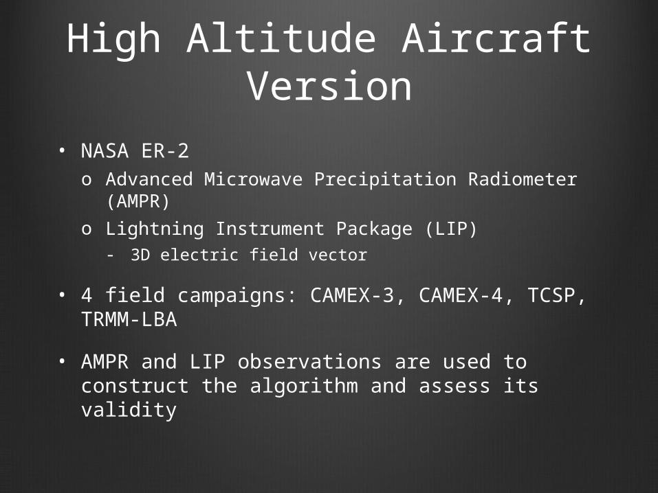
High Altitude Aircraft Version
• NASA ER-2o Advanced Microwave Precipitation Radiometer
(AMPR)o Lightning Instrument Package (LIP)
- 3D electric field vector
• 4 field campaigns: CAMEX-3, CAMEX-4, TCSP, TRMM-LBA
• AMPR and LIP observations are used to construct the algorithm and assess its validity

How the Algorithm Works
10 km
5 km
0 km
20 km
200 K
qi
Coulomb’s law:

How the Algorithm Works
10 km
5 km
0 km
20 km
260 K 200 K 150 K 200 K 250 K 270 K 290 K 280 K250 K250 K270 K300 K300 K 300 K 300 K

How the Algorithm Works
10 km
5 km
0 km
20 km
qnet i
260 K 200 K 150 K 200 K 250 K 270 K 290 K 280 K250 K250 K270 K300 K300 K 300 K 300 K

How the Algorithm Works
10 km
5 km
0 km
qnet i hi
260 K 200 K 150 K 200 K 250 K 270 K 290 K 280 K250 K250 K270 K
|qnet i| = f (Tb i)
20 km
hi = f (Tb i)

How the Algorithm Works
10 km
5 km
0 km
ri
260 K 200 K 150 K 200 K 250 K 270 K 290 K 280 K250 K250 K270 K
20 km
|qnet i| = f (Tb i)hi = f (Tb i)
hi
qnet i
Coulomb’s law:

How the Algorithm Works
10 km
5 km
0 km
ri
260 K 200 K 150 K 200 K 250 K 270 K 290 K 280 K250 K250 K270 K
20 km
|qnet i| = f (Tb i)hi = f (Tb i)
hi
qnet i
Coulomb’s law:

How the Algorithm Works
10 km
5 km
0 km
ri
260 K 200 K 150 K 200 K 250 K 270 K 290 K 280 K250 K250 K270 K
20 km
|qnet i| = f (Tb i)hi = f (Tb i)
hi
qnet i
Coulomb’s law:

Algorithm Performance Over Land
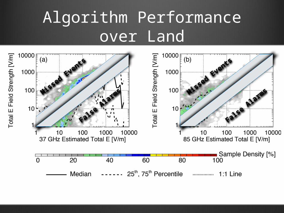
Algorithm Performance over Land
Miss
ed Eve
nts
False
Ala
rms M
issed E
vents
False
Ala
rms

Example Case

Missed Event Case

False Alarm Case

Overall Performance over Land
|Error|< 100%
Missed Events
False Alarms
37 GHzShower clouds
> 100 V/m40.3 % 53.2 % 6.4 %
Storm clouds> 100 V/m 41.7 % 47.1 % 11.2 %
85 GHZShower clouds
> 100 V/m68.2 % 17.5 % 14.4 %
Storm clouds> 100 V/m 69.5 % 7.4 % 23.2 %

Satellite Version
• Tropical Rainfall Measuring Mission (TRMM)o TRMM Microwave Imager (TMI)o Precipitation Radar (PR)o Lightning Imaging Sensor (LIS)
• Designed to take advantage of unique sensor packageo Radar-based estimate of charge heighto Radar-based stratiform/convective partitioning

Satellite Version
10 km
5 km
0 km
hi
260 K 200 K 150 K 200 K 250 K 280 K250 K250 K270 K
|qnet i| = f (Tb i)
20 km
hi = max ht of 30 dBZ
qnet i

1998 Distribution of LIS Lightning Flashes
1998 Distribution of Total Proxy E (stratiform scaling: 10%)
Comparison with LIS Lightning

Comparison with LIS Lightning
1998 Diurnal LIS Lightning Distribution
1998 Diurnal Proxy E Distribution over Land (stratiform scaling: 10%)

Comparison with LIS Lightning
1998 Diurnal LIS Lightning Distribution
1998 Diurnal Proxy E Distribution over Land (stratiform scaling: 10%)

Comparison with LIS Lightning
1998 Diurnal LIS Lightning Distribution
1998 Diurnal Proxy E Distribution over Land (stratiform scaling: 10%)

Conclusions
• The high altitude aircraft version can produce reasonable estimates of electric fields above convective clouds and clouds with significant electric fields
• The algorithm in its present form cannot adequately characterize electric fields above stratiform clouds and convection near large stratiform regionso Particularly a problem for oceanic regions and mature
MCS’s over land
• Passive microwave estimates of global electricity over land lead to similar spatial and temporal distributions compared to LIS lightning frequency

Next Steps
• Apply new dynamic stratiform scaling factor to prevent stratiform bias in convective pixel calculations (6,000 TRMM orbits processed)
• Incorporate ground-based radar observations into the high-altitude aircraft dataset
• Explore the feasibility of using a microwave-based convective/stratiform partitioning scheme
• Determine whether a combined 85 GHz/37 GHz charge proxy would have more skill than considering each frequency independently
• Apply algorithm to entire 16-year TRMM dataset

Proxy E E Transfer Functions

Stratiform Scaling1998 Distribution of Total Proxy E (stratiform scaling: 100%)
1998 Distribution of Total Proxy E (stratiform scaling: 0%)