A guide walks and hikes around the Lake Taupo District · To commemorate Miss Margaret Sweeney’s...
48
A guide to walks and hikes around the Lake Taupo District
Transcript of A guide walks and hikes around the Lake Taupo District · To commemorate Miss Margaret Sweeney’s...
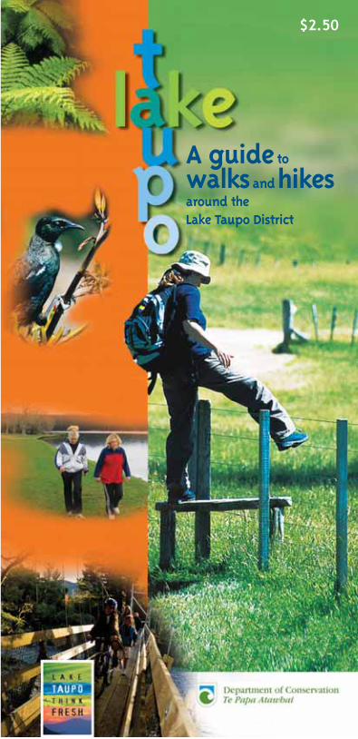
A guideto
walksandhikesaround the Lake Taupo District
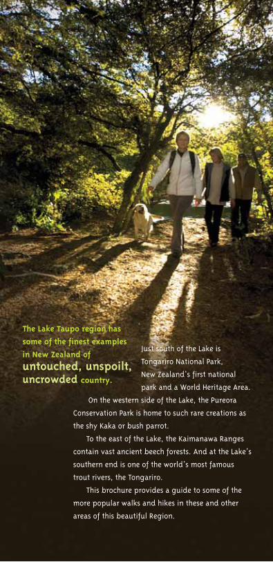
Just south of the Lake is
Tongariro National Park,
New Zealand’s first national
park and a World Heritage Area.
On the western side of the Lake, the Pureora
Conservation Park is home to such rare creations as
the shy Kaka or bush parrot.
To the east of the Lake, the Kaimanawa Ranges
contain vast ancient beech forests. And at the Lake’s
southern end is one of the world’s most famous
trout rivers, the Tongariro.
This brochure provides a guide to some of the
more popular walks and hikes in these and other
areas of this beautiful Region.
The Lake Taupo region has
some of the finest examples
in New Zealand of
untouched, unspoilt,uncrowded country.
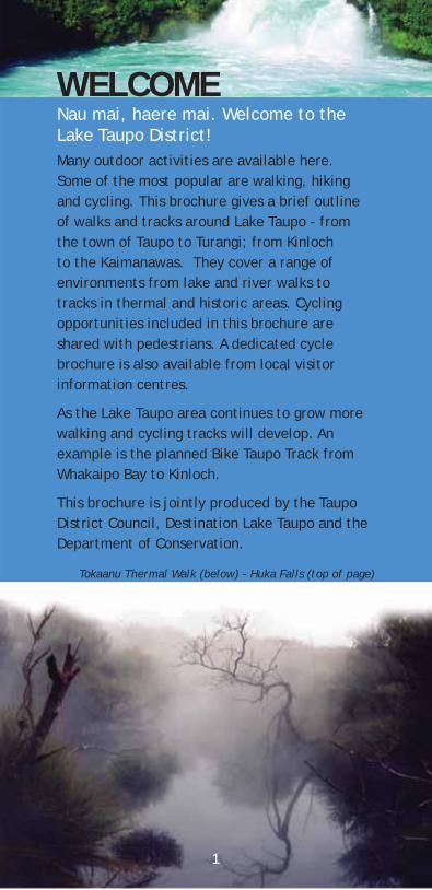
WELCOMENau mai, haere mai. Welcome to the Lake Taupo District! Many outdoor activities are available here. Some of the most popular are walking, hiking and cycling. This brochure gives a brief outline of walks and tracks around Lake Taupo - from the town of Taupo to Turangi; from Kinloch to the Kaimanawas. They cover a range of environments from lake and river walks to tracks in thermal and historic areas. Cycling opportunities included in this brochure are shared with pedestrians. A dedicated cycle brochure is also available from local visitor information centres.
walking and cycling tracks will develop. An example is the planned Bike Taupo Track from Whakaipo Bay to Kinloch.
This brochure is jointly produced by the Taupo District Council, Destination Lake Taupo and the Department of Conservation.
1
Tokaanu Thermal Walk (below) - Huka Falls (top of page)
As the Lake Taupo area continues to grow more
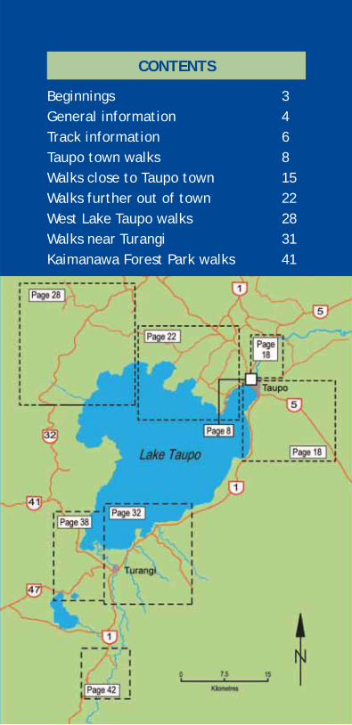
CONTENTS
2
Beginnings 3General information 4Track information 6Taupo town walks 8Walks close to Taupo town 15Walks further out of town 22
28Walks near Turangi 31Kaimanawa Forest Park walks 41
West Lake Taupo walks
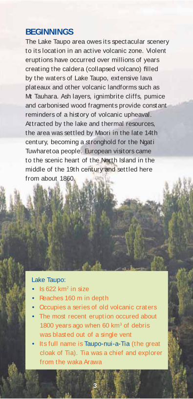
BEGINNINGS
eruptions have occurred over millions of years creating the caldera (collapsed volcano) lled by the waters of Lake Taupo, extensive lava plateaux and other volcanic landforms such as Mt Tauhara. Ash layers, ignimbrite cliffs, pumice and carbonised wood fragments provide constant reminders of a history of volcanic upheaval.Attracted by the lake and thermal resources, the area was settled by Maori in the late 14th century, becoming a stronghold for the Ngati Tuwharetoa people. European visitors came to the scenic heart of the North Island in the middle of the 19th century and settled here from about 1860.
Lake Taupo:• Is 622 km2 in size• Reaches 160 m in depth• Occupies a series of old volcanic craters • The most recent eruption occured about
1800 years ago when 60 km3 of debris was blasted out of a single vent
• Its full name is Taupo-nui-a-Tia (the great cloak of Tia). Tia was a chief and explorer from the waka Arawa
3
The Lake Taupo area owes its spectacular scenery to its location in an active volcanic zone. Violent

FOR FURTHER INFORMATION
Taupo i-SITE Visitor Centre Tongariro Street, TaupoPhone: +64 7 376 0027 Fax: +64 7 378 9003Email: [email protected]
Turangi i-SITE Visitor CentreNgawaka Place, TurangiPhone: +64 7 386 8999 Fax: +64 7 386 0074Email: [email protected]
Taupo District CouncilRi e Range Road, TaupoPhone: +64 7 376 0899 Fax: +64 7 378 0118Email: [email protected]
Department of Conservation
Taupo Field Centre P 0 Box 528, Taupo Phone: +64 7 378 3885 Fax: +64 7 378 3886
Tongariro/Taupo Conservancy Turanga Place, Turangi Phone: +64 7 386 8607 Fax: +64 7 386 7086
Pureora Field CentreRD 7, Te KuitiPhone: +64 7 878 1080 Fax: +64 7 878 1081
www.doc.govt.nz
Lake Taupo OnlineVisit us before you arrive. Check out the following websites for more ideas on what to see and do around Lake Taupo.www.LakeTaupoNZ.comEmail: [email protected]
Bike Taupowww.biketaupo.org.nz
4
ADDITIONAL PUBLICATIONS
• Kaimanawa Forest Park Map and brochure
• Tongariro National Park Map
• NZMS 260 maps: Tongariro, Ruapehu, Kaimanawa and Pureora
• Pureora Forest Park brochure
• Cycling around Lake Taupo brochure
Available from Department of Conservation of ces, visitor centres and some sport shops.
5
Whakamoenga Point
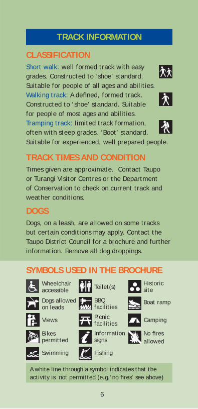
TRACK INFORMATION
CLASSIFICATIONShort walk: well formed track with easy grades. Constructed to ‘shoe’ standard. Suitable for people of all ages and abilities.Walking track: A de ned, formed track. Constructed to ‘shoe’ standard. Suitable for people of most ages and abilities.Tramping track: limited track formation, often with steep grades. ‘Boot’ standard. Suitable for experienced, well prepared people.
TRACK TIMES AND CONDITIONTimes given are approximate. Contact Taupo or Turangi Visitor Centres or the Department of Conservation to check on current track and weather conditions.
DOGSDogs, on a leash, are allowed on some tracks but certain conditions may apply. Contact the Taupo District Council for a brochure and further information. Remove all dog droppings.
SYMBOLS USED IN THE BROCHUREWheelchair accessible
Dogs allowed on leads
Views
Bikes permitted
Swimming Fishing
Toilet(s)
BBQ facilities
Picnic facilities
Information signs
Boat ramp
Camping
Historic site
No res allowed
A white line through a symbol indicates that the activity is not permitted (e.g.‘no res’ see above)
6
ESSENTIAL GEAR LISTThe following should always be carried
• Waterproof raincoat and warm clothing
• Suncream and sunglasses
• Sunhat and a warm hat
• Drinking water and food
THINK SAFE• Let a reliable person know your walking
plans. Check in with them on your return. If you are overdue they should call the police
• Always lock your car and don’t leave valuables inside it
• Drive with extra care on unsealed or icy roads
Protect plants and animals
Remove rubbish
Bury toilet waste
Keep streams and lakes clean
Take care with re
Keep to the track
Consider others
Respect our cultural heritage
Enjoy your visit
Toitu te whenua (Leave the land undisturbed)
ENVIRONMENTAL CARE CODE
7
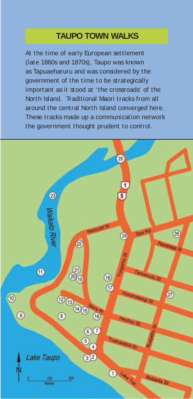
TAUPO TOWN WALKS
At the time of early European settlement (late 1860s and 1870s), Taupo was known as Tapuaeharuru and was considered by the government of the time to be strategically important as it stood at ‘the crossroads’ of the North Island. Traditional Maori tracks from all around the central North Island converged here. These tracks made up a communication network the government thought prudent to control.
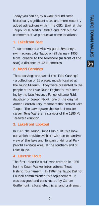
Today you can enjoy a walk around some historically signi cant sites and more recently added attractions within the CBD. Start at the Taupo i-SITE Visitor Centre and look out for commemorative plaques at some locations.
1. Lakefront Seat
To commemorate Miss Margaret Sweeney’s swim across Lake Taupo on 29 January 1955 from Tokaanu to the foreshore (in front of the seat) a distance of 42 kilometres.
2. Maori Carvings
These carvings are part of the ‘Reid Carvings’ - a collection of 51 pieces, mostly located at the Taupo Museum. They were presented to the people of the Lake Taupo Region for safe keep-ing by the late Mrs Lucy Rongoheikume Reid, daughter of Joseph Rickit, one of the original Armed Constabulary members that settled Lake Taupo. The carvings are the work of master carver, Tene Waitere, a survivor of the 1886 Mt Tarawera eruption.
3. Lakefront Lookout
In 1961 the Taupo Lions Club built this look-out which provides visitors with an expansive view of the lake and Tongariro National Park (World Heritage Area) at the southern end of Lake Taupo.
4. Electric TroutThe rst ‘electric trout’ was created in 1985 for the Dawn Walker International Trout Fishing Tournament. In 1999 the Taupo District Council commissioned this replacement. It was designed and constructed by Callum Guillemont, a local electrician and craftsman.
TAU
PO TO
WN
WA
LKS
9
5. Pakete Lions Cobb & Co Express The monorail train on the South Domiain is owned by the Pakeke Lions Club and operates as a fundraising venture. The train, locally designed and built, began operating in 1993.
6. South Domain Gardens and CarvingsIn 1993 the Taupo District Council constructed and developed gardens and a sculpture park in the South Domain.
7. Auntie Ku’s GardenThis garden is dedicated to Auntie Ku (Miss Ellen Rickit, 1882-1958) in recognition of her years of
8. Taupo Bowling ClubThe rst school in Taupo was built on land that is now home to the Taupo Bowling Club. The private school quickly became too small for the growing population and in 1894 a new public school was built in Ruapehu Street.
9. BBQ and seating areaLocated at the Yacht Club carpark, this coin operated BBQ was built by the Taupo Lions Club in 1991. The small seating area at the river end of the carpark was constructed by Pakeke Lions in memory of past members.
10. Petersen WharfThe Petersen Wharf was constructed by the Department of Internal Affairs in memory of Lt-Cmdr Peter Petersen RNZNVR (Lake Taupo Harbourmaster from 1955 to 1978).
11. Boat HarbourWhale boats, used by the Armed Constabulary, were the rst European boats on Lake Taupo.
10
service to the people of the Lake Taupo Region.

The largest boat on the lake before 1900 was 15 m long and operated a regular passenger service across the lake to Tokaanu.
12. Taupo Rose GardenThe rose garden was established on the original Armed Constabulary dump site in a project initiated by the Rose Society in 1979. The garden is maintained by the Taupo District Council and is a popular venue for weddings and picnics.
13. Lake Taupo Museum and Art GalleryThe Lake Taupo Museum and Art Gallery occupy part of the original Post Of ce building which was constructed in 1911. This building housed the Taupo Library until December 1991. Outside the museum rests an old mill steam engine. The Museum and Art Gallery display a comprehensive collection of historical artefacts and a permanent art collection. Visiting exhibitions are a regular feature.
14. Women’s Suffrage GardenThis garden honours the women, like Kate Sheppard, who led the campaign for votes for women in 1893. The garden was created as a centennial project in 1993.
15. Old Oak Tree
This tree was planted in Story Place at least 80 years ago for John Seddon (New Zealand’s Prime Minister from 1890 to 1912).
16. Totara TreesThese three totara trees were planted in memory of New Zealand Prime Minister Norman Kirk (1923 - 1974).
11
17. Library and Information CentreThe Taupo Library was opened in 1991. The rst library was established in the 1880s by the Armed Constabulary Unit near the Redoubt. Since then the library has always been located in the vicinity of Story Place (named after Taupo’s rst mayor - Joseph Story).
18. Great Lake CentreThis centre was opened in 1992 and contains a hall, theatre, multi-purpose dressing rooms and ancillary facilities. The Great Lake Centre Library and Information Centre were designed to re ect the mountains in Tongariro National Park (World Heritage area). The buildings contain columns with timber branches and canopies to re ect trees and much of the planting around the building has blue owers to mirror the colour of Lake Taupo.
19. Landmark Canoe(Adjacent to the Taupo Police Station)
This landmark canoe was found in the Opepe area when the land was being cleared for farming. The landmark canoe was brought to this site in 1967 and with any luck may soon move into the museum! It is the property of the Rutene family who allowed the canoe to be moved from its historic site.
20. The Armed Constabulary Hall/Old Courthouse
The Courthouse was built by the Armed Constabulary in 1881 and was called the Armed Constabulary Hall before becoming the Courthouse. Discussions leading to the formation of Tongariro National Park were held here in the mid 1880s. The building was originally sited
12
behind the present Magistrate’s Court until its relocation in 1966. The building is under the protection of the Historic Places Trust and is currently home to a local Te Kohanga Reo (a pre-school facility focusing on Maori language and culture).
21. Redoubt and Powder MagazineThe Tapuaeharuru Redoubt, built around 1870 by the Armed Constabulary (AC), housed about 30 men. The AC was used to ‘put down rebellion, quell disturbances, preserve the peace, prevent robberies and other felonies, and apprehend offenders against the peace’. Their presence provided the foundation for the establishment of Taupo township. Vegetable gardens, soldiers’ tents, the mess etc were all located around the redoubt in what is now the Domain. In 1877, with the establishment of a new constabulary force, the AC went out of existence. However, the Redoubt, the trenches and a powder magazine (restored in 1966) still exist.
22. Waikato River LookoutBreathtaking lake, river, boat harbour and mountain views. The lookout was constructed by the Taupo District Council and designed by the NZ Institute of Architects during their conference in 1993 held at the Great Lake Centre.
23. Waikato RiverThis is New Zealand’s longest river (425 km) and the only outlet for Lake Taupo.
24. Scented GardenThe scented garden was donated by the Soroptomist International of Taupo with the assistance of the Taupo Lions Club.
13
25. Control GatesBuilt across the Waikato River, the Control Gates were completed in 1942. The gates control the ow of water to eight hydro electric power stations situated on the Waikato River. On average 180 m3 of water ows through the gates every second.
26. Settler’s CemeteryThis is the original Settler’s Cemetery. Amongst those who rest here are Thomas Balfour Noble, a long time proprietor of the Lake Hotel and surgeon Samuel Walker, who served with the Armed Constabulary.
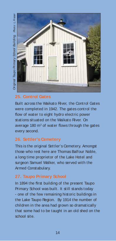
27. Taupo Primary SchoolIn 1894 the rst building of the present Taupo Primary School was built. It still stands today - one of the few remaining historic buildings in the Lake Taupo Region. By 1914 the number of children in the area had grown so dramatically that some had to be taught in an old shed on the school site.
14
Ori
gina
l Ta
upo
Prim
ary
Scho
ol B
uild
ing.
Pho
to:
L.Fr
aser
WALKS CLOSE TO TAUPO TOWN
Walkways link many of Lake Taupo’s residential streets, gullies and reserves – look out for the ‘Walkway’ signs.
Waipahihi Botanical ReserveMap: page 18. Follow SH 1 south from Taupo and turn left onto Shepherd Road (second left after the Napier/SH 5 turn-off).
The reserve (35 ha) was formed in 1966 to create a park of forest trees and plants and to be a refuge for birdlife. Of special interest are the alpine garden, lemonwood walk and the 2000 rhododendrons, azaleas and camellias.
Great Lake Walkway Taupo to Wharewaka PointTime: varies depending on which exit you take. Map: page 18.
This walkway is part of what may eventually become a track around all of Lake Taupo.
From the Lake Taupo Yacht Club follow the path beside Lake Terrace to the Taharepa Road Reserve where a paved track skirts the lake edge to Two Mile Bay then Wharewaka Point. Ideal picnic and swimming spots can be found along the way. Toilets can be found in all of the bays and there is a children’s playground and barbecue facility at Wharewaka. Return via the same track or arrange transport back to town.
WA
LKS CLOSE TO
TAU
PO TO
WN
15
There are walkways, beautiful lake and mountain views and attractive picnic areas.
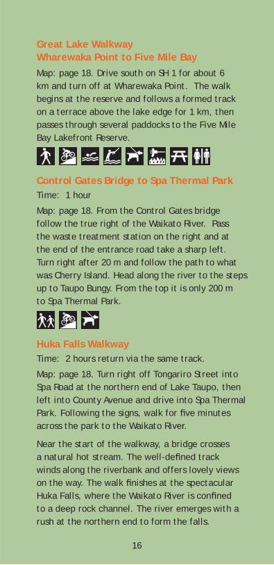
Great Lake Walkway Wharewaka Point to Five Mile BayMap: page 18. Drive south on SH 1 for about 6 km and turn off at Wharewaka Point. The walk begins at the reserve and follows a formed track on a terrace above the lake edge for 1 km, then passes through several paddocks to the Five Mile Bay Lakefront Reserve.
Control Gates Bridge to Spa Thermal ParkTime: 1 hour
Map: page 18. From the Control Gates bridge follow the true right of the Waikato River. Pass the waste treatment station on the right and at the end of the entrance road take a sharp left.
up to Taupo Bungy. From the top it is only 200 m to Spa Thermal Park.
Huka Falls WalkwayTime: 2 hours return via the same track.
Map: page 18. Turn right off Tongariro Street into
Park. Following the signs, walk for ve minutes across the park to the Waikato River.
Near the start of the walkway, a bridge crosses a natural hot stream. The well-de ned track winds along the riverbank and offers lovely views on the way. The walk nishes at the spectacular Huka Falls, where the Waikato River is con ned to a deep rock channel. The river emerges with a rush at the northern end to form the falls.
16
Turn right after 20 m and follow the path to what was Cherry Island. Head along the river to the steps
Spa Road at the northern end of Lake Taupo, then left into County Avenue and drive into Spa Thermal
A pleasant walk for the whole family. Return via the same track or arrange transport from Huka Falls carpark (across the bridge). This walk can be linked with the Aratiatia Rapids Walk.
Rotary Ride: Spa Thermal Park to Huka FallsTime: 2 hours return via the same track
Map: page 18. This is a shared bike track where walkers give way to bikes.
Follow the signs from the end of County Ave (off Spa Road). The track crosses the Otumuheke Stream approximately 200 m upstream from the Waikato River. From here the track meanders through gullies, twists around trees, runs alongside open farmland, crosses two bridged streams, passes through culverts and has great views of the Waikato River and open valleys.
Huka Falls to Aratiatia Rapids Walking TrackTime: 4 hours return via the same track
Map: page 18. Follow SH 1 north from Taupo for about 1.6 km, turn right into Huka Falls Road and follow the signs to Huka Falls. A refreshment kiosk and pay toilets are located in the carpark.
The track begins across the bridge. Head left to the last viewing area over Huka Falls. At the back of the viewing area the track climbs onto the cliff tops with magni cent views of the river. It then gradually descends and continues along the river to the Aratiatia hydro dam and rapids. Try to nish the walk when the control gates are due to open (see note in next section). Return via this route or arrange transport from Aratiatia.
17
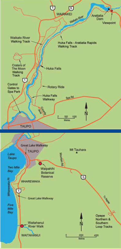
Aratiatia Rapids ViewpointA short track to three lookouts over the Aratiatia Rapids begins 50 metres from the bridge on the true right of the river. The dam’s control gates are opened several times a day to allow the rapids to ow - a spectacular sight.
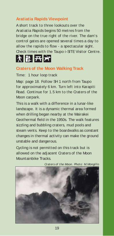
Craters of the Moon Walking TrackTime: 1 hour loop track
Map: page 18. Follow SH 1 north from Taupo for approximately 6 km. Turn left into Karapiti Road. Continue for 1.5 km to the Craters of the Moon carpark.
This is a walk with a difference in a lunar-like landscape. It is a dynamic thermal area formed when drilling began nearby at the Wairakei Geothermal eld in the 1950s. The walk features sizzling and bubbling craters, mud pools and steam vents. Keep to the boardwalks as constant changes in thermal activity can make the ground unstable and dangerous.
Cycling is not permitted on this track but is allowed on the adjacent Craters of the Moon Mountainbike Tracks.
19
Craters of the Moon. Photo: M.Mongillo
Check times with the Taupo i-SITE Visitor Centre.
Waikato River Walking TrackTime: 1 hour one wayMap: page 18. This walk begins at the Huka Falls carpark and ends at Otupo Flat. Return on the same track or arrange return transport.
Five minutes down the track there is a grassed area with a good view back to the falls. From here there is a short steep climb up to a road then the track drops again to the river and ambles along through a variety of terrain and vegetation. There are several short side tracks to points of interest along the way.
Acacia Bay Beach Walking TrackTime: Varies depending on the route taken.
Map: page 22. Follow SH 1 north across the Control Gates, turn left onto Norman Smith Street, then left into Acacia Bay Road. Turn left into Te Kopua Street and park at the end of the cul-de-sac.
Walk through patches of native bush to the lake shore then up to the reserve again. Veer right and wander through native bush until the track climbs steeply to Acacia Bay Road. The walk follows the lakeshore and is marked with Scenic Walk signs. The beach walk is also accessible from other points along Acacia Bay Road and can
Little Acacia Bay Walking TrackMap: page 22. Starts about 1 km past Te Kopua Street, heading towards Acacia Bay. The track leads downhill and then to the lake edge through native bush and opens out at Little Acacia Bay.
20
be linked with Little Acacia Bay Walk.
Rangatira Point Walking TrackTime: 1.5 hours return
Map: page 22. Follow Acacia Bay Road past the boat ramp and on for another 2 km. The track starts at the rst carpark on the left.
The track leads around the lakeshore to Totara Bay. There is a large group of pines at Te Karaka Point at the far end of the bay. A side track from this point leads back to Acacia Bay Road. The main track continues to Rangatira Point then loops back to meet the road. Excellent lake views. Vehicle access to both ends of this track.
Whakamoenga Walking TrackTime: 1 hour return via the same track
Follow Acacia Bay Road to the roadend carpark.
Map: page 22. Begin on the Rangatira Point Track. Turn right at the rst junction. An easy graded track runs through the bush beside the lake around to Whakamoenga Point. There are good views across the lake from many points along the walkway. Please respect adjacent private property by staying on the track.
Note: The Rangatira and Whakamoenga Point Tracks can be walked together (2.5 hours return).
Mapara WalkwayTime: 20 minutes return
Connects Mapara Road to the end of Brunette Drive. A boardwalked track through native planting restoration areas. Magni cent views.
21
WALKS FURTHER OUT OF TOWN
Kawakawa Bay Walking Track Time: 4 hours return
Travel north from Taupo on SH 1 over the Waikato River. At the top of the hill turn left into Poihipi Road and follow signs to Kinloch (24 km). Go past the boat marina to a parking area by the beach in Nisbett Terrace.
The track to Kawakawa Bay begins at the western end of the beach to the right of the parking area. The track entrance is signposted.
Glorious views feature as the track climbs from Whangamata Bay and sidles along the top of a broad cliff. The bush is dominated by rewarewa but look out for the giant matai too. Once you reach the rocky lookout the track drops down to Kawakawa Bay.
WA
LKS FURTH
ER OU
T OF TO
WN
Tahunatara Point Walking TrackTime: 1.5 hours return
Map: page 22. Take SH 1 north out of Taupo, cross the Control Gates, turn left onto Norman Smith Street, left onto Acacia Bay Road, and right onto Mapara Road. Follow this for 6.7 km then turn left onto the unsealed Whakaipo Bay Road. Head down towards the beach then veer left to the track signs. Park beside the fence.
The track begins across the Mapara Stream bridge. Cross the stile to the right of the bridge and follow the track markers past the boat ramp and along the lakeshore through regenerating bush. It’s an easy walk on level ground - ideal for families. There are several picnic and shing spots along the way.
At the end of the track there are views over the lake to Karangahape cliffs and the Tongariro National Park volcanoes. Walk a further ve minutes to view Tahunatara Point. Return via the same route.
Note: This track crosses private land leased by the department from the trustees of the ID2 Maori Land Trust. Please respect the landowners wishes and stay on the track.
Pho
to:
D.W
akel
in
24
Huka Falls
View from Maunganamu
Huka Falls Walkway
Craters of the MoonRangatira Point WalkPhoto: D
.Wakelin
Opepe Southern Loop
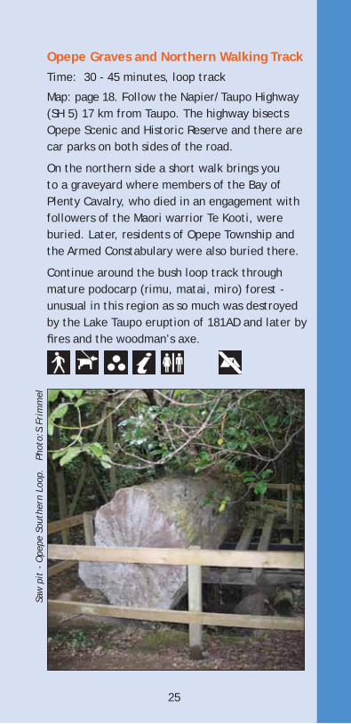
Opepe Graves and Northern Walking Track Time: 30 - 45 minutes, loop track
Map: page 18. Follow the Napier/Taupo Highway (SH 5) 17 km from Taupo. The highway bisects Opepe Scenic and Historic Reserve and there are car parks on both sides of the road.
On the northern side a short walk brings you to a graveyard where members of the Bay of Plenty Cavalry, who died in an engagement with followers of the Maori warrior Te Kooti, were buried. Later, residents of Opepe Township and the Armed Constabulary were also buried there.
Continue around the bush loop track through mature podocarp (rimu, matai, miro) forest - unusual in this region as so much was destroyed
res and the woodman’s axe.
Saw
pit
- O
pepe
Sou
ther
n Lo
op.
Pho
to:S
.Fri
mm
el
25
by the Lake Taupo eruption of 181AD and later by
26
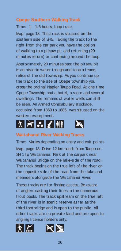
Opepe Southern Walking TrackTime: 1 - 1.5 hours, loop track
Map: page 18. This track is situated on the southern side of SH5. Taking the track to the right from the car park you have the option of walking to a pitsaw pit and returning (20 minutes return) or continuing around the loop.
Approximately 20 minutes past the pitsaw pit is an historic water trough and totara fence, relics of the old township. As you continue up the track to the site of Opepe township you cross the orginal Napier Taupo Road. At one time Opepe Township had a hotel, a store and several dwellings. The remains of water wells can still be seen. An Armed Constabulary stockade, occupied from 1869 to 1885, was situated on the western escarpment.
Waitahanui River Walking TracksTime: Varies depending on entry and exit points
Map: page 18. Drive 12 km south from Taupo on SH 1 to Waitahanui. Park at the carpark near Waitahanui Bridge on the lake-side of the road. The track begins on the true left of the river on the opposite side of the road from the lake and meanders alongside the Waitahanui River.
These tracks are for shing access. Be aware of anglers casting their lines in the numerous trout pools. The track upstream on the true left of the river is in scenic reserve as far as the third footbridge and is open to the public. All other tracks are on private land and are open to angling licence holders only.
27
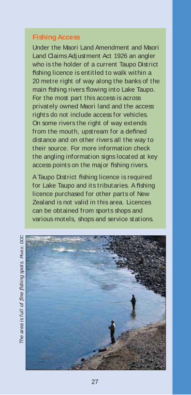
Fishing AccessUnder the Maori Land Amendment and Maori Land Claims Adjustment Act 1926 an angler who is the holder of a current Taupo District shing licence is entitled to walk within a 20 metre right of way along the banks of the main shing rivers owing into Lake Taupo. For the most part this access is across privately owned Maori land and the access rights do not include access for vehicles. On some rivers the right of way extends from the mouth, upstream for a de ned distance and on other rivers all the way to their source. For more information check the angling information signs located at key access points on the major shing rivers.
A Taupo District shing licence is required for Lake Taupo and its tributaries. A shing licence purchased for other parts of New Zealand is not valid in this area. Licences can be obtained from sports shops and various motels, shops and service stations.
The
area
is f
ull
of
ne
shi
ng s
pots
. Ph
oto:
DO
C
WEST TAUPO WALKS
Rimu Walking Track
Time: 30 minutes for the circuitMap: see below. A pleasant loop track though stunning podocarp forest. Cross the bridge at the Kakaho Campground and follow the river around to a great swimming hole. From here there is a climb up to a lookout with good views of Mount Pureora then you circle back to join the road just above the campground.
Waihora Lagoon Walking TrackTime: 20 minutes return
Map: see below. Drive up Waihora Road off SH 32. Follow the signs to the Waihora Lagoon carpark. It’s an easy, at walk in to the small rain-fed lake surrounded by immensely tall kahikatea and rimu trees.
After heavy rain the lagoon can ood into the surrounding forest effectively blocking off access to the edge of the clearing.
Waihaha Tramping Track / Waihaha HutTime: 3 hours to the hut / campsite
Map: page 28. The track starts on SH 32 beside the Waihaha River. The grade is generally easy with a few short steep sections. Initially you meander through regenerating bush before sidling upwards along the edge of the Waihaha Gorge. At the top of the gorge the track diverts away from the river and climbs over a low hill to Pokaiora Clearing - a large heathland covered in tussocks and monoao. At the far end of the clearing you enter the forest again for a 20 minute stroll through to the hut. The hut sleeps 10 and there are good tent sites in the clearing around the hut. Most people return to the carpark on the same track but there are longer routes available that follow the main Hauhangaroa Range. Talk to the Department of Conservation for more information.
Bog Inn Tramping Track / Bog Inn Hut45 minutes to the hut
Map: page 28. It’s a convoluted route to the start of the track but worth the effort. Take Kakaho Road off SH 32. Turn left just past the campground onto Tihoi Rd. After 7½ km turn right at the T-junction, then after 1½ km left on to Bog Inn Rd. Park by the timber bridge.
It’s a steady, easily graded climb to a ridge where the track south to Weraroa and Waihaha
WEST TA
UPO
WA
LKS
29
Hut turns off to the left. Five minutes on, another track branches off to the right, this time to Pureora. The main track carries on straight ahead for 10 minutes then skirts around the edge of an open boggy area to the four-bunk hut which is nestled into a small forest clearing. A short track from the hut leads out to the edge of the bog.
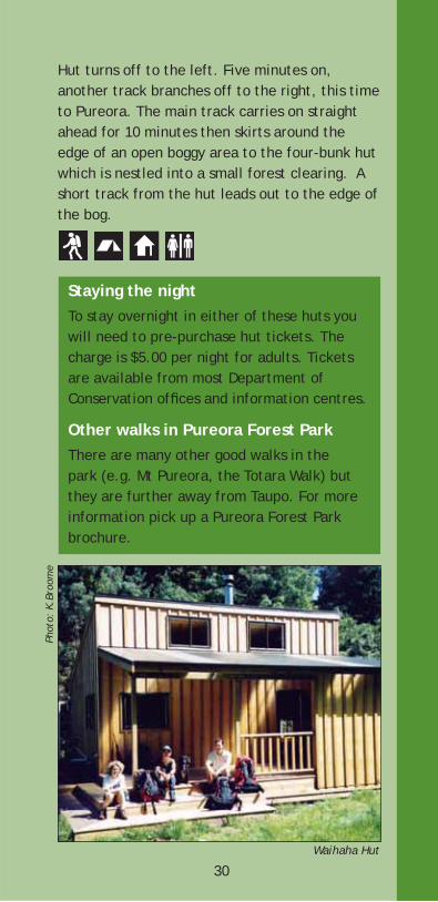
Staying the nightTo stay overnight in either of these huts you will need to pre-purchase hut tickets. The charge is $5.00 per night for adults. Tickets are available from most Department of Conservation of ces and information centres.
Other walks in Pureora Forest ParkThere are many other good walks in the park (e.g. Mt Pureora, the Totara Walk) but they are further away from Taupo. For more information pick up a Pureora Forest Park brochure.
30Waihaha Hut
Pho
to:
K.Br
oom
e
WALKS NEAR TURANGI
Motutere/Waipehi Walking TrackTime: 1.5 hours return via the same track
Map: page 32. Located approximately 22 km north of Turangi on SH 1. After passing Hallett’s Bay, then Jellicoe Point, get ready to park on the left opposite the north end of the Motutere motor camp.The track climbs through regenerating bush above SH 1. Along the way there are great views of Motutere Bay in the south, Motutaiko Island and Jellicoe Point to the north. The track descends through large kanuka trees, groves of young matipo and passes beside cliffs of volcanic ignimbrite from the Lake Taupo volcano. For a short time the track follows an old man-made terrace, once part of the main road, then crosses the Waipehi Stream. There are toilets and picnic areas at the lakeshore reserve of Jellicoe Point just across the road from the end of the track.
Walkers are advised to return via the track to Motutere or arrange to be picked up at your nishing point. This section of the main road is too busy and narrow to safely walk along.
Motuoapa Cliff Lookout Walking TrackTime: 15 - 20 minutes, return via same track
Map: page 32. Begins beside northern end of Motuoapa Lodge in Motuoapa, 10 km north of Turangi on SH 1.
The track heads up to the volcanic cliffs behind Motuoapa to a wooden viewing platform. The lookout offers excellent views
WA
LKS NEA
R TURA
NG
I
31
of Stump Bay, Motuoapa Peninsula, the South Taupo wetlands and Lake Taupo. Please treat with respect as it is of cultural importance to Ngati Tuwharetoa.
Return via the same track, or for a slight variation during the descent, continue along a path which leads to the north end of the settlement and return alongside the state highway to the track entrance.
Tauranga/Taupo River Walking TrackTime: 30 minutes, return via same track
Map: see below. Park on the south side of the Tauranga/Taupo River (about 12 km north of Turangi on SH 1). Cross the bridge, the track entrance is marked on the left at the corner.
This track follows the tranquil Tauranga/Taupo River for 15 minutes to the shore of Lake Taupo.
The beach is a great spot for picnicking, shing and swimming. Enjoy panoramic views of the Western Bays, Motutaiko Island, Taupo town and Mt Tauhara. Those wanting a longer walk can continue on along the foreshore toward the lakefront settlement of Waitetoko. The rst public access to SH 1 is at Mac’s Road 10-15 minutes along the beach.
Tauranga/Taupo Reserve Walking TrackTime: 30 minutes, return via same track
Map: page 32. Turn off SH 1 onto Heuheu Parade on the south side of the Tauranga/Taupo River at Oruatua, 12 km north of Turangi. Then turn left into Kopua Street and follow the unpaved one way road to a grassy lakeside clearing. A sign at the clearing’s entrance marks the start of this track which winds through the bush reserve towards Oruatua. After about 10 minutes the track branches. The options are to continue on to Oruatua Avenue (5 minutes) or take the right branch and walk for 15 minutes to the lake.
The main track leads to Oruatua Avenue. From here, either return via the same track or follow the road 500 m to the beach at Oruatua. Shade trees make this a popular picnic spot in summer.
The track can also be walked south to north from Oruatua Avenue through to the river. From SH 1 it is less than 100 m down Oruatua Avenue to the grassed accessway on the right leading to the track entrance. Once the northern end of the track is reached it is a short walk along the beach to the Tauranga/Taupo River mouth.
33
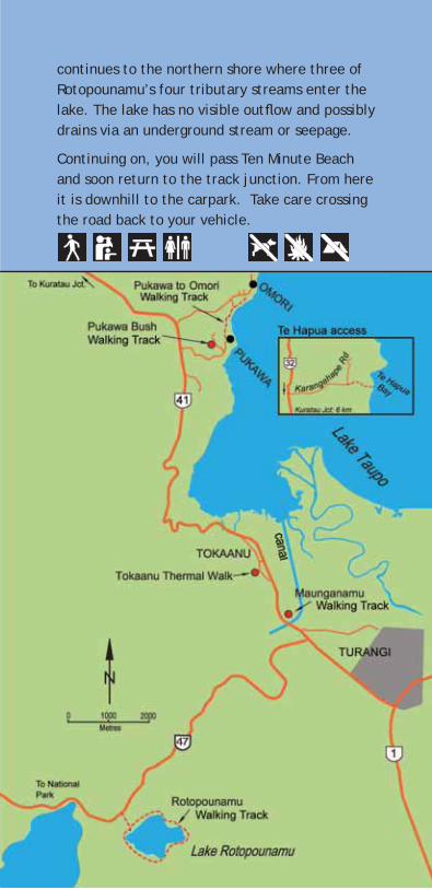
Te HapuaTime: 45 minutes to walk to the bay
Map: page 38. Access by boat or from Karangahape Road (off SH 32) along a poled easement through farmland to the reserve.
Te Hapua (or ‘Scenic Bay’) on the western shore of Lake Taupo is ideally reached by boat. From the lake edge it takes 15 minutes to walk up to a viewpoint just below the farmland, or 10 minutes to reach a bay to the south. Te Hapua Reserve is intended for day visitors.
Pukawa Bush Walking TrackTime: 45 minutes, loop track
Map: page 38. Begins on Hauraki Terrace (off Pukawa Road); the entrance is just past Rereao Lane. The track is usually walked in an anti-clockwise direction.
The track climbs up through Pukawa Bush above the village on a well graded route. A short way up there is a lookout with views over the village and lake. The lush podocarp forest contains large rimu, matai and totara trees. Birdlife is a feature of this area; bellbirds and tui in particular frequent this part of the bush.
The bush gradually changes to a rewarewa/kamahi forest and near the top opens out to a magni cent view of Lake Taupo and the surrounding countryside. Descending again, the last part of the track follows the route of the old Pukawa Road. The track ends on Rereao Lane which you can follow back to your starting point.
34
Pukawa to Omori Walking Track
Time: 1 hour 20 minutes, return via same track
Map: page 38. Begins at end of Kaiuru Avenue in Pukawa village (15 minutes drive west of Turangi – signposted to the right off SH 41).
The track wanders through the bush along the edge of Lake Taupo. Bellbird and tui may be seen in the trees above and from time to time there are glimpses of nearby Lake Taupo. The track emerges onto the shingle beach and picnic area at Omori Reserve.
The reserve is notable for kowhai trees which create a splash of bright yellow when owering. Aluminium bands have been placed around some kohuhu trees to prevent possums from climbing up to eat the palatable native mistletoe.
The track continues on over the Omori Stream where in winter spawning trout may be seen. Another 10 minute walk sees the end of the track at the Omori Boat Ramp.
35
Pukawa to Omori
Photo: J.Johnson
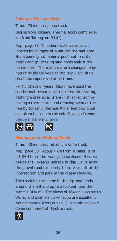
Tokaanu Thermal WalkTime: 20 minutes, loop track
Begins from Tokaanu Thermal Pools complex (6 km from Turangi on SH 41).
Map: page 38. This short walk provides an interesting glimpse of a natural thermal area. See steaming hot mineral pools set in sinter basins and spluttering mud pools amidst the native bush. Thermal areas are changeable by nature so please keep to the track. Children should be supervised at all times.
For hundreds of years, Maori have used the geothermal resources of this area for cooking, bathing and leisure. Share in this tradition by having a therapeutic and relaxing swim at the nearby Tokaanu Thermal Pools. Rainbow trout can often be seen in the cold Tokaanu Stream beside the thermal area.
Maunganamu Walking TrackTime: 40 minutes, return via same track
Map: page 38. About 4 km from Turangi, turn off SH 41 into the Maunganamu Scenic Reserve beside the Tokaanu Tailrace bridge. Drive along the gravel road for nearly 1 km. Veer left at the intersection and park in the grassy clearing.
The track begins at the bush edge and leads around the hill and up to a lookout near the summit (490 m). The views of Tokaanu, across to Waihi, and southern Lake Taupo are excellent. Maunganamu (‘Mosquito Hill’) is an old volcanic dome composed of rhyolite rock.
36
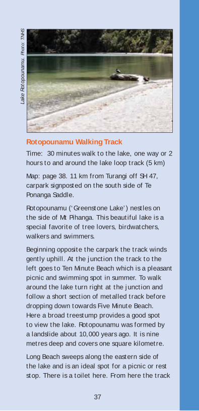
Rotopounamu Walking TrackTime: 30 minutes walk to the lake, one way or 2 hours to and around the lake loop track (5 km)
Map: page 38. 11 km from Turangi off SH 47, carpark signposted on the south side of Te Ponanga Saddle.
Rotopounamu (‘Greenstone Lake’) nestles on the side of Mt Pihanga. This beautiful lake is a special favorite of tree lovers, birdwatchers, walkers and swimmers.
Beginning opposite the carpark the track winds gently uphill. At the junction the track to the left goes to Ten Minute Beach which is a pleasant picnic and swimming spot in summer. To walk around the lake turn right at the junction and follow a short section of metalled track before dropping down towards Five Minute Beach. Here a broad treestump provides a good spot
metres deep and covers one square kilometre.
Long Beach sweeps along the eastern side of the lake and is an ideal spot for a picnic or rest stop. There is a toilet here. From here the track
37
Lake
Rot
opou
nam
u. P
hoto
: TN
HS
a landslide about 10,000 years ago. It is nine to view the lake. Rotopounamu was formed by
continues to the northern shore where three of Rotopounamu’s four tributary streams enter the lake. The lake has no visible out ow and possibly drains via an underground stream or seepage.
Continuing on, you will pass Ten Minute Beach and soon return to the track junction. From here it is downhill to the carpark. Take care crossing the road back to your vehicle.
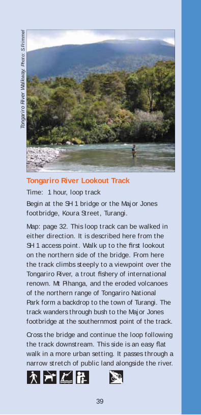
Tongariro River Lookout TrackTime: 1 hour, loop track
Begin at the SH 1 bridge or the Major Jones footbridge, Koura Street, Turangi.
Map: page 32. This loop track can be walked in either direction. It is described here from the SH 1 access point. Walk up to the rst lookout on the northern side of the bridge. From here the track climbs steeply to a viewpoint over the Tongariro River, a trout shery of international renown. Mt Pihanga, and the eroded volcanoes of the northern range of Tongariro National Park form a backdrop to the town of Turangi. The track wanders through bush to the Major Jones footbridge at the southernmost point of the track.
Cross the bridge and continue the loop following the track downstream. This side is an easy at walk in a more urban setting. It passes through a narrow stretch of public land alongside the river.
39
Tong
arir
o Ri
ver
Wal
kway
. Ph
oto:
S.F
rim
mel
Tongariro River WalkwayTime: 3 hours, return via same track. Or 1 hour 30 minutes one way (arrange return transport)
Map: page 32. Begins at Major Jones footbridge, Koura Street, Turangi; or Red Hut footbridge, 5 km south of Turangi, off SH 1.
This popular walk follows the Tongariro River south of Turangi. There are good views of the river’s calm pools and rippling rapids as you walk along the high banks above the river. The walk passes through native bush on the river edge and along the edge of private farmland. Keep an eye out for trout in the river pools.
Tongariro National Trout Centre 5 km south of Turangi off SH 1.Open 10am - 4pm (1 sept - 30 April) 10 am - 3pm (1 May to 30 Nov).
Map: page 32. A pleasant half-hour walk passes through the Tongariro National Trout Centre facilities beside the Tongariro River. Display panels explain the management of the Taupo Fishery while a viewing chamber provides underwater views of rainbow trout. A ranger is present during open hours for guidance and answering questions.
40
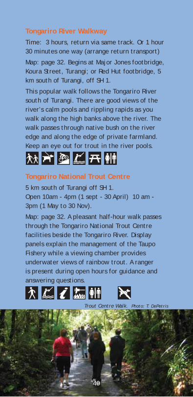
Trout Centre Walk. Photo: T. DePetris
KAIMANAWA FOREST PARK
Kiko Road Walking Track Time: 1 to 1 hour 30 minutes, loop track
Map: page 32. Drive 10 km north of Turangi on SH 1. Turn right into Kiko Road and continue for another 17 km to the Kaimanawa Forest Park carpark. Do not deviate from the main Kiko Road into the adjacent privately owned pine forest.
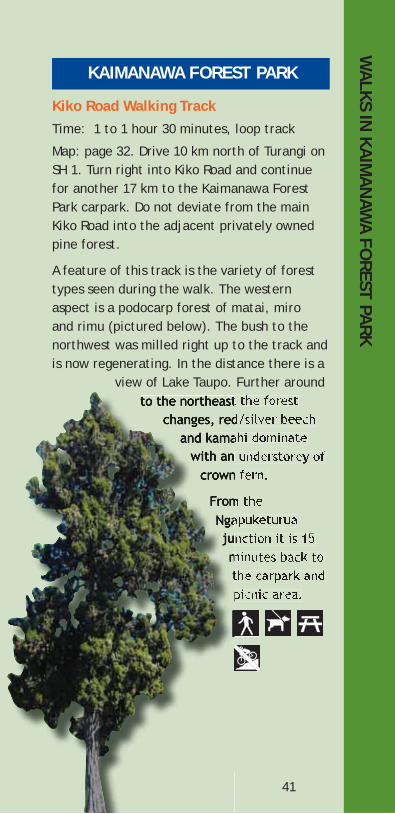
A feature of this track is the variety of forest types seen during the walk. The western aspect is a podocarp forest of matai, miro and rimu (pictured below). The bush to the northwest was milled right up to the track and is now regenerating. In the distance there is a
view of Lake Taupo. Further around
WA
LKS IN KA
IMA
NAW
A FOREST PA
RK
41
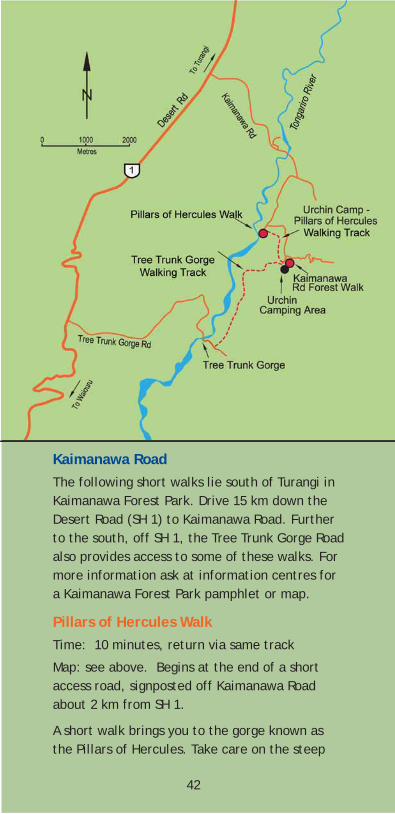
Kaimanawa RoadThe following short walks lie south of Turangi in Kaimanawa Forest Park. Drive 15 km down the Desert Road (SH 1) to Kaimanawa Road. Further to the south, off SH 1, the Tree Trunk Gorge Road also provides access to some of these walks. For more information ask at information centres for a Kaimanawa Forest Park pamphlet or map.
Pillars of Hercules Walk Time: 10 minutes, return via same track
Map: see above. Begins at the end of a short access road, signposted off Kaimanawa Road about 2 km from SH 1.
A short walk brings you to the gorge known as the Pillars of Hercules. Take care on the steep
42
steps at the beginning of the walk. This deep gorge was formed as the river eroded a narrow channel through ancient lava ows (350,000 years and older) of andesite and ignimbrite rock. It looks even more spectacular from the air as the Tongariro River can be seen to suddenly narrow as it passes through this chasm.
Urchin Camp - Pillars of Hercules Walking TrackTime: 1 hour, return via same track, or along the road
Begins from the Urchin Camping Area3 km along Kaimanawa Road or from the Pillars of Hercules carpark.
A pleasant walk through kamahi forest with occasional views down to the river.
43
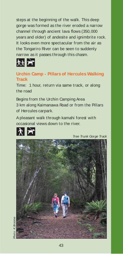
Tree Trunk Gorge Track
Phot
o: K
.Bro
ome
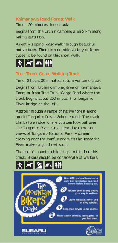
Kaimanawa Road Forest WalkTime: 20 minutes, loop track
Begins from the Urchin camping area 3 km along Kaimanawa Road
A gently sloping, easy walk through beautiful native bush. There is a notable variety of forest types to be found on this short walk.
Tree Trunk Gorge Walking TrackTime: 2 hours 30 minutes, return via same track
Begins from Urchin camping area on Kaimanawa Road; or from Tree Trunk Gorge Road where the track begins about 200 m past the Tongariro River bridge on the left.
A stroll through a range of native forest along an old Tongariro Power Scheme road. The track climbs to a ridge where you can look out over the Tongariro River. On a clear day there are views of Tongariro National Park. A stream crossing near the con uence with the Tongariro River makes a good rest stop.
The use of mountain bikes is permitted on this track. Bikers should be considerate of walkers.
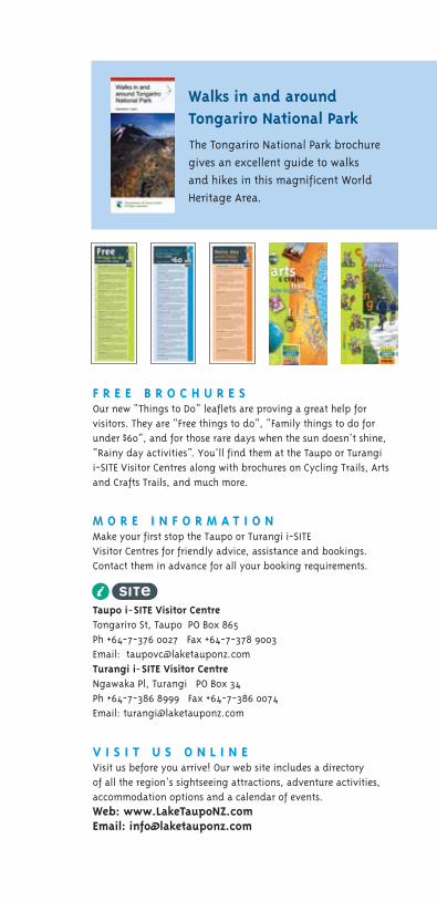
F R E E B R O C H U R E SOur new “Things to Do” leaflets are proving a great help for visitors. They are “Free things to do”, “Family things to do forunder $60”, and for those rare days when the sun doesn’t shine,
and Crafts Trails, and much more.
M O R E I N F O R M A T I O N
Visitor Centres for friendly advice, assistance and bookings.Contact them in advance for all your booking requirements.
Tongariro St, Taupo PO Box 865 Ph +64-7-376 0027 Fax +64-7-378 9003
Ngawaka Pl, Turangi PO Box 34 Ph +64-7-386 8999 Fax +64-7-386 0074
V I S I T U S O N L I N EVisit us before you arrive! Our web site includes a directory of all the region’s sightseeing attractions, adventure activities,accommodation options and a calendar of events. Web: www.LakeTaupoNZ.comEmail: [email protected]
Walks in and aroundTongariro National Park
\The Tongariro National Park brochure gives an excellent guide to walks and hikes in this magnificent WorldHeritage Area.
i-SITE Visitor Centres along with brochures on Cycling Trails, Arts
Make your first stop the Taupo or Turangi i-SITE
Turangi i SITE Visitor Centre
Taupo i SITE Visitor Centre
Email: [email protected]
“Rainy day activities”. You’ll find them at the Taupo or Turangi
Email: [email protected]
This brochure has been developed in partnershipwith the Taupo District Council, Department ofConservation (Tongariro Taupo Conservancy), and Destination Lake Taupo.
Tongariro Taupo Conservancy OfficeTuranga Place, TurangiPh +64-7-386 8607 www.doc.govt.nz
www.LakeTaupoNZ.com www.taupodc.govt.nz