A eace City - Green Map
8
HIROSHIMA Green Mapmaking in Japan’s Peace City A project of the Green Map System: promoting sustainability and citizen action in communities around the world through locally created maps of the natural and cultural environment �
Transcript of A eace City - Green Map
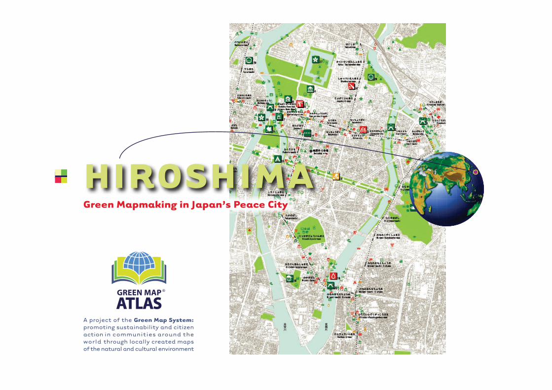
HIROSHIMAGreen Mapmaking in Japan’s Peace City
A project of the Green Map System:promoting sustainability and citizen action in communities around the world through locally created maps of the natural and cultural environment
�
Green Map Atlas · Volume One · Hiroshima’s Story · www.greenatlas.org · © Green Map® System 2004
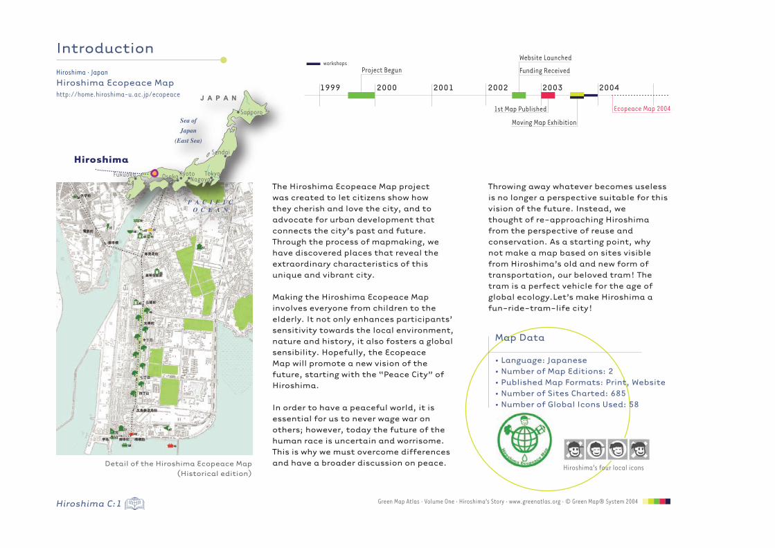
Hiroshima · JapanHiroshima Ecopeace Maphttp://home.hiroshima-u.ac.jp/ecopeace
Sendai
Sapporo
J A P A N
Sea ofJapan
(East Sea)
P A C I F I CO C E A N
Osaka NagoyaFukuoka TokyoKyoto
1st Map Published
Project Begun
Website Launched
Funding Received
Ecopeace Map 2004
workshops
Moving Map Exhibition
1999 2000 2001 2002 2003 2004
Introduction
Hiroshima’s four local icons
Hiroshima
Throwing away whatever becomes useless is no longer a perspective suitable for this vision of the future. Instead, wethought of re-approaching Hiroshima from the perspective of reuse and conservation. As a starting point, why not make a map based on sites visible from Hiroshima’s old and new form of transportation, our beloved tram! The tram is a perfect vehicle for the age of global ecology.Let’s make Hiroshima a fun-ride-tram-life city!
The Hiroshima Ecopeace Map project was created to let citizens show how they cherish and love the city, and to advocate for urban development that connects the city’s past and future. Through the process of mapmaking, we have discovered places that reveal the extraordinary characteristics of this unique and vibrant city.
Making the Hiroshima Ecopeace Map involves everyone from children to the elderly. It not only enhances participants’ sensitivity towards the local environment, nature and history, it also fosters a global sensibility. Hopefully, the Ecopeace Map will promote a new vision of the future, starting with the “Peace City” of Hiroshima.
In order to have a peaceful world, it is essential for us to never wage war on others; however, today the future of the human race is uncertain and worrisome. This is why we must overcome differences and have a broader discussion on peace.
Map Data
• Language: Japanese• Number of Map Editions: 2• Published Map Formats: Print, Website• Number of Sites Charted: 685 • Number of Global Icons Used: 58
Detail of the Hiroshima Ecopeace Map(Historical edition)
Hiroshima C:1
Hiroshima C:2Green Map Atlas · Volume One · Hiroshima’s Story · www.greenatlas.org · © Green Map® System 2004
Hiroshima · JapanHiroshima Ecopeace Maphttp://home.hiroshima-u.ac.jp/ecopeace
The Ecopeace Map is continuously created through a cycle of fieldwork, workshops, exhibitions and discussions called Open Cafés. The fieldwork for this round was done by traveling on the tram, then investigating the urban landscape on foot. Then, at workshops, we grouped the sites into different color categories: green for Good, red for Bad, and yellow for mixed opinions, with each age group plotting sites on their own maps. Interestingly, places that adults found green could be red for children, and vice versa! The completed workshop maps were exhibited in August 2003, timed with the Peace and Consolation Ceremony in remembrance of the atomic bombing in Hiroshima. A Moving Map Exhibition took place on our two thematic trams, the“A-Bomb Tram” and an accessible low-floor tram, the “Green Mover.” The public was also invited to participate in Open Cafés, which have enriched our discussions on the next round of fieldwork.
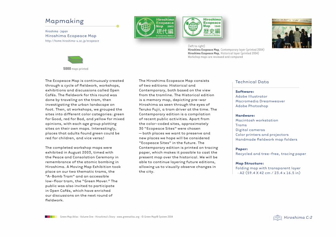
The Hiroshima Ecopeace Map consists of two editions: Historical and Contemporary, both based on the view from the tramline. The Historical edition is a memory map, depicting pre-war Hiroshima as seen through the eyes of Teruko Fujii, a tram driver at the time. The Contemporary edition is a compilation of recent public activities. Apart from the color-coded sites, approximately 30 “Ecopeace Sites” were chosen – both places we want to preserve and new places we hope will be considered “Ecopeace Sites” in the future. The Contemporary edition is printed on tracing paper, which makes it possible to cast the present map over the historical. We will be able to continue layering future editions, allowing us to visually observe changes in the city.
Mapmaking
Technical Data
Software:Adobe Illustrator Macromedia Dreamweaver Adobe Photoshop
Hardware:Macintosh workstationTramsDigital camerasColor printers and projectorsHandmade fieldwork map folders
Paper:Recycled and tree-free, tracing paper
Map Structure:Folding map with transparent layer · A2 (59.4 X 42 cm / 23.4 x 16.5 in)
5000 maps printed
(left to right) Hiroshima Ecopeace Map, Contemporary layer (printed 2004)Hiroshima Ecopeace Map, Historical layer (printed 2004)Workshop maps are reviewed and compared
Hiroshima C:3 Green Map Atlas · Volume One · Hiroshima’s Story · www.greenatlas.org · © Green Map® System 2004
Hiroshima · JapanHiroshima Ecopeace Maphttp://home.hiroshima-u.ac.jp/ecopeace
40 2840 9
Teamwork
The Ecopeace Map is a collaboration that brings together elementary schools, universities, citizens, city administrators and corporations. A wide range of age groups participate, from 10-year-old schoolchildren to 75-year-old senior citizens. Living through different eras of Hiroshima at different stages of their lives, the participants exchange experiences, mapping their own visions and imagining the future of the city together.
Ecopeace Mapmakers from Hiroshima University include: Shoichiro Sendai (Associate Professor, Graduate School of Engineering), Akira Yamazaki (Professor, Graduate School of Education), Hirokazu Seki (Attached Elementary School of Hiroshima University) and his 40 young students, and many undergraduate and graduate students under the leadership of Ichiro Kihara. In addition, we’ve also had helpful assistance from two Hiroshima University academic experts, Yoshihiko Takezaki (Assistant Professor of
Geography) and Atsushi Hikita (Associate Professor of Information Design). Professional urban developers from Japan Civil Engineering Consultants Association Chugoku, including Director Fuminori Kato, have contributed valuable advice.
Many civil servants involved in urban development and landscape issues have also partaken in this project. Koshi Kamatani and Tomohito Matsuda, Directors of Hiroshima’s Urban Planning Bureau, were the main participants from the city administration. In addition, senior citizens under the leadership of Kyoko Abe from the Aosaki Community Center have offered a great deal of valuable input on Hiroshima’s local histories.
Teamwork is mainly facilitated through Open Café sessions held at the Citizen Exchange Plaza, which fosters a loose network of participants. Space is kindly provided by Hiroshima City Plaza for Town Development.
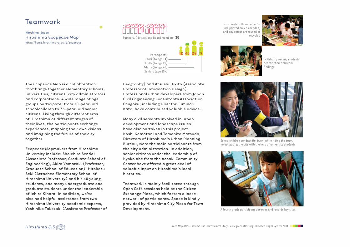
Schoolchildren conduct fieldwork while riding the tram, investigating the city with the help of university students
<< Urban planning students debate their fieldwork findings
Icon cards in three colors >> are printed only as needed,
and any extras are reused or recycled
Partners, Advisors and Board members: 30
Participants:Kids (to age 14)
Youth (to age 22)Adults (to age 65)Seniors (age 65+)
A fourth grade participant observes and records key sites
Hiroshima C:4Green Map Atlas · Volume One · Hiroshima’s Story · www.greenatlas.org · © Green Map® System 2004
Hiroshima · JapanHiroshima Ecopeace Maphttp://home.hiroshima-u.ac.jp/ecopeace
Economic Data
Type of Organization: Non-profit grassroots group
Support:Grants, sponsorship, in-kind
Major Project Supporters:Hiroshima Xerox Co., LtdHiroshima Electric Railway Co., LtdSumitomo 3M Ltd
Number of Paid or Volunteer Jobs Created: 1
Cost of Map: 100 yen, but some were provided free
Spin Off Projects: Youth mapping resources
Economics
To sustain the project, the Hiroshima Ecopeace Map bases its activity on volunteer work. Through Hiroshima’s Urban Planning Bureau we receive funding for cooperative research, and workshops are held at free public places such as elementary schools and other facilities owned by the city.
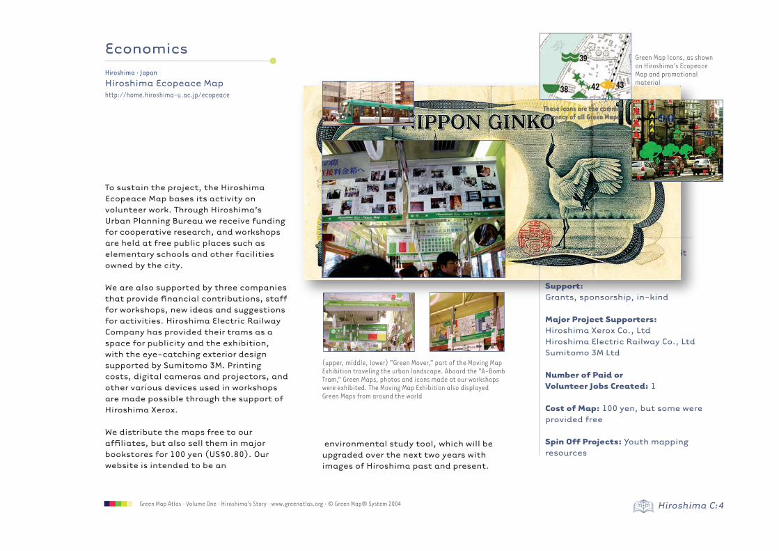
We are also supported by three companies that provide financial contributions, staff for workshops, new ideas and suggestions for activities. Hiroshima Electric Railway Company has provided their trams as a space for publicity and the exhibition, with the eye-catching exterior design supported by Sumitomo 3M. Printing costs, digital cameras and projectors, and other various devices used in workshops are made possible through the support of Hiroshima Xerox.
We distribute the maps free to our affiliates, but also sell them in major bookstores for 100 yen (US$0.80). Our website is intended to be an
environmental study tool, which will be upgraded over the next two years with images of Hiroshima past and present.
(upper, middle, lower) “Green Mover,” part of the Moving Map Exhibition traveling the urban landscape. Aboard the “A-Bomb Tram,” Green Maps, photos and icons made at our workshops were exhibited. The Moving Map Exhibition also displayed Green Maps from around the world
Green Map Icons, as shown on Hiroshima’s Ecopeace Map and promotional material
These icons are the common currency of all Green Maps
Hiroshima C:5 Green Map Atlas · Volume One · Hiroshima’s Story · www.greenatlas.org · © Green Map® System 2004
Hiroshima · JapanHiroshima Ecopeace Maphttp://home.hiroshima-u.ac.jp/ecopeace
Assessment
The Hiroshima Ecopeace Map is created through the teamwork of diverse people, reflecting its many contributors’ sensibilities towards urban space. This is why we stress individual intuition, rather than relying on scientific evidence, when choosing Green Map Icons and sites for the map. For example, the Ecopeace sites on the Contemporary edition were chosen during discussions and presentations at workshops and Open Cafés. Parallel to the map reflecting diverse perspectives, in the future we also plan to collect and store useful scientific and environmental data.
The map also works to convey perspectives on the past through the Historical edition, because we believe that historical sensibility is indispensable in charting the future of the city. The Contemporary edition raises historical awareness through collaboration among different generations. For example, when children get in touch with the perspectives of seniors, they increase their historical sensibility. In the future, we plan to
emphasize this dimension of seniors’ lifelong education.
We have edited the set of Green Map Icons for use by children, created a homepage for urban ecology lessons and conducted research for a more effective Green Mapmakers’ tool kit. All has been undertaken with consideration to diverse sensibilities of both space and time.
Ecology is about the relationship between humans and the Earth, and in today’s urban landscape, the past and the future are connected. A balanced relationship with the city’s history remains an important element of ecology.
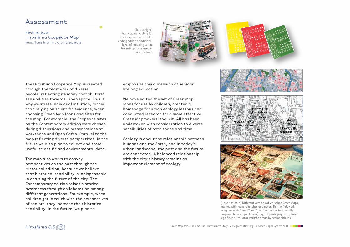
(upper, middle) Different versions of workshop Green Maps, marked with icons, sketches and notes. During fieldwork, everyone adds “good” and “bad” eco-sites to specially prepared base maps. (lower) Digital photographs capture significant sites on a workshop map by senior citizens
(left to right)Promotional posters for
the Ecopeace Map. Color coding adds an additional
layer of meaning to the Green Map Icons used in
our workshops
Hiroshima C:6Green Map Atlas · Volume One · Hiroshima’s Story · www.greenatlas.org · © Green Map® System 2004
Hiroshima · JapanHiroshima Ecopeace Maphttp://home.hiroshima-u.ac.jp/ecopeace
Î
Conclusion
The uniqueness of Hiroshima’s Ecopeace Map is that it consists of two editions,
Historical and Contemporary. Layering the present city over the context of history allows us to locate the changes, which will help us think about the future of Hiroshima.
The Hiroshima Ecopeace Map is for everyone, including all generations of citizens. Through the process of mapmaking, each generation ultimately contributes to a single comprehensive map. All icons on the map, except for Ecopeace sites, reflect the sensibility of each and every participant.
“We learned there used to be woods here, and always soldiers watching by the river. We were glad to find some “good” sites on the map even during such terrible times.” -Youth workshop participants
“Thank you for your report on the Ecopeace Map. This is a very interesting study for our students!” -Augustin Berque, French social sciences professor
A city is a living thing, and therefore a city is always changing. The Ecopeace sites on the Contemporary edition merely express this year’s vision of “Ecopeace,” so with every new edition, the types and colors of icons may change. This year’s Ecopeace sites carry our special hope: that red icons will transform into green. Our dream is for the children to carry on the Ecopeace message, and for them to participate in this activity as seniors in the future. We will continue to keep up our efforts until such a day comes.
“Initially I felt I have nothing left to offer people. However, I am extremely glad to have participated.” - Teruko Fujii, pre-war period tram driver
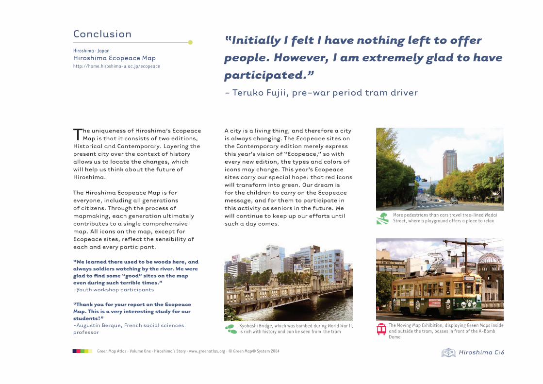
Kyobashi Bridge, which was bombed during World War II, is rich with history and can be seen from the tram
More pedestrians than cars travel tree-lined Wadai Street, where a playground offers a place to relax
The Moving Map Exhibition, displaying Green Maps inside and outside the tram, passes in front of the A-Bomb Dome
] …
CreditsHiroshima’s Story written by: Shoichiro SendaiHiroshima Ecopeace Map1-4-1 KagamiyamaHigashi-Hiroshima 739-8527Japantel: +81 (0)824-24-7834
Locator globes and maps © Map Resources®. All rights
reserved. All map, web and promo images © Hiroshima
Ecopeace Map Other Photos:Shoichiro Sendai and Green Map System
© Green Map® System, Inc. 2004PO Box 249, New York, NY 10002 [email protected]
email: [email protected] visit the online store atwww.greenatlas.org
WantThis Map?
Volume One
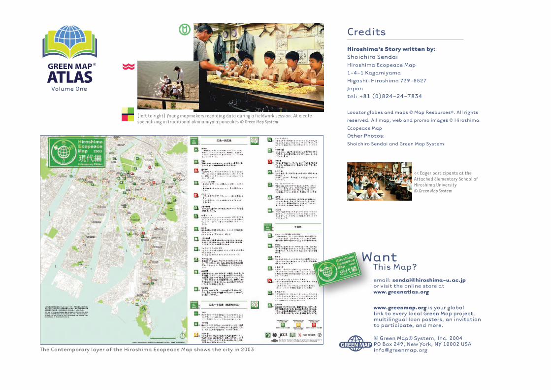
The Contemporary layer of the Hiroshima Ecopeace Map shows the city in 2003
(left to right) Young mapmakers recording data during a fieldwork session. At a cafe specializing in traditional okonamiyaki pancakes © Green Map System
<< Eager participants at the Attached Elementary School of Hiroshima University© Green Map System
www.greenmap.org is your global link to every local Green Map project, multilingual Icon posters, an invitation to participate, and more.
x
C
�
�