6 th IT Excellence Awards (Post Secondary) Mobile Application Generator for Route-based Location...
58
6 th IT Excellence Awards (Post Secondary) Mobile Application Generator for Route-based Location Sensitive Tourist Companion using Change of GSM Cell ID Event Lee Kwok Chau, Tommy ([email protected] du.hk) Video over InternEt and Wireless Techno 2004/06/09
-
date post
22-Dec-2015 -
Category
Documents
-
view
215 -
download
0
Transcript of 6 th IT Excellence Awards (Post Secondary) Mobile Application Generator for Route-based Location...

6th IT Excellence Awards(Post Secondary)
Mobile Application Generator for Route-based Location Sensitive
Tourist Companion usingChange of GSM Cell ID Event
Lee Kwok Chau, Tommy ([email protected])Video over InternEt and Wireless Technologies Lab.,
CUHK
2004/06/09
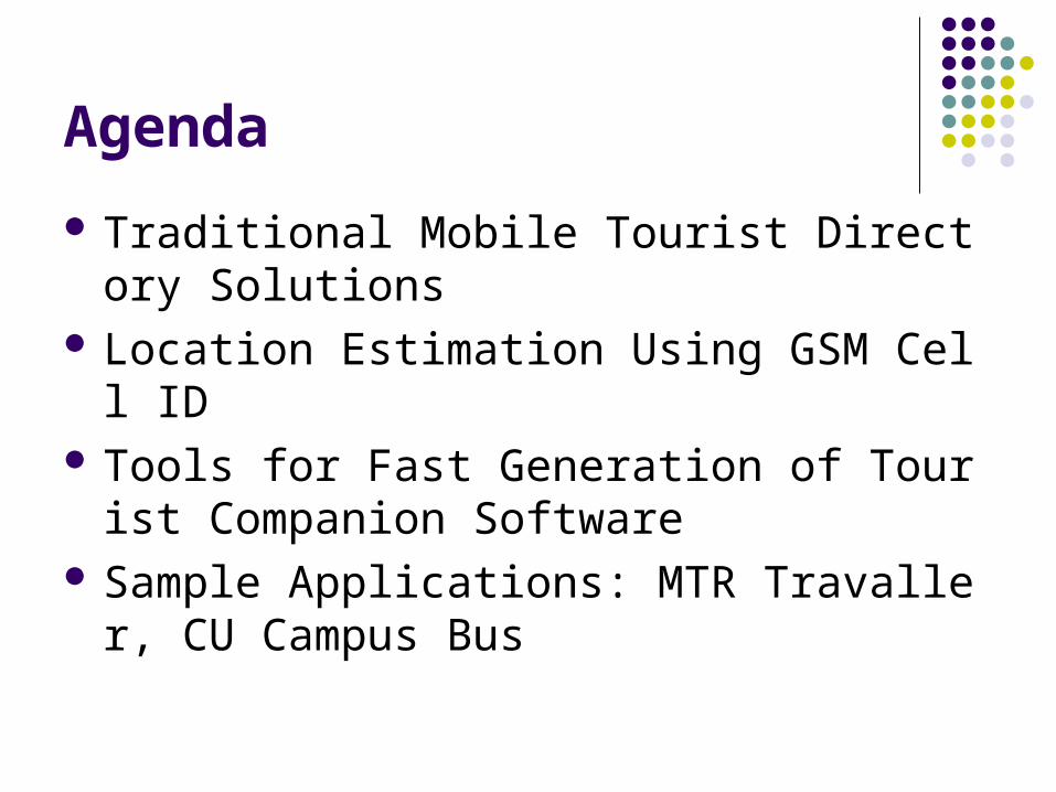
Agenda
Traditional Mobile Tourist Directory Solutions Location Estimation Using GSM Cell ID Tools for Fast Generation of Tourist Compani
on Software Sample Applications: MTR Travaller, CU Ca
mpus Bus

Traditional Mobile Tourist Traditional Mobile Tourist Directory SolutionsDirectory Solutions

Location-Based Services (LBS)
Services are provided based on user’s current location.
Applicable on different fields: Navigation (e.g. Driving) Shopping / Tourist Guides Games / Entertainment, ……
Location estimation acts as a mobile tourist directory solution where information and interaction are triggered by tourists’ current locations.

Current Technologies on LBS 1) Global Positioning System (GPS)
Good Accuracy: 30-100m Poor indoor and urban-area capabilities Generally high power consumption Expensive hardware at end users
2) 3rd Generation GSM (3G) 2G-compatible network – the majority Extra investment in addition to existing 3G network
3) Modified SIM Card Require telco support
4) Existing GSM Network Fairly advanced Expensive and require run-time support from telco
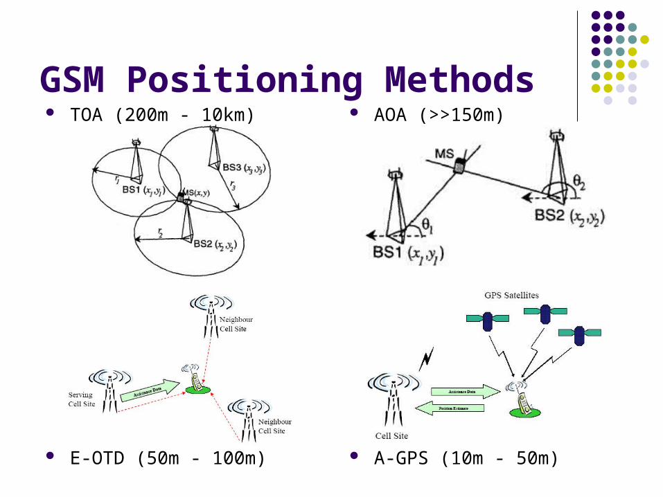
GSM Positioning Methods TOA (200m - 10km)
E-OTD (50m - 100m)
AOA (>>150m)
A-GPS (10m - 50m)
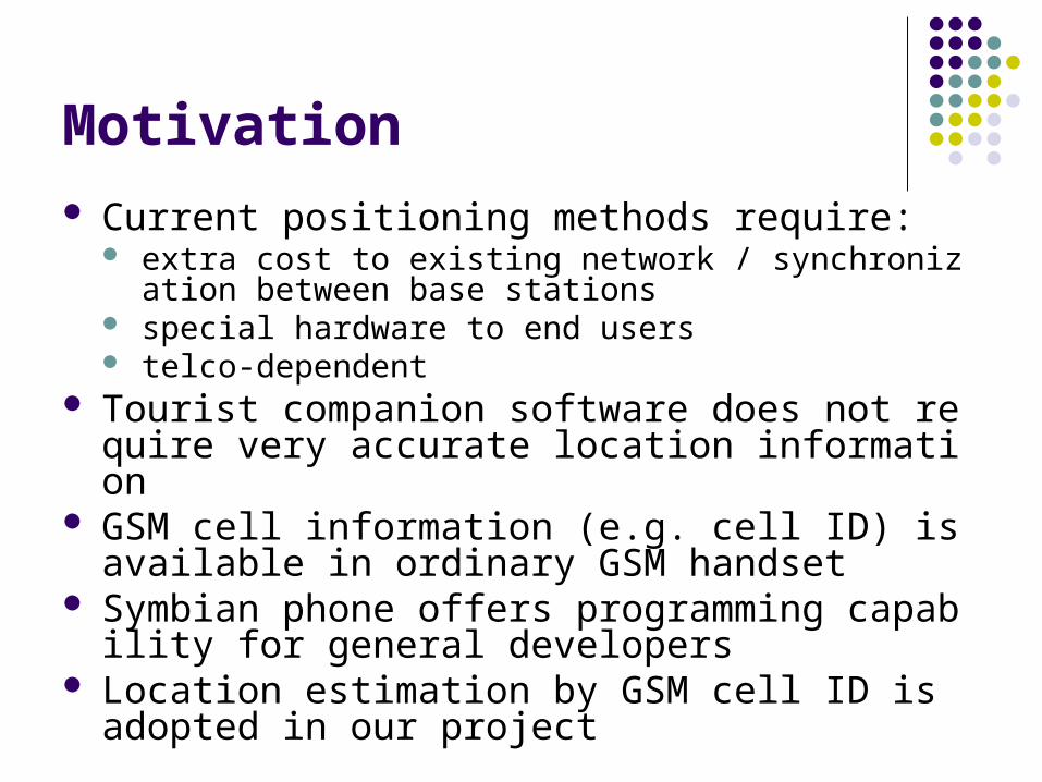
Motivation Current positioning methods require:
extra cost to existing network / synchronization between base stations
special hardware to end users telco-dependent
Tourist companion software does not require very accurate location information
GSM cell information (e.g. cell ID) is available in ordinary GSM handset
Symbian phone offers programming capability for general developers
Location estimation by GSM cell ID is adopted in our project

Location Estimation Using GSM Location Estimation Using GSM Cell IDCell ID

Overview of GSM Cell ID Location Estimation
Each base station has unique location ID and cell ID pair
Main idea: each base station can somehow provide certain ‘information’ about a particular location
Location ID: [50]Cell ID: [1]
Location ID: [50]Cell ID: [2]
Location ID: [50]Cell ID: [3]
Location ID: [50]Cell ID: [4]
Overview of GSM Cell ID Location Estimation
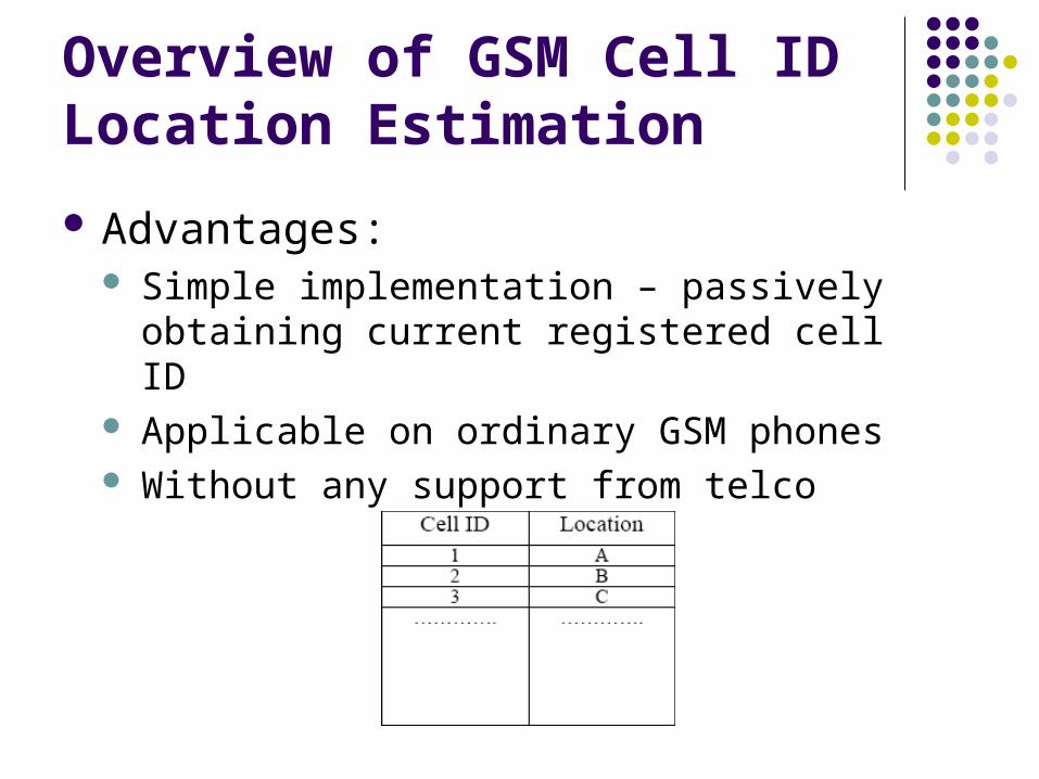
Advantages: Simple implementation – passively obtaining
current registered cell ID Applicable on ordinary GSM phones Without any support from telco
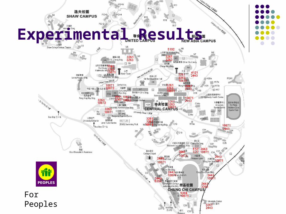
Experimental Results
For Peoples

Experimental Results

Experimental Results
For SmarTone

Experimental Results
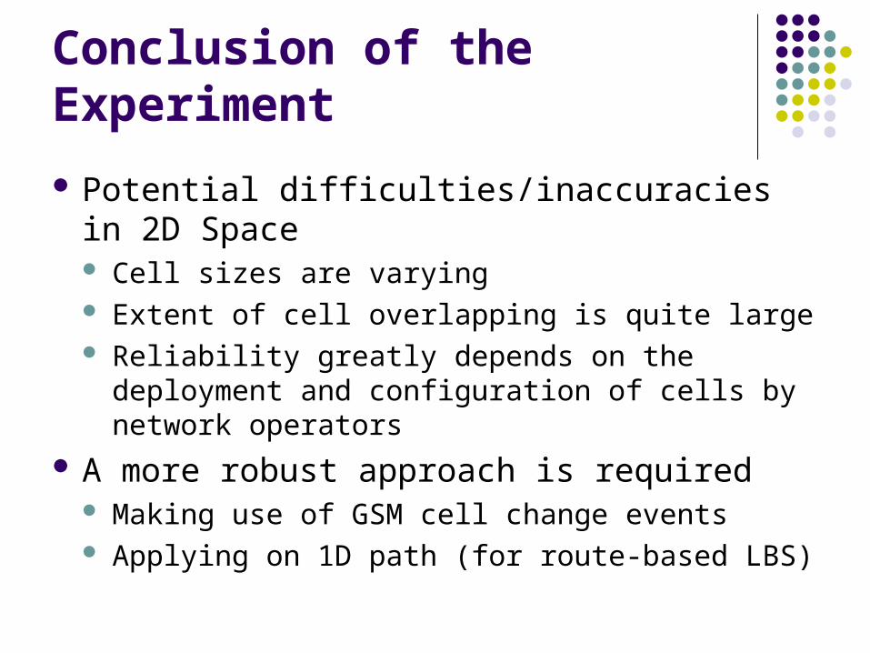
Conclusion of the Experiment
Potential difficulties/inaccuracies in 2D Space Cell sizes are varying Extent of cell overlapping is quite large Reliability greatly depends on the deployment and
configuration of cells by network operators A more robust approach is required
Making use of GSM cell change events Applying on 1D path (for route-based LBS)

GSM Cell Change Event
Received signal strength from current registered cell is weaker than another, so cell change occurs
Consequences: More information provided More reliable in detecting boundary

Using GSM Cell IDs in 1D Space
Location: [50]Cell ID: [1]
Location: [50]Cell ID: [2]
Location: [50]Cell ID: [3]
Location: [50]Cell ID: [4]
Cell ID: [1->2] Cell ID: [2->3]
A set of multiple cell change events can indicate a path
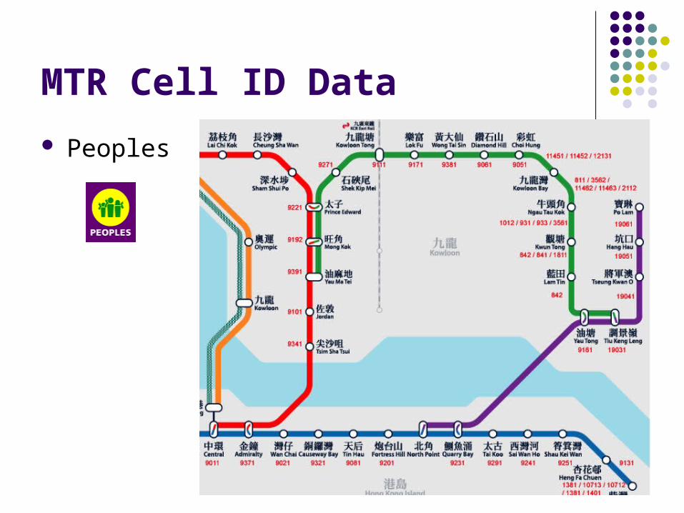
MTR Cell ID Data
Peoples
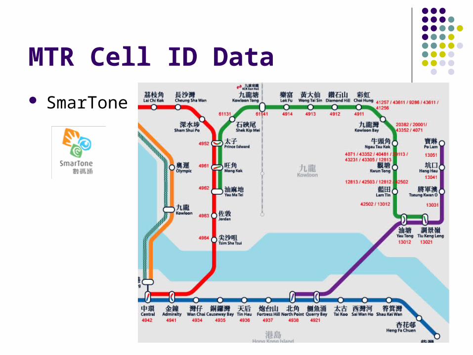
MTR Cell ID Data
SmarTone
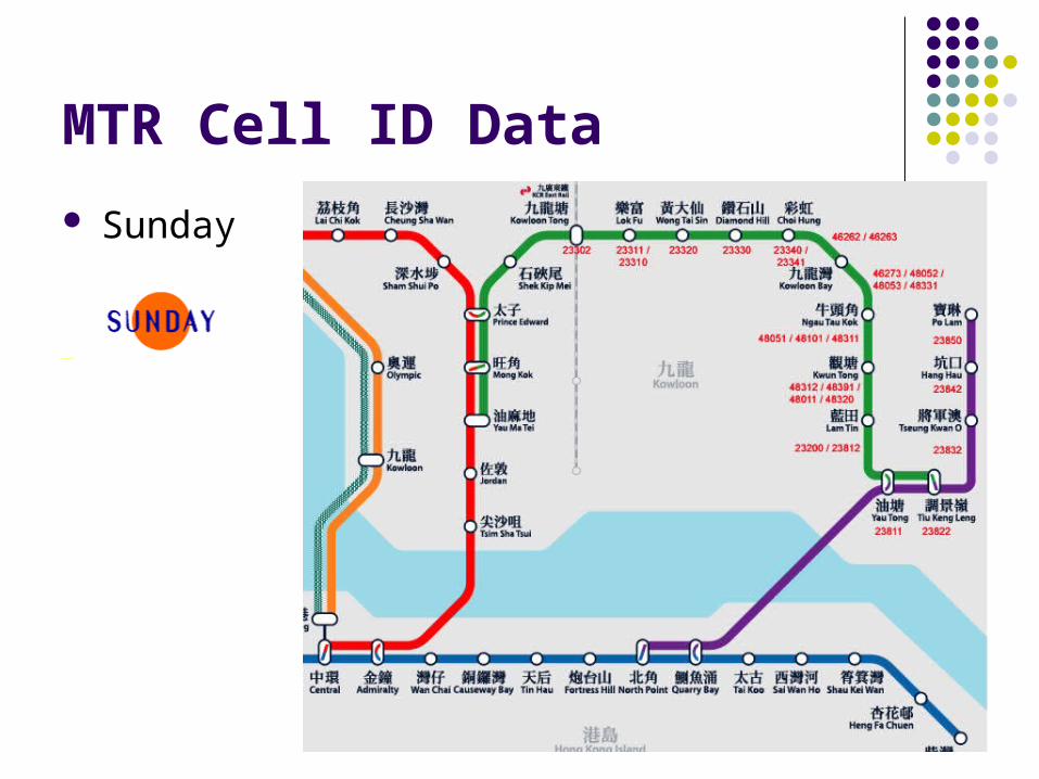
MTR Cell ID Data
Sunday

KCR Cell ID Data
Peoples

KCR Cell ID Data
SmarTone

Advantages of New Approach
Allow to keep track of entering and leaving a region
Become more reliable than purely mapping cell ID to location
Get rid of the problem of inconsistent cell sizes and high extent of cell overlapping
30-300m accuracy, enough for route-based mobile tourist companion software

Evolution of Our Positioning Methods
Pure GSM Cell
Information Location
Estimation(Region Based)
GSM Cell Change Method
(Boundary / Line Based)
GSM Cell Change Method in
1D Path(Point Based)Detect registered
cell change occurred at cell boundary
Concentrate on specific cell changes (intersections between the path and the boundary)

Tools for Fast Generation of Tools for Fast Generation of Tourist Companion SoftwareTourist Companion Software

Application Development Using GSM Cell ID

Desire of Fast Tourist LBS Application Generation
Current issues/overhead in development: Developers are required to put a great effort in the
whole development process Tourist information is usually the main focus Maintaining the software/information update is
difficult also There is a great desire to have a series of
software tools to generate route-based tourist companion software.
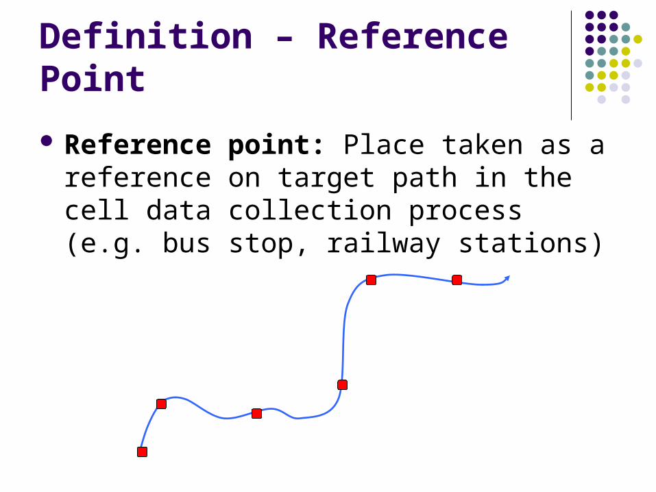
Definition – Reference Point
Reference point: Place taken as a reference on target path in the cell data collection process (e.g. bus stop, railway stations)
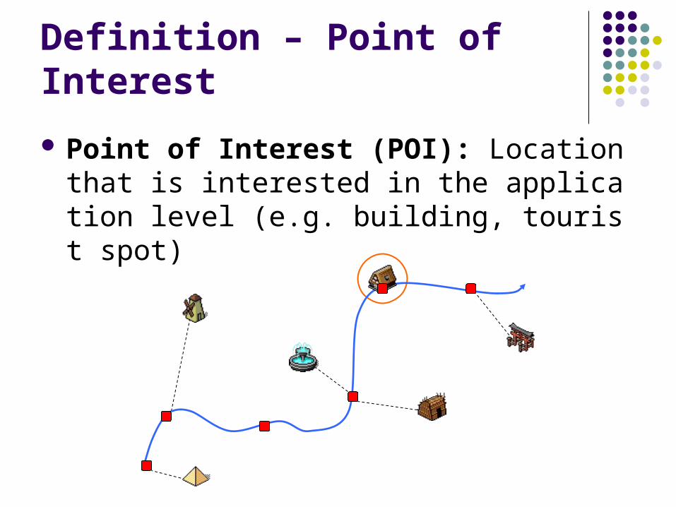
Definition – Point of Interest
Point of Interest (POI): Location that is interested in the application level (e.g. building, tourist spot)
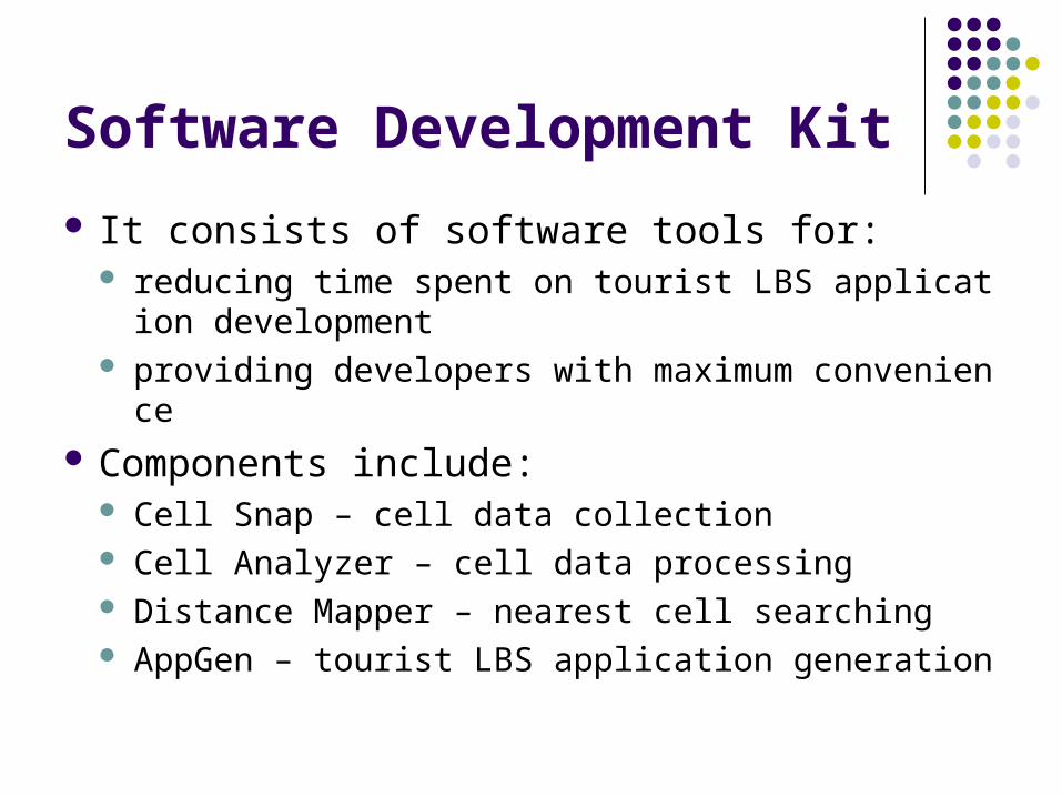
Software Development Kit
It consists of software tools for: reducing time spent on tourist LBS application de
velopment providing developers with maximum convenience
Components include: Cell Snap – cell data collection Cell Analyzer – cell data processing Distance Mapper – nearest cell searching AppGen – tourist LBS application generation

Architecture of Software Tool Set
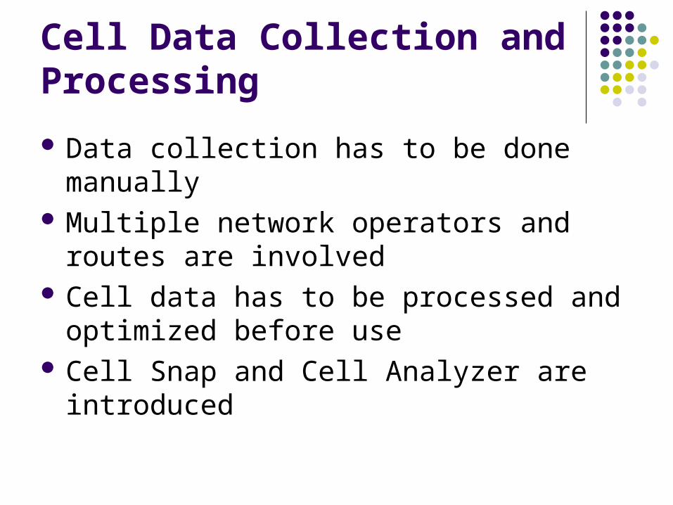
Cell Data Collection and Processing
Data collection has to be done manually Multiple network operators and routes are
involved Cell data has to be processed and optimized
before use Cell Snap and Cell Analyzer are introduced

Cell Snap
Collection of cell data was done manually in the past Cell Snap - a tool for automated cell data collection Different reference points can also be captured by
phone camera

Need of Data Processing
Photos and data output are separated, so developers have to map cell data and reference point on their own Better presentation of cell data to developers
Cell data from multiple telcos have to be combined together A convenient way to merge data for the same rout
e Cell Snap data is just raw data
Data editing tool and automated data analysis
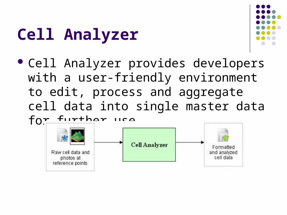
Cell Analyzer
Cell Analyzer provides developers with a user-friendly environment to edit, process and aggregate cell data into single master data for further use

Features of Cell Analyzer
It has the following features: Data processing:
Data format transform Better cell data presentation to developers Manual cell data editing Data combination for multiple operators
Automated data optimization: Cell duplicate removal Clear classification between reference points

Cell Data in Tree Representation
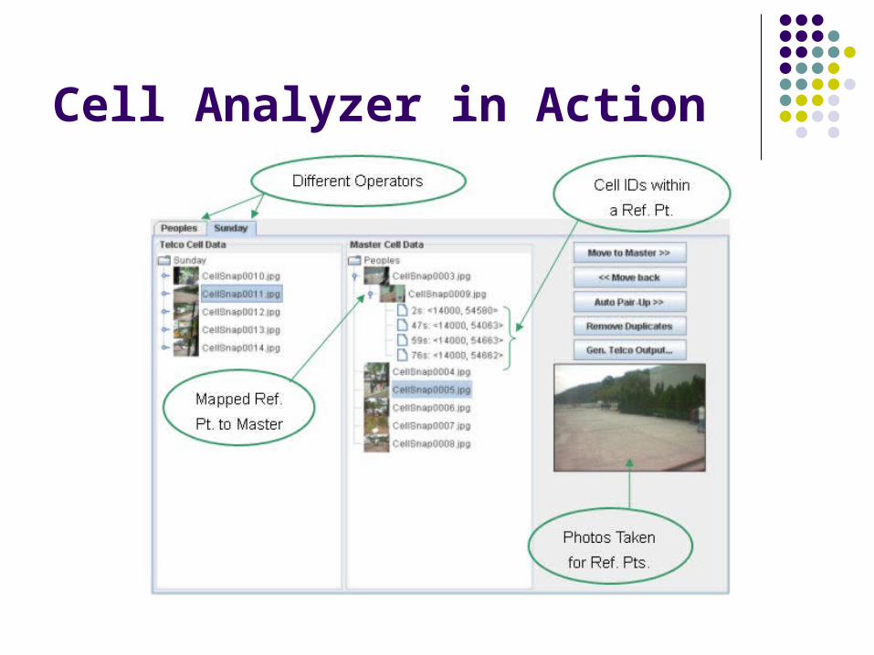
Cell Analyzer in Action

Location-to-cell Mapping
Up to now, pure cell data are not mapped to geometrical locations
It is quite impressive to have “nearest target” searching functions inside tourist companion mobile application, such as: Restaurant Toilet ATM Hospital / Police Station ……

Distance Mapper
Distance Mapper lets developers to map those POIs onto a real map
The tourist application is then allowed to search the nearesttarget from currentlocation
It reads in the filegenerated byCell Analyzer
Application Generation
The previous tools mentioned enable developers to have a nice tourist LBS application development environment
LBS application often focuses also on content and service, including actions upon cell changes and information provided
Points of interest (e.g. tourist spots) should also be considered instead of just reference points (e.g. bus stops)
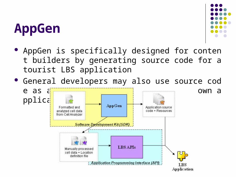
AppGen
AppGen is specifically designed for content builders by generating source code for a tourist LBS application
General developers may also use source code as a starting point to build their own applications
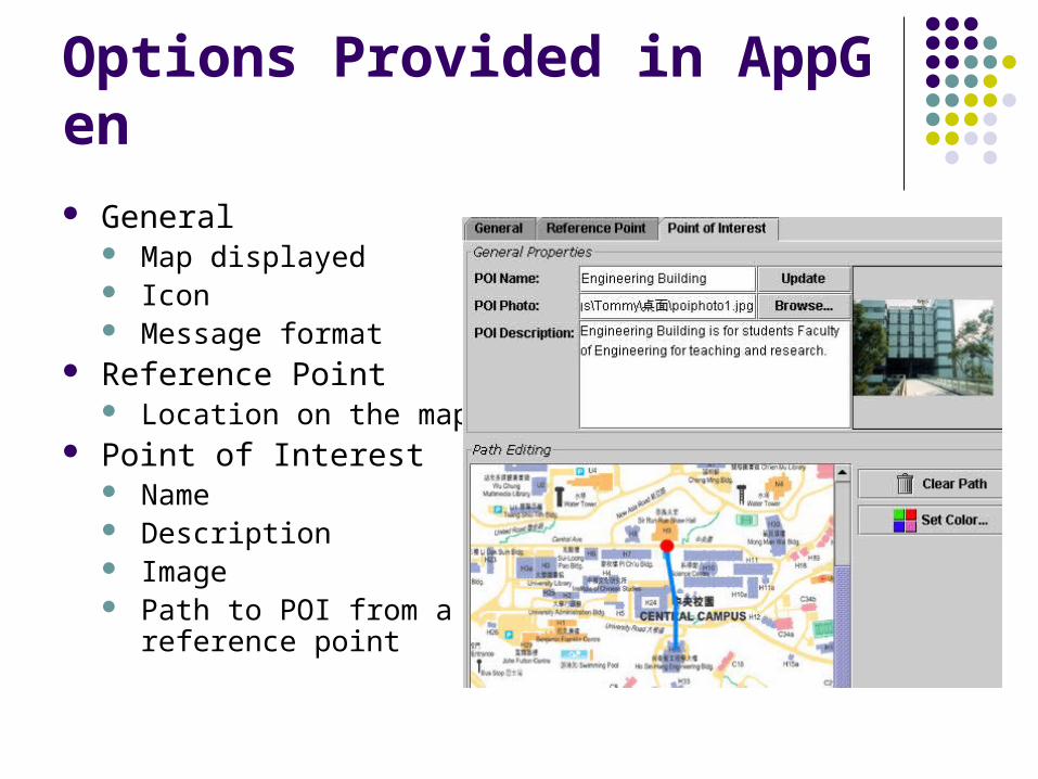
Options Provided in AppGen General
Map displayed Icon Message format
Reference Point Location on the map
Point of Interest Name Description Image Path to POI from a
reference point
Generated Tourist LBS Generated Tourist LBS ApplicationsApplications

Generated Mobile Tourist Companion Software
The mobile tourist application generated would be able to: keep track of interested cell changes and report to
user (e.g. entering a new MTR station) let user specify a POI (e.g. Engineering Building
in CUHK) and acknowledge user when he/she arrives a reference point containing that POI (e.g. bus stop)

Application in Action (1)
Reference Points
Points of Interest

Application in Action (2)
1. User selects adestination

Application in Action (3)
2. User is at the startingpoint of a route
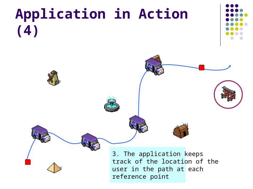
Application in Action (4)
3. The application keepstrack of the location of theuser in the path at eachreference point

Application in Action (5)
4. Display the informationabout the point of interestwhen the user arrives thedestination reference point

MTR Traveller and CU Campus Bus
Make use of GSM cell ID location estimation and AppGen in different traffic routes

Flow of Tourist Companion LBS Application Development
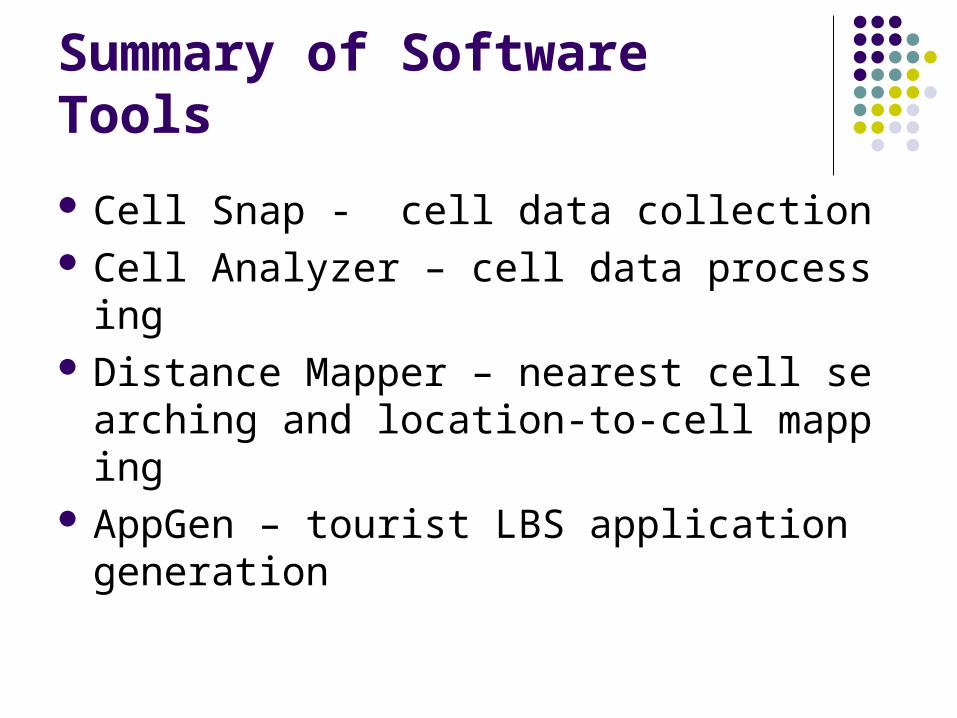
Summary of Software Tools
Cell Snap - cell data collection Cell Analyzer – cell data processing Distance Mapper – nearest cell searching a
nd location-to-cell mapping AppGen – tourist LBS application generatio
n
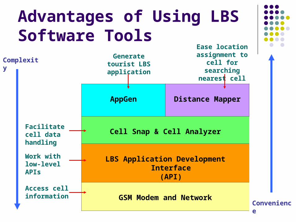
Advantages of Using LBS Software Tools
AppGen Distance Mapper
Cell Snap & Cell Analyzer
LBS Application Development Interface(API)
GSM Modem and NetworkAccess cell information
Work with low-level APIs
Generate tourist LBS application
Ease location assignment to cell
for searching nearest cell
Complexity
Convenience
Facilitate cell data handling
Contribution
Location estimation can be done by passively using GSM cell information: Applicable on ordinary GSM phones (neither extra
hardware or special SIM card on user side) Telco-independent, stand-alone in any phones
More robust approach (i.e. cell change event on 1D path) gives reliable location estimation
It should be the first complete solution
Contribution
Fast application generation of a route-based location sensitive tourist companion software Easy to use (hide the concept of GSM cell ID
location estimation from developers) Convenient tools for cell data collection
User-friendly tools for aggregating cell data Multiple network operators (inherited) Allow nearest location searching Easy content building (nice for tourist apps)
Commercialization
Tourist companion software (with reliable LBS available) is highly desired: University, large company with numerous retail
shops, public transport (MTR, KCR, tram) Nearly everyone are using GSM cell phones Smart phones which allow interactive
applications would become a major trend Fast application generation facilitates both
content providers and software developers

Thank you!
Q & A session