400 mya? or 700 mya “split the difference” 550 mya age of the Wichitas?
57
400 mya? or 700 mya 400 mya? or 700 mya “split the “split the difference” difference” 550 mya 550 mya age of the age of the Wichitas? Wichitas?
-
Upload
stuart-bishop -
Category
Documents
-
view
274 -
download
1
Transcript of 400 mya? or 700 mya “split the difference” 550 mya age of the Wichitas?
400 mya? or 700 mya400 mya? or 700 mya“split the difference”“split the difference”
550 mya550 myaage of the Wichitas?age of the Wichitas?
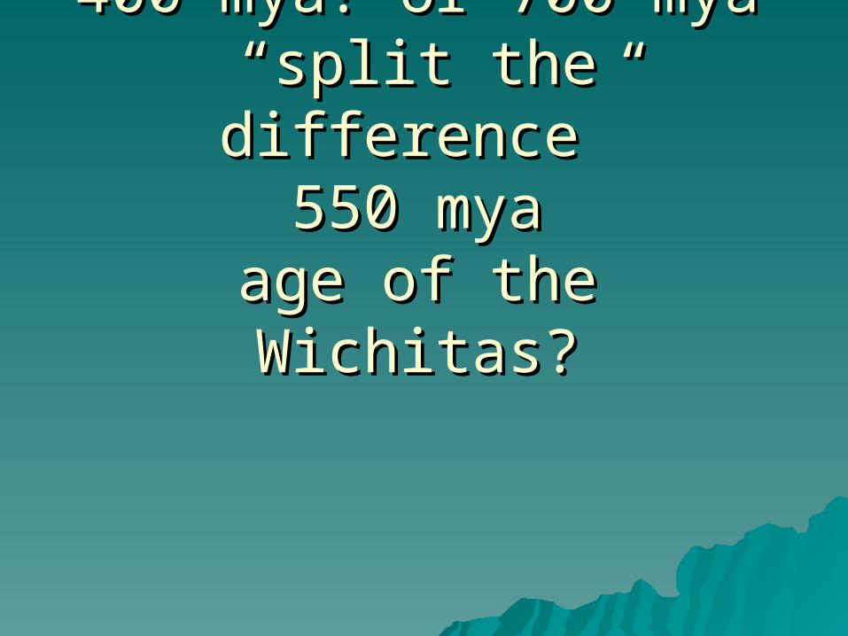
EXPECTATIONSEXPECTATIONS General comparison of the Wichitas to the General comparison of the Wichitas to the
OuachitasOuachitas Geologic Time ScaleGeologic Time Scale Tectonic activityTectonic activity Activities: Activities:
record strike and diprecord strike and dipconsider metamorphismconsider metamorphismecosystem change - elevation and ecosystem change - elevation and
rockrock typestypes
slope and terrainslope and terrain
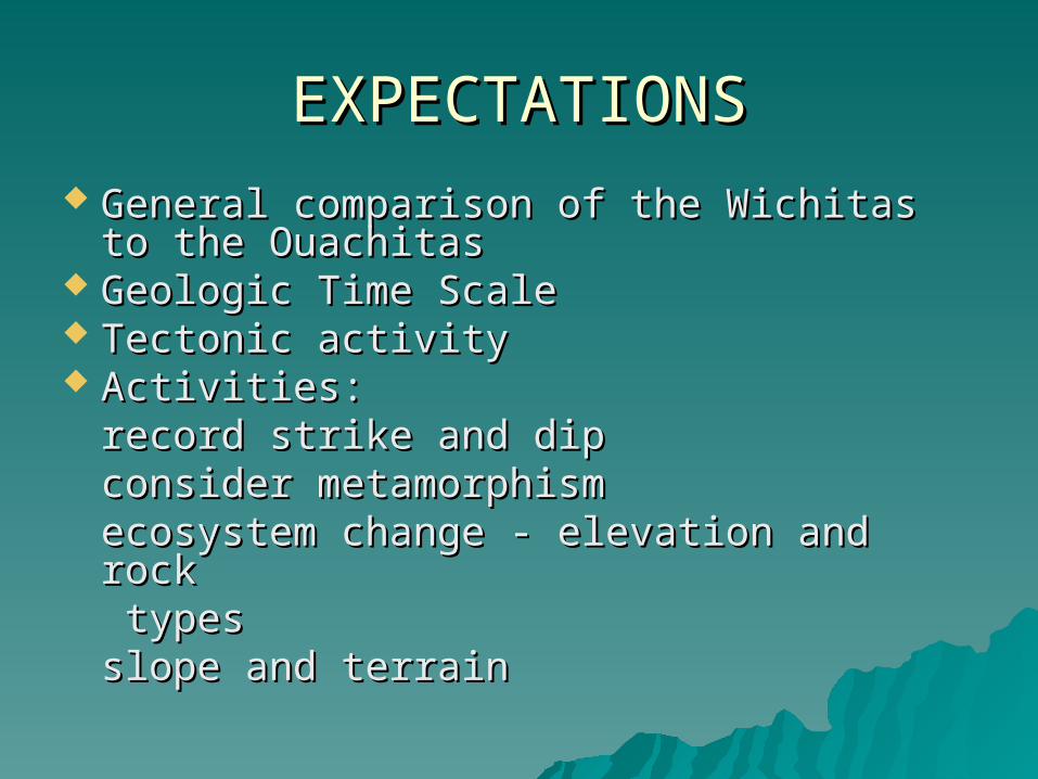
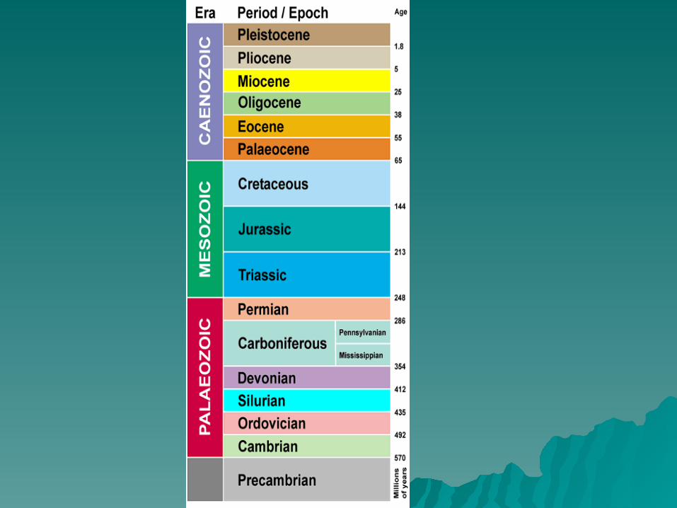
Geologic Time ScaleGeologic Time Scale Eon (1 billion years; major division)Eon (1 billion years; major division)
Phanerozoic Eon – (scientific) evidence of lifePhanerozoic Eon – (scientific) evidence of life Era (a major division of time)Era (a major division of time)
Cenozoic Era (since the dinosaur)Cenozoic Era (since the dinosaur)Mezozoic Era (since the last “supercontinent)Mezozoic Era (since the last “supercontinent)Paleozoic Era (the Wichitas & the Ouachitas)Paleozoic Era (the Wichitas & the Ouachitas)
Period (a subdivision of an Era)Period (a subdivision of an Era)Quaternary (since the last 2 million years)Quaternary (since the last 2 million years)includes the Jurassic Periodincludes the Jurassic Period
Epoch (a subdivision of a Period)Epoch (a subdivision of a Period)currently in the Holocene Epochcurrently in the Holocene Epoch
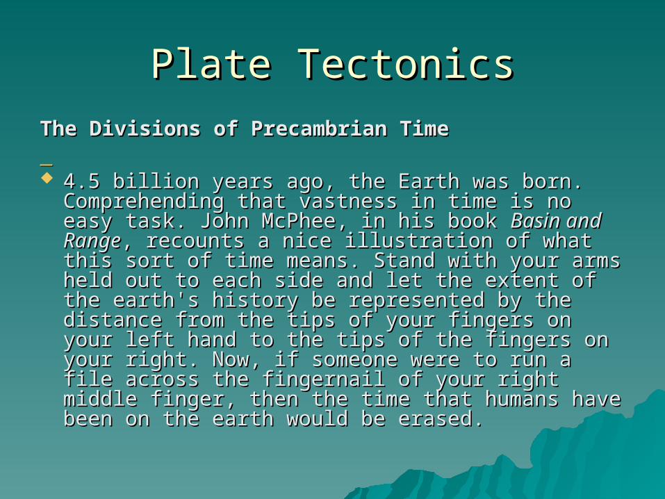
Plate TectonicsPlate Tectonics
The Divisions of Precambrian TimeThe Divisions of Precambrian Time 4.5 billion years ago, the Earth was born. 4.5 billion years ago, the Earth was born.
Comprehending that vastness in time is no easy Comprehending that vastness in time is no easy task. John McPhee, in his book task. John McPhee, in his book Basin and RangeBasin and Range, , recounts a nice illustration of what this sort of recounts a nice illustration of what this sort of time means. Stand with your arms held out to time means. Stand with your arms held out to each side and let the extent of the earth's history each side and let the extent of the earth's history be represented by the distance from the tips of be represented by the distance from the tips of your fingers on your left hand to the tips of the your fingers on your left hand to the tips of the fingers on your right. Now, if someone were to fingers on your right. Now, if someone were to run a file across the fingernail of your right middle run a file across the fingernail of your right middle finger, then the time that humans have been on finger, then the time that humans have been on the earth would be erased. the earth would be erased.
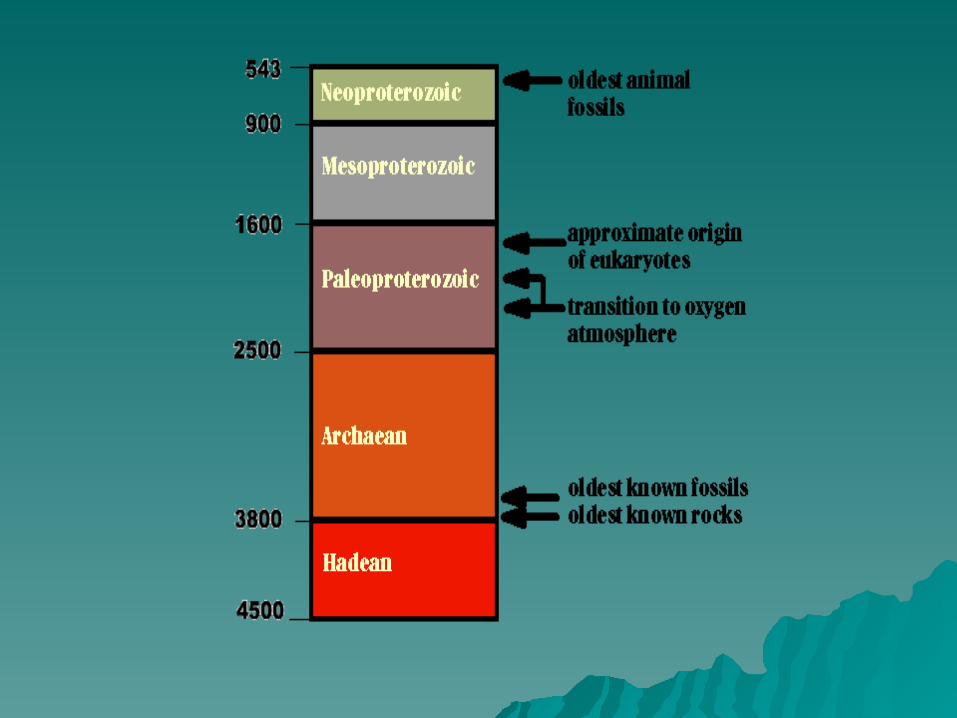
Nearly 4 thousand million years passed after the Nearly 4 thousand million years passed after the Earth's inception before the first animals left their Earth's inception before the first animals left their traces. This stretch of time is called the traces. This stretch of time is called the Precambrian. To speak of "the Precambrian" as a Precambrian. To speak of "the Precambrian" as a single unified time period is misleading, for it single unified time period is misleading, for it makes up roughly seven-eighths of the Earth's makes up roughly seven-eighths of the Earth's history. During the Precambrian, the most history. During the Precambrian, the most important events in biological history took place. important events in biological history took place. Consider that the Earth formed, life arose, the Consider that the Earth formed, life arose, the first tectonic plates arose and began to move, first tectonic plates arose and began to move, eukaryotic cells evolved, the atmosphere became eukaryotic cells evolved, the atmosphere became enriched in oxygen -- and just before the end of enriched in oxygen -- and just before the end of the Precambrian, complex multi-cellular the Precambrian, complex multi-cellular organisms, including the first animals, evolved. organisms, including the first animals, evolved.
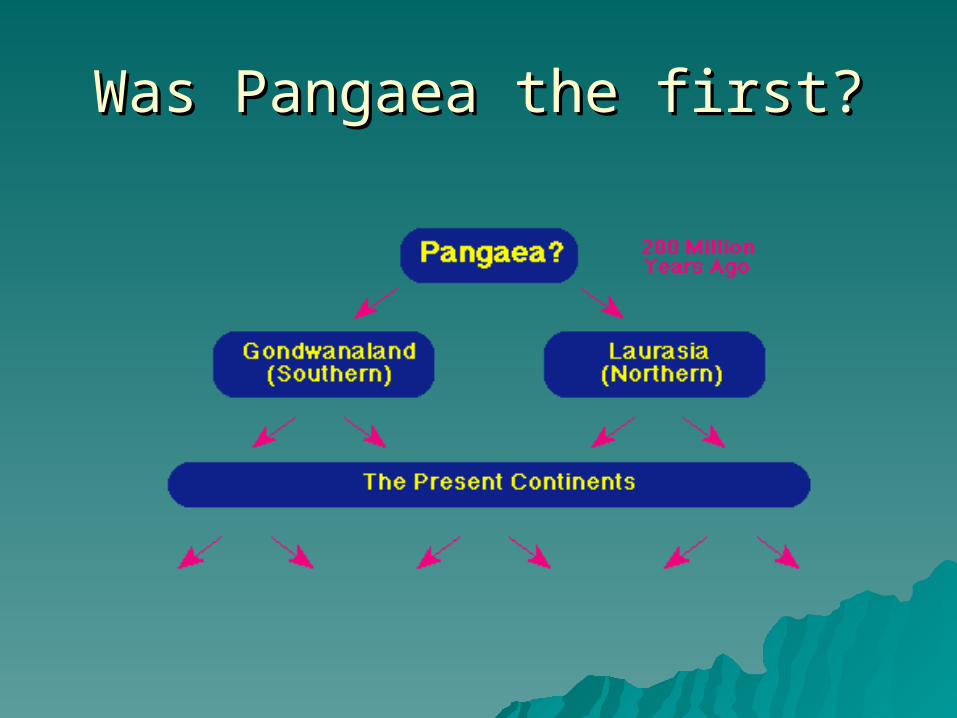
Was Pangaea the first?Was Pangaea the first?
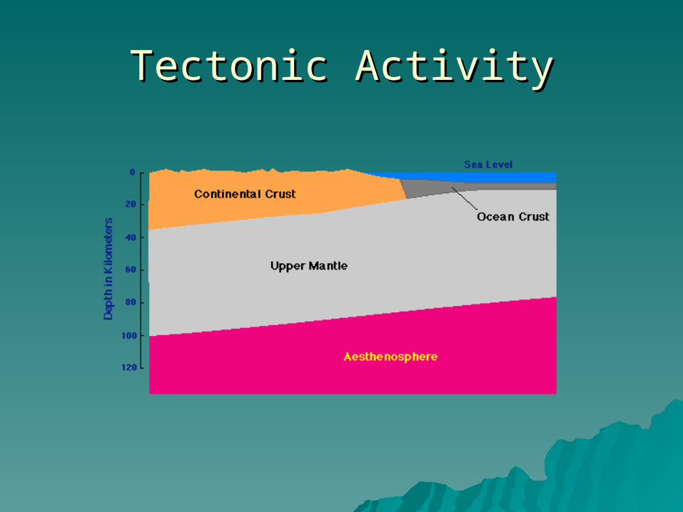
Tectonic ActivityTectonic Activity
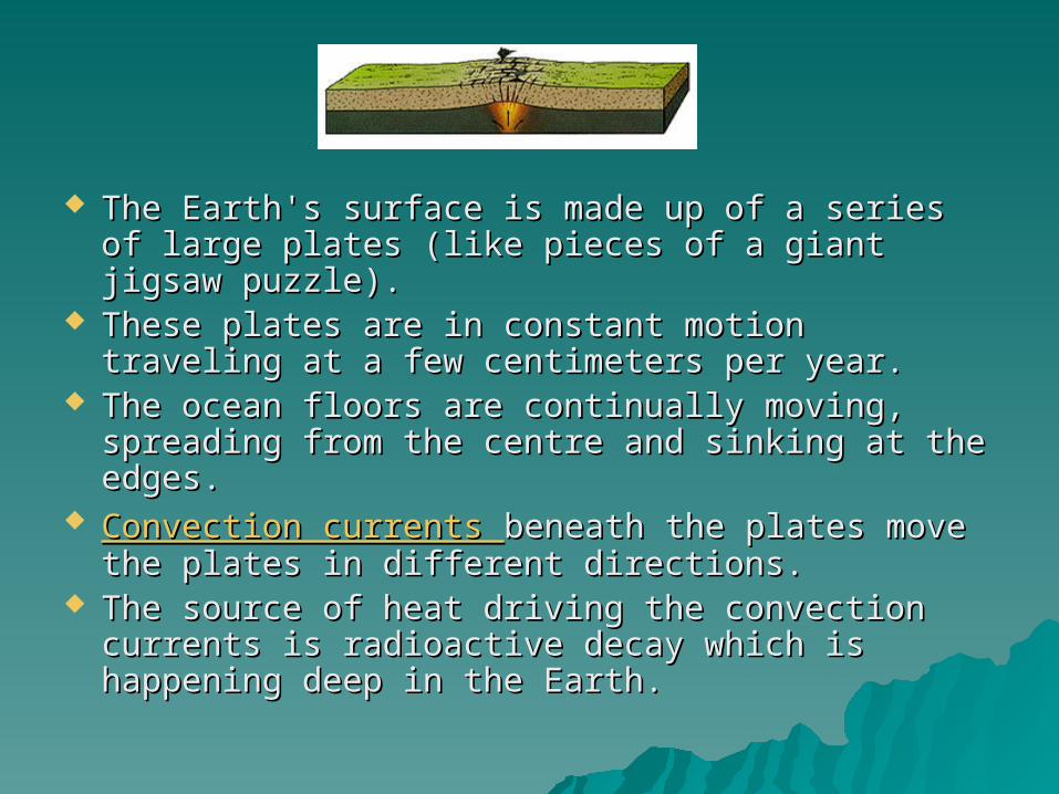
The Earth's surface is made up of a series of large The Earth's surface is made up of a series of large plates (like pieces of a giant jigsaw puzzle). plates (like pieces of a giant jigsaw puzzle).
These plates are in constant motion traveling at a These plates are in constant motion traveling at a few centimeters per year. few centimeters per year.
The ocean floors are continually moving, The ocean floors are continually moving, spreading from the centre and sinking at the spreading from the centre and sinking at the edges. edges.
Convection currents Convection currents beneath the plates move the beneath the plates move the plates in different directions. plates in different directions.
The source of heat driving the convection The source of heat driving the convection currents is radioactive decay which is happening currents is radioactive decay which is happening deep in the Earth. deep in the Earth.
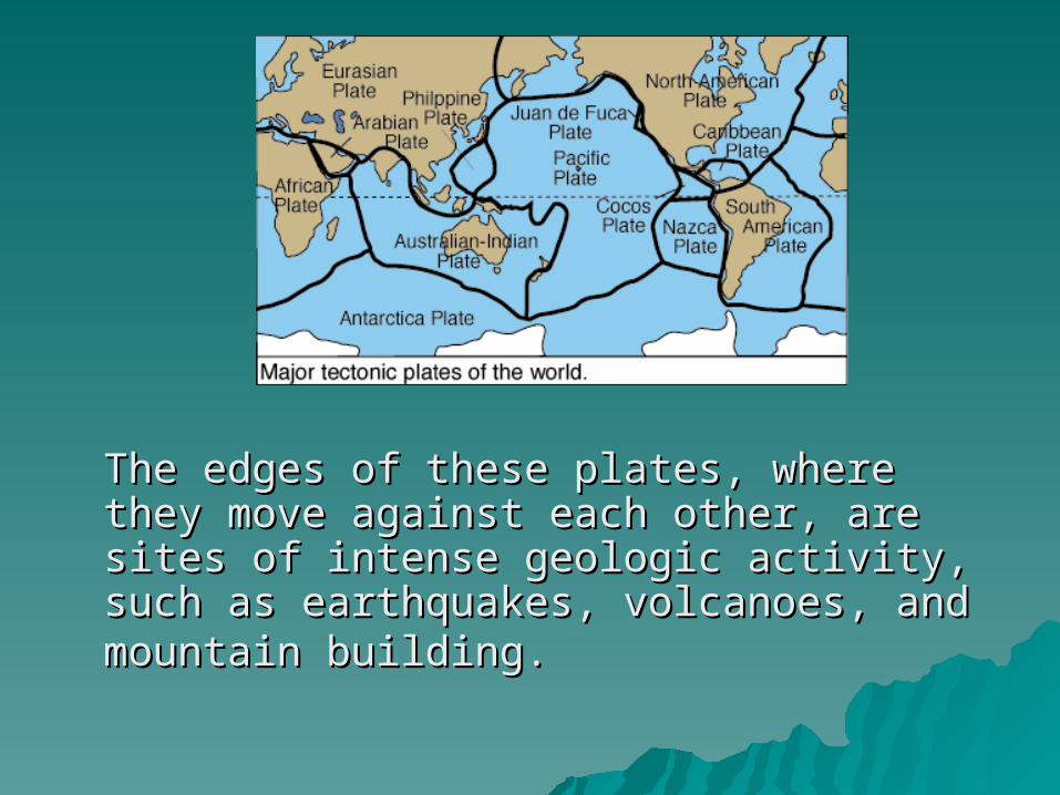
The edges of these plates, where they The edges of these plates, where they move against each other, are sites of move against each other, are sites of intense geologic activity, such as intense geologic activity, such as earthquakes, volcanoes, and mountain earthquakes, volcanoes, and mountain building.building.
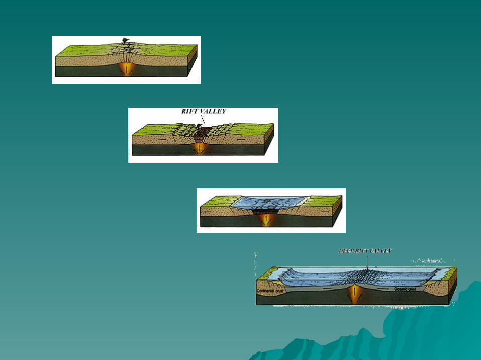
Divergent BoundariesDivergent Boundaries
Continental crust begins to separate Continental crust begins to separate creating a creating a divergingdiverging plate boundary. plate boundary. When a divergence occurs within a When a divergence occurs within a continent it is called rifting. A plume of hot continent it is called rifting. A plume of hot magma rises from deep within the mantle magma rises from deep within the mantle pushing up the crust and causing pressure pushing up the crust and causing pressure forcing the continent to break and forcing the continent to break and separate. Lava flows and earthquakes separate. Lava flows and earthquakes would be seen. Lava flows and would be seen. Lava flows and earthquakes would be seen. earthquakes would be seen.
SLICES OF SCOTLANDSLICES OF SCOTLAND
1998 year saw the agreement for 1998 year saw the agreement for Scottish devolution. But in fact Scottish devolution. But in fact Scotland and England have always Scotland and England have always been different. The rocks from which been different. The rocks from which these two countries are made from these two countries are made from formed in very different parts of the formed in very different parts of the world and it was plate tectonics world and it was plate tectonics which brought them together.which brought them together.
Oceans apart, although joined at the hip today, 550 million Oceans apart, although joined at the hip today, 550 million years ago Scotland and England were both in the southern years ago Scotland and England were both in the southern hemisphere, separated by a vast ocean called the Iapetus. hemisphere, separated by a vast ocean called the Iapetus.
To the south of the Iapetus Ocean lay the North American To the south of the Iapetus Ocean lay the North American continent including the rocks which now form England, continent including the rocks which now form England, Wales and southern Ireland. 5,000 kilometres to the north Wales and southern Ireland. 5,000 kilometres to the north lay the American continent, and the rocks of Scotland. As lay the American continent, and the rocks of Scotland. As permanent as a large ocean may seem, they don't last permanent as a large ocean may seem, they don't last forever. About 500 million years ago both European and forever. About 500 million years ago both European and American continents started to close in on each other. American continents started to close in on each other. Underneath the ocean, cold dense oceanic crust was diving Underneath the ocean, cold dense oceanic crust was diving down under the lighter continental crust moving the down under the lighter continental crust moving the continents ever closer- the process is called subduction. continents ever closer- the process is called subduction. Slowly the Iapetus ocean began to shrink. Around 430 Slowly the Iapetus ocean began to shrink. Around 430 million years ago, the ocean had been squeezed out and million years ago, the ocean had been squeezed out and the continents collided. Scotland and England were fused the continents collided. Scotland and England were fused together. The seamless join occurs, rather amazingly, not together. The seamless join occurs, rather amazingly, not far from Hadrian's wall. far from Hadrian's wall.
Piecing together the evidence - This is a Piecing together the evidence - This is a remarkable theory and you may be wondering remarkable theory and you may be wondering how can geologist tell all this happened. how can geologist tell all this happened. Remarkable theories need remarkable evidence - Remarkable theories need remarkable evidence - and that evidence certainly exists. Geologists and that evidence certainly exists. Geologists know the Iapetus Ocean existed because of know the Iapetus Ocean existed because of fossils called trilobites found in the rocks on fossils called trilobites found in the rocks on either side of the Scotland-England join. But that's either side of the Scotland-England join. But that's not all. The trilobites on the Scottish side are not all. The trilobites on the Scottish side are totally different from those seen in England and totally different from those seen in England and Wales. Why? It's thought that the width of the Wales. Why? It's thought that the width of the Iapetus was far too wide for trilobites to cross. Iapetus was far too wide for trilobites to cross. Only when the ocean had shrunk enough could Only when the ocean had shrunk enough could trilobites swim across which is recorded later on trilobites swim across which is recorded later on in the rock record. in the rock record.
Subduction is happening today under the Subduction is happening today under the Pacific ocean, where crust is diving down Pacific ocean, where crust is diving down under Japan. The volcanoes found on under Japan. The volcanoes found on Japan are the result of the this subduction. Japan are the result of the this subduction. The melting crust forms large underground The melting crust forms large underground vats of molten rocks called magma vats of molten rocks called magma chambers which feed the volcanoes. If you chambers which feed the volcanoes. If you look at a geology map of Scotland you'll look at a geology map of Scotland you'll notice some large red blobs. These blobs notice some large red blobs. These blobs are granites. They formed when the are granites. They formed when the magma chamber cooled and froze. The magma chamber cooled and froze. The granites are further evidence of the granites are further evidence of the closing Iapetus ocean - they were formed closing Iapetus ocean - they were formed from the subducting crust between 500 from the subducting crust between 500 and 400 million years ago. and 400 million years ago.
Rucked Rocks - Perhaps the most convincing Rucked Rocks - Perhaps the most convincing clues to the crunching of the continents can be clues to the crunching of the continents can be found at St Abbs Head in south-east Scotland. found at St Abbs Head in south-east Scotland. Exposures along the coast show rocks which are Exposures along the coast show rocks which are tilted and folded. The rocks are called greywackes tilted and folded. The rocks are called greywackes are made of mud, silt and sandstones which are made of mud, silt and sandstones which formed at the edge of the Iapetus ocean basin. formed at the edge of the Iapetus ocean basin. Geologists know they formed under water Geologists know they formed under water because of structures found in the rocks. One because of structures found in the rocks. One feature is that the fragments of rock from which feature is that the fragments of rock from which they are made are well sorted. The larger, they are made are well sorted. The larger, heavier bits sank quickly while the finer bits took heavier bits sank quickly while the finer bits took longer to settle to the bottom. Nearby rocks longer to settle to the bottom. Nearby rocks contain marine fossils called graptolites which contain marine fossils called graptolites which floated in the ocean. floated in the ocean.
Originally the greywackes were laid down horizontally, but Originally the greywackes were laid down horizontally, but today show spectacular folds. These folded rocks are found today show spectacular folds. These folded rocks are found over many tens of kilometers. What gave rise to such large over many tens of kilometers. What gave rise to such large scale folding? Large scale mountain building forces. These scale folding? Large scale mountain building forces. These forces buckled and rucked the greywackes as the forces buckled and rucked the greywackes as the continents came together. continents came together.
The final evidence comes from the composition of the The final evidence comes from the composition of the Scottish rocks - they match those found in Newfoundland Scottish rocks - they match those found in Newfoundland today. Newfoundland was also part of the American plate today. Newfoundland was also part of the American plate which collided together with the European plate. So how which collided together with the European plate. So how come it's so far away now? Well, on a planet like ours come it's so far away now? Well, on a planet like ours nothing stays still for long. Since the collision, further land nothing stays still for long. Since the collision, further land movements put play to our close encounter with America. movements put play to our close encounter with America. Slowly as the Atlantic ocean opened the American plate Slowly as the Atlantic ocean opened the American plate drifted away, leaving behind a large chunk of rock which drifted away, leaving behind a large chunk of rock which today forms Scotland.today forms Scotland.
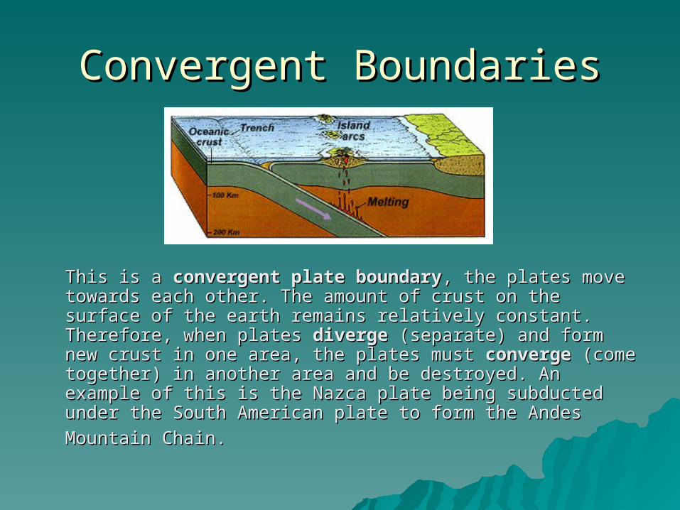
Convergent BoundariesConvergent Boundaries
This is a This is a convergent plate boundaryconvergent plate boundary, the plates move , the plates move towards each other. The amount of crust on the surface of towards each other. The amount of crust on the surface of the earth remains relatively constant. Therefore, when the earth remains relatively constant. Therefore, when plates plates divergediverge (separate) and form new crust in one area, (separate) and form new crust in one area, the plates must the plates must convergeconverge (come together) in another area (come together) in another area and be destroyed. An example of this is the Nazca plate and be destroyed. An example of this is the Nazca plate being subducted under the South American plate to form being subducted under the South American plate to form
the Andes Mountain Chain.the Andes Mountain Chain.
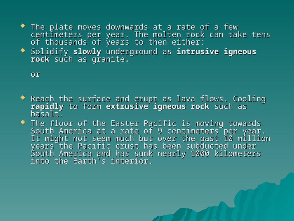
The plate moves downwards at a rate of a few centimeters The plate moves downwards at a rate of a few centimeters per year. The molten rock can take tens of thousands of per year. The molten rock can take tens of thousands of years to then either: years to then either:
Solidify Solidify slowlyslowly underground as underground as intrusive igneous rockintrusive igneous rock such as granitesuch as granite..
oror
Reach the surface and erupt as lava flows. Cooling Reach the surface and erupt as lava flows. Cooling rapidlyrapidly to form to form extrusive igneous rockextrusive igneous rock such as basalt. such as basalt.
The floor of the Easter Pacific is moving towards South The floor of the Easter Pacific is moving towards South America at a rate of 9 centimeters per year. It might not America at a rate of 9 centimeters per year. It might not seem much but over the past 10 million years the Pacific seem much but over the past 10 million years the Pacific crust has been subducted under South America and has crust has been subducted under South America and has sunk nearly 1000 kilometers into the Earth's interior.sunk nearly 1000 kilometers into the Earth's interior.
the the HimalayasHimalayas and Mount Everest and Mount Everest
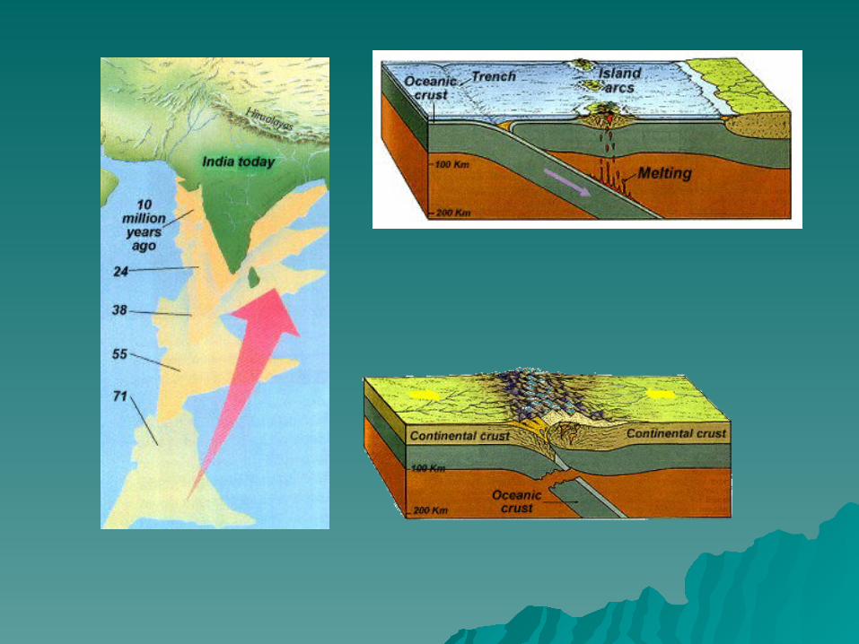
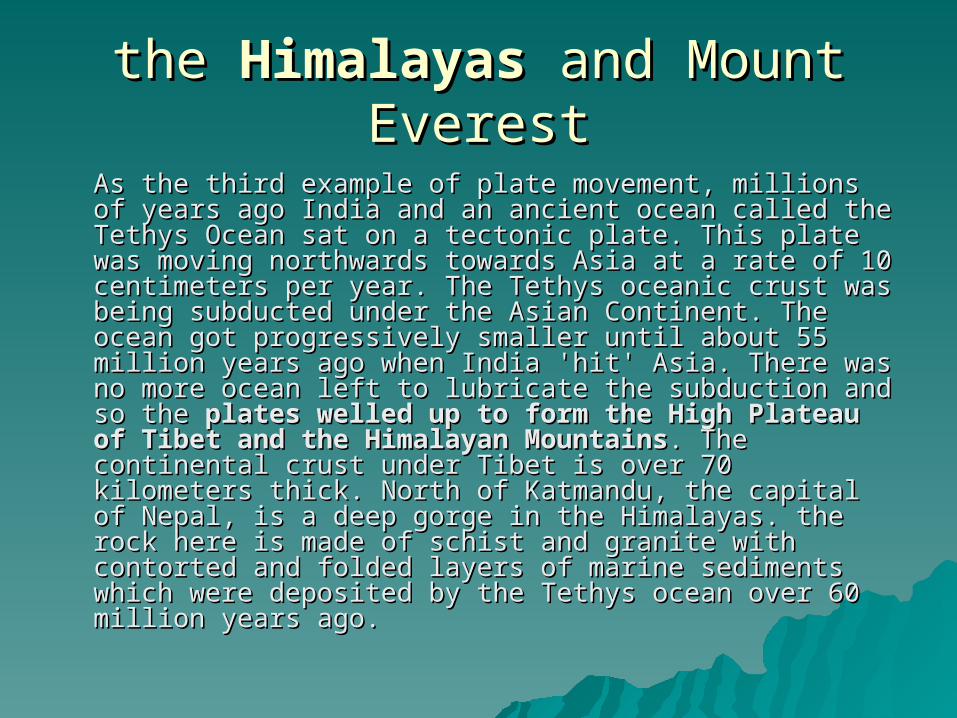
As the third example of plate movement, millions of years As the third example of plate movement, millions of years ago India and an ancient ocean called the Tethys Ocean sat ago India and an ancient ocean called the Tethys Ocean sat on a tectonic plate. This plate was moving northwards on a tectonic plate. This plate was moving northwards towards Asia at a rate of 10 centimeters per year. The towards Asia at a rate of 10 centimeters per year. The Tethys oceanic crust was being subducted under the Asian Tethys oceanic crust was being subducted under the Asian Continent. The ocean got progressively smaller until about Continent. The ocean got progressively smaller until about 55 million years ago when India 'hit' Asia. There was no 55 million years ago when India 'hit' Asia. There was no more ocean left to lubricate the subduction and so the more ocean left to lubricate the subduction and so the plates welled up to form the High Plateau of Tibet plates welled up to form the High Plateau of Tibet and the Himalayan Mountainsand the Himalayan Mountains. The continental crust . The continental crust under Tibet is over 70 kilometers thick. North of Katmandu, under Tibet is over 70 kilometers thick. North of Katmandu, the capital of Nepal, is a deep gorge in the Himalayas. the the capital of Nepal, is a deep gorge in the Himalayas. the rock here is made of schist and granite with contorted and rock here is made of schist and granite with contorted and folded layers of marine sediments which were deposited by folded layers of marine sediments which were deposited by the Tethys ocean over 60 million years ago. the Tethys ocean over 60 million years ago.
Southern Oklahoma AulacogenSouthern Oklahoma Aulacogen
Consortium for Continental Reflection Profiling - deep Consortium for Continental Reflection Profiling - deep reflection profiles recorded across the Wichita Mountains reflection profiles recorded across the Wichita Mountains and Anadarko Basin suggest that significant crustal and Anadarko Basin suggest that significant crustal shortening occurred in the final stages of the evolution of shortening occurred in the final stages of the evolution of the Southern Oklahoma aulacogen. the Southern Oklahoma aulacogen.
The crystalline rocks of the Wichita Mountains were thrust The crystalline rocks of the Wichita Mountains were thrust in Pennsylvanian time northeastward over sedimentary in Pennsylvanian time northeastward over sedimentary rocks of the Anadarko Basin along a series of faults with rocks of the Anadarko Basin along a series of faults with moderate (average 30° to 40°) and southwesterly dips. moderate (average 30° to 40°) and southwesterly dips. These faults can be traced possibly as deep as 20 to 24 km. These faults can be traced possibly as deep as 20 to 24 km.
Listric thrust faults and hanging-wall anticlines developed in the Listric thrust faults and hanging-wall anticlines developed in the sedimentary rocks of the basin. These features contrast with sedimentary rocks of the basin. These features contrast with conventional interpretations of Pennsylvanian structures as the conventional interpretations of Pennsylvanian structures as the result of predominantly vertical movements along high-angle result of predominantly vertical movements along high-angle faults, and they suggest that Pennsylvanian downwarping of the faults, and they suggest that Pennsylvanian downwarping of the Anadarko Basin was at least partially due to thrust loading. Anadarko Basin was at least partially due to thrust loading. Truncations of reflections from Cambrian-Ordovician rocks in the Truncations of reflections from Cambrian-Ordovician rocks in the deepest part of the basin suggest normal faulting, which would deepest part of the basin suggest normal faulting, which would support ideas of an early extensional stage in the aulacogen cycle. support ideas of an early extensional stage in the aulacogen cycle. The distinctive Precambrian layering seen on earlier COCORP data The distinctive Precambrian layering seen on earlier COCORP data recorded south of the Wichita Mountains cannot be recognized recorded south of the Wichita Mountains cannot be recognized under the Anadarko Basin, and the Proterozoic basin containing under the Anadarko Basin, and the Proterozoic basin containing that layering may have been bounded on its north side by a that layering may have been bounded on its north side by a Precambrian fault. This inferred fault was probably twice Precambrian fault. This inferred fault was probably twice reactivated during formation of the Southern Oklahoma aulacogenreactivated during formation of the Southern Oklahoma aulacogen—once during late Precambrian(?)-Early Cambrian extension, and —once during late Precambrian(?)-Early Cambrian extension, and again during Pennsylvanian compression. The popular view that again during Pennsylvanian compression. The popular view that aulacogens originated from radial rifting of updomed, aulacogens originated from radial rifting of updomed, homogeneous continental crust is probably too simplified, and a homogeneous continental crust is probably too simplified, and a more important constraint on their location and development may more important constraint on their location and development may be the nature of pre-existing lines of weakness. be the nature of pre-existing lines of weakness.
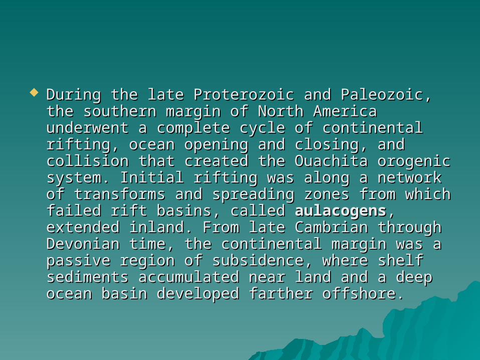
The Ouachita MountainsThe Ouachita MountainsThe Ouachita Mountains are a Paleozoic orogenic belt across the The Ouachita Mountains are a Paleozoic orogenic belt across the south-central portion of the United States. The Ouachitas are south-central portion of the United States. The Ouachitas are surficial mountains in parts of Arkansas and Oklahoma, and surficial mountains in parts of Arkansas and Oklahoma, and Ouachita structures are exposed in the Marathon Basin of West Ouachita structures are exposed in the Marathon Basin of West Texas. In between, the Ouachitas are buried beneath Cretaceous Texas. In between, the Ouachitas are buried beneath Cretaceous and younger strata. The Ouachita Mountains have much in and younger strata. The Ouachita Mountains have much in common with the Appalachian Mountains; the Ouachitas also have common with the Appalachian Mountains; the Ouachitas also have their own unique aspects in terms of rock sequence and tectonic their own unique aspects in terms of rock sequence and tectonic setting. During the late Proterozoic and Paleozoic, the southern setting. During the late Proterozoic and Paleozoic, the southern margin of North America underwent a complete cycle of margin of North America underwent a complete cycle of continental rifting, ocean opening and closing, and collision that continental rifting, ocean opening and closing, and collision that created the Ouachita orogenic system. Initial rifting was along a created the Ouachita orogenic system. Initial rifting was along a network of transforms and spreading zones from which failed rift network of transforms and spreading zones from which failed rift basins, called basins, called aulacogensaulacogens, extended inland. From late Cambrian , extended inland. From late Cambrian through Devonian time, the continental margin was a passive through Devonian time, the continental margin was a passive region of subsidence, where shelf sediments accumulated near region of subsidence, where shelf sediments accumulated near land and a deep ocean basin developed farther offshore. land and a deep ocean basin developed farther offshore.
The Ouachita system displays the "starved The Ouachita system displays the "starved basin" phase of development from late basin" phase of development from late Ordovician through Devonian time. Ordovician through Devonian time. Representative formations include the Big Representative formations include the Big Fork Chert, Arkansas Novaculite, and Fork Chert, Arkansas Novaculite, and Caballos Novaculite. These chert and shale Caballos Novaculite. These chert and shale formations were deposited slowly in deep formations were deposited slowly in deep water of a subsiding ocean basin. The water of a subsiding ocean basin. The starved-basin phase represents the starved-basin phase represents the maturing ocean basin following earlier maturing ocean basin following earlier continental rifting and prior to subsequent continental rifting and prior to subsequent collision. collision.
Beginning in early Mississippian time, a dramatic Beginning in early Mississippian time, a dramatic change in sedimentation took place, with rapid change in sedimentation took place, with rapid accumulation of very thick flysch (turbidites) and accumulation of very thick flysch (turbidites) and wildflysch (submarine landslides). Northward wildflysch (submarine landslides). Northward thrusting of the continental margin culminated in thrusting of the continental margin culminated in uplift of mountains by Pennsylvanian time and uplift of mountains by Pennsylvanian time and draining of shallow inland seas during the draining of shallow inland seas during the Permian. Crustal stress was transmitted into the Permian. Crustal stress was transmitted into the continental interior and resulted in local uplifts, continental interior and resulted in local uplifts, such as the Arbuckle Mountains, normal to the such as the Arbuckle Mountains, normal to the Ouachita trend. The region was once again Ouachita trend. The region was once again subjected to continental rifting during Jurassic subjected to continental rifting during Jurassic and Cretaceous time, as evidenced by the Gulf and Cretaceous time, as evidenced by the Gulf Coastal Plain sedimentary sequence and by Coastal Plain sedimentary sequence and by Cretaceous intrusive rocksCretaceous intrusive rocks
The Ouachita orogeny is distinctive in that volcanism, The Ouachita orogeny is distinctive in that volcanism, metamorphism, and intrusion are notably absent metamorphism, and intrusion are notably absent throughout most of the system. The obvious interpretation throughout most of the system. The obvious interpretation is that a subduction zone dipped southward beneath the is that a subduction zone dipped southward beneath the converging plate. By early Mississippian time, the Ouachita converging plate. By early Mississippian time, the Ouachita basin had become a narrow trough into which a vast basin had become a narrow trough into which a vast amount of clastic and some (very little) volcanic sediment amount of clastic and some (very little) volcanic sediment was rapidly deposited from the south. Thrust uplift of this was rapidly deposited from the south. Thrust uplift of this material was the result of a collision with a continental material was the result of a collision with a continental terrane that had been rifted from North America earlier. terrane that had been rifted from North America earlier. This terrane underlies the Gulf Coastal Plain, over which a This terrane underlies the Gulf Coastal Plain, over which a great thickness of Cretaceous and Tertiary sediment has great thickness of Cretaceous and Tertiary sediment has accumulated on a slowly subsiding, passive continental accumulated on a slowly subsiding, passive continental margin.margin.
The Ouachita Mountains are fold mountains like the The Ouachita Mountains are fold mountains like the Appalachian MountainsAppalachian Mountains to the east, and were originally part to the east, and were originally part of that range. During the of that range. During the PennsylvanianPennsylvanian part of the part of the CarboniferousCarboniferous period, about 300 million years ago, the period, about 300 million years ago, the coastline of the coastline of the Gulf of MexicoGulf of Mexico ran through the central parts ran through the central parts of Arkansas. As the of Arkansas. As the South American plateSouth American plate drifteddrifted northward, northward, a a subductionsubduction zone was created in this region. The South zone was created in this region. The South American American oceanic crustoceanic crust was forced underneath the less- was forced underneath the less-dense North American dense North American continental crustcontinental crust. Geologists call this . Geologists call this collision the collision the Ouachita Ouachita orogenyorogeny. The collision buckled the . The collision buckled the continental crust, producing the fold mountains we call the continental crust, producing the fold mountains we call the Ouachitas. At one time the Ouachita Mountains were very Ouachitas. At one time the Ouachita Mountains were very similar in height to the current elevations of the similar in height to the current elevations of the Rocky MountainsRocky Mountains. Due to the Ouachitas' age, the craggy . Due to the Ouachitas' age, the craggy tops have eroded away leaving the low formations that tops have eroded away leaving the low formations that used to be the heart of the mountains.used to be the heart of the mountains.
Unlike most other mountain ranges in the Unlike most other mountain ranges in the United StatesUnited States, the Ouachitas run east and west , the Ouachitas run east and west rather than north and south. Also, Ouachitas are rather than north and south. Also, Ouachitas are distinctive in that volcanism, distinctive in that volcanism, metamorphismmetamorphism, , and intrusions are notably absent throughout and intrusions are notably absent throughout most of the system.most of the system.
The Ouachitas are noted for The Ouachitas are noted for quartzquartz crystal crystal deposits around the deposits around the Mount IdaMount Ida area and for area and for renowned renowned Arkansas novaculiteArkansas novaculite whetstonewhetstones. s. This quartz was formed during the This quartz was formed during the Ouachita Ouachita orogenyorogeny, as folded rocks cracked and allowed , as folded rocks cracked and allowed fluids from deep in the Earth to fill the cracks.fluids from deep in the Earth to fill the cracks.
The Ouachita Mountain area of Arkansas is dominated by The Ouachita Mountain area of Arkansas is dominated by Cambrian through Pennsylvanian clastic sediments, with Cambrian through Pennsylvanian clastic sediments, with the lower Collier formation in the core of the range and the the lower Collier formation in the core of the range and the Atoka formation on the flanks. The Atoka Formation, formed Atoka formation on the flanks. The Atoka Formation, formed in the Pennsylvanian Period, is a sequence of marine, in the Pennsylvanian Period, is a sequence of marine, mostly tan to gray silty sandstones and grayish-black mostly tan to gray silty sandstones and grayish-black shales. Some rare calcareous beds and siliceous shales are shales. Some rare calcareous beds and siliceous shales are known. The Collier sequence is composed of gray to black, known. The Collier sequence is composed of gray to black, lustrous shale containing occasional thin beds of dense, lustrous shale containing occasional thin beds of dense, black, and intensely fractured chert. An interval of bluish-black, and intensely fractured chert. An interval of bluish-gray, dense to spary, thin-bedded limestone may be gray, dense to spary, thin-bedded limestone may be present. Near its top, the limestone is conglomeratic and present. Near its top, the limestone is conglomeratic and pelletoidal, in part, with pebbles and cobbles of limestone, pelletoidal, in part, with pebbles and cobbles of limestone, chert, meta-arkose, and quartz. It was formed during the chert, meta-arkose, and quartz. It was formed during the Late Cambrian.Late Cambrian.
The local rock formations are some of the The local rock formations are some of the most distinctive in the state of Oklahoma. most distinctive in the state of Oklahoma. Just north of Broken Bow, Just north of Broken Bow, sedimentary rocksedimentary rock has been thrust upward has been thrust upward due to an ancient collision of the due to an ancient collision of the North AmericanNorth American and and South American PlateSouth American Plates, forming what is now the s, forming what is now the Ouachita MountainsOuachita Mountains. Evidence of what is . Evidence of what is called the Ouachita called the Ouachita orogenyorogeny can be seen can be seen all over the park, where some layers of all over the park, where some layers of rock can be seen tilted up at angles of rock can be seen tilted up at angles of about sixty-degrees. These geologic about sixty-degrees. These geologic features can be easily viewed around features can be easily viewed around Broken Bow Lake and Mountain Fork River, Broken Bow Lake and Mountain Fork River, where where erosionerosion has left much of the rock has left much of the rock exposed. exposed.
TEACHER GUIDEto
OKLAHOMA LANDFORMSand
OKLAHOMA ROCKS
PASS for Grade 8: Earth/Space Science
Standard 4.1: Landforms result from constructive forces such as crustal deformation, volcanic eruption, and deposition of sediment and destructive forces such as weathering and erosion.
Standard 4.2: The formation, weathering, sedimentation and reformation of rock constitute a continuing “rock cycle” in which the total amount of material stays the same as its form changes.
Places to see metamorphic rock in Oklahoma While metamorphic rock is not common on the surface of Oklahoma’s landscape, there are a few locations where it can be seen. Metamorphic rock is at the earth’s surface in a couple of places at the eastern edge of the Arbuckle Mountains, north of Tishomingo. A small band of metamorphic rock is also located in the Wichita Mountains, north of Mount Scott. One of the best places to observe metamorphic rock in Oklahoma is at, or near to, Beavers Bend State Park, in southeast Oklahoma. Slate is present within the rock formations that are exposed below the emergency spillway of Broken Bow Lake, as well as on the east side of U.S. highway #259, 2.5 miles north of the south entrance to Beavers Bend State Park. A third location is about twelve miles west of Broken Bow, on the south side of state highway #3, immediately west of the Glover River. Here the shale is actually a phyllite, which is a variety of metamorphic rock that is an intermediate between a slate and a schist.

PANGAEA PANGAEA (Once? Twice? Three times? What about four times?)(Once? Twice? Three times? What about four times?)
During the late Proterozoic and Paleozoic, the During the late Proterozoic and Paleozoic, the southern margin of North America underwent a southern margin of North America underwent a complete cycle of continental rifting, ocean complete cycle of continental rifting, ocean opening and closing, and collision that created opening and closing, and collision that created the Ouachita orogenic system. Initial rifting was the Ouachita orogenic system. Initial rifting was along a network of transforms and spreading along a network of transforms and spreading zones from which failed rift basins, called zones from which failed rift basins, called aulacogensaulacogens, extended inland. From late , extended inland. From late Cambrian through Devonian time, the continental Cambrian through Devonian time, the continental margin was a passive region of subsidence, margin was a passive region of subsidence, where shelf sediments accumulated near land where shelf sediments accumulated near land and a deep ocean basin developed farther and a deep ocean basin developed farther offshore. offshore.
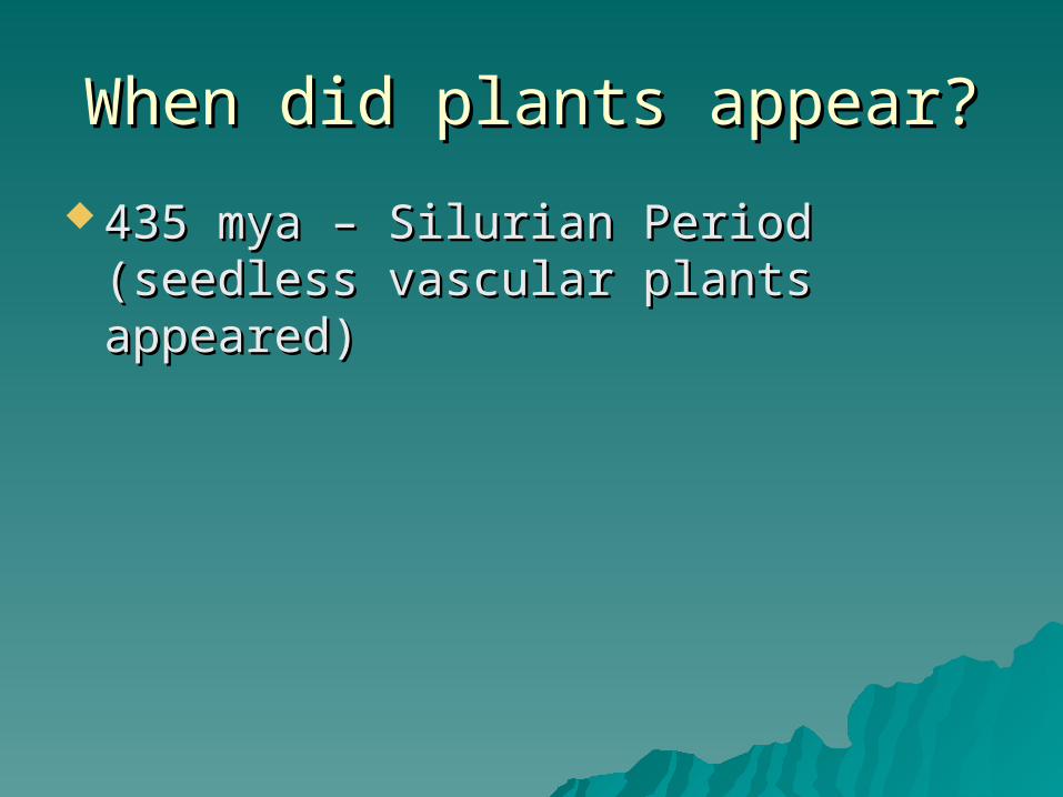
When did plants appear?When did plants appear?
435 mya – Silurian Period (seedless 435 mya – Silurian Period (seedless vascular plants appeared)vascular plants appeared)
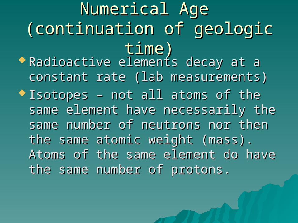
Numerical Age Numerical Age (continuation of geologic time)(continuation of geologic time)
Radioactive elements decay at a Radioactive elements decay at a constant rate (lab measurements)constant rate (lab measurements)
Isotopes – not all atoms of the same Isotopes – not all atoms of the same element have necessarily the same element have necessarily the same number of neutrons nor then the number of neutrons nor then the same atomic weight (mass). Atoms same atomic weight (mass). Atoms of the same element do have the of the same element do have the same number of protons.same number of protons.
238238U is the symbolism for the uranium U is the symbolism for the uranium nucleus (a nuclide) that has 238 nucleus (a nuclide) that has 238 neutrons and protons. This number neutrons and protons. This number is referred to as the mass number. is referred to as the mass number. All uranium atoms have 92 protons All uranium atoms have 92 protons (atomic number).(atomic number).
238238U has then 92 protons and 146 U has then 92 protons and 146 neutronsneutrons
Some isotopes of a given element Some isotopes of a given element are stable whereas others are not are stable whereas others are not stable (radioactive)stable (radioactive)
Radioactive decay converts Radioactive decay converts (transforms) a radioactive atom into (transforms) a radioactive atom into another atom type that is not another atom type that is not radioactive – a different elementradioactive – a different element
The parent isotope is the atom that The parent isotope is the atom that undergoes decayundergoes decay
The daughter product is the new The daughter product is the new element that is formedelement that is formed
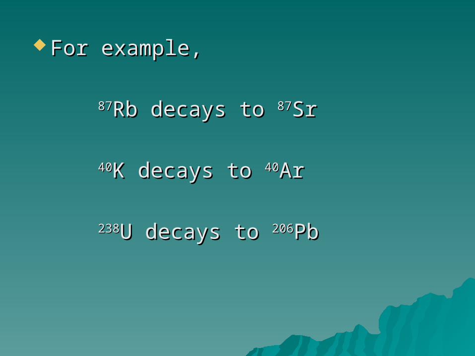
For example,For example,
8787Rb decays to Rb decays to 8787SrSr
4040K decays to K decays to 4040ArAr
238238U decays to U decays to 206206PbPb
Physicists can measure how long it Physicists can measure how long it takes for half of a group of parent takes for half of a group of parent atoms to decay into daughter atoms to decay into daughter productsproducts
Half-lifeHalf-life of the isotope of the isotope
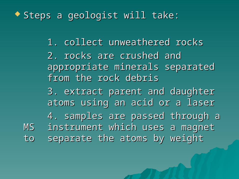
Steps a geologist will take:Steps a geologist will take:
1. collect unweathered rocks1. collect unweathered rocks
2. rocks are crushed and 2. rocks are crushed and appropriate minerals separated appropriate minerals separated from from the rock debristhe rock debris
3. extract parent and daughter 3. extract parent and daughter atoms using an acid or a laseratoms using an acid or a laser
4. samples are passed through a MS 4. samples are passed through a MS instrument which uses a magnet to instrument which uses a magnet to separate the atoms by weightseparate the atoms by weight
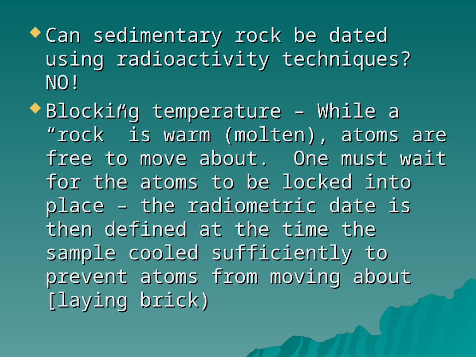
Can sedimentary rock be dated using Can sedimentary rock be dated using radioactivity techniques? NO!radioactivity techniques? NO!
Blocking temperature – While a Blocking temperature – While a “rock” is warm (molten), atoms are “rock” is warm (molten), atoms are free to move about. One must wait free to move about. One must wait for the atoms to be locked into place for the atoms to be locked into place – the radiometric date is then defined – the radiometric date is then defined at the time the sample cooled at the time the sample cooled sufficiently to prevent atoms from sufficiently to prevent atoms from moving about [laying brick)moving about [laying brick)
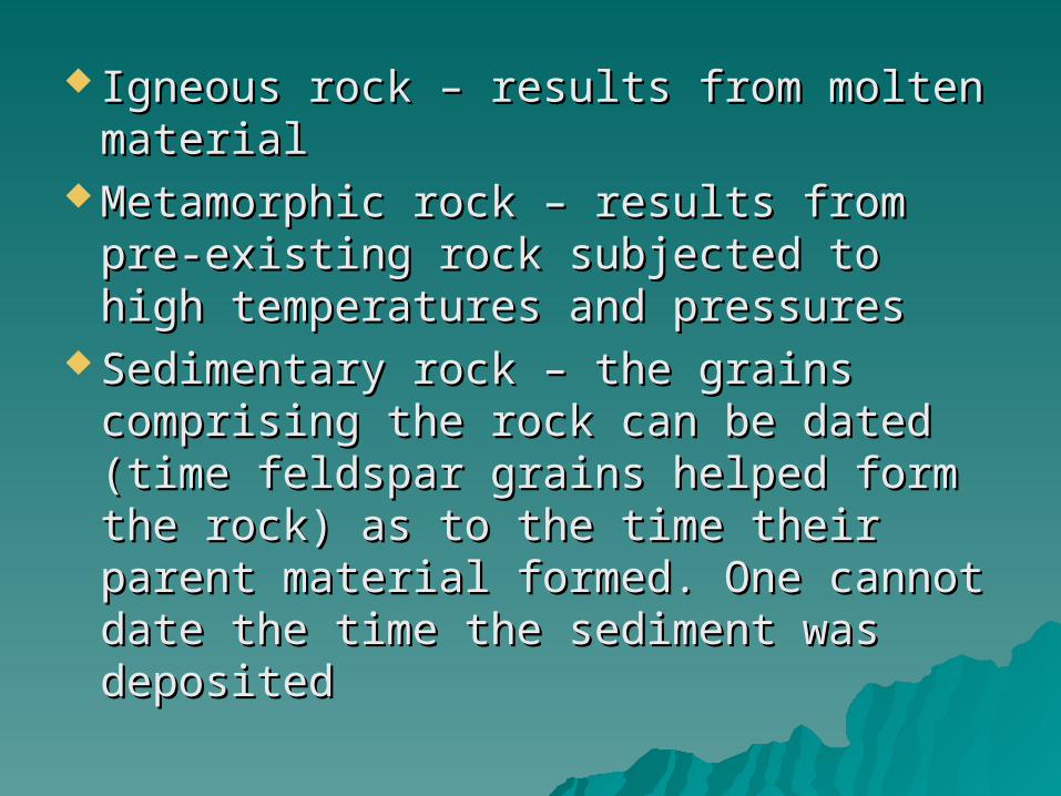
Igneous rock – results from molten Igneous rock – results from molten materialmaterial
Metamorphic rock – results from pre-Metamorphic rock – results from pre-existing rock subjected to high existing rock subjected to high temperatures and pressurestemperatures and pressures
Sedimentary rock – the grains Sedimentary rock – the grains comprising the rock can be dated comprising the rock can be dated (time feldspar grains helped form the (time feldspar grains helped form the rock) as to the time their parent rock) as to the time their parent material formed. One cannot date material formed. One cannot date the time the sediment was depositedthe time the sediment was deposited
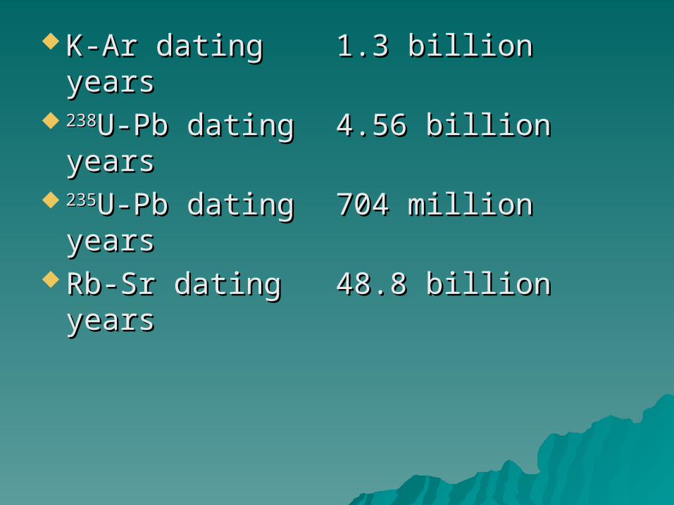
K-Ar dating K-Ar dating 1.3 billion years1.3 billion years 238238U-Pb datingU-Pb dating 4.56 billion years4.56 billion years 235235U-Pb datingU-Pb dating 704 million years704 million years Rb-Sr dating Rb-Sr dating 48.8 billion years48.8 billion years
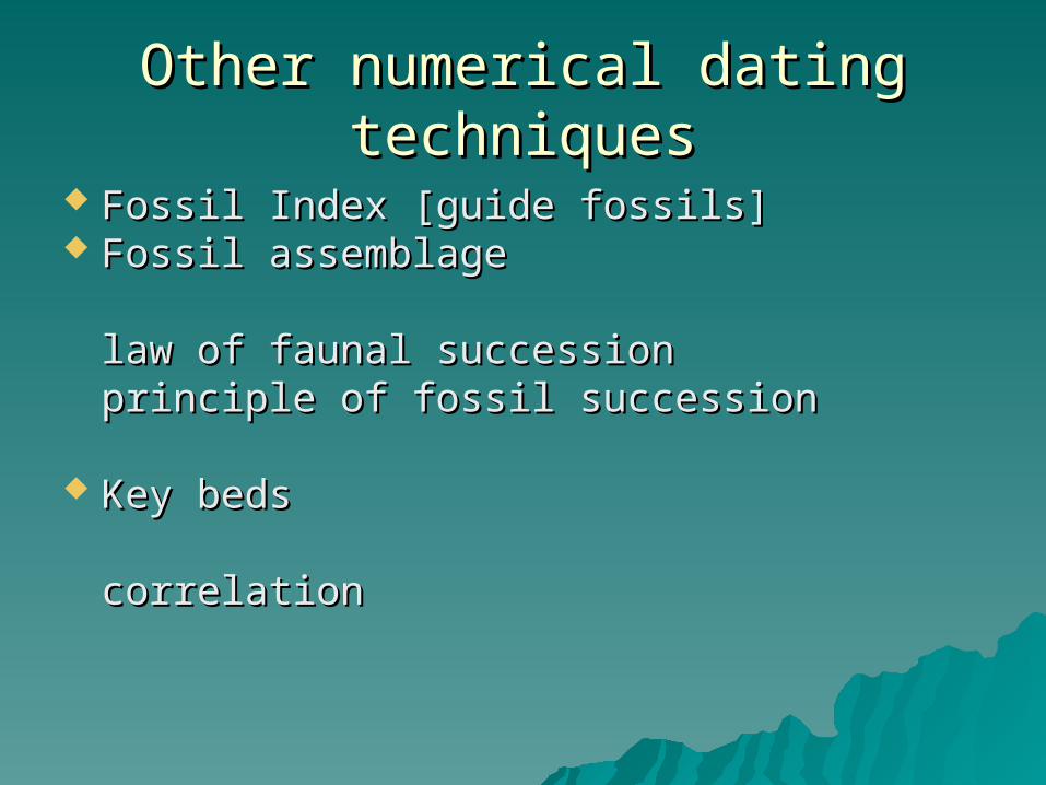
Other numerical dating techniquesOther numerical dating techniques
Fossil Index [guide fossils]Fossil Index [guide fossils] Fossil assemblage Fossil assemblage
law of faunal succession law of faunal succession principle of fossil successionprinciple of fossil succession
Key bedsKey beds correlationcorrelation
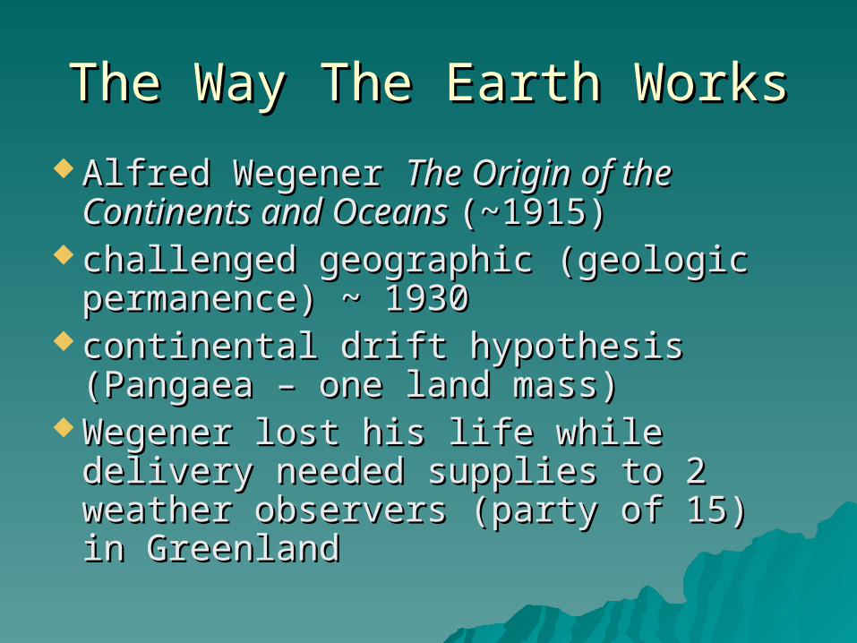
The Way The Earth WorksThe Way The Earth Works
Alfred Wegener Alfred Wegener The Origin of the The Origin of the Continents and Oceans Continents and Oceans (~1915)(~1915)
challenged geographic (geologic challenged geographic (geologic permanence) ~ 1930permanence) ~ 1930
continental drift hypothesis (Pangaea continental drift hypothesis (Pangaea – one land mass)– one land mass)
Wegener lost his life while delivery Wegener lost his life while delivery needed supplies to 2 weather needed supplies to 2 weather observers (party of 15) in Greenland observers (party of 15) in Greenland
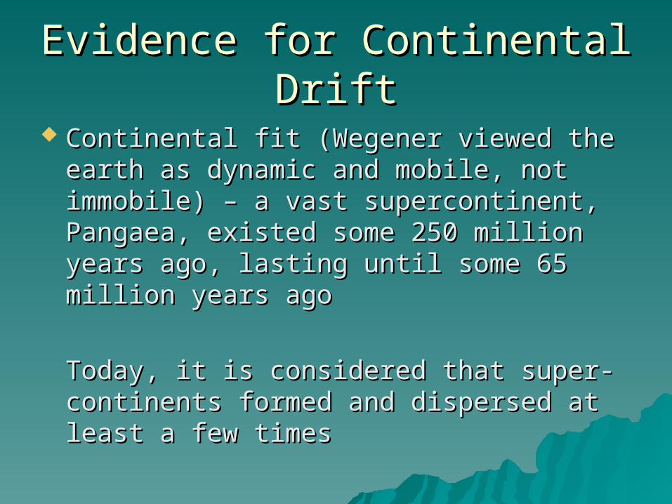
Evidence for Continental DriftEvidence for Continental Drift
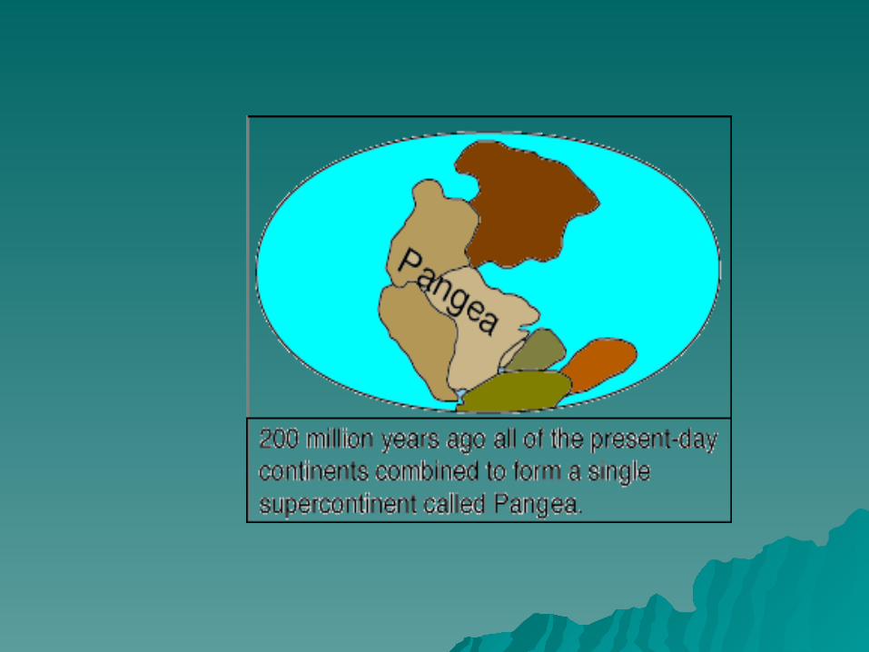
Continental fit (Wegener viewed the earth Continental fit (Wegener viewed the earth as dynamic and mobile, not immobile) – a as dynamic and mobile, not immobile) – a vast supercontinent, Pangaea, existed vast supercontinent, Pangaea, existed some 250 million years ago, lasting until some 250 million years ago, lasting until some 65 million years agosome 65 million years ago
Today, it is considered that super-Today, it is considered that super-continents formed and dispersed at least a continents formed and dispersed at least a few timesfew times
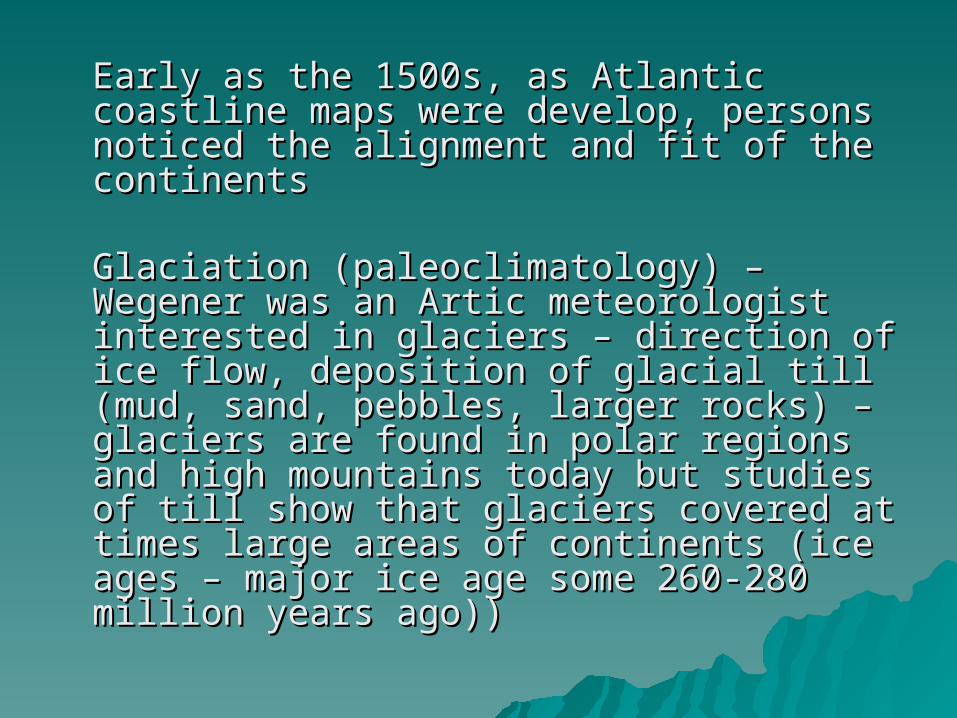
Early as the 1500s, as Atlantic coastline Early as the 1500s, as Atlantic coastline maps were develop, persons noticed the maps were develop, persons noticed the alignment and fit of the continentsalignment and fit of the continents
Glaciation (paleoclimatology) – Wegener Glaciation (paleoclimatology) – Wegener was an Artic meteorologist interested in was an Artic meteorologist interested in glaciers – direction of ice flow, deposition glaciers – direction of ice flow, deposition of glacial till (mud, sand, pebbles, larger of glacial till (mud, sand, pebbles, larger rocks) – glaciers are found in polar regions rocks) – glaciers are found in polar regions and high mountains today but studies of and high mountains today but studies of till show that glaciers covered at times till show that glaciers covered at times large areas of continents (ice ages – major large areas of continents (ice ages – major ice age some 260-280 million years ago))ice age some 260-280 million years ago))
glacial striations pointed outward from glacial striations pointed outward from southeastern Africasoutheastern Africa
During the Paleozoic Era, as the southern During the Paleozoic Era, as the southern continents straddled the South Pole, the continents straddled the South Pole, the southern regions of North America, Europe southern regions of North America, Europe and the northwestern part of Africa would and the northwestern part of Africa would have straddled the equator provide have straddled the equator provide tropical or semitropical climates ---- coal tropical or semitropical climates ---- coal depositsdeposits

What does one expect in the tropical What does one expect in the tropical regions (tropical climates)?regions (tropical climates)?
coal deposition environments (Where do coal deposition environments (Where do we find coal beds today?)we find coal beds today?)
reef development in the shallow seas of reef development in the shallow seas of tropical regionstropical regions
deserts developed in the subtroical deserts developed in the subtroical regions (sand dune formation)regions (sand dune formation)
accumulation of salt deposits from accumulation of salt deposits from evaporating sea waterevaporating sea water
third clue - distribution of fossilsthird clue - distribution of fossils
Why are there no polar bears in the Why are there no polar bears in the Antarctica? Kangaroos only in Antarctica? Kangaroos only in Australia?Australia?
Glossopteris, Mesosaurus, Glossopteris, Mesosaurus, Cynognathus, LystrosaurusCynognathus, Lystrosaurus
fourth clue – matching geologic units fourth clue – matching geologic units wherein rocks of adjacent coastlines wherein rocks of adjacent coastlines matched (Appalachian Mt.)matched (Appalachian Mt.)
fifth clue – paleomagnetism (since fifth clue – paleomagnetism (since 1853 – Italian physicist) – magnetism 1853 – Italian physicist) – magnetism in ancient rocks (What is magnetic in ancient rocks (What is magnetic declination?)declination?)
Curie point (~ 350 – 550 degrees Curie point (~ 350 – 550 degrees Celsius)Celsius)
apparent polar wanderingapparent polar wandering
A key A key to undersatnding the to undersatnding the importance of continental driftimportance of continental drift
& sea-floor spreading& sea-floor spreading