25. Availability of Land and Premises - City of Cessnock - Infrastructure.pdf · Availability of...
38
Transcript of 25. Availability of Land and Premises - City of Cessnock - Infrastructure.pdf · Availability of...


25. Availability of Land and Premises
The availability of suitable land or premises, at the ‘right’ price is part of any locational decision. The amount of land available for development also has implications for the construction and related industries. This Chapter assesses the supply and suitability of industrial and commercial land and premises within Cessnock LGA and the supply of residential land available to support population growth. The Lower Hunter Regional Strategy has identified Cessnock LGA as a growth area, with the LGA to accommodate an additional 21,700 dwellings over the next 25 years. This equates to an estimated 45,570 additional people and the need for over 19,000 jobs. 25.1 Industrial Land There are six established industrial areas in Cessnock LGA, with industrial activity also found in rural areas and intermixed with residential activities. The main areas are: • Cessnock – two areas plus dispersed activities. • Kurri Kurri – Weston – 1 large industrial area. • Branxton – two small areas. • Hunter Employment Zone (HEZ). The zonings for industrial land within Cessnock LGA1 are: • IN1 – General Industrial – manufacturing, warehousing and industrial activities that are not
hazardous or offensive, can include light industrial activities.
• IN2 – Light Industrial – activities that do not interfere with the amenity of the surrounding area through the generation of noise, vibrations or emissions.
• IN3 – Heavy Industry – activities that require separation from other development because of the
nature of the processes involved or the materials used, stored or produced. Activities include hazardous and offensive industries.
• B7 – Business Park – allows for a mix of light industrial, commercial and bulky goods retail
development. The total supply of zoned industrial land within Cessnock LGA is 1010.5 hectares (0.53% of the total area of the LGA) of which 875.66 hectares is General Industrial Land (IN1), 60.89 hectares is Light Industrial Land (IN2) and 73.76 hectares is Heavy Industrial Land (IN3). There is also 23.987 hectares in Cessnock zoned Business Park. 86.7% of the zoned industrial land within the LGA is located in the Hunter Economic Zone (HEZ), with the remainder (140.5ha) dispersed between Cessnock, Kurri Kurri and Branxton, with 66.9% of this land being in Kurri Kurri. The amount of industrial land in the City was only increased by 6.7 hectares with the introduction of the Cessnock City Local Environmental Plan (2011). There are currently no modern industrial units available for purchase or lease within Cessnock LGA. Cessnock There are two small established industrial areas in Cessnock which are located along the Maitland Road corridor on the northern side of the CBD and on the southern side of CBD centred on Cessnock Street, plus the former Bonds Factory site. The Maitland Road corridor on the northern side of town has three small clusters of industrial activity. Under the Cessnock City LEP 2011, the South Cessnock industrial area has been rezoned to Mixed Use. This leaves 16.4 hectares of light industrial land within the town, of which only 4 hectares is vacant.
1 Cessnock City Council Local Environmental Plan 2011
230 | Cessnock LGA Economic Development Strategy – Economic Profile, 2013

Maitland Road The two areas near the Old Maitland Road intersection are zoned Light Industrial and support a variety of activities including a car dealership, landscape supplies, computer cartridges, storage etc. The area to the north of Maitland Road (adjacent to Cessnock East Primary School) is relatively flat with access from both Maitland Road and Old Maitland Road. While only part of the zoned area is developed, the remainder of the site is forested and appears to be part of a creek corridor. Development potential appears limited.
Car and motorbike dealerships are a feature along Maitland Road near the Old Maitland Road Intersection. The area to the south of Maitland Road is located on footslopes and is hilly. Other than a car dealership, most of the land is occupied by older industrial units, with a few vacant lots as well as vacant buildings. While the area is ripe for redevelopment, the small size of the area and the hilly topography are constraints. These two areas form the eastern ‘gateway’ arrival point for Cessnock. Neither area presents well. Any new development or redevelopment needs to take into consideration the entry status of these areas and improve the visual impact and presentation. Maitland Road – Tunnel Road There is a small parcel of land (10 hectares) on the corner of Maitland and Tunnel Roads which is zoned IN3 – heavy industry. It currently has one business – a concrete batching plant. The small size of the site limits its potential, as does the surrounding bushland. South Cessnock The South Cessnock industrial area is centred on Cessnock Street and Wollombi Road. This is a light industrial area with around 25 businesses including a bus depot, produce store, range of automotive services, glazier, irrigation supplier, gymnasium etc. The area has been rezoned under the Local Environmental Plan, 2011 as B4 – Mixed Use. There are a number of vacant premises in this area, however these premises are older properties not modern industrial units.
231 | Cessnock LGA Economic Development Strategy – Economic Profile, 2013
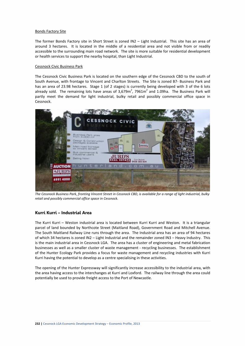
Bonds Factory Site The former Bonds Factory site in Short Street is zoned IN2 – Light Industrial. This site has an area of around 3 hectares. It is located in the middle of a residential area and not visible from or readily accessible to the surrounding main road network. The site is more suitable for residential development or health services to support the nearby hospital, than Light Industrial. Cessnock Civic Business Park The Cessnock Civic Business Park is located on the southern edge of the Cessnock CBD to the south of South Avenue, with frontage to Vincent and Charlton Streets. The Site is zoned B7- Business Park and has an area of 23.98 hectares. Stage 1 (of 2 stages) is currently being developed with 3 of the 6 lots already sold. The remaining lots have areas of 3,679m2, 7961m2 and 1.09ha. The Business Park will partly meet the demand for light industrial, bulky retail and possibly commercial office space in Cessnock.
The Cessnock Business Park, fronting Vincent Street in Cessnock CBD, is available for a range of light industrial, bulky retail and possibly commercial office space in Cessnock. Kurri Kurri – Industrial Area The Kurri Kurri – Weston industrial area is located between Kurri Kurri and Weston. It is a triangular parcel of land bounded by Northcote Street (Maitland Road), Government Road and Mitchell Avenue. The South Maitland Railway Line runs through the area. The Industrial area has an area of 94 hectares of which 34 hectares is zoned IN2 – Light Industrial and the remainder zoned IN3 – Heavy Industry. This is the main industrial area in Cessnock LGA. The area has a cluster of engineering and metal fabrication businesses as well as a smaller cluster of waste management - recycling businesses. The establishment of the Hunter Ecology Park provides a focus for waste management and recycling industries with Kurri Kurri having the potential to develop as a centre specialising in these activities. The opening of the Hunter Expressway will significantly increase accessibility to the industrial area, with the area having access to the interchanges at Kurri and Loxford. The railway line through the area could potentially be used to provide freight access to the Port of Newcastle.
232 | Cessnock LGA Economic Development Strategy – Economic Profile, 2013

The Kurri Kurri – Weston light industrial area fronting Maitland Road is poorly presented. It is not competitive with the modern industrial estates and business parks being developed in the surrounding LGAs. Kurri Kurri Light Industrial Area The Light Industrial area is bounded by the Railway line and Northcote Road. It accommodates a mix of activities including motor vehicle sales, repairs and spare parts, scrap metals and transport. There are a number of dwelling-houses scattered throughout this area. Approximately 8 hectares of this land is vacant, however the area is heavily fragmented with a variety of allotment sizes and ownerships. The area is constrained by localised flooding. Most of the buildings within the area are older style premises rather than contemporary light industrial – business park style units. Off street parking is relatively limited. Some of the streets are not kerbed and guttered and are residential scale streets rather suitable for larger trucks. Overall the area is not attractively presented and not competitive with the nearby new light industrial estates in Maitland and Newcastle areas (Thornton, Rutherford, Beresfield). Any redevelopment of the properties along Northcote Street (Maitland Road corridor) need to address visual impact and presentation as this is a gateway area for Kurri Kurri as well as being part of a route used by visitors to the City. Kurri Kurri Heavy Industrial Area The Heavy Industrial Area (approximately 60ha) is bounded by the Railway line and Government Road. Under the previous planning scheme this was zoned for general industry rather than heavy industry. The land to the west of Mitchell Drive been subdivided into approximately 18 allotments of various sizes and configurations with the majority being occupied and used primarily for engineering-related enterprises. There are a number of large factory units in this area including Alfabs, Industrial Packaging, and Endeavour Industries. As with the Light Industrial Area, this area is poorly presented with some of the roads being unsealed and/or not kerbed. A recent subdivision on the northern side of Mitchell Avenue has yielded six industrial lots ranging in size from 2500m2 – 4000m2. All six lots have been sold.
233 | Cessnock LGA Economic Development Strategy – Economic Profile, 2013
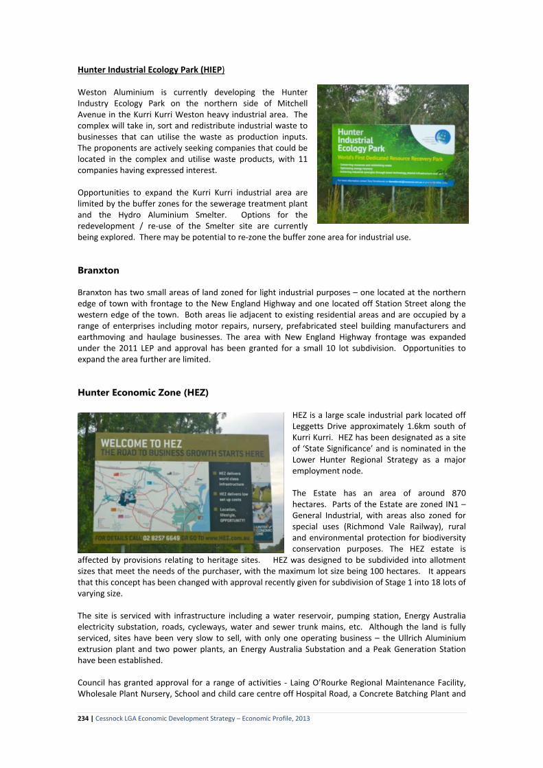
Hunter Industrial Ecology Park (HIEP) Weston Aluminium is currently developing the Hunter Industry Ecology Park on the northern side of Mitchell Avenue in the Kurri Kurri Weston heavy industrial area. The complex will take in, sort and redistribute industrial waste to businesses that can utilise the waste as production inputs. The proponents are actively seeking companies that could be located in the complex and utilise waste products, with 11 companies having expressed interest. Opportunities to expand the Kurri Kurri industrial area are limited by the buffer zones for the sewerage treatment plant and the Hydro Aluminium Smelter. Options for the redevelopment / re-use of the Smelter site are currently being explored. There may be potential to re-zone the buffer zone area for industrial use. Branxton Branxton has two small areas of land zoned for light industrial purposes – one located at the northern edge of town with frontage to the New England Highway and one located off Station Street along the western edge of the town. Both areas lie adjacent to existing residential areas and are occupied by a range of enterprises including motor repairs, nursery, prefabricated steel building manufacturers and earthmoving and haulage businesses. The area with New England Highway frontage was expanded under the 2011 LEP and approval has been granted for a small 10 lot subdivision. Opportunities to expand the area further are limited. Hunter Economic Zone (HEZ)
HEZ is a large scale industrial park located off Leggetts Drive approximately 1.6km south of Kurri Kurri. HEZ has been designated as a site of ‘State Significance’ and is nominated in the Lower Hunter Regional Strategy as a major employment node. The Estate has an area of around 870 hectares. Parts of the Estate are zoned IN1 – General Industrial, with areas also zoned for special uses (Richmond Vale Railway), rural and environmental protection for biodiversity conservation purposes. The HEZ estate is
affected by provisions relating to heritage sites. HEZ was designed to be subdivided into allotment sizes that meet the needs of the purchaser, with the maximum lot size being 100 hectares. It appears that this concept has been changed with approval recently given for subdivision of Stage 1 into 18 lots of varying size. The site is serviced with infrastructure including a water reservoir, pumping station, Energy Australia electricity substation, roads, cycleways, water and sewer trunk mains, etc. Although the land is fully serviced, sites have been very slow to sell, with only one operating business – the Ullrich Aluminium extrusion plant and two power plants, an Energy Australia Substation and a Peak Generation Station have been established. Council has granted approval for a range of activities - Laing O’Rourke Regional Maintenance Facility, Wholesale Plant Nursery, School and child care centre off Hospital Road, a Concrete Batching Plant and
234 | Cessnock LGA Economic Development Strategy – Economic Profile, 2013

for a manufacturing plant that produces wall and floor acoustic and fire-rated panels. To date, none of these developments have proceeded. Figure 25.1 Hunter Economic Zone shown in light purple outside the Kurri Kurri township.
Map source: Cessnock LEP 2011 Sheet LZN_009A While HEZ is located within 5 kilometres of the proposed Hunter Expressway, there is no direct road link between the HEZ site and the Expressway link roads. Access to HEZ is through the residential area Pelaw Main which could prove to be a constraint to some businesses. Much of the HEZ site is also environmentally sensitive with high biodiversity value. This is a further constraint to development. The development of a range of large business and industrial parks in surrounding LGAs has impacted on the competitiveness of HEZ, with these sites being more accessible to the highway networks, markets and the Port of Newcastle and not having the same level of environmental constraints as HEZ. The development of the proposed Freight Hub at Beresfield is also likely to compete directly with HEZ. Other Industrial Activities There are a number of significant industrial activities located in rural areas within Cessnock LGA. These activities include the former Hydro Aluminium Smelter at Loxford, Orica Explosives Plant on George Booth Drive, Council’s Waste Services depot at East Cessnock and numerous businesses in the Black Hill area. Competitive Industrial Areas Excluding the industrial areas in Cessnock LGA, there are 19 large industrial estates currently under various stages of development in the Lower Hunter sub-region, with the combined area of these Estates being over 2,000 hectares (see Table 25.1). Additional land has been identified for future industrial development. In the Upper Hunter sub-region there are also 3 large industrial estates in Singleton LGA (245ha) with a fourth estate (270ha) proposed. Estates are also being developed in Muswellbrook and Scone. Most of the estates in the surrounding LGAs are relatively new and provide flat, fully serviced sites with wide access roads. Estates within Maitland, Newcastle and Lake Macquarie LGAs are included in the NBN roll-out and have the advantage of fibre optic cabling, while the business park development around Newcastle Airport has access to the Department of Defence telecommunications system. The majority of the estates are also located close to the F3 Freeway, New England Highway and/or the Port of Newcastle. These areas do not have the environmental constraints of HEZ.
235 | Cessnock LGA Economic Development Strategy – Economic Profile, 2013

Table 25.1 Major Industrial Estates – Developed and Proposed – Hunter Region LGA Industrial Area Developer Description Companies located in the Estate Lower Hunter Sub-Region Newcastle Steel River Industrial
Park, Mayfield West
www.steelriver.com.au,
10 minutes’ drive from Newcastle CBD, and covers an area of 104 hectares. Lots are level with B-Double access. Power, water telecommunications and sewer connected to the boundary of each lot. Lots range in size from 4,339m2 to 4,833m2. Land prices range from $155/m2 plus GST with strata industrial units approximately $1,500 m2 plus GST.
CSIRO Energy Research Centre, Hunter Water Australia, Ullrich Aluminium, HIA Display Centre, Computer Science Corporation, Scorpion International Freight Services, Horan Steel, Steel River Brewery, Grace Records Management, SGE Australia, AeroLogistics Helicopter Base, RMD Australia, Advitech, Protector Alsafe, RCR Stelform VRBT Pty Ltd, Thomas & Coffey and others.
Warabrook Industrial Estate
First developed in the mid 1980s, Warabrook is located in Newcastle’s inner west, off the Pacific Highway at North Mayfield. Some redevelopment is now taking place with new commercial office complexes under construction.
AAMHatch, Australia Post – Hunter Mail Centre, Carbon Consulting International, Civico Manufacturing, Douglass Partners, ENSR, Hermes Precisa, Hunter Special Engineering, Hydratech Engineering, Pace Farms, Robtec Control Solutions, Service Forms Australia, Sherrin Hire, Star Dean-Willcocks Crosbie, Transfield Holdings, Worley Parsons, Wormald and others.
Freeway Business Park Beresfield
Hunter Land Pty Ltd www.hunterland.com.au
Land in lots up to four hectares. New releases in Freeway Business Park – South Precinct (20 hectares) and Freeway Business Park - North Precinct (30 hectares), with prices from $110 m2.
Air Liquide, Aldi Foods, Apollo Kitchens, Atlas Specialty Metals, Australian Safety Specialists, Beavis Party Hire, Blackwoods Trade Centre, Coates, CTM, Chubb Security Services, CH2, Coventry Fasteners, Bucyrus, Fletcher Insulation, F3 Motor Auctions, John R Turk Electrical Supplies, KAB Seating Systems, Keller Civil Engineers, MiniStor Self Storage, Quarry Mining, Reece Onsite, Robson Civil Projects, Southcott, Target Australia, Toyota Materials Handling, Geared Engineering, CSR Building Products and Volvo Mack.
Holmwood Business Park, Beresfield
On the border of Newcastle and Maitland Local Government Areas and serviced by major roads; Sydney Newcastle F3 Expressway, New England Highway and Pacific Highway. Most of the sites are now developed. Remaining sites are selling from $130 m2.
Anderson Group of Companies, Aquanaut Pty Ltd, Atlas-Copco, Beresford Park Nursery Supplies, Boral Concrete Plant, Chep Systems, Clark Food Service, Coast Reo, Control Synergy, David Reid Homes, Fairfax Regional Printers, Firebox Australia, Glenwood Rural Buildings, Global Food Equipment, Howard Haulage, Hunter Industrial Supplies, Hunter Joinery Supplies, Hardy Spicer, Hitachi Construction Machinery, KAB Seating Systems, LJH Electrical Mining, Manor Park Homes, McCabe Engineering Pty
236 | Cessnock LGA Economic Development Strategy – Economic Profile, 2013

LGA Industrial Area Developer Description Companies located in the Estate Ltd, Moody Kiddell & Partners, AUS Multicam CNC Routing Machines, National Truck Repairs, Northern Transport Services, Opalite Plastics, PowerDown, RTC Group, R T Taylor – Iveco, Specialised Welding Products, Symbion Health, Ultra Lite Plastics and WACO Kwikform.
Former BHP Steelworks site, Port of Newcastle, Mayfield Proposed new industrial area
www.hunterdevelopmentcorporation.com.au
150 hectare site consists of two main sections: the 60 hectare Intertrade Industrial Park managed by Hunter Development Corporation and a 90 hectare port-side portion of the site, managed by the Newcastle Port Corporation. This park has deepwater frontage to the Hunter River. The Hunter Development Corporation has remediated 90 hectares. The remaining 60 hectares in the Buildev Intertrade footprint will be remediated as the land is developed. This land will be suitable for general industry, freight and commercial uses including port-related industrial development. The Buildev Intertrade Consortium Pty Ltd plans to redevelop the site in a deal that would attract $120 million in new investment and provide an estimated 3,000 jobs. The consortium has plans to develop 62 hectares of the site: 10 hectares in the Intermodal Zone which will be capable of supporting port-related industry; and 52 hectares in the General Industry Zone.
Kooragang Island Proposed new industrial area
www.hunterdevelopmentcorporation.com.au
Kooragang Island is adjacent to the Port of Newcastle and jointly managed by Hunter Development Corporation and Newcastle Port Corporation. The Kooragang Island site comprises 1,300 hectares with good rail and road transport links. 800 hectares is zoned for environmental protection. 100 hectares has been developed with the remaining 400 hectares suited to a range of activities including an expansion of coal loading capacity and other large-scale industrial development.
Three coal loaders, grain loader, HiFert, Graincorp, Tomago Aluminium, Sims Metal, Toll Transport, Barclay Mowlem, BOC Gases, John Holland and Custom Transportable Buildings. A 4th coal loader is proposed for the area.
West Wallsend Proposed new industrial area
www.hunterdevelopmentcorporation.com.au
A large parcel of land (1,545ha) located at West Wallsend adjacent to the Port of Newcastle. The site is managed by the Hunter Development Corporation. The Lower Hunter Regional Strategy identified 355 hectares of this site as suitable for a range of
237 | Cessnock LGA Economic Development Strategy – Economic Profile, 2013

LGA Industrial Area Developer Description Companies located in the Estate employment use with other parts of the site suitable
for residential use. Development options are currently being assessed.
Lake Macquarie
Cameron Park Industrial Estate
A 50 hectare subdivision located at the Sydney- Newcastle Freeway and Newcastle Link Road interchange. Stage 4 is presently under development. Lot sizes range from 2,000 to 20,000 m2.. Prices are in the $120 to $150 / m2.range.
Ampcontrol, Hyne Timber, John Farragher Removals & Transport and Veolia Environmental Services.
Cardiff Industrial Park One of the older industrial areas in the region. In recent years it has been redeveloped. As a result the park is seeing a more commercial focus with the proposed Glendale Transport Hub nearby and the mooted connection to Argenton expected to feed demand.
Academy Sheetmetal Pty Ltd, Active Forklift Services, Alsco, Amdel Laboratories, ATF Mining Electrics Pty Ltd, AVM Safety Solutions, Barry McDonald Transport, Boart Longyear Pty Ltd, Brian Clulow Industrial Pumping Pty Ltd, Brian Hanson Civil Engineering Pty Ltd, Cardiff Signs, Case Equipment Sales, Crown Equipment Pty Ltd, Custom Fluid Power, Dexion, Downer Engineering Power Pty Ltd, Durham Fabrications, Edgeworth Furniture, EMB Manufacturing Pty Ltd, Enhanced Telecommunications Pty Limited, Fastway Couriers, Garry Brown Office Supplies, Graham Stainless Manufacturing Pty Ltd, Hardy Manufacturing Pty Ltd, Hunter Plastics, Hunter Watertech Pty Ltd, Inghams Enterprises, Inghams Feeds, Kenshaw Electrical Pty Ltd, Kev Baldwin Wholesale Confectionery, Kingston Heavy Haulage, Langford Windows, Macquarie Drywall Pty Ltd, Mander Toyota Industrial Equipment, Maxwell Engineering Pty Ltd, McColl Engineering Pty Ltd, MCM Manufacturing Pty Ltd, Merino Engineering Supplies, Metalcorp Steel, Mining Components Australia Pty Ltd, Mullings Fasteners, Newcastle Machine Shop, Newcastle's Pudding Lady, P & H Fibreglass Pty Ltd, Pacific Linen Services, Paul Harrison Transport, Priestley Electrical Pty Ltd, Pro Power, PromoBasics, Protection Engineers Pty Ltd, Quickturn Pty Ltd, Roadhound Electronics Pty Ltd, Sefton & Loudon Services Pty Ltd, Serck Controls Pty Ltd, Stramit Frames & Trusses, Swift & Company Limited, Sykes Group Pty Ltd, Taylors Belting Services Pty Ltd, Tesa Group Pty Ltd,
238 | Cessnock LGA Economic Development Strategy – Economic Profile, 2013

LGA Industrial Area Developer Description Companies located in the Estate Toll Logistics, Tyrex Technologies Pty Ltd and Viacitius Management Pty Ltd.
Morisset Gateway Industrial Park
Hunter Land Pty Ltd 46ha – most sites taken up.
Other business zoned lands in Lake Macquarie
• Gateshead/Bennetts Green Industrial Park • Warners Bay Bulky Goods Industrial Park
Maitland
Thornton Industrial Estate
Hunter Land Pty Ltd www.hunterland.com.au
Major industrial estate located on the New England Highway at the end of the Sydney-Newcastle Expressway. Comprises 100 hectares and is about three kilometres from the Beresfield industrial estates. Most of the land has been taken up with a few remaining sites ranging from 8,000m2 to 2.9 hectares. Land prices start from $120/m2.
Advanced Technology Solutions, Aggreko, A & D Lifting Equipment, All Seasons Spas, Arbre Skin Technologies, ASK Horticultural Distribution, ATSA Defence Services, Australian Plastic Profiles, Austrian Energy & Environment, Boral Transport, Boral Plasterboard, Cable Services Australia, Cavalier Homes, Classic Air Conditioning, Coates Hire, Combined Coatings, Cope Sensitive Freight, Decorative Technologies Australia, Delnorth, Primary Industries - Minerals Technical Facility, Earth Data, Eaton Fluid Power, ERM Australia, First Fleet Global Acoustics, GWH Build, Harris Transport, Hume Door & Timber, Hunter Buildings, Hunter Concrete Products, Hunter Land, Hunter Pets, Hunter Precast Concrete, Hunter Readymixed Concrete, Hunter Records Storage, Hunter Regional Organisation of Councils, Hunter Regional Tourism Organisation, Hunter Stainless Steel, Steeline Hunter, Hunter Transport Centre, Hunter Valley Boring, Hunter Valley Buses, Hunter Valley Interior Linings, Justin Norris Swim Academy, Life Technologies, ISS Hygeine Services, Linfox, Ludowici Processing & Handling Equipment, Mainstream Industries, Maitland Cool Rooms, McDonald Jones Homes, Marathon Truck & Coach, Midway Metals, Mortels Sheepskin Factory, MI Power, National Mining Services, National Plant & Equipment, Neumann Steel, Neumann Contractors, Newcastle Mitsubishi Trucks, Pinpoint Computer Services, Power Serve, Rapid Access Australia, Redman Business Equipment, Reece Plumbing, RTC Building Services, Schenk Australia, Sheer Stainless Steel, Sigma Pharmaceuticals, Southern Steel, Speed-E-Gas, Stratco, Steelcom, Thornton Joinery, Towers
239 | Cessnock LGA Economic Development Strategy – Economic Profile, 2013

LGA Industrial Area Developer Description Companies located in the Estate Transport, TriState Transport, Woods Electric Battery Charging Systems and others.
Anambah Business Park – Rutherford
Hunter Land Pty Ltd www.hunterland.com.au
New England Highway at Rutherford, five kilometres west of central Maitland. Access to New England Highway traffic with a variety of sites in various sizes from 2000m2 to 4ha. Land prices start from $95/m2.
Companies in this business park include: Tefol, LD Operations, Pullins Carpets, Signature Floats, CZL Excavating, Prestige Design Joinery, Esco, Hunter Valley Tiling, Joy Global, Masters Hardware, Hunter Commercial Vehicles, Kennards Hire, Caltex, Firestorm, Hunter Valley Filters, BT, Downunder Minesite Maintenance, P&H Minepro, Thompsons Mining Fabrications, Thompsons Paint Assembly, MRM Engineering, Warner Group, 1825 Interiors, Martin Building Services, Framing Memories, Hunter Valley Tile Mart, Seamless Mining Product, Reel Tech Remote Lighting, Lifter Light Mounting Australia.
Racecourse Business Park – Rutherford
New England Highway at Rutherford, five kilometres west of central Maitland, covers 140 hectares and is one of the Hunter’s major land release area. Adjoins the original Rutherford Industrial Area. Harvey Norman, opened a 22,000m2 store in early 2007. 20,000+ m2 has been developed for bulky goods. Limited bulky goods opportunities are still available. Limited sites are available from $100/ m2.
AJW Earthmoving Pty Ltd, Allrak Storage Systems, Atlantic Pacific Foods, Bearing Dynamics, D & K Safety Consultants, Firestorm Fire Protection, G & D Donnelly, Emeco, Everyday Living, Fantastic Furniture, Harvey Norman, H & M Engineering & Construction, Hogan’s Heavy Haulage, Hunter Valley Granite & Marble, Inbye Mining Services, Industrial Maintenance & Fabrication, Jarmain Electrical, John Holland Rail, Juganaut Industries, Jurox, Laffort, Maitland Fabrications, P&H MinePro Services, National Ceramic Industries Australia, Nationwide Oil, N J Contracting Services, Pioneer Road Services, Pneumatic Equipment Repair Sales & Service, Polymer Technology International, P W King & Sons – General Engineers, Royal Equipment, Rutherford Industrial Supplies, RSPCA, SLS Custom Stainless, Spotlight, Terex, Total Temco, Transpacific Industries, Transport Repairs & Services, Treloar, Ultrafloor, Valley Industrial & Irrigation, Vast Interiors, Vinkem Packaging, Wax Converters Textile and others.
Port Stephens
Hunter Industrial Park, Tomago
Adjacent to the Pacific Highway at Tomago, just north of the Hexham bridge. The land is level with power, water, telecommunications and sewer available to each lot. The sewer is a Community Association owned
Ampcontrol, Cannavale Constructions, Coates Hire, Komatsu, SGM Fabrications, Tropic Tomago, Varley, Volgren and Williams River Steel.
240 | Cessnock LGA Economic Development Strategy – Economic Profile, 2013

LGA Industrial Area Developer Description Companies located in the Estate and operated facility. Lot sizes range from 1881 to 4071m2 from $100/m2 with opportunity to consolidate adjoining lots.
Heatherbrae Industrial Estate
10ha Estate located off the Pacific Highway between Hexham and Raymond Terrace. Fully serviced level lots range in size from 1,800m2. Limited sites are now on the market at approximately $120m2.
Sandvic
Taylors Beach Business Park (Tomaree Peninsula)
Hunter Land Pty Ltd www.hunterland.com.au
Land from $100 per square metre, with sizes from 2,000 square metres upwards. Completed in 2010 by Hunter Land, the latest release includes level cleared sites adjacent to Bunnings Warehouse.
Bunnings, Tradelink and Supercheap Auto.
Williamtown Aerospace Centre
Hunter Land Pty Ltd www.hunterland.com.au
Williamtown Aerospace Centre (WAC) at Newcastle Airport will be a key economic driver for the Hunter Region and has the potential to position the Hunter as a major national and potentially international centre for the aerospace and aviation industry. It comprises Newcastle Airport and the soon to be commenced Williamtown Aerospace Park (WAP). Available from 2013, WAP is a 50 hectare employment park with an emphasis on aerospace, aviation and the existing industrial base that clusters around RAAF Base Williamtown. Land for aerospace users includes sites with airside access. Land and design/construct packages (for both owner occupiers and lessees) are available. WAP offers Torrens title freehold.
Early stage proposed components of WAP include a hotel and office buildings.
Tomago
www.hunterdevelopmentcorporation.com.au
Adjacent to Port of Newcastle and managed by the Hunter Development Corporation. This site is on former rural lands and comprises 545 hectares of land suitable for both light and heavy industry on a large scale. 120ha currently under development – with the site to have tow-way access to the Airport Runway.
RAAF, Mercure Hotel & Conference Centre
Upper Hunter Sub-Region Singleton
McDougall Business Park
Hunter Land Pty Ltd www.hunterland.com.au
Located on the New England Highway on the north edge of Singleton CBD. 65 hectares. The estate has signalised entry from New England Highway, connecting through to Maison Dieu Road. Lots for sale range from 2,000m2 over 2 hectares with prices from $65/m2.
Ausgrid, Bunnings, Hunter Valley Buses, Singleton Toyota, TNT, Entire Concrete, Singleton Elite Self Storage, Whitmore Industries, Tutt Bryant Hire and Cox Plant Hire, Actrol, Greg Hedges Smash Repair, HMA – Halley & Mellowes Australia, Prospectors Earth Science.
Maison Dieu Industrial David Williams Real Located off Maison Dieu Road at Singleton. 50 Birrana Engineering, Blackwoods, Boon Logistics,
241 | Cessnock LGA Economic Development Strategy – Economic Profile, 2013

LGA Industrial Area Developer Description Companies located in the Estate Estate
Estate www.realestatesingleton.com.au
hectares with lot sizes ranging from 2,000 to 4,000m2. Most of the sites have now been taken up.
Bradken, CCI FluidTech, CCI POPE, Consolidated Bearing Company, Enzed, Fanquip, Garland Engineering, LEGRA, Lubritene Australia, Marathon Equipment, MTU Detroit Diesel ustralia, MVD Australia, Outbye Engineering, PowerServe, Sandvik Surface Mining Division, Tefol, TradeLink, Tri-Steel, and Wormald Fire Systems.
Mt. Thorley Industrial Estate
Mt Thorley is a 130 hectare estate located west of Singleton. It is a heavy industrial area servicing the coal mining industry. Around six lots are currently available.
Companies operating in this estate include: Ellavale Engineering, Allen Precision Engineers, Firefly International, Gough & Gilmore, Hedweld Engineering, Hunter Frame & Truss, Komatsu, Leibherr, Marathon Tyres, SGS Australia, Terex Mining, Total Fire Solutions and Westrac.
Singleton Industrial Development Proposed - new development
Located opposite the New England and Golden Highways intersection at Wittingham. 355ha site with 270 hectares zoned for industrial development. The site includes 25 hectares with rail-side frontage. A wide range of lot sizes are planned, with consolidation possible for large operations.
Muswellbrook Muswellbrook Industrial Park
Mirvac
Five minutes from Muswellbrook town centre and off the main Industrial route (Thomas Mitchell Drive). Access has been designed for the needs of mine service companies with power, water and telecommunications provided to each lot. Muswellbrook Council recently announced plans to connect sewer to lot boundaries at no cost to land owners. Only a limited number of lots remain with these lots ranging in size from 2,300m2 to 1.2 hectares selling from $42/m2 plus GST.
A & D Lifting, Atlas Copco, Bell Scaffolding, Bradken, Bro- Built Engineering, Coates Hire, Convatech, Cummins, Ellavale Engineering, Enzed, Goodyear Hunter Valley, H & M Engineering & Construction, Hitachi Construction Machinery, John Holland, Laing O’Rourke, LeTouneau, Mitchell Drilling Contractors, Muswellbrook Bearing Centre, Phillips Engineering, Reliable Conveyor Belt, Sandvik Materials Handling, Thomas & Coffey, Titan Wheels & Rims Pty Ltd, and Valley Longwall Hydraulics.
Upper Hunter
Scone Business Park .
Elders Scone or Macallum Inglis Scone www.maccalluminglis.com.au
The 19.28 hectare estate, which is zoned light Industrial / Special Business, will provide a significant economic boost for Scone which has a shortage of quality industrial and commercial land. Located on the northern boundary of the Scone township, bounded by the highway and the Great Northern Rail Line, the estate offers fully serviced lots ranging in size from 1900 to 6670m2.
Source: Regional Development Australia – Hunter, 2013, Hunter Investment Prospectus 2013
242 | Cessnock LGA Economic Development Strategy – Economic Profile, 2013

Cessnock LGA – Industrial Lands Strengths Weaknesses • New business park on the southern edge of Cessnock. • Hunter Ecology Park – provides a focus for new
businesses. • HEZ – scale of the area. • Proposed freight hub in the Beresfield – Buchanan
area. • Additional employment lands proposed, including
industrial land and a business park in the Huntlee estate.
• Corridor from Black Hill to Loxford has ready access to the Hunter Expressway.
• Engineering - metal fabrication and waste – recycling clusters at Kurri Kurri.
• Limited availability of vacant land and premises in the established industrial areas.
• No contemporary industrial units available for purchase or lease.
• Existing industrial areas are tired, dated and poorly presented with constraints (eg topography, localised flooding, native forest) that limit their development potential.
• Existing industrial estates are not competitive with contemporary estates being built in surrounding LGAs.
• Cessnock LGA is not part of the NBN Fibre Optic cable roll-out.
• Proposed employment lands (Huntlee, Freight Hub) are medium to longer term developments that are likely to take time to deliver economic benefit to the LGA.
• HEZ is not ‘development ready’ with environmental constraints being an issue for potential developers and investors.
• Road access from HEZ to the Hunter Expressway is via residential areas.
Opportunities Threats • Capitalising on the Expressway access by expanding
the Kurri Kurri – Weston Industrial area (reassessing the need for the buffer zone).
• Proposed industrial and business park areas – opportunity to provide quality, state-of-the-art Estates.
• Competition from new industrial and business park estates being developed in surrounding LGAs.
25.2 Commercial Land and Premises While Cessnock LGA has relatively strong services sectors, the services are primarily targeted to the local community and local businesses. The LGA has limited corporate and professional ‘office’ sectors. Within the Lower Hunter Region, these activities are concentrated in Newcastle and Maitland CBDs. The lack of quality commercial office space in Cessnock and Kurri Kurri was raised as a significant constraint by the local business community. Within Cessnock LGA commercial development is permitted in areas zoned: B2 – Local Centre B3 – Commercial Core B4 – Mixed Use B7 – Business Park The zonings restrict commercial premises to the Branxton (B2), Kurri Kurri (B3, B4) and Cessnock (B3, B4) town centres and the new Cessnock Civic Business Park. The supply of commercial premises in Cessnock is limited, with commercial businesses tending to occupy shop-front properties or above shop premises. These premises are dated and do not necessarily meet the needs of commercial tenants. While there are over 20 vacant retail premises within the town centre, these premises do not provide quality office space. There are only a few buildings in Cessnock that provide contemporary commercial space. The need for contemporary office space in Cessnock may be partially met by the development of the Cessnock Civic Business Park, however given the shortage of land for bulky goods retail and light industrial activities in Cessnock LGA, it is likely that the commercial development in the Business Park area could be limited.
243 | Cessnock LGA Economic Development Strategy – Economic Profile, 2013
Kurri Kurri has a small cluster of commercial businesses in the Kurri Kurri Professional Centre. This is an older building located on the northern edge of the Kurri Kurri CBC, that has been subdivided into a number of small offices. As with Cessnock, Kurri Kurri lacks contemporary office space. Kurri Kurri’s accessibility to the Hunter Expressway renders it an ideal location for commercial development.
Strengths Weaknesses • Kurri Kurri – access to the Expressway + potential to
provide office space for businesses servicing the existing Kurri Kurri Industrial area and HEZ and the Freight Hub in the medium to longer term.
• Very limited supply of quality / contemporary commercial office space
Opportunities Threats • New business park being developed in Cessnock. • Proposed business park at Huntlee.
• Competition from business parks in the surrounding region.
25.3 Possible / Proposed Employment Lands Proposed Employment Lands in Cessnock LGA include: • The Huntlee Estate incorporates 160 hectares of employment land, allocated for retail (14ha),
commercial (10ha), mixed use (56ha), business park (20ha) and light industrial (30ha) use. This land is estimated to yield 700,000m2 of retail, commercial and business floorspace and 210,000m2 of industrial floorspace and provide around 7,500 jobs.
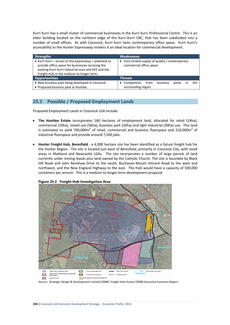
• Hunter Freight Hub, Beresfield - a 4,000 hectare site has been identified as a future freight hub for
the Hunter Region. The site is located just west of Beresfield, primarily in Cessnock City, with small areas in Maitland and Newcastle LGAs. The site incorporates a number of large parcels of land currently under mining leases plus land owned by the Catholic Church. The site is bounded by Black Hill Road and John Renshaw Drive to the south, Buchanan-Mount Vincent Road to the west and northwest, and the New England Highway to the east. The Hub would have a capacity of 500,000 containers per annum. This is a medium to longer term development proposal.
Figure 25.2 Freight Hub Investigation Area
Source: Strategic Design & Development Limited (2008) Freight Hub Hunter (2008) Executive Summary Report.
244 | Cessnock LGA Economic Development Strategy – Economic Profile, 2013

Figure 25.3 Proposed Site for Industrial Development, Old Buttai Road.
• Buchanan Road Interchange – Cessnock City Council has received a request from a landowner with a property in Old Buttai Road close to the Hunter Expressway Buchanan Interchange to rezone the land for industrial use. The site has an area of 470 hectares. Part of the site has been used as a construction camp and batching plant for the construction of the Hunter Expressway.
• Hydro Aluminium Site at Loxford – finding an alternative use or uses for the site, including the potential to expand the Kurri Kurri industrial area into the Smelter buffer zone.
25.4 Residential Development The Lower Hunter Regional Strategy identified Cessnock LGA as a growth area, with the potential to provide 21,700 additional dwellings by 2030, 19,700 in greenfield sites and the remainder as infill development. Proposed and approved residential land release areas in the LGA include: • Huntlee – 7,500 dwellings • Anvil Creek, Greta – 1,365 dwellings • Golden Bear, Rothbury – 550 dwellings • Bellbird North – 3,500 dwellings. • Bellbird Heights – 700 dwellings • Cliftleigh - 977 dwellings – 188 lots already sold with 100 lots coming on-line in 2014. • Heddon Greta – 24ha • Cessnock North – 400 lots • Paxton North – 44.21ha • Millfield – Mt View area – 280 lots Huntlee Huntlee is a master-planned community located on the southern edge of Branxton, in the North Rothbury Area. The project is classified as a ‘State Significant’ development that will occur over a 15-20 year period. The development concept is for 4 villages, a town centre, employment lands separated by open space corridors. Key components of the development include: • 7,500 residential lots to accommodate an estimated 21,000 people. The lot break down is 6,480
standard residential lots, 720 medium density dwellings and 300 large semi-rural lots. • 160 hectares of employment lands - retail (14ha), commercial (10ha), mixed use (56ha), business
park (20ha) and light industrial (30ha) use, to yield 700,000m2 of retail, commercial and business floorspace and 210,000m2 of industrial floorspace and provide around 7,500 jobs.
• Community facilities including – up to 8 schools, a tertiary learning centre, private hospital, aged care facilities, churches and community facilities.
• 875 hectares of open space.
Stage 1 is currently being developed and will include release of residential land in Village 1 (1429 lots), 253 lots in the town centre, 120 of the large semi-rural lots, as well as subdivisions for the town centre retail area.
245 | Cessnock LGA Economic Development Strategy – Economic Profile, 2013

Figure 25.4 Masterplan of the new Huntlee Estate
Anvil Creek, Greta
Anvil Creek at Greta is a 423 hectare master-planned estate incorporating 1364 residential dwellings, 18 hole golf course, 150 room hotel and 85 tourist villas, village centre and retail area. Figure 25.5 Masterplan and aerial of the proposed Anvil Creek development
Golden Bear, Rothbury The Golden Bear development is a golf resort, designed around a Jack Nicklaus signature golf course. The development includes 300 residential dwellings, 250 villas for tourism and residential use, 150 room boutique hotel, 18 hole championship golf course and driving range, sports club and lodge. The development will be adjacent to The Vintage, another residential golf resort. The development application is currently being assessed by Cessnock City Council and Planning NSW.
246 | Cessnock LGA Economic Development Strategy – Economic Profile, 2013

Figure 25.6 Masterplan - Golden Bear Resort Development
Source: WMK Architects
The rolling out of turf puts the finishing touches to a new house in a new estate in Heddon Greta.
High on the hill at Bellbird Heights, the new residential area adjoins the older part of Bellbird providing housing close to the Cessnock town centre.
The remaining heritage buildings of the Stanford Main Number 2 Colliery at Paxton are now forming the backdrop for a new residential housing estate with the Pay House, one of the original buildings, for sale.
The Vintage Estate and Golf Club, in the heart of Wine Country, provides an opportunity for a relaxed lifestyle surrounded by a golf course designed by Greg Norman.
247 | Cessnock LGA Economic Development Strategy – Economic Profile, 2013
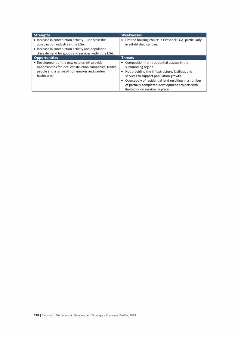
Strengths Weaknesses • Increase in construction activity – underpin the
construction industry in the LGA. • Increase in construction activity and population –
drive demand for goods and services within the LGA.
• Limited housing choice in Cessnock LGA, particularly in established centres.
Opportunities Threats • Development of the new estates will provide
opportunities for local construction companies, trades people and a range of homemaker and garden businesses.
• Competition from residential estates in the surrounding region.
• Not providing the infrastructure, facilities and services to support population growth.
• Oversupply of residential land resulting in a number of partially completed development projects with limited or no services in place.
248 | Cessnock LGA Economic Development Strategy – Economic Profile, 2013

26. Transport Infrastructure 26.1 Road Access to Cessnock LGA Cessnock LGA lies to the south west of two interstate Highways, the Pacific Highway and the New England Highway. The Sydney-Newcastle Freeway (F3) section of the Pacific Highway corridor lies to the east of Cessnock LGA along the western side of Wyong and Lake Macquarie LGAs. There are five regional roads that feed into the LGA from the Freeway – the Wisemans Ferry and Peats Ridge Roads that join with the Great North Road at the southern end of the LGA, Freemans Drive which is the main entry route into the LGA for traffic from Sydney and the Central Coast, George Booth Drive which links into the north western side of Lake Macquarie LGA, and John Renshaw Drive which links Cessnock LGA to the northern end of the Freeway. The New England Highway is located to the north of Cessnock LGA, and runs through Maitland and Rutherford, before entering the LGA at Lochinvar. The Highway runs through Branxton and Greta. There are a number of roads linking Cessnock to the New England Highway, with the main ones being Mount Vincent-Buchanan Road, Cessnock Road, Wollombi-Old Maitland Road, and Wine Country Drive. From the west and north-west, Cessnock LGA can be accessed via Broke in Singleton Shire, with local roads linking Broke to the Putty Road to the west and Golden Highway to the north-west. The Broke Road (east-west link) and the Wollombi Road (north-south link) then feed into Cessnock LGA. The Putty Road provides the link between Hawkesbury LGA (North-West sector of Sydney) and the Hunter Valley, while the Golden Highway links the Hunter Valley and Central NSW (through to Mudgee and Dubbo). The main entry points to Cessnock LGA are Freeman’s Drive, John Renshaw Drive, Cessnock Road and Wine Country Drive. State Tourism Route 33 runs north-south through the LGA, linking the F3 Freeway at Calga with the New England Highway at Branxton. Route 33 incorporates Peats Ridge Road, George Downs Drive, Great North Road and Wine Country Drive and links the historic village of Wollombi and the Wollombi wine area to Cessnock and then through to the Lovedale, Pokolbin and Rothbury wine areas. Approximate travelling times and distances between the main population centres and economic activity nodes in the surrounding region is summarised in the following Table. Table 26.1 Accessibility of Cessnock LGA from Sydney, Surrounding Population Centres and Economic Nodes Centre Distance by Road Approximate Travel Time From Cessnock Population Centres Sydney Newcastle Gosford Wyong Toronto (Lake Macquarie – west) Swansea (Lake Macquarie beaches) Maitland Singleton Muswellbrook
153km 52km 83km 65km 37km 65km 27km 44km 93km
2 hours
50 minutes 65 minutes 50 minutes 35 minutes 70 minutes 30 minutes 40 minutes 75 minutes
Transport Nodes Sydney Airport Newcastle Airport Newcastle Port (Kooragang Island)
160km 53km 48km
2 hours
50 minutes 45 minutes
Regional & Sub-Regional Shopping Centres Erina Tuggerah Rutherford
85km 65km 23km
70 minutes 50 minutes 30 minutes
249 | Cessnock LGA Economic Development Strategy – Economic Profile, 2013

Centre Distance by Road Approximate Travel Time Greenhills Kotara Charlestown
30km 47km 47km
30 minutes 50 minutes 55 minutes
From Kurri-Kurri Sydney Newcastle Maitland Rutherford Shopping Centre Greenhills Shopping Centre
146km 38km 13km 16km 16km
1 hour 45 minutes 35 minutes 15 minutes 17 minutes 16 minutes
From Branxton Newcastle Maitland Singleton Rutherford Shopping Centre Greenhills Shopping Centre
58km 25km 22km 20km 30km
55 minutes 26 minutes 17 minutes 20 minutes 30 minutes
Internal Road Network There are 1,011 kilometres of roads within Cessnock LGA, of which 10% are State Roads and 11% are regional roads, with the remainder being local roads under Council’s control. Historically, the internal road network within the LGA developed around the Great North Road which provided the link between Sydney and Maitland and Singleton, and the development of the coal industry along the Greta coal seam from Cessnock through to Kurri Kurri and the links to the port at Newcastle. The main routes through the LGA are: • Main Road 220 (State Road) – linking the F3 Freeway at Freeman’s Waterholes to the New England
Highway at Branxton, via Cessnock. The route includes Freemans Drive, Leggetts Drive, Lake Road and Wine Country Drive. This is the main route for traffic accessing the LGA from Sydney, the Central Coast and Lake Macquarie areas. MR 220 is also the shortest route between the Freeway and the New England Highway and as such attracts a lot of through traffic, including heavy vehicles. The road is single lane in both directions, with an overtaking lane over the Watagan Mountains. It is in reasonable condition. The crossing of the Watagan Mountains provides a ‘natural’ gateway into both Cessnock LGA and the Hunter Valley, with extensive views over the Valley and the change from bushland to rural land. There is no effective signage or gateway statement that welcomes visitors or creates a sense of arrival.
• Main Road 558 (State Road) – linking Cessnock to the northern end of the F3 Freeway at Thornton and includes Maitland Road and John Renshaw Drive. This route carries a significant volume of local traffic moving between Cessnock and Kurri Kurri and out of the LGA to Maitland and Newcastle. It is the main access road to Hunter Valley Wine Country for visitors arriving from Newcastle and the North Coast. The road is primarily single lane in both directions. Pavement condition ranges from good to fair. The Buchanan and Kurri Kurri exits off the Hunter Expressway will channel more traffic onto this route. The route passes through a mix of forested land, grazing land and towns and villages. There is no strong sense of arrival to the LGA, nor to each of the towns and villages. In the parts of the section from Kurri Kurri to Cessnock, the presentation of the corridor is not attractive.
• Wine Country Drive (part MR 220 and TR 33) (State Road) – connects Cessnock and Branxton and is
the main entry point for visitors arriving in the LGA from the North West. The road traverses the vineyards area, with the scenery being very attractive in some areas. As with the other gateway arrival points, there is no strong sense of arrival.
• State Touring Route 33 (Regional Road) – connects the F3 Freeway at Calga to the New England Highway at Branxton, via Laguna, Wollombi, Cessnock and Wine Country. Within Cessnock LGA, the route includes the Great North Road (MR 181), Wollombi Road (MR 181) and Wine Country Drive (MR220). This Route is very popular with visitors to the area and touring travellers with Wollombi being a popular day trip and short breaks destination. The Route is also popular for motorbike
250 | Cessnock LGA Economic Development Strategy – Economic Profile, 2013

touring. The section south of Cessnock is narrow and winding which adds to the tourism experience. Large sections of the pavement are however in very poor condition. Gateway and directional signage along the route is poor.
State Touring Route 33 passes through the historic Wollombi Village. The local hotel is capitalising on the Route name by providing a stop off point for travellers at their Route 33 Café. The road, and hotel, is popular with recreational motor bike riders. • Broke Road (Regional Road) – The Broke Road (Regional Road 7767) is the western gateway to the
LGA for visitors entering the Hunter Valley via the Putty Road and Golden Highway. The section between Broke and Pokolbin is one of the main drives within the Wine Country area, linking wineries, restaurants, accommodation properties and other attractions. The pavement of the section between Pokolbin and Broke is poor and a source of complaint from both visitors and local residents. The road is being upgraded as funds become available. The majority of the local roads through the vineyard areas are in poor to average condition. Council has received a grant to upgrade the Broke Road with this to occur in stages over the next 5 years.
• Main Road 195 (State Road) – links Leggetts Drive (MR 220) at Mulbring to John Renshaw Drive at Kurri Kurri. The route is used primarily by local and regional traffic as a ‘short-cut’ between the F3 Freeway and Kurri Kurri and Maitland. Traffic on this road is likely to decline with the opening of the Hunter Freeway.
• Route 128 (Local Road) – links Leggetts Drive at Mulbring to John Renshaw Drive at Buchanan with
links further north to East Maitland. The north-south section of the route includes Maitland and Richmond Vale Roads, which then link with Buchanan Road and Mount Vincent Road to the north of John Renshaw Drive (MR 527). George Booth Road (MR 527) is also part of this route. George Booth Road links the F3 Freeway at Seahampton to the Richmond Vale Road just south of Buchanan. George Booth Drive and Buchanan Road are both part of truck routes that service the coal mines, quarries, Orica and other heavy industries in this area. The Buchanan exit off the Hunter Expressway will increase accessibility to the Black Hill – Buchanan area.
• Old Maitland Road (Local Road) – this is a rural road that connects Cessnock to Rutherford. It
primarily carries local traffic and some visitor traffic.
• Regional Road 7766 – links Kurri Kurri to the New England Highway at Greta. The route includes Sawyers Gully Road, Majors Lane and Lovedale Road. This route carries mainly local and regional traffic including some truck traffic generated by the Kurri Kurri industrial area.
251 | Cessnock LGA Economic Development Strategy – Economic Profile, 2013

Figure 26.1 Main Roads and Hunter Expressway – Cessnock LGA
Base Map Google Earth
252 | Cessnock LGA Economic Development Strategy – Economic Profile, 2013
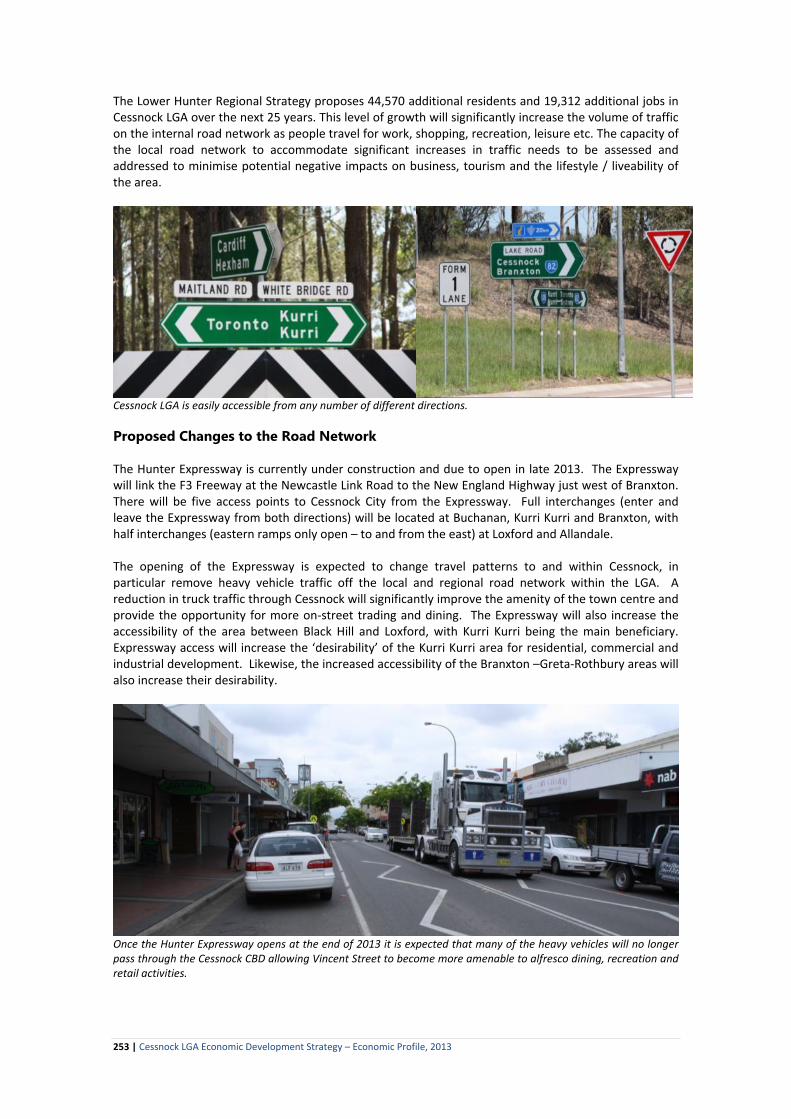
The Lower Hunter Regional Strategy proposes 44,570 additional residents and 19,312 additional jobs in Cessnock LGA over the next 25 years. This level of growth will significantly increase the volume of traffic on the internal road network as people travel for work, shopping, recreation, leisure etc. The capacity of the local road network to accommodate significant increases in traffic needs to be assessed and addressed to minimise potential negative impacts on business, tourism and the lifestyle / liveability of the area.
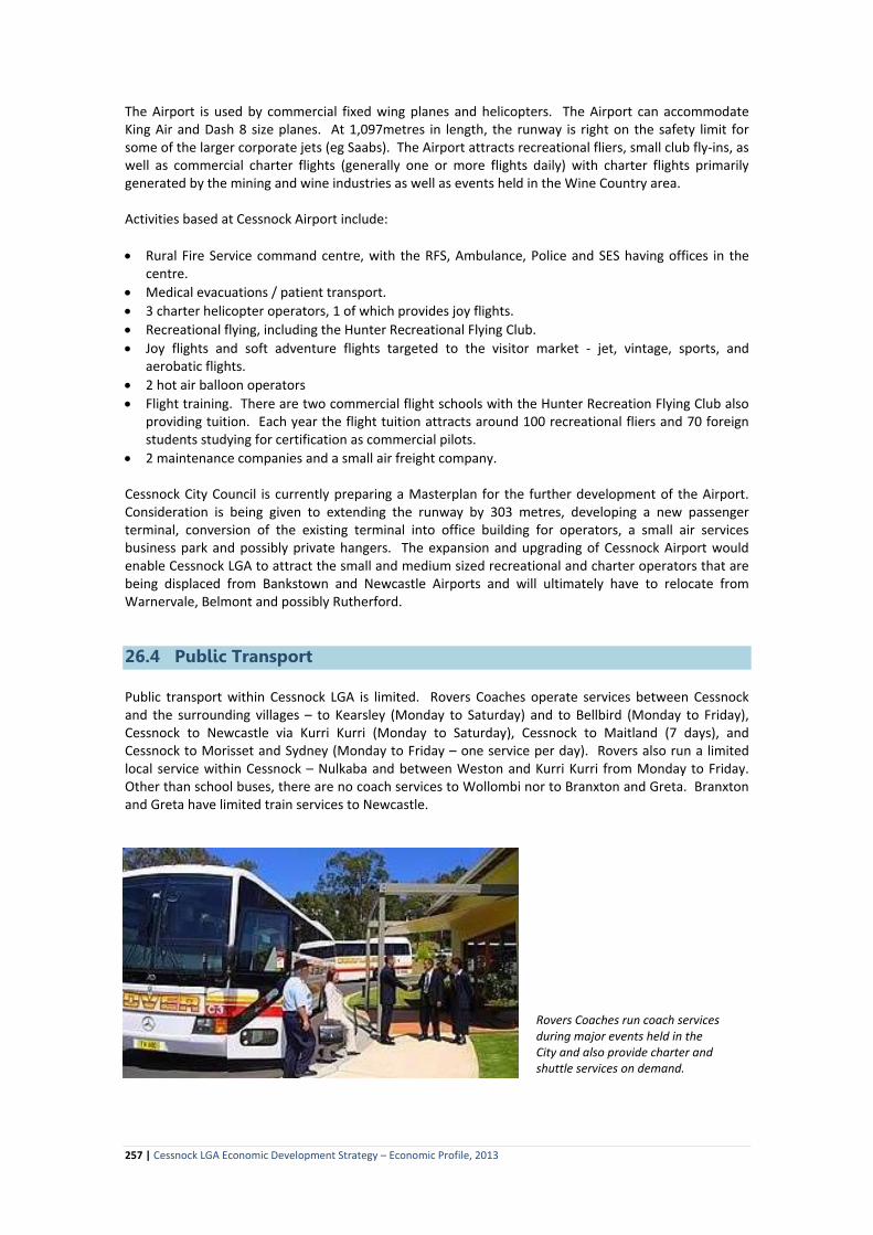
Cessnock LGA is easily accessible from any number of different directions. Proposed Changes to the Road Network The Hunter Expressway is currently under construction and due to open in late 2013. The Expressway will link the F3 Freeway at the Newcastle Link Road to the New England Highway just west of Branxton. There will be five access points to Cessnock City from the Expressway. Full interchanges (enter and leave the Expressway from both directions) will be located at Buchanan, Kurri Kurri and Branxton, with half interchanges (eastern ramps only open – to and from the east) at Loxford and Allandale. The opening of the Expressway is expected to change travel patterns to and within Cessnock, in particular remove heavy vehicle traffic off the local and regional road network within the LGA. A reduction in truck traffic through Cessnock will significantly improve the amenity of the town centre and provide the opportunity for more on-street trading and dining. The Expressway will also increase the accessibility of the area between Black Hill and Loxford, with Kurri Kurri being the main beneficiary. Expressway access will increase the ‘desirability’ of the Kurri Kurri area for residential, commercial and industrial development. Likewise, the increased accessibility of the Branxton –Greta-Rothbury areas will also increase their desirability.
Once the Hunter Expressway opens at the end of 2013 it is expected that many of the heavy vehicles will no longer pass through the Cessnock CBD allowing Vincent Street to become more amenable to alfresco dining, recreation and retail activities.
253 | Cessnock LGA Economic Development Strategy – Economic Profile, 2013

Allandale Road will become a significant gateway into the Hunter Valley Wine Country Area. The road will need to be upgraded and effectively signposted. It will require quality gateway entry signs as well as an information directory and effective directional and facility signage. Roads and Maritime Services are proposing to reclassify a number of the roads in Cessnock LGA with Buchanan and Lovedale Roads to be reclassified as Regional Roads and George Booth Drive (MR527) reclassified from a State Road to a local road, and Regional Road 7766 downgraded from a regional road to a local road.
Major construction works have taken place in the building of the Hunter Expressway with local contractors and retailers benefitting. Rail
The Main North Rail line follows the New England Highway and connects the northern part of Cessnock LGA with Maitland and Newcastle (Broadmeadow) with inter-urban services between Broadmeadow and Sydney via Lake Macquarie LGA and the Central Coast. Railway stations are located at Lochinvar, Greta and Branxton. CityRail (Hunter Line) provides a very limited service (4 trains in each direction per day on weekdays and 2 trains in each direction on weekends) between Scone and Newcastle. Countrylink trains also use this line but do not stop at the stations within Cessnock LGA. The Main North line is primarily used for freight. Maitland is the closest commuter station to Cessnock and Kurri Kurri with regular passenger services operating between Maitland and Newcastle.
There is an extensive rail system linking all of the coal mining areas from as far afield as Narrabri, Ulan, Mudgee and the Upper Hunter to the Newcastle Port which is the largest coal exporting port in the world.
254 | Cessnock LGA Economic Development Strategy – Economic Profile, 2013

The South Maitland Railway line runs through the ‘centre’ of the LGA. The line is privately owned and operated. It was established during the early 20th Century to service the coal mines in the LGA. There were a multitude of spur lines linking the collieries to the main line. There was also a line from Weston to Minmi via the Pelaw Main area. The spur lines and the Weston to Minmi line are now closed. A single track is still operating between Maitland and Bellbird Junction with this linking with a branch line servicing the Austar Mine at Pelton. The line is located in close proximity to the Hyrdo Smelter complex at Kurri Kurri and passes through the Kurri Kurri – Weston Industrial area. It also passes through the towns and villages of Weston, Abermain, Neath, Aberdare, Cessnock and Bellbird. Passenger services on the line operated between Newcastle / Maitland and Cessnock from 1902 to 1972. Most of the railway stations are still present however are falling into disrepair. There is a branch line between the Main North Line and the Bloomfield Coal Loader. This is located just north of Cessnock City in Maitland LGA. The rail lines through the City are part of the Hunter Valley Coal Rail Network. This Network, which is leased and operated by ARTC, incorporates 450 kilometres of track that is used to transport coal between the mines and coal loaders at the Port of Newcastle. Expansion of coal mining into the Upper Hunter, Gunnedah Basin and west into the Ulan area is placing increased pressure on the rail infrastructure. ARTC is progressively upgrading and expanding the rail infrastructure. ARTC ‘sells’ access to the railway lines and has in place long term contracts with the mining companies. Pacific National (which owns rolling stock) recently opened a state-of-the-art Train Support Facility adjacent to the Main North Line at Greta. This facility employs around 35 people. Figure 26.2 Hunter Valley Rail Network.
255 | Cessnock LGA Economic Development Strategy – Economic Profile, 2013

26.3 Air Services Cessnock LGA is located approximately 55km west (50 minutes’ drive) of Newcastle Airport and 160km north (2 hours’ drive) from Sydney Airport. Newcastle Airport has regular passenger services operated by Jetstar (flights to Brisbane, Gold Coast and Melbourne), Virgin (Brisbane and Melbourne), Qantaslink (Byron Bay - Ballina), Aeropelican (Sydney) and Brindabella (Canberra) airlines. It also caters for occasional international charter flights, primarily from New Zealand. Newcastle Airport currently handles around 1.2 million passenger movements per year. The number of incoming and outgoing passengers is approximately equal with the market being relatively evenly split between business, visiting friends and relatives (VFR) and tourism / leisure travel. Most of the leisure travel coming into the Airport is for Newcastle and the Lower Hunter sub-region with events (eg concerts, NSW Golf Open, Surfest) being a significant generator of passenger movements. Conferences and meetings (Hunter focused) are a significant component of the business travel market. The capacity of the Airport is being progressively upgraded, and when completed, will have a capacity of 4 million passengers per annum plus increased freight capacity. There are proposals to introduce flights to other Australian capital cities as well as to Cairns, Mackay and the Sunshine Coast. International flights are also proposed to New Zealand and Asia and are expected to be introduced by 2015. It is proposed that Newcastle Airport be positioned as a secondary airport for low cost domestic and international carriers, with Newcastle linked with Kuala Lumpur to connect with AsiaX and feed into the low cost carrier network in Asia with connections to London. Newcastle Airport is also actively looking at establishing air routes to China. Public transport between Newcastle Airport and Cessnock LGA is very limited, with air passengers needing to hire cars or arrange transfer services. Licensed airports within the Region are located in Cessnock, Rutherford, Belmont, Warnervale (Central Coast) and Scone. These airports are used for charter and recreational flights and emergency services. Due to development in the surrounding area, there is very limited potential for activities at Rutherford to increase, with the likelihood that the Airport could close in the medium to longer term. Warnervale Airport has around 5 years remaining on its lease, with the lease not expected to be renewed. Activity at Belmont Airport has been scaled back considerably with the future of the Airport uncertain. Scone Airport is expected to remain operational. Due to the surrounding topography pilots have to have endorsed licenses to land. Activity at Scone Airport has increased with an increase in private charter flights resulting from the development of both the mining and thoroughbred industries in the Shire. Cessnock Airport is located at Pokolbin in the heart of Hunter Valley Wine Country. It is approximately 6.5 kilometres (8 minutes’ drive) north of Cessnock CBD. The Airport is CASA licensed. Around 5 to 6 years ago the Airport handled around 60,000 aircraft movements per annum, however in recent years this has fallen to 23,000 movements. Council has resumed control of the Airport and is actively re-building patronage. The Airport is the busiest uncontrolled airport in NSW (no air traffic control tower).
Helicopter and fixed-wing light aircraft are available for charter and scenic rides at the Cessnock Airport and make up part of the 20,000+ aircraft movements at the Airport each year.
256 | Cessnock LGA Economic Development Strategy – Economic Profile, 2013
The Airport is used by commercial fixed wing planes and helicopters. The Airport can accommodate King Air and Dash 8 size planes. At 1,097metres in length, the runway is right on the safety limit for some of the larger corporate jets (eg Saabs). The Airport attracts recreational fliers, small club fly-ins, as well as commercial charter flights (generally one or more flights daily) with charter flights primarily generated by the mining and wine industries as well as events held in the Wine Country area. Activities based at Cessnock Airport include: • Rural Fire Service command centre, with the RFS, Ambulance, Police and SES having offices in the
centre. • Medical evacuations / patient transport. • 3 charter helicopter operators, 1 of which provides joy flights. • Recreational flying, including the Hunter Recreational Flying Club. • Joy flights and soft adventure flights targeted to the visitor market - jet, vintage, sports, and
aerobatic flights. • 2 hot air balloon operators • Flight training. There are two commercial flight schools with the Hunter Recreation Flying Club also
providing tuition. Each year the flight tuition attracts around 100 recreational fliers and 70 foreign students studying for certification as commercial pilots.
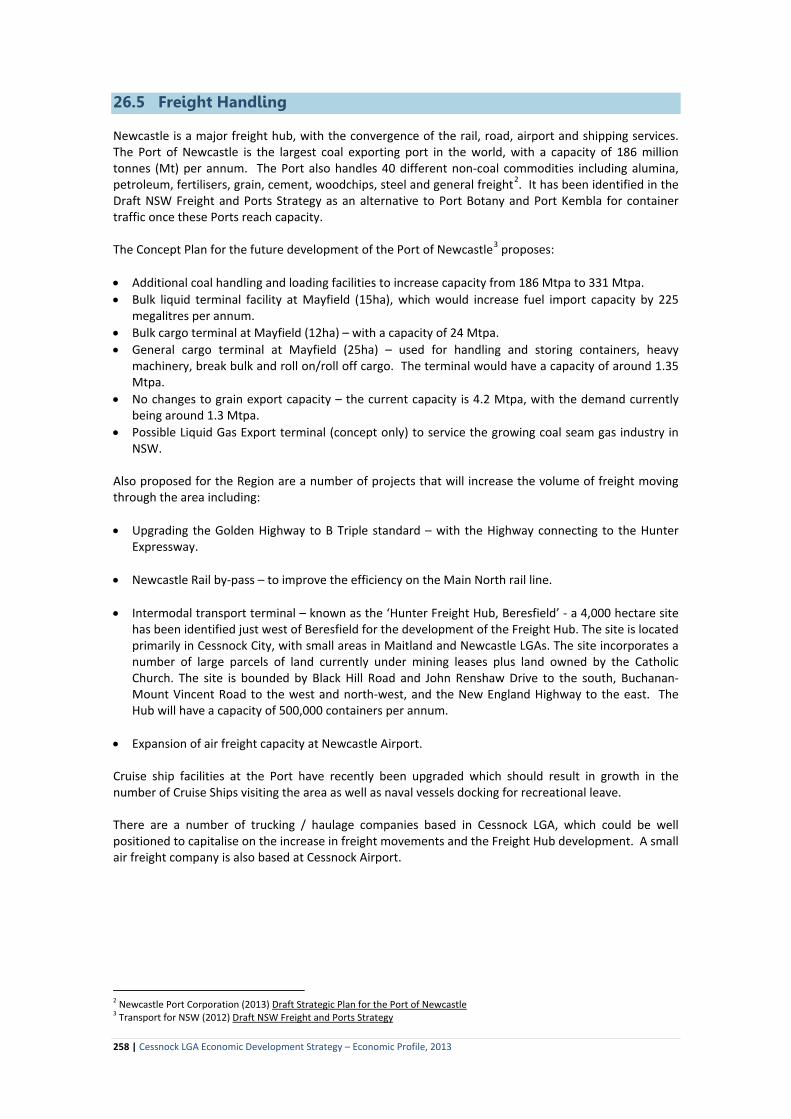
• 2 maintenance companies and a small air freight company. Cessnock City Council is currently preparing a Masterplan for the further development of the Airport. Consideration is being given to extending the runway by 303 metres, developing a new passenger terminal, conversion of the existing terminal into office building for operators, a small air services business park and possibly private hangers. The expansion and upgrading of Cessnock Airport would enable Cessnock LGA to attract the small and medium sized recreational and charter operators that are being displaced from Bankstown and Newcastle Airports and will ultimately have to relocate from Warnervale, Belmont and possibly Rutherford. 26.4 Public Transport Public transport within Cessnock LGA is limited. Rovers Coaches operate services between Cessnock and the surrounding villages – to Kearsley (Monday to Saturday) and to Bellbird (Monday to Friday), Cessnock to Newcastle via Kurri Kurri (Monday to Saturday), Cessnock to Maitland (7 days), and Cessnock to Morisset and Sydney (Monday to Friday – one service per day). Rovers also run a limited local service within Cessnock – Nulkaba and between Weston and Kurri Kurri from Monday to Friday. Other than school buses, there are no coach services to Wollombi nor to Branxton and Greta. Branxton and Greta have limited train services to Newcastle.
Rovers Coaches run coach services during major events held in the City and also provide charter and shuttle services on demand.
257 | Cessnock LGA Economic Development Strategy – Economic Profile, 2013
26.5 Freight Handling
Newcastle is a major freight hub, with the convergence of the rail, road, airport and shipping services. The Port of Newcastle is the largest coal exporting port in the world, with a capacity of 186 million tonnes (Mt) per annum. The Port also handles 40 different non-coal commodities including alumina, petroleum, fertilisers, grain, cement, woodchips, steel and general freight2. It has been identified in the Draft NSW Freight and Ports Strategy as an alternative to Port Botany and Port Kembla for container traffic once these Ports reach capacity. The Concept Plan for the future development of the Port of Newcastle3 proposes: • Additional coal handling and loading facilities to increase capacity from 186 Mtpa to 331 Mtpa. • Bulk liquid terminal facility at Mayfield (15ha), which would increase fuel import capacity by 225
megalitres per annum. • Bulk cargo terminal at Mayfield (12ha) – with a capacity of 24 Mtpa. • General cargo terminal at Mayfield (25ha) – used for handling and storing containers, heavy
machinery, break bulk and roll on/roll off cargo. The terminal would have a capacity of around 1.35 Mtpa.
• No changes to grain export capacity – the current capacity is 4.2 Mtpa, with the demand currently being around 1.3 Mtpa.
• Possible Liquid Gas Export terminal (concept only) to service the growing coal seam gas industry in NSW.
Also proposed for the Region are a number of projects that will increase the volume of freight moving through the area including: • Upgrading the Golden Highway to B Triple standard – with the Highway connecting to the Hunter
Expressway.
• Newcastle Rail by-pass – to improve the efficiency on the Main North rail line. • Intermodal transport terminal – known as the ‘Hunter Freight Hub, Beresfield’ - a 4,000 hectare site
has been identified just west of Beresfield for the development of the Freight Hub. The site is located primarily in Cessnock City, with small areas in Maitland and Newcastle LGAs. The site incorporates a number of large parcels of land currently under mining leases plus land owned by the Catholic Church. The site is bounded by Black Hill Road and John Renshaw Drive to the south, Buchanan-Mount Vincent Road to the west and north-west, and the New England Highway to the east. The Hub will have a capacity of 500,000 containers per annum.
• Expansion of air freight capacity at Newcastle Airport. Cruise ship facilities at the Port have recently been upgraded which should result in growth in the number of Cruise Ships visiting the area as well as naval vessels docking for recreational leave. There are a number of trucking / haulage companies based in Cessnock LGA, which could be well positioned to capitalise on the increase in freight movements and the Freight Hub development. A small air freight company is also based at Cessnock Airport.
2 Newcastle Port Corporation (2013) Draft Strategic Plan for the Port of Newcastle 3 Transport for NSW (2012) Draft NSW Freight and Ports Strategy
258 | Cessnock LGA Economic Development Strategy – Economic Profile, 2013
26.6 Attitudes to Transport & Accessibility
Attitudes of residents and business operators to transport infrastructure and services to and within the City were sought in the Community and Business Surveys and at the Community and Business Workshops. The main findings were: • Cessnock LGA’s location in the Lower Hunter and its proximity and accessibility to the major
population centres (Sydney, Central Coast, Newcastle and the Lower Hunter) and to the beaches and Lake Macquarie were identified as one of the major attributes by both residents and business operators.
• The Hunter Expressway will increase accessibility into the LGA and open up opportunities for
residential, retail, commercial and industrial development particularly along the northern edge of the LGA in the Kurri Kurri – Weston and the Branxton-Greta areas.
• The Expressway should also remove heavy vehicle traffic from Cessnock and Wine Country, which
would significantly improve the amenity of these areas and facilitate the development of the Cessnock town centre into a lifestyle centre with on-street trading and dining, improved landscaping etc.
• Limited public transport was considered a major constraint for young people and people on low incomes to access training programs located outside of the LGA and employment involving shiftwork or located in areas not serviced by public transport.
• The poor condition of a number of the regional roads, particularly those in the Wine Country area and the Wollombi Valley was considered to be a major issue, being a deterrent to travellers and creating negative impressions of the area.
Implications for Economic Development For businesses... • Cessnock LGA is readily accessible to Sydney, Central Coast and the Lower Hunter Valley.
Accessibility will be increased with the completion of the Hunter Expressway. Cessnock LGA, (in particular the Buchanan-Black Hill, Kurri Kurri-Weston and Branxton-Greta areas which will have direct access to the Expressway) is a favourable location for businesses relying on road transport and/or businesses operating into one or more of these population centres.
• The railway line through the LGA’s major industrial area and in relative close proximity to the
Hydro and HEZ sites, could be a strong advantage for businesses dependent on rail freight, provided that access to the line can be ‘purchased’.
• Increasing capacity and facilities for freight handling in Newcastle and surrounding areas. Close
proximity to the Port of Newcastle and/or the proposed Freight Hub potentially reduces transport costs.
• The proposed Freight Hub will create opportunities for the expansion / establishment of local
transport and service providers. The Pacific National Train Support Facility at Greta may also offer opportunities for local engineering, fabrication and other support services.
• Limited public transport renders it difficult to send staff to training programs located outside of
the LGA and in areas such as Wine Country, makes it very difficult to employ staff who do not have access to a vehicle.
• Increased congestion on local roads as a result of population growth could become a deterrent to
259 | Cessnock LGA Economic Development Strategy – Economic Profile, 2013

establishment of businesses in the LGA.
• For retail businesses in Cessnock, increased congestion on the local road network could also result in residents, particularly in outlying areas and along the Hunter Expressway corridor, shopping outside of the LGA.
For Tourism... • For tourism the LGA is highly accessible to the Sydney, Central Coast and Lower Hunter markets
for day trips and short breaks, as well as for business and entertainment events and weddings and functions. The LGA is also well located to attract international visitors out of Sydney.
• Proximity to Newcastle Airport, plus the proposal to increase capacity on existing domestic routes, open up new domestic routes and move into the international market, provides the opportunity to grow the domestic and international leisure and business and entertainment event markets into the area. There is also a small air freight company based at Cessnock Airport.
• Growth is expected in the number of cruise ships and naval ships (recreation leave) visiting Newcastle, providing opportunities for tourism operators within the LGA.
• For visitors / travellers arriving from the south, Cessnock LGA is the gateway to the Hunter Valley – a factor that needs to be capitalised more effectively on.
• Effective signage is needed to support the tourism industry, with signage having an information
and promotional role. This includes ‘inspirational’ gateway signs at the entry points into the LGA, place-making signs at the entrances to each of the towns and villages and Hunter Valley Wine Country, information directories (maps) at the main entry points into the LGA and Wine Country, and comprehensive directional and facility (using the international icons) signs throughout the LGA. Ideally, frames to hang event signs should also be erected at strategic locations throughout the LGA.
• The poor condition of some of the roads in the Wollombi Valley and Wine Country generate
negative impressions perceptions amongst visitors – particularly where there is damage or potential damage to vehicles. International and fly-in domestic visitors are often travelling in rental cars. Rental agreements do not permit cars to be driven on un-sealed roads. Hunter Valley Wine Country is promoted as a world class wine region and the roads (and signage) should be commensurate with this positioning.
• The opening of the Hunter Expressway will change how visitors enter and exit the LGA. Allandale Road is likely to become a major access route for Wine Country visitors. This will require route development including gateway and event signage, information directory, good directional signage and improvements in the road condition.
• There is no sense of arrival in either Cessnock or Kurri Kurri. The poor presentation of the road
corridors leading into Cessnock and Kurri Kurri do not encourage visitors to stop and explore these towns.
For Potential Residents... • From a ‘liveability / lifestyle’ perspective, Cessnock LGA offers a rural lifestyle while being less
than a hours’ drive from beaches, Lake Macquarie and major regional shopping, commercial, health and education services. It is also within 2-3 hours’ drive of Sydney and reasonably accessible to both Newcastle and Sydney Airports.
• Poor public transport may be an issue for people wanting to live in Cessnock LGA but working
outside of the LGA or in areas not serviced by public transport (eg Wine Country).
260 | Cessnock LGA Economic Development Strategy – Economic Profile, 2013
• The poor condition of some of the regional and local roads could also be a deterrent. The poor
condition of roads was identified by existing residents in the Community Survey as the most ‘disliked’ thing about living in Cessnock LGA. Similar sentiments were expressed in the Business Survey and at the community workshops.
• Poor presentation of the road corridors, lack of inspirational gateway signage, ineffective
directional signage and the poor condition of some of the regional roads, do not create a positive ‘first impression’ of the LGA.
261 | Cessnock LGA Economic Development Strategy – Economic Profile, 2013

27. Utilities
27.1 Electricity
The power grid infrastructure in Cessnock City is owned and operated by Ausgrid. This infrastructure includes Sub-transmission and Zone Substations as well as the feeder lines. In 2012, Ausgrid undertook an assessment of the total and secure capacities of each of the substations and feeder lines throughout its network, including the infrastructure in Cessnock LGA, with the capacity compared to peak summer and winter demand and forecast peaks as a result of proposed development within the area. The assessment found that there was sufficient space capacity in both the substations and feeder line networks within Cessnock City and that there was no need to amplify the infrastructure within the next 5 years. In 2010/11, Ausgrid significantly upgraded the power supply in the Kurri Kurri area with the replacement of equipment in the sub-transmission substation, replacement of the 132/11kV zone substation and upgrading and augmenting the feeder lines. Ausgrid’s Five Year Network Plan (2009-2014) has identified the need to replace the Paxton and Cessnock Zone substations and boost the local power supply. These projects are currently being planned and are likely to be in place in 2013/14. There is also a proposal to construct a new 33kV feeder line from Kurri Kurri to Cessnock to improve the capacity of the existing 33kV network in the area. Ausgrid has three sub-transmission feeder lines from Newcastle into the Hydro Smelter site at Kurri Kurri. With the closure of the Smelter, there is considerable spare capacity in this infrastructure. The development of the new urban land release areas (eg Huntlee) will require extension of the distribution infrastructure (zone substations, overhead and underground mains and distribution substations) as well as the acquisition of land and/or easements to accommodate the infrastructure. The cost of expansion will be the responsibility of the developer. Electricity retailers supplying the consumer market in Cessnock City include Country Energy, AGL Electricity, Integral Energy, Origin Energy, PowerDirect and TRUenergy.
27.2 Gas Reticulated natural gas is available to most industrial and urban areas in Cessnock City. The reticulation network infrastructure is owned and controlled by the Jemena Group, which is a wholly owned subsidiary of Singapore Power International Pty Ltd. The gas is sold and serviced through a number of suppliers including AGL Retail Energy, Country Energy and Energy Australia.4 The Jemena network is drawing gas from the Moomba gas fields in South Australia, with this reticulated across NSW and through the Sydney metropolitan area and Central Coast with the Hunter Region being at the ‘end of the line’. To increase certainty of supply of gas to the Hunter, Hunter Gas Pipeline Pty Ltd has approval to build a natural gas pipeline from the Wallumbilla Gas Hub in Queensland to Newcastle. The Pipeline will have a capacity of 85 Petajoules of gas per annum, with the potential to increase to 160PJ. The availability of a second source of gas in the Hunter is expected to make pricing more competitive. There are a number of coal seam gas (CSG) proposals in the Hunter Valley and the Gunnedah Basin to the north west. AGL is undertaking exploratory drilling for CSG in the Hunter Valley, including drilling in Cessnock LGA. Santos is planning to build a gas pipeline from its CSG operations in the Gunnedah Basin
4 Hunter Investment Prospectus 2013.
262 | Cessnock LGA Economic Development Strategy – Economic Profile, 2013

to Newcastle to export gas. Advent Energy is also conducting exploratory drilling 55km off the coast of Newcastle for natural gas. 27.3 Water With the exception of Wollombi, all towns and villages in Cessnock City have reticulated water. The reticulated water supply is owned and maintained by Hunter Water. As a result of the expected population growth in Cessnock City, Hunter Water has embarked on a four-stage program to upgrade the water supply infrastructure in Cessnock-Kurri Kurri and a six stage program to augment the water supply in the North Rothbury area. Cessnock-Kurri Kurri Augmentation The program commenced in 2009/10 with the replacement and augmentation of the water mains in Weston, Abermain and Cessnock. Stage 1(b) involves the construction of a new Reservoir (5ML) at Mount View, main and pumping station. This is expected to come on-line by mid 2013. North Rothbury Augmentation In 2009, Hunter Water commenced upgrading the water supply system to Lochinvar and the North Rothbury Area. The North Rothbury system currently provides water to 23,000 dwellings in Maitland, Cessnock and Singleton LGAs. The system is being augmented to meet the forecast demand for 26,000 additional connections by 2030. Stages 1 and 2 have been completed and involved a water pump station at North Rothbury, new trunk mains between Stoney Pinch and Thornton North, between Branxton and North Rothbury, and within the Greta and Louth Park area. Stage 3, which is due to be completed by mid 2013, involves the construction of a 10ML Reservoir at Lochinvar and associated mains and Telarah pump station. Stage 4, (commenced) involves construction of a new pump station at Lochinvar. 27.4 Waste Water All residential areas and near-by villages in and around Cessnock, Kurri Kurri and Branxton, and the villages of Paxton, Ellalong and Millfield have reticulated sewer systems. The remaining villages and the rural areas are un-sewered and rely on on-site effluent disposal. There are five waste water treatment plants (WWTW) in Cessnock LGA, with these located at Branxton, Cessnock, Kurri Kurri, Kearsley and Paxton. In 2009 in response to the proposed scale of development in Cessnock LGA, Hunter Water embarked on a program to significantly augment the capacity of the systems within the LGA. Branxton WWTW has recently been expanded with its capacity increased from 5,000 equivalent persons (EPs) to 13,000 EPs. This treatment plant is one of the most technically advanced plants in the Hunter Region, producing high quality water suitable for recycling and irrigation. A 10 kilometre pipeline has been constructed to provide irrigation water for the Vintage Golf Course in the Pokolbin area. Paxton WWTW has also been expanded, enabling the sewer to be extended to Ellalong and Millfield. This plant has the capacity to accommodate growth in the Paxton, Millfield and Ellalong areas for the next 20 years. The potential for water reuse is currently being assessed. At Kurri Kurri the waste water pumping station has recently been upgraded. This will reduce wet weather overflow impacts in the area and accommodate further development in the short to medium term. Further augmentation is likely to be required in the future. The Cessnock WWTW services the Cessnock, Aberdare, Bellbird and Nulkaba areas. It has a design capacity of 32,000 EPs. The potential for water reuse is currently being assessed. The plant does not
263 | Cessnock LGA Economic Development Strategy – Economic Profile, 2013

have the capacity to accommodate the projected population growth that could result from the level of development permitted under the new LEP and will require augmentation in the future. The Kearsley WWTW services the villages of Kearsley and Neath. It has a design capacity of 2050 EPs.
27.5 Drainage Poor drainage leading to localised flooding is an issue in a number of areas within the LGA, including the Kurri Kurri Industrial area. This is largely due to the limited capacity of the drainage infrastructure. Cessnock City Council has in place programs to progressively update and augment the drainage systems. 27.6 Telecommunications The telecommunications network in Cessnock LGA varies depending on location. The urban corridor between Cessnock and Kurri Kurri has good 3G and 4G mobile networks serviced by a number of competing carriers. Access to the mobile networks in the southern and western rural areas of the LGA is poor. In Wollombi the network only extends to areas within 5 kilometres of the village that have ‘line of sight’ to the tower. The limited availability of communication infrastructure in Wollombi and the rural areas is a constraint to home-based businesses establishing in the LGA. In February 2013, the NBN rollout of fibre optic connectivity in Maitland commenced. By December 2013, work on the NBN roll out will begin in Newcastle and a year later, installation of NBN fibre cable is due to commence in Lake Macquarie. Other areas within the Hunter, including Cessnock will receive high speed broadband via fixed wireless, satellite services and fibre optic cable, pending further announcements by NBN Co. Telecommunication infrastructure in the Thornton Industrial area on the border of Newcastle and Maitland LGAs is of a far higher standard than that available for the industrial and commercial areas in Cessnock LGA, giving Thornton an advantage over Cessnock. Likewise the roll-out of fibre optic cables in Maitland, Newcastle and Lake Macquarie LGAs will provide these areas with an advantage over Cessnock LGA. 27.7 Waste Infrastructure Cessnock City Council provides a kerb-side waste collection service for household rubbish. It also operates a kerb-side domestic recycling service in conjunction with Lake Macquarie and Maitland Councils. There are a number of commercial waste operators based in the City including EnviroKing which operates out of Black Hill. Cessnock City Council operates the Cessnock Waste and Reuse Centre on Old Maitland Road. This Centre is nearing capacity and Council has purchased adjoining land, which will enable it to meet the LGA’s landfill needs for the next 15-20 years. Kurri Kurri has a cluster of waste management and recycling businesses including the Hunter Ecology Park, Weston Aluminium, used building materials, auto-wreckers and used oil collection. The Hunter Ecology Park at Kurri Kurri includes a waste processing plant that separates waste products for recycling and reuse. Worth Recycling Australia has lodged a Development Application with Cessnock City Council to establish a Waste Recycling Depot at Kurri Kurri. The Depot will operate as a transfer station with waste taken to Worth’s processing plants in Windsor and Port Kembla.
264 | Cessnock LGA Economic Development Strategy – Economic Profile, 2013

Implications for Economic Development • The electricity supply infrastructure in the LGA is adequate to accommodate growth over the next 5
years, with the infrastructure being progressively upgraded to accommodate the 2030 population and employment growth forecasts. With the closure of the Hydro Aluminium Smelter there is significant spare capacity in the Kurri Kurri area.
• The gas supply to the Hunter Region is being augmented and ‘secured’ with the development of the
Hunter – Queensland Gas Pipeline. There will be sufficient gas supplies for businesses that are intensive gas users looking to establish in the area.
• Water and sewerage infrastructure is being progressively upgraded to accommodate the proposed
growth in the area. Recycled water is available from the WWTP in Branxton, with the potential for recycled water to also be available from WWTPs in other parts of the LGA as part of plant upgrades.
• The urban areas of Cessnock LGA have good 3G and 4G mobile networks. The rural areas have no or
very poor coverage which limits the potential for home-based businesses dependent on high speed internet connections. Cessnock LGA is not part of the current roll-out of the NBN fibre optic cable network. The NBN is currently being installed in Newcastle, Lake Macquarie and parts of Maitland LGAs, which will give these areas a competitive advantage over Cessnock LGA.
• Cessnock LGA has good waste services with no capacity constraints. Kurri Kurri is developing as a
centre for waste management and recycling, with potential to grow these activities further.
28. Business Support Services
An extensive range of business support and employment services are available within Cessnock LGA and the Lower Hunter Region. A list of the services, networks and programs available is given in Appendix 6. 28.1 Business Support Services and Networks Businesses located in Cessnock City have access to a wide range of services that provide information, advice and support both locally and across the Hunter. The services are provided by Federal and State Government Departments as well as a range of industry groups and networks. 28.2 Tertiary and Vocational Training Services The Hunter Region is home to a number of quality educational institutions and educational organisations (see Chapter 23). The University of Newcastle, TAFE NSW – Hunter Institute, Avondale College and Tocal College are the primary vocational education providers in the Hunter Region. These providers work closely with a variety of industry employers to match training programs and course with workplace requirements. There are also a number of private training providers available.
265 | Cessnock LGA Economic Development Strategy – Economic Profile, 2013
28.3 Employment Programs & Services The Australian Government has in place a number of employment programs that assist people to find employment and assist employers recruit employees. Job Services Australia is the Australian Government employment services system that supports job seekers and employers. For people looking for employment, a local Job Services Australia provider is the main point of contact. These providers assist job seekers with individually tailored support including advice on the best job search methods, career options and employment programs, as well as help with preparing résumés, enhancing interview techniques and undertaking skills development or professional training. Providers have access to the Employment Pathway Fund which can be used to help address vocational and non-vocational barriers to employment. For businesses Job Services Australia is a free service that can help find the right staff. A provider will work with a business to assess the type of skilled labour needed, and will work to match these needs with appropriately-trained and work-ready job seekers. Job Services Australia providers in Cessnock LGA are listed in Appendix 6. Youth Transitional (Education to Employment) Services Many young people find it difficult to make the transition from school to employment. There are a number of programs in Cessnock LGA geared towards assisting young people make the transition.
266 | Cessnock LGA Economic Development Strategy – Economic Profile, 2013