
20th District Santa Clara County - aelc.assembly.ca.gov · lick h.s. o’connor hospital overfelt...
8
28th District 17th District 23rd District 27th District 21st District 24th District 20th District STATE HWY 130 MINES RD MONTEREY HWY SAN FELIPE RD MCKEAN RD QUIMBY RD SIERRA RD SANTA TERESA BLVD HALE AVE S WHITE RD METCALF RD FELTER RD S KING RD SENTER RD MCKEE RD MCLAUGHLIN AVE YERBA BUENA RD STORY RD TULLY RD CALAVERAS RD HELLYER AVE CLAYTON RD PIEDMONT RD CASA LOMA RD SCHELLER AVE ALMADEN EXWY UVAS RD TOYON AVE CHYNOWETH AVE COCHRAN RD BRANHAM LN E CAPITOL AVE BERNAL WAY SNELL RD G S A N A N TONIO R D SAN JOSE CC THE VILLAGES CC Henry Willard Coe State Park LICK OBSERVATORY San Jose Santa Clara County Stanislaus County San Jose East Foothills Morgan Hill Milpitas 130 130 85 82 101 101 880 P G & E Gas Pipeline Weller Rd County Line Rd Felter Rd Capitol Expy Crothers Rd San Felipe Rd S White Rd Arroyo Aguague Clayton Rd Aborn Rd County Line Rd Norwood Ave Cunningham Ave County Boundary Mount Hamilton Rd Fleming Ave Dunne Ave Coyote Rd Nieman Blvd County Line Rd P G & E Gas Pipeline County Line Rd Park Estates Way Yerba Buena Creek Cribari Heights Cribari Ln Cribari Vale The Villages Pkwy Via Laguna Via Montecitos Mount Pleasant Rd Pleasant Acres Dr Murillo Ave Groesbeck Hill Rd Klein Rd 0 1 2 3 4 Miles Santa Clara Alameda San Mateo Contra Costa Santa Cruz San Joaquin Marin San Francisco 15 19 28 27 21 17 20 18 22 16 14 13 24 12 23 06 11 Mapped Area P a c i f i c O c e a n Assembly District 28 North Part Map 1 of 7 Legend Assembly Boundary State Boundary County Boundary City Boundary Major Highway Other Highway Railroad Outside District Major Landmarks
Transcript of 20th District Santa Clara County - aelc.assembly.ca.gov · lick h.s. o’connor hospital overfelt...

28th District
17thDistrict
23rd District
27th District21st District
24th District
20thDistrict
STA
TE
HW
Y 1
30
MIN
ES R
D
MO
NTER
EY H
W
Y
SAN FELIPE RD
MC
KEAN
RD
QU
IMB
Y R
D
SIERRA RD
SANTA TERESA BLVD
HALE A
VE
S W
HIT
E R
D
METC
ALF RD
FELTER R
D
S K
ING
RD
SEN
TER
RD
MCKEE R
D
MC
LAU
GH
LIN
AVE
YER
BA B
UEN
A R
D
STO
RY R
D
TU
LLY R
D
CA
LA
VE
RA
S R
D
HELLYER A
VE
CLAYTO
N R
D
PIE
DM
ON
T R
D
CASA LOMA RD
SCHELLER A
VE
ALM
AD
EN
EX
WY
UVAS R
D
TO
YO
N AV
E
CHYNOWETH AVE
CO
CH
RAN
RD
BRANHAM LN E
CA
PITO
L AV
E
BER
NAL
WAY
SNELL
RD G
SAN ANTO
NIO
RD
SAN JOSECC
THE VILLAGES CC
H e n r y W i l l a r d C o e
S t a t e P a r k
LICK
OBSERVATORY
San Jose
S a n t a C l a r a C o u n t y
StanislausCounty
San Jose
EastFoothills
Morgan Hill
Milpitas
130
130
85
82
101
101
880
P G
& E
Gas P
ipelin
e
Welle
r R
d
County
Line Rd
Felter Rd
Capitol E
xpy
Croth
ers R
d
San F
elip
e R
d
S W
hite R
d
Arroyo
Aguague
Clayton Rd
Aborn Rd
County Lin
e R
d
Norwood Ave
Cunnin
gham A
ve
County Boundary
Mount Hamilton RdFle
min
g A
ve
Dunne A
ve
Coyote Rd
Nie
man B
lvd
County Lin
e R
d
P G
&
E
Gas P
ipelin
e
County Lin
e R
d
Park Estates Way
Yerba Buena Creek
Cribari Heights
Cribari Ln
Cribari Vale
The Villages Pkwy
Via Laguna
Via Montecitos
Mount Pleasant Rd
Pleasant Acres Dr
Murillo Ave
Groesbeck Hill Rd
Klein Rd
0 1 2 3 4
Miles
Santa Clara
Alameda
San Mateo
Contra Costa
Santa Cruz
SanJoaquin
Marin
SanFrancisco
15
19
28
27
21
1720
18
22
16
14
13
24
12
23
0611
MappedArea
Pa
ci f i c
Oc
e an
Assembly District 28North Part
Map 1 of 7
Legend
Assembly Boundary
State Boundary
County Boundary
City Boundary
Major Highway
Other Highway
Railroad
Outside District
Major Landmarks

CHOLAM
E RDCHOLAM
E VALLEY RD
33rd District
28th District 30th District27th District
STATE HWY 269
LOS GATOS RD
COALINGA RD
INDIAN VALLEY RD
LA PANZA RD
ESTRELLA RD
CO HWY G18
W MT WHITNEY AVE
SHELL C
REEK RD
BITTERWATER
RD
CAMBRIA RD
GREEN VALLEY RD
GALE AVE
ODONOVAN RD
CLARK RD
CO HWY G16
W POZO RD
E POZO R
D
CATTLEMAN RD
PEACH TREE RD
VINEYAR
D DR
CO HWY G17
VINEYARDCANYON RD
W JAYNE AVE
NACIMIENTO LAKE DR
SLACKS C
ANYON RD
ADELAIDA RD
OAKLAND AVE
CENTRAL AVE
CLEAR CR
EEK RD
BRADLEY RD
S POMAR RD
S BAY BLVD
DIABLOCANYON RD
PALO PRIETA
CHOLAME RD
CO HWY G19
HARE CANYON RD
THORNE RD
FOOTHILL RD
AIRPORT RD
S DERRICK BLVD
SPRECKLES RD
NEW
IDRIA RD
LOCKWOOD JOLON RD
SHELBY R
D
W HARLAN AVE
AVENAL CUTOFF RD
CAYUCOS RD
SAN LUCAS RD
MESA VERDE RD
JOLONPLEYTO RD
QUINTANA RD
CO HWY 614
STARKEY RD
OLD CAYUCO
S
CREEK
MOONSTONE DR
CAMBRIDGE AVEW POLK ST
JOLON RD
CORBET CANYON RD
ELM AVE
RAILROAD ST
BITTERWATER RD
BITTERWATER RD
5
P a c i f i c
O c e a n
PinnaclesNational Monument
Andrew MoleraState Park
Julia PfeifferBurns State Park
Pfeiffer Big SurState Park
Hunter Liggett
Mi l i tary Reservat ion
Los Padres
National Forest
Los Padres National Forest
CSUSLO
Avenal
Atascadero
Cambria
Paso Robles
Morro Bay
Baywood-Los Osos
Coalinga
Cayucos
PismoBeach
Templeton
Huron
Soledad
LakeNacimiento
Greenfield
San Miguel
San Luis Obispo
San Luis ObispoCounty
MontereyCounty
FresnoCounty
KingsCounty
KernCounty
Arroyo GrandeOceanoGrover City
King City
1
1
1
198
198
198
145
33
33
25
25
58
229
58
227
46
46
41
41
41
41
46
46
101
101
Tassajara Rd
Alice Rd
Indians Rd
Tularcitos
Creek
Tassajara
Creek
E Carmel Valley Rd
Sanchez Rd
Milpitas
Rd
Arroyo
Seco Rd
Sam Jones Rd
Smith M
ountain
Lookout Rd
Ranchita Canyon Rd
Cachagua Rd
Sulphur Sp
rings Rd
Assembly District 28South Part
Map 2 of 7
Kern
Los Angeles
Tulare
Ventura
San LuisObispo
SantaBarbara
KingsMonterey Inyo
32
33
30
34
3735
36
28
41
27
38
54
59
Mapped Area
0 20161284
Miles
PacificO
cean
Legend
Assembly Boundary
State Boundary
County Boundary
City Boundary
Major Highway
Other Highway
Railroad
Outside District
Major Landmarks

28th District
27th District
MONTEREYPENINSULA
AIRPORT
SALINAS MUNI
OLD
STAGE R
D
COUNTY HWY G17
STA
TE H
WY
1
ABBOTT ST
ALISAL RD
CIE
NE
GA
RD
SAN
JUA
N G
RAD
E R
D
N M
AIN
ST
ESPINOSA RD
UNION RD
DOLAN RD
NASHUA RD
CO
HW
Y G
12
E BORONDA RD
MA
HE
R R
D
MO
NTE
BLV
D
DAVI
S RD
WILLIAMS RD
SAN BENANCIO RD
CR
AZY
HO
RS
E R
D
HA
RK
INS
RD
STRAWBERRY RD
SAN JUSTO RD
HILBY AVE
W ALISAL ST
ROGGE RD
CHUALAR RIVER RD
CHUALAR RD
E ROMIE LN
COUNTY HWY G17
ELKHORN RD
N S
OU
TH R
D
SA
LIN
AS
RD
COOPER RD
COUNTY HWY G16
E LAUREL DR
MO
LER
A R
D
CO
HW
Y G
20
CO
RR
AL D
E T
IER
RA
RD
E MARKET ST
ECHO VALLEY RD
MCFADDEN RD
E ALVIN DR
SALLE AVE
HA
RT
NE
LL R
D
E BLANCO RD
BROADWAY AVE
MILITARY AVE
CENTRAL AVE
SOUTH ST
CONSTITUTION BLVD
BEACH RDS
SA
NB
OR
N R
D
CARMEL AVE
PLUMAS AVE
SPRECKELS BLVD
AIRPORT B
LVD
LUC
Y B
RO
WN
RD SANTA ANA RD
MA
IN S
T
FOR
EST
HW
Y
W CURTIS ST
NASH RD
CAL
IFO
RN
IA A
VE
CIE
NE
GA
RD
P a c i f i c
O c e a n
For t Ord
Mi l i tary Reservat ion
Hollister HillsState Vehicular
Recreation Area
MOSS LANDING
Zmudowski BeachState Park
Salinas
Marina
Seaside
Prunedale
Monterey County
San BenitoCounty
Elkhorn
Hollister
Sand City
Castroville
AromasSan JuanBautista
Las Lomas
Carmel ValleyVillage
MontereyChualar
Boronda
MossLanding
Del Rey Oaks
Spreckels
156
1
156
68
68
1
101
101
101
El C
amino R
eal
Salinas River
Espinosa Rd
River Rd
Coo
per
Rd
Castroville R
d
Reservation Rd
Salinas River
San Juan Rd
W Blanco Rd
US
Highw
ay 101
El T
oro
Cre
ek
Chualar River Rd
Salinas River
0 1 2 43
Miles
Assembly District 28Salinas Detail
Map 3 of 7
Kern
InyoFresno
Tulare
Mono
Monterey
MaderaMerced
Kings
Tuolumne
SanLuis
Obispo
MariposaStanislaus
SanBenito
SanJoaquin
SantaClara
Calaveras
AlpineAmador
El Dorado
25
34
30
28
32
29
33
1727
27
31
15
04
10
26
0807
1921
02
1114
20
05
16
09
MappedArea
Legend
Assembly Boundary
State Boundary
County Boundary
City Boundary
Major Highway
Other Highway
Railroad
Outside District
Major Landmarks

Sunset
State
Beach
San Andreas Rd
Hecker Pass Hwy
Bodfish Creek
Pioneer Rd
Casserly Rd
Trafton Rd
Buena Vista Dr
San Juan Rd
Aro
mas
Rd
Union Pacific Railroad
Harkins
Slough
Mc G
owan R
d
State H
ighway 1
Old A
dobe Rd
Varn
i Rd
Gaffey Rd
San Juan Rd
Trafton Rd
Union Pacific RailroadS
an J
uan
Rd
28th District
27th District
WATSONVILLEAIRPORT
MOUNT MADONNA
COUNTY PARKGILROY
GC
FREEDOM BLVD
AMESTI RD
CO HWY G11
HAZEL DELL RD
LEE
RD
SA
N A
ND
RE
AS
RD
CASSER
LY RD
BEACH RD
BR
OW
NS
VA
LLE
Y R
D
GR
EE
N V
ALL
EY
RD
EU
RE
KA
CA
NYO
N R
D
SALINAS RD
HOLOHAN RD
CO
RR
ALI
TOS
RD
MU
RP
HY
RD
LARKIN VALLEY RD
POLE L
INE R
D
RO
GG
E L
N
S G
RE
EN
VA
LLE
Y R
D
WAT
SO
NV
ILLE
RD
BRID
GE
ST
Corralitos C
reek
Mou
nt M
adon
na R
d
Burchell R
dGreenValley Rd
Thurwacher R
d
Beach R
d
Whitehurst R
d
San
Mig
uel C
anyo
n R
d
Casserly Creek
Kor
trig
ht L
n
Salinas R
d
Union Pacific Railroad
Buen
a Vi
sta
Dr
Hecker Pass Hwy
Hecke
r Pas
sHwy
SUMMIT RD
MO
UNT M
ADO
NNA RD
LINCOLN ST
CA
RP
EN
TE
RIA
RD
HO
LM R
D
TUTTLE AVE
AROMITAS RD
MAIN ST
WALKER ST
BLACKHAWK CANYON RD
PE
NN
SY
LVAN
IA D
R
W A
IRP
OR
T B
LVD
BREW
ING
TON
AVE
WESTGATE DR
BU
ZZAR
D LAG
OO
N R
D
SUD
DEN
STB
RO
NS
ON
ST
SLOUGH RD
CHAPPEL RD
Pacific
Ocean
InterlakenSanta Cruz County
Monterey County
Santa ClaraCounty
Corralitos
Watsonville
Aromas
Aptos Hills-Larkin Valley
Freedom
Day Valley
Pajaro
Gilroy
Watsonville
Las Lomas
Amesti
1
152
152
129
129
1
0 0.5 1 2
Miles
Assembly District 28Watsonville Detail
Map 4 of 7
Kern
InyoFresno
Tulare
Mono
Monterey
MaderaMerced
Kings
Tuolumne
SanLuis
Obispo
MariposaStanislaus
SanBenito
SanJoaquin
SantaClara
Calaveras
AlpineAmador
El Dorado
25
34
30
28
32
29
33
1727
27
31
15
04
10
26
0807
1921
02
1114
20
05
16
09
MappedArea
Legend
Assembly Boundary
State Boundary
County Boundary
City Boundary
Major Highway
Other Highway
Other Road
Railroad
Outside District
Major Landmarks
Institutions
28th District
27th District
MO
NT
ER
EY
HW
Y
DAY RD
WAT
SO
NV
ILLE
RD
RO
OP R
D
HALE
AVE
E M
AIN
AVE
CHURCH AVE
HIL
L R
D
CA
NA
DA
RD
E SAN M
ARTIN A
VE
SA
NTA
TE
RE
SA
BLV
D
CO HW
Y G9
OA
K G
LE
N A
VE
CO
OLID
GE
AV
E
HOT SPRINGS RD
RAIL
RO
AD
AVE
CO
CH
RAN
RD
FE
RG
US
ON
RD
LLA
GA
S R
D
E DUNNE A
VE
W E
DM
UN
DS
ON
AV
E
TENNANT AVE
GILMAN HOT SPRINGS RD
W S
AN MARTIN
AVE
MO
NT
ER
EY
ST
LLAG
AS C
T
SA
NTA
TE
RE
SA
BLV
D
Morgan Hill
Gilroy
San Jose
SanMartin
HENRY COE
STATE PARK
COYOTE LAKECOUNTY PARK
ANDERSON LAKECOUNTY PARK
MOUNT MADONNACOUNTY PARK
COYOTE CREEKCHAIN PARK
ANDERSON LAKECOUNTY PARK
MILLERPARK
ANDERSON LAKECOUNTY PARK
COMMUNITYPARK
NORDSTROMPARK
GALVINPARK
JACKSON OAKSPARK
DIANAPARK
152
101
101
New
Ave
Coyo
te C
reek
Coyote
Reserv
oir R
d
Church Ave
Day Rd
Cente
r Ave
Masten Ave
Buena Vista A
ve
Llagas Creek
Lena Ave
Omar St
Unio
n P
acific
RR
Footh
ill Ave
Manna W
ay No N
am
e U
no R
d
Dunne A
ve
Coyote Rd
Santa
Tere
sa B
lvd
Eric
Ln
Monte
rey R
d
Coyote Creek
Lena Ave
Masten Ave
0 0.5 1 2
Miles
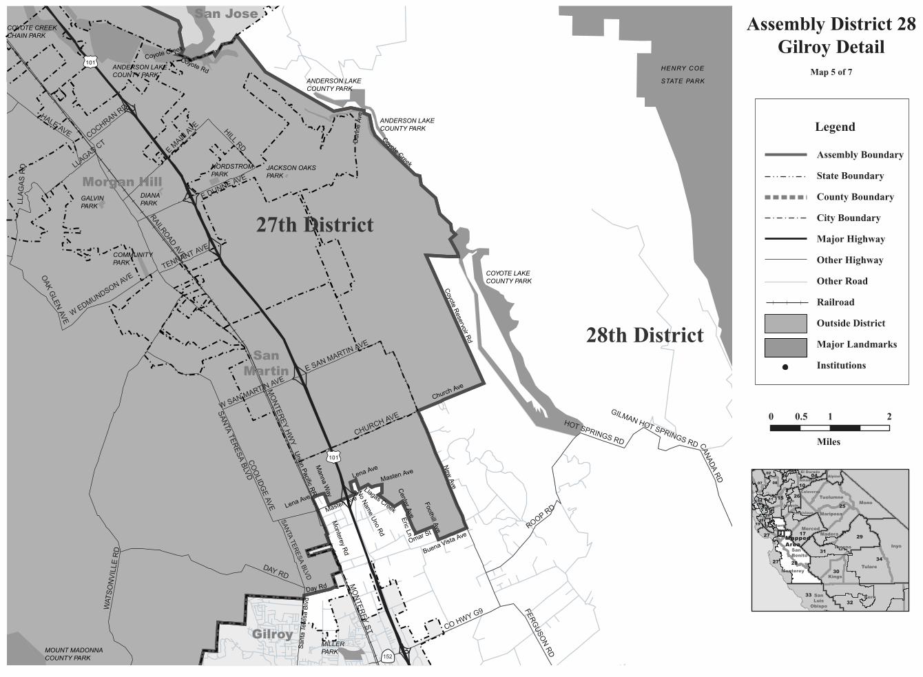
Assembly District 28Gilroy Detail
Map 5 of 7
Kern
InyoFresno
Tulare
Mono
Monterey
MaderaMerced
Kings
Tuolumne
SanLuis
Obispo
MariposaStanislaus
SanBenito
SanJoaquin
SantaClara
Calaveras
AlpineAmador
El Dorado
25
34
30
28
32
29
33
1727
27
31
15
04
10
26
0807
1921
02
1114
20
05
16
09
MappedArea
Legend
Assembly Boundary
State Boundary
County Boundary
City Boundary
Major Highway
Other Highway
Other Road
Railroad
Outside District
Major Landmarks
Institutions

LICKH.S.
O'CONNORHOSPITAL
OVERFELTHIGH SCHOOL
ALEXIANBROTHERSHOSPITAL
MISSIONSANTA CLARADE ASIS
SAN JOSECITY COLLEGE
SAN JOSEMEDI CEN
SANTA CLARAVALLEY MED CEN
23rd District
24th District
22nd District
20th District
28th District
SAN JOSEINTERNATIONAL
AIRPORT
N 1ST ST
SIERRA RD
STATE HWY 82
STORY RD
TULLY RD
S 7TH ST
STATE HWY 130
S KING RD
S 10TH ST
N 4TH
ST
MCKEE RD
RUBY AVE
N 10TH
ST
SENTER RD
MCLAUG
HLIN AVE
COLEMAN AVE
N WHITE R
D
N 7TH
ST
QUIMBY RD
CLAYTON RD
SW EXWY
OAKLAND RD
S MAIN ST
E JULIAN ST
ABORN RD
MERIDIAN AVE
HEDDING ST
S BASCOM AVE
MONTA
GUE EXWY
W TAYLOR ST
FLEMING AVE
W TRIMB
LE RD
FELTER RD
LINCOLN AVE
S 24TH ST
E GISH RD
LOUPE AVE
S CAPITO
L AVE
S 13TH ST
TULLY RD
BIRD AVE
OAKLAND RD
CAPITOL AVE
MABURY RD
N 17TH
ST
N 13TH
STLUNDY AVE
E SAN ANTONIO
ST
N 21ST ST
NAGLEE AVE
NORWOOD A
VE
E HEDDING ST
GUADALU
PE PKWY
KEYES ST
W ALMA AVE
TOYON AVE
MOUNTPLEASANT RD
N BASC
OM AVE
E SAN CARLOS ST
SILVER CREEK RD
S 4TH ST
S 17TH ST
E CAPITOL AVE
MINNESOTA AVE
KING RD
E SANTA CLARA ST
MONTAG
UE EXWY
ABORN RD
OLD BAYSHORE HWY
P
SAN JOSE CC
PLEASANTHILLS GC
SANTA CLARAUNIV
SAN JOSESTATEUNIVSAN JOSE
ARENA
CYPRESSGREENSGC
SAN JOSECHRISTIANCOLLEGE
S a n J o s e
Milpitas
SantaClara
EastFoothills
AlumRock
Burbank
CampbellFruitdale
ALUM ROCK PARK
COYOTECREEKCHAINPARK
LAKECUNNINGHAM
PARK
PRUSCHPARK
WELCHPARK
CAPITALPARK
HILLVIEWPARK
BRIGADOONPARK
MEADOW FAIRPARK
LOBUEPARK
BRIGADOONPARK
MOUNTPLEASANTPARK
FERNISHPARK
CASSELL PARK
OURPARK
17
130
130
87
82
82
237
82
280
280
680
880
880
101
101
Capitol Expy
Crothers Rd
S White Rd
San Felipe Rd
Norwood Ave
Arroyo A
guague
I-680
Clayton Rd
Cunning
ham Ave
N Capitol Ave
Penitencia Creek
WILLOW ST
Klein Rd
Klein R
d
Aborn Rd
Mount Hamilton Rd
Pleasant
Acres Dr
BELLOM
Y ST
Murillo Ave
Groesbeck Hill Rd
Fleming Ave
Mount Ple
asant R
d
MORRILL AVE
Nieman Blvd
0 0.5 1 2
Miles
Santa Clara
Alameda
San Mateo
Contra Costa
Santa Cruz
SanJoaquin
Marin
SanFrancisco
15
19
28
27
21
1720
18
22
16
14
13
24
12
23
0611
MappedAreaP
ac
i f i cO
ce a
n
Assembly District 28San Jose Detail
Map 6 of 7
Legend
Assembly Boundary
State Boundary
County Boundary
City Boundary
Major Highway
Other Highway
Railroad
Outside District
Major Landmarks

17th District
28th District
25th District
31st District
26th District
29thDistrict
RD
9
CO HWY J1
RD
23
RD
19
RD
26
G S
T
W NEES AVE
STAT
E H
WY
130
AVENUE 18 1 2
RD
16
AVENUE 14TH
AVENUE 1
2TH
PANOCHE RD
RD
4
LE GRAND RD
PALOMA R
D
MIN
ES
RD
CIEN
EGA R
D
EA
ST
IN R
D
AVENUE 26TH
W MANNING AVE
FAIRVIEW RD
WESTSIDE BLVD
WHIT
E RO
CK R
D
OAKDALE RD
RIV
ER
RD
WALNUT AVE
W SANDY MUSH RD
BLIS
S R
D
BLOSS AVE
CA
NA
DA
RD
INDIAN GULCH RD
S H
UN
T R
D
JAM
ES
RD
AVENUE 7 1 2
MEADOW DR
FRUIT AVE
S R
US
SE
LL A
VE
AVENUE 20TH
RD
16
RD
26
N R
US
SE
LL A
VE
STA
TE H
WY 2
33
PIONEER RD
S J
AM
ES
RD
FINK RD
N BISHOP AVE
PLA
INS
BU
RG
RD
BEAR VALLEY RD
ME
RC
ED
FA
LLS
RD
S C
EN
TR
AL A
VE
LIN
CO
LN
BLV
D
OLD
STA
GE
RD
W AMERICAN AVE
UNION RDT
UR
NE
R IS
LA
ND
RD
FRAZIE
R LA
KE R
D
N SANTA FE AVE
CALIFORNIA AVE
SN
ELLIN
G R
D
CA
NY
ON
RD
S P
LA
CE
R A
VE
COTTONWOOD RD
E OLIVE AVE
W JEFFERSON AVE
PRESTO
N R
D
FALLON RD
CO
LORAD
O R
D
VINEWOOD AVE
S L
YO
N A
VE
N SANTA FE DR
SANTA ANA RD
ORESTIMBA RD
W 23RD ST
S V
INC
EN
T R
D
W NORTH AVE
BLOSSOM ST
W WHITMORE AVE
CHOW
CHILLA
BLV
D
W MONTE VISTA AVE
N P
AR
SO
NS
AV
E
NIC
KE
L R
D
N W
ES
T A
VE
S D
EL
NO
RT
E A
VE
BELLEVUE RDW AVENUE 2ND
E LINWOOD AVE
INGOMAR GRADE ST
SAND SLOUGH RD
WARDROBE AVE
N M
ON
TPELIE
R R
D
CO
NT
RA
CO
STA
RD
S S
ANTA
FE AV
E
ERREC
A RD
AVENUE 22 1 2
RU
SS
ELL A
VE
TURLOCK RD
S M
INT
UR
N R
D
CHILDS AVE
N ST
NORTH AVE
W GAFFERY RD
CO
HW
Y 2
6
HENRY MILLER RD
PANOCHE RD
FA
IRFA
X A
VE
CO HWY J16C
IEN
EG
A R
D
MC
CR
AC
KE
N R
D
Henry Willard
Coe State Park
San Luis Reservoir
State Recreation Area
Castle
AFB
Turlock Lake
State Park
CA STATE UNIV
STANISLAUS
Fremont Ford
State Park
George J Hatfield
State Park
Merced
Turlock
Los Banos
Atwater
Hollister
Winton
Firebaugh
Planada
Chowchilla
Mendota
Gustine
Tranquillity
Dos Palos
Hughson
SanJoaquin
Gilroy
Madera
Ceres
Madera Acres
Modesto
Le Grand
Delhi
Denair
Hilmar-Irwin
Kerman
Keyes
Newman
Patterson
M e r c e d C o u n t y
F r e s n o C o u n t y
S t a n i s l a u s
C o u n t y
S a n B e n i t o
C o u n t y
M a d e r a
C o u n t y
Livingston
99
99
99
145
33
33
152
152
165
33
33
165
165
140
140
140
59
59
49
5
5
5
E Keyes Rd
Marshall Rd
Ra
ines R
d
Gra
yson
Rd
Marshall R
dWard
Ave
W Grayson Rd
Needham Rd
Ca N
orthern RR
Ro
ge
rsR
d
Cro
ws
Landin
g R
d
Del
Pue
rto
Cre
ek
Oak Flat RdCalifo
rnia
Aqueduct
Salado Cre
ek
County B
oundary
San Joaquin R
iver
Assembly District 28Northeast Part
Map 7 of 7
0 4 62 8
Miles
Legend
Assembly Boundary
State Boundary
County Boundary
City Boundary
Major Highway
Other Highway
Railroad
Outside District
Major Landmarks
Kern
InyoFresno
Tulare
Mono
Monterey
MaderaMerced
Kings
Tuolumne
SanLuis
Obispo
MariposaStanislaus
SanBenito
SanJoaquin
SantaClara
Calaveras
AlpineAmador
El Dorado
25
34
30
28
32
29
33
1727
27
31
15
04
10
26
0807
1921
02
1114
20
05
16
09
MappedArea

C A L I F O R N I A A S S E M B LY D I S T R I C T S
Assembly Redistricting Plan (SB 802), September 13, 2001
The Honorable Robert M. Hertzberg, SpeakerState CapitolRoom 219Sacramento, CA 95814
The California State Assembly Rules CommitteeThe Honorable Dennis Cardoza, ChairP.O. Box 942849Sacramento, CA 94249-0001
The California State Assembly Committee on Elections, Reapportionment, and Constitutional AmendmentsThe Honorable John Longville, ChairP.O. Box 942849Sacramento, CA 94249-0001
Produced at California State University NorthridgeDr. Jolene Koester, President
Eugene Turner, Project DirectorDepartment of Geography18111 Nordhoff St.Northridge, CA 91330
with
Rubyjane Domingo, Pat Jolley, Meredith Leonard
2001
About the Maps
These maps present specific informationabout the features comprising the borders of theAssembly Districts of California that were cre-ated after the 2000 Census. Each of the 80 dis-tricts are represented by one to ten maps withthe number depending on the size of the districtand the complexity of the features followed bythe boundary. In general, the boundaries followcounty lines, city limit lines, and roads, butoccasionally canals, streams, and small roadsare followed.
The Assembly boundary data were creat-ed in digital form from Census 2000 TIGERfiles for California by Pactech Incorporated ofPasadena, CA. The boundary files were releasedin two forms, as a file of district polygons andas a file of line segments used to create thepolygons. Where these line segments were iden-tified, those identifiers were used to label themap boundaries. In addition, place boundarieswere created from the TIGER files.
Other map information such as roads,railroads, coastlines, and landmarks wereobtained from Geographic Data Technologies.Dynamap 2000 files (v10.1). Government landownership information such as national forestboundaries was obtained from a governmentland ownership layer prepared by the CaliforniaTeale Data Center.
Maps were prepared from the digitalfiles using Arcmap 8.1 software fromEnvironmental Systems Research Incorporated.An Albers equal area projection was used forthe maps with a central meridian of 120 degreeswest longitude and standard parallels of 30 and40 degrees of latitude. Coordinates are based onNAD83.
conneljw
About the Maps These maps present specific information about the features comprising the borders of the Assembly Districts of California that were created after the 2000 Census. Each of the 80 districts are represented by one to ten maps with the number depending on the size of the district and the complexity of the features followed by the boundary. In general, the boundaries follow county lines, city limit lines, and roads, but occasionally canals, streams, and small roads are followed. The Assembly boundary data were created in digital form from Census 2000 TIGER files for California by Pactech Incorporated of Pasadena, CA. The boundary files were released in two forms, as a file of district polygons and as a file of line segments used to create the polygons. Where these line segments were identified, those identifiers were used to label the map boundaries. In addition, place boundaries were created from the TIGER files. Other map information such as roads, railroads, coastlines, and landmarks were obtained from Geographic Data Technologies. Dynamap 2000 files (v10.1). Government land ownership information such as national forest boundaries was obtained from a government land ownership layer prepared by the California Teale Data Center. Maps were prepared from the digital files using Arcmap 8.1 software from Environmental Systems Research Incorporated. An Albers equal area projection was used for the maps with a central meridian of 120 degrees west longitude and standard parallels of 30 and 40 degrees of latitude. Coordinates are based on NAD83.


