2015. ICRISAT. GIS and SDI for sustainable development
72
Putting Information and Communications Technologies to Work for Nations and Communities GIS and SDI for Sustainable Development
Transcript of 2015. ICRISAT. GIS and SDI for sustainable development

Putting Information and Communications Technologies to Work for Nations and
Communities
GIS and SDI for Sustainable Development

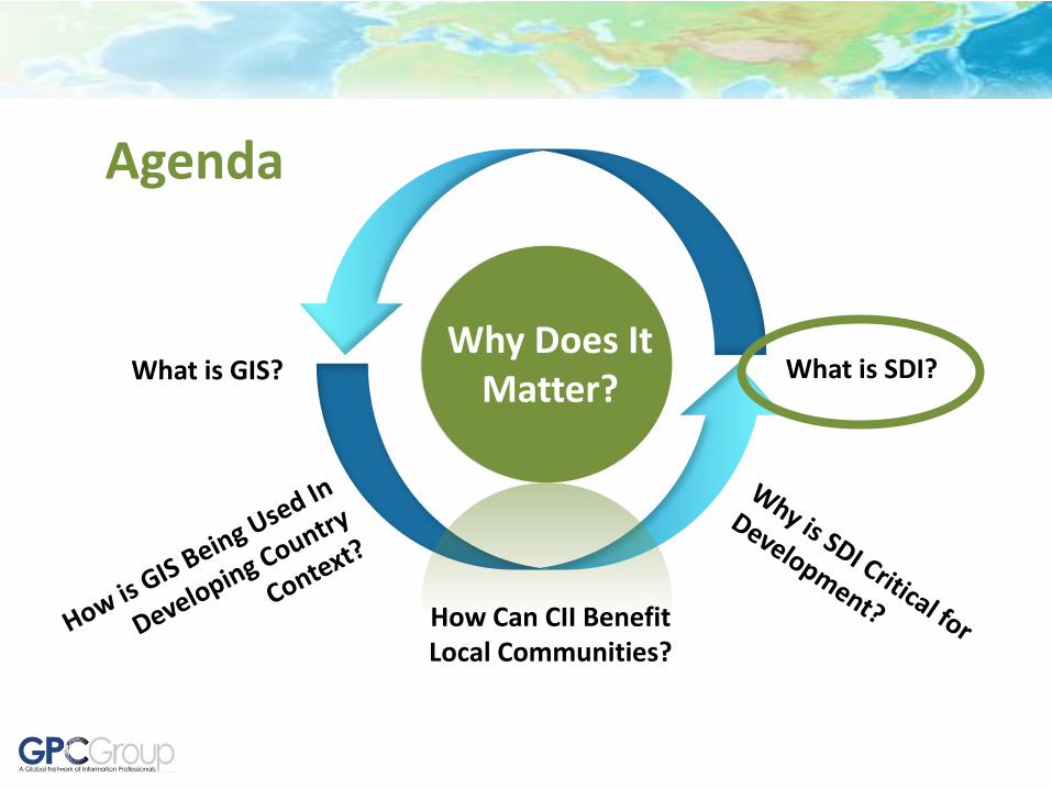
Agenda
What is GIS? What is SDI? Why Does It
Matter?
How Can GeoVillage Benefit Local Communities?

Geographic Information Systems (GIS)
Computerized System for Managing and Using “Intelligent Maps”

GIS provides computerized tools for capturing, managing, analyzing, and visualizing geographic information
GIS supports many types of uses……..

……converting the real world to a digital form that can be used and analyzed
…..and allows the comparison and display of many thematic types of data

More importantly, GIS has analysis, query and visualization tools to support many important uses……..

…… and it allows us to use location as a way to integrate and relate information
Census Data
Call Center Complaints
Building Permits
Student Records
Water Utility Customer Records
Business Customer Records
Emergency Dispatch
Home Delivery
Taxi Calls
Service Requests
Telephone Customer Records
Electric Utility Customer Records
11 Al Meel St

…… and it allows us to use location as a way to integrate and relate information from multiple sources in useful, and sometimes critical ways…..
Fire incident, hazard material, calculation of area likely affected based on wind speed/direction, and notification through reverse emergency call
Identify areas affected by a road widening project
Identify valves to be shut off in case of water main break, and to also find what properties will lose service so they can be notified
Best route for school bus based on student locations, geocoded by address
Identify potential environmental health and safety issues
Assess community facility and service availability
Students with high asthma rate
Air Quality Monitoring Station

How it used to work……..
• Building Outlines
• Utility Lines
• Parcels
• Street Centerlines
• Administrative Boundaries
• Street Edges
• Spot Elevations
• Survey Control Points
Previous survey and basemapping
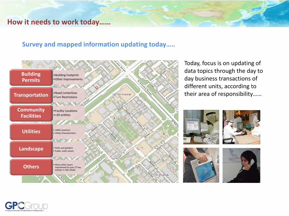
How it needs to work today……
Today, focus is on updating of data topics through the day to day business transactions of different units, according to their area of responsibility……
Survey and mapped information updating today…..
•Building Footprint
•Other Improvements
Building Permits
•Road Centerlines
•Turn Restrictions Transportation
•Facility Locations
•>20 entities
Community Facilities
• Utility locations
• Utility Characteristics Utilities
• Parks and gardens
• Public realm assets Landscape
• Many other layers maintained by over 27 key entities in Abu Dhabi
Others

GIS today is widely used to support planning and operations in nearly all sectors……..

GIS today is widely used to support planning and operations in nearly all sectors……..
Agenda
What is GIS? What is SDI?
How Can CII Benefit Local Communities?
Why Does It Matter?

Technology advances over the years made it technically possible for more people and organizations to be connected…….
Stand Alone
GIS Projects
Coordinated
GIS Systems
Cooperative
Distributed Networks
Public(s) Services
Cloud
Spatial Data Infrastructure
(SDI)
We then had to invent new institutional frameworks to take maximum advantage of these developments

2015
The technological world around us has evolved
tremendously…….
1982 1994

Geospatial Social Media
Crowd-Sourced Geographic Information
Citizen Reporting
Place-Based Social Media
Citizen Science
Global Social Connectedness
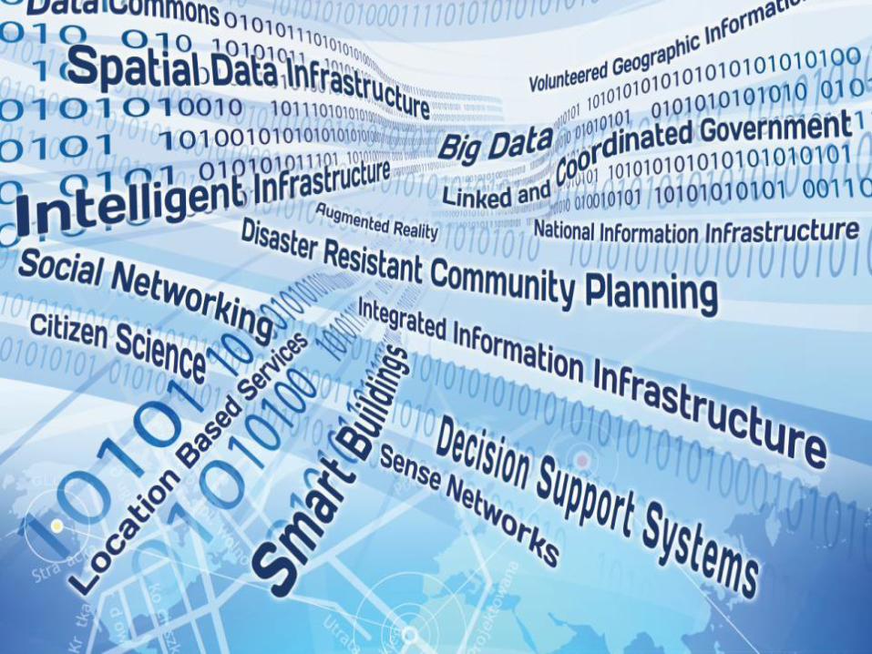
Many new technologies are e-Merging, creating exciting new opportunities for the future…….
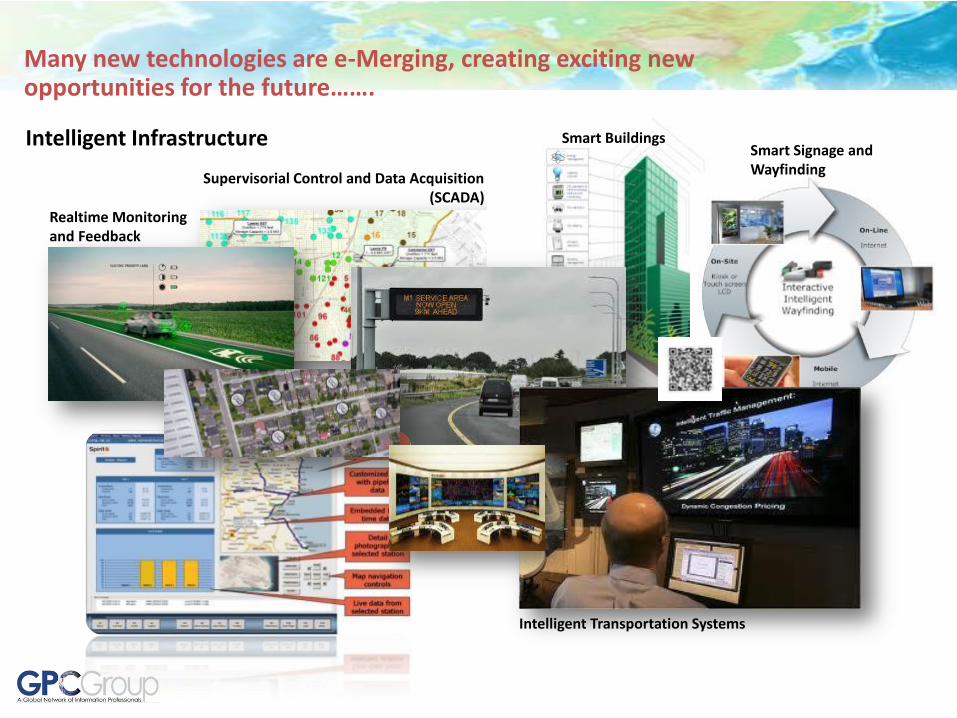
Intelligent Infrastructure
Intelligent Transportation Systems
Supervisorial Control and Data Acquisition (SCADA)
Smart Buildings Smart Signage and Wayfinding
Realtime Monitoring and Feedback
Many new technologies are e-Merging, creating exciting new opportunities for the future…….

Sense Networks
Cell Phone Movement Patterns
Advanced Satellite Remote Sensing Platforms
“Copenhagen Wheel” – example of citizen science
Vehicle Movements and Patterns
Spatial “Opt-In” and location-based notifications
Real-time monitoring
Many new technologies are e-Merging, creating exciting new opportunities for the future…….

Big Data
New Sensing Technologies
Billions of spatially-enabled data points
Social Media rapid adoption
Growing timeframe of legacy data collection
Many new technologies are e-Merging, creating exciting new opportunities for the future…….

SDI 3.0: Taking it to the Next Level
SDI 3.0 continues operational functioning for data clearinghouse management. Accurate, up to date, reliable data provides enabling en vironment for informed decision making. It also builds on interdisciplinary foundations towards more collaborative and systemic planning, policy making and coordinated interventions.
Location-enabled social networking, global connectivity and free flow of information,
opinions and ideas provides a fertile opportunity to re-craft and re-tool government engagement with
constituencies.

Agenda
What is GIS? What is SDI?
How Can CII Benefit Local Communities?
Why Does It Matter?
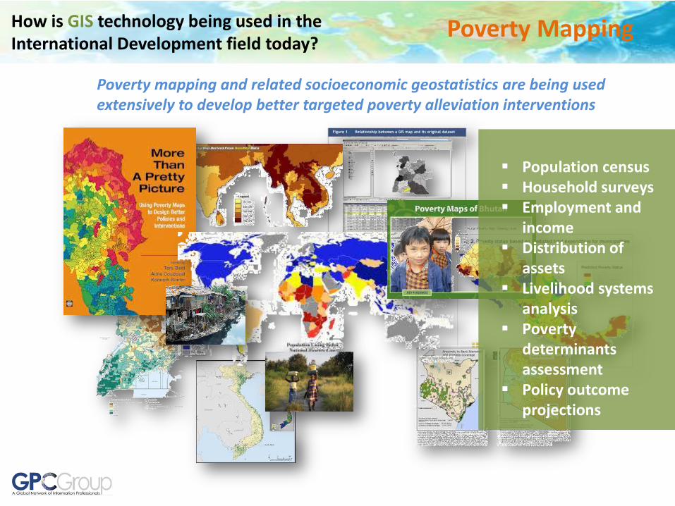
How is GIS technology being used in the International Development field today?
Poverty Mapping
Poverty mapping and related socioeconomic geostatistics are being used extensively to develop better targeted poverty alleviation interventions
Population census Household surveys Employment and
income Distribution of
assets Livelihood systems
analysis Poverty
determinants assessment
Policy outcome projections

How is GIS technology being used in the International Development field today?
Project Monitoring and Evaluation
GIS provides a critical capability for tracking development projects, monitoring and assessing their impacts, individually and cumulatively.
• Project location and meta-information
• Feasibility studies • Project planning and
design • Project monitoring
and reporting • Environmental
impact assessment • Social safeguards
compliance • Post project
operations and maintenance

How is GIS technology being used in the International Development field today?
Agriculture and Food Security
GIS can be used to help optimize arable land and agricultural resources and infrastructure for sustainable and resilient food production and security
• Agricultural suitability assessment
• Food insecurity assessment
• Farm planning and design
• Precision agriculture • Crop monitoring and
assessment • Early warning
assessment • Coop asset
management • Farm extension
management

How is GIS technology being used in the International Development field today?
Water Security
Access to clean drinking water, irrigation, watershed management, groundwater management, and other water security factors are addressed effectively with GIS
• Weather monitoring • Watershed analysis • Groundwater analysis • River and stream
monitoring • Well management • Irrigation infrastructure
asset management • Water insecurity early
warning • Water quality assessment

How is GIS technology being used in the International Development field today?
Humanitarian Assistance
Natural disasters, military conflicts, political upheaval have a disproportionately greater impact on the poorest people in any country. GIS provides tools for identifying, conducting and tracking humanitarian assistance.
Humanitarian assistance asset management and tracking
Management of Internally Displaced People (IDP’s)
Supply chain tracking Relief effort planning
and operations Security assessment and
operations Inter-agency
coordination

How is GIS technology being used in the International Development field today?
Cadastral Survey and Land Registration
Secure property rights support economic growth, social stability, encourage investment in infrastructure and land improvements and other societal benefits. GIS provides tools to establish and manage property boundaries and titles.
• Property boundary survey and mapping
• Land title preparation • Informal land use
mapping • Computer assisted tax
appraisal • Land use regulation and
monitoring • Land suitability
assessment • Property management • Land allocation and
reapportionment
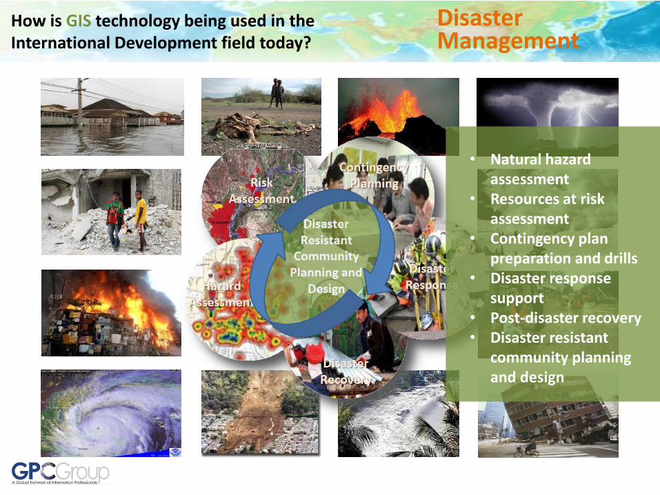
Disaster Management
• Natural hazard assessment
• Resources at risk assessment
• Contingency plan preparation and drills
• Disaster response support
• Post-disaster recovery • Disaster resistant
community planning and design
How is GIS technology being used in the International Development field today?
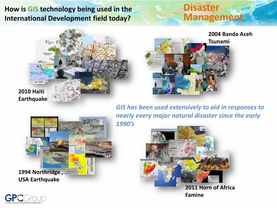
2010 Haiti Earthquake
2004 Banda Aceh Tsunami
1994 Northridge , USA Earthquake
2011 Horn of Africa Famine
How is GIS technology being used in the International Development field today?
Disaster Management
GIS has been used extensively to aid in responses to nearly every major natural disaster since the early 1990’s

COUNTRY TOTAL MINES
Afghanistan 10,000,000
Angola 15,000,000
Austria -
Azerbaijan 100,000
Belarus -
Belgium -
Bosnia and Herzegovina 3,000,000
Burundi -
Cambodia 6,000,000
Chad 70,000
China 10,000,000
Costa Rica -
Croatia 3,000,000
Cyprus 16,942
Czech Republic -
Democratic Republic of the Congo -
Denmark 9,900
Djibouti -
Ecuador 60,000
Egypt 23,000,000
El Salvador 10,000
Eritrea 1,000,000
Ethiopia 500,000
Falklands Islands (Malvinas) 25,000
Georgia 150,000
Germany -
Guatemala 1,500
Honduras 35,000
India -
Iran, Islamic Republic of 16,000,000
Iraq 10,000,000
Jammu and Kashmir -
Jordan -
Korea, Republic of 206,193
Kuwait -
Lao People’s Democratic Republic -
Latvia 17,000
Lebanon 8,795
Liberia 18,250
Libyan Arab Jamahiriya -
Luxembourg -
Mauritania -
Mozambique 3,000,000
Myanmar -
Namibia 50,000
Netherlands -
Nicaragua 108,297
Oman -
Peru -
Russian Federation -
Rwanda 250,000
Senegal -
Slovenia -
Somalia 1,000,000
Sri Lanka -
Sudan 1,000,000
Syrian Arab Republic -
Tajikistan -
Thailand -
Tunisia -
Turkey -
Uganda -
Ukraine 1,000,000
Viet Nam 3,500,000
Yemen 100,000
Yugoslavia 500,000
Zimbabwe -
- = indicates insufficient data to make an estimate.
How is GIS technology being used in the International Development field today?
Demining
Total number of land-mines 110 million in 64 countries
Human cost of land-mines 800 deaths a month, mostly innocent civilians, with thousands more maimed for life
Dollar cost of land-mines To buy one: $3-$10 To remove one: $300-$1,000
GIS provides a critical capability for the inventory, prioritization and tracking of mine removal and maintaining community safety.
Source: UNICEF
• Mined area mapping • Mine removal
prioritization and tracking
• Field data collection • Field crew tracking and
reporting • Security management • Public awareness and
safety

How is GIS technology being used in the International Development field today?
Renewable Energy
GIS is being used widely to identify and assess renewable energy resources all over the world, from global to local analysis
• Solar potential modeling • Hydro power potential
assessment • Wind energy potential
analysis • Biomasss energy potential
assessment • Renewable energy system
planning and design • Energy system asset
management • Operations and maintenance • Energy demand modeling • Customer tracking and
relationship management
How is GIS technology being used in the International Development field today?
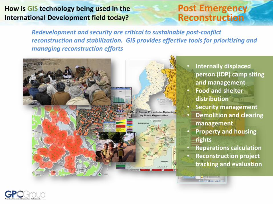
Post Emergency Reconstruction
Redevelopment and security are critical to sustainable post-conflict reconstruction and stabilization. GIS provides effective tools for prioritizing and managing reconstruction efforts
• Internally displaced person (IDP) camp siting and management
• Food and shelter distribution
• Security management • Demolition and clearing
management • Property and housing
rights • Reparations calculation • Reconstruction project
tracking and evaluation

How is GIS technology being used in the International Development field today?
Health and Human Services
GIS provides powerful tools for health management, including the tracking and response to chronic and communicable diseases, among other matters.
Medical facility inventory
Chronic disease assessment
Epidemiology and outbreak tracking and response
Environmental health Field health worker
tracking Mobile clinic mgmt Remote diagnosis Ambulance routing and
tracking

How is GIS technology being used in the International Development field today?
Education
GIS can be incorporated to nearly every field and level of education, thus providing important problem solving skills and employment opportunities
• Technical training • K-12 geographic science • On the job GIS training • Higher education and spatial
thinking and problem solving • Applied research in all sectors • Citizen engagement and
awareness building • Career development for
continuing education • International engagement in
education at all levels

How is GIS technology being used in the International Development field today?
Climate Change
GIS provides a critical capability for the inventory, prioritization and tracking of mine removal and maintaining community safety.
• Climate change risk assessment and contingency planning
• Emissions reduction planning
• Carbon offsets project planning and design (REDD, Blue Carbon, etc.)
• Awareness building • Ongoing monitoring
and assessment

How is GIS technology being used in the International Development field today?
Environmental Conservation
GIS has been used for many years all over the world for protection of natural and cultural heritage and community-based conservation
Habitat mapping and analysis
Community-based conservation
Protected areas management
Endangered species monitoring
Environmental monitoring
Environmental Impact Assessment

How is GIS technology being used in the International Development field today?
Governance and Democracy
GIS supports effective governance and promotion of democratic principles, especially when open data policies are adopted
Election monitoring Public polling and
opinion measurement Public awareness
building Social networking Multi-dimension public
information exchange Opinion trend
monitoring Stakeholder
information management

How can GIS technology be used in the International
Development field today and tomorrow? Green Economy
GIS provides the tools to understand and assess the intersection of local and regional natural and socioeconomic systems, and to plan and develop communities and economies that can evolve in ways that are sustainable, resilient and adaptable to disruptive change, and supportive of human and ecological well-being and social equity.
Optimize utilization of local natural resources and ecosystem services
Provide opportunities for sustainable econommic development and growth
Minimize impacts to local ecosystems
Support social equity Minimize and mitigate risks,
while maximizing opportunities
Provide evidence based monitoring and evaluation as basis for ongoing adaptive management

Agenda
What is GIS? What is SDI?
How Can CII Benefit Local Communities?
Why Does It Matter?

Schools Project
Watershed Restoration Program Agroforestry
Project
Informal Settlement Regularization
Flood Protection Project
Agriculture Irrigation Project
Road Construction Project
Water Supply Improvement
Community Electrification
Land Title Program
Many development needs
Multiple projects Different sectors Different Agencies Different sources of
project financing Different sources of
technical support Different project
implementers Different scales of
projects Different timeframes Variable local capacity Duplication in data
collection No comprehensive
picture of the development situation
Most projects developed with poor information
Sewer Treatment Facility
Community Electrification
Data
Data
Data
Data
Data
Data
Data Data
Data
Data
Data
Data
$$
$$
$$
$$
$$
$$
$$
$$
$$
$$
$$ $$
SDI for Development

Schools Project
Watershed Restoration Program Agroforestry
Project
Informal Settlement Regularization
Flood Protection Project
Agriculture Irrigation Project
Road Construction Project
Water Supply Improvement
Community Electrification
Land Title Program
International Finance Institutions and Technical Assistance providers not aware of each other’s projects
Project implementers unaware of each other’s projects
Government may lack complete picture across all sectors
Sewer Treatment Facility
Community Electrification
Data
Data
Data
Data
Data
Data
Data Data
Data
Data
Data
Data
$$
$$
$$
$$
$$
$$
$$
$$
$$
$$
$$ $$
SDI for Development

Many projects already creating data
Scattered information Little or no coordination
across sectors for projects No requirements to
repatriate data Variable local capacity to
maintain and use data No facility to coordinate
data sharing across sectors
Investment in data not leveraged beyond the initial purpose
Same data collected many times
Lost data, lost opportunity
Data
Data
Data
Data
Data
Data
Data Data
Data
Data
Data
Data
$$
$$
$$
$$
$$
$$
$$
$$
$$
$$
$$ $$
SDI for Development

Good information can increase positive impact and reduce risk
De-risking projects can attract more finance options (sovereign funds, private sector, foundations, etc.)
SDI for Development
Information
Risk
Poor information =
more risk
Better information =
less risk

What required to retain and reuse the information we have and attract additional investment???
Data
Data
Data
Data
Data
Data
Data Data
Data
Data
Data
$$
$$
$$
$$
$$
$$
$$
$$
$$
$$ $$
SDI for Development
Common Data Repository
$$$
Information
Risk
Better information =
less risk
Poor information =
more risk

SDI for Development
Common Data Repository
$$$ Policy acknowledging
project coordination and SDI function in government as an enabling environment for effective and sustainable development
Policy requiring repatriation of project data to host government
Project and information coordination
Capacity to effectively manage and use data
and tools
Capacity building program o Central unit o Agencies o Other Stakeholders
What required to retain and reuse this information investment???

Agenda
What is GIS? What is SDI? Why Does It
Matter?
How Can GeoVillage Benefit Local Communities?

Putting Information and Communications Technologies to Work for Local Community
Development
Community Information Infrastructure
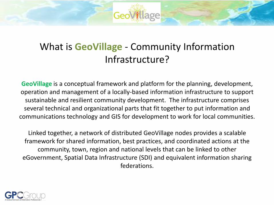
What is GeoVillage - Community Information Infrastructure?
GeoVillage is a conceptual framework and platform for the planning, development, operation and management of a locally-based information infrastructure to support
sustainable and resilient community development. The infrastructure comprises several technical and organizational parts that fit together to put information and
communications technology and GIS for development to work for local communities.
Linked together, a network of distributed GeoVillage nodes provides a scalable framework for shared information, best practices, and coordinated actions at the
community, town, region and national levels that can be linked to other eGovernment, Spatial Data Infrastructure (SDI) and equivalent information sharing
federations.

Telecommunications
Renewable Energy Power Generation
MicroGrid
Foundation Enabling
Infrastructure
GeoVillage Foundation Infrastructure can be provided for those communities that lack telecommunications and electrification

Cloud Computing Resources
Internet
gvNET Mobile Phone, Internet,
Email and VoIP
gvVIEW Geographic Information
System gvPROJECT
Project Management and Monitoring System
gvCOMMUNITY Local Community Website
gvSUCCEED Best Practices and
Success Stories
gvFINANCE Access to Microfinance
Networks
gvBANK Electronic Banking
Services
gvTRADE Market Prices, Barter,
Exchange, Local and Export Sales
gvHEALTH Remote Health Network
Services gvLEARN
Remote Learning Network Access
gvJOBS Employment
Opportunities gvGROW Agriculture Extension
Services

Rockefeller Foundation - SPEED India Akshaya Centers – Kerala, India
Builds On
Global Movement in Information and Communications Technology for
Development (ICT4D)

gvNET
Mobile Phone, Internet, Email and VoIP
Provide basic telephony services and points to charge phones
Access through low cost handsets and other portable devices
Provide local advanced services for internet, email and VoIP
Prepaid subscription provides credits for GeoVillage services

gvVIEW
Geographic Information System
Consolidation of relevant data for local development area (LDA)
Inventory of existing situation
Analysis of development issues, opportunities and constraints
Information confirmed and refined through community social networking

gvPROJECT
Project Management and Monitoring System
GIS opportunity and constraint analyses linked with community and multi-donor engagement process to support better project formulation
Track multi-donor and multi-sector project locations, resources and status
Generate project status reports and maps

gvGROW Remote Agriculture Extension Services
Support existing field extension services
Connectivity across agricultural communities and professional extension officers
Forum for sharing issues, ideas and best practices
Access to infrastructure, markets, finance, and banking
Access to fair trade certification services and marketing

gvFINANCE Access to Microfinance Networks
Many channels for microfinance now available across the world
Provide an online application to identify which microfinance institutions may be appropriate for a given need, as well as tutorials, help guides and models for how to prepare and submit funding requests

gvTRADE Market Prices, Barter, Exchange, Local and Export Sales
Establish mechanism for tracking and publishing market prices for common products. Local in this case would refer to logical economic market areas for local subsistence use
Provide an online market that in addition to cash sales can also accommodate barter and exchange transitions
For selected products, provide a framework for connecting local primary producers with consolidators or regional and international export sellers. Focus on fair trade channels and other avenues that protect the interests of primary producers

gvHEALTH Remote Health Network Services
Access to health information networks and resources
Remote consultation and diagnosis
Epidemiological reporting Environmental health and
chronic disease reporting Access to clinics and mobile
facilities Access to medical supply
material Emergency response support
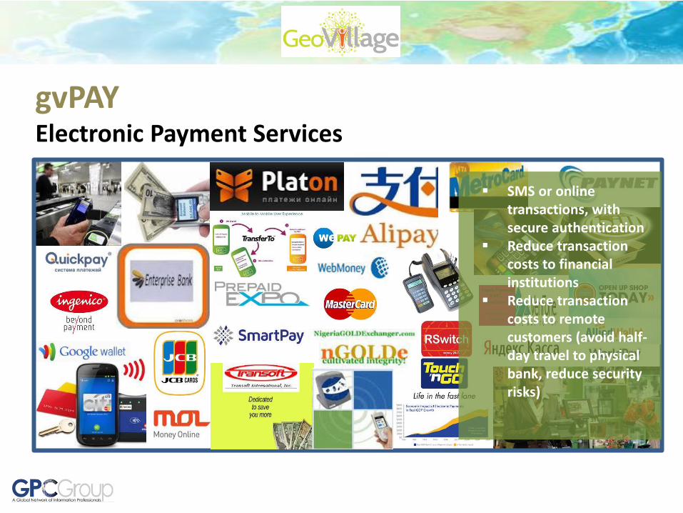
gvPAY Electronic Payment Services
SMS or online transactions, with secure authentication
Reduce transaction costs to financial institutions
Reduce transaction costs to remote customers (avoid half-day travel to physical bank, reduce security risks)

gvLEARN Remote Learning Network Access
Connect to education networks at various levels
Access to online teaching and learning resources
Trade school and certificate programs
Connecting schools and teachers for professional and cultural exchange
Home school options Student to Student
networking for learning

gvJOBS Employment Opportunities
Local and regional employment boards (long term, temporary and seasonal)
Job training opportunities
Online job opportunities

gvCOMMUNITY
Local Community Website
Represent local issues and provide community information
Website could act as a “portal” to other gv services
GV Service providers provided with templates and showcase example local community websites as a starting point

gvSUCCEED Best Practices and Success Stories
Provide a Wiki-based framework for compiling, searching and accessing relevant success stories, best practices and the like
Focus on subject areas, issues and technologies that are relevant to community development locally

GeoVillage Community Information Infrastructure

How can GIS technology be used in the International
Development field today and tomorrow?
GIS provides the tools to understand and assess the intersection of local and regional natural and socioeconomic systems, and to plan and develop communities and economies that can evolve in ways that are sustainable, resilient and adaptable to disruptive change, and supportive of human and ecological well-being and social equity.
Is increased GIS, SDI, and ICT for development at multiple scales feasible??
What challenges??

Perception #1 - “There is no local information available…..”
GeoVillage Community Information Infrastructure
Experience suggests that in most cases there is vastly more information existing than most people realize because it is scattered across many agencies and in many different forms.
Fundamental Data Uncovered Through Data Inventory and Assessment Activity
• Wide variety of data often available in different government and commercial sources
• Sector-specific data from local government sources
• International organizations
• NGO’s and charitable organizations
• Private companies (international and local)
• Declassified information from security and military sources
• Crowd-sourced information (e.g. USHAIDI, Open Street Map, etc.)

68
Enabling Technologies
• Cell phones outpacing electrification in many parts of the world
• Mobile devices increasingly able to connect to Internet and are location-aware
• Mixed media can provide access for semi-literate
• Communications infrastructure seen as development priority in most countries
• Cloud computing reducing need for heavy local computing resources
• Distributed options for local renewable energy sources becoming more feasible
GeoVillage Community Information Infrastructure
Cloud Computing
Global Telecommunications
Global Positioning Satellites (GPS)
Perception #2 - “The people are not ready for technology……”

69
• Price of basic computers has declined drastically while capabilities have soared
• ICT4D bringing lots of low cost, appropriate tech solutions in response to real world needs
• Education systems at all levels in most parts of the world incorporating computing at some level
GeoVillage Community Information Infrastructure
Perception #3 - “Technology is expensive…….”

70
• Cell phone adoption faster than any other technology adoption in history;
• Social networking HAS EXPLODED
• Mobile telephony and basic computing in wide usage in the developing world and growing rapidly;
• Basic technology only requires basic literacy, but encourages increased literacy and technology familiarity through usage for practical purposes.
GeoVillage Community Information Infrastructure
Perception #4 - “Change is difficult…….”

71
• Cell phone adoption faster than any other technology adoption in history;
• Social networking placeholder
• Mobile telephony and basic computing in wide usage in the developing world and growing rapidly;
• Basic technology only requires basic literacy, but encourages increased literacy and technology familiarity through usage for practical purposes.
GeoVillage Community Information Infrastructure
Perception #4 - “Change is difficult…….”

SDI for Development
Better information needed for better development project planning and execution;
Better planned and coordinated projects produce better results and attract more investment;
There is already significant investment in data going on, but it is not retained for use beyond initial project;
Leveraging this investment requires a combination of high level direction and support, institutional cooperation, and capacity building;
Policies are required for government and international finance institutions and development aid organizations to recognize SDI as a sustainable development enabling environment, and to require that data produced from projects is submitted to the host government;
Local communities need local solutions – ICT4D is bringing new opportunities that can be tailored to local conditions. The GeoVillage concept provides an organized framework for government to facilitate local solutions;
The return on investment in SDI and GeoVillage can be many times over……..and the positive societal impacts to communities immeasurable.