2008 Wake Forest Bicycle Plan
136
S TA T E OF N O R TH C A R O L I N A D E P A R T M E N T O F T R AN S P O R T AT I O N Town of Wake Forest z November 18, 2008 Division of Bicycle & Pedestrian Transportation
-
Upload
town-of-wake-forest -
Category
Documents
-
view
226 -
download
0
description
Â
Transcript of 2008 Wake Forest Bicycle Plan

STAT
E OF NORTH CAROLINA
DEPARTMENT OF TRANSPORTA
TIO
N
Town of Wake Forest November 18, 2008Division ofBicycle &PedestrianTransportation


Town of Wake Forest Bicycle Plan Table of Contents
i
Table of Contents Executive Summary Section 1: Introduction and Goals 1.1 Introduction 1.2 Goals Section 2: Current Conditions 2.1 Introduction 2.2 Existing Conditions Analysis 2.3 Built Environment Facilities 2.4 Bicycle-Automobile Crash Analysis 2.5 Demographic Analysis 2.6 Existing Needs Section 3: Existing Policies, Plans, and Programs 3.1 Introduction 3.2 Plan Review 3.3 Current Policy Discussion Section 4: Project Development 4.1 Introduction 4.2 Projects 4.3 Planned NCDOT Projects 4.4 Planned Town Projects 4.5 Greenway Priorities 4.6 New Proposed Projects Section 5: Project Priorities 5.1 Introduction 5.2 Basic Project Cost Estimates 5.3 Project Priorities Section 6: Ancillary Facilities and Programs 6.1 Introduction 6.2 Programs 6.3 Ancillary Facilities 6.4 Policy Recommendations Section 7: Design Guidelines 7.1 Introduction 7.2 Design Guidelines 7.3 Summary of Recommendations Section 8: Implementation 8.1 Introduction 8.2 Scheduling and Partners 8.3 Funding Sources and Recognition Programs 8.4 Funding Sources 8.5 Recognition Programs 8.6 Conclusion and Next Steps Appendix 1: Demographic Analysis Appendix 2: Community Survey Appendix 3: Projects Appendix 4: Bicycle Parking Ordinance

ii
Table 2-1. Roadway classifications in Wake Forest. Table 2-2. Planned bicycle facilities in the 2003 Wake Forest Transportation Plan. Table 2-3. Priority pedestrian corridors in the 2007 Wake Forest Pedestrian Plan. Table 2-4. Schools and activity centers in Wake Forest as of January 2007. Table 2-5. Bicycle crash rates for 11 NC Towns, 1997-2005. Table 2-6. Travel time to work of Wake Forest residents (in minutes). Table 3-1. Bicycle facility type and safety. Table 4-1. Planned TIP projects (roadway and bicycle) in Wake Forest. Table 4-2. CAMPO planned projects in Wake Forest. Table 4-3. Planned bicycle facilities in the 2003 Wake Forest Transportation Plan. Table 4-4. Priority pedestrian corridors in the 2007 Wake Forest Pedestrian Plan. Table 4-5. Priority greenway projects established by the Wake Forest Greenway Committee (2007). Table 4-6. FHWA matrix for bicycle facility treatments. Table 5-1. Short-term on-road priority bicycle projects in Wake Forest. Table 5-2. Mid-term on-road priority bicycle projects in Wake Forest. Table 5-3. Long-term on-road priority bicycle projects in Wake Forest. Table 7-1. Bicycle Facility Types. Table 8-1. Short-term project recommendations. Table 8-2. Short-term program recommendations. Table 8-3. Short-term policy recommendations. Table 8-4. Mid-term project recommendations. Table 8-5. Mid-term program recommendations. Table 8-6. Mid-term policy recommendations. Table 8-7. Long-term project recommendations. Table 8-8. Long-term program recommendations. Table 8-9. Long-term policy recommendations.
Figure 2-1. Functional classification of existing and proposed roads in Wake Forest. Figure 2-2. Locations of planned bicycle facilities in the 2003 Wake Forest Transportation Plan. Figure 2-3. Map of existing and proposed greenway facilities in the Wake Forest Open Space and Greenways Plan. Figure 2-4. Map of existing sidewalks and priority pedestrian corridors in the 2007 Wake Forest Pedestrian Plan. Figure 2-5. Major activity centers in the Town of Wake Forest as of January 2007. Figure 2-6. Map of schools and activity centers in Wake Forest as of January 2007. Figure 2-7. Map of reported bicycle-automobile crashes in Wake Forest, 2003-2006. Figure 2-8. Map of roads that stakeholders indicated as “comfortable” and “uncomfortable” for cyclists in Wake Forest. Figure 4-1. Bicycle funding and construction graphic. Figure 4-2. Map of proposed projects in the Wake Forest Bicycle Plan. Figure 5-1. Project priorities for on-road bicycle facilities in Wake Forest. Figure 7-1. Typical shared-use trail design. Figure 7-2. Trail information installations for gateways between on-street facilities and greenway systems. Figure 7-3. Innovative local access way graphics (bicycle wheel gutter and boardwalk bridge). Figure 7-4. Neighborhood bicycle and pedestrian access way. Figure 7-5. High-volume, high-speed roadway. Figure 7-6. Side path with bike lanes on a high-volume, high-speed roadway. Figure 7-7. Shared-use path on a high-volume, high-speed roadway. Figure 7-8. Bike lane with on-street parking. Figure 7-9. Wide outside curb lane and paved shoulder. Figure 7-10. Neighborhood street. Figure 7-11. Bike lane through intersection with free right-turn lanes. Figure 7-12. Bicycle lane configurations at intersections. Figure 7-13. Plan view of the bicycle box. Figure 8-1. Project priorities for the Wake Forest Bicycle Plan.
TABLES
FIGURES

Town of Wake Forest Bicycle Plan Executive Summary
S-1
Executive Summary In October of 2006, the Town of Wake Forest commenced the development of a comprehensive bicycle plan, the first in the Town’s 126-year history. Wake Forest is an historic education center. Short distances between destinations, conveniently located public schools, climate, and topography are all favorable factors for riding bicycles in Wake Forest. The Bicycle Plan (“Plan”) provides a framework for making bicycling better and more popular for residents, businesses and visitors. This Executive Summary briefly outlines the main recommendations from the Plan. There were three basic areas of recommendations: projects, policies, and programs. Recommendations are also divided into short-term, mid-term, and long-term time frames for expected action. The following tables present the recommendations: Short-Term Recommendations
Map ID Number Location Facility Type On-Road Facilities
1 N. White Street – County line to Juniper Ave. Wide Striped Shoulder 2 N. White Street- Juniper Ave. to Spring St. Bike Lanes 3 N. White Street – Spring St. to Roosevelt Ave. Wide Striped Shoulder 4 S. White Street – Roosevelt Ave. to Elm Ave. Sharrows 5 S. Main Street – South Ave. to Holding Ave. Sharrows 6 S. Main Street – Holding Ave. to 98 Bypass Wide Striped Shoulder 7 S. Main Street – 98 Bypass to Rogers Rd. Wide Striped Shoulder
8 S. Main Street – Rogers Rd. to Capital Blvd. Bike Lanes & Multi-Purpose Path
11 Ligon Mill Road – S. Main St. to Burlington Mills Rd. Bike Lanes
23 Stadium Drive – Capital Blvd. to Rock Springs Rd. Wide Striped Shoulders & Multi-Purpose Path
24 Stadium Drive – Rock Springs Rd. to Wingate St. Sharrows
35 Rogers Road – Main St. to Heritage lake Rd. Wide Striped Shoulders & Multi-Purpose Path
NA Greenway Recommendations Off-Road Greenway
NA Intersection of Main Street and Capital Blvd. Bicycle Improvements
Program Type
Establish a Safe Routes to School Program Participate in Bike-to-Work Week Establish Standing Bicycle and Pedestrian Advisory Committee Conduct Officer Training Develop a Local Routes Program Downtown “Green Streets” Program

Town of Wake Forest Bicycle Plan Executive Summary
S-2
Short Term Recommendations Continued Policy Type
Establish policy to require bicycle facilities and their impacts to be included in Traffic Impact Analyses for new private development and roadway projects. Establish school zones around all schools Strengthen Greenway Ordinance Requirements Require striped bicycle lanes and appropriate signage where called for in the Bicycle Plan Require striped bicycle lanes and appropriate signage along new subdivision streets Use the Design Section of the Bicycle Plan to determine the appropriate bicycle facility treatment for roadways in Wake Forest Require all new public facilities to have bike parking and bicycle access Mid-Term Recommendations
Map Reference Number
Location Facility Types
On-Road Facilities 9 Ligon Mill Road – Agora Dr. to Durham Rd. Bike Lanes
10 Ligon Mill Road – Durham Rd. to S. Main St. Bike Lanes
36 Rogers Road – Heritage Lake Rd. to Town Limits
Wide Striped Shoulders &
Multi-Purpose Path
Program Type
Establish a Travel Demand Management (TDM) Program Develop & Distribute Educational Pamphlets Wake Forest Bicycle-Friendly Signs Bicycle Parking Installation Program
Policy Type Require intersections to have bicycle-sensitive signals as part of development requirements and public works engineering standards Create an annual budget for bicycle-related improvements. Long-Term Recommendations
Map Reference Number
Location Facility Types
On-Road Facilities 19 Harris Road – Capital Blvd. to Oak St. Multi-Purpose Path
25 Burlington Mills Rd – Capital Bld. to Ligon Mill Rd. Wide Striped
Shoulder & Multi-Purpose Path
26 Bulrington Mills Rd – Ligon Mill Rd to Forestville Rd Wide Striped
Shoulder & Multi-Purpose Path
28 East Wait Ave – Allen Rd. to Jones Dairy Rd. Bike Lanes
34 Roosevelt Ave/Wait Ave –Front St. to Allen Rd. Sharrows; Bike Lanes
Program Type
Create a Bike Rodeo Event. Create a Helmet-to-Go Program Monthly Bike Day Bicycle Facilities Map
Policy Type Develop a Greenways Maintenance and Safety Policy.

Town of Wake Forest Bicycle Plan Section 1: Introduction and Goals
1-1
Section 1. Introduction and Goals
1.1. Introduction The Town of Wake Forest Comprehensive Bicycle Plan (“Plan”) is the first of its kind in Wake Forest. Its purpose is to improve and encourage bicycle transportation in the Town. The planning process began in October, 2006 and completed in April, 2008. The Plan was funded in part by a Bicycle Planning Grant received from the North Carolina Department of Transportation Division of Bicycle and Pedestrian Planning; it is intended to serve as the Wake Forest portion of the bicycle plan component of the forthcoming Comprehensive Transportation Plan for the Capital Area Metropolitan Planning Organization (CAMPO). Throughout the planning process, a steering committee of residents and Town staff provided guidance and input to create a Plan that will serve the entire Wake Forest community. The Plan focuses on creating a safe biking environment and providing more bicycling opportunities for more people in Wake Forest. To this end, the Plan provides a set of goals for the Town; an assessment of existing facilities and potential assets; a listing of future projects; and recommendations for safety, education and encouragement programs. Increased bicycle usage has a variety of benefits, including improved health, better air quality, reduced congestion, and increased attractiveness for visitors, businesses and residents.
1.2. Goals The goals for the Town of Wake Forest Bicycle Plan were generated by the Stakeholder Committee at their November 20, 2006 meeting. As a segue into developing their goals, participants were asked to discuss why they are involved in the Stakeholder Committee and what they hope for the future of Wake Forest as a result of the Bicycle Plan. Most stakeholders put a strong emphasis on providing safe and comfortable on-road and off-road bicycle facilities. Stakeholders also felt it is important to provide facilities that children could ride on to travel from one destination to another, such as from school to home or from home to a shopping area or the library. Many stakeholders would like to see the day when parents are comfortable allowing their children to bicycle or walk to school. Stakeholders agreed that another component of making Wake Forest safe for children and cyclists of all skill levels involves fostering an attitude of acceptance of cyclists as valid and legal users of the road. The stakeholders would like to see programs designed to educate motorists about sharing the road with cyclists and to encourage respectful behavior.
This section contains an introduction to the purpose of the Wake Forest Bicycle Plan, the Goals established by the Plan’s Stakeholder Committee, and lays the foundation for subsequent Sections.
CCOOMMMMOONN AACCRROONNYYMMSS AANNDD TTEERRMMSS CAMPO – Capital Area Metropolitan Planning Organization, responsible for transportation planning in the region
Bicycle Lane – A special area of the road for bicyclists delineated by pavement markings and painted bicycle stencils
Bikeway – A greenway trail, shared-use path, on-road bicycle lane or other facility which safely accommodates cyclists
Greenway – A paved trail not associated with a roadway wide enough (typ. 10’) to accommodate bicyclists and pedestrians
NCDOT – North Carolina Department of Transportation
Sharrow – A shared lane pavement marking
Sidewalk – A narrow (typ. 5’-wide), paved area to the side of a roadway legally reserved for use by pedestrians only
Stakeholder Committee – A group of people from different backgrounds and interests chosen to help direct the goals, content, and recommendations of the Bicycle Plan
Facility – A constructed improve-ment, such as a bike lane.

Town of Wake Forest Bicycle Plan Section 1: Introduction and Goals
1-2
The Stakeholder Committee is a group of people who have a direct interest in, and an ability to implement recommendations for improving the cycling environment of Wake Forest. This Committee met to help steer key decisions that shaped many aspects of the Bicycle Plan. Ann Ayers W.F. Planning Department Lisa Potts Planning/Greenways Committee Holly Spring Engineering Susan Simpson W.F. Parks & Recreation Chip Russell W.F. Planning Department Mike Barton Citizen Lee Godfrey/Jeff Leonard W.F. Police Department Daryl Cady Business Owner David Jerose W.F. Recreation Advisory Board Keith Shackleford Citizen Barney Baxter BusinessOwner/Cycling Enthusiast Steven Stoller W.F. Planning Board Seth Bible SEBTS Mike Deem Citizen Stephen Barrington W.F. Commissioners Karen Stanley Physical Activity&Nutrition Branch Kurt Massey Bicycle Club
WAKE FOREST BICYCLE PLAN STEERING COMMITTEE
The stakeholders also felt a major emphasis should be placed on providing regional connections – in particular to Raleigh and other parts of the Triangle. There was discussion of creating a rail-trail or other off-road, long-distance bicycle facility to allow for extended rides with limited bicycle/automobile interaction. The following items are the goals developed for the Wake Forest Bicycle Plan as a result of input from stakeholders and staff. 1. Regional Connections. The Plan should identify both on-road and off-road bike routes that provide family-friendly, regional connections between Wake Forest and the rest of the Triangle area, especially Raleigh. Routes should also incorporate access to nearby facilities and attractions, such as the future City of Raleigh Horseshoe Farm Park located to the south of town and Falls Lake Park to the west of town. Regional connections should also tie into Raleigh’s greenway system. 2. Safety for all skills and purposes. Emphasis is placed on ensuring the safety of bicyclists at all skill levels on Wake Forest’s existing and proposed bikeways. “Family-friendly” bicycle facilities are provided to make it safe and comfortable for families and children to ride together and access a variety of places in Wake Forest. When this goal is achieved, Wake Forest will have created an environment in which children and adults of all ages can travel safely and independently to locations such as the library, schools, parks, and shopping destinations. 3. An attitude of acceptance. The recommendations of the Bicycle Plan should help to foster a community of respectful cyclists and motorists who understand and obey local and state traffic laws, and operate their vehicles with courtesy for others. Policies and programs should be established to educate both drivers and cyclists, and enforce those laws relating to both motorists and cyclists which support a safe cycling atmosphere. Examples include providing “Share the Road” signage, creating bicyclist and law enforcement training programs and providing bicycle rodeos. 4. Improvements to existing facilities. Existing roadways and greenways within Wake Forest should be repaired and/or upgraded as necessary to accommodate cyclists through resurfacing, re-striping, adding bike lanes, and providing appropriate lane widths. The Town should coordinate with NCDOT on future road improvements and also plan for bicycle facilities on

Town of Wake Forest Bicycle Plan Section 1: Introduction and Goals
1-3
any future roadway construction. The Town should develop designated bicycle routes through town with an accompanying map and signage. 5. Construction/new projects. Recommendations within the Bicycle Plan include creating new on-road and off-road facilities, such as greenways, bike lanes, a rail-trail, and even a mountain biking facility. These new facilities will be well-connected with existing facilities, and provide access to major destinations. The implications of the goals for the planning process and desired outcomes are numerous, including a focus on connectivity; safety for school children wanting to use their bicycles to get to school; off-road, paved trail projects; better coordination among implementing agencies; and maximizing the potential of existing roadways as safe, effective bicycle routes.
Signage, pavement markings, andlane delineations could make thisWake Forest intersection at Franklin& Elm more bicycle-friendly.

Town of Wake Forest Bicycle Plan Section 1: Introduction and Goals
1-4
This page left intentionally blank.

Town of Wake Forest Bicycle Plan Section 2: Evaluating Current Conditions
2-1
Section 2. Current Conditions
2.1. Introduction The Town of Wake Forest has been very active in planning for and financing its capital infrastructure and programs through both public and private sector means. As is the case with all North Carolina communities, the North Carolina Department of Transportation (NCDOT) has absorbed the majority of the costs of creating and maintaining the public roadway system, as well as contributing to enhancements and specific bicycle projects in the Town. Additionally, the Town has been proactive in developing a list of needs for roadways, sidewalks, and greenways. This Section describes how the Town has grown and the characteristics of its current population, planned transportation system improvements that will aid bicycling in the future, and what survey respondents indicated would be the most important considerations to them in developing a better bicycling community.
2.2. Existing Conditions Analysis The following paragraphs discuss Wake Forest’s existing conditions and how they impact the recommendations made later in this Bicycle Plan. Existing conditions include the following built-environment facilities, demographic characteristics of the Town of Wake Forest’s population, and the needs as defined by the Town through a survey and public involvement effort:
♦ Built Environment Facilities: o Roads (existing and proposed) o On-road Bicycle Facilities (existing and proposed) o Greenways, Parks, and other Recreational Facilities
(existing and proposed) o Sidewalks (existing and proposed) o Schools and Activity Centers
♦ Recent Crash Record ♦ Demographic Characteristics
o Population Size o Age o Race o Income o Education o Commute to Work Travel Time o Commute to Work Mode
♦ Existing Needs o Stakeholder Input o Survey Results to date
It is important to identify the Town’s existing conditions, and planned future facilities, in order to make recommendations that
This section reviews the existing conditions for bicycling in Wake Forest, including: roads, on-road bicycle facilities, greenways, and sidewalks. The section also reviews items that may relate to bicycling in Wake Forest, such as demographic characteristics of the Town’s population, the location of schools and activity centers, and survey results.

Town of Wake Forest Bicycle Plan Section 2: Evaluating Current Conditions
2-2
are applicable to the Town’s current issues and to anticipate future needs.
2.3. Built Environment Facilities The Town of Wake Forest is located in Wake County, North Carolina, northeast of Raleigh and northwest of Rolesville. Wake Forest is a rapidly growing community with over 25,000 residents, but still takes pride in the “small town charm” of its historic downtown and mill district. Home to the Southeastern Baptist Theological Seminary, the DuBois Center and other historical landmarks, Wake Forest has a rich heritage; balancing the old with the new is thereby a focal point for the Town. In order to plan for and manage its growth, Wake Forest has established short-term and long-term urban service areas, in addition to its extraterritorial jurisdictional boundary (ETJ) and current town boundaries. Figure 2-1 illustrates these key planning classifications for the Town.

Town of Wake Forest Bicycle Plan Section 2: Evaluating Current Conditions
2-3
Figure 2-1. Land use classifications for the Town of Wake Forest, North Carolina.

Town of Wake Forest Bicycle Plan Section 2: Evaluating Current Conditions
2-4
Roads According to state law, every road in North Carolina is considered appropriate for bicycling, except those roads specifically identified as limited or controlled access. Thus, in Wake Forest, cyclists should be expected on nearly every roadway; however, some roads are more suitable for cyclists than others. In order to identify which roads are more suitable, it is first important to understand the conditions on the road and their purpose. A road’s classification generally indicates the volume of traffic on the road, the road’s cross-section, the agency responsible for its maintenance, and its general purpose. The Wake Forest Comprehensive Transportation Plan (January, 2003) provides a discussion and classification of all existing roadways, as well as recommendations for future roadway projects. Roads are classified by the following categories:
Classification Definition Roads in Wake Forest Major Regional Access Corridor
Roads that provide regional access from Wake Forest to other locations in the region and may serve to connect one location in the region to another by passing through Wake Forest.
• Capital Boulevard (US 1) • NC 98 (Durham Road/Wait Avenue) • US 401 (Louisburg Road)
Major Thoroughfares
Streets that serve medium to long distance travel and connect minor thoroughfares and collector streets to freeway and other higher type roadway facilities.
• Averette Road (goes to Rolesville) • Burlington Mills Road • Forestville Road/Heritage Lake Road • Franklin Street • Harris Road • Jenkins Road • Jones Dairy Road • Ligon Mill Road • NC 96 (Zebulon Road) (goes to Zebulon) • NC 98 (Durham Road/Wait Avenue) (goes to
Durham) • Oak Grove Church Road/East Juniper Avenue • Purnell Road • Rogers Road • Stadium Drive • US 1A (South Main Street/North Main Street) • West Oak Avenue
Minor Thoroughfares
Roads that primarily serve a local travel purpose and often connect to other minor thoroughfares as well as major thoroughfares. Some minor thoroughfares are also known as “collector streets” because they collect and distribute traffic from local roads to minor/major thoroughfares.
• North and South White Streets • North Allen Road • Elm Avenue • East Holding Avenue
Local Roads Low-volume roads that primarily serve neighborhoods, and are generally owned and maintained by towns or privately owned.
Figure 2- shows existing and proposed roads in Wake Forest by classification as identified in the 2003 Wake Forest Comprehensive Transportation Plan. The Transportation Plan also identifies several roads which have high traffic volumes. It is important to note roads with high traffic volumes because traffic volume is often one factor

Town of Wake Forest Bicycle Plan Section 2: Evaluating Current Conditions
2-5
which affects the suitability of a road for cyclists. The higher the traffic volume on a road, the less comfortable most cyclists will feel using that facility. The following roads with high traffic volumes may be less suitable for cycling by those with low or moderate experience maneuvering a bicycle in heavy traffic:
♦ Capital Boulevard (US 1); ♦ Durham Road (NC 98); ♦ Stadium Drive (where one of two reported bike/vehicle
collisions has occurred); ♦ South Main Street (US 1A); and ♦ Burlington Mills Road.
In addition to the Transportation Plan, Wake Forest’s Open Space and Greenways Plan also discusses key roadway conditions. This Plan identifies the following locations as scenic corridors: Highway 98, US Highway 1/Capital Boulevard, and Highway 98 Bypass. It was indicated in the Greenways Plan that the scenic views should be protected and enhanced along these routes. Although these roads may be scenic for motorists, they may not be suitable for all types of cyclists due to their high volume of traffic.

Town of Wake Forest Bicycle Plan Section 2: Evaluating Current Conditions
2-6
Figure 2-2. Existing and proposed roads in Wake Forest by functional classification as identified in the 2003 Wake Forest Comprehensive Transportation Plan.

Town of Wake Forest Bicycle Plan Section 2: Evaluating Current Conditions
2-7
Table 2-1. Planned bicycle facilities in the Wake Forest Transportation Plan (2003).
2.3.1. On-Road Bicycle Facilities The Wake Forest Transportation Plan provides recommendations for future bicycle facilities, some of which, such as Burlington Mills Road and Ligon Mill Road (as well as portions of South Main Street), are constructed now. Facility types are defined as follows: Shared Lane (also, “Wide Outside Lane” or “Wide Curb Lane”):
Extra width in the outermost travel lane on either single- or multi-lane roadways to accommodate cyclists. Typically, 14 feet wide on a multi-lane roadway and 15 feet on single-lane roadway, not striped as a designated bike lane but as a standard (wide) travel lane.
Striped Lanes: An exclusive lane, minimum of four feet wide, adjacent to outermost travel lane. Generally includes frequent signs and stenciled pavement markings.
Multi-Use Paths (one side of street):
Typically a 10-foot wide asphalt path generally parallel to the street (unlike a greenway) shared by pedestrians and cyclists. Usually these paths are set back from the curb by a planted verge area that is a minimum of five feet wide.
Signed Routes: Created in cases where no room or need exists to create additional space for cyclists. Often lead through “quieter” streets in town, favoring neighborhood streets where traffic speeds and volumes are low.
Note that a significant amount of bicycle travel takes place on low-speed, neighborhood streets. Appropriate lane widths, traffic calming features and safe behavior of motorists and bicyclists are important issues on these facilities. Figure 2- and Table 2-1 show a listing of the planned bicycle facilities in the Transportation Plan. These planned on-road bicycle facilities are highlighted here in order to reinforce existing priorities and also to explore new project opportunities (see Section 4). The Transportation Plan did not recommend any striped bicycle lanes.
Corridor End Points
Durham Road (NC 98) Hampton Way Drive US 1 Durham Road (NC 98) US 1 Tyler Run Drive Franklin Street Wait Avenue Holding Avenue Franklin Street Ext. Holding Avenue Rogers Road Harris Rd (& ext.)/North Loop Capital Boulevard (US 1) East Wait Avenue (NC 98) Heritage Lake Rd (& ext.)/Forestville Rd East Wait Avenue (NC 98) Louisburg Road (US 401) Jenkins Road Horse Creek Greenway Capital Boulevard (US 1) Jones Dairy Road NC 98 Bypass Averette Road Juniper Avenue North White Street Planned Smith Creek Greenway Ligon Mill Road South Main Street Burlington Mills Road Ligon Mill Road Burlington Mills Road Louisburg Road (US 401) Ligon Mill Road Extension Durham Road (NC 98) South Main Street North Main Street Harris Road North Avenue North White Street Wake/Franklin County Line Spring Street Purnell Road Horse Creek Greenway Capital Boulevard Rogers Road South Main Street Forestville Road Rogers Road Forestville Road Louisburg Route (US 401) Seminary Loop South Main Street South Avenue Holding Avenue South Main Street Holding Avenue Planned NC 98 Bypass South Main Street Planned NC 98 Bypass Capital Boulevard Stadium Drive Capital Boulevard (US 1) Wingate Street Wait Ave./Roosevelt Ave. White Street Planned North Loop Wait Ave. Planned North Loop Zebulon Road (NC 96)

Town of Wake Forest Bicycle Plan Section 2: Evaluating Current Conditions
2-8
Figure 2-3. Locations of planned bicycle facilities in the Wake Forest Transportation Plan (2003).

Town of Wake Forest Bicycle Plan Section 2: Evaluating Current Conditions
2-9
2.3.2. Greenways Greenways, or off-road trails, are in general one of the most popular types of cycling facilities because of their separation from traffic and often scenic routes. In the past, greenways have been used primarily as recreational facilities, but they have increasingly become major transportation routes for bicycle commuters. The Town of Wake Forest has a very limited system of existing paved greenways, but aggressive plans for expansion. The Town is pursuing annual expansion of the trail system and easements in conjunction with private development actions in order to increase trail connections throughout the area. The Wake Forest Open Space and Greenways Plan (2003) proposes the following locations as priority areas for greenways (in order of highest to lowest priority):
♦ Smith Creek (major north-south greenway corridor): This corridor is under considerable development pressures. Some trails have already been built. There is a new school coming on-line nearby and the potential for connection to downtown trails. This corridor has the greatest potential to be used as an alternate transportation route.
♦ Richland Creek (north-south): This corridor flanks downtown to the west. At the time of the Open Space and Greenways Plan, it was considered the most suitable for immediate greenway construction; however, development pressure along Smith Creek made it a second-highest priority.
♦ Horse Creek: This corridor is the least disturbed from an ecology standpoint and should therefore have minimal trail development in order to protect its current pristine condition. There are also limitations in route contiguity due to the presence of the Wake Forest Golf Club.
♦ Tom’s Creek: As of the writing of the Open Space and Greenways Plan, Tom’s Creek was a registered 303(d) stream, indicating that considerable ecological degradation has occurred in this corridor. The presence of wetlands and Brown’s Lake create the potential for a wildlife refuge and/or park attraction, but there is limited support from the surrounding neighborhoods for a greenway facility. This corridor is not slated for trail construction and is not shown in Figure 2-4 for this reason.
♦ Sanford Creek: This corridor is the eastern-most potential corridor, and would serve to provide connections between the Smith Creek corridor and Rolesville. The Sanford Creek corridor has already experienced significant ecological impact due to residential development.
Figure 2-4 shows a map of existing greenway facilities and the general location for each of the planned greenways.

Town of Wake Forest Bicycle Plan Section 2: Evaluating Current Conditions
2-10
Figure 2-4. Map of existing greenway facilities and proposed greenway corridors adapted from the Wake Forest Open Space and Greenways Plan.

Town of Wake Forest Bicycle Plan Section 2: Evaluating Current Conditions
2-11
2.3.3. Sidewalks It is important to consider the locations of sidewalks when making recommendations for future bicycle routes because sidewalks can often help to identify areas that may be more bicycle-friendly, or provide insight into destinations that are popular for non-motorists. In addition, future sidewalk projects can be implemented in conjunction with bicycle projects to maximize efficient use of resources and minimize construction time. As stated previously, many pedestrian projects and traffic calming efforts also result in benefits for cyclists. In fact, some bicycle improvements, such as bike lanes and signage, are often used specifically for traffic calming purposes. As in many towns and cities, ordinances prohibit bicycling on sidewalks or pedestrian paths in the Town of Wake Forest. However, many towns and cities do allow cycling on multi-use trail facilities which can accommodate both pedestrians and cyclists safely. Figure 2- shows a map of existing sidewalk and priority pedestrian corridors for the Town. Future priority pedestrian corridors locations are listed in Table 2-. The Town may wish to include bicycle facilities when sidewalk upgrades are made at these locations, in order to utilize funds most efficiently. Table 2-2. Priority pedestrian corridors as listed in the Town of Wake Forest Pedestrian Plan, January 2007.
Corridor End Points North Main Street North Avenue Harris Road Durham Road Capital Blvd (US 1) North Wingate Street North White Street Roosevelt Road Flaherty Park North Avenue Start End Roosevelt Road Front Street Wait Avenue Rogers Road Forestville Road South Main Street South Main Street South Avenue Holding Avenue E. Cedar Avenue North Main Street Railroad Tracks North Franklin Street NC 98 Bypass Wait Avenue Front Street Start End Heritage Lake Road Rogers Road Heritage Heights South Avenue Start End South Wingate Street Holding Avenue Stadium Drive Spring Street North White Street Taylor Street Wait Avenue Allen Road Roosevelt Avenue Rogers Road W.F. ETJ Forestville Road Stadium Drive North Wingate Street Capital Blvd. North Wingate Street Stadium Drive Chestnut Street Rock Spring Road Stadium Drive Juniper Avenue South Main Street Holding Avenue Rogers Road

Town of Wake Forest Bicycle Plan Section 2: Evaluating Current Conditions
2-12
Figure 2-5. Map of existing sidewalks and priority pedestrian corridors in the Wake Forest Pedestrian Plan as of January, 2007.

Town of Wake Forest Bicycle Plan Section 2: Evaluating Current Conditions
2-13
2.3.4. Schools and Activity Centers When preparing a bicycle plan, it is important to inventory and evaluate bicycling provisions and obstacles at schools and centers of high bicycling activity, as these are destinations that will attract many people. Improvements should be made to the routes linking these destinations in order to make it more convenient and safer for people to choose to bicycle rather than drive to their destinations. Elementary and middle schools are the types of schools that are most often identified as potential destinations for cyclists, but high schools and higher education centers should also be considered because the potential cyclists to/from these destinations are more age-appropriate for traveling independently by bicycle. Activity centers are locations such as shopping centers, strip malls, downtown commercial areas, and libraries as identified in the Town of Wake Forest’s Geographic information System data (January, 2007). Schools and popular activity centers in Wake Forest are listed in Table 2-. Figure 2- and Figure 2- show maps of the schools and activity centers that identified in Wake Forest and considered in this bicycle plan. Note that shopping and high-employment destinations are heavily concentrated along South Main Street and US Highway 1 / Capital Boulevard. Table 2-3. Schools and Activity Centers in Wake Forest as of January, 2007.
Schools Elementary Schools Middle Schools Heritage Elementary School Heritage Middle School Jones Dairy Elementary School Dubois Middle School Wake Forest Elementary School Wake Forest Middle School Franklin Academy
High Schools Higher Education Heritage High School Southeastern Baptist Theological Seminary Wake Forest High School
Activity Centers Capital Blvd. Business Center Lowe’s Home Improvement Capital Commerce Center Lyon Shopping Center Capital Pines Main Street Station Capital Plaza Market of Wake Forest Crenshaw Pointe North Wake Business Center Crescente Pointe Riverplace Commerce Center Friendship Chapel Center Shoppes at Caveness Golden Corral South Forest Business Park Hampton Commons Tarlton Park Office Center Hampton Park The Factory Heritage Business Park Wake Forest Business Park Heritage Commons Wake Forest Crossing Shopping Center Heritage Square Wakefield Ford Heritage Station Shopping Center Wakefield Junction Leith Chevrolet & Dodge Winn-Dixie Plaza Leith Kia Dealership Ligon Mill Business Center

Town of Wake Forest Bicycle Plan Section 2: Evaluating Current Conditions
2-14
Figure 2-6. Major activity centers in the Town of Wake Forest as of January 2007.

Town of Wake Forest Bicycle Plan Section 2: Evaluating Current Conditions
2-15
Figure 2-7. Map of schools and activity centers in Wake Forest as of January, 2007.

Town of Wake Forest Bicycle Plan Section 2: Evaluating Current Conditions
2-16
2.4. Bicycle-Automobile Crash Analysis A bicycle-automobile crash analysis is useful because it can be an indicator of the bicycle-friendliness of the Town and provide locations where changes should be made to improve safety. A crash analysis can also sometimes indicate popular routes for cycling. Only two bicycle crashes were reported to police in Wake Forest between January 1, 2003 and August 31, 2006. One crash, located at the intersection of Jones Dairy Road and Jones Farm Road at dusk resulted in evident, but not disabling, injury. Neither crash involved alcohol, which is often a contributing factor to bicycle-automobile crashes. Table 2-4 indicates the reported bicycle-related crash rates for 10 similar towns in North Carolina and the average (indicated by the red dashed line) for an eight-year period. Figure 2- shows a map of the two crash locations between January 1, 2003 and August 31, 2006. The low incident of reported crashes in the Town is more likely due to a low rate of cycling in Wake Forest, rather than the bicycle-friendliness of the Town’s streets. Preliminary survey results and stakeholder input suggest that residents do not feel comfortable riding in Town limits except on a few residential streets. This may result in fewer cyclists on the road, which can translate into fewer crashes than a town of a comparable size with better cycling conditions and thus more cyclists.
-
0.50
1.00
1.50
2.00
2.50
WAKE FOREST
Matthew
s
Corneli
us
Indian
Trail
Mint H
ill
Hende
rson
Garner
Albemarl
eEde
n
Morrisv
ille
Holly S
pring
s
AVERAGE
O NO INJURY C TYPE INJURY (POSSIBLE) B TYPE INJURY (EVIDENT) A TYPE INJURY (DISABLING) K KILLED
Total Average Accidents
0.86
Table 2-4. Bicycle Crash Rates for 11 N.C. Towns, 1997-2005.

Town of Wake Forest Bicycle Plan Section 2: Evaluating Current Conditions
2-17
Figure 2-8. A map of reported bicycle-automobile crashes in Wake Forest from January 1, 2003 to August 31, 2006 according to N.C. Department of Transportation.

Town of Wake Forest Bicycle Plan Section 2: Evaluating Current Conditions
2-18
Table 2-5. Travel Time to Work of WakeForest Residents (minutes)
0%5%
10%
15%20%
25%
Wor
ked
atho
me
Less
than
5
5 to
14
15 to
24
25 to
34
35 to
44
45 to
89
90 o
r mor
e
(minutes)
2.5. Demographic Analysis Demographic characteristics such as age and income can be indicators of a population’s likelihood to ride a bicycle, especially for transportation. To-work commute characteristics and vehicle availability by household can also be helpful to show the population’s current bicycle usage. The following paragraphs provide a summary of the demographic analysis for the Town and discuss the implications of this analysis for the recommendations made in the Bicycle Plan. For the complete demographic analysis, please see Appendix 1. A demographic analysis of the Town of Wake Forest’s Census 2000 data indicates that the Town has a primarily white, affluent population. Similar to the County and State, the Town has a low bicycle-to-work rate with less than one percent of commuters who bicycle to work compared to over 80 percent of commuters who drive to work. In addition, the Town has a higher rate of two vehicles available per household compared to the County and State. This could be the result of more dual income households in Wake Forest, meaning that both the husband and wife of a household work outside of the home and therefore each need a car for transportation. The other significant result of the demographic analysis is that in general, Wake Forest residents have longer commutes than those of Wake County or North Carolina. Nearly 50 percent of Wake Forest residents’ time to work is between a half-hour and an hour (refer to Table 2-5), whereas only 30 percent of Wake County residents and 24 percent of North Carolina residents travel that amount of time to work. This suggests that most Wake Forest residents either do not work within reasonable cycling distance of their homes, or that Wake Forest residents live within similar distance of their workplaces as the rest of Wake County and North Carolina, but that congestion on their routes to work has made their commute times comparatively much longer. In general, the results of the demographic analysis suggest that the Town’s population is very car-dependent. Given their commuting times and vehicle availability, the population is more likely to commute to work by car than bicycle. As a result, the Bicycle Plan should make recommendations that would improve the conditions for cycling to schools, shopping or recreation destinations, which are more likely to be cycling attractions in the short-term. At the same time, long-term recommendations should focus on encouraging Wake Forest’s residents to cycle to work, which can have health and environmental benefits as well as reduce traffic congestion.

Town of Wake Forest Bicycle Plan Section 2: Evaluating Current Conditions
2-19
2.6. Existing Needs
2.6.1. Stakeholder Input At the Stakeholder Meeting on November 16, 2006, stakeholders were given the opportunity to provide input on cycling routes in Wake Forest – specifically, popular cycling routes, and those that were considered too dangerous by even the most experienced cyclists. Stakeholders also specified areas where they would like to see improvements for bicycles. In particular, stakeholders would like to see better bicycle access into downtown from the Capital Boulevard and Main Street/New Falls of Neuse Road intersection, either through better on-road access or through the construction of an off-road facility. This intersection was identified as a particularly dangerous location. Stakeholders also indicated that, with improvements, both Ligon Mill and Forestville Roads would serve well as routes to Raleigh. Figure 2- shows the roads which stakeholders identified as uncomfortable and needing improvement, and those identified as safe and used for cycling. A number of real and perceived barriers to bicycling exist in Wake Forest, including the presence of railroad tracks parallel to White Street that make it difficult to widen; major arterials like US Highway 1 (Capital Boulevard) and NC 98 Bypass that “cut” the Town north-south and east-west; and increasing traffic congestion on roads like South Main Street that make novice cyclists uneasy. Some roadways, especially those that are older and designed/planned to a different standard, have narrow rights-of-way that may make widening difficult or have a lot of driveway openings that create conflict points between motorists and bicyclists.

Town of Wake Forest Bicycle Plan Section 2: Evaluating Current Conditions
2-20
Figure 2-9. Map of roads stakeholders indicated as "comfortable" and "uncomfortable" for cyclists in Wake Forest.

Town of Wake Forest Bicycle Plan Section 2: Evaluating Current Conditions
2-21
2.6.2. Survey Results The Wake Forest Bicycle Plan survey was conducted as one part of the Public Outreach effort for the Bicycle Plan. It was established as a way to provide a convenient, straightforward venue for the public to give input on the cycling conditions in the Town and their hopes for the Town’s cycling future. The results of this survey are not statistically significant since there was not an attempt to conduct random sampling or adjust for survey bias. Respondents could choose from either an online or hard copy of the survey. The online version of the survey was accessible through the Town website’s home page and the Bicycle Plan’s page on the project website. Hard copies were distributed through utility bills, a public school handout, and at the Wake Forest Town Hall. The survey was also advertised on the Town’s public access channel. The survey period began on December 8, 2006 and continued to accept responses until February 28, 2007 (nearly a three-month period). For a complete copy of the survey and survey results, please see Appendix 2. The survey received 193 responses. Of those respondents, 60 percent were male, and the majority of the respondents were between the ages of 30 and 49. Eighty-two percent of respondents had ridden a bicycle in the last six months, usually on weekends but regardless of the weather conditions. Most respondents indicated that they ride for recreation, exercise, and a family event. Top destinations included the park, neighborhood, and into town. Nearly 80 percent of respondents wear helmets. Nearly 100 percent of respondents indicated they would like to ride more. Most respondents indicated they would ride more if there were more clearly marked trails, better places to ride to, wider roads, and better and safer road conditions. All of the survey respondents indicated that they would like to see more greenways in the Town, and 95 percent indicated they would like to see more bike lanes. Respondents suggested the following locations for future greenways:
♦ Between neighborhoods for connections from one neighborhood to another;
♦ From neighborhoods to downtown, parks, and schools; ♦ From downtown to the Factory/US 1/Capital Blvd. area; ♦ Around parks, especially Flaherty Park; and ♦ As connections to the Raleigh Greenway system and the
Falls Lake Greenways.

Town of Wake Forest Bicycle Plan Section 2: Evaluating Current Conditions
2-22
SSEELLEECCTTEEDD SSUURRVVEEYY RREESSPPOONNSSEESS “I absolutely love living in Wake Forest but wish it was a little more bike friendly.” “Wake Forest would be an ideal town if there were more places to ride on the roads.” “I can’t wait to see what riding opportunities Wake Forest currently offers; and what Wake Forest plans to offer in the future. Thanks!” “Any mountain bike trails would be greatly appreciated….” “Make developers include bike/hike trails.” “It would be great if Wake Forest took the lead in bicycle paths in the area.” “I live in Heath Ridge (by Deacon’s Ridge) which is also near the post office and library, and I go to Wake Forest-Rolesville Middle School. So far I can’t ride my bike to middle school due to the fact that Main Street is a busy road and my parents don’t want me on it. Plus, I have to cross the [NC] 98 Bypass/Main Street intersection and that doesn’t seem safe enough for bikers to travel on. If there were clearer pathways to schools, more people that live in my neighborhood could ride there.” “I would be happy to see our famous ‘small town’ atmosphere survive and not get lost in the shuffle.” “We support any efforts of the town to make it easier for people to ride bicycles as an option to drive.” “Motorists think I'm in their way, but I can only get over so far before I feel scared.” “Developers in this area are profiting greatly from our growth. They should be responsible for providing recreational areas for the community as they consume the open land and provide upgrades to roads, such as sidewalks and bike lanes for residents to use.”
The following roads were common recommendations for bike lanes; while major arterials like US 1 and NC 98 Bypass should provide for parallel greenway facilities or accommodations on “backage” roads that parallel the main line facility:
♦ Stadium ♦ Forestville ♦ Rogers ♦ Ligon Mill ♦ S. Main Street ♦ Hwy 98/Durham Road ♦ Burlington Mills ♦ US 1-A ♦ Wait
♦ Franklin ♦ Capital Blvd. ♦ Louisburg ♦ Jenkins ♦ Purnell ♦ Ligon ♦ Thompson Mill ♦ Jones Dairy ♦ Wake Union
Several respondents also recommended that bike lanes should be constructed for commuting access to Raleigh; towards Falls Lake, Youngsville, and Rolesville; and on any new roadways. Sixty-two percent (62%) of respondents felt that Wake Forest needed more bike parking. Recommended locations for bike parking racks included the following areas.
♦ Downtown ♦ Parks ♦ Shopping areas (including Retail Drive Shopping Area, and
near Stucchi’s ice cream shop in Heritage) ♦ Churches ♦ Schools ♦ Libraries ♦ At trail heads ♦ In parking areas ♦ At public gathering places
Many of the comments from respondents (see text box to the right for examples) indicated that respondents felt that Wake Forest needed safer bicycling routes to schools, parks, tennis courts, and shopping centers. Respondents often discussed their wish to ride with their children, but they felt that they were unable to because the roads were too dangerous. These statements, along with a demand for connections to Raleigh’s greenway and bicycle system, are fairly consistent with the issues identified by the Stakeholder Committee that the Town needs an improved and safer cycling network for children.
The major conclusions that can be drawn from the survey results are as follows:
♦ Recommendations in the Plan should work to increase cyclist’s safety and comfort on existing roadways. This will also attract more cyclists to ride in Wake Forest.
♦ The Plan should emphasize building more greenways as a way to promote cycling in Wake Forest.
♦ Major roads that should be improved include: Main St, Forestville Road, Ligon Mill Road, and Durham Road.

Town of Wake Forest Bicycle Plan Section 3: Existing Policies, Plans, and Programs
3-1
Section 3. Existing Policies, Plans, and Programs
3.1. Introduction The Town of Wake Forest is a dynamic place, rapidly growing (see Section 2) and building new infrastructure in both the public and private realms. In order to keep pace with these changes, the Town has created a number of guidance documents that describe recommended changes and policies to realize a vision of how the Town should accommodate its new and existing population. These plans range from design standards for new streets, to land use regulations, to small area plans. In the Section below, the Plan reviews each of these documents, highlighting their importance to the overall goals and objectives of better bicycling in Wake Forest. Where there are places that the plans and policies could be expanded or modified to promote even better cycling conditions, these are explained further. By coordinating the various planning, policy, and regulatory documents that the Town has in place with the Bicycle Plan, potential conflicts in objectives can be identified and resolved before they are realized on the ground.
3.2. Plan Review The following paragraphs provide a brief summary of the plans that may affect cycling in Wake Forest. These Plans are as follows:
♦ Open Space and Greenway Plan (2002; www.ci.wake-forest.nc.us/client_resources/residents/planning/WF%20OS&G%20Plan.pdf);
♦ NC 98 Master Plan (2003; www.ci.wake-forest.nc.us/client_resources/residents/planning/NC98_Bypass_Corridor_Plan.pdf);
♦ Wake Forest Transportation Plan (2003; www.ci.wake-forest.nc.us/client_resources/residents/planning/Wake_Forest_Transportation_Plan_Final.pdf);
♦ Renaissance Plan for the Heart of Wake Forest (2005; www.ci.wake-forest.nc.us/residents/planning_renaissancemasterplan.aspx);
♦ Master Parks and Recreation Plan (2005; www.ci.wake-forest.nc.us/residentsparks_masterplan.aspx);
♦ Capital Area Metropolitan Planning Organization Bicycle and Pedestrian Plan (2003); and
♦ Wake Forest Pedestrian Plan (2006; www.ci.wake-forest.nc.us/client_resources/residents/planning/ped_plan_cover.pdf).
The summaries below focus on the key points in the plans that relate to cycling; a complete list of plans and internet links can be found on the Town of Wake Forest’s web site at www.ci.wake-forest.nc.us/residents/planningzoning_plans.aspx. While these may not be the major points of the plans themselves, they are the
Section 3 describes the existing planning documents, written policies, and current programs that may affect bicycling in Wake Forest. A description and summary of each is provided, along with recommendations for improvement and resolving conflicts that may hinder creating a better bicycling environment in the future.

Town of Wake Forest Bicycle Plan Section 3: Existing Policies, Plans, and Programs
3-2
points which should be taken into consideration in the Bicycle Plan. Open Space and Greenway Plan (2002) The Wake Forest Open Space and Greenways Plan (www.wakeforestnc.gov/client_resources/residents/planning/WF%20OS&G%20Plan.pdf), prepared to be consistent with the Wake County Consolidated Open Space Plan (March 2003, revised September 2006), presents a set of future actions for Wake Forest which will help the Town to create a strong greenway and open space system. The Open Space and Greenways Plan has three principal goals: (1) identify parcels and corridors of land that are in need of protection and conservation measures; (2) establish a comprehensive approach that will link greenspace lands and corridors to residential, commercial, institutional and central business areas of the community; and (3) define a concise set of strategies for protecting and conserving these corridors and at the same time develop public use facilities that would provide residents with access to these lands and corridors. Through an in-depth public involvement process, a set of open space- and greenways-related recommendations were developed to help the Town achieve its goals. The greenways recommendations are to be implemented in two phases:
♦ Phase One focuses on two primary axes. The first focus is on the Smith Creek corridor that runs north-and-south. A greenway should be developed along this location. The second axis is the east/west corridor that follows Wait Avenue and Durham Road for connections downtown and the shopping center to the west of US 1/Capital Boulevard. This location will be primarily on-road bicycle and pedestrian facilities.
♦ Phase Two expands the greenway system to other parts of the Wake Forest Community. Recommended locations for greenways include the north/south corridor along Richland Creek and another east/west corridor along Purnell Road. This phase will allow for an extension of the system eastward to possibly connect with Rolesville. In this phase, the system will begin to function as part of the regional Wake County system.
In addition to identifying future open space and greenway locations, the Open Space and Greenways Plan provides recommended design standards for greenways, trails, and bicycle facilities. NC 98 Bypass Corridor Master Plan (2003) Wake Forest’s NC 98 Bypass Master Plan Report (www.wakeforestnc.gov/client_resources/residents/planning/NC98_Bypass_Corridor_Plan.pdf) focuses on the NC 98 Bypass, an east-west route that demarcates the southern edge of downtown Wake Forest. The Bypass’ limits are from Thompson Mill Road in the west to Jones Dairy Road in the east. The Master Plan Report,

Town of Wake Forest Bicycle Plan Section 3: Existing Policies, Plans, and Programs
3-3
prepared by the landscape architecture and planning firm Mark Robinson & Associates, has four major goals, one of which is:
“To create an east-west pedestrian and bike route on each side of the corridor, with connections across the highway to trail and sidewalk networks north and south of the corridor.”
The NC 98 Bypass Master Plan recognizes the dual nature of the bypass as both an opportunity to develop east-west pedestrian and bicycle connections within Wake Forest, and also as a potential barrier to pedestrian and bicycle travel north-south across the corridor. To address the latter, the NC 98 Bypass Master Plan contains an entire section entitled “Pedestrian and Bicycle Circulation” which addresses a variety of bicycle and pedestrian opportunities along the route. This section also includes recommendations for future bicycle and pedestrian facilities and their design, which are itemized as follows:
♦ Paved trail should be provided along each side of the bypass;
♦ Grade-separated pedestrian crossing over the railroad should be considered since the roadway bridge does not include sidewalks;
♦ Greenway trail along NC 98 west of Falls of Neuse Road/NC 98 Business to connect to the Falls Lake area and neighborhoods to the west;
♦ Multi-use trail along NC 98 Business from Falls-of-Neuse Road intersection, continuing past Crenshaw Manor and transitioning to sidewalks in the shopping center area;
♦ Trail connection to Richland Creek greenway from the southeastern corner of Crenshaw Manor and the adjacent commercial area, via a pedestrian underpass under the Bypass just west of US 1;
♦ Trail along the south side of the bypass between Falls of Neuse Road/Business 98 and the Western Richland Creek trail connection;
♦ Pedestrian underpasses next to stream crossings at Smith Creek, Dunn Creek (Between Jones Dairy Road and Franklin Street), the stream west of Siena Drive, and the stream just west of US 1;
♦ A trail crossing under the highway bridge for Richland Creek; and
♦ Trail under the 98 Bypass bridge located between the railroad right-of-way and the bridge abutment.
The Plan also provided some over-arching design recommendations for construction along the bypass, as follows;
♦ Consider grade-separated pedestrian crossings at major road intersections and/or main greenway trail connections;
♦ Provide pedestrian underpasses on each side of the railroad under the new highway bridge, if they can be

Town of Wake Forest Bicycle Plan Section 3: Existing Policies, Plans, and Programs
3-4
accommodated between the railroad right-of-way and the bridge abutments;
♦ Allow pedestrian crossings of NC 98 Bypass only at signalized intersections and, most safely, at grade-separated crossings;
♦ Incorporate on-grade pedestrian crossings into all the signalized intersections, with provisions for pedestrians to stop safely in the median;
♦ Include provision in signal timing schemes for protected pedestrian crossing times, with signage requiring traffic turning right on red to give way to pedestrians; and
♦ Create frequent connections from the trail alongside NC 98 Bypass to the sidewalk systems in the adjacent neighborhoods, to the Town’s Richland Creek Greenway system as a whole, and to the Neuse River Greenway.
Wake Forest Transportation Plan (2003) The 2003 Wake Forest Transportation Plan (www.wakeforestnc.gov/transportation_plan.aspx) is an update to the Town’s 1986 Comprehensive Transportation Plan. According to the Transportation Plan, “the Wake Forest Transportation Plan identifies specific and general transportation system improvement recommendations and strategies to help accommodate growth in travel demand, while supporting a diversified transportation system that considers not only the automobile, but also the cyclist, the pedestrian, and the transit patron.” Although the Transportation Plan has a strong emphasis on roadway and intersection improvements for vehicles, it also contains a discussion of other transportation modes. Of the Transportation Plan’s eleven objectives, one of them is to “create interconnected bicycle and pedestrian networks.” The Plan contains several major elements, including a discussion of existing conditions, future conditions, recommendations and an implementation plan. In addition to these elements, “Chapter 5: Pedestrian and Bicycle Element” specifically addresses bicycle-related recommendations. In Chapter 5, the Transportation Plan recommends three steps to provide and improve the pedestrian and bicycle environment:
1. Integrate land use and transportation to create communities and neighborhoods that are designed for walking and cycling;
2. Adopt pedestrian- and bicycle-friendly development standards, policies, and guidelines; and
3. Have a proactive attitude toward change. It also contains a listing of planned bicycle facilities and notes the presence of the Mountains-to-Sea Trail, which runs through Wake Forest for a short distance along Purnell Road. In its chapter on Implementation, the Transportation Plan states that the Town should undertake in the long-term:

Town of Wake Forest Bicycle Plan Section 3: Existing Policies, Plans, and Programs
3-5
♦ Prioritize and design non-roadway related sidewalk, pathway, greenway, and bikeway improvements that are not dependent on roadway improvement projects; and
♦ Work with Wake County Schools to provide good non-vehicular connections to new school properties.
Renaissance Plan for the Heart of Wake Forest (2005) The Renaissance Plan for the Heart of Wake Forest (www.wakeforestnc.gov/residents/planning_renaissancemasterplan.aspx) is described in its opening paragraphs as “the culmination of an intensive community input process designed to provide a foundation for revitalization efforts for the historic downtown core, as well as the future development of areas surrounding the historic Central Business district.” The Renaissance Plan has two goals: (1) to provide policy and programmatic recommendations for the revitalization of and the encouragement of reinvestment into the historic downtown; and (2) to propose a number of realistic development opportunities specifically targeted throughout the heart of the Wake Forest community. The Renaissance Plan identifies three districts within downtown Wake Forest: the Arts & Entertainment district, the Town Center South district, and the Campus district. Each district received specific recommendations. Additional recommendations were also made in the sections titled “Transportation & Circulation” and “Parking”. The major recommendations from the Renaissance Plan mostly include approaches to promoting future development and improving existing development in the Downtown area. Some of the recommendations, however, relate directly to transportation and are pertinent to the Bicycle Plan. The Renaissance Plan contained recommendations for the following improvements that relate directly or indirectly to the cycling environment:
♦ Medians o Construct a median to prevent left turns from
southbound Front Street to eastbound East Roosevelt Avenue
o Install a 20’ planted median along South Franklin Street
♦ Intersection Improvements o Consider modification or removal of the traffic
signal at the East Roosevelt Street/Front Street intersection
o Construct a mountable directional island on East Roosevelt Avenue to direct all westbound traffic to make a right-turn
♦ Re-striping o Re-stripe Elm Street to provide an exclusive right-
turn lane and exclusive left-turn lane o Re-stripe southbound Main Street to provide an
exclusive left-turn lane and an exclusive through lane
Town of Wake Forest Bicycle Plan Section 3: Existing Policies, Plans, and Programs
3-6
♦ Re-alignments and Extensions o Bend northbound South Franklin Street to tie into
East Holding Avenue o Create a “T’ intersection at southbound South
Franklin Street and East Holding Avenue o Extend Taylor Street to South Brooks Street within the
Campus district o Connect South Brooks Street across the existing
Wake Forest Plaza site ♦ Parking:
o Provide additional on-street, unrestricted parallel parking along both sides of South Brooks Street between East Owen and Elm Avenue
The Renaissance Plan also made other recommendations that were not directed at specific roadways. One such recommendation was to improve signage and wayfinding (particularly in the Arts & Entertainment District). Wayfinding can be used beyond the Downtown area to assist greenway users and cyclists to follow designated routes. Visitors using bicycles can use these signs as directions for major attractions. Recommendations were also made relating to the potential for a connection with the future Triangle Transit Authority’s Regional Rail system and a high speed rail stop between Washington, DC and Charlotte. The Bicycle Plan should add to these recommendations that additional considerations should be made for providing bicycle racks and parking as well as bicycle access. In general, the Bicycle Plan should recommend that any improvements as a result of the recommendations made in the Renaissance Plan should also accommodate bicyclists. The Bicycle Plan recommends that bicycles are accommodated in each of the transportation-related projects listed in the Renaissance Plan. For intersection improvements, this includes bicycle-sensitive signals or additional striping to indicate a continuation of a bicycle lane. For street re-stripings, the Bicycle Plan recommends the Town provide bicycle lanes or “sharrows” in addition to signage to alert motorists to the presence of cyclists. Franklin Street, for example, might be signed and striped with bike lanes which could also serve as dual-purpose carpool lanes for Franklin Academy in the morning and evening peak hours. When providing on-street parking, special consideration should be given to appropriate parking space widths and striping treatments. On-street parking can often be a useful traffic calming approach which can reduce car speeds and thereby provide the added benefit of making a street safer for cyclists, but it can also result in more risk for a cyclist to be “doored” by inattentive drivers exiting parked cars. Similarly, medians can also be useful for traffic calming and reducing motorists’ speeds, but they can also result in a narrowed travel-way which can create a more threatening situation for less assertive cyclists, where they feel inclined to “hug”

Town of Wake Forest Bicycle Plan Section 3: Existing Policies, Plans, and Programs
3-7
the curb instead of taking full use of the travel lane. Re-alignments and extensions are also an opportune time for the Town to consider providing bicycle accommodations on streets, in particular streets like Franklin Street which have sufficient width to include a bicycle lane or sharrow. Master Parks and Recreation Plan (2005) The Wake Forest Master Parks and Recreation Plan Update (www.wakeforestnc.gov/client_resources/residents/parks/park_master_plan.pdf) was created in response to the need to develop more parks and recreation facilities in order to adequately serve the growing population of the Town. According to the Parks and Recreation Plan’s Chapter 1, “The purpose of the Parks and Recreation Master Plan Update is to review, refresh, and expand the framework for Town leaders and the Parks and Recreation staff to use as they chart the course for programming, maintenance, and development of the park system of the next 10 years.” The Parks and Recreation Plan is intended to serve as a step back to assess progress made and determine needs; an opportunity to inject public input into the process of programming a parks system; and a foundation for budgeting projects and grant applications. Within the document is an overview of existing facilities, an analysis of future demand, and a set of goals, objectives, and recommendations which are designed to help the Town develop a park system to adequately meet the needs of the community. The Parks and Recreation Plan references the Open Space and Greenway Plan (2003) as the main source for guidance on future greenways, which would have the main impact on bicycle facilities. Capital Area Metropolitan Planning Organization (CAMPO) Bicycle and Pedestrian Plan (2003) and Related Documents CAMPO is in the process of updating their current bicycle and pedestrian plan (www.campo-nc.us/BPSG/BPSG_docs_with_Disclaimer.htm) which incorporates recommendations for all of Wake County’s 13 governments. The purposes of the Plan include ensuring safe walking/biking environments to schools and other destinations; and to establish performance measures to track the status of improvements (page 4). One recommendation contained in the Plan concerns seven policy statements:
Policy I. Establish Bicycle & Pedestrian Access as a Fundamental Means of Travel in Regional Transportation Planning
Policy II. Implement Bicycle & Pedestrian-Friendly Elements within Existing and Future Land Use, Travel Demand Management and Clean Air Policies
Policy III. Identify All Potential Funding Opportunities to Implement Bicycle and Pedestrian Transportation
Policy IV. Encourage Safe & Efficient Bicycle\Pedestrian Travel Policy V. Promote an Integrated, Seamless, Interconnected
Transportation Network through Bicycle & Pedestrian Planning

Town of Wake Forest Bicycle Plan Section 3: Existing Policies, Plans, and Programs
3-8
Policy VI. Promote and implement education and encouragement plans aimed at youth, motorists, and sedentary populations
Policy VII. Promote education and law enforcement. Each policy is followed by a list of strategies to accomplish the policy. One such recommendation is to create an inventory of facilities (sidewalks and greenways), which CAMPO completed and updated in recent years. The Plan finishes with a glossary of terms and a map indicating corridors of “greater” and “lesser needs” (refer to image at right). Town of Wake Forest Pedestrian Plan (2006) It is important to examine the Wake Forest Pedestrian Plan (www.greenways.com/pages/wakeforest.html) for the purposes of this Bicycle Plan because pedestrian improvements often go hand-in-hand with bicycle improvements. Frequently, the changes that make a roadway more pedestrian-friendly can also make it more bicycle-friendly. Traffic calming efforts to make roadways safer for pedestrians by reducing traffic speeds also make roadways safer for cyclists. While some traffic calming solutions such as speed humps and curb extensions have to be carefully designed to ensure that they do not inhibit bicycling, most traffic calming approaches are actually improvements for cyclists, such as bike lanes and reduced speeds. Greenways and multi-use paths, both of which are often recommended for pedestrians, can also be used by cyclists. By identifying the top priority projects of the Pedestrian Plan, the Bicycle Plan can make recommendations that coincide with these projects so as to conserve resources and reduce overall construction time. “The purpose of the Town of Wake Forest Pedestrian Plan is to make an accessible, safe, convenient, interconnected, and functional pedestrian transportation system, ultimately contributing to a higher quality living environment.” The Plan is organized into the following six elements.
1. Pedestrian corridors: Identify important pedestrian connections within the Town.
2. Improvement projects: Prioritize levels of improvements to the existing facilities based on community developed criteria: safety, connectivity, accessibility, proximity to key destinations, access to natural areas, and regional connections.
3. Design guidelines: Provide design guidelines for future development and for retrofitting existing facilities and provide costs associated with both.
4. Policy recommendations: Recommend changes in policy for future development.
5. Funding recommendations: Quantify costs associated with desired facilities, alternative funding sources, and provide recommendations.
6. Marketing: Provide marketing strategies to promote the use of the pedestrian system.
Image of the Wake Forest portion of the CAMPO 2003 Bicycle Plan, showing a lot of bicycle lanes.

Town of Wake Forest Bicycle Plan Section 3: Existing Policies, Plans, and Programs
3-9
Similar to the outline of the Bicycle Plan, the Pedestrian Plan addresses existing conditions, plans, and programs, and makes program, policy, and implementation recommendations. In Chapter 7: Implementation, the Pedestrian Plan identifies its “top twenty” pedestrian projects. The Bicycle Plan should coordinate with these “top twenty” projects when prioritizing top bicycle corridor projects. In the appendices, the Pedestrian Plan provides recommendations for future pedestrian corridor improvements, cost estimates, and funding sources.
3.3. Current Policy Discussion The Town of Wake Forest has a variety of sources for policy guidance relating to cycling in the Town. Construction and design of bicycle facilities, including bicycle lanes, wide outside shoulders, greenways, and bicycle parking, is affected by the Town’s Manual of Specifications, Standards, and Design (July 2000), Wake Forest Transportation Plan (January 2003, discussed previously), and the Town’s Code of Ordinances. Bicycle facility maintenance is under two jurisdictions. For on-road facilities, maintenance is the responsibility of the North Carolina Department of Transportation (NCDOT) and the Wake Forest Streets Department. For off-road facilities, such as greenways, maintenance may be the responsibility of the Town’s Parks and Recreation Department or individual property/homeowners associations, depending on the ownership of the greenway. Bicycle facility use is guided by the Town’s Code of Ordinances and North Carolina State Law.
3.3.1. Bicycle Facility Construction On-road Facilities For on-road facilities such as bicycle lanes, wide outside shoulders, and nearby adjacent-to-road multi-use paths constructed by either NCDOT or as part of a new development, Town staff currently requests that bicycle facilities be provided in locations based on the guidance contained in the Wake Forest Transportation Plan (January 2003). These facilities will then be constructed using the specifications outlined in the Town’s Manual of Specifications, Standards, and Design and the NCDOT’s North Carolina Bicycle Facilities Planning and Design Guidelines. The Town’s Manual of Specifications, Standards, and Design (www.wakeforestnc.gov/residents/engineering_manual.aspx) sets minimum standards for subdivision streets, which includes a discussion of required curb and gutter, sidewalks, street lights, and street trees, but does not include bicycle facilities such as striped bike lanes, wide outside lanes, or greenways. The Manual’s Section 2.6.5: Greenways & Bikeways indicates the following relating to bicycle facilities:
1. Greenways: When required, greenways shall be provided with a minimum of a 50’ right-of-way.

Town of Wake Forest Bicycle Plan Section 3: Existing Policies, Plans, and Programs
3-10
2. Bikeways: When required, bikeways shall be designed in accordance with the NCDOT’s North Carolina Bicycle Facilities Planning and Design Guidelines, latest revision.
In addition, the Town’s Manual provides extensive guidelines for conducting Traffic Impact Analysis which address methods for assessing traffic generation, trip distribution, existing conditions, planned improvements, and even pedestrian facilities, but not bicycle facilities. The Bicycle Plan recommends a requirement for inclusion of proposed bicycle facilities with each Traffic Impact Analysis, and that a TIA’s recommended improvements to mitigate traffic impacts include bicycle facility considerations. Off-road Facilities Currently, the Town of Wake Forest requires developers to reserve land, sometimes in the form of easements, for greenways based on the planned future greenway locations indicated in the Town’s Open Space and Greenway Plan (2002); however, developers are not required to construct the greenways or to pay fees-in-lieu for construction. The Town does require developers to pay a Parks and Recreation fee which contributes to a fund for the construction of future Parks and Recreation facilities in the Town, including greenway construction. Bicycle Parking Racks The Town passed an ordinance in 2007 to require bicycle parking provided by all non-residential, multi-family, recreation, and industrial uses. Bicycle parking facilities required by the ordinance shall be designed and located in conformance with the Association of Pedestrian and Bicycle Professionals Bicycle Parking Guidelines, and information in Section 7: Design Guidelines of this Plan. Appendix 4 contains a copy of the Town’s bicycle parking ordinance.
3.3.2. Bicycle Facility Maintenance On-road facilities Most of the Town of Wake Forest’s roads are State-owned roadways, and are therefore maintained by NCDOT, which is also responsible for maintaining the bicycle facilities upon those roadways. Currently, there are no striped bicycle lanes in the Town. Partially due to this, the Town and NCDOT do not have a consistent maintenance schedule established for bicycle facilities. It is recommended that the Town meet with their NCDOT Division Engineers to discuss a maintenance schedule that includes resurfacing priority for major bike corridors, sweeping of future bike lanes, repainting key trail crossing facilities at intersections and other pavement marking maintenance. Off-road Facilities The Town of Wake Forest’s Parks and Recreation Department is responsible for maintenance of those greenways under their jurisdiction. Private greenways that have been constructed as part
Existing “wave” parking rack at Wake Forest library

Town of Wake Forest Bicycle Plan Section 3: Existing Policies, Plans, and Programs
3-11
of a residential development are the responsibility of the homeowner or neighborhood association, depending on the neighborhood’s regulations. The Town of Wake Forest’s Open Space and Greenway Plan contains the following text related to maintenance of new greenway facilities constructed by neighborhoods:
“It is expected that many Wake Forest neighborhoods will want to connect their greenway systems to the larger, municipal system. This is encouraged. However, it will be necessary for groups wishing to connect to the Wake Forest municipal system to seek permission from the Wake Forest Parks and Recreation Department. Efforts to join systems will require coordination between the Parks and Recreation Department and neighborhood associations. It must be clear to all parties that connecting to the Wake Forest municipal system does not transfer the neighborhood greenways responsibilities of safety, security, and/or maintenance to the Wake Forest Parks and Recreation Department.”
This policy may discourage support for constructing greenways if these connections will remain the responsibility of the homeowners upon completion by developers. It may also result in future problems relating to inconsistent maintenance and security along the Town’s various public and private trails. To remedy this, it is recommended that the Town establish a program to work with developers and homeowners to ensure that greenways are built, and that a suitable agreement for both parties is reached which guarantees long-term maintenance and security responsibilities. It is further recommended that the Town establish a maintenance system for greenways in order to clear debris and foliage from the path to ensure safe passage by bicyclists, as well as enhance aesthetic appeal of the facilities.
3.3.3. Bicycles around Schools Currently, the Town’s ordinances do not address requirements for bicycle facilities such as bike lanes, wide outside lanes, or greenways around schools. The Town should consider implementing these requirements to make it safer for students, staff, and faculty to access schools safely.
3.3.4. Bicycle Usage Bicycle usage in the Town of Wake Forest is guided by North Carolina State Law and the Town’s Code of Ordinances. The North Carolina Department of Transportation’s A Guide to North Carolina Bicycle and Pedestrian Laws (www.ncdot.org/transit/bicycle/laws/resources/BikePedLawsGuidebook-Part-1.pdf) provides a summary of laws pertaining to bicycling in North Carolina. In general, North Carolina law considers a bicycle a form of vehicle. Operating a bicycle is considered equivalent to driving a motor vehicle, and the
Wake Forest ElementarySchool shows that walking toschool is cool during this Walkto School Day event in 2006;biking would be popular, too.

Town of Wake Forest Bicycle Plan Section 3: Existing Policies, Plans, and Programs
3-12
0%
10%
20%
30%
40%
50%
60%
70%
80%
90%
100%
operator (or cyclist) is therefore subject to the same laws and rules of conduct as pertains to motor vehicles and motorists. As do many towns and cities in North Carolina, the Wake Forest Code of Ordinances expressly restricts the use of bicycles on sidewalks (Wake Forest Ordinance §30-15). While generally the use of bicycles on standard five-foot sidewalks has been shown to contribute to a bicycle-car accident1, there may be some sections of some roadways where wider sidepaths (minimum of 8’) could be designed safely and placed far enough behind the curbface (minimum 10’) to permit an alternative for areas without many driveways or street intersections. Nevertheless, the research shows that riding on sidewalks is less – up to twenty-five times less safe – than riding on the street, as indicated in Table 3-1. Table 3-1. Bicycle Facility Type and Safety2
Type of Bicycle Facility No. of Accidents per
Million Kilometers Traveled
Sidewalk 1,026 Off road or unpaved trail 282 Multi-use trail 88 Minor street with no bike facilities 59 Major street with no bike facilities 41 Street with signed bike route (no marked lanes) 32 Street with bike lanes 26
When bicyclists know the rules of the road and are well-trained, their chance of being involved in a serious accident, with or without a car, goes down still further.
1 Alan Wachtel and Diana Lewiston, Risk Factors for Bicycle-Motor Vehicle Collisions at Intersections, ITE Journal, September, 1994, pp. 30-35. (www.bicyclinglife.com/Library/riskfactors.htm) 2 William E. Moritz, “Adult Bicyclists in the United States,” Transportation Research Record No. 1636. 1998. (www.enhancements.org/download/trb/1636-001.pdf)

Town of Wake Forest Bicycle Plan Section 4: Project Development
4-1
Section 4. Project Development
4.1. Introduction This Section explains how bicycle projects are conceived, and what projects are currently in the planning and programmed stages of development. Current projects generally fall into one of two categories – public or privately funded – with the former easier to predict due to the longer planning phase involved with expending public dollars. Publicly funded projects can be financed with local, state, and/or federal monies. Privately funded projects often depend much more on the policy environment: what is the private developer of a residential or commercial subdivision expected to do for bicyclists? Next, we discuss additional project recommendations that build upon the set of planned projects for Wake Forest (from Section 2). These additional project recommendations will supplement the proposed projects and provide more connections for the Town’s bicycle system. Priorities were determined by the Stakeholder Committee and surveys from Wake Forest community members; specific project recommendations were developed using standard design criteria in conjunction with public input.
4.2. Projects Bicycle facilities can be constructed through a number of funding avenues, thus it is important to take a comprehensive look at the planned activities of all of the parties that potentially could build bicycle facilities. In the Town of Wake Forest, bicycle facilities are generally constructed in one of two ways – using public funds or through private development actions. Since private development is market-based and frequently difficult to predict, the following paragraphs will focus more on public spending for estimating the planned locations of bicycle facilities in Wake Forest. There are a variety of options for a project to be constructed through public funds. First, they can be constructed as part of a planned project by the Town, often either through the Public Works and Transportation Departments (frequently on-road facilities are constructed by these agencies) or through the Parks and Recreation Department (more often, greenways are constructed through this agency). Sometimes, bicycle facilities are installed in connection with the construction of other public facilities, such as schools, libraries, or health-related buildings. Often, the actual construction of a bicycle facility is affected by timeliness and coordination with other projects, sometimes leading to project improvements that are out of “priority” order. Additionally, there may be right-of-way acquisition and/or easement issues that push project construction forward or back in implementation, regardless of priority. In order to use public funds efficiently, it may be necessary for the Town to strategically
Section 4.0 describes how bicycle projects are developed, what projects are currently “in the works”, and what additional projects the public and stakeholders feel are important additions to the Town. Funding categories are also described in this Section.

Town of Wake Forest Bicycle Plan Section 4: Project Development and Recommendations
4-2
advocate for or construct bicycle facilities outside of priority order, when other construction projects provide a venue for a contiguous bicycle improvement. Figure 4-1 below graphically illustrates the general breakouts of public project funding.
Figure 4-1. This image illustrates the various means by which bicycle facilities can be funded. The most common method for construction of bicycle facilities is through the North Carolina Department of Transportation (NCDOT). When NCDOT builds bicycle facilities, they are usually constructed as one of four different types of projects. These projects are:
1. Incidental projects. Incidental projects are those bicycle facilities, either on-road or off-road, which are constructed as part of another, larger roadway project. These projects often occur when a road is widened or a new road is constructed.
2. Independent projects. Independent projects are those bicycle facilities which are constructed independent of another roadway project. In an independent project, NCDOT may construct a greenway or multi-use trail without making any improvements on related or nearby roadways except those improvements necessary for the greenway or multi-use trail.
3. Enhancement projects. Enhancement projects are funded by the NCDOT enhancement project fund, and are often intended to make improvements to a pre-existing roadway or area to enhance its appearance or use.

Town of Wake Forest Bicycle Plan Section 4: Project Development
4-3
4. Re-striping and repaving maintenance. Sometimes, on-road bicycle facilities can be provided when a road is restriped and repaved in association with routine maintenance. This can only happen when and where there is adequate roadway width for the bicycle lane.
In general, both NCDOT independent and incidental projects must go through the NCDOT Transportation Improvement Program (TIP) selection process, which includes recommendations from the Capital Area Metropolitan Planning Organization (CAMPO), of which the Town of Wake Forest is a member. Thus, in order to estimate planned bicycle facility construction in Wake Forest, it is important to look at the planned facilities of the following public agencies:
♦ North Carolina Department of Transportation: o Planned Incidental Projects o Independent Projects o Enhancement Projects o Maintenance Projects
♦ CAMPO Planned Projects ♦ Town of Wake Forest, including the Public Works,
Transportation, and Parks and Recreation Departments The following paragraphs provide a description of the planned projects for each of these agencies. Some projects are simply planned, while others are funded and expected for construction within the next few years.
4.3. Planned NCDOT Projects The following projects are planned in NCDOT’s listing of TIP projects. At the time of this publication, the projects are unfunded.
Table 4-1. Planned TIP Projects (roadway and bicycle) in Wake Forest. TIP No. Incidental Bicycle Related Improvements
None Assigned E. Juniper Ave: N. White St to Town Limits Bicycle Safety Improvements None Assigned N. Allen Road Wide Paved Shoulders
None Assigned S. Franklin St. Ext: E. Holding Ave to Forestville Rd./Rogers Rd. Bicycle Safety Improvements
R-2809 NC 98 Bypass west of Thompson Mill Rd. to east of Jones Dairy Rd. Pedestrian/Bike Path
R-3600 US 1A: Capital Blvd to NC 98 Bypass Widen - Include Bike Lanes None Assigned Stadium Dr: US 1 to Central Business District Bicycle Safety Improvements
E-4756* Old Mill Stream Greenway (0.5 miles) - COMPLETE Pedestrian/Bike Path Independent Bicycle Related Improvements
E-4708 Wake Forest Bypass Greenway scheduled for feasibility study Bridge Projects Bicycle Related Improvements
NC Moving Ahead Replace Bridge on Stadium Drive over Richland Creek Include Bike Facilities / Design
B-3705 Replace Bridge on Burlington Mills over Smiths Creek Include Bike Facilities / Design
B-3919 Replace Two Bridges on Jones Dairy Road over Austin Creek and Smiths Creek Include Bike Facilities / Design

Town of Wake Forest Bicycle Plan Section 4: Project Development and Recommendations
4-4
Table 4-2. CAMPO Planned Projects in Wake Forest.
CAMPO 2030 Incidental Bike Project List Thompson Mill Road: NC 98 to Granville Co. Averette Road: US 401 (North) to NC 98 Forestville Road: US 1A to Smithfield Road
4.4. Planned Town Projects In addition to funded roadway improvements, the Town also has several plans for future projects which relate to bicycle facilities. The Town has funded some bicycle projects locally (Table 4-3), and the Town’s Transportation Plan (2003) contains a section on bicycle facilities (Table 4-3). Table 4-3. Planned bicycle facilities in the 2003 Wake Forest Transportation Plan. (from Section 2, Table 2-2)
Corridor End Points Durham Road (NC 98) Hampton Way Drive US 1 Durham Road (NC 98) US 1 Tyler Run Drive Franklin Street Wait Avenue Holding Avenue Franklin Street Extension Holding Avenue Rogers Road Harris Road (& ext.)/North Loop Capital Boulevard (US 1) East Wait Avenue (NC 98) Heritage Lake Road (& ext.)/Forestville Road East Wait Avenue (NC 98) Louisburg Road (US 401)
Jenkins Road Horse Creek Greenway Capital Boulevard (US 1) Jones Dairy Road NC 98 Bypass Averette Road Juniper Avenue North White Street Planned Smith Creek Greenway Ligon Mill Road South Main Street Burlington Mills Road Ligon Mill Road Burlington Mills Road Louisburg Road (US 401) Ligon Mill Road Extension Durham Road (NC 98) South Main Street North Main Street Harris Road North Avenue North White Street Wake/Franklin County Line Spring Street Purnell Road Horse Creek Greenway Capital Boulevard Rogers Road South Main Street Forestville Road Rogers Road Forestville Road Louisburg Route (US 401) Seminary Loop South Main Street South Avenue Holding Avenue South Main Street Holding Avenue Planned NC 98 Bypass South Main Street Planned NC 98 Bypass Capital Boulevard Stadium Drive Capital Boulevard (US 1) Wingate Street Wait Avenue/Roosevelt Avenue White Street Planned North Loop Wait Avenue Planned North Loop Zebulon Road (NC 96)
Some of the other projects that are in construction through private development or the Town include widening S. Main Street to have wide outside lanes and adding bike lanes on Franklin Street. The Town also recently completed its Pedestrian Plan (2006), which contains a listing of corridors that should be considered for pedestrian improvement (Table 4-5). The Town should consider making bicycle facility improvements in conjunction with these pedestrian improvements, when the time comes for them to be constructed.

Town of Wake Forest Bicycle Plan Section 4: Project Development
4-5
Table 4-4. Priority pedestrian corridors as listed in the Town of Wake Forest Pedestrian Plan, January 2007.
Corridor End Points North Main Street North Avenue Harris Road Durham Road Capital Blvd (US 1) North Wingate Street North White Street Roosevelt Road Flaherty Park North Avenue Start End Roosevelt Road Front Street Wait Avenue Rogers Road Forestville Road South Main Street South Main Street South Avenue Holding Avenue E. Cedar Avenue North Main Street Railroad Tracks North Franklin Street NC 98 Bypass Wait Avenue Front Street Start End Heritage Lake Road Rogers Road Heritage Heights South Avenue Start End South Wingate Street Holding Avenue Stadium Drive Spring Street North White Street Taylor Street Wait Avenue Allen Road Roosevelt Avenue Rogers Road Wake Forest ETJ Forestville Road Stadium Drive North Wingate Street Capital Blvd. North Wingate Street Stadium Drive Chestnut Street Rock Spring Road Stadium Drive Juniper Avenue South Main Street Holding Avenue Rogers Road
4.5. Greenway Priorities The Town’s Greenways Advisory Board maintains a listing of priority greenway segments. While the Town’s greenway system is minimal at this time, these priority greenway segments are critical to making connections in the future with Raleigh’s greenway system and providing links between the Town’s various major park facilities. Table 4-5 is a listing of the priority greenway locations as identified by the Town’s Greenways Advisory Board as of March 12, 2007. In addition to these local trails prioritized by the Town, several Wake County municipalities have begun planning for a 28-mile paved regional “Neuse River Trail” from the Falls Lake Dam to the Wake & Johnston County lines. The City of Raleigh has committed $13 million or nearly half of the funds needed to complete the trail. The first eight miles of the trail will extend from Falls of Neuse Road to the CASL Soccer Complex, with construction slated to begin by late summer/early fall 2009. The final section will extend to the Johnston County line four years later in 2013. The available funding and regional support for this trail creates a unique opportunity for Wake Forest to connect to a regionally significant trail and provide access to many miles of walking, biking, hiking trail for citizens to enjoy. The Neuse River Trail is illustrated as part of the Smith Creek Greenway corridor in Figure 2-3 (see Section 2: Evaluating Current Conditions), as well as Figure 4-2. The two segments of the trail in Wake Forest are the:
1) Smith Creek to Neuse Trail - includes bridge and paved trail to connect to the current end of trail (1,600 linear feet, or approximately 1/3 mile). Costs are estimated to include Design: $133,466; Construct: $1,462,854, Total: $1,596,319.

Town of Wake Forest Bicycle Plan Section 4: Project Development and Recommendations
4-6
2) US-1 to Smith Creek - includes a trail head, parking and greenway trails leading to the Smith Creek Greenway (5,900 linear feet, or over 1 mile). Costs are estimated to include Design: $131,829; Construct: $1,230,262; Total: $1,362,090.
Table 4-5. Priority greenway projects as established by the Wake Forest Greenways Advisory Board (2007)
Section Segment Location East side of reservoir, from 98 Bypass tunnel to the north end of the reservoir West side of reservoir, from dam/east side connection (bridge over spillway), north along the west side, to the north end North end of golf course, north to 98 bypass to pedestrian tunnel Soccer center bridge, up the creek/east side of golf course, to sidewalk Rogers Rd south to park/school complex Heritage HS Park/school south to the opposite lot Opposite lot North end of the existing greenway at Burlington Mill Rd north to the opposition lot
Smith Creek
South end of existing Burlington Mills greenway to waste treatment plant and new tract recently purchased, meeting Neuse River trail from Durham Rd north to Joyner Park Joyner Park north to existing Mill Stream southern end Richland
Creek North Mill stream northern end to Franklin County line From Durham Rd south to 98 Bypass From 98 Bypass south to Wakefield trail connection Richland
Creek South From Wakefield trail south to Neuse River trail Soccer center to just north of 98 Bypass Just north of 98 Bypass north just past Wait Ave Dunn Creek North within "Reservoir Tract" From Dunn Creek connection (via sidewalks, to Kiwanis Trail and downtown) Downtown From Downtown west to Richland Creek greenway (along Stadium Dr) From Smith Creek north of golf course to Bowling Green Within Bowling Green to Austin Creek trail Austin Creek Austin Creek subdivision From Smith Creek connection (Heritage HS) east to Heritage South western end Heritage South/Wildflower Sanford east from Wildflower part way to Rolesville line
Sanford Creek
Sanford east the rest of the way to Rolesville line From east side of reservoir through Bishop's Grant In Bishop's Landing and The Reserve East of Bishop's Landing part way to Averette
Bishops Reservoir
Rest of the way to Averette and beyond Holding Farm Network within new village and connections to adjacent trails
Along Bypass from reservoir west to S. Main St. From S. Main St. west to Capital Blvd/Richland trail connection From Capital Blvd. West to NC 98 98 Bypass
From NC 98 north to Horse Creek connection? North side, west side of Capital, east to Waste Treatment Plant Neuse River North side, from Waste Treatment Plant east to US 401
Horse Creek From Franklin Co. line to Falls Lake Northwest
Area From Horse Creek northwest via unnamed Creek, to Franklin/Granville County line

Town of Wake Forest Bicycle Plan Section 4: Project Development
4-7
4.6. New Proposed Projects Based on the responses from the Wake Forest Bicycle Plan survey conducted in the earlier part of this project, as well as input from the Stakeholder Committee and Town Staff, a listing of proposed on-road project locations were generated and are presented in Figure 4- on page 4-9 and in Appendix 3. Over 45 miles of on-road improvements were identified, covering nearly every major road in Wake Forest, and 15.3 miles of greenways on new location. Appendix 3 presents information on the project locations, proposed treatments and level of service. In general, the appropriate bicycle facility for a particular roadway is identified by a variety of “level of service” factors that influence the relative comfort of the bicycle facility for the rider, including vehicle volumes, lane widths and the speed of the roadway. For this Bicycle Plan, treatments were identified similarly, and the basic characteristics of each roadway segment (number of lanes, right-of-way, speed) are identified in Appendix 3. Many of the projects in Appendix 3 are located on roads which have been identified for future motor vehicle improvements in the Town’s Transportation Plan (2003). To assist the Town in determining the appropriate action necessary for each project, the table also identifies any changes to the existing 2003 Transportation Plan recommendations. It is recommended that the Town’s Planning Department periodically monitor non-prioritized projects in Appendix 3 to ensure that “non-priority” projects are implemented as unforeseen opportunities arise, and also to consider these projects for re-evaluation as the built environment changes. Treatment recommendations were based on an analysis of the existing conditions on the roadways and guided by national and state guidelines for bicycle facilities. Table 4-9 shows a reproduction of the matrix in the Bicycle Facility Selection Guide for bicycle facility treatment guidelines used by the Federal Highway Administration. This is generally representative of the national approach to bicycle facility treatments.
Table 4-6. United States (FHWA) Matrix for Bicycle Facility Treatments. Posted Speed
Facility/Treatment 15 mph 20 mph 25 mph
30 mph
35 mph
40 mph
Narrow Lane -- -- -- -- -- -- Wide Lane < 10,000
ADT < 10,000
ADT -- -- -- --
Bike Lane or Shoulder > 10,000 ADT
> 10,000 ADT
All ADT
All ADT
All ADT
All ADT
Separated Lane or Path
-- -- -- -- -- --
Source for both tables: King, Michael. “Bicycle Facility Selection: A Comparison of Approaches.” Pedestrian and Bicycle Information Center, Highway Safety Research Center, University of North Carolina at Chapel Hill. August 2002. From this table, the proposed treatments in Wake Forest were:

Town of Wake Forest Bicycle Plan Section 4: Project Development and Recommendations
4-8
♦ Bike Lanes ♦ Wide Striped Shoulder ♦ Sharrows ♦ Shared Lanes ♦ Multi-Purpose Path ♦ Multi-Purpose Path and a Wide Striped Shoulder ♦ Greenway on new location
Descriptions of these treatments are provided in Section 7: Design Guidelines, Table 7-1. The final design of bicycle accommodations on state-maintained roads will require further coordination and evaluation by the Town of Wake Forest and NCDOT Highway Division 5. Following an extended discussion with stakeholders, it was determined that when possible the preferred treatment for bicycle facilities in Wake Forest should be to install multi-use paths. However, roadways, especially those that already exist, frequently have inadequate right-of-way available to construct multi-use paths without incurring great expense and disruption to existing homes and businesses at the edge of the roadway. In addition, multi-use paths adjacent to roadways can create hazardous situations for cyclists and motorists on certain types of roadways, especially those with many driveways and intersections. For this reason, multi-use paths are not always recommended by national and state standards. For roads in which multi-use paths are inappropriate (due to constructability or design limitations), the Town should use bicycle lanes or other alternatives.

Town of Wake Forest Bicycle Plan Section 4: Project Development
4-9
Figure 4-2. Map of proposed projects in the Bicycle Plan.

Town of Wake Forest Bicycle Plan Section 4: Project Development and Recommendations
4-10
This page left intentionally blank.

Town of Wake Forest Bicycle Plan Section 5: Project Priorities
5-1
Section 5. Project Priorities
5.1. Introduction This section provides basic cost estimates for the projects recommended in Section 4 and a general prioritization scheme for each type of project. Prioritization is based on factors that include safety, access, connectivity, proximity to schools and other major destinations, as well as public, staff, and stakeholder input. Using the basic cost estimates and other factors, projects are identified as short-term, mid-term, and long-term projects to help the Town determine which to address first as they begin to implement the Plan.
5.2. Basic Project Cost Estimates The following paragraphs develop basic project cost estimates for each of the proposed projects in Section 4. Please note that all cost estimates may increase or decrease depending on the cost of raw materials, labor, and inflation. Cost estimates do not take into account purchase of right-of-way or structure construction (i.e. bridges or tunnels). Itemized cost assumptions are shown as follows: Bicycle Lanes (on existing road) are assumed to include the following items:
♦ Existing Striping removal and re-application: $3 per linear foot
♦ Signage, which is placed every mile and at the start end of a route:
$250 per sign ♦ On-pavement symbols, placed every 1300 feet:
$250 per symbol New Greenway/Multi-Use Trail Construction: $700,000 per mile Individual pricing estimates for bicycle lane projects were based on general estimates from Wake Forest engineering staff. Bicycle lane projects do not include the cost of additional right-of-way purchase, additional lane width, resurfacing, or curb and gutter installation. New greenway/multi-use trail construction estimates assume a 10-foot-wide, multi-purpose trail with minor earthwork and minimal structures to cross drainage features, and do not include costs associated with the purchase of right-of-way.
5.3. Project Priorities All greenway recommendations were considered top priority.
For on-road projects, project priorities are based upon a series of factors, including safety, access, connectivity, proximity to schools and other major destinations, as well as public, staff, and stakeholder input. The following tables divide projects into short-
This section organizes projects based on short-term, mid-term, and long-term projects to help the Town implement the Plan in an orderly manner.

Town of Wake Forest Bicycle Plan Section 5: Project Priorities
5-2
term, mid-term, and long-term projects. Short-term represents a project which should be addressed within the next five years from the Plan’s completion. Mid-term projects should be addressed within six to ten years, and long-term projects are those that are most likely to happen beyond ten years of the Plan’s completion.
Items that had the greatest priority were those that meet an existing demand for facilities, or complete a necessary route to a destination. As a result, short-term projects are those that are along major, well-used thoroughfares in the center of Town. Long-term projects are those that are on less traveled roads or would connect fewer people. Table 5-1, Table 5-2, Table 5-3 and Figure 5-1 present short-term, mid-term, and long-term project priorities.
Short-Term Projects (1 – 5 years) The Town and Stakeholder Committee input indicated that while cost and constructability should be a consideration, need and demand for a facility should have greater priority. Thus, many of the projects in this table will require substantive study, design, and possibly right-of-way acquisition which may prolong their implementation; however, they are the first projects that should be addressed due to need and demand.
Mid-Term Projects (6 – 10 years) Like the short-term projects, these projects may also require additional right-of-way acquisition and substantive design; however, they received a mid-term priority because they are located on less central roads and serve fewer people as major access points into town. It is important to note that although these projects are labeled “mid-term,” many of them are located on roads which will most likely undergo improvements in the future by developers, NCDOT, or through Town-planned projects. The Town should require and coordinate future private and public improvements to ensure that these bicycle facility projects are constructed in conjunction with any improvements.
Long-Term Projects (11 or more years) Although these projects are labeled “long-term”, like the “mid-term” projects many of them are located on roads which will probably undergo improvements in the future by private developers, NCDOT, or through Town-planned projects. The Town should require and coordinate future private and public improvements to ensure that these bicycle facility projects are constructed in conjunction with any improvements. It is important to note that Appendix 3 also includes proposed projects that are not prioritized below for implementation in the near future. It is recommended that the Town’s Planning Department periodically monitor such non-prioritized projects in Appendix 3 to ensure that implementation occurs as unforeseen opportunities arise, and also to consider these projects for re-evaluation as the built environment changes. All project recommendations for “sharrows” are subject to NCDOT approval of pilot treatment or incorporation into MUTCD Design Standards.

Town of Wake Forest Bicycle Plan Section 5: Project Priorities
5-3
Table 5-1. Short-term on-road priority projects in Wake Forest. Map ID Num. Segment Bicycle Plan Recommendation Cost Estimate
35 mph; 50’ back-to-back, two-lane street with center turn lane and Wide Striped Shoulder to accommodate Fast Commuter Cyclists. 1 N White Street – County line to Juniper Ave (1.35 Miles)
Cost (including signage) incidental to roadway widening as recommended in Transportation Plan.
Bike Lanes to accommodate Leisure Cyclists. 2 N White Street – Juniper Ave. to Spring St. (0.27 Miles)
Cost (including signage) incidental to roadway widening as recommended in Transportation Plan.
Wide striped shoulders; sharrow markings adjacent to on-street parking. White Street Streetscape Plan to accommodate Utility Cyclists. 3 N White Street – Spring St. to Roosevelt Ave (0.15 Miles)
No additional cost. Shared lane part of Streetscape Plan.
Sharrow markings. White Street Streetscape Plan to accommodate Utility Cyclists. 4 S White Street – Roosevelt Ave to Elm Ave (0.28 Miles)
No additional cost. Shared lane part of Streetscape Plan.
Shared lanes with sharrow markings adjacent to on-street parking.
5 S. Main Street – South Ave to Holding Ave (0.47 Miles)
Portion of cost (including signage) will be incidental to the Transportation Plan project to reconfigure striping without parking. Estimated cost of 20 additional sharrow pavement markings: $5,000 ($250 each, placed every 250 feet and at intersections.)
Reconfigure center turn lane to provide more consistent Wide Striped Shoulder to accommodate Utility Cyclists. 6 S. Main Street – Holding Ave to 98 Bypass (0.46 Miles)
Cost (including signage) incidental to roadway restriping as recommended in Transportation Plan.
Construction Plans are being prepared for a three-lane configuration to provide a 48’ back-to-back section with 11’ center turn lane and Wide Striped Shoulders to accommodate Utility Cyclists. 7 S. Main Street – 98 Bypass to Rogers Rd (1.07 Miles)
Cost (including signage) incidental to roadway widening as recommended in Transportation Plan.
Bike Lanes with transition at Rogers Road intersection to dual adjacent multi-purpose trails to accommodate Leisure Cyclists and pedestrians. Driveway treatments including colored aprons and signage as well. 8 S Main Street – Rogers Rd to Capital Blvd (0.89 Miles)
Construction (material and labor) cost of two, 0.89 mile long, multi-purpose paths: $623,000. Additional ROW purchase may also be necessary.
Reconfigure lanes to provide bike lanes in 46-52’ back-to-back cross section to accommodate Utility / Leisure Cyclists. 11 Ligon Mill Road – S Main St to Burlington Mills Rd (2.3
Miles)
Cost (including signage) incidental to roadway widening as recommended in Transportation Plan.
Provide a 46’ - 52’ cross-section to accommodate Wide Striped Shoulders for Utility Cyclists. Provide 10’ multi-purpose path on south side for Leisure Cyclists. 23 Stadium Drive – Capital Blvd to Rock Springs Rd (1.00
Miles)
Portion of cost (including signage) will be incidental to the Transportation Plan widening project. Estimated cost of one additional, 1 mile long multi-purpose path: $700,000.
Sharrow markings to accommodate Leisure Cyclists; reduce speed to 25 mph, 3 lanes at 11’ wide, with angle parking on one side or on street parking on both sides. 24 Stadium Drive – Rock Springs Rd to Wingate St (0.12 Miles)
Differs from Transportation Plan. Portion of cost of sharrows will be incidental to restriping & widening. Estimated cost of 6 additional sharrow markings: $1,500 ($250 each, placed every 250 feet and at intersections).
Amend to provide 73’ back-to-back cross section with Wide Striped Shoulders to accommodate Utility and Fast Commuter Cyclists. Provide 10’ multi-use path to accommodate Child / Leisure Cyclists. 35 Rogers Road – Main Street to Heritage Lake Road (3500’
east of Forestville Road) (1.39 Miles)
Construction (material and labor) cost of one, 1.39 mile long, multi-purpose path: $973,000. Additional ROW purchase may also be necessary.

Town of Wake Forest Bicycle Plan Section 5: Project Priorities
5-4
Table 5-2. Mid-term on-road project priorities in Wake Forest.
Map ID Num. Segment Ultimate Recommendations Cost Estimate
Reconfigure lanes to provide bike lanes in 46-48’ back-to-back cross-section for Utility Cyclists.
9 Ligon Mill Road – Agora Dr to Durham Rd (0.45 Miles)
Cost (including signage) incidental to roadway construction as recommended in Transportation Plan. Additional 2 bike lane symbols: $500 ($250 per symbol, placed every 250 feet and at all intersections)
Reconfigure lanes & median to provide bike lanes for Utility Cyclists.
10 Ligon Mill Road – Durham Rd to S Main St (2.15 Miles)
Cost (including signage) incidental to roadway construction as recommended in Transportation Plan. Additional 18 bike lane pavement markings: $4,500 ($250 per symbol, placed every 1300 feet and at all intersections)
Provide 73’ back-to-back cross-section with Wide Striped Shoulders to accommodate Utility and Fast Commuter Cyclists. Provide 10’ multi-use path to accommodate Child / Leisure Cyclists. 36 Rogers Road – Heritage Lake Road to Town Limits (1.43
Miles)
No increase in Transportation Plan project cost.
Table 5-3. Long-term on-road project priorities in Wake Forest.
Map ID Num. Segment Ultimate Recommendations Cost Estimate
10’ multi-purpose path on north side to accommodate Leisure Cyclists. 19 Harris Road – Capital Blvd to Oak St (0.83 Miles)
Construction (material and labor) cost of one, 0.83 mile long, multi-purpose path: $581,000
Provide 73’ - 77’ back-to-back cross-section with Wide Striped Shoulders to accommodate Utility and Fast Commuter Cyclists. 10’ multi-purpose path to accommodate Leisure Cyclists. 25 Burlington Mills Road – Capital Blvd to Ligon Mill Rd (1.3
Miles)
Portion of cost will be incidental to the Transportation Plan widening project. Estimated cost of one additional, 1.3 miles long multi-purpose path: $910,000.
Provide 73’ - 77’ back-to-back cross-section with Wide Striped Shoulders to accommodate Utility and Fast Commuter Cyclists. 10’ multi-purpose path to accommodate Leisure Cyclists. 26 Burlington Mills Road –Ligon Mill Rd to Forestville Rd (1.28
Miles)
Portion of cost will be incidental to the Transportation Plan widening project. Estimated cost of one additional, 1.28 miles long multi-purpose path: $896,000.
Provide 46’ – 49’ back-to-back with Bike Lanes to accommodate Leisure Cyclists.
28 East Wait Avenue (NC 98) – Allen Rd to Jones Dairy Rd (0.7 Miles)
Portion of cost (including signage) incidental to roadway widening as recommended in Transportation Plan. Additional 6 bike lane symbols: $1,500 ($250 per symbol, placed every 1 mile and at all intersections)
Sharrows and STR signage from Front St to Franklin St; Bike lanes from Franklin St to Allen Rd to accommodate Utility Cyclists.
34 Roosevelt Avenue/Wait Avenue – Front Street to Allen Road (0.51 Miles)
Portion of cost (including signage) incidental to roadway restriping as recommended in Transportation Plan. Estimated cost of 12 additional sharrow markings: $5,500 ($250 each, placed every 250 feet and at intersections).
Recommended Treatments Legend:
Bike Lanes 10’ Multi-Purpose Pat h Sharrows (Shared lane markings) Landscaping
Paved Shoulders Wide Striped Shoulders Share the Road Signage Recommended Speed Limit

Town of Wake Forest Bicycle Plan Section 5: Project Priorities
5-5
Figure 5-1. Project priorities for on-road bicycle facilities in Wake Forest.

Town of Wake Forest Bicycle Plan Section 5: Project Priorities
5-6
This page intentionally left blank.

Town of Wake Forest Bicycle Plan Section 6: Programs, Ancillary Facilities, and Policies
6-1
Section 6. Programs, Ancillary Facility, and Policy Recommendations
6.1 Introduction A bicycle-friendly community is not created overnight, nor is it created simply by constructing bicycle lanes and greenways. A bicycle-friendly community also has programs and policies which support and promote cycling to its residents. In addition, the community has ancillary facilities and programs, such as bicycle parking and maps, which facilitate cycling and make it more pleasant for bicycling. According to the NCDOT Bicycle and Pedestrian Plan Outline, programs should be created that target three areas: encouragement, education, and enforcement. These are known as the “Three E’s” of bicycling (often joined by a fourth “E”, engineering). The following is a list of recommendations for programs and ancillary facilities which could be implemented by the Town to fulfill these three objectives.
6.2 Programs The tables on the following pages describe a number of education, encouragement and enforcement programs that can be implemented in Wake Forest. Each program idea is described briefly, including an identifier as to which of the “Three E’s” that it targets and which local entities might best facilitate and maintain the program. Many of these programs can be implemented at a relatively low cost to the Town, but may greatly enhance the cycling environment. Program Action: Establish a Safe Routes to School Program
Target E’s: Encouragement and Education
Purpose: To encourage students, teachers, and staff to walk or bicycle to school while creating a safer climate in which to do so. Activities:
♦ Walking or biking “school bus,” where an adult(s) lead a group of kids on a group walk or ride to school.
♦ Encouragement activities at school – education about benefits, games and promotions.
♦ Conduct a bicycling audit and identify potential improvements near the school.
♦ Distribute flyers to parents about being Safe Routes to School focused.
♦ Walk (or bicycle) to School day/week/month.
Responsible Parties: Wake County Schools – specifically those in Wake Forest in coordination with the Town’s Planning, Parks and Recreation, and Transportation Department.
Section 6.0 illustrates how programs and town-wide “spot” improvements can help create a better and safer cycling environment. The “Three E’s” of bicycling program development are explained, and numerous programs and policies are suggested for implementation in Wake Forest.

Town of Wake Forest Bicycle Plan Section 6: Programs, Ancillary Facilities and Policies
6-2
Program Action: Participate in Bike-to-Work Week
Target E’s: Encouragement and Education
Purpose: Encourage employees and employers to bicycle to work. Activities: A Triangle-wide activity with incentives and contests for employers and employees who participate in bicycling to work in the Bicycle-to-Work week.
Responsible Parties: Wake Forest Planning Department with the Capital Area Metropolitan Planning Organization’s Bicycle and Pedestrian Committee and SmartCommute
Program Action: Establish Standing Bicycle and Pedestrian Advisory Committee
Target E’s: Encouragement, Education, and Enforcement.
Purpose: Advocate for bicycle-friendly Town policies and actions. Activities: The Committee would meet regularly to discuss bicycle-related issues in Wake Forest, advise the Town staff and council on bicycle-related actions. Some of the actions that the Committee could be responsible for are:
♦ Coordinating a Town annual bicycle event
♦ Generating Wake Forest-specific education materials
♦ Reviewing development plans for bicycle-friendliness
♦ Lobbying Planning Commission and Planning staff to require more bicycle-friendly developments.
Responsible Parties: Town Council’s approval will be necessary to form the Committee in order for it to be official. Town staff assistance will be necessary to coordinate committee meetings – this could be undertaken by a Bicycle and Pedestrian Coordinator.
Program Action: Wake Forest Bicycle-Friendly Signs
Target E’s: Encouragement and Education
Purpose: To raise awareness that Wake Forest is a bicycle-friendly community (or wants to be) and motorists should therefore drive safely and be courteous to cyclists. Intended to create an understanding that cyclists are accepted and welcome road users. Actions: Install “Share the Road” signs at all major “gateways” into Wake Forest. These signs are commonly used at higher volume locations where bicycle traffic is frequent; the town should develop a coherent and structured strategy for the safe installation of these signs.
Responsible Parties: Wake Forest Planning and Public Works. A possible partner might be Wake County SAFEKIDS, whose mission is to prevent child injuries.

Town of Wake Forest Bicycle Plan Section 6: Programs, Ancillary Facilities, and Policies
6-3
Program Action: Create a Bike Rodeo Program
Target E’s: Education and Encouragement
Purpose: Educate children and parents about safe bicycling skills. Activities: This event could be held in conjunction with another event – either a Town event such as Downtown Arts Day or July 4th Celebration, or a Triangle-wide event such as Bike-to-Work Week. Bike Rodeos usually involve establishing an obstacle course (at a school parking lot or similar location) which mimics typical situations that a cyclist may encounter. Participants are then “coached” through the rodeo by trained rodeo “Emcees”, such as a League of American Bicyclists Instructor or a trained bicycle policeperson. These individuals help participants to understand appropriate actions that should be taken in tricky situations, as well as commonly accepted cycling behaviors (such as the use of hand signals when turning). Upon completion, the rodeo participant usually receives a prize, often a bike helmet or reflective gear to make cyclists more visible. Wake Forest could consider requesting bike helmets from NCDOT – they have a free bike helmet program for safety events.
Responsible Parties: Wake Forest Planning Department staff could hold the rodeo, potentially in coordination with the Parks and Recreation Department. Staff should also consider teaming with the Police Department to assist with safety educations. Could also team with local bike clubs who have certified instructors.
Program Action: Create a Helmet-to-Go Program
Target E’s: Enforcement (and Education)
Purpose: To encourage helmet use among cyclists. Activities: Police officers on patrol would be armed with free helmets. Should police see child or adult cyclists riding without a helmet, police will stop cyclist, remind them about helmet laws, and provide them with a helmet (or free helmet coupon) should they not own one. Disciplinary action could be taken for repeat offenders. This activity might also be conducted for cyclists riding at night without reflectors or lights, or for cyclists riding in the wrong direction. For cyclists riding at night, police could be equipped with free “blinkies” (blinking lights that affix to the bicycle frame) and reflective material to distribute to cyclists they meet.
Responsible Parties: Wake Forest Planning Staff and Police Department.

Town of Wake Forest Bicycle Plan Section 6: Programs, Ancillary Facilities and Policies
6-4
Program Action: Develop Pamphlets for Police to Distribute
Target E’s: Enforcement
Purpose: Educate motorists and cyclists about rights and responsibilities of the road. Activities: Develop and distribute pamphlets which clearly explain motorists’ and cyclists’ rights and responsibilities on the road (e.g. TTA’s regional “Share the Road” brochure, or the NCDOT “Bicycle Laws of NC” pamphlet available at http://www.ncdot.org/transit/bicycle/laws/resources/BikePedLawsGuidebook-Full.pdf). Provide these pamphlets to police to educate them on state bicycle law and the bicycle/vehicle relationship, as well as for distribution to traffic violators exhibiting dangerous behavior (perhaps instead of a citation for first-time offenders). Triangle SmartCommute and CAMPO also have brochures prepared which Wake Forest could use or borrow as a template to make Wake Forest-specific brochures.
Responsible Parties: Wake Forest Staff and Wake Forest Police Department.
Program Action: Monthly Bike Day
Target E’s: Encouragement
Purpose: Encourage cycling in Wake Forest. Activities: In many cities, such as Chicago (see http://www.bikethedrive.org/), a major thoroughfare is closed down to auto-traffic one day a month and cyclists are allowed to take over the street. Wake Forest should consider doing this, perhaps with White Street or portions of Main Street, or along a route which may encompass many streets. This monthly event could be advertised to neighboring communities as a draw for visitors. May have economic benefits by encouraging participants to shop at Wake Forest stores and eat at Wake Forest restaurants. If unwilling to do the event monthly, this activity could occur annually, perhaps during Bike to Work Week. The Town might also consider conducting the ride without shutting down the streets.
Responsible Parties: Wake Forest Staff and Parks and Recreation Department.

Town of Wake Forest Bicycle Plan Section 6: Programs, Ancillary Facilities, and Policies
6-5
Program Action: Establish a Travel Demand Management (TDM) Program
Target E’s: Encouragement
Purpose: A TDM program is intended to reduce demand for automobile travel by encouraging the use of alternative forms of transportation. Activities: TDM programs can be either private efforts or public projects. In Research Triangle Park, TDM efforts are spearheaded by SmartCommute@RTP which works to encourage RTP employees to take alternative transportation. In Chapel Hill, the Town has a TDM policy which requires new development to include access for alternative transportation – sidewalk and crosswalks for pedestrians, bicycle lanes for cyclists, connections to greenways, and bus stops. Developers receive priority treatment should they choose to include optional amenities such as showers and bicycle parking. Employers also participate in Chapel Hill’s TDM program. They receive incentives for committing to provide employees with information about alternative transportation, allowing employees flex time for bus travel, and encouraging employees to take alternative travel through reward programs. Wake Forest should consider a multi-pronged TDM approach. First, Wake Forest should consider making an over-arching town-wide commitment to TDM – either through a Town Council resolution, ordinance, or a staff policy. Next, Wake Forest should establish development requirements that encourage alternative transportation. At the same time, the Town should identify a TDM coordinator who would be responsible for promoting the Town’s TDM commitment both internally within Town staff and externally to employers and employees in Wake Forest. The coordinator would develop programs to reach out to employers and educate them about the importance of TDM, its benefits, and potential TDM related activities. The coordinator would encourage employers to establish their own TDM programs, and coordinate school-based efforts. Since Wake Forest currently does not have its own transit system, the TDM coordinator should also reach out to TT and CATS to encourage regional transit connections.
Responsible Parties: Town Staff to promote TDM resolution and TDM coordinator position. Then, TDM coordinator to follow-through and monitor the program.
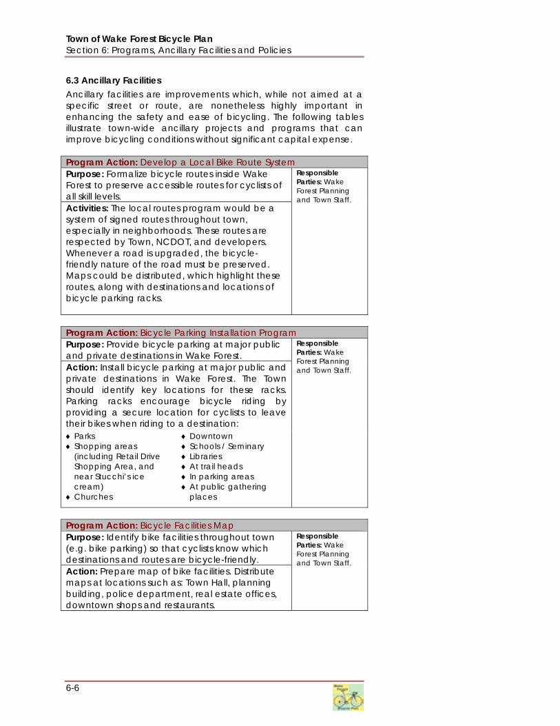
Town of Wake Forest Bicycle Plan Section 6: Programs, Ancillary Facilities and Policies
6-6
6.3 Ancillary Facilities Ancillary facilities are improvements which, while not aimed at a specific street or route, are nonetheless highly important in enhancing the safety and ease of bicycling. The following tables illustrate town-wide ancillary projects and programs that can improve bicycling conditions without significant capital expense. Program Action: Develop a Local Bike Route System Purpose: Formalize bicycle routes inside Wake Forest to preserve accessible routes for cyclists of all skill levels. Activities: The local routes program would be a system of signed routes throughout town, especially in neighborhoods. These routes are respected by Town, NCDOT, and developers. Whenever a road is upgraded, the bicycle-friendly nature of the road must be preserved. Maps could be distributed, which highlight these routes, along with destinations and locations of bicycle parking racks.
Responsible Parties: Wake Forest Planning and Town Staff.
Program Action: Bicycle Parking Installation Program Purpose: Provide bicycle parking at major public and private destinations in Wake Forest. Action: Install bicycle parking at major public and private destinations in Wake Forest. The Town should identify key locations for these racks. Parking racks encourage bicycle riding by providing a secure location for cyclists to leave their bikes when riding to a destination: ♦ Parks ♦ Shopping areas
(including Retail Drive Shopping Area, and near Stucchi’s ice cream)
♦ Churches
♦ Downtown ♦ Schools / Seminary ♦ Libraries ♦ At trail heads ♦ In parking areas ♦ At public gathering
places
Responsible Parties: Wake Forest Planning and Town Staff.
Program Action: Bicycle Facilities Map Purpose: Identify bike facilities throughout town (e.g. bike parking) so that cyclists know which destinations and routes are bicycle-friendly. Action: Prepare map of bike facilities. Distribute maps at locations such as: Town Hall, planning building, police department, real estate offices, downtown shops and restaurants.
Responsible Parties: Wake Forest Planning and Town Staff.

Town of Wake Forest Bicycle Plan Section 6: Programs, Ancillary Facilities, and Policies
6-7
CONCEPT: CHANGING POLICES
Making Policy Recommendations in the Wake Forest Bicycle Plan is not a one-step process. After the Bicycle Plan is adopted (or, later, amended), the policy recommendations shown here should still undergo a detailed examination in comparison to each recommendation’s context.
For example, a change to the Wake Forest Subdivision Ordinance to require bicycle parking at all new public (town) facilities would have to (A) look at where in the Subdivision Ordinance the language would be most appropriate; (B) develop specific language that describes the requirements; (C) undergo a public review and hearing process to accept comments and modifications; and (D) be reviewed by the Town Planning Board and Town Council to ensure that the proposed changes are in keeping with the direction that the Town leaders envision. At each step of the way, specific changes may be made to keep the recommendation in step with other policy directions, goals, and strategies that the Town has adopted.
Program Action: Downtown Green Streets Program Purpose: Create a series of bicycle-friendly “green streets” through downtown as a starter project for bicycle improvements in Town. Action: Construct a small network of striped bike lanes and intersection improvements within the downtown area as a ‘proof of concept’ project for on-street bikeways recommended in this Plan. This loop could serve as a connecting element within the proposed perimeter greenway.
Responsible Parties: Wake Forest Planning and Town Staff.
Program Action: Bicycle Facilities Maintenance Program Purpose: Develop a consistent maintenance program to clear debris and other obstructions from designated bicycle facilities. Action: Coordinate with NCDOT to establish a regular maintenance schedule for bicycle facilities on City and State roadways. It is recommended that the Town meet with their NCDOT Division Engineers to discuss a maintenance schedule that includes resurfacing priority for major bike corridors, sweeping of future bike lanes, repainting key trail crossing facilities at intersections and other pavement marking maintenance.
Responsible Parties: Wake Forest Public Works Department.
6.4 Policy Recommendations To make Wake Forest a truly bicycle-friendly community, the following are recommendations which build upon existing policies and also additional policies which should be established through the normal policy development and hearing procedures already in place. Policies can affect the Town’s budget, the construction of public facilities, and private and public development requirements. The following policy recommendations address each one of these areas. Development-related Policies 1. Establish policy to require bicycle facilities and their impacts to
be included in Traffic Impact Analyses for new private development. Currently, the Town’s Manual provides extensive guidelines for conducting Traffic Impact Analysis which address methods for assessing traffic generation, trip distribution, existing conditions, planned improvements, and even pedestrian facilities, but not bicycle facilities. The Town should establish a policy to require mapping of bicycle facilities, including bicycle lanes, paved multi-use paths, and greenways, to be included with each Traffic Impact Analysis. In addition, bicycle facilities should be considered as a mitigation approach for potential vehicle traffic generated by developments.
2. Establish school zones around all schools. Currently, there are elementary, middle, and high schools in Wake Forest which

Town of Wake Forest Bicycle Plan Section 6: Programs, Ancillary Facilities and Policies
6-8
have limited to no bicycle and pedestrian access. The Town should establish an ordinance which creates school zones around existing schools. Within these school zones, roads should be made bicycle- and pedestrian-friendly through reduced speeds, the addition of warning signs for bicyclists and pedestrians, construction of sidewalk and bicycle lanes, access to greenways, pedestrian- and bicycle-responsive signals, and bicycle parking. In addition, the Town should create a policy which requires provisions for bicycle access at all new schools. These policies, in coordination with an organized Safe Routes to School effort, should make schools in Wake Forest safer for students, parents, teachers, and staff.
3. Strengthen Greenway Ordinance Requirements. Currently, developers pay a Parks and Recreation Fee, which funds both parks and greenway construction. Developers are also required to reserve land for greenway construction based on the planned future greenway locations indicated in the Town’s Open Space and Greenway Plan (2002). These policies can be strengthened in a variety of ways, which are listed below. These recommendations are made in order of increasingly dramatic changes to the current policies:
a. Current Parks and Recreation fees should be divided into a specific percentage for greenway construction and a specific percentage for parks construction. The Town should maintain an accounting approach which tracks the amount of money designated for greenways and the money designated for parks.
b. Require developers to build greenways rather than to simply reserve land, and to make a payment-in-lieu separate from the Parks and Recreation fee when construction is not feasible on the developer’s site.
c. Require developers to identify existing or proposed greenways and construct connections to them, just as they would identify and construct connections to existing roads. These adjacent connections should be identified clearly on mapping submitted for site, subdivision, and zoning reviews (e.g., vicinity mapping on first sheet).
4. Develop a Greenways Maintenance and Safety Policy. Currently, greenway facilities constructed by neighborhoods must seek permission from the Wake Forest Parks and Recreation Department in order to join with the municipal system. In addition, connecting to the municipal system does not guarantee maintenance and security responsibilities are transferred from the neighborhood to the Town. In order to encourage neighborhoods and developers to construct greenways, this policy should be changed to guarantee the transfer of maintenance and security responsibilities to the Town. At the same time, to compensate for this, the neighborhood or developer should be required to make a “connection fee”. This “connection fee” could either be
Consultant Glenn Harbeck leads the Community Plan Steering Committee through an exercise. source: Town of Wake Forest

Town of Wake Forest Bicycle Plan Section 6: Programs, Ancillary Facilities, and Policies
6-9
considered as part of the Parks and Recreation Fee, or could be a separate fee.
5. Create More Opportunities for Mixed-Use and Compatible Development Types in Town. Wake Forest continues to grow and develop at a rapid pace, based in part on nearby employment opportunities in Raleigh and Research Triangle Park, but also based in part on its “small-town atmosphere.” In North Carolina, small towns have land uses that aren’t separated by great distances; are very well-connected by many local, surface streets; and are considered holistically as development occurred for schools, retail/shopping, homes, and business uses. All of this translates into a great environment for bicycling and walking. The following are specific ideas to encourage smart growth in Town policies:
a. Be an important participant in the Triangle J Council of Governments Smart Growth Committee (www.tjcog.dst.nc.us/regplan/smrtgrow.shtml#), Raleigh’s current smart-growth symposium series, and other regional efforts at making the Region more livable through planning, design and policy changes.
b. Encourage fast-track reviews of mixed-use developments that adhere to high design standards. This may require a higher degree of administrative review – and trust by elected officials – in staff. In turn, this recommendation implies more frequent, non-project-specific communication with Town staff to ensure that the policy directions are calibrated with the ideas of elected officials and the public.
c. Ensure that community planning efforts like the Community Plan currently underway includes mixed-use and bicycling considerations.
d. Work with developers, not against them. Too often, private development interests end up opposed to neo-traditional, smart growth, or sustainable growth initiatives. Including commercial and residential developers can significantly improve the implementation chances later in the process.
e. Build from and protect the downtown. The historic downtown of Wake Forest should be protected from bicycle un-friendly recommendations designed to increase automobile traffic speeds and throughput. The downtown should be viewed not as a static place frozen in a certain period of time, but rather as a great learning laboratory for how low-speed, people- and business-friendly development can work elsewhere.
Design-related Policies 1. Advance facility recommendations as funding becomes
available. Currently, Wake Forest relies on wide outside lanes/shared lanes in a few locations (e.g., parts of South Main Street) as its primary bicycle facility type. Interim wide outside lanes (WOL) and shared lanes should be replaced by

Town of Wake Forest Bicycle Plan Section 6: Programs, Ancillary Facilities and Policies
6-10
dedicated bicycle lanes in situations where they are safe and feasible as local funding and implementation opportunities are presented through private development actions.
2. Require striped bicycle lanes and appropriate signage along collector and thoroughfare streets. Encouraging more and safer bicycle use is dependent on the exposure and recognition that cycling receives. Signage and street markings can be useful in raising awareness of bicycling, if placed in moderation to avoid sign clutter and using good design practices such as avoiding thermoplastic stenciling that become slippery after a rainfall. Bicycle signs should be posted along all bicycle facilities indicated in the Bicycle Plan.
3. Use the design section of the Bicycle Plan as the primary guidance for determining bicycle facility types along streets and upgrade roads as maintenance or construction is planned, and use the AASHTO guidance on bicycle facility development (www.sccrtc.org/bikes/AASHTO_1999_BikeBook.pdf) and North Carolina Bicycle Facilities Planning and Design Guidelines (1994), as necessary, to supplement the guidance contained in the Bicycle Plan. Currently, Wake Forest has bicycle facilities selected for only certain roads. All roads in Wake Forest excepting interstates should accommodate cyclists and pedestrians. In keeping with this philosophy, the Town should use the guidelines set forth in this Plan to determine the appropriate bicycle facility for every road in the Town. One important aspect of this recommendation given the Town’s current development status is to adopt a street design policy that requires 14’ outside lanes on new collector streets (in addition to sidewalks). When work is scheduled for any road in Town – from maintenance to new construction – the guidance in the Plan should be consulted to determine the appropriate bicycle facilities which should be added with this work. Other guidance from the American Association of State Highway and Transportation Officials (AASHTO) and the North Carolina Department of Transportation (NCDOT) is acceptable for unique situations not addressed in the Plan.
4. Require intersections to have bicycle-sensitive signals as part of development requirements and public works engineering standards. None of the signals in the Town of Wake Forest are currently sensitive to cyclists. This results in circumstances in which cyclists who obey traffic laws must remain stopped at red lights until a vehicle large enough to trigger the signal arrives. Obviously, this sort of wait can be a hindrance to bicycle travel. Wake Forest should require all new signals, and any signal upgrades, to be set so that they are sensitive to cyclists.
5. Require all new public facilities and private, non-residential and multi-family developments to have bike parking and bicycle access. Wake Forest has instated requirements for new private development to have bicycle parking, and public facilities should be held to the same standard since they are

Town of Wake Forest Bicycle Plan Section 6: Programs, Ancillary Facilities, and Policies
6-11
frequently popular leisure destinations. Public and private facilities should also be required to provide bicycle access through bicycle lanes and direct connections to greenways from parking areas.
6. Create and Adopt a Policy on Traffic Calming. The concept of traffic calming in neighborhoods has gained momentum in many communities in North Carolina (e.g., Raleigh and Cary both have progressive programs in place). Reducing vehicular speeds, truck traffic, and “cut-through” traffic reinforces the street hierarchy and balance between mobility (on thoroughfares) and accessibility (on local streets). The design and location of traffic calming measures is as crucial as the specific measure(s) that are selected to address problems: poorly designed or located bulb-outs, speed humps, chicanes, and diverters can force bicyclists into unsafe behaviors at a point in the street where drivers are also negotiating the traffic calming device and their attention to other users of the roadway may be diverted. A number of excellent resources exist for the development of such a policy (see text box).
7. Require bicycle accommodations on all new bridge projects. In order ensure safe bicycle passage on bridges and overpasses, the Town should require sufficient widths and bicycle-safe railing on all bridge replacement projects, and consider installation of bicycle-safe railing on bridges exhibiting high bike traffic.
8. Incorporate bicycle accommodations into resurfacing and maintenance projects. Incorporating bicycle accommodations into current construction or maintenance projects is often the most cost-effective implementation strategy. The Town may be able to coordinate resurfacings for priority bicycle routes with the NCDOT annual resurfacing program. The Town should communicate regularly with the NCDOT Division 5 Office regarding their resurfacing plans, specifically regarding opportunities for cost-sharing in order to provide additional shoulder width and/or lane restriping to provide for bike accommodations.
Budget-Related Policy 1. Create an annual budget for bicycle-related improvements.
Currently, bicycle-related improvements are made as ancillary construction to a larger project, such as a new private development or a road widening. There are too many necessary bicycle improvements for the Town to wait for these sorts of mechanisms to construct the needed bicycle facilities. To address the lack of financing, the Town should create an annual budget item to conduct bicycle-related improvements in order to speed the process of making the Town more bicycle-friendly; raise the awareness of bicycling as an alternative to the private auto for short and casual trip-making; and to make bicycling a safe and fun way to travel.
Traffic Calming began in the 1960’s in European communities that were fed up with cars speeding through residential areas. In
response, they developed a practice called “living streets” (woonerven), and, later, “slow
streets.” In America, the practice of traffic calming has had to fit alongside a commitment
to safe and efficient car travel, even on neighborhood streets. Typical traffic calming
devices need to be installed under a consistent, thoughtful policy; accepted in advance by a
clear majority of the neighbors; do no harm to adjacent, neighborhood streets; and provide
safe passageway for all users of the road after the traffic calming device or program is
installed.
The Institute of Transportation Engineers (ITE) has developed guidance in an attempt to
standardize treatments and policies, thus gaining more acceptance with rank-and-file
engineers across the country (www.ite.org/traffic/tcstate.htm). However, the
practice can still be controversial, expensive, and not always as effective as your neighbors
might like. Other resources include:
www.trafficcalming.org/index.html
www.pps.org/info/placemakingtools/casesforplaces/livememtraffic
www.vtpi.org/tdm/tdm4.htm
CONCEPT: TRAFFIC CALMING

Town of Wake Forest Bicycle Plan Section 6: Programs, Ancillary Facilities and Policies
6-12
This page intentionally left blank.

Town of Wake Forest Bicycle Plan Section 7: Design Guidelines
7-1
Section 7. Facility Design Guidelines
7.1. Introduction This section of the Wake Forest Bicycle Plan is based on current state and national guidelines including the North Carolina Bicycle Facilities Planning and Design Guidelines (NCDOT Office of Bicycle and Pedestrian Transportation, January 1994) and the AASHTO Guidelines for the Development of Bicycle Facilities (AASHTO, 1999). The Wake Forest guidelines use these documents as a baseline for minimum conditions, and are intended to provide design solutions for a wide range of bicycle facility types. It is recognized that on facilities maintained by NCDOT, the State’s design guidelines will apply, and that Wake Forest has the potential to exceed these minimum guidelines where conditions warrant on facilities within their jurisdiction. The following are five key principles that underlie these guidelines. Wake Forest will have both a complete network of greenways and trails, and a complementary network of on-street bicycling facilities. These two systems will be interconnected to make it possible for all destinations in Wake Forest to be accessible by bicyclists. All roads in Wake Forest are legal for the use of bicyclists, except those roads designated as limited access arterials or freeway facilities which prohibit bicyclists. In addition, bicyclists are not permitted to ride on sidewalks in Wake Forest. This means that most streets are bicycle facilities and will be planned, designed and maintained accordingly. A “Complete Streets” policy approach will guide infrastructure development by ensuring that bicycle facilities are integrated in the community’s infrastructure. Bicyclists have a range of skill levels, from “Type B/C” inexperienced / recreational bicyclists (especially children and seniors) to “Type A” experienced cyclists (adults who are capable of sharing the road with motor vehicles). These groups are not always exclusive – some elite level athletes still like to ride on shared-use paths with their families and some recreational bicyclists will sometimes use their bicycles for utilitarian travel. At a minimum, facilities will be designed for the use of Type “A” cyclists with a goal of providing for Type “B” cyclists to the greatest extent possible. In areas where specific needs have been identified (for example, near schools), the needs of different types of bicyclists will be accommodated. These guidelines are intended to be flexible and can be applied with professional judgment by project designers. Specific national and state guidelines are identified in this document, as well as design treatments that may exceed these guidelines.
This section of the Plan provides an overview of bicycle facility design treatments and identifies solutions for trails, on-street facilities and bicycle parking. Most safe bicycling is done in the street, and proper design of on- and off-road facilities is paramount.
Greenways and On-Street Bikeways
Bicycling is “Street Legal”
Design for All Bicyclists
Baseline Accommodations
Flexibility

Town of Wake Forest Bicycle Plan Section 7: Design Guidelines
7-2
7.2. Design Guidelines Bicycle facilities are grouped into three categories: 1) Shared Use Paths, Greenways and Trails, 2) On Street Bikeways, and 3) Bicycle Parking and Support facilities. The following sections are based on definitions established by AASHTO, NCDOT, the MUTCD and innovative design concepts from other communities in the U.S.
7.2.1. Shared Use Paths, Greenways and Trails Shared use paths, greenways and trails are among the terms used to describe facilities for pedestrians, bicyclists and non-motorized travel that are separated from roadways. These facilities are presented in the 2002 Wake Forest Greenways Plan. This document provides supplemental information to ensure that greenways and on-street bikeways are integrated to provide a seamless system of bicycle facilities in Wake Forest. The graphic in Figure 7-1 illustrates a typical, shared use trail cross-section, which is the most common design for Wake Forest’s trail
Table 7-1. Bicycle Facility Types Facility Type Category Width Surface Treatment Function
Bike Lane On-Street 4'-6' Asphalt On-street lane striped and signed to NCDOT standards; design should ensure a limited number of commercial driveways and turning movements
For bicyclists on roadways
Signed Shared Roadways
On-Street varies Asphalt May either be a low volume roadway with traffic calming and signage to create a safe shared use environment, OR a higher volume roadway with wide (14') outside lanes
Used for designated bicycle routes; can include signage and pavement markings, including “sharrows”
Bicycle Boulevard
On-Street varies Asphalt Multiple traffic calming treatments combined with bike lanes and or signed shared roadways to create priority streets for bicyclists
Provides a continuous facility on streets with varying widths, volumes and speeds
Shared Curb Lane
On-Street 9’-12' Asphalt Common facility type in low-speed and low-volume street types; can include signage and treatment markings, including sharrows
Utilitarian cycling on streets which are not otherwise designated as elements of the bicycle network
Wide Curb Lane On-Street 12’-14' Asphalt Smooth pavement, bicycle compatible storm grates; can include signage and treatment markings, including sharrows
For skilled bicyclists who are capable of sharing the road with motor vehicles
Paved Shoulders/Wide Striped Shoulders
On-Street varies (min. 2’)
Asphalt The outside lane (in each direction of travel) is widened behind the white edge delineator stripe
For utilitarian bicyclists depending on condition, width, speed of adjacent traffic, and frequency of driveways
Shared Use/Multi-Purpose Path / Multi-Use Trail
Off-Street 10'-14' Asphalt, concrete or other smooth firm surface
Designed to NCDOT standards. Separated from roadway by planting strip or vertical curbing
Typical application for regional trail and some community pathways and bikeways. Accommodates bicycles, pedestrians, and wheelchairs. Minimizes potential trail crossing conflicts with autos
Single Track Trail Off-Street 3’-8’ Natural Surface
Designed to meet International Mountain Biking Assn (IMBA) guidelines
Designed for mountain bicyclists; can include a variety of off-road bicycling trail types

Town of Wake Forest Bicycle Plan Section 7: Design Guidelines
7-3
and greenway network. The cross-section provides for two-way bicycle and pedestrian traffic, typically has its own right-of-way, and can accommodate maintenance and emergency vehicles.
Figure 7-1. Typical Shared Use Trail Design Alta Planning + Design In addition to dimensional standards, there are other design considerations unique to bicyclists on shared use paths. One of the key elements is to safely integrate connections between these off-street facilities and on-street bikeways. This includes crossings and access features for roadways, with design features both for vehicles and trail users. Signage types, locations, and other criteria are identified in the Manual for Uniform Traffic Control Devices (MUTCD; available on-line at: http://mutcd.fhwa.dot.gov/kno-2003r1.htm). Warning signage and other notices, such as wayfinding signage, should be installed when a trail crosses a road or crosses another trail. Adequate warning distance is based on vehicle speeds and line of sight. Signage should be highly visible to alert motorists that trail users are present. Supplemental devices such as signals, flashing beacons, ramps, refuge islands, enhanced roadway striping or changes in pavement texture may also be required. Signing for trail users also includes standard stop or yield signs and pavement markings, interpretive trailheads and wayfinding signage, combined with bollards or other access controls.
Shared Use Path Crossing of localstreet in Durham, NC. Photo: J. Olson

Town of Wake Forest Bicycle Plan Section 7: Design Guidelines
7-4
MUTCD examples of signage and pavement markings for shared use paths.
Figure 7-2. Trailhead information installations provide gateways between on-street facilities and greenway systems. Alta Planning + Design

Town of Wake Forest Bicycle Plan Section 7: Design Guidelines
7-5
Neighborhood Trails and Access Ways Neighborhood trails provide access to shared use paths and between destinations within a community. These smaller-scale facilities typically have their own rights-of-way and serve only non-motorized users. These trails should be at least 8’ wide if shared pedestrian and bicycle use is anticipated, although smaller cross-sections are acceptable for access ways within neighborhoods.
Figure 7-3. Innovative local access ways include the Dutch Staircase (left) which provides bicycle wheel gutters to allow bicycles to be walked on stairways; and a small boardwalk bridge (right) that provides access across a creek between two neighborhoods. Alta Planning + Design
Figure 7-4. Neighborhood Bicycle and Pedestrian Access Way
Alta Planning + Design

Town of Wake Forest Bicycle Plan Section 7: Design Guidelines
7-6
7.2.2. On-Street Bikeways: Complete Streets The 2003 Wake Forest Transportation Plan calls for bicyclists to either ‘share the road’ with motor vehicles on roadways, or to ride on separated shared use paths. This approach will provide for experienced cyclists who are capable of riding in traffic, and for recreational bicyclists who will use the trails for recreation, health and fitness. This approach, however, will limit the potential of bicycling as a real transportation alternative for the Wake Forest community. An alternative approach calls for using a range of on-street bikeways to ensure that people of all skill levels can choose to ride their bicycles for transportation and recreation. The concept of “Complete Streets” is based on the principle that all streets should be safe and accessible for the use of all modes of transportation, not just motor vehicles. In order for Wake Forest to accommodate motor vehicles, bicyclists and pedestrians in the community’s roadway network, an expanded palette of design techniques including bike lanes, bicycle-actuated signals and other innovative solutions will need to be developed. The on-street bikeway design treatments in Wake Forest will vary according to the width and number of lanes of the facility; frequency of driveways; the average daily traffic (ADT); and travel speeds on the adjacent roadways. The following are configurations that can be applied to local roadways during new construction, re-design and maintenance projects. Flexibility in design and context sensitive solutions will need to be applied in sections with constrained rights-of-way in order to achieve solutions that work for all modes of travel.
High Volume Roadways On roadways with 3,000 or more vehicles per day and speeds greater than 40 mph, bicycle lanes or paved shoulders can be used to improve bicyclist safety and comfort over that typically provided by wide outside lanes. A buffer or curb must separate the sidewalk from the roadway for pedestrian safety. The width of the bicycle lane, buffer, and sidewalk (or side path) should appropriately reflect the volume and speed of the vehicles using the roadway.
Figure 7-5. High-Volume, High-Speed Roadway Alta Planning + Design
This complete street in Amsterdam includes wide sidewalks with landscaping and bicycle parking, bicycle lanes, transit lanes and vehicle lanes. Photo: J.Olson

Town of Wake Forest Bicycle Plan Section 7: Design Guidelines
7-7
Figure 7-7. Shared Use Path on a High-Volume, High Speed Road
Alta Planning + Design
Figure 7-6. Side Path with Bike Lanes on a High-Volume, High-Speed Roadway
Alta Planning + Design
SIDE PATHS AND ROADWAYS Bike Paths Adjacent to Roadways must be designed carefully, recognizing the following:
Discourage wrong-way travel on streets to reach the path Recognize that motorists may not pay attention to cyclists using an intersection from an adjacent path Right-of-Way limitations may impose carefully designed reductions of roadway and path width Motorists may harass on-road bicyclists if they feel that all cyclists should be using the path Barriers between the adjacent path and roadways, while often viewed as critical safety features, may complicate maneuvering on and maintenance of the path and/or roadway. Source: AASHTO Guide for the Development of Bicycle Facilities (1999)
The previous figure illustrates a typical bicycle accommodation in urbanized areas. The minimum bike facility width is four feet on open shoulders and six feet from the face of a vertical curb, guardrail, or parked cars. The width of the gutterpan (the flat part of the curb-and-gutter) should not be counted as part of the width of the bicycle lane, since safety issues arise with differentials in height of the street and the gutterpan due to repaving, presence of drainage grates, and conflicts with the vertical curb and bicycle pedals. Some arterials and major collectors can accommodate a shared use path on one side of the roadway and on-street bicycle lanes, shoulders or wide curb lanes on both sides of the road. The shared use path provides a comfortable walking space for pedestrians and enables children and recreational bicyclists to ride without the discomfort of riding in a busy street (Figure 7-6). This configuration works best along roadways with limited driveway crossings and with services primarily located on one side of the roadway, such as along a waterfront or other natural feature.
Sometimes a shared use path can provide accommodation on high-volume, high-speed roadways. This type of facility works best in corridors where there are limited driveway/intersection crossings and more desirable destinations along one side of the roadway, or where no roadway space is available to provide both bike lanes and sidewalks, yet the road travels past a number of desirable locations. The path should be at least 10’ wide (preferable 12’) with a 6’ or greater vegetated buffer where possible (Figure 7-7).

Town of Wake Forest Bicycle Plan Section 7: Design Guidelines
7-8
Figure 7-8. Bike Lane with On-Street Parking Alta Planning + Design
Figure 7-9. Wide Outside Curb Lane (left) and Paved Shoulder (above) Alta Planning + Design
Figure 7-10. Neighborhood Street Alta Planning + Design
Moderate Volume Roadways On moderate volume roadways, such as minor collectors, on-street parking is often permitted. Where on-street parking is permitted and a bike lane is provided, the bike lane should be between parking and the travel lane.
Another option is to provide a 14’-wide curb lane so that experienced bicyclists and motor vehicles can share the roadway. In rural and suburban sections, a paved shoulder can be provided where right-of-way is limited and there is not enough room to provide both sidewalks and the wide outside lanes.
Low Volume Roadways On low volume, low speed roadways (i.e., neighborhood streets); bicyclists can share the road with vehicles. Pedestrians should be separated from the roadway with a buffer or a curb, and traffic calming can be used to control motor vehicle speeds.

Town of Wake Forest Bicycle Plan Section 7: Design Guidelines
7-9
On-Road Bicycle Facility Selection Criteria The appropriate bicycle facility for a particular roadway can be identified by a variety of level of service factors, including vehicle volumes, lane widths and the speed of the roadway. The AASHTO “Guide for the Development of Bicycle Facilities” (1999) is recommended for additional reading and guidance.
7.2.3. Pavement Markings and Signage The Manual on Uniform Traffic Control Devices (MUTCD) provides guidance for lane delineation, intersection treatments, and general application of pavement markings and symbols for on-road bicycle facilities and off-road paths. In addition to those presented in the MUTCD, experimental pavement markings may also be considered in consultation with NCDOT.
MUTCD examples of optional word and symbol pavement markings for bicycle lanes.

Town of Wake Forest Bicycle Plan Section 7: Design Guidelines
7-10
A new bicycle shared lane arrow (or “sharrow”) stencil has been developed for use on on-road bikeways where the right-of-way is too narrow for designated bike lanes. The sharrow stencil can serve a number of purposes, such as making motorists aware of bicyclists in their lane, showing bicyclists the direction of travel and, with proper placement, reminding bicyclists to bike farther from parked cars to prevent “dooring” collisions. Denver, San Francisco, Portland and other cities have effectively used these markings for several years, and this treatment is currently being considered for inclusion in the MUTCD. Sharrows can be used on municipal roadways, and possibly as an ‘experimental’ treatment on state-maintained roads, with approval from the NCDOT.
San Francisco “Sharrow” Dimensions
“Sharrow” installed on Market Street, San Francisco, and design details for the pavement markings.

Town of Wake Forest Bicycle Plan Section 7: Design Guidelines
7-11
Signed bikeway systems can include bike lanes, signed bike routes, and shared use paths. Implementing a well-planned and attractive system of signage can greatly enhance bikeway facilities by defining their presence and location to both motorists and existing and potential bicycle users. By leading people to community destinations, these improvements provide benefits to local residents and visitors. Bike lanes and bike routes should be provided with distance-to-destination and wayfinding messages where appropriate. A selected list of bikeway signs from the MUTCD is shown below.
Recommended Bicycle Facilities Signage

Town of Wake Forest Bicycle Plan Section 7: Design Guidelines
7-12
In general, the sizes of signs used on shared-use paths are smaller than those used on roadways. The MUTCD lists minimum sign sizes for both types of bicycle facilities.
MUTCD Standard Bikeway Signage (Figure 9B-4) Innovative signing is often developed to increase bicycle awareness and improve visibility. Signs to be installed on public roadways in North Carolina must be approved by NCDOT’s Traffic Control Devices Committee. New designs can be utilized on an experimental basis with NCDOT approval, but are unlikely to be allowed at this time unless placed on a non-state maintained roadway in town. In California and Oregon, San Francisco and Portland have used approved customized bike route logo signs. Jurisdictions may choose a graphic of their choice for the upper third portion of the sign and a numbering system, similar to the highway numbering system, can be used in the lower third. Another signage option is the “Share the Road” sign, designed to advise motorists that, as vehicles, bicyclists need to share roadways with motor vehicles along certain sections of roadway, especially designated bicycle routes. Also refer to the North Carolina “Share the Road” initiative, which is described in detail at: www.ncdot.org/transit/bicycle/safety/programs_initiatives/share.html.
Share the Road signs remind motorists that bicyclists have the right to ride on the roadway.
Several California cities use customized logo signs to define bike routes.

Town of Wake Forest Bicycle Plan Section 7: Design Guidelines
7-13
BICYCLE LANES AND INTERSECTIONS
The Translation of Bicycle Lanes at Intersections requires considerations of the cross-section of the street, presence of on-street parking, and if turning lanes are present.
Right-Turn Only Lane. Use mini-skips (dotted lines) to denote the “weave” movement between bicycles going straight and cars crossing into a right-turn-only lane.
On-Street Parking. Again, the use of mini-skips helps mark the bike lane for drivers wishing to turn right.
Through-Right with Right-Turn Only Lane. Here, the bicycle lane disappears as the cyclist must negotiate a route to the center of the through-right lane. Source: AASHTO Guide for the Development of Bicycle Facilities (1999)
7.2.4. Bicycle-friendly Intersections Intersections represent one of the primary safety issues for bicyclists. Generally, the bigger the intersection, the more difficult it is for bicyclists to navigate. On-coming vehicles from multiple directions and increased turning movements make it difficult for motorists to see non-motorized travelers. Intersections must provide a designated place for bicyclists to operate as vehicles. Bike lanes and pavement markings should be continued through intersections, to provide safe conditions for all road users. Signal detection devices, including loop, infrared and video detectors should be designed to be activated by bicyclists. Bicyclists wanting to make left turns must either choose to behave as vehicles by crossing travel lanes and using the left-turning travel lane, or they can act as pedestrians and dismount their bikes, push the pedestrian walk button located on the sidewalk (if available), and then cross the street in the crosswalk. Where right-turn lanes are present, bicyclists traveling straight through an intersection need to maneuver from the right curb lane to a through lane of travel. The design of intersections should clearly communicate to motorists and bicyclists the movements for both to expect.
Figure 7-11. Bike lane through intersection with free right-turn lanes. Alta Planning + Design
Through bike lanes at intersection approaches protect bicyclists from right turning motorists. Photo: Alta Planning + Design

Town of Wake Forest Bicycle Plan Section 7: Design Guidelines
7-14
Figure 7-12. Bicycle lane configurations at intersections. Alta Planning + Design

Town of Wake Forest Bicycle Plan Section 7: Design Guidelines
7-15
Bicyclist Activated Signals
Changing how intersections operate can help make them more “friendly” to bicyclists. Improved signal timings for bicyclists and bicycle-activated loop, video or infrared detectors make it easier and safer for cyclists to cross intersections. Bicycle-activated loop detectors are installed within the roadway to allow the bicyclist to trigger a change in the traffic signal. This allows the bicyclist to stay within the lane of travel and avoid maneuvering to the side of the road to trigger a push button. The purpose of bicycle activated signals is to give cyclists extra green time before the light turns yellow to make it through the light. Current and future detection devices should have pavement markings to indicate where cyclists should be positioned on the roadway to activate the signals. “Bike Box” / Advance stop line
A ‘bike box’ is a relatively simple innovation to improve turning movements for bicyclists without requiring cyclists to merge into traffic to reach the turn lane or use crosswalks as a pedestrian. The bike box is formed by locating the stop line for motor vehicles back from the intersection and adding a stop line for bicyclists immediately behind the crosswalk. When a traffic signal is red, bicyclists can move into this “box” ahead of the cars to make themselves more visible, or to move into a more comfortable position to make a turn. Bike boxes have been used in Cambridge, MA, Eugene, OR, and in many European cities but they are not standard practice as yet in North Carolina.
Bike Box in Eugene, OR. Photo: Evaluation of an Innovative Application of the Bike Box, FHWA, 2000.
Bicycle signal actuation pavement markings. Photo: J.Olson MUTCD

Town of Wake Forest Bicycle Plan Section 7: Design Guidelines
7-16
Potential Applications of the Bike Box:
At intersections with a high volume of bicyclists and motor vehicles
Where there are frequent turning conflicts and/or intersections with a high percentage of turning movements by both bicyclists and motorists
To help enforce “No right turn on red” conditions Can be combined with a separate bicycle signal
(optional)
Figure 7-13. Plan View of the Bicycle Box Alta Planning + Design
Bicycle Box in Oxford, England filled in with color to emphasize
allocation of space to bicycle traffic. Photo: J.Olson

Town of Wake Forest Bicycle Plan Section 7: Design Guidelines
7-17
7.2.5 Bicycle Parking As bicycle usage grows, the need for bike parking also increases. Long-term bicycle parking at transit stations and work sites, as well as short-term parking at destinations throughout the community, can support bicycling. Bicyclists need secure parking because bicycles are exposed to weather and theft. When choosing bike racks, there are a number of factors to keep in mind:
The rack element (part of the rack that supports the bike) should keep the bike upright by supporting the frame in two places allowing both the frame and wheels to be secured.
Install racks so there is enough room between adjacent parked bicycles. If it becomes too difficult for a bicyclist to easily lock their bicycle, they will park it elsewhere and the bicycle capacity is lowered. A row of inverted “U” racks should be installed with 15” minimum between racks.
Empty racks should not pose a tripping hazard for visually impaired pedestrians. Position racks out of the walkway’s clear zone.
When possible, racks should be in a covered area protected from the elements, and within sight of building entrances for security. Long-term parking should always be protected and placed in visible locations.
Some revisions to the Town’s Bicycle Parking ordinance which the Town should consider include: ♦ Define the number of spaces in a “rack” or identify the
number of expected bicycle parking spaces. The number of bicycle parking spaces in a rack can vary from two all the way to as many as six or eight. As currently written, the ordinance specifies the number of racks, but not the number of spaces.
♦ Base bicycle parking requirements on characteristics such as land use or numbers of seats/attendees/expected amount of the community to be served rather than number of parking spaces. The needed number of parking spaces may decrease as bicycle use increases. In addition, parking spaces often indicate a level of inaccessibility by bicycling. Sometimes the smaller, more community-oriented places will have fewer parking spaces but are more likely to be attractions for bicyclists. This is especially true for libraries, schools, parks, recreation centers, and art centers.
The table on the following page provides basic guidelines on ideal locations for parking at key activity centers as well as optimum quantities of parking spaces.

Town of Wake Forest Bicycle Plan Section 7: Design Guidelines
7-18
APBP’s Recommendations for bicycle parking facilities
Recommended Locations and Capacities of Bicycle Parking

Town of Wake Forest Bicycle Plan Section 7: Design Guidelines
7-19
Improved facilities for bicycling in Wake Forest will be enjoyed byresidents and visitors of all ages and abilities. Photo: J.Olson
7.3. Summary of Recommendations These design guidelines provide Wake Forest with a flexible range of alternatives for creating an integrated network of bicycle facilities, including greenways, on-street bikeways and support facilities. These guidelines can supplement the typical sections developed in the 2002 Greenways Plan and the 2003 Transportation Plan. With a ‘complete streets’ approach to integrating bicycling and walking throughout the community, Wake Forest can apply these cost effective solutions to improve community mobility, recreation, health and safety. Implementing these concepts will require design judgment and careful applications of context-sensitive solutions. These design guidelines can be applied both through ‘stand alone’ projects and as integrated elements in ongoing projects. Bicyclists, pedestrians and motorists will benefit from these improvements to the community’s infrastructure.

Town of Wake Forest Bicycle Plan Section 7: Design Guidelines
7-20
Resources: The following is a list of references and sources utilized to develop design guidelines for Wake Forest’s Bicycle Master Plan. Many of these documents are available online and are a wealth of information and resources available to the public. AASHTO Guide Guide for the Development of Bicycle Facilities, 1999. American Association of State Highway and Transportation Officials, Washington, DC. www.transportation.org AASHTO Green Book Policy on Geometric Design of Streets and Highways, 2001. American Association of State Highway and Transportation Officials, Washington, DC. www.transportation.org NCDOT The North Carolina Bicycle Facilities Planning and Design Guidelines, 1994 NCDOT Division of Bicycle and Pedestrian Transportation www.ncdot.org/transit/bicycle/projects/resources/projects_facilitydesign.html (note: not available on-line but can be ordered from this location) MUTCD Manual on Uniform Traffic Control Devices, 2003. Federal Highway Administration, Washington, DC. http://mutcd.fhwa.dot.gov PBIC / APBP Bicycle Facility Selection: A Comparison of Approaches Michael King, for the Pedestrian and Bicycle Information Center Highway Safety Research Center, University of North Carolina – Chapel Hill, August 2002 www.bicyclinginfo.org/pdf/bikeguide.pdf Association of Pedestrian and Bicycle Professionals Bicycle Parking Design Guidelines www.bicyclinginfo.org/pdf/bikepark.pdf

Town of Wake Forest Bicycle Plan Section 8: Implementation
8-1
Section 8. Implementation
8.1. Introduction In order for Wake Forest to move forward with the next steps in becoming a more bicycle-friendly town, it must have an implementation plan which identifies priorities, potential partners, and possible future funding sources for each project. This Section illustrates an implementation plan, outlining priorities for not only projects but also programs and policies, as well as potential partners and funding sources.
8.2. Scheduling and Partners The following tables identify short-term, mid-term, and long-term priorities for project, program, and policy recommendations and potential partnerships that the Town should consider to implement the recommendations. As discussed in Section 5, short-term priorities are those projects, programs, or policies which should be addressed within the first five years of the plan’s completion. Mid-term priorities are those that should be addressed within 6 – 10 years, and long-term priorities are those that should be addressed beyond ten years from the Plan’s completion. Partners have been identified based on their potential interest or involvement in a project. Generally, the Town of Wake Forest Planning Department and Town Council will be responsible for policy implementation, while the Public Works Department will handle transportation related infrastructure improvements, the Parks and Recreation Department will be responsible for greenway related improvements, and a combination of agencies will implement program recommendations, including departments mentioned above and supporting agencies such as the Police Department. Program recommendations are prioritized based on ease with which they can be implemented. The lower cost, already established programs, such as Safe Routes to School and Bike-to-Work Week are prioritized first, and the more expensive programs that will require more preparation receive a lower priority. Programs, such as the Downtown Green Streets Program, also received a higher priority if they would be useful to “kick-off” the Town’s bicycle-friendliness efforts. Policy recommendations are prioritized based on need and the ease with which they can be implemented. For example, Wake Forest is expected to experience major development in the near future, and thus, any policy which addresses development should be implemented in the short-term in order to capitalize on the development that may occur. At the same time, policies related to development do not require additional funding or budget items, unlike a policy such as the “develop greenways maintenance and safety” policy, which has been given a lower priority.
The previous sections have all emphasized planning and programming; Section 8.0 discusses the costs and implementation strategies for putting in new / expanded facilities, starting programs, and revising important policies intended to promote safe cycling in Wake Forest.

Town of Wake Forest Bicycle Plan Section 8: Implementation
8-2
It is important to note that Appendix 3 of the Plan also includes proposed projects that are not prioritized below for implementation in the near future. It is recommended that the Town’s Planning Department periodically monitor such non-prioritized projects in Appendix 3 to ensure that implementation occurs as unforeseen opportunities arise, and also to consider these projects for re-evaluation as the built environment changes.
8.2.1. Short-Term Recommendations and Partners Table 8-1. Short-term project recommendations.
Map ID Number Location Potential Partners Facility Type
On-Road Facilities
1 N. White Street – County line to Juniper Ave.
NCDOT, developers Wide Striped Shoulder
2 N. White Street- Juniper Ave. to Spring St. NCDOT, developers Bike Lanes
3 N. White Street – Spring St. to Roosevelt Ave.
NCDOT, developers Wide Striped Shoulder
4 S. White Street – Roosevelt Ave. to Elm Ave. NCDOT, developers Sharrows
5 S. Main Street – South Ave. to Holding Ave.
NCDOT, neighborhood association, developers Sharrows
6 S. Main Street – Holding Ave. to 98 Bypass NCDOT, developers Wide Striped
Shoulder
7 S. Main Street – 98 Bypass to Rogers Rd. NCDOT, developers Wide Striped
Shoulder
8 S. Main Street – Rogers Rd. to Capital Blvd. NCDOT, developers
Bike Lanes & Multi-Purpose
Path
11 Ligon Mill Road – S. Main St. to Burlington Mills Rd. NCDOT, developers Bike Lanes
23 Stadium Drive – Capital Blvd. to Rock Springs Rd. NCDOT, Developers
Wide Striped Shoulders &
Multi-Purpose Path
24 Stadium Drive – Rock Springs Rd. to Wingate St. NCDOT, Developers Sharrows
35 Rogers Road – Main St. to Heritage lake Rd.
NCDOT, developers
Wide Striped Shoulders &
Multi-Purpose Path
NA Greenway Recommendations
Town Greenway Committee, Parks and Recreation Department, City of Raleigh
Off-Road Greenway
NA Intersection of Main Street and Capital Blvd. NCDOT, City of Raleigh Bicycle
Improvements

Town of Wake Forest Bicycle Plan Section 8: Implementation
8-3
Table 8-2. Short-term program recommendations. Program Type Primary Responsible
Party Potential Partners
Establish a Safe Routes to School Program
Wake County Schools
NC DOT, Public Health agencies, Town: Planning, Parks and Rec., Police Dept.
Participate in Bike-to-Work Week
Town: Planning Department, NC DOT
CAMPO, TTA
Establish Standing Bicycle and Pedestrian Advisory Committee
Town: Council and Planning Department
Citizens
Conduct Officer Training Town Police Dept. NC DOT Develop a Local Routes Program
Town Planning Dept. NC DOT
Downtown “Green Streets” Program
Town Planning Dept. Town Parks and Rec. Dept.
Bicycle Facilities Maintenance Program
Town Public Works Dept.
NCDOT Division 5 Office
Table 8-3. Short-term policy recommendations.
Policy Type Primary
Responsible Party
Potential Partners
Establish policy to require bicycle facilities and their impacts to be included in Traffic Impact Analyses for new private development and roadway projects.
Town Planning
Dept. NC DOT
Establish school zones around all schools Town
Planning Dept.
Wake County Schools
Strengthen Greenway Ordinance Requirements Town
Planning Dept.
Town Parks and Rec.
Require striped bicycle lanes and appropriate signage where called for in the Bicycle Plan NC DOT
Town Planning
Dept.
Require striped bicycle lanes and appropriate signage along new subdivision streets
Town Planning
Dept. NC DOT
Use the Design Section of the Bicycle Plan to determine the appropriate bicycle facility treatment for roadways in Wake Forest
NC DOT Town
Planning Dept.
Require all new public facilities to have bike parking and bicycle access
Town Public Works Dept.
Town Planning
Dept.
8.2.2. Mid-Term Recommendations and Partners Table 8-4. Mid-term project recommendations.
Map Reference Number
Location Potential Partners Facility Types
On-Road Facilities
9 Ligon Mill Road – Agora Dr. to Durham Rd. NCDOT, Developers Bike Lanes
10 Ligon Mill Road – Durham Rd. to S. Main St. NCDOT, Developers Bike Lanes
36 Rogers Road – Heritage Lake Rd. to Town Limits Developers
Wide Striped Shoulders &
Multi-Purpose
Path

Town of Wake Forest Bicycle Plan Section 8: Implementation
8-4
Table 8-5. Mid-term program recommendations. Program Type Primary Responsible
Party Potential Partners
Establish a Travel Demand Management (TDM) Program Town Planning Dept. Private Consultant
Develop & Distribute Educational Pamphlets Police Dept. Schools, TTA, NCDOT,
DMV Wake Forest Bicycle-Friendly Signs Town Planning Dept. Town Planning Dept.
Bicycle Parking Installation Program Town Planning Dept. NC DOT, Town Public
Works Dept. Table 8-6. Mid-term policy recommendations.
Policy Type Primary Responsible Party Potential Partners
Require intersections to have bicycle-sensitive signals as part of development requirements and public works engineering standards
Town Planning Dept. NC DOT, Town Public Works Dept.
Create an annual budget for bicycle-related improvements.
Town Planning Dept. NCDOT, Chamber of Commerce
8.2.3. Long-Term Recommendations and Partners Table 8-7. Long-term project recommendations.
Map Reference Number
Location Potential Partners Facility Types
On-Road Facilities
19 Harris Road – Capital Blvd. to Oak St.
Developers, Parks and Recreation
Multi-Purpose Path
25 Burlington Mills Road – Capital Blvd. to Ligon Mill Rd. NCDOT, Developers
Wide Striped Shoulder &
Multi-Purpose Path
26 Bulrington Mills Road – Ligon Mill Rd. to Forestville Rd. NCDOT, Developers
Wide Striped Shoulder &
Multi-Purpose Path
28 East Wait Avenue – Allen Rd. to Jones Dairy Rd. NCDOT, Wake Forest Seminary Bike Lanes
34 Roosevelt Avenue/Wait Avenue –Front St. to Allen Rd. NCDOT, Wake Forest Seminary Sharrows;
Bike Lanes
Table 8-8. Long-term program recommendations.
Program Type Primary Responsible Party Potential Partners Create a Bike Rodeo Event.
Town: Planning and Parks and Recreations
Wake County Schools, Police Department
Create a Helmet-to-Go Program Town: Parks and Rec. Police Dept.
Monthly Bike Day Town Parks and Rec.
Chamber of Commerce, Town: Planning, Police
Dept. Bicycle Facilities Map Town Planning Dept. NCDOT, Parks and Rec. Table 8-9. Long-term policy recommendations.
Policy Type Primary Responsible Party Potential Partners Develop a Greenways
Maintenance and Safety Policy. NC DOT Town: Public Works and Planning Dept.

Town of Wake Forest Bicycle Plan Section 8: Implementation
8-5
Figure 8-1. Project priorities for the Wake Forest Bicycle Plan.

Town of Wake Forest Bicycle Plan Section 8: Implementation
8-6
This page left intentionally blank.

Town of Wake Forest Bicycle Plan Section 8: Implementation
8-7
8.3. Funding and Recognition Sources It is important that Wake Forest consider external funding sources, recognition programs, and implementation partners in order to support their continued efforts to make the Town more bicycle-friendly. External funding sources can help to mitigate the financial burden of some bicycle facility improvements which will be necessary to make the town more bicycle-friendly, while also raising awareness about the Town’s efforts. Although some recognition programs do not provide funding, they serve the purpose of creating a goal for the Town to pursue in their efforts to become more bicycle-friendly, and establish a mechanism to highlight the Town’s efforts, both locally and nationally. Recognition makes the Town more marketable to visitors, businesses, and prospective residents, reinforces the message and energy of the Bicycle Plan after it is completed, and encourages more partners to participate in building the bicycling program in Wake Forest.
8.4. Funding Sources As discussed in Section 1, bicycle facilities are constructed – and therefore funded – through a number of different processes. Funding can be divided into four categories: local, state, national and private funding. The following paragraphs describe some of the more prominent sources in each category. Wake Forest should tap into all of these sources, and search for others, in order to take advantage of the funds available.
8.4.1. Local Funding Local funding sources can include budgets for the Town of Wake Forest’s Public Works Department, Engineering Department, Planning Department and Parks and Recreation Department. Currently, the Town does not have an annual budget line item specifically for bicycle facilities. The principal supplementary financing mechanism for municipal capital improvement projects are general obligation bonds. The Town of Wake Forest should consider a bond package to (in part) accelerate funding for bicycle facility improvements, including the aggressive greenway plans that have been described in Section 2.0. Bicycle facilities have been constructed ancillary to other projects in the past, such as the bicycle parking racks installed at Holding Library. Various departments in the Town should consider teaming more frequently to ensure that more funding is available for bicycle facilities. For example, if there is a roadway project being constructed by the Public Works Department that may also be adjacent to a proposed greenway to be constructed by the Parks and Recreation Department, the two departments should team together to build the greenway as part of the roadway project. This would reduce construction costs and provide cost-saving for the Town. Another example of such an opportunity would be the

Town of Wake Forest Bicycle Plan Section 8: Implementation
8-8
installation of new bike lanes (often called a “re-striping” project) during a roadway resurfacing project. Other entities that Wake Forest should consider teaming with locally include Wake County and the Capital Area Metropolitan Planning Organization (CAMPO). Wake Forest is in Wake County, which has its own Open Space and Transportation Plans. In situations where the Town may be making improvements recommended by these County level plans and which can be used by cyclists - specifically, greenways (Open Space Plan) or collector roads (from Transportation Plan) - the Town should consider cost-sharing with Wake County. As a member government of CAMPO, Wake Forest is also eligible for a number of federal grants. CAMPO is responsible for carrying out an annual work program approved by the CAMPO Transportation Advisory Committee, part of which must address updating the Metropolitan Transportation Improvement Program (a seven-year project programming schedule) and a long-range transportation plan (with a minimum twenty-year forecast of projects and programs). CAMPO funnels money from the federal government for use locally and regionally, and the Town of Wake Forest is eligible for funds which can be used for bicycle improvement projects (such as CMAQ and STP-DA funds). Since CAMPO is federally funded, a more detailed description of its funding opportunities for Wake Forest is provided in the next sub-section.
8.4.2. State and Federal Funding State and federal funding are a combined category because many of the state entities administer federal funds. The North Carolina Department of Transportation (NCDOT) is the single largest source of external funding available to Wake Forest for bicycle facilities, with the following potential funding sources: ♦ State Transportation Improvement Program;
• Incidental Projects • Independent Projects
♦ Transportation Enhancement Program; ♦ Spot Improvement Program; ♦ Small Urban Funds; ♦ Hazard Elimination Program; ♦ Governor’s Highway Safety Program; ♦ Congestion Mitigation for Air Quality (CMAQ) Funds; and ♦ Statewide Discretionary Funds (STP-DA); ♦ Parks and Recreation Trust Fund (PARTF).
NCDOT also administers the Safe Routes to School Program, which is federally funded. In addition to NCDOT, CAMPO is partially responsible for allocating funding from the Federal Highway Administration for the Congestion Mitigation and Air Quality Improvement Program (CMAQ) and Enhancement Program. The following paragraphs provide a more thorough description of each of the various funding sources.

Town of Wake Forest Bicycle Plan Section 8: Implementation
8-9
♦ State Transportation Improvement Program (STIP) – This program is the overall funding source for study, design, and construction of major transportation projects, including bicycle facilities, in the state. Frequently, projects funded by the STIP are also partly funded by other sources, including matching funds from local municipalities. Bicycle facilities are eligible for funding from this program as independent projects separate from a roadway construction, widening, or some other sort of roadway work, but one of the most cost-effective and efficient ways to gain funding for bicycle facility construction is to incorporate them as incidental to a larger project. Overall, most bicycle accommodations within the state are made as incidental improvements.1
♦ Transportation Enhancement Program - Transportation enhancements are transportation-related activities that are designed to strengthen the cultural, aesthetic, and environmental aspects of transportation systems. The transportation enhancements program provides for the implementation of non-roadway capacity improvement projects, including: bicycle and pedestrian facilities, landscaping; and aesthetic improvements. Various forms of bicycle facilities such as multi-use paths, underpasses, bridges, and crossing improvements are eligible for funding.
♦ Spot Improvement Program - The NCDOT Bicycle and Pedestrian Transportation Division budgets $500,000/year for “spot” safety improvements throughout the State. These improvements include items such as signing, grate replacement, bike rack installations, hazard remediation at skewed railroad crossings, and other small-scale improvements. The Spot Improvement Program is used only for bicycle and pedestrian projects; however, it should not be viewed as a priority source for funding identified projects. It is typically used for small-scale and special-situation projects that are not of a significantly large enough scale to merit being a TIP project. Taking these requirements into consideration, proposals for projects should be submitted directly to the Bicycle & Pedestrian Transportation Division.
♦ Small Urban Funds – Small Urban Funds are available for small improvement projects in urban areas. Each NCDOT Highway Division has $2 million of small urban funds available annually. Although not commonly used for bicycle facilities, local requests for small bicycle projects can be directed to the NCDOT Highway Division office for funding through this source. A written request should be submitted to the Division Engineer providing technical information such as location,
1 For more information on the TIP process, see: www.ncdot.org/transit/bicycle/ funding/funding_TIP.html. For NCDOT’s Bicycle Policy Guidelines, please see: http://www.ncdot.org/transit/bicycle/laws/laws_bikelaws.html. For NCDOT’s Greenway Policy, please use the following link at the Division of Bicycle and Pedestrian Transportation’s website: www.ncdot.org/transit/bicycle/laws/laws_greenways_ admin.html.

Town of Wake Forest Bicycle Plan Section 8: Implementation
8-10
improvements being requested, timing, etc. for thorough review.
♦ Hazard Elimination Program – This program focuses on projects intended for locations that should have a documented history of previous crashes. Bicycle projects are eligible for this program, although the funds are not usually used for this purpose. This program is administered through the NCDOT Division of Highways. Similar to the Small Urban Funds, it is a very limited funding source.
♦ Governor’s Highway Safety Program (GHSP) – This program provides funding for projects which show substantial progress in reducing crashes, injuries and fatalities at a specific location. All funding is considered to be “seed money” to get programs started – the grantee is expected to provide a portion of the project costs and to continue the program after GHSP funding ends. Projects are only approved for one full or partial federal fiscal year at a time; however, projects may be funded for up to three consecutive years. Amounts of GHSP funds available vary from year to year, according to the specific amounts requested.
♦ Statewide Discretionary Funding - The Statewide Discretionary Fund consists of $10 million and is administered by the Secretary of the Department of Transportation. This fund can be used on any project at any location within the state. Primary, urban, secondary, industrial access, and spot safety projects are eligible for this funding. To request funding, an agency must submit a written request to the NCDOT Highway Division office with a clear description of project and project justification.
♦ Surface Transportation Program Direct Allocation Funds (STP-DA) - The Capital Area Metropolitan Planning Organization (CAMPO) is able to program over 10% of the Surface Transportation Program annual allocation, which it has only recently started to program under this authority (previously, this sub-allocation or set-aside was programmed by NCDOT). CAMPO has decided to allocate $600,000 each year through Fiscal Year 2015 to bicycle and transit improvements. Town staff should coordinate with the staff of CAMPO and work through their appointed technical and policy (Transportation Advisory Committee) representatives to optimize their chances for procuring a portion of this funding, as well as be familiar with the bicycle/pedestrian project prioritization scheme and bicycle/pedestrian plans adopted by CAMPO to determine which projects are best-positioned to compete for these funds. (www.campo-nc.us)
♦ Safe Routes to School Program – The federal Safe Routes to School Program is intended to create and promote safe walking and cycling in order to improve safety near schools, promote active lifestyles, and reduce pollution and congestion caused by school traffic. In North Carolina, NCDOT, in conjunction with the Federal Highway Administration, has established the North Carolina Safe Routes to School program.

Town of Wake Forest Bicycle Plan Section 8: Implementation
8-11
The North Carolina Safe Routes to School program provides opportunities for schools to apply for funding for both programs and capital improvements projects to encourage walking and cycling to school.2
♦ Parks and Recreation Trust Fund (PARTF) - PARTF funds are allocated through the North Carolina Trails Program to help fund beach accesses, state trail systems, and local trail construction efforts. The Town of Wake Forest would need to apply for the grant (although joint applications – for example, with the Wake County Public School System – are permissible, one agency must serve as the lead sponsor), which is a one-to-one match on local funds. Only about 30% of the PARTF program goes to fund local trail programs, and the selection process is therefore highly competitive. Selection is based on numerous factors including geographic equity, population size, and scoring criteria that notably incorporate the following: presence of planning documents that support the project; public outreach that shows support; site suitability; size/impact of project; and commitment to operating and maintaining the project upon completion. A maximum dollar amount per grant is $500,000. As with most grant programs, the sponsor should be prepared to adhere closely to the rules governing the grant program, including the preparation of detailed expenditure reports and requests for reimbursement. (www.ncparks.gov/About/grants/partf_main.php)
♦ Coordination with CAMPO for CMAQ Funds – As part of the Capital Area Metropolitan Planning Organization, Wake Forest is eligible for assistance in receiving funding through the FHWA’s Congestion Mitigation and Air Quality (CMAQ) Improvement Program. Through this program, projects which may help to reduce traffic congestion and improve air pollution, such as bicycle-related improvements, are eligible for funding.
8.4.3. Private Funding In addition to fee-in-lieu money from developers, Wake Forest can consider a variety of private funding sources. Unlike NCDOT and federal funding, most private funding sources offer limited grants which are aimed at establishing programs and conducting projects on a smaller scale to encourage more cycling. Many of the funding sources, such as the Blue Cross Blue Shield Fit Together Grants and the Robert Wood Johnson Foundation Active Living By Design Awards, relate more to encouraging healthy lifestyles, which can be fostered through a more bicycle-friendly town. The following paragraphs provide descriptions of some of the private funding sources that Wake Forest can consider.
2 For more information about the Safe Routes to School Program, please see the North Carolina Safe Routes to School’s webpage at: www.ncdot.org/programs/ saferoutes.

Town of Wake Forest Bicycle Plan Section 8: Implementation
8-12
BETTER BICYCLE ACCESS CRITERIA CHECKLIST
Resid
entia
l (m
in. =
10)
C
omm
erci
al
(min
. = 1
5)
24” Clearance between parking and nearest wall 1 1
18” Clearance between parked bicycles 1 1
Min. 6’ clearance for bicycle parking in one direction 1 1
Lighting on bicycle parking 2 2 12”x12” Sign identifying
contact person at parking rack
0 3
Inverted “U”, “A”, or post-and-loop rack used exclusively
3 3
On-Site shower facilities 0 5 Bicycle parking as near as
furthest ADA-space from main entrance
1 2
Minimum 5’-wide aisle connecting bicycle parking to main parking lot
1 3
Restricted access parking (e.g., locker, cage, or locked room)
4 1
Bicycle parking in excess of minimum OR 2 parking spaces per 20 automobile spaces
1 2
Unobstructed, level pathway to bicycle parking area from nearest surface street
1 1
Example of a “Bicycle Access Checklist and Certification” (below)
♦ Blue Cross Blue Shield Fit Together Grants – The FitCommunity Program is one of the programs established by the Fit Together partnership of Blue Cross Blue Shield and the NC Health and Wellness Trust Fund. The Fit Together partnership was created to promote physical activity and healthy eating in an effort to combat the recent dramatic increase of obesity in North Carolina. The FitCommunity Program is a designation and grant program to recognize and reward municipality and county efforts to promote physical activity, healthy eating and tobacco-free programs, policies, environments and lifestyles. A municipality or county is eligible for grant money once it has received a FitCommunity designation. Potential Fit Together grant money could be used for starting a Safe Routes to School program, Walk-to-Work week, or another community event to promote bicycling locally.
♦ Bikes Belong Grants – The Bikes Belong Coalition is a national organization whose mission is to put people on bicycles more often. The Grants Program, founded in 1999, was the first major, ongoing initiative undertaken by the Bikes Belong Coalition. The Grants Program strives to put more people on bicycles more often by funding important and influential projects that leverage federal funding and build momentum for bicycling. These projects include bike paths, lanes, and routes, as well as mountain bike trails, BMX facilities, and large-scale bicycle advocacy initiatives. The Bikes Belong Grants Program funds projects in two categories: (1) Facilities and (2) Advocacy. For the facility category, Bikes Belong will accept applications from non-profit organizations and from public agencies and departments at the national, state, regional, and local levels. For the advocacy category, Bikes Belong will only fund organizations whose mission is expressly related to bicycle advocacy. Bikes Belong accepts requests for funding of up to $10,000 for either facility or advocacy projects. For more information, see http://bikesbelong.org.
8.5. Recognition Programs The following are examples of some of the recognition programs that are available to Wake Forest. Like funding sources, recognition programs can be either public or private sector entities. Although recognition programs may not include funding, through highlighting award recipients they provide free marketing which will make the Town more attractive to visitors, businesses, and future residents. ♦ Robert Wood Johnson Foundation Active Living By Design
Awards - Active Living by Design is a national program of the Robert Wood Johnson Foundation and is administered by the UNC School of Public Health. The program establishes innovative approaches to increase physical activity through community design, public policies and communications strategies. Active Living by Design is funding 25 community

Town of Wake Forest Bicycle Plan Section 8: Implementation
8-13
partnerships across the country to demonstrate how changing community design will impact physical activity. Although funding is currently not available for additional communities, the Town of Wake Forest should continue to monitor Active Living by Design as a potential funding source should the Town choose to make a commitment to healthy living. For more information, please see: http://www.activelivingbydesign.org/.
♦ League of American Bicyclists (LAB) Bicycle-Friendly Community Program – The LAB, founded in 1880 originally as the League of American Wheelmen, is one of the oldest national advocacy organizations for bicycles in the United States. The LAB’s Bicycle-Friendly Community Program is an awards program that recognizes municipalities that actively support bicycling. Currently, communities are designated “bicycle-friendly” on a scaled basis which runs from platinum (most bicycle-friendly community), gold, silver, and bronze levels. For more information, please see: http://bicyclefriendlycommunity.org.
♦ Town of Wake Forest Recognition Program. Wake Forest could start its own recognition program for developers, citizens, businesses and public sector organizations for creating better bicycling opportunities in town. A variation of this approach is to create a “Bicycle Access Award” for private developers. Developers adhering to specific best practices guidelines, such as installing greenway connections, edge lighting, preferential locations for bicycle parking, and other site elements that encourage bicycling would be recognized by the Town for their efforts if they achieve a minimum number of points on the checklist (see example).
8.6. Conclusion and Next Steps The Town of Wake Forest should use this Plan as a guide to creating a better, safer network of bikeways, multi-use paths, bicycle-friendly streets, greenways, and crossings for bicyclists in the Town. The Town’s next steps should be to immediately address the short-term priority program, policy, and project recommendations. At the same time, the Town should also start to lay the groundwork for the longer term recommendations by initiating dialogue with potential partners and budgeting for future projects. Most importantly, the Town should continue its efforts to raise awareness about the importance of making Wake Forest more bicycle-friendly and raise support for more bicycle improvements and programs. Residents, visitors and local leaders should be familiar with the economic, health and environmental benefits of a community in which there is less dependence on motor vehicles and more reliance on bicycle travel as not only a form of recreation, but also as a form of transportation.

Town of Wake Forest Bicycle Plan Section 8: Implementation
8-14
Conclusions
As a small town, Wake Forest is in an ideal situation to develop a more bicycle-friendly community. The Town should capitalize on its enthusiastic citizenry, including the members of its Stakeholder Committee and the existing bicycle community, to move forward with projects quickly. The Town should also look to potential local and regional partners, such as NCDOT or the City of Raleigh, to coordinate efforts in an efficient and timely manner. With careful planning, deliberate steps, and persistence, Wake Forest can soon become a more bicycle-friendly community.

Town of Wake Forest Bicycle Plan Appendix 1: Demographic Analysis
Appendix 1-1
Appendix 1. Demographic Analysis The following tables provide Census 2000 data for various demographic characteristics that are useful to the Town of Wake Forest’s Bicycle Plan. All data was collected from the US Census 2000 website, excepting where noted. Population
Town of Wake
Forest Wake
County North
Carolina 1990 Census Population: 5,581 423,380 6,628,637 2000 Census Population 12,588 627,846 8,049,313 Percent Change: 1.26 .48 .18 2005 Estimate Population* 22,784
*Wake Forest Planning Department Race
Town of Wake
Forest Wake
County North
Carolina Total: 12,588 627,846 8,049,313 By Percent White alone 79.63 72.3 72.08 Black or African American alone 15.78 19.6 21.54 American Indian and Alaska Native alone 0.21 0.36 1.25 Asian alone 2.03 3.3 1.38 Some other race alone 0.79 2.68 2.35 Population of two or more races 1.56 2.63 2.3 Hispanic or Latino* 2.08 5.41 4.71
*Note: The US 2000 Census measures “Hispanic/Latino” as an ethnicity and not a race. Hispanic/Latino population estimates are therefore considered separate from racial estimates. Age
Town of Wake
Forest Wake
County North
Carolina Total: 12,588 627,846 8,049,313 By Percent 9 years and younger 18.58 14.47 13.65 10 - 19 years 12.61 6.5 6.67 20 - 29 years 15.62 16.72 14.61 30 - 39 years 20.92 18.9 15.78 40 - 49 years 14.76 16.28 15.13 50 - 59 years 7.59 10.04 11.24 60 - 69 years 3.93 5.11 7.58 70 - 79 years 3.43 3.4 5.64 80 years and older 2.57 1.67 2.85

Town of Wake Forest Bicycle Plan Appendix 1: Demographic Analysis
Appendix 1-2
Educational Attainment
Town of Wake
Forest Wake
County North
Carolina Total: 7,922 627,846 8,049,313 By Percent No Schooling 0.18 Eighth Grade or Below 3.74 3.76 7.83 Some High School 6.79 6.92 14.03 High School Graduate 16.83 17.76 28.45 Some College 20.69 20.06 20.45 Associate Degree 8.74 7.63 6.78 Bachelor's Degree 32.34 29.59 15.3 Graduate or Professional School Degree 10.70 14.29 7.17
Income
Town of Wake
Forest Wake
County North
Carolina Median Household Income (1999) $54,988 $39,184 Median Family Income (1999) $52,307 $67,149 $46,335 Total Population 1,079 627,846 8,049,313 Percent Population Below Poverty Line 8.82 7.82 12.28
Percent Under Age 5 13.99 10.94 11.81 Percent Over Age 65 12.14 8.23 12.75
Household Vehicle Availability
Town of Wake
Forest Wake
County North
Carolina Total: 4,622 242,040 3,132,013 By Percent No vehicle available 5.76 4.88 7.51 1 vehicle available 29.71 32.05 32.27 2 vehicles available 49.46 44.68 39.93 3 vehicles available 12.22 14.11 14.91 4 vehicles available 2.08 3.31 3.97 5 or more vehicles available 0.78 0.96 1.41

Town of Wake Forest Bicycle Plan Appendix 1: Demographic Analysis
Appendix 1-3
Work Commute (for workers over 16 years old)
Town of Wake
Forest Wake
County North
Carolina Total: 6,275 338,602 3,837,773 By Percent Single Occupancy Vehicle 82.42 81.12 79.39 Carpooled: 11.73 11.17 14.03 Public transportation: 0.22 1.23 0.91 Bicycle 0.11 0.19 0.18 Walked 1.26 1.73 1.93 Other means 0.91 0.08 0.89 Worked at home 3.35 3.76 2.68
To-Work Travel Time
Town of Wake
Forest Wake
County North
Carolina Total: 6,275 338,602 3,837,773 By Percent Less than 5 minutes 2.76 2.11 2.93 5 minutes to a half hour 38.71 60.45 64.75 Half hour to an hour 48.51 29.12 24.05 Hour to an hour and a half 4.97 2.95 3.38 More than an hour and a half 1.71 1.61 2.21 Worked at Home 3.35 3.76 2.68

Town of Wake Forest Bicycle Plan Appendix 1: Demographic Analysis
Appendix 1-4
This page left intentionally blank.

Town of Wake Forest Bicycle Plan Appendix 2: Community Survey
Appendix 2-1
Appendix 2. Community Survey During late 2006 and extending into February, 2007 a survey was conducted of the citizens of Wake Forest to ascertain their experiences and opinions about bicycling in Wake Forest. A total of 193 survey responses were received, although not all questions were answered for every survey. A complete listing of the survey responses is contained in this Appendix; a summary is provided in Section 2 of the main Bicycle Plan.

Town of Wake Forest Bicycle Plan Section 1: Introduction and Goals
Appendix 2-2

Town of Wake Forest Bicycle Plan Appendix 2: Community Survey
Appendix 2-3

Town of Wake Forest Bicycle Plan Section 1: Introduction and Goals
Appendix 2-4

Town of Wake Forest Bicycle Plan Appendix 2: Community Survey
Appendix 2-5

Town of Wake Forest Bicycle Plan Section 1: Introduction and Goals
Appendix 2-6

Town of Wake Forest Bicycle Plan Appendix 3: Projects Table
Appendix 3-1
Appendix 3. Projects Table The following table presents all of the identified on-road bicycle projects in the Wake Forest Bicycle Plan. Table legends are included below. Recommended Treatments Legend:
Bike Lanes
Paved Shoulders (shoulder section)
Wide Striped Shoulders (curb and gutter)
Wide Outside Lanes
10’ Multi-Purpose Path
Sharrows (Shared lane markings)
Share the Road Signage
Landscaping
Recommended Speed Limit Recommended User Legend:
Fast Commuter Cyclist
Utility Cyclist
Leisure Cyclist
Child Cyclist

Town of Wake Forest Bicycle Plan Section 1: Introduction and Goals
Appendix 2-2
This page left intentionally blank.

Map ID Segment Current Conditions Transportation Plan Purpose & Linkages
Forbes to Rogers three lane, 85-90’ Right-of-Way, 36’ of pavement with curb-and-gutter on one side.Forestville Rd. to Forbes Rd, 60’ Right-of-Way two-lanes.
Forms a major north-south bicycle corridor with local connections to businesses, future greenway trails and parks and regional connections to the City of Raleigh greenway system.Add STR Signage to accommodate Utility Cyclists.
Forms a major north-south bicycle corridor linking residences to the Town Center, Heritage High School and future greenway trails.
Add STR Signage to accommodate Utility Cyclists. Pave shoulders within existing Right-of-Way.
Wide Striped Shoulder to accommodate Fast Commuter Cyclists.
14 Forestville Road –Burlington Mills Rd to US 401 19’ two-lane roadway, 45 mph, 60’ Right-of-Way, no curb-and-gutter
70’ back-to-back, 45 mph, 110’ Right-of-Way, four lanes, landscaped median, wide outside lanefor Fast Commuter Cyclists.
Add STR Signage to accommodate Utility Cyclists. Wide Striped Shoulders to accommodate Fast Commuter Cyclists. Reconfigure lanes in 41’ - 44’ crosssection as needed to accommodate striped shoulders and center turn lanes at intersections.
13 Forestville Road – Rogers Rd to Burlington MillsRd
19’ two-lane roadway, 45 mph, 60’ Right-of-Way, no curb-and-gutter
70’ back-to-back, 45 mph, 110’ Right-of-Way, four lanes, landscaped median, wide outside lanefor Fast Commuter Cyclists.
Add STR Signage to accommodate Utility Cyclists. Pave shoulders within existing Right-of-Way.
Wide Striped Shoulder to accommodate Fast Commuter Cyclists.
12 Ligon Mill Road – Burlington Mills Rd to US 401 21’, 60’ Right-of-Way, 45 mph, no curb-and-gutter
36’, 90’ Right-of-Way, two-lanes, 45 mph, center turn lane at intersections, no curb-and-gutter, wide outside lane to accommodate Fast Commuter Cyclists.
11 Ligon Mill Road – S Main St to Burlington Mills Rd 24’, 60’ Right-of-Way, 45 mph, no curb-and-gutter
45’, 70’ Right-of-Way, three lanes, curb-and-gutter, wide outside lane to accommodate Fast Commuter Cyclists.
Add STR Signage to accommodate Utility Cyclists, reduce speed to 35 mph from South Main St. to the RR Crossing.
Bike Lanes to accommodate Utility Cyclists. Reconfigure lanes to provide bike lanes in 46’ - 52’ back-to-back cross section.
Future Road: road does not exist. Bike Lanes to accommodate Utility Cyclists. Reconfigure lanes & median to provide bike lanes.
10 Ligon Mill Road – Durham Rd to S Main St Future Road: road does not exist. 70’, 90’ Right-of-Way, four lanes divided by landscaped median, curb-and-gutter, wide outside lane to accommodate Fast Commuter Cyclists.
Driveway treatments including colored aprons and signage as well.
9 Ligon Mill Road – Agora Dr to Durham Rd Future Road: road does not exist. 45’, 90’ Right-of-Way, three lanes, 35 mph, curb-and-gutter, wide outside lane to accommodate Fast Commuter Cyclists
Future road: road does not exist. Bike Lanes to accommodate Utility Cyclists. Reconfigure lanes to provide bike lanes in 46-48’ back-to-back cross-section.
8
Sharrow Markings to accommodate Utility Cyclists. Remove on-street parking from Elm Ave south and center the two-lane road markings.
Add STR Signage to accommodate Fast Commuter Cyclists, reduce speed limit to 35 mph.
Wide Striped Shoulders to accommodate Utility Cyclists. Construction Plans are being prepared for a three-lane configuration to in a 48’ back-to-back section.
S Main St – Rogers Rd to Capital Blvd 69’ back-to-back, 100’ Right-of-Way, five lanes, 45 mph, curb-and-gutter, wide outside lane to accommodate Fast Commuter Cyclists. This link is currently a high-traffic segment with various driveway conflicts.
69’ back-to-back, five lanes, 45 mph, curb-and-gutter, wide outside lane to accommodate Fast Commuter Cyclists.
S. Main St – 98 Bypass to Rogers Rd 69’ back-to-back, five lanes, 45 mph, curb-and-gutter, wide outside lane to accommodate Fast Commuter / Utility Cyclists.
Add STR Signage to accommodate Fast Commuter Cyclists, reduce speed limit to 35 mph.
Bike Lanes to accommodate Utility Cyclists. Create transition at Rogers Road intersection to dual adjacent multi-purpose trails to accommodate Leisure Cyclists and pedestrians.
`
6 S. Main St – Holding Ave to 98 Bypass 40’ back-to-back, 60’ Right-of-Way, curb-and-gutter, 35 mph, two-lanes, center turn lane at intersections.
40’ back-to-back, 70’ Right-of-Way, curb-and-gutter, 35 mph, two-lanes, center turn lane at intersections, wide outside lane to accommodate Fast Commuter Cyclists.
Add STR Signage to accommodate Fast Commuter Cyclists.
Wide Striped Shoulders to accommodate Utility Cyclists. Reconfigure center turn lane to provide more consistent shoulder widths.
7
5 S. Main St – South Ave to Holding Ave 29’ back-to-back, 50’ Right-of-Way, curb-and-gutter, 35 mph, two-lanes, parking on one side.
29’ back-to-back, 50’ Right-of-Way, curb-and-gutter, 35 mph, two-lanes, same as existing.
35’ back-to-back, 50’ Right-of-Way, 25 mph, no center turn lane.
Add STR Signage to accommodate Utility Cyclists.
Add STR Signage to accommodate Utility Cyclists. Consider removing on-street parking to center the street and widen shoulders from Elm Ave to Holding Ave.
Wide Striped Shoulders with Sharrow Markings when on-street parking is present in existing 35’ back to back street to accommodate Utility Cyclists.
4 S White St – Roosevelt Ave to Elm Ave 42’ back-to-back with center turn lane at Roosevelt AVE intersection, parking on both sides, 25 mph speed limit.
42’ back-to-back, 50’ Right-of-Way, 25 mph, no center turn lane.
White St Streetscape Plan, width accommodates Child & Leisure Cyclists.
Sharrow Markings to accommodate Utility Cyclists with on-street parking, wide sidewalks, and narrow lanes.
Forms a north-south bicycle corridor with links between subdivisions and NE Neighborhood to job centers, downtown and Flaherty Park. Recreational and transportation bike trips. Achieves a pedestrian and bicycle friendly vibrant downtown center. Provides links toWake Forest Elementary School.
2 N White St – Juniper Ave to Spring St 21’ two-lane roadway, 45’ Right-of-Way, 35 mph, Right-of-Way constrained on the RR track side.
35’ back-to-back, 60’ Right-of-Way, two-lanes, 35 mph, 15’ wide outside lane to accommodate Fast Commuter bicyclists.
Add STR Signage to accommodate Utility Cyclists. Bike Lanes to accommodate Leisure Cyclists within 35’ – 37’ back-to-back two-lane street.
3 N White St – Spring St to Roosevelt Ave 35’ back-to-back with center turn lane at Roosevelt AVE. intersection, 50’ Right-of-Way, 25 mph speed limit.
Interim Recommendations Ultimate Recommendations1 N White St – County line to Juniper Ave 21’ two-lane roadway, 60’ Right-of-Way, 40 mph,
no curb-and-gutter, Right-of-Way constrained due to railroad on one side. Numerous residentialdriveways and ditches on east side create potential space limitations; curb and gutter is present on the eastern side of the roadway from
45’ back-to-back, 70’ Right-of-Way, 45 mph, curb-and-gutter, 14’ lanes & 12’ center turn lane, wide outside lane to accommodate Utility Cyclistsand 10’ multi-purpose lane on one side to accommodate Leisure Cyclists.
Add STR Signage; consider reducing speed limit to 35 mph to accommodate Utility Cyclists. Work with Wake County to ensure continuity.
Wide Striped Shoulders to accommodate Fast Commuter Cyclists within 48’ – 50’ back-to-back, two-lane street with center turn lane and 35 mph limit.
1 Sharrow Markings on NCDOT Streets are subject to NCDOT approval of experimental treatment or incorporation into MUTCD Design Standards.

Map ID Segment Current Conditions Transportation Plan Purpose & LinkagesInterim Recommendations Ultimate Recommendations
Add STR Signage to accommodate Utility Cyclists. Wide Striped Shoulders to accommodate Utility and Fast Commuter Cyclists and 10’ multi-purpose trails to accommodate Leisure Cyclists where possible.
Links residences to future greenways, a commercial center locally, and Rolesville regionally.
27 Jones Dairy Rd – 98 Bypass to Averette Rd 19’ two-lane roadway, 50 mph, 60’ Right-of-Way, no curb-and-gutter
69’ back-to-back, 45 mph, 90’ Right-of-Way, five lanes, curb-and-gutter, wide outside lane for FastCommuter cyclists.
Add STR Signage to accommodate Fast Commuter Cyclists.
Wide Striped Shoulders to accommodate Utility and Fast Commuter Cyclists. Amend to provide 73’ - 77’ back-to-back cross section. 10’ multi-purpose path to accommodate Leisure Cyclists.
Forms a major east-west bicycle corridor linking to future greenway trails.
26 Burlington Mills Road –Ligon Mill Rd to ForestvilleRd
27’ two-lane roadway, 45 mph, 60’ Right-of-Way, no curb-and-gutter
69’ back-to-back, 45 mph, 90’ Right-of-Way, five lanes, curb-and-gutter, wide outside lane for FastCommuter cyclists.
Add STR Signage to accommodate Fast Commuter Cyclists.
Wide Striped Shoulders to accommodate Utility and Fast Commuter Cyclists. Amend to provide 73’ - 77’ back-to-back cross section. 10’ multi-purpose trail to accommodate Leisure Cyclists; Wide Outside Lanes forFast Commuter Cyclists.
25 Burlington Mills Road – Capital Blvd to Ligon MillRd
27’ two-lane roadway, 45 mph, 60’ Right-of-Way, no curb-and-gutter
69’ back-to-back, 45 mph, 90’ Right-of-Way, five-lanes, curb-and-gutter, wide outside lane for FastCommuter cyclists.
24 Stadium Dr – Rock Springs Rd to Wingate St 52’ two-lane roadway, 25 mph, 70’ Right-of-Way 53’ back-to-back, 35 mph, 70’ Right-of-Way, four lanes, no median treatment.
Add STR Signage to accommodate Fast Commuter Cyclists.
Sharrow Markings to accommodate Leisure Cyclists. Amend to reduce speed to 25 mph, provide three-lanesat 11’ wide, with angle parking on one side or on street parking on both sides.
Add STR Signage to accommodate Fast Commuter Cyclists.
Wide Striped Shoulder to accommodate Utility Cyclists. Amend cross section to 34’ two-lane street.
Forms a major east-west bicycle corridor linking students to Wake Forest-Rolesville High School.
23 Stadium Dr – Capital Blvd to Rock Springs Rd 22’, 60’ Right-of-Way, two-lanes, 35 mph, center turn lane at some intersections, some curb-and-gutter
40’ back-to-back, 35 mph, 70’ Right-of-Way (two-lanes with center turn lane at driveways & intersections).
Add STR Signage to accommodate Fast Commuter Cyclists.
Wide Striped Shoulders to accommodate Utility Cyclists. Amend to increase ROW and provide for a 46’- 52’ cross section to accommodate wide striped shoulders in three-lane sections.10’ multi-purpose path on south side to accommodate Leisure Cyclists.
22 Jenkins Rd – Thompson Mill Rd to Capital Blvd 21’ two-lane roadway, 35 mph, 60’ Right-of-Way, no curb-and-gutter
30’ two-lane roadway, 45 mph, 70’ Right-of-Way, wide outside lane & multi-purpose path for bicyclists.
40’ back-to-back, 90’ Right-of-Way, 45 mph, two-lanes with center turn lane at driveways & intersections, curb-and-gutter
Add STR Signage to accommodate Utility Cyclists. 10’ multi-purpose path on north side to accommodate Leisure Cyclists.
Future road: road does not exist. 10’ Multi-Purpose Path on both sides to accommodate Leisure Cyclists.
21 Planned North Loop – N. Main St to Oak GroveChurch Rd
Future road: road does not exist. 36’ roadway, 90’ Right-of-Way, two-lanes, center turn lane at intersections, 45 mph, no curb-and-gutter.
Forms a major east-west bicycle corridor with regional connections to the Mountain to Sea Bicycle Route and local connection to Joyner Park.
19 Harris Road – Capital Blvd to Oak St 21’, 60’ Right-of-Way, two-lanes, 45 mph, no curb-and-gutter
36’, 90’ Right-of-Way, 45 mph, center turn lane at intersections, no curb-and-gutter.
Add STR Signage to accommodate Utility Cyclists. 10’ multi-purpose path on north side to accommodate Leisure Cyclists.
20 Harris Road – Oak St to N. Main St 27’, 90’ Right-of-Way, two-lanes, 45 mph, no curb-and-gutter
Future road: road does not exist. Holding Village Subdivision Plans with Wide Outside Lanes and Sharrows to accommodate Leisure Cyclists. Bike Lanes south of Holding Village Center to Rogers Rd to accommodate Utility Cyclists.
18 Purnell Rd – Fairlake Dr to Capital Blvd 21’ two-lane roadway, 45 mph, 60’ Right-of-Way, Mountain to Sea Trail.
None Limited area within jurisdiction. Plan for regional significance; include STR signage to accommodate Fast Commuter Cyclists.
Wide Striped Shoulder to accommodate Utility Cyclists.
17 Franklin St – 98 Bypass to Rogers Rd Future road: road does not exist. 69’ roadway, five lanes, 35 mph, 90’ Right-of-Way, curb-and-gutter.
16 Franklin St – Roosevelt Ave to 98 Bypass 69’ roadway, 25 mph, 90’ Right-of-Way, curb-and-gutter
69’ roadway, five lanes, 35 mph, 90’ Right-of-Way, curb-and-gutter.
Elm St to Holding Ave: construction in progress. Wide outside lanes will accommodate Leisure Cyclists.
Bike Lanes to accommodate Leisure Cyclists. Franklin St Streetscape currently under construction to provide two-lanes, landscaped median, and roundabouts,
North-south bicycle corridor extending from Miller Park, through the center of a planned traditional neighborhood development and to Rogers Road in close proximity to developed greenway trails.
15 Heritage Lake Rd – 98 Bypass to Rogers Rd 45’ back-to-back, three-lane roadway, 35 mph, 90’ Right-of-Way, some curb-and-gutter (northern section under construction)
45’ back-to-back, three-lane roadway, 35 mph, 90’ Right-of-Way, curb-and-gutter, wide outside lane for bicyclists.
Add STR Signage to accommodate Utility Cyclists. Wide Striped Shoulder to accommodate Utility Cyclists. Amend cross section to 46’ – 52’ back-to-back. 10’ multi-purpose path to accommodate Child / Leisure Cyclists.
2 Sharrow Markings on NCDOT Streets are subject to NCDOT approval of experimental treatment or incorporation into MUTCD Design Standards.

Map ID Segment Current Conditions Transportation Plan Purpose & LinkagesInterim Recommendations Ultimate Recommendations
Add STR Signage to accommodate Utility Cyclists. Sharrow Markings to accommodate Utility and Leisure Cyclists.
40 Durham Rd – 98 Bypass to Wake Union ChurchRd
32’ two-lane roadway, 55 mph, 120’ Right-of-Way, no curb-and-gutter
70’ edge to edge, no c&g, 45 mph, 120’ Right-of-Way, four lanes, landscaped median, wide outside lane for Fast Commuter Cyclists. 10’ multipurpose path for Leisure Cyclists.
Add STR Signage to accommodate Utility Cyclists. Bike Lanes to accommodate Utility Cyclists. Provide 73edge-to-edge cross section; 10’ Multi-Purpose Path where possible to accommodate Leisure Cyclists.
Forms a major east-west bicycle corridor linking residences to the Town Center, future greenway trails, and regional connections to the City of Raleigh multipurpose path, Camp Kanata and Falls Lake.
39 North Ave – Wingate St to N Main St 30’ two-lane roadway, 25 mph, 60’ Right-of-Way, curb-and-gutter, on street parking
28’ back-to-back, 35 mph, 60’ Right-of-Way, two-lanes, variable.
Add STR Signage to accommodate Utility Cyclists. Sharrow Markings to accommodate Utility and Leisure Cyclists.
38 Front St – N Main St to S Main St 30’ two-lane roadway, 25 mph, 50’ Right-of-Way, curb-and-gutter
30’ back-to-back, 25 mph, 50’ Right-of-Way, two-lanes, variable.
Add STR Signage to accommodate Utility Cyclists. Sharrow Markings to accommodate Utility and LeisureCyclists.
37 South Ave – Wingate St to S Main St 41’ two-lane roadway, 25 mph, 60’ Right-of-Way, curb-and-gutter, on street parking – roundabout at S Main St intersection
41’ back-to-back, 25 mph, 60’ Right-of-Way, two-lanes, center turn lane at intersections, wide outside lane for Fast Commuter Cyclists.
Major road that connects existing and new developments to downtown and Main ST/US 1/Capital Blvd intersection. Also connects neighborhoods with Heritage Elementary School, Heritage High School, and Wake Forest Middle School. High traffic volumes and 45 MPH speed necessitate off-road improvements, especially for children.
36 Rogers Rd – Heritage Lake Rd to Town Limits 19’ two-lane roadway, 45 MPH, 60’ Right-of-Way, no curb-and-gutter.
36’ two-lane roadway, 45 MPH, 90’ Right-of-Way, no curb-and-gutter, sidewalk on both sides. Bike Facility: Two-way off-street multi-use path (10 feet wide), shared lane (14-foot, wide outside lanes).
Add STR Signage to accommodate Utility Cyclists. Wide Striped Shoulders to accommodate Utility and Fast Commuter Cyclists. Amend to provide 73’ back-to-back cross section. Extend to limits of LRUSA. 10’ multiuse path to accommodate Child & Leisure Cyclists.
Add STR Signage to accommodate Utility Cyclists. Wide Striped Shoulders to accommodate Utility and Fast Commuter Cyclists. Amend to provide 73’ back-to-back cross section. Extend to limits of LRUSA. 10’ multiuse path to accommodate Child & Leisure Cyclists.
34(B) Roosevelt Ave - Franklin St to Allen Rd
35 Rogers Road – Main St to Heritage Lake Rd(3500’ east of Forestville Rd)
Wide Striped Shoulders to accommodate Utility Cyclists. Amend to provide at least 30’ cross section.
28’ two-lane roadway, 35 MPH, 60’ Right-of-Way, no curb-and-gutter south of Oak AVE. 22’ two-lane roadway, 45 MPH, 100’ Right-of-Way, no curb-and-gutter north of Oak AVE.
28’ two-lane roadway with left-turn lanes at intersections and driveways, 35 MPH, 60’ Right-of-Way, no curb-and-gutter, sidewalk south of Oak AVE. 30’ two-lane roadway with left-turn lanes at intersections and driveways, 45 MPH, 100’ Right-of-Way, no curb-and-gutter, sidewalk north of Oak AVE. Bike Facility: Shared lane.
65’ two-lane roadway with center turn lane, 45 MPH, 90’ Right-of-Way, curb-and-gutter. Bridge over railroad is limiting factor for future improvements.
69’ four-lane roadway with center turn lane, 35 MPH, 90’ Right-of-Way, curb-and-gutter, sidewalk both sides. Bike Facility: Two-way off-street multi-use path (10 feet wide), shared lane (14-foot, wide outside lanes).
35’ two-lane roadway, 35 MPH, intermittent center turn lane, 50’ Right-of-Way, curb-and-gutter
35’ two-lane roadway, 25 MPH, no center turn lane, sidewalk and curb-and-gutter, 50’ Right-of-Way. Bike Facility: Shared lane for Utility Cyclists.
Add STR Signage to accommodate Utility Cyclists. Bike Lanes to accommodate Utility Cyclists.
Add STR Signage to accommodate Fast Commuter Cyclists.
Continuation of north-south connection for neighborhoods into downtown. Will also serve to provide a connection with Harris Road and bicycle facilities there, as well as the planned park on Harris Road.
34(A) Roosevelt Ave/Wait Ave – Front St to Franklin St 35’ two-lane roadway, 35 MPH, intermittent center turn lane, 50’ Right-of-Way, curb-and-gutter (varies)
35’ two-lane roadway, 25 MPH, no center turn lane, sidewalk and curb-and-gutter, 50’ Right-of-Way. Bike Facility: Shared lane for Utility Cyclists.
Add STR Signage to accommodate Utility Cyclists. Sharrow Markings to accommodate Utility and Leisure Cyclists.
Connects downtown Wake Forest and the Wake Forest Seminary with neighborhoods to the west. High level of development and Right-of-Way constraints make any treatment that widens roadway difficult.
33 N. Main St – Cedar Ave to Harris Rd
Major north-south connection from downtown Wake Forest to nearby neighborhoods north of downtown. Wide, residential nature of roadway and adjacent historic homes will make this a popular and scenic route, as well as an important access route.
32 N. Main St – North Ave to Cedar Ave 53’ two-lane roadway with landscaped median, parallel parking, 25 MPH, 85’ Right-of-Way, curb-and-gutter
56’ two-lane roadway with landscaped median, parallel parking, 35 MPH, 85’ Right-of-Way, curb-and-gutter. Bike Facility: Shared lane.
Add STR Signage to accommodate Utility Cyclists. Sharrow Markings to accommodate Utility and Leisure Cyclists.
31 98 Bypass – Wait Ave to Durham Road 75’ 4-lane roadway (12’ inside lane, 14’ outside lane), 45 mph, 150’ Right-of-Way, landscaped median with curb-and-gutter
75’ 4-lane roadway, 45 mph, 150’ Right-of-Way, landscaped median with curb-and-gutter with 10’ multi-use path on one side
East-west corridor through the center of a planned traditional neighborhood development to future greenway trails.
Add STR Signage to accommodate Fast Commuter Cyclists.
10’ multi-use path to accommodate Child & Leisure Cyclists.
Major east-west link through town. Many nearby developments already have reserved land for easy greenway connections to proposed multi-use path. Multi-use path will make it safe and comfortable to travel on high-speed, high-traffic volume road.
Add STR Signage to accommodate Utility Cyclists. Bicycle Lanes and Sharrows inside Holding Village development.
Gateway Commons – Heritage Lake to Jones Dairy Rd, 10’ multi-purpose path to accommodate Child & Leisure Cyclists.
Add STR Signage to accommodate Fast Commuter Cyclists. Add Wide Outside Lane for this rural route.
Bike Lanes to accommodate Utility and Leisure Cyclists.
30 Friendship Chapel Rd Future road: road does not exist. N/A
29 East Wait Ave (NC 98) - Jones Dairy Rd to NC 96 20’ two-lane roadway, 35 mph, 60’ Right-of-Way, no curb-and-gutter
70’ back-to-back, four lanes, 45 mph, 110’ Right-of-Way, landscaped median, curb-and-gutter, wide outside lane & multi-purpose path for bicyclists.
28 East Wait Ave (NC 98) – Allen Rd to Jones DairyRd
24’ two-lane roadway, 35 mph, 60’ Right-of-Way, no curb-and-gutter
45’ back-to-back, three lanes, 35 mph, 70’ Right-of-Way, curb-and-gutter, wide outside lane for bicyclists.
Add STR Signage to accommodate Utility Cyclists. Bike Lanes to accommodate Utility and Leisure Cyclists. Amend to provide 46’ – 49’ back-to-back cross section.
Links residences to the major east-west bicycle corridor and the future Reservoir greenways locally and provides a regional connection to Franklin County.
3 Sharrow Markings on NCDOT Streets are subject to NCDOT approval of experimental treatment or incorporation into MUTCD Design Standards.

Map ID Segment Current Conditions Transportation Plan Purpose & LinkagesInterim Recommendations Ultimate Recommendations
Add STR Signage to accommodate Utility Cyclists. Bike lanes to accommodate Leisure Cyclists. Amend to provide 44’ edge-to-edge or 49’ back-to-back cross section; Multi-Purpose path where possible to accommodate Leisure Cyclists.
44 Durham Rd – Tyler Run Dr to Wingate St 28’ two-lane roadway, 35 mph, 60’ Right-of-Way, intermittent curb-and-gutter
28’ back-to-back, 35 mph, 60’ Right-of-Way, two-lanes, center turn lane at intersections, wide outside lane for Fast Commuter Cyclists.
Add STR Signage to accommodate Utility Cyclists. Sharrow Markings to accommodate Utility and Leisure Cyclists. Provide transition from bike lanes west of Tyler Run Dr to downtown area.
43 Durham Rd – Ligon Mill Rd to Tyler Run Dr 24’ two-lane roadway, 35 mph, 65’ Right-of-Way, no curb-and-gutter
40’ back-to-back, 35 mph, 70’ Right-of-Way, two-lanes, center turn lane at intersections, wide outside lane for Fast Commuter Cyclists.
Add STR Signage to accommodate Utility Cyclists. Bike Lanes to accommodate Leisure Cyclists. Amend to provide 78’ back-to-back cross section, consider landscaped median to reduce left turn movements; 10’ Multi-Purpose Path where possible for Leisure Cyclists.
42 Durham Rd – US-1 to Ligon Mill Rd 40’ two-lane roadway, 35 mph, 65’ Right-of-Way, no curb-and-gutter
40’ back-to-back, 35 mph, 70’ Right-of-Way, two-lanes, center turn lane at intersections, wide outside lane for Fast Commuter Cyclists.
Add STR Signage to accommodate Utility Cyclists. Bike lanes to accommodate Utility Cyclists. Amend to provide 44’ edge-to-edge or 49’ back-to-back cross section; Multi-Purpose path where possible to accommodate Leisure Cyclists.
41 Durham Rd – Wake Union Church Rd to US-1 75’ multilane roadway, 45 mph, 140’ Right-of-Way, some curb-and-gutter
75’ back-to-back, 45 mph, 140’ Right-of-Way, four lanes, center turn lane at intersections, wide outside lane for Fast Commuter Cyclists.
4 Sharrow Markings on NCDOT Streets are subject to NCDOT approval of experimental treatment or incorporation into MUTCD Design Standards.

Town of Wake Forest Bicycle Plan Appendix 4: Parking Ordinance
Appendix 4-1
Appendix 4. Parking Ordinance The following pages contain the entire bicycle parking ordinance for the Town of Wake Forest.


228
ARTICLE VII. OFF-STREET PARKING AND LOADING Section 1. Off-Street Parking Requirements Permanent off-street parking shall be provided at the time of erection of any building, expansion of any principal building resulting in increased capacity from added dwelling units, guest rooms, seats or floor area, or change of use or occupancy. Off-street parking shall be provided in the amount specified in this section. A. Certification of Minimum Parking Requirements
1. Each application for a development permit as provided for in this ordinance shall include information as to the location and dimensions of off-street parking and loading space and the means of ingress and egress to such space. This information shall be in sufficient detail to demonstrate whether or not the requirements of this section are met.
2. The North Carolina Building Code and American Disability Act general requirements for
handicapped parking, curb cuts/curb ramps, passenger loading zones, legal signage (including maximum penalty signage for illegal parking) and accessibility shall be provided.
B. Combination of Required Parking Space
The required parking space for any number of separate uses may be combined in one lot but the required space assigned to one use may not be assigned to another use, except that one-half of the parking space required for churches, theaters, or assembly halls whose peak attendance will be at night or on Sundays may be assigned to a use which will be closed at night and on Sundays.
C. Off Site Parking Space
If the off-street parking space required by this ordinance cannot be reasonably provided on the same lot on which the principal use is located, such space may be provided on any land within 400 feet of the main entrance to such principal use, provided: 1. such land is in the same ownership as the principal use, or
2. easements are recorded by all owners of record. D. Calculation of Required Parking
1. When calculations result in a fraction of a space, round up to the next highest number.

229
2. On-street parking shall not be used to meet minimum parking requirements, except as
provided in the Renaissance Districts. 3. Parking based on seating, students or employees shall be based on maximum occupancy
or design capacity unless otherwise specified. 4. Parking based on floor area shall be based on gross floor area unless otherwise specified. 5. Parking for residential uses shall be based on the number of dwelling units. 6. Parking for low, medium and high generator retail uses that are otherwise unlisted and
any other unlisted uses shall be determined by the Planning Director based on closest comparable use. Alternatively, the Planning Director may require submission of a parking demand study to estimate parking required according to the recommendations of the Institute of Traffic Engineers (ITE).
7. The Planning Director may modify the minimum or maximum parking requirements
based on consideration of the parking demand for the proposed use, any special area characteristics, hours of operation and demand in determining the amount of parking needed. Sufficient professionally prepared parking demand data shall be provided to make such considerations possible.
E. Location and Design of Required Parking
1. Parking areas shall be located and designed to avoid undue interference with the use of public rights-of-way, driveways or pedestrian ways. Parking stalls shall not be located in areas that would require backing into access driveways except where allowed for residences.
2. Parking design and location shall be in accordance with the Wake Forest Manual of
Specifications & Standards, other sections of this ordinance and any corridor or area plans.
3. Parking shall be provided in parking structures or paved surfaces. Paved surfaces include
concrete or asphalt. Parking shall be in stalls in paved lots or areas, except as otherwise provided:
a. single family residential developments shall provide the required parking in paved
private driveways.
b. townhouses or condominiums shall provide the required parking in paved driveways or in parking lots or areas.

230
c. townhouses or condominiums may provide the required parking in on street parking stalls at the discretion of the Planning Director.
4. Parking stalls shall be located a minimum of 10 feet from public rights-of-way and
buildings to allow sufficient separation for sidewalks, landscaping and other site features except along the backs of buildings in areas designed for loading and unloading.
5. Parking shall not be located in landscaped, open space or tree save areas. 6. Parking areas shall be maintained to provide for vehicle access and shall be kept free of
litter, debris, outdoor display and sales and material storage, including portable containers.
7. Parking for service vehicles shall be designated, located and screened to minimize the
view from adjacent properties and rights-of-way, generally at the rear of buildings. 8. Vehicle storage or display areas shall be identified on the site plan distinct from customer
and employee parking areas and shall comply with parking access, location and design requirements, except that striping of the display or storage area shall not be required. Vehicle storage or display areas shall not be located in a manner that interferes with vehicle or pedestrian access aisles or driveways.
9. Tractor trailers, cargo trucks, busses and other large commercial vehicles or heavy
equipment parking and storage shall comply with parking access, location and design requirements except for stall size and aisle size which shall be as appropriate for the vehicles to be stored and shall be designated on a site plan.
F. Drive-thru Requirements
Drive-thru lanes shall be designed and located to provide adequate queuing so as to ensure that access aisles and rights-of-way remain unimpeded and to minimize automobile and pedestrian conflicts. The design and queuing shall be based on consideration of the demand for the proposed use, any special area characteristics and site circulation. Upon request, sufficient professionally prepared data shall be provided to make such considerations possible.
G. Bicycle Parking Requirements
Bicycle parking shall be provided by all non-residential, multi-family, recreation and industrial uses. Bicycle parking facilities required by this section shall be designed to provide convenient bicycle parking and to protect parked bicycles from damage. Acceptable rack elements, rack location and access, rack area and site conditions such as protection from the elements and visibility shall conform to the Association of Pedestrian and Bicycle Professionals Bicycle Parking Guidelines.

231
1. Bicycle Parking Facilities
Bicycle parking spaces shall be Class I, Class II, or Class III facilities. Racks which only support one wheel are not acceptable. Multi-family uses shall provide shelter over Class II and Class III spaces provided to accommodate long term storage.
a. Class I. Bicycle lockers are generally rectangular enclosures, each holding one or
two bicycles.
b. Class II. Bicycle parking racks which allow all three major components of the bicycle, back wheel, frame, and front wheel, to be locked, without removal of the front wheel.
c. Class III. Racks such as loop, post, rails, “A” and inverted "U" racks. Each rack
provides two bicycle parking spaces. Common properties in a class III facility include its support of the bicycle with or without the front wheel removed and post or pipe dimensions which allow the lock to encompass the front tire and down post or the rear wheel and seat post. Class III facilities are recommended for short-term parking, although, in combination with shelter, they can be adequate for long-term storage.
2. Surfacing
Bicycle parking shall be provided on a hard-surface, all-weather pavement of asphalt or concrete with curb ramps installed as appropriate.
3. Signage
Where not clearly visible from the access way, directional signage shall be provided to route bicyclists to the bicycle parking facility.
4. Installation
Installation shall be according to the manufacturers’ instructions.
5. Placement
a. Bicycle parking shall be separated from automobile parking by a physical barrier or by at least five feet where automobile parking is prohibited and shall be located as close to public and employee entrances as possible without interfering with the flow of pedestrian and vehicular traffic.
b. Bicycle parking shall be conveniently located near entrances. Where multiple
entrances exist, the racks shall be dispersed among the entrances rather than located in large groupings.

232
c. Bicycle parking shall be located so as not to interfere with pedestrian access.
H. Transportation Facility Permitting
1. A Transportation Facility (TF) is any surface parking lot of 1500 spaces or more, a combination of surface and structure parking of 1000 spaces or more or any parking structure of 750 spaces must comply with the regulations pertaining to the TF Program administered by the North Carolina Department of Environmental and Natural Resources, Division of Air Quality.
2. Any existing facility that plans a modification that exceeds the above thresholds is
subject to the TF Program regulations.
I. Minimum Parking Requirements
The following off-street parking space shall be required:
Use Required Parking Residential and Related Uses
Single Family Residential Two parking spaces on the same lot for each dwelling unit in a paved driveway.
Single Family Residential Detached, Duplex, Triplex or Quadroplex
Two parking spaces on the same lot for each dwelling unit in a paved driveway or parking space.
Single Family Residential Attached
Two parking spaces on the same lot for each dwelling unit in a paved driveway or parking space.
Multi-Family Residential Two parking spaces for each dwelling unit and, plus one space for every 10 units. One bicycle parking rack for every building or one rack per 50 units, whichever is greater.
Rooming house, boarding house or bread and breakfast establishment
Two parking spaces plus one parking space for each room to be rented.
Home Occupation
Two parking spaces plus 50 percent of the parking required for the square footage of the business in the home occupation based on parking required for the closest related business use.
Public and Semi Public Uses
Hospital
One parking space for each two beds intended for patient use plus one parking space for each employee at max shift. Bicycle parking at one rack per building and one bicycle parking rack for every 40 employees at max shift.

233
Use Required Parking
Clinic or surgery center
One parking space for every two beds, four parking spaces for every exam or treatment room and two parking spaces for every three employees at max shift. Bicycle parking at one rack per building and one bicycle parking rack for every 40 employees at max shift.
Nursing Home
One parking space for each three beds intended for patient use plus one parking space for each employee at max shift. Bicycle parking at one rack per building and one bicycle parking rack for every 40 employees at max shift.
Libraries
One parking space for each 300 square feet, one parking space for each employee at max shift and one parking space for each four seats in any auditorium or meeting room. One bicycle parking rack for every 40 automobile parking spaces.
Museums, Cultural Facilities and Art Galleries
One parking space for each 500 square feet. One bicycle parking rack for every 40 automobile parking spaces.
Elementary School (public or private)
Two parking spaces for each classroom and administrative office. One bus space for each bus to be stored on the premises. One bicycle parking rack for every 40 students.
Middle School (public or private)
Two parking spaces for each classroom and administrative office. One bus space for each bus to be stored on the premises. One bicycle parking rack for every 40 students.
High School
One parking space for each four students, one parking space for each classroom and one parking space for every administrative office or one parking space per four seats for any assembly room, hall, auditorium or sporting arena, whichever is greater. One bus space for each bus to be stored on the premises. One bicycle parking rack for every 40 students.
Church, auditorium, and other assembly.
One parking space for each four seats. One bicycle parking rack for every 50 seats.
Utility Buildings
One parking space for every 400 square feet in customer receiving areas, one parking space for each employee at max shift and one parking space for every service vehicle. One bicycle parking rack for every 100 automobile spaces.
Recreational and Fitness Uses
Public or private clubs, fitness centers, amenities centers or recreational facilities
The greater of one parking space for each 200 square feet of gross floor area or one parking space for every four persons based on maximum capacity. One bicycle parking rack for every 40 automobile parking spaces.
Passive recreation area
One parking space for every 10,000 square feet for passive recreation areas smaller than five total acres, one parking space for every acre for sites larger than five acres. One bicycle parking rack for every 40 automobile parking spaces.

234
Use Required Parking
Tennis or racket ball court Two parking spaces for each court. One bicycle parking rack for every two courts.
Swimming pool
The greater of one parking space for every 75 square feet of pool surface area or one parking space for every three persons based on maximum capacity. The greater of four bicycle parking racks or one bicycle parking rack for every 20 automobile parking spaces.
Community garden One parking space for every 10,000 square feet. One bicycle parking rack for every acre.
Stadiums
One parking space for every four persons based on maximum seating and one parking space for every four players. One bicycle parking rack for every 40 automobile parking spaces up to a maximum of 50 racks.
Basketball court Six parking spaces for every full court. One bicycle parking rack for every full court.
Baseball field Twenty parking spaces per field. Four bicycle parking racks for every field.
Guest Accommodations
Motel One parking space for each room to be rented plus one parking space per employee at max shift. One bicycle parking rack for every 50 automobile spaces.
Hotel
One parking space for every room to be rented plus one parking space for each employee at max shift and 50 percent of the parking required for all accessory uses such as restaurants and meeting rooms. One bicycle parking rack for every 50 automobile parking spaces.
Offices
General, business or professional offices
One parking space for every 300 square feet of gross floor area. One bicycle parking rack for every 50 automobile spaces.
Financial offices and banks
One parking space for every 300 square feet of gross floor area, one parking space for each employee and queuing space for three vehicles for each drive-thru window. One bicycle parking rack for every 50 automobile spaces.
ATM (stand alone) Two parking spaces for each terminal.
Dental or medical office
Minimum: three parking spaces for each exam or treatment room plus one parking space for each employee at max shift. Maximum: one parking space for every 125 square feet. One bicycle parking rack for every 50 spaces.
Animal Services
Veterinarian clinic or hospital One parking space for every 300 square feet of gross floor area. One bicycle parking rack for every 40 automobile spaces.

235
Use Required Parking
Kennel One parking space for every 400 square feet of gross floor area. One bicycle parking rack for every 40 automobile spaces.
Business Uses
Restaurant (sit down only)
Minimum: The greater of one parking space for every four seats and two parking spaces for every three employees at max shift or one parking space for every 200 square feet of gross floor area and two parking spaces for every three employees at max shift. Bicycle parking: one bicycle parking rack for every 50 automobile spaces. Maximum: The greater of one parking space for every seat at maximum capacity and one parking space for every employee at max shift or one parking space for every 40 square feet of gross floor area and one parking space for every employee at max shift.
Restaurant (sit down with drive-thru)
Minimum: The greater of one parking space for every four seats, two parking spaces for every three employees at max shift and one parking space for every drive-thru or one parking space for every 200 square feet of gross floor area, two parking spaces for every three employees at max shift and one parking space for every drive-thru. Bicycle parking: one bicycle parking rack for every 50 automobile spaces. Maximum: The greater of one parking space for every seat at maximum capacity, one parking space for every employee at max shift and one parking space for every drive-thru or one parking space for every 40 square feet of floor area, one parking space for every employee at max shift and one parking space for every drive-thru.
Restaurant (delivery, drive-thru or walk-up only)
Minimum: One parking space for every 200 square feet of gross floor area, one parking space for every employee at max shift and one parking space for every service vehicle used in operation. Bicycle parking: one bicycle parking rack. Maximum: One parking space for every 40 square feet of gross floor area, one parking space for every employee at max shift and one parking space for every service vehicle used in operation.
ABC store One parking space for every 300 square feet of gross floor area. One bicycle parking rack.
Retail store One parking space for every 200 square feet of gross floor area. One rack for every 40 automobile spaces.

236
Use Required Parking
Stand alone department store, bulk retail store or wholesale club
Minimum: One parking space for every 300 square feet of gross floor area. One bicycle parking rack for every 40 automobile spaces. Bicycle parking: one rack for every 100 automobile spaces. Maximum: One parking space for every 150 square feet of gross floor area.
Pharmacy
One parking space for every 300 square feet of retail sales area and one space for every 200 square feet of pharmacy and waiting area. One bicycle parking rack for every 40 automobile spaces.
Retail nursery or greenhouse
One parking space for every 200 square feet of gross floor area and one parking space for every 1,000 square feet of outdoor or open display or storage area. One bicycle parking rack for every 40 automobile spaces.
Wholesale nursery or greenhouse
One parking space for every 10,000 square feet of display area, one parking space for every employee and one parking space for every service vehicle used in operations. One rack for every 40 automobile spaces.
Personal services One parking space for every 300 square feet of gross floor area. One bicycle parking rack.
Theaters One parking space for each three seats based on maximum capacity. One bicycle parking rack for every theater screen.
Repair services One parking space for every 400 square feet of gross floor area and one parking space for every service vehicle use in operations. One bicycle parking rack.
Automobile sales
One parking space for every 300 square feet of gross floor area and one parking space for every 5,000 square feet of outdoor vehicle display area. One bicycle parking rack for every 80 parking spaces.
Automobile rental One parking space for every 300 square feet of gross floor area and one parking space for 5,000 square feet of outdoor vehicle rental storage area. One bicycle parking rack.
Automobile service station
Three parking spaces for every service bay, one parking space for every 200 square feet in sales floor area, one parking space for every office and one parking space for every vehicle used in operations. One bicycle parking rack.
Automobile gasoline station or convenience store
One parking space for every 300 square feet of gross floor area, less one space for every station in the pump island. One bicycle parking rack for every 40 automobile spaces.
Funeral Homes One parking space for each three seats in the chapel or parlor. One bicycle parking rack.
Daycare center Two parking spaces for every classroom and one parking space for each office and every vehicle used in operations. One bicycle parking rack for every 40 automobile spaces.

237
Use Required Parking
Trade or vocational school Two parking spaces for every classroom and one parking space for every two students. One bicycle parking rack for every 40 automobile spaces.
Instructional (dance, karate and etc.)
Minimum: one parking space for every 200 square feet. Maximum: one parking space for every 100 square feet. One bicycle parking rack for every 20 automobile spaces.
Shopping Centers
Convenience center up to 50,000 square feet
One parking space for every 300 square feet of gross floor area. One bicycle parking rack for every 40 automobile spaces.
Neighborhood center 50,001 to 125,000 square feet
One parking space for every 250 square feet of gross floor area. One bicycle parking rack for every 40 automobile spaces.
Community or Regional centers 125,001 square feet or more
One parking space for every 275 square feet of gross floor area. One bicycle parking rack for every 40 automobile spaces.
Retail Uses Not Otherwise Indicated
Low generator retail and service establishments
One space for each 400 square feet of gross floor area, two spaces for each three employees and one space for each service vehicle used in operation. One bicycle parking rack for every 40 automobile spaces.
Medium generator retail and service establishments
One space for each 300 square feet, two spaces for each three employees and one space for each vehicle used in operation. One bicycle parking rack for every 40 automobile spaces.
High generator retail and service establishments
One space for each 200 square feet, two spaces for each three employees and one space for each vehicle used in operation. One bicycle parking rack for every 40 automobile spaces.
Industrial and Wholesale Uses
Warehouse or Wholesale uses
One parking space for each employee at max shift, one parking space for every service vehicle used in operation and one parking space for every two persons based on maximum capacity in public reception areas. One bicycle parking rack per building.
Industrial uses
One parking space for each employee at max shift, one parking space for every service vehicle used in operation and one parking space for every two persons based on maximum capacity in public reception areas. One bicycle parking rack per building.
Campus Uses
Administrative and Faculty Offices
One parking space for each faculty and administrative office plus one space for every four offices. One bicycle parking rack for every 40 automobile spaces.

238
Use Required Parking Churches, Stadiums, and other places of public assembly Same as listed elsewhere in this section.
Classrooms
One parking space per classroom plus one parking space for each three students for which the building was designated. (The required number of parking spaces may be reduced by a maximum of 30 percent if it can be demonstrated that a similar proportion of students live within 400 feet of the classroom building.) Two bicycle parking racks for every classroom.
Dining Facilities (including cafeterias, snack bars, etc.)
One parking space for each four seats at tables, one parking space for each three seats at counters or bars and one space for each employee. (The required number of parking spaces may be reduced by a maximum of 30 percent if it can be demonstrated that a similar proportion customers are attending classes or are employed on campus within 400 feet of the eating facility. However, such reduction may not endanger needed parking for banquet facilities.) One bicycle parking rack for every eight seats.
Libraries, Art Galleries, Museums, etc.
One parking space for each 300 square feet of gross floor area. (The required number of parking spaces may be reduced by a maximum of 30 percent if it can be demonstrated that a similar proportion of visitors are attending classes or are employed on campus within 400 feet of the library or other facility in question. However, such reduction may not endanger needed parking for meeting facilities.) One bicycle parking rack for every 40 automobile parking spaces.
Recreation Same as listed elsewhere in this section for the particular type of recreation.
Section 2. Off-Street Loading The number of off-street loading berths required by this section shall be considered as the minimum and the developer shall evaluate his own needs to determine if they are greater than the minimum specified by this section. This section does not apply to:
• Residential and related uses, • Renaissance Area Historic Core District,
Square Feet of Gross Floor Area Range Required No. of Berths
Less than 40,000 1 40,000 100,000 2 100,000 160,000 3 160,000 240,000 4

239
240,000 320,000 5 320,000 400,000 6
Above 400,000 6 + 1 for every 90,000 gross floor area over 400,000 square feet
A. Each loading berth shall have a minimum plan dimension of 12 feet by 75 feet with 14 feet of
overhead clearance and adequate means for ingress and egress. B. For uses containing a gross floor area of less than 20,000 square feet, each off-street loading
space shall have a minimum length of 30 feet. C. Uses which do not handle large quantities of goods, including but not limited to office
buildings, classroom buildings, funeral homes, hotels, motels, apartment buildings, and places of public assembly, shall provide off-street loading facilities in the following amounts:
Square Feet of Gross Floor Area Range Required No. of Berths
Less than 80,000 1 80,001 200,000 2 200,001 320,000 3
Above 320,000 3 + 1 for every 180,000 gross floor area over 320,000 square feet
D. The Planning Director may waive or modify the off-street loading requirements upon finding that the use does not require loading spaces of the number or size specified given specific operational characteristics related to shipping and receiving to and from the site.