1st SRII Asia Summit - fao.org · 1st SRII Asia Summit: ... Case Study of Broadband Services in...
62
1st SRII Asia Summit : SMART Service Innovation - Regional Workshop on Connecting Service Innovation and Emerging Technology for a Sustainable Agricultural Development Agriculture Track September 16-18, 2013 Centara Grand and Bangkok Convention Center Bangkok, Thailand
Transcript of 1st SRII Asia Summit - fao.org · 1st SRII Asia Summit: ... Case Study of Broadband Services in...

1st SRII Asia Summit: SMART Service Innovation - Regional Workshop on Connecting Service Innovation and Emerging Technology for a Sustainable Agricultural Development
Agriculture Track
September 16-18, 2013Centara Grand and Bangkok Convention Center
Bangkok, Thailand

Proceedings for the 1st SRII Asia Summit: SMART Service Innovation - Regional Workshop on Connecting Service Innovation and Emerging Technology for a Sustainable Agricultural Development - Agriculture Track
December 2013

Table of ContentsExecutive Summary 5
Keynote and panel - Agriculture Track 6
Agricultural Innovations and Sustainable Development 7
Service Innovations for Smart Agriculture 8
APAN for network research in agriculture in the Asian region 9
Service Innovation in Action for Agriculture - Thailand 10
Applying Wireless Sensor Network Technologies for Sustainable Aquaculture 11
The Existing ICT System in Tanah Datar Regency – West Sumatra Province 12
Case Study of Broadband Services in Rural Areas 13
Youth Mediated Communiction (YMC) – Agricultural Technology Transfer Through the Farmers’ Children 14Summary 15
Track 1 - TECHNOLOGIES TO ENSURE TRACEABILITY FOR FOOD SAFETY 16
Introduction 17
Global Perspectives on Food Safety, Traceability, and Recall 18
Traceability implementation in grape value chain for exports: Case Study from India 20
Technologies and Strategy to Ensure Traceability for Food Safety: The Case of Indonesian Nutmeg 21Development of Traceability for Food Safety 23
Track 2 - PRECISION FARMING, GIS, AND REMOTE SENSING FOR SUSTAINABLE AGRICULTURE 25
Collaborative Monitoring on Rice Crop in Asia 26
WebGIS for Service Innovation with Agriculture Information 28
Agriculture with Satellite Remote Sensing and Sensors 31
Agriculture with Satellite Remote Sensing and Sensors Estimations of Sugarcane Biophysical and Biochemical Parameters by Hyperspectral Remote Sensing 34Drought Monitoring and Early Warning using Satellite Data 37
Track 3 - EMERGING ICTS FOR AGRICULTURAL INFORMATION SYSTEMS 40
e-Krishok: A Bangladesh Experience, Way Forward to Integrate ICT in Agriculture 41
ICT Trends and Potential for Agrciulture 45
Emerging Technologies for Agriculture Information Management (FAO) 46
Emerging Technologies for Agricultural Information Management (NECTEC) 51
Annexes 55


Executive Summary
The 1st SRII Asia Summit: SMART Service Innovation - Regional Workshop on Connecting Service Innovation and Emerging Technology for a Sustainable Agricultural Development, hosted by FAO, SRII, and NECTEC, together with three ministries from the Government of Thailand, aimed to bring together experts in various fields to share service innovations and engage in discussion.
It mainly brought together policy makers, experts, practitioners, and other private sector players from Bangla-desh, Cambodia, China, India, Indonesia, Japan, Lao PDR, Malaysia, Pakistan, Philippines, Sri Lanka, Thailand, and Viet Nam, who influence and are involved in using service innovation, science and technology, and ICTs as a catalyst for sustainable livelihoods.
The conference specifically aimed to:Create a platform to facilitate a dialogue among various stakeholders, policy makers, and ministries of agriculture in the region on the use of emerging technology for agricultural sustainable development;Present and exchange current practices and public policies regarding the use of emerging technology and service innovation for agricultural sustainable development to address the challenges of agricul-tural development and rural poverty reduction, especially food security and sustainable agricultural development;Provide an opportunity to learn from the experience of other countries on favorable policy environ-ment to facilitate the uptake of smart services such as Knowledge as a service, Information as a Ser-vice, Platform as a Service, and many more in agriculture;Discuss the role of public and private sector, policies and ways to increase the use of ICT and service innovation in rural areas to strengthen networks, and explore prospects for public private partnership; and Introduce and demonstrate service design and application, which have been developed and/or de-ployed in various sectors e.g. health, education, agriculture, finance, and businesses.
This process documentation focused on the agriculture track of the conference. The morning of the first day focused on service innovations for Smart Agriculture, featuring various initiatives that show how innovations support agriculture production. Specific cases in Thailand, Philippines, Indonesia, and Vietnam were discussed. The afternoon session, meanwhile, featured Technologies to Ensure Traceability for Food Safety. It tackled inter-national and local guidelines for food traceability as well as efforts to standardize such guidelines. Cases from India, Indonesia, and Thailand on applying food traceability standards in their respective countries were also discussed. (See Annex A for the conference agenda.)
The morning of the second day of the agriculture track featured topics on: 1) Precision Farming, GIS and Re-mote Sensing for Sustainable Agriculture; and 2) Emerging ICTs for Agricultural Information Systems. The first topic featured various research and development undertakings of institutions and universities in using tools, such as satellites, remote sensing, and imaging equipment for agriculture-related projects. The second topic, meanwhile, specifically emphasized the use of technology in developing systems for knowledge sharing and collaboration in agriculture, with one case study that discussed how this was done.
5

Keynote and panel
Agriculture Track

1st SRII Asia Summit - Agriculture Track
Today, there is an undeniable and necessary link between agriculture, Information and Communications Technology (ICTs), and innovation. The increasing demand for food and the challenge of providing enough food calls for innovation, and these innovations are facilitated by ICTs.
The main challenge is how to increase food production to cover the rapid growth of population. Currently, world population is at 7.1 billion and by 2050, forecasts show that it could be about 9.2 billion.
In addition to the fast population growth, there is also rapid urbanization. By 2050, it is predicted that 60 per cent of the world population will be living in cities. There is also a rising trend in the average daily food con-sumption especially among developed Asian nations, the US, and European countries. As more people are moving up to middle class status, they are also consuming more meat. Producing more meat translates to more en-
ergy and resource requirements. To meet the increasing demand, there is a need to increase food production by 60 per cent worldwide, and 77 per cent in developing countries.
There are, however, constraints in achieving this goal. First, there is little room to increase arable land by 2050 in developing countries, which are primarily agricultural countries. There is also a lack of investment in agricul-ture research. Another problem is the slowing growth in cereal and wheat yields. Food wastage in the supply chain, as well as in the dining table is another huge constraint. About 1.3 billion tons of food are wasted right after harvest and about 45 per cent of vegetable are lost in the supply chain.
Developed Asian countries, European nations, and the US also increase the rate of food wastage by buying and cooking more food than they consume. Another challenge is the constant increase in crude oil prices since 1999. This affects the price of food as crude oil is used for fuel in most agricultural processes. There is also the uncertainty brought about by climate change. Natural disasters have doubled in the past 10 years and have destroyed crops and harvests worldwide. Lastly, the increase in the production of bioethanol and biodiesel competes with resources for food production such as water and land.
The solution is to increase yield with existing arable land. Agriculture research must be pushed higher up in the priority scale and results of such studies must be communicated and shared with farmers. Innovation is needed to answer the challenges presented above. Innovation is the application of new solu-tions, putting new ideas and technology to bring about significant improvements. To sustain innovation, the following building blocks are crucial: data, process, technology, and environment.
Agricultural Innovations and Sustainable DevelopmentDr. Hiroyuki KonumaFAO Assistant Director General and Regional Representative Regional Office for Asia and the Pacific, FAO
7

Data must be open and made available to be shared with the global community and the availability of digital content related to agriculture should be improved both in terms of quality and quantity. FAO is helping address the challenges associated with information management in agriculture through the Agricultural Information Management Standards (AIMS) and the Coherence in Information for Agricultural Research for Development (CIARD) movement. One specific example would be FAO’s AGROVOC, which aims to provide controlled vocabu-lary covering all areas of interest to FAO, including food, nutrition, agriculture, fisheries and forestry, environ-ment etc. This serves as a ’glue’ for agricultural content spread across various languages as well as in bringing semantics into play.
The various processes in agriculture must take into consideration the various stakeholders and their unique situations and challenges. One key area is food traceability where food must be traced within the supply chain to identify contaminants, if there are any, and to enhance quality assurance of the produce. This is very critical among livestock, seafood, and other fresh produce such as fruits and vegetables. Key challenges in food trace-ability are data collection, processes, technological solutions, business models, costs and learning.Technology is an enabler of innovation. One technology that has figured prominently in the field of agriculture is mobile phones. Currently, there are 6.8 billion mobile connections worldwide, with the last 1 billion connec-tions coming from the economically poor.
The challenge still is to be able to deliver the right information, to the right person, at the right time, in the right format. Everything must be spot on. Another technology in the field of agriculture is GIS (Geographic Information System) mapping and remote sensing for precision farming techniques resulting to improved qual-ity of crops and prevention of soil degradation. Another is nanotechnology where certain crop attributes are engineered for control at a very small scale.
The environment should also enable such innovations. Policies should be effective, frameworks should exist, and capacities ensured. To ensure food security, results of research in agriculture must be made available to those who need them the most – the poor farmers. Knowledge sharing must be fostered and the public-private sector partnership must be strengthened.
Service Innovations for Smart AgricultureProf. Seishi NinomiyaInstitute of Sustainable Agro-ecosystem Services, Graduate School of Agriculture and Life Sciences, University of Tokyo
There are two predictions about the world population by 2050 – Jorgen Randers says it will be 8 billion, while FAO says it will be 9.2 billion. With Rander’s prediction, it might seem like food security is not too difficult to achieve. However, in dealing with the definition of food sufficiency, there should be a paradigm shift. Is food sufficiency merely having food to survive or is it having food for enjoyment of life?
Recent years have shown an increase in food consumption and more meat in the diet. Current meat produc-tion practices are very inefficient. Similarly, water consumption for food production is also increasing. Agricul-ture is also responsible for eutrophication and other damages to the ecosystem.
8

1st SRII Asia Summit - Agriculture Track
To reverse such conditions, smart agriculture must be in place. Smart ag-riculture is sustainable - there is high productivity while at the same time saving the environment. It is exemplified by maximizing the use of land, water, and energy resources for stable production. Produce must be safe and of high quality. This translates to better lives for the farmers, which then translates to better lives for consumers, too.
The challenge is to accommodate global optimization and to solve things globally since agriculture is a very complex field. ICTs must take an impor-tant role in providing solutions. Some innovations that are needed include sensor innovation so that farmers and researchers could know what’s happening in the field, market, and other areas. Another is to have data centric sciences, where data mining, knowledge extraction, and risk man-agement must be improved. Communication innovation, as well as service science should also be used.
APAN for network research in agriculture in the Asian regionMr. Takuji KiuraNational Agriculture and Food Research Organization (NARO)Asia –Pacific Advanced Network (APAN)
APAN or Asia-Pacific Advanced Network is a non-profit group that connects the research and education networks of its member countries to other research networks around the world. Its main work includes coordinating with its members and other international organizations to promote net-work-enabled research collaboration.
APAN has three relevant working groups for the conference’s purposes: Agriculture, Earth Monitoring, and Network Research. Currently, the Agri-culture Working Group focuses on the following fields: Smart Farming, Crop Monitoring, Climate Change, and Field-based Phenomics.
However, the challenges they face remain the same: government and the private sector are not involved; and there is really very little budget for collaborative research and education activities.
APAN will hold its 37th Meeting on January 20-24, 2014. Papers to the presented include the following: 1) Fires in Sumatra; 2) Satellite Imaging, Field Monitoring Data; 3) Effects of Climate Change on Major Crops in Asia; and 4) Grene-ei CAAM Project. Other topics to be discussed include Field Research, Field Monitoring, Crop Modeling, Downscaled Weather Data, etc.
9

There are still various topics to be researched on and this work needs collaborative effort. In the SRII con-ference in India last 2012, the focus on agriculture research and innovation should not have been limited to production but also on post harvest losses. Another aspect worth looking at in terms of collaborative research is the significant problem of cereal wastage in Asia based on an FAO report.
Network and collaborative research and education efforts is important for the field of agriculture in the Asian region.
Service Innovation in Action for Agriculture - ThailandDr. Asanee KawtrakulAssociate ProfessorKasetsart University, Thailand
The project Cyber Brain Model aims to develop smart agriculture, smart farmers, and eventually smart communities. It is focused on rice agricul-ture because half of the agricultural sector in Thailand is devoted to rice planting.
The general consensus is that there is a need to reform the land, the farm-er, and the management before there can be smart agriculture. These three important factors must be reformed to manage and optimize resources well. There is also the need to strengthen decision support for strategic planning in agriculture. For the Cyber Brain Model, the key concepts were knowledge management, knowledge engineering, and management reform.
For this reform to start, much data is needed. To start with the smart farmer, knowledge management and engineering is needed. A knowledge bank must be constructed; as such, the project gathered information from
farmers themselves to build up this data bank.
Data collected included all steps in rice planting, where each step needed a different knowledge management practice - from fertilization, pesticide management, disease detection to disease control and others. There is also the Rice Watch platform supported by the National Research Council of Thailand. This is where farmers can check price information as well as market information.
These are among the information available through Mr. Cyber Brain, the ICT platform, which is housed in hubs managed by agricultural cooperatives. Mr. Cyber Brain represents the farmer leader who has four major roles: news reporter, problem solver, knowledge engineer, and IT man. Agricultural cooperatives were included in the system as they were found to be very good mechanism drivers. Currently, Thailand has 4,535 cooperatives.
10

1st SRII Asia Summit - Agriculture Track
Kasetsart University developed the platform to provide the service. The hubs, of which there are now five, are located in the agricultural cooperatives. They serve as knowledge brokers and bridges between IT and the farmer with the aim of developing smart farmers and eventually, smart communities.
The project also emphasized the need to build networks with farmers, experts in agriculture, government of-ficials, and cooperatives. It is very important to apply top-down and bottom-up approach in developing the project. Plans for a nationwide implementation of the hub is the long-term goal. Another goal is to add the service on precision farming to the existing platform.
As a whole, the project aims to empower farmers in decision-making, build strong networks, and provide holis-tic services for the rice agriculture sector in Thailand.
Applying Wireless Sensor Network Technologies for Sustainable AquacultureDr. Gregory TangonanProfessor, Ateneo de Manila University (ADMU) and Congressional Committee in Science and Technology and Engineering (COMSTE)
Lake Palakpakin in San Pablo City, province of Laguna in the Philippines, is one of the seven lakes in the city, which has been the source of livelihood for almost all the surrounding areas. It does not just serve a function for the agriculture sector but for tourism as well. Through the years, it has not been easy being a fish famer due to: the changing season, which length-ens the hot days; cases of overfeeding resulting to spoiled lake beds; poor feed fish available; incidences of agricultural runoff; extreme rainfall caus-ing damage; and unpredictable fish kills.
SHARE, in partnership with ADMU, built a decision support system for fisher folks using a new wireless sensor technology. It attempted to an-swer the following challenges: 1) Can we move from data poor to data rich ecosystem?; 2) Can decision support system become a ‘life line’ for fisher folks?; 3) Can we co-develop new technologies with fisher folks?; and 4) Can we leverage ‘local wisdom’ in decision making? So far, it has become a lifeline for the fisher folks who were considered data poor.
The project started by installing mobile field servers. Solar powered aerators were also installed. Information from the field were sent directly to the website from mobile phones. Other information included aerial imaging and remote sensing from a group of university researchers using the Fixed Wing Imagery technology.
The Decision Support System is integrated in a website and is readily available for use among the fisher folks. The project made full use of the combination of software and hardware.
1st SRII Asia Summit - Agriculture Track11

The researchers also documented the community’s response to the project. So far, responses from members of the Fisheries and Aquatic Resources Management Council were positive – getting more information about the situation of the lake; the project being a benefit to all involved; and implementing stricter policies for the lake’s cleanliness as an offshoot of the project.
The Existing ICT System in Tanah Datar Regency – West Sumatra ProvinceINDONESIA Dr. Muzwar Tanah Datar (represented by Yendrah Aprilla)
Tanah Datar has a population of 350,000, where 70 per cent are farmers and 80 per cent of the area are rice fields. Most of them are rice farmers, with a few fruit farmers.
APT J3 (Promotion of e-local Community with ICT Solution in Indonesia) initially implemented the project from 2009-2010, which was then extended to 2013. The project pioneered an e-health network among the local gov-ernment agencies where data were collected from health clinics and were then connected to the regency hospital.
Benefits from the project include: help in accelerating the work process; e-healthcare data made available for citizens; and the set up of district financial management information system.
Challenges include lack of human resources to man the project; people’s lack of understanding on how to make use of the technology; limited budget; and hilly areas in the project site, making connection of a number of offices to the online system difficult.
The next step for the project is to include more applications to be put in place for the existing ICT system, such as e-aquaculture, e-education, and others.
12

1st SRII Asia Summit - Agriculture Track
Case Study of Broadband Services in Rural AreasINDONESIADr. Hideyuki IwataSuccess and Happiness by Activating Regional Economy (SHARE)
The project entitled Exploration of ICT’s Potential in Peat Land Environ-mental Conservation to Address Climate Change is one example of the use of broadband services in rural areas. It started in 2010 under the APT J2 project in Kalimantan, Indonesia.
In 2011, peat fires in Indonesia were a source of major concern. It was found that the number of fires in the peat land is closely related with the water level in the dry season. Related to this, the project proposed to establish the ICT remote monitoring system to monitor the water level, carbon dioxide, visual image, precipitation, temperature, humidity, and pH, near an existing simplified dam in the canal. The field server network monitors the elements and transmits the information to the data center. This serves as basis for controlling the water level of canal in the peat land.
The first step in the project was the installation of the three towers. In these towers is a network of sensors, which includes those that measure wind speed, methane, and water level. Attached in one of the towers is the field server for data on carbon dioxide amount, temperature, humidity, and precipitation. There is also an attached solar panel and battery and charger control to power the sensors. Data gathered were used for decision-making.
The 2011 APT J3 Indonesia Project expanded its remote monitoring for the protection from peat fires and its information and knowledge distribution via telecommunications, which eventually led to the setting up of e-education in Palangkaraya, the new site.
Current challenges in the project include: the installation of an additional tower; con-nection of the data center to a university; and continued education of people on the importance of the issue.
1st SRII Asia Summit - Agriculture Track13

Youth Mediated Communiction (YMC) – Agricultural Technology Transfer Through The Farmers’ ChildrenVIETNAMProf. Seishi Ninomiya
In the project area, farmers practice non-sustainable agriculture and there is a need to improve on their agricultural practices. Most of the farmers in the project area are also illiterate, which makes transferring agricultural information from experts difficult. Information such as meteorological data and crop yield records, among others, are also lacking. These data are needed for experts to provide scientific advise to farmers. In addition, there is no operational extension service in the area.
In order to provide the farmers with necessary and accurate agricultural information, the project tapped the farmers’ children who go to school. The project’s proposed model is the youth-mediated communication (YMC) to transfer knowledge from agricultural experts to the farmers.
Since there are no data available, the children were requested to serve as field researchers. They were provided with tools such as thermo-hygrom-eter, mobile phones, measure tape, leaf color chart, and an insect discovery plate. The mobile phone serves as an incentive for the children also. They take photos of the field, the rice plant, and their other observations using these mobile phones.
They would also visit their parents’ paddies twice a week to measure the height of the plant, color of the leaves, observe the presence of insects and diseases, and many more. This information is needed by the experts to assess the condition of the plants and serve as background information when the parents ask for advice from experts regarding their rice plants.
Twice a week, the children go to the village center to access the Internet so they can ask questions and send the photos to the experts. The children thus serve as the conduit for the question and answer flow between the parents and the experts. Sometimes, however, the children find it hard to describe the answers or advice to their parents. The project then developed the ‘recipe cards’ which show frequently asked questions and their corresponding answers. The expert will just tell the child to get a specific card and explain it to their par-ent. This ensures the right information transfer from the expert to the parent.
Since the main users are children, the platform must have child-friendly interface. Also, since experts are from Japan, there is a need to initially translate information. The project is still on-going but effectiveness in infor-mation transfer has already been observed. The main issue for the project is scaling up and sustainability.
14

1st SRII Asia Summit - Agriculture Track
Summary
For Smart Agriculture, the presentations highlighted that cooperation among stakeholders is necessary in all levels of intended projects. Also, the merging of analog and digital technologies have provided answers to the goal of developing smart agriculture.
Among all the presentations, the top two issues highlighted were on sustainability and lack of human resourc-es. There is also the problem of cross-country sharing of data.
The presentations highlighted that projects/programs should also not only focus on technology but emphasize non-technology aspects, specifically the stakeholders involved. Linking stakeholders is not only a bottom-up approach, but must also be balanced with the top-down approach since authorities have the power and influ-ence to make programs sustainable.
In issues of sustainability, involving the private sector is also suggested as well as coordination among the institutions and government so that people will know who’s doing what. In dealing with communities, it is also very important that the locals trust those who implement the programs and projects. It is very important to negotiate in a respectful manner.
The community trusts project implmenters because of social buy in and previous contact. It is very important to negotiate with communities in a very respectful manner.
1st SRII Asia Summit - Agriculture Track15

Track 1
TECHNOLOGIES TO ENSURE TRACEABILITY FOR FOOD SAFETY

In today’s era of globalization, there is an increasing food supply chain to meet consumers’ demands; a single food product or item may have ingredients from a number of sources within the country, as well as other countries. This leads to a higher chance for food safety, quality, and fraud-related issues to arise that have major health, social, and economic impli-cations.
Food production chain involves many steps, from primary production or imports, to sale to final consumers. At each stage, there is a scope for in-troduction of food safety hazards or even issues that relate to food quality or fraud. Some well-known examples of these are residues, heavy metals, toxins, pathogens; fraud issues are horsemeat sold as beef, melamine, common adulterants, and many more.
It is important to identify not only the contaminant in the product impli-cated, but also the source to enable the same to be managed and removed from the chain most effectively and efficiently. The identification of food implicated and linking it to the source is known as traceability.
In such a global scenario, traceability has become very important as a risk-management tool, by which the movement of food can be followed through specified stages of production, processing, and distribution. It al-lows food business operators or authorities to contain a food safety problem through targeted and accurate withdrawal or recall of products, which have been identified as unsafe; this helps avoid unnecessary wider disruption of trade.
In addition to safety issues, producers and processors often make claims such as the ‘organic’ label, geograph-ical or product origin, halal, free from allergen, and others. Traceability is also important to be able to verify such claims by being able to track the product as it moves through various stages and locations.
Traceability is a fundamental tool in events of food safety emergencies in national food safety control for recall of products. The concept of food recall and traceability have to be built in to the national food control systems. Although some countries have initiated work in this direction, there is a need to create awareness on these aspects among the policy makers and food control authorities. Further, these programs cannot be achieved by a single agency in one country, but need to have multi-agency and stakeholder cooperation, as well as interna-tional cooperation and alignment with international standards.
Although the concept has been recognized as important in the last 7 to 8 years and various principles and guideline documents have been published by international organizations, countries are still not clear on how to practically apply the tool and have often been requesting for FAO support in this area. Last year, a training
1st SRII Asia Summit - Agriculture Track
Introduction
1st SRII Asia Summit - Agriculture Track
Ms. Shashi Sareen FAO Regional Office for Asia and the Pacific
17

program was organized in Chiang Mai on Food Recall and Traceability – Application in National Food Safety Con-trol for national food control safety, especially in relation to risk and crisis management.
However, countries have been asking for further clarification on the practical applications of traceability and recall. The workshop session will serve to highlight the global perspectives in this area, as well as share actual experiences of application of traceability in various value chains. Experiences of three countries will be shared in the sectors of grapes, nutmeg, and a general application in Thailand. The importance of GSI Global Traceabil-ity Standards will also be highlighted.
Global Perspectives on Food Safety, Traceability, and RecallMr. Patrik JonassonDirector Public Policy International, GS1
GS1 is an independent, non-profit, global standards organization. Its standards provide the framework to allow products and services and their informa-tion to move efficiently and securely for businesses and governments. They have 111 offices estab-lished in various countries, which is mainly driven by the local industry in the country.
The GS1 standards provide the framework for facili-tating the supply chain standard as authorized by ISO. Primarily, GS1 is governed by the large names in the industry (i.e. P&G, Nestle, Unilever, Coca Cola, etc.) but almost 80 per cent are also SMEs or small to medium enterprises. It is not difficult for SMEs to become members as they can get in for
as low as $25 a year for those in the Asia Pacific network. As of 2013, GS1 has about 12 million products listed using its system.
GS1 has many experiences with small-scale farmers. What GS1 is pushing forth is not the technology, but the unique identifying standards. For example, in the Ivory Coast in Africa, the farmers use stickers instead of barcodes. GS1 is seriously looking at small-scale farmers and how they can customize what they are doing to support farmers.
There are also different set ups of GS1 in each country. In China and Vietnam, they are in partnership with and part of the government system, while in Thailand, they are part of the local chamber of commerce.
For agriculture, the standards that GS1 developed could be used by suppliers and traders in their supply chain.
18

1st SRII Asia Summit - Agriculture Track
The food supply chain is very complex and traceability must be understood in order to protect it from contami-nation of the supply chain.
The trends show that legislation serves as the driver for traceability and that countries need more regulation including traceability requirements. There has been various traceability requirements set up among developed countries. GS1 collated these and came up with a single traceability process to meet multiple business and regulatory requirements that highlights inter-operability.It is important that traceability be ensured and documented until delivery of product to the customer. Down-stream traceability records should also be in place. Also mentioned in the requirements is the identification of GMOs and allergens. A newer version cited more stringent requirements for product identification, trace, withdrawal, and recall, as well as traceability in site security to ensure that products are safe from intentional adulteration.
Similarly, traceability of allergens and products requiring preservation of their identity such as Halal or Kosher products, and identification of raw materials have also been in place. Another is that the environment for traceability in agriculture is technically complex, with new technologies coming up offering possibilities as well as challenges.
The GS1 standards have been aligned to the standards of individual organizations and governments. They have also enabled efficient track-and-trace across the entire supply chain, which has become the starting point for product recall. Product recall is an extension of traceability and can only be done if the system for traceability is in place.
However, the standards in place will not replace the actual implementation of these standards to ensure the safety and quality of the products. GS1 is in a unique position in the food and product safety landscape. How-ever, key issues need to be addressed especially in terms of cross-border supply chain.
Governments need to keep up with the globalized supply chains where the volume of imports is increasing and traditional inspection methods are inefficient. For example, GS1 has Global Classification Codes (GPC), which helps reduce the time on product examination so inspectors can focus on high-risk products. These identifiers enable governments to better manage operations.
Currently, GS1 is working with the APEC Business Advisory Council (ABAC) in the use of global product data standards to reduce the supply chain choke points.
For food and agriculture traceability, GS1 can help industry and governments through:1. Identifying a problem or opportunity and organizing to solve it;2. Defining their needs/goals and creating adoption roadmaps;3. Developing standards, guidelines, tools, readiness and programs, education and training, as well as
providing inputs and review to draft regulation; and4. Measuring how industry adopts and uses standardized technology.
1st SRII Asia Summit - Agriculture Track19

Traceability implementation in grape value chain for exports: Case Study from IndiaDr. SudhanshuDeputy General Manager, APEDAMinistry of Commerce and Industries, India
Traceability is defined by the Codex Alimentarius Commission as the ‘abil-ity to follow the movement of food through specified stages of production, processing, and distribution’. At present, consumer concerns and needs and their ability to question products and process have driven traceability. In India, traceability initiatives are exemplified by its fresh grape exports to the European Union (EU).
Grapes are among the major fruits produced in India with more than 40,000 farmers, 150 exporters, and 120 pack-houses involved in this industry. India is the 12th largest producer of grapes in the world but it is the highest in terms of productivity per hectare.
Previously, the government did manual registration and inspection of the produce. However, there are already existing good agricultural practices. Exports come only from recognized pack-houses. There are also certified
laboratories, as well as periodic checks and alerts. The government also provides regular training programs for all concerned stakeholders.
Even as this system is in place, the idea of making the process IT-enabled gave birth to the GrapeNet initiative. GrapeNet is an Internet-based traceability software system. It is an end-to-end system for monitoring pesticide residue, achieving product standardization, and facilitating tracing back from retail shelves to the grower’s farm.
APEDA maintains and continues to offer more and more services through its website 24/7. Its stakeholders include the exporters, processing plants, laboratories, and state government departments. Other indirect stake-holders are farmers, shelling units, and pack-houses.
APEDA’s implementation can be divided into two stages:1. Government of India regulates the export of fresh grapes through monitoring of pesticide residues and
meeting standards of the international market. 2. IT-enabled regulation, compliance, and monitoring where all the stakeholders in the supply chain of
grapes export are integrated in a centralized database.
The website gives the following information of each consignment: 1. Container number2. Phytosanitary Certificate Number3. Agrimark Certificate Number
20

1st SRII Asia Summit - Agriculture Track
4. CAG ID5. Other details (Agrimark Inspection Report ID; Residue Analysis Report; Farm Registration Number; Total
Quantity; Name of Authorized Packer; Exporter Name)
These certifications are issued by various government agencies and all certificates can be viewed online. If the preceding process is not completed, the system will not allow the succeeding certificates to be generated. The traceability of the produce can be checked also through labels pasted on pallets and cartons.
Integrating all the stakeholders is very challenging but the system was developed in consultation with them. APEDA took all their requirements and placed it in the system for easier processing. APEDA maintains the sys-tem and all these agencies use it.
Through GrapeNet, there have been no rejections of consignment of fresh grapes in the last five years to EU due to quality reasons. Also, the past year showed that the export of fresh grapes from India to the EU in-creased by almost 100 per cent. Another result showed that the per unit realization (for exporters directly and for farmers indirectly) went up from the previous years due to the stringent standards defined and monitored in the grapes sector in India.
Major impacts within India’s grape industry include: added self-confidence among farmers; developed culture for food quality and safety; benefits directly going to the almost 40,000 farmers and 150 exporters; value–ad-dition through improved packaging; flow of investment from the private entrepreneurs; and EU laboratories acknowledging the competency of Indian laboratories. For the grape supply chain, there has been efficiency of laboratories and traceability throughout the supply chain; zero paperwork; and total accountability.
With the success of GrapeNet, plans are underway for the development of AnarNet (pomengranates), TraceNet (organic products), Peanutnet (peanuts), and HortiNet (all fruits and vegetables).
Technologies and Strategy to Ensure Traceability for Food Safety: The Case of Indonesian NutmegDr. Gardjita BudiDirector of Quality and StandardizationMinistry of Agriculture, Indonesia
Increasing globalization has affected the international market for agricultural produce. There is a need for inno-vation on how to produce with low costs but with high quality that meet international standards. Competition in the food industry is now highly based on food safety and quality.
The Indonesian nutmeg faces various problems with traceability as well as food safety. EU imports 80 per cent of its nutmeg requirement from Indonesia. The three main producers of Nutmeg in Indonesia are Maluku, North Maluku, and North Sulawesi. Nutmeg has been exported since the colonization era, but in the last three years, there have been more than nine rejections due to the contamination of aflatoxin.
Indonesia responded by aiming to improve the quality of its product to meet the demands of the international
1st SRII Asia Summit - Agriculture Track21

market. First, it required the technology for traceability of nutmeg. Since Indonesia is a tropical country, it is inherently open to the risk of fac-tors that contribute to the contamination of aflatoxin. Contamination of mycotoxin is a result of environmental conditions and damage caused by insects. It is also a result of inappropriate harvest handling, storage, and processing.
The contamination can occur because of inadequacies at various levels – in the farm, among traders and exporters, in the provincial agriculture service offices, or among the authorities of food safety. In the top three producing provinces, there are no assigned/accredited laboratories to test for afla-toxin contaminants.
In 33 provinces, only 19 competent authorities in food safety have been trained and developed in the past five or six years. In relation to this, the
EU standard for maximum levels of aflatoxin in nutmeg is at 10 ppb while the Indonesian National Standard is 20 ppb. Indonesia finds it difficult to reach the EU standard especially since EU standards also keep getting tighter.
In terms of technology, the handling of drying process is crucial. In every level of the nutmeg supply chain, the moisture meter, box dryer, and data logger were used to address this issue. Drying is the most crucial aspect. The issue is not just in implementing the technology but making the farmers see the returns from these ad-ditional stringent measures. There are extra costs of proper drying and the farmer must clearly see the benefits of this.
In terms of policy strategies, the Indonesian government needs to review, adjust, and improve on its existing legislation. In addition, human resource capacities must be improved -- farmers need to be trained and con-sumers should be further educated.
Currently, Indonesia has updated its Food Law (2012) and the Consumer Protection Law (1999) to serve as basis for traceability process, not only for nutmeg, but also for other agricultural produce. The country also aims to have an Integrated Food Safety System, where many organizations and agencies would be involved. The set up for the country’s agri-food safety control system, as well as the infrastructure for export quality products are also being put in place.
In summary, traceability is indeed a key point to control food safety from farm to table. To further improve the system of traceability, all stakeholders in the value chain must have access to materials, technology, and best practices in the various stages of the supply chain. There is also a need to revise the national standards regarding control of food hygiene so it will be up to date with international standards.
The competent authority to control food safety of fresh agricultural products need to have the capability to conduct relevant official control of nutmeg and nutmeg producers based on uniform procedures and in line with international codes of practice. In testing nutmeg for mycotoxin, capacity building for authorities as well as business operators is needed. And lastly, in order to disseminate information, a training of trainers for all operators in the various parts of the supply chain is needed.
22

1st SRII Asia Summit - Agriculture Track
Development of Traceability for Food Safety
Dr. Ponprome ChairidchaiDirector of Secretariat OfficeNational Bureau of Agricultural Commodity and Food Standards (ACFS)
ACFS is a government agency responsible for food safety standard setting in agricultural and food products. In the global net trade in food, most countries in the world are importing countries. Thailand is the only country in Southeast Asia that is a net exporter country, mostly of food.
Another global look at the food industry shows that there is a highly in-terconnected international network of the agri-food trade. This means that when something happens in the network – say a food safety threat - this could spread very fast. Therefore, traceability is very important to assure food safety and prevent wide scale damage in the complex food network.
In Thailand, traceability is mainly for food safety control and to provide rapid response to food control. It is mainly among the business sector where the benefits are achieved -- mostly for the big operators in man-aging production, supply chain, and corrective actions. For authorities,
traceability serves as a tool to confirm standard compliance and food incident management. Traceability also aims to improve the SME’s competitiveness in the market. This could ensure food safety as well as provide an efficient flow of information. SMEs make up a large part of the food sources in Thailand.
Since 2008, ACFS has been developing and implementing traceability standards for producers. These, however, are being revised until October 2013. The case of the Royal Project Foundation showcases how traceability is being used in Thailand. The project has 25,000 small farmers north of Thailand.
The ACFS Trace-1 system is an application for fruit and vegetable producers; it is a tool for recording essential information related to their production. The information is useful for the management of the supply chain and required in the investigation of food incidents.
The project aims to strengthen the ability of SMEs in rural areas in Thailand to implement traceability require-ments in a cost effective manner. These would then help the SMEs in producing, selling, and delivering high quality produce to both domestic and international markets. The traceability system, when in place, could help them comply with international and local regulations on food safety. There is still limited adoption of best practices in Thailand and it is almost impossible to cover the whole country. There must be concerted effort to promote best practices in the agriculture sector.
In terms of food safety management, the project recommends strengthening internal audit and encouraging the private sector to provide third party audit services. For record keeping, there should be improved data cap-ture using automation system and adoption of the batch production system.
1st SRII Asia Summit - Agriculture Track23

For the project, the challenge is how to include the small-scale farmers in the traceability system. There is also a question of whether to maintain the current policy and regulatory systems or switch to a more stringent one. It is also important to have borderless and paperless transactions since IT is becoming the new environment. The challenge is the crossing of country borders.
For more impact, traceability systems must target high risk products and products with special claims (e.g. organic, eco-friendly, Halal, etc). It is also very important to raise consumer awareness.
24

1st SRII Asia Summit - Agriculture Track
Track 2
PRECISION FARMING, GIS, AND REMOTE SENSING FOR SUSTAINABLE AGRICULTURE

Collaborative Monitoring on Rice Crop in Asia
Mr. Takuji KiuraNational Agriculture and Food Research Organization (NARO)Asia –Pacific Advanced Network (APAN)
The APAN (Asia Pacific Agriculture Network) Agricultural Working Group (AGWG) was borne out of the APAN Tsukuba meeting held in March 1998. A sub-group of AGWG became an independent working group of the Earth Monitoring Group at the Seoul APAN meeting in June 1998.
Since its inception, AGWG has been one of the most active working groups and has maintained a close relationship with other working groups of APAN such as the Earth Monitoring WG and Sensor Network WG, having overlapping membership with these groups. APAN is a backbone network interconnecting research and education in Asia Pacific Region.
The GEO Global Agricultural Monitoring (GEO GLAM) initiative was concep-tualized for improved crop monitoring and reduced price volatility in world markets. It was built with support from the G20 to develop a program and budget, and initiate implementation. It is a contribution to Global Earth Ob-
servation System of Systems (GEOSS), Group on Earth Observation (GEO) coordinates. Asia-RICE is part of GEO-GLAM for stakeholders developing Asia Rice Crop Monitoring and Estimation Systems. The Food and Agriculture Organization Regional Office for Asia and the Pacific (FAORAP) is likewise a big stakeholder.
The Asia-RICE workplan contains the following salient activities and their corresponding timelines:July 2012: Came up with a report about Asia rice crop monitoring requirement to CEOS User Require-ment Meeting at Montreal (by Shin-ichi Sobue)September 2012: Developed a draft Asia rice crop monitoring work planNovember 2012: Reviewed the work plan at Asian Conference on Remote Sensing (ACRS) 2012 hosted by GISTDA, Thailand with Asian Association on Remote Sensing (AARS)December 2012: Approved the work plan version 1.0 at the Asia-Pacific Regional Space Agency Forum (APRSAF)-19 hosted by Malaysian National Space Agency (ANGASA) and Japan submitted it to GEO sec-retariatFebruary 2013: Revised the work plan version 2.0 with technical demonstration sites at GEOSS-APMonthly Asia rice crop monitoring teleconferences were also conducted
JAXA (Japan Aerospace Exploration Agency) contributes to food security in both the regional (Asia) and global level. At the global level, JAXA contributes to agricultural monitoring and has partnered with FAO and the G20 to contribute to AMIS (Agricultural Market Information System). In Asia, it contributes to rice crop monitoring.
Through the Asia-RICE project, information is gathered for specific target crop/agricultural products. It pro-vides: 1) rice crop area estimates/maps, which includes cultivated areas and inventory of agricultural activities;
26

1st SRII Asia Summit - Agriculture Track
2) crop calendars and crop growth status information; 3) crop damage assessment; 4) agro-meteorological information products; and 5) yield estimation and forecasting. Phase 1A of the project is being conducted in various countries, such as Indonesia, Thailand, and Vietnam, while Phase 1B is happening in Lao PDR, Philip-pines, China, India, Japan, Malaysia, and Taiwan.
For the project, agro-meteorological information, specifically on rice crop condition, is provided to AMIS by satellites. One satellite produces information for crop area mapping, while another provides soil moisture infor-mation.
Another tool is the Drought Early Warning System in Indonesia, which produces the Keetch-Byram Drought Index, a soil duff/drought index based on 20cm soil capacity of water. This index is produced by satellite observations and specifically produce data on Land Surface Temperature (LST) and precipitation derived from global satellite mapping. LST data is important since agriculture depends on local temperature. On the other hand, precipitation data is also needed since rain is a very crucial factor in cropping in dry areas. Another facet of the project -- soil moisture monitoring data from AMSR-E/AMSR2 -- is featured in the JAXA website. It is not only done in the Asian region but in North America as well.
Aside from these initiatives by JAXA, NECTEC and HAII (Hydro and Agro Informatics Institute) have collaborated on a ground-based monitoring project using Wireless Sensor Network. It gathers temperature, rain, soil mois-ture, and humidity data. NECTEC/HAII also came up with an application - fertilizer calculation - that computes for NPK requirements. Another application helps farmers manage fertilizer and water inputs.
With all these initiatives, JAXA and NECTEC piloted a project that aimed to answer the following questions: 1) Can JAXA improve their crop/agricultural products using NECTEC/HAII ground monitoring data?; and 2) Can NECTEC improve their spatial coverage and resolution using JAXA crop/agricultural products? They are currently working on a project entitled, Climatic Changes and Evaluation of their Effects on Agriculture in the Asian Mon-soon Region (CAAM Project). It focuses on the Asian Monsoon region since 60 per cent of the world’s popula-tion lives in this area. Since most of the countries in this region are agrarian, effects of climate change will be quite serious there.
The project will cover three countries, Thailand, Indonesia, and the Philippines, and aims to do the following:Improve predictive accuracy through digitizing past agro-meteorological and climate data; observing in-situ data; developing agro-meteorological and climatological databases; andCome up with adaptation and mitigation strategies for agriculture through: developing an evaluation system using crop model and downscale data; clarifying the influence of climate change on major crops; developing an information platform to design adaptation and mitigation strategies.
The structure of the evaluation system for the CAAM project will feature meteorological data from the agro-climate database and crop models for various crops, such as rice, cassava, maize, sugarcane, oil palm, and crude rubber. The resulting data will be crop yield and growth period with effects of climate change. These results will be compared and validated with field data. For the meteorological data, for example, spatial data was interpolated against actual data since actual data produced “rough” results.
Another pilot project by JAXA is in partnership with NARO (National Agriculture and Food Research Organization) and aims to answer the following questions: 1) Can JAXA use the NARO model execution framework to improve their products or estimate yield of rice?; 2) Can NARO use JAXA crop/agricultural products as driving data in executing crop models and improve spatial resolution?; and 3) Can satellite data be juxtaposed with models?
1st SRII Asia Summit - Agriculture Track27

Through the two pilot projects, JAXA hopes to be able to create a collaborative monitoring mechanism, whereby JAXA provides satellite data, NECTEC/HAII provides ground base data, and NARO, crop models. The collaborative monitoring scheme addresses a specific aspect of the GEO workplan, specifically, launching new activities in relevant areas such as modeling cropping systems’ response in the context of global change.
Comments/Questions
Comment: One concern is that the farmers should be able to use the informa-tion gathered from this collaborative project. While collaboration is important, information should also be disseminated to farmers and hopefully, they are also part of these initiatives.
Mr. Kiura: The project is in collaboration with NECTEC and they have the agri-cultural extension aspect, which ensures that farmers participate and informa-tion reaches them.
Mr. Pisuth Paiboonrat (NECTEC): The response to the concern will be discussed in more detail later. NECTEC is working with government agencies at the policy level. NECTEC also works with farmers’ associations to disseminate information generated by the project. We work together with government agencies and farmers’ associations to understand these technologies and how farmers can benefit from them.
WebGIS for Service Innovation with Agriculture Information Dr. Masahiko Nagai Associate Director, Geoinformatics Center (GIC)Asian Institute of Technology (AIT)
A geo-portal is a type of web portal, such as WebGIS (Web-based geospatial information and information ser-vices) that serves as a gateway to share information with local people. These instruments can be applied to agriculture. It allows users to discover, view, and access geospatial information (geographic information) and associated services made available by their sources. It is important for effective use of geographic information systems (GIS) and a key element of Spatial Data Infrastructure (SDI).
Functions of geo-portals are the following:Managing data and metadata;Delivering data to external clients;Sharing data within the organization;
28

1st SRII Asia Summit - Agriculture Track
Authenticating user permissions; Allowing discovery of the data; andOffering a web user interface
There are existing geo-portals with various uses: geographic software, ma-jor disasters, relief operations, and hazard mapping, among others.
In conducting the project, several problems were faced. There was an issue on getting information from the local farmers. In addition, there was lim-ited open access of local level users to various geo-portals available. Aside from this, local users like farmers found it difficult to use technical func-tionalities. Language was also a challenge since some users need content to be in their native language. There was also an issue on compatibility of data based on advanced level and local level users’ understanding.
The framework of the project involved collaboration and knowledge sharing from farmers to scientists, i.e., how to collaborate with different levels of users to be able to use information that they can give. It entails getting important information (crops, fertilizers used, etc.) from local farmers; the data set generated is very scientific. It also features images that have low to high resolutions.
The objectives of the geo-portal are the following:Determine how to collaborate with the different levels of users (from farmers to local decision-makers to scientists) to share the information;Find possible ways to collect information from local level users to be associated with advanced level users’ information pool;Enable local level users to easily access the portal and overcome their lack of technical skill as well as language barriers.
The study area spans 14 villages in the Haoy Khamin Sub-district, Nong Khae district, and Saraburi province in central Thailand. The agriculture area is 5,526 hectares; a total of 111 households and 89 farmers were included in the study. Survey questionnaires were distributed and group discussions were also done. The survey con-tained questions to determine common ability and knowledge between advanced level and local level users. Aside from this, it also gathered information on basic socio-demographic information, modes of communica-tion, navigational tools used, and their use of Internet and geo-portals.
Results from the July 11, 2013 survey in Saraburi were shared:There were 51 respondents with an average age of 56.Most of the respondents were male and most owned their farms.Respondents used their mobile phones mainly for calls. Nokia was the brand used by most of them. Only one used Facebook as mode of communication; they don’t use any Facebook or Twitter.In terms of navigational tools and devices, most of the mobile phones the respondents used did not have a camera. Most also said that they do not know how to use digital cameras or cameras in their mobile phones. Of those who do use cameras, most only sometimes use the camera to take pictures of their farm field. Most do not know how to use and most do not have GPS capability in their mobile phones. In terms of Internet and geo-portal use, most cannot access the Internet. Some said their family mem-bers (kids or wife) could access it.
1st SRII Asia Summit - Agriculture Track29

Most respondents said they could provide daily/weekly/monthly information on farm status even though they do not use GPS and SMS. Their capacities regarding this could be enhanced since they are willing to provide information. In terms of frequency, most would like to provide information on a yearly basis. Most also wanted to provide information via face-to-face interviews.In summary, in terms of mobile phone use, most used Nokia or Samsung brands and mainly for calls and they used prepaid. The navigational tool/device most use is a digital camera. They have little or no technical skills, and the language used is Thai. They could contribute information mainly via SMS and interview. Farmers could be capacitated and a system could be developed for them so they could contribute information better.
The functionalities of the prototype geo-portal system include four main types of data:Remote sensing data, which provides images and tags in terms of location;Field data, which uses forms that make it easier for the farmers to input information, such as their ID, name, paddy area, address, and soil test. The address is important because farmers do not have GPS so this is a useful way to locate them;GPS photos come from scientists and farmers and contain images and location data; and GIS data using Google Earth.
The data is indexed and shared through a web service. In terms of data types, the project gathers user infor-mation containing the farmer’s Thai name, English name, G Polygon ID, photo ID and photo file, among others. In terms of field photos, the project team goes to the field and takes as many photographs as they can. They also capture images during harvest and after harvest. Some farms display information on their agriculture plantation containing details about the owner name, planting area, address, rice type, planting date, and agri-culture technique applied.
Field photos and videos recorded are maintained in respective folders. Information of each paddy field accom-panies media files captured. Each paddy field is geo-referenced manually in Google Earth as G_Polygon_ID.kmz files. These KMZ files are maintained in separate folders. The designed system works on KMZ files in order to geo-tag the paddy fields. Another project component is the UAV flight experiment. It is flown two times, one to capture RGB images and another to capture NIR images.
Because the project gathers different types of data sets – texts, images, and photographs – these have to be linked with one another. The project uses dif-ferent tools and most are freeware. In sum-mary, the prototype geo-portal system collects data, extracts information, converts and inte-grates these data through index and folders, and conducts data visualization.
In terms of flow of the research done, the backward integration comprises the different data sets and tools used to gather data (open GIS, satellite image, UAV photo, GIS camera, Gazetteer, social media), which are then inte-grated into the Geoinformatics Web Portal. This is made available to the end users, which, in turn, comprises the forward integration.
30
1st SRII Asia Summit - Agriculture Track
The research reached the following conclusions:1. The system provides users with an interactive yet simple user interface with Data Integrated View,
Mapping and Geo-tag media.2. The local level users can publish their work in textual and media via online form or SMS.3. Both local level and advanced level users can contribute together.4. Users can perform search based on keywords and timeline.5. The system works for Thai Language, such that local level users like farmers can easily understand the
terminologies. This addresses language barrier issues.6. Various data types can be brought together into one index schema format maintaining the standard
data format.
The project combines scientists and farmer data sets as well as low resolution and high-resolution data sets; the challenge is how to combine data sets for various uses.
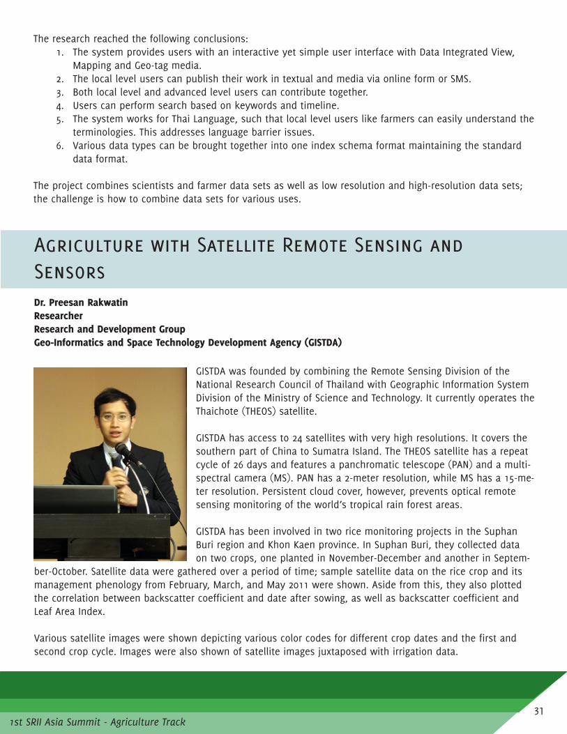
Agriculture with Satellite Remote Sensing and SensorsDr. Preesan RakwatinResearcherResearch and Development Group Geo-Informatics and Space Technology Development Agency (GISTDA)
GISTDA was founded by combining the Remote Sensing Division of the National Research Council of Thailand with Geographic Information System Division of the Ministry of Science and Technology. It currently operates the Thaichote (THEOS) satellite.
GISTDA has access to 24 satellites with very high resolutions. It covers the southern part of China to Sumatra Island. The THEOS satellite has a repeat cycle of 26 days and features a panchromatic telescope (PAN) and a multi-spectral camera (MS). PAN has a 2-meter resolution, while MS has a 15-me-ter resolution. Persistent cloud cover, however, prevents optical remote sensing monitoring of the world’s tropical rain forest areas.
GISTDA has been involved in two rice monitoring projects in the Suphan Buri region and Khon Kaen province. In Suphan Buri, they collected data on two crops, one planted in November-December and another in Septem-
ber-October. Satellite data were gathered over a period of time; sample satellite data on the rice crop and its management phenology from February, March, and May 2011 were shown. Aside from this, they also plotted the correlation between backscatter coefficient and date after sowing, as well as backscatter coefficient and Leaf Area Index.
Various satellite images were shown depicting various color codes for different crop dates and the first and second crop cycle. Images were also shown of satellite images juxtaposed with irrigation data.
1st SRII Asia Summit - Agriculture Track31

In 2011, the rice crop working groups were able to develop a mock-up system to estimate rice crop produc-tion for rain-fed region at Khon Kaen using SAR data, crop growth model, and ground observation data. For the estimation process, satellite data feeds into SAR data analysis for rice crop acreage. Meanwhile, both satellite and ground data feed into crop models, which produces data on rice crop yield. Various images were shown on crop acreage estimation using SAR image for both transplanting season and well-growing season, as well as initial detection of paddy field and post processing. Images can help monitor growth of rice and create a map for each growth period as well as capture characteristics of fields. Satellite observations can also be done, not only for rice crop, but also for rice, sugarcane, and cassava.
For crop yield estimation using KKU model, they used JAXA satellite data to get solar radiation, precipitation, and soil moisture, and used the TMD weather station data to get the temperature, humidity, and wind speed. Then they calculated for acreage, yield, and production. They validated these data with field surveys and they got a 98 per cent accuracy with acreage estimation and more than 80 per cent for production estimates.
GISTDA also uses the NECTEC field server for agriculture monitoring, which contains, among others, a rain gauge, temperature and humidity sensors, as well as digital cameras. Aside from this, they do phenology monitoring using time-series MODIS imagery. MODIS is a device that is installed on the Terra and Aqua satel-lites, used to measure the spectrum to track and monitor natural resources. The sensor has 705 kilometer of altitude, 36 bands of product between 0.4 and 14 micrometers, data resolution between 250 and 1000 meters, and repeats every 16 days. A sample image captured in a study site in central Thailand shows areas where there is high agricultural activity. The MODIS imagery was able to capture data for single crops, double crops, and 2.5 crops. Aside from this, through the tool, a risk area map was generated from flood frequency analysis. This data is important for identifying flood-prone areas.
Another GISTDA initiative is the GISAGRO project for agriculture effectiveness and efficiency management in Thailand. It is a collaborative project with various government departments and relies on satellite and GeoDa-tabase data. Each department will contribute data and these will be integrated in the system. It also incorpo-rates other data, such as irrigation and meteorological data. The system has mechanisms for monitoring crop, pest and plant diseases, agriculture technology transfer, weather forecast, and productivity estimation.
In the initial meeting with farmers, they corroborated data on farmer identification and mapping with the farm-ers. They have conducted farmer registration in which they got detailed GIS farm data; farm assistant training;
surveying and assisting; as well as cultivat-ing and grading.
GISTDA has also generated a flood map de-rived from satellite data, which is a major source of information to support decision-making. GISTDA is in charge of the EOS-based data center for flood relief opera-tions, which delivers flood map products within 4 hours after acquiring satellite data. They have also integrated data from vari-ous sources. Flood map production is not highly automated as people are fielded
32

1st SRII Asia Summit - Agriculture Track
Comments/Questions
Dr. Gardjita Budi: In situations where majority of farmers grow multiple crops in their fields, the problem may be more complicated. In your techniques, could you distinguish between ages of crops? For rice, it is about 120 days but for two crops, where age of crops may produce different production levels, could these techniques be applied? In areas where there is monoculture it’s more predictable. Another issue, almost every year we have a problem about knowing the real situation on the stocks of rice; we know the harvested areas and yields but we don’t know the stocks. In your data, can this be reflected? In real situations, we need to know one month ahead so we know if we need to import rice.
Dr. Rakwatin: For phenology data, it can clearly show the differences in data. However, there is confusion between upland rice and corn because their periods are both 3 months. This is another challenge that NVDI is currently working on. Remote sensing cannot answer everything; we use satellite data to compare with field survey to balance out results and to see characteristics of the real situation. Sometimes accuracy is not very high but it can give a general idea. Dr. Budi: For many countries, data difference of 1million tons, for instance, is a big deal economically and politically. Importing rice for Indonesia is “taboo”; this decision is very important. Data of less than 1 million tons of rice is im-portant to determine if import is required or not; purchasing takes time – 6 or 7 weeks. Rice is more predictable; other commodities are not, especially those with multiple farming systems. For geographic conditions like that in Indone-sia, it’s more difficult to predict.
1st SRII Asia Summit - Agriculture Track
for mapping. These maps are released to local villages so the community can use the information.
The data also covered some areas in Vietnam and Cambodia. Flood impacts include submergence of 432,000 hectares of grown rice paddies and submerged crops. Satellite data has also been used for the flood victims’ compensation verification as the data can confirm if a house belongs to an area that was indeed flooded.
33

Agriculture with Satellite Remote Sensing and Sensors Estimations of Sugarcane Biophysical and Biochemical Parameters by Hyperspectral Remote Sensing
Dr. Poonsak Miphokasap Kasetsart University
Sugarcane is one of the most important economic crops in Thailand with a total cultivated area of 1.28 M hectares. It is the primary source of the sugar and ethanol industry. As such, the early precise estimation (preci-sion farming) of annual sugarcane productivity and quality is necessary. The project is important to be able to establish the proper policies for sugarcane (fertilizer, irrigation), contribute to food security, and reduce the damage from crop diseases or insects.
Many biophysical and biochemical parameters directly influence sugarcane productivity (quality and quantity) leaf area index, macronutrient concen-tration (nitrogen, potassium), biomass, chlorophyll content, water avail-ability, soil properties, and climatic conditions; nitrogen and leaf area index are the two most important parameters according to research done.
Canopy Nitrogen Concentration (CNC) and Leaf Area Index (LAI) are meas-ured using destructive and non-destructive methods. Ground check and conventional equipment are labor intensive, time-consuming, expensive and only practical at the leaf level and is limited to the large spatial ex-tent. On the other hand, remote sensing has high accuracy, large ground cover, low cost, is not time consum-ing, and has near-real time monitoring.
The research done by Kasetsart University was conducted at the field level and space level. The spectrometer could not show some information (e.g. macronutrients) because of low resolution. The use of the hyperspec-trometer ensured higher quality data. It aimed to estimate CNC using hyperspectral satellite imagery.
The research aimed to:1. Develop the model for estimating CNC and LAI in sugarcane with combined cultivars from the field
spectroscopy using univariate and multivariate approaches (try to produce one model for several spe-cies);
2. Investigate the performance of SVR for estimating sugarcane CNC from the hyperspectral data;3. Analyze the effects of canopy architecture on spectral signature and precision of predictive model;
and4. Map the variations of sugarcane CNC from orbiting EO-1 Hyperion image.
34

1st SRII Asia Summit - Agriculture Track1st SRII Asia Summit - Agriculture Track
At the field level, two experimental plots based on RCB with 3 sugarcane cultivars and three replications were established. Each had different soil types – one loamy sand and another, loamy clay. At the space level, 55 farmers’ sugarcane plots un-der natural conditions in Sakaeo Province were selected. Plots were measured 30m X 30m.For the field spectral measurement, the experimental attributes considered were generally narrow: distance form canopy to sensor was only 1.5 meters and spectral resolution was only 1.4-2 nanometers. For the image acquisition, it spanned a long period of time, from October to January.
Results of the univariate and multivariate estimations show that the best method used was SMLR, yielding 80 percent ac-curacy in mapping CNC and 65 percent accuracy for estimating LAI.
For the second study, the team tried to integrate support vector regression and hyperspectral data to map CNC in sugarcane from orbiting EO-1 Hyperion Image. Using narrow vegetation indices, the variable CRDR yielded the highest accuracy in estimating CNC – 70 per cent. Using the SMLR approach, CRDR variable also yielded the highest accuracy with 74 per cent. Using the SVR approach, the SVR/RBF estimation method and BD variable yielded the highest accuracy of 80 per cent.
The study found the following salient points in response to the objectives earlier stated:1. Develop the model for estimating CNC and LAI in sugarcane with combined cultivars from the field spec-
troscopy using univariate and multivariate approachesThe best modified linear statistical model developed by SMLR yielded the highest accuracy of 80 per cent for CNC and 65 per cent for LAI.The model developed by SMLR yielded a higher correlation coefficient compared to the model comput-ed by narrow vegetation index as this uses only a limited amount of the spectral information.The model accuracy for estimating CNC can be significantly improved by using narrow vegetation indi-ces and SMLR.
2. Investigate the performance of SVR for estimating sugarcane CNC from the hyperspectral dataThe model based on non-linear transformation developed by SVR can improve the accuracy of stand-ard linear model for estimating sugarcane CNC. The proposed model yielded an accuracy of 83 per cent even if the number of samples were small.The optimal values of the free parameter of SVR were achieved by using the leave-one-out cross vali-dation method but this method is time consuming.
3. Analyze the effects of canopy architecture on spectral signature and precision of predictive model Canopy architecture directly influences the sugarcane spectral signature and predictive model capabil-ity.Canopy architecture is closely related to the amount of light intensity penetrating the sugarcane canopy and interacting with subsequent leaves. Prior knowledge of canopy structure should be considered in estimating sugarcane characteristics in sugarcane fields.
35

4. Map the variations of sugarcane CNC in sugarcane fields from orbiting EO-1 Hyperion imageThe estimation model developed by non-linear SVR yielded a higher correlation coefficient with CNC from Hyperion hyperspectral data compared to the model computed by the empirical statistical meth-ods (SMLR and VI) with 80 per cent accuracy.Estimation accuracy of models at the space level is remarkably lower than at the field level because of coarse spectral resolution of Hyperion compared to field spectroscopy. In addition, influences of atmospheric noise, cloud cover, presence of water in fresh canopies resulted in variations of spectral signature and accuracy of an estimation model.
However, many parameters could not be explained in this estimation. Some issues encountered were time lapse and study difference between species in terms of canopy. In terms of research contributions, the new methodologies used were seen to significantly improve modeling of quality in sugarcane canopy. The research outcome likewise contributes to effective use of remote sensing for practical management of sugarcane agri-culture.
Among the recommendations are the following:Effects of growth stage to spectral characteristics, sensitive wavelengths and precision of estimation model should be investigated.Estimation models developed in the study should be validated with sugarcane that is cultivated in other sites. However, some conditions have to be controlled, such as cultivars, age group, irrigation, and date of sowing.Nitrogen is not the only important macronutrient in the growth of sugarcane; other macronutrients such as phosphorous, potassium, and magnesium or leaf water content should also be assessed through hyperspectral techniques.The UAV platform is best to use for problems of imaging with cloud cover.
Comments/Questions
Dr. Budi: I’m interested in this research. It is important that research results must have an important contribution to the sugarcane industry itself; expecta-tions of findings can stimulate growth of sugarcane industry.
Mr. Miphokasap: It’s quite difficult to apply this research directly for farmers. If the information will be sent to the sugar mill, I think that the sugar mill can do something to increase productivity. Productivity is the main target of the sugar mill. Applications can be developed for farmers for the future.
Mr. Yuji Niino: Can pest and diseases also be monitored? I see this as cutting edge research so I expect many uses of the results maybe for other species as well.
Mr. Miphokasap: It may be possible because the system detects chlorophyll concentration, which, in turn, is affected by pest and diseases.
36

1st SRII Asia Summit - Agriculture Track1st SRII Asia Summit - Agriculture Track
Drought Monitoring and Early Warning using Satellite DataMr. Syam NashrrullahGeoinformatics CenterAsian Institute of Technology
Drought is not very easy to define as there are so many definitions and there is no globally accepted definition. The Glossary of Meteorology de-fines it as a period of abnormally dry weather sufficiently prolonged for lack of water to cause serious hydrologic imbalance in the affected area. Craig (2006) defines it as a prolonged period of below-average precipitation severe enough to negatively impact the environment and human activities. There are two common things in this definition – there is below normal precipitation and it can have impacts like hydrologic imbalance and human activities.
Drought is a temporary phenomenon, unlike aridity, which is permanent. Less rainfall in certain periods could affect productivity in agriculture. One important aspect of drought is that it is a slow disaster; it is not like flood that has a very immediate impact. Mostly, it is difficult to define when it starts and when it is going to end.
In drought modeling, drought indices are used. These indices assimilate thousands of bits of data into a com-prehensible big picture; there could be a lot of data but what does it mean? There is a need for some kind of method or index to make it easier to assess the situation. It is typically a single number and is far more useful than raw data for decision-making. There are two different types of index based on its source: 1) statistical data index (coming from meteorological station, for example); and 2) remote sensing data index. The presenta-tion focused on remote sensing data index. Both have limitations and strengths.
There are many kinds of statistical data indices. Among these are: 1) percent of normal, which is the simplest method; 2) SPI, which is the most commonly used (SPI can compute in different time scales); and 3) PDSI. Each of these indices requires different data sets; many use precipitation. PSDI, for example, requires more data on temperature, soil moisture etc. It depends on the application or purpose for which it will be used.
There is an ongoing project on mapping drought hazards in Bangladesh, the final outputs of which will be risk assessment. The drought hazard map uses SPI, which uses different time scales by season, e.g. premonsoon, monsoon, or cropping seasons. SPI can calculate period of drought and produce different maps for these differ-ent time periods. There are also different classifications of drought. This is based on meteorological station so data has to be interpolated to be able to generate a map.
There are limitations of the statistical index. One is the sparse number of meteorological locations. Two is that point locations, rather than areas, are represented so there is a need to interpolate if data on areas are need-ed. Three, weather parameters are physical in nature and not entirely related to physiological characteristics of
37

the vegetation. Four, most depend on rainfall data, which are limited in the region, are often inaccurate and, most importantly, are difficult to obtain in near-real time.
On the other hand, satellite-sensor data are consistently available so drought could be monitored daily. It can also be used, to some extent, to detect the offset of drought and its magnitude. Remote sensing data indices, include, among others, SMI and NDVI (which most people use). Each index has different data sets and sensors.
One of the indices is SMI or Soil Moisture Index, based on surface temperature and vegetation index. It can measure both drought (zero value) and wet conditions (one). A project in Mongolia uses this index. Drought monitoring is done every 8 days using MODIS optical data. Data is examined to see how is it comparable to SPI; this was done for data gathered from 2000 to 2007. A similar project was done in Cambodia, where data was gathered from 2000 to 2009. Keetch-Byram Drought Index (KBDI), based on 20 cm soil capacity of water, is another index used in the pro-ject. It is an old method but it is used in meteorological data and it uses remote sensing data to the calculate image. KBDI uses two data sets that come from satellites – evapotranspiration (land surface temperature) and precipitation. Values ranges from 0 to 800 units and represents a moisture regime of 0-8 inches (20 cm) of water through the soil layer. Zero is the point of no moisture deficiency and 800 is the maximum dry condition possible. The GSMaP or the Global Satellite Mapping of Precipitation features hourly global rainfall maps in near real-time. It uses a combination of different data sets; rainfall data are retrieved from each microwave imager and/or sounder and are merged to generate the hourly rainfall map. The MTSAT (Multifunctional Transport Satel-lites), meanwhile, also provides hourly data with a broader spatial resolution at 4 kilometers.
For the system configuration of web-based drought monitoring, data is processed and uploaded in a web server. Several countries in South and Southeast Asia are collaborating for this project.
They are currently involved in a drought monitoring project in Mongolia as they experience what is locally termed as “dzud” – a multiple natural disaster consisting of a summer drought resulting in inadequate pasture and production of hay, followed by very heavy winter snow, winds, and lower-than-normal temperatures – which happened in 2009-2010. The project monitored drought during summer season and during the winter for snow. They monitored the drought data for that year. GSMaP gener-ated for Mongolia in 2009 showed that rainfall occurred from April to September. A KBDI map was like-wise generated, where red areas represented sections where drought occurred. Maps showing snow cover were also generated. Both maps were juxtaposed with each other; as such, drought and snow data map-ping could be clearly plotted.
38

1st SRII Asia Summit - Agriculture Track1st SRII Asia Summit - Agriculture Track
Comments/Questions
Mr. Yuji Niino: As you mentioned, there is a need to interpolate data as agro meteorological data, like rainfall data, is often not very available. How can you use existing information for disaster risk reduction? Disaster risk weather fore-casts, particularly droughts, use climatic information and it can be interpreted for agriculture sector information. Using weather data particularly temperature and precipitation, how much time can you give for warning?
Mr. Nashrrullah: We are talking about two different methods. One is based on meteorological station, which depends on meteorological data; another is remote sensing index, which we are using and which gets information from satellite. Remote sensing data is available every hour – e.g., precipitation from GS map is available hourly. For KBDI, profile data is available every day. But validation is needed from the ground; we are trying to do validation now and see how it matches KBDI and rainfall as well.
Data has shown that different years can have different drought periods. These data can somehow be used as early warning system since data can show the average time period for droughts occurring in the area.
The research has found that MODIS-based drought index and KBDI can be used to effectively monitor drought. KBDI can provide near real-time information such that early warning can be provided by the system. It repre-sents both LST and precipitation anomaly, and it can capture drought onset and offset data. Future prediction is possible using KBDI only if weather forecast is available, including LST and precipitation.
39

1st SRII Asia Summit - Agriculture Track
Track 3
EMERGING ICTS FOR AGRICULTURAL INFORMATION SYSTEMS
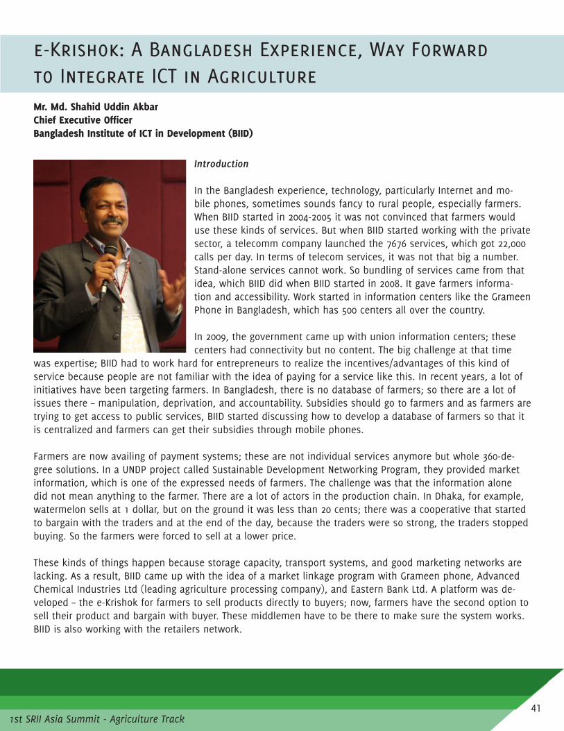
1st SRII Asia Summit - Agriculture Track
e-Krishok: A Bangladesh Experience, Way Forward to Integrate ICT in AgricultureMr. Md. Shahid Uddin AkbarChief Executive Officer Bangladesh Institute of ICT in Development (BIID)
Introduction
In the Bangladesh experience, technology, particularly Internet and mo-bile phones, sometimes sounds fancy to rural people, especially farmers. When BIID started in 2004-2005 it was not convinced that farmers would use these kinds of services. But when BIID started working with the private sector, a telecomm company launched the 7676 services, which got 22,000 calls per day. In terms of telecom services, it was not that big a number. Stand-alone services cannot work. So bundling of services came from that idea, which BIID did when BIID started in 2008. It gave farmers informa-tion and accessibility. Work started in information centers like the Grameen Phone in Bangladesh, which has 500 centers all over the country.
In 2009, the government came up with union information centers; these centers had connectivity but no content. The big challenge at that time
was expertise; BIID had to work hard for entrepreneurs to realize the incentives/advantages of this kind of service because people are not familiar with the idea of paying for a service like this. In recent years, a lot of initiatives have been targeting farmers. In Bangladesh, there is no database of farmers; so there are a lot of issues there – manipulation, deprivation, and accountability. Subsidies should go to farmers and as farmers are trying to get access to public services, BIID started discussing how to develop a database of farmers so that it is centralized and farmers can get their subsidies through mobile phones.
Farmers are now availing of payment systems; these are not individual services anymore but whole 360-de-gree solutions. In a UNDP project called Sustainable Development Networking Program, they provided market information, which is one of the expressed needs of farmers. The challenge was that the information alone did not mean anything to the farmer. There are a lot of actors in the production chain. In Dhaka, for example, watermelon sells at 1 dollar, but on the ground it was less than 20 cents; there was a cooperative that started to bargain with the traders and at the end of the day, because the traders were so strong, the traders stopped buying. So the farmers were forced to sell at a lower price.
These kinds of things happen because storage capacity, transport systems, and good marketing networks are lacking. As a result, BIID came up with the idea of a market linkage program with Grameen phone, Advanced Chemical Industries Ltd (leading agriculture processing company), and Eastern Bank Ltd. A platform was de-veloped – the e-Krishok for farmers to sell products directly to buyers; now, farmers have the second option to sell their product and bargain with buyer. These middlemen have to be there to make sure the system works. BIID is also working with the retailers network.
41

Accessibility and other service issues are addressed as well. Realities on the ground show that if a full basket of solutions are not available, there would be no benefits. Bangladesh is missing good practices. But it has started extension-related information and market linkage; at the same time, BIID has opened up a window to share good practices from different countries as well as academicians. There are gaps between what academi-cians and practitioners do; so an extension network was set up to put stakeholders in the process together. At the end of the day, research has to be used and scaled up.
The Bangladesh extension department has about 13,000 field staff. They could be mobilized and capacitated on the technologies for getting information (collecting and managing information). As it is, collection and manage-ment of data is not very efficient as it is manually done; distortion of data sometimes happens.
Knowledge can be a good opportunity for developing e-agriculture tools. Commitment of government in com-bining IT and agriculture is also important in this development. Issues on ownership may arise in e-agriculture in terms of who manages IT - Ministry of IT or Ministry of Agriculture. It is a complex situation but there’s a lot of potential. Champions can be brought together for the sake of the future.
Presentation
Bangladesh has 147,570 sq. km land with 149 million population. Agriculture is the single largest producing sector of the Bangladesh economy and it comprises about 18 per cent of the country’s GDP. About a third of the total population is youth, aged 18-40. Bangla-desh has come up with a Digital Bangladesh initiative promoting ICT4D.
BIID is an inclusive business initiative that offers a range of services and works with various agencies, such as Katalyst, USAID, JCI Bang-ladesh, Grameen Phone, and Intel, among others. Among BIID’s key services are research and consulting, as well as service development and promotion.
One of BIID’s projects, e-Krishok, is an ICT-enabled extension and market linkage program, geared towards the goals related to ini-tiatives for smart farmers. Initially it started with the extension component, then later on expanded to the marketing component. The project began in 2008 and was pilot-tested in 10 locations – 5 were successful and 5 were not. Lessons learned were documented and in 2011, the project was expanded nationwide to induce trial of agricultural extension and market linkage service. It is about mobilization and awareness building, as well as services demanded by farmers. It also provides back-end support services in the form of content, promo-tion, marketing, and partnership.
When BIID framed e-Krishok, it was basically driven by demand and supply. They: mapped existing services, providers, and roles; tried to understand success factors and causes of failure; identified incentives; capaci-tated the extension department and research institutes; and ensured quality and validation of content. For the future, they are moving towards need-based and trustworthy quality content -- packaging it into tools that are low cost, accessible, and available; market-driven and branded services; and policy and environment-friendly.
42

1st SRII Asia Summit - Agriculture Track1st SRII Asia Summit - Agriculture Track
The project is based on partnership and branding, a symbol of agriculture services. In the project, the empha-sis is on driving information using new technology tools. The service diagram of the project mainly features extension (information and advisory services) and market linkage (connecting farmers to the market). As part of commercializing the e-Krishok service, BIID and Grameen Phone developed a Business Model to make the service sustainable and reach wider farmer groups.Farmers can register through SMS and avail of advisory alerts on demand or as required via push SMS.
A help desk will also be available with Short Code facility to cater to the demand of the farmers over phone. An online market place has been developed to connect farmers directly to buyers so they can make transac-tions; order placement, trading, payment, and all services are ICT-enabled. This will be piloted with over 2,000 farmers by March 2014.
BIID plans to reach 3 million farmers by 2015 as it wants to focus on scalability, sustainability, replication, and reach of the project. To do this, they are trying to segment users based on age groups and based on an under-standing of service usage since the project started. They are also trying to address issues on the next genera-tion’s lack of willingness to engage in farming and lack of innovation in farm level activities.
The e-Krishok project also takes into consideration the perspectives on youth engagement in agriculture. They are looking into issues on whether agriculture is lucrative for the youth; whether they get into it by choice, by chance, or by force; and what the youth can get out of being engaged in agriculture. This is taken into consid-eration because about a third of the Bangladesh population are the youth. Young people are vibrant, dynamic, and are ICT adopters; they will be future leaders of the work force and they engage in different social and voluntary works.
So far, BIID has engaged the youth groups in their market linkage program jointly with Grameen Phone and ACI. They have also partnered with DCCI, VSO International, and JCI Bangladesh to engage the youth in entre-preneurship. For the younger ones, they developed the kitchen garden initiative to promote the use of ICTs for agriculture.
Currently, the program has been scaled up in more than 350 Upazilla and has reached over 148,000 farmers. More than 84,000 enquiries have been logged and more than 72,000 solutions have been given. Approximately 29,000 farmers have said that they benefited from the project. For this year, they have introduced new ser-
vices (such as hotline 16250 and market link-age) and expanded delivery points.
Several challenges have been encountered. At the government and policy level, there are still some issue on clarity of policies and lack of supportive environment. At the implementation level, issues on government readiness and availability of services and content have been observed. At the benefi-ciary and user level, there are still issues on awareness and understanding as well as lack of capacity of farmers in terms of access to technology.
43

In terms of strategies and actions taken, BIID is closely working with the government in setting vision and strategies. They have established an e-agriculture working group and brought all stakeholders on board; profiled the youth as change-makers; created a supportive environment for innovation, access to technology, finance and market for youth; facilitated learning opportunities; and linked them with local and international e-agriculture practices and programs.
Comments/Questions
Mr. Gerard Sylvester: You mentioned that there are 13,000 field workers, how many villages do they cover?
Mr. Akbar: We have around 80,000 villages. Almost 2,000 farmers are under one agriculture area, which is a large number. But extension is not only the job of these extension officers. They do a lot of other things. But the good part is that with private sector engagement, retailers have become some sort of extension service providers. So we are trying to build their capacity.
Mr. Sylvester: In previous experience, when extension wokers don’t visit villages, farmers resort to getting advice from input suppliers (e.g. pesticides). That’s a big problem because farmers use a broad spectrum of inputs; this is not good for the crop and for consumers. The role of agriculture extension workers is very crucial and ICTs help them do their job in a more effective way. So we need these people to be on the ground, too.
Mr. Akbar: In our experience, farmers are not that unaware now. They know what is good and what is bad. Sometimes, we misjudge them about their capability. I have seen farmers who buy Syngenta products at a cost 300 times higher than a Bangladesh product because of the quality. Trends also change because now, every-body is informed.
Question: In developing ICT in rural sector, three things test the success of the project: 1) illiteracy of farmers about the technology; 2) access of farmers to technology– which means the purchasing capacity to buy the minimum equipment; and 3) content of information itself. If pesticide companies are very active in filling up this information required by farmers, farmers might be influenced. So these things also need to be considered by the government – information that will influence decision-making in doing their farming activities.
Mr. Akbar: These three things are crucial for extension. But if you see the trend, mobile penetration in Bang-ladesh is now almost 99 per cent. In terms of access, 60 per cent of the population has access to mobile phones. Initially, when mobile phones were introduced, there was a project from Grameen Bank – they used to educate users about using mobile phones. ICT is not always used; it depends on the information need of the farmer. It can be given through extension workers or retailers. In terms of content, government and research agencies as well as agriculturists develop these. Quality of information is ensured because of that. In terms of buying capacity, if it is beneficial, they will pay for that. We have developed call centers that provide informa-tion for a certain fee. Mobile phones are being used by the farmers’ sons or daughters. We have targeted these young users to use this kind of technology. Some framers in remote areas even use Facebook.
44

1st SRII Asia Summit - Agriculture Track1st SRII Asia Summit - Agriculture Track
ICT Trends and Potential for Agrciulture
Dr. Ashish NarayananInternational Telecommunication Union
There is now a need for interoperability and working together. ICT has become so broad that it has also been difficult to examine how things are going on. According to ITU Secretary-General Hamadoun Touré, “In the 21st century affordable broadband access to Internet is becoming as vital to social and economic development as network like transport, water, and power.”
Global trend of growth over the last 13 years in telecommunication ICT shows that mobile penetration has reached about 96 per cent. It is inter-esting to note that the fastest growing service is mobile broadband. There is a big opportunity for growth and as it becomes more affordable, we may be able to see a steeper growth, especially in developing countries. That’s important to note when developing agriculture solutions or smart solu-tions.
Mobile has now caught up with the world population, and the growth rates have fallen. There are some coun-tries with mobile penetration at 100 per cent. It is predicted that by 2013, there will be two billion subscrip-tions worldwide of mobile broadband; in Asia Pacific, there are 895 million mobile broadband subscriptions, but that’s just 22 per cent penetration. Next to Asia Pacific is the Americas with 460 million.
Affordability is a key. In developed countries, that’s where some of the problems come – at the grassroots level. If you see the price of mobile broadband in developed countries is about 1-2 per cent of GNI; in develop-ing countries, it’s 11-25 per cent. If volumes increase, economies of scale is achieved and prices drop. It’s a combination of policies, regulation, and, industry. Economies of scale are not at the national level, but at the global level. Postpaid handset-based services are the cheapest and prepaid computer-based services are the most expensive, and that’s why there’s a broadband revolution coming up.
The next biggest thing that’s happening is in terms of IP traffic, it’s been growing almost vertically. And the number of apps that is growing is very difficult to track. On one side it is good because it is encouraging new services; on the other side, it can also fragment the market. In the app industry, the most important thing is how popular the app is and how many people are using it, and who has the credibility in good apps.
In terms of Internet traffic, Internet video stands far, far ahead; next is file sharing. Machine to machine traf-fic (M2M) (e.g. between handsets or between the car and the transport system), is predicted to grow 8 times until 2020. The number of screens people are exposed to are growing everyday – hand phone, LCD TV, and tab-let. Humans are not the only users as reflected in the growth of machine-to-machine traffic and that’s where growth in services is reflected – agriculture, transport, automation, utilities, infrastructure, and retail.
45

Broadband is now an enabler of the information society. ITU is working on areas of the use of telecoms and ICT – e-governance, education, digital cities, smart water management, etc. ICT and telecom are being used to solve the problems laid down in the Millennium Development Goals – education, health, and food security.
National broadband plans are universal; about 145 countries have either developed a plan or are planning to adopt national broadband plans; 134 have already developed and 12 are planning to adopt. In broadband plans, 88 per cent talk about nationwide infrastructure. The plan also contains provisions on education, citizen participation, employment, health, food security, gender etc. – these are not really Ministry of ICT plans but more like national plans.
What speeds could be available to build applications; how quickly will these be universal? There are 7 coun-tries with 100 Mbps; 7 countries with 10-20 Mbps; kbps does not exist anymore; it’s currently at 30-100Mbps. In developed countries, it could go as high as 1Gbps. In 4G mobile, it’s 100 Mbps-1Gbps over the network. Mobile network is much easier to reach nationwide.
How much time does it take for the service and what type of technology is needed? That depends on how quickly one wants to do something. If 8GB of DVD movie is needed within one minute, perhaps Gb Internet is the only option. But if one can wait for 1 hour, then lower version could be used.
In terms of ICT and agriculture, a report that came out in 2013 divided it into three aspects:ICT for production systems management – productivity, crisis management, long-term productivity, risk managementICT for market access – pricing, trade servicesICT for financial inclusion – insurance, transfer payments, credits, savings
How can capability be developed to harness these technologies (GIS, mobiles, sensors, RFID, broadcasting, smart devices, cloud networks, telecommunication)? Digital literacy, security, confidence and trust in the app used, accessibility, network availability, policies, regulation, and legislation all come into play here. ITU is work-ing with FAO to develop national toolkits, guidelines, e-strategies to develop agriculture. ITU is likewise work-ing with WHO to come up with a national e-health strategy. Hopefully, a similar partnership can be established with FAO for toolkits that governments can use for agriculture.
Emerging Technologies for Agriculture Information ManagementMr. Gerard SylvesterKnowledge and Information Management Officer FAO Regional Office for Asia and the Pacific
The previous presentation on trends in technologies has shown that there is a lot of opportunity to use this for agriculture extension. Even though technologies abound, it does not mean that agriculture extension will au-tomatically happen. Agriculture content is currently lacking in the web. As example, the topic Gangnam Style, when searched in Google, will yield more than 100 million results. But a similar search on rinderpest (a disease which affects cattle) will yield just more than 200,000 results.
46

1st SRII Asia Summit - Agriculture Track1st SRII Asia Summit - Agriculture Track
What does FAO do to address this problem? One is the agriculture infor-mation management standard, which is done in collaboration with other international organizations and technical panels to foster standards for better data related to agriculture information management. There should be standards in information sharing otherwise information might not reach consumers who need it. Once there is a common understanding and a common platform on sharing and understanding each other’s information, excellent match-ups can be done with information from different sources to be able to generate new content.
While there is a lot of disparity in the capacity to implement ICTs for agri-culture among countries in the Asia Pacific region due to various factors, it should be noted that this is the region where a lot of development is tak-ing place on ICTs, as seen from the World Bank statistics.
We see the number of mobile cellular subscriptions have been increasing tremendously over the last few years to a point where mobile phone access has become ubiquitous in almost all countries, especially in the Asia Pacific region. (http://data.worldbank.org/indicator/IT.CEL.SETS.P2/countries/1W?display=default) With the need for targeted and highly local information related to agriculture, we hear from experts on their opinion on a few technologies that could bring about a huge advantage for agricultural information manage-ment.
While there are many projects aimed at increasing the knowledge flows in agricultural research, I would like to mention a few that the Food and Agriculture Organization is part of:
FAO’s Virtual Extension, Research and Communication Network (VERCON, http://km.fao.org/vercon/) aims to enchance interaction among agricultural research, extension, farmers and the other stakehold-ers of agriculture and rural development. VERCON aims at improving linkages among all these stake-holders as this is crucial to facilitate knowledge-sharing and access to agricultural information and to increase food security. To ensure this process, collaborative techniques and innovative methods of communication are used as well as Information and Communication Technologies (ICTs).
The e-Agriculture community led by FAO (http://www.e-agriculture.org) is a global community of practice where people from all over the world exchange information, ideas, and re-sources related to the use of informa-tion and communication technologies (ICT) for sustainable agriculture and rural development.Identified as a key action line during the World Summit on Information Society (WSIS, http://www.itu.int/wsis/index.html) 2003 and 2005 workshops, the Agriculture community serves as a catalyst for
47

institutions and individuals in agriculture and rural development to share knowledge, learn from oth-ers, and improve decision making about the vital role of ICTs to empower rural communities, improve rural livelihoods, and build sustainable agriculture and food security.
FAO has also contributed to the ICT in Agriculture sourcebook (http://www.ictinagriculture.org/) which provides a lot of case studies on connecting small holders to knowledge, networks, and institutions.
On the other hand, The Coherence in Information for Agricultural Research for Development (CIARD, http://www.ciard.net) movement is working to make agricultural research information and knowledge publicly accessible to all. The CIARD pathways (http://www.ciard.net/ciard-pathways-opening-agricul-tural-knowledge) provides an introduction to the ways in which research outputs can be made more widely Available, Accessible and Applicable (3As) to stakeholders. Maximizing the reach and use of research outputs have many advantages. The CIARD Manifesto (http://www.ciard.net/ciard-manifesto) and the CIARD Checklist (http://www.ciard.net/checklist-good-practices ) of Good Practices are state-ments of what needs to be done in order to achieve the enhancement of the 3As. The CIARD Pathways are practical guides, showing how the different elements of the Manifesto and the Checklist can be achieved by institutions around the world. A collection of case studies (http://www.ciard.net/cases) documents efforts by institutions around the world in opening up access to their research outputs. A set of standards and tools (http://www.ciard.net/standards-and-tools-information-and-data-manage-ment) makes sure that research outputs/repositories are interoperable with other repositories and that the data itself is interoperable enabling ease of export to other platforms/applications.
The CIARD Routemap to Information Nodes and Gateways (CIARD RING http://www.ciard.net/ciard-ring-0) is a global registry/referatory of web-based services that will give access to any kind of infor-mation sources pertaining to agricultural research for development (ARD).
The Information Management Resource Kit (IMARK, http://www.imarkgroup.org) is a partnership-based e-learning initiative targeting the effective management of information to address the information needs of people who are not in the classroom milieu. IMARK consists of a suite of distance learning resources, tools and communities on information management.
The AGORA program (http://www.aginternetwork.org/en/), set up by the Food and Agriculture Organiza-tion of the UN (FAO) together with major publishers, enables developing countries to gain access to an outstanding digital library collection in the fields of food, agriculture, environmental science, and related social sciences. AGORA provides a collection of more than 3500 key journals and 3300 books to 2500 institutions in 106 countries. AGORA is designed to enhance the scholarship of the many thou-sands of students, faculty and researchers in agriculture and life sciences in the developing world.
We find more instances of technology-mediated extension services in developing countries, many documented on the e-Agriculture platform (www.e-agriculture.org). Not only does ICTs provide a faster way of interacting, they also provide a more effective monitoring and evaluation platform.
The role that ICT can play as an instrument of change is potentially transformative. Smallholder farmers, particularly women involved in agriculture, have a huge advantage when the right ICTs are induced into the agriculture value chain. The access to the right information at the right time gives them the capacity to make informed decisions that would affect their livelihoods and thereby play a major role in ensuring food security.
48

1st SRII Asia Summit - Agriculture Track1st SRII Asia Summit - Agriculture Track
ICTs in Agriculture: Exchanging Information or Enabling Innovation?Dr. Rasheed Sulaiman VadakkelDirector Centre for Research on Innovation and Science Policy (CRISP)
There should be a shift in debate from ICT for development to ICT for inno-vation; it should not merely deal with accessing and sharing information, but using information to innovate.
There are three main arguments in this topic. Improved availability and access to new ICTs have enhanced information delivery (access and shar-ing) to a large number of rural communities. It is more timely, cost effec-tive, and interactive. The problem is information, though necessary, is not sufficient to bring about innovation; farmers need access to other sources of support and services to apply new knowledge and these processes (in-novation management) need to be facilitated. People need to use informa-tion that is being supplied through ICTs, and people need to have access to these ICTs. There is also lack of proper appreciation of these roles; under-estimation of the role of “intermediaries/infomediaries” has resulted in under-utilization of the potential of ICTs.
New ICTs based on personal computers, Internet and mobile phones have provided people with the power to access and organize information, as well as wider choice in collection, storage, processing, transmission and presentation of information. Experience with information kiosks, voice, SMS facilities, knowledge platforms, call centers, digital photography, GIS, ICTs for tracking traceability, telecenters, web portals, community radio, digital videos, audio-video conferencing, touch screens, e-discussions, blogs, etc. has shown the advantages of ICTs.
However, there are emerging concerns about this. For one, there are too many scattered initiatives or “pro-jects”. There is increasing evidence (though mostly anecdotal) on issues of its usefulness or effectiveness. These issues are related to locally relevant content (basic field level problems at the local level are not always addressed by content); sustainable and scalable impacts; varying capacity to use the information (very specific information may not be useful to farmers); and gender (women have less access to information). ICTs are also mostly focused on information dissemination; there is not much attention to other activities needed for put-ting new knowledge to use.
ICT4D debates are not linked to the “new understanding” from the fields of Innovation Communication and Ex-tension. ICT is mainly looked at as a tool to disseminate information to farmers. Currently, innovation is looked at as an inclusive process of generating, diffusing, adapting, and applying new knowledge. It is not a “technol-ogy” developed by research and disseminated by extension (Research-Extension-Farm). Innovation requires knowledge flows and interactions among a wide range of actors within the innovation systems. Transferring invention/technology is not enough for innovation. Different organizations have been talking not only about
49

agricultural information systems, but agricultural innovation systems. There should be a focus on building bridges among actors in an innovation system.
Communication, meanwhile, can play a major role in supporting processes relevant for innovation. In the past, communication was disseminating information from extension workers to farmers -- a very top-down approach; then the concept of participatory communication (communication and feedback) was developed in the 80s. Now, it can be associated with network building, supporting social learning, and dealing with dynam-ics of power and conflict. It’s about different interest groups discussing with one another. The role of extension should expand beyond providing information and knowledge.
Similarly, in talking about market development, market information is simply not enough anymore. ICTs have the potential to make market information available to farmers and be understood and used by them. ICTs can also help in facilitating interaction between farmers and intermediaries. Empirical studies have shown that there is not much difference in people who access and people who do not access the information in terms of the benefits they have gotten from it.
People have now started talking about the importance of managing innovation. The role of extension should expand from merely providing information and training to a host of other activities. The project has found that for an initiative to have scalable and sustainable impacts, there should be collaboration among organizations; there are a lot of functions and actions that could be done. ICTs have great potential in making these happen. Human intermediaries are still very important. It’s not merely providing information and farmers accessing information through ICTs. ICTs can help in other activities as well in terms of interaction.
A report produced by the Global Forum for Rural Advisory Services in 2012 discussed the new extensionist – or the role of the extension worker in the 21st century – networking and partnership building; setting up/strengthening user groups; training; advocacy for institutional and policy change; enhancing access to technol-ogy, expertise, markets, credit and inputs; and reflective learning.
If the innovation management lens is used in trying to find the contributions of ICTs, it could be found that: most of the ICTs used in extension focus on information dissemination (technical messages, generic package of practices, scheme details, price/weather information); most are one way-limited opportunities for interaction; and ICTs do not contribute sufficiently to other innovation management functions.
There is a need to have platforms for interac-tion because people have to make sense of the information they get from ICT tools. Knowledge is the meaning that people derive from infor-mation. Opportunities for dialogue are critical for communities to use this knowledge. Devel-oping locally relevant content costs money and need lot of effort. There is a lot of scope for use in training, distance learning, and policy advocacy, but this is used only rarely.
There is a lot of potential for social media in sharing knowledge. Knowledge management –
50

1st SRII Asia Summit - Agriculture Track1st SRII Asia Summit - Agriculture Track
it is technically feasible to store, retrieve, and share large amounts of information (database, video recordings, power points) in communities of practice and virtual communities. Knowledge sharing is not a technical chal-lenge but a sociological one – there are individual and social barriers and there is a need to develop trust and incentives for sharing.
Good human intermediaries are important but there is very limited appreciation for this role; as such, there is a need to enhance their capacities. ICTs cannot replace human interaction; traditional extension approaches are still relevant (on-farm advisory visits, one-to-one interaction, demonstrations, cluster-based approaches, farmer field schools, farmer organization development). ICTs can improve the effectiveness of these approach-es.
In conclusion, there is a need to re-evaluate ICTs in terms of its contribution to innovation management, and not merely information dissemination. There is a need to explore how best it can be done. ICTs should support facilitate/enable/support innovation and be able to support application of new knowledge and thus have a scalable impact. Finally, there is a need to initiate rigorous evaluation of experiences with use of ICTs.
Emerging Technologies for Agricultural Information ManagementDr. Pisuth PaiboonratSpecialistNECTEC
The presentation revolved around the following questions: What information do the farmers need? Why does information need to be managed and how can it be managed? How can service research innovation be a key?Who provides services and who become service receivers?What are the appropriated tools (or emerging technologies) for informa-
tion services?
By experience, there are two groups of people that are related – farmers and officers; these two groups can be related with technology, knowledge, and information. There is a need to think about the appropriate technolo-gies for farmers in terms of what they really need. Only 5 per cent of farm-ers in Thailand have smartphones.
In addition, there is a need to reflect on problems that are area-based. Information is a key to success; bur how can the right information be delivered at the right time? Information should likewise change mindsets and perspectives of people in agricultural business. But this is not very easy to change. It should not start with technology; rather, it should start with the social benefits or social gathering of people to create new paradigms of information services for smart agricultural extension.
51

Extension should also be changed; technology can be used to change the way people do extension. Extension should involve people more. Aside from this, there should also be a shift from broadcasting to location-based services. There is a wide presence of smart websites nowadays that broadcast information about an organi-zation and what it does; the question is whether this information reaches the farmers who need it, as such, the need for this shift. Knowledge should also become a service for clusters and zones as farmers tend to be grouped together in clusters or zones.
Why does information need to be man-aged? First, because the Asian region, in general, is an aging society; farmers’ average ages in Thailand are 57 or 58 so the future of agriculture in Thailand is a concern. There is a lack of skilled labor be-cause farmers are already retiring and the young generation does not want to be in the agriculture business anymore. Small-holders also need more intensive manage-ment. Cost of production in agriculture is likewise getting higher; there was an issue on prices of agriculture products.
How can service innovation be applied to solve these problems? Agriculture service is quite new in Thailand. Modeling was done to understand how service innovation could be applied to agriculture. Initially, there is a need to understand co-creation – it is very important for the farmers, officers, and private sector to collaborate in this area. Secondly, there is also a need to understand farmers’ practices deeply before being able to offer a service or technology for them. Problems and constraints need to be clarified in every step; thus, a new ser-vice can be designed accordingly. There should be enough time to really understand the needs of the farmers in terms of technology information. Participation, interaction, and accessibility of services are important.
In terms of service providers, champions should be identified in the ranks of extension officers, researchers, and local government officers. In terms of service receivers, farmers are composed of volunteer farmers, new generation of farmers, farm technical students, and investors, aside from traditional farmers. For smart farms to be smarter, clusters of smallholders, selected areas in agriculture zoning, and plantations are needed.
Among the emerging technologies for information services are: sensor networks; mobile application; image processing and photonics; knowledge as service; remote sensing, GIS, and spatial analysis; UAV; and modeling. How can these tools be appropriated for agriculture services? Some examples are the following:
Farmers and farm registration systemSpecific information services for each cluster of productionApplication for weather forecast (especially for micro-climate) for each production zoneApplication for forecasting insect population dynamicsMobile GAP assessment systemTraceability with smart packaging and QR codeContent repository and open API toolsAgricultural cloudHuman sensing
52

1st SRII Asia Summit - Agriculture Track1st SRII Asia Summit - Agriculture Track
Smart farmers’ mindsets need to changed; there should be more learning by doing activities, show and share, networking, and the like. For smart officers, they should have a new paradigm set; they should be egoless; and know how to facilitate, understand, and share. With these two factors, smart farm/smart agriculture can be achieved, which optimizes cost of production, maximizes benefits, creates sustainable living, and provides a better quality of life.
NECTEC’s technology roadmap features four main aspects:Production that targets smart farms and precision farming;Standard and quality that targets food safety and a food safety assurance system;Disaster management that targets food security a and location-based system for climatic variability adaptation; andKnowledge services that target smart farmers and a self-developed area-based KM.
53

54

1st SRII Asia Summit - Agriculture Track1st SRII Asia Summit - Agriculture Track
Annexes
55

Annex a: Schedule

!"#$%&' (
)#*+,- 8
&..
. 5
6
Room
Tim
e
8.3
0 -
9.0
0
9.0
0 -
10.4
5
Dr. H
iroyuki K
onum
a, Ass
ista
nt
Direct
or-
Genera
l and R
egio
nal
Repre
senta
tive, FAO
RAP,
Agricu
ltura
l In
novations
for
a
Sust
ain
able
Develo
pm
ent
Dr. A
nan P
usi
ttik
ul, I
nsp
ect
or-
Genera
l,M
inis
try
of
Agricu
lture
and C
oopera
tive, Thaila
nd
Ass
oc.
Pro
f.D
r. A
sanee K
aw
trakul, K
ase
tsart
Univ
ers
ity,
Thaila
nd
Pro
f. S
eis
hi N
inom
iya, V
ice D
irect
or
of
Inst
itute
of
Sust
ain
able
Agro
-
eocs
yst
em
Serv
ices,
Gra
duate
Sch
ool
of
Agricu
lture
and L
ife S
cience
s, t
he
Univ
ers
ity o
f Tokyo.
Mr. T
akuji Kiu
ra, Ja
pan,
APAN
Repre
sentr
ative
Pro
f.D
r. G
regory
Tangonan, Execu
tive D
irect
or
of
the
Congre
ssio
nal Com
mitte
e in S
cience
and T
ech
nolo
gy a
nd
Engin
eering o
r CO
MSTE,
10.4
5 -
11.0
0
11.0
0 -
12.1
5
Dr. S
ura
chai S
risa
rakham
, G
overn
or
of
Nakorn
Nayok P
rovin
ce
Pro
f. S
ore
n A
uer, U
niv
ers
ity o
f Bonn a
nd
Fra
uhofe
r IA
IS, G
erm
any:
Lin
ked O
pen D
ata
Pro
f. F
reim
ut
Bodendorf, H
ead o
f th
e
Depart
ment
of
Info
rmation S
yst
em
s,
Univ
ers
ity o
f Erlangen-N
ure
mberg
Mr. R
ain
er
Naegele
, Pre
sident
of
the
Fra
unhofe
r G
ese
llsch
aft
and m
em
ber
of
the
Fra
unhofe
r In
tegra
tion A
lliance
(FIA
)
Gra
ce L
in, Vic
e P
resi
dent
and D
irect
or
Genera
l, A
dvance
Rese
arc
h I
nst
itute
at
Inst
itute
for
Info
rmation I
ndust
ry (
III)
,
Taiw
an :
SRII
Str
ate
gic
Advis
or
for
Asi
a &
Em
erg
ing M
ark
ets
12.0
0 -
13.0
0
1300-1
315
1315-1
345
1345-1
415
1415-1
445
1415-1
515
15.1
5-1
5.4
5
17.3
0 -
18.0
0
18.0
0 -
21.0
0Cock
tail
Din
ner
at
Centr
ara
Gra
nd, Centr
al W
orld in B
angkok
Tra
ceabili
ty im
ple
menta
tion in g
rape v
alu
e c
hain
for
export
s: C
ase
stu
dy f
rom
India
– D
r Sudhansh
u, D
eputy
Genera
l M
anager, A
PED
A, M
inis
try o
f Com
merc
e &
Indust
ries,
India
15.4
5-1
645
Tech
nolo
gie
s and s
trate
gy t
o e
nsu
re t
race
abili
ty f
or
food s
afe
ty:
the c
ase
of
Indonesi
an n
utm
eg –
Dr
Gard
jita
Budi, D
irect
or
of
Qualit
y a
nd S
tandard
ization, M
inis
try o
f Agricu
lture
, In
donesi
a
Pa
ne
l D
iscu
ssio
n &
Wra
p U
p
*** E
xhib
itio
n &
Serv
ice I
nnovation C
linic
***
Welc
om
e D
esk
/ R
egis
tration
Tech
nolo
gie
s to
ensu
re t
race
abili
ty f
or
food s
afe
ty
TR
AC
K 1
: T
ech
no
log
ies t
o e
nsu
re t
race
ab
ilit
y f
or
foo
d s
afe
ty
The s
chedule
of
SRII
Asi
a S
um
mit 2
013
Septe
mber
16-1
8, 2013, 08.3
0-1
7.0
0 h
ours
CEN
TARA G
RAN
D &
Bangkok C
onvention C
entr
e a
t Centr
alw
orld, Flo
or
23 @
Bangkok, Thaila
nd
17
th S
ep
tem
be
r 2
01
3
= =
= =
= =
= =
= =
= =
= =
= =
= @
World B
allro
om
B &
C =
= =
= =
= =
= =
= =
= =
= =
= =
Glo
bal pers
pect
ives
on f
ood s
afe
ty, tr
ace
abili
ty a
nd r
eca
ll – M
r Patr
ik J
onass
on, D
irect
or, P
ublic
Polic
y I
nte
rnational, G
S1
Develo
pm
ent
of
Tra
ceabili
ty f
or
Food s
afe
ty :
the C
ase
of
Thaila
nd -
D
r Ponpro
me C
hairid
chai, D
irect
or
of
Secr
eta
riat
Off
ice, The N
ational Bure
au o
f Agricu
ltura
l Com
modity a
nd F
ood S
tandard
s, (
ACFS),
Thaila
nd
Coff
ee B
reak
Keynote
& P
anel
"S
erv
ice
In
no
va
tio
ns f
or
Sm
art
Ag
ricu
ltu
re"
Coff
ee B
reak
Keynote
& P
anel (D
)
"S
erv
ice
In
no
va
tio
ns f
or
Sm
art
Cit
y"
Lunch
& E
xhib
itio
n &
Serv
ice I
nnovation C
linic
Welc
om
e a
nd O
penin
g R
em
ark
s by M
sShash
i Sare
en, F
AO
Regio
nal O
ffic
e f
or
Asi
a a
nd t
he P
aci
fic

!"#$%&' (
)#*+,- 8
&..
. 5
6
Room
Tim
e
8.3
0 -
9.0
0
9.0
0 -
10.3
0
10.3
0 -
10.4
5
10.4
5 -
12.0
0
12.0
0 -
13.0
0
13.0
0-1
5.0
0
15.0
0-1
5.3
0
15.0
0 -
16.0
0
16.0
0 -
16.3
0
The s
chedule
of
SRII
Asi
a S
um
mit 2
013
Septe
mber
16-1
8, 2013, 08.3
0-1
7.0
0 h
ours
CEN
TARA G
RAN
D &
Bangkok C
onvention C
entr
e a
t Centr
alw
orld, Flo
or
23 @
Bangkok, Thaila
nd
18
th S
ep
tem
be
r 2
01
3
= =
= =
= =
= =
= =
= =
= =
= =
= @
World B
allro
om
B &
C =
= =
= =
= =
= =
= =
= =
= =
= =
Wra
p-U
p w
ith
ma
in t
rack
TR
AC
K 2
:
Pre
cisi
on F
arm
ing, G
IS a
nd r
em
ote
sensi
ng f
or
sust
ain
able
agricu
lture
Dr. M
asa
hik
o N
agai
Mr. T
akuji K
iura
Dr. P
oonsa
k M
iphokasa
p
Dr. P
reesa
n R
akw
atin
Mr
Syam
Nash
rrulla
h
Mr
Md. Shahid
Uddin
Akbar
Dr
Rash
eed S
ula
iman V
adakkel
Dr
Pis
uth
Paib
oonra
t
Mr
Ash
ish N
ara
yanan
Welc
om
e D
esk
/ R
egis
tration
coff
ee b
reak
TR
AC
K 3
: Panel dis
cuss
ion o
n E
merg
ing I
CTs
coff
ee b
reak
TR
AC
K 2
:
Pre
cisi
on F
arm
ing, G
IS a
nd r
em
ote
sensi
ng f
or
sust
ain
able
agricu
lture
Lunch
and E
xhib
itio
n
TR
AC
K 3
:
Em
erg
ing I
CTs
for
Agricu
ltura
l In
form
ation S
yst
em
s

Annex B: Participants

!"#$%&'"()*+,#-.+/01
!" !#$% &%'()*#+"*,#--.%'' /#*%0('1
! 2&#-345&++6-(4." "##$#%&'%()$*+,%-*(.+'+*&/(&'0(1+2$-'&/(
1+3*+#+'%&45+6(7--0(&'0("2*$,8/%8*+(
9*2&'$:&4-'6(1+2$-'&/(9;,+(<-*("#$&(&'0(%=+(
>&,$?,6(@&'2A-AB(C=&$/&'0B
D$*-E8A$BF-'8G&H<&-B-*2
I 7&8&+/4"9"- )+38%E(1+2$-'&/(1+3*+#+'%&45+6(7--0(&'0(
"2*$,8/%8*+(9*2&'$:&4-'6(1+2$-'&/(9;,+(<-*("#$&(
&'0(%=+(>&,$?,6(@&'2A-AB(C=&$/&'0B
J$/$B78&5&-H<&-B-*2
K :;#"#<+=389;*);#F'-L/+02+(M(N'<-*G&4-'(O&'&2+G+'%(9;,+*6(
1+2$-'&/(9;,+(<-*("#$&(&'0(%=+(>&,$?,6(@&'2A-AB(
C=&$/&'0B
.+*&*0BPE/5+#%+*H<&-B-*2
Q =>"*>&+="#;;(
P+'$-*(7--0(P&RE(&'0(S8%*$4-'(9;,+*6(1+2$-'&/(
9;,+(<-*("#$&(&'0(%=+(>&,$?,6(@&'2A-AB(C=&$/&'0B
P=&#=$BP&*++'H<&-B-*2
T ?4@&+A&&(- U&'0(O&'&2+G+'%(9;,+*6(1+2$-'&/(9;,+(<-*("#$&(
&'0(%=+(>&,$?,6(@&'2A-AB(C=&$/&'0B
V8W$BS$$'-H<&-B-*2
X =4'"@&)+B&;('"$ 1+2$-'&/(9;,+(<-*("#$&(&'0(%=+(>&,$?,(@&'2A-AB(
C=&$/&'0B
P83&W$%BC$+'3&4H<&-B-*2
Y 2;#.&8;"+C"#&;+D"*$88- "##$#%&'%(>*-<+##-*
Z-//+2+(-<()+5+/-3G+'%(Z-GG8'$,&4-'
['$5+*#$%E(-<(%=+(>=$/$33$'+#(U-#(@&\-#
=G,,//-H0+5,-GB+08B3=
)-,8G+'%-*#
] 08;)>;&"+:"#%&"+D"(4E"* N'#%*8,%-*
Z-//+2+(-<()+5+/-3G+'%(^-8*'&/$#G
['$5+*#$%E(-<(%=+(>=$/$33$'+#(U-#(@&\-#
&2,&'8_&#H0+5,-GB+08B3=
)-,8G+'%-*#
` =4<>"(*>4 )+38%E(.+'+*&/(O&'&2+*
">a)"
O$'$#%*E(-<(Z-GG+*,+(M(N'08#%*$+#
.-5+*'G+'%(-<(N'0$&
O8G_&$
#80=&'#=8H&3+0&B2-5B$'
C*&,A(!
!b :"#<@&)"+F4<& )$*+,%-*(-<(c8&/$%E(&'0(P%&'0&*0$:&4-'
O$'$#%*E(-<("2*$,8/%8*+
2_80$BWA%H2G&$/B,-G
C*&,A(!

!! !"#$%&'()*"++)* "#$%&'($)*+,-#&)*(-#&.)/*/01)23!)
45'$#678(95::(9;<:!7($<=$5&6)!
!> ,**"#-"'.$%'/"$0"*% "#$%&'($5'%)(?)@+5-#'.)59A)3'59A5$A#B5C(9
D#9#:'$.)(?)/<$#&+-'+$%)EDF/G
H9A(9%:#5
=$5&6)!
!I 1#"'1+2*%*34%0"-'56*"$4%*% "#$%&'($5'%)(?)@+5-#'.)59A)3'59A5$A#B5C(9
D#9#:'$.)(?)/<$#&+-'+$%)EDF/G
H9A(9%:#5
=$5&6)!
!J !)*7$)89':-"%$%4;-"%"$)*(94$(K%)0L5#$#A&L5#
"#$%&'($)(?)3%&$%'5$#5')FM&%
=L%)N5C(95-)O+$%5+)(?)/<$#&+-'+$5-)0(KK(A#'.)
59A)P((A)3'59A5$A:)E/0P3G
=L5#-59A
=$5&6)!
!Q <"&6=%'>%6$" N5C(95-)/<$#&+-'+$%)59A)P((A)R%:%5$&L)
F$<59#B5C(9)EN/RFG
S5459
6#+$5;5T$&7<(784
=$5&6)>
!U 5"+"-%&)'?"3"% /::('%)"#$%&'($1)2%(#9?($K5C&:)0%9'%$)E2H0G
/:#59)H9:C'+'%)(?)=%&L9(-(<.)E/H=G))
6K)J>1)*5L(-.('L#9)V#<LW5.1)*7F7)O(X)J1)Y-(9<)
Z+59<
*5'L+K'L59#)!>!>[1)=V/HZ/N"
95<5#K;5#'75&7'L
=$5&6)>
!\ !))*+"&'5%7-)&"+"7 Y5:%':5$')]9#^%$:#'.
?:(&4:K;6+75&7'L=$5&6)>
!_ !$99+"*'@"&A"2* R%:%5$&L%$
R%:%5$&L)59A)"%^%-(4K%9')2$(+4
2%(`H9?($K5C&:)59A)345&%)=%&L9(-(<.)
"%^%-(4K%9')/<%9&.)E*+,-#&)F$<59#B5C(9G
!>[)=L%)2(^%$9K%9')0(K4-%X1)O+#-A#9<)O)\'L)
P-(($1
0L5%9<)a5b595)R(5A1)Z56)3#1)O59<6(6)
!" !"#$%%&'()*"+,"-'."&"//%* #$%&'()%*+,&-(%&+.)%+/&0&1%'2+)-+3--)415)-+1-6+
7'$&-'&+8)9$':+;,/378<*+
=>!>?"!@AB@"*+C1D1%+E21-+,)9)-:*++/)16+F)+"G*+
H1-I1%1+J$990*+J:6&%1K16>AGGGLB*++
M-62%1+8%16&02*++3F#3M
N&9O+P">GBG>!LLG"PQ?
R1SO+P">GBG>!LLGG=BB
T>U1$9O+%102&&6V0W91$U1-XYU1$9V')U
ZZZV'%$0[$-6$1V)%Y
N%1'\+L
!! 0+#)1$'0"+233-4"1 7[&'$19$0(
F15)-19+T9&'(%)-$'0+1-6+,)U[W(&%+N&'2-)9)Y:+
,&-(&%
F15)-19+7'$&-'&+1-6+N&'2-)9)Y:+#&4&9)[U&-(+
MY&-':
81(2WU(21-$+"!"!G*+N21$91-6
[$0W(2V[1$K))-%1(X-&'(&'V)%V(2
N%1'\+L
!L 5#$+#$'6"4"7"-"- M64$0)%
3N]+/&Y$)-19+^_'&+.)%+M0$1+1-6+(2&+81'$`'
N&9&')UUW-$'15)-+#&4&9)[U&-(+HW%&1W+;H#N<
H1-Y\)\*+N21$91-6
102$02V-1%1:1-X$(WV$-(
N%1'\+L