
17.1 - Drifting Continents · PDF fileIsochron Map of the Ocean Floor Red = youngest Blue =...
70
17.1 - Drifting Continents 8 th Grade Earth & Space Science Class Notes
Transcript of 17.1 - Drifting Continents · PDF fileIsochron Map of the Ocean Floor Red = youngest Blue =...

17.1 - Drifting Continents
8th Grade Earth & Space Science
Class Notes

Continental Drift
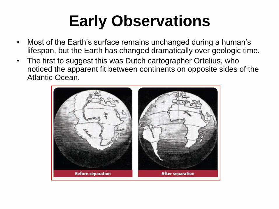
Early Observations
• Most of the Earth’s surface remains unchanged during a human’s lifespan, but the Earth has changed dramatically over geologic time.
• The first to suggest this was Dutch cartographer Ortelius, who noticed the apparent fit between continents on opposite sides of the Atlantic Ocean.

Ortelius, Suess, & Wegener
Ortelius - Dutch
cartographer
who noticed the
similarities in
coastlines on
either side of the
Atlantic Ocean
(late 1500s)
was an Austrian
geologist, an
expert on the
geography of the
Alps - proposed
Gondwana &
Tethys Ocean
(1861)
Wegener -
astronomer
by schooling, well
versed in many
areas of science -
Continental Drift
& Pangaea
(1912)
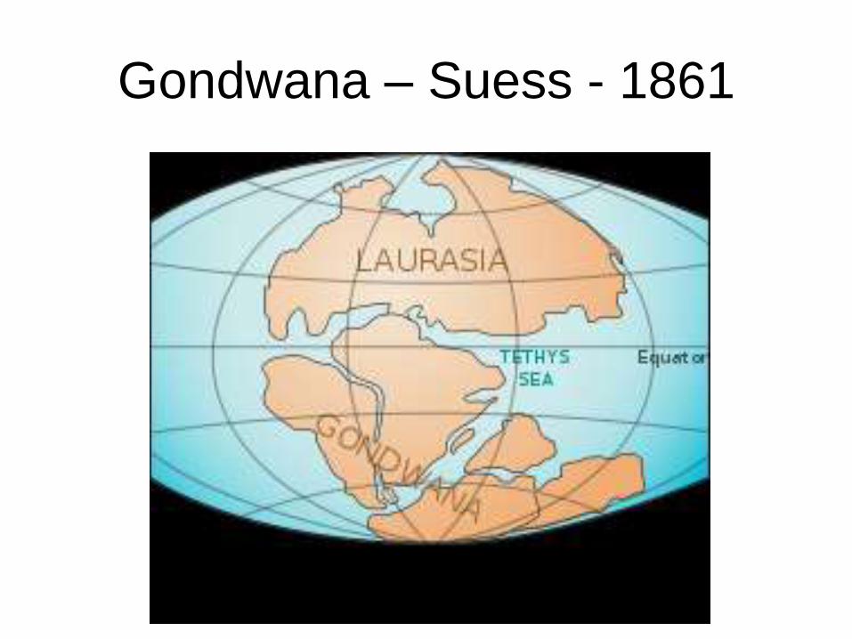
Gondwana – Suess - 1861

Continental Drift
• Wegener proposed that the Earth’s continents had once been joined as a supercontinent that broke apart. (1912)
• Wegener called his supercontinent Pangaea.
• He collected and organized rock, climatic, and fossil evidence to support his data.

Evidence from Rock Formations
• Wegener observed that many layers of
rock in the Appalachian Mountains in the
United States were identical to layers of
rock in Greenland and Europe.
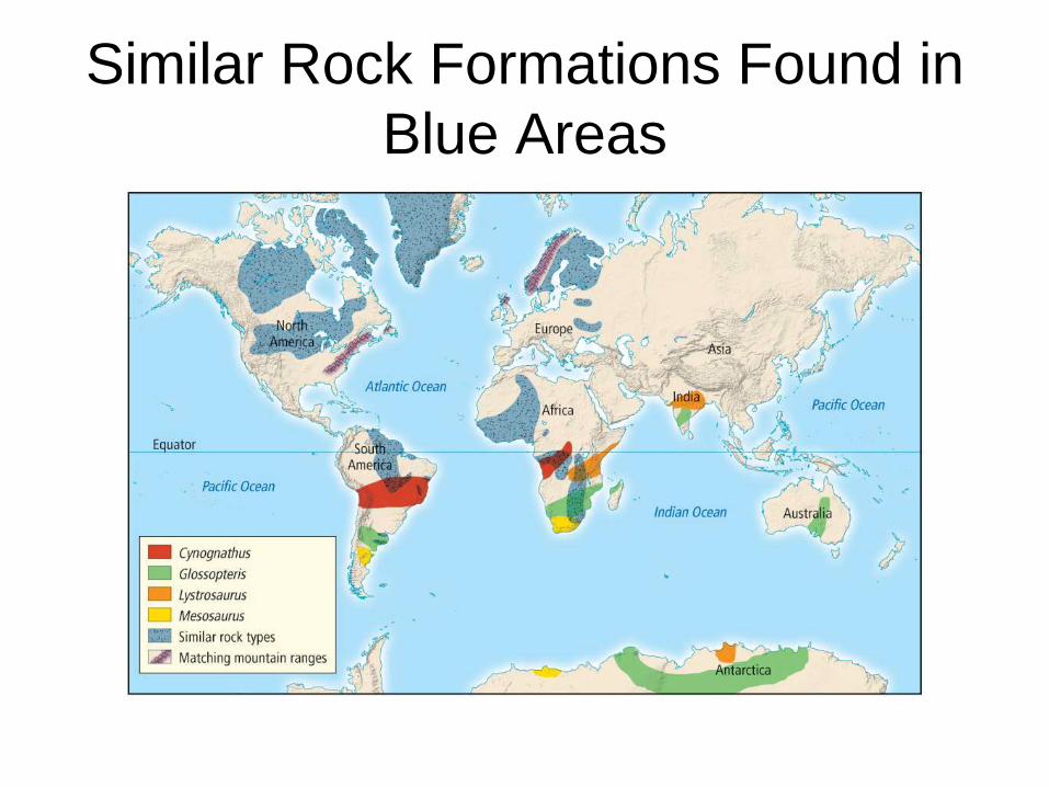
Similar Rock Formations Found in
Blue Areas

Evidence from Fossils
• Wegener also gathered similar fossils of
several different animals and plants that
once lived on or near land had been found
on widely separated continents. He
believed that this supported the hypothesis
of Pangaea.

Fossils from Identical Species
Found in Color Coded Areas

Climatic Evidence
• Wegener had a strong background in
meteorology, and recognized clues about
ancient climates. Found that a particular
fern (Glossopteris) was found spread
throughout the world where it should only
been in temperate climates. He reasoned
that these areas had temperate climates at
one point in time.

Coal Deposits
• Coal deposits were found in Antarctica
which shows that it once had a tropical
climate. Wegener used this as evidence
that climates of some continents had
changed considerably.
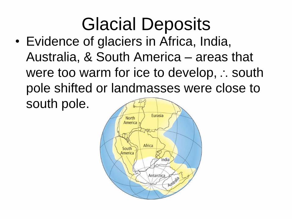
Glacial Deposits • Evidence of glaciers in Africa, India,
Australia, & South America – areas that
were too warm for ice to develop, south
pole shifted or landmasses were close to
south pole.
A Rejected Notion • Wegener’s ideas were not widely accepted
until the 1960’s.
• Why?
– no explanation how a force could be strong enough to move the landmasses
– no explanation of exactly how solid landmasses were moving through solid ocean crust
Seafloor Spreading
8th Grade Earth and Space
Science
Class Notes

Mapping the Ocean Floor
• Until the mid-1900s scientists assumed
the ocean floor was flat
• In the 1940s -1950s technology advanced
and showed this was hardly the case!
Mapping the Ocean Floor
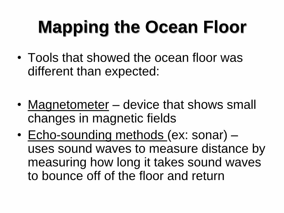
• Tools that showed the ocean floor was different than expected:
• Magnetometer – device that shows small changes in magnetic fields
• Echo-sounding methods (ex: sonar) – uses sound waves to measure distance by measuring how long it takes sound waves to bounce off of the floor and return

Magnetometer and Sonar
Magnetometer being towed
by a ship Sonar and Sonar Display Screen
Ocean Floor Topography
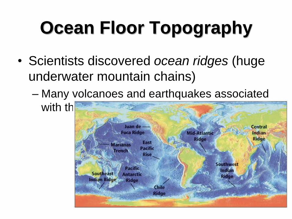
• Scientists discovered ocean ridges (huge
underwater mountain chains)
– Many volcanoes and earthquakes associated
with them
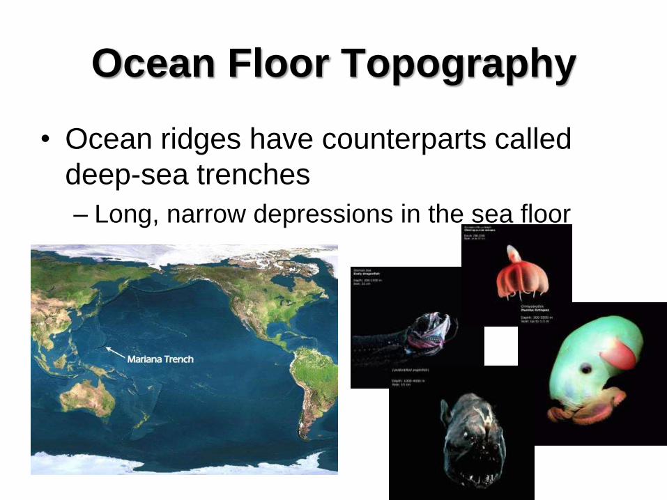
Ocean Floor Topography
• Ocean ridges have counterparts called
deep-sea trenches
– Long, narrow depressions in the sea floor

Ocean Rocks and Sediments
• The ages of rocks vary in a predictable
way across the sea floor.
– Near ocean ridge = younger
– Age of crust increases with distance from the
ridge
– Ocean-floor rocks are geologically young
(180 million years old compared in 3.8 billion)

Oceanic Rocks and Sediments • Ocean-floor sediments are a few hundred
meters thick compared to continents which
are as much as 20 km thick.
• Thickness varies with distance
from the ocean ridge.
– Closer to ridge = thinner
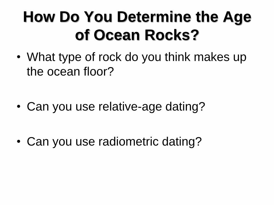
How Do You Determine the Age
of Ocean Rocks?
• What type of rock do you think makes up
the ocean floor?
• Can you use relative-age dating?
• Can you use radiometric dating?

The Earth’s Magnetic Field
• The Earth is surrounded by a magnetic
field.
• Caused by flow of molten iron in the outer
core.
• Field can be reversed if direction of flow
reverses.
• Reversal has occurred
many times in the Earth’s
history.
Magnetic Polarity Time Scale
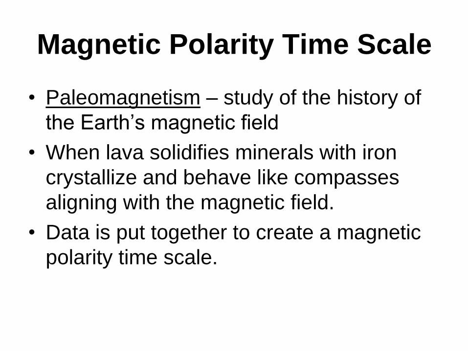
• Paleomagnetism – study of the history of
the Earth’s magnetic field
• When lava solidifies minerals with iron
crystallize and behave like compasses
aligning with the magnetic field.
• Data is put together to create a magnetic
polarity time scale.

Magnetic Polarity Time Scale

Magnetic Symmetry
• Oceanic crust is mostly basaltic with large amounts of iron.
• Therefore, oceanic crust shows a record of magnetic reversals.
• Scientists found regions with normal and reverse polarity formed a series of stripes across the floor parallel to the ocean ridges.
• Also, the ages and widths of the stripes matched from one side of the ridges to the other.

Magnetic Symmetry

Magnetic Symmetry
• By matching the patterns of the seafloor to
the known patterns of reversal on land
scientists can date the oceanic rocks.
• Isochron maps – use imaginary lines to
show points that are the same age
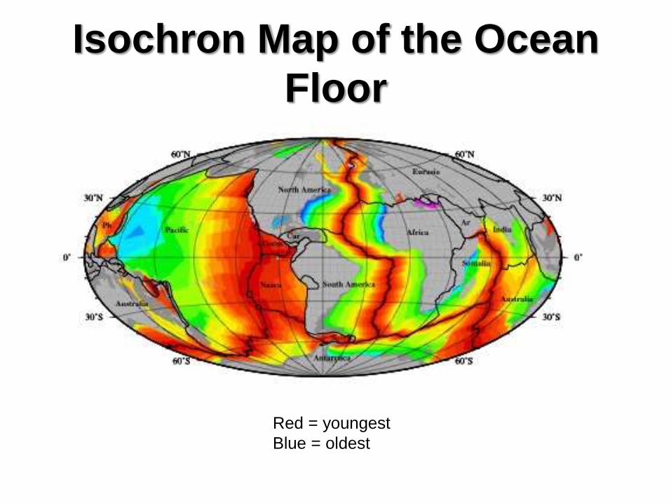
Isochron Map of the Ocean
Floor
Red = youngest
Blue = oldest

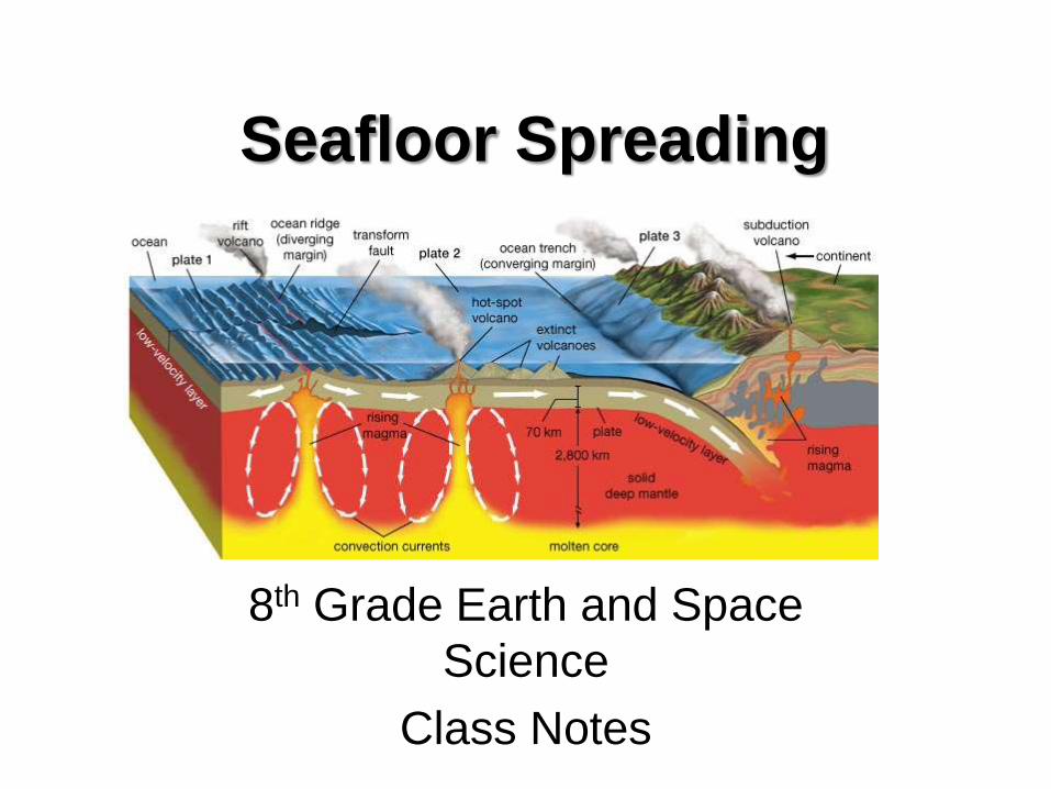
Seafloor Spreading
• Topographic, sedimentary, and
paleomagnetic data was put together to
form the theory of seafloor spreading.
• Seafloor spreading explains how new
ocean crust is formed at ocean ridges and
destroyed at deep sea trenches.
Seafloor Spreading
• Magma is forced toward the surface of the
crust along an ocean ridge.
• As the two sides of the ridge spread apart,
the rising magma fills the gap that is
created.
• When the magma solidifies, a small
amount of new ocean floor is added to
Earth’s surface.

Seafloor Spreading
• As spreading along an ocean ridge
continues, more magma is forced upward
and solidifies.
• The cycle of spreading and the intrusion of
magma continues the formation of ocean
floor, which slowly moves away from the
ridge.

Seafloor Spreading
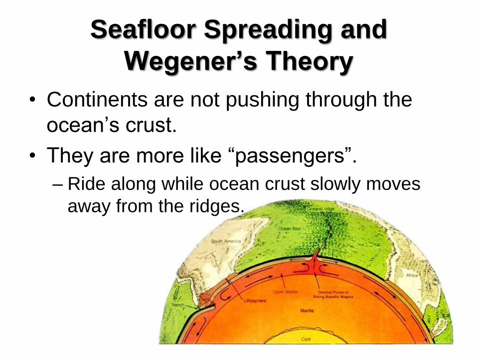
Seafloor Spreading and
Wegener’s Theory
• Continents are not pushing through the
ocean’s crust.
• They are more like “passengers”.
– Ride along while ocean crust slowly moves
away from the ridges.

Plate Tectonics - Sections 17.3 & 17.4

Part 1 – Seafloor Spreading

An Underwater Surprise
• Until the mid-1900s, many scientists thought that the ocean floors were essentially flat and that oceanic crust was unchanging and was much older than continental crust.
• Advances in technology during the 1940s and 1950s showed that all of these widely accepted ideas were incorrect. – Magnetometers
– Sonar
– Studies of magnetic reversals
Ocean Floor Topography
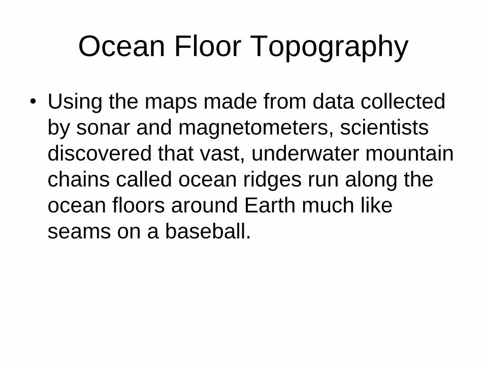
• Using the maps made from data collected
by sonar and magnetometers, scientists
discovered that vast, underwater mountain
chains called ocean ridges run along the
ocean floors around Earth much like
seams on a baseball.

Ocean Floor Topography • Maps generated with sonar data revealed
that underwater mountain chains had
counterparts called deep-sea trenches.
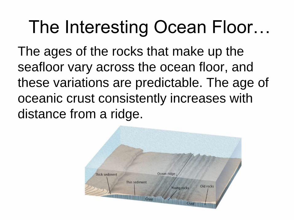
The Interesting Ocean Floor…
The ages of the rocks that make up the
seafloor vary across the ocean floor, and
these variations are predictable. The age of
oceanic crust consistently increases with
distance from a ridge.

What Does It Mean?
• Ocean-floor sediments are typically a few
hundred meters thick. Large areas of
continents, on the other hand, are
blanketed with sedimentary rocks that are
as much as 20 km thick.
• How is this possible?

Seafloor Spreading

Seafloor Spreading
• During seafloor spreading, magma, which is
hotter and less dense than surrounding mantle
material, is forced toward the surface of the crust
along an ocean ridge.
• As the two sides of the ridge spread apart, the
rising magma fills the gap that is created. When
the magma solidifies, a small amount of new
ocean floor is added to Earth’s surface.
Seafloor Spreading
• As spreading along an ocean ridge
continues, more magma is forced upward
and solidifies.
• The cycle of spreading and the intrusion of
magma continues the formation of ocean
floor, which slowly moves away from the
ridge.

Part 2 – Plate Boundaries

Theory of Plate Tectonics
• Tectonic plates are huge pieces of crust
and rigid upper mantle that fit together at
their edges to cover Earth’s surface.
Theory of Plate Tectonics
• Plate tectonics is the theory that describes
how tectonic plates move and shape
Earth’s surface.
• They move in different directions and at
different rates relative to one another, and
they interact with one another at their
boundaries.
Types of Plate Boundaries
• Divergent Boundaries
• Convergent Boundaries
• Transform Boundaries

Divergent Boundaries
• Regions where two tectonic plates are moving
apart are called divergent boundaries.
• Most divergent boundaries are found along the
seafloor in rift valleys. The formation of new
ocean crust at most divergent boundaries
accounts for the high heat flow, volcanism, and
earthquakes associated with these boundaries.

Divergent Boundaries • Some divergent boundaries form on
continents. When continental crust begins
to separate, the stretched crust forms a
long, narrow depression called a rift
valley.
Convergent Boundaries
• At convergent boundaries, two tectonic plates are moving toward each other.
• When two plates collide, the denser plate eventually descends below the other, less-dense plate in a process called subduction.
• There are three types of convergent boundaries, classified according to the type of crust involved. The differences in density of the crustal material affect how they converge.

Type 1 – Oceanic-Oceanic
• In the oceanic-oceanic convergent
boundary, a subduction zone is formed
when one oceanic plate, which is denser
as a result of cooling, descends below
another oceanic plate.
• The process of subduction creates an
ocean trench.

Type 1 – Oceanic-Oceanic
• In an oceanic-oceanic convergent boundary,
water carried into Earth by the subducting plate
lowers the melting temperature of the plate,
causing it to melt at shallower depths.
• The molten material is less dense so it rises
back to the surface, where it often erupts and
forms an arc of volcanic islands that parallel the
trench.

Oceanic-Oceanic
Type 2 – Oceanic-Continental
• When an oceanic plate converges with a
continental plate, the denser oceanic plate
is subducted.
• Oceanic-continental convergence
produces a trench and volcanic arc. The
result is a mountain range with many
volcanoes.
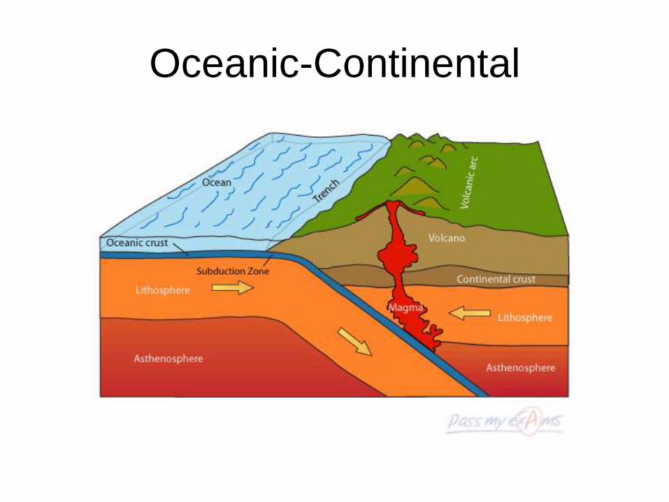
Oceanic-Continental
Type 3 – Continental-Continental
• Continental-continental boundaries form
when two continental plates collide, long
after an oceanic plate has converged with
a continental plate.
• This forms a vast mountain range, such as
the Himalayas.

Continental-Continental

Transform Boundaries
• A region where two plates slide
horizontally past each other is a
transform boundary.

Transform Boundaries
• Transform boundaries are characterized
by long faults, sometimes hundreds of
kilometers in length, and by shallow
earthquakes.
• Most transform boundaries offset sections
of ocean ridges. Sometimes transform
boundaries occur on continents.
• San Andreas Fault is an example on land.

Part 3 – Causes of Plate
Movements

Convection
• Many scientists now think that large-scale motion in the mantle—Earth’s interior between the crust and the core—is the mechanism that drives the movement of tectonic plates.
• Convection is the transfer of thermal energy by the movement of heated material from one place to another.

Convection Currents
• The cooling of matter causes it to contract
slightly and increase in density. The
cooled matter then sinks as a result of
gravity. Warmed matter is then displaced
and forced to rise.
• This up-and-down flow produces a pattern
of motion called a convection current.
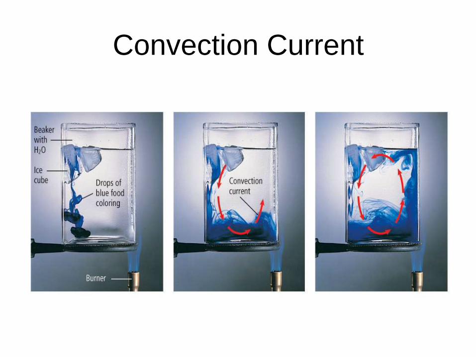
Convection Current

Convection in the Mantle • Convection currents develop in the mantle,
moving the crust and outermost part of the
mantle and transferring thermal energy
from Earth’s interior to its exterior.
Convection and Plate Movement
• The rising material in a convection current
spreads out as it reaches the upper mantle and
causes both upward and sideways forces, which
lift and split the lithosphere at divergent plate
boundaries.
• The downward part of a convection current
occurs where a sinking force pulls tectonic
plates downward at convergent boundaries.

Push and Pull
• Ridge push is the tectonic process
associated with convection currents in
Earth’s mantle that occurs when the
weight of an elevated ridge pushes an
oceanic plate toward a subduction zone.
Push and Pull
• Slab pull is the tectonic process
associated with convection currents in
Earth’s mantle that occurs as the weight of
the subducting plate pulls the trailing
lithosphere into a subduction zone.

Push & Pull


