13th Annual CAP LTER Poster Symposium · 13th Annual CAP LTER Poster Symposium Wednesday-Thursday...
27
13th Annual CAP LTER Poster Symposium Wednesday-Thursday January 12-13, 2011
Transcript of 13th Annual CAP LTER Poster Symposium · 13th Annual CAP LTER Poster Symposium Wednesday-Thursday...

13th Annual CAP LTERPoster SymposiumWednesday-Thursday January 12-13, 2011

1
CAP LTER Thirteenth Annual Poster Symposium
and All Scientists MeetingJanuary 12-13, 2010
Arizona Ballroom, Memorial Union
January 12, 2011Urban Sustainability: Phoenix and Beyond
2:00 pm WelcomeRick Shangraw Director, Global Institute of Sustainability, and Senior VicePresident for Knowledge Enterprise Development
2:15 pm CAP3 Overview and Introduction to the UrbanSustainability Intercity Initiative (USII)Dan Childers Lead PI and Director of CAP LTER; Professor, School ofSustainability
3:00 pm BES3 Overview and Ideas for the USIISteward PickettLead PI, Baltimore Ecosystem Study LTER, Cary Institute ofEcosystem Studies, Milbrook, NY
3:30 pm Urban Ecology in Miami and Ideas for the USIILaura OgdenLead PI, Florida Coastal Everglades LTER; Assistant Professor,Florida International University, Miami
4:00 pm Discussion
4:30 pm Celebration and Awards: 13 Years of CAP LTER
5:00 pm Adjournment for CAPpy Hour

2
January 13, 2011Poster Symposium
8:45 am Opening RemarksDan ChildersLead PI and Director, CAP LTER; Professor, School ofSustainability
9:00 am 1st Interactive Poster Session – Urban Spatial Dynamics
10:15 am Break
10:45 am 2nd Interactive Poster Session – Urban and Non-urban Habitats
12:00 pm Lunch on your own
1:30 pm 3rd Interactive Poster Session – Urban Energetics and Cycles
2:45 pm Break
3:15 pm 4th Interactive Poster Session – Urban Heat Island and Water
4:30 pm Closing Remarks
5:00 pm Adjournment to CAPpy Hour

3
2011 CAP LTER Symposium
Posters are listed alphabetically by first author with poster location number in parentheses.
Poster Session #1 – 9:00-10:15 amUrban Spatial Dynamics
Poster Session #2 – 10:45 am-NoonUrban and Non-urban Habitats
Bleasdale et al. (1) Banville and Bateman (10)
Crouch et al. (2) Davies and Deviche (11)
Frisk and Larson (3) Gade (12)
Hale, A., and Talen (4) Johnson et al. (13)
Kim and Wentz (5) Johnson et al. (14)
Sayles et al. (6) Lerman et al. (15)
Sovick (7) Lettsome and Bateman (16)
Taylor (8) Ripplinger and Franklin (17)
Zhang, C., et al. (9) Shoumaker et al. (18)
Trubl et al. (19)
Zhang, S. (20)
Poster Session #3 – 1:30-2:45 pmUrban Energetics and Cycles
Poster Session #4 – 3:15-4:30 pmUrban Heat Island and Water
Chapman and Warner (21) Ackley (29)
Frijia et al. (22) Elser et al. (30)
Gifford and Westerhoff (23) Middell et al. (31)
Hale, R., et al. (24) Ruddell et al. (32)
Hamilton and Hartnett (25) Sampson and Sailor (33)
Metson et al. (26) Tuccillo (34)
Turnbull et al. (27) Wutich et al. (35)
Warner et al. (28)

4
Speaker Bios
Steward Pickett is a Distinguished Senior Scientist and plant ecologist at theInstitute of Ecosystem Studies, in Millbrook, New York. He was awarded thePhD by the University of Illinois in 1977. He directs the Baltimore EcosystemStudy Long-Term Ecological Research program. His research focuses on theecological structure of urban areas and the temporal dynamics of vegetation.He has written books on ecological heterogeneity, humans as components ofecosystems, conservation, and the philosophy of ecology.
Laura Ogden is an Associate Professor of Anthropology in the Department ofGlobal & Sociocultural Studies at Florida International University. Herresearch focuses on the political ecology of environmental change andrestoration in the Florida Everglades. She is serving as Interim PI for theFlorida Coastal Everglades Long-Term Ecological Research program. Herbook, Swamplife: People, Gators and Mangroves Entangled in theEverglades, is forthcoming (Spring 2011, University of Minnesota Press).
5
List of Posters
URBAN SPATIAL DYNAMICS
Bleasdale Thomas, Carolyn Crouch, and Sharon Harlan. Community gardening indisadvantaged neighborhoods in Phoenix, Arizona: Aligning programs withperceptions.
Crouch, Carolyn, Phoenix Revitalization Corporation, and Sharon Harlan. Community foodresource mapping in central city south, Phoenix: An exploratory study ofcommunity capacity building.
Frisk, Erin, and Kelli Larson. Developing and implementing sustainability educationthrough the integration of behavioral science.
Hale, Anne, and Emily Talen. Analysis of zoning changes–Phoenix AZ.
Kim, Won Kyung, and Elizabeth A. Wentz. Re-examining the definition of urban openspace using fuzzy set theory.
Sayles, Jessie S., Elizabeth M. Cook, Kelli L. Larson, and Sharon J. Hall. The influence ofenvironmental values, urban structure, and neighborhood context on household-level biodiversity and plant composition.
Sovik, Brian R. A spatial-temporal representation of land subsidence in thenorthwest Phoenix valley, Arizona.
Taylor, Carissa. Participation in and accessibility of Arizona's urban farmers'markets: An institutional analysis of farmers' market sustainability.
Zhang, Chi, Nancy Grimm, J. Wu, Melissa McHale, Xiaoli Dong, and Yun Ouyang. Modelingthe structure and functions of human-dominated terrestrial ecosystems with ahierarchical patch dynamics approach.
URBAN AND NONURBAN HABITATS
Banville, Melanie, and Heather Bateman. Herpetofauna and microhabitatcharacteristics of urban and wildland reaches along the Salt River, Arizona.
Davies, Scott, and Pierre Deviche. Does urbanization influence the timing of seasonalbreeding and the effect of stress on the reproductive physiology of a SonoranDesert songbird?
Gade, Kris. Roadside maintenance practices influence plant migration alongfreeways.
Johnson, J. Chadwick, Gina M. Hupton, Dianna Bonney, and Monica Elser. The web ofinquiry: Urban black widow behavior as a tool to teach the scientific process.

6
Johnson, J. Chadwick, Meghan Still, and Theresa Gburek. Conspecific silk cues shape thehabitat preferences of black widows.
Lerman, Susanne B., V. Kelly Turner, and Christofer Bang. Linking homeownersassociations with biodiversity: A case study in Phoenix, AZ.
Lettsome, Olivia, and Heather Bateman. Avian communities from urban and non-urbanriparian habitats.
Ripplinger, Julie, and Janet Franklin. Spatiotemporal patterns of dominant plantspecies in CAP LTER.
Shoumaker, Tracy C., Jianguo Wu, Carol Chambers, and Andrew Smith. Effects ofurbanization on bat community structure in the Phoenix metropolitan region: Amulti-scale perspective.
Trubl, Patricia, Theresa Gburek, Lindsay Miles, and J. Chadwick Johnson. Black widows inan urban desert: Population variation in an urban pest across metropolitanPhoenix.
Zhang, Sainan, Christopher G. Boone, and Abigail M. York. Impacts of landfragmentation on biodiversity in the Phoenix metropolitan region.
URBAN ENERGETICS AND CYCLES
Chapman, Eric, and Benjamin Warner. Foreseeing critical phosphorus cycle transitionsin constructed wetlands: Applied to the new Tres Rios arid-land constructedwetlands with the City of Phoenix.
Frijia, Stephanie, Eric Williams, Subhrajit Guhathakurta, and Ariane Middel. Scalingbehavior of the life cycle energy of residential building and impacts on greenhousegas emissions.
Gifford, J. Mac, and P. K. Westerhoff. Making biofuel renewable: Recoveringphosphorus from residual biomass.
Hale, Rebecca, Laura Turnbull, Stevan Earl, and Nancy Grimm. Effects of urbanstormwater infrastructure and spatial scale on nutrient export and runoff fromsemi-arid urban catchments.
Hamilton, Alex, and Hilairy Hartnett. Chemical structure and functionality of blackcarbon in central Arizona soil.
Metson, Genevieve, Jessica Corman, Elizabeth Cook, Rebecca Hale, David Iwaniec, andChristopher Galletti. Nutrient movements in human environment interactions:Phosphorus in Phoenix.
Turnbull, Laura, Daniel L. Childers, Rebecca Hale, Enrique Vivoni, Stevan Earl, and Nancy B.Grimm. Ecosystem structure and hydrologic function of urban deserts.

7
Warner, Benjamin, Daniel Childers, and Laura Turnbull. Hydrology versus ecology: Theeffectiveness of constructed wetlands for wastewater treatment in a semi-aridclimate.
URBAN HEAT ISLAND AND WATER
Ackley, J. W. Off the sand and onto the asphalt: Does the urban heat island impactdesert lizards?
Elser, Monica, Tirupalavanam Ganesh, Sharon Harlan, Gina Hupton, Dulce Medina, and ElenaOrtiz. Creating a cross-disciplinary unit for middle school children on the urbanheat island.
Middel, Ariane, Anthony Brazel, Patricia Gober, Soe Myint, Heejun Chang, and Jiunn-DerDuh. Impacts of weather variability on turbulent heat fluxes in Phoenix, AZ andPortland, OR.
Ruddell, Darren M., Anthony Brazel, Juan Declet, P. Grady Dixon, Patricia Gober, SusanneGrossman-Clarke, Sharon L. Harlan, Scott Kelley, and Elizabeth Wentz. EnvironmentalTradeoffs in a desert city: An investigation of water use, energy consumption, andlocal air temperature in Phoenix, AZ. Sampson, David, and David Sailor. Coupled energy and water use in the PhoenixMetro Area as influenced by drought and climate change; empirical observationsand simulation analyses.
Tuccillo, Joseph. Water allocation and settlement pattern morphologies in the earlySalt River Project, 1902-1968.
Wutich, Amber, Alexandra Brewis, Sveinn Sigurdsson, Rhian Stotts, and Abigail York.Fairness and the human right to water: A preliminary cross-cultural theory.

8
Abstracts
All abstracts are listed alphabetically by first author. * indicates student poster.
*Ackley, J. W. Off the sand and onto the asphalt: Does the urban heat islandimpact desert lizards?
Climate change has dire implications for many ectotherms. Lizards prefer a narrow rangeof the environmental temperature distribution in most habitats; this limits their activity inspace and time. In winter, global warming could benefit lizards by allowing for shorterhibernations. But in summer, an increase of 1-2EC can greatly restrict daily lizard activity,often below a threshold required to obtain enough energy for survival and reproduction. As aresult, climate change may drive 40% of lizard populations extinct by 2080. This assumeslizards will not adapt by dispersing to cooler areas or shifting their activity time to coolerseasons. Such assumptions can be tested in cities like Phoenix, AZ. Here, roads limitdispersal and contribute to a spatially and temporally heterogeneous urban heat island (UHI)effect, which averages +4EC and can locally exceed +10EC at night. I will integrate ecology,physiology, behavior, and climatology to achieve a better understanding how lizards adapt toPhoenix's existing UHI. This will also help us predict the future consequences of climatechange for the distribution and abundance of organisms.
Goals of Proposed Research: (1) Measure the spatial and temporal structure of the UHIat scales relevant to thermoregulating lizards. (2) Identify how elevated temperatureimpacts behavior, population dynamics, and community structure. (3) Determine the relativesignificance of non-thermal urban variables. (4) Collect data and disseminate managementimplications with the help of local herpetology clubs and Arizona Game and Fish.
School of Life Sciences, Arizona State University, PO Box 874501, Tempe, AZ 85287-4501
*Banville, M., and H. Bateman. Herpetofauna and microhabitat characteristics ofurban and wildland reaches along the Salt River, Arizona.
Urbanization can alter vegetation structure and composition, affecting habitat suitabilityfor many wildlife species. Herpetofauna can be good indicators of structural changesoccurring in the environment. We evaluated herpetofauna abundance, species richness, anddiversity as well as microhabitat characteristics from three reaches along the Salt River,Arizona. The wildland reach is located in the Tonto National Forest and two urban reachesare located within the greater Phoenix area. One urban reach has been recently rehabilitatedand the second is highly disturbed. We predict that more structural diversity of microhabitatand lower urbanization will favor herpetofauna abundance, richness, and diversity. At eachreach, we performed visual surveys for herpetofauna along eight transects (n=24) todetermine species presence and relative abundance. Microhabitat characteristics such asground substrate, vegetative cover, woody debris, and plant species richness werequantified along each transect and preliminary results show significant differences amongreaches. Preliminary results also show significant differences for herpetofauna speciesrichness among all reaches with wildland reach having the highest species richness andurban disturbed reach the lowest. The Shannon-Wiener diversity index was significantlygreater at the wildland reach; whereas, diversity along the two urban reaches did not differ.Abundance of herpetofauna was approximately six times lower along the urban disturbedreach compared to the wildland and urban rehabilitated reaches, which did not differ. Further analyses will identify correlations among microhabitat characteristics andherpetofauna community-level variables. Preliminary results suggest that rehabilitation

9
efforts may be beneficial for herpetofauna abundance and that urbanization may negativelyinfluence herpetofauna diversity.
Department of Applied Sciences and Mathematics, Arizona State University Polytechnic , 6073 S BackusMall, Mesa AZ 85212
*Bleasdale T.1, C. Crouch2, and S. Harlan1. Community gardening in disadvantagedneighborhoods in Phoenix, Arizona: Aligning programs with perceptions.
This study examines a struggling community gardening program in an economicallydisadvantaged minority area of south-central Phoenix, Arizona. The gardening programexists within a larger resident-driven local food initiative. The goals of the local food initiativeare to create a sustainable source of food, income, and social cohesion within thecommunity. The objective of the study is to determine what factors are inhibiting the successof the gardening program. We used informal and semi-structured interviews and participantobservation to design an exploratory survey, which was administered to 149 residents at acommunity fair in March 2010. The survey allowed us to analyze neighborhood perceptionsof benefits and burdens associated with maintaining the community gardens. We comparedperceptions of gardening among three groups of survey respondents: neighborhoodresidents who are currently engaged in gardening, residents who have gardened but are nolonger active, and those who are interested in community gardening but have notparticipated in the program (potential gardeners). Results indicate these groups of residentsdo not conceptualize community gardens similarly to each other and that their perceptions ofthe benefits of gardening differ from the goals of the larger local food initiative in someimportant ways. If community gardens and local food initiatives are to succeed, they mustalign themselves with neighborhood perceptions or align the residents with the program'sgoals through education.
1School of Human Evolution and Social Change, Arizona State University, P.O. Box 872402, Tempe, AZ85287-2402; 2School of Sustainability, Arizona State University, PO Box 875502, Tempe, AZ 85287-5502
*Chapman, E.1, and B. Warner2. Foreseeing critical phosphorus cycle transitions inconstructed wetlands: Applied to the new Tres Rios arid-land constructed wetlandswith the City of Phoenix.
Constructed wetland ecosystem design and management plans often do not provide thenecessary insight into phosphorus (P) cycle dynamics to allow regulatory and managementagencies to foresee and adapt to system changes in order to maintain P removal rates asrequired by law. Insights into critical transitions in wetlands to steady-state P cyclingincorporate complexity and will add useful focus into constructed wetland managementplans. These insights will allow for better design and management of constructed wetlandecosystems. Three objectives exist within the scope of this project: (1) the results of adynamic systems model (the Kadlec-Knight K-C* Dynamic Model) will be compared tosample data from the new City of Phoenix Tres Rios constructed wetland system tounderstand the relationship between nutrient uptake and nutrient release by biomass decay,specifically the rate of a modeled 'critical slow down' in state variables will be comparedagainst sample results; (2) the relationship between the CAP LTER community and the Cityof Phoenix Water Department will be developed through the co-production of research, inline with CAP LTER III objectives; and (3) a working database will be created to synthesizewetland sample data collected by the City of Phoenix Water Department over the pastdecade to compare experimental results to a larger temporal scale. The City of PhoenixWater Department recently constructed the Tres Rios wetland system to improve the
10
performance of their 91st Avenue Wastewater Treatment Plant and meet new water qualitystandards issued by the Arizona Department of Environmental Quality.
1School of Life Sciences, Arizona State University, PO Box 874501, Tempe AZ 85287-4501; 2School ofSustainability, Arizona State University, PO Box 875502, Tempe AZ 85287-5502
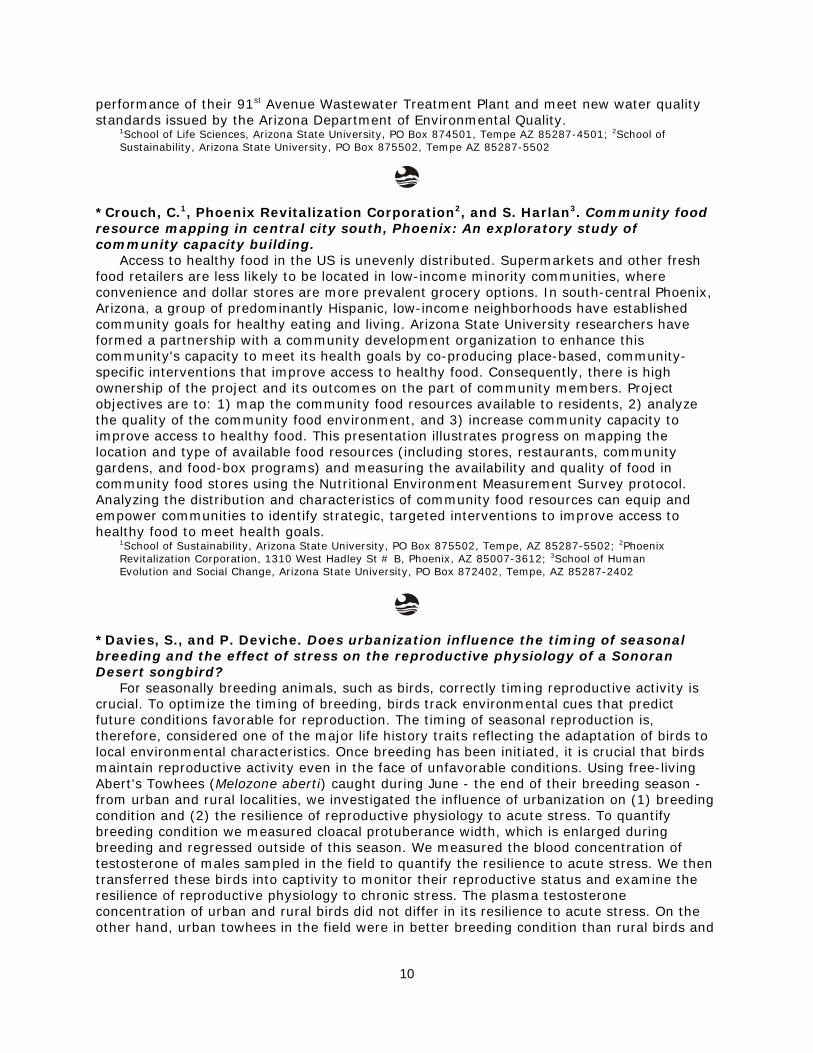
*Crouch, C.1, Phoenix Revitalization Corporation2, and S. Harlan3. Community foodresource mapping in central city south, Phoenix: An exploratory study ofcommunity capacity building.
Access to healthy food in the US is unevenly distributed. Supermarkets and other freshfood retailers are less likely to be located in low-income minority communities, whereconvenience and dollar stores are more prevalent grocery options. In south-central Phoenix,Arizona, a group of predominantly Hispanic, low-income neighborhoods have establishedcommunity goals for healthy eating and living. Arizona State University researchers haveformed a partnership with a community development organization to enhance thiscommunity's capacity to meet its health goals by co-producing place-based, community-specific interventions that improve access to healthy food. Consequently, there is highownership of the project and its outcomes on the part of community members. Projectobjectives are to: 1) map the community food resources available to residents, 2) analyzethe quality of the community food environment, and 3) increase community capacity toimprove access to healthy food. This presentation illustrates progress on mapping thelocation and type of available food resources (including stores, restaurants, communitygardens, and food-box programs) and measuring the availability and quality of food incommunity food stores using the Nutritional Environment Measurement Survey protocol.Analyzing the distribution and characteristics of community food resources can equip andempower communities to identify strategic, targeted interventions to improve access tohealthy food to meet health goals.
1School of Sustainability, Arizona State University, PO Box 875502, Tempe, AZ 85287-5502; 2PhoenixRevitalization Corporation, 1310 West Hadley St # B, Phoenix, AZ 85007-3612; 3School of HumanEvolution and Social Change, Arizona State University, PO Box 872402, Tempe, AZ 85287-2402
*Davies, S., and P. Deviche. Does urbanization influence the timing of seasonalbreeding and the effect of stress on the reproductive physiology of a SonoranDesert songbird?
For seasonally breeding animals, such as birds, correctly timing reproductive activity iscrucial. To optimize the timing of breeding, birds track environmental cues that predictfuture conditions favorable for reproduction. The timing of seasonal reproduction is,therefore, considered one of the major life history traits reflecting the adaptation of birds tolocal environmental characteristics. Once breeding has been initiated, it is crucial that birdsmaintain reproductive activity even in the face of unfavorable conditions. Using free-livingAbert's Towhees (Melozone aberti) caught during June - the end of their breeding season -from urban and rural localities, we investigated the influence of urbanization on (1) breedingcondition and (2) the resilience of reproductive physiology to acute stress. To quantifybreeding condition we measured cloacal protuberance width, which is enlarged duringbreeding and regressed outside of this season. We measured the blood concentration oftestosterone of males sampled in the field to quantify the resilience to acute stress. We thentransferred these birds into captivity to monitor their reproductive status and examine theresilience of reproductive physiology to chronic stress. The plasma testosteroneconcentration of urban and rural birds did not differ in its resilience to acute stress. On theother hand, urban towhees in the field were in better breeding condition than rural birds and

11
this disparity persisted in captivity. Chronic stress had no influence on testosterone. Thus,urbanization prolongs seasonal breeding in urban Abert's Towhees, which suggests thaturbanization may influence the environmental cues used by birds to time their seasonalreproduction.
School of Life Sciences, Arizona State University, PO Box 874501, Tempe, AZ 85287-4501
Elser, M.1, T. Ganesh2, S. Harlan3, G. Hupton1, D. Medina4, and E. Ortiz5. Creating across-disciplinary unit for middle school children on the urban heat island.
We will present our efforts to create and implement a 7/8th grade unit focusing on theUrban Heat Island that involved input from natural scientists associated with CAP LTER,social scientists associated with the NSF-funded Urban Vulnerability to Climate Changeproject, and engineering education faculty associated with an NSF-funded InnovativeTechnology Experiences for Students and Teachers grant. Various components of the unitwere tested in after-school programs and in the Junior Ace program of Phoenix College.
1Global Institute of Sustainability, Arizona State University, PO Box 875402, Tempe, AZ 85287-5402;2School for Engineering of Matter, Transport, & Energy, Ira A. Fulton Schools of Engineering, Arizona StateUniversity, PO Box 876106, Tempe, AZ 85287-6106; 3School of Human Evolution and Social Change,Arizona State University, PO Box 872402, Tempe, AZ 85287-2402; 4School of Social and Family Dynamics,Arizona State University, PO Box 873701, Tempe, Az 85287-3701; and 5Biosciences Department, PhoenixCollege, 1202 W. Thomas Rd., Phoenix, AZ 85013
*Frijia, S., E. Williams1, S. Guhathakurta2, and A. Middel3. Scaling behavior of thelife cycle energy of residential building and impacts on greenhouse gas emissions.
Environmental life cycle assessment (LCA) has been increasingly used in studiesexamining sustainable urban forms to evaluate impacts of urbanization on resources and onthe environment. Typically LCA for residential buildings includes the total energy consumed"within a building," which is considered the operational energy use phase, and energy usedduring the construction energy use phase. The anthropogenic operational phase ofresidential buildings is significantly higher than the construction phases as a source ofenvironmental impacts. However, the scalability of life cycle energy as a function of buildingsize has not been analyzed systematically so far. Our case study investigates the scalingbehavior of the life cycle assessment as a function of building size and number of stories fordetached single family and multi-family residential homes within a unified modelingframework. We use an economic hybrid life cycle assessment to estimate constructionimpacts on energy consumption and greenhouse gas emissions. This approach combines abreakdown of producer prices of individual construction material assemblies with aneconomic input-output analysis. Results suggest that energy use for the construction phasescales more slowly as a function of size than the operation phase. Thus, the share of theconstruction phase in the life cycle is smaller for larger homes. The energy scaling behaviorfor residential houses can be integrated into a larger model to assess the environmentalimpacts of different urban form on greenhouse gas emission and energy use.
1School of Sustainable Engineering and the Built Environment, Arizona State University, PO Box 875306,Tempe, AZ 85287-5306; 2School of Geographical Sciences and Urban Planning, Arizona State University,PO Box 875302, Tempe, AZ 85287-5302; 3Global Institute of Sustainability, Arizona State University, POBox 875402, Tempe, AZ 852875402
12
*Frisk, E.1, and K. Larson1,2. Developing and implementing sustainability educationthrough the integration of behavioral science.
As the urgency to address environmental, social, and economic challenges increases,education continues to be seen as a central part of the solution. In 1997, UNESCO issued areport declaring: "education is the most effective means that society possesses forconfronting the challenges of the future. Indeed, education will shape the world oftomorrow" (1997:17). In order for education to be a fundamental part of the solution,educational practices must motivate behavioral change. Therefore, the driving question forthis research is: How can we motivate sustainable behavioral change through educationalprograms?
This research will provide insights to three fields of literature (and practice) which areseldom considered concurrently – educational pedagogy, behavioral change, andsustainability science – through the development of educational principles and practices thatpromote sustainable change. The framework we develop will be applied to (1) an extensivesurvey of high school students regarding their declarative, procedural, effectiveness, andsocial knowledge as its relates to urban sustainability; (2) an intensive program for highschool students that utilizes the knowledge domains to educate for sustainable change. Theprogram will be held in collaboration with SOS, GK-12, and STEM College-for-Kids program,and Phoenix Metropolitan K-12 teachers (summer 2011) and will focus on issues of urbansustainability.
This research will further CAP-LTER's goals of bringing "ecology into sustainabilityeducation" while also raising awareness of sustainability challenges among students andteachers.
1School of Sustainability, Arizona State University, PO Box 875502, Tempe, AZ 85287-5502; 2School ofGeographical Science and Urban Planning, Arizona State University, PO Box 875302, Tempe, AZ 85287-5302
Gade, K. Roadside maintenance practices influence plant migration alongfreeways.
General ecological thought regarding plant biology and urban areas has rested on twopotentially contradictory assumptions. The first is that non-native plants spread easily fromhuman developments to "pristine" areas. The second is that native plants cannot dispersethrough developed areas. Both assume anthropogenic changes to ecosystems createconditions that favor non-native plants and hinder native species. However, it is likely thatanthropogenic alterations of habitats will favor groups of plant species with similar functionaltraits, whether native or not.
Migration of plants can be divided into the following stages: dispersal, germination,establishment, reproduction and spread. Functional traits of species determine which aremost successful at each of the stages of invasion or range enlargement. I studied the traitsthat allow both native and non-native plant species to disperse into freeway corridors,germinate, establish, reproduce, and then disperse along those corridors in Phoenix,Arizona. Field methods included seed bank sample collection and germination, vegetationsurveys, and seed trapping. I also evaluated concentrations of plant-available nitrate as aresult of localized nitrogen deposition. While many plant species found on the roadsides areeither landscape varieties or typical weedy species, some uncommon native species andunexpected non-native species were also encountered. Maintenance regimes greatlyinfluence the amount of vegetative cover and species composition along roadsides.Understanding which traits permit success at various stages of the invasion process indicateswhether it is native, non-native, or species with particular traits that are likely to movethrough the city and establish in the desert.
AECOM, 2777 E Camelback Road, Suite 200, Phoenix, AZ 85016

13
*Gifford, J. M., and P. K. Westerhoff. Making biofuel renewable: Recoveringphosphorus from residual biomass.
Current energy consumption practices deplete fossil fuels, create greenhouse gases, andcontribute to global warming. Biofuel from phototrophic microbes like algae and bacteriaprovides a viable substitute. Lipids and fatty acids are produced from microorganisms, butare typically less than 40% of the biomass. Residual biomass includes nutrients, likephosphorus, which can be recycled in four steps to increase overall sustainability. First,cellular digestion converts organic phosphorus into inorganic species. Step two separates,captures, and concentrates it. Third, phosphorus is supplied to a new biomass crop. Finallylipids are extracted for biofuel. This poster presents research which improves biofuelsustainability by refining nutrient recycling focused on the first two steps.
The digestion step will be enhanced by laboratory testing various methods on biomasssamples of the same composition. The separation step refinement might includedevelopment of an ion exchange filter. Resins with specific affinity have shown great promisein wastewater nutrient recovery, but have yet to be examined for biomass applications. Theinputs, wastes, and rate of recovery from each digestion and separation method will bemeasured, ensuring overall sustainability improvement.
Nutrient recovery has additional applications in wastewater treatment and fertilizerproduction. Global phosphorus reserves are depleting. Wastewater treatment plant sludgemay be a renewable source of nutrients for fertilizer if they can adequately be captured,increasing food availability across the globe. Improved recovery techniques may also resultin reduced agriculture runoff, thereby reducing eutrophication of downstream water bodiesand maintaining quality of natural water resources.
School of Sustainable Engineering and the Built Environment, Arizona State University, PO Box 875306,Tempe, AZ 85287-5306
*Hale, A.1, and E. Talen2. Analysis of zoning changes–Phoenix AZ.The intention of this research project was to document zoning changes in Phoenix over
time. The project documents these changes in ten year intervals, beginning with a map ofthe 1930 zoning districts and ending with a present day (2008) map of zoning districts. Byprocess, these maps were transcribed from hard copies into ArcGIS, a mapping andgeographical analysis computer program.
Phoenix's original city boundary line from 1930 was the parameter for sampling the citieszoning changes in these ten year intervals. Although the city has since grown in size from itsoriginal 1930's form, this area proved to be a good sample of change, land developmentpatterns, and the complexity of zoning codes and reforms in Phoenix. This is exemplified inthe contrast between various historic images which document on the ground behaviorrelated to the research site.
As anticipated, the zoning changes moved from less complex zoning districts in the1930's (i.e., residential, commercial, and industrial) to multi-layered complex zoning districtsin 2008 (i.e., residential infill that uses underlying zoning, planned community districts,historic preservation overlays, etc). This shift towards complexity is also expressed withinPhoenix's building ordinances documents.
Several limitations and set backs were experienced in this research project. The City ofPhoenix has not preserved or documented historically the progression of its own zoningchanging and or decisions. In addition, a zoning map from the 1950's is not available to beadded to the research and data sets. Likewise, locating pictures that show the same scenethroughout the various decades has proven to be difficult.
14
1School of Sustainability, Arizona State University, PO Box 875402, Tempe, AZ 85287-5402; 2School ofGeographical Sciences and Urban Planning, Arizona State University, PO Box 875302, Tempe, AZ 85287-5302
*Hale, R.1, L. Turnbull2, S. Earl2, and N. Grimm1. Effects of urban stormwaterinfrastructure and spatial scale on nutrient export and runoff from semi-arid urbancatchments.
The modification of the land surface and hydrologic networks due to urbanization hasdriven changes in stormwater runoff processes and nutrient export to downstream systems.Previous research has focused on the effects of impervious areas and land cover, but therole of urban drainage infrastructure (engineered hydrologic networks) and spatial scale instormwater hydrology and biogeochemistry is largely unstudied. We measured rainfall anddischarge, and sampled stormwater runoff from 8 urban catchments with similar land use(urban residential) but differing drainage infrastructure (primarily surface runoff, pipes,washes, or retention basins), across eight spatial scales from 5 to 21,000 ha. We sampled 9storms during the 2010 summer monsoon season, for a total of 27 storm x catchmentevents. We analyzed stormwater samples for dissolved nitrogen, phosphorus, organiccarbon, and chloride. We found that patterns of nutrient export and discharge vary stronglywithin catchments due to storm characteristics, and between catchments due toinfrastructure type. Results show that the transport of dissolved and particulate N, P and Care governed primarily by flow characteristics, which vary depending on the extent and typeof stormwater infrastructure. Thus, changes in ecosystem structure resulting fromurbanization exert a major control over the dynamics of nutrient redistribution within thesecatchments.
1School of Life Sciences, Arizona State University, PO Box 4601, Tempe, AZ 85287-4601; 2Global Instituteof Sustainability, Arizona State University, PO Box 4502, Tempe, AZ 85286-4502
*Hamilton, A.1, and H. Hartnett1,2. Chemical structure and functionality of blackcarbon in central Arizona soil.
Black carbon (BC) is the product of incomplete combustion of fossil fuels and biomass.The amount of BC has been well quantified in aerosols and ocean sediments, however; littleis known about BC in a terrestrial urban setting. Since the BC global budget is unbalancedwith respect to sources and sinks, we propose that BC is undergoing bio-, chemical-, orphoto-degradation in soil. Since it is also known that BC is a significant portion of the organiccarbon in central Arizona soils (31%), it could play a major role in organic biogeochemicalprocesses in this area. In an attempt to understand the reactive nature of BC in soil, solid-and liquid-state nuclear magnetic resonance (NMR) is utilized to identify chemical functionalgroups of soil black and organic carbon. Preliminary results show that BC is primarilyaromatic (ring structure); however, there are indications that other functionality, such ascarbonyl (C=O) and alkene (C=C) groups, exists. Black carbon solubility experiments werealso completed using acid and aqueous soil extractions. Organic and black carbon wasdetected in extraction media using a total organic carbon (TOC) analyzer. Results indicatethat a portion of the BC in soil is water-soluble and therefore, could be more involved inbiogeochemical processes than previously thought.
1Department of Chemistry and Biochemistry, Arizona State University. PO Box 871604, Tempe, AZ85287-1604; 2School of Earth and Space Exploration, Arizona State University, PO Box 871404, Tempe,AZ 85287-1404
Johnson, J. C.1, G. M. Hupton2, D. Bonney3, and M. Elser2. The web of inquiry: Urbanblack widow behavior as a tool to teach the scientific process.

15
Hands-on inquiry is a major emphasis in K-12 science education, but how often dostudents design and conduct tests of their own ideas in the classroom? Here we present acollaborative effort between a CAP LTER research program and a middle school scienceclassroom. Specifically, students were introduced to the behavior and urban ecology of blackwidow spiders and encouraged to use their observations of black widow behavior to askquestions and formulate a testable hypothesis. This stage of hypothesis development can bethe greatest challenge for teachers and students. We facilitated this by encouraging studentsto build on their initial questions by further exploring the underlying independent variablesand refining their original question into a testable explanation. Students were excited tofocus intensively across an entire month on this engaging study species leading us toconclude that partnerships between K-12 classrooms and academic researchers canjump-start genuine inquiry projects. Lastly, it should be emphasized that the curriculum wepresent here is not unique to black widows, and can be implemented with any organismteachers are able to bring into the classroom.
1Division of Mathematical and Natural Sciences (2352), Arizona State University at the West Campus, 4701W. Thunderbird Rd, Glendale, AZ 85306; 2Ecology Explorers, Global Institute of Sustainability, ArizonaState University, PO Box 875402, Tempe, AZ 85827-5402; 3Orangewood Middle School, 7337 N. 19thAve,Phoenix, AZ 85021-7915
Johnson, J. C., M. Still, and T. Gburek. Conspecific silk cues shape the habitatpreferences of black widows.
The Western Black widow spider (Latrodectus hesperus) is a common pest that thrives indisturbed, urban habitat including the Phoenix metropolitan area. Widow spiders are both aspecies of medical importance owing to the danger their venom presents to human victims,and a common urban, agricultural and invasive pest species. However, relatively little isknown about the ecology of black widows. For example, habitat choices of web-buildingspiders like the black widow are critical as web construction is an energetically costlybehavior. While our lab has previously demonstrated that urban infestations of black widowsarise, in part, because spiders prefer to settle near chemical cues from prey, it's unclearwhat other factors promote high-density infestations of widow spiders in urban areas. Here,we indirectly tested the hypothesis that infestations are, in fact, aggregations of closerelatives by predicting that spiders would prefer to build webs in the presence of silk from afull sister. Instead, we found that, given the choice of related silk, unrelated silk, and no silk,black widows significantly preferred to settle where unrelated chemical cues were present.Thus, we found no evidence to support the contention that infestations are made up offamily groups, and instead found widow spiders to actively avoid chemical cues of siblings.We discuss the alternative hypothesis that benefits of urban family groups may beoutweighed by costs (e.g. increased risk of competing/cannibalizing a full sister). We alsodiscuss the anecdotal observation that abiotic factors, specifically the worst hail storm in 75years, led the majority of spiders to leave their web and settle in areas that were bestsheltered from heavy winds.
Division of Mathematical and Natural Sciences (2352), Arizona State University at the West Campus, 4701W. Thunderbird Rd, Glendale, AZ 85306
16
*Kim, W. K., and E. A. Wentz. Re-examining the definition of urban open spaceusing fuzzy set theory.
Urban open space is a key infrastructure to the quality of the urban environment andsustainable living in cities. Extensive research on urban open space shows that there areenvironmental, social, and economic benefits. Nevertheless, there is no standard definitionfor urban open space. Various factors, such as size, shape, diversity, greenness, facilities,and distribution, as well as the design and management of urban open spaces play adecisive role in defining urban open space and its function. This research suggests the newapproach to define urban open space to satisfy the demand for better understanding urbanopen space with different characteristics. Fuzzy set theory can be a solution to delineatemany phenomena, which are difficult to delineate because of vague definition and meaning.We develop a theoretical perspective of urban open space typology based on how theirattributes and elements of a configuration are connected to open space benefits. The dataused in this research include Quickbird satellite images and parcel data. Sample sites inPhoenix, Arizona are empirically investigated to test new theoretical concept for urban openspace. Multiple-factors representation is implemented to compare the approaches of binaryand fuzzy sets. Examining for a solution to mitigate urban heat island is complex becausemany variables of urban environment interact. The new definition of open spaces can beapplied to solve this problem. Our findings show how the theoretical perspective developedin this study allows for detailed and appropriate analyses for urban open space research.
School of Geographical Sciences and Urban Planning, Arizona State University, PO Box 875302, Tempe AZ85287-5302
*Lerman, S. B.1, V. K. Turner2, and C. Bang3. Linking homeowners associations withbiodiversity: A case study in Phoenix, AZ.
Residential yards and gardens have the potential to mitigate the loss of urbanbiodiversity if they can provide habitat for native wildlife. The approach humans employ tomanage yards and gardens is often at odds with natural processes and ecological function.For example, weed removal and pest control could have negative implications forground-dwelling arthropods and insectivorous birds. Homeowners' Associations (HOA)manage a significant proportion of residential landscapes in the Phoenix Metropolitan areathrough the authority of official Covenants, Conditions and Restrictions (CCR). The activemanagement of the yards might prove beneficial for native wildlife. We calculated native birdspecies diversity, insect diversity, and plant diversity at 39 PASS neighborhoods. Half ofthese neighborhoods belong to an HOA. We then compared plant, bird, and insect diversitybetween neighborhoods with and without an HOA. Neighborhoods belonging to an HOA hadsignificantly greater bird and plant diversity, though insect diversity did not differ. For theneighborhoods belonging to an HOA, we analyzed landscape form and managementpractices based on the CCR. We link these features with ecological function and suggest howto modify these management practices in ways to help improve conditions for native wildlife.We conclude with suggestions on how HOAs can incorporate strategies from the SustainableSites Initiative in order to help promote biodiversity in current and future HOAneighborhoods.
1Graduate Program in Organismic and Evolutionary Biology, University of Massachusetts, Amherst, MA;2School of Geographical Sciences and Urban Planning, Arizona State University, PO Box 875302, Tempe,AZ 85287-5302; 3School of Life Sciences, Arizona State University, PO Box 874501, Tempe, AZ 85287-4501

17
*Lettsome, O., and H. Bateman. Avian communities from urban and non-urbanriparian habitats.
Riparian ecosystems are important habitats to bird species by providing water, shade,food, and nesting sites. As urbanization increases, the quality and extent of the riparianareas will likely decrease. Some urban ecosystems may be rehabilitated by planting nativevegetation. We were interested in how urbanization and rehabilitation affects birdcommunities. The purpose of our research is to compare avian diversity, abundance, speciesrichness and microhabitat at three types of urban and non-urban riparian habitats. Wetested the null hypothesis that bird diversity of an urbanized riparian area was similar to awildland riparian area. I counted birds at eight point-count stations six times during thespring of 2010 at three locations: Salt River (SR, wildland riparian), Rio Salado (RS,rehabilitated urban riparian), and Boyce Thompson Arboretum (BTA, non-native andnon-urban riparian). Avian diversity and species richness did not differ among locations. However, avian abundance was 30% greater at SR compared to RS and BTA. Among avianguilds, aquatic species were four times more abundant at SR compared to the other twosites. Microhabitat characteristics were similar among the locations except for canopy coverwas greatest at BTA. These results suggest that our urban and non-urban locations weresimilar in avian diversity and vegetation characteristics, with some differences in avianabundance. By comparing habitat of rehabilitated and non-rehabilitated riparian ecosystems,this work can provide information to resource managers on how urbanization andrehabilitation impact avian communities.
Applied Sciences and Mathematics, Arizona State University at the Polytechnic campus, 6073 S BackusMall, Mesa, AZ 85212
*Metson, G.1,2, J. Corman1,3, E. Cook1,3, R. Hale1,3, D. Iwaniec1,3, and C. Galletti1,4.Nutrient movements in human environment interactions: Phosphorus in Phoenix.
Humans alter urban biogeochemistry by deliberately changing inputs and outputs ofmaterials into a city, by inadvertently altering air, water, and soil conditions, and bychanging the location where materials accumulate. Urban biogeochemistry can affect humanactivity by controlling city-wide policy regulations (i.e., pollution control), by regulating costsof manufacturing, agriculture, and transportation, and by affecting individual health andquality of life. The feedbacks between human activity and biogeochemistry are influenced bythe relationships between elements, e.g., carbon (C) and phosphorus (P), in the systemcomponents (e.g. building materials, foods, fuels, biota, soil). The relative amounts ofelements in each component may have a unique elemental signature or stoichiometry. Astechnologies, regulations, built structures, values, preferences and economies change anddevelop, so does the stoichiometry of the city.
Here we present our work constructing an urban phosphorus budget for the Metropolitanregion of Phoenix, using the Central–Arizona Phoenix ecosystem as our boundary. In thisbudget we take into account the built environment, which is often overlooked as a nutrientstock. We also calculated other major stocks, including vegetation soil, humans, pets andlivestock. The major flows in the CAP ecosystem include fertilizer to agricultural soils, humanwaste, food to humans and livestock and wastewater. This P budget was created in order tocouple it with two other biogeochemically important elements: C and N to create the firststoichiometric budget of an urban system.
1Graduates in Integrative Society and Environment Research (GISER), [email protected]; 2School ofSustainability, Arizona State University, PO Box 875502, Tempe, AZ 85287-5502; 3School of Life Sciences,Arizona State University, PO Box 874501, Tempe, AZ 85287-4501; 4School of Geographical Sciences andUrban Planning; Arizona State University, PO Box 875302, Tempe, AZ 85287-5302

18
Middel, A.1, A. Brazel2, P. Gober1,2, S. Myint2, H. Chang3, and J. Duh3. Impacts ofweather variability on turbulent heat fluxes in Phoenix, AZ and Portland, OR.
This local-scale study examines the effects of historic weather extremes on the summerdaytime surface energy balance in Phoenix, AZ and Portland, OR, two cities with distinctclimates, but warm and dry summers. We use the Local-Scale Urban MeteorologicalParameterization Scheme (LUMPS, after Grimmond and Oke, 2002) to estimate the surfaceenergy balance based on land cover fractions derived from Quickbird imagery (2.5 mresolution) and historic hourly weather observations. The study area comprises ca. 200 blockgroups (length scale 0.5 km), ranging from dry to wet neighborhoods in and around the coreof the two cities where UHI mitigation might be considered important. In our analysis, weparticularly focus on the turbulent latent and sensible heat fluxes, which correlate to outdoorwater use and temperatures. Results show that latent heat increases almost linearly withrespect to equivalent vegetative surface area and Bowen ratios (sensible ÷ latent heat) varyinversely with vegetation fraction between and within cities. Impervious surface cover ispositively correlated to the available energy that is partitioned into sensible heat. Cumulativeevapotranspiration is similar for average weather conditions across medium wet sites inPhoenix and Portland, but varies more in Portland under extreme weather conditions.Results suggest that land cover manipulation could offset influences of deleterious weatherextremes on evapotranspiration in Portland to a certain degree, but not in Phoenix. Furtherresearch will combine historic weather variability with IPCC climate change scenarios toinvestigate future outdoor water use and temperatures under climatic uncertainties.
1Decision Center for a Desert City, Arizona State University, PO Box 878209, Tempe AZ 85287-8209;2School of Geographical Sciences and Urban Planning, Arizona State University, PO Box 875302, Tempe AZ85287-5302; 3Department of Geography, Portland State University, PO Box 751- GEOG, Portland, OR97207-0751
*Ripplinger, J.1, and J. Franklin2. Spatiotemporal patterns of dominant plantspecies in CAP LTER.
We are exploring spatiotemporal dynamics of plant communities in urban andsurrounding desert sites of the rapidly urbanizing Phoenix metropolitan area. Our effortsbuild on theoretical work developed primarily in 'natural' systems as well as considerableefforts by Central-Arizona Phoenix Long-Term Ecological Research (CAP LTER) projects. Data for the CAP LTER Survey 200 project was collected at 204 randomly located sampleplots. Previous analyses of these data detected associations between both environmentaland socioeconomic factors (e.g., land use) and plant diversity and composition based onsingle survey years. We have detected changes in species frequency and abundancebetween 2000 and 2005. For example, dominant cactus species decrease in frequency from2000 to 2005, while frequency of dominant tree and shrub species remain relativelyconstant. We hypothesize that changes in relationships are related to environmental andsocioeconomic factors but that their relative impact differs between urban, desert, andagricultural sites. This work is a preliminary step to identifying thresholds of change anddiscerning the applicability of ecological resilience theory in urban landscapes, which willcontribute to our understanding of threshold behaviors in coupled human-natural systems.
1School of Life Sciences, Arizona State University, PO Box 874601, Tempe AZ 85287-4601; 2School ofGeographical Sciences and Urban Planning & School of Life Sciences, Arizona State University, PO Box875302, Tempe AZ 85287-5302
19
Ruddell, D. M.1, A. Brazel2, J. Declet3, P. G. Dixon4, P. Gober2, S. Grossman-Clarke1,S. L. Harlan3, S. Kelley5, and Elizabeth Wentz2. Environmental Tradeoffs in a desertcity: An investigation of water use, energy consumption, and local air temperaturein Phoenix, AZ.
Three environmental challenges in an urban desert environment are temperatureregulation, water scarcity, and energy demands. The rapid urban growth of Phoenix, AZ overthe last fifty years has strained environmental systems and raised the importance of waterresource management. For instance, the urban heat island (UHI) effect observes highernighttime temperatures in the urban corridor threaten human health and well-being. Asecond challenge is water scarcity, and research shows that the temperature variabilitywithin metropolitan Phoenix is strongly correlated with vegetation cover. Water intensivelandscapes, such as turf grasses and trees, mitigate against warm temperatures throughevapotransportation in some areas of Phoenix, while soils of drought resistant landscapingstore heat, exacerbating high temperatures in other areas. A third challenge is energydemand to provide electricity for indoor cooling which is water intensive. This studyexamines 16 diverse census blocks groups within the city of Phoenix to investigate thecomplex relationship between water consumption, energy use, and local air temperature. Research hypotheses are: 1) neighborhoods composed of drought-resistant landscapes usemore energy and at higher demands compared to irrigated landscapes; and 2)neighborhoods with irrigated landscapes use water more efficiently than drought-resistantyards when considering the indirect costs of energy generation, transmission, andconsumption. This study utilizes four datasets for the year 2005 at the census block grouplevel, which are: monthly water consumption; monthly residential energy use; vegetationfraction; and simulated air temperature.
1Global Institute of Sustainability, Arizona State University, PO Box 875402, Tempe AZ 85287-5402;2School of Geographical Sciences and Urban Planning, Arizona State University, PO Box 875302, Tempe AZ85287-5302; 3School of Human Evolution and Social Change, Arizona State University, PO Box 872402,Tempe AZ 85287-2402; 4Department of Geosciences, Mississippi State University, Starkville, MS39762-5448; 5Landiscor, 1500 E. Bethany Home Rd, Ste 185, Phoenix, AZ 85014.
Sampson, D.1, and D. Sailor2. Coupled energy and water use in the Phoenix metroarea as influenced by drought and climate change; empirical observations andsimulation analyses.
We examined current electricity consumption and water availability and use in thePhoenix metropolitan area, and future projections through the year 2100, using dailyestimates of temperature and precipitation downscaled from two emission scenarios and fourGeneral Circulation Models. Our conceptual framework follows the flow path for electricityproduction and use and water supply and demand from source to end-use for: 1) watertreatment plants, 2) residential and commercial use (in-door and out-), 3) waste watertreatment, 4) agricultural irrigation, and 5) power plants. We used empirical estimates ofelectricity use from the Federal Energy Regulatory Commission to generate relationshipsbetween electricity consumption and hourly temperature (load sensitivity). We also usedempirical algorithms to model the electrical requirements of conveying and treating surfaceand groundwater. A variant of the Decision Center for a Desert City's WaterSim providedestimates of water supply for 35 Valley water providers. We estimated water demand usingprovider-specific estimates of GPCD from the Arizona Department of Water Resources(ADWR) (modeled through 2100) and time series forecasts of population estimates from theMaricopa Association of Governments. ADWR provided estimates of agricultural andIrrigation District pumping. Analyses were aggregated to obtain monthly metropolitan-wideestimates. Results suggest a load sensitivity of 3% per °C increase in temperature whichtranslated as a 7% to 12% increase in summer electricity use by 2100 for current (static)

20
populations. Water demand, as influenced by temperature alone, may increase five to 15%during summer months by 2100. We present results for future population projections.
1Global Institute of Sustainability, Arizona State University, PO Box 878209, Tempe, AZ 85287-8209;2Department of Mechanical & Materials Engineering, Portland State University, Portland, OR 97201.
*Sayles, J. S.1, *E. M. Cook2, K. L. Larson1,3, and S.J. Hall2. The influence ofenvironmental values, urban structure, and neighborhood context on household-level biodiversity and plant composition.
Residential gardens and lawns are a primary setting for many peoples' interactions withtheir environment. Both individual homeowner's actions and wider societal drivers influencethe shape of these landscapes and thus, the suburban and urban environment. A number ofstudies have investigated how urbanization affects biodiversity at regional scales, but fewerstudies have examined biodiversity across households. To address this need we performedfield and social surveys across 428 front yards, stratified across four distinctiveneighborhoods in the Central Arizona-Phoenix ecosystem. We examined how differentdomains of environmental values and urban structural components including house age,yard size, and property value, affect plant biodiversity (richness, evenness, Fisher's alpha,and Sorenson's index) and plant community composition across household yards. We findthat yard area is significantly associated with wealth, and both appear to drive plantdiversity, whereas house age and environmental values are only weakly related to diversity. Our findings suggest that mangers of municipal biodiversity programs should consider urbanstructure, rather than only prioritizing residents' values.
1School of Geographical Sciences and Urban Planning, Arizona State University, PO Box 875302, Tempe,AZ 85287-5302; 2School of Life Sciences, Arizona State University, PO Box 874601, Tempe, AZ85287-4601; 3School of Sustainability, Arizona State University, Tempe, AZ 85287-5302
*Shoumaker, T.1, J. Wu1, C. Chambers2, and A. Smith1. Effects of urbanization onbat community structure in the Phoenix metropolitan region: A multi-scaleperspective.
Rapid transformation of habitats into highly urbanized landscapes can affect animalbehavior preventing the recruitment of native biodiversity into urban areas even for themost mobile species such as birds and bats. Yet, few studies have considered the multi-scale effects of urbanization on bat community structure, especially in the Southwest. Theobjective of this study is to examine the relationship between bat community structure andlandscape pattern across multiple scales in the Phoenix metropolitan region. Three siteswere randomly placed in seven land use land cover (LULC) types: compacted soil, cultivatedgrass, cultivated vegetation, disturbed commercial/industrial, disturbed residential,undisturbed, and water. Sites were passively monitored from May 1, 2010 - October 31,2010 using Anabat detectors. To elucidate characteristic scales at which bats perceive theirenvironment, significant variables will be examined across three circular, hierarchicallynested scales: local, home range and landscape. This research seeks to address thefollowing research questions: 1) What is the spatial distribution of bat activity across LULCtypes? 2) How is bat community structure, specifically species richness and foraging activityaffected by different degrees of urbanization? and 3) What variables and scales are mostimportant for relative bat habitat use? As a response to declining bat populations,examination of the effects of urbanization on bat community structure across multiple scaleswill enhance management of essential urban habitats required to maintain bat populationsinhabiting urban ecosystems of the West.
1School of Life Sciences, Arizona State University, PO Box 874501, Tempe, AZ 85287-4501; 2School ofForestry, Northern Arizona University, PO Box 15018, Flagstaff, AZ 86011

21
*Sovik, B. R. A spatial-temporal representation of land subsidence in thenorthwest Phoenix valley, Arizona.
A frontier in GIScience is converting objective data of dynamic and complex real worldphenomena into spatial-temporal building blocks. This research analyzed objective data for acomplex and dynamic phenomena called land subsidence. The analysis focused on thetemporal state of land subsidence in the northwest Phoenix metropolitan area. The costs ofdamage from land subsidence are in the millions of dollars for critical infrastructure inArizona. Base information was derived from satellite Interferometric Synthetic Aperture(InSAR) data and processing. The research examined query limitations of GIS - bothspatially and temporally. Cartographic results were presented to provide improved subjectiveanalysis. Underlying this research, theoretical perspectives from Donna Peuquet'sSpace-Time Theoretical Framework were applied and analyzed.
School of Geographical Sciences and Urban Planning, Arizona State University, PO Box 875302, Tempe, AZ85287-5302
*Taylor, C. Participation in and accessibility of Arizona's urban farmers' markets:An Institutional analysis of farmers' market sustainability.
Farmers' markets are a growing trend in the U.S., and are often touted as a solution tomany of the environmental, social and economic problems implicated in the conventionalU.S. food system. However, there is growing evidence that the benefits of farmers' marketsaccrue to a small proportion of U.S. farmers and consumers. A mere 6.2% of farmers in theU.S. participate in any form of direct-marketing, and studies repeatedly find that local foodoutlets such as farmers' markets primarily serve the urban elite, with low-income andethnically diverse consumers often absent. This calls into question the assumption thatfarmers' markets are necessarily panaceas for the ills of the conventional food system. Whileresearchers have begun to document lack of participation in farmers' markets, little researchhas explicitly explored why producers and consumers encounter barriers to participation. Inthe limited body of (largely unpublished) research exploring the rules and norms whichgovern farmers' markets, there is some indication that some rules and norms may serve torestrict access to a limited group of users in alignment with the market's particular goals.This study begins to synthesize and analyze the existing literature on consumer andproducer barriers to farmers' market participation, farmers' market institutions, and how therules and norms that govern markets may influence consumer and farmer participation.Specific need for additional research in this area is outlined.
School of Sustainability, Arizona State University, PO Box 875502, Tempe, AZ 85287-5502

22
*Trubl, P.1, T. Gburek1, L. Miles1, and J. C. Johnson2. Black widows in an urbandesert: population variation in an urban pest across metropolitan Phoenix.
Ecologists are still coming to grips with the effects of urbanization on biodiversity. Forexample, urban habitats are often characterized by reduced species diversity but increasedabundances of a handful of urban specialists. Yet, the reasons why urban specialists thrivewhile species diversity suffers remains unclear. The Western Black widow spider (Latrodectushesperus) is a common pest that thrives in disturbed, urban habitat including the Phoenixmetropolitan area. Widow spiders are both a species of medical importance owing to thedanger their venom presents to human victims, and a common urban, agricultural andinvasive pest species. Over a 10-week period, during the peak of the breeding season(July-Sept), we followed 10 populations of widows throughout the greater Phoenix area. Toexamine the extent to which urban populations are distinct from each other, we quantifiedthe degree of among-population variation relative to within-population variation. Variablesexamined include: average spider mass, population density (males and females), webvolume, fecundity (# of egg sacs), prey diversity and density. An appreciation of thevariation in these variables across populations of an urban pest species such as black widowscan give urban ecologists a greater understanding of how urban specialists exploit disturbedenvironments. Future work will i) map abiotic variation across these urban sites on top ofthese biotic data, and ii) compare these urban populations to black widows inhabitingancestral, relatively undisturbed Sonoran desert habitat.
1School of Life Sciences, Arizona State University, PO Box 874501, Tempe AZ 85287-4501: 2 Division ofMathematical and Natural Sciences (2352), Arizona State University at the West Campus, 4701 W.Thunderbird Rd, Glendale, AZ 85306
*Tuccillo, J.1,2 Water allocation and settlement pattern morphologies in the earlySalt River Project, 1902-1968.
Using GIS to determine the relationship of settlement densities relative to canals andgroundwater pumps in the early Salt River Valley Water Users Association, I examine threestages of growth: the collectivization and development of water resources from 1903-1917,the enactment of municipal water privileges in 1937, and contracted water delivery betweenSRP and municipalities in 1952. Results so far reveal several discrete canal flow regionsalong the urban peripheries of Phoenix, Mesa, Tempe, and Chandler, with high settlementdensities and dependency on minor branches of the canal system. In 1915, for example,such settlement patterns are visible among regions including Lehi, Scottsdale, East Tempe,and South-Central Phoenix. Incorporating decisionmaking policies that led to rapid urbandevelopment of peripheral land in the Salt River Valley during the post-World War IIpopulation boom, I assess where, and under which circumstances (i.e. industrialization,canal displacement), this settlement type became most vulnerable to urban development.
1School of Geographical Sciences and Urban Planning, Arizona State University, PO Box 857302, Tempe,AZ 85287-5302: 2Consortium for Science Policy and Outcomes, Arizona State University, PO Box 875603,Tempe, AZ 85287-4401
Turnbull, L.1, D. L. Childers2, R. Hale3, E. Vivoni4, S. Earl1, and N. B. Grimm4.Ecosystem structure and hydrologic function of urban deserts.
Urbanization affects the water budget by altering the partitioning of precipitation intoevapotranspiration (ET), surface runoff, and groundwater recharge. Modifications inecosystem structure resulting from urbanization and human decisions about outdoor wateruse will affect the nature of horizontal hydrological fluxes (surface runoff and stormwater

23
flow) and vertical hydrological fluxes (ET and infiltration, which may lead to groundwaterrecharge). To establish the effects of urbanization and future climate stressors on the waterbalance we need to determine how land use, human decisions about water use, and climatechange affect the vertical and horizontal components of the urban water budget. We presenta conceptual framework for the study of urban ecohydrological processes that is based onstructural-functional interactions and feedbacks. We consider the focal processes in terms ofthe horizontal versus vertical movement of water, the extent to which they are controlled byhuman engineering of the built environment and decision-making in the urban ecosystem.Following this conceptual framework, the three primary components of the urban waterbalance of interest, besides water inputs, are 1) runoff, 2) ET and 3) infiltration andgroundwater recharge. We present data on the runoff component of the urban water budgetin the Phoenix metropolitan area. Results show that runoff from small (5 ha) basins wascharacteristically flashy while hydrographs from medium-sized watersheds (100 ha) weremore sensitive to stormwater infrastructure type. Ultimately, hydrologic connectivity atlarger (1000s of ha) scales significantly dampened stormwater hydrographs, even though awide mix of infrastructure types characterize this urban watershed.
1Global Institute of Sustainability, Arizona State University, PO Box 875402, Tempe, AZ 85287-5402;2School of Sustainability, Arizona State University, PO Box 875502, Tempe, AZ 85287-5502; 3School ofLife Sciences, Arizona State University, PO Box 874501, Tempe, AZ 85287-4501; 4School of Earth andSpace Exploration, Arizona State University, PO Box 871404, Tempe, AZ 85287-1404
*Warner, B.1, D. Childers1, and L. Turnbull2. Hydrology versus ecology: Theeffectiveness of constructed wetlands for wastewater treatment in a semi-aridclimate.
Urbanization is a major driver of land-use change world-wide, including semi-arid areasof the southwestern USA, such as Phoenix, and is associated with an increase in the volumeof municipal wastewater that is tied to the growing human population in the city.Increasingly, wetlands are being constructed for tertiary wastewater treatment (i.e., nutrientremoval from effluent). The use of constructed wetlands to improve the quality ofwastewater effluent is relatively uncommon in arid ecosystems, however, and lessonslearned from their use in more mesic settings may not translate well to dryland settings.
We seek to address two pertinent questions about these aridland wetland treatmentecosystems: 1) Is wetland uptake and transformation of bioactive solutes [by plants and soilmicrobes] sufficient to counteract the effects of evapoconcentration to yield a netimprovement in the quality of wastewater? 2) What are the relative effects of surface waterevapoconcentration and soil evapoconcentration on the short and long-term ability ofconstructed wetlands to improve wastewater quality?
In semi-arid climates, high evaporation rates will concentrate solutes in the watercolumn while high evapotranspiration rates will concentrate solutes in the soils ofconstructed wetlands. The concentration of bioactive and non-bioactive solutes via theseprocesses may exceed the ability of wetland biological processes to transform and removebioactive solutes, thus reducing the treatment efficacy of the wetland. These sameprocesses will also concentrate solutes that are not biogeochemically active, particularly insoils, perhaps to the point that wetland plant function and thus treatment efficacy areadversely affected.
1School of Sustainability, Arizona State University, PO Box 875502, Tempe, AZ 85287-5503; 2GlobalInstitute of Sustainability, Arizona State University, PO Box 874501, Tempe AZ 85287-4501

24
Wutich, A., A. Brewis, S. Sigurdsson, R. Stotts, and A. York. Fairness and thehuman right to water: A preliminary cross-cultural theory.
Here we attempt to develop a preliminary cross-cultural theory of conceptions of fairnessaround the right to water. To develop such an elemental theory, our analysis of people'sideas in four ecologically and culturally different sites focuses on three key questions: Howare conceptions of fairness in water grounded in local cultures, ecologies, and governancesystems? What general factors or conditions might best explain variation in ideas aroundspecific dimensions of fairness in water distribution? Are there general principles of waterdistribution that people understand as fundamentally fair or unfair cross-culturally?
The central themes identified in each fieldsite resonate with local ecological, economic,and political situations, and our meta-analysis found four key domains – water access, waterquantity, the role of government, and equity/equality issues – to be consistent concernsacross the four field sites. By contrast, water quality, water cost, water source, water rightsand infrastructure turn are only relevant to people in some sites. The distinction betweenwater-rich and water-scarce sites and wealthier versus poorer economies seems to providemuch of the contextual explanation of this variation, and as scarcity and costs rise, we wouldpredict that discord around key notions of fairness will increase.
Importantly, our findings can be directly related to the global movement toward definingwater as a human right, show that there are shared concerns that are not well developed orrepresented in current international agreements, and hopefully contribute to a moresophisticated theory of fairness related to the human right to water.
School of Human Evolution and Social Change, Arizona State University, PO Box 872402, Tempe, AZ85287-2402
Zhang, C.1, N. Grimm2, J. Wu2, M. McHale3, X. Dong2, and Y. Ouyang1. Modeling thestructure and functions of human-dominated terrestrial ecosystems with ahierarchical patch dynamics approach.
In order to address the spatial heterogeneity and functional complexity of thehuman-dominated ecosystems, a Hierarchical Patch Dynamic Ecosystem Model (HPDEM) wasdeveloped to simulate the impacts of management and environmental changes on thecarbon/water/nitrogen dynamics of the terrestrial ecosystem. Ecosystem was modeled asinterrelated subsystems that were in turn composed of their own subsystems, and so on,until the elementary level was reached. At the elementary level of the HPDEM, plantphysiological submodels were developed to simulate the ecological processes of individualplants. Above the plant level, five other hierarchical levels (population, landcover, land-use,landscape, and region) were modeled by addressing their dominant processes, drivers, andconstraints. After model parameters were fit and validated against intensively studiedecological sites, the model was applied to the Phoenix (AZ) metropolitan area to study thespatiotemporal pattern of ecosystem carbon balance in response to the influence of urbanlandscape composition, land-use management, and urban-induced environmental changessuch as the CO2 dome-effect, urban heat island, and air pollution. The model simulationestimated total ecosystem carbon storage of Phoenix to be 15.78 Tg (1 T = 1012 g), most ofwhich is stored in the desert land-use type. Our results also indicated that in arid cities likePhoenix, human management, especially irrigation, was the most important factordetermining the productivity and carbon pool size of the terrestrial ecosystem. Other factors,such as urban-induced environmental changes and alteration of landscape structure, alsohave important impacts on carbon dynamics of the Phoenix ecosystem.
1Global Institute of Sustainability, Arizona State University, PO Box 875402, Tempe, AZ 85287-5402;2School of Life Sciences, Arizona State University PO Box 874501, Tempe, AZ 85287-4501; 3Department ofForestry and Natural Resources, North Carolina State University, Box 8008, Raleigh, NC 27695
25
*Zhang, S.1, C. G. Boone1,2, and A. M. York2. Impacts of land fragmentation onbiodiversity in the Phoenix metropolitan region.
Land fragmentation, in part a product of land use and land cover changes attributed tourbanization, is regarded as a key driver of declining global biodiversity. Social-ecologicalsystems (SESs) frameworks identify biodiversity loss as a consequence of coupledhuman-environment dynamics, but it is rarely considered in policy making due to the paucityof monitoring, weak methods and vague indicators. In recent years, biodiversity analysisand evaluation has improved, but little is known about biodiversity dynamics in complexurban settings where interaction with social dynamics is intense. This research explores theimpacts of land fragmentation on biodiversity change in the Phoenix metropolitan region toinvestigate potential drivers of change, and to link patterns and processes.
Biodiversity has three attributes: composition, structure and function. We focus on thecomposition at the population species level, and apply a suite of biodiversity indices toexamine the correlation of land fragmentation with population abundance and speciesrichness. Biodiversity data are drawn from the Central Arizona–Phoenix Long-TermEcological Research 200-point survey (for years 2005 and 2008). Land fragmentationpatterns and metrics are generated from the National Land cover Dataset (NLCD) dataset(for years 1992 and 2001). The primary method is the integration of biological data andremote sensing data using spatial statistic analyses. Results of this study provide empiricalevidence of human activity and its impacts on ecosystems in a rapidly urbanizing and aridregion.
1School of Sustainability, Arizona State University, PO Box 875502, Tempe, AZ 85287-5502; 2School ofHuman Evolution and Social Change, ASU, PO Box 872402, Tempe, AZ 85287-2402

26
NOTES