1 Richard Butgereit [email protected] Information Management Section Head Florida...
46
1 Richard Butgereit [email protected] .com Information Management Section Head Florida Division of Emergency Management 850-413-9907 US National Grid – Implementing USNG within your Emergency Management Agency
-
Upload
jacquelyn-slate -
Category
Documents
-
view
216 -
download
0
Transcript of 1 Richard Butgereit [email protected] Information Management Section Head Florida...

1
Richard [email protected] Information Management Section HeadFlorida Division of Emergency Management850-413-9907
US National Grid – Implementing USNG within your Emergency Management Agency
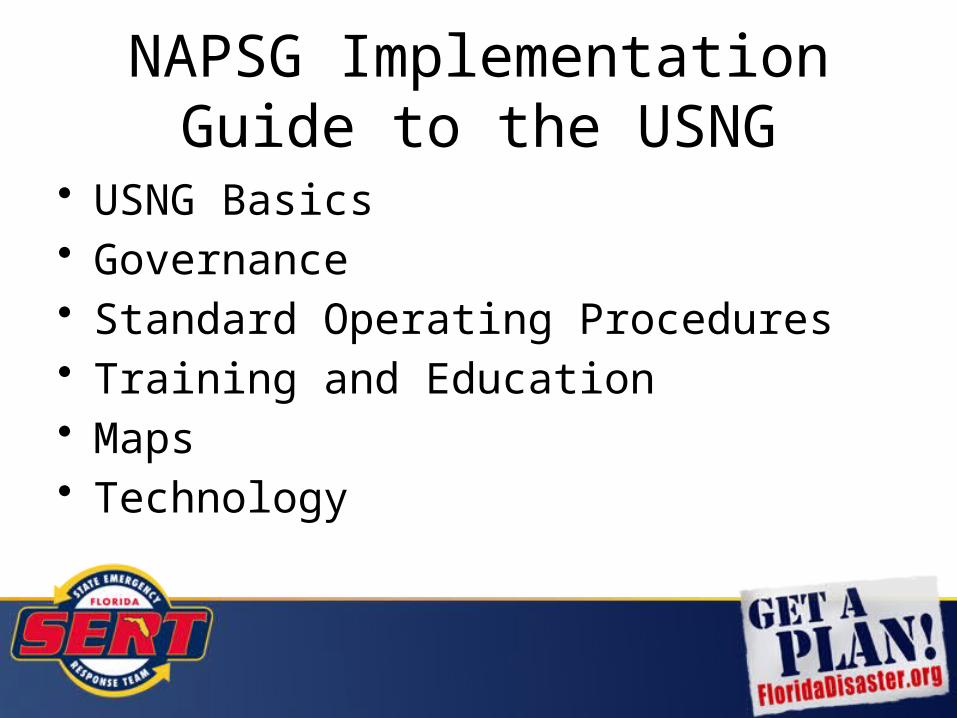
NAPSG Implementation Guide to the USNG
• USNG Basics• Governance• Standard Operating Procedures• Training and Education• Maps• Technology

3
What’s wrong with current systems?
We already have…
– Latitude/Longitude–Township/Range/Section– Street Address and Zip– UTM

4
Latitude/Longitude
Multiple formats are confusing
DD -85.990151, 30.272240
DM -85 59.409089, 30.16.334386
DMS 85 59’24.545”W, 30 16’20.063”N
All the same location!!!

5
How far is a second anyway?
What is the distance from….
85 59’24.545”W, 30 16’20.063”N• To here….
85 59’26.292”W, 30 16’14.546”N
6
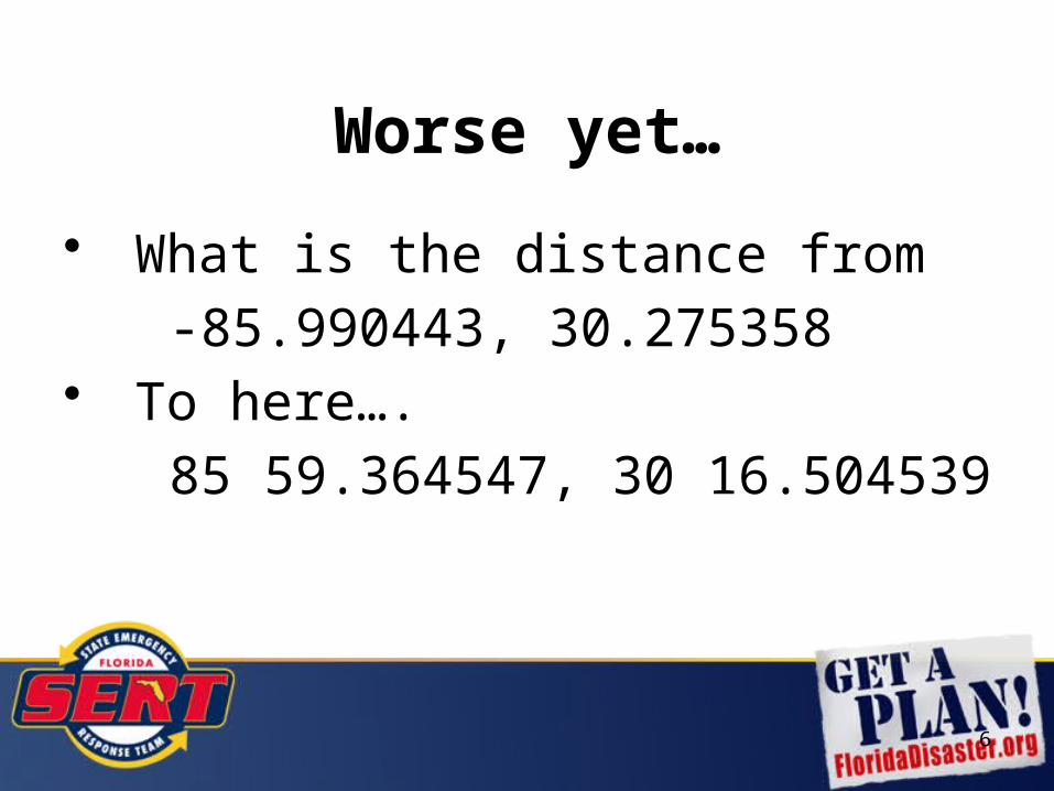
Worse yet…
• What is the distance from
-85.990443, 30.275358• To here….
85 59.364547, 30 16.504539

7
Township/Range/Section
Township/Range/Section grid from the Public Lands Survey System is an important and good system…– basis of land ownership records– been in use for over 180 years

8
Township/Range/Section
• But a perfect section really doesn’t exist
• irregular in coastal areas
• too large to meet needs of ground crews


12
Street Address and Zip
• Problematic due to…– rural routes– post office boxes

13
• What do you do when the SIGNS are gone?
14
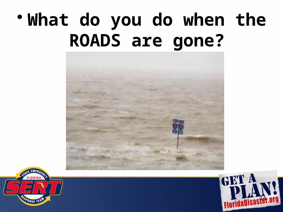
• What do you do when the ROADS are gone?

15
• When you ain’t got much else left, you still got the grid!

US National Grid
The USNG is a point reference system of grid references that provides a nationally consistent language of location in a user friendly format.

US National GridBuilt to create “a more interoperable environment for developing location-based services within the United State and to increase the interoperability of location services appliances with printed map products”…

… use of the National Grid has been widely adopted within emergency management for use in preparedness, response, and recovery efforts.

National Standards• National Search and Rescue Committee
– specifies US National Grid as primary system for ground operations
• Federal Geographic Data Committee – US National Grid Standard since 2001
• FEMA - Established a standard for operational maps using the National Grid

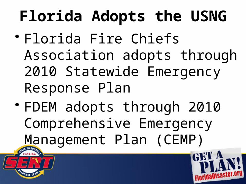
Florida Adopts the USNG• Florida Fire Chiefs Association
adopts through 2010 Statewide Emergency Response Plan
• FDEM adopts through 2010 Comprehensive Emergency Management Plan (CEMP)

Florida CEMP
“The State of Florida has adopted the use of the U.S. National Grid (USNG) during response and recovery efforts which allows for both point and area referencing.”

EM Constellation• EM Constellation is the web-based information
management software platform adopted by the State of Florida for emergency management.
• The platform allows the State Emergency Response Team composed of county, state, federal, volunteer, and mutual aid entities to use the same operating environment when responding to and recovering from an emergency.


Getting Missions on the Map
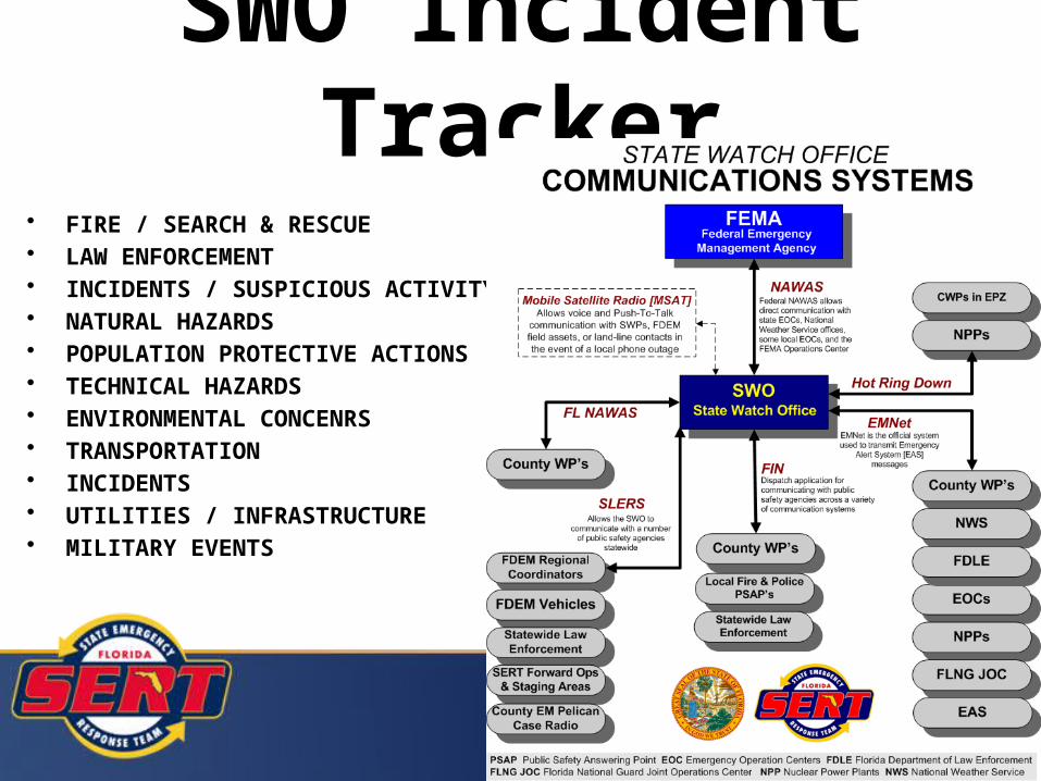
• FIRE / SEARCH & RESCUE• LAW ENFORCEMENT • INCIDENTS / SUSPICIOUS ACTIVITY• NATURAL HAZARDS• POPULATION PROTECTIVE ACTIONS• TECHNICAL HAZARDS• ENVIRONMENTAL CONCENRS• TRANSPORTATION • INCIDENTS• UTILITIES / INFRASTRUCTURE• MILITARY EVENTS
SWO Incident Tracker

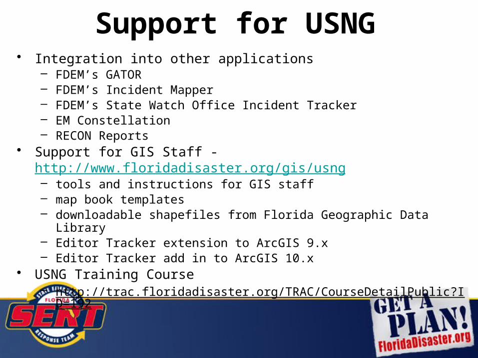
Support for USNG• Integration into other applications
– FDEM’s GATOR– FDEM’s Incident Mapper– FDEM’s State Watch Office Incident Tracker– EM Constellation– RECON Reports
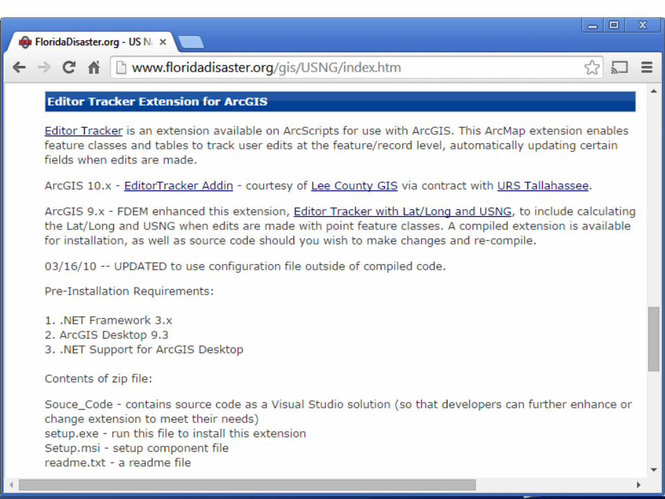
• Support for GIS Staff - http://www.floridadisaster.org/gis/usng – tools and instructions for GIS staff– map book templates– downloadable shapefiles from Florida Geographic Data Library– Editor Tracker extension to ArcGIS 9.x– Editor Tracker add in to ArcGIS 10.x
• USNG Training Course– http://trac.floridadisaster.org/TRAC/CourseDetailPublic?ID=192

KML for Google Earth
http://map.floridadisaster.org/GIS/KML • Critical Facilities – including USNG
coordinates for facilities• USNG layers – statewide 100,000m,
10,000m, and 1,000m

30
KML for Google Earth

County Map Books

Map Book Templates• Produce 4,000 m x 5,000 8.5” x 11”
1:24,000 scale maps• Style guide, templates and video from
Delta State University linked from http://www.floridadisaster.org/gis/USNG/index.htm#mapbooks

33
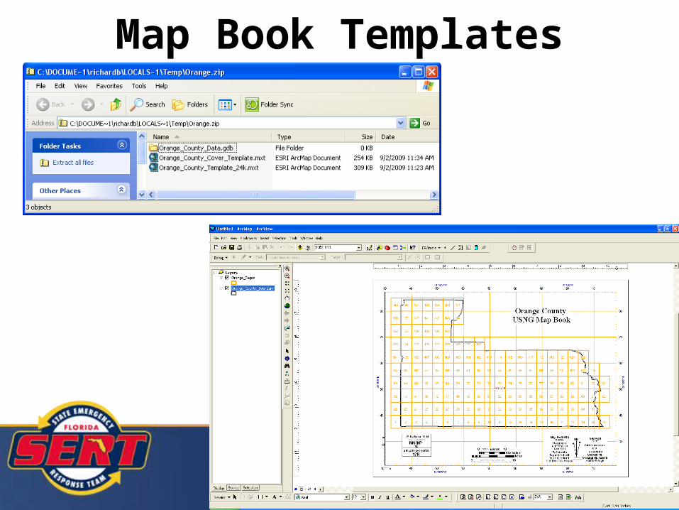
Map Book Templates

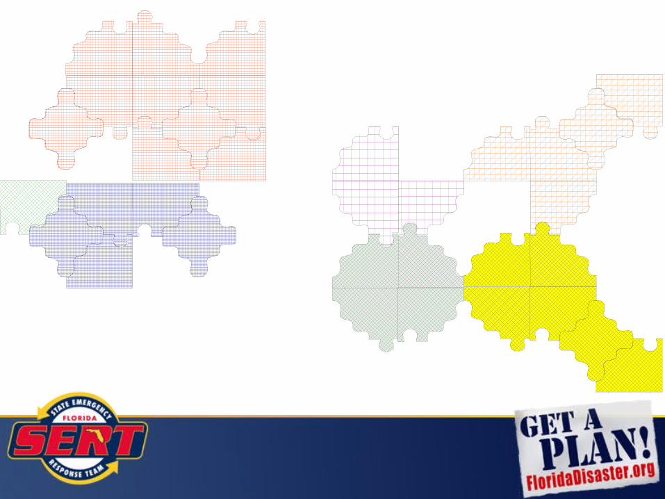
USNG – Data aggregation

USNG – Data aggregation
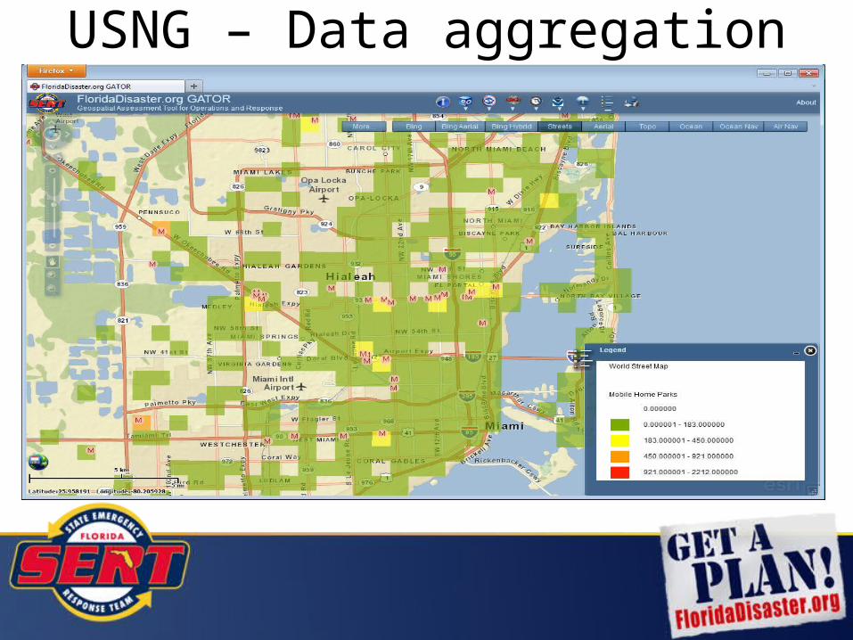
USNG – Data aggregation

USNG – Data aggregation

USNG – Data aggregation

USNG – Data aggregation

Zip CodeNot effective…• Zip codes cross jurisdictional boundaries (counties)• No contiguous

Map of statewide IA applicants
USNG – Data aggregation
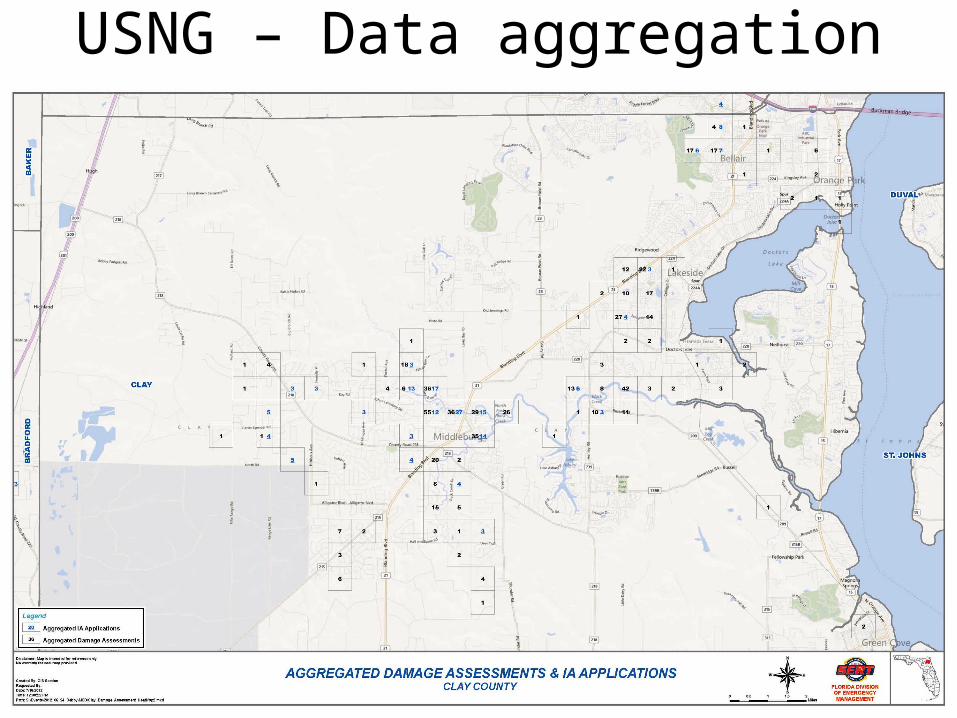
Map of Clay county damage assessments and IA applications
USNG – Data aggregation

Map of Clay county damage assessments and IA applications
USNG – Data aggregation
ConclusionUS National Grid has proven a useful tool for transforming raw data into meaningful and useful information for the Florida State Emergency Response Team
USNG is truly the language of location.