1 GRASS – Public domain. 2 MapInfo - Business 3 ESRI - Environmental.
43
1 GRASS – Public GRASS – Public domain domain
-
Upload
harold-dorsey -
Category
Documents
-
view
214 -
download
0
Transcript of 1 GRASS – Public domain. 2 MapInfo - Business 3 ESRI - Environmental.

11
GRASS – Public domainGRASS – Public domain
22
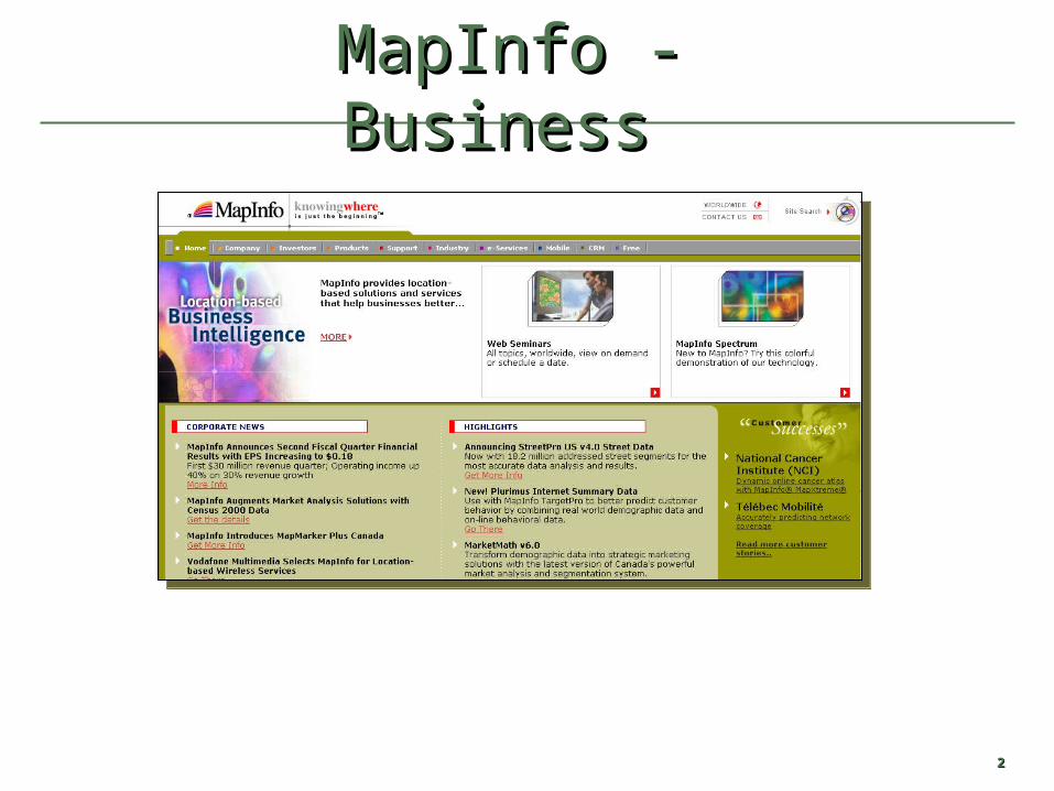
MapInfo - BusinessMapInfo - Business

33
ESRI - EnvironmentalESRI - Environmental

44
Caliper - TransportationCaliper - Transportation
55
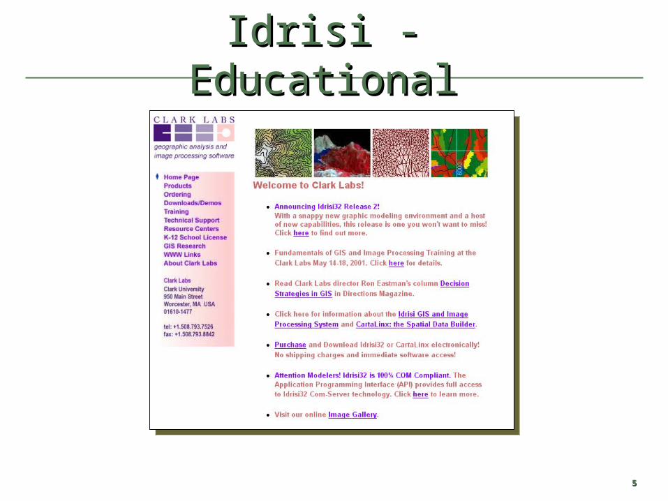
Idrisi - EducationalIdrisi - Educational
66
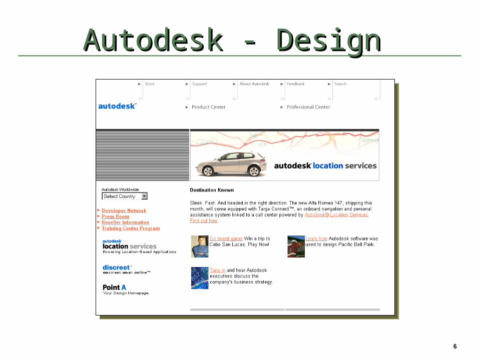
Autodesk - DesignAutodesk - Design
77
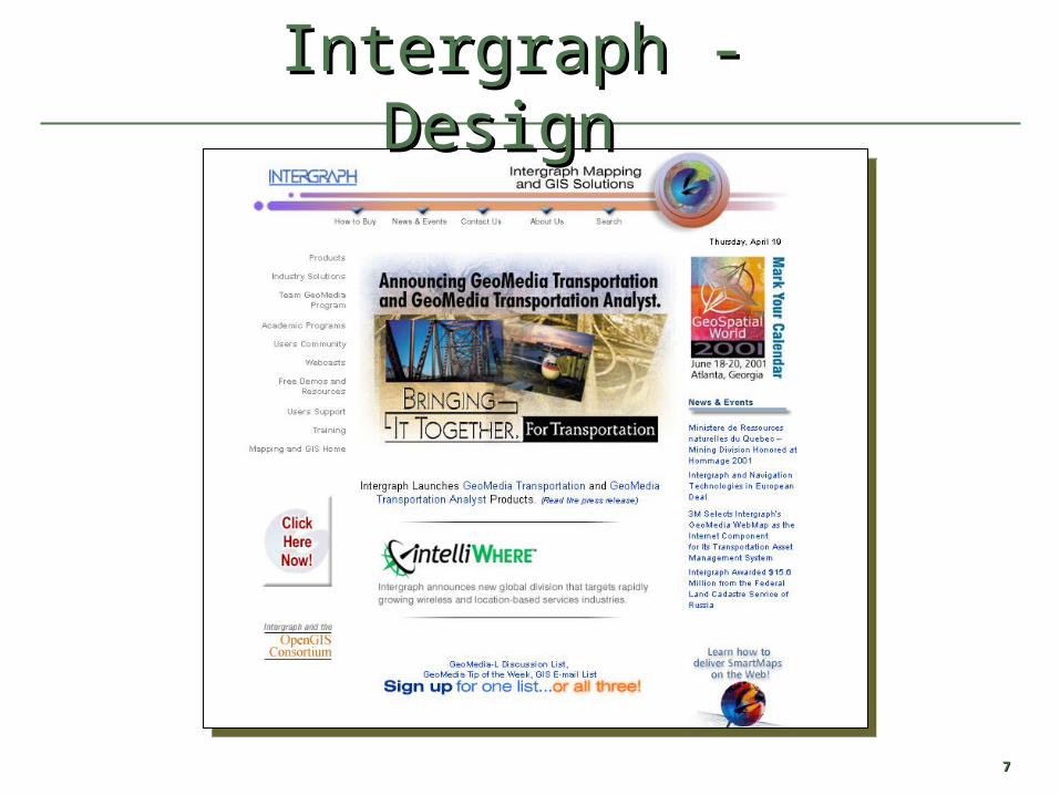
Intergraph - DesignIntergraph - Design
88
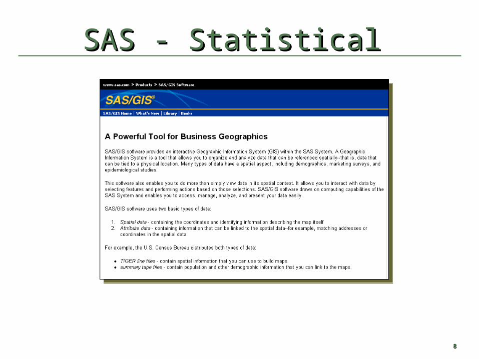
SAS - StatisticalSAS - Statistical
99
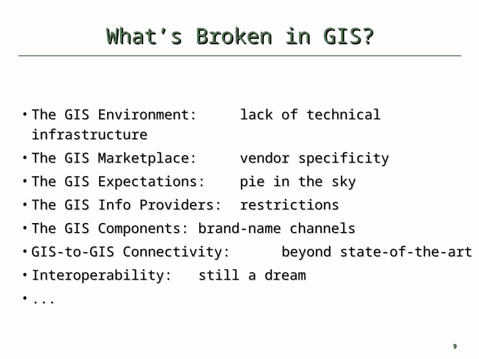
What’s Broken in GIS?What’s Broken in GIS?
• The GIS Environment: The GIS Environment: lack of technical infrastructurelack of technical infrastructure
• The GIS Marketplace: The GIS Marketplace: vendor specificityvendor specificity
• The GIS Expectations: The GIS Expectations: pie in the skypie in the sky
• The GIS Info Providers: The GIS Info Providers: restrictionsrestrictions
• The GIS Components: The GIS Components: brand-name channelsbrand-name channels
• GIS-to-GIS Connectivity: GIS-to-GIS Connectivity: beyond state-of-the-artbeyond state-of-the-art
• Interoperability: Interoperability: still a dreamstill a dream
• ......

1010
MunicipalServices
Transportation
Government
Cadastre
Utilities
Network computing resources with OpenGIS interfaces
Natural Resources& Agriculture
Business Logistics
Civil Engineering
SharingSharing Geodata within and between Geodata within and between Information CommunitiesInformation Communities

1111
VisionVision
The complete integration of geospatial data The complete integration of geospatial data and geoprocessing resources into and geoprocessing resources into
mainstream computingmainstream computing

1212
OpenGIS StandardOpenGIS Standard
““The ability to The ability to share heterogeneous geodata and geoprocessing share heterogeneous geodata and geoprocessing resourcesresources transparently in a networked environment.” transparently in a networked environment.”
1313
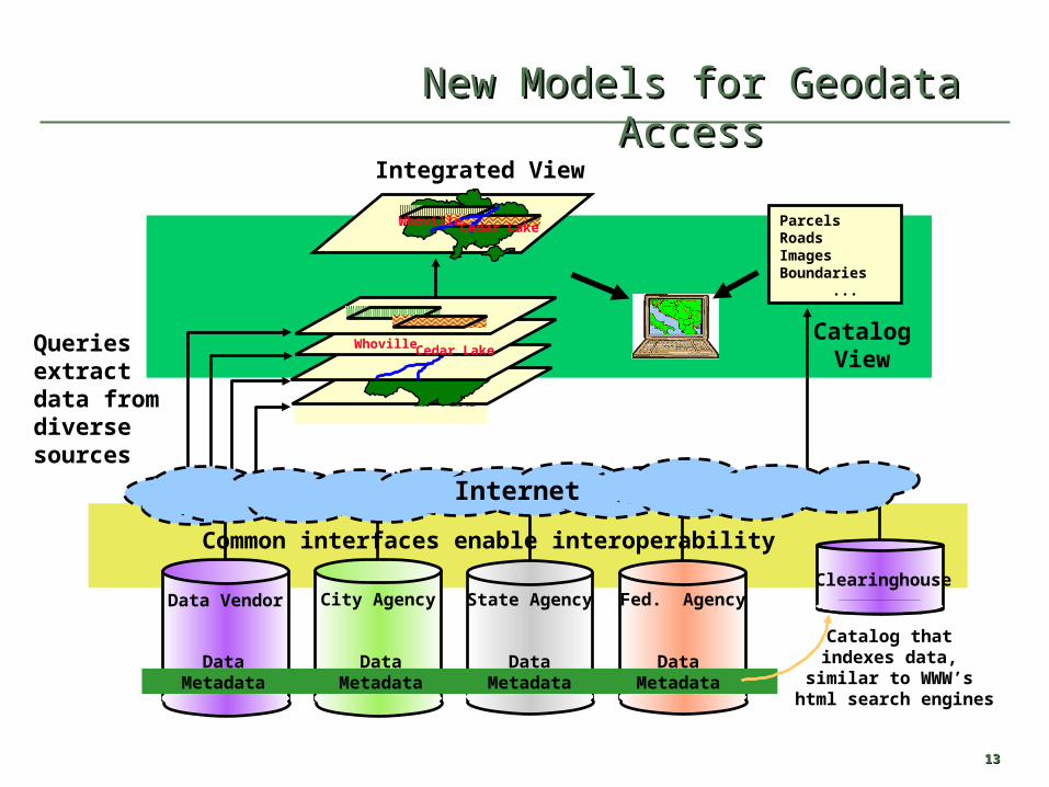
New Models for Geodata AccessNew Models for Geodata Access
Internet
Data Vendor City Agency State Agency Fed. AgencyClearinghouse
Whoville Cedar Lake
Whoville Cedar Lake
ParcelsRoadsImagesBoundaries ...
Integrated View
CatalogView
DataMetadata
DataMetadata
DataMetadata
DataMetadata
Catalog thatindexes data,
similar to WWW’s html search engines
Common interfaces enable interoperability
Queries extractdata from diversesources
1414
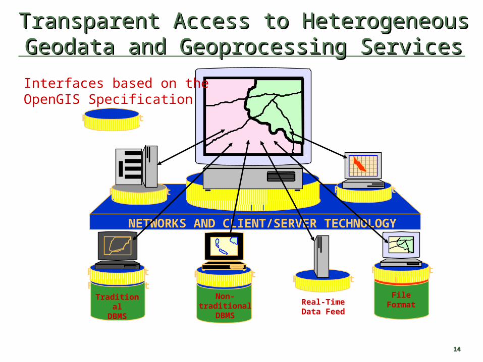
Transparent Access to Heterogeneous Geodata and Transparent Access to Heterogeneous Geodata and Geoprocessing ServicesGeoprocessing Services
Non-traditional
DBMS
File FormatFile FormatFile Format
File Format
Real-TimeData Feed
File FormatTraditional
DBMS
File Format File Format
NETWORKS AND CLIENT/SERVER TECHNOLOGY
File FormatFileFormat
File Format
File Format
Interfaces based on the OpenGIS Specification

1515© 1999, Open GIS Consortium, Inc. All Rights © 1999, Open GIS Consortium, Inc. All Rights ReservedReserved
SCOTSSCOTS
Standards-based Commercial Off-The-Shelf
1616
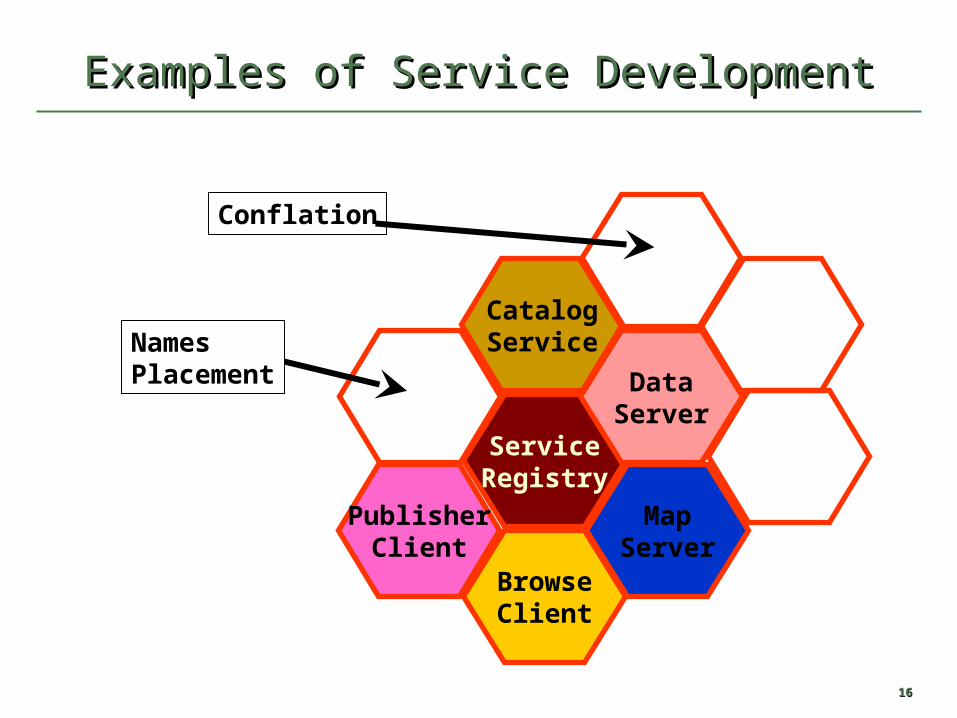
PublisherClient
BrowseClient
ServiceRegistry
CatalogService
DataServer
MapServer
Conflation
NamesPlacement
Examples of Service DevelopmentExamples of Service Development
1717
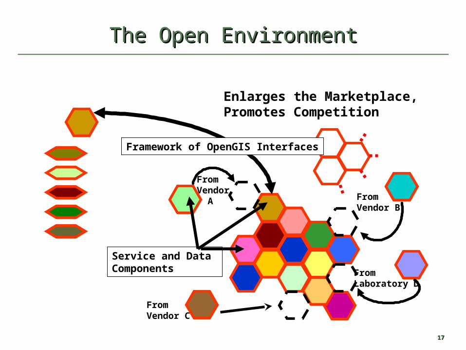
From Vendor A From
Vendor B
FromVendor C
FromLaboratory D
Service and Data Components
The Open EnvironmentThe Open Environment
Framework of OpenGIS Interfaces
Enlarges the Marketplace,Promotes Competition

1818
Some (non-interoperating) Web Mapping Systems
GeoMedia™ WebMap
MapGuide™
MapObjects IMSMapXtreme™
ELVIS
GIS Viewer
ModelServer Imager
Spatial Web Broker
CARIS Internet Server
OGDI
NetGISSTAR Next Surf TerraServer
Orthophoto Browser
Mapquest Internet
PARC Map Viewer
Internet Map ServerTIGER Map Server
GLOBE VisualizationEnviroMapper
Web Browser
GISDATA
Web Browser
GISDATA
Web Browser
GISDATA
GISDATA
Web Browser Web Browser
GISDATA
Web Browser
GISDATA
Web Browser
GISDATA
Web Browser
GISDATA
Web Browser
GISDATA
Web Browser
GISDATA
Web Browser
GISDATA
Web Browser
GISDATA
Web Browser
GISDATA
GISDATA
Web Browser
GISDATA
Web Browser
GISDATA
Web Browser
GISDATA
Web Browser
GISDATA
Web Browser
GISDATA
Web Browser
GISDATA
X X X X X X X X X X X X X X X X X X X
Web Browser
Arc Info ™

The Web Revolution and The Web Revolution and Web MappingWeb Mapping
2020
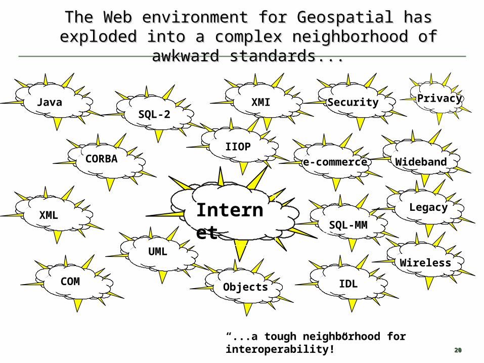
The Web environment for Geospatial has exploded into The Web environment for Geospatial has exploded into a complex neighborhood of awkward standards...a complex neighborhood of awkward standards...
Java
UML
CORBA
XMI
Internet
SQL-2
SQL-MM
IIOP
XML
COM Objects IDL
Security
e-commerce Wideband
Wireless
Legacy
“...a tough neighborhood for interoperability!”
Privacy
2121
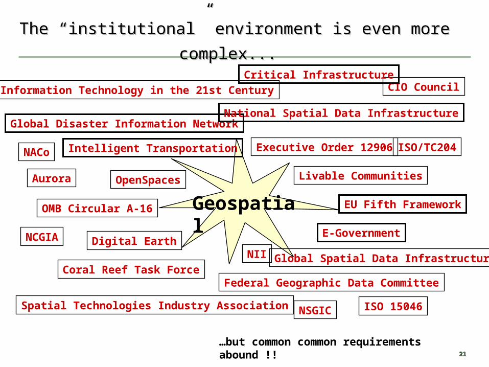
The “institutional” environment is even more complex...The “institutional” environment is even more complex...
Geospatial
Executive Order 12906
OMB Circular A-16
Global Disaster Information Network
Federal Geographic Data Committee
National Spatial Data Infrastructure
Spatial Technologies Industry Association
Digital Earth
Aurora OpenSpaces Livable Communities
E-Government
Coral Reef Task ForceGlobal Spatial Data Infrastructure
Intelligent Transportation
Information Technology in the 21st Century
EU Fifth Framework
NACo
NSGIC
NCGIA
ISO 15046
ISO/TC204
NII
CIO Council
…but common common requirements abound !!
Critical Infrastructure
Before the Web Mapping Before the Web Mapping EraEra

2323
TerraServer - http://terraserver.microsoft.com
Before WMTBefore WMT
MapQuest - http://www.mapquest.comEPA - http://www.epa.gov/enviro/enviromapper.html
After The Web Mapping After The Web Mapping RevolutionRevolution
2525
Web Browser
Viewer Client
MapServer
MapServer
MapServer
MapServer
inte
rnet
Web Map Servers
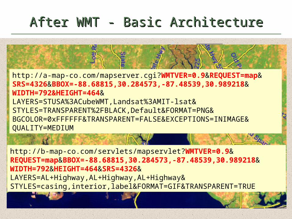
After WMT - Basic ArchitectureAfter WMT - Basic Architecture
http://a-map-co.com/mapserver.cgi?WMTVER=0.9&REQUEST=map&SRS=4326&BBOX=-88.68815,30.284573,-87.48539,30.989218&WIDTH=792&HEIGHT=464&LAYERS=STUSA%3ACubeWMT,Landsat%3AMIT-lsat&STYLES=TRANSPARENT%2FBLACK,Default&FORMAT=PNG&BGCOLOR=0xFFFFFF&TRANSPARENT=FALSE&EXCEPTIONS=INIMAGE&QUALITY=MEDIUM
Web Browser
Viewer Client
MapServer
MapServer
MapServer
MapServer
inte
rnet
Web Map ServersWeb Browser
Viewer Client
MapServer
MapServer
MapServer
MapServer
inte
rnet
Web Map Servers
http://b-map-co.com/servlets/mapservlet?WMTVER=0.9&REQUEST=map&BBOX=-88.68815,30.284573,-87.48539,30.989218&WIDTH=792&HEIGHT=464&SRS=4326&LAYERS=AL+Highway,AL+Highway,AL+Highway&STYLES=casing,interior,label&FORMAT=GIF&TRANSPARENT=TRUE
Web Browser
Viewer Client
MapServer
MapServer
MapServer
MapServer
inte
rnet
Web Map ServersWeb Browser
Viewer Client
MapServer
MapServer
MapServer
MapServer
inte
rnet
Web Map ServersWeb Browser
Viewer Client
MapServer
MapServer
MapServer
MapServer
inte
rnet
Web Map Servershttp://a-map-co.com/mapserver.cgi?WMTVER=0.9&REQUEST=map&SRS=4326&BBOX=-88.68815,30.284573,-87.48539,30.989218&WIDTH=792&HEIGHT=464&LAYERS=STUSA%3ACubeWMT,Landsat%3AMIT-lsat&STYLES=TRANSPARENT%2FBLACK,Default&FORMAT=PNG&BGCOLOR=0xFFFFFF&TRANSPARENT=FALSE&EXCEPTIONS=INIMAGE&QUALITY=MEDIUM
http://b-map-co.com/servlets/mapservlet?WMTVER=0.9&REQUEST=map&BBOX=-88.68815,30.284573,-87.48539,30.989218&WIDTH=792&HEIGHT=464&SRS=4326&LAYERS=AL+Highway,AL+Highway,AL+Highway&STYLES=casing,interior,label&FORMAT=GIF&TRANSPARENT=TRUE
2626

2727

2828
2929
3030

3131

3232
3333
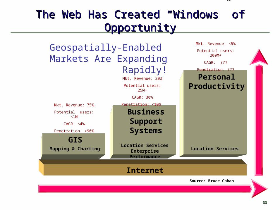
The Web Has Created “Windows” of OpportunityThe Web Has Created “Windows” of Opportunity
GIS
BusinessSupportSystems
PersonalProductivity
Location ServicesLocation Services
Enterprise PerformanceMapping & Charting
Internet
Geospatially-Enabled Markets Are Expanding Rapidly!
Mkt. Revenue: 75%
Potential users: <1M
CAGR: <4%
Penetration: >90%
Mkt. Revenue: 20%
Potential users: 25M+
CAGR: 30%
Penetration: <10%
Mkt. Revenue: <5%
Potential users: 200M+
CAGR: ???
Penetration: ???
Source: Bruce Cahan

Location ServicesLocation Services

3535
• Services that use location based information and Services that use location based information and location models:location models:
• Maps, routes, positions, demographics, transactions, Maps, routes, positions, demographics, transactions, service points, sites, events, assets, directoriesservice points, sites, events, assets, directories
• Location Services should beLocation Services should be• Web-enabled … Web-enabled … availableavailable to anyone, anywhere, anytime, to anyone, anywhere, anytime,
on any deviceon any device• Integral to the enterprise environmentsIntegral to the enterprise environments• Efficient and easy-to-useEfficient and easy-to-use
• Location Services Applications include:Location Services Applications include:– Just-in-time & locationJust-in-time & location– Know your (business), neighbor, customer,…Know your (business), neighbor, customer,…– Find a customer, place, asset…Find a customer, place, asset…– Coordinate activitiesCoordinate activities– Plan growthPlan growth– Delivery & travel servicesDelivery & travel services– Organize by location and timeOrganize by location and time– Location sensitive alerts and transactionsLocation sensitive alerts and transactions– Privacy and Security is user invokedPrivacy and Security is user invoked
What are Location Services? Applications that enable devices to exploit their location or mobility, or the location or mobility of other devices in real time

The Pizza StoryThe Pizza Story
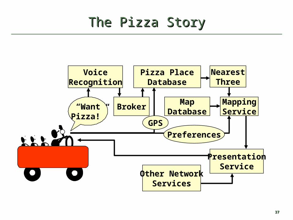
3737
The Pizza StoryThe Pizza Story
VoiceRecognition
“WantPizza!”
Broker
Pizza PlaceDatabase
GPS
NearestThree
MapDatabase
MappingService
Preferences
PresentationService
Other NetworkServices

3838
An Infrastructure of AgreementsAn Infrastructure of Agreements
WirelessProtocols
Limited Speech Recognition Geo-
Coding
LocationServices
"Yellow Page" Databases
Thematic Data Providers
WebMapping ServersMobile
Devices
Spatial Data Representation andManipulation
Advertisement Pathways
Spatial Query Engines
Interfaces
WebRoutingServer
3939
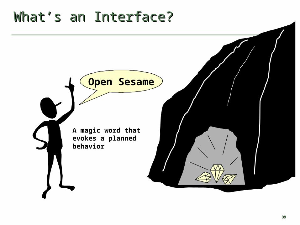
What’s an Interface? What’s an Interface?
Open Sesame
A magic word thatevokes a plannedbehavior
4040
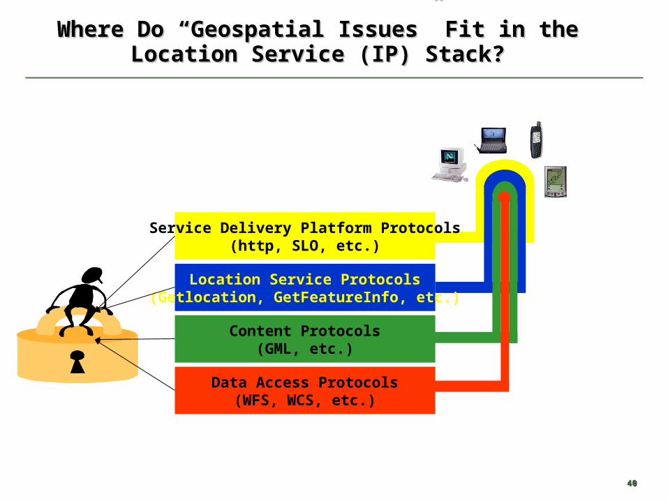
Where Do “Geospatial Issues” Fit in the Location Where Do “Geospatial Issues” Fit in the Location Service (IP) Stack?Service (IP) Stack?
Data Access Protocols(WFS, WCS, etc.)
Service Delivery Platform Protocols(http, SLO, etc.)
Location Service Protocols(Getlocation, GetFeatureInfo, etc.)
Content Protocols(GML, etc.)

4141
Location Services (1)Location Services (1)
• Traffic InformationTraffic Information (e.g. "You are about to join a ten kilometer traffic (e.g. "You are about to join a ten kilometer traffic queue, turn right on the A3 ahead.")queue, turn right on the A3 ahead.")
• Emergency ServicesEmergency Services (e.g. "Help, I'm having a heart attack!") (e.g. "Help, I'm having a heart attack!") • Roadside EmergencyRoadside Emergency (e.g. "Help, my car has broken down!") (e.g. "Help, my car has broken down!") • Law EnforcementLaw Enforcement (e.g. “What is the speed limit on this road where I am (e.g. “What is the speed limit on this road where I am
at?”)at?”)• FirefightingFirefighting (e.g., “Where should I shovel snow to find the hydrant?” and (e.g., “Where should I shovel snow to find the hydrant?” and
“Are there flammables/explosives nearby?”)“Are there flammables/explosives nearby?”)• Classified AdvertisingClassified Advertising (e.g.. “Is there a job nearby?” and “Where are (e.g.. “Is there a job nearby?” and “Where are
nearby yard-sales featuring antiques?”)nearby yard-sales featuring antiques?”)• Fiat Object visualizationFiat Object visualization (e.g. “Where is my parcel boundary?”) (e.g. “Where is my parcel boundary?”)• Underground Object VisualizationUnderground Object Visualization (e.g. “Where is the water main?”) (e.g. “Where is the water main?”)• Public Safety Vehicle ManagementPublic Safety Vehicle Management (e.g. "Who is closest to that (e.g. "Who is closest to that
emergency?") emergency?") • Location-Based BillingLocation-Based Billing (e.g. Free calls on your mobile phone, while you (e.g. Free calls on your mobile phone, while you
are in a particular location) are in a particular location)
4242
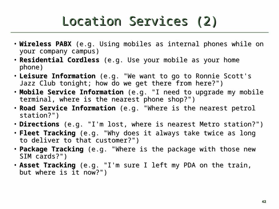
Location Services (2)Location Services (2)
• Wireless PABXWireless PABX (e.g. Using mobiles as internal phones while on your (e.g. Using mobiles as internal phones while on your company campus) company campus)
• Residential CordlessResidential Cordless (e.g. Use your mobile as your home phone) (e.g. Use your mobile as your home phone) • Leisure InformationLeisure Information (e.g. "We want to go to Ronnie Scott's Jazz Club (e.g. "We want to go to Ronnie Scott's Jazz Club
tonight; how do we get there from here?") tonight; how do we get there from here?") • Mobile Service InformationMobile Service Information (e.g. "I need to upgrade my mobile (e.g. "I need to upgrade my mobile
terminal, where is the nearest phone shop?") terminal, where is the nearest phone shop?") • Road Service InformationRoad Service Information (e.g. "Where is the nearest petrol station?") (e.g. "Where is the nearest petrol station?") • DirectionsDirections (e.g. "I'm lost, where is nearest Metro station?") (e.g. "I'm lost, where is nearest Metro station?") • Fleet TrackingFleet Tracking (e.g. "Why does it always take twice as long to deliver (e.g. "Why does it always take twice as long to deliver
to that customer?") to that customer?") • Package TrackingPackage Tracking (e.g. "Where is the package with those new SIM (e.g. "Where is the package with those new SIM
cards?") cards?") • Asset TrackingAsset Tracking (e.g. "I'm sure I left my PDA on the train, but where is (e.g. "I'm sure I left my PDA on the train, but where is
it now?") it now?")

4343
Location Services (3)Location Services (3)
• Vehicle NavigationVehicle Navigation (e.g. "How do I get back to the (e.g. "How do I get back to the Interstate from here?") Interstate from here?")
• Public Transport TrackingPublic Transport Tracking (e.g. "I need to display train (e.g. "I need to display train arrival times at un-staffed stations.") arrival times at un-staffed stations.")
• Vehicle Theft Detection and RecoveryVehicle Theft Detection and Recovery (e.g. "My car has (e.g. "My car has been stolen, where is it?") been stolen, where is it?")
• Child TrackingChild Tracking (e.g. "Tell me if my child strays beyond the (e.g. "Tell me if my child strays beyond the neighborhood.") neighborhood.")
• Animal TrackingAnimal Tracking (e.g. "Where has Tibbles gone this (e.g. "Where has Tibbles gone this time?")time?")