5. Seismology William Wilcock OCEAN/ESS 410. A. Earthquake Seismology.

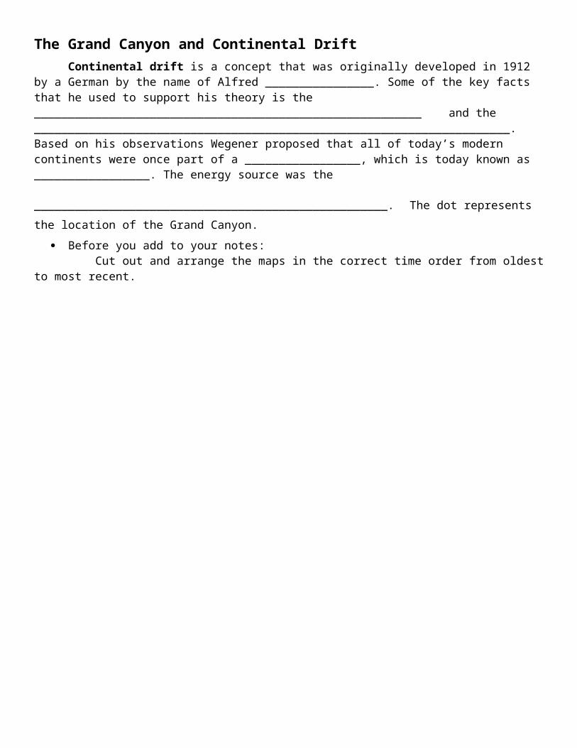
The Grand Canyon and Continental DriftContinental drift is a concept that was originally developed in 1912 by a German
by the name of Alfred ________________. Some of the key facts that he used to support his theory is the _________________________________________________________ and the ______________________________________________________________________. Based on his observations Wegener proposed that all of today’s modern continents were once part of a _________________, which is today known as _________________. The energy source was
the ____________________________________________________. The dot represents the location of the Grand Canyon.
Before you add to your notes: Cut out and arrange the maps in the correct time order from oldest to most recent.
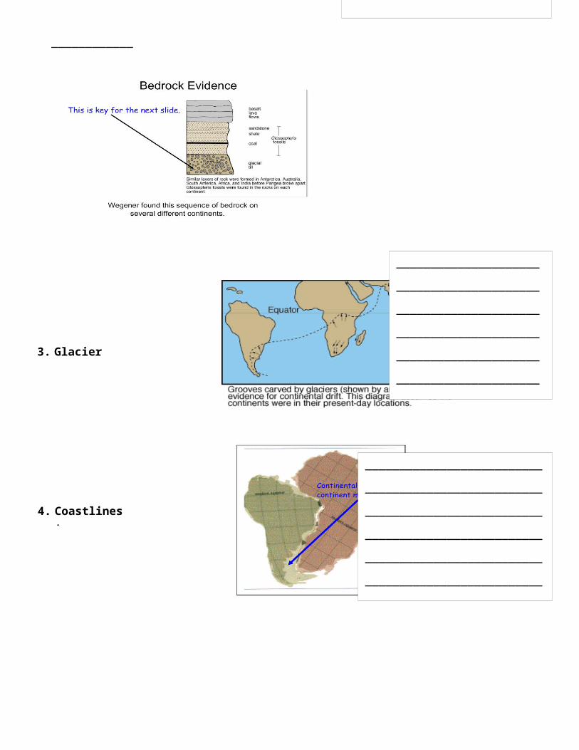
To prove his theory of Continental Drift ,

Wegener used the following observations/phenomena:1. Fossils - Use the fossil puzzle handout to give an example of the fossils found on different
continents.
______________________________________________________________________________
______________________________________________________________________________
3. Glaciers:
2. Bedrock:
_______________________________
_______________________________
_______________________________
_______________________________
_______________________________
_______________________________
_________________
_______________________
_______________________
_______________________
_______________________
_______________________
_______________________
________________
4. Coastlines:
____________________________
____________________________
____________________________
____________________________
____________________________
____________________________
______________
Your words: _______________________________
_______________________________
_______________________________
_______________________________
_______________________________
_______________________________
_______________________________
_______________________________
_______________________________
_______________________________
_______________________________
_______________________________
_______________________________
_______________________________
_______________________________
_______________________________
_______________________________
_______________________________
_______________________________
_______________________________
_______________________________
Where does the energy to move the tectonic plates come from?
Heat energy is causing the water to boil. As water heats, it rises. The cooler water sinks. This is what causes movement in what is known as convection cells. Heat energy is being transferred.
The energy for the plates to move comes from the heat energy in the core and mantle. The molten rock in the mantle moves as convection cells in the same way that water does in the comparison above.

The Student Puzzle Pieces and Legend
What heats the earth's core? The heat inside Earth moves continents, builds mountains and causes earthquakes. Where does all this heat come from?
http://www.neok12.com/video/Fossils/zX665b6c417a74564f5f067f.htm

There are four main sources of heat in the deep earth: (1) heat from when the planet formed, which has not yet been lost; (2) frictional heating (gravitational heat), caused by denser core material sinking to the center of the planet; (3) latent heat from the expanding core as it cools; and (4) heat from the radioactive decay of elements in the earth.
A cross-section of the Earth reveals three concentric layers. Around the outside is a thin, hard crust, ranging from 10 to 100 kilometers thick. Under that, a donut-shaped mantle 2,900 kilometers thick that surrounds the core of the earth. The mantle consists of viscous molten rock that flows very slowly, on a geological time scale. "It moves about as fast as your fingernails grow," Marone explains.
At the center of the Earth lies a two-part core. "The inner part is about the size of our moon," Marone says, "and has a density of steel." The outer core surrounding it is an ocean of liquid metal 2,300 kilometers thick. The Earth's rotation makes this ocean flow and swirl, and the moving metal generates the planet's magnetic field.
Most of Earth's heat is stored in the mantle, Marone says, and there are four sources that keep it hot. First, there's the heat left over from when gravity first condensed a planet from the cloud of hot gases and particles in pre-Earth space. As the molten ball cooled, some 4 billion years ago, the outside hardened and formed a crust. The mantle is still cooling down.
"We don't think this original heat is a major part of the Earth's heat, though," Marone says. It only contributes 5 to 10 percent of the total, "about the same amount as gravitational heat."
To explain gravitational heat, Marone uses the image of the hot, freshly formed Earth, which was not of a consistent density. In a gravitational sorting process called differentiation, the denser, heavier parts were drawn to the center, and the less dense areas were displaced outwards. The friction created by this process generated considerable heat, which, like the original heat, still has not fully cooled.
Then there's latent heat, Marone says. This type arises from the core's expanding as the Earth cools from the inside out. Just as freezing water turns to ice, that liquid metal is turning solid—and adding volume in the process. "The inner core is becoming larger by
Although we crust-dwellers walk on nice cool ground, underneath our feet the Earth is a pretty hot place. Enough heat emanates (comes from, is emitted) from the planet's interior to make 200 cups of piping hot coffee per hour for each of Earth's 6.2 billion inhabitants, says Chris Marone, Penn State professor of geosciences. At the very center, it is believed temperatures exceed 11,000 degrees Fahrenheit, hotter than the surface of the sun.

about a centimeter every thousand years," Marone says. The heat released by this expansion is seeping into the mantle.
For all this, however, Marone says, the vast majority of the heat in Earth's interior—up to 90 percent—is fueled by the decaying of radioactive isotopes like Potassium 40, Uranium 238, 235, and Thorium 232 contained within the mantle. These isotopes radiate heat as they shed excess energy and move toward stability. "The amount of heat caused by this radiation is almost the same as the total heat measured being given off from the Earth."
Radioactivity is present not only in the mantle, but in the rocks of Earth's crust. For example, Marone explains, a 1-kilogram block of granite on the surface releases a tiny, but measurable, amount of heat (about as much as a .000000001 watt light bulb) through radioactive decay.
That may not seem like much. But considering the vastness of the mantle, it adds up, Marone says.
Sometime billions of years in the future, he predicts, the core and mantle could cool and solidify enough to meet the crust. If that happens, Earth will become a cold, dead planet like the moon.
Long before such an occurrence, however, the sun will likely have evolved into a red-giant star, and grown large enough to engulf our fair planet. At that point, whatever heat is left in the mantle will hardly matter.
Color each continent a different color or pattern. Neatly label each continent.Using the idea of a jigsaw puzzle, piece the parts together into one landmass to best represent what Pangaea might have looked like 190 million years ago. When you are
satisfied with their arrangement, you should neatly glue your arrangement onto a notebook page titled PANGEA .

In geologic terms, a plate is a large, rigid slab of solid rock. The word tectonics comes from the Greek root "to build." Putting these two words together, we get the term plate tectonics, which refers to how the Earth's surface is built of plates. The theory of plate tectonics states that the Earth's outermost layer is fragmented into a dozen or more

large and small plates that are moving relative to one another as they ride atop hotter, more mobile material. Before the advent of plate tectonics, however, some people already believed that the present-day continents were the fragmented pieces of preexisting larger landmasses ("supercontinents"). The diagrams below show the break-up of the supercontinent Pangaea (meaning "all lands" in Greek), which figured prominently in the theory of continental drift -- the forerunner to the theory of plate tectonics.
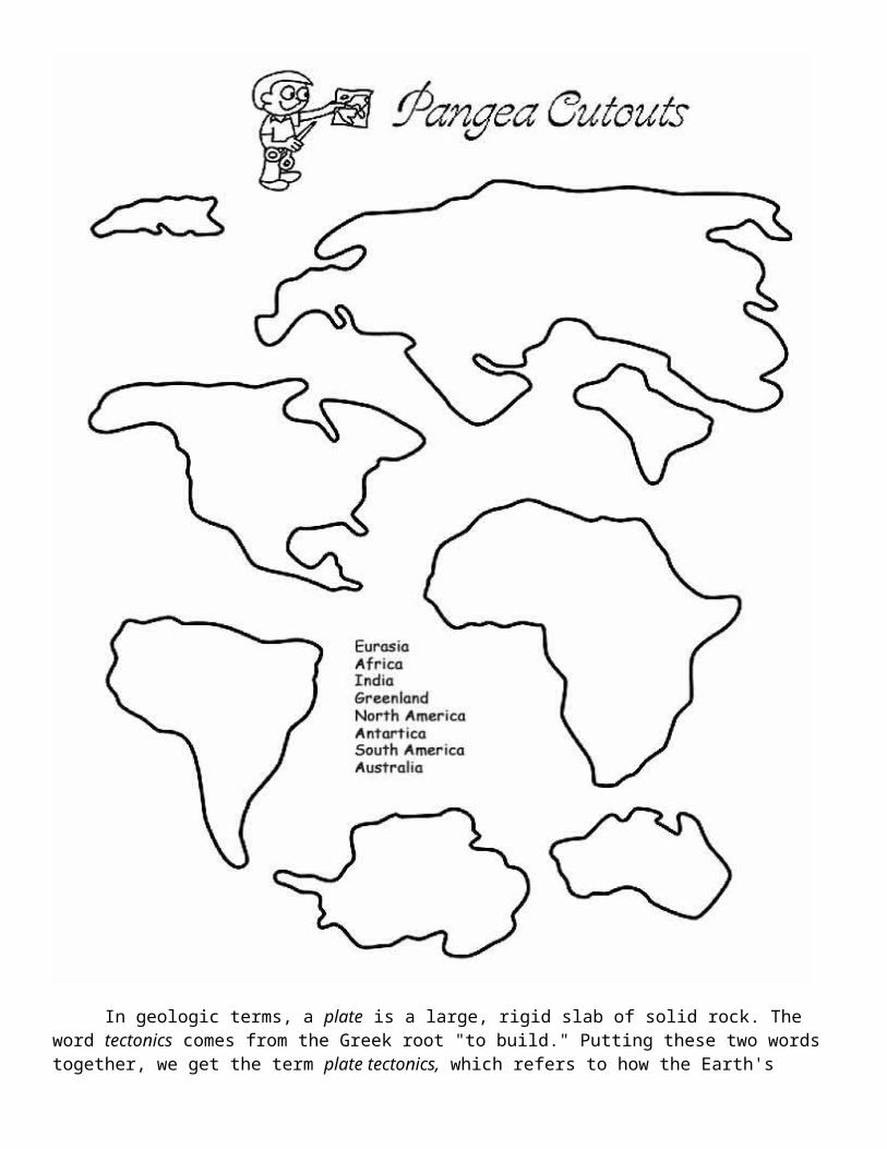
According to the continental drift theory, the supercontinent Pangaea began to break up about 225-200 million years ago, eventually fragmenting into the continents as we know them today.

Plate tectonics is a relatively new scientific concept, introduced some 30 years ago, but it has revolutionized our understanding of the dynamic planet upon which we live. The theory has unified the study of the Earth by drawing together many branches of the earth sciences, from paleontology (the study of fossils) to seismology (the study of earthquakes). It has provided explanations to questions that scientists had speculated upon for centuries -- such as why earthquakes and volcanic eruptions occur in very specific areas around the world, and how and why great mountain ranges like the Alps and Himalayas formed.
Why is the Earth so restless? What causes the ground to shake violently, volcanoes to erupt with explosive force, and great mountain ranges to rise to incredible heights? Scientists, philosophers, and theologians have wrestled with questions such as these for centuries. Until the 1700s, most Europeans thought that a Biblical Flood played a major role in shaping the Earth's surface. This way of thinking was known as "catastrophism," and geology (the study of the Earth) was based on the belief that all earthly changes were sudden and caused by a series of catastrophes. However, by the mid-19th century, catastrophism gave way to "uniformitarianism," a new way of thinking centered around the "Uniformitarian Principle" proposed in 1785 by James Hutton, a Scottish geologist. This principle is commonly stated as follows: The present is the key to the past. Those holding this viewpoint assume that the geologic forces and processes -- gradual as well as catastrophic -- acting on the Earth today are the same as those that have acted in the geologic past.
The belief that continents have not always been fixed in their present positions was suspected long before the 20th century; this notion was first suggested as early as 1596 by the Dutch map maker Abraham Ortelius in his work Thesaurus Geographicus. Ortelius suggested that the Americas were "torn away from Europe and Africa . . . by earthquakes and floods" and went on to say: "The vestiges of the rupture reveal themselves, if someone brings forward a map of the world and considers carefully the coasts of the three [continents]." Ortelius' idea surfaced again in the 19th century. However, it was not until 1912 that the idea of moving continents was seriously considered as a full-blown scientific theory -- called Continental Drift -- introduced in two articles published by a 32-year-old German meteorologist named Alfred Lothar Wegener. He contended that, around 200 million years ago, the supercontinent Pangaea began to split apart. Alexander Du Toit, Professor of Geology at Witwatersrand University and one of Wegener's staunchest supporters, proposed that Pangaea first broke into two large continental landmasses, Laurasia in the northern hemisphere and Gondwanaland in the southern hemisphere. Laurasia and Gondwanaland then continued to break apart into the various smaller continents that exist today.

In 1858, geographer Antonio Snider-Pellegrini made these two maps showing his version of how the American and African continents may once have fit together, then later separated. Left: The formerly joined continents before (avant) their separation. Right: The continents after (aprés) the separation. (Reproductions of the original maps courtesy of University of California, Berkeley.)